ALTA/ACSM Land Title Surveys (2011 revision) · ALTA/ACSM Land Title Surveys (2011 revision) A...
104
PDHonline Course L156 (8 PDH) ALTA/ACSM Land Title Surveys (2011 revision) Minimum Standard Detail Requirements for ALTA/ACSM Land Title Surveys (effective beginning Feb. 23, 2011) Instructor: Jonathan Terry, P.L.S. (PA) 2012 PDH Online | PDH Center 5272 Meadow Estates Drive Fairfax, VA 22030-6658 Phone & Fax: 703-988-0088 www.PDHonline.org www.PDHcenter.com An Approved Continuing Education Provider
Transcript of ALTA/ACSM Land Title Surveys (2011 revision) · ALTA/ACSM Land Title Surveys (2011 revision) A...

PDHonline Course L156 (8 PDH)
ALTA/ACSM Land Title Surveys (2011 revision)
Minimum Standard Detail Requirements for
ALTA/ACSM Land Title Surveys (effective beginning Feb. 23, 2011)
Instructor: Jonathan Terry, P.L.S. (PA)
2012
PDH Online | PDH Center
5272 Meadow Estates Drive Fairfax, VA 22030-6658
Phone & Fax: 703-988-0088 www.PDHonline.org www.PDHcenter.com
An Approved Continuing Education Provider

www.PDHonline.org PDH Course L156 www.PDHcenter.com
© 2011 Jonathan Terry, PLS Page 2
ALTA/ACSM Land Title Surveys (2011 revision)
A COURSE OF STUDY OF THE
2011 MINIMUM STANDARD DETAIL REQUIREMENTS FOR
ALTA/ACSM LAND TITLE SURVEYS
TABLE OF CONTENTS
THE LEARNING STYLE of THIS COURSE 3
No Human Sacrifices 4
Brief History of the Standards 5
What Does “Brood” Mean? 7
The Completely Reformatted, Reorganized 2011 Standards 8
Prepare For the Big Move! 10
THE 2011 REQUIREMENTS – Section‐by‐Section 13
SECTION 1 – PURPOSE 13
SECTION 2 – REQUEST FOR SURVEY 16
SECTION 3.A. – Effective Date 19
SECTION 3.B. – Other Requirements and Standards of Practice 21
SECTION 3.C. – The Normal Standard of Care 26
SECTION 3.D. – Boundary Resolution 27
SECTION 3.E. – Measurement Standards 28
SECTION 4 – RECORDS RESEARCH 33
SECTION 5 – FIELD WORK 39
SECTION 6 – PLAT OR MAP 50
SECTION 7 – CERTIFICATION 65
SECTION 8 – DELIVERABLES 67
TABLE A – OPTIONAL ITEMS 69
APPENDIX A – 2005 Standards Cross Referenced to 2011 Standards 87
APPENDIX B – Summary of Wording Changes – 2005 to 2011 Standards 91
APPENDIX C – Links Available on the ACSM Web Site 93
APPENDIX D – Afterthoughts and Recommendations 95
APPENDIX E – Links 97
APPENDIX F – ALTA/ACSM Land Title Survey – Checklists 101

www.PDHonline.org PDH Course L156 www.PDHcenter.com
© 2011 Jonathan Terry, PLS Page 3
ALTA/ACSM LAND TITLE SURVEYS (2011 Revision)
A course of study of the
MINIMUM STANDARD DETAIL REQUIREMENTS FOR ALTA/ACSM LAND TITLE SURVEYS as adopted by
American Land Title Association
and
National Society of Professional Surveyors
(A member organization of the American Congress on Surveying and Mapping)
THE LEARNING STYLE OF THIS COURSE
Wherever appropriate, I try to create courses that read more in the style of a live seminar. I
adopt a ‘me speaking to you’ approach rather than a ‘thus saith the know‐it‐all instructor.’ At a
few points, I may subject you to light humor, but not the kind of incessant, cutsie banter that is
common to the Dummies books that are so popular. This is not “ALTA
Surveys for Dummies.” You would not be reading this material if you
were a dummie. You have experience and intelligence.
The course is aimed at the experienced ALTA surveyor, the new‐to‐
ALTA‐Surveys surveyor and even to field crews and technicians.
Every reader should take away something of value. That’s my goal.
I do not presume to have knowledge superior to yours or experience of
more value than yours, but mine may be different than yours and I want to share some things
I’ve learned the hard way that may save you time, emotional stress and, in a few cases, maybe
even your livelihood. You will, of course, be ‘blessed’ with some of my opinions, with which you
may freely differ – and that’s OK. The intent of this course is to present the 2011 MINIMUM
STANDARD DETAIL REQUIREMENTS FOR ALTA/ACSM LAND TITLE SURVEYS, hereinafter referred
to as “the Standards” or “the 2011 Standards,” in a way that makes them as memorable and
useful to you as possible.
Fact is, the 2011 ALTA Standards, when applied to your practice, will in some cases boil down to
what you think their application is in your situation. Mostly though, the Standards are so clearly
written that their intentions (and therefore their requirements) are fairly straightforward.

www.PDHonline.org PDH Course L156 www.PDHcenter.com
© 2011 Jonathan Terry, PLS Page 4
NO HUMAN SACRIFICES
Requirements for ALTA/ACSM Land Title Surveys go through periodic revisions. In a nutshell,
here’s the history of these Standards:
Original issue dated 1962, followed by revisions in 1986, 1988, 1992, 1997, 1999, 2005
(effective starting January 1, 2006) and the current revision called the “2011 Minimum
Standard Detail Requirements for ALTA/ACSM Land Title Surveys,” effective beginning February
23, 2011.
This effective date was chosen over January 31 (the other date being considered) in honor of
the Roman God (brought forward from the Greek god) named Terminus, the god of boundaries,
who was honored in a festival observance on February 23rd.
This perhaps goes to show how far our nation has departed from the religious convictions of
our early settlers and the founders. Curt Sumner, Executive Director of the American Congress
of Surveying & Mapping [ACSM] has assured inquiring minds that no human sacrifices were
observed associated with this effective date of the 2011 Minimum Standard Detail
Requirements for ALTA/ACAM Land Title Surveys. (I hope he’s right.)
The only human sacrifice required to benefit from this course is, well, yours.
Your attention to detail and concentration will require sacrifice on your part. I’m aware of this
and appreciate that you’re willing to sacrifice other business or pleasure activities to spend time
with me learning the 2011 Standards. I’ll do my best to find that fine line between not quite
making the point and providing too much information.
You might like to know that many, weeks of my time have gone into preparing this course for
you. So, I’ve made a human sacrifice of my own in hopes you will benefit from at least a few
tips gained. Or perhaps a costly problem is avoided through your study of this course. And, of
course, you’ll be far more familiar with the 2011 Minimum Standard Detail Requirements for
ALTA/ACSM Land Title Surveys. In preparing this course, I’ve labored with a heart to serve you,
my fellow surveyors, and I sincerely hope you benefit from the time we spend together.

www.PDHonline.org PDH Course L156 www.PDHcenter.com
© 2011 Jonathan Terry, PLS Page 5
BRIEF HISTORY OF ALTA/ACSM LAND TITLE SURVEY STANDARDS
The need for consistency regarding land title surveys brought forth a common set of standards
across the nation in the 1962 version of the Standards, which required revision in 1986 due to
changes in technology and other factors. Table A of the Standards came into being with the
1988 version. Table A provided a standard set of options that lenders or insurers of title could
select if they so desired. Subsequent revisions took place in Standards of 1992, 1997, 1999 and
2005. Of significant impact on performance to the 2005 Standards, which actually took effect
on January 1, 2006, was the complete removal of language telling the surveyor HOW to
perform measurements. Instead, the surveyor was simply required to meet a specified
“Relative Positional Accuracy.” How a surveyor achieved this was left up to the surveyor.
The 2011 Standards have mostly left the surveying to the surveyor, although practically
speaking, a surveyor using traditional equipment will probably benefit from abandoning
“traditional traverse layout” kinds of thinking. Instead, create a geometric control network
yielding true redundancy in observations, not just repeated angles or ‘closing the horizon.’ Set
control points so they can be observed from different other control points. Process the results
using least squares adjustment software capable of adjusting points not occupied but observed
with redundancy. (Many least squares programs in common use can’t do this!)
Those words, Urban, Suburban, Rural and Mountain/Marshland that once defined “classes” of
ALTA/ACSM surveys almost disappeared by the time of the 1999 version. The words Urban and
Suburban lingered in the 1999 Standards without being so much related to a specific “class” of
survey, except once where the 1999 Standards addressed angle turning for “Urban Surveys.”
But, those classifications of surveys, as such, no longer existed. The 1999 requirements seemed
to betray a “foot in each camp” compromise between historic measurement and adjustment
methods and cutting edge approaches gaining acceptance at the time. The language of the
1999 Standards regarding field survey procedures was to my taste something of an oil‐and‐
water presentation. The 1999 Standards did set, “Positional Tolerances for Classes of Surveys”
at 0.07 feet plus 50 ppm. What classes??? But, remnants of the 1997 mind‐set and language
related to angle repetition and measurement of distances escaped notice and remained in the
1999 version. Finally, Classes of surveys were no longer mentioned in the 2005 version!
The 2005 Standards also did away with specifying the how‐to of measurement, leaving simply a
“Relative Positional Accuracy” requirement of +/‐ 0.07 feet (or 20 mm) + 50 ppm. Per the 2005
version, “Relative Positional Accuracy” [meant] the value expressed in feet or meters that
represents the uncertainty due to random errors in measurements in the location of any point
on a survey relative to any other point on the same survey at the 95 percent confidence level.”
www.PDHonline.org PDH Course L156 www.PDHcenter.com
© 2011 Jonathan Terry, PLS Page 6
The 2005 section on Accuracy Standards also stated the following:
Relative Positional Accuracy may be tested by:
(1) comparing the relative location of points in a survey as measured
by an independent survey of higher accuracy or
(2) the results of a minimally constrained, correctly weighted least
square adjustment of the survey.
We surveyors typically love to meditate on the difference between ACCURACY and PRECISION.
Normal folks think us anal‐retentive for our penchant for details, but they fail to realize that for
us, meditating on the difference between ACCURACY and PRECISION, gives us the same
pleasure as they receive from a one‐week cruise to the exotic Mediterranean islands.
Therefore, many of us surveyors were disturbed by use of the word “ACCURACY” in the 2005
Standards, because it wasn’t the best word to use for what was being expressed. “PRECISION”
would have been a much better (ironically, the “accurate”) word for what was being stated.
Now, in the 2011 Standards, the chosen terminology has corrected this. Section 3.E.i. addresses
“Relative Positional Precision.”
If any reader is foggy on the important distinction between the meanings of these two words,
“accuracy” and “precision,” here’s a simple example to illustrate this important difference. A
surveyor, who stakes a house for construction, placing his stakes with ultimate precision, BUT…
on the wrong building lot, has achieved a high degree of PRECISION while failing miserably at
ACCURACY.
In preparing this course for the previous (2005) version of the Standards, I was critical of a few
choices of wording scattered here and there throughout the 2005 Standards, wording that I felt
bred confusion or was not as specific as I thought was necessary to specify the true intent of
the 2005 Accuracy Standards. I also suggested that the Standards really needed a complete
rewrite, as the 2005 Standards’ requirements for similar matters (like mapping, for instance)
were scattered between different sections of the 2005 Standards – a likely consequence of the
many “edits” to earlier versions of the Standards over the 43 years between the 1962 and the
2005 versions. I even created a spreadsheet, to “gather together” from places here and there in
the 2005 Standards, a section on field work and another section on mapping – just to be sure I
didn’t miss anything important because of the disorderly presentation in the 2005 Standards.
Not only that, the “bottom line,” requirement for precision was obscurely worded. At least one
writer of a professional journal article apparently believed the 2005 Relative Positional

www.PDHonline.org PDH Course L156 www.PDHcenter.com
© 2011 Jonathan Terry, PLS Page 7
Accuracy requirement applied to locating such features as water valves – and therefore by
implication, to EVERYTHING located and depicted on an ALTA survey! And, I could see how that
writer could make a case for the 2005 ALTA Standards actually implying such an absurd
requirement. I assumed a different interpretation in my earlier course on the 2005 Standards,
but the point was: why didn’t the 2005 Standards specify what was meant by what was
written? How could they be adopted and released with such ambiguity?
WHAT DOES “BROOD” MEAN?
The answer, I presume, is that the selfless folks who spent countless hours immersed in revising
the Standards were too familiar with their own intent, and they couldn’t disengage to the
viewpoint of someone coming to the Standards for their first reading thereof.
I know this often happens. I once read an entire book written as an introduction to
beekeeping. Early on in that book, the author brought out the term, “brood.”
I read the entire volume without learning what brood meant. Why? Because
the book’s author was too familiar with the terms of beekeeping. He couldn’t
put himself in the position of a novice reader who’d not yet
learned the term every experienced beekeeper already knew:
brood. I realize that by now, some of you readers want to know
what brood means. (I recommend that you find a good book on
beekeeping!)
The 2011 Standards are remarkably free of this common flaw in developing regulations of any
kind. Halleluiah! I am grateful for the increased clarity of intent brought forth in the 2011
Standards, and I think you will be, too.
Well, there’s the background and some hints about what to expect. If you’ve been doing ALTA
Surveys for decades (or even years), I think you’ll agree that a great deal of work by the NSPS
Committee has gone into presenting us with the best ALTA Standards ever – Standards that
look out for our interests in the ‘real world’ realm where our practice must function. The 2011
Standards are more down‐to‐earth than any previous version has ever been.

www.PDHonline.org PDH Course L156 www.PDHcenter.com
© 2011 Jonathan Terry, PLS Page 8
THE COMPLETELY REFORMATTED, REORGANIZED, 2011 STANDARDS…
Finally – we surveyors have been given a much‐needed, long‐overdue, complete reformatting
and reorganization of the Minimum Standard Detail Requirements for ALTA/ACSM Land Title
Surveys! My deep appreciation goes out to those
who labored to accomplish this important task.
This course material assumes the reader
possesses the skills and equipment necessary to
perform surveys that meet or exceed
requirements of the 2011 version of the
Standards. Prior experience performing “ALTA
surveys” is not a prerequisite for taking this
course, but those who’ve been surveying to ALTA
survey Standards will appreciate references
within the course to former requirements and the
occasional mention of changes from earlier
versions of the Standards.
Studying the 2011 ALTA/ACSM Land Title Surveys
Minimum Standard Detail Requirements is a
mandatory part of this course. I suggest you begin
your study of this course by going to the following Internet address: https://www.nsps.us.com/
(the NSPS site). Then, on the left side, hover your mouse over “Resources” and click on
“ALTA/ACSM Standards” from the drop‐down list of “Resources.” Print out a copy.
This course does include the 2011 ALTA Standards interspersed with course commentary, so it’s
not essential that you print out a separate copy. But, you’ll probably want to mark up or hi‐lite
your copy of the 2011 Standards while following along with this written material.
While the primary focus of this course is the 2011 Standards, I’ll also present some notes on
changes to the two previous versions (1999 and 2005) of the Minimum Standard Detail
Requirements for ALTA/ACSM Land Title Surveys to benefit those readers making the transition
from earlier Standards.
No attempt is made to discuss each and every aspect of the requirements or the methods
needed to attain the acceptable Relative Positional Precision, the new term replacing a
misnomer in the wording of the 2005 Standards, Relative Positional Accuracy. You may wish to

www.PDHonline.org PDH Course L156 www.PDHcenter.com
© 2011 Jonathan Terry, PLS Page 9
refer occasionally to the 1999 and 2005 requirements for comparison, but that’s not necessary.
Links to these older Standards are also provided at http://www.acsm.net, but be aware that the
2011 Standards are effective beginning February 23, 2011 and thereafter – no matter what
version of the Standards some clients may request.
In my experience, it is not unusual for a client to request an ALTA survey and specify an earlier
standard (say the 2005 or even the 1999 Standards). This occurs simply because some old form
has been photo‐copied, or outdated wording has been copied to a current request for an
ALTA/ACSM Land Title Survey. The person requesting the survey doesn’t realize that what
they’re requesting no longer applies. In any case, do not perform surveys to earlier Standards.
Advise your client of your obligation to survey to current Standards. (The current Standards
REQUIRE you to survey to their specification.) Also, remember that whenever a client requests
a survey to some former version of the Standards, certain Table A options and possibly
references in your client’s request for a survey may need to be rewritten in terms applicable to
current Standards, since the Table A item numbers have changed. Make certain you and your
client are speaking the same language – referencing the 2011 Table A numbers.
As we get started in our study of these 2011 Standards, I remind you that any opinions
expressed in this course are mine, and they do not necessarily reflect opinions or
intent of any other person or organization. My intention in preparing this discussion
is to clearly distinguish my personal opinions, endorsements, criticism, exhortations,
etc. from the requirements of the published 2011 Standards.
While I may personally disagree with or express criticism of just a few aspects of the
Standards, this in no way suggests we surveyors are not bound by them, or that I lack
appreciation for those who gave of their time and energies to forge the significant
improvements in the 2011 revision. When not one, but two committees negotiated
and debated a set of requirements intended to meet the needs of two very different
interests related to real estate transactions, it’s commendable that the 2011 requirements
emerged as considerate of and beneficial to the surveying profession as they did.
In fact, the NSPS reviewed over twenty pages of suggestions and comments on the 2005
Minimum Standard Detail Requirements for ALTA/ACSM Land Title Surveys, and a number of
surveyors from different regions reviewed and commented on potential revisions to the 2005
Standards. Lots of diligent, selfless work went into creating these 2011 Standards, and we
surveyors should appreciate those who labored behind the scenes to produce these Standards.
Hat’s off to the hard work and diplomacy of our fellow surveyors whose selfless contribution of
their time, talents and energy brought forth this significant improvement!

www.PDHonline.org PDH Course L156 www.PDHcenter.com
© 2011 Jonathan Terry, PLS Page 10
PREPARE FOR THE BIG MOVE!
Things have moved! This is an unavoidable consequence of the complete reformatting and
reorganization from earlier versions. This first significant rewrite of the Standards since they
were introduced in 1962 may at first glance seem strangely arranged. If you’re familiar with the
2005 Standards, you’ll still find much of what you’re used to (and more) in the 2011 Standards,
but you won’t find what you’re looking for in all the same places you’re used to finding them in
the old 2005 Standards. Related information had become scattered throughout the 2005
version due to the numerous revisions that preceded it.
In the 2005 Standards, for example, you had to look in several sections to find every matter that
impacted your mapping effort. Now, the 2011 MAPPING standards and requirements are
gathered together in Section 6. Well, sort of. Section 5 covers FIELD WORK, which is included by
reference in Section 6. In other words, Section 5 does double
duty; it covers both the field survey work and the results
of that work as it applies to mapping. (If this word‐
explanation doesn’t make sense to you, it will get
clearer once we come to our discussion of the Standards.) Client‐selected options of Table A
also impact both field survey work and mapping.
Because of the complete reformatting and reorganization, to become acquainted with the 2011
Standards, you’ll probably find it’s easier to just start over in reviewing these revised Standards,
rather than trying to follow the restructuring from the 2005 to the 2011 version. This, of course,
means you’ll also need to create new checklists and abandon the old ones you may have been
using that are tied to old 2005 Section numbers and Table A items.
Take comfort in the fact that you only have to deal with revisions once every few years. (This
ALTA/ACSM survey specification presents far less frequent changes than many states’ rules,
regulations, statutes and standards. And, I’ll bet that the next ALTA Standards revision (2016)
will require only minor adjustments for you, thanks to this current, more logical restructuring of
the Standards. But not this time around; this is a BIG change! Why?
Yes, I know I’ve said it earlier in the course, but one or two of you skipped reading some of the
introduction. Tisk, tisk. It’s because the 2011 Standards present the first major reformatting
since 1962, and various requirements of the Standards are now (at last!) grouped in their logical
order – classified as they should be. No longer are field survey requirements and mapping
requirements interspersed and scattered throughout the Standards.
www.PDHonline.org PDH Course L156 www.PDHcenter.com
© 2011 Jonathan Terry, PLS Page 11
At the end of the course material, you’ll find…
Appendix A – Transition: 2005 to 2011 Standards
If you’re familiar with the 2005 Standards, you may start this learning session by checking out
the transition from the 2005 Standards to the 2011 Standards. The ACSM web site has
thoughtfully provided a document that cross‐references, sentence by sentence, the 2005
standards to the 2011 standards. That document is reproduced in Appendix A. A link to a PDF
version of the material is provided.
Appendix B – Summary of Significant Wording Changes between 2005
ALTA/ACSM Standards ~ and ~ the NEW 2011 ALTA/ACSM Standards
This document presents a summary of changes from the 2005 Standards to the 2011 Standards.
A link is provided to the ACSM website where you may obtain a PDF version of the material.
Appendix C – Links Available on the ACSM Website
Numerous links on ACSM site for those requesting or providing ALTA/ACSM Land Title Surveys.
Appendix D – Afterthoughts and Recommendations
Some additional ideas and suggestions you should find worth reading.
Appendix E – Links
Your course author has prepared some links of interest and made a short introduction to what
the links contain. Although many of the links lead to articles written for the 2005 standards,
some of them are “MUST reading.”
One of the links is to what’s probably the most ridiculous certification you’ll ever see! The
author of that article, Gary Kent, has performed the kind of analysis that you’ll want to perform

www.PDHonline.org PDH Course L156 www.PDHcenter.com
© 2011 Jonathan Terry, PLS Page 12
should you ever be asked to provide a certificate like the one he’s selected as the Launchpad
for his fascinating article.
If you don’t click any of the links in Appendix E be sure to click on this one! It is a fascinating,
down‐to‐earth example of the types of certifications surveyors have been asked to sign. I think
you’ll find it worth your while to spend some quality time studying Gary’s example.
Appendix F – Quality Control Checklists for 2011 ALTA/ACSM Land Title Surveys
The checklists in Appendix F are a wonderful tool!
Once you’ve studied and become familiar with the 2011 ALTA standards, these checklists will
remind you of every item in the standards as you perform quality control on your ALTA/ACSM
Land Title Surveys.
One of the checklist sheets serves as a quality control sheet for your field crew. A copy of the
field survey checklist along with a copy of the Table A requirements, will keep your properly
trained field crew on track.
If any item on the checklist seems unfamiliar to you, the two columns on the right will lead you
directly to the particular standards that you need to review.
THE QUIZ
COMPLETING AND PASSING THE QUIZ IS REQUIRED TO
RECEIVE CONTINUING EDUCATION CREDIT FOR THIS
COURSE. Just so you know, some quiz questions may
reference my comments, so please don’t study just the
new ALTA Standards alone. Your greatest benefit will
come from studying the entire course material, which is
comprised of the 2011 ALTA Standards and your course
author’s comments.
Let’s dig in…

www.PDHonline.org PDH Course L156 www.PDHcenter.com
© 2011 Jonathan Terry, PLS Page 13
THE 2011 REQUIREMENTS, SECTION‐BY‐SECTION
Now to our paragraph‐by‐paragraph discussion of the 2011 Minimum Standard Detail
Requirements for ALTA/ACSM Land Title Surveys.
The Standards are provided below for convenience. The course commentary is offered
paragraph‐by‐paragraph and/or section‐by‐section in blue typeface, indented and italicized to
distinguish it from the Standards themselves ‐‐‐ as formatted immediately below:
As we review the 2011 Standards in the remainder of this
course material, my comments will appear indented, in blue
italicized text, following portions of the Standards. This will
assist in readily distinguishing between the course’s comments
and the 2011 Standards themselves. We begin this study now.
SECTION 1 ‐ PURPOSE
1. Purpose ‐ Members of the American Land Title Association (ALTA) have specific needs,
unique to title insurance matters, when asked to insure title to land without exception as to the
many matters which might be discoverable from survey and inspection, and which are not
evidenced by the public records.
You’ve probably heard of the “survey exception.” Basically, if a survey is NOT
performed, the title insurance company will include an exception to their
coverage that absolves them of general responsibility to insure against
matters that a complete and accurate survey would reveal.
Thus, the surveyor is the party charged with representing/protecting some
of the interests the insurer considers when insuring a property. In a very real
sense, the surveyor is the eyes on the property for the insurer. The surveyor
is expected to discover matters that a properly conducted survey would
reveal related to the “bundle of rights” the purchaser is to receive. Thus, it is
critically important that the surveyor gives diligent and thorough attention
to such matters – through records examination; observation and precise
measurements of visible improvements on the property; locating apparent
encroachments and documentation through notes, measurements and
possibly images collected in the course of the field survey.
The surveyor must remember at all times that he or she is an investigator
representing certain interests of the owner, the lender and the title insurer

www.PDHonline.org PDH Course L156 www.PDHcenter.com
© 2011 Jonathan Terry, PLS Page 14
as well as being an expert in measuring and mapping the physical placement
of improvements located on the property and referenced in the records.
A popular notion exists that is best stated in the disclaimer: “I’m just an
expert in measurement; I’m not in the legal profession”. How many times
have you heard surveyors express this philosophy? No offence if you’re such
a person, but I gag on this one!
While that statement is technically true, it is morally offensive (to this
surveyor, at least). True, a surveyor must never pretend to be a lawyer or to
offer expert legal opinions that rightly belong to the legal profession. That
said, a surveyor IS an investigator with knowledge of boundary law and law
related to the ‘bundle of rights’ associated with property ownership. A
surveyor who hides behind that “I’m only an expert in measurement” mask
is begging to be compensated as a non‐professional tradesman. Fact is, in
our time, due to the advancement in technology, making precise
measurements is often not all that difficult.
Please, please, at least when performing ALTA/ACSM Land Title Surveys,
notice that the Standards imply the surveyor is more than merely an expert
in measurement. If a dirt strip running through the grass between adjacent
owners is best described as “a well‐worn foot path,” have the character,
professionalism and courage to locate it and label it such on your map. If
some interested party asks you to remove that feature and your label,
simply state that both the ethics of your profession and the ALTA Standards
require that it be shown.
If you study the 2011 Standards with a view to discovering the level of
professional ability expected of the surveyor, I think you’ll agree that much
is expected of our profession – and what’s expected is not unreasonable. Of
course, it is foolhardy and unethical to pretend to be something we’re not or
to claim expertise we don’t possess or to work outside our sphere of
personal experience and expertise. No wise person would argue otherwise.
But, we ARE experts in more than just measurements. We are
knowledgeable and capable investigators of facts. Some of the facts we
discover run contrary to our clients’ financial interests. Too bad! Our
unethical clients should hire blind surveyors if they don’t want us to behave
professionally and ethically as unbiased observers and recorders of the way
things are – and to recognize and document matters we know have the
potential to impact that ‘bundle of rights’ associated with property
ownership. The tests we take to obtain our professional registration should
give us a clue as to what our profession requires of us, don’t you think?

www.PDHonline.org PDH Course L156 www.PDHcenter.com
© 2011 Jonathan Terry, PLS Page 15
REMEMBER: Author’s comments are indented in blue, like this.
ALTA/ACSM Standards are in black, as in the paragraph that follows immediately below:
For a survey of real property, and the plat, map or record of such survey, to be acceptable to a
title insurance company for the purpose of insuring title to said real property free and clear of
survey matters (except those matters disclosed by the survey and indicated on the plat or map),
certain specific and pertinent information must be presented for the distinct and clear
understanding between the insured, the client (if different from the insured), the title insurance
company (insurer), the lender, and the surveyor professionally responsible for the survey.
Many surveyors view the above statement of Section 1 (related to the
“Purpose” for their professional services) as so much yada, yada, blah, blah,
blah. But, notice those last seven words of the above paragraph in the
standards. If you get sloppy in the performance of your duty to the many,
specified parties you serve when performing a survey to these Standards as
“the surveyor professionally responsible for the survey,” this opening
section of the Standards may be the rope you swing by! It’s prudent to never
forget how serious your duty is to these several stated parties who RELY on
you to perform a professional service that represents their interests.
In order to meet such needs, clients, insurers, insureds, and lenders are entitled to rely on
surveyors to conduct surveys and prepare associated plats or maps that are of a professional
quality and appropriately uniform, complete and accurate. To that end, and in the interests of
the general public, the surveying profession, title insurers and abstracters, the ALTA and the
National Society of Professional Surveyors, Inc. (NSPS) jointly promulgate the within details and
criteria setting forth a minimum standard of performance for ALTA/ACSM Land Title Surveys. A
complete 2011 ALTA/ACSM Land Title Survey includes the on‐site fieldwork required under
Section 5 herein, the preparation of a plat or map showing the results of the fieldwork and its
relationship to record documents as required under Section 6 herein, any information in Table
A herein that may have been negotiated with the client, and the certification outlined in Section
7 herein.
Two, separate “standards of care,” if you will, exist within the 2011 Standards.
The first of these is phrased in Section 1, paragraph 3 (immediately above) as
“minimum standard of performance for ALTA/ACSM Land Title Surveys.” In
short, this means the minimum standard of performance is stated in the 2011
Standards, which are arranged categorically and logically in Sections as follows:
www.PDHonline.org PDH Course L156 www.PDHcenter.com
© 2011 Jonathan Terry, PLS Page 16
Section 1 ‐ General statements of Purpose
Section 2 ‐ Request for Survey – matters related to client/surveyor
coordination and negotiation
Section 3 – Surveying Standards and Standards of Care
Section 4 – Records Research
Section 5 – Field Work: Field‐survey specifications
Section 6 – Plat or Map: Platting (or mapping) requirements
Section 7 – Certification: Your professional surveyor’s certification
Table A – Optional Survey Responsibilities and Specifications: Other
items required by the client
In addition, a statement regarding your local “standard of care” appears in Section 3.C., which we’ll discuss when we come to that Section.
SECTION 2 – REQUEST FOR SURVEY
2. Request for Survey ‐ The client shall request the survey or arrange for the survey to be
requested, and shall provide a written authorization to proceed from the person or entity
responsible for paying for the survey.
Don’t allow the informality born of a long‐term client relationship or your desperation for needed work cloud your need for AUTHORIZATION from whoever is prepared to pay for your professional services. The Standards say it has to be WRITTEN authorization and also say who it must be from: the paying entity. Typically, there are several parties involved in matters surrounding the ALTA/ACSM Land Title Survey. Be sure you begin your work AFTER you receive the proper request – written authorization from the person who is prepared to pay for your services.
Unless specifically authorized in writing by the insurer, the insurer shall not be responsible for
any costs associated with the preparation of the survey.
Oh yes. Notice who is generally NOT assuming any responsibility for paying you.
The request shall specify that an "ALTA/ACSM LAND TITLE SURVEY" is required and which of
the optional items listed in Table A herein, if any, are to be incorporated.
Again, if your client’s boilerplate request specifies the 1999 or 2005 Standards,
get a new request specifying the 2011 ALTA/ACSM Land Title Survey – and –

www.PDHonline.org PDH Course L156 www.PDHcenter.com
© 2011 Jonathan Terry, PLS Page 17
don’t forget they must use the 2011 version of Table A. Be sure they realize that
whatever item numbers on Table A they request MUST be item numbers on the
2011 version of Table A.
Certain properties, including, but not limited to, marinas, campgrounds, trailer parks and leased
areas, may present issues outside those normally encountered on an ALTA/ACSM Land Title
Survey.
It is good and thoughtful that the authors of the 2011 Standards have drawn our
client’s and our attention to this fact.
The scope of work related to such properties should be discussed with the client, lender and
insurer, and agreed upon in writing prior to requesting the survey.
Be prepared for some serious time to be spent in fulfilling this requirement. It
can be time consuming to coordinate with all these interested parties. I suggest
that if your primary contact speaks for all the involved parties, that you send
something in writing indicating your understanding that this primary contact has
assumed responsibility for coordinating and presenting the needs of all such
parties in the request for survey. This should cover you in the event some party
decides in the future that more work is actually required and that you were
negligent in not discussing this with all the parties specified above.
You may need to be bold and daring to hold your client’s feet to the fire to
resolve issues in a timely enough manner to actually allow you to meet your
client’s delivery schedule.
The client may need to secure permission for the surveyor to enter
upon the property to be surveyed, adjoining properties, or offsite
easements.
I must be critical of that last sentence of Section 2, because it is vague.
Intent is unclear. Is it meaning to say, “Don’t forget, you may need
permission to enter properties when performing your surveying.” To a
surveyor, this is like saying, “Don’t forget to check your gas gauge so you
don’t run out of gas.” Surveyors know whether they have or don’t have the
right to enter properties without specific permission and whether such
permission is required in their state. So what is it saying? Perhaps it’s just

www.PDHonline.org PDH Course L156 www.PDHcenter.com
© 2011 Jonathan Terry, PLS Page 18
reminding you to remember such access MAY require permissions to be
obtained by, well, somebody. Duh!
Often, your client will be the best person to arrange access (or put you in
touch with whoever controls access) to buildings on the property or the
property itself. This can save you investigation and coordination time.
Your state or local jurisdiction may have a certain form or certain wording
you must use or a specific process you must follow in providing notice of
your intent to enter lands to perform a survey. Perhaps you have a right‐of‐
entry statute in your state that allows you to show up unannounced.
Entry on various high‐risk, limited access, government, utility,
transportation, biomedical, dangerous sites or military lands (or even
agricultural‐use lands) may require special permissions, background checks,
clearances, special preliminary training or specified safety equipment and
limited hours of access. Perhaps you’ll encounter fees for safety or security
personnel. You may be required to notify a port or airport authority or even
homeland security.
If permission to enter the parcel to be surveyed or adjoining lands is
required or if special circumstances are involved, be sure you negotiate with
your client to determine who will perform this potentially time‐consuming
task, and who will pay for associated lost time and expenses. Be certain your
client knows how the time required to actually meet all these conditions
impacts your ability or inability to meet the client’s schedule.
If your state requires that you take specific steps to gain legal access to
properties for the purposes of your surveying work, my advice is do not
assume your client has done this. If a land owner challenges your right to be
on the property you’re surveying or on adjoining parcels or offsite
easements, you don’t want to be uncertain as to whether you’ve fulfilled the
practical or legal obligation to obtain necessary permissions.
I just don’t understand the intent or the benefit of including that last
sentence of Section 2 – except it does point to something that MAY require
negotiation, time, effort and compensation if you have to shoulder the
responsibility for obtaining all permissions and other associated costs. If the
intent was to put the responsibility for obtaining necessary permissions on
the client, it failed to say this.
www.PDHonline.org PDH Course L156 www.PDHcenter.com
© 2011 Jonathan Terry, PLS Page 19
SECTION 3 – SURVEYING STANDARDS AND STANDARDS OF CARE
SECTION 3.A. – EFFECTIVE DATE
A. Effective Date ‐ The 2011 Minimum Standard Detail Requirements for ALTA/ACSM Land
Title Surveys are effective February 23, 2011. As of that date, all previous versions of the
Minimum Standard Detail Requirements for ALTA/ACSM Land Title Surveys are superseded
by these standards.
Here’s a hypothetical situation you’ll need to consider about once every five
years:
Suppose on January 10th of 2011, a client requested an ALTA/ACSM Land Title
Survey with an executed contract that stated delivery of the final survey,
performed to the 2005 ALTA/ACSM Land Title Survey Standards, should be both
dated and delivered February 25, 2011. You receive the records research
package and the Schedule B exceptions on January 20th and schedule the field
work to begin on January 30th.
QUESTION: Would you perform the FIELD SURVEY to the 2005 Standards or to
the 2011 Standards, effective February 23, 2011?
Because I knew the 2011 Standards would become effective between the date I
received the contract and authorization to proceed and the date I was to place
on the survey map, I would do the following:
Advise the client that I would perform the survey to the 2011 Standards.
I would send the client the 2011 Standards and a copy of the 2011
Standards Table A with the appropriate options checked, based on what
the client had checked off in the 2005 Table A options.
I would instruct the field crew to perform the field survey work to the
2011 Standards, even though the 2005 Standards would be in effect
while the field work is being performed. Why? Because the map would
be dated after the effective date of the 2011 Standards, and therefore
requires us to perform the entire survey per the 2011 Standards.
This eliminates the potential for performing field surveying to one standard and
mapping to another.
Speaking of updates... Was I? Well no. But I will.

www.PDHonline.org PDH Course L156 www.PDHcenter.com
© 2011 Jonathan Terry, PLS Page 20
I suggest that Section 3.A. be employed as one of the reasons you cite when you
politely refuse to perform “updates” of earlier surveys.
Some clients who call asking for “an update to your earlier survey” are really
asking that a new date, a new certification and your seal be applied to an old
survey. Your ‘hey‐good‐buddy‐will‐ya‐do‐me‐a‐favor’ client hastens to assure
you that “nothing has changed,” so he or she “just needs an update.”
Often, the Land Title Survey Standards, local and state standards, equipment,
field crew and office staff have changed since your earlier survey. The Standards
have never, to my remembrance, addressed an ALTA/ACSM Land Title Update
Map. Therefore, no such thing exists. What you client is really asking for is
similar to asking your mechanic for an update to a brake job performed on your
car 30,000 miles ago.
A drive‐by‐the‐property‐survey, a drive‐within‐the‐site‐survey or even a walk‐
the‐property‐update approach simply cannot reveal that the spatial
relationships have remained unchanged. Take, for example, a situation in which
a neighbor has pulled up a corner pin bearing a cap with the ID of the original
surveyor (you). The neighbor then resets this same pin in a position deviously
intended to increase his rear lot line by about 15 feet into the rear property line
of this 10‐acre industrial property you subdivided 12 years ago and performed
an ALTA survey on a few years after that. This disturbed corner pin can easily be
an “invisible to the eye” change of critical importance when the pin is located in
a large area of grass. Your crew sees the pin and assumes, since it has your cap
on it, that it is the rear corner you set and that it is in the original position. So,
the neighbor’s land‐grab goes undetected because “you’re only doing an
update.”
Then a few years later, after you’ve closed up shop and moved to Aruba, some
other surveyor surveys the property formerly owned by the devious neighbor.
Because the pin in question bears your identification, appears to be solid in the
ground with no visible evidence of having been disturbed, this surveyor
concludes that this pin (found 15 feet from where the subdivision plat’s
dimensions would place it) marks the true corner. Why? Because that pin bears
the look of an undisturbed monument set by the original surveyor, and therefore
(in most states) the pin should be honored over a call for bearing and distance.
Many, many changes in the spatial relationships of improvements can evade
visual detection and can only be discovered through current measurement and
verification via computation and/or plotting overlays. (Fire up that old light
table.)

www.PDHonline.org PDH Course L156 www.PDHcenter.com
© 2011 Jonathan Terry, PLS Page 21
How I wish surveyors everywhere would firmly refuse to issue drive‐by
“updates.” I wish the standards of every state as well as the Standards for
ALTA/ACSM Land Title Surveys would address this topic of “updated surveys”
firmly with unambiguous, specific, minimum requirements. It is one thing for a
title examiner to “update” records research but quite another for a surveyor to
“update” a survey!
Issuing title insurance on a property previously insured is considerably different
than “updating” a survey by doing a cursory visual check. A surveyor who’s
asked to issue an update because “nothing has changed” should require an
indemnification from responsibility for any failure to note, or locate and map,
changes from the earlier survey. Tell the person requesting the update that you’ll
place their indemnification on the face of the “update” map. The person who is
quick to say, “nothing has changed since your last survey” will invariably balk at
providing such an indemnification. Your negotiation for a reasonable fee should
go more smoothly after that!
SECTION 3.B. – OTHER REQUIREMENTS AND STANDARDS OF PRACTICE
3.B. Other Requirements and Standards of Practice ‐ Some Federal agencies, many states
and some local jurisdictions have adopted statutes, administrative rules and/or
ordinances that set out standards regulating the practice of surveying within
their jurisdictions. In addition to the standards set forth herein, surveyors shall
also conduct their surveys in accordance with all applicable jurisdictional
requirements and standards of practice. Where conflicts between the
standards set forth herein and any such jurisdictional requirements and
standards of practice occur, the more stringent shall apply.
Not all clients realize this, and you’ll have to inform them – especially when your
professional fee is impacted by more stringent state or local requirements that
are more time‐consuming to satisfy than the ALTA/ACSM Standards.
One way to help your client to understand this is to explain that the ALTA/ACSM
Land Title Survey requirements are in a sense a federal requirement in that they
apply across all state boundaries. The states, however, each have their own laws
and administrative rules that govern the performing of surveys within state
boundaries, and some State requirements are more stringent than those of the
ALTA/ACSM Standards. In addition, especially in the case of “original surveys,”
www.PDHonline.org PDH Course L156 www.PDHcenter.com
© 2011 Jonathan Terry, PLS Page 22
local jurisdictions and various regulatory entities often have additional
requirements that impact surveys.
Historically, the ALTA/ACSM Land Title Survey has been termed, “the Cadillac of
surveys.” Yet, these requirements are the “Yugo of standards” when it comes to
requiring the surveyor to perform independent research.
Local and states’ minimum standards and survey requirements vary widely for
each of the eight states in which I’ve obtained surveying licenses. In some states,
I could be disciplined or even lose my license for taking what a client hands me
as “research” and performing a survey from that information without doing my
own, independent research. Typically, records research provided by a title
insurance company for an ALTA survey is apparently thorough and intensive.
But, performing a survey to the ALTA/ACSM Land Title Survey requirements
cannot circumvent the surveyor’s obligations under the laws, rules and
regulations of the state in which the survey is performed.
The bottom line is this, and it’s important:
Don’t assume that you don’t need to perform research of your own when
performing an ALTA/ASCM Land Title Survey if your state, local or other
authority requires you to do so.
Any relevant and applicable minimum standards CANNOT be ignored if they
are more stringent than ALTA/ACSM’s requirements! Under no circumstances
can you survey to standards LESS stringent than the current Minimum
Standard Detail Requirements for ALTA/ACSM Land Title Surveys when
performing an ALTA/ACSM Land Title Survey.
If you’re not sure about this, draft a letter to the state board that regulates
licensing of your profession in your state and ask how they feel about
performing surveys based solely on the research provided to you for an
ALTA/ACSM Land Title Survey. While you’re at it, ask how your Board of
Registration feels about ANY client offering you a contract stating that no
additional research is required beyond what the client has provided. You may
find yourself pressured to NOT perform research in addition to what you’ve been
furnished by a client, when your state requires additional research or research
performed under your direct supervision. Your state or other authority may also
require that additional certifications or statements or data be shown upon the
face of surveys. Don’t get burned!

www.PDHonline.org PDH Course L156 www.PDHcenter.com
© 2011 Jonathan Terry, PLS Page 23
At the heart of this question is knowing whether you and your client have the
right to publish a survey that doesn’t conform to the statutes, rules and
regulations of your jurisdiction pertaining to the practice of land surveying. In
some states, a contract between the client and surveyor can “sidestep” certain
general requirements. Generally, in my experience, such variances are rare and
may refer to the setting of corner monumentation and such, but not to matters
that impact the surveyor reaching a professional opinion as to boundary
location.
Failing to perform independent research can create just such an impact, and I
doubt if any state’s intention is to allow the surveyor to accept as full research
the packet provided by a title insurance company. Remember, title insurance
covers issues related to title (who owns what rights), not to the specific location
or physical limits of property. Extensive records research performed from the
surveyor’s point of view is often critical to reaching a properly informed
professional opinion as to boundaries.
Reaching a professional OPINION of the legally defensible location of a parcel’s
boundaries, measuring accurately its configuration, and locating evidence of
potential, unrecorded rights benefiting or
burdening the parcel are matters that fall within
the expertise of the land surveying profession – and
these are typically depicted and/or noted on a
survey map or plat. The map or plat (and
sometimes a Survey Report) presents the results of
thorough and competently field‐located features
along with an expert, professional analysis of
boundary location performed by the licensed
surveyor. Obtaining this professional service is, after all, the reason a survey is
ordered as a part of the real estate transfer or financing process.
Remember too, there’s a difference between performing diligent, adequate and
thorough records research and merely performing analysis of records provided
by another. Surveyors will diligently (I hope) analyze the information provided by
a title company. The Minimum Standard Detail Requirements for ALTA/ACSM
Land Title Surveys do NOT specifically require the surveyor to perform
independent research. But, does this meet the requirements of your state,
district or other “local” requirements? And, don’t forget the “Standard of Care”
implications which become what we might term, “unwritten standards.”
I’ve been around and have to tell you – no matter what you hear in seminars and
read in books – many surveyors in lots of geographical locations rely solely on

www.PDHonline.org PDH Course L156 www.PDHcenter.com
© 2011 Jonathan Terry, PLS Page 24
that package of research provided by the title company for ALL of their research
when performing ALTA/ACSM Land Title Surveys. And let me say that simply
going to the recorder’s office to pick up a map called for in a deed provided by
the title company does not qualify as thorough, independent research performed
under the direct supervision of a licensed land surveyor. If your state requires
research performed under your direct supervision, that package from the title
company does not qualify as having been performed “under your direct
supervision,” in my opinion.
Furthermore, many easements or other rights enter the chain of title long before
some of the more recent transactions included in the title company’s package,
and it’s often impossible to figure out where on the earth’s surface those rights
apply without benefit of tracing the title back through many previous transfers
that aren’t typically included in the package from the title company.
It’s important to remember that your state regulates the licensing of surveyors
and specifies the requirements regarding research that they expect will be met
for ALL surveys performed in that state. The title company’s researchers,
however competent, did NOT perform their research under your direct
supervision, and they are looking for issues that impact title to the parcel, not
specifically matters related to property location. This is beyond their expertise
and thus their professional obligation. Location is not insured by the title
company. You are surveying for a specific reason, applying your particular
expertise, and performing independent records research and analysis from your
expert point of view, while applying your specific, professional expertise and
wisdom. Does the Board that regulates your profession say, “Oh, don’t worry
about our standards when you perform an ALTA/ACSM Land Title Survey?”
Not likely!
This has been a point of confusion in the past in the surveying community
(whether or not we care or dare to admit it), and the 2005 ALTA/ASCM
Standards finally got around to dealing with this frequent misconception in the
opening paragraph:
“It is recognized and understood that local and state standards
or standards of care, which surveyors in those respective
jurisdictions are bound by, may augment or even require
variations to the standards outlined herein. Wherein conflicts
between the standards outlined herein and any jurisdictional
statutes or regulations occur, the more restrictive requirement
shall apply.”
www.PDHonline.org PDH Course L156 www.PDHcenter.com
© 2011 Jonathan Terry, PLS Page 25
Fortunately, the essence of the above language has been retained in the 2011
version, although it has be rephrased and moved deeper within the body of the
2011 version’s text, to Section 3.B. (Section 3.C. addresses UNWRITTEN
standards of care.)
May I suggest that when you offer a quotation for performing an ALTA/ACSM
Land Title Survey, that you inform your client if your state has more restrictive
requirements regarding research or other matters, and let your client know that
any surveyor who doesn’t follow those more stringent standards (as a minimum
requirement) is not obeying the law and is not likely to provide the quality of
professional service desired by the client.
Doing what’s required costs more than doing less. Your client needs to recognize
this and to require professional performance in their contract language. Few
clients make this distinction, and the added clarity introduced with the 2005
Standards and included in the 2011 revision will not change this without our
diligent and vocal faithfulness to ourselves and our profession. It’s a fact of life
that we have to spend a portion of our time educating our clients and standing
our professional ground.
The nature and scope of our profession requires that in addition to our clients,
we must also educate those in other professions and the average citizen. Tell
them about our professional obligation to clients and public alike. We, as a
profession, have often overlooked this duty, and we’re less respected and
financially poorer as a consequence.
I recommend that you keep within reach any news clippings, professional journal
articles or other records of HORROR STORIES – of what can happen when
surveyors take short cuts performing surveying. Include reminders of the bad
news you’ve had to deliver to clients who failed to commission a competent
surveyor to perform a thoroughly researched and properly conducted survey.
How about those errors you discovered when other surveyors did their $300
surveys? We KNOW what can happen when surveyors do shoddy work. Our
public doesn’t.
How will they come to understand why we’re called Professional Land Surveyors
– especially in these days when the general public will soon be able to precisely
measure at the press of a button? We buy life insurance on young people. Why?
Because tragic stories abound of those who die young. Life insurance sales
people have such stories ready when they give you their sales pitch.

www.PDHonline.org PDH Course L156 www.PDHcenter.com
© 2011 Jonathan Terry, PLS Page 26
Have a few true stories of your own memorized – actual, real, factual examples
of problems encountered when people buy cheap surveys.
SECTION 3.C. – THE NORMAL STANDARD OF CARE
3.C. The Normal Standard of Care ‐ Surveyors should recognize that there may be
unwritten local, state, and/or regional standards of care defined by the practice of the
“prudent surveyor‟ in those locales.
In addition to the absolute minimums of ANY and ALL written rules, regulations,
statutes and standards, there exists another standard often weighed as evidence
in court proceedings – the “prudent surveyor” standard of care for your locale.
I regret to say it, but in some locations (not limited to just rural areas), surveying
is normally quite sloppy when compared with standards of other geographical
locations. The first time I performed research for a
surveying firm serving an urban area, I was called
on the carpet for spending five hours in the records
research for a large parcel. This was in a county‐wide
land records facility of a densely populated
county that recently computerized its land records index. Everything about this
facility was unfamiliar to me. I’d come from a state where the standard of care
normally promoted tracing deeds back into the mid 1800’s.
I was actually quite proud of what I’d accomplished in that amount of time, as
this was a large parcel with no recorded survey associated with its present
configuration; it was a leftover parcel from a large parent tract out of which
numerous small parcels had been created at an earlier time. In my five hours
spent at the courthouse, I’d become familiar with the new software and
searched the subject parcel and adjoiner parcels back through numerous
conveyances.
I had expected praise, not angry condemnation when I returned to the office. It
took me a few minutes to realize, as two partners of the firm fired off at me for
taking so long, that in this new‐to‐me area of the country, surveying was
typically performed by this company using the most recent deed for the tract
being surveyed, with no adjoiner deed research at all!
Personally, I don’t call this “prudent surveying,” no matter how common it may
be for a particular geographical location. But, fact was, this was common for the

www.PDHonline.org PDH Course L156 www.PDHcenter.com
© 2011 Jonathan Terry, PLS Page 27
area, not just for the firm I’d joined. I’d come to this new‐to‐me area of the
country from a region where significant subject parcel AND adjoiner research
was both required and “prudently” followed by most surveyors. In fact, I knew a
surveyor in my former location who had his license suspended for failure to
prepare a formal abstract of title for adjoining land owner parcels.
Having just begun a new job, I was shocked at the procedures being followed in
a region far more urban than the area where I last practiced. I’d left a fulfilling
professional career as a rural land surveyor to become an urban mapper. I felt
like crying, because surveying in this new firm amounted to little more than
measuring and mapping.
Section 3.C. calls attention to UNWRITTEN STANDARDS, but it doesn’t say what’s
expected of us in relation to same. I guess Section 3.C. assumes we all know that
the wise choice is to survey (at a MINIMUM) to “the normal standard of care
observed by a ‘prudent surveyor’ who is surveying in the same geographical area
for a similar purpose – even when that unwritten standard reaches higher than
what’s required by any written Standards applicable to our survey.
SECTION 3.D. – BOUNDARY RESOLUTION
3.D. Boundary Resolution ‐ The boundary lines and corners of any property being surveyed
as part of an ALTA/ACSM Land Title Survey shall be established and/or retraced in
accordance with appropriate boundary law principles governed by the set of facts and
evidence found in the course of performing the research and survey.
I might add “…AND in accordance with Sections 3.B. and 3C.”
Some surveyors over the years have wondered if an ALTA/ACSM Land Title
Survey was in fact truly a boundary survey. Answer? Yep!
And please note those precious words, “in accordance with appropriate
boundary law principles governed by the set of facts and evidence found in the
course of performing the research and survey.” This wording sets the bar
blessedly higher than mere measuring and mapping. Section 3.D. makes it clear
that we are expected to act and think as professional land surveyors!

www.PDHonline.org PDH Course L156 www.PDHcenter.com
© 2011 Jonathan Terry, PLS Page 28
It’s about that simple. Basically, we’re told, “Dude (or Dudette), you ARE
performing a boundary survey; you’re not just out there to measure and draw a
pretty picture.”
SECTION 3.E. – MEASUREMENT STANDARDS
E. Measurement Standards ‐ The following measurement standards address Relative
Positional Precision for the monuments or witnesses marking the corners of the surveyed
property.
As noted earlier in the course, the 2005 Standards left many surveyors confused
regarding which physical features the Relative Positional Accuracy (the 2005
terminology) applied to. Was it the control traverse? The property corner
monumentation? The building corners in relation to themselves and/or to the
property lines? Or, as one professional journal columnist stated, the water valves
(thus implying ALL features)?
Clearly, this 2011 revision attempts to clarify literal/practical meaning and thus
the bottom‐line intent. Was it successful? I’m sure some folks know (or assume
they know) exactly what is intended. American Surveyor, Vol. 7 No. 8 states, “To
assist in the understanding and application of [Relative Positional Precision], the
committee is working with volunteers to develop a document that will not be a
part of the Standards per se, but that will be a reference for surveyors with
respect to the measurement standards. I hope this effort is successful.
Some least squares programs commonly in use today for processing our field
work lack the ability to perform least squares adjustment on redundantly
observed side shots to points that have not been occupied by the instrument;
many programs do not allow you to correctly weight the adjustment of control
points. Choose your software carefully. All least squares adjustment programs
are NOT created equal!
i.‐ “Relative Positional Precision” the length of the semi‐major axis, expressed in feet or
meters, of the error ellipse representing the uncertainty due to random errors in
measurements in the location of the monument, or witness, marking any corner of the
surveyed property relative to the monument, or witness, marking any other corner of the
surveyed property at the 95 percent confidence level (two standard deviations). Relative
Positional Precision is estimated by the results of a correctly weighted least squares
adjustment of the survey.

www.PDHonline.org PDH Course L156 www.PDHcenter.com
© 2011 Jonathan Terry, PLS Page 29
Some surveyors have wondered, does this in effect mean HALF that length at
each corner or witness marker (0.035’ + 50 ppm), such that the statistical
probability at the 95% confidence level of ANY TWO corner or witness markers
on the surveyed parcel are expected to be remeasured at another time (using
the same or more accurate method) with the resulting, calculated horizontal
distance difference between these two points being no more than the maximum
semi‐major axis allowed (0.07’ + 50 ppm)? OR, is the tolerance TWICE that
distance (the sum of two maximum semi‐major axis distances allowed as the
difference in resulting calculated distances between the two points (0.14’ + 50
ppm)?
Uncertainty may be generated through not understanding what is meant by the
words “relative to…any other corner…” in Section 3.E.i.
So, I refer the reader to the following articles:
Professional Surveyor Magazine, June 2010: Guest Editorial: What Do
the New ALTA/ACSM Standards Mean?
http://www.profsurv.com/magazine/article.aspx?i=70756
From the ACSM web site: Relative Positional Accuracy in the new 2005
ALTA/ACSM Standards ‐ (This article by Gary Kent appeared in the
May/June 2006 issue of The ACSM Bulletin.)
http://www.acsm.net/_data/global/images/bulletin0506.pdf
From the ACSM web site: Relative Positional Accuracy – (This article by
Gary Kent appeared in the July/August 2006 issue of The American
Surveyor) http://www.acsm.net/_data/global/images/as0806.pdf
[Note: What looks like a space in the above hyperlinks is an underscore.]
These articles address the now expired 2005 Standards, nevertheless, the
meaning of the current term (Relative Positional Precision) is similar enough to
the old “Relative Positional Precision” that I think you’ll find the articles helpful
to study. If you’re still not clear after reading these articles, perhaps Section
3.E.v., below, will clarify the intent of the 2011 Standards’.
ii. Any boundary lines and corners established or retraced may have uncertainties in
location resulting from (1) the availability, condition, history and integrity of reference or
controlling monuments, (2) ambiguities in the record descriptions or plats of the surveyed
property or its adjoiners, (3) occupation or possession lines as they may differ from the
written title lines, and (4) Relative Positional Precision. Of these four sources of
uncertainty, only Relative Positional Precision is controllable, although due to the inherent
See Appendix E.
www.PDHonline.org PDH Course L156 www.PDHcenter.com
© 2011 Jonathan Terry, PLS Page 30
errors in any measurement, it cannot be eliminated. The magnitude of the first three
uncertainties can be projected based on evidence; Relative Positional Precision is
estimated using statistical means (see Section 3.E.i. above and Section 3.E.v. below).
Section 3.E.ii. is more informative than instructional. We should already know
what’s being communicated here, but, it never hurts to be reminded.
iii. The first three of these sources of uncertainty must be weighed as part of the evidence
in the determination of where, in the surveyor’s opinion, the boundary lines and corners
of the surveyed property should be located (see Section 3.D. above). Relative Positional
Precision is a measure of how precisely the surveyor is able to monument and report
those positions; it is not a substitute for the application of proper boundary law principles.
A boundary corner monument may compute within the Relative Positional Precision
tolerance because the survey measurements were precise, and yet be physically located
in the wrong position (i.e., inaccurately set) if it was established or retraced using faulty or
improper application of boundary law principles.
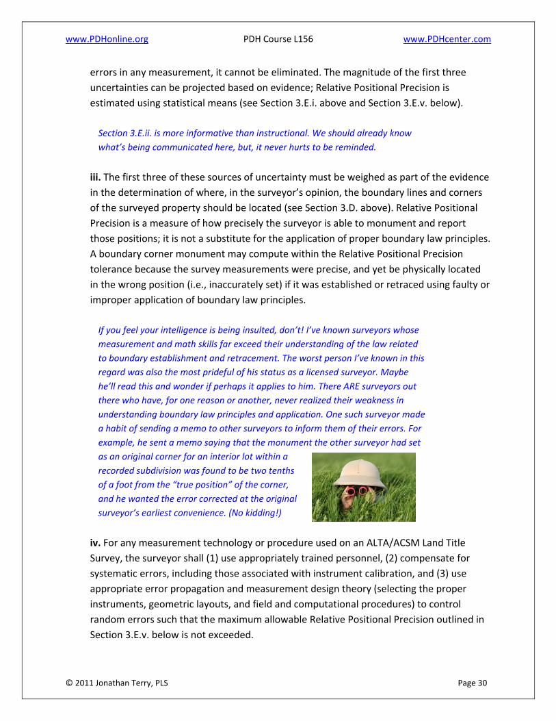
If you feel your intelligence is being insulted, don’t! I’ve known surveyors whose
measurement and math skills far exceed their understanding of the law related
to boundary establishment and retracement. The worst person I’ve known in this
regard was also the most prideful of his status as a licensed surveyor. Maybe
he’ll read this and wonder if perhaps it applies to him. There ARE surveyors out
there who have, for one reason or another, never realized their weakness in
understanding boundary law principles and application. One such surveyor made
a habit of sending a memo to other surveyors to inform them of their errors. For
example, he sent a memo saying that the monument the other surveyor had set
as an original corner for an interior lot within a
recorded subdivision was found to be two tenths
of a foot from the “true position” of the corner,
and he wanted the error corrected at the original
surveyor’s earliest convenience. (No kidding!)
iv. For any measurement technology or procedure used on an ALTA/ACSM Land Title
Survey, the surveyor shall (1) use appropriately trained personnel, (2) compensate for
systematic errors, including those associated with instrument calibration, and (3) use
appropriate error propagation and measurement design theory (selecting the proper
instruments, geometric layouts, and field and computational procedures) to control
random errors such that the maximum allowable Relative Positional Precision outlined in
Section 3.E.v. below is not exceeded.

www.PDHonline.org PDH Course L156 www.PDHcenter.com
© 2011 Jonathan Terry, PLS Page 31
Again, perhaps this is more instructional in nature than anything else. But, it
should not be glossed over, as it states requirements. Notice the word, “shall.”
This is an imperative, a commandment, not a suggestion. Many surveyors use
the same field methods for ALTA surveys as for all other boundary surveys and
back in the office push the button marked “least squares adjustment,” applying
very little thought about redundancy of measurements to control points or the
geometry of the control network.
I stepped into the waters of “statistical means” very early in the last decade of
the last century while surveying on Florida Dept. of Transportation projects,
although if memory serves me, it was five or ten years earlier that Vermont
introduced a “statistical means” to their requirements. Its time had not yet
come. It wasn’t long in Vermont until the rather radical approach went into the
trash can. The requirement was rescinded and more traditional methods
returned. Vermont, with its large tracts, semi‐mountainous terrain and lots of
woodlands, didn’t lend itself to a control network suited to the independent
measurements that a make least squares adjustment dance and click its heels.
If you were to graph the age of surveyors and their acceptance of “statistical
means” on the same chart, you’d get lines that overlap.
Younger surveyors probably find it easier to employ statistical adjustments, but
I’ve observed a tendency for even these younger surveyors to set out control
traverses no differently for their least squares adjustments than for compass
adjustments. In other words, they do NOT build into their control network any
significant redundancy – even on sites that permit, for example taking
observations on control points from multiple control points. On the other hand,
extravagant and impractical attempts to manufacture redundancy (for example
observing a control point or corner using a short backsight and long foresight to
the observed point) may satisfy the jaws of the least squares robot that crunches
the numbers we feed it, but in the process, we create statistically bad results –
results worse than if we’d just taken a single shot (with care, of course) to the
point from a geometrically strong position.
My point? Don’t let the tail wag the dog!
This is why Section 3.E.iv. requires us to, “(3) use appropriate error propagation
and measurement design theory (selecting the proper instruments, geometric
layouts, and field and computational procedures) to control random errors such
that the maximum allowable Relative Positional Precision outlined in Section
3.E.v. below is not exceeded.”

www.PDHonline.org PDH Course L156 www.PDHcenter.com
© 2011 Jonathan Terry, PLS Page 32
Remember the wisdom of Forest Gump’s Mama, “Stupid is, as stupid does.”
Or that maxim, “Garbage in, garbage out.”
I don’t see any practical reason why a surveyor should be
qualified to perform a least squares adjustment by hand
if the power goes out for a month while the calculation is
made. But a basic understanding of geometric network
design for least squares analysis IS something every surveyor who employs least
squares should know. Many field surveyors and party chiefs need to think more
about how they lay out their control network in order to make their use of
“statistical means” more meaningful.
Remember, the above requirement of the Standards (Section 3.E.iv.) does NOT
say, “Click your mouse on the Least Squares button.” Section 3.E.iv. has three (3)
components; each is very important.
And always remember the words of that famous instructor, Jonathan Terry, who
says, “The less thought that’s necessary to perform surveying, the greater
thought is required to examine the results.” So much of our work has become
automated that we lose touch with the logic and reason behind the results. Too
often we’re detached from the PROCESSES that we used to follow through to our
conclusion. This detachment can lead us to accept results that don’t
make sense. We still need to THINK about the results.
Are they within an expected range? Do the points
that appear on the monitor fall in the right general
location? Does everything “look right?” Is your sixth
sense uneasy about something you can’t quite define?
Do the statistics and reality seem to singing the same
tune?
We should apply the wisdom of Mark Twain, who counseled, “Facts are stubborn
things, but statistics are more pliable.” Surveyors, please don’t allow automation
to put your instincts into a snooze. Seasoned, mature surveyors possess precious
instincts – their sixth sense developed through years of experience, that smells
trouble and somehow knows when… “something just doesn’t feel right.”
A surveyor is an intelligent, learned, gifted investigator who’s in control of his
processes, who knows how to sift through the evidence and discover its
message. A surveyor is not just a collector of data and information. Be surveyors
at heart, not statisticians! Never allow your keenly developed intuition to

www.PDHonline.org PDH Course L156 www.PDHcenter.com
© 2011 Jonathan Terry, PLS Page 33
decompose. It is the hallmark of your profession! Always remember the
definition of a STATISTICIAN, and don’t allow your computer to talk you into
becoming one:
A statistician is a person who,
having one foot in a pot of boiling water
and the other foot frozen in a block of ice,
is, on the average, comfortable!
v. The maximum allowable Relative Positional Precision for an ALTA/ACSM Land Title Survey
is 2 cm (0.07 feet) plus 50 parts per million (based on the direct distance between the two
corners being tested). It is recognized that in certain circumstances, the size or
configuration of the surveyed property, or the relief, vegetation or improvements on the
surveyed property will result in survey measurements for which the maximum allowable
Relative Positional Precision may be exceeded. If the maximum allowable Relative Positional
Precision is exceeded, the surveyor shall note the reason as explained in Section 6.B.ix
below.
I can’t understand why the framers of this totally reformatted version of the
standards put separation between Section 3.E.i. and the above paragraph,
Section 3.E.v. Your best shot at understanding the statistical precision you’re
required to provide is through reading Section 3.E.i. and 3.E.v. together.
Oddly, we’re required in more than one place within these Standards to note the
reason we fail to achieve the allowable Relative Positional Precision, but I can’t
locate in the Standards any requirement to state the actual VALUE of the
Relative Positional Precision we finally managed to achieve. Presumably, it could
be quite large without any obligation on our part to reveal its actual value. I find
no requirement in the Standards to note this data on the survey map.
SECTION 4 – RECORDS RESEARCH
4. Records Research ‐ It is recognized that for the performance of an ALTA/ACSM Land Title
Survey, the surveyor will be provided with appropriate data which can be relied upon in
the preparation of the survey.
In this discussion of Section 4, I’ve separated the one, lengthy
paragraph covering records research requirements into several
blocks of text. Each portion is discussed separately, so that you can

www.PDHonline.org PDH Course L156 www.PDHcenter.com
© 2011 Jonathan Terry, PLS Page 34
relate my comments to the relevant requirements. These appear in the order
they appear in the Standards.
The request for an ALTA/ACSM Land Title Survey shall set forth the current record description
of the property to be surveyed or, in the case of an original survey, the current record
description of the parent parcel that contains the property to be surveyed.
I wish this section had been titled, “Request for Survey.” Following that
categorical title, I wish it said, “The request for survey shall not be complete, and
the surveyor’s work shall not commence on the survey until the surveyor is
supplied with the following…”
Why? I’ll bet that surveyors who’ve performed even a few ALTA surveys know
the answer without my spelling it out, don’t you?
Too often, I’ve been supplied with PARTIAL information, and my deadline for
delivery can’t be met without extra, uncompensated work on my part, as I begin
the survey while yet lacking everything I should have been furnished at the start.
Often, I’ve been provided the older research from an earlier title commitment.
This means I have to review and compare the old data with the current research
AFTER I’ve completed the field work, the processing and most of the mapping.
Sometimes, I’ve had to perform independent research that’s later duplicated in
research I receive after I’ve had to begin the survey. It’s not unusual to lack
copies of documents referenced in documents I’ve been provided. I have to
either retrieve these record documents myself or take the time to request them
from the client and wait for them to arrive. The FLOW of work begins unevenly
and endures interruptions as I encounter the need for additional items.
In addition to the dangers engendered through such a choppy progression in the
work flow, I’m also tempted to make assumptions regarding the records I don’t
yet have in hand in order to maintain the necessary pace on the project. Then,
with all the things on my mind, I may lose memory of that critical distinction
between assumptions I’ve been forced to make and verified facts.
This makes the surveying effort more taxing and time consuming. It also tends to
breed errors as relationships between the record documents in hand and the
missing documents go unnoticed in a subsequent review – relationships that
would have been detected if review of complete records took place in one sitting.

www.PDHonline.org PDH Course L156 www.PDHcenter.com
© 2011 Jonathan Terry, PLS Page 35
Clients do this version of the old ‘bait and switch’ to us repeatedly, and we
surveyors tend to let them complicate our lives, increase our liability and reduce
our profits unreasonably. Maybe the 2016 Standards will provide wording that
gives us some leverage to resist unreasonable pressure to work from partial
data!?!
Complete copies of the most recent title commitment, the current record description of the
property to be surveyed (or, in the case of an original survey, the parent parcel),
Notice the term, “most recent.” I don’t like that we often start work without the
CURRENT title commitment. What if the “most recent title commitment” is the
one issued for a prior transfer? Shouldn’t this read, “…the title commitment for
the ANTICIPATED TRANSFER OF PROPERTY”?
If, at the time of the request for survey, the MOST RECENT title commitment in
existence pertains to an earlier transfer of the property (not the anticipated one
for which we’re performing a survey), then we’re not necessarily being provided
with the CURRENT Schedule B exceptions. If the title company’s research has not
been completed by the time we are under contract to complete the survey,
transfers of land or rights into or out of the property may have occurred that are
not reflected in the “most recent,” yet not current, title commitment we’ve been
furnished.
Thus, in order to meet our required delivery date for the survey, we may be
forced to perform our own records research to obtain records that the title
company will furnish to us later (when they get to it.) Essentially, we are paid as
if we’re not responsible for performing that research, since the title company will
eventually provide it. But, the title company doesn’t furnish it in time for our
analysis to precede our field survey. Our other choice is to begin the survey
based on possibly outdated research. As a consequence, we lack certainty that
we know what to expect and to look for in our field survey phase. If the records
research package arrives after our field work is completed, and it reveals
matters we didn’t expect, then it’s back out to the field for additional work.
Much progress toward protecting the surveyors’ interests has been achieved in
the 1999, 2005 and 2011 revisions to the Standards, and I’m very grateful for
this. Hopefully, the next version will continue the quest to establish more
humane and business‐like treatment of surveyors.
Perhaps a future revision of the ALTA Standards will include a section titled,
“Request for Survey” that will state, “The surveyor’s field work shall not begin

www.PDHonline.org PDH Course L156 www.PDHcenter.com
© 2011 Jonathan Terry, PLS Page 36
until a complete package of current research has been delivered to and reviewed
by the surveyor.” Is this an unreasonable hope? Well, all I can say is that it will
never happen if we DON’T work for it. Our liability and ultimately the insurers’
and owners’ risks are increased through piecemeal delivery of truly current
records research.
the current record descriptions of adjoiners,
Thank you, thank you, thank you ,NSPS committee – for adding this NEW
language to the 2011 Standards requiring that adjoiners’ descriptions be
supplied to the surveyor. Now, if surveyors will just study them…
any record easements benefiting the property, the record easements or servitudes and
covenants burdening the property (all hereinafter referred to collectively as "Record
Documents"),
Often, we’re supplied with documents that do not apply to the property being
surveyed, and considerable time may be required to establish this fact.
For example, a blanket easement might have been granted to a utility company
long, long ago by the owner of a huge tract. Numerous divisions of the property
have been made over the years. Perhaps even adjoining parcels have been
merged with the parent tract, and then the new parcel formed gets subdivided
without regard to original property lines. The title company’s examiner locates
the record of an easement or other rights burdening one of the original tracts,
but the title searcher has no clue whatsoever WHERE the easement is located or
IF it applies to the parcel currently being surveyed.
At this point, I have to air a complaint about any state that allows SURVEY
BROKERS to market surveys without having a licensed surveyor of that state who
is actually present within a place of business in that state. You and I both know
that the traveling surveyor (more likely, the traveling survey CREW) representing
the survey broker will seldom possess the familiarity in the specific region to
determine whether an ancient recorded document does or does not impact the
survey of the current tract.
Some survey brokers do actually contact knowledgeable surveyors who conduct
business in the local area where the property to be surveyed is located. But, I see
a trend emerging for “national survey firms” that offer ALTA surveys. If there’s
one thing I’ve learned as a surveyor who has obtained registration in eight
states, it is this: Surveying is NOT a transportable profession. When I’ve accepted

www.PDHonline.org PDH Course L156 www.PDHcenter.com
© 2011 Jonathan Terry, PLS Page 37
management positions in surveying firms located in areas where I’ve not
personally practiced, I’ve always told those hiring me that any competent
surveyor who’s been practicing in that specific location for a number of years will
be better and faster at surveying in that location than I.
Another example: those numerous lease parcels for cell towers. These are more
problematic when performed under the seal of a surveyor who is not familiar
with local records and procedures. I know this from personal experience, though
logic provides sufficient argument on this point. I’ll restrain myself from reciting
examples, as this is not the subject of this course.
But, ALTA surveys are the subject of this course, and I don’t believe ANY survey is
likely to be performed to the highest standard by a surveyor unfamiliar with the
geographical area where the parcel is located.
documents of record referred to in the Record Documents,
As mentioned, frequently these are NOT supplied – at least not without your first
examining the documents provided and determining they are missing, issuing a
request for same, waiting for their arrival, and coming back at a later time to
review that missing information ‐‐or‐‐ just spending your own time and money
to obtain them yourself.
documents necessary to ascertain, if possible, the junior/senior relationship pursuant to Section
6.B.vii. below, and
Whoa thar Nellie! What meaneth this phrase, “if possible?” In the many states
where I’ve surveyed, I gotta tell ya, the ascertaining (embedded word, ‘certain’)
of junior/senior rights is sometimes a monstrous task. Seldom do surveyors
REALLY go back in the records far enough,
nor do they perform adequate field work,
to truly discover the full potential impact of
junior/senior rights. The typical “standard
of care” is abysmal in this regard.
Think about this as if you are in court
giving testimony under oath, and you’re
asked, “Mr. (or Ms.) Surveyor, are you telling the court that you are certain that
you’ve examined the records AND performed field work sufficient to confidently
state that no junior/senior rights can possibly impact the professional opinion
you’ve reached for this property’s boundaries?” Would you answer a simple,

www.PDHonline.org PDH Course L156 www.PDHcenter.com
© 2011 Jonathan Terry, PLS Page 38
“Yes?” Or, would you shift in your seat a little and begin a longer explanation to
evade the implications of a direct reply?
Have the documents you’ve received from the title company’s research included
sufficient records for you to “ascertain” (be CERTAIN) whether or not
junior/senior rights could be an issue? Are you confident no such rights would
surface from extensive research and field locations expanded to include
surrounding properties in a wider area?
I can’t figure out if this requirement absolves us surveyors of responsibility to
discover junior/senior rights (because the title company rarely supplies us with
adequate research) or ‘hangs us by the neck until dead’ if we fail to discover
such complications.
See additional comments under discussion of 6.B.vii.
any other documents containing desired, appropriate information affecting the property being
surveyed, and to which the ALTA/ACSM Land Title Survey shall make reference, shall be
provided to the surveyor for use in conducting the survey. Reference is made to Section 3.B.
above.
Thus ends Section 4, all of which falls under the boldface words, RECORDS
RESEARCH. I do wish it had been titled, REQUEST FOR SURVEY and specified (as
noted above) that the information provided to the surveyor would be complete
and current at the time the survey request is made.
CONCLUSION REGARDING SECTION 4, RECORDS RESEARCH:
Ah, to dream… Yes, I know I’m presenting what amounts to a pie‐in‐the‐sky wish
list in this section – a desire for order that will never be achieved. Clients are
used to feeding us this research piecemeal. Financial considerations and project
schedules don’t have a heart; they don’t care that our work is harder, or that we
end up not getting what we’re supposed to from our clients.
A final, practical word on records research: Often, professional title
examiners are available for hire as independent contractors. These
people hang out at the records centers and know their records reposi‐
tory and how to find things more quickly than we probably do. Often,
it’s faster and more economical to hire such a person to perform your
records research. If none of the statutes, rules or requirements gover‐
ning your surveying effort preclude hiring such a person, you may find
it prudent to do so.

www.PDHonline.org PDH Course L156 www.PDHcenter.com
© 2011 Jonathan Terry, PLS Page 39
SECTION 5 – FIELD WORK
5. Field Work ‐ The Survey shall be performed on the
ground (except as otherwise negotiated pursuant to
Table A, Item 15 below, if selected by the client), and
the field work shall include the following:
This, in my opinion DOES NOT mean driving slowly around the site with your
vehicle “on the ground” or walking the site with your shoes “on the ground” and
an earlier survey in your hand. In the early pages of this course, I’ve covered this
already in the discussion on UPDATES to surveys.
SECTION 5.A. – MONUMENTS
i. The location and description of any monuments or lines that control the boundaries of
the surveyed property.
You always do this on every survey, right? Do you REALLY?
Very few surveyors provide FULL descriptions for monuments found and set in
the course of performing a boundary survey. How often have you run across a
survey map that called out a monument this precise?
2” O.D. IRON PIPE FOUND – UP 18”, LOOSE, LEANING N.E.
I’ve seen situations in which a corner marker like the one above is “described” on
a survey map simply as IPF. Haven’t you? Did the prior survey locate an iron pin
found, an iron pipe found? Was it sticking up? Firm? Loose? Beneath the
surface? Did it have a surveyor’s cap? Was it a “pinch pipe” (i.e., cut with huge
shears rather than a saw)?
When you retrace an earlier survey having a corner marker labeled “IPF”, how
do you know (or how can you even speculate) whether the rebar you find is the
IPF located during an earlier survey? The honest answer is, “I can’t.”

www.PDHonline.org PDH Course L156 www.PDHcenter.com
© 2011 Jonathan Terry, PLS Page 40
I’ve experienced times when a COMPLETE description of a corner marker has
provided the critical information that eliminated ambiguity and confusion as to
the location of property lines. Uncertainty was been eliminated only because of a
surveyor’s COMPLETE description of the corner marker.
On one original survey of a parcel, the plat’s description of monumentation set
at a corner of the new parcel read, “2‐INCH IRON PIPE SET, UP 18 INCHES.” In
the geographical region where the original survey was performed, (and even for
the original surveyor whose habits were well known in the area), it was most
unusual for a 2” pipe to be set as a corner marker. It was also unusual that a
pipe used for a corner monument would be left sticking out of the ground a foot
and a half. The distances and bearings called for in the deed for the original
survey didn’t agree as well as one might wish with the surveyed location of that
2‐inch pipe recovered during a later retracement. The original monument (the 2‐
inch pipe) set by the original surveyor would never have been given its proper
weight had less than a FULL description of the corner monumentation been
provided on the map and in the written description.
I appeal to all surveyors to make detailed descriptions in your labeling of corner
monumentation found or set. And, whether your state or jurisdiction requires it
or not, when you set a corner marker ALWAYS insure that the corner marker (or
witness) has your durable identification on it.
ii. The location, size and type of any monuments found (or set, if Table A, Item 1 is
requested by the client, or if otherwise required – see Section 3.B. above) on the boundary
of the surveyed property.
This reference to Section 3.B. is a reminder to always survey to the most
stringent, applicable Standards or requirements. Too often surveyors have
mistakenly thought the ALTA Standards trumped their state or other
jurisdictional requirements, which were more stringent. This is particularly
prevalent in states that require more stringent records research or an abstract of
title prepared by the surveyor. And don’t forget that the research PROVIDED to
the surveyor is NOT research “performed under the direct supervision of the
surveyor.”
Check the wording of your state or local jurisdiction’s laws and rules. Find out
how much of your surveying must be performed “under the direction of a
licensed land surveyor.”

www.PDHonline.org PDH Course L156 www.PDHcenter.com
© 2011 Jonathan Terry, PLS Page 41
SECTION 5.B. – RIGHTS OF WAY AND ACCESS
i. The distance from the appropriate corner or corners of the surveyed property to the
nearest right of way line, if the surveyed property does not abut a right of way.
Self‐explanatory.
ii. The name of any street, highway or other public or private way abutting the surveyed
property, and the width and location of the travelled way relative to the nearest boundary
line of the surveyed property.
This is so easy to overlook. Mapping the travelled way (drawing lines on a map)
is not the same as labeling the distance from same to the nearest boundary line
of the property. I interpret this item as requiring a dimension label on the survey
map, not merely a graphic depiction. Also, the travelled way is not the same as
the shoulder in most cases. (Again, my interpretation.) Personally, I depict and
dimension both the travelled way and the shoulder – and the sidewalk, if
present. A blow‐up or detail may be needed.
iii. Visible evidence of physical access (such as, but not limited to, curb cuts and driveways)
to any abutting streets, highways or other public ways.
This includes curb cuts at locations where no driveway has been constructed.
Field crews sometimes miss locating such curb cuts if not specifically reminded
before they head out for the day.
iv. The location and character of vehicular, pedestrian or other forms of access by other
than the apparent occupants of the surveyed property to or across the surveyed property,
including, but not limited to driveways, alleys, private roads, sidewalks and footpaths
observed in the process of conducting the survey.
Beware of the “well‐worn path.” Personally, I’d be certain to depict foot
paths and ATV ruts and the like, as these could indicate the potential
for unwritten rights.
You, as a licensed surveyor, should understand how important
this is. Unfortunately, many party chiefs don’t! I wish that every
state’s laws and rules required the surveyor to walk the boundaries and field
check the survey map PERSONALLY. The quality and reliability of our work would
be improved.

www.PDHonline.org PDH Course L156 www.PDHcenter.com
© 2011 Jonathan Terry, PLS Page 42
Whenever possible, I avoid the word “encroachment” when labeling a map.
Determining whether an observed condition is or is not legally an encroachment
is beyond the expertise of a surveyor to decide. However, an APPARENT
encroachment can, in most cases, be located and/or measured and
depicted/noted on the plat or map. The surveyor is obligated to locate and
document uses and conditions that MAY burden or benefit the property being
surveyed, but I think it wise to carefully avoid labeling that implies the legal
status of these conditions has been determined if it has not.
v. Without expressing a legal opinion as to ownership or nature, the location and extent of
any potentially encroaching driveways, alleys, and other ways of access from adjoining
properties onto the surveyed property observed in the process of conducting the survey.
The word in the above paragraph to boldly highlight in your understanding is
“potentially.” Surveyors have a tendency to label improvements or uses that
don’t seem to be where they should be or are not discovered as lawful uses
during records research and analysis as “encroachments.”
Whether or not some improvement or some use is legally an encroachment is
often beyond the expertise, authority or experience of a surveyor to determine. If
a building extends onto the property being surveyed or extends over the
property line onto lands of others, it is usually sufficient to dimension the extent
of the “POTENTIAL encroachment” without adding those two words as labels.
It’s even more risky to label the situation as an “encroachment.”
Things are not always as they appear. It is the surveyor’s duty to locate
“apparent encroachments,” but it’s wise to avoid conveying the impression that
such use or occupation has created a settled legal impact unless you are
absolutely certain that is the case.
Remember, too, it is possible some undiscovered, recorded document or an
unrecorded agreement has influenced the use or occupation that appears as an
encroachment.
In short, I recommend avoiding the use of the word, “encroachment” unless you
are conscious of that word’s meaning, and the meaning exactly (and legally)
describes the situation.
vi. Where documentation of the width or location of any abutting street, road or highway
right of way was not disclosed in Record Documents provided to the surveyor or was not

www.PDHonline.org PDH Course L156 www.PDHcenter.com
© 2011 Jonathan Terry, PLS Page 43
otherwise available from the controlling jurisdiction (see Section 6.C.iv. below), the
evidence and location of parcel corners recovered which might indicate the width or
location of such right of way lines.
Obviously, this implies, “Look across the street!” Width of the right‐of‐way
should not be estimated based on twice the distance from the located centerline
of the road to evidence of the subject parcel’s corners. Roads are not always
located in the center of the right‐of‐way. States vary significantly on how
difficult it is to locate the road rights‐of‐way.
For example, consider three of the states in which I’ve surveyed.
VERMONT: If no records of a road’s width exist, the road is presumed to have a
3‐rod (49.5’) wide right‐of‐way. Each town keeps its own land records.
Determining whether ancient records exist for old roads can be daunting. It
helps when the Town Clerk is elderly and has held the office for decades. Some
Town Clerks have limited hours of operation, and you may have to share the
vault with the Town Clerk’s cat. If you’re not the only person in the vault, you
may not have room to open a record book on the table – if there’s a table.
CONNECTICUT: Connecticut’s state highways are well monumented in most
cases. Along state highways, control lines (called, “Random lines”) were
established, and these were usually quite precise. Concrete monuments,
originally set off these random lines, mark the rights‐of‐way of state highways.
Much of the mapping for this is dated in the 1930’s, yet many monuments are
recoverable due to the state’s historic diligence to require permits for excavation
along the highways. State highway survey crews tie‐in monuments prior to
construction and replace them once construction or excavation is completed.
Right‐of‐way maps dimension rights‐of‐way off of the random lines. In most
areas of the state where I’ve worked, concrete monuments along state highways
can be recovered as well as some of the original random monumentation.
NORTHEASTERN PENNSYLVANIA, Monroe County: Located just a few hours’
drive from Connecticut, one finds an entirely different story. Little
monumentation exists for many state roads. Rights‐of‐way of state highways
may include the area curb‐to‐curb, while the local municipality owns title to land
within the state’s right‐of‐way width and beyond it to back of sidewalk on each
side of the road. In some areas, municipalities own title to the land, as highways
and streets were created by ordinance. At any time prior to a certain year, the
state acquired just a right‐of‐way for highways; after that year, the state owns
title to the land within its “right‐of‐way.” Monumentation is rare, except for

www.PDHonline.org PDH Course L156 www.PDHcenter.com
© 2011 Jonathan Terry, PLS Page 44
occasional front property corners of adjoining parcels, and what monumentation
you find has often been set by individual surveyors, or perhaps even by Joe
Landowner. At least one multi‐discipline engineering firm designing road
improvements actually drafted a contract requiring THE CONTRACTOR to replace
disturbed monuments. Yikes! If you attend the annual surveyors’ conference in
Pennsylvania and take two continuing education courses on highways, the first
taught by an attorney and the second course taught by an educator, you can
find one presenter is teaching highway rights‐of‐way principles contradictory to
the other.
FLORIDA, Marion County: Suppose a “national survey firm” is contracted to
perform an ALTA survey for a parcel at 855 NW Pine Avenue located within the
city limits of Ocala, Florida. The firm discovers that this address is on U.S. Route
301, U.S. Route 441, U.S. Route 27, State Highway 25, and State Highway 200
(This is an actual location.)
How will a “national survey firm” having a surveyor residing in Alabama (who’s
never actually surveyed in Florida but holds a Florida license) handle the rented
field crew out of Georgia to research this road’s right‐of‐way width? (This is a
hypothetical, but you catch my drift.)
vii. Evidence of access to and from waters adjoining the surveyed property, such as paths,
boat slips, launches, piers and docks observed in the process of conducting the survey.
Obviously, such evidence indicates that rights may exist that burden/benefit the
property being surveyed. Your failure to discover and depict (or note) these
conditions may come back to haunt you later.
SECTION 5.C. LINES OF POSSESSION AND IMPROVEMENTS ALONG THE BOUNDARIES
i. The character and location of evidence of possession or occupation along the perimeter of
the surveyed property, both by the occupants of the surveyed property and by adjoiners,
observed in the process of conducting the survey.
Basic stuff. Every survey performed should always include examining the site and
locating/noting such conditions.

www.PDHonline.org PDH Course L156 www.PDHcenter.com
© 2011 Jonathan Terry, PLS Page 45
ii. The character and location of all walls, buildings, fences, and other
improvements within five feet of each side of the boundary lines,
observed in the process of conducting the survey.
Be sure to remind a surveyor or party chief who’s unaccustomed to
performing ALTA surveys that the crew must locate certain conditions
found beyond the perimeter of the property being surveyed. In addition
to simply locating these improvements, the “character” of them must somehow
be recorded and conveyed. Details! Height, condition, construction, materials,
uses (storage shed or garage?), etc.
More stringent requirements may apply. Here’s one example, Connecticut has in
its regulations a type of survey called a Perimeter Survey, which maps a strip
along the boundaries. This strip must be 15 feet wide, depicting many specified
improvements and conditions located 10 feet within the property line and 5 feet
outside it.
iii. Without expressing a legal opinion as to the ownership or nature of the potential
encroachment, the evidence, location and extent of potentially encroaching structural
appurtenances and projections observed in the process of conducting the survey, such as
fire escapes, bay windows, windows and doors that open out, flue pipes, stoops, eaves,
cornices, areaways, steps, trim, etc., by or onto adjoining property, or onto rights of way,
easements or setback lines disclosed in Record Documents provided to the surveyor.
Look up! This is a survey made “on the ground,” but look up and locate
overhangs, projections – all the things mentioned and anything else of like
nature. And, don’t forget; closed doors or fence gates located near the property
line that open outward or toward the property line may need to be located. I tell
crews to locate any gate or doorway on adjacent property that may come within
five feet of the property line when swung open. In such cases, I instruct them to
locate the hinge, the closing side of the door and, as a check, measure the door
or gate. This provides what’s needed to graphically depict an arc representing
the swing of the door on the survey map.
SECTION 5.D. BUILDINGS
Based on the normal standard of care, the location of all buildings on the surveyed property
shown perpendicular to the nearest perimeter boundary line(s) and expressed to the
appropriate degree of precision.

www.PDHonline.org PDH Course L156 www.PDHcenter.com
© 2011 Jonathan Terry, PLS Page 46
This specification in the 2011 ALTA Standards clarifies a point of confusion
created in the earlier, 2005 Standards, which seemed to imply that “Relative
Positional Accuracy” (now called, “Relative Positional Precision”) applied to
building location. Thankfully, the clear intent of the 2011 Standards in regard to
building location eliminates the 2005 version’s potential for confusion.
If we weren’t in the habit of showing dimensions (measured perpendicular to the
property line) from building corners to property lines, I’m not sure we’d know
what this requirement intends in the mapping phase. The decision on the part of
those who drafted the 2011 standards to incorporate by reference all the field
work requirements into the mapping phase brings with it some awkwardness in
the writing.
Incidentally, I believe it is important, not just on ALTA surveys but on all surveys
requiring the location of buildings, that the survey crew note where on the
building the shot is taken (on brick corner, on foundation below siding, on siding
[type?], on window sill, on roof overhang, on siding at corner of bay window
wall, etc).
SECTION 5.E. EASEMENTS AND SERVITUDES
i. Evidence of any easements or servitudes burdening the surveyed property, disclosed in
the Record Documents provided to the surveyor and observed in the process of conducting
the survey.
We really shouldn’t have to be told to do this. How obvious is this? Yet, no doubt
those who drafted these Standards knew of cases where this was not done.
ii. Evidence of easements or servitudes not disclosed in the Record Documents provided to
the surveyor, but observed in the process of conducting the survey, such as those created
by roads; rights of way; water courses; ditches; drains; telephone, fiber optic lines, or
electric lines; water, sewer, oil or gas pipelines on or across the surveyed property and on
adjoining properties if they appear to affect the surveyed property.
Again, do we really need to be reminded that this is “normal” surveying? The
answer is, “Yes.” Often, I have to remind crews to locate overhead power lines,

www.PDHonline.org PDH Course L156 www.PDHcenter.com
© 2011 Jonathan Terry, PLS Page 47
identify poles having power lines that drop to be routed underground, locate
water valves, monitoring wells, cable boxes, etc.
Property ownership is better thought of as “a bundle of rights.” Property owners
may hold paper title to a certain perimeter boundary, but who owns which rights
within that perimeter boundary? And, what parties own rights related to “our
land?”
We’re at a good place in this course to suggest sending a licensed surveyor or a
seasoned, observant person who has not been to the site before to perform the
field check of the survey map. Charge the person sent with three objectives. First,
examine the site for potential encroachments and rights benefitting or
burdening the property. Second, confirm that all necessary field locations have
been made (nothing existing on the site is missing on the map) and that things
appear to have plotted in the right spatial relationship to other physical
features. Third, verify that the data collection methods employed to create
automated linework have produced a correct result on the map. Data collection
that automates the drawing of linework is great, but it can be prone to errors.
Sometimes the last curb shot logged may not be at the end of the curb – for
example, when the physical curb itself extends to a building corner, but the shot
at the building corner hasn’t functioned as the end point of the linework for the
curb. Curves in linework can sometimes render unrealistic representations of the
field conditions. So, the person field checking is looking not just to verity that
features are in the right place on the map, but also for features not located,
features mislabeled (the manhole plotted as a monitoring well), and in general
how well the mapping represents the field conditions.
A tabulated checklist is often helpful as well.
iii. Surface indications of underground easements or servitudes on or across the surveyed
property observed in the process of conducting the survey.
Same concerns here as above.
iv. Evidence of use of the surveyed property by other than the apparent occupants
observed in the process of conducting the survey.
Again. Eyes open and alert for those “bundle of rights” issues.

www.PDHonline.org PDH Course L156 www.PDHcenter.com
© 2011 Jonathan Terry, PLS Page 48
SECTION 5.F. CEMETERIES
As accurately as the evidence permits, the location of cemeteries, gravesites, and burial
grounds (i) disclosed in the Record Documents provided to the surveyor, or (ii) observed in the
process of conducting the survey.
A church I know of buries the cremated remains of some departed members on
the church grounds and places a plant or a shrub to mark the spot. About 18
members’ remains (ashes) are resting in the resulting garden with only one clue
(a small, granite plaque set level with the ground) indicating that this
landscaped garden actually holds the last physical remains of numerous
members.
Be careful to look closely, as burial grounds can totally kill a plan of
development. Don’t risk a failure to disclose possible burial grounds.
That word, “observed,” places a burden on you to not turn a blind
eye to a little block of granite engraved, “Hilda–with God,” or
to notice some bone fragments next to the arrowhead you
picked up on the site. Hilda may have been the family
parakeet – or Grandma.
Don’t expect to be praised for noticing and bringing to the attention of others
the possibility of burial grounds. But, practicing your profession is not a
popularity contest; it’s a professional obligation to the public. A surveyor, unlike
a lawyer, is charged with a responsibility to be objective and unbiased. You are
not your clients’ advocate.
SECTION 5.G. WATER FEATURES
i. The location of springs, together with the location of ponds, lakes, streams, and rivers
bordering on or running through the surveyed property, observed during the process of
conducting the survey. See Table A, Item 19 for wetlands locations.
I recommend always noting on the survey map that the Water body elevation(s)
were observed on the date of the field survey. I can’t imagine a situation in
which showing only the centerline of a stream would be adequate for an ALTA
survey, except perhaps in the rare case the width and depth are uniform and
noted on the map.
www.PDHonline.org PDH Course L156 www.PDHcenter.com
© 2011 Jonathan Terry, PLS Page 49
ii. The location of any water boundary on the surveyed property. The attribute(s) of the
water feature located (e.g. top of bank, edge of water, high water mark, etc.) should be
congruent with the boundary as described in the record description or, in the case of an
original survey, in the new description. (See Section 6.B.vi. below).
Because the survey may be depended upon for decades after the actual date of
survey, after the 2011 ALTA Standards have long since been forgotten, I
recommend notes on the plat or map that read something like this:
The Water body elevation(s) noted hereon were observed on the date of the
field survey. The elevation(s) related to water boundaries noted on this map
are congruent with the boundary as described in the [insert ‘record’ and/or
‘new’] description.
Make certain your boundary location and issues related to legal rights of the
public or “waters of the State” are not in conflict and note if they are. But, don’t
trick yourself into stating an opinion or determination that should be left to a
lawyer or a judge.
I once attended a seminar for surveyors taught by a judge. Regarding situations
involving depositions or litigation, he said to us surveyors, “Your first need is to
explain boundary law to the lawyer.” (This is a direct quote from a judge, and
you surveyors who’ve been involved in boundary litigation probably know why
that judge gave us this advice.) Surveyors walk a fine line between their
professional obligation to know how a judge should rule if given all the relevant
evidence and the humility to carry such knowledge with discretion. We must not
act or speak beyond the expected expertise of the surveying profession. Always
state facts and leave the legal arguments to the lawyers and the legal
determinations to the courts.
If I’m meeting with a lawyer on a matter related to a survey I’ve performed, I
make it a point to suggest he or she ask me a question that allows me to answer,
“When making a boundary determination, I always try to test my conclusions
and professional opinions based on how I believe a judge will weigh the evidence
and facts I’ve documented.”

www.PDHonline.org PDH Course L156 www.PDHcenter.com
© 2011 Jonathan Terry, PLS Page 50
SECTION 6 – PLAT OR MAP
6. Plat or Map ‐ A plat or map of an ALTA/ACSM Land Title Survey shall show the following
information. Where dimensioning is appropriate, dimensions shall be in accordance with the
appropriate standard of care.
In order for this to be the case, appropriate decisions must be made regarding
what goes into locating what is dimensioned and the precision stated or
depicted on the survey map. Both the field crew and the person creating the
map must represent the policies and wishes of the surveyor who seals the
survey.
A. The evidence and locations gathered during the field work as outlined in Section 5 above.
The wording of Section 6.A. is so brief as to be easily overlooked. When making
your ALTA Surveys Checklist, be sure you carefully review Section 5 and include in
your checklist the items noted in Section 5 in both your field survey checklist and
your mapping checklist.
B. Boundary, Descriptions, Dimensions and Closures
i. The current record description of the surveyed property, and
any new description of the surveyed property that was
prepared in conjunction with the survey, including a statement
explaining why the new description was prepared. Preparation
of a new description should be avoided unless deemed
necessary or appropriate by the surveyor and insurer.
Preparation of a new description should also generally be
avoided when the record description is a lot or block in a
platted, recorded subdivision.
When a new description of the surveyed property is a REFINEMENT of the earlier
description (such as a description containing bearings and distances for a parcel
that formerly was only described by subdivision, block and lot), I recommend
noting within the new description that it is the result of a field survey and
describes the same property as described in [cite land records and/or plat
recording data].

www.PDHonline.org PDH Course L156 www.PDHcenter.com
© 2011 Jonathan Terry, PLS Page 51
Of course, if the new description essentially corrects a problem with the older
description, provide this information in the new description.
It’s generally best to cite your survey plat or map in the written description and
the survey report, if one was created. Whenever possible, record the survey plat
or map and cite the recording data for that drawing in the written description. If
a revision date is shown on the map, plat or survey report, make sure that same
revision date is also noted in the written description of the property.
I feel it’s important to state in a new description whether or not this new
description essentially agrees with the earlier description. Is the new description
written to bring greater precision, detail or specificity to the old one? Or, was a
new description required because you performed an independent resurvey that
disagrees with an earlier one? Perhaps the new description simply adds a
missing call, and your new description is NOT intended to state disagreement
with the intent of an older description. My rule regarding any survey: If you
create a new description, explain why. This is not just my motto, though. It’s a
requirement of the 2011 Standards.
Often a new description confuses people unfamiliar with interpreting written
descriptions of land. They may think the new description is of a DIFFERENT
property than the earlier description. If your description even looks like it’s
different from the one you’ve been furnished (say for example, having a different
basis of bearings), state within the new description its relationship to the earlier
description. This may save you the considerable effort necessary to educate the
person reviewing your description and survey. On the reviewer’s checklist, an
item may read, “Plat or map’s written description agrees with the one furnished
to surveyor.” The reviewer has a checklist, but lacks an ability to really compare
the old description with the new one because the wording doesn’t appear
identical. People who lack the technical ability or experience to analyze apparent
(not actual) differences between written descriptions may stir up a hornets nest.
The 2011 Standards discourage writing a new description, and I think both you
and I know why. But, there are times when you contribute an important
professional service to the parties involved and to the general public by doing so.
Use care and judgment when deciding.
ii. The location and description of any monuments, lines or other evidence that control the
boundaries of the surveyed property or that were otherwise relied upon in establishing or

www.PDHonline.org PDH Course L156 www.PDHcenter.com
© 2011 Jonathan Terry, PLS Page 52
retracing the boundaries of the surveyed property, and the relationship of that evidence to
the surveyed boundary. In some cases, this will require notes on the plat or map.
I am shocked by the lack of notes and detailed information shown on survey
maps in general, and I have to wonder: if a survey map provides no indication of
WHY the boundaries shown are presented as such, is this really a professional
survey product?
Some surveyors “hold their cards close to their chest” as a business tactic. If
anyone desires to know the ‘why’ behind a survey map, they’ll have to come to
that surveyor. I find this distasteful – perhaps unethical as well. It wouldn’t be
offensive to me, if I could be certain that every surveyor would live forever.
Because surveyors do eventually die, I believe all boundary survey maps should
at the least provide a complete list of reference documents and, as mentioned
earlier in the course, FULLY describe monuments found or set.
It’s difficult to follow in the footsteps of the earlier surveyor when that person
has carefully swept over his or her footprints, making it impossible to follow his
trail.
iii. All distances and directions identified in the record description of the surveyed property
(and in the new description, if one was prepared). Where a measured or calculated
dimension differs from the record by an amount deemed significant by the surveyor, such
dimension shall be shown in addition to, and differentiated from, the corresponding record
dimension.
What one surveyor deems significant is likely to not agree with another
surveyor’s judgment. If you’ve done a number of ALTA Surveys, you may have
received a call from a non‐surveyor who’s going through a checklist to see if your
survey map contains everything on the checklist. One item on the list is: Map
bearings and distances agree with deed description.
Your caller states, “Your map’s bearings and distances dif‐
fer from the record description.” You begin a short course
on how bearings between two lines actually express an
angle and how a measurement is never exactly perfect.
Some states require that both the record description’s bearing and distances and
the survey’s bearings and distances are noted on the map. Personally, I think this
is a good idea, whether or not the differences are significant.

www.PDHonline.org PDH Course L156 www.PDHcenter.com
© 2011 Jonathan Terry, PLS Page 53
iv. The directional, distance and curve data necessary to compute a mathematical closure of
the surveyed boundary. A note if the record description does not mathematically close. The
basis of bearings and, when it differs from the record basis, the difference.
Do you agree with the following statement?
Two elements of curve data (for example: radius and length, or radius and
central angle) are insufficient to compute a mathematical closure of the
boundary – unless, the curve is clearly depicted or noted as being a curve
tangent to the line leading to the point of curvature AND we’re told if the curve
is to the left or right.
I ALWAYS provide at least three elements of the curve, so that the person
checking closure can verify redundancy of the curve data. One element of the
curve data is most often the chord bearing and distance. If the map’s linework
doesn’t make it abundantly clear where the center of the curve lies, I will note
the bearing and distance to the center of the curve or define the curve as being
to the right or to the left along with including the chord bearing and distance.
(An alternate method to noting the bearing and distance to the curve’s center is
to describe the curve as “concave northeasterly,” for example).
These methods allow for a true check of the mathematical closure and a
redundant check of curve data.
Yes, it’s true that generally, one may assume correctly whether the curve is to
the left or the right by the tangents on either end of the curve, but not always.
Isn't it better to simply write your descriptions in a way that requires no
assuming? And it’s wrong, in my experience, to assume that all curves that list
just two elements of curve data are tangent. The larger the radius or shorter the
length of curve, the greater is the difficulty in feeling confident guessing at the
data the earlier surveyor hasn’t bothered to provide.
v. The remainder of any recorded lot or existing parcel, when the surveyed property is
composed of only a portion of such lot or parcel, shall be graphically depicted. Such
remainder does not need to be included as part of the actual
survey, except to the extent necessary to locate the lines
and corners of the surveyed property, and it need not
be fully dimensioned or drawn at the same scale as the
surveyed property.

www.PDHonline.org PDH Course L156 www.PDHcenter.com
© 2011 Jonathan Terry, PLS Page 54
MAYBE. In many jurisdictions, you are creating a subdivision when you cut a lot
out of a parent tract. Yes, some jurisdictions consider it a “minor subdivision”
and some don’t call it a subdivision until you create the second new lot from a
parent tract, BUT… be sure you know your local requirements when you create a
new parcel, when your survey is an original survey and your description of the
parcel is the first on record. It is likely that your local requirements will be more
stringent than the ALTA Standards. (See Section 3.B. and many topics
throughout this course.)
vi. When the surveyed property includes a water boundary, a note on the face of the plat or
map noting the date the boundary was measured, which attribute(s) of the water feature
was/were located, and the caveat that the boundary is subject to change due to natural
causes and that it may or may not represent the actual location of the limit of title. When
the surveyor is aware of natural or artificial realignments or changes in such boundaries, the
extent of those changes and facts shall be shown or explained.
Notice the four (4) notations required on your map per the first sentence of
requirement vi.
Read that last sentence again, please. I suggest you include a note when you
AREN’T AWARE as well. If you can’t be certain whether the water boundary has
or has not moved, I’d suggest a note stating this fact. Surveyors seem to feel
they can’t give the “I don’t know” answer, and they often increase their liability
by not simply stating the obvious. If nobody paid you to keep your eye on that
water boundary for the last hundred years, why do you think less of yourself for
not knowing if the boundary has been stable? This is just some food for
contemplation. When “I don’t know” is the honest answer, it’s better than a lie.
The first sentence of Section 6 B.vi. (above) gives you a clue as to how the note
you place on the map might read. Stick close to this suggestion in wording your
note, and you can direct a client who complains to the 2011 Standards, Section 6
B.vi. That will probably send them on their way to graze in greener pastures.
If you map a water boundary of a significant stream, and you are not familiar
with the flood history of that area, how are you to determine whether the shift
in stream location was sudden or the result of gradual changes over time? The
first condition doesn’t generally cause a deed’s call “to the stream” to follow the
stream; the second does in most cases. Water boundaries may tempt you to flow
past the banks of your own professional expertise and knowledge. Resist this.

www.PDHonline.org PDH Course L156 www.PDHcenter.com
© 2011 Jonathan Terry, PLS Page 55
Significant investigation may be required to locate water boundaries, and if a
flood moved the water body 20 years ago, how does today’s surveyor determine
where the boundary was located prior to that flood?
I can’t resist bringing out my soap box against survey brokers and national
survey firms. (If you want to skip reading the following two paragraphs, feel free
to do so.)
Consider this example: A “national survey firm” located in California, has a
business relationship with a Colorado surveyor who happens to also hold a
Virginia surveyors license. The CA firm hires a Maryland survey crew to do the
fieldwork and research for a Northern Virginia ALTA/ACSM Land Title Survey of a
parcel having as it’s eastern border a call for “the Potomac River.” Does this
sound like a recipe for disaster?
Or, how about the New Hampshire engineering firm who had a surveyor in
Colorado (who held a NH surveying license) sealing the NH surveys performed by
this NH engineering firm? A complaint was lodged against that Colorado
surveyor and the NH engineering firm. Can you guess the ruling? No violation
was committed! Enough said.
vii. The relationship of the boundaries of the surveyed property (i.e. contiguity, gaps, or
overlaps) with its adjoiners, where ascertainable from Record Documents and/or from field
evidence gathered during the process of conducting the survey of the property being
surveyed. If the surveyed property is composed of multiple parcels, the extent of any gaps
or overlaps between those parcels shall be identified. Where gaps or overlaps are identified,
the surveyor shall, prior to preparation of the final plat or map, disclose this to the insurer
and client for determination of a course of action concerning junior/senior rights.
I think the words, “composed of” in the above paragraph should probably be
“compiled from” or “comprised of.” Anyway, we all know what’s being said.
Bottom line: the Standards are directing our attention to things we might rather
ignore – interior gaps and overlaps. Why? Call me dumb, but regarding interior
overlaps, I can’t understand why, unless perhaps an easement location is tied to
a former boundary line of an interior parcel that overlaps another interior
parcel’s boundary line. In such a case, which does happen, the origin and
resolution of the overlap may need to be resolved before the location of the
easement (or other right) can be determined.
But, when it comes to gaps between interior parcels, remember that an interior
gap may signal a no man’s land that actually never entered the chain of title for

www.PDHonline.org PDH Course L156 www.PDHcenter.com
© 2011 Jonathan Terry, PLS Page 56
Gap?
the overall parcel you’re surveying. The land within that seemingly insignificant
gap may belong to another party. At the least, it may represent a cloud on the
title that the title insurer may want remedied.
But, on the other hand, the gap may simply be the result of
deed plotting, when the intent of the parties to the original de‐
scription is clearly to convey to the land of another party. The
math stinks, but the intent of the parties indicates you should let
the call to the adjoining parcel prevail over the call for a particular
distance. Distance calls in old deeds are often not very accurate.
I love the last sentence of Section 6.B.vii. It may help you get paid for
unanticipated, extra work required. This sentence allows us to contact the
insurer and client to dialogue about the problem. During your conversation or
correspondence, look for your opportunity to note that this condition you’ve
discovered, to the benefit of your involved parties, is an unforeseeable
complication that will require authorization to compensate you for your efforts
in searching out this matter. In other words, if you have been so unfortunate as
to enter a contractual obligation that doesn’t provide for unforeseen
circumstances, stake your claim on that last sentence of Section 6.B.vii., and
tactfully negotiate your need to be paid for your extra work.
Please note that Section 6.B.vii. of the Standards (above) is married to Section
4’s requirement related to “junior/senior rights.”
This is a good place of offer a statement you may want to think about:
In other words, an overlap may be a vague term used to describe a boundary
uncertainty created by deed plotting, when a proper analysis of junior/senior
rights will resolve the overlap or gap. The call for an adjoiner in the deed
description that created the parcel may resolve a condition that, for lack of
diligent records research, is termed an overlap or gap. The graphical plot of
adjoining descriptions may present the appearance of an overlap or gap, when
the deed’s language, “to lands of…” clearly controls over the distances from
which our mathematical/graphical portrayal cries, “overlap, gap!”
It’s easy in the CAD/graphic world of deed plotting to become too centered on
the super‐precise, geometric representations on our computer screens of what
Many of what surveyors call ‘gaps’ and ‘overlaps’ are in fact neither; they are actually undiscovered or unresolved matters related to junior/senior rights.
Lot 14 Lot 15

www.PDHonline.org PDH Course L156 www.PDHcenter.com
© 2011 Jonathan Terry, PLS Page 57
were originally rather poorly crafted property descriptions that lacked precision.
Our graphics may “create” gaps and overlaps that were not “legally” created in
the original descriptions. At times though, our compilation plotting of many
deed descriptions is greatly aided by CAD capabilities. But, don’t forget that old
light table, if your office still has one. Young CAD folks probably don’t know what
a light table is, and they will be slow to use one, even when your fastest route to
solving certain mysteries is found bending over a light table and sliding plots
around until they begin to make sense. This is possible in the CAD environment,
and I absolutely love the CAD/computation capability, but sometimes that old
light table provides a faster, more comprehensible clue as to how descriptions
relate to each other.
Here is a real example of the “interior gap” problem that I encountered recently.
I performed a boundary survey of a property comprised of 18 parcels. The
assembly of the many tracts that together made up the overall parcel that
occurred over many years, and the compilation took place as multiple owners of
the growing tract added a parcel here and another there, eventually expanding
the size of the industrial‐use parcel over time to become what I was surveying.
It was not easy assembling plots of these many, rather rough descriptions into
the collage that represented the current tract having frontage on three different
roads. In the course of developing the compilation plot made to graphically
depict the fruit of my extensive records research, I suspected that one interior
parcel never made it into the current owner’s chain of title, and that the current
owner of the property being surveyed actually had a “hole” (gap) in his overall
tract – that is, one entire parcel had not conveyed into my client’s chain of title
as was assumed to be the case.
As you can imagine, considerable extra time and effort was expended in chasing
this matter down with the title company’s involvement.
Such discoveries can surface when surveying a tract made up of multiple smaller
parcels. If at all possible, do not lock in a set fee that fails to allow for significant
impacts that can’t be anticipated at the time a fee is quoted. No offence
intended, but surveyors are notoriously prone to doing extra work for no
compensation. We need to learn something from the recent news media
attention given to bullying in our schools. Bullying is socially unacceptable. It’s
wrong to allow yourself to be bullied into suffering losses that aren’t your
responsibility. Encountering unforeseeable circumstances, not known to exist
when a survey is requested, is justification for being paid for your efforts to
investigate and, if possible, solve such circumstances.

www.PDHonline.org PDH Course L156 www.PDHcenter.com
© 2011 Jonathan Terry, PLS Page 58
Surveyors, awake! Negotiate contracts that make sense and are fair
to you. In my decades of experience, I’ve only met one surveyor who
typically charges like a lawyer. He estimates what a survey may cost
based on similar surveys, gets a sizable retainer before starting the
work and requires an additional retainer if that well runs dry. This, in
my opinion, is how survey businesses should structure their financial
operation. At the least, surveyors should not lock in on a fee until the
records research and deed plotting has revealed what’s involved.
Field work is more predictable and thus might be performed for a set
fee based on prior experience with similar sites.
viii. When, in the opinion of the surveyor, the results of the survey differ significantly from
the record, or if a fundamental decision related to the boundary resolution is not clearly
reflected on the plat or map, the surveyor shall explain this information with notes on the
face of the plat or map.
This is good, but what if such matters are more properly discussed in a Survey
Report? Does 6.B.viii. preclude the presentation of unresolved or complex issues
in a Survey Report? One solution to this is to create a survey map of multiple
sheets. The Survey Report can essentially be printed as part of the survey map
set instead of being bound separately. In such a situation, I would discuss the
method of presentation with my client. If a Survey Report is presented as a
separate document, I always include a note on the survey that reads something
like the following:
This survey is not complete without the accompanying Survey Report titled,
“_________________________” and dated _____________that depicts and/or
explains matters relevant to this survey map.
ix. A note on the face of the plat or map explaining the site conditions that resulted in a
Relative Positional Precision that exceeds the maximum allowed under Section 3.E.v. of
these standards.
I’m not sure why this requirement doesn’t also necessitate specifying the
magnitude of the Relative Positional Precision.
As mentioned earlier, we’re required in more than one place within these
Standards to note the reason we fail to achieve the allowable Relative Positional
Precision, but I can’t locate in the Standards ANY requirement to state the actual
value of the Relative Positional Precision we were actually able to achieve.

www.PDHonline.org PDH Course L156 www.PDHcenter.com
© 2011 Jonathan Terry, PLS Page 59
Presumably, it could be quite large without any formal obligation to reveal the
actual result. This doesn’t make sense to me.
x. A note on the face of the plat or map identifying the title commitment/policy number,
effective date and name of the insurer for any title work provided to the surveyor.
Self‐explanatory.
C. Easements, Servitudes, Rights of Way, Access and Record Documents
i. The width and recording information of all plottable rights of way, easements and
servitudes burdening and benefitting the property surveyed, as evidenced by Record
Documents which have been provided to the surveyor.
Possibly a blanket easement was long ago granted to a utility company to
construct and maintain power lines over the property being surveyed. No width
for the easement is stated in the recorded documents. What if you’re aware of
case law that limited the extent of the easement to a certain width centered on
the constructed transmission lines?
In any situation similar to this, I’d suggest placing carefully worded notes on
your survey map. Be careful to only note facts pertinent to the matter at hand,
Avoid stating opinions about how this applies to your situation.
ii. A note regarding any right of way, easement or servitude evidenced by a Record
Document which has been provided to the surveyor (a) the location of which cannot be
determined from the record document, or (b) of which there was no observed evidence at
the time of the survey, or (c) that is a blanket easement, or (d) that is not on, or does not
touch, the surveyed property, or (e) that limits access to an otherwise abutting right of way,
or (f) in cases where the surveyed property is composed of multiple parcels, which of such
parcels the various rights of way, easements, and servitudes cross.
This requirement seems well thought out and complete. It would be easy for a
surveyor to overlook the requirement to include adequate notation of some
condition or determination noted in this list. In your final review of your survey
map, ask yourself if any of the above matters pertains to your survey. If so, be
certain they are so noted.
www.PDHonline.org PDH Course L156 www.PDHcenter.com
© 2011 Jonathan Terry, PLS Page 60
I think most astute surveyors would tend to obey this requirement without being
told to do so. But, I think that requirement (e) might be depicted without being
noted, and Section 6 C.ii. actually requires a NOTE. Suppose a drainage
easement runs along the frontage of the parcel being surveyed. A wide ditch has
been constructed along this frontage, except where a culvert pipe under a
driveway allows access to the parcel. Perhaps you should cover yourself with a
note stating that the wording of the drainage easement does not restrict access,
but the construction of the drainage channel effectively prevents vehicular
access. Personally, I would do this just to be on the safe side of compliance.
There is one other point I want to address briefly, ii.(a). In my experience, very
old utility easements often do not specify either a location or a width. When
large tracts burdened by these easements sells off parts of the property, the
deeds for those smaller parcels frequently carry forward a reference to the
easement. Often numerous smaller parcels are created out of the early divisions,
and the original utility easement is mentioned in each successive deed.
In such cases, ii.(a), (b) (c) and (d) appear to possibly apply. A surveyor may
believe, from his knowledge of the history in the area, that the original easement
was created for the purpose of constructing and maintaining utility lines that are
nowhere near the smaller parcel currently being surveyed. I would caution the
surveyor having such knowledge to be careful about stating that the easement
does not apply to the parcel being surveyed, as this seems to be a matter beyond
the expertise of a land surveyor. How can the surveyor know what was in the
heads of the original parties to the easement?
Surveyors should be very careful crafting notes to address such situations, as
most of them call for a legal opinion or determination the surveyor is not
qualified to present. Distinguish carefully between facts you can prove and
assumptions based on your experience, and refrain from noting anything beyond
your knowledge of facts. Let the title company worry about whether the old
easement has any bearing on the parcel being surveyed.
iii. A note if no physical access to a public way was observed in the process of conducting
the survey.
Keyword: PUBLIC! If you’re surveying a typical restaurant out‐parcel located
within the parking lot of a large shopping mall, your parcel probably does not
have access to a “public way.” The public has driveway access, but does this
restaurant property truly have physical access to a public way? To my thinking, a
public way is a municipal or state road, not a travel way within a privately

www.PDHonline.org PDH Course L156 www.PDHcenter.com
© 2011 Jonathan Terry, PLS Page 61
owned development – UNLESS the deeds and/or plat specify this. If the access
driveway of a surveyed property doesn’t connect directly to a dedicated (or
otherwise created) public road, then I’d suggest carefully wording a note
regarding the flow of vehicular traffic you observed and leave it at that. For
example, a note on your survey map might read:
“In the course of performing the survey on the ground for this
parcel, vehicles were observed leaving and entering the property
via a winding, paved travelway that services numerous parking
areas surrounding the Hopstedder Mall buildings and connects
with both SW 34th Avenue and State Route 200. (See vicinity
map.)”
Does this constitute “physical access to a public way?” If you’re not 100%
certain, just state what you observed and/or know to be facts.
I know of a particular property that had access to a public road via a connecting
lane that ended at a cemetery having gravestones over 150 years old. The lane
had a name posted on a municipal street sign and street numbers had been
assigned for the several residences along that lane. A woman who was born in a
home along that lane 97 years earlier had observed public traffic along that
travel way throughout her entire life. In an affidavit filed in the land records of
that county, this life‐long resident testified to this fact. Even so, no lender would
loan on properties along this three quarter‐mile long lane. Why? Because the
properties along that lane were considered by the title companies to not have
any access to a public way. When in doubt, just state the facts. Leave
conclusions and solutions to lawyers or title companies.
iv. The width of abutting rights of way and the source of such information (a) where
available from the controlling jurisdiction or (b) where disclosed in Record Documents
provided to the surveyor.
To my reading, this does not absolve the surveyor from the requirements of
5.B.6. to seek physical evidence that might give an indication of right‐of‐way
limits. As always, cite your source(s) of information when you note or label a
width.
v. The identifying titles of all recorded plats, filed maps, right of way maps, or similar
documents which the survey represents, wholly or in part, with their recording or filing
data.

www.PDHonline.org PDH Course L156 www.PDHcenter.com
© 2011 Jonathan Terry, PLS Page 62
In most areas where I’ve practiced, any such document that aids in determining
the boundary location, or other right associated with the surveyed property, is
listed on the map and keyed by identifying symbol or I.D. to the respective
mapped location of same. I generally head this list on the map with the words,
Reference Document(s).
On ALTA/ACSM Land Title Surveys, documents related to Schedule B exceptions
should be keyed to the exception numbers in an unmistakable way. I typically list
these AND any other reference documents that are not specifically Schedule B
exceptions, making a clear distinction between them through use of distinctly
different symbols.
vi. For non‐platted adjoining land, names and recording data identifying adjoining owners
according to current public records. For platted adjoining land, the recording data of the
subdivision plat.
Notice what words DO NOT follow the sentence ending with, “current public
documents.” The words NOT included are “supplied to the surveyor.”
Does this mean you do not need to verify that the adjoiner deeds supplied to you
are “current?” I think you know what I’m implying here…
vii. Platted setback or building restriction lines which appear on recorded subdivision plats
or which were disclosed in Record Documents provided to the surveyor.
Bear in mind that a jurisdiction may have more stringent setback or building
restriction lines than what appears on plats you are furnished. It has come to the
attention of some surveyors that depicting such lines graphically amounts to
INTERPRETING setback requirements or building restrictions. In some cases, the
regulations controlling these “protected” areas are not so easy to interpret.
Many surveyors have in some cases stopped graphically depicting such lines on
the maps and are now providing only tabulated data that provides the setback
data without actually depicting setback lines on the map.
If you are one of those who considers depicting these lines on the map to be a
thing of the past, be sure to specify something I’ve recommended elsewhere:
note what surface of the building you located at the points from which you show
your perpendicular offsets to the property line. Also show dimensions from
overhangs and swinging doors and gates to the property lines. If you are forced
by the client to plot setback lines or building restriction lines, I suggest you run

www.PDHonline.org PDH Course L156 www.PDHcenter.com
© 2011 Jonathan Terry, PLS Page 63
your determination past a person paid to interpret zoning regulations and note
the date, name, title, etc. of the person who told you that your graphic depiction
of the data is correctly interpreted. Be especially careful with bulk restrictions
involving intense calculations. Sometimes “building height” in zoning regulations
is the result of a very complicated computation made at several locations at the
building.
Again, pay careful attention to requirements of 5.C.iii. and the implications of
same as related to this requirement. Some overhangs within setback or building
restriction lines are allowed and others are not. This varies widely in different
jurisdictions. Whenever possible, state the facts and leave the making of
conclusions to those paid to make them or to interpret the meaning/intent of the
regulations.
D. Presentation
i. The plat or map shall be drawn on a sheet of not less than 8 ½ by 11 inches in size at a
legible, standard engineering scale, with that scale clearly indicated in words or numbers
and with a graphic scale. When recordation or filing of a plat or map is required by law, such
plat or map shall be produced in recordable form. The boundary of the surveyed property
drawn in a manner that distinguishes it from other lines on the plat or map. A north arrow
(with north to the top of the drawing when practicable), a legend of symbols and
abbreviations, and a vicinity map showing the property in reference to nearby highway(s) or
major street intersection(s).
Some firms plot their survey/subdivision maps in color. One firm I worked for
plotted every survey in color, and these maps really stood out from the
competitions’ mapping products. But, when it came time to record a map, it got
plotted on film in black ink. Some of the clarity present in the firm’s color plots
got confusing in the black‐only plots required for recording purposes. Perhaps
this type of thing is why the ALTA Standards feel the need to require that the
boundary lines need to be distinguishable from other lines on the map when
they’re recorded.
With the advent of CAD mapping, we gradually lost the need for a certain artistic
capability that used to be present in most people who drafted our maps. CAD
programs now have the ability to automatically shrink or enlarge labeling text
size according to the plot scale. CAD can perform lots of time‐saving tricks that
sometimes result in the loss of “art” in our map making (proportions,
composition, balance, even beauty).

www.PDHonline.org PDH Course L156 www.PDHcenter.com
© 2011 Jonathan Terry, PLS Page 64
Plat competitions used to be at least partly art exhibits. I’ve seen maps
submitted for plat competitions in the past decade where it’s hard to tell which
lines are the property lines. In the public records we find maps with text too
small to read.
Could this be why those crafting the language of the ALTA Standards felt
compelled to require that the boundary lines must be distinguishable from other
lines on the map when they’re recorded? Duh!
What have we come to, that people even THINK they might need to tell us our
maps’ boundary lines should be distinguishable from other lines on our boundary
surveys? Do we really need to be told this? Sadly, we probably do. My own
observations suggest that it’s probably the result of frequent complaints on the
part of our clients. How sad for our profession that it’s come to this.
I wish the authors of the Standards had been even pickier about including
abbreviations in the legend. How many maps have I seen that include
abbreviations the layman won’t understand? Yet, the only state I’m personally
familiar with that requires this in their mapping standards is Florida. The Florida
Minimum Technical Standards should, in my not‐so‐humble opinion, be a model
standard, adapted of course, as appropriate, to the unique differences of other
states. Florida’s mapping standards are the most comprehensive I’ve seen. If
you’re a person who lives, eats and sleeps surveying, check out Florida’s
Minimum Technical Standards.
In my course on the 2005 Standards, I complained that the Vicinity Map was a
Table A option. I’ll never understand why all standards for every boundary
survey don’t require a Vicinity Map that actually gives a good indication of the
general location of the subject parcel in relation to roads. In some geographical
locations, most surveyors use clippings from USGS maps adding a mark in the
general location of the survey. I find these inadequate to truly do the job. Most
surveys are better served by a Google‐like presentation of streets, so the viewer
of the map can really determine the approximate location of the survey.
ii. Supplementary or detail diagrams when necessary.
These are greatly underused! Often, areas of a map are simply too congested to
clearly depict important information at the overall map scale. Yet, I rarely see
“blow up” details drawn at a scale appropriate to clearly depict relevant
information.

www.PDHonline.org PDH Course L156 www.PDHcenter.com
© 2011 Jonathan Terry, PLS Page 65
iii. If there are no visible buildings on the surveyed property, a note stating “No buildings
existing on the surveyed property” shall appear on the face on the survey.
Call me picky, but the suggested note is not a complete sentence. I think perhaps
the word, “existing,” is a typo that should read, “exist.”
iv. The surveyor’s project number (if any), and the name, registration or license number,
signature, seal, street address, telephone number, and email address of the surveyor who
performed the survey. The date(s) of any revisions made by said surveyor.
This raises a question that I can’t answer: Does this REALLY mean what it says?
Most ALTA surveys are conducted by surveyors who are employed by a firm that
offers land surveying services. The letter of the Standards requires divulging
publicly much personal information about the surveyor (NOT the firm issuing the
survey). Can this be the intent?
I can understand a requirement to provide a phone number of the FIRM whose
title block appears on the survey, but not the email address, the street address
and phone number of the SURVEYOR who sealed the drawing.
Can this really mean what it says?
v. Sheet numbers where the plat or map is composed of more than one sheet.
No comment.
vi. The caption “ALTA/ACSM Land Title Survey.”
If your state or jurisdiction requires a particular map title, be sure to ALSO
include the required ALTA caption in addition to the other map title.
SECTION 7 – CERTIFICATION
7. Certification ‐ The plat or map of an ALTA/ACSM Land Title Survey shall bear only the
following certification, unaltered, except as may be required pursuant to Section 3.B. above:
UNALTERED!!! Thank you, thank you committee! This one word, dear fellow
surveyors, is golden! It gives you the leverage to FINALLY stand your ground

www.PDHonline.org PDH Course L156 www.PDHcenter.com
© 2011 Jonathan Terry, PLS Page 66
when clients request those famous, ridiculous, dangerous, outrageous, how‐
dare‐they‐ask‐me‐to‐guarantee… certifications that pledge your wealth and
your dog’s life for any number of situations someone else should be insuring –
NOT the surveyor. (They’re paid to insure it; you are not!)
Have you detected some pent up frustration in my above comments over
certification language? Gosh, I let it slip. Probably you’ve all seen some of the
certifications that stand as testaments to our clients’ unmitigated gall.
Certification battles have raged for decades, and finally our dear representatives
at NSPS have given us something to bolster our typically‐too‐timid business
souls.
When your client presents a request for an ALTA survey and gives you a
certification that is different or in any way modified from THE certification
REQUIRED by the 2011 Standards, tell them that an ALTA survey MUST contain
that certification, UNALTERED.
NOTHING can be added to or taken away from it. NOTHING, NADA, ZIP! Except,
of course, what may be required per Section 3.B.
Now, you can always give your bullying client a certification statement on a
separate piece of paper, but your survey CAN’T survive as an ALTA/ACSM Land
Title Survey with an altered certification. An altered certification (except per
Section 3.B.) is better called a non‐conforming certification.
My advice regarding the first paragraph of the unaltered certification (below) is
NEVER ask your client for the name of an attorney that you should certify to. If
things go south later on, you don’t want to invite an attorney to name you in a
law suit. (Of course this may happen anyway, but why paint a target on yourself
– if you can avoid it?) If you’re fortunate enough to not be given the name of an
attorney to include, don’t ask for one!
Below is THE certification that you MUST put on your ALTA/ACSM Land Title
Surveys. You may also add your Federal, State, or local jurisdiction required
certification(s), but you MAY NOT ALTER your ALTA/ASCM
Land Title Survey certification to suit your client.
This is the key thought.

www.PDHonline.org PDH Course L156 www.PDHcenter.com
© 2011 Jonathan Terry, PLS Page 67
IF YOU DO ALTER YOUR CERTIFICATION from the one that’s REQUIRED by the
2011 Standards, then you can’t allow your survey to go out the door labeled as
ALTA/ACSM Land Title Survey.
Protecting you is the reason that NSPS negotiated the wording of the 2011
Standards, and we’ve been battling requests for certification that put us at
unreasonable risk for decades. Don’t blow it! Stick to your guns.
THANK YOU NSPS! The certification follows:
To (name of insured, if known), (name of lender, if known), (name of insurer, if known), (names
of others as negotiated with the client):
This is to certify that this map or plat and the survey on which it is based were made in
accordance with the 2011 Minimum Standard Detail Requirements for ALTA/ACSM Land Title
Surveys, jointly established and adopted by ALTA and NSPS, and includes Items __________ of
Table A thereof. The field work was completed on ___________.
Date of Plat or Map: ___________ (Surveyor’s signature, printed name and seal with
Registration/License Number)
Notice that the alternative certification of the previous version of the Standards
(2005) is gone. Don’t forget, though, if your survey does NOT conform to the
Relative Positional Precision requirement of the 2011 Standards, you MUST so
state on the survey – NOT in some alternative certification. (Refer to Section
3.E.v. and Section 6.B.ix. for how to handle that situation).
SECTION 8 – DELIVERABLES
8. Deliverables ‐ The surveyor shall furnish copies of the plat or map of survey
to the insurer and client, and as otherwise negotiated with the client. Hard
copies shall be on durable and dimensionally stable material of a quality stan‐
dard acceptable to the insurer. Digital copies of the plat or map may be pro‐
vided in addition to, or in lieu of, hard copies in accordance with the terms of
the contract. When required by law or requested by the client, the plat or map
shall be produced in recordable form and recorded or filed in the appropriate
office or with the appropriate agency.

www.PDHonline.org PDH Course L156 www.PDHcenter.com
© 2011 Jonathan Terry, PLS Page 68
Be sure to include in your contract a fee for recording the survey if you’re
requested to perform this service. Otherwise, you may eat the costs of time and
materials plus recording fees.
Personally, in the Deliverables section of my contract, I’d state a fee for
providing a deliverable suitable for recording AND a separate fee for recording.
If you don’t know how many sheets will be required at the time you enter into a
contract, then include a per sheet fee for paper, film, recordable and digital
copies.
Because the “2 copies” provision of the 2005 Standards has properly
disappeared, I recommend that your standard contract language under a
general heading, DELIVERABLES, include per sheet fees. AND, include a table of
hourly rates for technical, clerical and delivery personnel PLUS a per mile cost for
vehicles and reimbursement of associated shipping, mailing and recording fees.
This suggestion is offered to stir your own creative thinking.
TABLE A
BEGINS ON FOLLOWING PAGE
www.PDHonline.org PDH Course L156 www.PDHcenter.com
© 2011 Jonathan Terry, PLS Page 69
TABLE A
OPTIONAL SURVEY RESPONSIBILITIES AND SPECIFICATIONS
NOTE: The items of Table A must be negotiated between the surveyor and client. It may be necessary for the surveyor to qualify or expand upon the description of these items (e.g., in reference to Item 6(b), there may be a need for an interpretation of a restriction). The surveyor cannot make a certification on the basis of an interpretation or opinion of another party. Notwithstanding Table A Items 5 and 11(b), if an engineering design survey is desired as part of an ALTA/ACSM Land Title Survey, such services should be negotiated under Table A, item 22.
Throughout the 2011 Standards, the authors have taken care to provide
guidance as well as Standards. In other words, when drafting the 2011
Standards, the NSPS committee cared for us beyond merely crafting ‘rules’ to
follow.
The opening NOTE of Table A is a good illustration of what I’ve noticed in the
2011 Standards: The NSPS committee went the extra mile to limit unnecessary
liability exposure in two ways.
First, throughout the 2011 Standards we receive instruction. If we are open to
receive the embedded instruction, we’ll be wiser and less susceptible to harm.
Second, many broad statements (disclaimers, in a sense) have been wedded to
the Standards that should discourage a client or third party from attempts to
hold us responsible for matters beyond the scope of our expertise and from using
any ALTA surveys for purposes beyond its original, intended use.
We should be very grateful to the NSPS committee for caring for us as they have.
The last sentence in the 2005 Standards regarding HUD projects has been
removed from the opening paragraph of Table A. (Now, Item 12 of Table A
mentions HUD surveys.) A new last sentence (beginning, “Notwithstanding…”)
speaks to USE of an ALTA/ACSM Land Title Survey as an engineering design
survey. I strongly recommend you include a note on all your ALTA survey plats
and maps that states, “This survey is not for use as an engineering design
survey.” (…unless, of course, it is.)
Please keep in mind that an ALTA/ACSM Land Title Survey is, by virtue of its title
and the 2011 Standards, a SPECIFIC PURPOSE SURVEY. It should not do double
duty as an engineering design survey without compensation commensurate with
the attendant, additional risk. If a client or third party chooses to use a Land Title
Survey as a basemap for engineering design ‐and‐ if Item 22 of Table A does not
indicate that the survey is intended for that purpose, the surveyor has at least a

www.PDHonline.org PDH Course L156 www.PDHcenter.com
© 2011 Jonathan Terry, PLS Page 70
starting point for argument or defense against claims that might arise out of
that unintended use.
Surveyors must be diligent to limit risks that emerge when surveys are used for
purposes beyond their intended application. An ounce of prevention…
If checked, the following optional items are to be included in the ALTA/ACSM LAND TITLE SURVEY, except as otherwise qualified (see note above):
The slight change in wording from the 2005 to the 2011 Standards provides
some needed clarity. Surveyors often overlook the important fact that items
checked by the client may require clarification, specification, limitation or
quantification to modify the client’s check mark. Don’t proceed based on a
phone chat. The summary of any negotiations and agreement should be
documented in writing.
Never forget that age‐old wisdom:
1. _____ Monuments placed (or a reference monument or witness to the corner) at all major corners of the boundary of the property, unless already marked or referenced by existing monuments or witnesses.
Only a slight change in wording to Item 1 has been made in the 2011 Standards.
Item 2 in the 2005 Standards referred to a Vicinity Map, which is now (finally!)
mandatory to include on your survey.
2. _____ Address(es) if disclosed in Record Documents, or observed while conducting the survey.
Item 2 is new to the 2011 Standards. This means your crew needs to notice and
record street numbers and suite numbers on buildings and/or even on mailboxes
in some cases.
3. _____ Flood zone classification (with proper annotation based on federal Flood Insurance Rate Maps or the state or local equivalent) depicted by scaled map location and graphic plotting only.
A slight change from the ALTA Standards’ wording was made to Item 3.
The most faded ink
has far better memory
than the sharpest of minds.

www.PDHonline.org PDH Course L156 www.PDHcenter.com
© 2011 Jonathan Terry, PLS Page 71
I always note on the survey, “Flood zone classifications are depicted by scaled
map location and graphic plotting only.” I cite the FIRM’s panel number and
relevant dates. If you’re not already aware, you can plot a “firmette” on 8 ½ x 11
paper directly from FEMA’s web site. This product presents a portion of the flood
map along with title block on letter‐size paper you can plot on any office printer.
If you’re not already familiar with firmettes, Google: FEMA firmette. You’ll be led
to a tutorial on how to obtain this useful document. Keep your firmette in your
ALTA survey’s job file.
4. _____ Gross land area (and other areas if specified by the client).
No change from 2005 Standards
5. _____ Vertical relief with the source of information (e.g. ground survey or aerial map), contour interval, datum, and originating benchmark identified.
This item is improved and much more specific than the 2005 Standards.
Negotiation is required to determine contour interval, spot elevation interval and
method of acquiring the vertical relief with expected accuracies.
Probably because of the purpose of a land title survey, the 2011 Standards do
not (in my experience) normally require vertical relief. If Item 5 is checked by the
client, I would ask the client if this information is really needed and, if so, for
what purpose. It may be that the client is more accurately desiring an
engineering design survey, which should (per the Standards) be ordered and
specified in Item 22(+).
6. _____ (a) Current zoning classification, as provided by the insurer.
In the 2005 Standards, Item 6 did not require the insurer to provide this, in fact,
the letter of former Item 6 didn’t require the zoning classification – only the data
related to the particular classification as stated in wording similar to the current
6.(b), below.
_____ (b) Current zoning classification and building setback requirements, height and floor space area restrictions as set forth in that classification, as provided by the insurer. If none, so state.
Table A, Item 6(b) includes Item 6(a) plus additional data, all of which is to be
provided by the insurer. Be safe, and note the provider of the data you show on

www.PDHonline.org PDH Course L156 www.PDHcenter.com
© 2011 Jonathan Terry, PLS Page 72
your survey map. My suggestion is to avoid showing setback requirements as
linework offset from property lines, but rather to provide setback, buffer
requirements, etc. in table format, quoting directly or mimicking the
presentation provided in the relevant regulations themselves, and do the same
for other applicable restrictions. The less we alter the actual regulations’
wording or appearance, the safer we are when complications arise.
Some jurisdictions have adopted complex height and bulk restriction calculations
that may call for the expertise and interpretation of a code enforcement officer.
Floor area computations are not always straightforward. Do you subtract utility
areas, elevators, stairways, etc.? Be sure to obtain full zoning ordinance
publications, so that you can research fully what is meant by what is written in
them. Often, the true picture must be assembled from different areas within the
document. Beware of the temptation to assume based on logic or word usage in
another jurisdiction than the one in force at the site of your survey. Words have
different meanings in various jurisdictions.
Whenever possible, TABULATE, LIST, and/or NOTE the zoning and other
restriction data rather than drawing lines on your map; note the height at a
certain, distinctly identifiable and recognizable point on the building; if you feel
it’s required, note the presence of rooftop antennas, chimneys and utility
features (HVAC enclosures, stairway enclosures, water towers, etc.). But, be
very, very careful about stating whether or not the site and buildings (or other
improvements) conform to or violate regulatory requirements. When it comes to
zoning conformance or nonconformance, provide facts and leave opinions to
other experts. If you choose to, or if you feel you are forced to make any such
statements, be absolutely certain you are qualified to make the judgments and
statements you’re offering. It’s unlikely that mercy will embrace you with its
forgiveness if you err!
7. _____ (a) Exterior dimensions of all buildings at ground level.
Surveyors may be inclined to take this word, “ground” literally and note
horizontal distances (not slope distances, of course) where exterior surfaces of
buildings meet the earth. Often, therefore, the measurements are taken on the
foundation, not on the siding or facing. However, most perpendicular offsets to
the property line tend to be located based on shots taken on the siding or facing.
A field crew may locate points on the building that are NOT relevant to the
zoning regulations. Then, the person drafting the map uses those shots to
determine a distance to the property line and note THAT distance on the map.
This may not be the distance that’s important for determining conformance with
setback regulations. Don’t mix apples and oranges!

www.PDHonline.org PDH Course L156 www.PDHcenter.com
© 2011 Jonathan Terry, PLS Page 73
As noted earlier in this course material, I advise always recording in field notes
or point descriptions specifically what surface of the building a shot is taken on
and noting on maps what surface of the building dimensions refer to.
(b) Square footage of:
_____ (1) exterior footprint of all buildings at ground level.
The word, “footprint,” in the 2011 Standards has replaced the word,
“dimensions,” used in the 2005 Standards. I think of the word, “footprint,” to
mean the point at which the grade outside the building meets the most exterior
wall surface as it enters the earth. Often, a point along this face of building is not
identical with the exterior wall’s siding or facing. Know what you are expected to
locate as the ‘footprint’ of the building.
Does footprint include exterior concrete stairways? Is this footprint really being
used to calculate impervious area? If so, probably the roof plus covered walks,
stairs and porch overhangs are what the client is really after. Know what’s being
asked of you if this item is checked. Most buildings on sites that require ALTA
surveys are rather complex when it comes to what ‘footprint’ means. A little
check mark on Table A may generate a huge expenditure of labor. Be clear about
what your client actually needs. Be careful what you get yourself into! What
looks like a basic, rectangular building on Google’s satellite view may be far from
a basic rectangle at its footprint.
_____ (2) other areas as specified by the client.
This current Item 7.(b)(2) was formerly 7.(b)(3) in the 2005 Standards. The
former 7.(b)(2) was gross floor area… which I’m delighted to see removed. Why?
My impression has been that those ordering ALTA surveys sometimes just check
Items without knowing how necessary an Item is to their purposes, and they
don’t realize how complex and difficult (thus costly) it can be to deliver what
they’ve checked just because it felt good to make another check mark.
If a client requests “gross floor area” as Item 22(+), you should require of the
client a clear definition or calculation method that fits the client’s need, and let
the client know that due to the time involved to measure and calculate the
result, it adds considerable expense for the survey. Your request for this
specification may well lead the client deciding it isn’t truly necessary after all.

www.PDHonline.org PDH Course L156 www.PDHcenter.com
© 2011 Jonathan Terry, PLS Page 74
_____ (c) Measured height of all buildings above grade at a location specified by the client. If no location is specified, the point of measurement shall be identified.
Keep in mind that the “location specified by the client” may or may not be the
same as the “height” of the building as calculated per the requirements of
zoning regulations or determined by a code enforcement officer. And, your client
may not realize this.
I suggest that you clarify your measurement of building height in a note that
states something like, “Building heights as noted on this map are a calculation of
difference in elevations between an observable point located on the building and
the ground elevation directly below, measured or calculated at the point(s)
indicated or noted on this plan.”
You can probably come up with wording better suited to your specific situation
or taste, but my suggestion illustrates one way to avoid confusion between a
simple vertical measurement of building height at a particular location and
“building height” as defined in varying ways by zoning regulations.
Be sure to label or note the upper point to which you measured. Your
measurement may not be direct. For example, you may state a vertical height
from the lowest corner of a building to the peak of a roof that is not observable
directly from that lowest corner. In this case you are really stating an elevation
difference based on a low point at a building corner and a high point on the
building that’s not directly over the referenced low point. Just be careful in
labeling or noting what you present as “height” so that you provide what the
client asked for while leaving no room for misinterpretation. Make your note
regarding height a word‐picture that clearly conveys what your height label
represents.
8. _____ Substantial features observed in the process of conducting the survey (in addition to the improvements and features required under Section 5 above) such as parking lots, billboards, signs, swimming pools, landscaped areas, etc.
This refers the reader to SECTION 5 in the body of these Standards, not to Item 5
of Table A.
Said Section 5 is titled, “Field Work.” Section 5 is related strongly to title issues
and other matters relating to the ‘bundle of rights’ associated with property
ownership.
This Item 8 of Table A, by contrast, focuses our attention toward what we
typically think of as topographic surveying. It expands on Section 5, but it does
so rather vaguely – enough so, that you might get into hot water with your

www.PDHonline.org PDH Course L156 www.PDHcenter.com
© 2011 Jonathan Terry, PLS Page 75
client. What constitutes “substantial?” (Substantial is in the eye or the
beholder!)
If you perform ALTA surveys, draft a prepared, representative list of what you
will agree to locate under Item 8, and note any potential gray‐area features you
do not typically locate. (Be sure to include tree surveys in that second list!)
I feel that the surveyor’s stronger, safer negotiating position is achieved through
presenting your client with a written list of what you intend to (want to) locate
and what you don’t normally locate, rather than to risk asking your client what
he or she wants included. Often, clients don’t have a clue what they want, and
they’ll go along with whatever you specify.
Remember, contract negotiation at the start of a project is not just about
defining specifics; it’s ultimate purpose is to prevent the confusion, hard feelings,
stress and losses that often arise when a venture launches without mutual
commitments to a plan of joint‐participation capable of fulfilling realistic,
mutual expectations.
9. _____ Striping, number and type (e.g. handicapped, motorcycle, regular, etc.) of parking spaces in parking areas, lots and structures.
Striping, to my interpretation, includes lane division lines, stop bars, cross walks,
hatched areas and painted words on pavement. In short, PAINT.
Maybe the intention in Item 9 is related exclusively to parking spaces and not to
lane striping, fire lanes, cross‐hatched areas, etc. But it’s hard to tell. Item 9 is
poorly phrased, in my opinion. Perhaps it should have said, “Parking spaces:
striping, number and type… in parking areas, lots and structures.” Then we’d
know this is all about parking primarily and striping secondarily. As it reads here,
I can’t be certain.
Specificity to the rescue! Advise your client in writing of your interpretation of
Item 9’s requirements, and have the client sign off on your list. Perhaps you can
create a checklist that clarifies the scope of the client’s requirements. On your
checklist, you might include the following:
____ fire lane pavement markings
____ lane lines and stop bars
____ cross‐hatched paint
____ speed bumps if painted
____ painted curb limits

www.PDHonline.org PDH Course L156 www.PDHcenter.com
© 2011 Jonathan Terry, PLS Page 76
____ wording and common symbols painted on pavement
____ lane turning arrows
____ compact vehicle parking spaces and lines
____ bus and/or RV parking spaces and lines
____ assigned parking
____ specific numbers or other identification of assigned spaces
____ guest and visitor spaces distinguished from general parking
____ detail drawings of parking within or on structures
____ tabulation of parking within or on structures
____ painted areas related to helicopter or aircraft landing/takeoff
Finally, be sure to emphatically advise your “OK, let’s do it all” client that other
surveyors are likely to not seek specifics and not provide the same services you
will provide. Therefore their estimates will be lower than yours.
If you handle your negotiations carefully, your client will often grow in
appreciation of your attention to detail. This works in your favor except when
the ultimate decision‐maker is not the person you are negotiating with.
If that ultimate decision maker is likely to just grab the lowest estimate and
award the job based on that, I’d suggest a different approach. Base your fee on
the minimum requirements you feel are required to fulfill the letter and the spirit
of the ALTA Standards. Wait to be awarded the project, and then send written
clarification of what you will and will not locate or show on your final survey
map. Tell the client that the ALTA Standards do not require many features that
some clients want included in their ALTA survey, and that if the client desires
these services, they can be negotiated under Table A, Item 22(+). Tell them that
if they don’t respond, you will proceed with the survey based solely on the ALTA
requirements plus, of course, client‐selected Table A options.
A thinking client will communicate with you. A silent, unresponsive client has at
least been advised in writing of what you will or will NOT do. This hopefully
spares you from receiving grief from clients whose assumptions and false
expectations are not gratified.

www.PDHonline.org PDH Course L156 www.PDHcenter.com
© 2011 Jonathan Terry, PLS Page 77
10. _____ (a) Determination of the relationship and location of certain division or party walls designated by the client with respect to adjoining properties (client to obtain necessary permissions).
Breaking Item 10(a) into its parts and rephrasing based on the grammar, I see
that we will provide our “determination.” Our determination has two parts:
First of the “relationship” of something; second the “location” of something. To
what? “Adjoining properties.”
Oh, and by the way, our client will obtain our permission to enter lands and
buildings as necessary. But, who will actually make the arrangements once the
permission is granted? Probably you, with contact information provided by your
client. This may require several trips to the site to accommodate various parties’
schedules.
That covers it, right? Not quite.
Locating party walls may be difficult, and remember that there often is an
underground footing beneath the wall that you probably can’t physically locate.
It’s best that your agreement or contract with the client specifies that you’ll
locate party walls’ visible, accessible surfaces.
_____ (b) Determination of whether certain walls designated by the client are plumb (client to obtain necessary permissions).
“Plumb” is a state of vertical perfection. Walls are generally neither plumb nor
not in the exact same plane top to bottom. Walls often bend in and out a little.
Perhaps you’ll want to report the walls as being “plumb within [an amount]+/‐.”
11. Location of utilities (representative examples of which are listed below) existing on or serving the surveyed property as determined by:
_____ (a) Observed evidence.
Have you been surveying long enough that you remember vividly the struggles
you had with clients who requested, “location of ALL underground utilities?”
Or what about a request for a certification that read something like, “No
underground utilities exist other than those shown on this plan?”
Or this certification statement: “No encroachments exist either way across the
property lines.” ???

www.PDHonline.org PDH Course L156 www.PDHcenter.com
© 2011 Jonathan Terry, PLS Page 78
Our representatives have worked hard for years to achieve ALTA Standards
containing those two simple words, “observed evidence.” Be grateful to them!
_____ (b) Observed evidence together with evidence from plans obtained from utility companies or provided by client, and markings by utility companies and other appropriate sources (with reference as to the source of information).
Negotiate and put in writing the agreement reached between you and your
client regarding:
1) Who will obtain plans from utility companies; the extent of independent
research, if any, you are to perform; and the degree to which you may rely
on plans provided by the client.
2) What level of investigation and documentation of elevations related to
utilities is required and who will perform this work.
3) Who will order underground utility marking, and who will pay for such
marking if fees are involved.
If plans are client‐supplied, be certain that no responsibility lies with you for
determining their completeness or sufficiency. On one industrial site I surveyed,
the best utility plans covering the area of the municipal roadway in front of the
surveyed property were discovered in flat files within a vacant, on‐site
maintenance building, not in the municipal engineer’s office. These privately
owned plans were ancient and more complete than plans furnished by the
municipality.
In my experience, some states’ One‐Call systems refuse to mark utility locations
unless construction is imminent. In other states, marking is provided for
design/engineering purposes. But, even if your geographical area is served by a
One‐Call system that will routinely locate underground utilities for surveyors, will
individual utility providers mark utilities on private property, utilities located
beyond the limit of their maintenance responsibility? For example, will the water
company mark on site beyond the curb stop, all the way to private hydrants or to
buildings? Are sanitary sewer laterals located at all? (Often, they’re not.) Will it
be necessary to hire a private firm to mark the underground utilities not marked
through the One‐Call provision? Who will pay fees for private utility marking?
Mapping utilities that are NOT visible in the field can get you in a world of
financial hurt, and clearly relating your sources for the various utilities depicted
on a survey through graphics or notes is sometimes a drafting nightmare. On
your map, you may end up with a confusing mix of field‐located, visible utilities;

www.PDHonline.org PDH Course L156 www.PDHcenter.com
© 2011 Jonathan Terry, PLS Page 79
utilities based on mark‐outs (paint and flagging) located during the field survey;
and utilities compiled and scaled from numerous (sometimes ancient) maps
provided by various utility companies and other sources.
These various sources of utilities depicted on your maps should be distinguished
through notes and/or graphics. This can be very difficult to achieve, particularly
in urban locations.
When your project lies in a geographical area where you don’t typically practice,
getting contact information for record utility mapping may prove next to
impossible. Once you do reach the proper source of record utility mapping, you
may find that security concerns put in place since terrorism became more
prominent will restrict the release of such information.
The time required to obtain record utility mapping can delay your delivery
significantly. Once you actually obtain the mapping, it may be ancient,
insufficient, unreadable or impossible to relate to present day physical features.
TIME! Sorting through all this takes time, and it is not possible in most cases to
predict how much time will be involved. If you can’t negotiate an hourly fee for
the utility research aspect of the survey, that is, if your client insists upon a set
fee for researching utility information and mapping, then be sure to put your set
fee high enough to cover your effort if difficulties arise. (They probably will!)
Railroad tracks, spurs and sidings;
If by any chance you’ve not surveyed on railroad‐controlled land, be aware that
you may need to send your field crew for training and certification before the
railroad will allow you to set foot within their right‐of‐way. Such classes may not
be offered within the time you’re allowed to perform your field surveying. In
such a case, you might be able to subcontract a field crew certified for work
within the railroad right‐of‐way. I’ve found that subcontracting a field crew
you’ve not worked with before can be most frustrating.
Your hours of access within the right‐of‐way may be severely restricted. Other
costs and restrictions may apply. Your state’s statutes and even the rules of your
Board may place requirements on you.
Some (possibly all?) tracks will signal trouble to the railroad control facility if you
lay a steel measuring tape across them, and in short order you’ll find a railroad
employee arrives in less than a good mood to order you off their right‐of‐way.

www.PDHonline.org PDH Course L156 www.PDHcenter.com
© 2011 Jonathan Terry, PLS Page 80
Tempting as it is, don’t set your control points between the rails. Railroads can
be very, very touchy. Do your homework and know all that’s required of you to
complete your work and be remembered fondly by the railroad folks.
Manholes, catch basins, valve vaults and other surface indications of subterranean uses;
Again, thank you NSPS committee members! Keyword: “surface.”
And, if you investigate beneath the surface, be certain some brave and daring
field crew member doesn’t climb down into a sewer or underground chamber
without the necessary permission, training, certification and equipment.
Frankly, I don’t know what authority the communications companies have to
forbid opening the manhole cover that is not locked down in some way and
that’s located within a public highway right‐of‐way. But I’ve been told by a
Verizon supervisor that I’m not to open their manholes, even those within a
public right‐of‐way. The reason? Because there are fiber‐optic lines in there, and
(as you may know) it will cost a fortune if you disturb fiber‐optic lines. I do mean
a fortune!
If you are asked to locate other than SURFACE INDICATIONS OF SUBTERRANEAN
USES, be very, very sure you know what you’re agreeing to and what it will cost
to fill the request. Be sure it’s clearly spelled out in writing who will be
responsible for what and how this will impact your time to complete the survey.
Wires and cables (including their function, if readily identifiable) crossing the surveyed property, and all poles on or within ten feet of the surveyed property. Without expressing a legal opinion as to the ownership or nature of the potential encroachment, the dimensions of all encroaching utility pole crossmembers or overhangs; and
In the next revision of these Standards, let’s get that word, “visible,” in this
option. Some wires and cables are underground and not visible. Chances are
high that your field crew will NOT locate crossmembers unless you tattoo it on
the back of the hand they eat their sandwiches with. If your client selects this
optional requirement, remind your crew that this is required just before they
leave the driveway and head for the job site. Also, you’ll do well to have a
reflectorless instrument available to that crew.
And don’t forget to advise your office technician processing the field data and/or
the person drafting the plan to look for those shots and properly draw and label
the crossmembers.

www.PDHonline.org PDH Course L156 www.PDHcenter.com
© 2011 Jonathan Terry, PLS Page 81
Finally, be sure the crew is aware that their eyes must be looking for any such
objects within ten feet of the property line and that control points should be set
with locating these objects in mind as well.
utility company installations on the surveyed property.
Self‐explanatory.
Note - With regard to Table A, item 11(b), source information from plans and markings will be combined with observed evidence of utilities to develop a view of those underground utilities. However, lacking excavation, the exact location of underground features cannot be accurately, completely and reliably depicted. Where additional or more detailed information is required, the client is advised that excavation may be necessary.
I recommend a form of this note be included on the plan, even though it is stated
in the 2011 Standards. One can’t be too careful about this!
12. _____ Governmental Agency survey-related requirements as specified by the client, such as for HUD surveys, and surveys for leases on Bureau of Land Management managed lands.
Of course, such requirements need to be specified by the client.
13. _____ Names of adjoining owners of platted lands according to current public records.
This is NOT a duplication of Section 6.C.vi. In addition to the plat recording
information required on all ALTA surveys, Item 13, when checked, requires the
NAMES of the platted lot owners, not just the lot numbers. If I go to the trouble
to provide this information, most likely I’d also provide the recording information
for the current owners as well, but notice that recording information is not
specifically required here.
14. _____ Distance to the nearest intersecting street as specified by the client.
In my version of this course prepared for the 2005 Standards, I griped that
neither this item nor the vicinity map were required – that both were optional.
Since the vicinity map is now required, I can rest more easily about this being
optional. However, there are times when providing this distance is beneficial to
the viewers of your survey, and I would hope that in such cases you’d provide
this measurement without it being required. By nature it is a plus or minus

www.PDHonline.org PDH Course L156 www.PDHcenter.com
© 2011 Jonathan Terry, PLS Page 82
measurement in most cases, but this information will often help the next
surveyor or a person viewing your survey to discover the site’s location far more
accurately than what’s depicted on a vicinity map.
When creating written descriptions for original surveys, I will often lead the
reader of the description into the tract’s location with such a call. For example, I
might start a description, “A certain parcel of land in [State, County,
Municipality] on the north side of State Highway 40 (also known as
Whatitsname Road and Jonesville Turnpike), located approximately 700 feet
west of the intersection of said road with Maple Street, said parcel more
particularly described as follows:”
When authoring a lead‐in to a description, I pick well established roads that I
have no reason to believe will be closed or relocated in the foreseeable future,
and hopefully not renamed after a dead president. This does not preclude me
from using an entirely different point of commencement that follows my general
location statement and leads more precisely to the true point of beginning.
Neither does is preclude describing the parcel as a portion of a Section of land or
as a certain lot number within a block or subdivision. What it does achieve is
providing a person coming to the description in the future a quick fix on the
parcel’s neighborhood location.
How many times have you found it frustratingly time consuming to locate the
correct deed for land conveyed from Smith to Jones (because Smith or Jones
owned many parcels in that municipality or county), and the descriptions are
numerous and not clear as to the land’s neighborhood location.
This “locus lead‐in” is a courtesy paid to every future viewer of that description
throughout ages to come. I consider it a gift to humanity, and how I wish others
were this kind to me! Do unto others…
15. _____ Rectified orthophotography, photogrammetric mapping, airborne/mobile laser scanning and other similar products, tools or technologies as the basis for showing the location of certain features (excluding boundaries) where ground measurements are not otherwise necessary to locate those features to an appropriate and acceptable accuracy relative to a nearby boundary. The surveyor shall (a) discuss the ramifications of such methodologies (e.g. the potential precision and completeness of the data gathered thereby) with the insurer, lender and client prior to the performance of the survey and, (b) place a note on the face of the survey explaining the source, date, precision and other relevant qualifications of any such data.
The first 50 words of Item 15 end with a period following the word, “boundary.”
Like many other options offered in Table A, there’s more to this paragraph than
merely what the surveyor will deliver.

www.PDHonline.org PDH Course L156 www.PDHcenter.com
© 2011 Jonathan Terry, PLS Page 83
They are:
Imbedded in Item 15 is an implied caution, namely to be sure that the
accuracy of these alternate data‐gathering methods is sufficiently
accurate to permit NOT using ground measurements.
Coordination and communication: The surveyor MUST coordinate with
three parties (not just the person who ordered the survey) and
specifically discuss at least two considerations.
The map or plat must note a minimum of three specific matters plus
other relevant qualifications related to the data.
Be sure your client knows what he or she is really asking for when checking Item
15, and that the results of using the selected method(s) are appropriate,
accurate enough, and economically feasible. In many cases, utilizing one of the
listed methods will be the wise choice, but not always.
When the client checks Item 15, the surveyor becomes responsible for doing
more than just blindly following the client’s wishes.
16. _____ Observed evidence of current earth moving work, building construction or building additions.
Because the request for an ALTA survey is primarily related to insuring title, I
might suggest that apparent evidence of recent (not just current) earth moving,
construction or additions be discretely reported to the client, because of the
potential for that work not having been paid for, and the property getting
slapped with a mechanic’s lien. I’m grateful for the word, “current,” being used
here and not “recent.” The identification of recent work calls for a judgment we
shouldn’t make definitively.
Be sure to tell your crew to be on the lookout if this item is checked! Most crews
are not used to thinking in these terms or caring about construction taking
place. They’re more into thinking about locating things not chronicling activities
on site.
17. _____ Proposed changes in street right of way lines, if information is available from the controlling jurisdiction. Observed evidence of recent street or sidewalk construction or repairs.
The second requirement of Item 17 is relatively easy to discover. What isn’t
spelled out (and requires judgment) is how far away from the parcel being
surveyed are we to look for such conditions.

www.PDHonline.org PDH Course L156 www.PDHcenter.com
© 2011 Jonathan Terry, PLS Page 84
The first requirement (proposed changes) necessitates knowing who to ask. If
you already know who this is, there isn’t much to it. If you don’t, it may take
some time to find out, particularly at the State level.
18. _____ Observed evidence of site use as a solid waste dump, sump or sanitary landfill.
Oh boy! If the piles aren’t mounting and the sea gulls flying, or if the site doesn’t
stink like rotting feces, or if you’re not kicking cans as you walk… well then, what
constitutes such observed evidence? Some sites contain areas once used to
dump cans, bottles, dolls with broken legs, and dead farm implements along
with the probably‐decomposed‐by‐now carcass of Bessie, the beloved family
milk producer.
Are such “discoveries” to be reported? Since the average field crew lacks
expertise in bovine anatomy, is it possible that what looks like Bessie’s bones is a
sign of burial grounds? Or maybe you’ve not discovered Bessie – maybe you’ve
stumbled on a crime scene! (Yes, I know, this comment probably belongs under
the Cemeteries section.) Decades back, work on a construction project was
halted in Rocky Hill, Connecticut to check out something the excavator dug up.
That property is now the site of Dinosaur State Park.
If Item 18 is checked, I think you need to state the facts you find and support it
with photos and a sketch showing where on the property you’ve taken your
photos. Avoid all judgment and speculation. Report facts and disengage from
the issue. Without real expertise, you don’t know if you’ve stumbled on a
significant discovery or the remains of a discarded garbage bag.
Leave it at reporting the facts and get back to surveying.
19. _____ Location of wetland areas as delineated by appropriate authorities.
This is a new addition to Table A.
Be sure to obtain the sketch (and maybe the report) prepared by the person who
flagged the wetlands. It may be worth making a preliminary check of the
wetland marking a week or so ahead of the field survey to verify that the
marking still remains on the site. Report missing wetland flagging (or other
wetland markers) to your client with information about how delays in replacing
the delineation will delay the delivery of the survey. If time is of the essence to
your client, you may be able to negotiate some additional money for an
unanticipated trip to the site and separate processing of that field data and its
associated mapping effort.

www.PDHonline.org PDH Course L156 www.PDHcenter.com
© 2011 Jonathan Terry, PLS Page 85
20. _____ (a) Locate improvements within any offsite easements or servitudes benefitting the surveyed property that are disclosed in the Record Documents provided to the surveyor and that are observed in the process of conducting the survey (client to obtain necessary permissions).
What I don’t like about this is that offsite easements can run for miles, or at
least a considerable distance, and in order to locate improvements within the
easement, the easement’s location must be established in the field. In some
cases this is not too challenging, but in others it can require a massive survey
effort in itself.
If your client checks Item 20(a) or 20(b), be sure to learn the client’s reason for
checking this item and lay out the options and associated costs. In most cases
you’ll need to get a more specific scope and the client’s authorization for
associated fees in writing.
_____ (b) Monuments placed (or a reference monument or witness to the corner) at all major corners of any offsite easements or servitudes benefitting the surveyed property and disclosed in Record Documents provided to the surveyor (client to obtain necessary permissions).
Again, how far from the property being surveyed is one to go? Short easements
may not require too much effort, but long ones or easements whose descriptions
lack specificity could present a huge challenge.
What’s strange to me is that no mention is made in Item 20(a) or (b) of
easements burdening the property. I must be missing something.
21. _____ Professional Liability Insurance policy obtained by the surveyor in the minimum amount of $____________ to be in effect throughout the contract term. Certificate of Insurance to be furnished upon request.
This will eliminate some otherwise prospective clients and certainly some
excellent surveyors. Perhaps it should, since a surveyor who is not very wealthy is
likely to lack the resources to cover a serious omission or error, unless he or she
carries professional liability insurance.
My opinion based on decades of observation and experience is that both the
best and the worst surveys are likely to come from hiring someone who operates
a hands‐on, small surveying operation. This is because the community of very
small survey operations has in its fold some surveyors who survey for love of it
and who are able to do more for less due to low overhead. (Of course, it helps if
the surveyor’s spouse is a world‐renowned brain surgeon.)
www.PDHonline.org PDH Course L156 www.PDHcenter.com
© 2011 Jonathan Terry, PLS Page 86
On the other side of the coin are the hard‐drinking gamblers who count on
getting by on quick, sloppy, surveying. They radically underbid their competition
and perform lots of quick and dirty (often worthless) surveys – and occasionally
that ALTA survey for the new Hooplah Medical Research Center. If they screw up
on that survey, they disappear – or, they simply can’t do a thing to pay for their
mistake.
So, I understand this new‐to‐the‐2011‐Standards Item 21. At the same time, I
think it will ultimately get checked off almost always, and the result will be a
gradual decline in the quality of surveys produced as only the larger firms can
afford the insurance. In my experience in both large and small firms, there is no
corollary between larger firms and better surveying. This is my opinion. It’s free,
worth every penny, and comes with a money‐back guarantee.
22. ________________________________________________________________________
Any additional requirements of the survey can be added to Table A, starting with
Item 22.
Per the last sentence of the NOTE at the top of Table A, if the survey is to serve
as an engineering design survey (e.g., a basemap for planning and design), Item
22 is the place where your client begins a list of additional requirements.
When the survey is to serve as an engineering survey (i.e., usually a basemap for
planning and design), the specialized requirements not already required through
the 2011 Standards along with client‐selected Table A options should appear as
Item 22 and beyond, as necessary.
Adopted by the Board of Governors, American Land Title Association, on October 13, 2010. American Land Title Association, 1828 L St., N.W., Suite 705, Washington, D.C. 20036.
Adopted by the Board of Directors, National Society of Professional Surveyors, on November 15, 2010. National Society of Professional Surveyors, Inc., a member organization of the American Congress on Surveying and Mapping, 6 Montgomery Village Avenue, Suite 403, Gaithersburg, MD 20879
THANK YOU – for taking this course! You may find the Appendix section that follows of interest. If you enjoyed this course, you’ll find several others I’ve created on this site. Wishing you the very best! Jonathan Terry, PLS (PA)
www.PDHonline.org PDH Course L156 www.PDHcenter.com
© 2011 Jonathan Terry, PLS Page 87
Appendix A
2005 Standards CROSS REFERENCED to 2011 Standards
2005 MINIMUM STANDARD DETAIL REQUIREMENTS FOR ALTA/ACSM LAND TITLE SURVEYS
Cross-referenced by sentence to the 2011 Standards
It is recognized that members of the American Land Title Association (ALTA) have specific needs, peculiar to title insurance matters, which require particular information for acceptance by title insurance companies when said companies are asked to insure title to land without exception as to the many matters which might be discoverable from survey and inspection and not be evidenced by the public records [Section 1 – 1st paragraph]. In the general interest of the public, the surveying profession, title insurers and abstracters, ALTA and the National Society of Professional Surveyors, Inc. (NSPS) jointly promulgate and set forth such details and criteria for standards [Section 1 – 3rd paragraph, second sentence]. It is recognized and understood that local and state standards or standards of care, which surveyors in those respective jurisdictions are bound by, may augment, or even require variations to the standards outlined herein [Section 3.B.]. Where conflicts between the standards outlined herein and any jurisdictional statutes or regulations occur, the more restrictive requirement shall apply. [Section 3.B.]. It is also recognized that title insurance companies are entitled to rely on the survey furnished to them to be of an appropriate professional quality, both as to completeness and as to accuracy [Section 1 – 3rd paragraph, 1st sentence]. It is equally recognized that for the performance of a survey, the surveyor will be provided with appropriate data which can be relied upon in the preparation of the survey. [Section 4 – 1st sentence]
For a survey of real property and the plat or map of the survey to be acceptable to a title insurance company for purposes of insuring title to said real property free and clear of survey matters (except those matters disclosed by the survey and indicated on the plat or map), certain specific and pertinent information shall be presented for the distinct and clear understanding between the client (insured), the title insurance company (insurer), and the surveyor (the person professionally responsible for the survey) [Section 1 – 2nd paragraph]. These requirements are:
1. The client shall request the surveyor arrange for the survey to be requested and shall provide a written authorization to proceed with the survey from the person responsible for paying for the survey [Section 2 – 1st sentence]. Unless specifically authorized in writing by the insurer, the insurer shall not be responsible for any costs associated with the preparation of the survey [Section 2 – 2nd sentence]. The request shall specify that an "ALTA/ACSM LAND TITLE SURVEY" is required and shall designate which of the optional items listed in Table A are to be incorporated [Section 2- 3rd sentence]. The request shall set forth the record description of the property to be surveyed or, in the case of an original survey, the record description of the parent parcel that contains the property to be surveyed [Section 4 – 2nd sentence]. Complete copies of the record description of the property (or, in the case of an original survey, the parent parcel), any record
Black lettering is the text of the 2005 Standards. Red notations within the square brackets, thus:
[Section 1 – 1st paragraph] indicate where in the 2011 Standards the subject matter of the 2005 Standards now located.

www.PDHonline.org PDH Course L156 www.PDHcenter.com
© 2011 Jonathan Terry, PLS Page 88
easements benefiting the property; the record easements or servitudes and covenants burdening the property ("Record Documents"); documents of record referred to in the Record Documents; and any other documents containing desired appropriate information affecting the property being surveyed and to which the survey shall make reference shall be provided to the surveyor for notation on the plat or map of survey [Section 4 – 3rd sentence].
2. The plat or map of such survey shall bear the name, address, telephone number, and signature of the professional land surveyor who performed the survey, his or her official seal and registration number, the date the survey was completed, the dates of all of the surveyor's revisions [Section 6.D.iv.] and the caption "ALTA/ACSM Land Title Survey" [Section 6.D.vi.] with the certification set forth in paragraph 8 [Section 7]
3. An "ALTA/ACSM LAND TITLE SURVEY" shall be in accordance with the then-current "Accuracy Standards for Land Title Surveys" ("Accuracy Standards") as adopted, from time to time by the National Society of Professional Surveyors and the American Land Title Association and incorporated herein by reference [Section 3.A. and 3E.].
4. On the plat or map of an "ALTA/ACSM LAND TITLE SURVEY," the survey boundary shall be drawn to a convenient scale, with that scale clearly indicated [Section 6.D.i.]. A graphic scale, shown in feet or meters or both, shall be included [Section 6.D.i., except Feet or Meters is not addressed in 2011]. A north arrow shall be shown and when practicable, the plat or map of survey shall be oriented so that north is at the top of the drawing [Section 6.D.i.]. Symbols or abbreviations used shall be identified on the face of the plat or map by use of a legend or other means [Section 6.D.i.]. If necessary for clarity, supplementary or exaggerated diagrams shall be presented accurately on the plat or map [Section 6.D.ii.]. The plat or map shall be a minimum size of 8½ by 11 inches [Section 6.D.i.].
5. The survey shall be performed on the ground [Section 5 – 1st sentence] and the plat or map of an "ALTA/ACSM LAND TITLE SURVEY" shall contain, in addition to the required items already specified above, the following applicable information [Section 5 (1st sentence); Section 6 (1st sentence); Section 7] :
(a) All data necessary to indicate the mathematical dimensions and relationships of the boundary represented, with angles given directly or by bearings, and with the length and radius of each curve, together with elements necessary to mathematically define each curve [Section 6.B.iv. – 1st sentence]. The point of beginning of the surveyor's description shall be shown as well as the remote point of beginning if different [Section 6.B.ii. and 6.B.iii, 1st sentence]. A bearing base shall refer to some well-fixed line, so that the bearings may be easily re-established [Section 6.B.iv – 3rd sentence]. The North arrow shall be referenced to its bearing base and should that bearing base differ from record title, that difference shall be noted [Section 6.B.iv – 3rd sentence].
(b) When record bearings or angles or distances differ from measured bearings, angles or distances, both the record and measured bearings, angles, and distances shall be clearly indicated [Section 6.B.iii., 2nd sentence]. If the record description fails to form a mathematically closed figure, the surveyor shall so indicate [Section 6.B.iv., 2nd sentence].
(c) Measured and record distances from corners of parcels surveyed to the nearest right-of-way lines of streets in urban or suburban areas, together with recovered lot corners and evidence of lot corners, shall be noted [Section 5.B.i and 5.B.vi.]. For streets and highways abutting the property surveyed, the name, the width and location of pavement relative to the nearest boundary line of the surveyed tract, [Section 5.B.ii] and the width of existing rights of way, where available from the controlling jurisdiction, shall be shown. [Section 6.C.iv] Observable evidence of access (or lack thereof) to such abutting streets or highways shall be indicated. [Section 5.B.iii] Observable evidence of private roads shall be so indicated. [Section 5.B.iv] Streets abutting the premises, which have been described in Record Documents, but not physically opened, shall be shown and so noted. [Section 6.C.ii]
(d) The identifying titles of all recorded plats, filed maps, right of way maps, or similar documents which the survey represents, wholly or in part, shall be shown with their appropriate recording data, filing dates and map numbers, and the lot, block, and section numbers or letters of the surveyed premises [Section 6.C.v.]. For non-platted adjoining land, names, and recording data identifying adjoining owners as they appear of record shall be shown [Section 6.C.vi.- 1st sentence]. For platted adjoining land, the recording data of the subdivision plat shall be shown [Section 6.C.vi. – 2nd sentence]. The survey shall indicate platted setback or building restriction lines which have been recorded in subdivision plats or which appear in Record Documents which have been delivered to the surveyor [Section 6.C.vii.]. Contiguity, gores, and overlaps along the exterior boundaries of the surveyed premises, where ascertainable from field evidence or Record Documents, or interior to those exterior boundaries, shall be

www.PDHonline.org PDH Course L156 www.PDHcenter.com
© 2011 Jonathan Terry, PLS Page 89
clearly indicated or noted [Section 6.B.vii.]. Where only a part of a recorded lot or parcel is included in the survey, the balance of the lot or parcel shall be indicated [Section 6.B.v.].
(e) All evidence of monuments shall be shown and noted to indicate which were found and which were placed [Sections 5.A.i., 5.A.ii and 6.B.ii.]. All evidence of monuments found beyond the surveyed premises on which establishment of the corners of the surveyed premises are dependent, and their application related to the survey shall be indicated [Sections 5.A.i. and 6.B.ii.].
(f) The character of any and all evidence of possession shall be stated and the location of such evidence carefully given in relation to both the measured boundary lines and those established by the record [Section 5.C.i.]. An absence of notation on the survey shall be presumptive of no observable evidence of possession [This sentence does not appear in 2011 Standards].
(g) The location of all buildings upon the plot or parcel shall be shown and their locations defined by measurements perpendicular to the nearest perimeter boundaries [Section 5.D]. The precision of these measurements shall be commensurate with the Relative Positional Accuracy of the survey as specified in the current Accuracy Standards for ALTA/ACSM Land Title Surveys [Section 5.D]. If there are no buildings erected on the property being surveyed, the plat or map shall bear the statement, "No buildings." [Section 6.D.iii]. Proper street numbers shall be shown where available [Table A, Item 2].
(h) All easements evidenced by Record Documents which have been delivered to the surveyor shall be shown, both those burdening and those benefiting the property surveyed, indicating recording information [Section 5.E.i and 6.C.i.]. If such an easement cannot be located, a note to this effect shall be included [Section 6.C.ii.]. Observable evidence of easements and/or servitudes of all kinds, such as those created by roads; rights-of-way; water courses; drains; telephone, telegraph, or electric lines; water, sewer, oil or gas pipelines on or across the surveyed property and on adjoining properties if they appear to affect the surveyed property, shall be located and noted [Section 5.E.ii.]. If the surveyor has knowledge of any such easements and/or servitudes, not observable at the time the present survey is made, such lack of observable evidence shall be noted [Section 6.C.ii.]. Surface indications, if any, of underground easements and/or servitudes shall also be shown [Section 5.E.iii].
(i) The character and location of all walls, buildings, fences, and other visible improvements within five feet of each side of the boundary lines shall be noted [Section 5.C.ii]. Without expressing a legal opinion, physical evidence of all encroaching structural appurtenances and projections, such as fire escapes, bay windows, windows and doors that open out, flue pipes, stoops, eaves, cornices, areaways, steps, trim, etc., by or on adjoining property or on abutting streets, on any easement or over setback lines shown by Record Documents shall be indicated with the extent of such encroachment or projection [Section 5.C.iii.]. If the client wishes to have additional information with regard to appurtenances such as whether or not such appurtenances are independent, division, or party walls and are plumb, the client will assume the responsibility of obtaining such permissions as are necessary for the surveyor to enter upon the properties to make such determinations [Table A, Items 10a and 10b].
(j) Driveways, alleys and other ways of access on or crossing the property must be shown [Section 5.B.iv]. Where there is evidence of use by other than the occupants of the property, the surveyor must so indicate on the plat or map [Section 5.B.iv. and 5.E.iv.]. Where driveways or alleys on adjoining properties encroach, in whole or in part, on the property being surveyed, the surveyor must so indicate on the plat or map with appropriate measurements. [Section 5.B.v.]
(k) As accurately as the evidence permits, the location of cemeteries and burial grounds (i) disclosed in the Record Documents provided by client or (ii) observed in the process of performing the field work for the survey, shall be shown. [Section 5.F.]
(I) Ponds, lakes, springs, or rivers bordering on or running through the premises being surveyed shall be shown. [Section 5.G.i.]
6. As a minimum requirement, the surveyor shall furnish two sets of prints of the plat or map of survey to the title insurance company or the client. [Section 8, 1st sentence] If the plat or map of survey consists of more than one sheet, the sheets shall be numbered, the total number of sheets indicated and match lines be shown on each sheet. [Section 6.D.v.] The prints shall be on durable and dimensionally stable material of a quality standard acceptable to the title insurance company. [Section 8, 2nd sentence] The record title description of the surveyed tract, or the description provided by the

www.PDHonline.org PDH Course L156 www.PDHcenter.com
© 2011 Jonathan Terry, PLS Page 90
client, and any new description prepared by the surveyor must appear on the face of the plat or map or otherwise accompany the survey. [Section 6.B.i.] When, in the opinion of the surveyor, the results of the survey differ significantly from the record, or if a fundamental decision related to the boundary resolution is not clearly reflected on the plat or map, the surveyor may explain this information with notes on the face of the plat or map or in accompanying attachments. [Section 6.B.viii.] If the relative positional accuracy of the survey exceeds that allowable, the surveyor shall explain the site conditions that resulted in that outcome with a note on the face of the map or plat. [Section 6.B.ix.]
7. Water boundaries necessarily are subject to change due to erosion or accretion by tidal action or the flow of rivers and streams. A realignment of water bodies may also occur due to many reasons such as deliberate cutting and filling of bordering lands or by avulsion. Recorded surveys of natural water boundaries are not relied upon by title insurers for location of title. [This paragraph deleted from 2011 Standards]
When a property to be surveyed for title insurance purposes contains a natural water boundary, the surveyor shall measure the location of the boundary according to appropriate surveying methods and note on the plat or map the date of the measurement and the caveat that the boundary is subject to change due to natural causes and that it may or may not represent the actual location of the limit of title. [Section 5.G.ii.and 6.B.vi.] When the surveyor is aware of changes in such boundaries, the extent of those changes shall be identified. [Section 6.B.vi.]
8. [Section 7 – Certification] When the surveyor has met all of the minimum standard detail requirements for an ALTA/ACSM Land Title Survey, the following certification shall be made on the plat:
To (name of client), (name of lender, if known), (name of title insurance company, if known), (name of others as instructed by client):
This is to certify that this map or plat and the survey on which it is based were made in accordance with the "Minimum Standard Detail Requirements for ALTA/ACSM Land Title Surveys," jointly established and adopted by ALTA and NSPS in 2005, and includes Items __ of Table A thereof. Pursuant to the Accuracy Standards as adopted by ALTA and NSPS and in effect on the date of this certification, undersigned further certifies that in my professional opinion, as a land surveyor registered in the State of __________________, the Relative Positional Accuracy of this survey does not exceed that which is specified therein.
Date: (signed) (seal) Registration No.
NOTE: If, as otherwise allowed in the Accuracy Standards, the Relative Positional Accuracy exceeds that which is specified therein, the following certification shall be made on the plat: [Section 6.B.ix.]
To (name of client), (name of lender, if known), (name of title insurance company. if known), (name of others as instructed by client):
This is to certify that this map or plat and the survey on which it is based were made in accordance with the "Minimum Standard Detail Requirements for ALTA/ACSM Land Title Surveys," jointly established and adopted by ALTA and NSPS in 2005, and includes Items ____ of Table A thereof. Pursuant to the Accuracy Standards as adopted by ALTA and NSPS and in effect on the date of this certification, undersigned further certifies that in my professional opinion, as a land
surveyor registered in the State of , the maximum Relative Positional Accuracy is _____ feet.
Date: (signed) (seal) Registration No. [Alternate certificate above deleted from 2011 standards; see 2011 Section 6.B.ix.]
The 2005 Minimum Standard Detail Requirements for ALTA/ACSM Land Title Surveys became effective January 1, 2006 and were superseded by the 2011 Requirements on February 23, 2011.
NOTE: PDF version is available on the Internet at the ACSM web site at:
http://acsm.net/_data/global/images/PDF%20Documents/ACSM/2005_Standards_XREF_to_2011.pdf

www.PDHonline.org PDH Course L156 www.PDHcenter.com
© 2011 Jonathan Terry, PLS Page 91
Appendix B
Summary of Significant Wording Changes between 2005 ALTA/ACSM Standards ~ and ~
the NEW 2011 ALTA/ACSM Standards
The NSPS and ALTA committees on the ALTA/ACSM Standards reviewed over twenty pages of suggestions and comments on the 2005 Minimum Standard Detail Requirements for ALTA/ACSM Land Title Surveys and on early drafts of the 2011 version. The new 2011 Minimum Standard Detail Requirements for ALTA/ACSM Land Title Surveys have now been adopted by ALTA and NSPS/ACSM and will become effective on February 23, 2011.
Notwithstanding the complete reformatting and reorganization represented by the 2011 standards, following are highlights of the changes in wording from 2005 to 2011. References to “Sections" are to the sections in the 2011 draft standard.
• An effort has been made to standardize wording in the standards with regard to:
a. The property being surveyed, which has, in the past, been referred to as the "premises," the "property," the "parcel," and the "tract." The 2011 standards use the term "the surveyed property," except where it is not appropriate (as in Section 4 where the property is not actually being surveyed yet, so it is referred to as "the property to be surveyed.")
b. The use of terms like visible, observed, observable, physical, etc. The 2011 standards use the term "observed in the process of conducting the survey" whenever possible and appropriate. There are a couple of places where that phrase was not quite appropriate, so other more appropriate wording was used.
• Section 1 – New sentence at the end of the 3rd paragraph of Section 1 defining what constitutes an ALTA/ACSM Land Title Survey.
• Section 2 – 3rd, 4th and 5th sentences give surveyors guidance on non-standard types of properties.
• Section 3.C. – Recognizes the existence of the normal standard of care.
• Section 3.D. – The ALTA/ ACSM Standards have, in the past, not addressed the integrity of the boundary resolution directly.
• Section 3.E. – modifies and expands on the definition of Relative Positional Accuracy and changes the name to Relative Positional Precision. In addition, the committee is working with volunteers to develop a document that would not be part of the Standards per se, but that will be a reference for surveyors with respect to the measurement standards.
• Section 4 – Expands on what documents are to be provided to the surveyor.
• Section 5.B.iv. – Addresses the issue of access, beyond that addressed by Section 5.B.iii., by other than the apparent occupants of the property.
• Section 5.D. – The dimensions of buildings relative to property lines are to be expressed to a degree of precision based on the normal standard of care.

www.PDHonline.org PDH Course L156 www.PDHcenter.com
© 2011 Jonathan Terry, PLS Page 92
• Sections 5.G.ii. and 6.B.vi. – There should be a relationship between the water feature located and how it is described in the relevant land description.
• Section 6 – The dimensioning of features shown on the survey has never been addressed in previous versions of the standards except with regard to building locations in the 2005 standards.
• Section 6.B.i. – 2nd and 3rd sentences suggest avoiding writing new descriptions.
• Section 6.B.v. – Clarifying how the remainder of a parcel should be shown.
• Section 6.B.vii. – Addresses the resolution of junior/senior rights issues.
• Section 6.B.x. – Requires that title commitment information be identified on the plat or map.
• Section 6.C.i. – Requires that the width of on-site easements be shown on the survey.
• Section 6.C.ii. – Requires certain notes regarding easements be placed on the face of the plat or map.
• Section 6.D.i. – Requires a vicinity map (this used to be a Table A item).
• Section 7 – Introductory sentence requires that the plat or map "shall bear only the following certification, unaltered ... " (except as may be required by jurisdictional requirements pursuant to Section 3.B.).
• Section 7 – Certification requires date of field work and date of plat or map.
• Section 8 – Allows digital copies in addition to, or in lieu of, hard copy prints.
• Table A – Introductory sentences: Eliminated comment about HUD items in Table A. Added sentence regarding design surveys.
• Table A, Item 2 – New item regarding addresses. Former Item 2 (vicinity map) now required under Section 6.D.i.
• Table A, Item 5 – Rewording clarifies this item.
• Table A, Item 6 – Bifurcated into 6(a) and 6(b). Requires that zoning information be provided by the title company.
• Table A, Item 7b – Former Item 7(b)2 has been deleted in favor of 7(b)3.
• Table A, Item 10 – Former Item 10 is now mandatory. (See Sections 5.B.iii and 5.B.vii.) New Items 10(a) and 10(b) are created from the last sentence of former paragraph 5(i) in the 2005 Standards.
• Table A, Item 11- Qualifying sentences added to the end of Item 11.
• Table A, Item 12 - Examples of jurisdictional requirements are given.
• Table A, Item 15 - Reference to scanning changed to "airborne/mobile scanning."
• Table A, Items 16 and 17 - Minor modifications to wording.
• Table A, Item 19 - New item regarding wetlands.
• Table A, Item 20 - New items regarding evidence of, and monumenting, offsite easements.
• Table A, Item 21- Surveyor to obtain professional liability insurance and provide proof of same if requested.
NOTE: PDF version is available on the Internet at the ACSM web site:
http://www.acsm.net/_data/global/images/PDF%20Documents/ACSM/2011_Standards_Summary_of_Changes_to_2005_Stds.pdf

www.PDHonline.org PDH Course L156 www.PDHcenter.com
© 2011 Jonathan Terry, PLS Page 93
Appendix C
This link takes you to the ACSM web site and their listing of numerous, available documents: http://www.acsm.net/index.cfm?fuseaction=page.viewpage&pageid=513
The screen capture provides a snapshot of the many valuable resources available on the ACSM site.
continues on following page…

www.PDHonline.org PDH Course L156 www.PDHcenter.com
© 2011 Jonathan Terry, PLS Page 94
continued from previous page…
Note: Some of the articles on the ACSM web site are summarized in Appendix E.

www.PDHonline.org PDH Course L156 www.PDHcenter.com
© 2011 Jonathan Terry, PLS Page 95
Appendix D
Afterthoughts and Recommendations
Notes on ALTA surveys: You may wish to make notes on your survey about what you did NOT
investigate or locate. Some examples follow:
A determination of surface water flow onto the surveyed property from adjoining lands
or from the surveyed property onto adjoining lands
The presence of or location of not‐readily‐apparent improvements such as (but not
limited to) underground utilities not depicted on the survey (communications lines and
cables, utilities: electric, gas, oil, water, sanitary sewer, steam, wells, vaults, etc.)
Matters related to historical value, preservation issues or restrictions
Archeological investigations
Wetlands (whether apparent or not)
Environmental impacts or concerns if not visible and evident
Burial grounds not readily apparent
Soils and subsurface investigations
Determination(s) of conformance to applicable zoning, development and building codes
Trees, shrubbery and landscaping
On site minor signage, wheel stops, pavement paint other than parking and hatching
If VISIBLE improvements exist on the surveyed property that have NOT been located and
mapped, so note this information.
Certifications–multiple: I recommend that when state or local jurisdictions require certifica‐
tions, that you draft the ALTA certification verbatim followed by any additional certification(s).
For example, at the conclusion of the wording required by the ALTA certification, the other
required certification begins in a new paragraph with, “I further certify…”This keeps the re‐
quired, UNALTERED ALTA certification in conformance. If you merge multiple certifications,
your argument against modifying certifications at the whim of clients is weakened.
Building Corners: Existing buildings are often drawn on the map using shots taken in the field
combined with measurements of building wall lengths. I recommend that you use a symbol on
corners actually field‐located during the survey to distinguish them from “drafted” corners.
Abbreviations: Many firms, if not most, fail to include abbreviations in a legend. Don’t be one
of them. What’s your reason for NOT providing a legend of abbreviations? Is it that your use of
abbreviations varies map to map and therefore each abbreviation legend will become a time‐

www.PDHonline.org PDH Course L156 www.PDHcenter.com
© 2011 Jonathan Terry, PLS Page 96
consuming, custom drafting exercise? Then, why not make your legend extensive, and include a
notice, “Abbreviations in this legend may not appear on all maps.”
CAD’s Layer Translator: If you typically plot your surveys in color, you probably rely on color
differences to distinguish clearly between mapped physical features and labels on your maps –
especially on ‘busy’ maps. When recording a map requires a black‐only plot, many firms simply
change layer colors globally to black. In the process, features that were distinguished by their
colors become muddled. Changing various colors to shades of gray and modifying linewidth and
even line types can clarify the one‐color mapping. Take advantage of the “layer translator”
feature of your CAD program when preparing your map for recording in one‐color. The ability of
layer‐governed display characteristics is often underused, to my observation. Once you’ve
established your parameters for translation from color to black (white in AutoCAD) and shades
of gray, with adjusted lineweights (using plotstyles), and linetypes, your layer translations occur
virtually at the click of a mouse. If yours is a land surveying office that does not deliver
basemaps to other disciplines, it’s feasible to virtually duplicate the old “work map” and “final
map” way of working. If you name all work layers starting with “w‐*”, a really sharp CAD tech
can write a lisp program to copy work layers to final layers (beginning “m‐*”) at the click of a
mouse. Your CAD equivalent of the old working plots is thus retained in the CAD file. Don’t
overlook the possibility of automating processes to streamline your computation/analysis
processes or mapping. Most of CAD’s power to work the way YOU want to work and to serve
YOU goes untapped. Know your software – or – hire someone who does!
CAD Luncheon: If your office has a few CAD‐literate users, set up monthly CAD luncheons. The
company buys the pizza and sodas and makes time for a CAD users confab. One person each
session brings the tips he or she has found most useful since the last meeting and shares this
with the group. It’s absolutely amazing what one CAD operator knows that others don’t! And, in
most firms having many CAD users, most people do many things the hard way. Only one firm
I’ve worked with throughout my long career has held these meetings regularly, and I can tell
you, the fruits of this periodic CAD users meeting paid off for that firm! CAD is most efficiently
learned in bite‐sized pieces! And, the benefits went beyond the sharing of technical growth.
The CAD users came to feel like a team, rather than a collection of isolated technicians paid to
“grind out the corn.” They got to know each other as people. People‐helping‐people breeds a
sense of community. This is something that can be hard to achieve in a computer‐oriented
production environment like a design or surveying business. Morale was boosted through these
CAD sharing meetings, and people came to know whom to ask when questions arose. There is
almost always an “easier way” to do things in CAD.

www.PDHonline.org PDH Course L156 www.PDHcenter.com
© 2011 Jonathan Terry, PLS Page 97
Appendix E
Links
The term, Relative Positional Accuracy (as in the 2005 Standards) was corrected to read
Relative Positional Precision (in the 2011 Standards). The change is essentially in wording,
rather than substance, and therefore the larger share of content in articles written on Relative
Positional Accuracy applies to Relative Positional Precision.
The following links will help the reader to understand Relative Positional Precision. Just don’t be
confused if the articles references elements of the expired ALTA Standards that were in force
when the some of the pieces were published.
Relative Positional Accuracy, by Gary Kent (June 2006)
http://www.amerisurv.com/PDF/TheAmericanSurveyor_Editorial‐RelativePositionalAccuracy_Jul‐Aug2006.pdf
Mr. Kent begins this article by pointing out that the 2005 introduction of Relative Positional
Accuracy (“accuracy” being a misnomer that has been changed to “precision” in the current,
2011 Standards) is, with limited exceptions, what was required beginning with the 1999
Standards. In the 1999 Standards, the terms “Positional Uncertainty” (Should we call this P‐U
for short?) and “Positional Tolerance.”
You will probably find the Editor’s Note in the center column worth your time to read as well.
This continuation of the Editor’s Note in the right‐hand column is unrelated to RPA.
More on Relative Positional Accuracy, by Gary Kent (May 2007)
http://www.amerisurv.com/PDF/TheAmericanSurveyor_Kent‐MoreOnRPA_June2007.pdf
This article begins, “There continues to be a great deal of misunderstanding and confusion over
the definition and application of Relative Positional Accuracy…”
A statement within the article is something worth meditating on if you’re not too familiar with
least squares analysis: “…points separated by some combination of the most observations with
the lowest confidence in those observations will probably result in the highest RPAs.”
Note: Some least squares programs allow you to control the scale at which the error ellipses are
displayed on your computer. This sometimes facilitates a quick, visual discovery of the points
where the worst cases of RPP exist on your survey.

www.PDHonline.org PDH Course L156 www.PDHcenter.com
© 2011 Jonathan Terry, PLS Page 98
Appendix E – Links (continued)
Relative Positional Accuracy ‐ Again, by Gary Kent (October 2007)
http://www.amerisurv.com/PDF/TheAmericanSurveyor_Kent‐RPA_Again_November2007.pdf
This article is interesting to me in the following regard:
Gary Kent, who served as Chairperson of the NSPS Committee responsible for the ALTA/ACSM
Standards, tries to address what he felt were the misconceptions of Joel Leininger’s earlier
column published in the same magazine.
Mr. Kent comes off as a little peeved by Mr. Leininger’s impression that the 2005 Standards of
RPA applied to ALL PLANIMETRIC FEATURES on an ALTA Survey. Mr. Kent argued that there was
no need for Mr. Leininger’s request (in Leininger’s article) that NSPS “either explain [what the
RPA pertained to] or correct it.”
Mr. Kent banks his defense on the fact that, “The very first sentence of the 2005 Accuracy
Standards states, ‘These Accuracy Standards address Relative Positional Accuracies for
measurements that control land boundaries on ALTA/ACSM Land Title Surveys.” (emphasis Mr.
Kent’s).
I, myself wondered if the 2005 Standards actually applied to all planimetric features, but I
concluded it absurd that this could be the case. I have to side with Mr. Leininger that the 2005
Standards failed to say clearly what they meant to say. In my 2005 Standards course I criticized
the Standards for being unclear, and I think Mr. Kent’s apparent bristling at Mr. Leininger’s
confusion was not necessarily warranted. What I believe happened is that the NSPS Committee
became so familiar with the 2005 ALTA Standards that they couldn’t come to the Standards
with the lack of prior consideration that the average surveyor would.
This is addressed on pages 5 through 7 of this course material.
What Do the New ALTA/ACSM Standards Mean?, by Stephen Estopinal, PE, PLS (June 2010)
http://www.profsurv.com/magazine/article.aspx?i=70756
A very interesting and informative article that touches on checking of equipment, not just using
it. Provides information, concisely presented, that I’ve not seen elsewhere.
Appendix E continues on following page…

www.PDHonline.org PDH Course L156 www.PDHcenter.com
© 2011 Jonathan Terry, PLS Page 99
Appendix E – Links (continued)
Article answering a question on: “…the proper way to calculate the [RPA]…” (February 2007)
http://www.webmazine.org/issues/bull225/article7.shtml
Quote from the article (with an apparent typo not corrected):
What is allowable uncertainty between any two points is 0.07 feet plus 50 ppm? This is
based on the direct distance between the two specific points being checked—even if they are
not connected by observation and are at opposite ends of the survey.
Whether or not the RPA between those two points passes the allowable RPA “test” is a
function of an analysis in which the error ellipses at each point are used to compute a
“relative error ellipse” for the relationship between those two points. The length of the semi‐
major axis of that relative error ellipse at 2 standard deviations is then compared against
the 0.07 feet and 50 ppm between the same two points.
Land Title Survey Certification, by Gary Kent (February 2011)
http://www.webmazine.org/issues/current/documents/ALTA249_certification.pdf
This article from the ACSM Bulletin is a ‘must read’ for anyone asked (or demanded) to change
the standard ALTA Survey certification to suit the client’s wishes. See Section 7 of the ALTA
Standards for the only certification that should appear on an ALTA Survey, UNALTERED! Well,
almost the only one. State or local jurisdictional bodies often require an additional certification
to meet their regulations or standards. But, the ALTA Survey certification itself cannot be
altered.
The article raises several interesting points. Among them is the fact that THE SURVEYOR IS THE
ENFORCER OF THE STANDARDS.
Several simple steps are recommended by the article’s author to assist you in standing firm
regarding use of the ALTA/ACSM certification UNALTERED. I found particularly interesting a
quote from the article noted below.
“…a lender’s attorney… knew that he was being unreasonable. But, he said,
’85 percent of the surveyors completely fold under pressure,’ so he figures,
‘what the heck, if they’re going to sign it [a certification altered to the
attorney’s satisfaction], we’ll just keep asking.”
Appendix E continues on following page…
www.PDHonline.org PDH Course L156 www.PDHcenter.com
© 2011 Jonathan Terry, PLS Page 100
More on Lenders’ Certificates, by Gary Kent (August 2007)
http://www.acsm.net/_data/global/images/TheAmericanSurveyor_Kent‐LendersCertificates_September2007.pdf
or http://www.amerisurv.com/content/view/4876/
or http://www.amerisurv.com/PDF/TheAmericanSurveyor_Kent‐LendersCertificates_September2007.pdf
This might have been titled “MORON’s Lender Certificates.”For an almost unbelievable request
for a certificate, check out this article! It reads more like an exaggeration than truth, but Gary
wouldn’t lie.
The only comment I care to make beyond the education it provides is my suggestion that you
not use the words, “short form,” with lenders, owners, title companies or attorneys. (Would
you really order a “short hot dog” or a “short almost‐anything?” The fact is, the ALTA Survey
certification is to be UNALTERED. Tell your client you’re not authorized to alter the REQUIRED
certification. Most, if not all, clients will not argue with that.
If you have errors and omissions professional liability insurance, which you are likely to have if
you’re doing ALTA Surveys (now that the Standards draw this to the clients’ attention), it might
be worth asking your insurer if they mind you altering the certification that the ALTA Standards
specify must remain unaltered. (Talk about a leading question!) The answer you probably
receive is the one you want. Ask if they’ll put it in writing so that you can furnish it to any client
who asks you for a variation on that required certificate. Now, you’re armed!

www.PDHonline.org PDH Course L156 www.PDHcenter.com
© 2011 Jonathan Terry, PLS Page 101
Appendix F
Quality Control Checklists for 2011 ALTA/ACSM Land Title Surveys
The checklists on the following pages are a tool that I’ve found to be extremely helpful if used for every ALTA Survey once you’ve become familiar with the Standards.
The checklists should NOT be used as a substitute for reading and comprehending the Standards themselves, but they do help you not to miss anything that might be overlooked when performing an ALTA Survey.
The leftmost column provides broad title categories for the matters listed under the ITEM DESCRIPTION column.
Checklist, Page 1 of 3…
…covers the ALTA Standards’ REQUEST FOR SURVEY, RECORDS RESEARCH and the beginning of MAPPING requirements.
Checklist, Page 2 of 3…
…covers the remainder of the ALTA Standards’ MAPPING requirements.
Checklist, Page 3 of 3…
…can serve a twofold purpose:
First, it can serve as a list the field crew can use to be sure the field survey requirements of the ALTA Standards are being followed.
Second, this third page of the checklist (plus the first two pages) form a quality control tool for use in the office. Technical/drafting staff will find it helpful in keeping them on track to fulfill ALTA Survey requirements. When the computations and the drawing is ready for final review, a fresh copy of the checklist provides a check far more convenient than flipping through the ALTA Standards.
The two right‐hand columns provide references in the ALTA Standards where a fuller explanation of the requirements can be studied.
I hope you find this checklist as useful as I have! Feel free to copy this checklist for your personal or your company’s use, provided you maintain the copyright notice.

www.PDHonline.org PDH Course L156 www.PDHcenter.com

www.PDHonline.org PDH Course L156 www.PDHcenter.com

www.PDHonline.org PDH Course L156 www.PDHcenter.com