Airborne synthetic aperture radar for near- real-time ... · Airborne synthetic aperture radar for...
21
National Aeronautics and Space Administration Airborne synthetic aperture radar for near- real-time wildfire monitoring using NASA’s UAVSAR instrument Jerry Heo (Team Lead) Erika Higa Mark Barker Christine Rains
Transcript of Airborne synthetic aperture radar for near- real-time ... · Airborne synthetic aperture radar for...
National Aeronautics and Space Administration
Airborne synthetic aperture radar for near-
real-time wildfire monitoring using NASA’s
UAVSAR instrument
Jerry Heo (Team Lead)
Erika Higa
Mark Barker
Christine Rains

Previous Results from Spring Term
dCA dNBR Vegetation Cover

Process all fire case studies from 2009-present and provide a
comprehensive list of these fires with associated R2 values
between our UAVSAR derived differenced cross-polarized
(dCA) product versus the Landsat derived dNBR products
Analyze field data and correlate it with the UAVSAR output (dCA)
Summer Term Project Objectives
Image Credit: Monet Credit: Jerry Heo

Study Area
California Department of Forestry and Fire Protection
(CAL FIRE)
U.S. Forest Service
Project Partners

Ability to fly day or night for data acquisition
High spatial resolution (5m)
Penetrate cloud and smoke
UAVSAR
Credit: Jerry Heo

UAVSAR Data
Water
Urban
Agriculture

Methodology
Before After Difference

Results: Briggs Fire
dCA dNBR Vegetation Cover

Results: Mint Fire
dCA dNBR Vegetation Cover

Results: Ken Fire
dCA dNBR
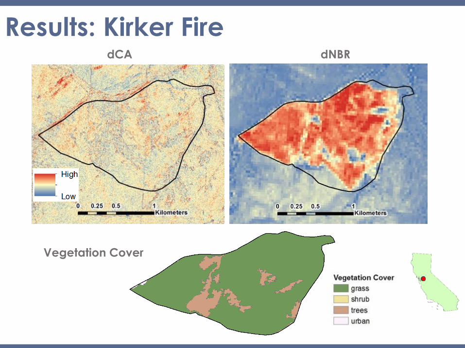
Results: Kirker Fire
dCA dNBR
Vegetation Cover

Case Study: Canyon Fire GeoCBI

Case Study: Canyon Fire Correlation
Pearson Correlation = 0.80

Correlation & Pixel Estimate Tool (PET)
Inner Buffer
Fire Name PET Value Pearson Value Primary Vegetation Type
Briggs 5.60 0.74 Shrub
Mint 3.75 0.69 Shrub
Morgan 4.97 0.70 Mixed: shrub, grass, tree
Kirker 1.06 0.10 Grass
Outer Buffer PET = /
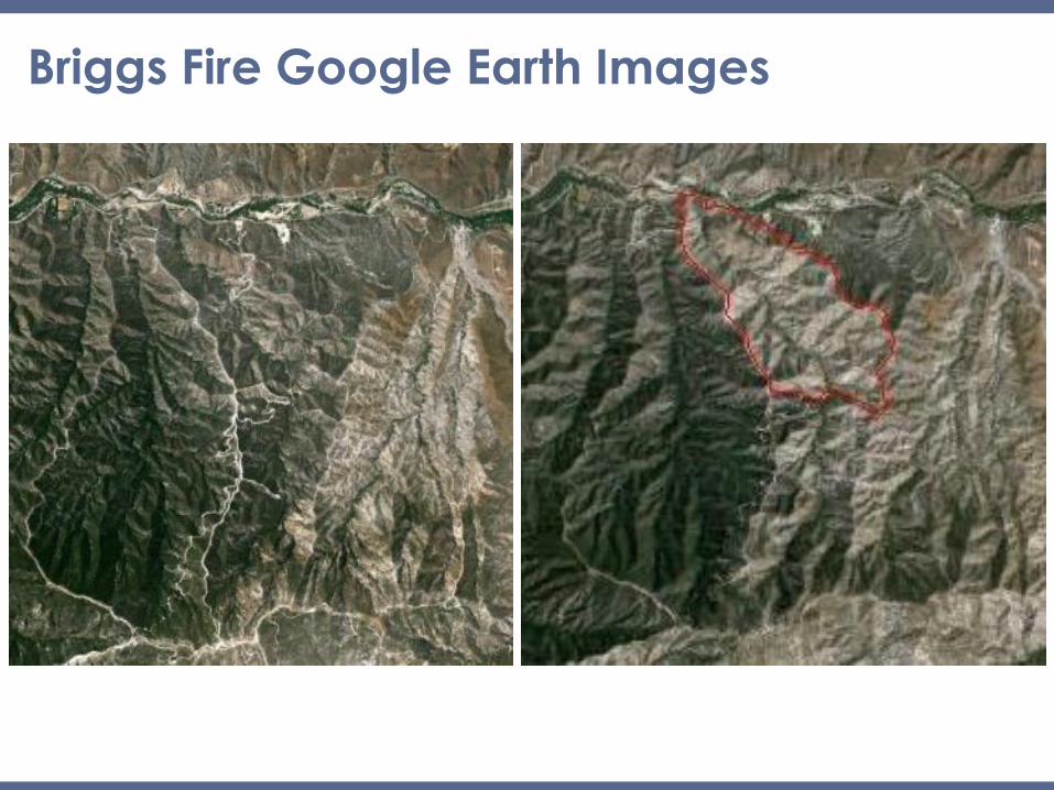
Briggs Fire Google Earth Images

Briggs Fire
PET: 5.6

Monte Fire Google Earth images

Monte Fire
PET: 1.1

Lake Fire dCA
UAVSAR - dCA
Fire perimeter
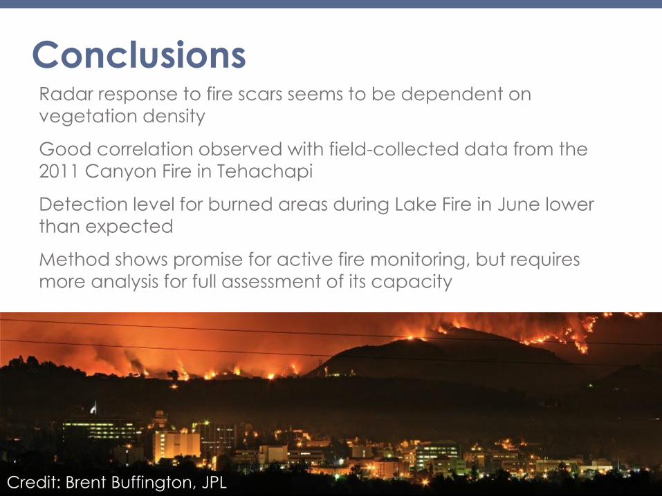
Conclusions Radar response to fire scars seems to be dependent on
vegetation density
Good correlation observed with field-collected data from the
2011 Canyon Fire in Tehachapi
Detection level for burned areas during Lake Fire in June lower
than expected
Method shows promise for active fire monitoring, but requires
more analysis for full assessment of its capacity
Credit: Brent Buffington, JPL

Acknowledgements
This material is based upon work supported by NASA through contract NNL11AA00B and cooperative agreement NNX14AB60A.
Jet Propulsion Laboratory: Dr. Sang-ho Yun
California Institute of Technology: Dr. Mark Simons, Brent Minchew
California Department of Forestry and Fire Protection (CAL FIRE): Chief Chris Starnes and Chief Jana Luis
US Forest Service Remote Sensing Activities Center: Brad Quayle
US Forest Service: Carl Albury & Lorri Peltz-Lewis
Jet Propulsion Laboratory: Yunling Lou, Naiara Pinto, Natasha Stavros, Tim Miller
UC Irvine: Sander Veraverbeke
Orange County Water District: Scott Nygren and Chris Wilson
NASA Armstrong Flight Research Center: Corry Rung, Paul Viscuglia, Tim Williams, Stuart Broce, Todd Renfro
DEVELOP: Ben Holt and Gwen Miller
Advisors
Partners
Others