AFFECTED ENVIRONMENT - GSA · 3.0 AFFECTED ENVIRONMENT ... on South Capitol Street to C Str enue;...
59
3.0 AFFECTED ENVIRONMENT
Transcript of AFFECTED ENVIRONMENT - GSA · 3.0 AFFECTED ENVIRONMENT ... on South Capitol Street to C Str enue;...
3.0
AFFECTED ENVIRONMENT

This page intentionally left blank

FOB 8 EXTERIOR IMPROVEMENTS ENVIRONMENTAL ASSESSMENT
3.0 AFFECTED ENVIRONMENT
3.1
This section
CULTURAL RESOURCES
within the surrounding area. Thi documents the potential archaeol
s information ogical, historic, was derived from
and vihist
suoric maps, Nationaal resources that are present on t
l Register nominatiohe FOB 8 site and
disturbing and field surveys. It was determined that the only impacts to archaeological resources would
ns, prior studies,
athe building and the c
ctivities. Thus, theurbline. T
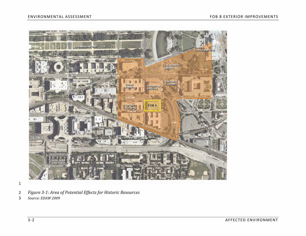
Area of Potential Effects (APE) for archeological resources includes the area between toccur as a result of ground
he face of
potential fogenerally bounded by: 4th
r the proposed securits was defined based o
3rdW
unding the site. Thn the
Street, Sy improvements to be visible
hrough the Section 106 process,from historic properties s the APE for historic resource
in the west, north to Jeffeurro e area is
Street, SW to Maryland Avon South Capitol Street to C Str
enue; northeast on Maryland Avenue torson Drive; east on Jefferson Dr
the U.S. Capitol Building; soive to 3rd Street, SW; south on
uth from the Capitol Building
3‐1). The study area ftracks; west along the railroad
or visual restrac
Street,
oks to Virg
eet, SW; west oninia Avenue, C Street to 1st
SW; and northwest on VirgiSW; south along the 1
nia Avst Street alig
urces is identical to the APE for historic resources. enue, SW to 4th Street, SW
nment to the railroad (Figure
AFFECTED ENVIRONMENT 3 ‐1
ENVIRONMENTAL ASSESSMENT FOB 8 EXTERIOR IMPROVEMENTS
3 ‐2 AFFECTED ENVIRONMENT
1
2 3
Figure 31: Area of Potential Effects for Historic Resources Source: EDAW 2009

FOB 8 EXTERIOR IMPROVEMENTS ENVIRONMENTAL ASSESSMENT
3.1.1 Archaeological
As part of the larger Potomac Ri
Resources
reflect 1815, the
this Whashingtoistory: according to
n Canal was the U.S. Departconstructed north and
ment of
ver watershed, the land sueast of rroun
the dingsite, resulting in t the Mall was historic
he fillingally marshland. Between 1810
of these marshes. The area’s sand
soils. Urban soils have a man‐maAgric
de surface layer that has been produlture’s soil surveys, t
uced by mixing, fillinhe area
g, around FOB 8 is composed of Urb
oilsan
disturbed through consurface in urban and sub
struction aurban ar
cteas. ivities for th
Due to the nature oe building, roa
f the dways, and sidewalsoils, and the fact that the site
ation of land
archaeological resources ar sks, it is unlikely that
and immediate aor by the contamin
inr
tea were
e pre ent near the surface on the FOB 8 site. tact prehis oric
spread wworkers due to the proximity tDuring the 19th century, the pro
o ject site was part of a residenthe Capitol, the area became a
tial covibrant residentia
mmunity known as Sol neighborhood. As residential dev
uthwest. Attractive to government elopment
scale residential and commercial uses until thithin Southwest, commercial establis
e mid‐20th hments ben
centurefited. T
y whhis portion of Southwest DC reen urban renewal resulted in
ma the dined a
emolition of combination of low‐
office buildings during half of the area’s buildings. T
the 1950s, 1960s, and 1970s. he area now known as the Southwest Federal Center was redeveloped with large‐scale federal
more than
the 19thAccording to historic Sanborn and Baist maps, the block now occupied by FOB 8 was fairly densely developed from the end of
stables exisbrick struct
ted nearer the cente century through the middle of the 20th century. Th
r of the site, off the main streets. The e structures
Metropolitan were brick or frame
Wesley A.and small in scale. A number of
ure, was located on D Street near the center of the block. The Watts and Brothers Coal and WM.E. Zion Church, a modest sized
on C Street near the center oparking (Sanborn 1928‐1959).
f the block. By 1959, the buildings on the site had been razed and the block was being used for ood Yard was located
the 18th century were doNo archaeological surveys have b
cumented in a survey ceen completed on the FOB 8 site.
ompleted prior to the Norconth of FOB 8, historic archaeological remains dating from
Associates 1993). Although it is possible that similar historic archaeological resstructio
ources were n of the NMA
present on the FOB 8 site, it iI building (John Milner and
s likely that they have been disturbed due to the urban renewal efforts in the 1950s and the construction of FOB 8 itself.
AFFECTED ENVIRONMENT 3 ‐3

ENVIRONMENTAL ASSESSMENT FOB 8 EXTERIOR IMPROVEMENTS
3.1.2
FOB 8
Historic Resources
FOB 8 was constructed in 19buildings from this period, FOB
65 as laboratory 8 is set back significan
space for thtly fro
e Food and m C Street, SW. The ar
Drug Administratea betw
ion. eAens is characteristic of m the north face of the building
any modern
and C Street was designed as a parking lot. GSA and the District of Columbia State Historic Preservation Officer are in concurrence that FOB 8 does not meet the criteria for listing in the National Register of Historic Places.
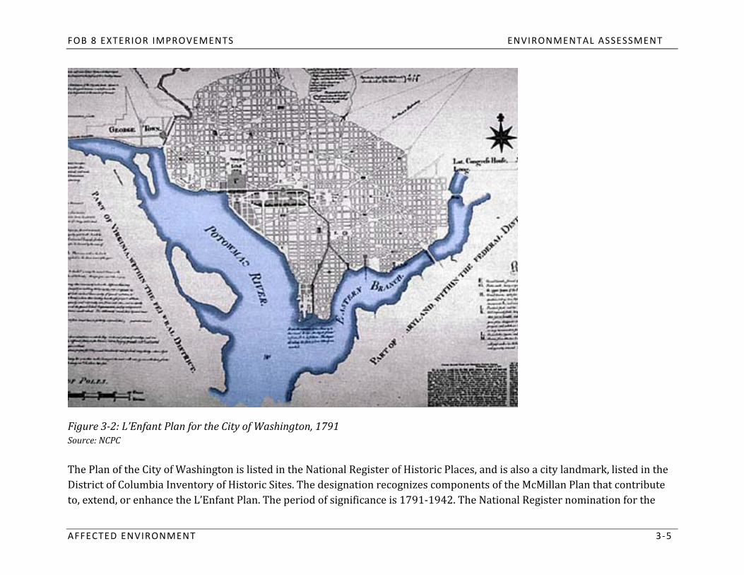
L’Enfant and McMillan Plans
the countryThe project
’site is bordered by sts most notable achievements i
reets originn urally planned by Pierre Charles L’Enfant in the 18th century. Recognized as one of
example of Bcoordinated system of radiating
aroque city planning, L’Enfant’s Plan defines the pavenues, vistas, and parks over
ban planning, the laid upoL’Enfant Plan, c
n an orthogonal grid of strompleted in 1791, is characterized
hysical and symbolic character of the capital city teets (Figure 3‐2). A
by a
arrangement of roadways, buildinhrough its
notable
the L’Enfant Plan in a manner consistent with gs, parks, and views. At the
the City Beautifuturn of the 20th century, the l movement. The McMillan Plan e
McMillan Commission expandextended the Mall to the west
d on
and terminated sdevelopment of the c
everality today. important visual axes with monuments. The principles articulated in these plans still guide the
3 ‐4 AFFECTED ENVIRONMENT
FOB 8 EXTERIOR IMPROVEMENTS ENVIRONMENTAL ASSESSMENT
Figure 32: L’Enfant Plan for the City of Washington, 1791 Source: NCPC
District of Columbia Inventory of Historic Sites. The designation recognizes components of the McMillan Plan that contribute The Plan of the City of Washington is listed in the National Register of Historic Places, and is also a city landmark, listed in the
to, exte
AFFECTED
nd,
or enhance t
ENVIRONMENT
he L’Enfant Plan. The period of signifi
cance is 1791‐1942. The National Register nomination for the
3 ‐5
ENVIRONMENTAL ASSESSMENT FOB 8 EXTERIOR IMPROVEMENTS
The portions of 3rd
Appropriatthe L’Enfant Plan. In addition
ion Number 2. The vis, the
Street, SW, C Street, SW, and D Street, SW that border the project site are all contributing elements within
ta Capitol Groualong C Stre
nds and thet, SW, is ide
e Natntified within the noional Mall east of 14th Street c
mination as bomprise L’Enfant’s Original eing interrupted by I‐395 east of
th
L’Enfant Plan identifies historic streets, reservations and appropriations, and vistas that contribute to the plan’s significance.
the project site and at 5 Street west of the project site.
3 ‐6 AFFECTED ENVIRONMENT
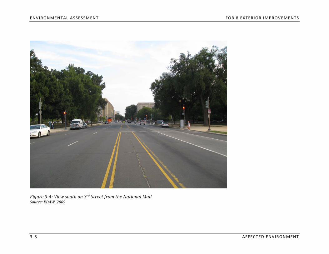
Mall
Northwest Capitol Grounds in the east to 14
of FOB 8, the Mall was th Street in ta key component o
he west, fand f L’Enfant an
rom Cod Mcnstitution Ave
Millan’s plans for nue in the n
the cityorth
. The Mto Independence Av
all extends from the enue in
Mall was listed in the Dthe south (Figure 3‐3).
C InventoNumerou
rys national museums line the Mall, and a tree‐lined greensward runs through the center. The
identified contributing features aMultiple Property Nomination for
n the L’Enfant Plan. In in 1964 and the Nation
2006, a al Register in 1966. It is also a comp
cultural landscape inventory was completed for the Maonent of the National Register
ll which
significance. FOB 8 is visible in views south on 3rdd concluded that, while not
Street from the Mall (Figure 3‐4). a National Historic Landmark, the Mall clearly has national

FOB 8 EXTERIOR IMPROVEMENTS ENVIRONMENTAL ASSESSMENT
Figure 33: The Mall Source: EDAW, 2009
AFFECTED ENVIRONMENT 3 ‐7
ENVIRONMENTAL ASSESSMENT FOB 8 EXTERIOR IMPROVEMENTS
3 ‐8 AFFECTED ENVIRONMENT
Figure 34: View south on 3rd Street from the National Mall Source: EDAW, 2009

FOB 8 EXTERIOR IMPROVEMENTS ENVIRONMENTAL ASSESSMENT
The U.S. Capitol Building and Grounds
AFFECTED ENVIRONMENT 3 ‐9
The U.S. Capitol Building is one of the nation’s iconic historic buildings. Located approximately ¼ mile northeast of FOB 8
the 19th century by (Figure 3‐6), the Neoclassical style structure was designed by
columned portico on the front ofBenjamin Latro
thebe, Charles Bulfin building, and a massive dome that caps the
ch, and Thomas U. Walter. The sstructure (
tructure iWilliam Thornton in 1793, and the
s characterin renovated and
zed by a large expanded in
building is sited on an originalthe Capitol dome and the grounds are visible from the nor
L’Enfant Appropriation and is set withFigure 3‐5). The monumental
theastin a landsc
corner of FOB 8. ape desiThe Capi
gned by Fredertol was designated a National
ick Law Olmsted. Both
Historic Landmark in 1960 and listed in the DC Inventory of Historic Sites in 1964.

ENVIRONMENTAL ASSESSMENT FOB 8 EXTERIOR IMPROVEMENTS
Figure 35: U.S. Capitol Building Source: EDAW, 2009
3 ‐10 AFFECTED ENVIRONMENT

FOB 8 EXTERIOR IMPROVEMENTS ENVIRONMENTAL ASSESSMENT
Figure 36: View to U.S. Capitol from the northeast corner of the project site Source: EDAW, 2008
AFFECTED ENVIRONMENT 3 ‐11
ENVIRONMENTAL ASSESSMENT FOB 8 EXTERIOR IMPROVEMENTS
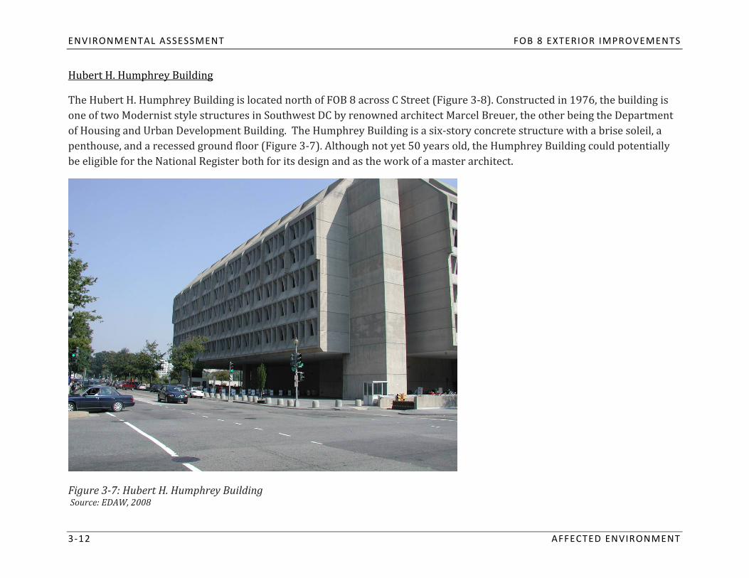
Hubert H. Humphrey Building
one of two Modernist style structuThe Hubert H. Humphrey Building is located north of FOB 8 across C
of Housing and Urban Developmentres in Southwest DC by renown Building. The Humphrey Buildi
ed ang is a six‐strchitect Marcel Breuer, Street (Figure 3‐8). Constructed in
the other being 1976, the building is
ory concrete structure with a brise soleil, a the Department
penthouse, and a recessed ground floor (Figure 3‐7). Although not yet 50 years old, the Humphrey Building could potentially
3 ‐12 AFFECTED ENVIRONMENT
be eligible for the National Register both for its design and as the work of a master architect.
Figure 37: Hubert H. Humphrey Building Source: EDAW, 2008

FOB 8 EXTERIOR IMPROVEMENTS ENVIRONMENTAL ASSESSMENT
Figure 38: View of Hubert H. Humphrey Building from FOB 8 Source: EDAW, 2009
AFFECTED ENVIRONMENT 3 ‐13
ENVIRONMENTAL ASSESSMENT FOB 8 EXTERIOR IMPROVEMENTS
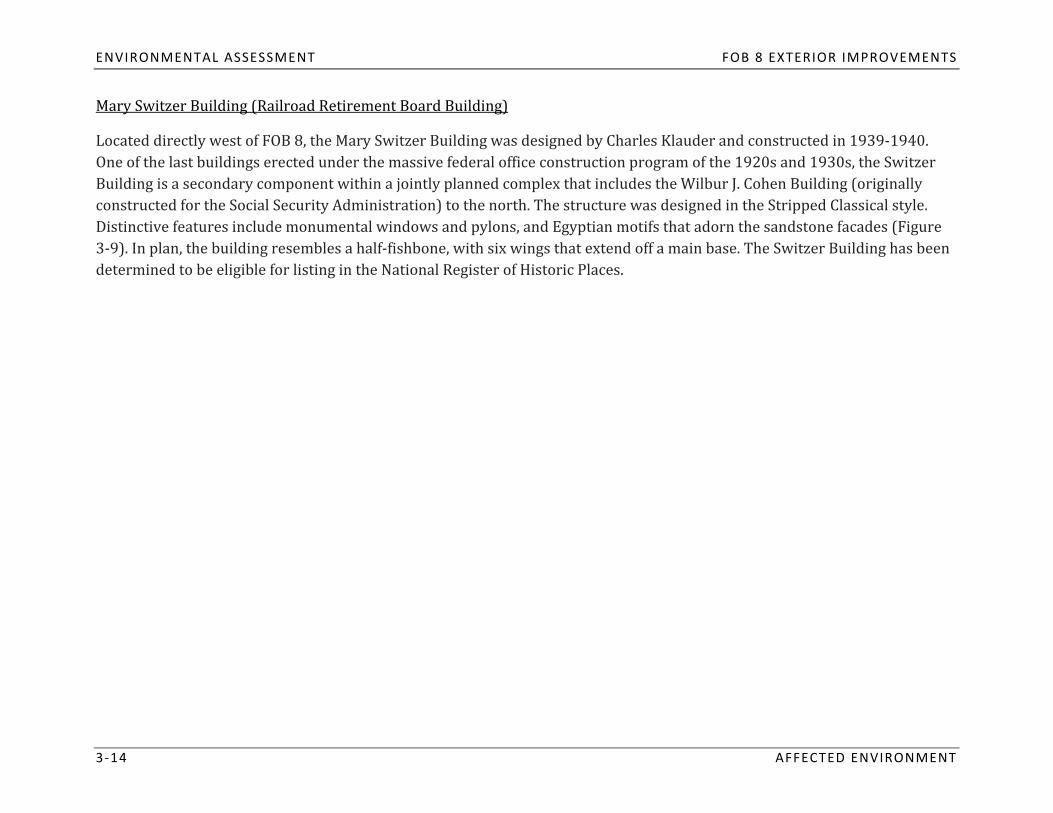
Mary Switzer Building (Railroad Retirement Board Building)
3 ‐14 AFFECTED ENVIRONMENT
One of tBuilding is
he last buildingLocated directly west of
s erecte FOB 8,
d under ththe Mary Switz
e massive federer Building
al offwas designed by Charl
ice construction program of es Klauder and constructed in
the 1920s and 1930s, the Switze1939‐1940.
r
Distinctivconstructed
e features inclu for the Social Secura secondary componen
ity Administt within a jointly planned complex that includes the Wilbur J. Cohen Building (originally
3‐9). In plan, the building resede monumental win
ration) to the nort
mbles a half‐fisdows and pylons, and Egyptian motifs that ador
h. The structure was designed inn the sandstone facade the Stripped Classical style.
s (Figure
determined to be eligible for listing in the National Register hbone, with six
of Historic Places. wings that extend off a main base. The Switzer Building has been

FOB 8 EXTERIOR IMPROVEMENTS ENVIRONMENTAL ASSESSMENT
Figure 39: Mary Switzer Building Source: EDAW, 2008
AFFECTED ENVIRONMENT 3 ‐15

ENVIRONMENTAL ASSESSMENT FOB 8 EXTERIOR IMPROVEMENTS
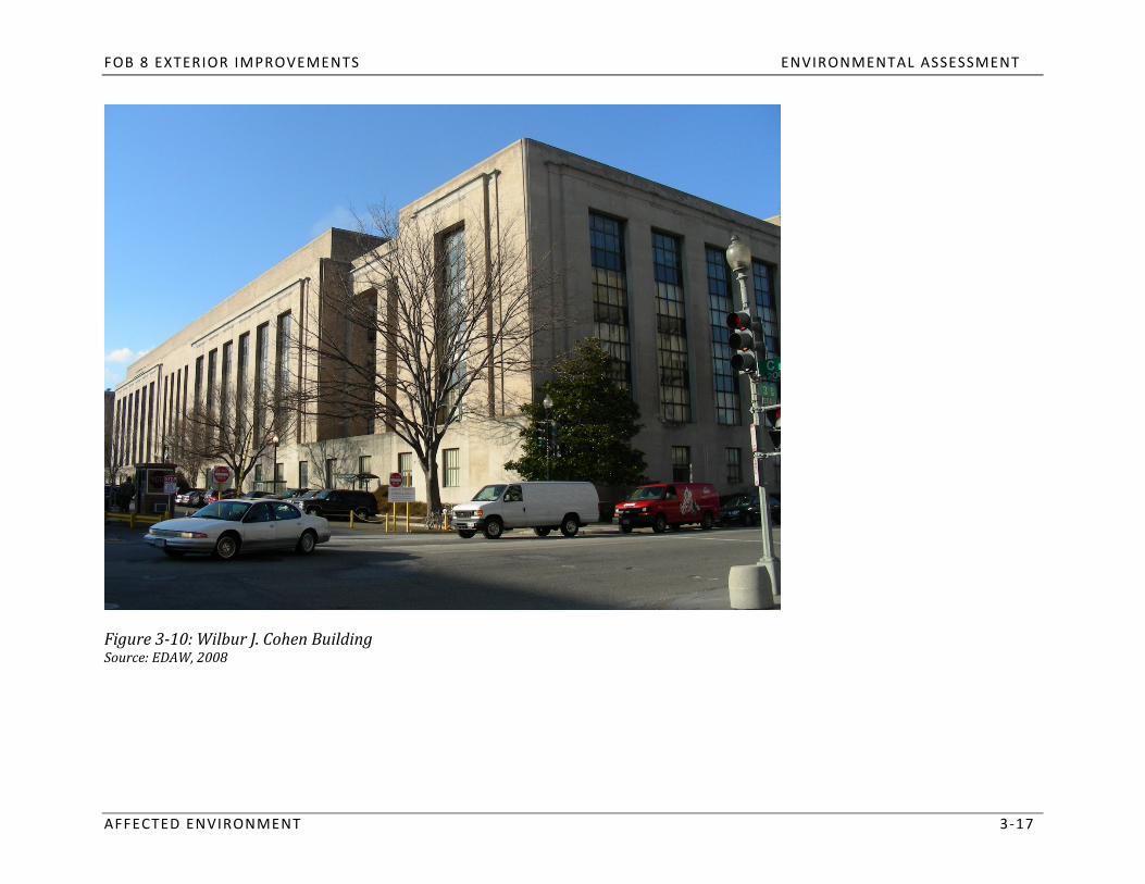
Wilbur J. Cohen Building
3 ‐16 AFFECTED ENVIRONMENT
Switzer Building to the south, tNorthwest of FOB 8, the Wilbur J. Cohen Building was constructed in 1939 for the Social Security Administration. Like the
style with its bands of verticaDistrict of Columbia, as well as
lly oriented windows (Figure 3‐1he structure was designed by Charles
0). The building is significant Klauder and is representative of t
for its role in he Stripped
city planning iClassical
n the
modern programmatic needs. Deal. The Wilbur J. Cohen Buildi
It is further significant for it the last work of a prominent a
s association with the Srchitect known for his skill in melding hi
ocial Security Adminstistorricaatio
l refe
in 2007. ng was listed in the DC Invento
n and rences with
ry of Historic Sites and the National Register of Histthoric Plac
e New es
FOB 8 EXTERIOR IMPROVEMENTS ENVIRONMENTAL ASSESSMENT
Figure 310: Wilbur J. Cohen Building Source: EDAW, 2008
AFFECTED ENVIRONMENT 3 ‐17

ENVIRONMENTAL ASSESSMENT FOB 8 EXTERIOR IMPROVEMENTS
U.S. Botanic Garden
3 ‐18 AFFECTED ENVIRONMENT
in varThe Botani
ying cc Garden, located limatic exhibits. The ga
north rden was originaof FOB 8 within the Ca
Dlly est
pitol Grounds, showcases diverse vegetative species a
kind in North America. esigned in the Beaux Arts Stylabli
e by Bennett Parsons & Frost in 1902,shed by Congress in 1820, and rem
the garden ains one of the larg
nd ecoest of its systems
was listed in the DC Inventory of Historic Sites in 1964. It also lies within the bounds of the National Mall (Figures 3‐11 and 3‐12).
Figure 311: U.S. Botanic Garden Source: EDAW, 2008

FOB 8 EXTERIOR IMPROVEMENTS ENVIRONMENTAL ASSESSMENT
Figure 312: View of U.S. Botanic Garden from FOB 8 Source: EDAW, 2009
AFFECTED ENVIRONMENT 3 ‐19
ENVIRONMENTAL ASSESSMENT FOB 8 EXTERIOR IMPROVEMENTS
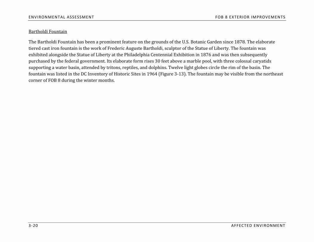
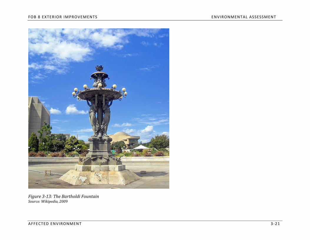
Bartholdi Fountain
3 ‐20 AFFECTED ENVIRONMENT
tiered cast iron fountaiThe Bartholdi Fountain h
n is theas been a prominent feature on th
exhibit work of Frederic Auguste Barth
e grouoldi, sc
nds of the U.S. Boulptor of the Statue o
tanic Gardenf Liberty. The fountain was
since 1878. The elaborate
ed alongside the Statue o
supporting a water basipurchased by the federal governm
entennial Exhibition in 1876 and was then subsequently
fountain was listed in the DC Inn, attended
ent. Its elaborate ff Liberty at the Philadelphia C
ventory of His
by tritons, reptiles,
corner of F B 8 during the winter months. toric Sites in 19
and doorm rises 30 feet above a m
lphins. Twelve light globes circarble pool, wi
le the rim of the basin. The th three colossal caryatids
O64 (Figure 3‐13). The fountain may be visible from the northeast
FOB 8 EXTERIOR IMPROVEMENTS ENVIRONMENTAL ASSESSMENT
Figure 313: The Bartholdi Fountain Source: Wikipedia, 2009
AFFECTED ENVIRONMENT 3 ‐21

ENVIRONMENTAL ASSESSMENT FOB 8 EXTERIOR IMPROVEMENTS
3.1.3 Visual Resources
Methodology
was detThis sect
eiormn documents the exined by estimating
itsthe visibility of Fing visual character of
OB 8, and thus FOB 8 a
the proposed exterior improvnd the surrounding area. The stu
ements, to viewers from public dy area for visual resources
afforded alplaces and
ohistoric resources. Due to the urban density of the Southwest Federal Center neighborhood, views are generally
open parcelThe visual character of
s east of the site, nng the streets that border the site, including C, 3
ortheast towards the U.S. Capitrd, D, and 2nd Streetol Building, and sou
s, SW. In addition, views are afforded from the
the roadways, buildings, and open space that border the site are described below. thwest from the Capitol Grounds to FOB 8.
3 ‐22 AFFECTED ENVIRONMENT
FOB 8 EXTERIOR IMPROVEMENTS ENVIRONMENTAL ASSESSMENT
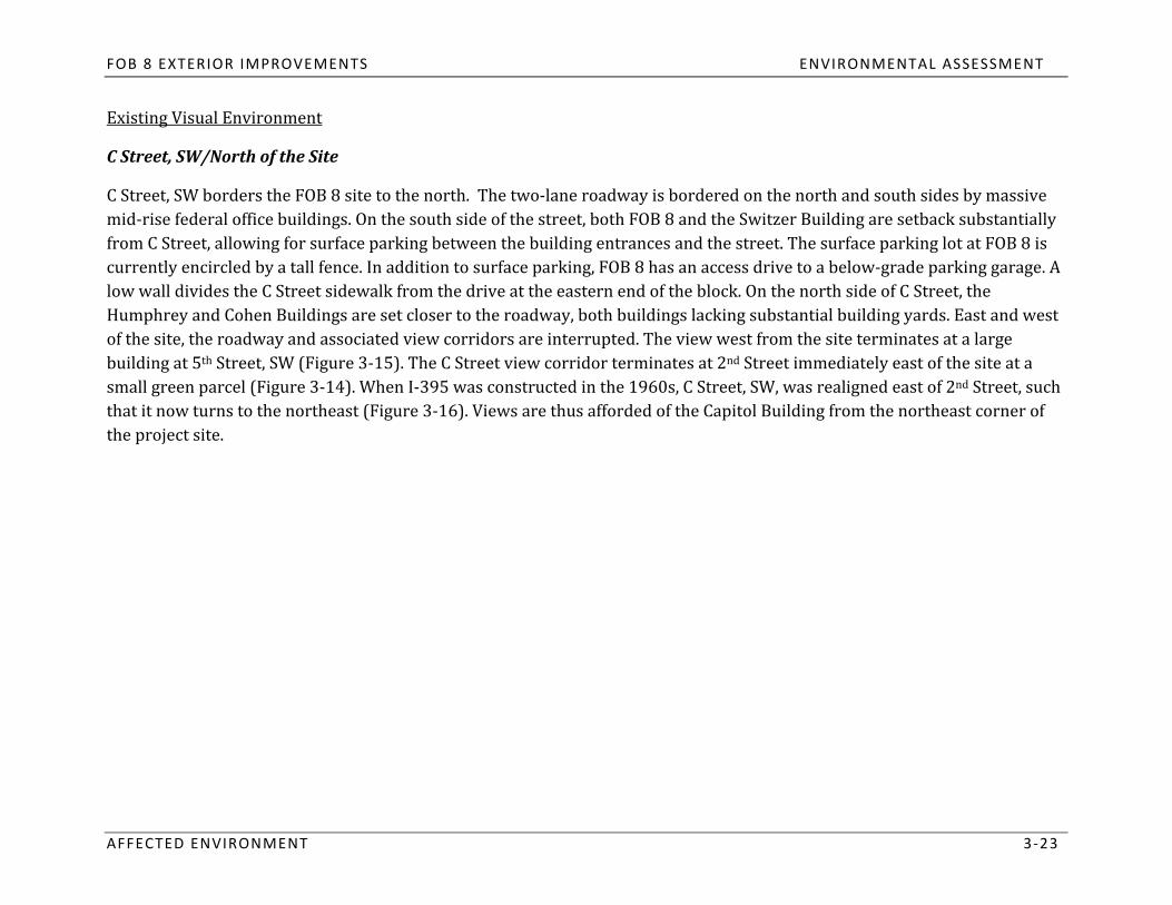
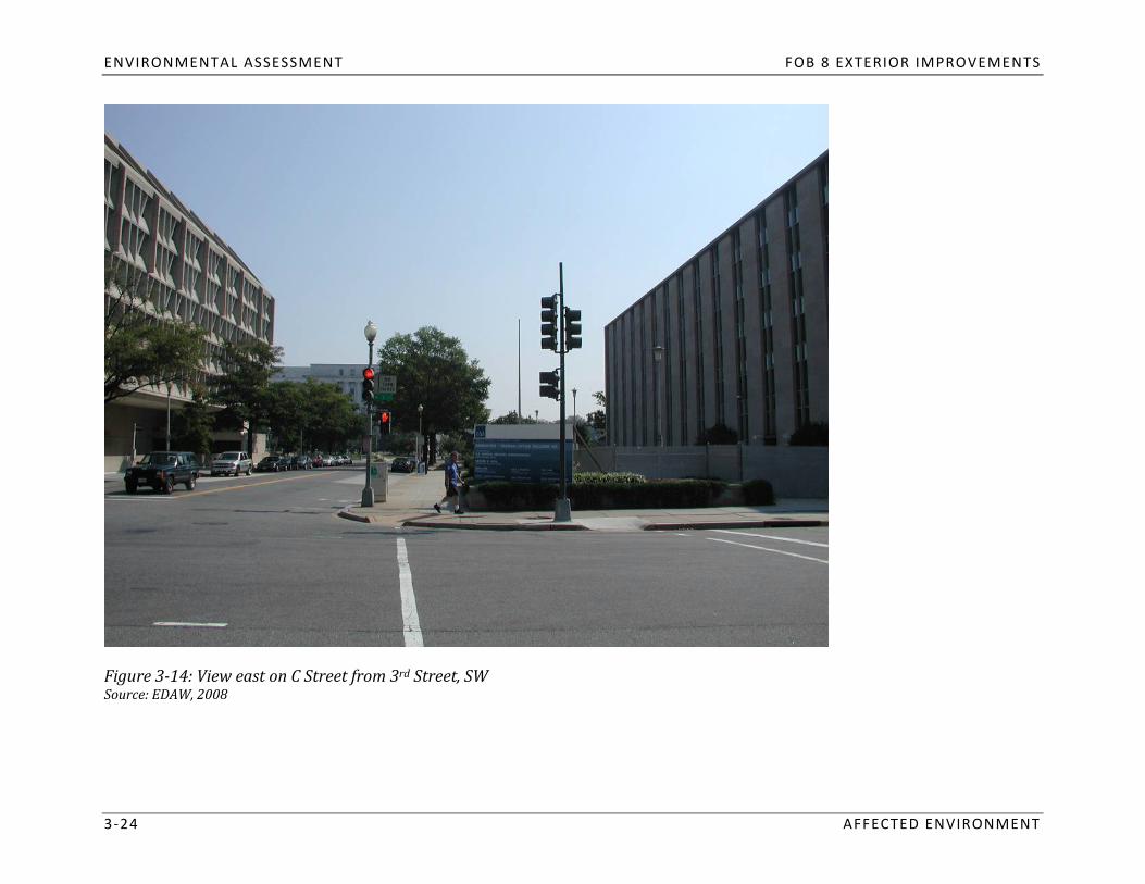
Existing Visual Environment
AFFECTED ENVIRONMENT 3 ‐23
C Street,
C Street, SW
SW/North of the Site
mid‐rise federal office building borders the FOB 8 site to the north. The two‐lane roadway is bordered on the north and south sides by massive
currently encircled by from C Street, allowing for surfa
a tall fence. ce parkinIn addition
g bettween t
s. On the south side of the str
o surface parhe buildin
eet, both FOB 8 and the Switzer g entrances and the street. The surface
Building are setback substantia
c lly
low wall divides the C Street sidewalk from the drive at the eaking, FOB 8 has an ac ess drive
parking lot at FOB 8 is
Humphrey and Cohen Buildings are set closer to the roadway, botstern end of the block. On the north side of C Str
h buildings lacking substantial building yards. Eeet, the
to a below‐grade parking garage. A
of the site, the roadway and associated view corridors are interrupted. The view west from the site terminates at a large ast and west
now small greenbuilding at 5th Street, SW (Figure 3‐15). The C Street view
that it turns to the northea parcel (Figure 3‐14). When I‐395 was constru
st (Figure 3‐16). Views are thucted in
s afford the 1960s,
corridor terminates at 2nd Street immediately igned east of
east of the site at a
the project ed of the Capitol Buildi
C Street, SW, was real 2
site. ng from the northeas
nd
t corner of Street, such
ENVIRONMENTAL ASSESSMENT FOB 8 EXTERIOR IMPROVEMENTS
Figure 314: View east on C Street from 3rd Street, SW Source: EDAW, 2008
3 ‐24 AFFECTED ENVIRONMENT
FOB 8 EXTERIOR IMPROVEMENTS ENVIRONMENTAL ASSESSMENT
Figure 315: View west on C Street with FOB 8 and the Switzer Building in the foreground Source: EDAW, 2008
AFFECTED ENVIRONMENT 3 ‐25

ENVIRONMENTAL ASSESSMENT FOB 8 EXTERIOR IMPROVEMENTS
Figure 316: View along the diagonal portion of C Street from the northeast corner of the project site Source: EDAW, 2008
3 ‐26 AFFECTED ENVIRONMENT

FOB 8 EXTERIOR IMPROVEMENTS ENVIRONMENTAL ASSESSMENT
3rd Street, SW/West of the Site
along 3rd
rdBorderin
Street are frag FOB 8 to the
mwest, 3ed by mid‐rise b
Street, SW is a four‐lane roadway that runs north‐south, following L’Enfant’s city grid. Views
and a sunken garden lomirroring the walk on the west si
cated betwdeeen t of the st
he sidreet adjacent to the Switz
uildings and a variety of street er Building trees. The sidewalk adjacent t
(Figure 3‐17). There o is aFOB 8 is narrow, small planting bed
Views green stri
are ap ffordis wider an
ed to tdh extends e north along 3rd
to the face ofewalk and FO the building; h
B 8 at towev
he ea is currently
south end of the block. At the nortlocked from view by a tall fence.
h end of the block, the
Street to the Mall (Figure 3‐er, this ar b
the elevated railroad lines one block south of FOB 8. 18). Views to the south along 3rd Street are obstructed by
AFFECTED ENVIRONMENT 3 ‐27

ENVIRONMENTAL ASSESSMENT FOB 8 EXTERIOR IMPROVEMENTS
Figure 317: View looking north along 3rd Street from D Street, SW Source: EDAW, 2008
3 ‐28 AFFECTED ENVIRONMENT

FOB 8 EXTERIOR IMPROVEMENTS ENVIRONMENTAL ASSESSMENT
Figure 318: View looking north on 3rd Street near C Street, SW Source: EDAW, 2008
AFFECTED ENVIRONMENT 3 ‐29

ENVIRONMENTAL ASSESSMENT FOB 8 EXTERIOR IMPROVEMENTS
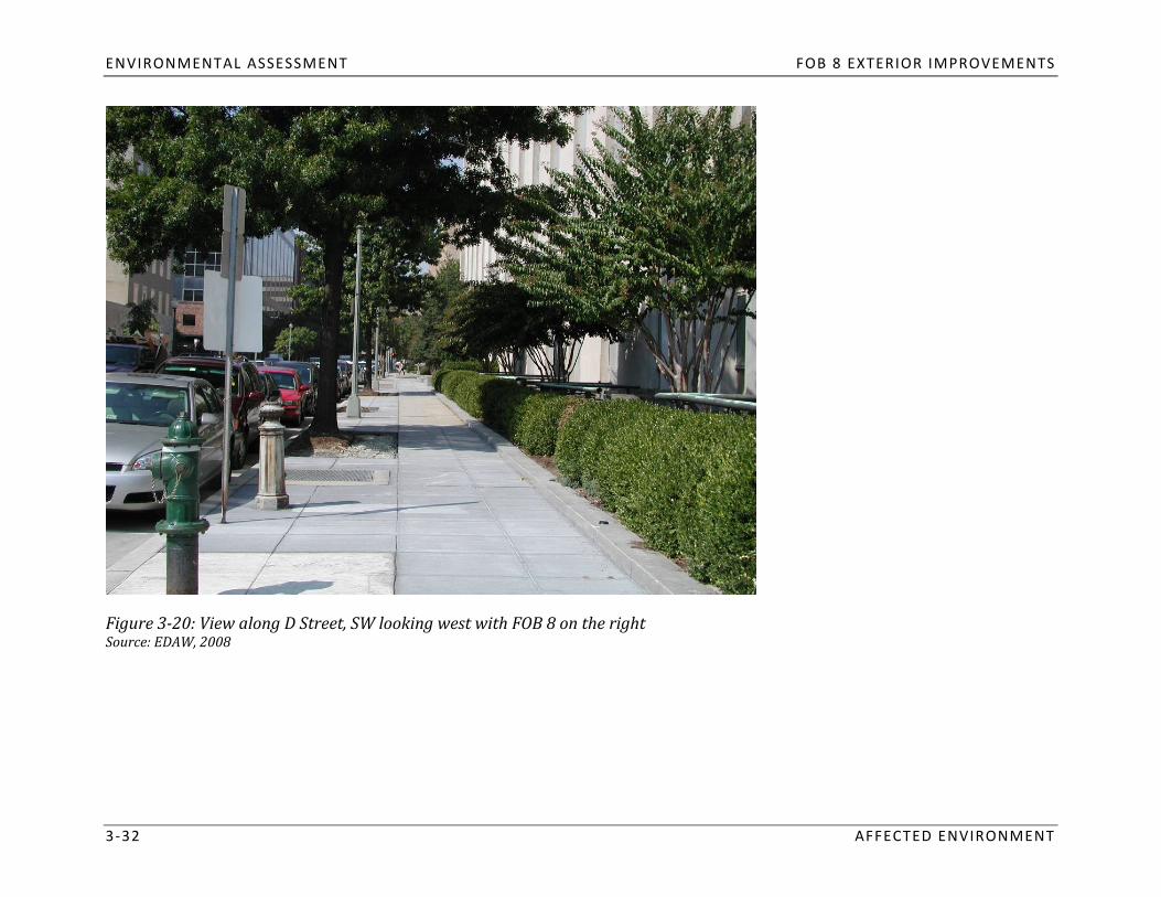
D Street, SW/South of the Site
sidewalk iD Street, S
s W is a narnarrow.
roA line ow one‐way street tha
natural lighslightly raised planting
f street trees and lampposts run bt borders FOB 8 to t
etween the curb and the sidewalkhe south. On the north side of D Street, adjacent to FOB 8, th
. Inside of the walk, a narrow,e
bed contains a line of low shrubs and small trees. Between the trees, a series of light wells provide
t to the building’s
sizes and modern mid‐rsidewalk and the roadway encircl
ise buildines the Ford House Office
lower level. On the south side
gs. Views to the east include Building. Views alonof the street, a line of unifor
g D Street are framed by street trm bollards placed between the
ees of va
infrastructure (Figure 3‐19). Views to the west terminate at 4ththe on ramp to I‐395 and gr Street, SW, where a building interr
eenspace beyond the higupts L’Enfant’s hist
hway rying
street alignment (Figure 3‐20). oric
3 ‐30 AFFECTED ENVIRONMENT

FOB 8 EXTERIOR IMPROVEMENTS ENVIRONMENTAL ASSESSMENT
Figure 319: View looking east on D Street, SW with FOB 8 on the left Source: EDAW, 2008
AFFECTED ENVIRONMENT 3 ‐31
ENVIRONMENTAL ASSESSMENT FOB 8 EXTERIOR IMPROVEMENTS
Figure 320: View along D Street, SW looking west with FOB 8 on the right Source: EDAW, 2008
3 ‐32 AFFECTED ENVIRONMENT

FOB 8 EXTERIOR IMPROVEMENTS ENVIRONMENTAL ASSESSMENT
2nd Street,
East of FOB 8, 2nd
SW/East of the Site
FOB 8, the sidewalk is narrow. Between t Street, SW runs in two lanes one‐way from the north to the south. On the west side of the street, adjacent to
createAmerican
s a gr Veen edge. eterans Dis
Oan the east side of the sbled for Life Memorial
treet, thhe sidewalk and
e sid ewthe building face, a planting bed containing both trees and shrubs
ramp to the recessed portion of . To the south, at
I‐395 (Figure 3‐21). Views nortthe intersection of 2nd and D
alk divides the roadway from a small park, the future site of t Streets, SW, there is an access
he
buildings, open greensAvenue (Figure 3‐22).
pace, highFrom the corner of 2nd
way infrastructure, surface parking, and the
northeas and C Streets, SW views are affo
elevated h and south along the 2
rnd Street corridor include mid‐rise office
rded of the ailwU.S. Capitol Building to the ay south of FOB 8 at Virginia
t.
AFFECTED ENVIRONMENT 3 ‐33

ENVIRONMENTAL ASSESSMENT FOB 8 EXTERIOR IMPROVEMENTS
Figure 321: View south on 2nd Street from C Street, with FOB 8 on the right Source: EDAW, 2008
3 ‐34 AFFECTED ENVIRONMENT

FOB 8 EXTERIOR IMPROVEMENTS ENVIRONMENTAL ASSESSMENT
Figure 322: View north on 2nd Street, SW with the Humphrey Building on the left and the National Mall and U.S. Botanic Garden in the Center of the View Source: EDAW, 2008
AFFECTED ENVIRONMENT 3 ‐35

ENVIRONMENTAL ASSESSMENT FOB 8 EXTERIOR IMPROVEMENTS
3.2 SOCIOECONOMIC RESOURCES
3.2.1
FOB 8 is a g
Land Use
overnment‐and grounds. Bounded by 2nd
owned building locat Street to the east, 3rd
ed within the Southwe
acre site oc Street to the west, C Street to t
st Federal Center, two blocks frhe north, and D Street to the south, the 2.1‐
om the U.S. Capitol Building
An additiopedestrian
neantrance is ocupies a full city block. The structure is six‐stories high, with two addition
l below‐grade parkn C Street,
ing area is accessed via a ramp owhere an approximately 100‐
ff of 2nd Street. Constructed foot setback allows for a surface
al stories located below grade. The
in 1965 as laboratory sp parking lot for the building.
main
lU.S. Food and Drug Administrati B 8 has been vacant since FDA relocated in 2002. While GSA owns the building,
ace for the
the surrounding sidewa ks are undon (FDA), FOer the jurisdiction of the District of Columbia.
The area surrounding Fcity block. The Hubert Humphrey
OB 8 is dominateBuilding is
d by mid‐rise fede
Department of Health and Human Ssited directly nort
ral offich of F
e buildings. LikOB 8, across C Street.
e FOB 8, many This structure houses the
of these structures fill a full
Building is occupied by the U.S.ervices. Northeast of FOB 8, across Interstate 395 (I‐395), the Rayburn House Office
ArchitecDepartment of Health and Human Services. T
House of Representatives. The
t of the Capitol, borders FOB 8 to the south. Privatelyhe Ford House Office Bu
Cohen Building lies northwest ofilding, which houses Congressional staff and the
FOB 8 and is occupied by the
8 at 3rd and D Streets, and 4
There are severa
th and E Streets. owned commercial office buildings are located southwest of FOB
parcel dirthe site, across 2nd
l small parks and larger areas of open space in the immediate vicinity of FOB 8. Directly east and northeast of
for the American Vetectly east o
erf the site a
Street, are several small, irregularly shaped parcels, each landscaped and traversed by sidewalks. The
and the ans Disabl
cts as a partial barrier to the I‐395 underpass. A parcel to the northeast is the planned location
U.S. Capitol Grounds offeMall, lies one block north of FOB
r additioned for Life Memorial. Further north and east of the site, the National Garden, Bartholdi Park,
grounds in the west. 8 and stretches from the
al public open sU.S.pace. The largest area o
Capitol grounds in the east to tf greenspace in
he Washingthe downtown, th
ton Monument e National
Other land uses in the area include cultural attractions, retail establishments, and transportation infrastructure. The National Air and Space Museum and the National Museum of the American Indian are located to the north of FOB 8 along the edge of
3 ‐36 AFFECTED ENVIRONMENT

FOB 8 EXTERIOR IMPROVEMENTS ENVIRONMENTAL ASSESSMENT
is open daily for public tours.
The Federal Center‐SW MetroraiInterstate 395 runs below grade d
l Station irectly east of
is located less than the site and a
SW. A rail line also runs along Virginia Ave SW and crosses ov one block from the site, at the intersecticcess to this highway is provided via an o
on of 3nramp at 2nd
rd Street.
er I‐395 two blocks to the south. Finally, several surface lots and D Streets,
and
the Mall. The U.S. Capitol Building, located two blocks northeast of FOB 8, also functions as a civic and cultural institution and
AFFECTED ENVIRONMENT 3 ‐37
parking structures are located within the vicinity of FOB 8.
3.2.2
Zoning
Planning Controls and Policies
federal property are under the pAs a federally‐owned property, FOB 8 is not subject to DC zonin
urview of NCPC, pursuant to the District of Cg regulations. Instead, new design
Stat. 802 and DC ST § 6‐641.15). In accordance with the olumbia Zoning Enabling
and rAenovatioct of 1938
n projects on
Act, NCPC has approval authority for use, open space, height, and (ch. 534, 52
Com
The
prehensive Plan fo
bulk, for projects on fe
r the Nation
deral proper
al
ty.
Capital (2004)
planning of fedeComprehensive Plan
ral facilitifor es ithe n WaNational Capital, Federal shington, DC. The Plan is
Elements is the principal planning tool
growth and development in the Nation’s Capital. There are two elements that are of particular relevance to the procomprised of goals, objectives, and policies intended to guide
used by NCPC to guide the
perimeter security project at FOB 8, the Federal Workplace Element and the Preservation and Historic Features Element. posed
the fedeThe Federa
ral workforce to enhance tl Workplace Element states that it
he efficiencis y, productivthe goal of
ity, the federal and public image of
governmenthe fedet in the N
ral ational Capital
economic well‐being and expand egovernment; to strengthen the
Region to: “Locate
the Distriaddress pe
ct orimeter security af Columbia as the
nd incseat of the national govern
mployment opportunitmenties of the
.” This region and thelement out
el localities tines policie
herein; and to give es in support of this goal that
mphasis to
•
lude the following:
Design such improvements in accordance with guidance included in The National Capital Urban Design and Security Plan (and related policies).

ENVIRONMENTAL ASSESSMENT FOB 8 EXTERIOR IMPROVEMENTS
•
excessmanner tha
ively trestri: enhances a
ct or impede operationnd beautifies the public realm, resultin
impact the health of exial use of sidewalks or pedest
g in co
• sting mature trees.
riherenan, han
t and dicap
welcoming streetscapes; does not , or vehicular mobility; and does not
• security wDesign proj
itects in ah the need t
manner thato enhance and main
does not impetain the vitality of
de commerce and urban areas.
economic vitality, but balances the need for perimeter
•
Design security barrlocated and that respe
ier lines act the histor
nd eliements tc context of
hat the area when complement and enha
applicable. nce the character of the area in which they will be
•
Design sminimize t
ecurity he size of
elemen sec
ts to responurity elements when p
d to site‐spossible. ecific conditions, such as vehicle approach speed and angles, in order to
Place security elements in the building yard, rather than in public space where possible.
The Prthe image
eseranvationd identi
and ty Hof the nationistoric Features Element states t
’s capital and region throuhat it is the
gh design and devegoal of the federa
lopment thl govern
atment to: “Preserve a
principles of the L’Enfant and McMillan Plans, the enduring val is respectful of the guiding
nd enhance
following: of the capital’s setting.” Policies in support of this goal that ar
ue of historic buildings and plae applicable to the FOB 8 exterior improvements include the
ces, and the symbolic character
•
• image. Protect and enhance the vistas and views, both natural and designed, that are an integral part of the national capital’s
• views, and principles oPromote continuity in t
fh the L’Enfae historic
ndesigt Plan.
n framework of the nation’s capital by protecting and enhancing the elements,
Protect the the historic c
settings of haracter o
historic pro
National Capital Urban Design and Security
f the propert
y. perties, including views to and from the sites where significant, as integral parts of
Plan (2002) and
NCPC’s
Urban
(adopted May
Design and Security Plan Policies and Objectives (2005)
Natirequiremen
onal ts of federa
Capital l agencUrban Desi
ies wgn and ith the n
Secueed
rity Plan to protect the historic urban fabric of Washingt
5, 2005) seeks to balance the security needs and on, DC. The Plan holds that
Incorporate security needs into the design of buildings, streetscapes, and landscapes using urban design principals in a
3 ‐38 AFFECTED ENVIRONMENT

FOB 8 EXTERIOR IMPROVEMENTS ENVIRONMENTAL ASSESSMENT
security elements for federal buildings should be enhanced in a manner that does not compromise the vitality and function of
the Plan estthe public realm, be it
ablishes a spedestrianeries of goa
circulation, ls. These goals are as foll
vehicular mobilows: ity, commerce, or the aesthetic experience of visitors. To this end,
•
•
Provide apby unautho
propriatrized vehicles appr
e levels of perioach
meter seing or ent
curity forering them.
sensitive buildings and their occupants against threats generated
•
Providrather t
e sechan
uas a separity in the
ratcontext e or red
ofundant sys a city‐wide p
tem rogram of streetscape eof components whose o
nhancement and pubnly purpose is security.
lic realm beautification,
•
Expand the palette of elemeendless lines of jersey barriers
nts tor b
hat can gracefully providollards, which only invoke
e peri defens
mieter veness.
standoff security, avoiding the monotony of
Produce a cgiven to ach
oieving aeherent str
stheategy for tic cont
deploying specific families of streetscape and security elements in which priority
• needs of a particular building u
inuity along streets, and wnder the jurisdiction of one pu
ithin areas, rablic agency.
ther than solutions selected solely by the is
Provide perimeter mobility, or operation
security in al use of
a manner that does not impede tsidewalks within the Monumental
he City's commerce Core or downtown.
and vitality, pedestrian or vehicular
In oThese
rder to solutions
achieve include
these such pgoals, the P
hysical lan offers elements
a as var“hariety of design elements that can be used in perimeter security projects.
plinth walls, bolmeasures. Poten
lards, large rotial security me
unasd linear plantersures should be des
withigne seatindened”
g, obr ficycle rortified st
acks, reet and
furniturecurbside
, hedges planters,
w ith eand fences
d to be applied in a variety of different contexts and waysmbedd
, ed low securitystone
to meet the
specific security a
The
inte
Urban
nded to
Design
n
and
d d
esign
Security
needs of each particular downtown area.
vehicular and pedestrian controlbe used to guide feder
Plan
al agenc
Policies
ies
and s, and the place
when evment andObjectives
aluating, design
plann of p
ih
was adopted in 2005 ysical security
to clarify isselements.
ues related The objectives and po
to contextual design,
ng, and designing proposed perimeter securitlicies ar
y projects. e
•
The policies and objectives include the following:
Strike a balance between physical perimeter security for federal buildings and the vitality of the public realm.
AFFECTED ENVIRONMENT 3 ‐39
ENVIRONMENTAL ASSESSMENT FOB 8 EXTERIOR IMPROVEMENTS
•
• structural engineerininformation, operational and pro
g, window glazing, emergency egress, and pcedural measures (such as surveilla
hysicance and screening), anl perimeter barriers).
d design strategies (such as
•
Intelligeborne explosives.
nce information, operational controls, and physical design measures should be used to protect against vehicle‐
• The placement of physical security barriers in public space is discouraged and should be minimized. For existi
the sng
face of face of
the ensitive building t
building to the outso the
buildings in urban areas, perimetoutside edge
er security of the build
barriing yard is ers should be located within
a minimum of 20 feet. If the building yard when the
•permitted in public space adjacen
ide tedge of the to the building.
building yard is less than 20 feet, then perimeter s the disecurity
tance from the barriers may be
Perimeter seed; barriers curity barriers
that arat i
•
be minimizmovement.
entersections, corners and near needed should be located to allow safe pedestrian waiting
crosswalks or other highly uareas and pedestriased pedestrian areas
n should
The design landscape c
oontext in f security
•associat
wbarriers,hich they are located an
including their mass, form andd complement and aesthetically enhan
materials should respond to the architectural and
ed building and precinct.
ce the special character of the
Perimeter security barriers in pbenches, parking meters, trash receptacles an
ublic space should incorporate dd other elements a
end pcorative t
ublic amenities typicree wells, plante
ally found in a strers, light poles, signage,
National Capital Framework Plan (2008)
etscape.
The National Capital Framework and the U.S. Commission of Fine A
Plan, released in the surts (CFA). The Plan serves as a t
mmer of 2008, is the ool to guide strategic decisi
result of a joint planning effort between NCPons to coordinate federal and
C
goals of the Plan are to: Plan flocal interests, identifying opportunities to coordinate lan
or the future needs of the feded ural goverse, urban design, and transportation improvements. The principal
the Nationpublic gathering spaces, and fed
al Mall and protect it from overbuilding; eral offices in a way that cont
and extend the spributes t
noment, including space for new memorials, museums,
ecial civic sustainab
qualities of le city life;
thpresere Nation
ve the historic opal Mall and the vital
en spity ace of
Encourage a multi‐faceted approach to selection of appropriate security measures that considers intelligence
and vibrancy of the city into the adjacent federal precincts.
3 ‐40 AFFECTED ENVIRONMENT

FOB 8 EXTERIOR IMPROVEMENTS ENVIRONMENTAL ASSESSMENT
In order to accomplish these goals, the Plan identifies four major precincts adjacent to the National Mall which are to be the
Triangle, focus for future cultural attractions and government offices. The four
precincts in order to meet tthe Southwest Rectangl
he future needs of the federal govee, and East Potomac Park. The
rnmentFramew
precincork Pl
ts ana ere: xaminthe Northwest Rectangle, Federal
realm. , while also
e protecting th
s opportunitiee city’s ope
s to enhn space an
ance these d public
As identified within the Plan, the Southwest Rectangle precinct generally stretches from Jefferson Drive, SW on the north to
FreewayRectangle
onis to tranthe east
the Southeast Freeway and the 10th Street Overlook on the south, and from 15th Street, SW on the west to the Center Leg
through improved consfor
nections betm it from a ster
. FOB 8 is located at the east end of this area. The Plan states that the primary objective for the Southwest
and the Jefferson Memorial. Specifiween the S
ile office precinct tmithsonian
oC astle a desira
andble workplace, cultural venue, and visitor destination
•
c strategies to achieve this objective include the following: the Southwest waterfront, and between the U.S. Capitol
• National Mall and the Establish 10th Street, SW and the O
Southwest waterfront; verlook as a lively mixed‐use corridor and premier cultural destination to connect the
• •
Establish Maryland Avenue, SW as a grand urban boulevard to link the U.S. Capitol to the Jefferson Memorial; Create new places for museums, offices, shops, and residences to increase the mix of uses within the precinct; and Bridge the Potomac River and restore the street grid to improve mobility.
Tree Removal Permit
The Urban removal of street tr
Forestry Adees.
m
et
inist
seq.
ratSpecifically
ion, under the
), established a, the Urban
Distr
Official Code 8‐6501.01 Forest Pr
n urban foreeserv
ict Departmenation
t of TransportatioAct of 2002, effective J
n (DDOT), requires permits for the
prior to the removal of a tree with a circumference of 55 inchest preservation program requirin
Forestry s or more. If a tree removal p
g a Special Tune 12, 2003 (D.C. Law 14‐309; D.
ree Removal Permit C.
Administration will require the replacement of lost trees based on caliper, either on the site or ermit is approved, the Urban
in a comparable area.
AFFECTED ENVIRONMENT 3 ‐41

ENVIRONMENTAL ASSESSMENT FOB 8 EXTERIOR IMPROVEMENTS
3.2.3
The District
Public Space
of Columbia Department of Transportation, Public Space Management
The Districtthe public space. Accor
Department of Trading to D
ns
a street Dportation (DDOT) has management and oversight responsibility for the use and occupancy of
athe walks and curbline a
nd includes, but is not limOited to, the T, public space is defined as all the publicly owned property
round FOB 8 are considerroadway, tree
ed to be public spa spaces, sidewalks,
ce under the jurisdiction of DDOT. and alleys. The sidewalks and the area betw
between the property lines on een
DDOT encourages that buildings, not on sidewalks, cur
security perimetbs, gutters, str
ers be establishedeets, or public
within priv alleys. In the event that perimeter s
ately‐owned space or federecurity al public space adjacent to
closer than within public space, a Public Sp
two feet from the curb line and neither block pedesace Permit must be obtained fro
trian traffic flow frm DDOT. Further,
om the curbDDOT requires that peri
elements ameter barr
re proiers be no
posed
line to the sidewalk, nor present unreasonable barriers to pedestrians traveling within the sidewalk.
GSA: Achieving Great Federal Public Spaces
Federal Although not directly related to DDOT’s public
Guide space policy and review, GSA has published guidelines titled
and improvPublic
spaces should:
Spaces: A e public spaces and t
Propertyr Manager’s ansform federal spaces into civ
. This publication was released ic places. According to this guide, GSA
in 2007 as part of GSA’bs effo
Acrt
uildings as to ehieving Great
nd public
valuate
• • •
Reflect the dignity and accessibility of government;
•
Be secure and welcoming;
•
Improve tenant satisfaction and building revenue; Provide a forum for tenant activity and public use; and Act as a catalyst for downtown revitalization.
partneThe guide p
rshipresents an s with communities,
overall strategy fto better ma
or impnagementrovement
proaf a facctices. It
ility’ recognizes a key challens public spaces, from physical enh
ge to be the need tancements
o incto rease
security at federal facilities while providing welcoming public spaces.
3 ‐42 AFFECTED ENVIRONMENT

FOB 8 EXTERIOR IMPROVEMENTS ENVIRONMENTAL ASSESSMENT
3.3
The study area fo
NATURAL
r the inven
RESOURCES
as bordered by C, D, 2nd rdtory
Streets, SW. In preparing this and analysis of physical and b
Survey (USGS) mapping, aeri, and 3
al photos, local comprehensive and lanalysis, the following riological resources has been
esources wer defined a
e rs eviewed: the area ar
U.ound FOB 8 S. Geological
databases, conceptual design drawings, scientific literature, government reports, other preand use plans, Geographic Informat
vious studioies, agency cn System (GIS)
omments, and other materials as needed. Site visits to the grounds around FOB 8 were also conducted.
3.3.1
Vegetation a
Vegetation
The vegetation consists entirelyround FOB 8 was inve
of Taxus
ntoried through site restreetscape plantings and m
connaiss
these plantings consist of yews ( sp.), creeping juniper (Juniperus horizoBuxux
odest landscaping
nclude boxwood, crepe myrtle, jMalus
building. Along C Street, SW,
gntalis
ance and a review of theadjacent the
most recent survey drafted in 2006.
and two lar e oak tr), and crepe myrtle (
SW. Along D Street, SW, shrubs iees at the curbline. Boxwoods (
unipers (
Lagerstroemia
Juniperus sp.) and flowering cherries (
sp.), holly (Ilex sp.), and abelia (sp.) are planted along 2nd
indica Street,
)
) with some yarrow ( sp.) planted as well. Scarlet oaks (
(
grandiflora Achillea Quercus bicolor
MagnoliaStreet trees along 3rd Str
sp.) at the building’s northweseet include swamp white oaks (
t corner (Figure 3Quercus
Acer japonica‐23). Additio
), white oak (Q.) are presen along the st
Abelia coccinea
albat reet.
nal plantings along 3rd), scarlet oaks, and a large magnolia
and Japanese maples ( ).
Street, SW include crepe myrtle,
AFFECTED ENVIRONMENT 3 ‐43

ENVIRONMENTAL ASSESSMENT FOB 8 EXTERIOR IMPROVEMENTS
Figure 323: Magnolia at the corner of C and 3rd Streets, SW Source: EDAW, 2008
3 ‐44 AFFECTED ENVIRONMENT
FOB 8 EXTERIOR IMPROVEMENTS ENVIRONMENTAL ASSESSMENT
3.3.2 Wa
The Distri
te
ct
r Resources
of Columbia Department of Health (DDOH)
administer the U.S. Envi
pronmental rograms create
Protectid by t
on Ahe Federal gency (EP
WAater P) regulate
Wwater rater Quality Division, the DDOH Watershed Protection Division, and
the federal Water Quality Act of 1987, and a 1984 amendmollution Con
esources and water pollution in the District. Together, they
ent to ttrohe federal Resource Conl Act of 1972 (commonl
servaty known as the Clean Water Act),
ion and Recovery Act (RCRA).
ecosystemsimplementsIn addition,
the Water Qthe Water Quality Di
uality Standards for Surface Wavision administers programs en
ter. Buildacted by the Water Pollutioning construction and use can affect water qualit
Control Act of 1948 y and
by altering the dominand aquatic
contributing pollutants and particulates to downstream surface ant hydrodynamics (i.e., the vo
walume and timter bodies.
ing of flows), increasing water temperature, and
There are no surface wstreet curb and gutter system fo
ater bodies r diin the vicinity of FOB 8. Allscharge to the DC Water and Sewer Authority (
stormwater drainage moves oveDC WASA) sto
rland into area drains or the
floodplain mapping produced by the Federal Emergency Management Agency (FEMA) has indicated that if the current levee rm sewer system. Preliminary
expectsystem is
ed to not updated, tcommence in 2009. As a result, it i
he FOB 8 site would be within s unlikely t
the hat100‐year fl
FOB 8 will be located withioodplain. Construction of the new levee sy
n the 100‐year floodplain. stem is
AFFECTED ENVIRONMENT 3 ‐45

ENVIRONMENTAL ASSESSMENT FOB 8 EXTERIOR IMPROVEMENTS
3.4 TRANSPORTATION
3.4.1
The transportati
Vehicular
on net
Circulation
work in the vicinibordered by four local roadways, C Street, S
ty oW in the north, 3rdf FOB 8 includes bo
Street, SW in theth local roadways and a federal highway.
west, D Street, SW in the south, and 2ndThe FOB 8 site is
Street, SW in the east. Interstate 395 (I‐395) is located immediately east of 2nd Street, SW.
C Street, SW
east‐wesinclude intermediaryC Street is classified as
streets that a collector roadway according to DDOT’s roadway classification system. Collector roadways
t, with one trthis, the roadway turns
avel lane in eto the north
ach directfunnel vehicu
ion. The roalar traffic from
dway is int local str
errupted at 2ndeets to arterial str
east towards the U.S. Capitol Building. Adjacent to F Street, SW
eets and back. C Street runs
OB 8, metered parking is , by a small park. Beyond
provided oparking. Acc
n both sides of the roaording to DDOT, the average
dway most times of the day; ho weekday volume on the portion of
wever, the portion east of 3the roadway adj
rd
acent t Street provides no
o FOB 8 was 5,500 vehicles in 2007. The posted speed limit is 25 mph.
2nd Street, SW
left turn only lane that pAs it passes the FOB 8 site, 2nd
rovides ac Street, SW is a o
cess to I‐395, and the righne‐way, two‐la
t lane is both a left turn and throune roadway that runs southbound. The left hand lane i
to I‐395. According to DDOT, 2nd Street is classified as a local roadway. Parking is provided along the west sidgh lane, providing acc
s a
e of the ess
roadway. The posted speed limit is 25 mph.
intersection of 2Truck access to FOB 8 is also provided via 2nd Street, SW. A guard station is located off of 2nd
nd and C Streets. A secure ram Street, near the
deliveries, as well as to secure parking below. p sloping downward from east to west provides access for service and
3 ‐46 AFFECTED ENVIRONMENT

FOB 8 EXTERIOR IMPROVEMENTS ENVIRONMENTAL ASSESSMENT
D Street, SW
AFFECTED ENVIRONMENT 3 ‐47
travD Street, S
el lane. WThe majority of its borders the FOB 8 site to the south. This local ro
users are federal workers acceadway ssing the
is one direc buildings in the
tional and pimmediate ar
rovides onea. Parking is e eastbound
provided on both sides of the roadway. The posted speed limit is 25 mph.
3rd Street, SW
two travThe District
el lanes i classifies 3rd
a.m. and 4:00 – 6:30 p.n the north‐south direction
Street, SW as a collector streeduring off‐peak times, and four trav
t. As it passes the western eside of FOB 8, 3rd Street, SW provides
m.). Two lanes of parking are provided during off‐peak hours whel lanes during peak hours (7:00 – 9:30
purposes. According to DDOT, the average weekday volume in 2007 on 3rd Street adjacent to n not in use for travel
FOB 8 was 6,600 vehicles. The posted speed limit is 25 mph.
Interstate 395
Located directly east of 2ndsouthbound on‐ramp located at 2
Street, nd and D Streets, SW andSW, I‐395 carries a large
an off‐ra proportio
mpn of the daily traf located to the northeast on Washington Avenue
fic into and out of the District. A
accommodate travel to and from the FOB 8 site. According to DDOT, the average weekday volume on I‐395 was 107,000 in 2007. The posted speed limit is 55 mph.
Park
3.4.2
ing
Parking
and garageis provided wi parking. A t
tohin and arotal of 38 metered park
und the FOB 8 site in ting spaces,
he forand 3
m of metered parking spaces, permit parking, at‐gr
FOB 8. On C Street, SW there are eight metered spaces on each side of the roadw5 permit spaces, a
ay. On tre provi
he nded along the roadways t
ade parkinghat border
,
2nd Street, Snot allowed
Wbetween 7:00 and 9:30 there are eight meter
a.m. On the south side of theed spaces on the west side of the street. Ther
street, parking is e are restricted b
orth side of the stretween 4:00 and
eet, parking is6:30 p.m. On
allowed on the east side of 2nd Street. On D Street, SW, there are 18 parking spno peak hour restrictions. Parking is not
the north side of the street. Similarly, there are 17 permit spaces on the south side of the straces reserved
eet. There arfor local government w
e seven metered orkers on

ENVIRONMENTAL ASSESSMENT FOB 8 EXTERIOR IMPROVEMENTS
parking spaces on each of the east and west sides of 3rd Street, SW. The metered spaces permit public parking for two hour increments and follow the DC guidelines for accessible parking spaces.
An at‐gr
garagemotorbike parking spa
ade parking lot c
lding provides f
within the building. The es. These spaces servelocated on the C Street side of the bui orty‐eight autom
garage is accessible via an entrancd employees at FOB
e 8. on 2ndFifty‐nine a
Street. dditionA guard stat
al spaces are located obile parking spaces and 15
in a below‐grade
and exiting both lots. Due to the fact that FOB 8 is vacant, utilization of these lots is minimal. ion monitors vehicles entering
several managed and privately oAdditional parking throughout th
perate study ar
ed parking gea is av
aragailable in th
es. The cloe form of metered spaces alosest garages to the FOB 8 site are loc
ng local roadways as well as ated on Virginia Avenue
3 ‐48 AFFECTED ENVIRONMENT
and 4th Street, both managed and operated by Colonial Parking.
3.4.3 Public Transit
Metrorail
The FOB 8 site is accessFederal Center SW station is loc
ed by the Federal Center SW Metrorail sated one block from FOB 8 along
tation D Street, near the int
, which is served by theersection of D and 2nd
Blue and Orange lines. The
served by the Blue and Orange lines, the Capitol South Metrorai Streets, SW. Also
FOB 8. Although not accessible by either of these lines, Union Statiol Stat
n, one of ion is locat
the region’s med approximately six blocks to the so
ost significant intermodal utheast of
transportation terminals, is easily accessible via Metrorail (Red line) and Metrobus.
Metrobus
site, whilpoint for The second major component o
the Metrobus, served by f thnearly 100 e public transit system
Metrobus routes. Tserving the study area is WMATA’s Metrobus. Ward 2 is the focal
e the P6 linnorth of the site, connecting th
e has stops on C Street, Sis portion of So
W adjacent to tuthwest with Ca
he site.
the west pitol Hill to the eas
Numerous lines rhe P1 and P2 lines run along 3rd
un along Independence Street, SW adjacent to the
t and the MaAven
ll and Pennsylvania Avenue to ue, one block
and north.

FOB 8 EXTERIOR IMPROVEMENTS ENVIRONMENTAL ASSESSMENT
3.4.4 Pedestrian and Bicycle Circulation
Pedestrian activity in the vicinity of the FOB 8 site is generally light, with the majority of pedestrian consisting of federal workers in the surrounding office buildings. The highest levels of pedestrian activity occur during the a.m. and p.m. peak
as the frothat accessed the main entrance and one that bordered the roadwhours, and during lunch time. When FOB 8 was occupied, there we
ay. The sidewalk closest to the re two sidewalks along the C Street side of the building, on
building is currently closed, e
but is difficult to navigate duent of the building and
to the below‐grade parking area to it
(Figure 3‐24s changing widths. It is
feet wid). Sidewalks
the surface parking lot are co
substantialntained
lwithin ay narrowe
fence. The outer sidewalk remains operational,
on 2nd, D, and 3rdr at the eas
e. Streets, SW are relatively
t end of the block due to the ramp narrow, between 5 and 8
route connects to its east‐west paAccording to DDOT’s Bicycle Map,
th along I Street in the sout the closest designated bicycle route to the FOB 8 site is alo
h and up north to the National Mng 4th Street. This signed bike
signed bicycle paths along the roadways immediately surrounding the site. all. There are no designated or
AFFECTED ENVIRONMENT 3 ‐49

ENVIRONMENTAL ASSESSMENT FOB 8 EXTERIOR IMPROVEMENTS
Figure 324: Narrow sidewalk at the east end of C Street, SW with FOB 8 on the left Source: EDAW, 2008
3 ‐50 AFFECTED ENVIRONMENT
FOB 8 EXTERIOR IMPROVEMENTS ENVIRONMENTAL ASSESSMENT
3.5 UTILITIES/INFRASTRUCTURE
3.5.1 Site Utilities
The following utility information is based on a 2006 utility plan compiled by A. Morton Thomas and Associates, Inc. (AMT).
Water
Water service is supplied to FOB 8 by the DC Water and Sewer Authority (WAS
crosses the sidewalk aroadways surrounding the site. Water lines cro
nd enters the building at the north end oss the sidewalk o
f the block along 3rdn D Streets, entering
A). Eight inthe buildi
ch waterng at mid‐block. Another line
lines are located below the
nd Street. An abandoned water line is also
located near the southeast corner of the site, within the 2 Street right‐of‐way (ROW).
Sanitary Sewer
WASA provides wacollected and transported for tre
stewater management for atment at WASA’s Blue Plains Was
DC, including the collection, tretewater Tr
atment, and dieatment Plant. T
schareated rge of
discharged eeffluent. Seffluent is then
wage is
into the Potomac River.
tunnel to the Ford Building and aA 24 inch (610 mm) sewer line ru
gansin further e below D Street, cros
ast on D Street.sing the sid
Another 24 ewalk and entering the
inch (610 mm) linbe is located within uilding near the ped
the 3rdestrian
ROW. A 15 inch (381 mm) sewer line runs south along 2nd Street, entering FOB 8 at the buildings northeast corner. In a Street ddition,
manholes include one on the soutseveral storm sewer manholes are
heast corner of the building al located on the periphery of the s
ong itthe, along the e curb, three along
curbline. Thnde identified locations of the
rdthe 2 Street curbline, one in the
northeast corner, and two along 3 Street near the front of the building.
Electric
Electric service is provided to Street curb/gutter line. Smaller
thfeeder lines run along the pere building by PEPCO. The main lin
imeteres are located of the building a
within the 3rdnd below adjacent sidewalks.
Street ROW and alo ng the 3rd
AFFECTED ENVIRONMENT 3 ‐51
ENVIRONMENTAL ASSESSMENT FOB 8 EXTERIOR IMPROVEMENTS
Steam
3 ‐52 AFFECTED ENVIRONMENT
Heating PlanThe FOB 8 building is
t), which is operateheated by s
d tand owned eam provided by the Heating O
by GSA. The main stperation and Transmission Districeam line serving the site is located within the 3
t (Steam Distrrd Sibution and treet ROW
and enters the building from the west, crossing below the sidewalk near the pedestrian tunnel to the Switzer Building.
Communications
According system along D Street, entering a
to the survey conducted by AMT in 2006, fnd leaving the south wall of t
iber optic lineshe metro
were vent. Additional fiber optic lines were
not locatable but are believed to exist wifound
thin ato be
duct
located outside of the curbline along C Street. Telephone lines run below the sidewalk on D Street.
Other
two along 3Street lampposts are located along the perimeter of the site, three along D Street, two along 2nd
rd Street. An additional six lampposts are located along the at‐grade parking lot on C Str
Street, eet.
three along Because the metro
C Street, and
tunnel is located immediately to the south of the site, several metro vents are located along D Street.
3.5.2 Stormwater
Typical of the urban environment
Management
general area have been altered a throughout the District, the natur
collected in storm drains and combined sewer lis a result of urbanization. Stor
nes located alonmwateg the pe
r within theal stormwater
area drainage p
riphery of the sitdrainse, as
away fratterns of t
om thehe site
noted in the Uti buildi
and ng and iwithin t
s he
Combined sewer lines that convey both stormwater and sanitary sewage are located along the perimeter of the sitlities s
e. ection.
sewer overStormwater is treated at the Blue Pl
flows (CSOs) may be released dirains Wastewater Treatment Plant. However, under extreme stormwater events, combined
stormwater management in DC is the Stormwater Maectly into th
nage ePotomament Sectio
c River, impacting watn of the Department of Consu
er quality. Thmer e governing body for and Regulatory Affairs.

FOB 8 EXTERIOR IMPROVEMENTS ENVIRONMENTAL ASSESSMENT
3.5.3 Hazardous Materials
Due to the age of the building a
a 1998‐1999, a
Phase I Environmental Site Assessment
the
Final Environmental
nd p
Hazards hazardous substances at FOB 8. These studies i
Reportnclude a
rior uses, several environmental st
Chemical
udies have
Decommission
been completed t
ing Report
o assess potential
Fly Ash
PCBs (in electrical fixtu
Contamination Sampling Report Environmental Conditions Report
(Phase 1 ESA) undertaken in
Environmental
these substances a
Con
re b
ditions Report final
completed in 2
documented ized in 20
the pr0esence7, and an
003, a released
completed in 2005,
res) in the of asbestos containing materials (ACMs
in 2008. Although
eing remediated during the renovation process, a separabuilding, it is unlikely that such substances ar
te actioe present o
n froumtside of the structure. In ad
), lead based paint, adition,
nd
and metals of interest above theEA. The 2007 sampling of fly ash
limit of detection. This contaat FOB 8 established the prese
mination is due to the prior opence of dioxins and furans, Polyn
what is being uclear Aromatic H
analyzyed in this drocarbons,
incinerator system by the FDA. It is possible that these materials are present in the soil immediately surrration of a biological waste
due to the ventilation of the system through a stack on the roof. ounding the building,
AFFECTED ENVIRONMENT 3 ‐53

ENVIRONMENTAL ASSESSMENT FOB 8 EXTERIOR IMPROVEMENTS
3.6 AIR QUALITY
In response to the Clean Air Act (CAA) of 1970 and the
monoxide (CO), ozone (O3Agency (EPA) has established Nat
), nitrogen dioxide (NO2), sulfur dioxidional Ambient Air Quality Stand
CAA Amendments of 1977 and 1990, the U.S. Environmental Protection
microns in size (PM10), and fine particulate matter eqe (SO2), lead (Pards (NAAQS) for criteria air pollutants including carbon
ual to or less than 2.5 microns in size (PM2.5
b), particulate matter e). The NAAQS include
qual to or less than 10
primary standards designed to protect human health and secondary standards to protect public welfare.
attainment areas are classified Regions of the country that are
as “curr
mentlyargin
naot meeting tl”, “moderate”,
he NAAQS are identified as “nonattainment” areas. These non‐
quality regas moderat
ie non‐attainment for ton, which includes Washington, DC and ten su
“serrroundi
ious”, “severe”, or “extreme”. Tng counties in Virginia and Maryland,
he Metropolitan Washington air
he federal eight‐hour ozone standard and non‐atta is currently designated
standaWashington Air Qualit
rd. The Washington DC metry Committee
opolitan a(MWAQC)
rea is also located w, as the region’s lead
ithin an ozone transport rinment f
egion. Tor the fin
he e Mparticulate (PM2.5)
to bring the region into compliance with the NAAQS. air quality planning agency, has undertaken pl
etropolitan anning efforts
The EPA requires that non‐attainment regio agenc
ns prepare a
determine if the action either coto reach compliance with the NAAQS. Federal
nforms to the prepared ies r
ttaesponsibinment
le for an action in a non‐at plans aimed at reducing ozone
tainment area ar‐causing emi
e required to ssions in order
direct and idetermined
de minimis
that federandirect emissions of
l actions aregiona
noo
r
ne exempt fr‐attainment pollutants: (1)
m conformity determinations where the tl attainment plan or is exempt
otal of all reasonably foreseeable from conformity. The EPA has
known as conformity de minimis
lim limits for ozone nonaits, and (2) would be less than 10 percent of the area’s an
would be less than their specified emission rate thrnual emission budget. The general
esholds,
is 100 organic co
tons per year. mpounds (VOC) and 100 tons per y
ttaiear nment areas insifor nitrogen oxid
de an ozone traes (NOx). The
nde sport regminimis
ion are limit for d
50 toirect ns per year
emissions of PMfor volatil
2.5
e
3 ‐54 AFFECTED ENVIRONMENT

FOB 8 EXTERIOR IMPROVEMENTS ENVIRONMENTAL ASSESSMENT
3.7
Noise can be
NOISE
gen
LEVELS
logarithmic scale, that erally
are wdefined a
eights unwanted or unwelcome sound. Noise levels are usually measured in decibels (dB), on a
as an average over a period of tdecibels account for the fact that the human ea
ed to sounds perceivr is not equally
able by t sensitivehe human ear (A‐
to all frequencies. Noweighted sou
ise levels arnd level (dBA)). A‐w
e typically expreighted
operation or occurrence. ime (Leq) since noise sources may produce varying degrees of sound throughout the period of
essed
Noise regulations property, based on t
in the Distrime of day an
ict esd land use category (i.e., residtablish maximum permissible
ential sound levels for an operation, activity, or noise source on a
There are exceptions to the maxicommercial, such as the project site, have a ma
mum allowable noise levels in tximum allowable
he noisDC noise e limit of 65
noise ed ergency
regulations sdBA (dayti
, commercial, and industrial). Areas that are zoned me) and 60 dBA (nighttime).
emitting from em vehicles. From 7:00 a.m. to 7:00u
or demolition are limit to a maximum of 80 dBA. p.m. on any weekday, noise levels res
ch as for constructionulting from
activities anconstructio
dn
The maximambient no
uise. Certain land usesm allowable noise levels are designed to pro
hospitals, nursing homes, educational facilities, and libraries are considered to be noise‐se
tect humansitive
n activities orreceptors, i
land uses thncluding residen
at may be infringed uptial dwellings, hotels,
on by
potentially be classified as a nois. The National Museum of the American Indian (NMAI) would
land uses are generally not considee‐sensitive rered to be no
ceptor becise sensitiv
ausee receptors.
it serves an educational function. Commercial and industrial
prominent Ambient noise leve
vehicle typsource of n
ls ato ise is the vthe project site a
ehicular trand sur
es on those adjacent ffic on the rrounding are
oadwas are primarily generated by t
streets corresponds with the volume of noise generated. ays adjacent to the site. Level
ransportation activity. The most
buses, further contribute to the volume of noise. Because traffic is the largest source of noiIdls of traffic congestion ing vehicles, such as WMATA
and mix of
period of the day is anticipated to be the peak hour traffic period. Thse in the study area, the peak noise
pedestrians on the sidewalks surrounding the site and visitors o
to the museums and the Mase primarily affected by this traffic noise wo
ll one block to the north. uld be
AFFECTED ENVIRONMENT 3 ‐55

This page intentionally left blank