ACRE Part 1
48
Aurora Campus for Renewable Energy Prepared by City of Aurora, ERO Resources Corporation, Matrix Design Group, Merrick & Company, Muller Engineering Company, Inc Framework Development Plan ACRE
Transcript of ACRE Part 1

Aurora Campus for Renewable Energy
Prepared by City of Aurora, ERO Resources Corporation, Matrix Design Group, Merrick & Company, Muller Engineering Company, Inc
Framework Development Plan
ACRE

AACCRREE
AAUURROORRAA CCAAMMPPUUSS FFOORR RREENNEEWWAABBLLEE EENNEERRGGYY TTaabbllee ooff CCoonntteennttss
Letter of Introduction
Site Analysis: Form A Tab 1
FDP Narrative: Form B Tab 2
Proposed Land Uses : Form D Tab 3
Environmental Design Standards: Form F Tab 4
Landscape Standards: Form G Tab 5
Parks and Recreation: Form J Tab 6
Public Improvement Plan and Public Art Plan Tab 7
Tracking Form: Form K

ACRE Aurora Campus for Renewable Energy Framework Development Plan
SIT
E A
NALY
SIS

Form A: Site Analysis Narrative Aurora Campus for Renewable Energy (ACRE)
ACRE General Site Character
Site Location ACRE is currently an undeveloped site of 1,762 acres comprised primarily of agricultural uses and the distinct floodplains of Coyote Run and Box Elder Creek. The site is located within the Northeast Plains Boundary Area in Township 3S and Ranges 65W and 64W. It is generally bounded on the west side by Hudson Road, by 48th Avenue on the north, 26th Avenue on the south and Imboden Road to the east. The site is located approximately three miles south of the Denver International Airport (DIA) and approximately one mile southwest of the western runway of the Front Range Airport. Existing Land Uses The majority of the ACRE property is currently sustaining dryland agricultural activity in the form of field crops and intermittent cattle grazing. The site is also interlaced by the Box Elder Creek and Coyote Run stream corridors. The floodplains of varying widths associated with these streams are overlapped with farm fields and have been heavily grazed by cattle well into the channel proper. Adjacent Land Uses ACRE is located just north of the unincorporated Adams County village of Watkins and is bounded by agricultural fields on the north, south and west. The northwest corner of the site in the southwest corner of Section 24 is bordered by a 64 acre private parcel currently used as a heavy equipment operator training facility. Single family residential development exists along ACRE’s eastern edge and is represented by the Prairie View Subdivision and multiple low-density agriculturally zoned residential parcels. Dominant Physical Characteristics and Topography The ACRE site is primarily flat in topography throughout its western and central areas. Coyote Run and Box Elder Creek cut through the center of the site. The topography rises more intensely to the east of Box Elder Creek which cuts through the southwestern portion of the site and is characterized by a more undulating upland terrain with multiple major and minor high points. Views to the Continental Divide from these upland areas are dramatic and worthy of preservation. The two stream corridors, Coyote Run and Box Elder Creek, are intermittent flowing only in response to major rain or snow events or high groundwater inflow. Coyote Run is tributary to Box Elder Creek and both streams flow north toward the eastern edge of DIA. The confluence of the streams occurs approximately 1 ½ miles northwest of the ACRE site. Coyote Run is a meandering stream with a very narrow low-flow channel between 5 and 10 feet in width. There is very little riparian character remaining as adjacent agricultural fields have encroached on the corridor on either side of the channel. The floodplain surrounding Coyote Run is comparatively large with widths ranging from 600 feet to 1,500 feet. There is very little physical evidence of the floodplain boundary on the site. Box Elder Creek being the dominant corridor has strong physical characteristics defining its length. The channel is relatively straight, wide and shallow with a braided sandy bottom. Semi-mature cottonwood trees are interspersed throughout the reach of Box Elder Creek. Very little other riparian-associated vegetation exists due to heavy grazing activity in and around the stream corridor. Wildlife The ACRE site in its current condition does not provide ideal wildlife habitat for a diverse population of indigenous Colorado wildlife species. Agricultural activity in the form of significant cattle grazing and dryland cultivation has heavily impacted the property’s habitat quality. Game trails traversing the stream corridors are evident suggesting that, despite the disturbed

condition of the riparian areas, wildlife is moving through the site regularly. In an impact-free condition, the riparian corridors of Box Elder Creek and Coyote Run would provide natural vegetative cover for hunting and movement of terrestrial species. As trees mature, additional raptor habitat may develop naturally. Nesting and hunting perches are expected to become more abundant.
• The site currently supports bird species such as, but not limited to, American Kestrel, Bald Eagle, European Starling, Eurasian Collared Dove, Great Horned Owl, Horned Lark, House Finch, House Sparrow, Northern Harrier, Red Tailed Hawk, Rock Pigeon and Western Meadowlark.
• Other wildlife observed in the vicinity of or directly on the ACRE site includes Vole, Pocket Gopher, Black Tailed Jackrabbit, Coyote, Black Tailed Prairie Dog, Mule Deer and Pronghorn.
Existing Vegetation
Upon acquisition of ACRE, it was noted that the area was highly disturbed and presently supports only a light framework of native vegetation among non-native, exotic and noxious plant species. The Coyote Run riparian area is dominated by non-natives such as crested wheatgrass, smooth brome, curly dock, kochia, marsh-elder, Canada thistle, and pigweed. In some isolated areas, a native palette of western wheatgrass, goldenrod, sage, and common sunflower dominate. On the north side of 26th Ave, where Coyote Run goes under the road, there is a small area of willows (Salix irrorata, most likely). The Box Elder Creek riparian area is characterized by a disturbed cottonwood gallery. The understory of this area is in poor condition due to loitering and grazing cattle. No young cottonwoods were noted. Mature cottonwoods are characterized by rubbing and damage at lower (cattle) levels. Understory and open areas of this drainage have a mix of non-native species such as Scotch thistle, mullein, cheatgrass and smooth brome; as well as some native species such as sand dropseed, common sunflower, evening-star and Indiangrass. The following is a list of plant species observed on ACRE.
Species List ** = non-native, exotic species n = noxious species Grasses CRESTED WHEATGRASS Agropyron desertorum** CHEATGRASS Anisantha tectorum**, n RED THREE-AWN Aristida purpurea SMOOTH BROME Bromopsis intermis** NEEDLE-AND-THREAD Hesperostipa comata JUNEGRASS Koeleria macrantha GREEN NEEDLEGRASS Nassella viridula WESTERN WHEATGRASS Pascopyrum smithii SAND DROPSEED Sporobolus cryptandra Forbs PIGWEED Amaranth sp.** PRAIRIE SAGE Artemisia ludoviciana WORMWOOD Artemisia sp. KOCHIA Bassia sieversana** CANADA THISTLE Breea arvensis**, n MUSK THISTLE Carduus nutans**, n BLUE MUSTARD Chorispora tenella** HORSEWEED Conzya Canadensis**
MARSH-ELDER Cyclachaena sp. LOW DAISY Erigeron pumilis WILD LICORICE Glycyrrhiza lepidota COMMON SUNFLOWER Heliathus annuus WINTERFAT Krascheninnikovia lanata PRICKLY LETTUCE Lactuca serriola** SCOTCH THISTLE Onopordum acanthium CURLY DOCK Rumex crispus** RUSSIAN-THISTLE Salsola australis** JIM HILL MUSTARD Sisymbrium altissimum** GOLDENROD Solidago mollis FIELD PENNYCRESS Thlapsi arvense** SALSIFY Tragopogon dubius MULLEIN Verbascum thapsus**, n ROUGH WHITE ASTER Virgulus falcatus COCKLEBUR Xanthium strumarium** Woody Plants RABBITBRUSH Chrysothamnus nauseosus COTTONWOOD Populus deltoides SANDBAR WILLOW Salix exigua WILLOW Salix irrorata YUCCA Yucca glauca
2
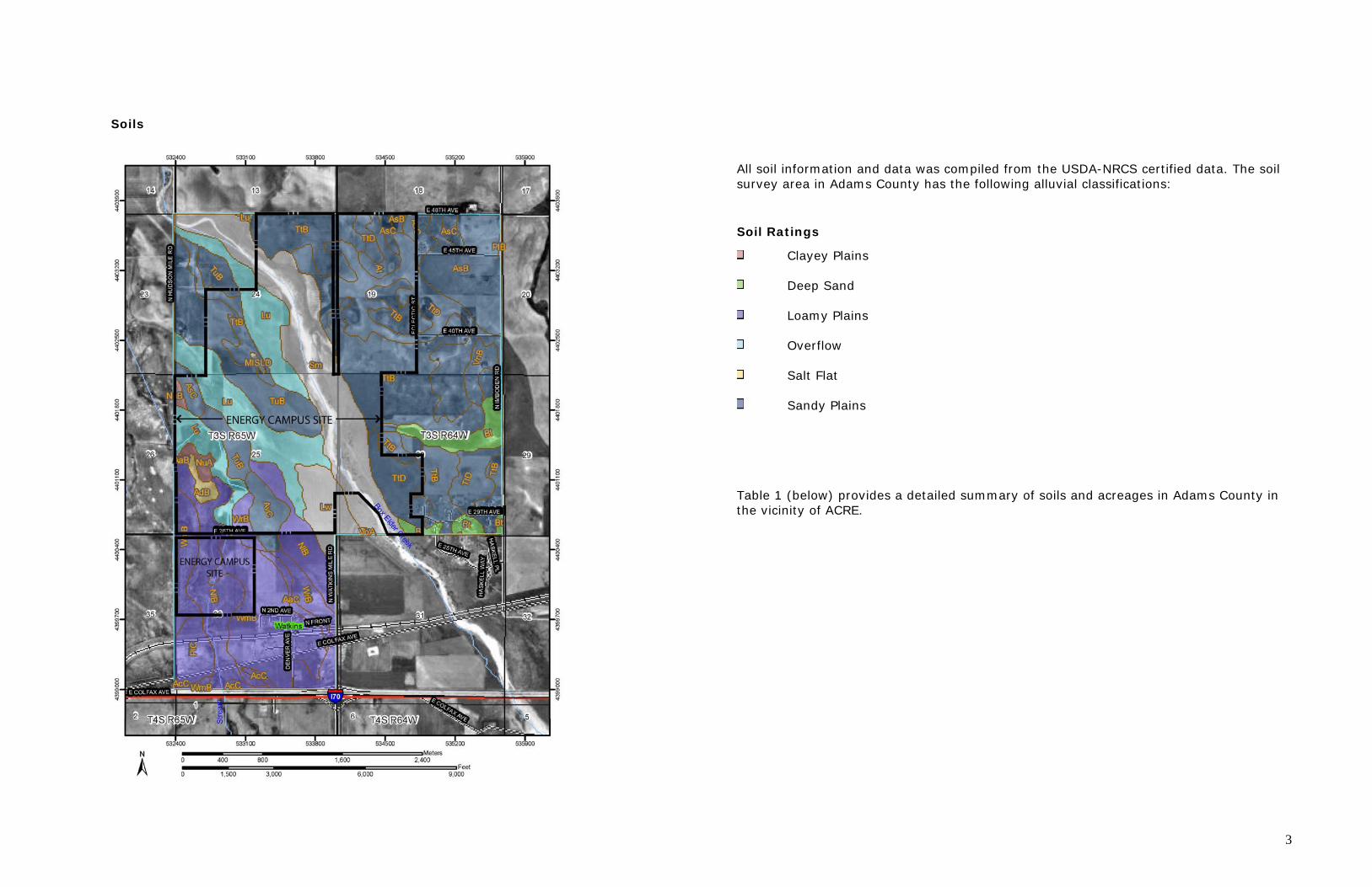
Soils
All soil information and data was compiled from the USDA-NRCS certified data. The soil survey area in Adams County has the following alluvial classifications:
Soil Ratings
Clayey Plains
Deep Sand
Loamy Plains
Overflow
Salt Flat
Sandy Plains Table 1 (below) provides a detailed summary of soils and acreages in Adams County in the vicinity of ACRE.
3

Table 1: Soils in Adams County Vicinity of ACRE / Ecological Site Name: NRCS Rangeland Site— Summary by Map Unit — Adams County Area, Parts of Adams and Denver
Adams County, Colorado Map unit
symbol Map unit name Rating Acres in AOI Percent of AOI
AaB Adena loam, 0 to 3 Loamy Plains 3.2 0.1% percent slopes AaC Adena loam, 3 to 5 Loamy Plains 20.0 0.6% percent slopes AcC Adena-Colby Loamy Plains 12.8 0.4% association, gently sloping AdB Arvada loam, 0 to 3 Salt Flat 14.8 0.5% percent slopes AsB Ascalon sandy loam, 1 to Sandy Plains 169.0 5.2% 3 percent slopes AsC Ascalon sandy loam, 3 to Sandy Plains 68.0 2.1% 5 percent slopes At Ascalon-Platner Sandy Plains 27.8 0.9% association AvC Ascalon-Vona sandy Sandy Plains 49.3 1.5% loams, 1 to 5 percent slopes Bt Blakeland-Truckton Deep Sand 81.1 2.5% association Lu Loamy alluvial land Overflow 347.2 10.7%
Lw Loamy alluvial land, 81.3 2.5% moderately wet MISLD Gravel pits 2.7 0.1% NlB Nunn loam, 1 to 3 Loamy Plains 243.3 7.5% percent slopes NuA Nunn clay loam, 0 to 1 Clayey Plains 14.2 0.4% percent slopes NuB Nunn clay loam, 1 to 3 percent slopes Clayey Plains 6.2 0.2% PlB Platner loam, 0 to 3 Loamy Plains 1.7 0.1% percent slopes PlC Platner loam, 3 to 5 Loamy Plains 53.2 1.6% percent slopes Sm Sandy alluvial land 360.0 11.1% TtB Truckton loamy sand, 0 Sandy Plains 572.9 17.7% to 3 percent slopes TtD Truckton loamy sand, 3 Sandy Plains 427.7 13.2% to 9 percent slopes
TuB Truckton sandy loam, 1 to 3 percent slopes
Sandy Plains 252.1 7.8%
4

Utilities The existing City of Aurora water and wastewater systems do not extend to this property. The property is included within the Water Department’s overall master planning areas, and service will be available in the future. The City has the rights to the groundwater under the property and initial development on ACRE must consider the use of ground water for interim water service. Because sanitary sewer is not yet available interim wastewater service must come from the use of septic systems. Adjacent properties utilize septic systems in lieu of central sanitary sewer service. ACRE and all specific users of the site will provide septic systems as needed for all sanitary needs until a sanitary sewer line is extended to the site. The City does not anticipate extension of any existing sanitary sewer main lines in the near future. Initial development is not expected to exceed Tri-County Health Department’ septic system capacity limits. Other existing utility services found near the ACRE site include an Electric Transmission Line (ETL) 230 kv electrical line located in the East 48th Avenue right of way and a fiber optic line located along East 26th Avenue and Watkins Road on the southern boundary of the site.
Airport Overlay District ACRE is located approximately three miles south of the DIA and one mile south and west of Front Range Airport. The site is subject to Airport Influence District (AID) overlay requirements identified in City Zoning Code and all applicable criteria relative to the proposed land uses stated therein. The purpose of the AID overlay ordinance is to assure compatible development in the areas around airports. Airport districts are created in and around these airports for the following purposes:
1. To minimize exposure of residential and other land uses to aircraft noise; 2. To minimize risks to public safety from potential aircraft accidents; 3. To protect property values; 4. To promote sound land use planning and zoning practices in areas encompassed by airport influence districts; 5. To restrict incompatible land use within the airport influence districts; and 6. To promote and protect public health, safety, and welfare.”
All framework planning and site planning efforts at ACRE will meet all requirements of the AID overlay ordinance.
Views ACRE is effectively divided into two physically distinct segments differentiated by their unique topography and separated by Box Elder Creek. The portion west of Box Elder Creek is relatively flat with slopes in the general range of ½% to 3% gradient. There are no topographically distinct landmarks in this area. East of the Box Elder Creek corridor, the topography is marked by steeper slopes in the range of 1% to 15% gradient. Numerous ridges, valleys, saddles and high points exist due to the undulating nature of the eastern portion of the site. Views to the Continental Divide are prominent from many locations. The most desirable view planes originate from major high points at the northeast and southeast corners of the site. Secondary high points with corresponding views to the west are located along the eastern property line of the site.
Existing Structures There are no structures of note, residential, agricultural, vehicular or otherwise, interior to the site. Along the periphery of the site are two vehicular structures crossing Coyote Run. A small two-lane bridge crosses Coyote Run along the western edge of the site within the Hudson Road right of way. A low-water crossing with dual corrugated metal pipe culverts crosses Coyote Run within the 26th Avenue right of way along the southern portion of the site.
5
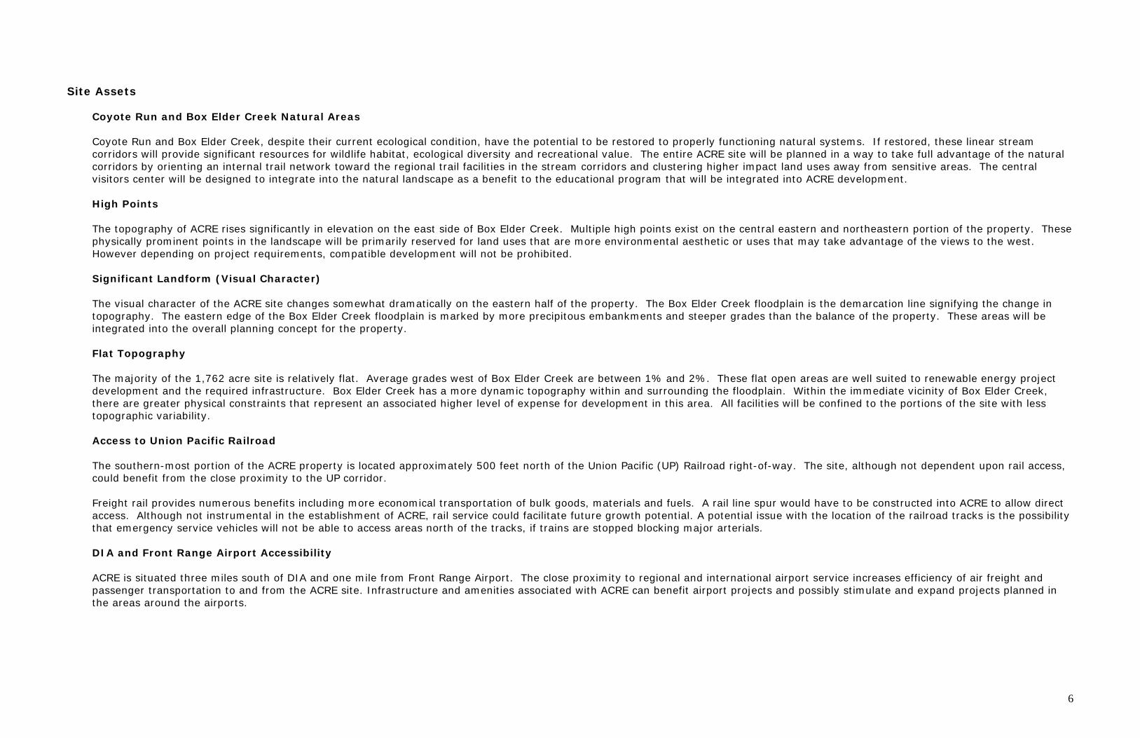
Site Assets Coyote Run and Box Elder Creek Natural Areas Coyote Run and Box Elder Creek, despite their current ecological condition, have the potential to be restored to properly functioning natural systems. If restored, these linear stream corridors will provide significant resources for wildlife habitat, ecological diversity and recreational value. The entire ACRE site will be planned in a way to take full advantage of the natural corridors by orienting an internal trail network toward the regional trail facilities in the stream corridors and clustering higher impact land uses away from sensitive areas. The central visitors center will be designed to integrate into the natural landscape as a benefit to the educational program that will be integrated into ACRE development.
High Points The topography of ACRE rises significantly in elevation on the east side of Box Elder Creek. Multiple high points exist on the central eastern and northeastern portion of the property. These physically prominent points in the landscape will be primarily reserved for land uses that are more environmental aesthetic or uses that may take advantage of the views to the west. However depending on project requirements, compatible development will not be prohibited. Significant Landform (Visual Character) The visual character of the ACRE site changes somewhat dramatically on the eastern half of the property. The Box Elder Creek floodplain is the demarcation line signifying the change in topography. The eastern edge of the Box Elder Creek floodplain is marked by more precipitous embankments and steeper grades than the balance of the property. These areas will be integrated into the overall planning concept for the property. Flat Topography The majority of the 1,762 acre site is relatively flat. Average grades west of Box Elder Creek are between 1% and 2%. These flat open areas are well suited to renewable energy project development and the required infrastructure. Box Elder Creek has a more dynamic topography within and surrounding the floodplain. Within the immediate vicinity of Box Elder Creek, there are greater physical constraints that represent an associated higher level of expense for development in this area. All facilities will be confined to the portions of the site with less topographic variability. Access to Union Pacific Railroad The southern-most portion of the ACRE property is located approximately 500 feet north of the Union Pacific (UP) Railroad right-of-way. The site, although not dependent upon rail access, could benefit from the close proximity to the UP corridor. Freight rail provides numerous benefits including more economical transportation of bulk goods, materials and fuels. A rail line spur would have to be constructed into ACRE to allow direct access. Although not instrumental in the establishment of ACRE, rail service could facilitate future growth potential. A potential issue with the location of the railroad tracks is the possibility that emergency service vehicles will not be able to access areas north of the tracks, if trains are stopped blocking major arterials. DIA and Front Range Airport Accessibility ACRE is situated three miles south of DIA and one mile from Front Range Airport. The close proximity to regional and international airport service increases efficiency of air freight and passenger transportation to and from the ACRE site. Infrastructure and amenities associated with ACRE can benefit airport projects and possibly stimulate and expand projects planned in the areas around the airports.
6
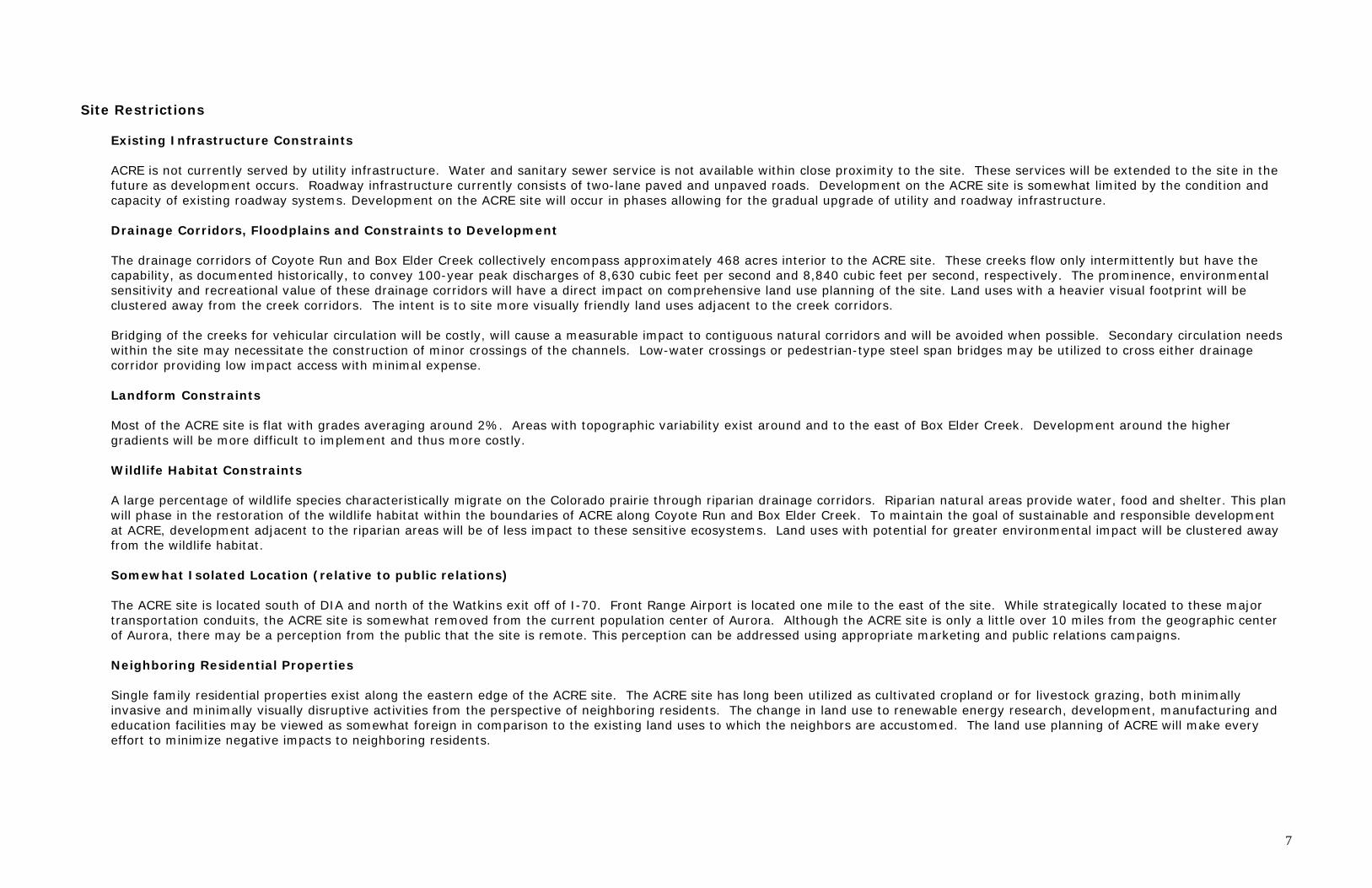
Site Restrictions Existing Infrastructure Constraints ACRE is not currently served by utility infrastructure. Water and sanitary sewer service is not available within close proximity to the site. These services will be extended to the site in the future as development occurs. Roadway infrastructure currently consists of two-lane paved and unpaved roads. Development on the ACRE site is somewhat limited by the condition and capacity of existing roadway systems. Development on the ACRE site will occur in phases allowing for the gradual upgrade of utility and roadway infrastructure.
Drainage Corridors, Floodplains and Constraints to Development The drainage corridors of Coyote Run and Box Elder Creek collectively encompass approximately 468 acres interior to the ACRE site. These creeks flow only intermittently but have the capability, as documented historically, to convey 100-year peak discharges of 8,630 cubic feet per second and 8,840 cubic feet per second, respectively. The prominence, environmental sensitivity and recreational value of these drainage corridors will have a direct impact on comprehensive land use planning of the site. Land uses with a heavier visual footprint will be clustered away from the creek corridors. The intent is to site more visually friendly land uses adjacent to the creek corridors. Bridging of the creeks for vehicular circulation will be costly, will cause a measurable impact to contiguous natural corridors and will be avoided when possible. Secondary circulation needs within the site may necessitate the construction of minor crossings of the channels. Low-water crossings or pedestrian-type steel span bridges may be utilized to cross either drainage corridor providing low impact access with minimal expense.
Landform Constraints Most of the ACRE site is flat with grades averaging around 2%. Areas with topographic variability exist around and to the east of Box Elder Creek. Development around the higher gradients will be more difficult to implement and thus more costly.
Wildlife Habitat Constraints A large percentage of wildlife species characteristically migrate on the Colorado prairie through riparian drainage corridors. Riparian natural areas provide water, food and shelter. This plan will phase in the restoration of the wildlife habitat within the boundaries of ACRE along Coyote Run and Box Elder Creek. To maintain the goal of sustainable and responsible development at ACRE, development adjacent to the riparian areas will be of less impact to these sensitive ecosystems. Land uses with potential for greater environmental impact will be clustered away from the wildlife habitat.
Somewhat Isolated Location (relative to public relations) The ACRE site is located south of DIA and north of the Watkins exit off of I-70. Front Range Airport is located one mile to the east of the site. While strategically located to these major transportation conduits, the ACRE site is somewhat removed from the current population center of Aurora. Although the ACRE site is only a little over 10 miles from the geographic center of Aurora, there may be a perception from the public that the site is remote. This perception can be addressed using appropriate marketing and public relations campaigns.
Neighboring Residential Properties Single family residential properties exist along the eastern edge of the ACRE site. The ACRE site has long been utilized as cultivated cropland or for livestock grazing, both minimally invasive and minimally visually disruptive activities from the perspective of neighboring residents. The change in land use to renewable energy research, development, manufacturing and education facilities may be viewed as somewhat foreign in comparison to the existing land uses to which the neighbors are accustomed. The land use planning of ACRE will make every effort to minimize negative impacts to neighboring residents.
7
Existing Roadways Roadways surrounding the ACRE are primarily two lanes paved and unpaved:
• North Imboden Road • I-70 • Smith Road/Highway 36 • Hudson Road • East 26th Avenue • East 56th Avenue
Design Response to Site Assets Trail Corridors, Interconnectivity ACRE is situated amidst numerous resources. Box Elder Creek and Coyote Run are recognized as significant trail corridors by the Emerald Strands Park, Open Space and Trail Plan, Parks and Open Space Master Plan, he Win Win Trail and Open Space Plan and the Northeast Greenway Corridor Plan. Ultimately this combined trail corridor will provide alternate mode connectivity for recreational users and commuters from Brighton, north of DIA, to Aurora’s network of parks, trails and natural areas. ACRE will provide a vital link in this transportation infrastructure to the north and south for external users and also for those visiting and working at the campus itself. The intent of the ACRE project is to combine renewable energy research, development, power generation, manufacturing, demonstration and education land uses in an environmentally synergistic manner with the restored and enhanced stream corridors of Box Elder Creek and Coyote Run. Approximately 4 miles of regional trail will be constructed along the lengths of the natural corridors and integrated with a network of connecting trail facilities. The internal trail system will promote alternate modes movement emanating from the central visitors’ center to each planning area within the campus then connecting to the regional trail corridors. Natural Areas, Habitat Restoration and Enhancement Natural areas within the ACRE site are associated primarily with the linear corridors surrounding Box Elder Creek and Coyote Run. These areas, defined in the attached Urban Drainage study, amount cumulatively to 468 acres. Agricultural activity on the ACRE site has impacted the existing natural areas considerably. Box Elder Creek and Coyote Run have sustained significant damage to their native ecological systems from cattle grazing and dryland cultivation. Mechanical cultivation practices have widened terraced farm fields laterally causing substantial encroachment into sensitive riparian and wetland areas paralleling the streams within the natural corridors. Repetitive cattle grazing throughout the Box Elder Creek floodplain has produced physical damage to the semi-mature cottonwood gallery and all understory vegetation. No young cottonwoods are evident in this area. In addition, understory plants normally plentiful in an environment such as this, are not reproducing. Systematic pesticide and herbicide applications have caused the natural areas to be all but uninhabitable by native plant and animal species with the exception of the most disturbance-tolerant species. Initial study and site analysis has determined that the natural areas of Box Elder creek and Coyote Run are in need of environmental restoration to return them to a condition typical of a native Colorado riparian corridor. In effect, habitat restoration practices must reverse the effects of agricultural impact and return the quality and diversity to a once present resource along the stream corridors. Planned development on ACRE will place a very high priority on the restoration of these natural corridors. In a restored condition, they will provide an immense resource of ecological diversity, habitat, wetland and riparian value. In addition, natural corridors will offer a distinct benefit to citizens of Aurora and the surrounding community through educational and recreational opportunities. A tree canopy inventory and augmentation plan will aid in improving CO2 sequestration and reduce ground temperatures. Maintaining a portion of the ACRE site as parks and open space will provide balance and sustainability to the overall project, while meeting the conditions for acquisition.
8

Central Visitors’ Facility ACRE will enable the collective development of multiple renewable energy facilities on a single campus. Inherent to this concept is an enormous opportunity for public technology demonstration and education. ACRE is anticipated to become a destination for myriad public and professional user groups. A central visitors’ center, comprised of a primary interpretive center and ancillary educational facilities amounting to approximately 50,000 square feet of demonstration space, will be constructed as the primary interface between renewable energy professionals, the technology featured on ACRE and the interested public. The structures themselves will be principal examples of alternative energy technology, renewable materials implementation and environmental synergy. Potential technologies that could be incorporated into visitors’ center architecture and site development are photovoltaic solar power, geothermal system for seasonal heating and cooling, natural storm drainage treatment systems, pervious pavement parking areas, rapidly renewable/recycled building materials, use of local rock and lumber building materials, natural daylight lighting, natural ventilation and demonstration of technologies researched and developed at ACRE. The visitors’ center and educational structures along with its site amenities, parking, gardens, trails and outdoor interpretive exhibits will sit on a part of an 63-acre parcel in the central portion of the overall campus immediately adjacent to the Box Elder Creek natural area. A planned sequence of arrival events and visual cues will draw the visitor into the site, past active renewable energy research and development parcels to the centrally located center. The visitors’ center parcel will be planned and designed to accommodate multiple user groups in a diversity of outdoor and indoor educational, demonstration and recreational venues. This center will offer a transition from the technology portions of the ACRE development to the natural corridors and open spaces. The architecture will be unique but complimentary to the site and the comprehensive environment. Views The ACRE site is primarily flat with average grades of 2% existing over most of the property. At the eastern end of ACRE, the topography becomes more dramatic at the edge of the Box Elder Creek floodplain. Physical high points rise up from the flat landscape in this area providing exceptional views to the Front Range and Continental Divide. Planning of the ACRE site will capitalize on these high points by siting land uses that enhance and showcase the beneficial view corridors on and around the high points. Alternatively, placing land uses with less visual appeal will be a priority on parcels having lower elevations.
Design Response to Site Challenges
How does your development plan deal with the site’s development constraints as identified above? Have you considered alternate strategies to deal with these problems? If so, why did you select the particular approach shown on your development plan?
• Response to Drainage Corridors • Minimize Crossings • Cluster Development away from Habitat Corridors • Trails will not access most sensitive areas • Development located away from significant landforms • Phasing of Infrastructure Development
9

Proj
ect A
rea
02,
000
4,00
0Feet
DIA
Nois
e M
itigat
ion P
arce
ls N
RASe
ctio
ns 1
9 an
d 30
, T3S
, R54
W; S
ectio
ns 2
4, 2
5, a
nd 3
6, T
3S, R
54W
; 6th
PM
UTM
NA
D 8
3: Z
one
13N
; 533
696m
E, 4
4017
17m
N
Latit
ude,
Lon
gitu
de: 3
9.76
471°
N, 1
04.6
0653
°W
USG
S M
anila
and
Wat
kins
, CO
Qua
d.; A
dam
s C
ount
y, C
olor
ado
±1
inch
eq
uals
2,0
00 f
eet
Figu
re 1
Site
Loc
atio
n
Prepa
red fo
r: City
of Au
rora
File:
4141
Figu
re 1.m
xd [d
lh]Au
gust
2008

Proj
ect A
rea
N Hudson Rd
N Watkins Rd
N Imboden Rd
E 48
th A
ve
E 26
th A
ve
E Sm
ith R
d
Box
Elde
r Creek
Wat
kins
Coy
ote
Run
Prai
rie
dog
colo
ny
02,
000
4,00
0Feet
DIA
Nois
e M
itigat
ion P
arce
ls N
RA
±1
inch
eq
uals
2,0
00 f
eet
Figu
re 2
Nat
ural
Res
our
ces
Prepa
red fo
r: City
of Au
rora
File:
4141
Figu
re 2.m
xd [d
lh]Au
gust
2008
Cu
ltiva
ted
Lan
ds
Dis
turb
ed G
rass
land
/Gra
zin
g
Iso
late
d W
etla
nd
Ripa
rian
Cot
ton
woo
d G
alle
ry
Mix
ed W
etla
nd
and
Upl
and
Swal
e
Ripa
rian
Upl
ands
/Sa
ndy
Ch
ann
el
ACRE Aurora Campus for Renewable Energy Framework Development Plan
FDP
NARRATIV
E

Form B: FDP Narrative
ACRE General Description of the FDP
1. The city has a commitment to prohibit residential uses within the development. 2. The city has a commitment to promote sustainable development with a primary goal: TO BECOME THE PREMIER U.S. SITE FOR RESEARCH AND DEVELOPMENT PERTAINING TO RENEWABLE ENERGY, PARTICULARLY SOLAR ENERGY. Sustainability is defined as: “Meeting present needs without compromising the ability of future generations to meet their needs.” To meet this definition and to meet City goals, the predominant land uses on the 1,762 acres include research, development, education and manufacturing in support of renewable energy technologies and generation of renewable energy. These land uses will be integrated with natural corridors and open spaces. This development will support the efforts of the City, renewable energy manufacturers, academic organizations, federal agencies and utilities including benefits for the community and general public, making ACRE a unique development with a forward-looking vision for a more sustainable Aurora. The goals of the campus are as follows:
• To encourage the use of clean, renewable energy. • To serve as a leader in exploring alternative energy resources for the citizens of Aurora. • To take advantage of the green economy to create new, quality jobs in Aurora. • To help fulfill Aurora’s goal of becoming a sustainable community and to ensure Aurora is recognized as a leader in sustainability. • To support Aurora’s interest in furthering green energy through education. • To encourage research and development initiatives that support renewable energy technology advancements nationally and internationally. • To provide production-level generation from renewable resources. • To provide a central location for a wide range of renewable energy technologies which:
- creates opportunities for cross-industry cooperation and information sharing - supports efficiencies in infrastructure - promotes renewable energy projects in an appropriate location - enhances public visibility of a green energy park - develops partnerships among the education community To support the State of Colorado’s New Energy Economy.
3. The city has a commitment to sustaining its natural areas and corridors and exploring opportunities for renewable energy. Natural corridors along floodplains offer Aurora residents opportunities for recreation and education about habitat and ecosystems within our city boundaries. Trails and open spaces create a scenic destination, in addition to connectivity, within the campus for renewable energy tenants. Utility-scale renewable energy generation offers the city a unique opportunity to offset city government utility needs, saving taxpayer dollars. Technology improvements result in more efficient, durable and cost-effective equipment. Renewable resources used in these technologies are the building blocks of a more sustainable Aurora. 4. The city has a commitment to plan, build and operate the campus in a sustainable manner which will provide environmental, social and economic benefits.
Planning
The land uses will be structured to preserve and maintain the natural corridors and the land’s ecological character. Nesting birds, wildlife refuge areas and stream flows needed to maintain habitat are considerations included in the land use designations. The campus is designed to maintain the land’s natural character by incorporating the ecosystem value and surface water corridors into the design; target research and development to fine tune cutting edge renewable energy practices into technologies that can be implemented at larger scales within utility service market territories; apply utility-scale electric power generation that produces no greenhouse gases and reduces the city’s carbon footprint; make provisions for manufacturing of equipment and materials that will support renewable energy deployment within the region; and build in accessibility for educating people about the important environmental, social and

economic benefits associated with the ACRE. In addition, designation of this land as a renewable energy campus serves to preclude its use for residential development, maintaining compliance with the terms of the property acquisition. Build The facilities that will be built on the campus will comply with environmental and worker health and safety requirements. Storage of materials, spill containment and fire protection will all be important features incorporated into building design. Green infrastructure components will be built into the design of the streets, parking lots, facilities and buildings to support and demonstrate sustainable concepts. Natural drainage corridors will be protected in compliance with the Migratory Bird Treaty Act and the protection of endangered species. Structures will meet commercial building standards and up-to-date energy conservation codes. Demonstration of building science technologies, including on-site applications such as district heating with renewable energy will be incorporated, if feasible. Operation Operating procedures will complement the protections used in the design of the buildings and structures. Decisions about tenants and their proposed use of land for renewable energy purposes will be made with protection of the environment, workers and visitors as paramount considerations. Compliance with existing regulations is considered an integral component of these operating procedures, and periodic revisions will be made to keep operations current with best practices.
Defining the Character of the FDP Three integral strategies guide the ACRE framework. The campus is planned around the site’s natural features as it is situated on Aurora’s eastern boundaries on the front range part of the Eastern Plains. Secondly, the design of continuous open space system dedicates the most prominent features for public use to enhance the campus’s role in the community. Lastly, the development of a core will serve as, not only an educational center, but the point which ensures connectivity through out the site. Adequate connectivity is vital to the ACRE concept, projects, employees and visitors. Parks & Open Space:
2

Hudson Road
Imbodden Road
E. 48th Avenue
E. 26th Avenue
The bold lines represent the major streets with Hudson Road forming the western boundary, E. 48th Avenue to the far north, Imboden Road to the east and 26th Avenue to the south with N. Watkins Road bisecting the development running north to south. Due to the need to preserve and enhance the natural drainage corridors of Coyote Run and Box Elder Creek, some of the roads are off the standard grid system as outlined in the North East Transportation Study.
Circulation:
3

Organization of the Land Uses:
Legend: Color/symbol Land Use Open Space
Recreation Lt.
Manufacturing Lt. and Heavy
Manufacturing R&D
Demonstration Education Utility Scale Power Generation
Distribution of Uses
U/P
U/P
U/P
U/P
U/P
U/P
U/P
U/P
4

Timeframe and Phasing What is the projected start date for development? What is the estimated timeframe for build out? Will development occur in phases? If so, what are the projected phases and start times? How do the phases for roads, utilities, parks, trails and public facilities relate? The development will occur in accordance with the attached Public Improvement Plan. The required infrastructure improvements are identified for each planning area. Recognizing that large areas with little topographic variability may be required for myriad potential technologies, this FDP allows for infrastructure phasing. Maintaining existing infrastructure will remain a priority for initial development, and goals will be reassessed as development expands and projects diversify. The projected start date for development of the first Contextual Site Plan (CSP) is approximately August/September of 2008. The projected build out is 20- 40 years with a projected spike when municipal water is extended and expected to serve the site.
Zoning Conformance Does the FDP accurately reflect adopted E-470 or Northeast Plans Zoning District Subarea Boundaries?
The property is zoned Northeast Plains - General Subarea. This zone permit uses such as research and development; major and minor utilities; and electric power generation including solar and wind; educational facilities; and recreation. Although the existing zoning allows residential use as an overlay, conditions of property acquisition preclude all residential uses on ACRE. Proposed uses meet the goals established for this subarea. This proposal removes any allowance for residential use.
The uses are subject to development standards as set by Article 10 of the zoning code and any special development standards as set by a Framework Development Plan (FDP). Any deviations from these standards may require a waiver that can be proposed through the Contextual Site Plan approval process as defined in Article 4, Sections 146-409 & 410 of the City of Aurora zoning code.
Potential Regulatory Conflicts
Are there any existing or potential conflicts between FDP design ordinance requirements and the terms of any existing annexation agreements with other jurisdictions or interest groups? If so, what are they and how do you propose to resolve them?
No conflicts have been identified at this time.
Waivers
Does your current design require any ordinance waivers in order to be approved? If so, list each proposed waiver, and answer the following questions for each.
No waivers are anticipated at this time, although alternative solutions to meeting the landscaping requirements will be explored on this site. ACRE will serve as a testing ground to explore xeric options, irrigations solutions, the use of native materials and various alternative turf/native grass options.
Required City Facilities
What additional city facilities or services will the City of Aurora have to provide in order for your FDP to be implemented? What police, fire, and recreation facilities are required and where are they located (inside or outside your FDP boundary.) To what extent will your development plan help to fund or construct these facilities? The FDP will dedicate land for parks and open space. Although a minimum of thirty (30) acres is required for public uses based on the annexation agreement, these uses are a high priority for ACRE, and up to 500 acres may be dedicated to parks and open space use. Because there are no residential uses planned for the site, there are no additional P&OS dedication requirements outside of the original annexation agreement. Education and recreation is integral to the success of the campus. Planned locations for fire protection will be addressed and accommodated when a threshold of 4 million square feet of building area is reached within the general vicinity of this development. Centralized water and sewer is not provided to the site at this time. There will be a need to draft interim water and sewer plan for initial low-density uses until water and sewer can be extended. See proposed Public Improvement Plans (attached).
5

Vehicular Circulation Do the proposed arterial and collector roadways align with the arterials and collectors of adjacent properties? If not, explain why. To retain and enhance the significant natural features of Box Elder Creek and Coyote Run, the main vehicular system within the interior of the campus will be off the established grid as indicated in the North East Area Transportation Study (NEATS). The connections along the site’s perimeter will be aligned with the existing grid system and provide connections to the adjacent development.
Pedestrian Circulation Do off-street trails on your site connect with connect with those on adjacent properties. If not, explain why. All trails will connect with adjacent properties, where applicable, and include both pedestrian and bicycle circulation. The trail system will serve as a major organizing element of the campus and allow for crossings of the prominent creek systems that will be aligned and integrated into the development.
Protection of Natural Features, Resources and Sensitive Areas. Describe how the development will be designed to protect, use or enhance natural resources and features. In particular, describe how the design of the development will respond to: • Water features, such as floodplains, streams, and arroyos. • Adjacent parks and public open space • Historic or archeological sites • Significant views of the Front Range and views from public parks and I-70 and E-470 and other collector and arterial streets • Riparian wildlife habitat • The approximate topographic form of major ridgelines and swales • Natural or geologic hazard areas, including unstable slopes and expansive soils
Other natural features such as bluffs, ridges, steep slopes, stands of mature trees, rock outcroppings, or wetlands. Coyote Run and Box Elder Creek, despite their current ecological condition, have the potential to be restored to properly functioning natural systems. If restored, these linear stream corridors represent significant resources for wildlife habitat, ecological diversity and recreational value. The entire ACRE site will be planned in a way to take full advantage of the natural corridors by orienting an internal trail network toward the regional trail facilities in the stream corridors and clustering higher impact land uses away from sensitive areas. This project will serve as an example of how industrial uses can be combined with native landscapes resulting in sustainable development that will preserve and enhance the prairie and riparian ecosystems of the eastern plains. The central visitors’ center will be designed to integrate into the natural landscape as a benefit to the educational program established for ACRE.
Steep Slope Standards
Does your development plan include building on areas with an existing slope of 6% or greater? If so, what standards and design strategies have you adopted to deal with drainage and aesthetic issues? Have you reviewed and considered our recommended steep slope design guidelines? If not, why? The topography of ACRE rises significantly in elevation on the east side of Box Elder Creek. Multiple high points exist on the central eastern and northeastern edge of the property. These physically prominent points in the landscape will generally be reserved for land uses utilizing a higher environmental aesthetic or for uses that may take advantage of mountain views to the west.
6

Consultations with Outside Jurisdictions and Agencies Have you consulted with representatives of your local school district, the Colorado Division of Wildlife, or other applicable local, state or federal agencies? If so, list the dates, contact person, and results of your discussions. Include any letters you’ve received from these agencies as an appendix to your application. Contacts: FAA Linda Bruce, Colorado State Planner Front Range Airport Dennis Heap, Executive Director of Aviation Denver International Airport Thomas Reed, Airport Planner Adams County Alice J. Nichol, District 2 Commissioner Urban Drainage Bill DeGroot, Flood Plain Manager Tri-County Health Warren S. Brown, PE School District This is not applicable, because no residential uses are proposed or permitted within the boundaries of the ACRE Framework Development Plan. Colorado Division of Wildlife Town of Bennett
7

ACRE Aurora Campus for Renewable Energy Framework Development Plan
PRO
POSED
LAN
D U
SES
Aurora’s Campus for Renewable Energy’s Proposed Land Uses ACRE
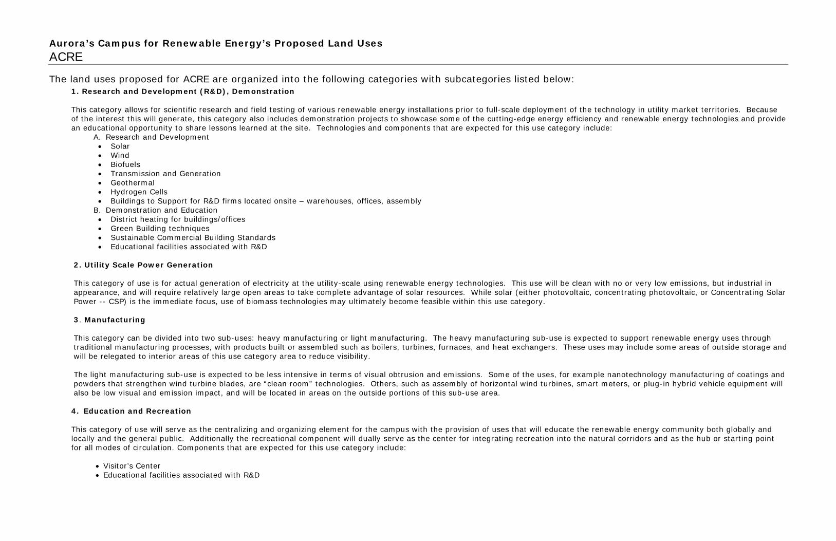
The land uses proposed for ACRE are organized into the following categories with subcategories listed below: 1. Research and Development (R&D), Demonstration This category allows for scientific research and field testing of various renewable energy installations prior to full-scale deployment of the technology in utility market territories. Because of the interest this will generate, this category also includes demonstration projects to showcase some of the cutting-edge energy efficiency and renewable energy technologies and provide an educational opportunity to share lessons learned at the site. Technologies and components that are expected for this use category include:
A. Research and Development • Solar • Wind • Biofuels • Transmission and Generation • Geothermal • Hydrogen Cells • Buildings to Support for R&D firms located onsite – warehouses, offices, assembly
B. Demonstration and Education • District heating for buildings/offices • Green Building techniques • Sustainable Commercial Building Standards • Educational facilities associated with R&D
2. Utility Scale Power Generation This category of use is for actual generation of electricity at the utility-scale using renewable energy technologies. This use will be clean with no or very low emissions, but industrial in appearance, and will require relatively large open areas to take complete advantage of solar resources. While solar (either photovoltaic, concentrating photovoltaic, or Concentrating Solar Power -- CSP) is the immediate focus, use of biomass technologies may ultimately become feasible within this use category.
3. Manufacturing This category can be divided into two sub-uses: heavy manufacturing or light manufacturing. The heavy manufacturing sub-use is expected to support renewable energy uses through traditional manufacturing processes, with products built or assembled such as boilers, turbines, furnaces, and heat exchangers. These uses may include some areas of outside storage and will be relegated to interior areas of this use category area to reduce visibility. The light manufacturing sub-use is expected to be less intensive in terms of visual obtrusion and emissions. Some of the uses, for example nanotechnology manufacturing of coatings and powders that strengthen wind turbine blades, are “clean room” technologies. Others, such as assembly of horizontal wind turbines, smart meters, or plug-in hybrid vehicle equipment will also be low visual and emission impact, and will be located in areas on the outside portions of this sub-use area. 4. Education and Recreation
This category of use will serve as the centralizing and organizing element for the campus with the provision of uses that will educate the renewable energy community both globally and locally and the general public. Additionally the recreational component will dually serve as the center for integrating recreation into the natural corridors and as the hub or starting point for all modes of circulation. Components that are expected for this use category include:
• Visitor’s Center • Educational facilities associated with R&D

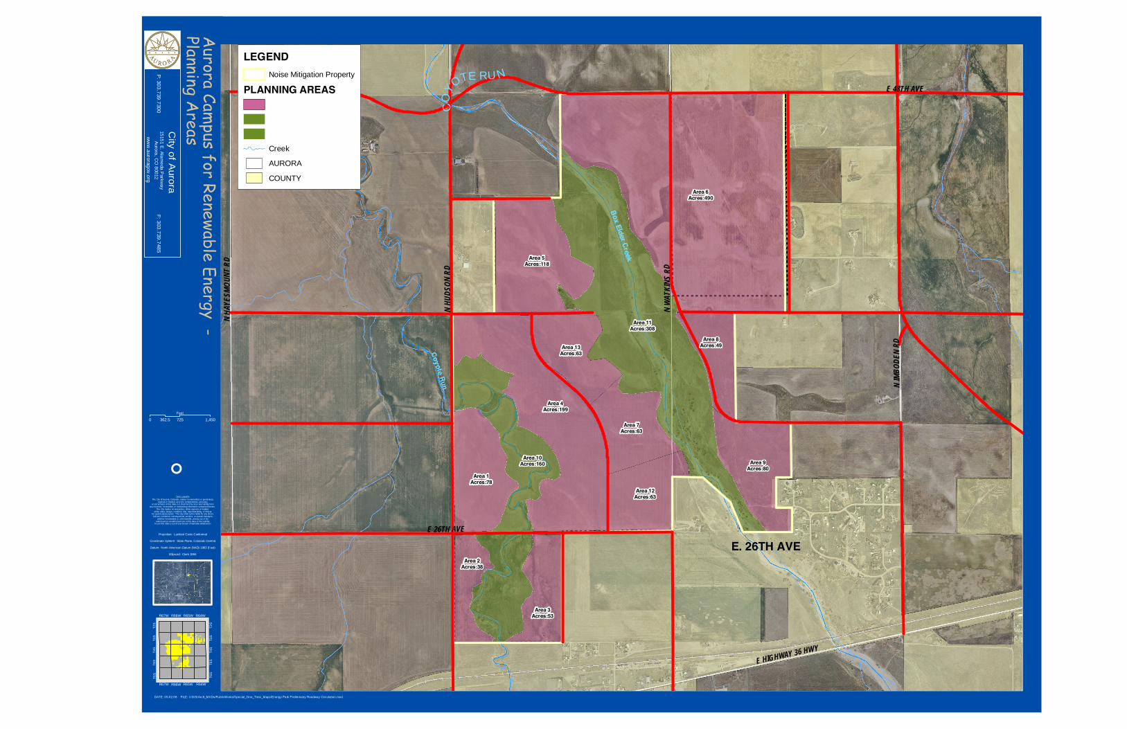
Planning Area Assignments
Planning Area Planning Area Size (acres)
R&D, Demonstration and Education
Utility Scale Power Generation
Manufacturing L=Light H= Heavy
Education and Recreation
Planning Area 1 78 X Planning Area 2 38 X Planning Area 3 53 X X L Planning Area 4 199 X X H, L Planning Area 5 118 X X H, L Planning Area 6 490 X H, L Planning Area 7 63 X L X Planning Area 8 49 X X H, L Planning Area 9 80 X X L Planning Area 10* 160 X Planning Area 11* 308 X Planning Area 12 63 X X L X Planning Area 13 63 X X L X
Total Acres 1762
* Planning Areas 10 and 11 are designated as natural corridors and other land uses will not be allowed.
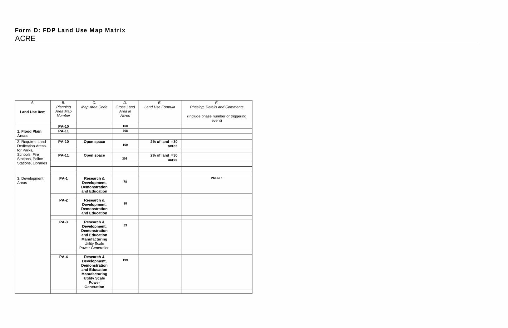
Form D: FDP Land Use Map Matrix ACRE
A.
Land Use Item
B. Planning Area Map Number
C. Map Area Code
D. Gross Land
Area in Acres
E. Land Use Formula
F. Phasing, Details and Comments
(Include phase number or triggering event)
PA-10 160 PA-11 308 1. Flood Plain
Areas
PA-10 Open space 160
2% of land =30 acres
PA-11 Open space
308 2% of land =30
acres
2. Required Land Dedication Areas for Parks, Schools, Fire Stations, Police Stations, Libraries
PA-1 Research &
Development, Demonstration and Education
78
Phase 1
PA-2 Research &
Development, Demonstration and Education
38
PA-3 Research &
Development, Demonstration and Education Manufacturing
Utility Scale Power Generation
53
PA-4 Research &
Development, Demonstration and Education Manufacturing
Utility Scale Power
Generation
199
3. Development Areas

PA-5 Research & Development, Demonstration and Education Manufacturing
Utility Scale Power
Generation
118
PA-6 Manufacturing
Utility Scale Power Generation
490
PA-7 Manufacturing
Utility Scale Power Generation
63
PA-8 Research &
Development, Demonstration and Education Manufacturing
Utility Scale Power
Generation
49
PA-9 80
4. Total Map Acreage (Total figures above)
1762
5. Total Flood Plain Acreage
468
NW
ATKI
NSRD
E HIGHWAY 36 HWY
E 26TH AVE
E 48TH AVE
NIM
BODE
NRD
NHU
DSON
RD
NHA
YESM
OUNT
RD
BoxElder Creek
CoyoteRun
Area 6Acres:490
Area 9Acres:80
Area 4Acres:199
Area 1Acres:78
Area 2Acres:38
Area 3Acres:53
Area 5Acres:118
Area 7Acres:63
Area 8Acres:49
Area 11Acres:308
Area 10Acres:160
Area 12Acres:63
Area 13Acres:63
Aurora
Campus
forRenewable
Energy-
PlanningA
reas
DATE: 05.02.08 FILE: I:/GIS/Arc9_MXDs/PublicWorks/Special_One_Time_Maps/Energy Park Preliminary Roadway Circulation.mxd
0 725 1,450362.5Feet
LEGENDNoise Mitigation Property
PLANNING AREAS
Creek
AURORA
COUNTY
Projection: Lambert Conic Conformal
Coordinate System: State Plane, Colorado Central
Datum: North American Datum (NAD) 1983 (Feet)
Ellipsoid: Clark 1866
DISCLAIMER:The City of Aurora, Colorado, makes no warranties or guarantees,
express or implied, as to the completeness, accuracy,or correctness of this data, nor shall the City incur any liability from
any incorrect, incomplete, or misleading information contained therein.The City makes no warrant ies, either express or implied,
of the value, design, condition, tit le, merchantability, or fitnessfor a particular purpose. The City shall not be liable for any direct,
indirect, incidental, consequential, punit ive, or special damages,whether foreseeable or unforseeable, arising out of the
authorized or unauthorized use of this data or the inabilityto use this data or out of any breach of warranty whatsoever.
°
T6S
T2S
T3S
T4S
T6S
T2S
T3S
T4S
T5S
T6S
R66W
R64WR65WR66WR67W
R64WR65WR67W
City
ofAurora
15151E.Alam
edaP
arkway
Aurora,CO
80012P:303.739.7300
F:303.739.7485
ww
w.auroragov.org
CO
YOTE RU N
E. 26TH AVE
ACRE Aurora Campus for Renewable Energy Framework Development Plan
EN
VIR
ON
MEN
TAL
DESIG
N

ACRE AURORA’S CAMPUS FOR RENEWABLE ENERGY ENVIRONMENTAL DESIGN STANDARDS developed by the city of aurora’s staff september 2008

ACRE environmental design standards GENERAL STANDARDS The built environment has a profound impact on the natural environment, the economy, human health and productivity. Sustainable design, construction and operation are fundamental objectives of the Aurora Campus for Renewable Energy (ACRE). These design standards are intended to create healthier, more comfortable, more durable, more energy-efficient development with minimal environmental impacts. The primary goals of these standards are to:
Define expectations for the facility’s performance Minimize environmental impacts and preserve natural corridors Design sites and buildings with improved performance Create partnerships in the design, construction and renewable energy practices Save tenants money through reduced energy and material expenditures, waste disposal and utility costs
Provide comfort, health and well-being for the occupants and visitors Stimulate markets for sustainable technologies and products
The primary components of the standards include:
Cohesive site design which encourages connectivity and efficient circulation patterns Preservation and enhancement of the natural environment Strategic site selection and building orientation Creation of a sustainable campus identity Landscaping and development designed to minimize water and energy usage Durable building design that reduces waste, material usage, and maintenance needs Minimization of construction waste Emphasis on energy efficiency Encourage the use of Energy Star, LEED-NC and LEED-EB practices for the design, construction and operation of all buildings
2

COHESIVE SITE DESIGN WHICH ENCOURAGES CONNECTIVITY AND EFFICIENT CIRCULATION PATTERNS
Landscape design at entry monumentation and key entry points will act as examples of this principle. Points of entry will be designed in such a manner as to introduce visitors to the unique purpose and character of ACRE. A hierarchy of signs and landscape characters will be developed for primary, secondary and directional signs and their settings.
Provide pedestrian, vehicular and trail connections to adjacent uses, both within each development and between developments. Materials should be pervious. Handicap accessibility requirements must be met.
PRESERVATION AND ENHANCEMENT OF THE NATURAL ENVIRONMENT
Current landscape standards for special landscape buffers such as parks, open spaces and drainage ways shall apply. The standards allow full discretion by the Parks and Open Space Department to control the landscape character of these buffers.
Preserve steep slopes with native vegetation to protect natural habitats and reduce erosion Mitigate storm water runoff by increasing pervious pavements, and increasing on-site storm water infiltration. Current landscape standards shall apply at detention, retention and water quality ponds with an emphasis on drought tolerant xeriscape or native plant materials and grasses. Development and use of “experimental” and newly developed varieties of turf grasses will be encouraged.
Limit the site disturbance during construction aiding in the preservation of the natural corridors as well as the habitats for native species. The systematic restoration of these natural areas would be composed of restoration components such as storm water conveyance, stream stabilization, vegetative cover and related animal habitat structure. All components would be included in a comprehensive design for both natural area corridors.
Recreational standards managing trail alignment, educational and interpretive potential, wayfinding and architectural elements would then be developed to integrate a human element to the natural environment. The principal goal would be to provide a recreational/trail experience enhanced by the experience of restored natural corridors.
Through the joint public/private venture of ACRE to partner with renewable energy companies, organizations and entities with a goal to gradually put back into place all natural functions of Coyote Run and Box Elder Creek. Natural area restoration would work synergistically with the renewable energy resources being cultivated collectively within the ACRE site to advance the concept of sustainability.
The systematic restoration of these natural areas would begin with the historical analysis of each stream, and physical analysis of adjacent similar environments and analysis of related habitat to establish a baseline of physical character. Once the baseline has been determined, the design team would then develop a restoration objective specific to the physical characteristics presented by each stream corridor.
STRATEGIC SITE SELECTION AND BUILDING ORIENTATION No buildings shall be constructed within the 100 year flood plain. Buildings shall be clustered to minimize environmental impacts. The buildings should be elongated on an east-west axis with a solar orientation. Building entries should be emphasized with the provision of weather protection and enhanced ground level paving patterns Loading, trash areas and outdoor storage should be minimized, screened from view, located within the site’s interior and should not significantly impact the natural corridors or drainage patterns.
LANDSCAPING AND DEVELOPMENT DESIGNED TO MINIMIZE WATER AND ENERGY USAGE (SEE TAB 11) The Campus will showcase creative xeriscape and native landscape design, state of the art irrigation practices, and drought tolerant plant species within a unique context. These FDP Landscape Standards will:
Provide for the design of sustainable landscapes utilizing xeriscape principles consisting of alternative turf species, mulches (organic and inorganic), zoning for irrigation, soil amendments (organic, inorganic, and experimental composting methodologies), efficient irrigation techniques (sub-surface and surface) and xeriscape maintenance.
3

Allow for flexibility when implementing current landscape standards (See Comparison Matrix below) to encourage the development of indigenous landscapes unique to Colorado’s and Aurora’s high plains landscapes. For example the FDP landscape standards will emphasize development of alternative 100% xeriscape streetscape characters, parking lot screening and landscaping, building perimeter and buffer landscapes.
Plan for use of xeriscape plant materials, alternative turf grasses, innovative soil amendments and natural and man-made landscape materials. When possible, utilize native plants which are well-adapted to local climates and conditions and which will reduce the amount of resources and maintenance required. Limit lawn to areas in close proximity of human interaction. Utilize shade producing trees which reduce the amount of water lost to evaporation along southern exposures Utilize evergreens for screening and for wind protection along northern exposures Use slow release fertilizers yielding in lesser impact on stormwater runoff and surrounding vegetation Strive for the implementation of efficient irrigation design practices and development of cutting edge water conserving irrigation components and techniques.
DURABLE BUILDING DESIGN THAT OPTIMIZES PASSIVE SOLAR ORIENTATION AND REDUCES WASTE, MATERIAL USAGE, AND MAINTENANCE NEEDS
Glazing should be enhanced along the south side of the building. Use insulated window systems. Maximize natural light. The use of clerestories is encouraged. Interior spaces requiring the most light should be along the south face with less used spaces to the north. An open floor plan/ and or daylighting to optimize a passive solar orientation. Use of a shading device along the southern portion of the building to protect from harsh summer sun. Provide flooring that can serve as a thermal mass to distribute heat constructed of concrete or other masonry products painted a dark color. The exterior walls should be of masonry construction to retain heat with darker walls along the south side. Have a ventilation system for summer months that can passively cool. Utilize building integrated photovoltaic construction materials, if possible. Utilize a pitched (4/12 pitch minimum) metal roofing to retain heat and optimize opportunities for utilizing recycled metals or for future recycling efforts.
MINIMIZE IMPACTS OF HARD SURFACES AND OUTDOOR STORAGE OR RESEARCH AREAS
Heat island effect can be reduced by limiting the amount of ground area covered by dark absorptive materials such as asphalt in parking lots. Utilize pervious pavements for parking lots or other large masses of paved areas. Biofiltration systems can help to reduce particulates immersed in stormwater runoff, as well as the provision of parking lot filters and bioswales.
Screening of paved surfaces from view with an native or xeric plant species, berm or small wall. Erosion control.
MINIMIZE CONSTRUCTION IMPACTS
Reduce construction waste. Utilize local construction materials. Minimize dust during construction. Erosion control.
EMPHASIS ON ENERGY EFFICIENCY Use renewable energy sources. Explore district heating and cooling systems.
4

Use ENERGY STAR® labeled appliances and light fixtures. Abide by operating manual detailing the optimal usage and upkeep practices. Utilize as appropriate Demand Site Management programs available though Xcel Energy for process and design related considerations Use appropriate methods of control to monitor energy use and make efficiency adjustments
OPERATIONS MANUAL TO ENSURE SUSTAINABILITY
Will define operating standards within the campus and may include: Requirements for bioswales and drainage, pervious surfaces, erosion control, district heating and cooling , the use of composting toilets, trail connections, exterior solar lighting and other interior energy efficiency standards.
Design Standards for site, buildings, landscaping, site amenities and signage.
5

ACRE environmental design standards ARCHITECTURAL STANDARDS green buildings Architectural Design Standard
Brief Description of the Feature
General Building Standard Passive Solar Orientation Commercial/Campus Design
Commercial Materials Palette Local materials encouraged such as wood, and masonry and glazing for day lighting
Commercial Color Palette Utilize natural colors associated with exterior materials chosen Commercial Architectural Styles Contemporary Commercial Architectural Features Clerestories, defined through entries with overhangs, glazing, day
lighting, standing seam metal pitched roofs with integrated solar panels or BIPV, high ceilings for shared public spaces
Office Design
Office Materials Palette Wood and masonry, with glazing for day lighting Office Color Palette Utilize natural colors associated with exterior materials chosen Office Architectural Styles Contemporary Office Architectural Features Clerestories, defined through entries with overhangs, glazing, day
lighting, standing seam metal pitched roofs or BIPV, high ceilings for shared public spaces
Industrial Design
Industrial Materials Palette Wood and masonry, with glazing for day lighting Industrial Architectural Styles Contemporary Industrial Architectural Features Standing seam metal pitched roofs with incorporated solar panels or
BIPV (building integrated photovoltaics) , clerestories, defined entries with overhangs
6

ACRE environmental design standards ARCHITECTURAL STANDARDS green buildings
These building illustrations demonstrate: Passive solar orientation Natural lighting and heating options The use of clerestories Ventilation solutions
7

ACRE environmental design standards ARCHITECTURAL STANDARDS building design
Building design should be contemporary with integrated energy saving features such as: Overhangs Clerestories Glazing
8

ACRE environmental design standards ARCHITECTURAL STANDARDS solar panel installations
Examples of solar integrated roof designs. BIPV –building integrated photovoltaics – not limited to roofs
9

ACRE environmental design standards SITE PLAN STANDARDS solar orientation
Passive Solar Orientation is essential to the long term durability of the ACRE buildings and systems while allowing for future adaptive reuse. Clustering of educational buildings and visitor centers will minimize impacts and optimize land areas for renewable energy research.
10

ACRE environmental design standards SITE PLAN STANDARDS uniform design standards
Special Urban
Design Feature
Brief Description of the Feature
1. Entry Monumentation
Corner or entry features are encouraged
2. Retaining Walls
Use of retaining walls is discouraged to maintain natural corridor flows.
3. Fence and privacy walls
Minimize impact visually and environmentally. Street frontage fencing will include masonry columns 120 feet on center with metal pickets and interior security fencing will be black poly/vinyl coated chain link.
4. Lighting Standards
Solar and LED lighting is encouraged, minimize impact on night sky, no up lighting permitting
5. Paving Standards
Permeable paving is encouraged, minimize impact of hard surfaces
6. Street Furniture Standards
Utilize recycled products for site furnishings
7. Signage Standards
Utilize local materials in the development of signs, provide way finding signs to direct visitors to both public and research areas.
8. Special Neighborhood Concepts
Not applicable, no residential permitted
9. Special Facilities and Structures Such as Clubhouses and Recreational Facilities
Visitor center and other exhibition areas
10. Other
Curb and gutter around parking lots are discouraged to allow for bioswales and filtration of runoff. Tower design, research field standards, and outdoor storage, screening
The design standards listed in this matrix implement the design themes of the FDP and are intended to complement and exceed Northeast Plains and other ordinance standards. Unless a waiver has been specifically requested and granted, if a conflict should exist between any specific provisions of this matrix and any other ordinance standards, the higher standards shall govern. All the photos and illustrations referenced by this matrix are representative of the level of design quality required by this FDP. Final designs to be submitted at the Contextual Site Plan level will not necessarily duplicate the exact illustrations, but will contain the same themes and dimensions as shown, and will be at the same or higher level of design quality, extent, and detail.
11

ACRE environmental design standards SITE PLAN STANDARDS permeable ground surfaces
Each outdoor storage, staging or research area should allow for permeability and erosion control such as gravel treatments with underlayment of filter cloth or mesh.
12
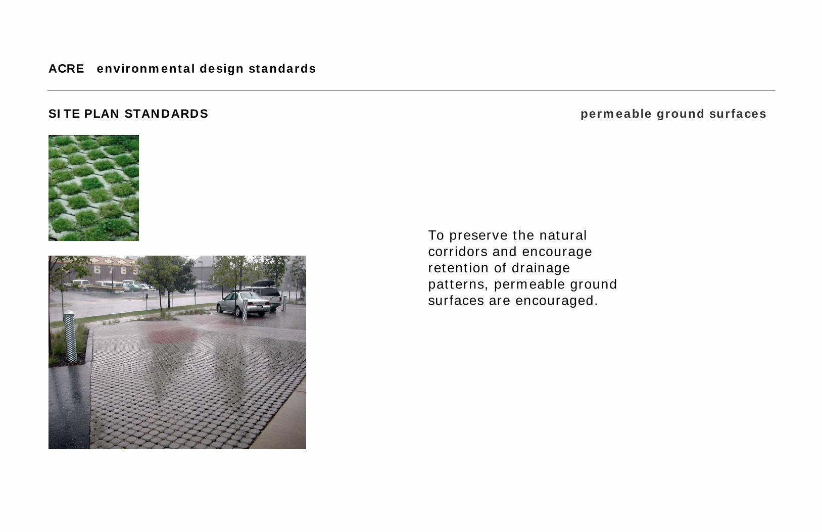
ACRE environmental design standards SITE PLAN STANDARDS permeable ground surfaces
To preserve the natural corridors and encourage retention of drainage patterns, permeable ground surfaces are encouraged.
13

ACRE environmental design standards SITE PLAN STANDARDS bioswales
ACRE Operational and Building Standards are essential. Components may include: district heating and cooling, and an overall drainage strategy to allow for bioswales and pervious surfaces.
14

ACRE environmental design standards interim street and bridge cross sections SITE PLAN STANDARDS Texas crossing and two lane roadway with bioswale
15

ACRE environmental design standards SITE DESIGN STANDARDS solar lighting
ACRE Standards will address: The need for exterior solar lighting with a unified design concept.
16
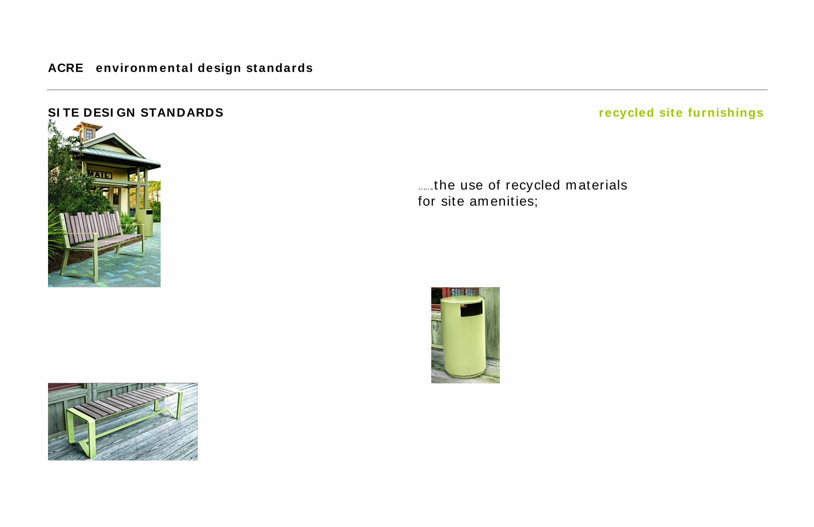
ACRE environmental design standards SITE DESIGN STANDARDS recycled site furnishings
…….the use of recycled materials for site amenities;
17

ACRE environmental design standards SITE DESIGN STANDARDS minimize fencing impacts
perimeter fencing street frontage fencing trail fencing security poly-coated fencing,
an alternative to galvanized chainlink
………the minimization of fencing impacts with recognized need for security;
18
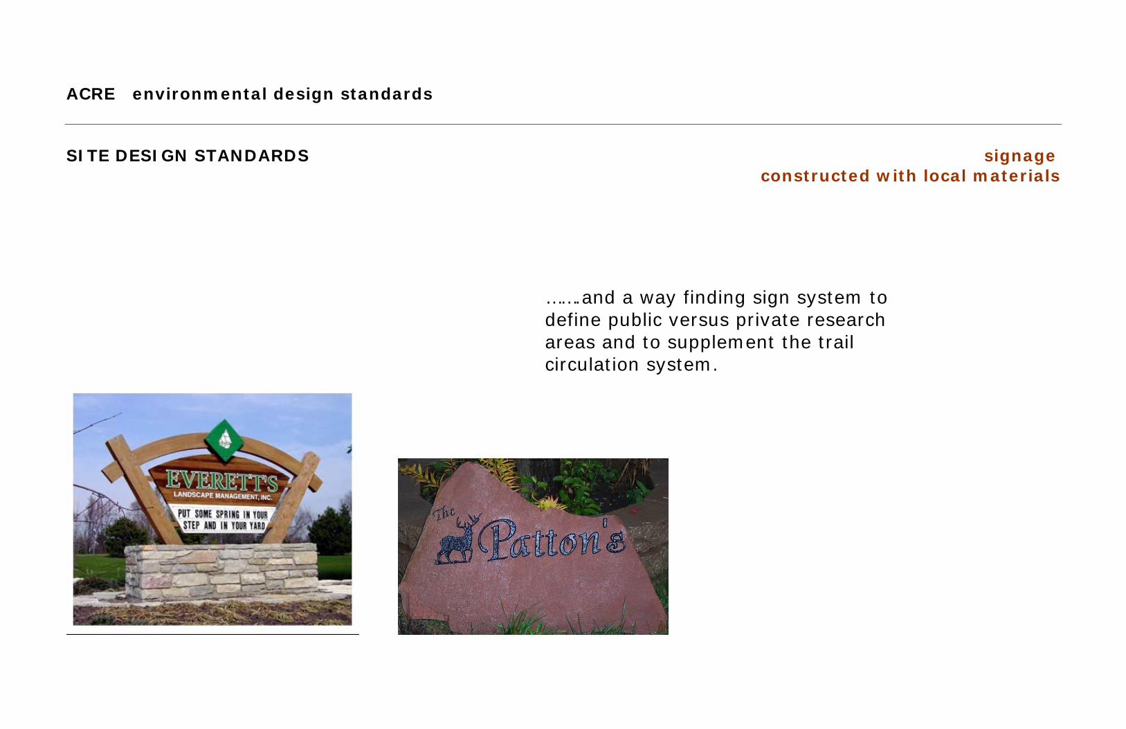
ACRE environmental design standards SITE DESIGN STANDARDS signage
constructed with local materials
…….and a way finding sign system to define public versus private research areas and to supplement the trail circulation system.
19