A Survey of Roadside Conservation Values in the Shire of ...
36
A Survey of Roadside Conservation Values in the Shire of Woodanilling and Roadside Management Guidelines September 2003 - Roadside Conservation Committee Declared Rare Flora, such as Verticordia fimbrilepis subsp. fimbrilepis occur along roadsides in the Shire of Woodanilling Photos: WA Herbarium, taken by E.A.George, N.J.Stevens, R.Smith,
Transcript of A Survey of Roadside Conservation Values in the Shire of ...

A Survey of Roadside
Conservation Values
in the Shire of Woodanilling
and Roadside Management
Guidelines
September 2003 - Roadside Conservation Committee
Declared Rare Flora, such as Verticordia fimbrilepis subsp. fimbrilepis occur along roadsides in the Shire of Woodanilling Photos: WA Herbarium, taken by E.A.George, N.J.Stevens, R.Smith,

CONTENTS
1.0 Introduction 1
1.1 Flora and Fauna 1
1.2 Weeds 3
2.0 Values of Roadsides 5
3.0 Legislation 7
4.0 Assessment Process 8
4.1 Methods 8
4.2 Quantifying Conservation Values 9
4.3 Mapping Conservation Values 9
5.0 Survey Data Results 11
6.0 Management Techniques 16
6.1 Minimal Disturbance 17
6.2 Code of Practice 17
6.3 Tree Roads 17
6.4 Flora Roads and Roads Important for Conservation 18
6.5 Special Environment Areas 18
6.6 Special Environment Area Register 19
7.0 Roadside Planning, Strategies and Action Plans 20
7.1 Planning 20
7.2 Strategies 21
7.3 Roadside Action Plans 22
References 24

FIGURES
Figure 1. Climate statistics
Figure 2. Conservation status of roadsides in the
Shire of Woodanilling
Figure 3. Native vegetation on roadsides
Figure 4. Extent of native vegetation
Figure 5. Number of native species
Figure 6. Weed infestation
Figure 7. Value as a biological corridor
Figure 8. Predominant adjoining land use
Figure 9. Marking SEA sites in the field
TABLES
Table 1. Colour codes used to depict the conservation
status of roadsides
Table 2 Summary of roadside conditions in the Shire
of Woodanilling
APPENDICES
Appendix 1. Definitions of remnant vegetation types
Appendix 2. Standard survey sheet
Appendix 3. Raw data used to calculate conservation values
Appendix 4. Plant species in the Shire of Woodanilling

A survey of the roadside conservation values in the Shire of Woodanilling and roadside management guidelines
1
1.0 INTRODUCTION
Woodanilling is located 250 km south east of Perth in Western Australia’s south west land
division. The Shire covers an area of 1126km2 and supports a population of 409 people. The
area experiences a mediterranean climate with an average annual rainfall of 455.6 mm.
Seasonal temperatures are characterised by warm summers, with maxima averaging in the
high twenties, and mild winters, with maxima in the mid teens. Mean daily maximum and
minimum temperatures and rainfalls are shown below (Figure 1).
Figure 1. Monthly average maximum and minimum temperatures (C) and rainfall (mm) in the
Shire of Woodanilling.
Typical of the region, the major agricultural pursuits are cereal crops, sheep and cattle.
Tourism is also an important industry with the area's spectacular natural resources being a
major attraction. Salient features of the area include a heritage trail, Wingedyne Nature
Reserve, Martup Pool, Queerearrup Lake and the wildflowers that abound in the area.
1.1 Flora and Fauna
Based on WA Herbarium records, almost 400 species of plants have been recorded from the
Shire of Woodanilling. These include 14 species of Acacia, 23 species of Orchids, 21 species
of Eucalypt and 17 species of Verticordia, see Appendix 4.
0
5
10
15
20
25
30
35
J F M A M J J A S O N D
Month
Tem
pera
ture
(o
C)
0
10
20
30
40
50
60
70
80
90
Rain
fall
(m
m)
Maximum temperature (0C) Minimum temperature (0C) Rainfall (mm)

A survey of the roadside conservation values in the Shire of Woodanilling and roadside management guidelines
2
Conostylis drummondii Photo- WA Herbarium, taken by S.D. Hopper
Declared rare flora (DRF) refers to species, or populations of native plants that are of great
significance and should be treated with special care when road and utility service, construction
or maintenance is undertaken. Populations of DRF along roadsides are designated Special
Environment Area’s (SEA’s), and are marked out by yellow stakes with an identification plate
welded on, see section 6.5 and figure 9.
Based on information from the Department of
Conservation and Land Management (DCLM), there
are nine populations of rare and priority flora on
roadsides in the Shire of Woodanilling. Seven of these
locations are vested in the Shire, and two are vested
in Main Roads WA.
Species of declared rare, or priority flora, in the Shire
include:
• Verticordia fimbrilepis subsp. fimbrilepis
• Jacksonia velveta
• Verticordia fimbrilepis subsp. fimbrilepis
• Conostylis drummondii
• Dryandra acanthopoda
• Jacksonia velveta
Dryandra acanthopoda Photos- WA Herbarium, taken by J.A.Cochrane, M.Hancock, M.Pieroni
Jacksonia velveta Photo-WA Herbarium, taken by C. Broex

A survey of the roadside conservation values in the Shire of Woodanilling and roadside management guidelines
3
Information collected by the Department of Conservation and Land Management indicated that
a number of threatened species of fauna have also been recorded and/or observed in the
Shire.
These include:
• Chuditch (Dasyurus geoffroii)
• Red-tailed Phascogale
(Phascogale calura)
• Western Brush Wallaby
(Macropus irma),
• Numbat (Myrmecobius
fasciatus),
• Carpet Python (Morelia spilota
imbricata)
1.2 Weeds Weed invasion along roadsides is an important issue, as they impact on many aspects and
values of the road reserve per se. Weeds are often disturbance colonisers and as such invade
roadsides, often increasing the fire risk, degrading biodiversity values or interfering with the
road and its infrastructure. The effect of weed infestations on native plant populations can be
severe, often with flow on effects for native fauna, such as diminished habitat or food
resources.
WA Herbarium records indicate 12 main
weed species recorded in the Shire of
Woodanilling, see next page.
Please note - this should not be
considered as a complete list, as
collectors often overlook weeds as
legitimate botanical specimens.
Stinkwort (Dittrichia graveolens) is a common roadside weed Photo- WA Herbarium, taken by K.C. Richardson
Chuditch Photo by Bert and Babs Wells

A survey of the roadside conservation values in the Shire of Woodanilling and roadside management guidelines
4
List of exotic plants (weeds) recorded in the Shire of Woodanilling: Botanical Name Common Name Asparagus asparagoides Bridal creeper Chrysanthemoides monilifera subsp. Monilifera Boneseed, bitou bush Dittrichia graveolens Stinkwort Eragrostis Lovegrass Helichrysum leucopsideum Common heliotrope Hordeum geniculatum Mediterranean barley grass Ixia maculata Yellow ixia Lolium perenne x rigidum Ryegrass Monopsis debilis Pennisetum setaceum Fountain grass Solanum hoplopetalum Afghan thistle Sparaxis bulbifera Vaccaria hispanica Cowcockle
Sparaxis bulbifera Photo- WA Herbarium, taken by R.Randall
Pennisetum setaceum Photo- Western Weeds (1997)
Monopsis debilis Photo- Western Weeds (1997)

A survey of the roadside conservation values in the Shire of Woodanilling and roadside management guidelines
5
2.0 VALUE OF ROADSIDES
Since the settlement of Western Australia by Europeans, large areas of native vegetation in
the south west of the state have been cleared to make way for agriculture and other
development ventures. The fragmentation of the more or less continuous tracts of native
vegetation suites by clearing has resulted in the isolation of plant and animal populations and
communities. Populations of flora and fauna restricted to these man-made biogeographical
islands of small remnants are prone to food shortages, disease and reduced genetic diversity.
However, the presence of native vegetation along roadsides can often assist in alleviating this
isolation effect by providing corridors between bush remnants, thereby facilitating the
movement of biota across the landscape. Unfortunately the protective mantle afforded by the
native flora has been badly depleted with now only approximately 14,367 ha, or 12.9% of
remnant vegetation remaining in the Shire of Woodanilling. (Beeston et al, 2001).
Trees are good - bush is better
Remnant native vegetation includes more than just trees. Trees, shrubs and ground covers
(creepers, grasses and herbs) combine to provide valuable food and shelter for different types
of wildlife. Existing native vegetation will require less maintenance if left undisturbed.
Native trees, shrubs and grasses on the roadside are valuable because they: - Often are the only remaining example of original vegetation within cleared areas;
- Are easier to maintain and generally less fire prone than introduced vegetation;
- Provide habitat for many native species of plants, mammals, reptiles amphibians and
invertebrates;
- Provide wildlife corridors linking other areas of native vegetation;
- Often contain rare and endangered plants and animals;
- Provide the basis for our important wildflower tourism industry; the aesthetic appeal of well-
maintained roadsides should not be overlooked and they have the potential to improve local
tourism and provide a sense of place. As well as creating a more favourable impression of
an area, roadsides attract tourists who visit specifically to view wildflowers.
- Often contain sites of historical or cultural significance;
- Provide windbreaks and stock shelter areas for adjoining farmland; (This can help stabilise
temperature and reduce evaporation, and thereby providing microhabitat more suitable to
higher levels of productivity. Well-conserved roadsides also assist with erosion and salinity
control. In addition, native vegetation on roadsides is generally far less of a fire threat than
annual weeds. Undisturbed roadsides provide a benchmark for the study of soil change
during agricultural development).
- Are a vital source of local seed for revegetation projects. In lieu of other alternatives and
cognisant of limitations; road reserves can also provide a valuable source of seed for

A survey of the roadside conservation values in the Shire of Woodanilling and roadside management guidelines
6
regeneration projects. This is especially pertinent to shrub species, as clearing and grazing
beneath farm trees often removes this layer. Approval of the local shire and a CALM
permit are required prior to collection.
In a time of rapid change where the demands placed on the natural world are many, it is vital
that there is a coordinated management of lands across all tenures to ensure the sustainability
and integrity of the natural biota and processes, agricultural lands and service infrastructure. It
is somewhat ironic that the reserves established to cater for a transport system in a modern
world are now an integral component of this coordinated management approach.
Roadsides ……………………………… the vital linkRoadsides ……………………………… the vital linkRoadsides ……………………………… the vital linkRoadsides ……………………………… the vital link

A survey of the roadside conservation values in the Shire of Woodanilling and roadside management guidelines
7
3.0 LEGISLATION
Uncertainty often exists in the minds of many with regard to the ‘ownership’, control and
management of 'the roadside'. This problem is also exacerbated by the multitude of legislative
reference to activities within a transport corridor.
The Department of Conservation and Land Management (DCLM) has the legislative
responsibility to manage and protect all native flora and fauna in Western Australia. It is
important to note that all flora and fauna is protected under provisions of the Wildlife
Conservation Act 1950 and cannot be taken unless it is taken in a lawful manner. In addition
to the general provisions relating to protected flora under the Wildlife Conservation Act, special
protection is afforded to flora that is declared as rare or threatened under section 23F of the
Wildlife Conservation Act.
The legislation pertaining to the management of road reserves is complex and includes those
listed below.
State legislation:
- Aboriginal Heritage Act 1972
- Agriculture and Related Resources Protection Act 1976
- Bush Fires Act 1954
- Conservation and Land Management Act 1984
- Environmental Protection Act 1986
- Heritage of WA Act 1990
- Land Act 1933
- Local Government Act 1995
- Main Roads Act 1930
- Mining Act 1978
- Soil and Land Conservation Act 1945
- State Energy Commission Supply Act 1979
- Water Authority Act 1987
- Wildlife Conservation Act 1950-1979
Commonwealth legislation:
- Environment Protection and Biodiversity Conservation Act 1999
It is recommended that a cautionary approach be taken when working within roadsides, and
that the relevant authority be contacted if there is any doubt about the management or
protection of heritage or conservation values present in the roadsides.

A survey of the roadside conservation values in the Shire of Woodanilling and roadside management guidelines
8
The Environmental Protection Amendment Bill 2002 is currently before parliament and it is
envisaged that this will require greater adherence to legislative requirements before native
vegetation is cleared. This legislation will provide for two types of permits which will provide
for permission to clear native vegetation, however they will have certain conditions attached to
them. One of these will be to prepare, implement and adhere to a roadside or specific tenure
management plan. Before any native vegetation clearing is undertaken it is emcumbent on the
project manager or land manager to ensure that the proposed clearing is being carried out
under the terms and conditions of the pending legislation, as there are transitional provisions
within it, which are retrospective from 26th June 2002.
4.0 ASSESSMENT PROCESS
4.1 Methods
The methods to assess and calculate the conservation value of the roadside reserves are
described in Jackson (2002). The process involves scoring a set of pre-selected attributes,
which, when combined, represent a roadside's conservation status. A list of these attributes is
presented on a standard survey sheet, see Appendix 2. This provides both a convenient and
uniform method of scoring. Ideally, the survey is undertaken by a group of local volunteers,
who, aided by their knowledge of the area, are able to provide an accurate and cost effective
method of data collection. Community participation also ensures a sense of 'ownership' of the
end product, which increases the likelihood of its acceptance and use by the local community
and road managers. Lamont and Blyth (1995).
Fieldwork was conducted by David Lamont and RCC volunteer Siusan Campbell-Lamont
during the months of November 1997 and April 1998.
It is now hoped that the data collected will be used
by all sectors of the community who have an
interest in the roadside environment.
A survey of the roadside conservation values in the Shire of Woodanilling and roadside management guidelines
9
4.2 Quantifying Conservation Values
The following attributes were used to assess a quantitative measure of conservation value:
- native vegetation on roadside;
- extent of native vegetation along length of roadside;
- number of different native species;
- weed infestation;
- value as a biological corridor;
- predominant adjoining land use.
Each of these attributes was given a score ranging from 0 to 2 points. The combined scores
provide a conservation score ranging from 0 to 12. The conservation values, in the form of
conservation status categories, are represented by the following colour codes
Conservation Value Conservation Status Colour Code
9 - 12 High Dark Green 7 – 8 Medium High Light Green 5 – 6 Medium Low Dark Yellow 0 - 4 Low Light Yellow
Table 1: Colour codes used to depict the conservation status of roadsides.
The following attributes were also noted but did not contribute to the conservation value score:
• width of road reserve;
• width of vegetated roadside;
• presence of utilities/disturbances;
• dominant native species;
• dominant weeds;
• fauna observed;
• general comments. It is felt that the recording of these attributes will provide a community database that would
provide information useful in many spheres local government and community interest.
4.3 Mapping Conservation Values
A computer generated (GIS Arc Info) map, at a scale of 1:100 000, depicting the conservation
status of the roadside vegetation and the width of the road reserves within the Shire of
Woodanilling was produced. The data used to produce both the map and the following figures
and tables are presented in Appendix 3.
The roadside conservation value map initially provides an inventory of the status quo of the
condition of the roadside vegetation. This is important as quality of roadside vegetation has far
A survey of the roadside conservation values in the Shire of Woodanilling and roadside management guidelines
10
reaching implications for sustaining biodiversity, tourism and landcare values. Moreover the
data and map can be incorporated as a management and planning tool for managing the
roadsides per se, as it enables the condition of roadside vegetation to be easily assessed.
This information can then be used to identify environmentally sensitive areas, high
conservation roadsides or strategically important areas, and thus ensure their conservation.
Conversely it enables degraded areas to be identified as areas important for strategic
rehabilitation, or in need of specific fire management techniques or regimes and weed control
programmes.
The map can also be used as a reference to overlay transparencies of other information
relevant to roadside conservation. Data obtained from MRWA, DCLM and the Department of
Agriculture WA can been used to produce an overlay map that depicts the location of remnant
vegetation on both the Crown estate and privately owned land. This enables the roadside
vegetation to be assessed in the context of its importance to the shire’s overall conservation
network. Other transparencies, such as the degree of weed infestation, or the location of
environmentally sensitive areas or future planned developments, could also be produced as
an aid to roadside management.
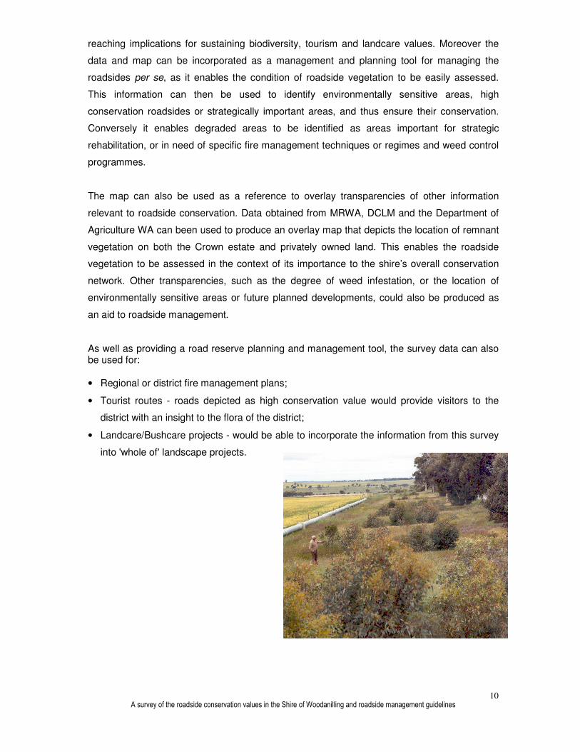
As well as providing a road reserve planning and management tool, the survey data can also be used for:
• Regional or district fire management plans;
• Tourist routes - roads depicted as high conservation value would provide visitors to the
district with an insight to the flora of the district;
• Landcare/Bushcare projects - would be able to incorporate the information from this survey
into 'whole of' landscape projects.

A survey of the roadside conservation values in the Shire of Woodanilling and roadside management guidelines
11
5.0 SURVEY DATA RESULTS
A summary of the general roadside conditions in the Shire of Woodanilling is presented in
Table 2. The survey data have been collated to provide the total kilometres, and percentages,
of roadside occupied by each of the conservation status categories and the attributes used to
calculate the conservation values (Table 2).
Table 2: Summary of roadside conditions along roads in the Shire of Woodanilling. As roadsidTable 2: Summary of roadside conditions along roads in the Shire of Woodanilling. As roadsidTable 2: Summary of roadside conditions along roads in the Shire of Woodanilling. As roadsidTable 2: Summary of roadside conditions along roads in the Shire of Woodanilling. As roadsides occur es occur es occur es occur on both sides of the road, roadside distances (km) are equal to twice the actual distance of road on both sides of the road, roadside distances (km) are equal to twice the actual distance of road on both sides of the road, roadside distances (km) are equal to twice the actual distance of road on both sides of the road, roadside distances (km) are equal to twice the actual distance of road travelled.travelled.travelled.travelled. Conservation Status of Roadsides Roadside sections of high conservation value covered 165.2 km of roadside, 17.3% of the
length of roadside surveyed. Medium-high conservation areas accounted for 261.5km of
roadside, 27.4% of the total surveyed. Medium-low conservation roadside covered 439.3km,
46% of the total surveyed. Areas of low conservation occupied 89.5km, 9.4% of the roadside
surveyed (Table 2, Figure 2).
Conservation Status (km) Native Vegetation on Roadside (km) Weed Infestation (km)
High (9-12) 165.2 17.3% 2 - 3 veg layers
258.6 27.1% Light (2) 253.5 26.5%
Med (7-8) 261.5 27.4% 1 veg layer 674.7 70.6% Medium (1)
634.4 66.4%
Med (5-6) 439.3 46.0% 0 veg layers
22.2 2.3% Heavy (0) 67.6 7.1%
Low (0-4) 89.5 9.4%
Total 955.5 100.0% Total 955.5 100.0%
Conservation Values (km) Extent of Native Vegetation (km) Value as Biological Corridor (km)
0 0.0 0.0% >80%, Good (2)
48.5 5.1% High (2) 305.8 32.0%
1 12.3 1.3% 20-80 % Med (1)
788.3 82.5% Medium (1)
480.6 50.3%
2 21.9 2.3% <20% Low (0)
118.7 12.4% Low (0) 169.1 17.7%
3 19.1 2.0%
4 36.2 3.8% Total 955.5 100.0% Total 955.5 100.0%
5 132.2 13.8%
6 307.1 32.1% Number of Native Species (km) Adjoining Land Use (km)
7 194.7 20.4%
8 66.9 7.0% Over 20 (2)
162.7 17.0% Cleared 15.4 1.6%
9 73.5 7.7% 6 - 19 (1) 710.2 74.3% Scattered 889.3 93.1%
10 61.3 6.4% 0 - 5 (0) 82.7 8.7% Uncleared 50.2 5.3%
11 30.4 3.2% Other 0.7 0.1%
12 0.0 0.0% Total 955.5 100.0% Urban
Railway 0.7
Total 955.5 100.0% Drain
Plantation
Period of survey: Nov 97 - April 98 Total 955.5 100.0%

A survey of the roadside conservation values in the Shire of Woodanilling and roadside management guidelines
12
High (17.3%)
Medium high (27.4%) Medium low (46.0%)
Low (9.4%)
Figure 2: Conservation Status of roadsides in the Shire of Woodanilling.Figure 2: Conservation Status of roadsides in the Shire of Woodanilling.Figure 2: Conservation Status of roadsides in the Shire of Woodanilling.Figure 2: Conservation Status of roadsides in the Shire of Woodanilling.
The Native Vegetation on Roadside value is determined from the number of native vegetation
layers from either the tree, shrub or ground layers. Sections with at least two layers of native
vegetation covered 27.1% of the roadside, 70.6% had only one layer and 2.3% had no layers
of native vegetation (Table 2, Figure 3).
2 - 3 vegetation layers (27.1%)
1 vegetation layer (70.6%)
0 vegetation layers (2.3%)
Figure 3: Native Vegetation on RoFigure 3: Native Vegetation on RoFigure 3: Native Vegetation on RoFigure 3: Native Vegetation on Roadside.adside.adside.adside.

A survey of the roadside conservation values in the Shire of Woodanilling and roadside management guidelines
13
Roadside vegetation with a good Extent of Native Vegetation value, ie with native vegetation
cover greater than 80%, occurred along 5.1% of the length of roadside surveyed. Survey
sections with 20 to 80% cover of native vegetation, accounted for 82.5% of the roadside. The
remaining 12.4% had less than 20% native vegetation and, therefore, low Extent of Native
Vegetation value (Table 2, Figure 4).
>80%, Good (5.1%)
20-80 % Medium (82.5%)
<20% Low (12.4%)
Figure 4: Extent of Native Vegetation.Figure 4: Extent of Native Vegetation.Figure 4: Extent of Native Vegetation.Figure 4: Extent of Native Vegetation. The Number of Native Species score provides a measure of the diversity of the vegetation.
Survey sections with more than 20 plant species spanned 17% of the roadside. Roadside
sections with between 6 and 19 plant species accounted for 74.3% of the roadside. The
remaining 8.7% of roadside had less than 6 plant species and, therefore, nil contribution to the
conservation value scores (Table 2, Figure 5).
Over 20 species (17.0%)
6 – 19 species (74.3%)
0 - 5 Species (8.7%)
Figure 5: Number of Native Species.Figure 5: Number of Native Species.Figure 5: Number of Native Species.Figure 5: Number of Native Species.

A survey of the roadside conservation values in the Shire of Woodanilling and roadside management guidelines
14
26.5% of the roadside surveyed was only lightly affected by weeds. Medium level weed
infestation occurred on 66.4% of the roadside. Whilst 7.1% of the roadside was heavily
affected by weeds (Table 2, Figure 6).
Light (26.5%)
Medium (66.4%)
Heavy (7.1%)
Figure 6: Weed Infestation. Light infestation = weeds less than 20% of ground layer. MediuFigure 6: Weed Infestation. Light infestation = weeds less than 20% of ground layer. MediuFigure 6: Weed Infestation. Light infestation = weeds less than 20% of ground layer. MediuFigure 6: Weed Infestation. Light infestation = weeds less than 20% of ground layer. Medium infestation m infestation m infestation m infestation = weeds 20 to 80% of the ground layer. Heavy infestation = weeds more than 80% of the ground layer.= weeds 20 to 80% of the ground layer. Heavy infestation = weeds more than 80% of the ground layer.= weeds 20 to 80% of the ground layer. Heavy infestation = weeds more than 80% of the ground layer.= weeds 20 to 80% of the ground layer. Heavy infestation = weeds more than 80% of the ground layer. The Value as a Biological Corridor score is largely dependent upon the diversity of habitat and
whether the corridor connects areas of uncleared land. High value biological corridor (as
determined by the roadside surveyors) was present along 32% of the roadside, medium value
along 50.3% of the roadside and low value corridor 17.7% (Table 2, Figure 7).
High (32.0%)
Medium (50.3%)
Low (17.7%)
Figure 7: ValuFigure 7: ValuFigure 7: ValuFigure 7: Value as Biological Corridor.e as Biological Corridor.e as Biological Corridor.e as Biological Corridor.

A survey of the roadside conservation values in the Shire of Woodanilling and roadside management guidelines
15
Most land adjoining the roadsides had at least some natural vegetation remaining. A scattered
distribution of native vegetation was present on the land adjoining 93.1% of the roadside,
whilst 5.3% of roadside was adjoined by land that had not been cleared. 1.6% of the roadside
surveyed was adjoined by land that had been totally cleared of its native vegetation. Railway
reserve adjoined the remaining 0.1% of roadside (Table 2, Figure 8).
Figure 8: Predominant Adjoining Land Use.Figure 8: Predominant Adjoining Land Use.Figure 8: Predominant Adjoining Land Use.Figure 8: Predominant Adjoining Land Use.
Scattered
93.1%
Cleared
1.6%
Uncleared
5.3%Railway
0.1%

A survey of the roadside conservation values in the Shire of Woodanilling and roadside management guidelines
16
6666.0 MANAGEMENT TECHNIQUES
The primary aim of road management is the creation and maintenance of a safe, efficient road
system. However, the following management procedures should be adopted.
The following section provides management recommendations that will assist in retaining and
enhancing roadside conservation value. These guidelines are taken from the Roadside
Conservation Committee's Roadside Manual and or the Roadside Handbook. The Executive
Officer of the Roadside Conservation Committee is also available to assist on all roadside
conservation matters and can be contacted on (08) 9334 0423.
High Conservation Value Roadsides:
Management Goal �
Maintain and enhance the native plant
communities.
Management Guidelines � Minimise disturbance to existing vegetation.
Disturbance leads to weed invasion, which
downgrades the conservation value, and increases
the fire threat.
Medium Conservation Value Roadsides:
Management Goal � Maintain native vegetation wherever possible, and
to encourage its regeneration.
Management Guidelines � Minimise disturbance to existing vegetation.
With the information available on weed infestation
on roadsides within the Shire of Woodanilling,
consideration could be given to strategic roadside
weed control programmes.
Low Conservation Value Roadsides Management Goal
� Retain remnant trees and shrubs and encourage
their regeneration.
�
Encourage revegetation projects using indigenous
plants.
Management Guidelines � Minimise soil disturbance to reduce weed invasion.
Encourage revegetation projects by adjacent
landholders.

A survey of the roadside conservation values in the Shire of Woodanilling and roadside management guidelines
17
6.1 Minimal Disturbance
Minimal disturbance can be achieved by:
- adopting a road design that occupies the minimum space;
- diverting the line of a table drain to avoid disturbing valuable flora;
- pruning branches, rather than removing the whole tree or shrub;
- not dumping spoil on areas of native flora;
- observing dieback control measures as required;
- apply the Fire Threat Assessment (Roadside Manual chapter 9) before burning roadside
vegetation;
- use methods other than fuel reduction burns to reduce fire threat; if roadside burning must
be undertaken, incorporate it into a district fire management program;
- encourage adjacent landholders to set back fences to allow roadside vegetation to
proliferate;
- encourage adjacent landholders to plant windbreaks or farm tree lots adjacent to roadside
vegetation to create a denser wind or shelterbelt;
- encourage revegetation projects by adjacent landholders.
6.2 Code of Practice
A Code of Practice has been developed through collaboration with Main Roads WA, the WA
Local Government Association and the Roadside Conservation Committee. It is anticipated
that this document will be accepted as an industry standard for all working within, or interested
in roadsides conservation. This document provides defined parameters for all roadside
management works and also provides the local community with an overview of management
practices that will ensure the sustainability of native roadside vegetation. Please contact the
RCC Executive Officer on 9334 0423 for further information.
6.3 Tree Roads
Tree roads are defined as those roadsides with a sufficient density of mature trees to create
an attractive tunnel effect. Besides the aesthetic benefits, these areas also provide valuable
habitat for birds and other arboreal fauna. Since mature trees are slow growing and hard to
replace, care should be taken to conserve these avenues wherever possible. The points
following should be considered when working on Tree Roads:
- prune offending branches rather than remove the whole tree;
- cut branches off close to limb or tree trunk;
- divert line of table drain to avoid disturbing tree roots;

A survey of the roadside conservation values in the Shire of Woodanilling and roadside management guidelines
18
- import fill to build up formation, rather than using side-borrow from roadside;
- when using herbicide for weed control on the roadside do not use a soil residual type, such
as Siomazine or Atrazine. Eucalypts are especially sensitive to these;
- encourage the adjoining landholders to plant shelter belts on their property that will
complement the roadside vegetation.
6.4 Flora Roads and Roads Important for Conservation
Flora Roads are significant sections of road having a special conservation value due to the
vegetation growing on the road reserve. Signs are available from the RCC to mark these
roads as Flora Roads. This has a twofold effect of drawing the attention of tourists to the high
conservation roadside and it also alerts all that work in the roadside environment that the
marked section of roadside requires due care to protect the values present
In order to plan roadworks so that important areas of roadside vegetation are not disturbed,
road managers should know of these areas. It is suggested that the Shire Engineer or
Environmental Officer establish a Register of Roads Important for Conservation. The following
guidelines should be considered prior to establishing this registrar:
- the roadside must contain a significant population of native vegetation, (introduced trees
and grasses are not important for conservation;
- the native vegetation must be in as near to its natural condition as possible;
- in undisturbed vegetation several layers of plants occur, i.e. trees, shrubs and
groundcovers (herbs or native grasses). if one or more of the expected layers are missing,
the conservation value is reduced;
- the roadside may be the only remaining example of original vegetation within a cleared
area. it thus assists in vegetation mapping and distribution studies, provides a benchmark
for study of soil change during agricultural development, may provide a source of local seed
for revegetation projects and acts as a wildlife habitat for the protection of fauna;
- rare or endangered plants may occur on the roadside;
- it may provide nest sites and refuges for native animals. Dense vegetation provides habitat
for avifauna and invertebrates.
6.5 Special Environmental Areas A ‘Special Environmental Area’ is a section of roadside that has such significance that it
requires special protection. Reasons for establishing ‘Special Environmental Areas’ can
include:
- Protection of rare or threatened species of native plants;
- Protection of sites that have other high conservation, scientific or aesthetic values;

A survey of the roadside conservation values in the Shire of Woodanilling and roadside management guidelines
19
- Protection of Aboriginal or European cultural sites.
‘Special Environmental Areas’ can be delineated by the use of site markers. See Figures 9 &
10 for design and placement of SEA markers. Workers who come across a ‘Special
Environmental Area’ marker in the field should not disturb the area between the markers
unless specifically instructed. If in doubt, the Supervisor, Shire Engineer or CEO should be
contacted.
Western Power and WestNet rail also have systems for marking sites near power or rail lines.
Examples of these are seen in the picture below.
6.6 Special Environmental Area Register To ensure that knowledge of rare flora and other sites does not get lost due, perhaps, to staff
changes, a Local Authority should establish a Special Environmental Area Register. This
should outline any special treatment, which the site should receive, and be consulted prior to
any work in the area being initiated in the area.
The Special Environmental Area Register should be consulted by the appropriate person prior
to starting work on any particular road, to ensure that inadvertent damage does not occur. All
Special Environment Area sites should be marked on the Shire map, which records Roadside
Conservation Value
Special Environment Area Site marker

A survey of the roadside conservation values in the Shire of Woodanilling and roadside management guidelines
20
Local Government is encouraged to permanently mark Special Environmental Areas to
prevent inadvertent damage to the rare flora or other values being protected. Markers of a
uniform shape and colour will make recognition easier for other authorities using road
reserves.
Figure 9- Marking sites in the field
When notified of a population needing marking, the Local Authority should contact the
appropriate C.A.L.M. Regional or District office for assistance to ensure the exact site location
and correct positioning of marker posts.
7.0 ROADSIDE PLANNING, STRATEGIES AND ACTION PLANS
7.1 Planning
The RCC is able to provide good models of Roadside Management Plans and encourages all
shires to adopt this practice of planning for roadside conservation. The following actions
greatly enhance likelihood of a plan that changes behaviour and results in on-ground actions:
� Community support:
Encourage ongoing community involvement and commitment by establishing a local Roadside
Advisory Committee or working group within the Shire Environmental Committee;
� Contract specifications:
Maintain roadside values by developing environmental specifications for inclusion in all tender
documents or work practices;
� Community education:
Use of innovative and pertinent material can increase community understanding of roadside
values;

A survey of the roadside conservation values in the Shire of Woodanilling and roadside management guidelines
21
� Training:
Promote local roadside planning initiatives and gain acceptance and understanding by
involving shire staff, contractors, utility provider staff and the community in workshops,
seminars or training days.
Training develops recognition and understanding of roadside values and highlights best work
practices. Workshops are developed to ensure that local issues and environments are dealt
with and they include site visits to high conservation remnants, current projects and works.
The objective of all roadside management planning should be to:
� Protect
- native vegetation
- rare or threatened flora or fauna
- cultural and heritage values
- community assets from fire
� Maintain
- safe function of the road
- native vegetation communities
- fauna habitats and corridors
- visual amenity and landscape qualities
- water quality
� Enhance
- indigenous vegetation communities
- fauna habitats and corridors
� Minimise
- land degradation
- spread of weeds and vermin
- spread of soil borne pathogens
- risk and impact of fire
- disturbance during installation and
maintenance of service assets
7.2 Strategies The development of a strategy enables potentially competing uses to coexist and ensures that
roadsides have a coordinated approach to management. When producing regional strategies
the RCC suggests that:
- organisational support from local government is essential from the outset;
- strategies should take no longer that 12 months to produce (including a period for
community comment);
- communities need to be provided with background information to make formal decisions.

A survey of the roadside conservation values in the Shire of Woodanilling and roadside management guidelines
22
Management strategies should be produced to address local issues, rather than be to a
standard format. Issues can be categorised as:
� Functional
- Firewood collection and timber
harvesting
- Fire prevention
- Installation and maintenance of
services
- Road construction and road widening
- Road maintenance
- Stockpile and dumpsite
management
- Vegetation removal
- Vehicle and machinery activity
- Water Supply Catchments
� Cultural and Recreational
- Cultural and heritage values
- Visual amenity
- Landscape values
- Wayside stops
- Horse riding
� Landcare
- Apiculture
- Insect Pests
- Pest animals
- Ploughing, cultivating or grading
- Revegetation and site rehabilitation
- Weeds
� Conservation
- Protecting and conserving remnant
native vegetation
- Rare, threatened or significant flora
and fauna
- Regeneration of native plant
communities
- Roadside marking of special
environmental areas
- Unused road reserves
- Wetlands
- Wildlife habitat
- Wildlife corridors

A survey of the roadside conservation values in the Shire of Woodanilling and roadside management guidelines
23
7.3 Roadside Action Plans A Roadside Action Plan is prepared for an individual road and contains a works
program that will enable conservation values and other road uses to be managed
compatibly. Roadside Action Plans are based on the guidelines that are produced as
part of the roadside strategy.
The RCC suggests that Roadside Action Plans be:
- short term documents (to be reviewed within 2 years);
- prepared on a need basis;
- prepared after consultation with major stakeholders;
- a maximum of 2 pages per road;
- names a person or agency responsible for implementing the management
recommendations.

A survey of the roadside conservation values in the Shire of Woodanilling and roadside management guidelines
24
References
Shepherd, D.P., Beeston, G.R., and Hopkins, A.J.M. (2001.). Native Vegetation in Western
Australia, Technical Report 249. Department of Agriculture, Western Australia, South Perth.
Jackson, K A (2002) Assessing Roadsides A Guide to Rating Conservation Value, Roadside
Conservation Committee, Kensington, Western Australia
Lamont, D.A. and Blyth, J.D. (1995). Roadside corridors and community networks, pp 425-35.
In Nature Conservation 4: The Role of Networks, ed by Saunders, D.A., Craig J.L., and
Mattiske E.M. Surrey Beatty & Sons, 1995.
Roadside Conservation Committee. (1990). Roadside Manual Roadside Conservation
Committee, Como WA
Lamont D A (1998) Western Australian Roadside Handbook, Environmental guidelines for
road construction and maintenance workers. Roadside conservation Committee, Kensington,
Western Australia.

A survey of the roadside conservation values in the Shire of Woodanilling and roadside management guidelines
25
APPENDIX ONE
Definitions of remnant vegetation types, Beeston et al (1993).
Vegetation classed as "remnant vegetation" has one or more of the following
characteristics (Beeston et al., 1993): * Most closely reflects the natural state of vegetation for a given area.
* Has an intact understorey (if forest or woodland).
* Has minimal disturbance by agents of human activity.
Vegetation classed as "modified vegetation" has one or more of the following
characteristics: * Degraded understorey (ie reduction in the number of native species, includes weeds).
* Obvious human disturbance-clearing, mining, grazing, weeds.
* Affected by salt.
* Narrow corridors of vegetation (usually along roads and railway lines or windbreaks),
which are more likely to be affected by edge effects.
Vegetation classed as "scattered vegetation" has: * No understorey
* Parkland cleared ie are scattered single trees.
* No significant signs or chance of regeneration.

A survey of the roadside conservation values in the Shire of Woodanilling and roadside management guidelines
26
APPENDIX 2
Standard Survey Sheet

A survey of the roadside conservation values in the Shire of Woodanilling and roadside management guidelines
27
APPENDIX 3
Raw data used to calculate the conservation values

A survey of the roadside conservation values in the Shire of Woodanilling and roadside management guidelines
28
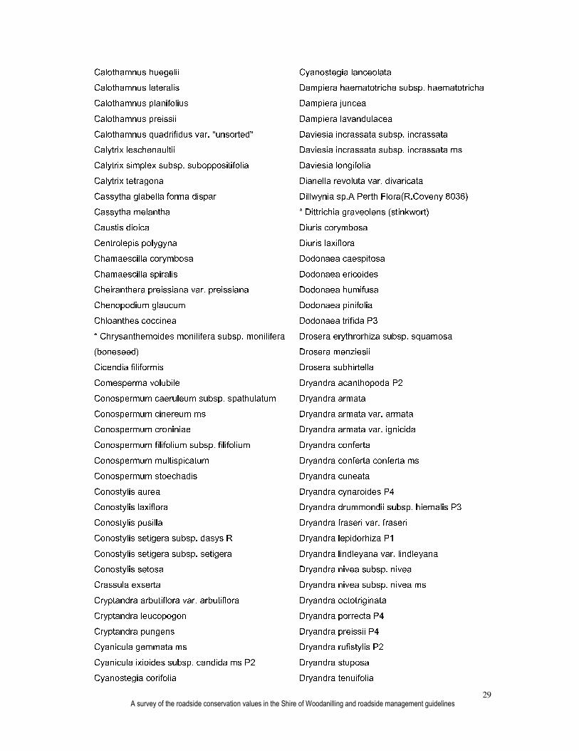
APPENDIX 4
Plant species in the Shire of Woodanilling Acacia acuminata subsp. acuminata ms Acacia ataxiphylla subsp. ataxiphylla ms P3 Acacia erinacea Acacia incurva Acacia lasiocarpa var. sedifolia Acacia leptospermoides subsp. leptospermoides Acacia lullfitziorum ms P3 Acacia microbotrya Acacia pulchella Acacia pulchella var. glaberrima Acacia pycnocephala Acacia saligna Acacia squamata Acacia stenoptera Acacia varia var. crassinervis Acacia varia var. parviflora Actinostrobus arenarius Adenanthos cygnorum subsp. cygnorum Allocasuarina humilis Allocasuarina microstachya Allocasuarina thuyoides Amphipogon turbinatus Amyema miquelii Amyema preissii Andersonia brevifolia Andersonia carinata P2 Andersonia nymphaea ms Andersonia parvifolia Anigozanthos humilis Anigozanthos humilis subsp. humilis Aphelia brizula Aphelia cyperoides * Asparagus asparagoides (bridal creeper) Astroloma aff. epacridis Astroloma cataphractum ms Astroloma epacridis
Astroloma pallidum Atriplex cinerea Austrodanthonia caespitosa Austrostipa hemipogon Baeckea crispiflora Baeckea floribunda Baeckea preissiana Baeckea pygmaea Banksia meisneri subsp. meisneri Banksia nutans var. cernuella Banksia prionotes Banksia sphaerocarpa var. caesia Banksia violacea Billardiera lehmanniana Blennospora drummondii Boronia scabra subsp. scabra ms Boronia spathulata Borya scirpoidea Bossiaea eriocarpa Brachysema celsianum Caesia occidentalis Caladenia caesarea subsp. caesarea ms Caladenia cairnsiana Caladenia dilatata Caladenia dorrienii R Caladenia falcata Caladenia flava Caladenia longicauda subsp. eminens ms Caladenia longiclavata Caladenia luteola ms P2 Caladenia pendens subsp. pendens ms Caladenia reptans subsp. reptans ms Caladenia uliginosa subsp. uliginosa ms Caladenia x cala ms Caladenia xantha ms Calectasia grandiflora
A survey of the roadside conservation values in the Shire of Woodanilling and roadside management guidelines
29
Calothamnus huegelii Calothamnus lateralis Calothamnus planifolius Calothamnus preissii Calothamnus quadrifidus var. "unsorted" Calytrix leschenaultii Calytrix simplex subsp. suboppositifolia Calytrix tetragona Cassytha glabella forma dispar Cassytha melantha Caustis dioica Centrolepis polygyna Chamaescilla corymbosa Chamaescilla spiralis Cheiranthera preissiana var. preissiana Chenopodium glaucum Chloanthes coccinea * Chrysanthemoides monilifera subsp. monilifera (boneseed) Cicendia filiformis Comesperma volubile Conospermum caeruleum subsp. spathulatum Conospermum cinereum ms Conospermum croniniae Conospermum filifolium subsp. filifolium Conospermum multispicatum Conospermum stoechadis Conostylis aurea Conostylis laxiflora Conostylis pusilla Conostylis setigera subsp. dasys R Conostylis setigera subsp. setigera Conostylis setosa Crassula exserta Cryptandra arbutiflora var. arbutiflora Cryptandra leucopogon Cryptandra pungens Cyanicula gemmata ms Cyanicula ixioides subsp. candida ms P2 Cyanostegia corifolia
Cyanostegia lanceolata Dampiera haematotricha subsp. haematotricha Dampiera juncea Dampiera lavandulacea Daviesia incrassata subsp. incrassata Daviesia incrassata subsp. incrassata ms Daviesia longifolia Dianella revoluta var. divaricata Dillwynia sp.A Perth Flora(R.Coveny 8036) * Dittrichia graveolens (stinkwort) Diuris corymbosa Diuris laxiflora Dodonaea caespitosa Dodonaea ericoides Dodonaea humifusa Dodonaea pinifolia Dodonaea trifida P3 Drosera erythrorhiza subsp. squamosa Drosera menziesii Drosera subhirtella Dryandra acanthopoda P2 Dryandra armata Dryandra armata var. armata Dryandra armata var. ignicida Dryandra conferta Dryandra conferta conferta ms Dryandra cuneata Dryandra cynaroides P4 Dryandra drummondii subsp. hiemalis P3 Dryandra fraseri var. fraseri Dryandra lepidorhiza P1 Dryandra lindleyana var. lindleyana Dryandra nivea subsp. nivea Dryandra nivea subsp. nivea ms Dryandra octotriginata Dryandra porrecta P4 Dryandra preissii P4 Dryandra rufistylis P2 Dryandra stuposa Dryandra tenuifolia

A survey of the roadside conservation values in the Shire of Woodanilling and roadside management guidelines
30
Dryandra tenuifolia var. reptans Elythranthera emarginata Eremaea pauciflora Eremaea pauciflora var. pauciflora Erymophyllum tenellum Eucalyptus aff. latens Eucalyptus angustissima Eucalyptus argyphea Eucalyptus calycogona var. calycogona Eucalyptus conglobata Eucalyptus drummondii Eucalyptus flocktoniae Eucalyptus horistes Eucalyptus hypochlamydea Eucalyptus incrassata Eucalyptus kochii subsp. kochii Eucalyptus kochii subsp. plenissima Eucalyptus longicornis Eucalyptus loxophleba Eucalyptus loxophleba subsp. gratiae Eucalyptus perangusta Eucalyptus pluricaulis subsp. porphyrea Eucalyptus redacta subsp. thamnoides ms Eucalyptus sargentii Eucalyptus spathulata Eucalyptus spathulata subsp. grandiflora Eucalyptus spathulata subsp. spathulata Eucalyptus uncinata Eucalyptus vegrandis Eucalyptus xanthonema subsp. xanthonema Eutaxia densifolia Eutaxia parvifolia Franklandia fucifolia Gastrolobium calycinum Gastrolobium spinosum Gastrolobium trilobum Gastrolobium truncatum Glischrocaryon aureum Gnephosis drummondii Gnephosis tenuissima
Gompholobium knightianum Gompholobium marginatum Gompholobium polymorphum Gompholobium tomentosum Grevillea fasciculata Grevillea hookeriana Grevillea newbeyi P3 Grevillea pilulifera Grevillea uncinulata Grevillea uncinulata subsp. uncinulata Haemodorum spicatum Hakea baxteri Hakea corymbosa Hakea lehmanniana Hakea prostrata Halosarcia lepidosperma Helichrysum leucopsideum * Heliotropium europaeum (common heliotrope) Hemiandra pungens Hibbertia acerosa Hibbertia commutata Hibbertia enervia Hibbertia microphylla Hibbertia polystachya Hibbertia quadricolor Hibbertia rhadinopoda Hibbertia spicata * Hordeum geniculatum (Mediterranean barley grass) Hovea pungens Hyalosperma cotula Hypocalymma angustifolium Hypolaena exsulca Isolepis setiformis Isopogon buxifolius Isopogon buxifolius var. spathulatus Isopogon teretifolius subsp. teretifolius ms Isotoma hypocrateriformis * Ixia maculata (yellow ixia) Jacksonia alata

A survey of the roadside conservation values in the Shire of Woodanilling and roadside management guidelines
31
Jacksonia condensata Jacksonia sp.Collie(C.J.Koch 177) P1 Jacksonia sternbergiana Juncus radula Kennedia prostrata Lambertia ilicifolia Lambertia inermis Lambertia inermis var. drummondii Lawrencella rosea Laxmannia brachyphylla Laxmannia minor Laxmannia ramosa subsp. ramosa Lechenaultia biloba Lechenaultia formosa Lechenaultia tubiflora Lepidosperma longitudinale Lepilaena australis Leptomeria lehmannii Leptospermum erubescens Lepyrodia glauca Leucopogon assimilis Leucopogon fimbriatus Leucopogon ozothamnoides Linum marginale Lobelia rhombifolia Logania flaviflora * Lolium perenne x rigidum (ryegrass) Lomandra rupestris Lyginia barbata Lysinema ciliatum Melaleuca bracteosa Melaleuca carrii ms Melaleuca halmaturorum Melaleuca pungens Melaleuca seriata Melaleuca spathulata Melaleuca uncinata Melaleuca viminea Melaleuca viminea subsp. viminea Mirbelia spinosa
Mirbelia subcordata Mirbelia trichocalyx * Monopsis debilis Myriocephalus occidentalis Nemcia obovata Neurachne alopecuroidea Nicotiana rotundifolia Olearia rudis Opercularia vaginata Oxalis purpurea Patersonia juncea Patersonia occidentalis * Pennisetum setaceum (fountain grass) Persoonia quinquenervis Petrophile ericifolia subsp. ericifolia ms Petrophile longifolia Petrophile media Petrophile seminuda Petrophile serruriae Petrophile squamata subsp. squamata Petrophile teretifolia Phebalium tuberculosum Philydrella pygmaea Phyllangium palustre P1 Phyllangium paradoxum ms Phyllota gracilis P3 Pimelea angustifolia Pimelea ciliata subsp. ciliata Pimelea imbricata Pimelea imbricata var. "unsorted" Pimelea imbricata var. piligera Pimelea preissii Platysace effusa Platysace juncea Podolepis canescens Podolepis capillaris Podolepis gracilis Podolepis lessonii Praecoxanthus aphyllus ms Prasophyllum ovale

A survey of the roadside conservation values in the Shire of Woodanilling and roadside management guidelines
32
Prasophyllum plumiforme Ptilotus declinatus Ptilotus manglesii Pultenaea tenuifolia Regelia cymbifolia P4 Regelia inops Rhodanthe citrina Rhodanthe corymbosa Rhodanthe manglesii Rhodanthe pygmaea Ricinocarpos tuberculatus Ruppia megacarpa Ruppia tuberosa Sarcocornia blackiana Sarcocornia quinqueflora Scaevola aff. sericophylla Scaevola lanceolata Scaevola pulvinaris Schoenus capillifolius P2 Schoenus plumosus Schoenus sp.Beaufort(G.J.Keighery 6291) P1 Schoenus subflavus subsp. subflavus Schoenus trachycarpus * Solanum hoplopetalum (Afghan thistle) Sollya heterophylla * Sparaxis bulbifera Sphaerolobium drummondii Sphaerolobium medium Stackhousia monogyna Stylidium calcaratum Stylidium caricifolium Stylidium dichotomum Stylidium emarginatum subsp. exappendiculatum P2 Stylidium guttatum Stylidium lepidum P3 Stylidium leptophyllum Stylidium luteum subsp. clavatum Stylidium miniatum Stylidium pseudohirsutum P3
Stylidium rhipidium P1 Stylidium squamellosum Stypandra glauca Synaphea hians P3 Synaphea spinulosa Templetonia sulcata Tetratheca virgata Thelymitra crinita Thelymitra fuscolutea Thelymitra macrophylla Thomasia macrocalyx Thysanotus acerosifolius P1 Thysanotus brevifolius P2 Thysanotus cymosus P3 Thysanotus patersonii Thysanotus thyrsoideus Thysanotus triandrus Tribonanthes longipetala Tricoryne elatior Triglochin lineare * Vaccaria hispanica (cowcockle) Velleia trinervis Verreauxia reinwardtii Verticordia acerosa var. preissii Verticordia brevifolia subsp. brevifolia P1 Verticordia chrysanthella Verticordia densiflora var. densiflora Verticordia endlicheriana var. endlicheriana Verticordia fimbrilepis subsp. fimbrilepis R Verticordia grandiflora Verticordia habrantha Verticordia huegelii var. stylosa Verticordia insignis subsp. compta Verticordia lindleyi subsp. purpurea P4 Verticordia multiflora subsp. multiflora P4 Verticordia pennigera Verticordia plumosa Verticordia plumosa var. brachyphylla Verticordia roei subsp. roei Verticordia serrata var. serrata

A survey of the roadside conservation values in the Shire of Woodanilling and roadside management guidelines
33
Verticordia subulata Wilsonia rotundifolia Xanthorrhoea brevistyla P4 Xanthorrhoea drummondii Xanthosia ciliata * = Exotic weed species D = Declared rare species P = Priority species


![Roadside Vegetation Management Guidelines for Tweed Shire ... Attach 2 [EO-CM] Tweed...2012 - Roadside Vegetation Management Guidelines for Tweed Shire Council Page 2 Best Practice](https://static.fdocuments.in/doc/165x107/5e789dd78c98a076fb1d412a/roadside-vegetation-management-guidelines-for-tweed-shire-attach-2-eo-cm-tweed.jpg)