3D tree modeling
19
3D Modeling of Trees using DSM for forest Application Presented by Presented by Anand R, Anand R, 200712101 200712101 ME Geoinformatics, final year ME Geoinformatics, final year IRS, Anna University IRS, Anna University GUIDE : Dr.L.Subbaraj, GUIDE : Dr.L.Subbaraj, Scientist Scientist IRS ,Anna University IRS ,Anna University
-
Upload
guest6de9740 -
Category
Education
-
view
750 -
download
1
Transcript of 3D tree modeling
3D Modeling of Trees using DSM for forest Application
Presented byPresented byAnand R,Anand R,
200712101200712101ME Geoinformatics, final yearME Geoinformatics, final year
IRS, Anna UniversityIRS, Anna University
GUIDE : Dr.L.Subbaraj, GUIDE : Dr.L.Subbaraj, Scientist Scientist IRS ,Anna UniversityIRS ,Anna University

Objectives completed :
1. Tree parameters have been extracted using MicroStation with TerraScan & TerraModel It includes
• Tree height• Attributes height range• Distance between two crown points • Shape of trees (ie circle or ellipse)• Top canopy area
2. 3D Tree Model
• Algorithm framed• Coding completed for coordinates display in 3D space
• 3D tree model (in progress)..

Stages of Work : (using Micro Station)
1. File.XYZ points are loaded and displayed in 3D space.
2. DSM is created for the entire area with default classes which include ground ,high vegetation, medium vegetation, low vegetation, low points.
3. The points are classified based on ground, low vegetation and low points.
4. Now the ground and non-ground points are classified and separated.
5. Contour is generated for the non-ground points and the crown points are identified manually.
6. It gives the Tree height information and attribute height range.

Point cloud with default classes

Classified ground points

Low points are classified
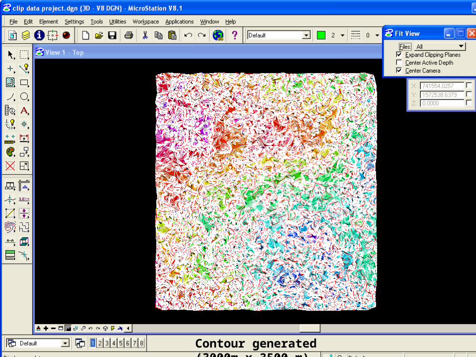
Contour generated (3000m x 3500 m)

Zoomed view of contour 5m interval

Showing contour top elevation

Showing contour bottom elevation

Distance between two tree crown points


3D Tree algorithm
Display 3D co-ordinates
Start
Create 3D contour
Input1 : Tree.xyz data
Create solid tree model
Interpolation
End
Input 2: Image. tiff Image Processing
Create 2D Contour
Matching Fitting
ConnectingFilling
Surface

Each layers boundary points are separately connected. Creating 2D contour
fig 1 - 2D Contour
Connecting Points

Create solid surface of each layer.
layer 1 layer 2 layer 3
2D Solid Surface

layers converted to filled surface
Filled surface

Conclusion
• Tree parameters are identified by processing data using
microstation with terrascan and terramodel.
• Creating tree model in progress..

Thank you