370 Tropical
64
370 Tropical
-
Upload
blaze-berg -
Category
Documents
-
view
43 -
download
0
description
370 Tropical. Trade Wind Inversion. Trade Wind or Subtropical Inversion. The height of the base of this inversion varies from about 500 m at the eastern extremities of the subtropical highs to about 2000 m at the western and equatorial extremities. - PowerPoint PPT Presentation
Transcript of 370 Tropical
370 Tropical


Trade Wind Inversion
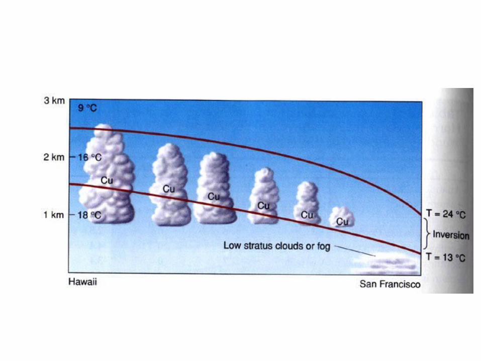

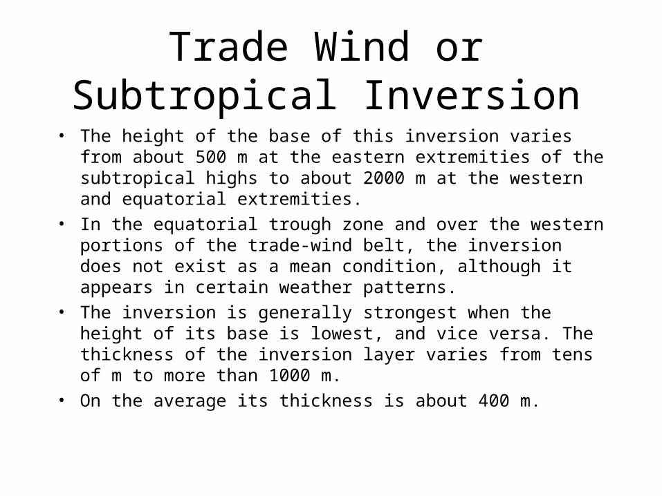
Trade Wind or Subtropical Inversion
• The height of the base of this inversion varies from about 500 m at the eastern extremities of the subtropical highs to about 2000 m at the western and equatorial extremities.
• In the equatorial trough zone and over the western portions of the trade-wind belt, the inversion does not exist as a mean condition, although it appears in certain weather patterns.
• The inversion is generally strongest when the height of its base is lowest, and vice versa. The thickness of the inversion layer varies from tens of m to more than 1000 m.
• On the average its thickness is about 400 m.
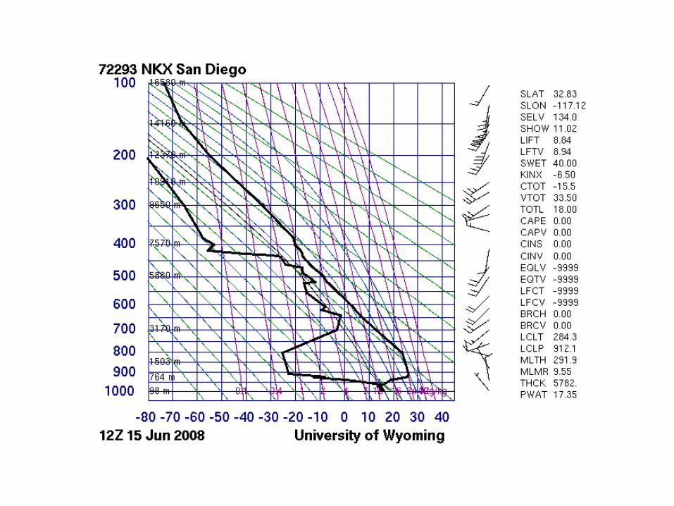
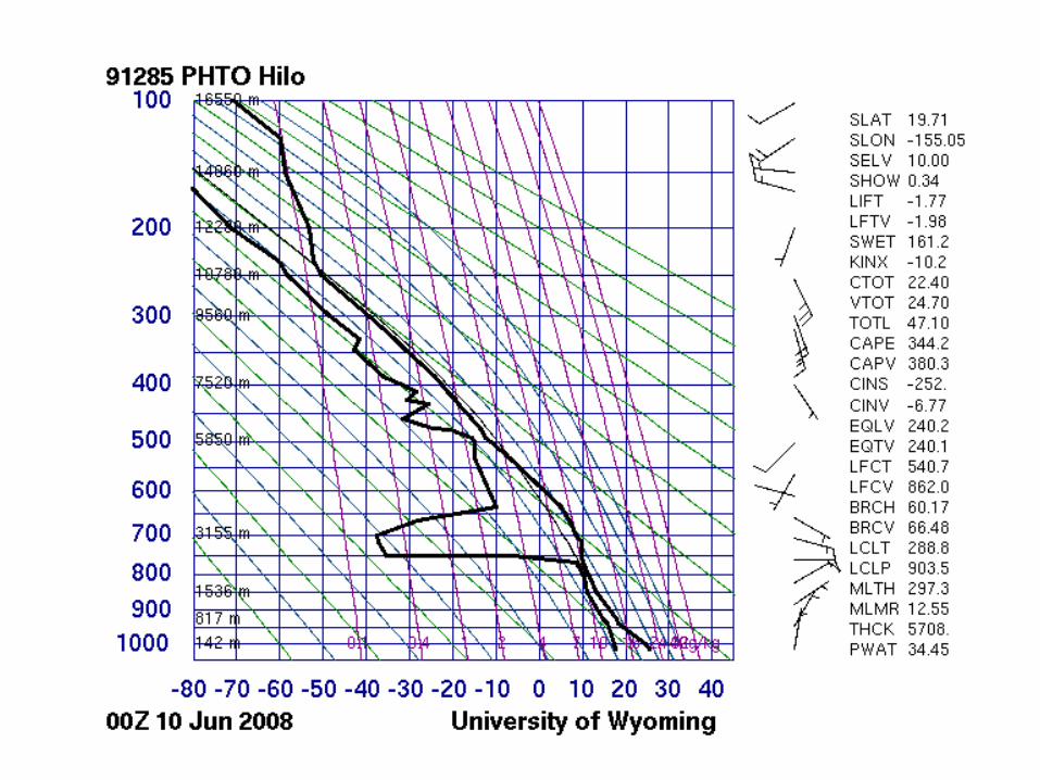
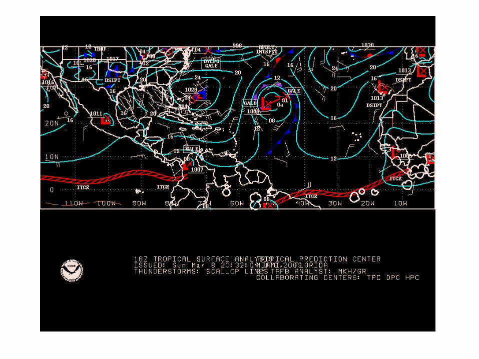
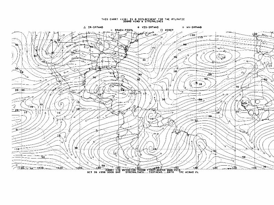
Tropical Analyses
• See both midlatitude style, isobaric analysis, and streamline/isotach analyses.
• Why the latter?
Monsoons
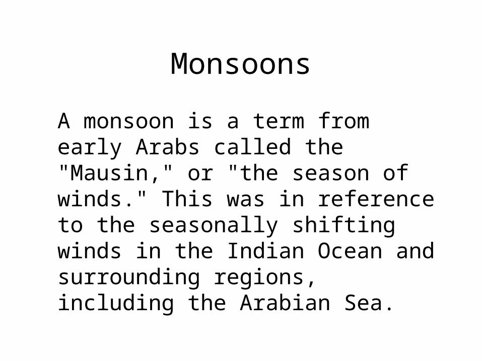
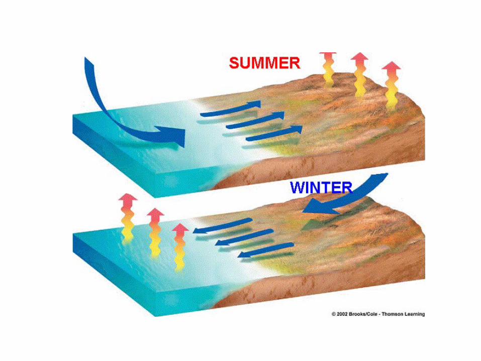
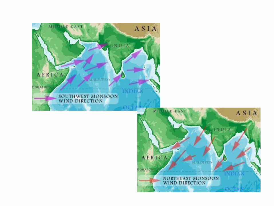
A monsoon is a term from early Arabs called the "Mausin," or "the season of winds." This was in reference to the seasonally shifting winds in the Indian Ocean and surrounding regions, including the Arabian Sea.
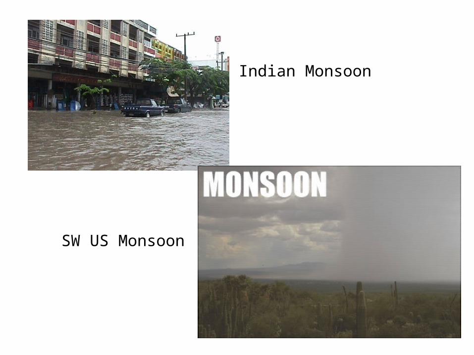
Indian Monsoon
SW US Monsoon
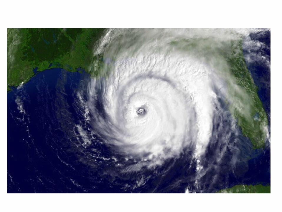
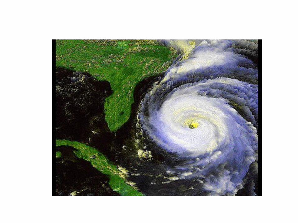
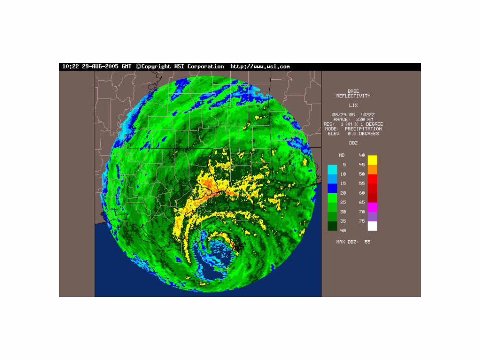

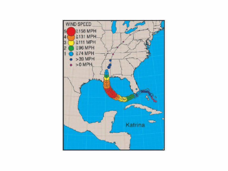
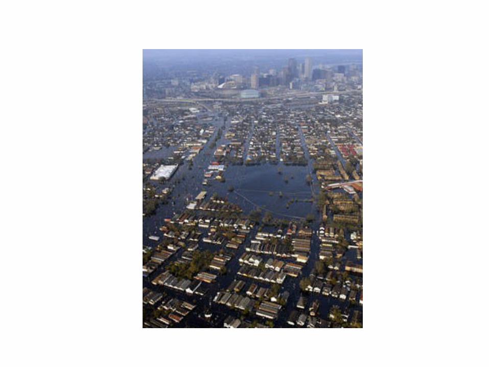
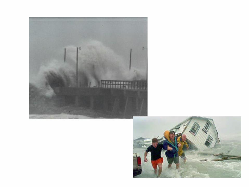


Katrina
• 1833 deaths
• 125 billion in damage

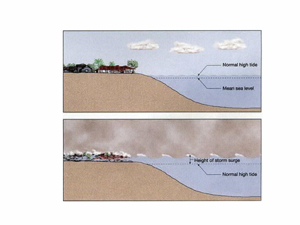
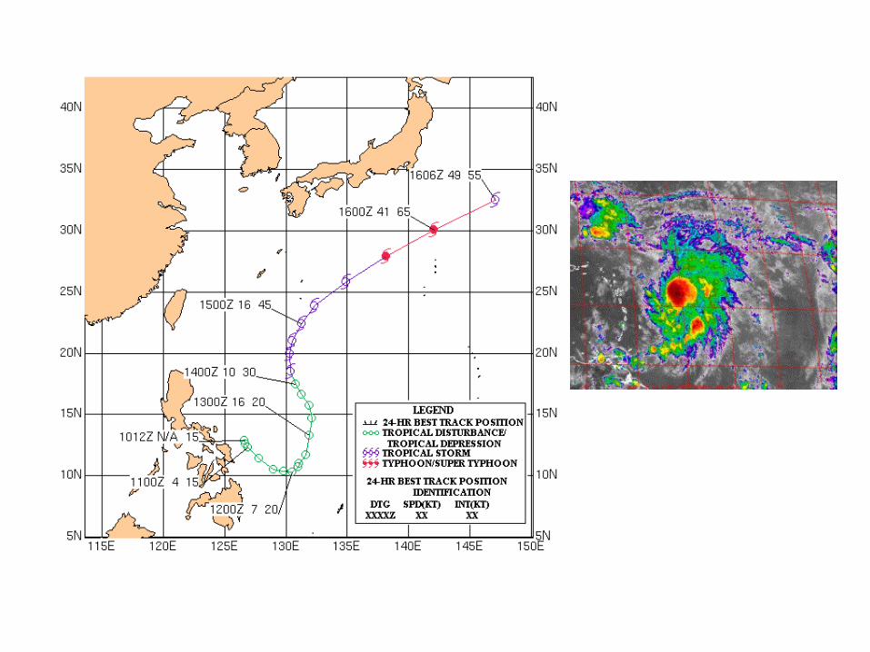
Their Origin

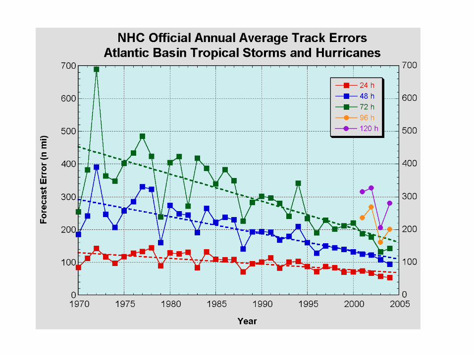
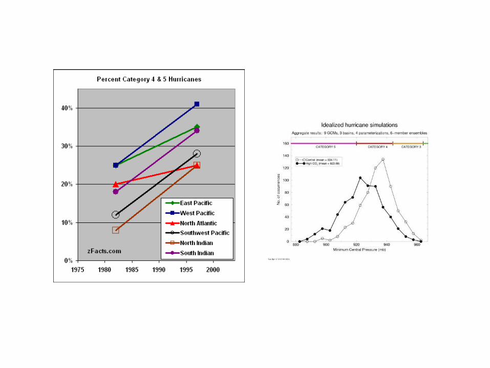
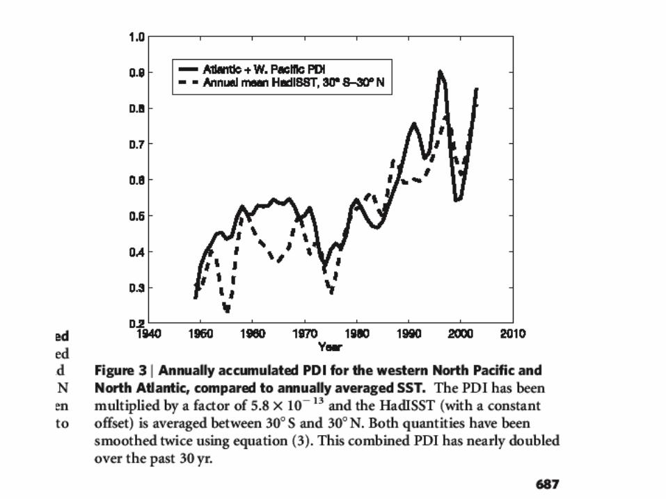
Hurricane Prediction: A Mixed Report
• During the past thirty years there has been substantial in improvement is hurricane track forecasts as computer models improved and more data became available to describe their environment.
• Over the same period only minimal improvement is hurricane intensity forecasts.


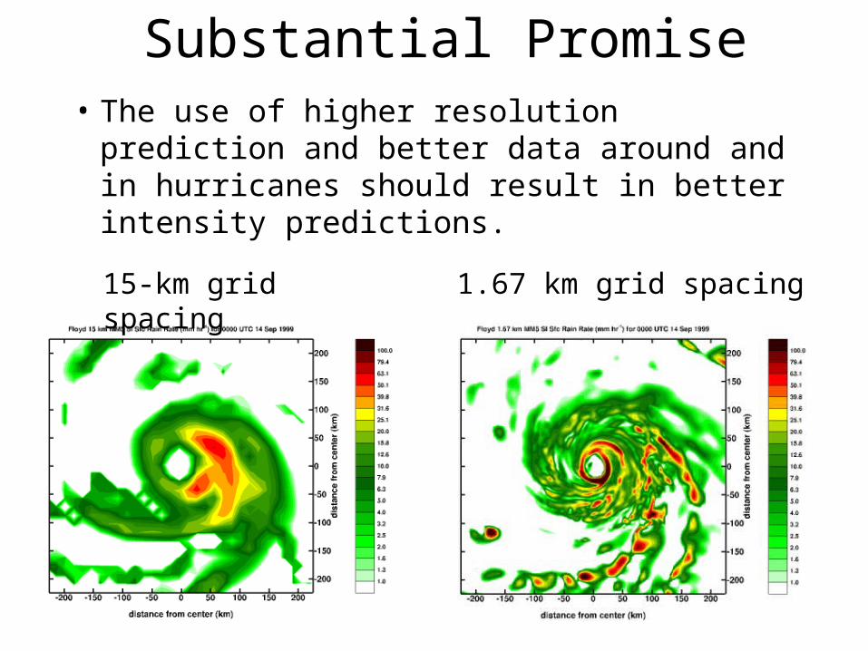
Substantial Promise• The use of higher resolution prediction and
better data around and in hurricanes should result in better intensity predictions.
15-km grid spacing 1.67 km grid spacing
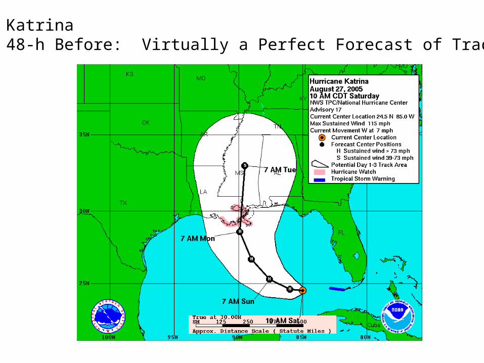
Katrina48-h Before: Virtually a Perfect Forecast of Track
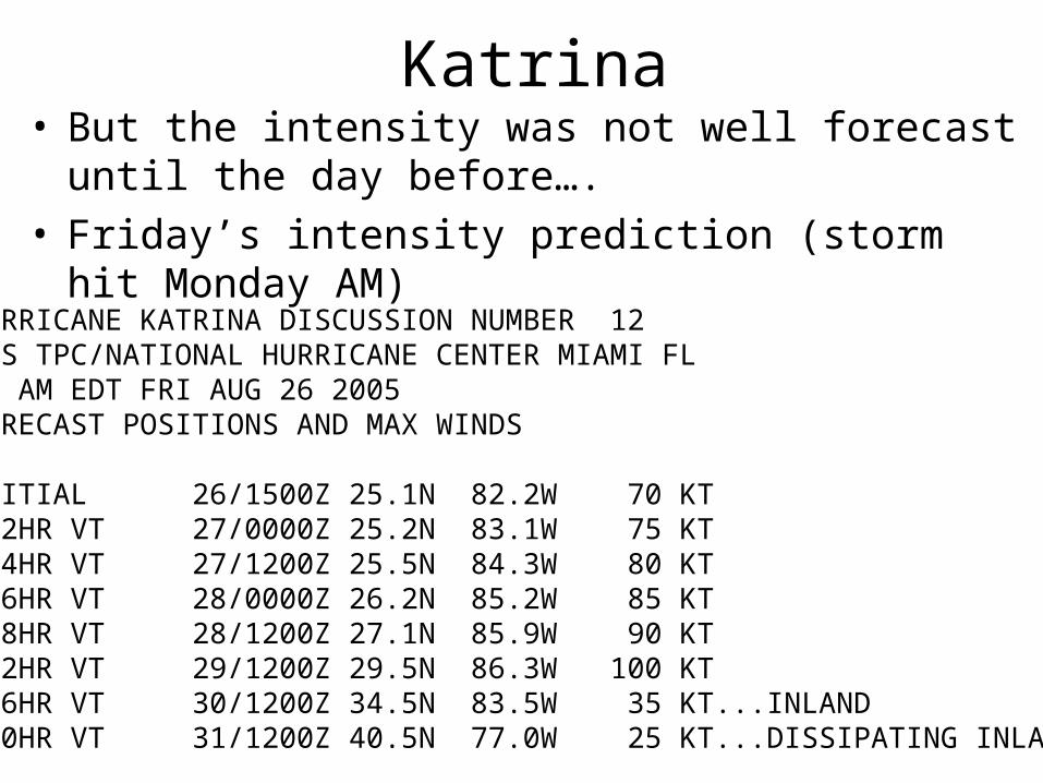
Katrina• But the intensity was not well forecast until the day
before….• Friday’s intensity prediction (storm hit Monday AM)
HURRICANE KATRINA DISCUSSION NUMBER 12NWS TPC/NATIONAL HURRICANE CENTER MIAMI FL11 AM EDT FRI AUG 26 2005FORECAST POSITIONS AND MAX WINDS INITIAL 26/1500Z 25.1N 82.2W 70 KT 12HR VT 27/0000Z 25.2N 83.1W 75 KT 24HR VT 27/1200Z 25.5N 84.3W 80 KT 36HR VT 28/0000Z 26.2N 85.2W 85 KT 48HR VT 28/1200Z 27.1N 85.9W 90 KT 72HR VT 29/1200Z 29.5N 86.3W 100 KT 96HR VT 30/1200Z 34.5N 83.5W 35 KT...INLAND120HR VT 31/1200Z 40.5N 77.0W 25 KT...DISSIPATING INLAND

• URGENT - WEATHER MESSAGE• NATIONAL WEATHER SERVICE NEW ORLEANS LA• 1011 AM CDT SUN AUG 28 2005• ...DEVASTATING DAMAGE EXPECTED...
• .HURRICANE KATRINA...A MOST POWERFUL HURRICANE WITH UNPRECEDENTED• STRENGTH...RIVALING THE INTENSITY OF HURRICANE CAMILLE OF 1969.• MOST OF THE AREA WILL BE UNINHABITABLE FOR WEEKS...PERHAPS LONGER. AT• LEAST ONE HALF OF WELL CONSTRUCTED HOMES WILL HAVE ROOF AND WALL• FAILURE. THE MAJORITY OF INDUSTRIAL BUILDINGS WILL BECOME NON FUNCTIONAL.• PARTIAL TO COMPLETE WALL AND ROOF FAILURE IS EXPECTED. ALL WOOD• FRAMED LOW RISING APARTMENT BUILDINGS WILL BE DESTROYED. CONCRETE• BLOCK LOW RISE APARTMENTS WILL SUSTAIN MAJOR DAMAGE...INCLUDING SOME• WALL AND ROOF FAILURE.• HIGH RISE OFFICE AND APARTMENT BUILDINGS WILL SWAY DANGEROUSLY...A• FEW TO THE POINT OF TOTAL COLLAPSE. ALL WINDOWS WILL BLOW OUT.• AIRBORNE DEBRIS WILL BE WIDESPREAD...AND MAY INCLUDE HEAVY ITEMS SUCH• AS HOUSEHOLD APPLIANCES AND EVEN LIGHT VEHICLES. SPORT UTILITY• VEHICLES AND LIGHT TRUCKS WILL BE MOVED. THE BLOWN DEBRIS WILL CREATE• ADDITIONAL DESTRUCTION. PERSONS...PETS...AND LIVESTOCK EXPOSED TO THE• WINDS WILL FACE CERTAIN DEATH IF STRUCK.• POWER OUTAGES WILL LAST FOR WEEKS...AS MOST POWER POLES WILL BE DOWN• AND TRANSFORMERS DESTROYED. WATER SHORTAGES WILL MAKE HUMAN SUFFERING• INCREDIBLE BY MODERN STANDARDS.• THE VAST MAJORITY OF NATIVE TREES WILL BE SNAPPED OR UPROOTED. ONLY• THE HEARTIEST WILL REMAIN STANDING...BUT BE TOTALLY DEFOLIATED. FEW• CROPS WILL REMAIN. LIVESTOCK LEFT EXPOSED TO THE WINDS WILL BE• KILLED.
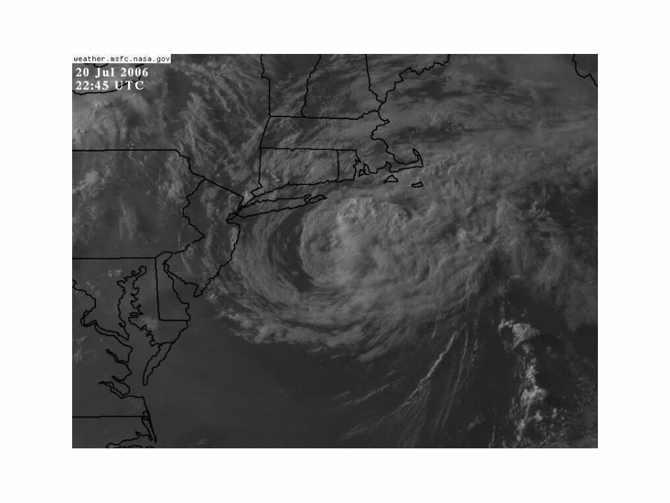
Extratropical Transition

Madden Julian Oscillation