2015 FOSS4G Track: Integrating FOSS4G Into a Government Web-Editing Application by Kevin McNinch and...
23
+ September 24, 2015 Kevin McNinch & James Coble Integrating FOSS4G Into a Government Web-Editing Application USGS NGTOC [National Geospatial Technical Operations Center] -- Lakewood Colorado
-
Upload
gis-in-the-rockies -
Category
Technology
-
view
2.244 -
download
1
Transcript of 2015 FOSS4G Track: Integrating FOSS4G Into a Government Web-Editing Application by Kevin McNinch and...

+
September 24, 2015 Kevin McNinch & James Coble
Integrating FOSS4G Into a Government Web-Editing Application
USGS NGTOC [National Geospatial Technical Operations Center] -- Lakewood Colorado

+ 2 + 2
Abstract
U.S. Geological Survey National Geospatial Technological Operations Center (NGTOC) is building a suite of vector web-editing (VWE) applications for data collection and maintenance of The National Map (TNM) data. Initially built with a proprietary geospatial software architecture, VWE has integrated FOSS4G into the software architecture, including Leaflet, Esri-Leaflet, and GeoServer. Instead of entirely replacing proprietary geospatial software, VWE has adopted a hybrid architecture, mixing open and proprietary software products. This hybrid approach allows VWE to leverage the strengths of each software product for specific requirements and business rules in the different VWE applications and work within pre-existing TNM data management processes and workflows.

+ 3 + 3
Topics
■The National Map (TNM) Overview ■TNM Vector Web-Edit
■ VWE Architecture ■ Integrating FOSS4G/”Open” into VWE
■ Standards, Software, Community, Contributions ■Using “Open” as a federal government
organization
+ 5
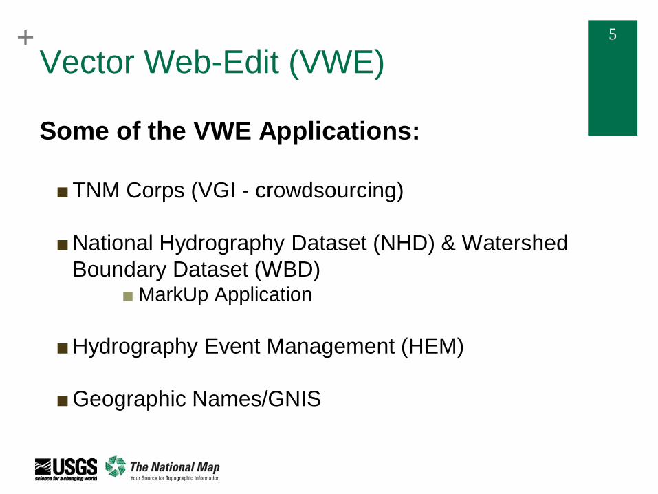
Vector Web-Edit (VWE)
Some of the VWE Applications: ■TNM Corps (VGI - crowdsourcing)
■National Hydrography Dataset (NHD) & Watershed
Boundary Dataset (WBD) ■MarkUp Application
■Hydrography Event Management (HEM)
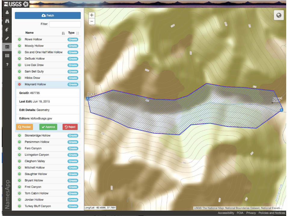
■Geographic Names/GNIS

+ 6
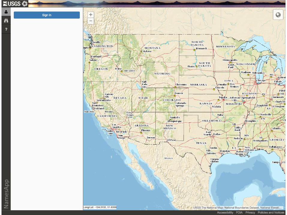
TNM Vector Web-Edit Project Suite of map-centric web-editing applications for TNM ■ Modular development ■ Data collection ■ Data maintenance ■ Public (external) & internal deployment

+ 7
VWE Users: Federal, Partners, Public
Federal
DOI
USGS
NGTOC
NGP
Other
BLM
Other
EPA USDA
Other Non-Federal Partners
State Gov’t /Stewards
Local Gov’t /Sub-stewards
Other
Public
General Public (TNM Corps)
Approved Public
(Names)
■Role-based Permissioning
■ Editor ■QA/QC
■User Authentication ■ oAuth
+ 8

+ 9

+ 10

+ 11

+ 12

+ 13
+ 14

+ 15
VWE Architecture
Initial Development: ■FY14 Development ■Esri-based web application ■NGTOC infrastructure is Esri based
■ArcGIS Server ■ArcSDE
■Quickest route to initial implementation
TNM
Core VWE Application (Modular)
ArcGIS API for JavaScript
Browser
ArcGIS Server
ArcSDE
+ 16
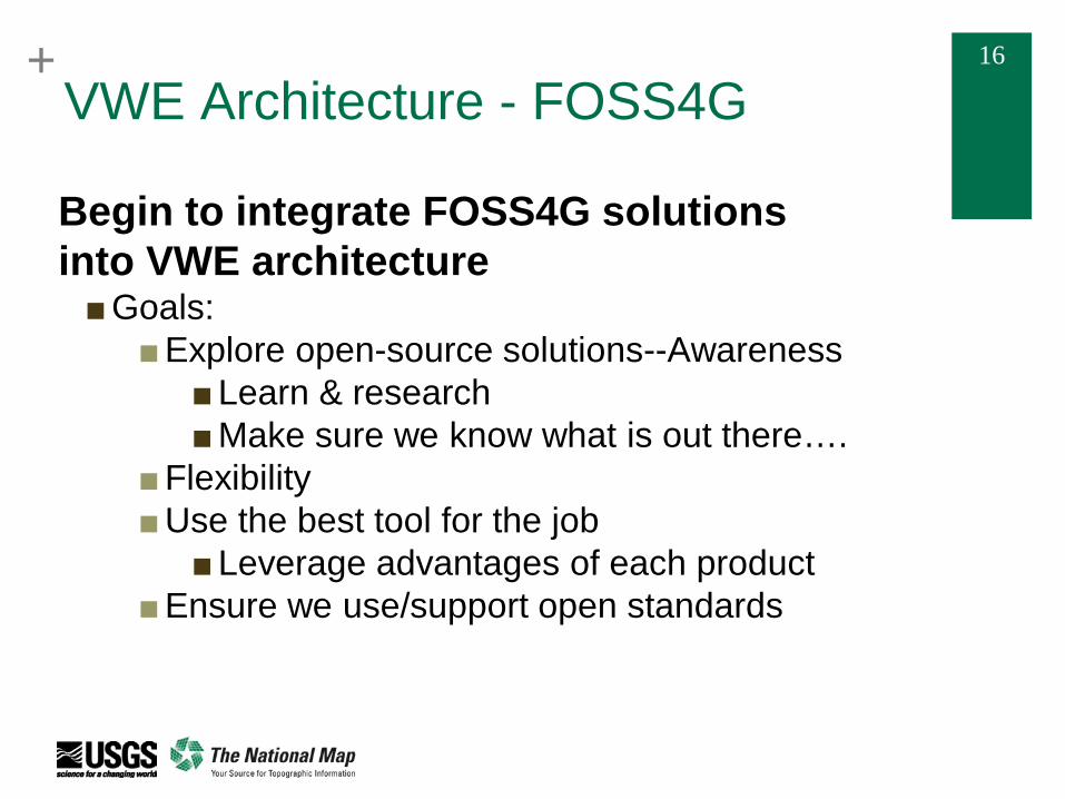
VWE Architecture - FOSS4G
Begin to integrate FOSS4G solutions into VWE architecture ■Goals:
■Explore open-source solutions--Awareness ■Learn & research ■Make sure we know what is out there….
■Flexibility ■Use the best tool for the job
■Leverage advantages of each product ■Ensure we use/support open standards
+ 17
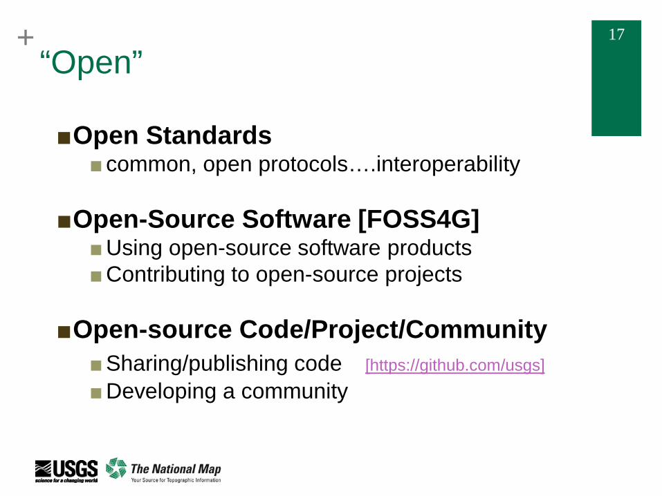
“Open”
■Open Standards ■common, open protocols….interoperability
■Open-Source Software [FOSS4G] ■Using open-source software products ■Contributing to open-source projects
■Open-source Code/Project/Community ■Sharing/publishing code [https://github.com/usgs]
■Developing a community

+ 18
VWE Architecture Going Forward - 1 VWE development is not leaving the Esri platform! VWE chose a Hybrid architecture: ■ Use Esri when it makes sense ■ Data management ■ ArcSDE reliance by organization—not going away (or
need to) ■ Geoprocessing (complex?) ■ Linear referencing

+ 19
VWE Architecture Going Forward - 2
VWE chose a Hybrid architecture: ■ Use Open-source solutions when it makes sense ■ Support open standards—interoperability ■ Licensing ■ Supporting an open-source community ■ Cost?
■ Community of developers/support? ■ Updates
■ Avoid vendor lock-in ■ Lightweight architecture ■ Where it works best….leverage the right tool for
the job

+ 20
TNM
Core VWE Application (Modular)
ArcGIS API for JavaScript
Browser
TNM TNM
Pure Esri Solution FOSS4G client side Esri server side
Pure FOSS4G Solution
Hybrid FOSS4G/Esri Solution
Browser Browser Browser
Leaflet Esri-leaflet (plugin)
Leaflet Esri-leaflet plugin
WFS-T plugin
Open Layers/Leaflet
Core VWE Application (Modular)
Core VWE Application (Modular)
Core VWE Application (Modular)
ArcGIS Server ArcGIS Server
GeoServer GeoServer
TNM
ArcGIS Server
ArcSDE ArcSDE ArcSDE PostGIS
Integrating “Open” into VWE
PostGIS

+ 21
Some “Open” Software Used in VWE
Esri-Leaflet
WFS-T Plugin

+ 22 “Open” communities and federal gov’t
■Can government organizations contribute to OSS project? ■Need to review the licensing of the project ■Policy! (in flux) ■VWE team consulted USGS counsel
■ Answer: Yes* ■ But it depends on the licensing of the project
* The views of the VWE team do not necessarily match those of USGS or DOI
+ 23
Questions?
Contact Information: Kevin McNinch: [email protected] James Coble: [email protected]