Foss4G 2009 Scenz Grid
21
SCENZ-Grid The implementation of a Science Collaboration and Computation Environment Niels Hoffmann Landcare Research
Transcript of Foss4G 2009 Scenz Grid
SCENZ-Grid
The implementation of a Science Collaboration and Computation
Environment
Niels HoffmannLandcare Research
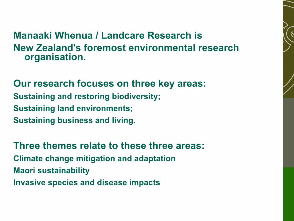
Manaaki Whenua / Landcare Research isNew Zealand's foremost environmental research
organisation.
Our research focuses on three key areas:Sustaining and restoring biodiversity;
Sustaining land environments;
Sustaining business and living.
Three themes relate to these three areas:Climate change mitigation and adaptation
Maori sustainability
Invasive species and disease impacts
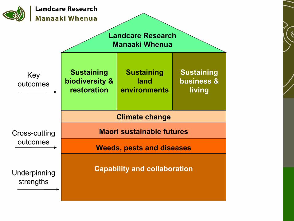
Sustaining biodiversity &
restoration
Sustaining land
environments
Sustaining business &
living
Climate change
Maori sustainable futures
Weeds, pests and diseases
Capability and collaboration
Landcare Research Manaaki Whenua
Key outcomes
Cross-cutting outcomes
Underpinning strengths
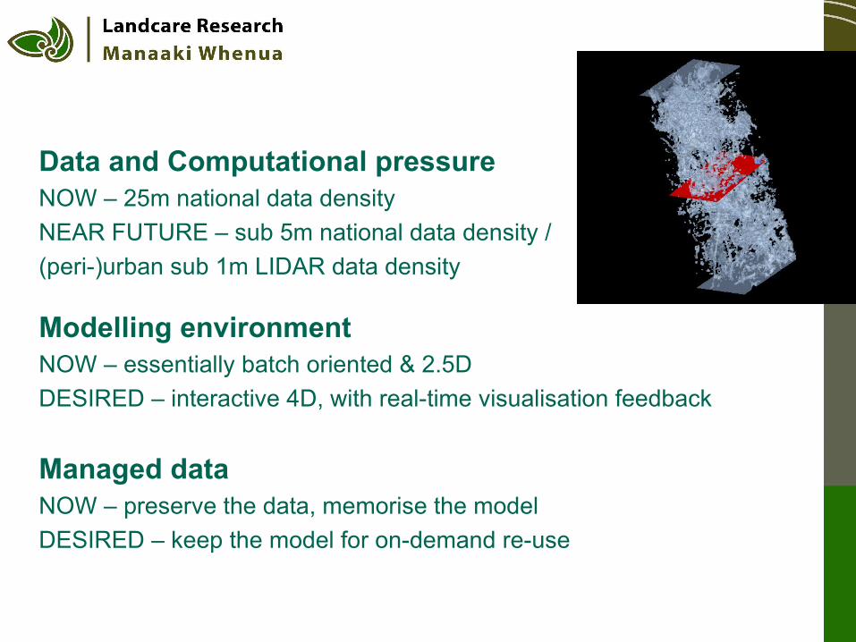
Data and Computational pressureNOW – 25m national data density
NEAR FUTURE – sub 5m national data density /
(peri-)urban sub 1m LIDAR data density
Modelling environmentNOW – essentially batch oriented & 2.5D
DESIRED – interactive 4D, with real-time visualisation feedback
Managed dataNOW – preserve the data, memorise the model
DESIRED – keep the model for on-demand re-use
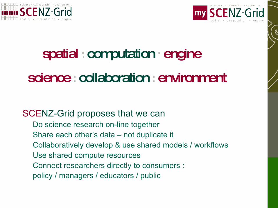
science : collaboration : environment
SCENZ-Grid proposes that we canDo science research on-line together Share each other’s data – not duplicate itCollaboratively develop & use shared models / workflows Use shared compute resourcesConnect researchers directly to consumers :policy / managers / educators / public
spatial : computation : engine
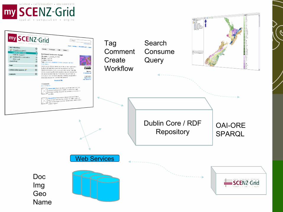
Dublin Core / RDFRepository
Web Services
DocImgGeoName
SearchConsumeQuery
TagCommentCreateWorkflow
OAI-ORESPARQL
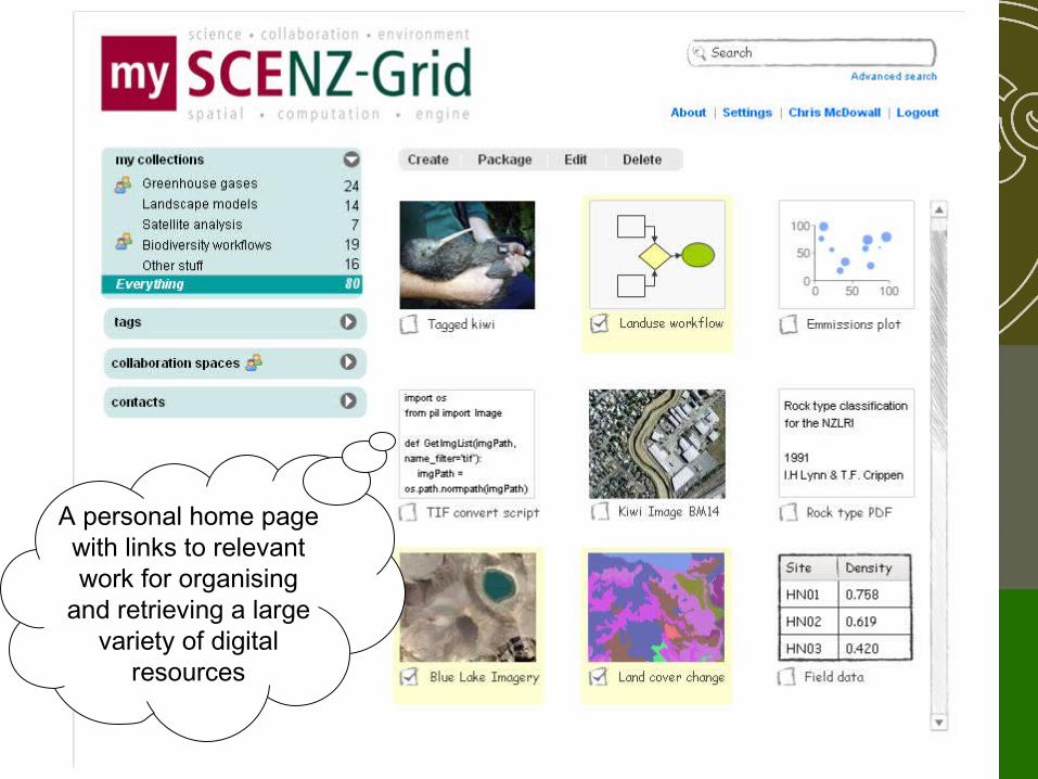
A personal home page with links to relevant work for organising
and retrieving a large variety of digital
resources
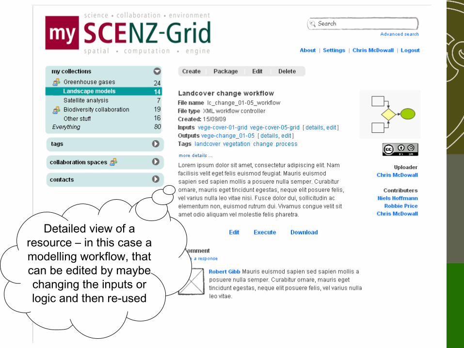
Detailed view of a resource – in this case a modelling workflow, that can be edited by maybe changing the inputs or logic and then re-used
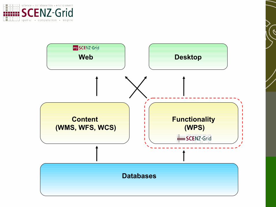
Databases
Content (WMS, WFS, WCS)
Functionality (WPS)
DesktopWeb
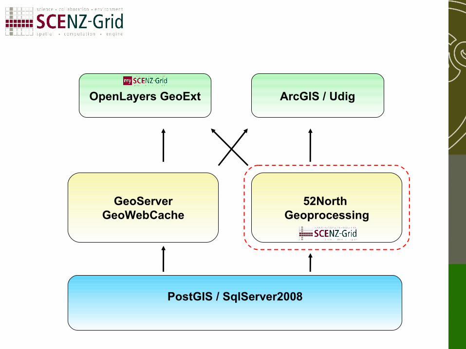
PostGIS / SqlServer2008
GeoServerGeoWebCache
52North Geoprocessing
ArcGIS / UdigOpenLayers GeoExt
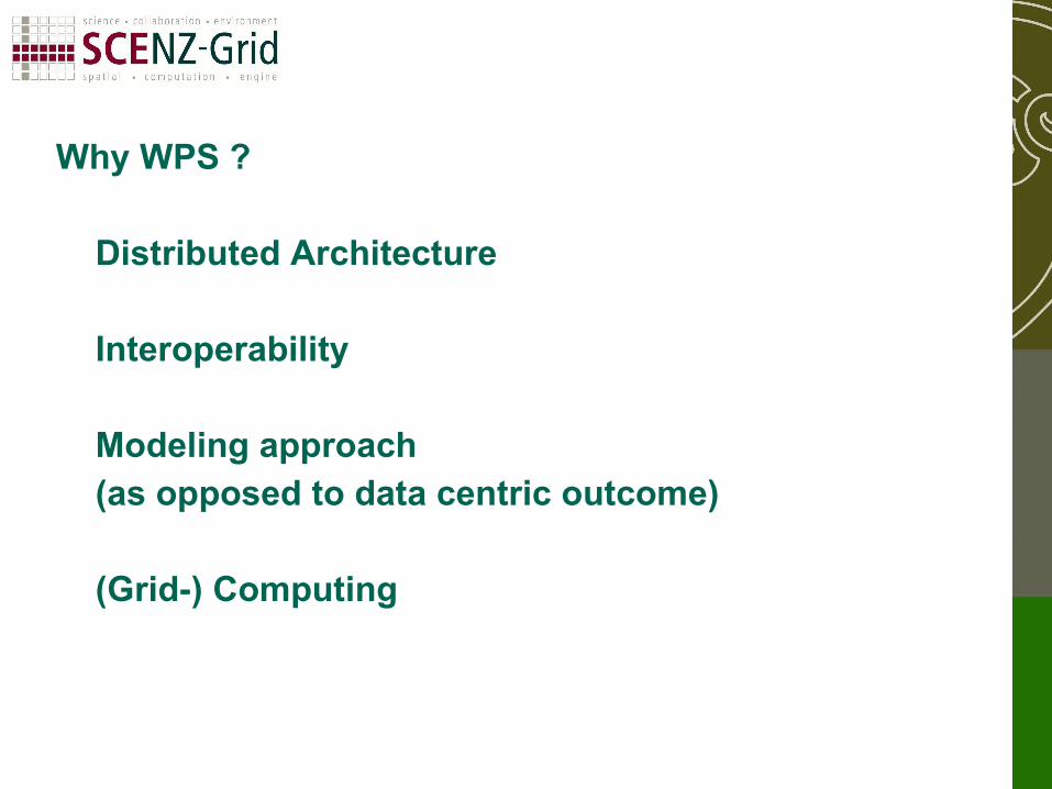
Why WPS ?
Distributed Architecture
Interoperability
Modeling approach (as opposed to data centric outcome)
(Grid-) Computing
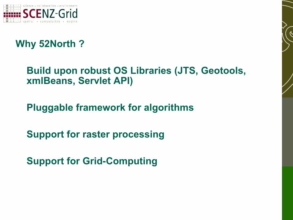
Why 52North ?
Build upon robust OS Libraries (JTS, Geotools, xmlBeans, Servlet API)
Pluggable framework for algorithms
Support for raster processing
Support for Grid-Computing
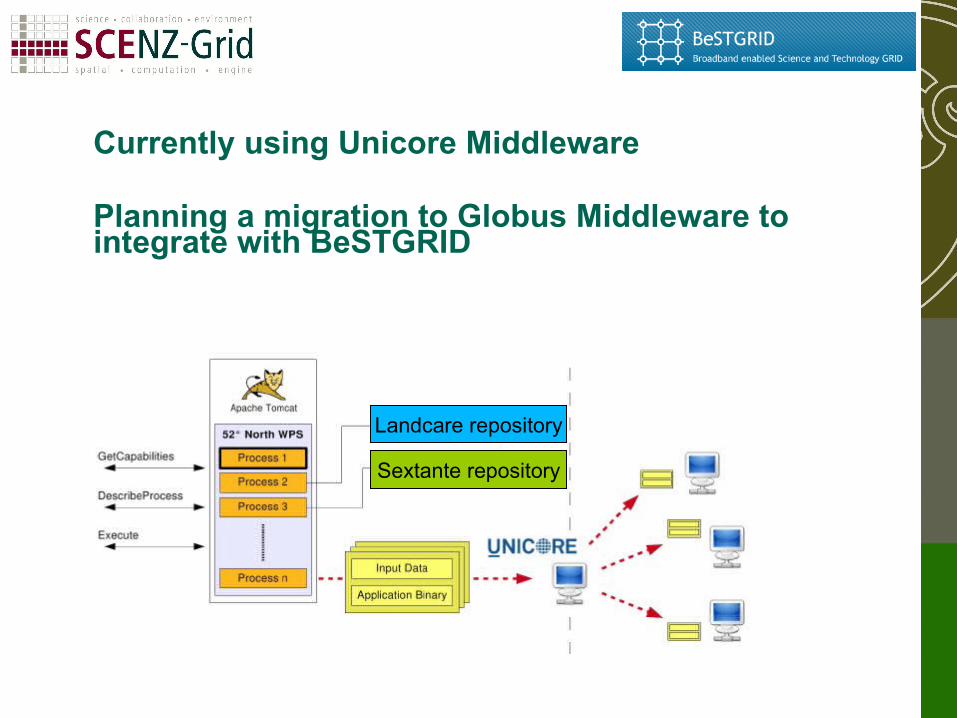
Currently using Unicore Middleware
Planning a migration to Globus Middleware to integrate with BeSTGRID
Landcare repository
Sextante repository
WPSGeoserver
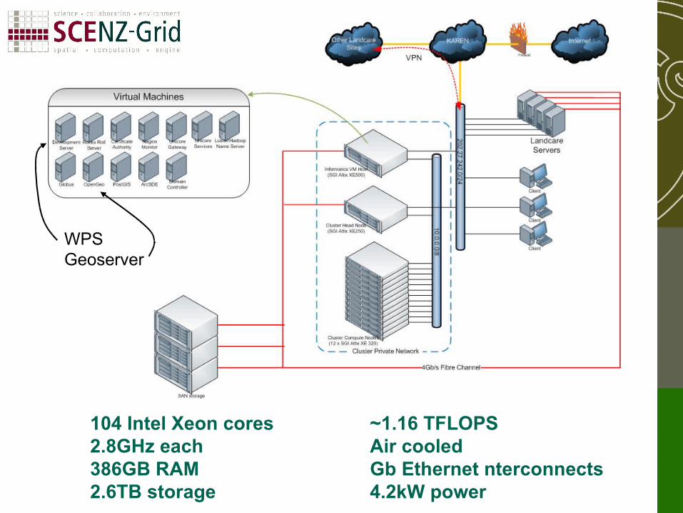
104 Intel Xeon cores2.8GHz each386GB RAM2.6TB storage
~1.16 TFLOPSAir cooledGb Ethernet nterconnects4.2kW power
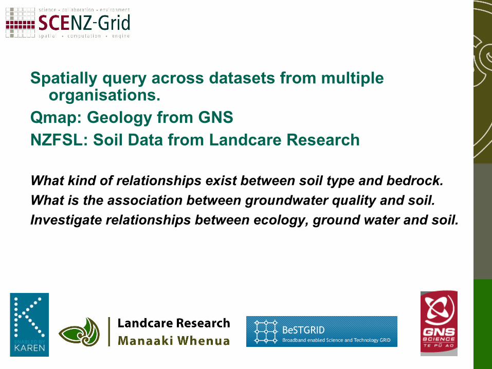
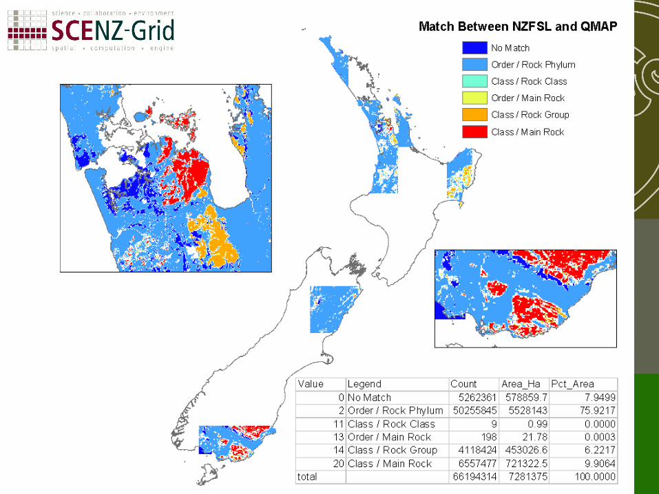
Spatially query across datasets from multiple organisations.
Qmap: Geology from GNSNZFSL: Soil Data from Landcare Research
What kind of relationships exist between soil type and bedrock.
What is the association between groundwater quality and soil.
Investigate relationships between ecology, ground water and soil.
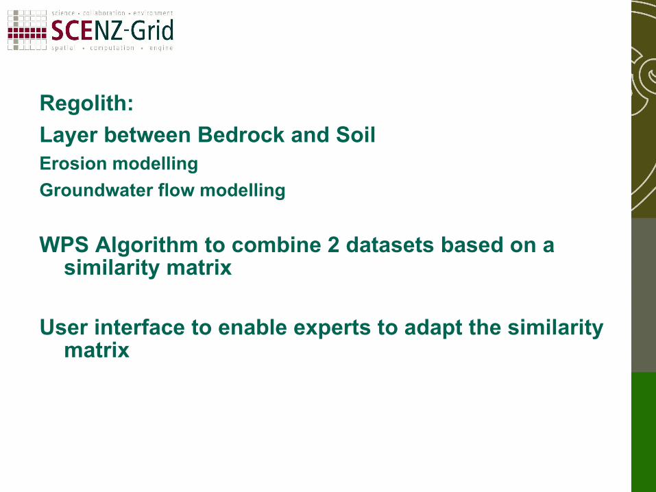
Regolith:
Layer between Bedrock and SoilErosion modelling
Groundwater flow modelling
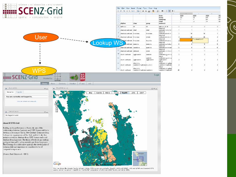
WPS Algorithm to combine 2 datasets based on a similarity matrix
User interface to enable experts to adapt the similarity matrix
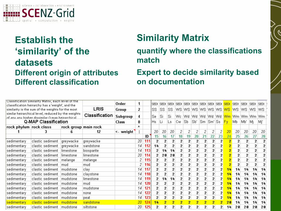
Establish the ‘similarity’ of the datasetsDifferent origin of attributesDifferent classification
Similarity Matrixquantify where the classifications match
Expert to decide similarity based on documentation
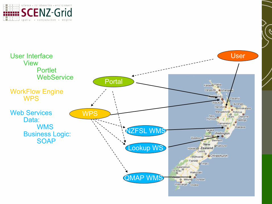
QMAP WMS
NZFSL WMS
Lookup WS
Portal
User
WPS
User InterfaceView
PortletWebService
WorkFlow EngineWPS
Web ServicesData:
WMSBusiness Logic:
SOAP
Lookup WS
WPS
User
Thank You,Any questions?
Slide Credits:
Chris McDowall, Aaron Hicks
science : collaboration : environment
spatial : computation : engine