
2010 State Data Center Annual Training Conference Geographic Programs Update: Post-2010 Census...
24
2010 State Data Center Annual Training Conference Geographic Programs Update: Post-2010 Census Geographic Areas Michael Ratcliffe Geography Division October 14, 2010
-
Upload
henry-blasingame -
Category
Documents
-
view
221 -
download
1
Transcript of 2010 State Data Center Annual Training Conference Geographic Programs Update: Post-2010 Census...

2010 State Data Center Annual Training Conference
Geographic Programs Update:Post-2010 Census Geographic Areas
Michael Ratcliffe
Geography Division
October 14, 2010
Overview
• Public Use Microdata Areas (PUMAs)• ZIP Code Tabulation Areas (ZCTAs)• Urban / Rural (Urban Areas) • Traffic Analysis Zones (TAZs)
2

Proposed Criteria for PUMAs
• Standard PUMAs (one level)• Place-of-Work (POW) PUMAs and Migration
(MIG) PUMAs• State-based• Minimum population threshold of 100,000
throughout decade• Counties and standard census tracts as
building blocks• Contiguity
3

Population Threshold for PUMAs
• Each PUMA must have a minimum 2010 Census population of 100,000
• The minimum population must be met at the time of delineation and maintained throughout the decade– In areas expected to experience population
decline, define PUMAs above the minimum threshold to ensure at least 100,000 population throughout the decade
– PUMAs that fall “substantially below” the 100,000 person threshold will be combined with one or more adjacent PUMAs
4

PUMA Types• Only one level of “standard” PUMA
• Place-of-work PUMAs (POW PUMAs) and migration PUMAs (MIG
PUMAs) are proposed to be county based, consisting of:
5
PUMA 1PUMA 1
PUMA 3PUMA 3
PUMA 2PUMA 2
County
Tract-based PUMA
POW PUMA & MIG PUMA
Boundary Symbology
County ACounty A
County BCounty B
POW PUMA I and MIG PUMA I
– a single PUMA for county-based PUMAs– a combination of adjacent tract based-PUMAs so that together the
PUMAs compose one or more complete counties

PUMA Composition
• All PUMA types (standard, POW, and MIG) must nest within states
• PUMAs will be based on aggregations of counties and census tracts only• Tract-based PUMAs may cross county boundaries as long
as each county part contains at least 2,400 people
• Incorporated places and MCDs will not be used as building blocks for 2010 PUMAs. Census tracts may be aggregated to approximate minor civil divisions, incorporated places, census designated places, and/or AIRs/ORTLs.
6
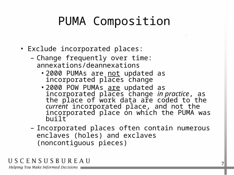
• Exclude incorporated places:– Change frequently over time:
annexations/deannexations• 2000 PUMAs are not updated as incorporated
places change• 2000 POW PUMAs are updated as incorporated
places change in practice, as the place of work data are coded to the current incorporated place, and not the incorporated place on which the PUMA was built
– Incorporated places often contain numerous enclaves (holes) and exclaves (noncontiguous pieces)
7
PUMA Composition
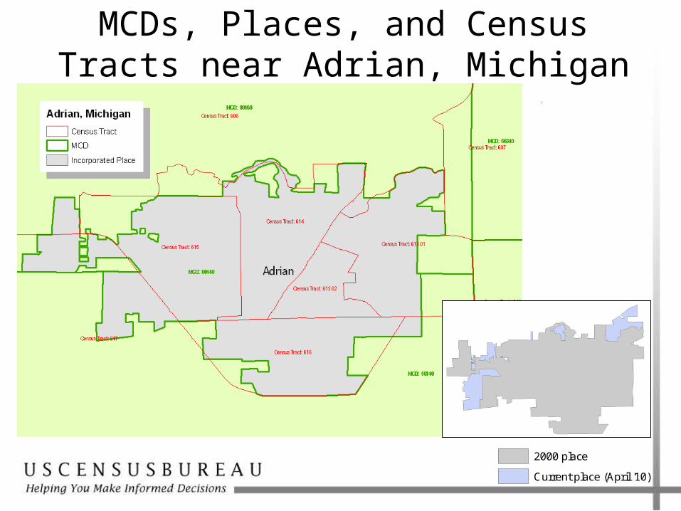
MCDs, Places, and Census Tracts near Adrian, Michigan
2000 place
Current place (April '10)
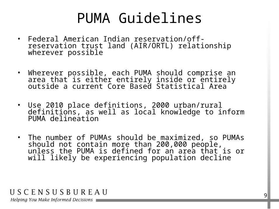
PUMA Guidelines• Federal American Indian reservation/off-reservation trust
land (AIR/ORTL) relationship wherever possible
• Wherever possible, each PUMA should comprise an area that is either entirely inside or entirely outside a current Core Based Statistical Area
• Use 2010 place definitions, 2000 urban/rural definitions, as well as local knowledge to inform PUMA delineation
• The number of PUMAs should be maximized, so PUMAs should not contain more than 200,000 people, unless the PUMA is defined for an area that is or will likely be experiencing population decline
9
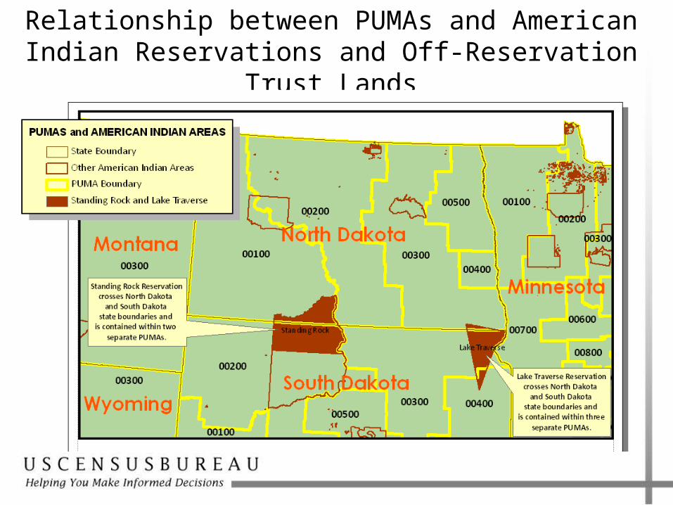
Relationship between PUMAs and American Indian Reservations and Off-Reservation Trust Lands

PUMA Draft Schedule
• November 2010: Proposed criteria will be distributed to SDCs, and a wide variety of stakeholder groups
• August 2011: Materials sent to SDCs for PUMA delineation
• Fall 2011: Hands on training using MTPS
• January 3, 2012: Return deadline for submissions
11

ZIP Code Tabulation Area Delineation
• 5-digit ZCTAs only– No 3-digit ZCTAs
• 2010 census blocks will form the “building blocks” for ZCTAs
• ZCTAs will be defined only for areas with residential ZIP Codes– Will not cover the entirety of the nation
• Enclaves lacking residential ZIP Codes will be assigned to an adjacent ZCTA
• ZCTAs will more closely approximate ZIP Codes
12
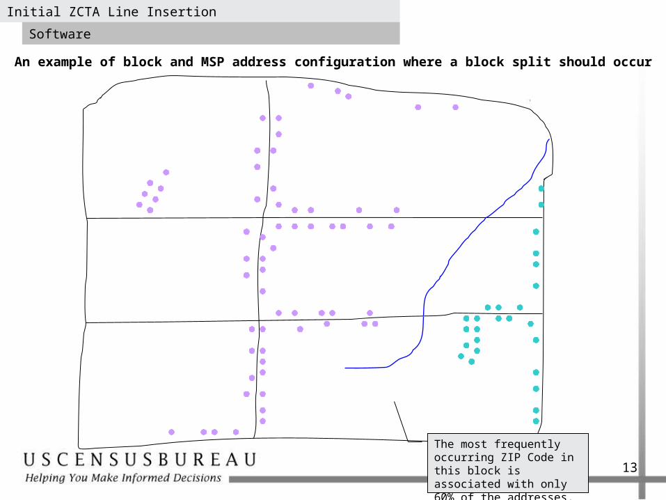
An example of block and MSP address configuration where a block split should occur
Initial ZCTA Line Insertion
Software
The most frequently occurring ZIP Code in this block is associated with only 60% of the addresses.
13
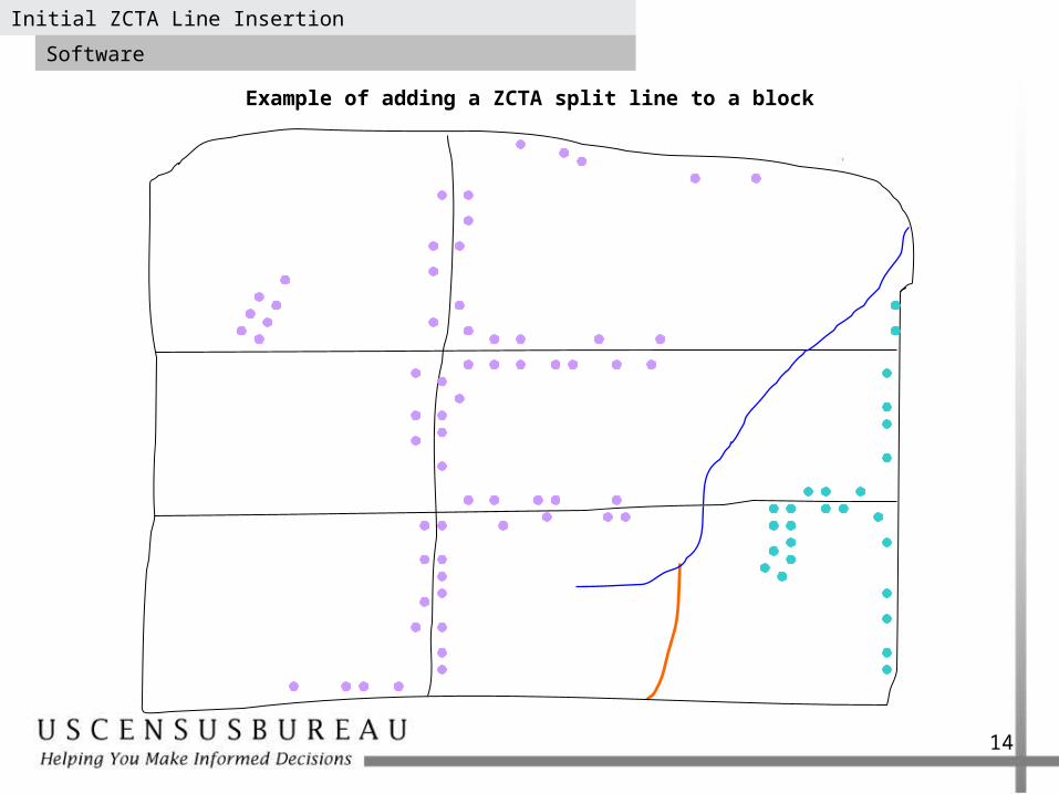
Example of adding a ZCTA split line to a block
Initial ZCTA Line Insertion
Software
14
ZCTAs Delineation Schedule
• Spring 2010: Added nonvisible edges to MTDB
• November 2010 - March 2011: ZCTA delineation
• April 2011: ZCTA TIGER/Line Shapefiles
15

Urban and Rural Classification
• Two types of urban areas:– Urbanized areas of 50,000 or more people– Urban clusters of at least 2,500 and less than
50,000 people
• Territory outside urban areas is classified as rural.
• Proposed criteria published in August 24 Federal Register. Comment period closes November 22.
16
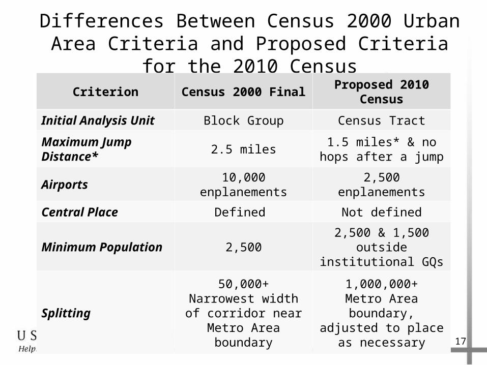
Differences Between Census 2000 Urban Area Criteria and Proposed Criteria for the 2010 Census
Criterion Census 2000 FinalProposed 2010
Census
Initial Analysis Unit Block Group Census Tract
Maximum Jump Distance*
2.5 miles1.5 miles* & no hops
after a jump
Airports 10,000 enplanements 2,500 enplanements
Central Place Defined Not defined
Minimum Population 2,5002,500 & 1,500 outside
institutional GQs
Splitting
50,000+Narrowest width of corridor near Metro
Area boundary
1,000,000+Metro Area boundary, adjusted to place as
necessary
17
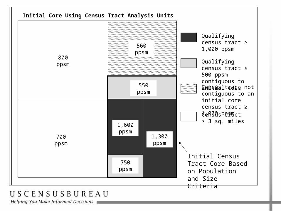
Qualifying census tract ≥ 1,000 ppsm
Qualifying census tract ≥ 500 ppsm contiguous to initial core
Census tract not contiguous to an initial core census tract ≥ 1,000 ppsm
Census tract > 3 sq. miles
Initial Census Tract Core Based on Population and Size Criteria
1,600 ppsm
1,300 ppsm
750 ppsm
550 ppsm
560 ppsm
700 ppsm
800 ppsm
Initial Core Using Census Tract Analysis Units
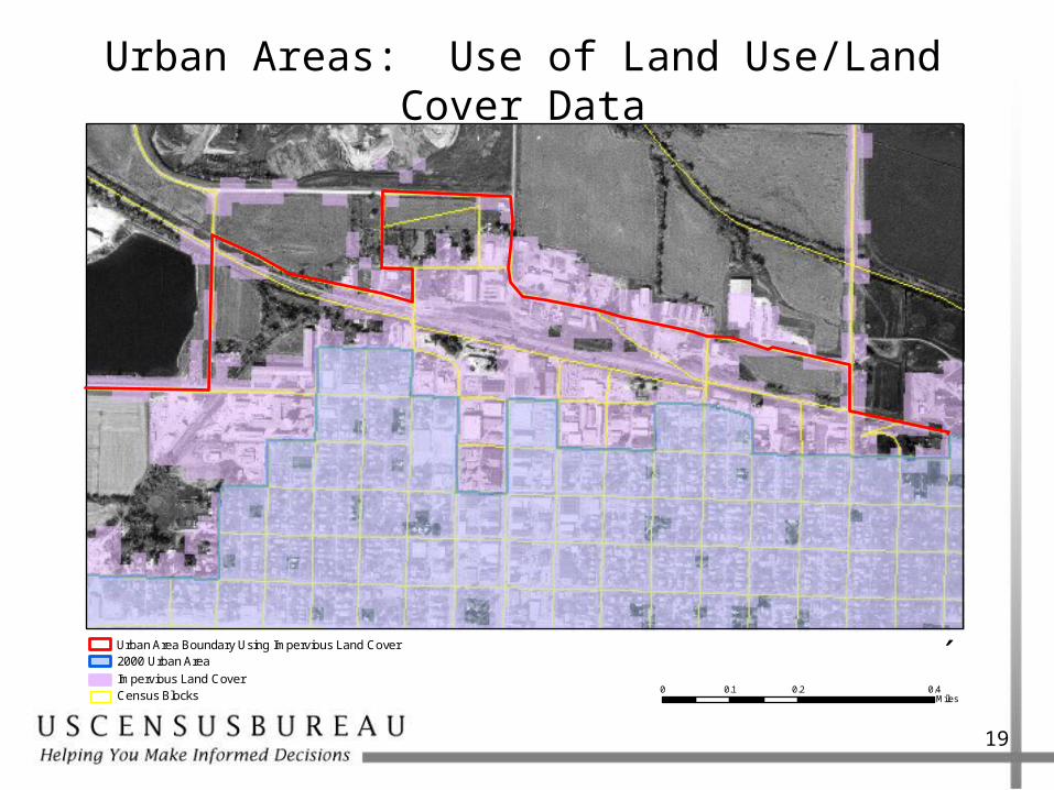
Urban Areas: Use of Land Use/Land Cover Data
19
2000 Urban Area ´Urban Area Boundary Using Impervious Land Cover
Impervious Land CoverCensus Blocks
0 0.2 0.40.1Miles
Urban Areas: Schedule
• November 22, 2010: Public comment period ends for proposed criteria published in Federal Register– http://www.census.gov/geo/www/ua/urbanruralclass.html
• First quarter of 2011: Final criteria published in Federal Register
• March-December 2011: delineation
• Spring 2012: Federal Register notice listing Urban Areas
• Spring 2012: Urban/Rural TIGER/Line Shapefiles
20
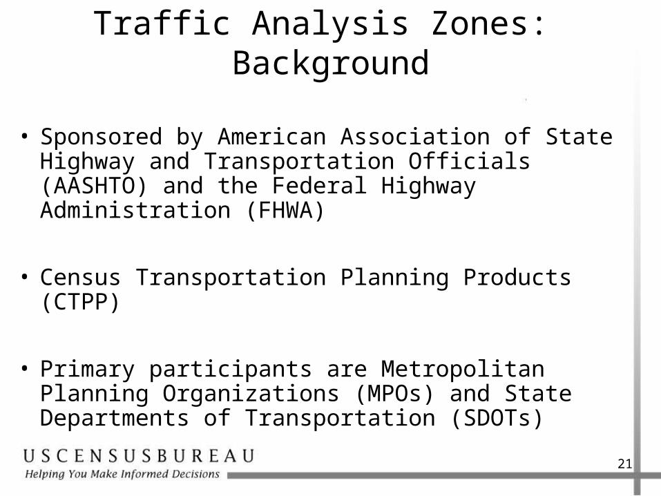
Traffic Analysis Zones: Background
• Sponsored by American Association of State Highway and Transportation Officials (AASHTO) and the Federal Highway Administration (FHWA)
• Census Transportation Planning Products (CTPP)
• Primary participants are Metropolitan Planning Organizations (MPOs) and State Departments of Transportation (SDOTs)
21
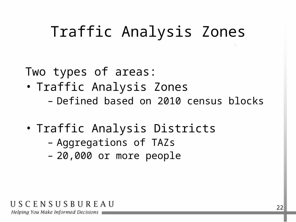
Traffic Analysis Zones
Two types of areas:• Traffic Analysis Zones
– Defined based on 2010 census blocks
• Traffic Analysis Districts– Aggregations of TAZs– 20,000 or more people
22
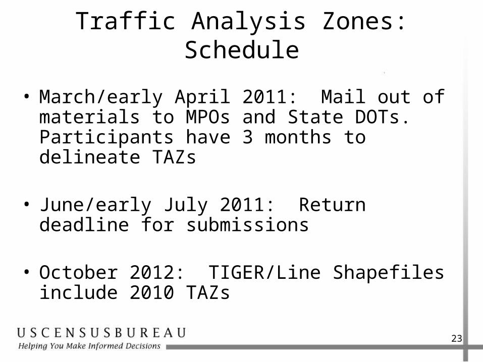
Traffic Analysis Zones: Schedule
• March/early April 2011: Mail out of materials to MPOs and State DOTs. Participants have 3 months to delineate TAZs
• June/early July 2011: Return deadline for submissions
• October 2012: TIGER/Line Shapefiles include 2010 TAZs
23

Questions? Comments?
24
Geographic Standards & Criteria Branch
301-763-3056
ZCTAs – Kevin Hawley, Josh Coutts, Matt Jennings
Urban/Rural – Chris Henrie, Kevin Hawley
TAZs – April Avnayim, Jeff Ocker,
PUMAs – April Avnayim, Dierdre Bevington-Attardi