2006 Annual Report - NASA · 2006 Annual Report National Aeronautics ... urable Synthetic Aperture...
11
2006 Annual Report National Aeronautics and Space Administration www.nasa.gov NASA Earth Science Technology Office
Transcript of 2006 Annual Report - NASA · 2006 Annual Report National Aeronautics ... urable Synthetic Aperture...
2006
Ann
ual R
epor
t
National Aeronautics and Space Administrationwww.nasa.gov
NAS
A Ea
rth S
cien
ce T
echn
olog
y O
ffice

Executive Summary2006 has been another productive year for Earth science technology development.
NASA’s Earth Science Technology Office (ESTO) completed 41 technology projects
over the fiscal year, of which nearly 90% advanced at least one Technology Readi-
ness Level (TRL) during the course of funding. A competitive solicitation through
the Advanced Information Systems Technology (AIST) program added 28 new
awards to ESTO’s portfolio of more than 500 active and completed projects.
The success of ESTO’s portfolio continues to be driven by several factors:
• A commitment to competitive, peer-reviewed solicitations
• A focus on active technology management
• A diverse research community – principal investigators are drawn from more than
100 organizations in 32 states
ESTO continues to build upon a strong history of technology infusion. In fiscal year
2006 (FY06), 16% of active ESTO technology projects achieved actual infusion in
science measurements, system demonstrations, or societal applications.
Finally, I would like to take this opportunity to thank George Komar for his vision
and leadership since the inception of the ESTO program, and wish him well in his
new technology role at NASA.
Amy Walton
Deputy Program Director, ESTO
i
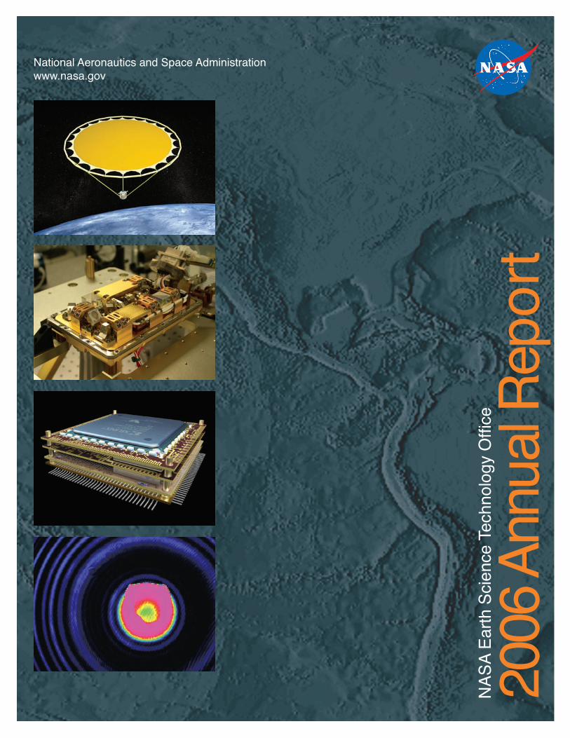
On the cover:
Four technology images from top to bottom are 1) an innovative Doppler radar antenna (see page 5),
2) a test laser similar to the Mercury Laser Altimeter (MLA) instrument aboard the MESSENGER space-
craft (see page 11), 3) a radiation-tolerant, intelligent memory stack (see page 13), and 4) a Fabry-Perot
ring pattern from a laser test (see page 10). The background science image shows Earth’s elevation and
bathymetry in shaded relief.

Contents
About ESTO •••••••••••• 1
The Year in Review:
Overview ••••••••••• 2
Instruments ••••••••• 4
UAVSAR •••••••••••• 6
Components •••••••• 8
Lasers ••••••••••••• 10
Information Systems •• 12
Future Challenges ••••••• 14
Additional Resources ••••• 15
About ESTO
As the lead technology office within
the Earth Science Division of the NASA
Science Mission Directorate, the Earth
Science Technology Office (ESTO) per-
forms strategic technology planning
and manages the development of a
range of advanced technologies for fu-
ture science measurements and opera-
tional requirements. ESTO technology
investments attempt to address the full
science measurement process: from the
instruments and platforms needed to
make observations, to the data systems
and information products that make
those observations useful.
ESTO’s approach to technology
development is also end-to-end:
• Planning technology investments
through comprehensive analyses of
science requirements
• Developing technologies through
competitive solicitations and
partnership opportunities
• Making technologies available to
scientists and mission managers for
infusion
ESTO employs an open, flexible,
science-driven strategy that relies on
competitive, peer-reviewed solicitations
to produce the best cutting-edge tech-
nologies. In many cases, investments
are leveraged through partnerships to
mitigate financial risk and to create a
broader audience for technology
infusion.
The results speak for themselves: a
varied portfolio of over 500 emerging
technologies that can enable and/or
enhance future science measurements
and an ever-growing number of infu-
sion successes.
From instruments
to data access,
ESTO technolo-
gies enable a full
range of scientific
measurements
1ii

Year in Review: Overview
With more than 400 completed
technology investments and a
current, active portfolio of over
100 projects, ESTO has continu-
ally built upon NASA’s reputation
for developing and advancing
leading-edge technologies.
How did ESTO do this year?
Here are few of our successes for fiscal
year 2006 (FY06), tied to NASA’s per-
formance goals for ESTO:
GOAL: Annually advance 25% of funded
technology projects one Technology
Readiness Level (TRL).
FY06 RESULT: 36% of funded
technology projects advanced at
least one TRL.
SPOTLIGHT: ESTC2006
ESTO held its sixth annual technol-
ogy conference on June 26th-29th
at the University of Maryland. This
year’s conference – ESTC2006 (Earth
Science Technology Conference
2006) – included over 90 technical
papers in three parallel session-
tracks. A third session track was
added this year to showcase technol-
ogy developments from across the
NASA Science Mission Directorate,
including topics such as: astrophys-
ics, planetary, propulsion, and sub-
orbital technologies. More than 300
GOAL: Enable one new science
measurement capability or significantly
improve performance of an existing
one.
FY06 RESULT: The Multiband Reconfig-
urable Synthetic Aperture Radar Proj-
ect has resulted in the fabrication and
testing of a sixteen-element Synthetic
Aperture Radar Small Array Demonstra-
tor (SARSAD) system, capable of limited
frequency tuning and azimuth/eleva-
tion steering under computer control.
Although this technology still has some
challenges to overcome, additional
investment may enable a geostation-
ary Earth orbit interferometric SAR that
could measure crustal deformations
(i.e. glaciers and volcano monitoring)
and that might contribute to earth-
quake prediction capabilities.
GOAL: Mature two to three technolo-
gies to the point where they can be
demonstrated in space or in an opera-
tional environment.
FY06 RESULTS: 20 technology projects
that were funded in FY06 achieved ac-
tual infusion. Examples include:
- The Radiation Tolerant Intelligent
Memory Stack (RTIMS) has been com-
mercialized and successfully sold.
- The Spatial-Temporal Data Mining
System for Tracking and Modeling
Ocean Object Movement project has
provided customized code to sev-
eral NASA programs, NOAA, and the
Florida Fish and Wildlife Research
Institute for a wide array of applica-
tions.
attendees hailed from NASA, academia,
industry and federal labs. Full proceed-
ings are available at the ESTO website.
2
- The Reconfigurable Hardware in
Orbit (RHinO) project was selected by
the Human and Robotic Technologies
program in NASA’s Exploration Office
for implementation funding. RHinO
has also been employed by the Cross
Track Infrared Sounder – which will
fly on NASA’s NPP mission and the
NPOESS satellites – as well as by two
U.S. Air force satellites: the
XSS-11 and TACSat2.
3
ESTO’s Infusion Success (Over 400 completed
projects through FY06)
Each dot represents one of the over 500projects (active and completed) in ESTO’s portfolio as of June, 2006
���� ���� ���� ���� ���� ���� ����
���
���
���
���
���
���
���
��������
��
��������������������������������������������
��������������
�����������
���
����
Technologies Infused(over 29%)
Technologies with a Path
Identified for Infusion
(over 45%)
TechnologiesAwaiting Infusion
Opportunity(under 26%)

Year in Review: Instruments
The Instrument Incubator Program
(IIP) provides funding for new instru-
ment and measurement techniques,
from concept development through
breadboard and flight demonstrations.
Instrument development of this scale
outside of a flight project consistently
leads to smaller, less resource inten-
sive, and easier to build flight instru-
ments. Furthermore, developing and
validating these technologies before
mission development improves their
acceptance and infusion by mission
planners, thereby significantly reduc-
ing costs and schedule uncertainties.
The IIP held some 35 active projects in
FY06. 23 of these were added in FY05
as part of a competitive solicitation
focused on high-priority science areas,
including aerosol and trace gas mea-
surements in the lower troposphere,
ice topographic mapping, and tropo-
spheric winds measurements. The IIP
graduated seven projects this year, all
of which advanced at least one technol-
ogy readiness level. The FY06 gradu-
ates are as follows:
• Tropospheric Trace Species Sensing
Fabry-Perot Interferometer (TTSS-FPI)
• Far IR Spectroscopy of the Tropo-
sphere (FIRST)
• Miniature Vector Laser Magnetom-
eter
Inst
ru
men
ts
The IIP-funded NEXRAD in Space
project, which graduated in FY06, has
completed design, prototype, and
performance study tasks on several
critical technologies for this innova-
tive Doppler radar instrument.
The NEXRAD instrument concept is
a radar system that consists of a 30
meter, space-deployable antenna with
a spiral scanning feed. This design
54
The NEXRAD
deployment
scenario
SPOTLIGHT: NEXRAD in Space
• Cryospheric Advanced Sensor: A Spaceborne Microwave
Sensor for Sea Ice Thickness and Snow Cover Character-
istics
• NEXRAD (Next Generation Weather Radar) In Space - A
radar for monitoring hurricanes from geostationary orbit
• Prototype Geostationary Synthetic Thinned Aperture
Radiometer (GeoSTAR)
• SVIP: Solar Viewing Interferometer Prototype for Obser-
vations of Earth Greenhouse Gases
This assembled receiver is a key sub-system of the Tro-
pospheric Wind Lidar Technology Experiment (TWiLiTE)
instrument, an airborne Doppler lidar. Other technolo-
gies under development for the TWiLiTE project include a
high-spectral-resolution, all-solid-state laser transmitter,
optical filters, and a conically scanning holographic tran-
ceiver. Ground testing of TWiLiTE may begin in early 2007
and the project team anticipates a test flight on one of the
NASA WB-57 high-altitude aircraft in 2008.
A joint experiment was performed recently among
NASA, the University of Michigan, and the Ohio State
University, which brought together four ESTO projects:
two current Advanced Component Technology (ACT)
efforts, one current IIP project, and one graduated
IIP project. The goal of the experiment was to investi-
gate and collect data on radio-frequency interference
(RFI) seen in microwave radiometer measurements.
The NASA Passive/Active L/S-band (PALS) microwave
radar/radiometer, using a new ACT-developed flat-
panel antenna (see spotlight on page 9), was placed on
a building roof viewing the sky at the RF-noisy grounds
of the NASA Jet Propulsion Laboratory. Three different
RFI detectors (all IIP and ACT projects) collected PALS
data and detected RFI.
Initial analysis indicates the major source of RFI is like-
ly an air-traffic control radar from the nearby airport.
The data are being analyzed to compare the RFI detec-
tion and mitigation techniques utilized by the different
systems. Data are also being used to validate a RFI
mitigation algorithm being developed for the Aquarius
radiometer.
The data are also proving to be invaluable for under-
standing the emerging technologies and how they func-
tioned together. The integrated experiment provided a
data set not attainable with any one individual project.
could potentially
monitor a 5300
km earth disk
from geostation-
ary Earth orbit, or
about 36,000 km
from Earth. The
novel spiral scan-
ning system elimi-
nates the need to
rotate or steer the
antenna and sig-
nificantly reduces
the complexity of
the system.
NEXRAD has been
specifically de-
signed to capture
full lifetimes of all
hurricane eye-
wall replacement cycles, an essential
ingredient for significantly improved
hurricane forecasting. Resolution is
estimated to be 12 - 14 km horizontal
and 300 m vertical using real-time
data compression techniques.
SPOTLIGHT: Four ESTO-Funded Projects
Participate in Successful Joint Experiment,
Data Used in Aquarius Validation
A setup of the flat-panel
antenna – on a rooftop
at the NASA Jet Propul-
sion Laboratory – during
the joint radio-frequency
interference experiment

Year in Review: UAVSAR
The Uninhabited Aerial Vehicle Synthetic Aperture Radar (UAVSAR) project finds its origins in an
Instrument Incubator Program investment at the Jet Propulsion Laboratory entitled: “Repeat Pass
Deformation Measurement Capability for an Airborne Platform.” That IIP investment was singled
out for targeted funding to develop a SAR system and conduct flight testing on a NASA Gulf-
stream III aircraft. The SAR design is also capable of being flown on an Ikhana (Predator-B) UAV.
With flight testing set to begin in early 2007, the UAVSAR project has met significant milestones:
delivery of the first pod to the Jet Propulsion Laboratory for instrument integration, completion of
all ground system hardware, integration and testing of flight radar components, and completion
of necessary modifications to the Gulfstream III.
The UAVSAR will have the capability to
conduct rapid repeat pass interferom-
etry measurements with separations
ranging from minutes to years, en-
abling measurements of surface defor-
mation to mm level accuracy. Current
space-based assets have a repeat orbit
cycle of 24 to 44 days, limiting their
effectiveness in the study of rapidly
deforming features.
The design of the UAVSAR focuses
on two key challenges. First, repeat
pass measurements will need to be
taken from flight paths that are nearly
identical. The instrument will utilize
real-time GPS that interfaces with the
platform flight management system to
confine the repeat flight path to within
a 10 m tube. Second, the radar vector
from the aircraft to the ground target
area must be similar from pass to
pass. This will be accomplished with
an actively scanned antenna designed
to support electronic steering of the
antenna beam with a minimum of 1°
increments over a range to
exceed ±15° in the flight direction.
Anticipated Technology Benefits:
• Enable a repeat pass in as little as
20 minutes
• Greatly reduced mass and volume to
existing airborne SAR technologies
• Modular design to allow integration
on multiple airborne platforms UA
VSA
R
Anticipated Science Applications:
• Land Cover (classification)
• Hydrology (soil moisture)
• Agriculture
• Ice (velocity, thickness, and age)
• Oceanography
• Vegetation Structure
• Hydrology (Topography)
• Archeology
• Pre-programmed, autonomous
operation without need for a radar
operator
• Flexible digital system that can trade
data rate for performance and accept
additional frequencies and param-
eters in the future
Assembly of the first SAR pod, to be flown on the NASA Gulf-
stream III aircraft, viewed from the aft end of the pod. Note
the two aft cooling ducts; these are critical to maintain the
antenna and equipment at an appropriate temperature.
This illustration depicts
synthetic aperture radar
patterns of seismic defor-
mations associated with
a model earthquake on
the San Francisco section
of the San Andreas Fault
(depicted in yellow).
76

Year in Review: Components
The Advanced Component Technology
(ACT) program leads research, develop-
ment, and testing of component- and
subsystem-level technologies to
advance the state-of-the-art of instru-
ments, Earth- and space-based plat-
forms, and information systems. The
ACT program focuses on projects that
reduce risk, cost, size, mass, and devel-
opment time of technologies to enable
their eventual infusion into missions.
In FY06, the ACT program held 31 ac-
tive projects, 14 of which were selected
in FY05 as part of the 2005 NASA
ROSES (Research Opportunity for Space
and Earth Science) solicitation. 92 pro-
posals were received for this solicita-
tion, which sought core component and
subsystem technologies that could en-
able new Earth science measurements.
The ACT program also graduated 11
projects in FY06:
• Electro-Optic Imaging Fourier Trans-
form Spectrometer
• Ultra-High Efficiency L-Band Trans-
mit/Receive Modules for Large Aper-
ture Scanning SAR Antennas
• Development of a 1K X 1K GaAs
QWIP Far Infrared Detector Array
• Multiband Reconfigurable Synthetic
Aperture Radar (SAR)
• Quantum Gravity Gradiometer for
Sub-Surface Mapping Co
mpo
nen
ts
• Development of a Large Format Visible-NIR Blind Gallium
Nitride UV Imager for Atmospheric Earth Science Applica-
tions
• Transmit/Receive Membranes for Large Aperture SAR
Scanning Antennas
• Lightweight, Deployable, Dual-frequency / Polarization Mi-
crostrip Antenna array for Remote Sensing of Precipitation
• Low-power radio-frequency analog-to-digital converter (RF-
ADC) for Digital Microwave Radiometry with application to
Soil Moisture Remote Sensing
• Unified Onboard Processing and Spectroscopy (UniOPS)
• Compact, Lightweight Dual-Frequency Microstrip Antenna
Feed for Soil Moisture and Sea Surface Salinity Missions
All of the FY06 graduates from the ACT program advanced
at least one technology readiness level (TRL) and 8 of the 11
graduates advanced at least two TRLs.
A Quantum Well Infrared Photodetector (QWIP) array,
developed with funding by the ACT program, can now
see invisible infrared light in a range of “colors,” or
wavelengths. The detector is the world’s largest infra-
red detector technology that can sense infrared over
a broad range (8 to 12 micrometers) – an important
advance that has greatly increased the possible uses of
the technology.
Potential applications include: tropospheric and strato-
spheric temperatures and atmospheric trace chemicals;
tree canopy energy balance measurements; cloud layer
emissivities, droplet size, composition and height; vol-
canic SO2 and aerosol emissions; dust particle tracking;
CO2 absorption; coastal erosion; ocean and river ther-
mal gradients and pollution; equipment and instrument
analysis; ground based astronomy; and temperature
sounding.
A false color image of a NASA engi-
neer in the far infrared taken with
the one megapixel QWIP camera.
Warmer temperatures are orange,
cooler temperatures are dark red.
Notice the thermal handprint on her
lab coat as she removes her hand
from her pocket.
98
SPOTLIGHT: Million Pixel Infrared Detector Has Many Potential Applications
is a critical component for the development of a novel UV
holographic optical element telescope.
The project team expects to infuse the ShADOE technol-
ogy into an IIP project, called The Tropospheric Wind Lidar
Technology Experiment (TWiLiTE), aimed at developing an
airborne and/or space borne Doppler Lidar instrument to
measure tropospheric winds (see inset on page 4).
MSPA, a compact, lightweight, dual-frequency antenna
feed technology, will be flown on an aircraft in support of
CLASIC in June 2007. Based on technology originally de-
veloped for a large, lightweight, L-band, space-deployable
antenna, the MSPA will be used in CLASIC to help enable
airborne remote sensing of soil moisture during the three-
month study in Oklahoma.
It is hoped that CLASIC will provide new insights about the
relationship between land surface processes and observed
cloud cover, and vice versa. CLASIC is jointly supported
by the US Department of Energy Atmospheric Radiation
Measurement Program and NASA.
SPOTLIGHT: Microstrip Stacked-Patch Array (MSPA) Antenna Goes Airborne
to Support DOE Cloud Land Surface Interaction Campaign (CLASIC)
The prototype design of the 16-ele-
ment MSPA antenna to be installed
on a Twin Otter aircraft in support
of CLASIC.
This sample optic, one
of several developed
as part of the Shared
Aperture Diffractive
Optical Element (ShA-
DOE) project, contains
5 holographic optical
elements to collect and
focus atmospheric laser
backscatter. This optic

Exploration: Lander Guidance/Control, Atmo-
spheric Winds, Biochemical Identification, Optical
Communication, and Automated Ren-dezvous & Docking
Aeronautics: Turbulence Detection, Wind Shear Detection, and Wake
Vortices
The LRRP currently funds 18 projects at
NASA Goddard Space Flight Center and
NASA Langley Research Center. Part-
ners and collaborators include: Ameri-
can University, Boston College, the Jet
Propulsion Laboratory, Johns Hopkins
University Applied Physics Labora-
tory, Montana State University, Sandia
National Laboratory, the University of
Maryland, and numerous industrial
partners. The investments also cover
a broad range of laser/lidar challenge
areas, including:
• High-performance 1- and 2- Micron
Lasers
• High-reliability Pump Laser Diode
Arrays
• Space Radiation Tolerance
• Frequency Control and Wavelength
Conversion
• Electrical Efficiency
• Heat Removal and Thermal
Management
• Contamination Tolerance
• Photoreceiver and Detector
Development
Year in Review: Lasers
The Laser Risk Reduction Program
(LRRP) was established in 2001 by
the NASA administrator under the
recommendation of the Earth Science
Independent Laser Review Panel. LRRP
works to formalize design, testing, and
development procedures for durable
laser/lidar systems and architectures,
particularly in the critical 1- and 2- mi-
cron wavelengths. In doing so, the LRRP
aims to:
• demonstrate laser technologies that
can be reliably and confidently
infused;
• prepare technologies well in advance
of missions;
• maintain NASA’s in-house laser ex-
pertise and capabilities
• investigate science-technology trade-
offs; and
• test engineering flight models in final
configurations.
Laser/lidar remote sensing techniques
can satisfy a variety of measurement
and operational requirements:
Earth Science: Clouds/ Aerosols, Tropospheric Winds, Ozone, Carbon Dioxide, Biomass, Water
Vapor, Land, Ice, and Ocean, Surface Mapping, and Laser Altimetry
Space Science: Surface Materials, Physical State, Surface Topography, Molecular Species, and
Atmospheric Composition / Dynamics
A 20 milli-Joule (mJ) laser developed with LRRP funding
was successfully used to communicate with the Mercury
Laser Altimeter (MLA) instrument aboard the MESSENGER
spacecraft during an Earth fly-by in May 2005. The laser, a
diode pumped High Output Maximum Efficiency Resonator
(HOMER), was installed at the NASA’s Goddard Geophysical
and Astronomical Observatory in Maryland and exchanged
laser pulses with the MLA, approximately 15 million miles
away.
The successful tests set a new distance record for back-
and-forth exchange of laser signals (the Galileo probe
received a one-way laser transmission from Earth at a
distance of about 4 million miles in 1992).
While this milestone is noteworthy, the real objective of
these tests was to verify the MLA’s ability to detect and
respond to a returned laser signal. Once MESSENGER is in
orbit around Mercury, the MLA will measure the round trip
time of its transmitted laser pulses that are reflected off
Lase
rs
1110
Fabry-Perot ring pattern
from a sequence of 22 la-
ser shots by a 15 mJ, 40
to 100 Hz, Diode pumped
Nd:Cr:YAG laser during a
vacuum life test
Goddard technologists used
this 48-inch telescope track-
ing facility at the Goddard
Geophysical and Astronomical
Observatory to transmit the
20 mJ laser return signal to
the MESSENGER spacecraft
An artist’s depiction of
MESSENGER’s Earth flyby
SPOTLIGHT: MESSENGER’s Earth Flyby Provides Opportunity for Ground
Return Tests, Sets Record for Laser Communication
An MLA-type laser, used for
testing and evaluation
the surface of the planet. These measurements, taken together with data obtained from other
instruments on MESSENGER, will provide high-precision mapping of Mercury’s topography and
libration, the slight wobble in a planet’s motion that can give insights about its core.

Year in Review: Information Systems
Advanced information systems are used
to process, archive, access, visualize,
and communicate science data. Ad-
vanced computing and communications
concepts that permit the transmission
and management of terabytes of data
are essential to NASA’s vision of a
unified observational network. ESTO’s
Advanced Information Systems Technol-
ogy (AIST) program employs an end-to-
end approach to evolve these critical
technologies – from the space segment,
where the information pipeline begins,
to the end user, where knowledge is
advanced.
In FY06, the AIST program added 28
new projects through a competitive
solicitation under the 2005 NASA Re-
search Opportunities in Space and Earth
Sciences (ROSES) announcement. The
AIST solicitation was targeted at fund-
ing component technologies to enable
sensor webs that can achieve future
Earth science objectives. The awards
are as follows:
• A Smart Sensor Web for Ocean Observa-
tions
• Implementation Issues and Validation of
SIGMA (Seamless IP-diversity based Gen-
eralized Mobility Architecture) in Space
Network Environment
• Virtual Sensor Web Infrastructure for Col-
laborative Science (VSICS)
• Increasing the Technology Readiness of
SensorML for Sensor Webs
• A Framework and Prototypes for the Self-
Adaptive Earth Predictive Systems (SEPS)
• Telesupervised Adaptive Ocean Sensors
• QuakeSim: Enabling Model Interactions in Info
rm
ati
on
Syst
emsSolid Earth Science Sensor Webs
• Satellite Sensornet Gateway (SSG)
• Sensor-Analysis-Model Interoperability Technology Suite
• Sensor Management for Applied Research Technologies (SMART)
• SEAMONSTER: A Smart Sensor Web in Southeast Alaska
• An Expandable Reconfigurable Instrument Node for a Web Sen-
sor Strand
• Land Information Sensor Web
• Reconfigurable Sensor Networks for In-Situ Sampling
• Autonomous, Intelligent Controller for Distributed Sensor Webs
• Sensor Web Dynamic Replanning
• An Objectively Optimized Sensor Web
• Sensor-Web Operations Explorer (SOX)
• Autonomous Disturbance Detection and Monitoring System for
UAVSAR
• An Inter-operable Sensor Architecture to Facilitate Sensor Webs
in Pursuit of GEOSS (Global Earth Observing System of
Systems)
• Soil Moisture Smart Sensor Web Using Data Assimilation and
Optimal Control
• Harnessing the Sensor Web through Model-based Observation
• Efficient Sensor Web Communication Based on Jointly Optimized
Distributed Wavelet Transform and Routing
• Sensor Web Modeling and Data Assimilation System Architec-
tures
• Optimized Autonomous Space - In-situ Sensorweb
• The Multi-agent Architecture for Coordinated, Responsive Obser-
vations
• An Adaptive, Negotiating Multi-Agent System for Sensor Webs
• Intelligent Agents for an Autonomous Mission Operations Web
12 13
Future space missions will require
increased resolution, improved data
quality, and additional capacity for
raw and processed data. This radia-
tion-tolerant stacked memory array,
suitable for both geostationary and
low Earth orbit missions, can ef-
ficiently handle the large data sets
of tomorrow, increase the accessibil-
ity and utility of data, and reduce
the risk, cost, size and development
time of space-based systems.
The RTIMS module is a major step
forward in the state of the art for
space based memory arrays. Its fea-
tures provide advanced functionality
and allow standardized hardware to
be used for radically different mis-
sions.
RTIMS features:
• Low mass (60 grams) and low vol-
ume (42.7 mm x 42.7 mm x 13.0
mm) package
• Large memory array (2 Gigabits
of error-corrected or 1 Gigabit of
triple redundant digital memory)
• Radiation, thermal, vibration, and
lifespan tested
• Reprogrammable Xilinx based
controller
First active layer of components
Quad Flat Package (QFP)
Layers fully assembled
Pure epoxy resin molding
Nickel and gold plating
Final tantalum shielding
The AIST program held some 56 active
investments, several of which gradu-
ated over the course of FY06, including:
• Reconfigurable Hardware in Orbit (RHinO)
• TCP/IP Router Board (TRB) with Ethernet
Interfaces
• Radiation Tolerant Intelligent Memory
Stack (RTIMS)
• 10/100 mb/sec Flight Ready Ethernet
Hardware
• Reconfigurable Protocol Chip for Satellite
Networks
• Realtime-Reconfigurable Distributed-
Computing for Adaptive Science Ops in
Satellite Formations using Heterogeneous
CPUs & Heterogeneous Connectivity
• Coupling High Resolution Earth System
Models Using Advanced Computational
Technologies
• Implementing a Supercomputer-Based
Grid Compute Engine for End-to-end Op-
eration of a High-Resolution, High Data-
Volume Terrestrial Carbon Cycle Model
• Complexity Computational Environments:
Data Assimilation SERVO (Solid Earth
Research Virtual Observatory) Grid
• Integration of OGC and Grid Technolo-
gies for Earth Science Modeling and Ap-
plications
• Hybrid Ground Phased Array for Low
Earth Orbiting Satellite Communications
• Mining Massive Earth Science Data Sets
for Climate and Weather Forecast Models
• Spatiotemporal Data Mining System for
Tracking and Modeling Ocean Objects
• Selection Technique for Thinning Satellite
Data for Numerical Weather Prediction
• Rapid Characterization of Causal Interac-
tions among Climate/Weather System
Variables
Nearly 90% of FY06 AIST program
graduates advanced at least one TRL
over the course of their funding.
A demo board that incorpo-rates two RTIMS modules
SPOTLIGHT: Radiation Tolerant Intelligent
Memory Stack (RTIMS)
An example of a simulation by the Grid-BGC project, a con-tinental-scale carbon cycle modeling system. The left image shows one input to the model: total precipitation (18-year annual Mean). The right image, showing potential gross pri-mary productivity for evergreen needleleaf forest (18-year annual Mean), is an output from the model, which produces estimates of state and flux variables for carbon, nitrogen, and water cycles.

Future Challenges Additional Resources
Active Remote Sensing Technologies to enable measurements of the atmo-
sphere, hydrosphere, biosphere, and lithosphere.
• Atmospheric chemistry using lidar vertical profiles
• Ice cap, glacier, sea ice, and snow characterization using radar and lidar
• Troposperic vector winds using lidar
While ESTO is uniquely situated to pursue a wide range of technology requirements, we have identified
five crosscutting technology areas that will serve a multitude of science disciplines:
14 15
A wealth of additional materials is available online at the
ESTO homepage – http://esto.nasa.gov – including:
Fully searchable database of active ESTO investments
Abstracts, papers and pre-sentations from the 2006 Earth Science Technol-ogy Conference (ESTC2006) as well as from previous ESTO conferences.
Information about ESTO solicitations and awards
The Earth Science Technology Integrated Planning System (ESTIPS), an evolving database of science require-ments linked to technology needs
Large Deployable Apertures to enable future weather, climate, and natural
hazards measurements.
• Temperature, water vapor, and precipitation from GEO
• Soil moisture and sea surface salinity using L-band
• Surface deformation and vegetation using radar
Intelligent Distributed Systems using advanced communication, on-board
radiation-tolerant reprogrammable processors, autonomous operations and
network control, data compression, high density storage.
• Long-term weather prediction linking observations to numerical models
• Interconnected sensor webs that share information to enhance observations
Information Knowledge Capture through novel visualizations, memory and
storage advances, and seamlessly linked models.
• Intelligent data fusion to merge multi-mission data
• Discovery tools to extract knowledge from large and complex data sets
• Real time science processing, archiving, and distribution of user products to
drive decision-support systems

Earth Science Technology OfficeGoddard Space Flight CenterGreenbelt, MD 20771
http://esto.nasa.gov