Keynote Speaker-1 Food for the World – GeoComputation Meeting

427
19 GeoComputation in 2061
Keith C. Clarke
ABSTRACT
This chapter examines the status of GeoComputation (GC) in the year 2061, 50 years into the future. It begins by using two case studies – the SAGE and CORONA systems – to show that the fields behind GC, namely, geographic information science and computer science, share a common twentieth-century heritage. Six themes are then chosen: fusion, mobility, ubiquity, the GeoWeb, interactive multimedia and biocomputation. Each of these is explored with respect to today’s trends and then in terms of what these areas could look like in 2061. Some extraordinary new develop-ments are anticipated, including bionic computing, quantum computers and an artificial reality inseparable from the actual. The chapter concludes by raising issues of preparation, posing ques-tions about what training and skills can prepare GC for its not-too-distant future.
19.1 INTRODUCTION
GeoComputation (GC) has been defined as the ‘art and science of solving complex spatial problems with computers’ (Openshaw and Abrahart, 2000). Taken narrowly, GC is the intersection in the Venn diagram that is geographic information science (GISci) on the one hand (Goodchild, 1992) and computer science on the other. Yet both fields have moved on significantly since the first exami-nations of the overlap, and any examination must now also include grid computing, simulation and modelling, spatial analysis, cartographic visualisation and visual analytics in addition to issues of high-performance computing (Clarke, 2003). Ubiquitous and mobile computing, in which comput-ers have morphed from desktop computing machines into components of almost every appliance and device associated with everyday life, were distant visions when GC was in its formative stage. Nevertheless, they were firmly on the futurist radar scope more than a decade ago (Clarke, 1999) and advances have since been made (Sui, 2014).
CONTENTS
Abstract .......................................................................................................................................... 42719.1 Introduction .......................................................................................................................... 42719.2 SAGE .................................................................................................................................... 42919.3 CORONA .............................................................................................................................. 43119.4 Evolution of Computer Cartography ..................................................................................... 43219.5 Future of GeoComputation ................................................................................................... 434
19.5.1 Future Fusion ............................................................................................................ 43419.5.2 Future Mobility ......................................................................................................... 43719.5.3 Ubiquitous Computing Future .................................................................................. 43819.5.4 Future GeoWeb .........................................................................................................44019.5.5 Interactive Multimedia in 2061 ................................................................................44019.5.6 Biocomputational Future ..........................................................................................442
19.6 Conclusion ............................................................................................................................442References ...................................................................................................................................... 443
K14459_C019.indd 427 2/10/2014 1:27:07 PM

428 Geocomputation
In this chapter, the question is posed: what lies in the future for GC? From both theoretical and practical perspectives, most of what could be foretold in 1999 has come about. Intractable problems have become tractable (Saalfeld, 2000); new methods for handling and visualising vast quantities of information have been developed and become commonplace, for example, the word cloud; human–computer interaction has reached a level that was science fiction in the 2002 movie Minority Report; the Internet is now how we pay our bills, do our shopping and communicate with our friends; and the World Wide Web has led to visions of cyberinfrastructure and cloud computing (Foster and Kesselman, 1999; Foster et al., 2001, 2002), a digital earth (Grossner et al., 2008) and the paradigm of volunteered geographic information (Goodchild, 2007). Significantly, these trends have led GISci into new application areas, across academic disciplines, and strengthened this emerging field of sci-ence (Janelle et al., 2009). The future trend is quite obviously toward interdisciplinarity, an aspect that GC has somewhat pioneered. Yet what exactly does the future hold for GC? What new trends in both GISci and computing will impact that future? To quote Aristotle, if you would understand anything, observe its beginning and its development. With this in mind, this chapter re-examines the past of computing and of computer-based mapping and analysis. Surprisingly, the pasts are not as separate as might be imagined, and so this confluence is used as a jumping-off point to examine the future, 50 years hence.
Geographers are often taught the history of the discipline’s traditions and paradigms. Varenius’ Geographia Generalis (1650) established both geography’s basis in observational science and its use of applied mathematics. Later came the quantitative revolution, the spatial analytic tradition and the birth of geographic information systems (GISs) and GISci. Yet geographical preparation rarely includes the history of computing and the deep links between mapping, spatial analysis and computational methods.
Missing also are the theories around which computer science is based. For example, the Church–Turing thesis is an essential part of understanding computers, programming languages and com-puter logic. A formal expression of the theorem states that for a process symbolised as M,
1. M can be set out in terms of a finite number of exact instructions (each instruction being expressed by means of a finite number of symbols)
2. M will, if carried out without error, produce the desired result in a finite number of steps 3. M can (in practice or in principle) be carried out by a human being unaided by any machin-
ery save paper and pencil 4. M demands no insight or ingenuity on the part of the human being carrying it out
Today, we would express the Church–Turing theorem as any task that can be reduced to a series of incremental steps that can be automated. In programming, we are taught that complex tasks can be simplified into steps and steps into sub-steps, so that eventually their solution becomes trivial. This approach is often called divide and conquer, and without it, few computing solutions to complicated problems would be forthcoming. The sequential processing that the theorem embeds, however, has probably restrained research into the reasoning behind parallel programming, an area that is likely to be of continued research in GC.
Analogue computing and geographical problem-solving may go back millennia, yet it is the Herman Hollerith mechanical tabulator, submitted for his Ph.D. dissertation and patented in 1889, that is credited with reducing the time needed to process the 1890 census from an estimated 13 years to just one (Figure 19.1). Hollerith used punched cards, an idea favoured by Charles Babbage in his analytical engine, borrowed in turn from Joseph Marie Jacquard’s weaving loom of 1805 (Figure 19.2). The link between the census and computing continued into the digital era. Digital computing’s earliest origins have recently been re-evaluated, and John Vincent Atanasoff and his student Clifford Berry are now credited with developing and building the first ABC (Atanasoff–Berry computer) during 1934–1942 at Iowa State College. Contrary to what is stated in many text-books, in 1973, the ENIAC patents of John Mauchly and J. Presper Eckert, then owned by the
AQ1
AQ2
K14459_C019.indd 428 2/10/2014 1:27:07 PM
429GeoComputation in 2061
Sperry Corporation, were voided, on evidence that Mauchly had seen Atanasoff’s design. In addi-tion in 1945, John von Neumann’s notes entitled First Draft of a Report on the EDVAC had broadly circulated. These notes recorded and expanded the computing logic behind the ABC, Mauchly’s ENIAC and the competing EDVAC at the Moore School of Electrical Engineering at the University of Pennsylvania, thus establishing computing principles as being in the public domain and giving birth to computer science independent from applied mathematics.
The earliest uses of computers were for computing ballistic trajectories by the US Army, solving large numbers of simultaneous equations, simple tabulation and cryptology. This changed rapidly, however, with the advent of the Cold War. The degree to which cartography, geography and com-putational problem-solving are intertwined is illustrated using two large-scale historical projects: the semiautomatic ground environment (SAGE) and CORONA. Each of these projects left profound impacts on GC, which we can extend to form the basis of an examination of GC’s future.
19.2 SAGE
The SAGE was an automatic control system for tracking and intercepting enemy bomber aircraft used by NORAD from the late 1950s into the 1980s. In the early stages of the Cold War, early warn-ing radar systems for mass bomber attacks over the north polar regions were capable of detecting incoming aircraft, but not of linking together data with other radars so that flight tracks and intercep-tion information could be synthesised. The system could eventually automatically guide defensive aircraft by transmitting instructions directly to their autopilot systems. The original concept came
FIGURE 19.1 The Hollerith Tabulator, as used for the 1890 US census. (From US Census Bureau, Suitland, MD.)
K14459_C019.indd 429 2/10/2014 1:27:09 PM

430 Geocomputation
from George E. Valley and Jay Forrester at MIT’s Lincoln Laboratories (Forrester went on to build simulation systems for urban modelling). Principal contractors for SAGE were IBM, Burroughs, the Mitre Corporation (formed for the project), Bell, Western Electric and the Systems Development Corporation, a RAND corporation spin-off (Jacobs, 1986). The network of radar sites extended offshore and included the Dew, Pine Tree and Mid-Canada lines, as well as many control stations in the United States. In 1964, the project was estimated to have cost between 8 and 12 billion dollars to design and deploy, and the project pushed the limits of theory and capability in computing, network-ing and control (NRC, 1999). The IBM AN/FSQ-7 computer used for the project contained 55,000 vacuum tubes, occupied about 2000 m2 of floor space, weighed 275 tons and used up to 3 MW of power. Telecommunications for the project were radio and telephone based, but many accounts attribute the early concept of the Internet and packet switching to SAGE.
The computer workstation for SAGE, a combination computer display and radar scope, was developed at the RAND corporation in Santa Monica, California (Figure 19.3). The workstation involved several elements now considered essential components of GIS, input of data from distrib-uted databases, real-time entry of positions using an on-screen stylus or gun, symbolic encoding of tracking data onto point symbols and computed map projections. Then graduate student Waldo Tobler, who worked on the project, initially created mylar map projection overlays to be placed on
FIGURE 19.2 Jacquard’s weaving loom of 1805, found still in use in Assam, India. (Author.)AQ3
K14459_C019.indd 430 2/10/2014 1:27:09 PM

431GeoComputation in 2061
the screens. From there to using the screen to draw the map was a logical next step (Clarke and Cloud, 2000), and within a year, Tobler (1959) posed and answered the question ‘Do possibilities for automation exist in cartography?’ Thus, SAGE is part of the creation story for GC, but then it is also directly linked to computer graphics, computer simulation and the Internet. As regards the latter, J.C.R. Licklider, who worked on SAGE, later became the first director of the Defense Department’s Information Processing Techniques Office and initiated the research that led to the creation of the ARPANET, precursor to the Internet. Similarly, SAGE was codesigned by Jay Forrester, a professor at MIT’s Lincoln Lab who later pioneered dynamical systems and urban modelling.
19.3 CORONA
CORONA was the world’s first spy satellite system and the project that invented the field of remote sensing. CORONA’s origins lie in another RAND project, called FEEDBACK, dating back to 1950. FEEDBACK, later operationalised as the SAMOS program and the lunar mapping camera (Cargill Hall, 2001), was a remote sensing system that used long focal length cameras in earth orbit, auto-matically developed the film and then scanned it for analogue transmission back to earth. Cameras for the project had their origin in the GENETRIX program, which during 1953–1954 released 640 weather balloons to drift across China and the Soviet Union carrying Itek cameras. The balloons were designed to be caught in flight by C-119 aircraft after drifting across the denied territory, and CORONA also borrowed this technology. CORONA became critical when the U-2 spy plane was shot down over Russia in May 1960. SAMOS’s transmission system was set aside in favour of a back-up system developed in case of failure in orbit. Fortunately, after 13 actual failures, CORONA (under the guise of the civilian/biological Discoverer program) acquired its first imagery in August 1960. The program was to profoundly influence US geography and the role that computation was to play in mapping and remote sensing.
CORONA was a film return system, in that exposed film was spooled into a canister that detached from the satellite and re-entered the atmosphere. These capsules were caught in mid-air by the same system designed for GENETRIX, later refined to use C-130 aircraft based out of Hickam Air Force Base in Honolulu, Hawaii. Over 12 years and 103 successful missions, some lasting months in orbit, CORONA acquired 800,000 images covering 750 million square nautical miles – 2.1 million linear feet of film taking up 39,000 storage canisters (Figure 19.4). Three aspects of CORONA are critical to the argument here. First, the amount of film and repeat imaging led to the need for an automated system to locate and recover images on demand, what would today be called
AQ4
AQ5
FIGURE 19.3 A SAGE early warning system radar console. (JoiIto and Wikipedia.)
K14459_C019.indd 431 2/10/2014 1:27:10 PM

432 Geocomputation
a digital library. Second, the peculiar geometry of the panoramic camera required systems for automatically geo-registering and re-projecting images into map geometry for display and overlay. This was initially done in analogue, but later digitally via camera models, creating the first military GIS (Cloud, 2002). Third, once CORONA became less mission critical to the Cold War as new sys-tems came on-line, it began to be used for civilian mapping purposes, first for environmental crises by the Environmental Protection Agency (EPA) and later for routine map revision by the USGS (Figure 19.5). The USGS created several special mapping centres for this purpose, and by 1968, ‘the Geological Survey became the largest civil agency user of the CORONA imagery’ (Baclawski, 1997). This clandestine cooperation was revealed in 1995, when CORONA imagery and the pro-gram were declassified (Ruffner, 1995; Peebles, 1997). Thus, CORONA’s history is another good example of how geographical problem-solving, cartography, applied mathematics and computer science came together not only to work toward national security but to also invent new technologies and create new disciplines, among them GC.
19.4 EVOLUTION OF COMPUTER CARTOGRAPHY
As the Cold War gave way to the New World Order, GIS entered the mainstream and geo-position-ing entered everyday life through navigation and location-finding systems. By way of making some general observations, consumer products as commodities often seem to have a broader basis in basic scientific research, with a time lag determined by the degree of sensitivity of the science. These science efforts are often coordinated nationally or globally and are led by funding efforts spear-headed by national science institutions or the Department of Defense. The larger institutions that deal with geography, the Census Bureau, the defence and intelligence agencies, the civilian map-ping agencies, NASA, the EPA, etc., are all fully invested in the integration of cartography/GISci and computer science. Indeed, a social network theory diagram of the key participants in the history of the disciplines in the last 60 years would produce a tight set of personal linkages. These links would play out in joint publication, study, dissertation advising, sabbatical visits and other ways.
FIGURE 19.4 CORONA Argon KH-5 image of the Santa Barbara channel. Approximately 1965. (Author.)
K14459_C019.indd 432 2/10/2014 1:27:10 PM

433GeoComputation in 2061
(a)
(b)
FIGURE 19.5 (a) CORONA KH-4 image of Goleta, California, about 1966. (b) Revised USGS 1:24,000 scale map, published the next year.
K14459_C019.indd 433 2/10/2014 1:27:13 PM

434 Geocomputation
There are also more formal links, such as the establishment of GIS sections and conferences under the IEEE and the ACM.
In spite of this strong linkage, the pace of computing science is increasing rapidly. New develop-ments in computer science, new theories and technological changes, will have profound impacts on GC. As science becomes increasingly specialised, the environments and circumstances that force cross-cutting and interdisciplinary or multidisciplinary study are increasingly rare. In spite of the years of research, there remains a gap between cutting-edge research in computing and in GISci. In our speculation on the future of GC, we assume that this gap will narrow or perhaps disappear. One wonders what could be done today to make this a certainty for the future.
19.5 FUTURE OF GEOCOMPUTATION
Daniel Hudson Burnham, architect of New York’s Flatiron Building and Washington’s Union Station, is known for having stated in 1921: ‘Make no little plans. They have no magic to stir men’s blood and probably will not themselves be realized’. Using this logic, for the sake of discussing the future of GC, the target year of 2061, 50 years hence, will be chosen. Having been raised on the wild future technology of the Jetsons, a cartoon which featured elaborate robotic contraptions, aliens, holograms and whimsical inventions, and it being set in 2062, this seems appropriate. At the risk of losing focus, the discussion will centre on six trends in computing and their implications for GC. These are (1) data fusion, sometimes also called integration or interoperability, (2) mobility, (3) ubiquity, (4) the evolving GeoWeb, (5) interactive multimedia and (6) biocomputation. In each case, the situation in 2011 will be used as a jumping-off point for some ideas about 2061.
19.5.1 FUTURE FUSION
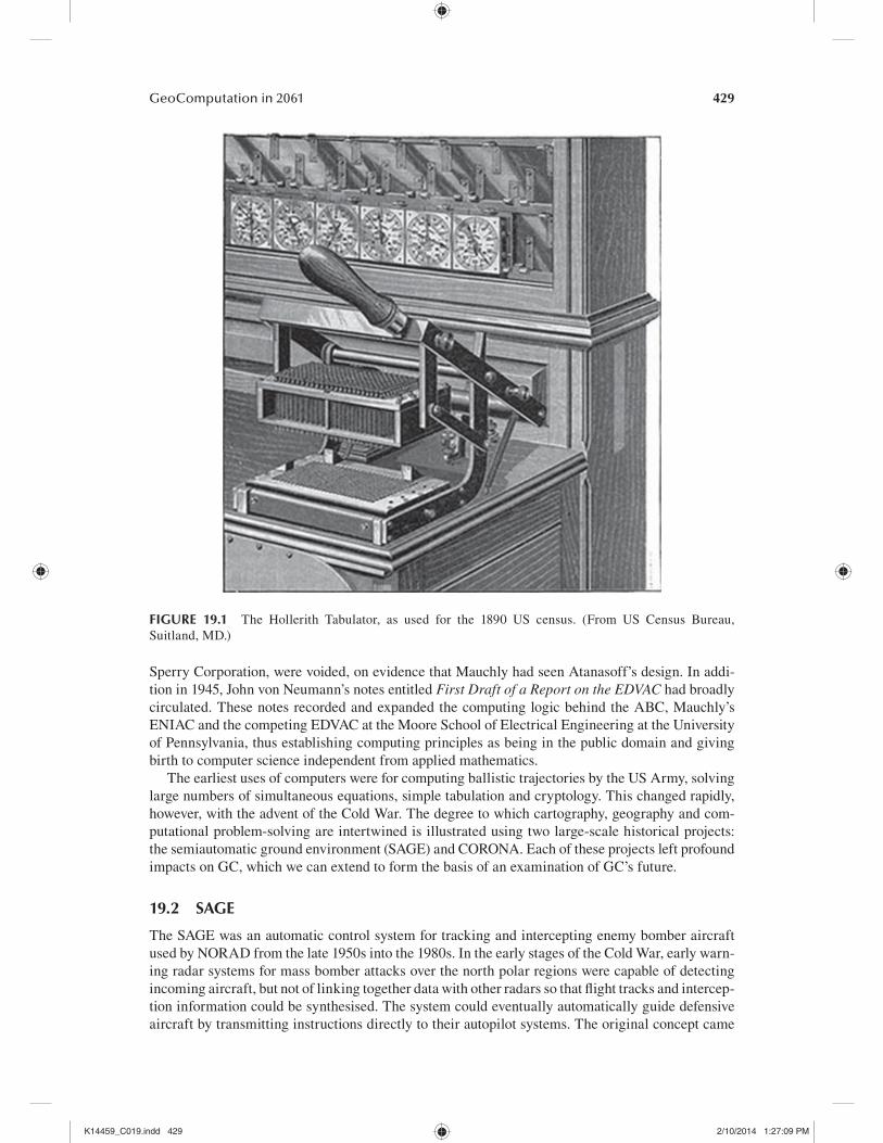
Contemporary issues surrounding the theme of geospatial data fusion largely surround the long-standing themes of formats, standards and data integration based on the GIS layer model. Major remaining unsolved problems are how to remove the effects of data collection, such as image and map tiling, how to integrate across scales and the role of standards. Current research is centred on the role of open source software within GIS, reflecting movement away from pro-prietary turnkey style software systems (Steiniger and Bocher, 2009); on the need to make data accessible and discoverable, not just in searches but by search engines; and on the nature of data ownership, including issues of privacy, secrecy, encryption and watermarking (Lopez, 2002). Key elements include what is usually termed spatial data infrastructures, global or national, including clearing houses, web portals, user-contributed or volunteered geographic databases and the GeoWeb (Giuliani et al., 2011). The digital earth is probably the grandest vision for the future, a vision only partly realised at present (Grossner and Clarke, 2007; Goodchild et al., 2012) (Figure 19.6). The early US lead in creating the vision was passed up in 2001, only to be taken up in China.
Data fusion also means dealing with new and more available data sources, such as high-resolution overhead and oblique imagery, lidar, webcams, sensor webs and autonomous vehicles (e.g. Elaksher, 2008; Conover et al., 2010; Bradley and Clarke, 2011). Also present and highly influential is the NSF-driven vision of the cyberinfrastructure, widely known as grid computing. Current research focuses on grid architectures for geospatial data handling and analysis systems, web services and open standards, such as those of the Open Geospatial Consortium (Yang et al., 2010).
Reflecting on current trends that are likely to extend into the future, one trend has been the cost of memory. Computer science teaches us that memory reflects a paradox of efficiency versus access. With the cost and size of memory falling at a rapid pace, it is easily possible to imagine a situation where so much disc storage exists that it is highly redundant (sometimes as a back-up mechanism) and suffers from the versioning problem (i.e. many versions of the same data set and software func-tions must be stored, yet differences among them are minor). Retrieval costs and time may rise,
AQ6
K14459_C019.indd 434 2/10/2014 1:27:13 PM
435GeoComputation in 2061
as the digital earth vision is fulfilled and new data sources and very-high-resolution imagery become commonplace. Also critical is the handling of time. The current approach of keeping a snapshot of a time-static data layer must yield to time stamps on objects, so that geographic situations at a particular time can be reconstructed. The current generation of searching and spatial indexing systems largely reflect research of the late twentieth century, and completely new and efficient data structures and indexing may be necessary as we move forward (Samet, 2009). Generally, as data projects become more digital and on-line, the incremental addition of creating new data will give way to the demands for update and maintenance. Therefore, change detection and characterisation will assume new significance. Special purpose web mining tools that detect and label new roads or settlements will be necessary or even mandatory. Cartography will enter an era when geospatial data are compiled, identified and indexed automatically, in much that same way that web pages are currently handled by search engines.
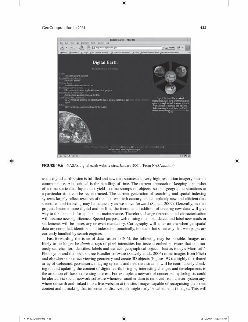
Fast-forwarding the issue of data fusion to 2061, the following may be possible. Images are likely to no longer be dumb arrays of pixel intensities but instead embed software that continu-ously searches for, identifies, labels and extracts geographical objects. Just as today’s Microsoft’s Photosynth and the open source Bundler software (Snavely et al., 2006) mine images from Flickr and elsewhere to extract viewing geometry and create 3D objects (Figure 19.7), a highly distributed array of webcams, geosensors, imaging systems and new data streams will be continuously check-ing on and updating the content of digital earth, bringing interesting changes and developments to the attention of those expressing interest. For example, a network of concerned hydrologists could be alerted via social network software whenever another dam is removed from a river system any-where on earth and linked into a live webcam at the site. Images capable of recognising their own content and in making that information discoverable might truly be called smart images. This will
FIGURE 19.6 NASA’s digital earth website circa January 2001. (From NASA/author.)
K14459_C019.indd 435 2/10/2014 1:27:14 PM
436 Geocomputation
involve feature level coding, automated metadata creation and complete lineage coding. It could also recognise event sequences or narratives (NRC, 2010). For example, the reverse-pointing cam-era worn on my head could alert me when I’m being approached from behind in a suspicious way or when one of my friends’ faces is recognised nearby. By 2061, this capability will be in every camera and smartphone and embedded into our vision systems via bionics or augmented reality.
By 2061, the current concern with merging spatial and temporal movement, patterns and trends will be thoroughly researched, have substantial theory and be linked to new suites of methods for visualising and interpreting movement and actions. Theory will link real time with longer time horizons, for example, weeks, months, years and geological eras. There will be standardised and well-understood means by which simulations and artificial environments are integrated with current and near-time data. Personal guidance systems could be highly customised; for example, a personal global positioning system (GPS) could recognise a route and ask if we are retracing a visit we made a year ago. In a group decision-making environment, say a local planning meeting, the entire future of a building could be simulated, along with the associated uncertainties, and presented to the audi-ence for approval or modification. Furthermore, these capabilities are likely to embrace all of our senses and respond to voice, touch and human thought. Just as today’s Internet is still largely word and text oriented, yet has transformed memory, communication and social activity, future develop-ments in multisensory input and output are likely to change the meaning and purpose of the web and its content. The digital earth vision, as a framework on which to hang georeferenced information, could create a digital globe that is simultaneously all of human memory, the knowledge base of human experience and history and a day-to-day representation that frames our perceptions, if only as the base for augmented information.
The latter implies that geography must reframe its role as an academic discipline. When all geographical data and facts are instantaneously retrievable, they become simply the basis around which new knowledge can be acquired. Geography is a synthesis discipline, and synthesis is best done by human interpretation, but at a higher level than simply detecting and recognising features and events in data. While visiting a site, for example, we could ask the system what has happened here and what will happen here in the future? This is an extension of Goodchild’s (2004) request that a digital library be able to answer the request: give me everything that has happened here.
FIGURE 19.7 The Bundler open source image reconstruction software used to create a 3D point cloud from tourist photos of London’s Trafalgar Square. (From Snavely, N. et al., Int. J. Comput. Vis., 80, 189, 2008. With permission.)
K14459_C019.indd 436 2/10/2014 1:27:25 PM

437GeoComputation in 2061
We may be able to ask, What is happening here, why and what will the outcome be? This is an entirely higher level of spatial reasoning, spatial thinking and geographical intelligence.
19.5.2 FUTURE MOBILITY
If ever a suite of technologies was destined to collide with GISci and GC, it was the field now known as location-based services (Raper et al., 2007). Highly mobile computing devices, often cellular telephones, which include the ability to interact with global navigation satellite systems (GNSSs) (usually the GPS), have built new markets and new applications, facilitated navigation and rout-ing and opened up the geospatial world to a whole new popular audience. When coupled with the on-line and wireless capabilities of the Internet and the World Wide Web, our current era is largely determined by services and innovations in this emergent field. Issues today are largely technical, how strong can wireless service support phone service, how can applications be made to fit onto small devices with limited displays, what impact is the mobile pad computing device market having and what impact are spatially enabled social networking applications such as Foursquare having on how we interact with our geographic environment? Meek et al. (2014) provided their view on location-based GC, with a vision of how mobile devices might be used in the future for undertaking analysis and modelling in the field.
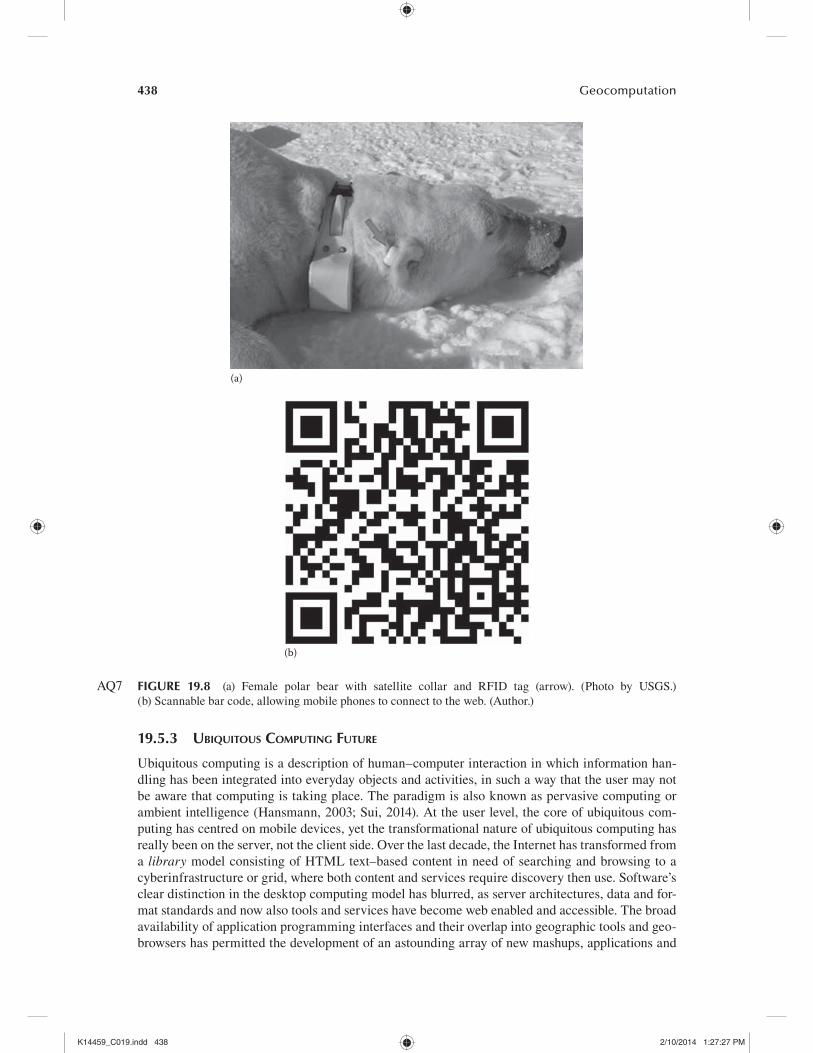
Speculation on mobile computing in 2061 can be made with more certainty than in other fields. The vision of global wireless coverage, as demonstrated by today’s satellite telephones common in journalism, is already feasible. With four proposed GNSSs likely to be in operation well before 2061, the positioning redundancy is likely to drop receiver errors to the order of millimetres, with positions acquirable in seconds with 60 Hz frequency. GPS chips have continued to become smaller, to require less powerful antennas and to be embedded in everything from telephones to shoes and ski jackets. Next-generation systems, such as microlites, offer the promise of positioning indoors, underground and underwater, thus eliminating many of the current constraints on GNSS use. Pretty much any appliance will be able to report its position, velocity and track. Once embedded into sen-sor networks and combined with other technologies such as video recognition, bar code reading and radio-frequency identification (RFID), it will be possible by 2061 to track anything, anywhere (Figure 19.8). The on-line tracking services currently offered by FedEx and UPS are merely hints of what is to come.
The company Advanced Digital Concepts reported on their website in 2007 that employee Ben Thompson has implanted an RFID chip surgically into the palm of his hand that can unlock and start his car automatically by touching a target on the window. With GNSS and wirelessly enabled devices, such implanted chips will probably be common in the future, for everything from validating security to managing employees in smart buildings and on campuses. As a uni-versity professor, if I am still lecturing to classes in the near future, I would welcome the day when a glimpse at my iPad as class starts reveals a map of the students in my class, some sitting neatly in rows with symbols indicating that they have submitted their homework, some as red line symbols desperately converging on the lecture theatre and others remaining as blinking orange dots motionless in one place at home or in the coffee shop. Nevertheless, this vision presents challenges. Who will track 9 billion lifelines in 2061, and for what purpose? Will we still rely on visual analytics to envision the patterns and flows of human motions (daily commutes, journeys, migrations, pilgrimages), or will automated systems do this? If so, are we interested in normal behaviour or that which varies from the norm? Can such technologies be used to enforce, identify and convict individuals who are in the wrong place at the wrong time? Will GC have the power and capacity to do agent-based modelling with 9 billion agents with human traits in real time? If so, what new knowledge will be created that is of use or of direct benefit? These are intergen-erational questions of great importance. Experience shows that today’s youth are quick to trade positional (Foursquare) and personal (Facebook) identity for shared information, and I wonder if their grandchildren will feel the same way in 2061.
K14459_C019.indd 437 2/10/2014 1:27:25 PM
438 Geocomputation
19.5.3 UBIQUITOUS COMPUTING FUTURE
Ubiquitous computing is a description of human–computer interaction in which information han-dling has been integrated into everyday objects and activities, in such a way that the user may not be aware that computing is taking place. The paradigm is also known as pervasive computing or ambient intelligence (Hansmann, 2003; Sui, 2014). At the user level, the core of ubiquitous com-puting has centred on mobile devices, yet the transformational nature of ubiquitous computing has really been on the server, not the client side. Over the last decade, the Internet has transformed from a library model consisting of HTML text–based content in need of searching and browsing to a cyberinfrastructure or grid, where both content and services require discovery then use. Software’s clear distinction in the desktop computing model has blurred, as server architectures, data and for-mat standards and now also tools and services have become web enabled and accessible. The broad availability of application programming interfaces and their overlap into geographic tools and geo-browsers has permitted the development of an astounding array of new mashups, applications and
(a)
(b)
FIGURE 19.8 (a) Female polar bear with satellite collar and RFID tag (arrow). (Photo by USGS.) (b) Scannable bar code, allowing mobile phones to connect to the web. (Author.)
AQ7
K14459_C019.indd 438 2/10/2014 1:27:27 PM

439GeoComputation in 2061
services (Crooks et al., 2014). Also new has been the incorporation of virtual computational power delivered via the World Wide Web, including grid access and links to high-performance comput-ing (Adnan et al., 2014; Birkin and Malleson, 2014). The highly distributed nature of these systems has led to the emergence of cloud computing: the provision of computational resources on demand via computer networks. It has also led to task dispersal, the so-called crowdsourcing possible when systems exist that allow users to create and contribute their own data and information (Crooks et al., 2014). While these developments have already revolutionised GC, by 2061, they promise a future where living and computing become almost indistinguishable, a world where bits and atoms are mixed (Negroponte, 1995).
Moore’s law, in which the number of transistors that can be placed on an integrated circuit doubles about every 2 years, is expected to continue until 2015 or 2020 or later. Yet before 2061, it is likely that improvements in silicon-wafer-based computers will produce diminishing returns. Heat generation, materials shortages and several other factors will contribute to the end of the CPU chip as we know it (See, 2014). However, well before 2061, it is believed that the first quan-tum computers will be more readily available. Quantum computers are nanoscale technologies that use the spin state and spin space to exploit quantum mechanical phenomena, such as super-position and entanglement, to perform operations on data. Although quantum computing is in its infancy, NASA and Google have formed a partnership to invest in the first commercial quantum computer developed by the Canadian company D-Wave. The computer, which will cost 15 million USD, will reach speeds 3600 times greater than conventional computers (Jones, 2013). Moreover, quantum algorithms already exist that run exponentially faster than any possible probabilistic classical algorithm.
Quantum computing requires a rethinking of Boolean logic, based on q-bits or qubits. A quan-tum computer (Figure 19.9) is exponentially more complex than a classical computer with the same number of bits because describing the state of n qubits requires 2n complex coefficients. Measuring the qubits would produce a classical state of only n bits, but such an action would also destroy the quantum state. Instead, a quantum computer operates by modifying qubits with a fixed sequence of quantum logic gates called a quantum algorithm. Theoretically, any problem solvable with a quantum computer can also be solved with a traditional computer. The difference is speed, and in a few known instances, quantum computers could make computationally impossible or intractable problems solvable. A 300 qubit computer is capable of describing 2300 states, a value of about 1090, exceeding the number of atoms in the known universe. Computing capacity and storage would be
FIGURE 19.9 Qubit coupled to a resonator. (From Erik Lucero, Quantum Research Laboratory, University of California, Santa Barbara, Santa Barbara, CA.)
K14459_C019.indd 439 2/10/2014 1:27:27 PM

440 Geocomputation
immense, and computation would be extremely fast, even for difficult problems. Pseudorandom number generators would yield to true randomness. If quantum computers are also small as implied by the promise of nanotechnology, then 2061 could have available computing power for almost everything that humans use.
GeoQuantumComputation would be a world in which all objects could compute. The Internet of things could become an Internet of intelligent things. Coupling computing power with nanoma-chines such as actuators and motes would reinvent computing itself. With millimetre accuracy posi-tioning within microseconds, even every molecule could have memory and network connections and perform operations. Steel girders could measure and report their level of stress; nanorobots could examine the human circulatory system from the inside, recognising health problems as they develop; and every stem of wheat could be monitored for its health, moisture and insolation. A paper (or plastic) map could be its own digital analogue! Perhaps at some time soon after 2061, living mat-ter will have computing power placed directly into its DNA, rather than it having to be implanted surgically or worn.
19.5.4 FUTURE GEOWEB
The Internet and the World Wide Web of today are still shaped by the information vehicles that gave them birth, including the file transfer protocol, the hypertext transfer protocol, e-mail and search engines. The so-called Web 2.0 has extended the set to include social networking, Twitter and others (see Crooks et al., 2014 for their view of the evolving GeoWeb). To these have been added GeoWeb applications that exploit position, such as Foursquare and EchoEcho. Ubiquitous GPS-enabled wire-less devices have created virtual organisations of users who share everything from restaurant tips to photos. Some central sites exploiting user-supplied data have created maps and databases, while others have used the web as a new distribution medium for everything from government reports to books. After a generation of the web as an archive, clearing houses first assisted finding, and then portals became the means to browse and locate. With Wikipedia and Google, the web is fast taking the place of the collective human memory.
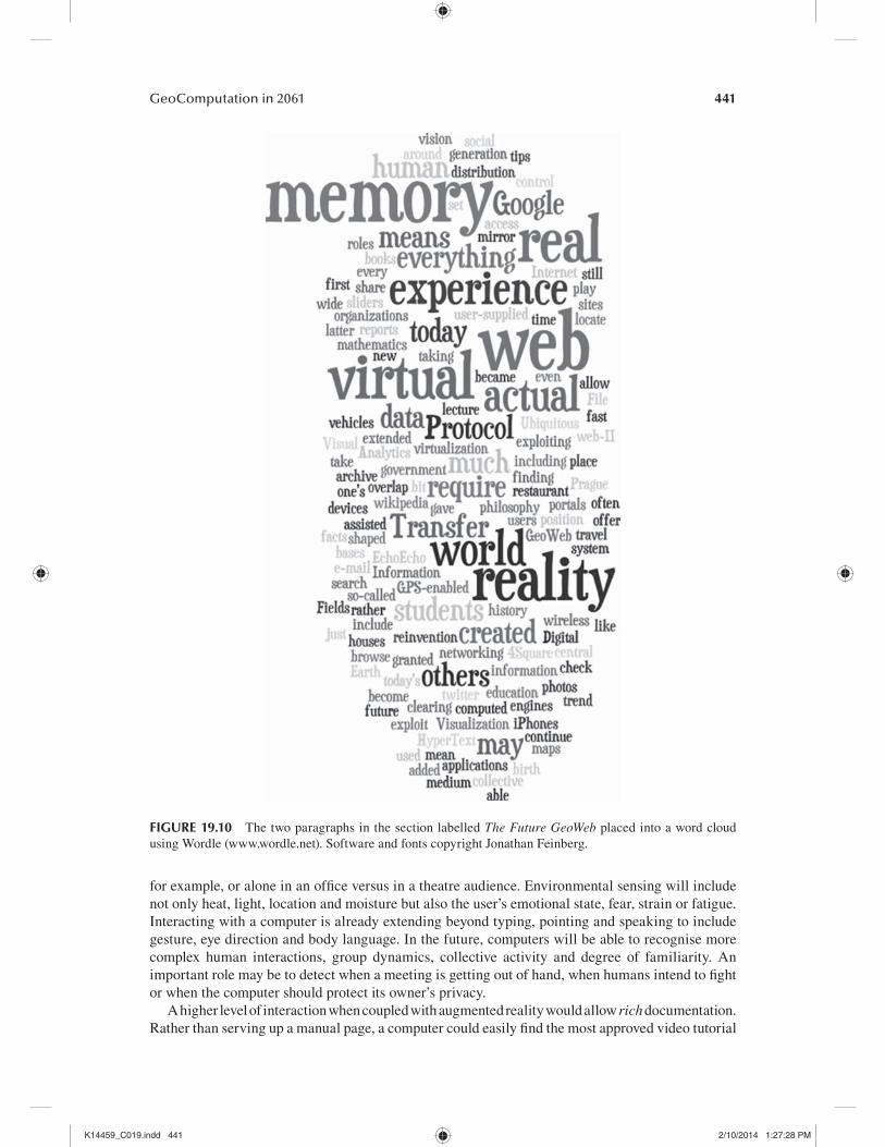
This latter trend will continue. By 2061, the web will have become both human memory and history and the means by which to access them. The virtualisation of the digital earth will mean that reality and virtual reality will overlap. Such a mirror world will offer virtual travel to all such that one’s memory of, say, Prague will be a real memory of a virtual experience as often as a real memory of an actual experience that is every bit or even more real than the actual. Such a vision system may require reality sliders that allow us to control how much of our reality is actual and how much is computed. This would require a reinvention of education; just as today’s students check lecture facts in real time on their iPhones with Google, students in 2061 will be able to experience rather than take for granted the world around them. Fields like information visualisation and visual analytics in the future may play the roles that philosophy or mathematics does today. This paragraph may be better presented to its audience in 2061 as Figure 19.10.
19.5.5 INTERACTIVE MULTIMEDIA IN 2061
We live in an age of interactivity. A child placed in front of a computer with a mouse clicks on everything, expecting some action or event to happen as a result. From simple computational begin-nings in Wikis and HyperCard stacks, computer interaction now includes words, sounds, video, speech recognition, audio and music. Media which developed separately, telephones and e-mail, for example, have merged into new devices and systems. The smartphone and interactive tablet have recently redefined how we interact with our computers. I recently found myself dragging my hands outward in front of a projection screen, expecting the image on it to enlarge!
Trends in interactive multimedia can be extended into the future. Context-sensitive comput-ers can adapt to the conditions under which they are being used, at night or in direct sunlight,
AQ8
K14459_C019.indd 440 2/10/2014 1:27:27 PM
441GeoComputation in 2061
for example, or alone in an office versus in a theatre audience. Environmental sensing will include not only heat, light, location and moisture but also the user’s emotional state, fear, strain or fatigue. Interacting with a computer is already extending beyond typing, pointing and speaking to include gesture, eye direction and body language. In the future, computers will be able to recognise more complex human interactions, group dynamics, collective activity and degree of familiarity. An important role may be to detect when a meeting is getting out of hand, when humans intend to fight or when the computer should protect its owner’s privacy.
A higher level of interaction when coupled with augmented reality would allow rich documentation. Rather than serving up a manual page, a computer could easily find the most approved video tutorial
FIGURE 19.10 The two paragraphs in the section labelled The Future GeoWeb placed into a word cloud using Wordle (www.wordle.net). Software and fonts copyright Jonathan Feinberg.
K14459_C019.indd 441 2/10/2014 1:27:28 PM

442 Geocomputation
and select the part most suitable. Intelligent devices could summon specialised help depending on what accident has happened. Using haptics, the computer could both be controlled and provide user feedback; for example, a robotic frame could both support weakened legs and provide force feed-back to strengthen the muscles. By 2061, all five of the senses will be available for human–computer interactions. Smell and taste have remained almost unexploited so far, but are powerful and evoca-tive and highly spatial. Human suffering and adaptation on losing a sense are well known, and here, the computer could also play an important role.
19.5.6 BIOCOMPUTATIONAL FUTURE
Biological computation is a catch-all phrase for four distinct subfields: biomolecular computation (e.g. DNA sequencing), computational biology (use of simulation in biological systems), bioinfor-matics (management of biological information) and biological computation (simulating living pro-cesses). Laffan (2014) provides a comprehensive overview of the application of GC methods to geolocated biological data. However, two new developments will affect BioGeoComputation by 2061: artificial life and biological computers.
Artificial life has often seen the creation of programs and models that emulate biological processes, such as plant succession, disease dispersal, neural networks or genetic algorithms. Biomimicry has recently expanded to include machines that simulate biological adaptations, such as fins, textured skin and autonomous microdrones that fly like bees or hummingbirds. Many devel-opments have taken place in the last decades in creating artificial limbs, even under thought control by their users. Both of these computational areas can be extended into the future.
The genetic unravelling of DNA that opened up bioengineering implies that living organisms could be bred or engineered around computing tasks. Rather than encode an algorithm to simu-late land use change, for example, a solution could be bred by combining genetic virus fragments and having them compete to best mimic the process across space. Agent-based models could be physically placed into simulated or even natural environments to determine where transportation bottlenecks will occur. Experience shows that genetically engineered foods often contaminate the natural environment, so care would have to be taken not to allow these biofragments to be self-sustainable organisms. Just as in quantum computing, there may be a means to tap DNA itself for computation by emulating gates and switches, allowing computers or solutions to be grown or assembled.
Far more likely is the increased use of computing devices inside or on the human body. While some applications will allow disabilities to be overcome, others will enhance the senses, truly the stuff of superhero comics. There is essentially no difference between wearing augmented reality glasses that can display a collection of blueprints in correct position and transparent perspective across a building in three dimensions on the one hand and actually having x-ray vision on the other. Already, body scans are replacing human searches for airport security. A digital earth promises to deliver any piece of information anywhere on demand. Increasingly, the ties of distance to geogra-phy will weaken, just as the international computer expertise market has opened up the world from Bangalore to Japan. Not only the where but also the who of computing will change and reconfigure as a result. Clearly, all of humankind will be users, but who will be the designers, developers and builders once these concepts come to fruition?
19.6 CONCLUSION
In this chapter, we began by examining the thesis that the twentieth-century histories of computing and of GISci, including cartography and remote sensing, share more in common than is well under-stood. GC is that self-selected branch of both fields that overlaps. After examining two examples of these blended histories, the chapter selected six topics of current interest to GC, explored the present state of the art and speculated on where the issues will be 50 years into the future. All six
K14459_C019.indd 442 2/10/2014 1:27:28 PM

443GeoComputation in 2061
topics – fusion, mobility, ubiquity, the GeoWeb, interactive multimedia and biocomputation – reveal some extraordinary potential changes in the future, sufficient that the challenges of today will be overcome and that a new set of challenges will emerge to face our grandchildren.
A closing theme is that of preparation. What sets of new skills are necessary to be a designer, a developer or a user of the next generation of technologies and how are they best learned and taught? What geographic and computational theory will survive and still show relevance in the years ahead? How can today’s faculty and professionals retrain themselves for a future where today’s new technologies are primitive? How will the students who are to inherit this future get the interdisciplinary and even ultradisciplinary skills necessary to flourish? The need for truly interdisciplinary education is now clear, yet institutions have been slow in responding. Geography seems well positioned intellectually to lead this interdisciplinary shift (Clarke, 2011), but to do so, the discipline needs to lose its internal divisions and further embrace computational geogra-phy and GIS. Already, other fields are exploring spatial cognition, human factors, visual analyt-ics, augmented reality and spatial thinking. What can be done today to position GC for what is yet to come?
One thing that is clear is that geographers know too little computer science and vice versa. Any effort that blends the disciplines will help, and where this can be encouraged, it should be. Geographers should know how to program, how to manipulate the web and how to serve data across the Internet and about the quirks of numerical operations. Similarly, the stereotypical computer sci-ence student needs to lift his or her head up from a computer screen and take in the richness of the world around him or her. All who work across the field owe it to themselves to follow research and developments in both disciplines, a demanding task. Perhaps most of all, GC needs to keep an eye on the future, to better know how to mould it. John Pierce (1910–2002) stated that ‘after growing wildly for years, the field of computing appears to be reaching its infancy’. I, for one, regret that I will not live to see GC in its prime.
REFERENCES
ADC. 2007. Implanted chip opens new doors. http://www.adcmobile.com/media/ben_rfid_interview.htm.Visited4-13-2011.
Adnan, M., Longley, P., Singleton, A., and Turton, I. 2014. Parallel computing in geography. In GeoComputation, 2nd edn., eds. R. J. Abrahart and L. See, pp. x–x. Boca Raton, FL: Taylor & Francis.
Baclawski, J. A. 1997. Corona: The foundation for a mapmaking revolution. In CORONA: Between the Sun and the Earth. The First NRO Reconnaissance Eye in Space, ed. R. A. McDonald. Bethesda, MD: American Society for Photogrammetry and Remote Sensing.
Birkin, M. and Malleson, N. 2014. e-Research and GeoComputation. In GeoComputation, 2nd edn., eds. R. J. Abrahart and L. See, pp. x–x. Boca Raton, FL: Taylor & Francis.
Bradley, E. S. and Clarke, K. C. 2011. Outdoor webcams as geospatial sensor networks: Challenges, issues and opportunities. Cartography and Geographic Information Science 38(1): 5–22.
Cargill Hall, R. 2001. SAMOS to the Moon: The Clandestine Transfer of Reconnaissance Technology Between Federal Agencies. Chantilly, VA: Office of the Historian, National Reconnaissance Office.
Clarke, K. 2003. Geocomputation’s future at the extremes: High performance computing and nanoclients. Parallel Computing 29(10): 1281–1295.
Clarke, K. C. 1999. Visualizing different geofutures. In Geocomputation: A Primer, eds. P. Longley, S. Brooks, R. McDonnell, and B. Macmillan, pp. 119–137. London, U.K.: John Wiley & Sons Ltd.
Clarke, K. C. and Cloud, J. G. 2000. On the origins of analytical cartography. Cartography and Geographic Information Science 27(3): 195–204.
Cloud, J. 2002. American cartographic transformations during the Cold War. Cartography and Geographic Information Science 29(3): 261–282.
Conover, H., Berthiau, G., Botts, M., Goodman, M., Li, X., Lu, Y., Maskey, M., Regner, K., and Zavodsky, B. 2010. Using sensor web protocols for environmental data acquisition and management. Ecological Informatics 5(1): 32–41.
Crooks, A., Hudson-Smith, A., Croitoru, A., and Stefanidis, A. 2014. The evolving GeoWeb. In GeoComputation, 2nd edn., eds. R. J. Abrahart and L. See, pp. x–x. Boca Raton, FL: Taylor & Francis.
AQ9
AQ10
AQ11
AQ12
K14459_C019.indd 443 2/10/2014 1:27:28 PM

444 Geocomputation
Elaksher, A. F. 2008. Fusion of hyperspectral images and lidar-based dems for coastal mapping. Optics and Lasers in Engineering 46(7): 493–498.
Foster, I. and Kesselman, C. (eds.) 1999. The Grid: Blueprint for a New Computing Infrastructure. San Francisco, CA: Morgan Kaufman.
Foster, I., Kesselman, C., Nick, J. M., and Tuecke, S. 2002. The physiology of the grid: An open grid services architecture for distributed systems integration. Open Grid Service Infrastructure WG, Global Grid Forum.
Foster, I., Kesselman, C., and Tuecke, S. 2001. The anatomy of the grid: Enabling scalable virtual organizations. Lecture Notes in Computer Science, Vol. 2150. Berlin, Germany: Springer.
Giuliani, G., Ray, N., and Lehmann, A. 2011. Grid-enabled spatial data infrastructure for environmental sciences: Challenges and opportunities. Future Generation Computer Systems: The International Journal of Grid Computing—Theory, Methods and Applications 27(3): 292–303.
Goodchild, M. F. 1992. Geographical information science. International Journal of Geographical Information Systems 6: 31–46.
Goodchild, M. F. 2004. The Alexandria digital library: Review, assessment, and prospects. D-Lib Magazine 10: 5.Goodchild, M. F. 2007. Citizens as voluntary sensors: Spatial data infrastructure in the world of Web 2.0.
International Journal of Spatial Data Infrastructures Research 2: 24–32.Goodchild, M. F., Guo, H., Annoni, A., Bian, L. de Bie, K. et al. 2012. Next-generation digital Earth. Proceedings
of the National Academy of Sciences United States of America, doi:10.1073/pnas.1202383109.Grossner, K. E. and Clarke, K. C. 2007. Is Google Earth, “Digital Earth”—Defining a Vision. In Proceedings,
Fifth International Symposium on Digital Earth, San Francisco, CA, June 5–9, 2007.Grossner, K. E., Goodchild, M. F., and Clarke, K. C. 2008. Defining a digital earth system. Transactions in GIS
12(1): 145–160.Hansmann, U. 2003. Pervasive Computing: The Mobile World. New York: Springer.Jacobs, J. F. 1986. The SAGE Air Defense System: A Personal History. Bedford, MA: MITRE Corporation.Janelle, D. G., Hespanha, S. R., Goodchild, F. M., and Goodchild, M. F. 2009. Workshops and national dis-
semination of geographic analysis in the social sciences: The CSISS experience in the USA. Journal of Geography in Higher Education 33(Suppl. 1): S88–S103.
Jones, N. 2013 Google and NASA snap up quantum computer. Nature 497: 417–418. doi:10.1038/nature.2013.12999.
Laffan, S. W. 2014. GeoComputation: Applications in biology. In GeoComputation, 2nd edn., eds. R. J. Abrahart and L. See, pp. x–x. Boca Raton, FL: Taylor & Francis.
Lopez, C. 2002. Watermarking of digital geospatial datasets—A review of technical, legal and copyright issues. International Journal of Geographical Information Science 16(6): 587–607.
Meek, S., Priestnall, G., and Abrahart, R. J. 2014. Location based GeoComputation: A strategic rethinking of the opportunities for outdoor research afforded by mobile devices. In GeoComputation, 2nd edn., eds. R. J. Abrahart and L. See, pp. x–x. Boca Raton, FL: Taylor & Francis.
National Research Council. 1999. Funding a Revolution: Government Support for Computing Research. Washington, DC: National Academies Press.
National Research Council. 2010. New Research Directions for the National Geospatial Intelligence Agency. Workshop Report. Washington, DC: National Academies Press.
Negroponte, N. 1995. Being Digital. New York: Vintage.Openshaw, S. and Abrahart, R. J. 2000. GeoComputation. London, U.K.: Taylor & Francis.Peebles, C. 1997. The CORONA Project: America’s First Spy Satellites. Annapolis, MD: Naval Institute Press.Raper, J., Gartner, G., Karimi, H., and Rizos, C. 2007. A critical evaluation of location based services and their
potential. Journal of Location Based Services 1(1): 5–45.Ruffner, K. C. (ed.) 1995. CORONA: America’s First Satellite Program. Washington, DC: Center for the Study
of Intelligence, Central Intelligence Agency.Saalfeld, A. 2000. Complexity and intractability: Limitations to implementation in analytical cartography.
Cartography and Geographic Information Science 27(3): 239–249.Samet, H. 2009. Database and representation issues in Geographic Information Systems (GIS). Lecture Notes
in Computer Science 5886: 1–6.See, L. 2014 Limits to GeoComputation. In GeoComputation, 2nd edn., eds. R. J. Abrahart and L. See. Boca
Raton, FL: Taylor & Francis.Snavely, N. Steven, M. Seitz, S. M., and Szeliski, R. 2006 Photo tourism: Exploring photo collections in 3D.
ACM Transactions on Graphics 25(3): 835–846.
AQ13
AQ14
K14459_C019.indd 444 2/10/2014 1:27:28 PM
445GeoComputation in 2061
Steiniger, S. and Bocher, E. (2009) An overview on free and open source GIS developments. International Journal of Geographical Information Science 23(10): 1345–1370.
Sui, D. 2014. Ubiquitous computing, spatial big data, and open GeoComputation. In GeoComputation, 2nd edn., eds. R. J. Abrahart and L. See, pp. x–x. Boca Raton, FL: Taylor & Francis.
Tobler, W. R. 1959. Automation and cartography. Geographical Review 49(4): 526–534.Yang, C. W, Raskin, R., Goodchild, M., and Gahegan, M. 2010. Geospatial cyberinfrastructure: Past, present
and future. Computers, Environment and Urban Systems 34(4): 264–277.
AUHTOR QUERIES[AQ1] Citation Foster et al. (2000), Cargill Hall (2002) have been changed to Foster et al. (2001),
Cargill Hall (2001), respectively as per the reference list. Please check.[AQ2] Please provide the expansions of the acronyms “ENIAC”, “EDVAC”, “CORONA”, and
“NORAD” if appropriate.[AQ3] Please provide complete source line details for Figures 19.2–19.4, 19.8.[AQ4] Please provide the expansion of the acronym “ARPANET,” if appropriate.[AQ5] Please provide the expansions of the acronyms “FEEDBACK,” “SAMOS” and
“GENETRIX,” if appropriate.[AQ6] Please provide the expansion of the acronym “ACM” and “IEEE,” if appropriate.[AQ7] Please check the caption of Figure 19.8 for correctness.[AQ8] Please check the term “GeoQuantumComputation” for correctness.[AQ9] Clarke (2011) is cited in the text but not provided in the reference list. Please check.[AQ10] Please provide citation for ADC (2007).[AQ11] Please update page range for Adnan et al. (2014), Birkin and Malleson (2014), Crooks et al.
(2014), Laffan (2014) Meek et al. (2014), Sui (2014).[AQ12] Please provide page range for Baclawski (1997), Grossner and Clarke (2007), if applicable.[AQ13] Please provide complete details for Foster et al. (2002).[AQ14] Please provide volume number and page range for Goodchild (2012).
K14459_C019.indd 445 2/10/2014 1:27:28 PM