05 WRE Introduction - 2-Points to White Rock East ...€¦ · watches. The area is a ... Driven by...
11
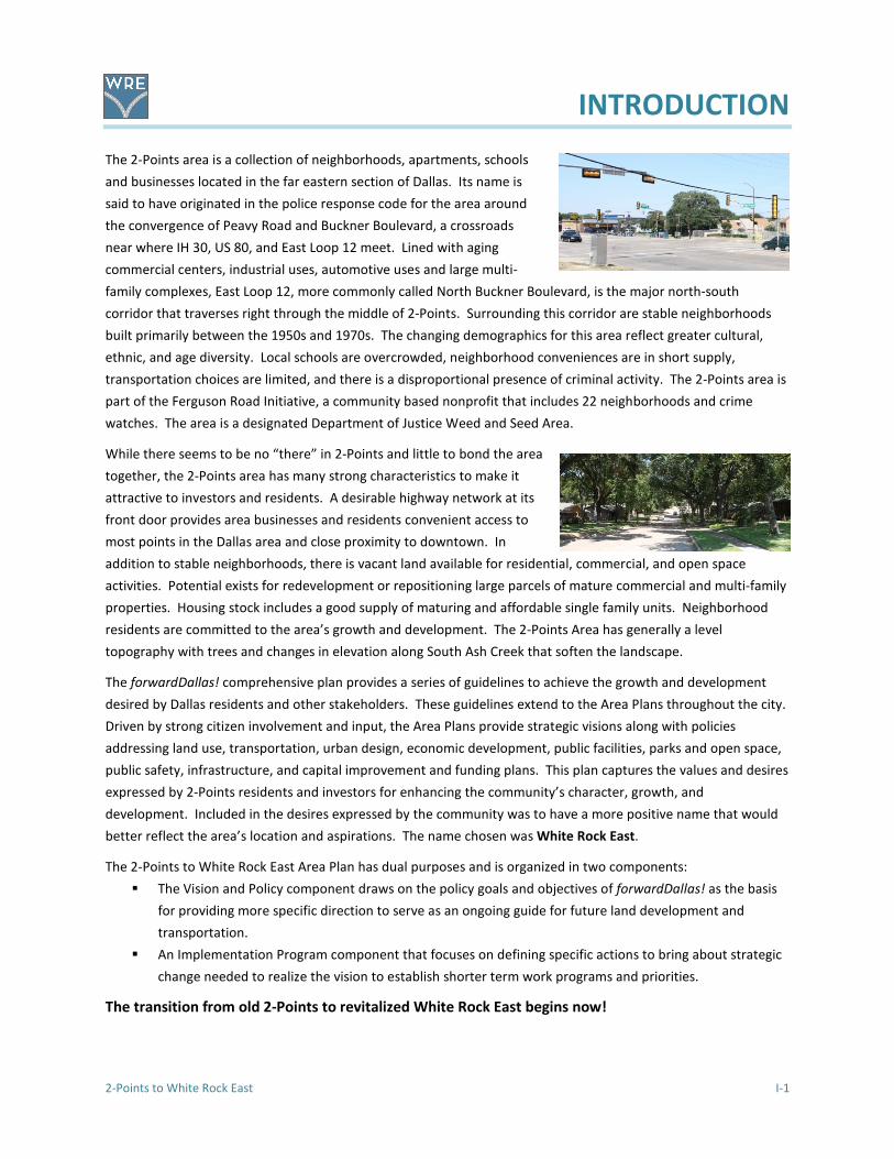
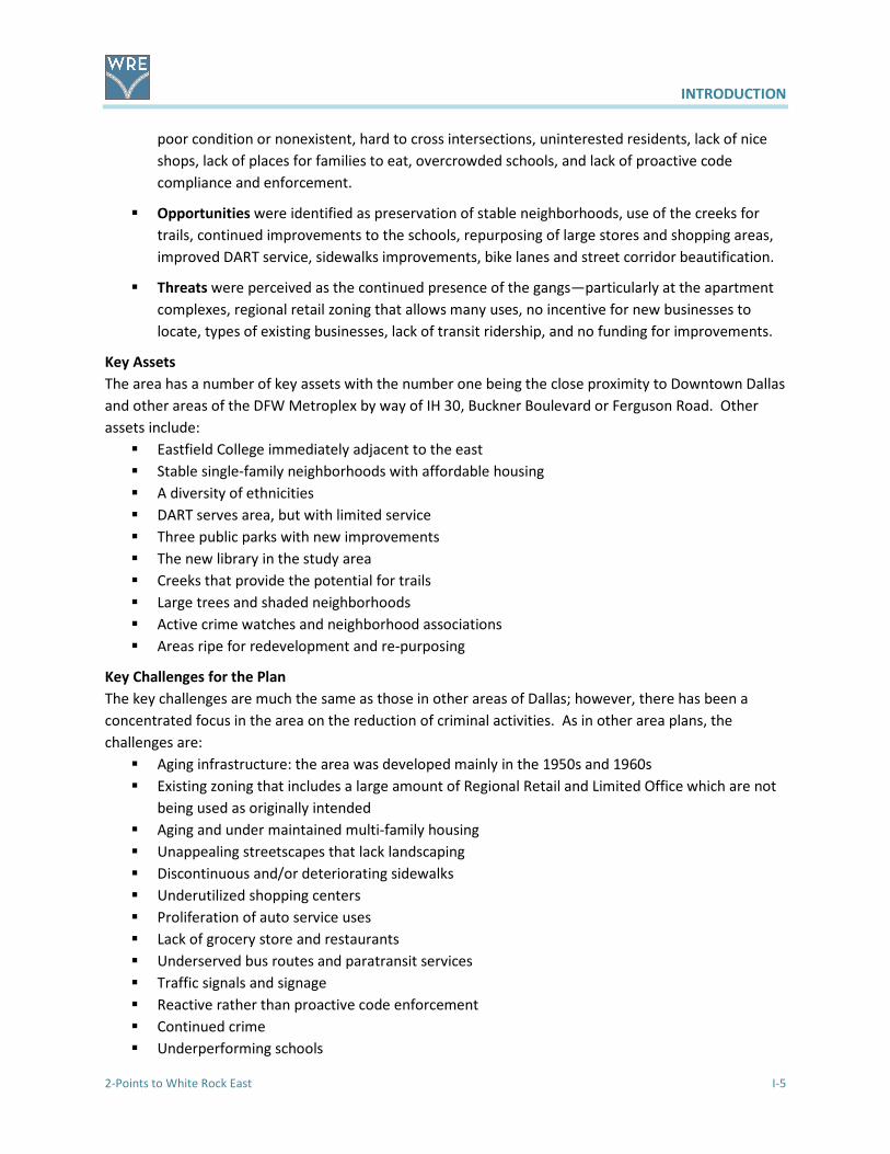
INTRODUCTION 2-Points to White Rock East I-1 The 2-Points area is a collection of neighborhoods, apartments, schools and businesses located in the far eastern section of Dallas. Its name is said to have originated in the police response code for the area around the convergence of Peavy Road and Buckner Boulevard, a crossroads near where IH 30, US 80, and East Loop 12 meet. Lined with aging commercial centers, industrial uses, automotive uses and large multi- family complexes, East Loop 12, more commonly called North Buckner Boulevard, is the major north-south corridor that traverses right through the middle of 2-Points. Surrounding this corridor are stable neighborhoods built primarily between the 1950s and 1970s. The changing demographics for this area reflect greater cultural, ethnic, and age diversity. Local schools are overcrowded, neighborhood conveniences are in short supply, transportation choices are limited, and there is a disproportional presence of criminal activity. The 2-Points area is part of the Ferguson Road Initiative, a community based nonprofit that includes 22 neighborhoods and crime watches. The area is a designated Department of Justice Weed and Seed Area. While there seems to be no “there” in 2-Points and little to bond the area together, the 2-Points area has many strong characteristics to make it attractive to investors and residents. A desirable highway network at its front door provides area businesses and residents convenient access to most points in the Dallas area and close proximity to downtown. In addition to stable neighborhoods, there is vacant land available for residential, commercial, and open space activities. Potential exists for redevelopment or repositioning large parcels of mature commercial and multi-family properties. Housing stock includes a good supply of maturing and affordable single family units. Neighborhood residents are committed to the area’s growth and development. The 2-Points Area has generally a level topography with trees and changes in elevation along South Ash Creek that soften the landscape. The forwardDallas! comprehensive plan provides a series of guidelines to achieve the growth and development desired by Dallas residents and other stakeholders. These guidelines extend to the Area Plans throughout the city. Driven by strong citizen involvement and input, the Area Plans provide strategic visions along with policies addressing land use, transportation, urban design, economic development, public facilities, parks and open space, public safety, infrastructure, and capital improvement and funding plans. This plan captures the values and desires expressed by 2-Points residents and investors for enhancing the community’s character, growth, and development. Included in the desires expressed by the community was to have a more positive name that would better reflect the area’s location and aspirations. The name chosen was White Rock East. The 2-Points to White Rock East Area Plan has dual purposes and is organized in two components: The Vision and Policy component draws on the policy goals and objectives of forwardDallas! as the basis for providing more specific direction to serve as an ongoing guide for future land development and transportation. An Implementation Program component that focuses on defining specific actions to bring about strategic change needed to realize the vision to establish shorter term work programs and priorities. The transition from old 2-Points to revitalized White Rock East begins now!
-
Upload
truongkiet -
Category
Documents
-
view
212 -
download
0
Transcript of 05 WRE Introduction - 2-Points to White Rock East ...€¦ · watches. The area is a ... Driven by...
INTRODUCTION
2-Points to White Rock East I-1
The 2-Points area is a collection of neighborhoods, apartments, schools
and businesses located in the far eastern section of Dallas. Its name is
said to have originated in the police response code for the area around
the convergence of Peavy Road and Buckner Boulevard, a crossroads
near where IH 30, US 80, and East Loop 12 meet. Lined with aging
commercial centers, industrial uses, automotive uses and large multi-
family complexes, East Loop 12, more commonly called North Buckner Boulevard, is the major north-south
corridor that traverses right through the middle of 2-Points. Surrounding this corridor are stable neighborhoods
built primarily between the 1950s and 1970s. The changing demographics for this area reflect greater cultural,
ethnic, and age diversity. Local schools are overcrowded, neighborhood conveniences are in short supply,
transportation choices are limited, and there is a disproportional presence of criminal activity. The 2-Points area is
part of the Ferguson Road Initiative, a community based nonprofit that includes 22 neighborhoods and crime
watches. The area is a designated Department of Justice Weed and Seed Area.
While there seems to be no “there” in 2-Points and little to bond the area
together, the 2-Points area has many strong characteristics to make it
attractive to investors and residents. A desirable highway network at its
front door provides area businesses and residents convenient access to
most points in the Dallas area and close proximity to downtown. In
addition to stable neighborhoods, there is vacant land available for residential, commercial, and open space
activities. Potential exists for redevelopment or repositioning large parcels of mature commercial and multi-family
properties. Housing stock includes a good supply of maturing and affordable single family units. Neighborhood
residents are committed to the area’s growth and development. The 2-Points Area has generally a level
topography with trees and changes in elevation along South Ash Creek that soften the landscape.
The forwardDallas! comprehensive plan provides a series of guidelines to achieve the growth and development
desired by Dallas residents and other stakeholders. These guidelines extend to the Area Plans throughout the city.
Driven by strong citizen involvement and input, the Area Plans provide strategic visions along with policies
addressing land use, transportation, urban design, economic development, public facilities, parks and open space,
public safety, infrastructure, and capital improvement and funding plans. This plan captures the values and desires
expressed by 2-Points residents and investors for enhancing the community’s character, growth, and
development. Included in the desires expressed by the community was to have a more positive name that would
better reflect the area’s location and aspirations. The name chosen was White Rock East.
The 2-Points to White Rock East Area Plan has dual purposes and is organized in two components:
� The Vision and Policy component draws on the policy goals and objectives of forwardDallas! as the basis
for providing more specific direction to serve as an ongoing guide for future land development and
transportation.
� An Implementation Program component that focuses on defining specific actions to bring about strategic
change needed to realize the vision to establish shorter term work programs and priorities.
The transition from old 2-Points to revitalized White Rock East begins now!

INTRODUCTION
I-2 2-Points to White Rock East
The Study Area
The study area covers approximately 1,522 acres within the boundaries of Ferguson Road on the
northeast from Lakeland to Oates, east along Oates to La Prada, then south on La Prada to John West,
west on John West to a point on the Mesquite city limits line and Eastfield College, then south to R. L.
Thornton Freeway (IH 30/US 80), then westerly along the freeway to St. Francis, then north to Hunnicutt
to Lakeland, and back to Ferguson. North Buckner Boulevard, a major thoroughfare crosses the area
from Ferguson Road to the freeway. The area is located entirely within City Council District 7.
Map I-1 - White Rock East Parcel Boundary courtesy of Department of Sustainable Development and Construction
Map I-1 - White Rock East – Parcel Boundary

INTRODUCTION
2-Points to White Rock East I-3
The Planning Process
The concept that there could be an area plan for the White Rock East area began with the adoption of
forwardDallas!, the comprehensive plan the City of Dallas adopted in June 2006. Enlightened citizens of
the area saw that an area plan using the strategic planning program in the comprehensive plan would
give them the opportunity to revitalize their area with new ideas for residential and commercial
development, while protecting their stable neighborhoods. The focus of much thinking and activities
had been on the reduction of crime though a Department of Justice Weed and Seed strategy initiated by
the umbrella citizens group, the Ferguson Road Initiative. Initial area plan discussions were held in
March 2008 and June 2009.
With encouragement from the City Councilmember, a community meeting was held in December 2009
with over thirty interested residents attending. The follow up to this meeting was the establishment of
an advisory committee. This committee was comprised of interested residents and representatives of
organizations that would be involved in the development of a plan to guide land use decisions,
infrastructure improvements, and solutions to traffic and streets problems. Improvements to the
appearance and conditions should reduce crime and promote a safe, desirable place to live, work, shop
and play.
When early discussions with involved citizens in the White Rock East area were held, the participants
expressed their concern about crime, gangs, and gun shots—mostly associated with the numerous
apartment complexes. While these are still a problem, there has been a significant reduction in crime
due to the combined efforts of the Department of Justice Weed and Seed strategy through the Ferguson
Road Initiative and dedication of the members of area crime watches and neighborhood associations.
These successes enabled the residents to focus on what was good about the area and what would be
needed to continue to improve this part of the overall community.
Advisory Committee Meetings
The advisory committee met regularly beginning in January 2010. Given the limitations of City staff and
that the area plan was not on the first list of plans listed in forwardDallas!, it was agreed to use the pro
bono services of a professional planner who lived nearby to facilitate the development of the plan. The
Strategic Planning staff provided initial guidance and base maps for the study area. Two additional
professional planners joined the planning team and contributed their services to the planning process.
December 5, 2009 Kickoff Community meeting with overview of the study process and
requirements and a SWOT analysis (Appendix A)
January 30, 2010 Review of SWOT (see summary following the list of meetings)
April 1, 2010 Land Use, Zoning and Demographics Discussion
April 24, 2010 Introduction to Goals and Objectives
May 29, 2010 Follow-up on goals, introduction to Transportation issues
July 10, 2010 Land Use issues in the community and Transportation continued
August 28, 2010 Stakeholder Interview briefing and discussion of DART services

INTRODUCTION
I-4 2-Points to White Rock East
September 18, 2010 First draft of Existing Conditions/relationship to forwardDallas! Building
Blocks, policies and infrastructure needs
November 13, 2010 Land Use discussion, Consensus Vision discussion and Stakeholder results
January 8, 2011 Review of first Draft of Plan
March 26, 2011 Second Community Meeting for community update the on the progress of
the planning process and explanation of goals and Strategic Opportunity
Areas
June 4, 2011 Review and distribution of the Draft Plan to the Advisory Committee for
editing and comments
July 9, 2011 Discussion of edits and changes to the Draft Plan
July 29, 2011 Submittal of draft to City staff for review, comment and input
April 8, 2012 Comments and input received from Staff
May 29, 2012 Meeting with City staff to discuss review comments
June 28, 2012 Meeting to discuss revisions
August 19, 2012 Meeting to set third Community Meeting date and review draft
September 5, 2012 Revisions completed and resubmitted to City
September 15, 2012 Third Community Meeting at White Rock Hills Branch Library
December 18, 2012 Resubmitted draft final documents
February 7, 2013 Briefing at City Plan Commission
February 7, 2013 Recommendation by City Plan Commission to City Council
March 27, 2013 Adoption by Resolution by City Council
Community Meetings
The first Community Meeting was held on December 5, 2009 at the New Hope Community Center on
Peavy Road. Approximately 30 people attended to participate in a SWOT (Strengths, Weaknesses,
Opportunities and Threats) analysis of the White Rock East area, then referred to as 2-Points.
The SWOT analysis identified a wide variety of issues in the area. From area maps, concerns were
expressed then documented and summarized to form the basis of the existing conditions and concerns.
� Strengths included the new library, Bishop Lynch High School, Lakeland Post Office, Nexus
Center, New Hope Center, three parks with their improvements, tree canopy, places for new
businesses, location close to major roads and downtown, Eastfield College, area churches, well
built homes, the Weed and Seed strategy, and interested, involved residents.
� Weaknesses were identified as continued presence of gangs, the number of under-maintained
homes and apartment complexes, distressed appearance of streets, motel, sexually oriented
business, overabundance of automotive shops, payday loan places, underutilized shopping
areas, lack of a grocery store, insufficient DART service, inability to get around—sidewalks in
INTRODUCTION
2-Points to White Rock East I-5
poor condition or nonexistent, hard to cross intersections, uninterested residents, lack of nice
shops, lack of places for families to eat, overcrowded schools, and lack of proactive code
compliance and enforcement.
� Opportunities were identified as preservation of stable neighborhoods, use of the creeks for
trails, continued improvements to the schools, repurposing of large stores and shopping areas,
improved DART service, sidewalks improvements, bike lanes and street corridor beautification.
� Threats were perceived as the continued presence of the gangs—particularly at the apartment
complexes, regional retail zoning that allows many uses, no incentive for new businesses to
locate, types of existing businesses, lack of transit ridership, and no funding for improvements.
Key Assets
The area has a number of key assets with the number one being the close proximity to Downtown Dallas
and other areas of the DFW Metroplex by way of IH 30, Buckner Boulevard or Ferguson Road. Other
assets include:
� Eastfield College immediately adjacent to the east
� Stable single-family neighborhoods with affordable housing
� A diversity of ethnicities
� DART serves area, but with limited service
� Three public parks with new improvements
� The new library in the study area
� Creeks that provide the potential for trails
� Large trees and shaded neighborhoods
� Active crime watches and neighborhood associations
� Areas ripe for redevelopment and re-purposing
Key Challenges for the Plan
The key challenges are much the same as those in other areas of Dallas; however, there has been a
concentrated focus in the area on the reduction of criminal activities. As in other area plans, the
challenges are:
� Aging infrastructure: the area was developed mainly in the 1950s and 1960s
� Existing zoning that includes a large amount of Regional Retail and Limited Office which are not
being used as originally intended
� Aging and under maintained multi-family housing
� Unappealing streetscapes that lack landscaping
� Discontinuous and/or deteriorating sidewalks
� Underutilized shopping centers
� Proliferation of auto service uses
� Lack of grocery store and restaurants
� Underserved bus routes and paratransit services
� Traffic signals and signage
� Reactive rather than proactive code enforcement
� Continued crime
� Underperforming schools

INTRODUCTION
I-6 2-Points to White Rock East
The second Community Meeting was held on Saturday, March 26, 2011 at the White Rock Church of
Christ on Ferguson Road in the study area. Approximately 80 people, including a number of children,
attended. The PowerPoint presentation addressed the planning process, showed the results of the
SWOT analysis, provided a summary of the stakeholder interviews, explained Building Blocks and
introduced the concepts of strategic opportunity areas. The presentation is included in Appendix A. The
announcement of the meeting as well as meeting coverage was carried by several local newspapers.
The sections of the draft and meeting presentation were also posted on the plan’s website:
www.2pointstowhiterockeast.com.
Business Outreach
In preparation for the second Community Meeting, members of the Advisory Committee circulated
5,000 flyers as invitations to the meeting. They personally contacted over 60 businesses (list provided in
Appendix A) along the commercial corridors to explain the plan, the process, draft documents and ask to
display the flyer. They were well received by the government offices, locally owned and operated
businesses and retail establishments. Many said that the time of the meeting might preclude their
attendance, but offered support in displaying the flyer. One of the franchise operators printed 2,000
flyers and a representative attended the meeting. Flyers were also given to schools and churches for
distribution. The businesses were re-contacted for the next community meeting.
A third Community Meeting was held on September 15, 2012 at the new White Rock Hills Library.
Elements of the final draft were presented to over 40 attendees. The presentation is in the Appendix A.
Following the meeting, the final draft was submitted to City Staff for review, prior to consideration by
City Plan Commission and City Council.
Existing Plans
In 1984, the Land Use Study - Buckner/John West, a plan for the area around that intersection was
prepared by the staff of the City of Dallas, Department of Planning & Development, to guide the future
land use development and zoning in that immediate area. The impetus for this plan was a number of
rezoning requests.
There is the 1998 Urban Design Area Plan for the both sides of Ferguson Road from IH 30 to Lakeland
Drive. Parts of this plan have been implemented, mainly the improvements to Highland Road from
Ferguson to St Francis. Proposed improvements on Ferguson at IH 30, Highland and Lakeland were
developed and added to the Needs Inventory List (NIL) for future city bond elections.
In 2006, the City of Dallas adopted forwardDallas! as its comprehensive plan. The Vision Illustration
shows this area as primarily Residential Neighborhoods and Business Center or Commercial Corridor
along the southern part of Buckner and IH 30.
This area was included in a Public Improvement District (PID) Feasibility Study prepared for the Ferguson
Road Initiative by Le Tourneau University in 2006. The area was identified as Areas B and C, having the
potential to sustain economic, public, and social benefits.

INTRODUCTION
2-Points to White Rock East I-7
Meetings with City of Dallas Departments
The planning team met with the following City department staff to discuss their issues and plans for the
study area. Their input was invaluable in developing the plan.
Peer Chacko, David Schleg and Shilpa Ravande, Strategic Planning Division
Michael Hellman, Parks and Recreation Department
Keith Manoy and Tanya Brooks, Transportation Planning
Sue Alvarez, Steve Parker, and Peter Blanchette, Stormwater Management
Cobbie Ransom and Aldo Fritz, Housing Department
Eduardo Valerio, Water Utilities, Water/Wastewater (by telephone and email)
Max Kalhammer, Dallas Bike Plan
Arturo Del Castillo, City Design Studio
Todd Plesko, Dallas Area Rapid Transit (by telephone and email)
The following sections are an overview of the existing conditions.

INTRODUCTION
I-8 2-Points to White Rock East
Demographics and Housing Characteristics
The following chart provides an overview of the population and housing statistics for the study area for
both the 2000 and 2010 Census. The following numbers indicate a stable population. There were
several new multi-family developments built in the years between the 2000 and 2010 Census. It is not
apparent that an appreciable number of units were demolished. The same appears to hold true for
single family and townhomes. A new single-family neighborhood was started, stalled, and appears to be
building again. As shown in the table below, not all of the same data was available in each Census.
Demographics for 2-Points to White Rock East
2000 2010
Total Population 19,337 19,345
Age Distribution
Under 5 years old 1,982 10% 2,145 11%
5-19 years old 4,883 25% 4,573 24%
20-64 years old 10,884 56% 11,170 58%
65 and older 1,588 8% 1,457 8%
Gender
Male 9,019 47% 9,026 47%
Female 10,318 53% 10,319 53%
Race/Ethnicity
White 4,651 23.6% 2,923 15%
Black 8,020 41.5% 7,348 38%
Hispanic* 5,403 27.9% 8,401 43%
Asian 1,086 5.6% 374 2%
Other 132 1.4% 304 2%
Housing/Households
Total Households
Total Housing Units 7623 8,405
Total Occupied Units 7,078
Rental Units 5,222 68.5%
Vacant 1327 Source: Census Data, 2000 and 2010. The study area includes Census Tracts 122.10, 122.11, 123.01, and 123.02
*Although Hispanic is not technically a race, showing this ethnicity is important and realistic numbers were available for 2000 and 2010
The population totals and distributions over the 10 year period indicate a basically stable population as
far as number, gender and age distribution. There is a decline in the White population and an increase
in those who identified themselves as Hispanic. Both Black and Asian populations declined slightly.
There is concern that there could be an undercount in the apartments who are home to a number of
residents who do not speak English.
It is assumed that the study area will grow in population with more younger families. The potential
repurposing of older multi-family to lower density and the proposed mixed use development fronting on
IH 30 at Buckner Boulevard are assumed to offset each other.

INTRODUCTION
2-Points to White Rock East I-9
Existing Development Patterns
The study area boundaries are Ferguson Road on the northeast from Lakeland to Oates, east along
Oates to La Prada, then south on La Prada to John West, west on John West to a point on the Mesquite
city limits line, then south to R. L. Thornton Freeway (IH 30/US 80), then westerly along the freeway to
St. Francis, then northwest to Hunnicutt then northeast to Lakeland, and back northwest to Ferguson.
North Buckner Boulevard (Loop 12), a major thoroughfare crosses the area from Ferguson Road to IH 30.
The area covers approximately 1,522 acres.
Current land uses in the area include single-family residences, multi-family apartments, large and small
shopping centers, strip center commercial, nine churches, social service providers, two elementary
schools, one middle school, a private high school, post office, two large car dealerships, industrial uses,
offices, a motel, a sexually oriented business, general retail establishments, auto services, and three
parks.
Area Description
Beginning at the intersection of Oates and Ferguson, the first land uses
are commercial ones. At the corner is an automotive repair shop. To the
east is an aging strip shopping center with a variety of small businesses—
novelty store, a resale/thrift store, a gym, tobacco store, tattoo parlor,
ice cream parlor and vacant space. The center has seen a succession of
owners and is marginally maintained with limited landscaping and
lighting with deteriorating parking lot surface. Often the parking lot is
used for overnight parking by large trucks.
East from the shopping center toward La Prada and south of Oates is a
large single-family neighborhood comprised of small brick and frame
houses. The area appears to be transitioning to one of larger families as
evidenced by on-street parking. The houses are well maintained, but the
area is beginning to show its age.
Along La Prada south of Oates, the single-family neighborhood continues down to an institutional use
and then apartments. To the east is the City of Mesquite and Eastfield College. La Prada then divides
with apartments in the middle and a strip shopping center, La Prada Shopping Center, facing west.
Between John West and IH 30 (R. L. Thornton Freeway) is a large undeveloped tract. Facing the freeway
is a large manufacturing facility and a car dealership. Tuning north on Buckner Boulevard there are
several automotive businesses and an industrial plant in a former big box store. On the east side of
Buckner and north of the extension of Chenault is a compressed gas plant and then a large underutilized
shopping center that extends to north.
Beginning at the intersection of La Prada and John West are several very large apartment complexes
that extend north to the single-family neighborhood and west to Hillview Terrace, a single-family
neighborhood developed in the 1970s that includes Hillview Park. On the south side of John West is the
single-family neighborhood, Lake Pointe Place.
The area that fronts IH 30 west of Buckner to Dilido and on both sides of Chenault has a large car
dealership, mixed industrial uses, office/warehouse uses, Lang Middle school, a motel, a sexually-

INTRODUCTION
I-10 2-Points to White Rock East
oriented business, and several vacant tracts. East of Dilido there are several apartment complexes and
an office building for a large utility provider. To the north between Chenault and accessible from John
West are apartment complexes and a senior living facility.
White Rock Village is a single-family neighborhood best known for aviation-related street names and the
former site of the White Rock Airport. It is north of St. Francis and extends to John West. It includes the
Lakeland Hills Park. To the north as Lakeland transitions into John West, there is S. S. Conner
Elementary School, Fire Station # 53 and a large church. Encompassing the area is Eastwood Hills, a
neighborhood of well maintained single family homes.
From southwest to northeast along the east side of Ferguson, starting at the Lakeland intersection,
there is the United States Post Office, a strip shopping center, apartment complex and five churches. On
Hibiscus, near the intersection, of Ferguson is the new White Rock Hills Library. Where Ferguson crosses
Buckner are several apartment complexes. At the corner of Peavy and Ferguson is Bishop Lynch High
School. South of the high school on Peavy is Truett Elementary School which is surrounded by the Truett
neighborhood. Proceeding east on Peavy are several single-family neighborhoods, apartment
complexes, one mid-rise office building and another underutilized big box shopping center. Automotive
uses fill in between other uses. Peavy then joins Buckner to create the area often called 2-Points. Dallas
Housing Authority’s Lakeland Manor is one block southwest of Buckner on Peavy.
From Peavy along both sides of Buckner to the southeast are a variety of small retail uses. At the
intersection of John West and Buckner, there are two big box type shopping centers—one of which is
the location of a bingo establishment. The other one is the former site of a major grocery store and a
number of social services offices with small retail. Between John West and IH 30 is a large well
maintained apartment complex and popular local restaurants.
Existing Zoning
The White Rock East Area is home to a variety of districts as shown on Map LU2 in the Land Use section.
Single-family zoning district is R-7.5(A) which allows detached residences on lots of 7,500 square feet or
greater. There is an R-5(A), 5,000 square foot lot district, north of John West, east of Buckner. There
are five areas zoned for attached dwelling units developed as townhomes in TH districts. Other areas
are zoned for apartments in MF-1, MF-2 and MF-3 districts.
Regional Retail (RR), Community Service (CS) and Community Retail (CR) districts, interspersed with Light
Industrial (LI), are along Buckner and the IH 30 frontage. At the corner of Oates and Ferguson and at
Lakeland and Ferguson are CR districts. Those more regional serving districts do not currently address
the needs and interest of the area. Primarily, they allow more uses that tend to negatively impact the
adjacent residential areas.
Area Circulation
The White Rock East study area is crisscrossed and bordered by several notable East Dallas roads. The
roadway network helps to move local residents around the area with their daily tasks and commuters
through the area to get to their destinations. Two Texas Department of Transportation roadways are
within the study area boundaries. IH 30 borders the study area on the south while North Buckner
Boulevard, also known as Loop 12, bisects the study area from north to south. The other roadways in
the study area are owned and managed by the City of Dallas. The only other road that bisects the study

INTRODUCTION
2-Points to White Rock East I-11
area is John West Road, from west to east. Peavy Road, a north-south roadway, splits off from North
Buckner Boulevard to serve neighborhoods to the north. Other roads in the study area help define the
peripheral boundaries of the study area, including Ferguson Road to the northwest, Oates Drive to the
north, La Prada Drive to the east, and Lakeland Drive as a partial western boundary. A further
description of White Rock East major roadways is detailed in the Transportation section.
Parks and Open Space
There are three parks in the study area, Lakeland Hills Park on St. Francis, Hillview Park on Homeway
and Ferguson Park on Gross. All three parks have undergone major improvements in the past three
years. Lakeland Hills Park is the site of the first skate park in the Dallas Park System and is used
extensively. All three parks have seen the addition of internal loop walking paths. New playground
equipment has been installed. Harry Stone Recreation Center is to the north on Millmar and White Rock
Lake is close by to the northwest. A recreation center is proposed close-by to the study area on the
north side of the intersection of Highland Road at Ferguson Road.
What is missing is a trail system that could use creek banks and vacant property to provide off street
connections from the parks to neighborhoods, schools, and particularly to the new library on Hibiscus.
Trails that connect areas, as well as places to walk, were very important issues to those attending the
first community meeting.
Stormwater Infrastructure
The study area is transected by several forks of Ash Creek. Areas immediately adjacent to the creeks are
in floodways or flood plains. There are no immediate projects, but any improvements, such as clearing
and trail development should be coordinated with Stormwater Management.
A new approach is “Green Infrastructure” which recognizes and gives greater value to the natural
elements that serve the local ecological system. These natural elements include waterways, riparian
environments, wetlands and marshes, recharge zones, springs, woodlands, and grasslands. Taken as a
whole, these natural elements function together serving an area's ecology. The approach is called iSWM
for integrated storm water management.
Water and Wastewater
Water and wastewater improvements, both under construction and proposed are shown on the
following map.