


Languages
Pages
Legal

Web-Based Data and Tools for Coastal Management
Gretchen ChiquésThe Baldwin Group on contract with the
NOAA Office for Coastal Management – Pacific Islands
October 16, 2015
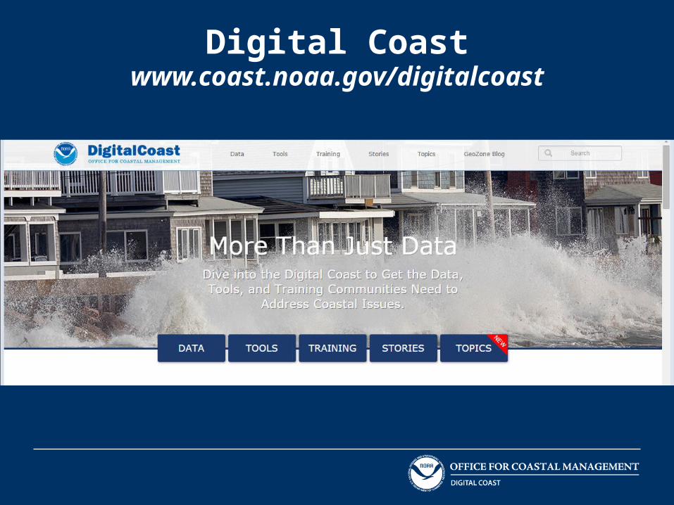
Digital Coast: More Than Just Data

Agenda
• Digital Coast websiteDataToolsTrainingStoriesTopics
• Questions

Digital Coastwww.coast.noaa.gov/digitalcoast
Approach: Bring the geospatial and coastal management communities together
Outcome: A constituent-driven, integrated, enabling platform supporting coastal resource management
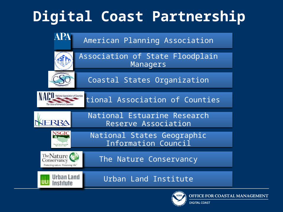
Digital Coast PartnershipAmerican Planning Association
Association of State Floodplain Managers
Coastal States Organization
National Association of Counties
National Estuarine Research Reserve Association
National States Geographic Information Council
The Nature Conservancy
Urban Land Institute
Digital Coastwww.coast.noaa.gov/digitalcoast

Digital Coast: Data
• Lidar• High-resolution land cover data (through the
Coastal Change Analysis Program C-CAP)• Historical aerial imagery• Miscellaneous (the Data Registry)
High-resolution imagery• Hawaii Ocean Uses (Oct 15, 2015)
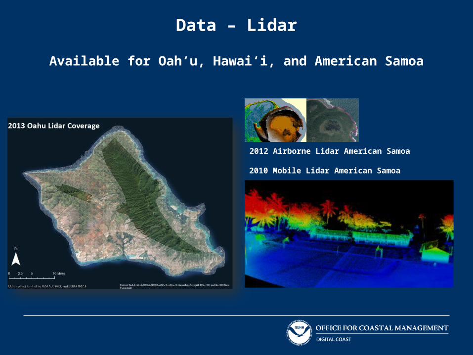
Data – Lidar
Available for Oah‘u, Hawai‘i, and American Samoa
2010 Mobile Lidar American Samoa
2012 Airborne Lidar American Samoa

Data – Coastal Change Analysis Program
Available for American Samoa, Commonwealth of the Northern Mariana Islands (CNMI) for 2005, Guam, and Hawai‘i
High-resolution land cover map
Updated every five years
Mapping classes include forest, wetlands, development, and other natural and man-made features

Data – Coastal Change Analysis Program
19861972 1990 1995 2000

Data – Historical Aerial Imagery
Available for American Samoa, CNMI, Guam, and Hawai‘i

Data – Historical Aerial Imagery
Koko Bay, Oah‘u
1954 1965

Data – Historical Aerial Imagery
Ardensen Air Force Base and Naval Base Pati Point , Yigo, Guam
1944 1967

Data – Historical Aerial Imagery
1947
1992
2006
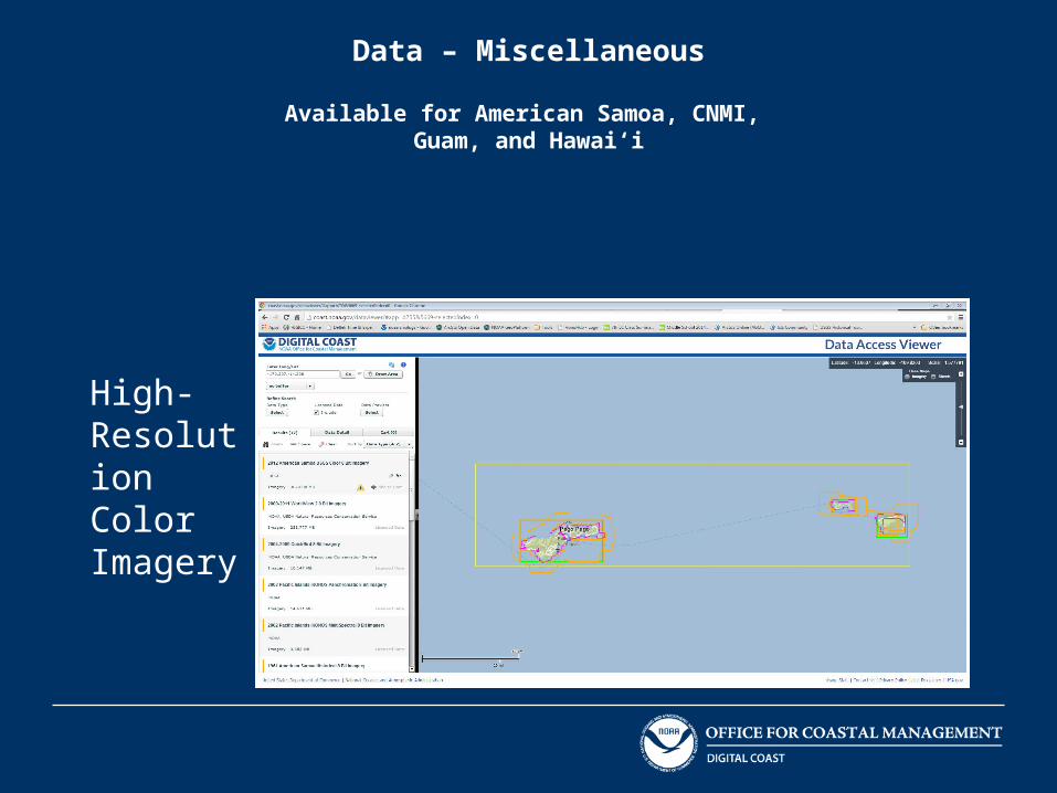
Data – Miscellaneous
Available for American Samoa, CNMI, Guam, and Hawai‘i
High- Resolution Color Imagery
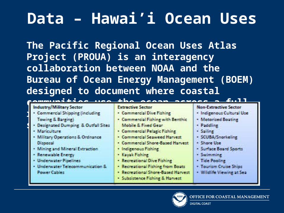
Data – Hawai’i Ocean Uses
The Pacific Regional Ocean Uses Atlas Project (PROUA) is an interagency collaboration between NOAA and the Bureau of Ocean Energy Management (BOEM) designed to document where coastal communities use the ocean across a full range of typical human activities and sectors.

Data – Hawai’i Ocean Uses
Heat map showing the number of all overlapping dominant use areas. Dominant use areas are defined as ocean areas routinely used by most users most of the time
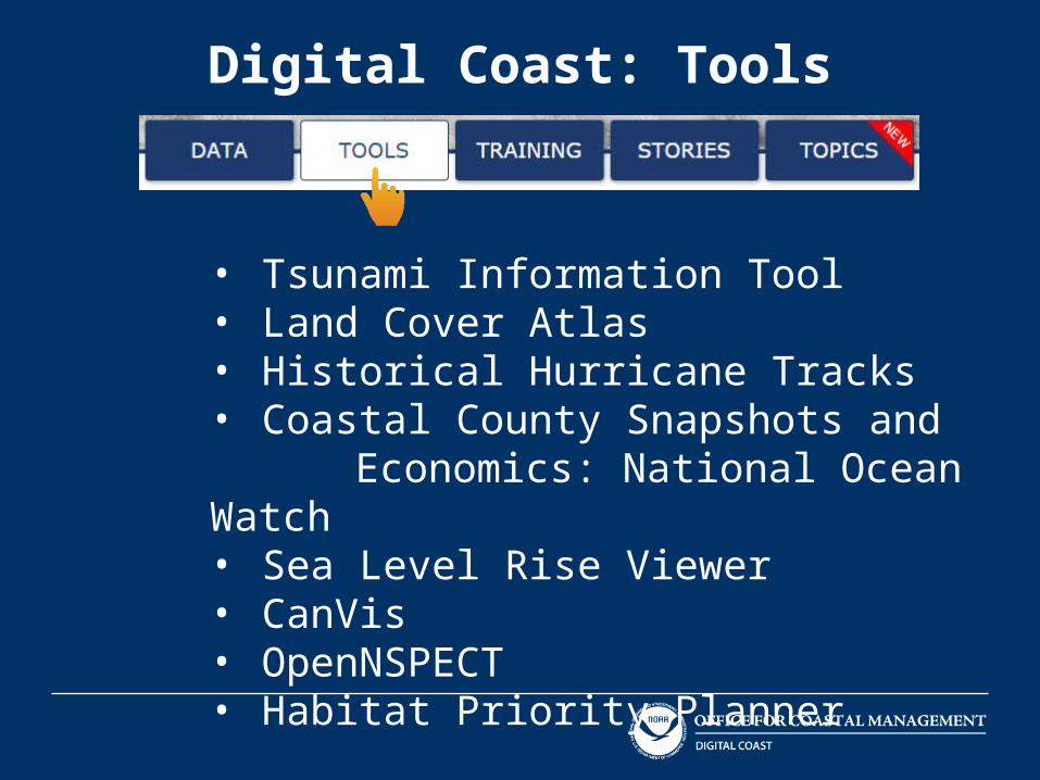
Digital Coast: Tools
• Tsunami Information Tool• Land Cover Atlas• Historical Hurricane Tracks• Coastal County Snapshots and Economics: National Ocean Watch • Sea Level Rise Viewer• CanVis• OpenNSPECT• Habitat Priority Planner
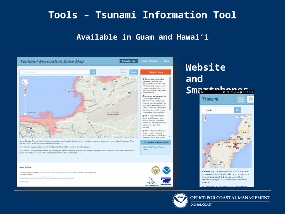
Tools – Tsunami Information Tool
Available in Guam and Hawai‘i
Website and Smartphones

Tools – Land Cover Atlas
Available in American Samoa, Guam, and Hawai‘i
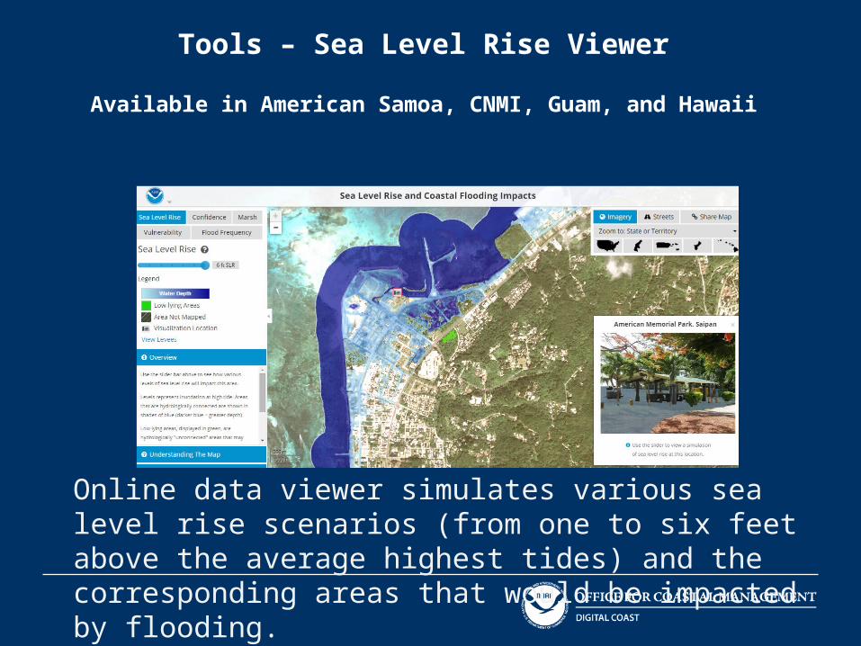
Tools – Sea Level Rise Viewer
Available in American Samoa, CNMI, Guam, and Hawaii
Online data viewer simulates various sea level rise scenarios (from one to six feet above the average highest tides) and the corresponding areas that would be impacted by flooding.

Tools – Sea Level Rise Viewer
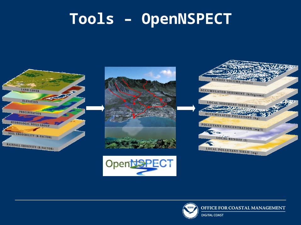
Tools – OpenNSPECT
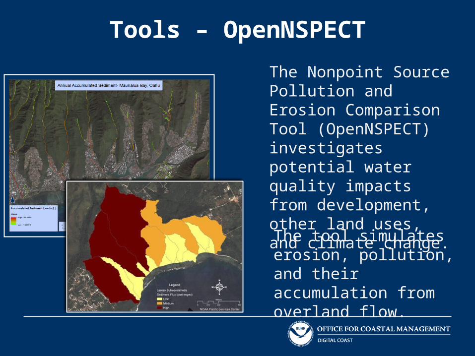
Tools – OpenNSPECT
The Nonpoint Source Pollution and Erosion Comparison Tool (OpenNSPECT) investigates potential water quality impacts from development, other land uses, and climate change.
The tool simulates erosion, pollution, and their accumulation from overland flow.

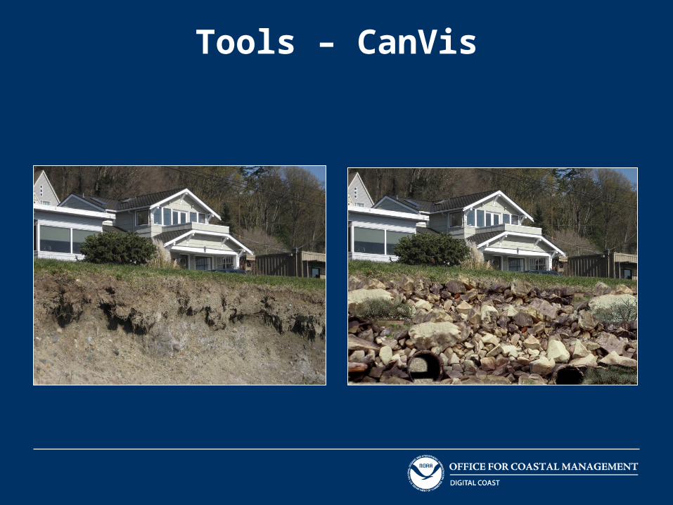
Tools – CanVis
Model and visualize environmental impacts
Tools – CanVis
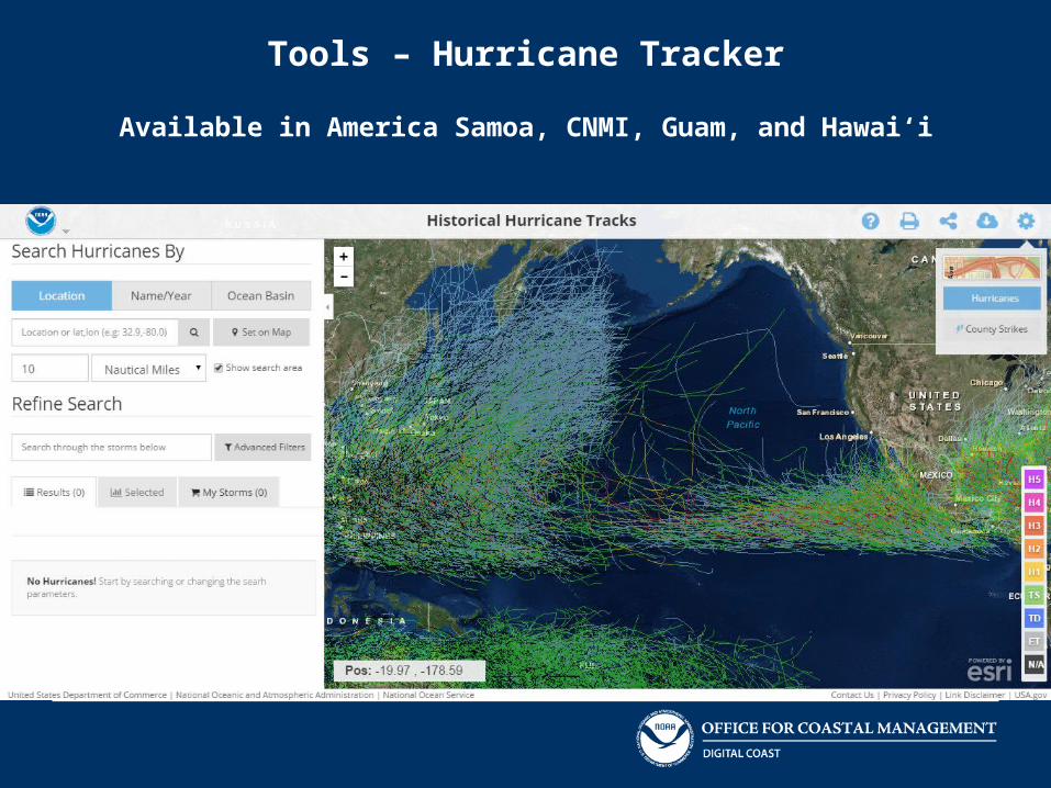
Tools – Hurricane Tracker
Available in America Samoa, CNMI, Guam, and Hawai‘i

Tools – Hurricane Tracker

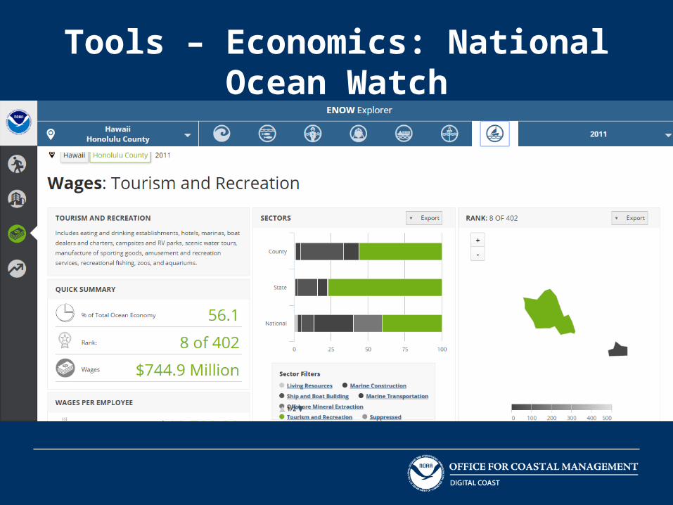
Tools – Economics: National Ocean WatchENOW
Available for Hawai‘i
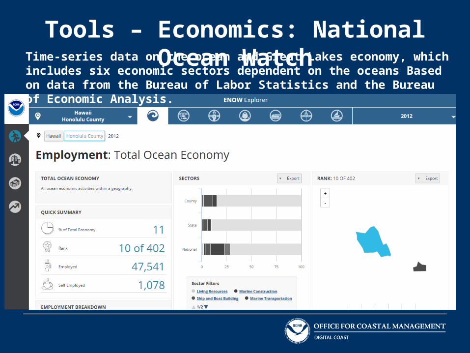
Tools – Economics: National Ocean WatchTime-series data on the ocean and Great Lakes economy, which includes six economic sectors dependent on the oceans Based on data from the Bureau of Labor Statistics and the Bureau of Economic Analysis.
Tools – Economics: National Ocean Watch
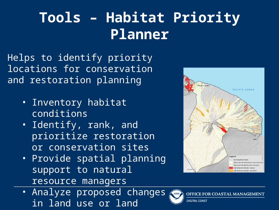
Tools – Habitat Priority Planner
Helps to identify priority locations for conservation and restoration planning
• Inventory habitat conditions• Identify, rank, and prioritize
restoration or conservation sites• Provide spatial planning support to
natural resource managers• Analyze proposed changes in land
use or land cover• Create maps, reports, and queries
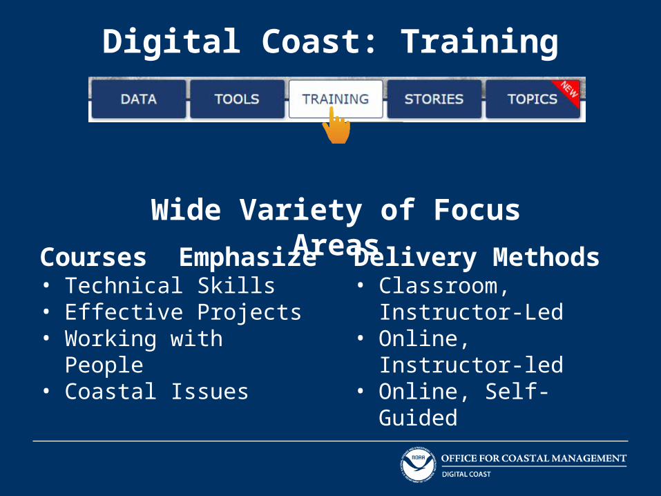
Digital Coast: Training
Courses Emphasize• Technical Skills • Effective Projects • Working with People • Coastal Issues
Delivery Methods• Classroom, Instructor-Led • Online, Instructor-led • Online, Self-Guided
Wide Variety of Focus Areas
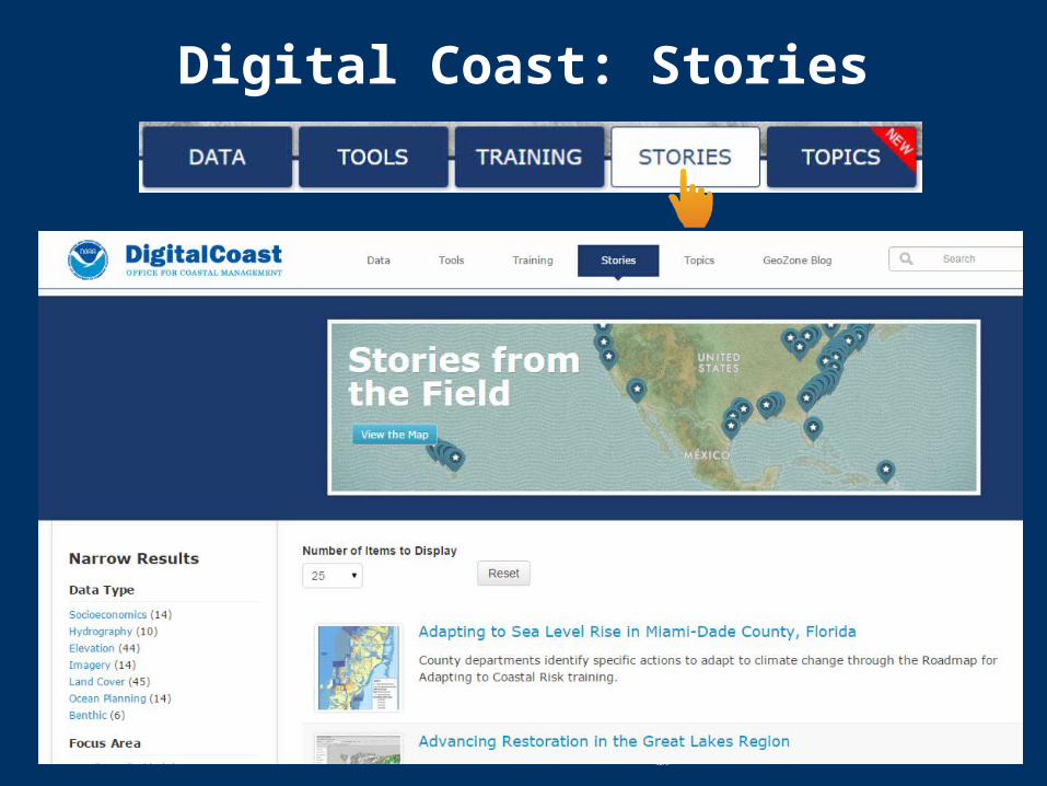
Digital Coast: Stories

Questions?Gretchen Chiqués
www.facebook.com/NOAADigitalCoast
@NOAADigCoast
www.csc.noaa.gov/DigitalCoast
Top Related