


Languages
Pages
Legal

UPPER MISSISSIPPI RIVER RESTORATION
LAKE ODESSA HABITAT REHABILITATION AND ENHANCEMENT PROJECT
OPERATION AND MAINTENANCE MANUAL
APPENDIX F
PROJECT PHOTOGRAPHS

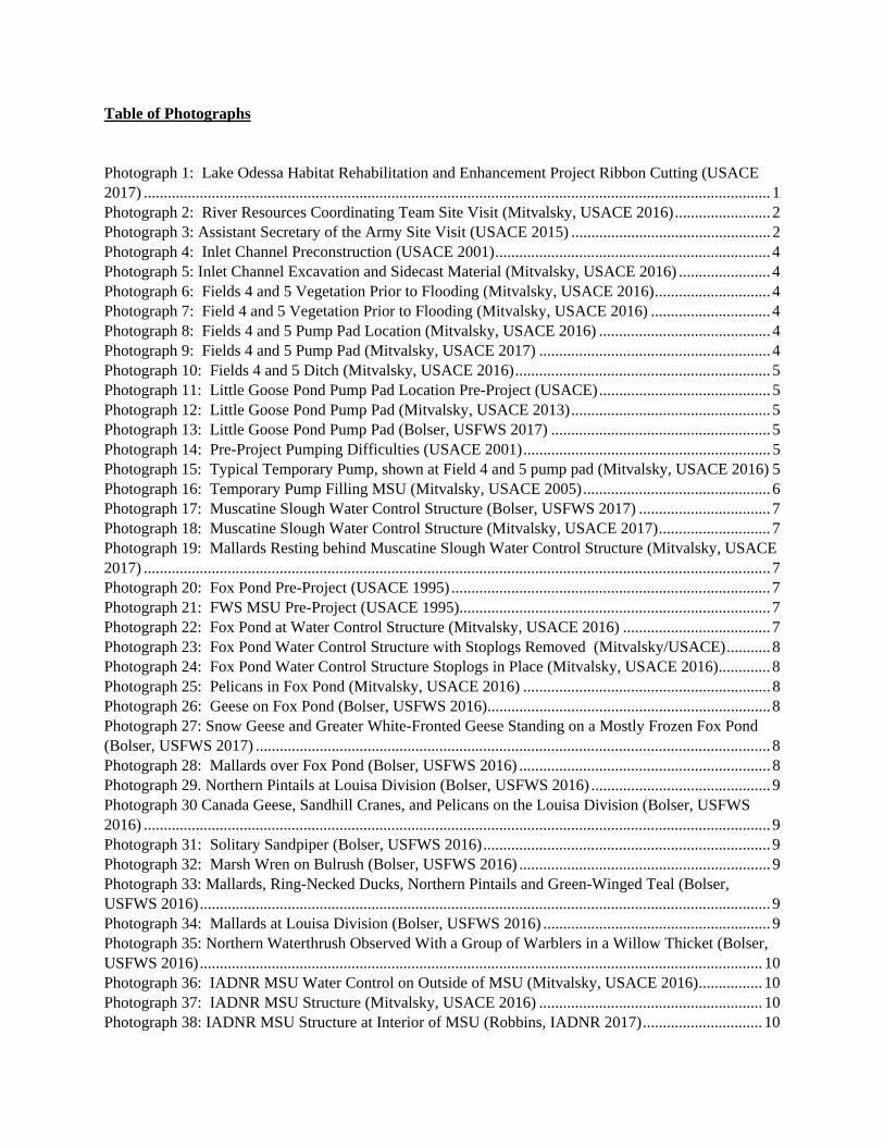
Table of Photographs Photograph 1: Lake Odessa Habitat Rehabilitation and Enhancement Project Ribbon Cutting (USACE 2017) ............................................................................................................................................................. 1 Photograph 2: River Resources Coordinating Team Site Visit (Mitvalsky, USACE 2016) ........................ 2 Photograph 3: Assistant Secretary of the Army Site Visit (USACE 2015) .................................................. 2 Photograph 4: Inlet Channel Preconstruction (USACE 2001) ..................................................................... 4 Photograph 5: Inlet Channel Excavation and Sidecast Material (Mitvalsky, USACE 2016) ....................... 4 Photograph 6: Fields 4 and 5 Vegetation Prior to Flooding (Mitvalsky, USACE 2016) ............................. 4 Photograph 7: Field 4 and 5 Vegetation Prior to Flooding (Mitvalsky, USACE 2016) .............................. 4 Photograph 8: Fields 4 and 5 Pump Pad Location (Mitvalsky, USACE 2016) ........................................... 4 Photograph 9: Fields 4 and 5 Pump Pad (Mitvalsky, USACE 2017) .......................................................... 4 Photograph 10: Fields 4 and 5 Ditch (Mitvalsky, USACE 2016) ................................................................ 5 Photograph 11: Little Goose Pond Pump Pad Location Pre-Project (USACE) ........................................... 5 Photograph 12: Little Goose Pond Pump Pad (Mitvalsky, USACE 2013) .................................................. 5 Photograph 13: Little Goose Pond Pump Pad (Bolser, USFWS 2017) ....................................................... 5 Photograph 14: Pre-Project Pumping Difficulties (USACE 2001) .............................................................. 5 Photograph 15: Typical Temporary Pump, shown at Field 4 and 5 pump pad (Mitvalsky, USACE 2016) 5 Photograph 16: Temporary Pump Filling MSU (Mitvalsky, USACE 2005) ............................................... 6 Photograph 17: Muscatine Slough Water Control Structure (Bolser, USFWS 2017) ................................. 7 Photograph 18: Muscatine Slough Water Control Structure (Mitvalsky, USACE 2017) ............................ 7 Photograph 19: Mallards Resting behind Muscatine Slough Water Control Structure (Mitvalsky, USACE 2017) ............................................................................................................................................................. 7 Photograph 20: Fox Pond Pre-Project (USACE 1995) ................................................................................ 7 Photograph 21: FWS MSU Pre-Project (USACE 1995) .............................................................................. 7 Photograph 22: Fox Pond at Water Control Structure (Mitvalsky, USACE 2016) ..................................... 7 Photograph 23: Fox Pond Water Control Structure with Stoplogs Removed (Mitvalsky/USACE) ........... 8 Photograph 24: Fox Pond Water Control Structure Stoplogs in Place (Mitvalsky, USACE 2016) ............. 8 Photograph 25: Pelicans in Fox Pond (Mitvalsky, USACE 2016) .............................................................. 8 Photograph 26: Geese on Fox Pond (Bolser, USFWS 2016) ....................................................................... 8 Photograph 27: Snow Geese and Greater White-Fronted Geese Standing on a Mostly Frozen Fox Pond (Bolser, USFWS 2017) ................................................................................................................................. 8 Photograph 28: Mallards over Fox Pond (Bolser, USFWS 2016) ............................................................... 8 Photograph 29. Northern Pintails at Louisa Division (Bolser, USFWS 2016) ............................................. 9 Photograph 30 Canada Geese, Sandhill Cranes, and Pelicans on the Louisa Division (Bolser, USFWS 2016) ............................................................................................................................................................. 9 Photograph 31: Solitary Sandpiper (Bolser, USFWS 2016) ........................................................................ 9 Photograph 32: Marsh Wren on Bulrush (Bolser, USFWS 2016) ............................................................... 9 Photograph 33: Mallards, Ring-Necked Ducks, Northern Pintails and Green-Winged Teal (Bolser, USFWS 2016) ............................................................................................................................................... 9 Photograph 34: Mallards at Louisa Division (Bolser, USFWS 2016) ......................................................... 9 Photograph 35: Northern Waterthrush Observed With a Group of Warblers in a Willow Thicket (Bolser, USFWS 2016) ............................................................................................................................................. 10 Photograph 36: IADNR MSU Water Control on Outside of MSU (Mitvalsky, USACE 2016) ................ 10 Photograph 37: IADNR MSU Structure (Mitvalsky, USACE 2016) ........................................................ 10 Photograph 38: IADNR MSU Structure at Interior of MSU (Robbins, IADNR 2017) .............................. 10

Photograph 39: IADNR MSU Final Grading (Mitvalsky, USACE 2012) ................................................. 10 Photograph 40: IADNR MSU after final grading (IADNR 2012) ............................................................. 10 Photograph 41: IADNR MSU (Mitvalsky, USACE 2016) ........................................................................ 11 Photograph 42: IADNR MSU (Mitvalsky, USACE 2016) ......................................................................... 11 Photograph 43: Waterfowl use at Flooded IADNR MSU (Robbins, IADNR 2016) ................................. 11 Photograph 44: Waterfowl Use at Flooded IADNR MSU (Robbins, IADNR 2016) ................................ 11 Photograph 45: IADNR MSU Pump Pad Looking at Timber Stand Improvement Area (Mitvalsky, USACE 2011) ............................................................................................................................................. 11 Photograph 46: IADNR MSU Pump Pad Leading into Burris Ditch (Mitvalsky, USACE 2016)............. 12 Photograph 47: View across proposed cuts from BeBee Pond, through BeBee/Swarms Cut, across Swarms Pond, through Swarms/Odessa Cut, across Lake Odessa and towards the bluff (USACE 2007) . 12 Photograph 48: View across cuts from BeBee Pond Post Construction (Mitvalsky, USACE 2010) ........ 12 Photograph 49: Floating Excavator for Small Channel Cuts (Mitvalsky, USACE 2009) ......................... 12 Photograph 50: Lake Odessa/Swarms Pond Dredge Cut and Sidecast Area (Mitvalsky, USACE 2009) . 12 Photograph 51: Odessa/Swarms Cut Post Construction and Vegetated (Mitvalsky, USACE 2012) ......... 13 Photograph 52: Bebee Pond/Swarms Pond Placement Site (Mitvalsky USACE 2009) ............................ 13 Photograph 53: BeBee Pond/Swarms Pond Placement Site (Mitvalsky, USACE 2009) .......................... 13 Photograph 54: Levee Pre-Project (USACE 1994) .................................................................................... 15 Photograph 55: Levee Pre-Project (USACE 1994) .................................................................................... 15 Photograph 56: Levee Pre-Project (USACE 1994) .................................................................................... 15 Photograph 57: Dredge for Levee Sand (USACE 2007) ........................................................................... 15 Photograph 58: Sand Embankment (USACE 2007) .................................................................................. 15 Photograph 59: Sand Embankment (USACE 2008) .................................................................................. 16 Photograph 60: Levee Repairs (Mitvalsky, USACE 2008) ....................................................................... 16 Photograph 61: Top of Levee before seeding (Mitvalsky, USACE 2012) ................................................ 16 Photograph 62: Clay Cap preparation (USACE 2008) ............................................................................... 16 Photograph 63: Coyote on Levee surrounded by floodwater (Mitvalsky, USACE 2011) ......................... 16 Photograph 64: Clay Cap Preparation (Mitvalsky, USACE 2011) ............................................................ 16 Photograph 65: Delivering Clay for Two Foot Clay Cap (Mitvalsky, USACE 2011) .............................. 17 Photograph 66: Excess Material Management (Mitvalsky, USACE 2011) ............................................... 17 Photograph 67: Smoothing Out Side Slopes after Clay Cap in Place (Mitvalsky, USACE 2011) ............ 17 Photograph 68: Levee Repairs Post Seeding (Robbins, IADNR 2016) ..................................................... 17 Photograph 69: Restored Levee (Mitvalsky, USACE 2016) ..................................................................... 17 Photograph 70: Breach Repairs near Inlet (Mitvalsky, USACE 2016)...................................................... 17 Photograph 71: Breach Repairs near Inlet (Mitvalsky, USACE 2016)...................................................... 18 Photograph 72: Riprap Providing Flood Protection (Mitvalsky, USACE 2017) ....................................... 18 Photograph 73: Outlet Structure Being Constructed and Adjacent Levee Pre-Project (USACE 1995) .... 18 Photograph 74: Erosion at Outlet after Sand Enhancement and the 2008 Flood (USACE 2008) ............. 18 Photograph 75: Riprap at Outlet Structure (USACE 2009) ....................................................................... 18 Photograph 76: Riprap at Outlet Structure (USACE 2009) ....................................................................... 18 Photograph 77: Low Water Crossing at Inlet (Harper, USACE 2012) ...................................................... 19 Photograph 78: Low Water Crossing at Inlet with Gate (Harper, USACE 2011) ..................................... 19 Photograph 79: Temporary Crossing near outlet (Mitvalsky, USACE 2015) ........................................... 19 Photograph 80: Temporary Crossing near Outlet (Mitvalsky, USACE 2015) .......................................... 19 Photograph 81: Mississippi River Spillway (Mitvalsky, USACE 2016) ................................................... 19 Photograph 82: Mississippi River Spillway Access Road around Structure (Mitvalsky, USACE 2016) .. 19 Photograph 83: Iowa River Upstream Spillway (Mitvalsky, USACE 2016) ............................................. 20

Photograph 84: Iowa River Downstream Spillway (Mitvalsky, USACE 2016) ........................................ 20 Photograph 85: Iowa River Spillway Overtopping (USACE 2008) .......................................................... 20 Photograph 86: Iowa River Spillway Overtopping (USACE 2011) .......................................................... 20 Photograph 87: Iowa River Spillway Overtopping (Robbins, IADNR 2011) ........................................... 20 Photograph 88: Iowa River Spillway Overtopping (Robbins, IADNR 2011) ........................................... 20 Photograph 89: Iowa River Spillway Starting to Overtop (Robbins, IADNR 9/29/2016) ......................... 21 Photograph 90: Iowa River Spillway Overtopping (Robbins, IADNR 9/30/2016) ................................... 21 Photograph 91: Iowa River Spillway Overtopping (Robbins, IADNR 10/3/2016) ................................... 21 Photograph 92: New (Upstream) Iowa River Spillway Overtopping (Robbins, IADNR 9/30/2016) ....... 21 Photograph 93: New (Upstream) Iowa River Spillway Overtopping (Robbins, IADNR 10/3/2016) ....... 22 Photograph 94: Mississippi River Spillway (Robbins, IADNR 9/30/2016) .............................................. 22 Photograph 95: Ephemeral Wetland (Robbins, IADNR 2012) .................................................................. 24 Photograph 96: Ephemeral Wetland (Robbins, IADNR 2012) .................................................................. 24 Photograph 97: Ephemeral Wetland (Robbins, IADNR 2012) .................................................................. 24 Photograph 98: Diamondback Water Snakes (Robbins, IADNR 2016) .................................................... 24 Photograph 99: Diamondback Water Snakes (Robbins, IADNR 2016) .................................................... 24 Photograph 100: Water Snake at Outlet Structure (Mitvalsky, USACE 2016) ......................................... 24 Photograph 101: Interior Wetland (Mitvalsky, USACE 2013) .................................................................. 25 Photograph 102: Interior Wetland (Mitvalsky, USACE 2013) .................................................................. 25 Photograph 103: Fisheries (Robbins, IADNR 2016) .................................................................................. 27 Photograph 104: Sanitation (Harper, USACE 2010) ................................................................................. 27 Photograph 105: Upper Goose Pond Cut (Mitvalsky, USACE 2010) ....................................................... 27 Photograph 106: Upper Goose Pond Placement (Mitvalsky, USACE 2010) ............................................ 27 Photograph 107: Lower Goose Pond Placement (Mitvalsky, USACE 2010) ............................................ 27 Photograph 108: Lower Goose Pond in Water Placement (Mitvalsky, USACE 2010) ............................. 28 Photograph 109: Middle Goose Pond Placement (Mitvalsky, USACE 2011) ........................................... 28 Photograph 110: Goose Pond Cut Off Berm (Mitvalsky, USACE 2012) .................................................. 28 Photograph 112: BeBee Pond Cut (Mitvalsky, USACE 2010) .................................................................. 28 Photograph 113: Blackhawk Chute Yankee Chute (Mitvalsky, USACE 2008) ........................................ 28 Photograph 114: Blackhawk Chute Yankee Chute (Mitvalsky, USACE 2008) ........................................ 29 Photograph 115: South End of Blackhawk Chute (Mitvalsky, USACE 2010) .......................................... 29 Photograph 116: South End of Blackhawk Chute with placement sites on each side (Mitvalsky, USACE 2017) ........................................................................................................................................................... 29 Photograph 117: North End of Blackhawk/Yankee Chute with Alignment Stakes (Mitvalsky, USACE 2010) ........................................................................................................................................................... 29 Photograph 118: North End of Blackhawk/Yankee Chute Tree Clearing in Preparation for Dredged Material Placement (Mitvalsky, USACE 2011) ......................................................................................... 29 Photograph 119: North End of Blackhawk Chute (Mitvalsky, USACE 2017) .......................................... 29 Photograph 120: Yankee Chute (Mitvalsky, USACE 2013) ..................................................................... 30 Photograph 121: Blackhawk Chute Material Recovery (USACE 2007) ................................................... 30 Photograph 122: Blackhawk Chute Material Recovery (USACE 2007) ................................................... 30 Photograph 123: Blackhawk Chute Excavation (USACE 2007) ............................................................... 30 Photograph 124: Flood Inundation Line (USACE 1995) .......................................................................... 32 Photograph 125: Flood Line on Trees following the 2008 Flood (Mitvalsky, USACE 2009) .................. 32 Photograph 126: Post Flood Stress Pre-Project (USACE 2002) ................................................................ 32 Photograph 127: Tree Planting (Harper, USACE 2010) ............................................................................ 32 Photograph 128: Tree Planting (Harper, USACE 2010) ............................................................................ 32

Photograph 129: Timber Stand Improvement Locations (Mitvalsky, USACE 2011) ............................... 32 Photograph 130: Floodplain Forest TIMBER STAND IMPROVEMENT Area (Mitvalsky, USACE 2016) ........................................................................................................................................................... 33 Photograph 131: Tree Planting (Lundh, USACE 2012) ............................................................................ 33 Photograph 132: Timber Stand Improvement, Tree Girdling (Lundh, USACE) ....................................... 33 Photograph 133: Tree Planting (Lundh, USACE 2012) ............................................................................ 33 Photograph 134: Selective Tree Clearing (Lundh, USACE 2012) ............................................................ 33 Photograph 135: Tree Planting (Lundh, USACE 2012) ............................................................................ 33 Photograph 136: Tree Planting Site (Mitvalsky, USACE 2012) ............................................................... 34 Photograph 137: Tree Planting on Dredged Material Berms (Mitvalsky, USACE 2017) ......................... 34 Photograph 138: Fish Nursery Structure Original (USACE) ..................................................................... 36 Photograph 139: Fish Nursery Structure (Bolser, USFWS 2017) ............................................................. 36 Photograph 140: Fish Nursery Screw Gate (Bolser, USFWS 2017) ......................................................... 36 Photograph 141: Pre-Project Erosion Site 446 (Mitvalsky, USACE 2001) ............................................... 38 Photograph 142: Erosion Protection Site 446 (Robbins, IADNR 2017).................................................... 38 Photograph 143: Site 98 & 99 riprap only (Mitvalsky, USACE 2008) ..................................................... 38 Photograph 144: Site 98 & 98 Riprap and Sand Protection (Mitvalsky, USACE 2009) ........................... 38 Photograph 145: Site 98 & 99 erosion protection (Mitvalsky, USACE 2009) .......................................... 38 Photograph 146: Recreational Use at Archeological Site Post Construction (Mitvalsky, USACE 2012) . 38 Photograph 147: Site 424 Erosion Protection (Mitvalsky, USACE 2009) ................................................ 39 Photograph 148: Site 300 (Mitvalsky, USACE 2017) ............................................................................... 39 Photograph 149: Erosion Protection Site 30 (Robbins, IADNR 2017)...................................................... 39 Photograph 150: Erosion Protection Site 30 (Robbins, IADNR 2017) ...................................................... 39 Photograph 151: Site 299 (Mitvalsky, USACE 2017) ............................................................................... 39 Photograph 152: Site 423 (Mitvalsky, USACE 2017) ............................................................................... 39 Photograph 153: Erosion Protection Site 27 (Mitvalsky, USACE 2017) .................................................. 40 Photograph 154: Ribbon Cutting Site Visit (2017) .................................................................................... 42 Photograph 155: Ribbon Cutting Site Visit (2017) .................................................................................... 42 Photograph 156: Ribbon Cutting Site Visit (2017) .................................................................................... 42 Photograph 157: IANDR (Robbins, Griffin) Observing Final Site (2016) ................................................ 42 Photograph 158: Fox Pond Lookout (2016) .............................................................................................. 42 Photograph 159: USFWS Refuge Manager Cathy Nigg (2016) ................................................................ 42 Photograph 160: Tree Clearing for Breach Repairs (2016) ....................................................................... 43 Photograph 161: Spillway Construction Oversight (2015) ........................................................................ 43 Photograph 162: Spillway Construction (2015) ......................................................................................... 43 Photograph 163: Assistant Secretary of the Army Site Visit (2015) ......................................................... 43 Photograph 164: 2014 Flood Damage Assessment with USFWS and USACE (2014) ............................. 43 Photograph 165: 2014 Levee Breach Assessment (2014) .......................................................................... 43 Photograph 166: Levee Monument Discovered in Levee Breach (2013) .................................................. 44 Photograph 167: 2013 Flood Damage Assessment by Boat in Flooded Interior (2013) ........................... 44 Photograph 168: 2013 Levee Damage Assessment (2013) ........................................................................ 44 Photograph 169: 2013 Flood Damage Assessment (2013) ........................................................................ 44 Photograph 170: Mississippi River Levee Breach near Outlet (USACE 2013) ........................................ 44 Photograph 171: Debris and Levee Damage (2013) .................................................................................. 44 Photograph 172: 2011 Flood Damage Assessment (2011) ........................................................................ 45 Photograph 173: Recreational Use at Archeological Site Following Protection (2011) ............................ 45 Photograph 174: Contractor's Off Site Borrow Location (2012) ............................................................... 45

Photograph 175: Clay Cap Work near Dredge Cut (2011) ........................................................................ 45 Photograph 176: Extra Sam from Clay Cap Preparation (2011) ................................................................ 45 Photograph 177: Levee Grading (2011) ..................................................................................................... 45 Photograph 178: In Water Placement Sites (2011) .................................................................................... 46 Photograph 179: Forest Assessment (2010) ............................................................................................... 46 Photograph 180: Connecting Channels (2009) .......................................................................................... 46 Photograph 181: IADNR Review of Water Conditions (2008) ................................................................. 46 Photograph 182: Construction Oversight (2008) ....................................................................................... 46 Photograph 183: 2008 Flood Damage Assessment (2008) ........................................................................ 46 Photograph 184: Public Involvement in Site Observations (2008) ............................................................ 47 Photograph 185: 2008 Flood Damage Assessment (2008) ........................................................................ 47 Photograph 186: Spillway Construction (2007) ......................................................................................... 47 Photograph 187: Spillway Construction (2006) ......................................................................................... 47 Photograph 188: Project Engineers (2006) ................................................................................................ 47 Photograph 189: Multiagency Review of Proposed Features (2006) ........................................................ 47 Photograph 190: Pump Inspection (2006) ................................................................................................. 48 Photograph 191: USFWS Refuge Manager Tom Cox (2006) ................................................................... 48 Photograph 192: USFWS Spillway (2005) ................................................................................................ 48 Photograph 193: Constructing the USFWS Spillway (2004) .................................................................... 48 Photograph 194: Forestry Meeting (2002) ................................................................................................. 48 Photograph 195: Forestry Meeting (2002) ................................................................................................. 48 Photograph 196: Initial Survey (2001) ....................................................................................................... 49 Photograph 197: 2001 Flood Damage Assessment (2001) ........................................................................ 49 Photograph 198: Hydraulic Engineer Review of Water Control Structures (2001) .................................. 49 Photograph 199: Snake with a Copper Belly (2001) ................................................................................. 49 Photograph 200: 2001 Flood Damage Assessment (2001) ........................................................................ 49 Photograph 201: IANDR Observing Trees (2000) .................................................................................... 50 Photograph 202: Inlet Structure (2000) ..................................................................................................... 50 Photograph 203: 1993 Flood Damage Assessment (1995) ........................................................................ 50 Photograph 204: 1993 Flood Damage Assessment (1995) ........................................................................ 50 Photograph 205: 1993 Flood Damage Assessment (1995) ........................................................................ 50 Photograph 206: 1993 Flood Damage Assessment (1995) ........................................................................ 51 Photograph 207: Early Planning Meetings (1995) ..................................................................................... 51


1
Photograph 1: Lake Odessa Habitat Rehabilitation and Enhancement Project Ribbon Cutting (USACE 2017)
Appendix F
2
Photograph 2: River Resources Coordinating Team Site Visit (Mitvalsky, USACE 2016)
Photograph 3: Assistant Secretary of the Army Site Visit (USACE 2015)
Appendix F

3
Lake Odessa HREP Moist Soil Unit (MSU)
Water Level Management
Appendix F

4
Photograph 4: Inlet Channel Preconstruction (USACE 2001)
Photograph 5: Inlet Channel Excavation and Sidecast Material (Mitvalsky, USACE 2016)
Photograph 6: Fields 4 and 5 Vegetation Prior to Flooding (Mitvalsky, USACE 2016)
Photograph 7: Field 4 and 5 Vegetation Prior to Flooding (Mitvalsky, USACE 2016)
Photograph 8: Fields 4 and 5 Pump Pad Location (Mitvalsky, USACE 2016)
Photograph 9: Fields 4 and 5 Pump Pad (Mitvalsky, USACE 2017)
Appendix F

5
Photograph 10: Fields 4 and 5 Ditch (Mitvalsky, USACE 2016)
Photograph 11: Little Goose Pond Pump Pad Location Pre-Project (USACE)
Photograph 12: Little Goose Pond Pump Pad (Mitvalsky, USACE 2013)
Photograph 13: Little Goose Pond Pump Pad (Bolser, USFWS 2017)
Photograph 14: Pre-Project Pumping Difficulties (USACE 2001)
Photograph 15: Typical Temporary Pump, shown at Field 4 and 5 pump pad (Mitvalsky,
USACE 2016)
Appendix F

6
Photograph 16: Temporary Pump Filling MSU (Mitvalsky, USACE 2005)
Appendix F

7
Photograph 17: Muscatine Slough Water Control Structure (Bolser, USFWS 2017)
Photograph 18: Muscatine Slough Water Control Structure (Mitvalsky, USACE 2017)
Photograph 19: Mallards Resting behind Muscatine Slough Water Control Structure
(Mitvalsky, USACE 2017)
Photograph 20: Fox Pond Pre-Project (USACE 1995)
Photograph 21: FWS MSU Pre-Project (USACE 1995)
Photograph 22: Fox Pond at Water Control Structure (Mitvalsky, USACE 2016)
Appendix F

8
Photograph 23: Fox Pond Water Control Structure with Stoplogs Removed
(Mitvalsky/USACE)
Photograph 24: Fox Pond Water Control Structure Stoplogs in Place (Mitvalsky,
USACE 2016)
Photograph 25: Pelicans in Fox Pond (Mitvalsky, USACE 2016)
Photograph 26: Geese on Fox Pond (Bolser, USFWS 2016)
Photograph 27: Snow Geese and Greater White-Fronted Geese Standing on a Mostly
Frozen Fox Pond (Bolser, USFWS 2017)
Photograph 28: Mallards over Fox Pond (Bolser, USFWS 2016)
Appendix F

9
Photograph 29. Northern Pintails at Louisa Division (Bolser, USFWS 2016)
Photograph 30 Canada Geese, Sandhill Cranes, and Pelicans on the Louisa Division
(Bolser, USFWS 2016)
Photograph 31: Solitary Sandpiper (Bolser, USFWS 2016)
Photograph 32: Marsh Wren on Bulrush (Bolser, USFWS 2016)
Photograph 33: Mallards, Ring-Necked Ducks, Northern Pintails and Green-Winged
Teal (Bolser, USFWS 2016)
Photograph 34: Mallards at Louisa Division (Bolser, USFWS 2016)
Appendix F

10
Photograph 35: Northern Waterthrush Observed With a Group of Warblers in a
Willow Thicket (Bolser, USFWS 2016)
Photograph 36: IADNR MSU Water Control on Outside of MSU (Mitvalsky, USACE 2016)
Photograph 37: IADNR MSU Structure (Mitvalsky, USACE 2016)
Photograph 38: IADNR MSU Structure at Interior of MSU (Robbins, IADNR 2017)
Photograph 39: IADNR MSU Final Grading (Mitvalsky, USACE 2012)
Photograph 40: IADNR MSU after final grading (IADNR 2012)
Appendix F

11
Photograph 41: IADNR MSU (Mitvalsky, USACE 2016)
Photograph 42: IADNR MSU (Mitvalsky, USACE 2016)
Photograph 43: Waterfowl use at Flooded IADNR MSU (Robbins, IADNR 2016)
Photograph 44: Waterfowl Use at Flooded IADNR MSU (Robbins, IADNR 2016)
Photograph 45: IADNR MSU Pump Pad Looking at Timber Stand Improvement Area
(Mitvalsky, USACE 2011)
Appendix F

12
Photograph 46: IADNR MSU Pump Pad Leading into Burris Ditch (Mitvalsky,
USACE 2016)
Photograph 47: View across proposed cuts from BeBee Pond, through BeBee/Swarms
Cut, across Swarms Pond, through Swarms/Odessa Cut, across Lake Odessa and
towards the bluff (USACE 2007)
Photograph 48: View across cuts from BeBee Pond Post Construction (Mitvalsky, USACE
2010)
Photograph 49: Floating Excavator for Small Channel Cuts (Mitvalsky, USACE 2009)
Photograph 50: Lake Odessa/Swarms Pond Dredge Cut and Sidecast Area (Mitvalsky,
USACE 2009)
Appendix F

13
Photograph 51: Odessa/Swarms Cut Post Construction and Vegetated (Mitvalsky,
USACE 2012)
Photograph 52: Bebee Pond/Swarms Pond Placement Site (Mitvalsky USACE 2009)
Photograph 53: BeBee Pond/Swarms Pond Placement Site (Mitvalsky, USACE 2009)
Appendix F

14
Lake Odessa HREP Levee Restoration
Appendix F

15
Photograph 54: Levee Pre-Project (USACE 1994)
Photograph 55: Levee Pre-Project (USACE 1994)
Photograph 56: Levee Pre-Project (USACE 1994)
Photograph 57: Dredge for Levee Sand (USACE 2007)
Photograph 58: Sand Embankment (USACE 2007)
Appendix F

16
Photograph 59: Sand Embankment (USACE 2008)
Photograph 60: Levee Repairs (Mitvalsky, USACE 2008)
Photograph 61: Top of Levee before seeding (Mitvalsky, USACE 2012)
Photograph 62: Clay Cap preparation (USACE 2008)
Photograph 63: Coyote on Levee surrounded by floodwater (Mitvalsky, USACE 2011)
Photograph 64: Clay Cap Preparation (Mitvalsky, USACE 2011)
Appendix F
17
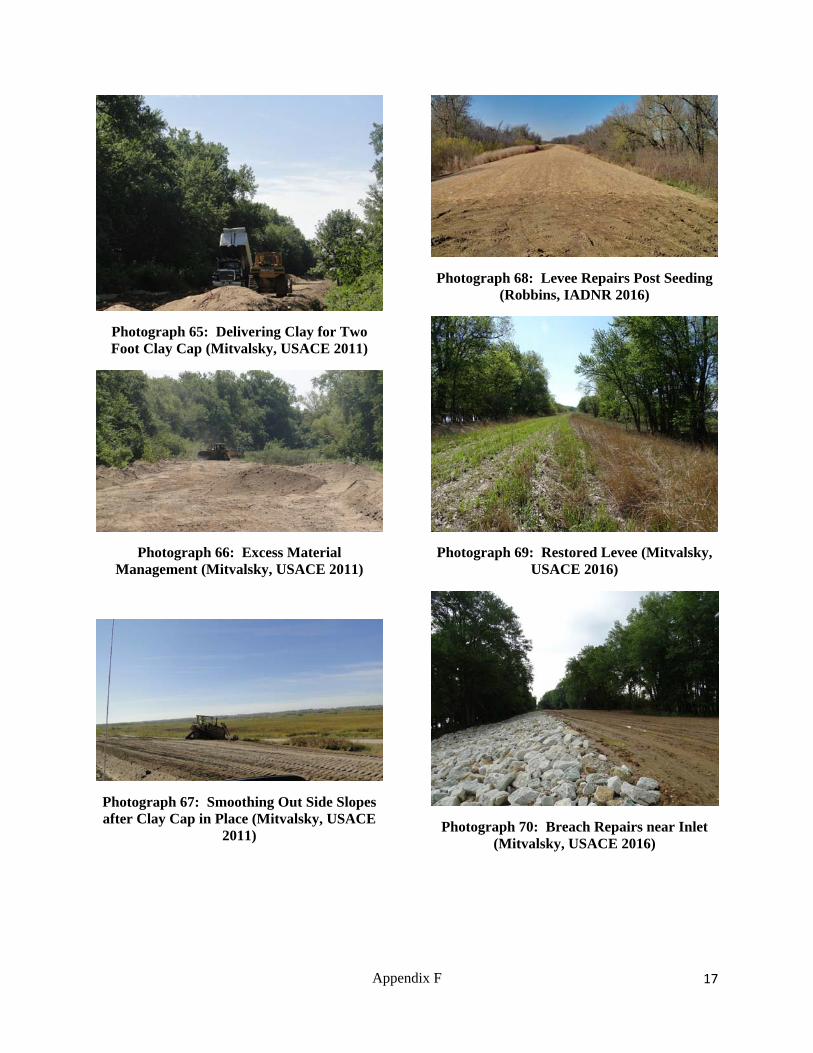
Photograph 65: Delivering Clay for Two Foot Clay Cap (Mitvalsky, USACE 2011)
Photograph 66: Excess Material Management (Mitvalsky, USACE 2011)
Photograph 67: Smoothing Out Side Slopes after Clay Cap in Place (Mitvalsky, USACE
2011)
Photograph 68: Levee Repairs Post Seeding (Robbins, IADNR 2016)
Photograph 69: Restored Levee (Mitvalsky, USACE 2016)
Photograph 70: Breach Repairs near Inlet (Mitvalsky, USACE 2016)
Appendix F

18
Photograph 71: Breach Repairs near Inlet (Mitvalsky, USACE 2016)
Photograph 72: Riprap Providing Flood Protection (Mitvalsky, USACE 2017)
Photograph 73: Outlet Structure Being Constructed and Adjacent Levee Pre-Project
(USACE 1995)
Photograph 74: Erosion at Outlet after Sand Enhancement and the 2008 Flood (USACE
2008)
Photograph 75: Riprap at Outlet Structure (USACE 2009)
Photograph 76: Riprap at Outlet Structure (USACE 2009)
Appendix F
19
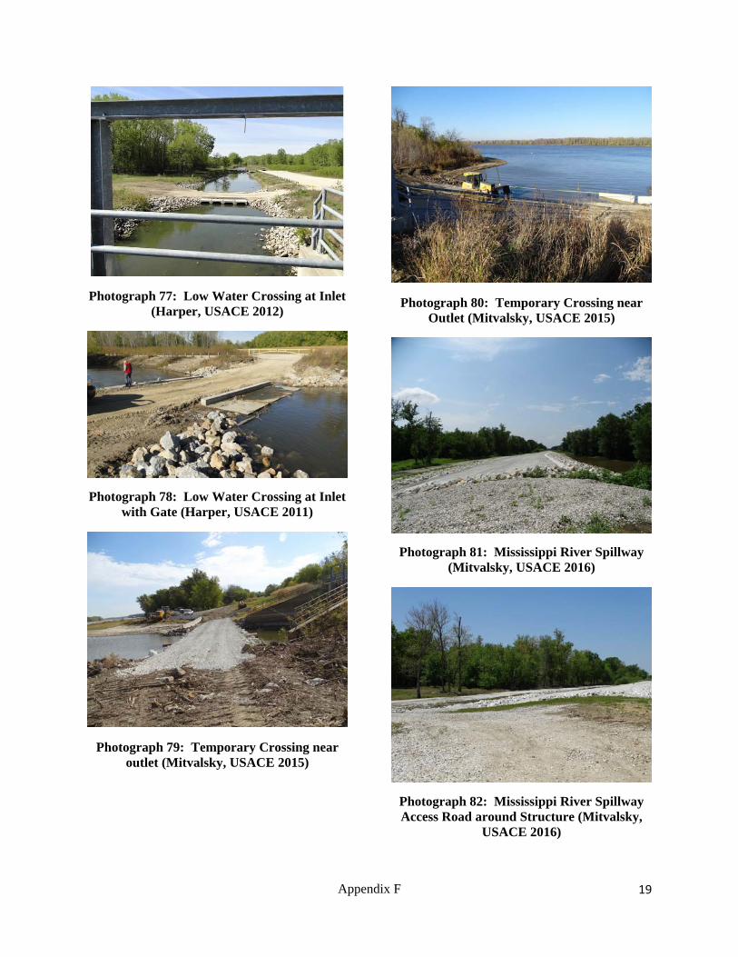
Photograph 77: Low Water Crossing at Inlet (Harper, USACE 2012)
Photograph 78: Low Water Crossing at Inlet with Gate (Harper, USACE 2011)
Photograph 79: Temporary Crossing near outlet (Mitvalsky, USACE 2015)
Photograph 80: Temporary Crossing near Outlet (Mitvalsky, USACE 2015)
Photograph 81: Mississippi River Spillway (Mitvalsky, USACE 2016)
Photograph 82: Mississippi River Spillway Access Road around Structure (Mitvalsky,
USACE 2016)
Appendix F

20
Photograph 83: Iowa River Upstream Spillway (Mitvalsky, USACE 2016)
Photograph 84: Iowa River Downstream Spillway (Mitvalsky, USACE 2016)
Photograph 85: Iowa River Spillway Overtopping (USACE 2008)
Photograph 86: Iowa River Spillway Overtopping (USACE 2011)
Photograph 87: Iowa River Spillway Overtopping (Robbins, IADNR 2011)
Photograph 88: Iowa River Spillway Overtopping (Robbins, IADNR 2011)
Appendix F

21
Photograph 89: Iowa River Spillway Starting to Overtop (Robbins, IADNR 9/29/2016)
Photograph 90: Iowa River Spillway Overtopping (Robbins, IADNR 9/30/2016)
Photograph 91: Iowa River Spillway Overtopping (Robbins, IADNR 10/3/2016)
Photograph 92: New (Upstream) Iowa River Spillway Overtopping (Robbins, IADNR
9/30/2016)
Appendix F

22
Photograph 93: New (Upstream) Iowa River Spillway Overtopping (Robbins, IADNR
10/3/2016)
Photograph 94: Mississippi River Spillway (Robbins, IADNR 9/30/2016)
Appendix F

23
Lake Odessa HREP Ephemeral Wetlands
Appendix F

24
Photograph 95: Ephemeral Wetland (Robbins, IADNR 2012)
Photograph 96: Ephemeral Wetland (Robbins, IADNR 2012)
Photograph 97: Ephemeral Wetland (Robbins, IADNR 2012)
Photograph 98: Diamondback Water Snakes (Robbins, IADNR 2016)
Photograph 99: Diamondback Water Snakes (Robbins, IADNR 2016)
Photograph 100: Water Snake at Outlet Structure (Mitvalsky, USACE 2016)
Appendix F

25
Photograph 101: Interior Wetland (Mitvalsky, USACE 2013)
Photograph 102: Interior Wetland (Mitvalsky, USACE 2013)
Appendix F

26
Lake Odessa HREP Aquatic Diversity
Fisheries Enhancement
Appendix F

27
Photograph 103: Fisheries (Robbins, IADNR 2016)
Photograph 104: Sanitation (Harper, USACE 2010)
Photograph 105: Upper Goose Pond Cut (Mitvalsky, USACE 2010)
Photograph 106: Upper Goose Pond Placement (Mitvalsky, USACE 2010)
Photograph 107: Lower Goose Pond Placement (Mitvalsky, USACE 2010)
Appendix F

28
Photograph 108: Lower Goose Pond in Water Placement (Mitvalsky, USACE 2010)
Photograph 109: Middle Goose Pond Placement (Mitvalsky, USACE 2011)
Photograph 110: Goose Pond Cut Off Berm (Mitvalsky, USACE 2012)
Photograph 111: Goose Pond Berm Shaping to Control Top Height (Mitvalsky, USACE
2011)
Photograph 112: BeBee Pond Cut (Mitvalsky, USACE 2010)
Photograph 113: Blackhawk Chute Yankee Chute (Mitvalsky, USACE 2008)
Appendix F

29
Photograph 114: Blackhawk Chute Yankee Chute (Mitvalsky, USACE 2008)
Photograph 115: South End of Blackhawk Chute (Mitvalsky, USACE 2010)
Photograph 116: South End of Blackhawk Chute with placement sites on each side
(Mitvalsky, USACE 2017)
Photograph 117: North End of Blackhawk/Yankee Chute with Alignment
Stakes (Mitvalsky, USACE 2010)
Photograph 118: North End of Blackhawk/Yankee Chute Tree Clearing in
Preparation for Dredged Material Placement (Mitvalsky, USACE 2011)
Photograph 119: North End of Blackhawk Chute (Mitvalsky, USACE 2017)
Appendix F
30
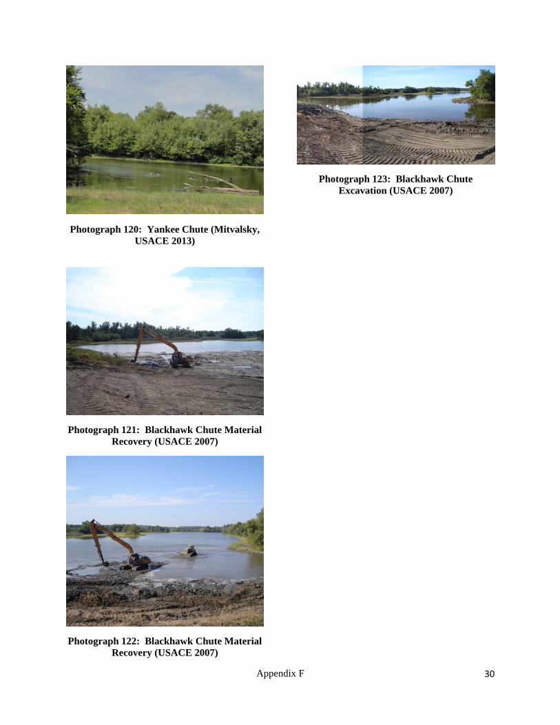
Photograph 120: Yankee Chute (Mitvalsky, USACE 2013)
Photograph 121: Blackhawk Chute Material Recovery (USACE 2007)
Photograph 122: Blackhawk Chute Material Recovery (USACE 2007)
Photograph 123: Blackhawk Chute Excavation (USACE 2007)
Appendix F

31
Lake Odessa HREP Floodplain Forest
Appendix F

32
Photograph 124: Flood Inundation Line (USACE 1995)
Photograph 125: Flood Line on Trees following the 2008 Flood (Mitvalsky, USACE
2009)
Photograph 126: Post Flood Stress Pre-Project (USACE 2002)
Photograph 127: Tree Planting (Harper, USACE 2010)
Photograph 128: Tree Planting (Harper, USACE 2010)
Photograph 129: Timber Stand Improvement Locations (Mitvalsky, USACE
2011)
Appendix F

33
Photograph 130: Floodplain Forest TIMBER STAND IMPROVEMENT Area (Mitvalsky,
USACE 2016)
Photograph 131: Tree Planting (Lundh, USACE 2012)
Photograph 132: Timber Stand Improvement, Tree Girdling (Lundh,
USACE)
Photograph 133: Tree Planting (Lundh, USACE 2012)
Photograph 134: Selective Tree Clearing (Lundh, USACE 2012)
Photograph 135: Tree Planting (Lundh, USACE 2012)
Appendix F

34
Photograph 136: Tree Planting Site (Mitvalsky, USACE 2012)
Photograph 137: Tree Planting on Dredged Material Berms (Mitvalsky, USACE 2017)
Appendix F

35
Lake Odessa HREP Fish Nursery
Appendix F

36
Photograph 138: Fish Nursery Structure Original (USACE)
Photograph 139: Fish Nursery Structure (Bolser, USFWS 2017)
Photograph 140: Fish Nursery Screw Gate (Bolser, USFWS 2017)
Appendix F

37
Lake Odessa HREP Shoreline Protection of
Historic Sites
Appendix F

38
Photograph 141: Pre-Project Erosion Site 446 (Mitvalsky, USACE 2001)
Photograph 142: Erosion Protection Site 446 (Robbins, IADNR 2017)
Photograph 143: Site 98 & 99 riprap only (Mitvalsky, USACE 2008)
Photograph 144: Site 98 & 98 Riprap and Sand Protection (Mitvalsky, USACE 2009)
Photograph 145: Site 98 & 99 erosion protection (Mitvalsky, USACE 2009)
Photograph 146: Recreational Use at Archeological Site Post Construction
(Mitvalsky, USACE 2012)
Appendix F

39
Photograph 147: Site 424 Erosion Protection (Mitvalsky, USACE 2009)
Photograph 148: Site 300 (Mitvalsky, USACE 2017)
Photograph 149: Erosion Protection Site 30 (Robbins, IADNR 2017)
Photograph 150: Erosion Protection Site 30 (Robbins, IADNR 2017)
Photograph 151: Site 299 (Mitvalsky, USACE 2017)
Photograph 152: Site 423 (Mitvalsky, USACE 2017)
Appendix F

40
Photograph 153: Erosion Protection Site 27 (Mitvalsky, USACE 2017)
Appendix F

41
LAKE ODESSA HREP PLANNING, DESIGN,
CONSTRUCTION, AND FLOODS
Appendix F

42
Photograph 154: Ribbon Cutting Site Visit (2017)
Photograph 155: Ribbon Cutting Site Visit (2017)
Photograph 156: Ribbon Cutting Site Visit (2017)
Photograph 157: IANDR (Robbins, Griffin) Observing Final Site (2016)
Photograph 158: Fox Pond Lookout (2016)
Photograph 159: USFWS Refuge Manager Cathy Nigg (2016)
Appendix F

43
Photograph 160: Tree Clearing for Breach Repairs (2016)
Photograph 161: Spillway Construction Oversight (2015)
Photograph 162: Spillway Construction (2015)
Photograph 163: Assistant Secretary of the Army Site Visit (2015)
Photograph 164: 2014 Flood Damage Assessment with USFWS and USACE (2014)
Photograph 165: 2014 Levee Breach Assessment (2014)
Appendix F

44
Photograph 166: Levee Monument Discovered in Levee Breach (2013)
Photograph 167: 2013 Flood Damage Assessment by Boat in Flooded Interior (2013)
Photograph 168: 2013 Levee Damage Assessment (2013)
Photograph 169: 2013 Flood Damage Assessment (2013)
Photograph 170: Mississippi River Levee Breach near Outlet (USACE 2013)
Photograph 171: Debris and Levee Damage (2013)
Appendix F

45
Photograph 172: 2011 Flood Damage Assessment (2011)
Photograph 173: Recreational Use at Archeological Site Following Protection (2011)
Photograph 174: Contractor's Off Site Borrow Location (2012)
Photograph 175: Clay Cap Work near Dredge Cut (2011)
Photograph 176: Extra Sam from Clay Cap Preparation (2011)
Photograph 177: Levee Grading (2011)
Appendix F

46
Photograph 178: In Water Placement Sites (2011)
Photograph 179: Forest Assessment (2010)
Photograph 180: Connecting Channels (2009)
Photograph 181: IADNR Review of Water Conditions (2008)
Photograph 182: Construction Oversight (2008)
Photograph 183: 2008 Flood Damage Assessment (2008)
Appendix F

47
Photograph 184: Public Involvement in Site Observations (2008)
Photograph 185: 2008 Flood Damage Assessment (2008)
Photograph 186: Spillway Construction (2007)
Photograph 187: Spillway Construction (2006)
Photograph 188: Project Engineers (2006)
Photograph 189: Multiagency Review of Proposed Features (2006)
Appendix F

48
Photograph 190: Pump Inspection (2006)
Photograph 191: USFWS Refuge Manager Tom Cox (2006)
Photograph 192: USFWS Spillway (2005)
Photograph 193: Constructing the USFWS Spillway (2004)
Photograph 194: Forestry Meeting (2002)
Photograph 195: Forestry Meeting (2002)
Appendix F

49
Photograph 196: Initial Survey (2001)
Photograph 197: 2001 Flood Damage Assessment (2001)
Photograph 198: Hydraulic Engineer Review of Water Control Structures (2001)
Photograph 199: Snake with a Copper Belly (2001)
Photograph 200: 2001 Flood Damage Assessment (2001)
Appendix F

50
Photograph 201: IANDR Observing Trees (2000)
Photograph 202: Inlet Structure (2000)
Photograph 203: 1993 Flood Damage Assessment (1995)
Photograph 204: 1993 Flood Damage Assessment (1995)
Photograph 205: 1993 Flood Damage Assessment (1995)
Appendix F

51
Photograph 206: 1993 Flood Damage Assessment (1995)
Photograph 207: Early Planning Meetings (1995)
Appendix F

Top Related