


Languages
Pages
Legal

EUMETSAT fellow dayMonday, 01 March 2021
Towards an automated severe weather warning tool based on MTG-LI and FCI data
Felix ErdmannAdvisor: Dieter Poelman
Funding: EUMETSAT
I NT RO
MA I N
OUT LOOK
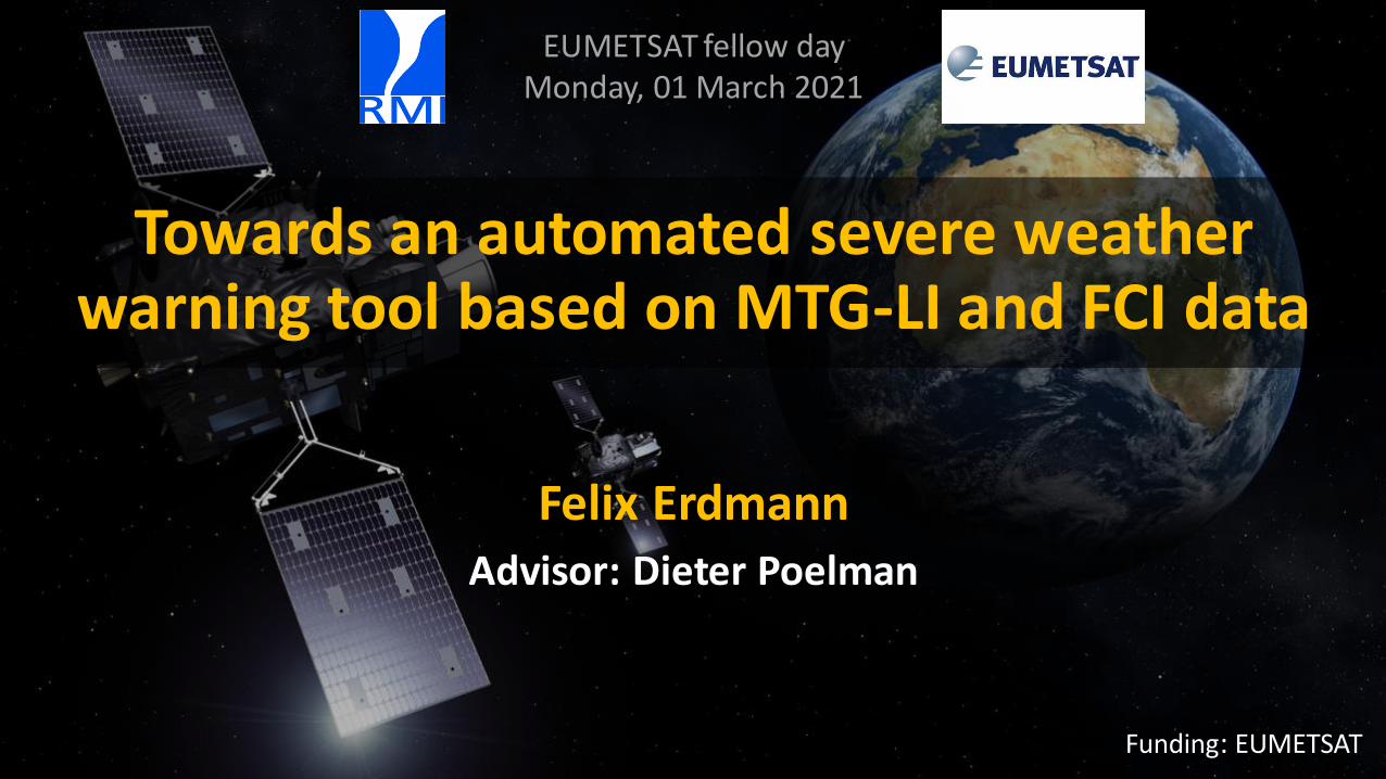
Introduction
From https://www.flickr.com/photos/okweatherwatch/42186567924/in/photostream/, accessed 14/12/2019
From https://de.wikipedia.org/wiki/Sturzflut, accessed 14/12/2019
(a) (b)
(c)
01/03/2021 Nowcasting of Severe Weather: MTG-LI usage – Felix Erdmann 2 | 18

I NT RO
MA I N
OUT LOOK
Thunderstorms
Adapted from Erick Brenstrum, 'Weather - Thunderstorms', Te Ara - the Encyclopedia of New Zealand, http://www.TeAra.govt.nz/en/interactive/7767/how-a-thunderstorm-forms (accessed 25 November 2020)
Stage 1: Convection and Cumulus cloud formation
Stage 2: Mature phase with lightning and thunder
Stage 3: Decay and finally dissipation
(b)(a) (c)
01/03/2021 Nowcasting of Severe Weather: MTG-LI usage – Felix Erdmann 3 | 18
I NT RO
MA I N
OUT LOOK
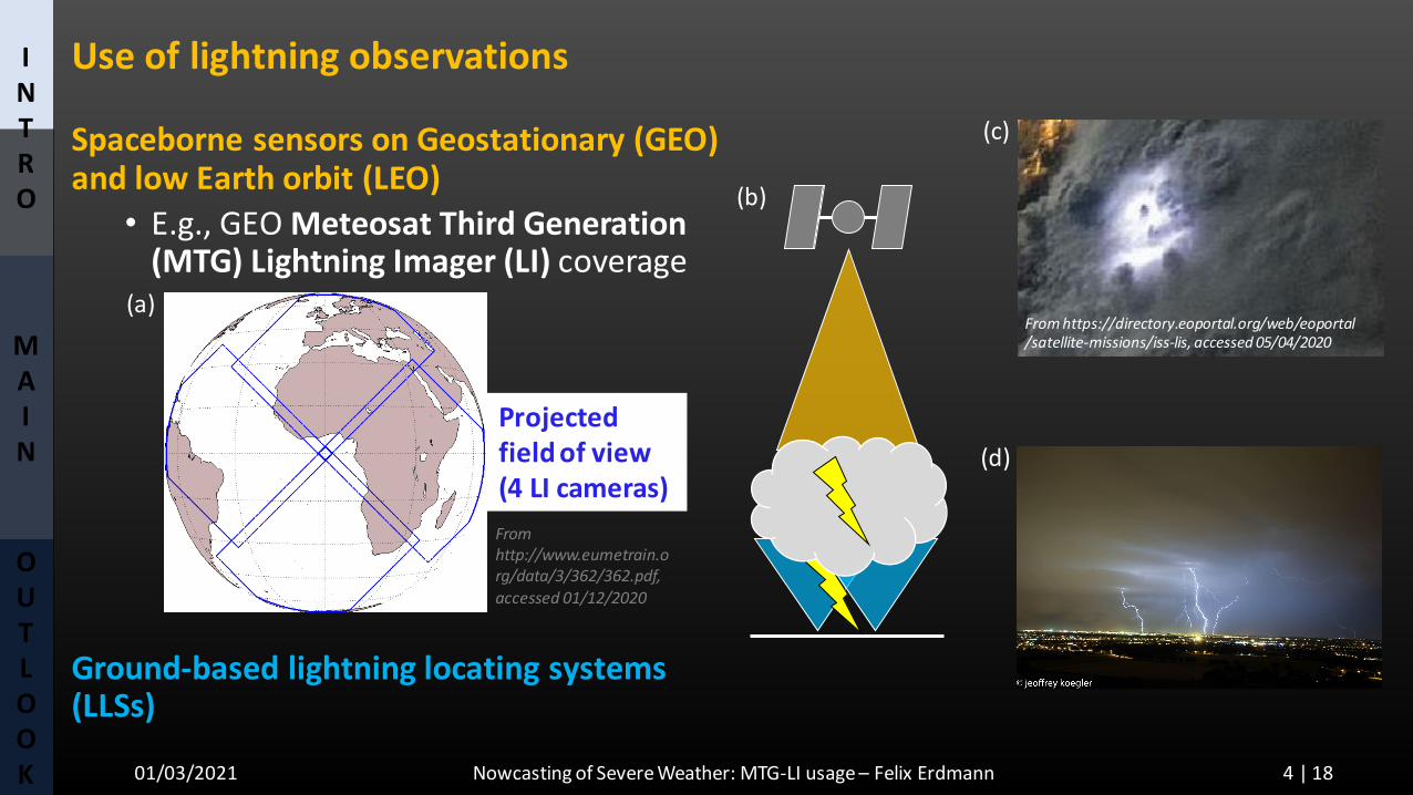
Use of lightning observations
Spaceborne sensors on Geostationary (GEO) and low Earth orbit (LEO)
• E.g., GEO Meteosat Third Generation (MTG) Lightning Imager (LI) coverage
Ground-based lightning locating systems (LLSs)
From https://directory.eoportal.org/web/eoportal /satellite-missions/iss-lis, accessed 05/04/2020
(b)
(c)
(d)
From http://www.eumetrain.org/data/3/362/362.pdf,
accessed 01/12/2020
(a)
Projected field of view(4 LI cameras)
01/03/2021 Nowcasting of Severe Weather: MTG-LI usage – Felix Erdmann 4 | 18
I NT RO
MA I N
OUT LOOK
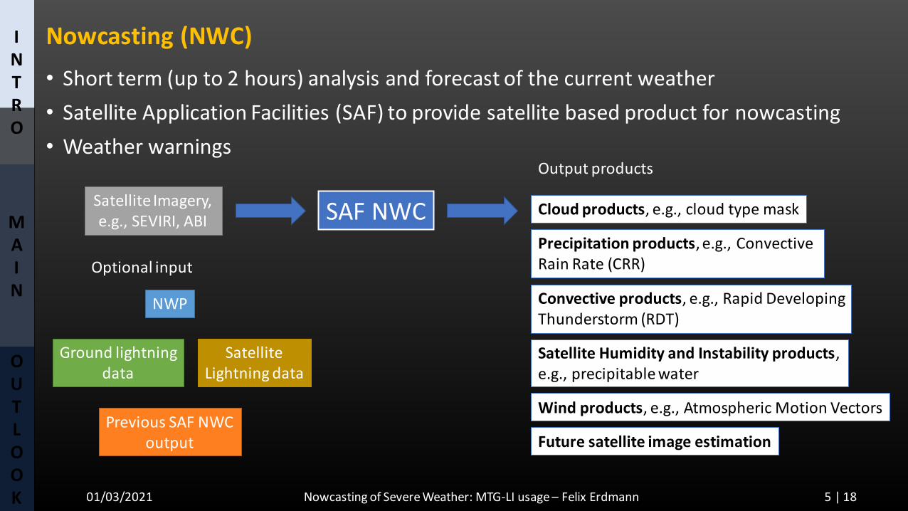
Nowcasting (NWC)
• Short term (up to 2 hours) analysis and forecast of the current weather
• Satellite Application Facilities (SAF) to provide satellite based product for nowcasting
• Weather warnings
01/03/2021 Nowcasting of Severe Weather: MTG-LI usage – Felix Erdmann
SAF NWCSatellite Imagery,e.g., SEVIRI, ABI
NWP
Optional input
Ground lightningdata
Previous SAF NWCoutput
5 | 18
SatelliteLightning data
Cloud products, e.g., cloud type mask
Precipitation products, e.g., ConvectiveRain Rate (CRR)
Convective products, e.g., Rapid DevelopingThunderstorm (RDT)
Wind products, e.g., Atmospheric Motion Vectors
Satellite Humidity and Instability products,e.g., precipitable water
Future satellite image estimation
Output products
I NT RO
MA I N
OUT LOOK
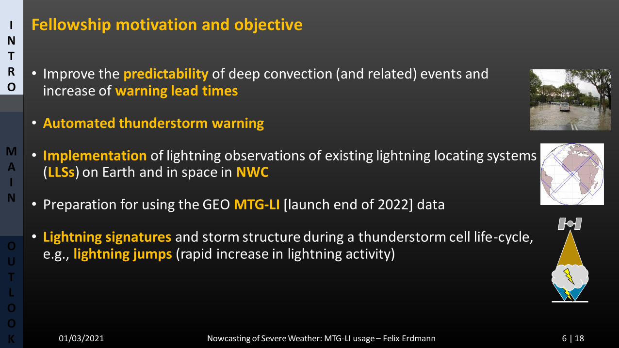
Fellowship motivation and objective
• Improve the predictability of deep convection (and related) events and increase of warning lead times
• Automated thunderstorm warning
• Implementation of lightning observations of existing lightning locating systems (LLSs) on Earth and in space in NWC
• Preparation for using the GEO MTG-LI [launch end of 2022] data
• Lightning signatures and storm structure during a thunderstorm cell life-cycle, e.g., lightning jumps (rapid increase in lightning activity)
01/03/2021 Nowcasting of Severe Weather: MTG-LI usage – Felix Erdmann 6 | 18
I NT RO
MA I N
OUT LOOK
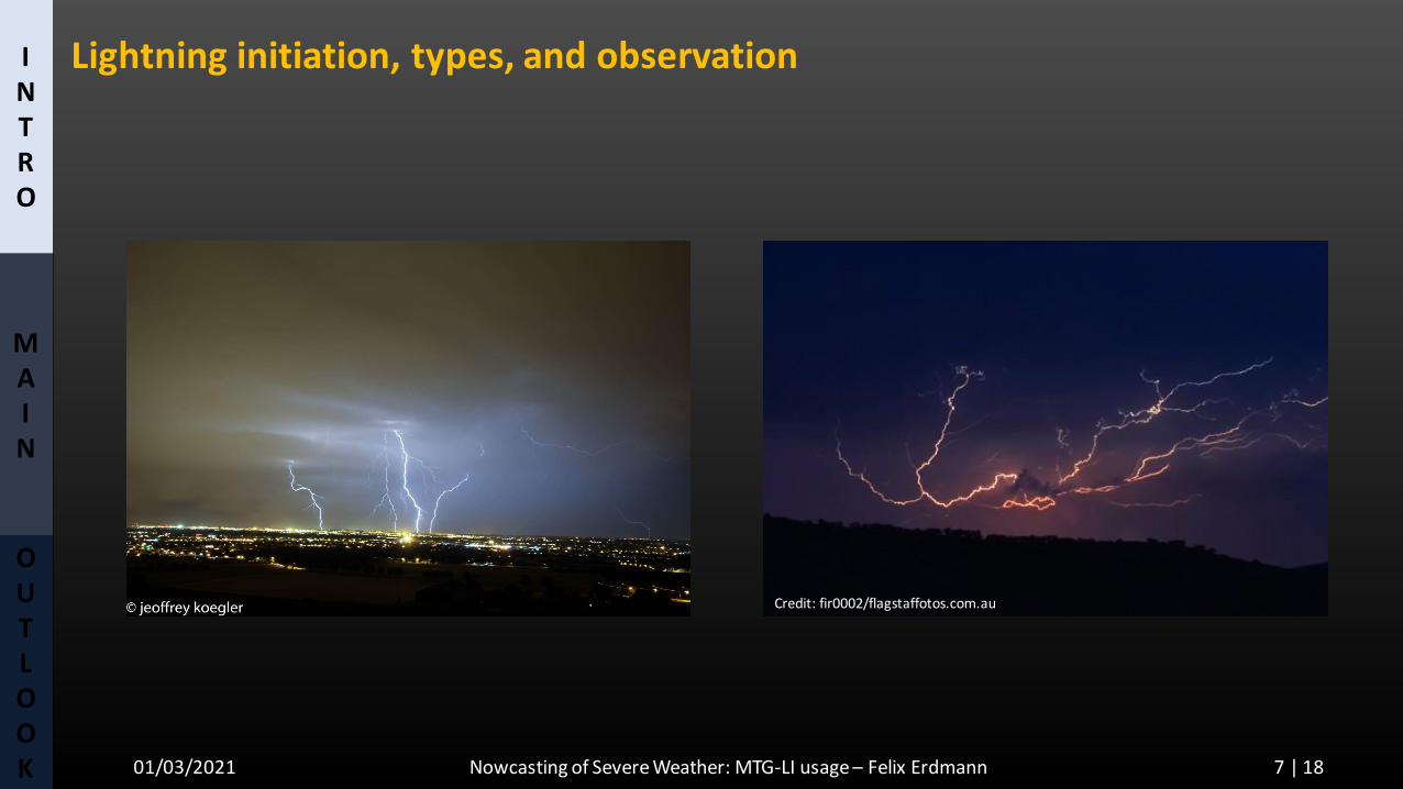
Lightning initiation, types, and observation
Credit: fir0002/flagstaffotos.com.au
01/03/2021 Nowcasting of Severe Weather: MTG-LI usage – Felix Erdmann 7 | 18
I NT RO
MA I N
OUT LOOK
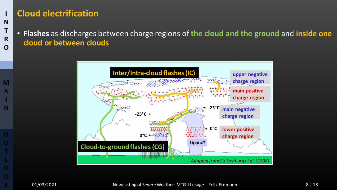
Cloud electrification
• Flashes as discharges between charge regions of the cloud and the ground and inside one cloud or between clouds
Adapted from Stolzenburg et al. (2008)
-25°C
0°C
0°C
-25°C
upper negative charge region
main negative charge region
main positive charge region
lower positive charge region
Cloud-to-ground flashes (CG)
Inter/Intra-cloud flashes (IC)
01/03/2021 Nowcasting of Severe Weather: MTG-LI usage – Felix Erdmann 8 | 18
I NT RO
MA I N
OUT LOOK
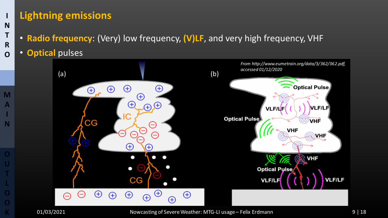
Lightning emissions
• Radio frequency: (Very) low frequency, (V)LF, and very high frequency, VHF
• Optical pulses From http://www.eumetrain.org/data/3/362/362.pdf, accessed 01/12/2020
(a) (b)
01/03/2021 Nowcasting of Severe Weather: MTG-LI usage – Felix Erdmann 9 | 18
I NT RO
MA I N
OUT LOOK
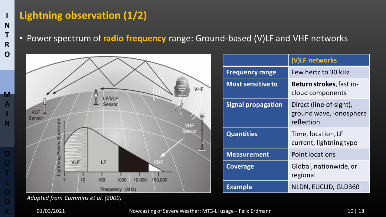
Lightning observation (1/2)
• Power spectrum of radio frequency range: Ground-based (V)LF and VHF networks
Adapted from Cummins et al. (2009)
(V)LF networks
Frequency range Few hertz to 30 kHz
Most sensitive to Return strokes, fast in-cloud components
Signal propagation Direct (line-of-sight), ground wave, ionospherereflection
Quantities Time, location, LF current, lightning type
Measurement Point locations
Coverage Global, nationwide, or regional
Example NLDN, EUCLID, GLD360
01/03/2021 Nowcasting of Severe Weather: MTG-LI usage – Felix Erdmann 10 | 18
I NT RO
MA I N
OUT LOOK
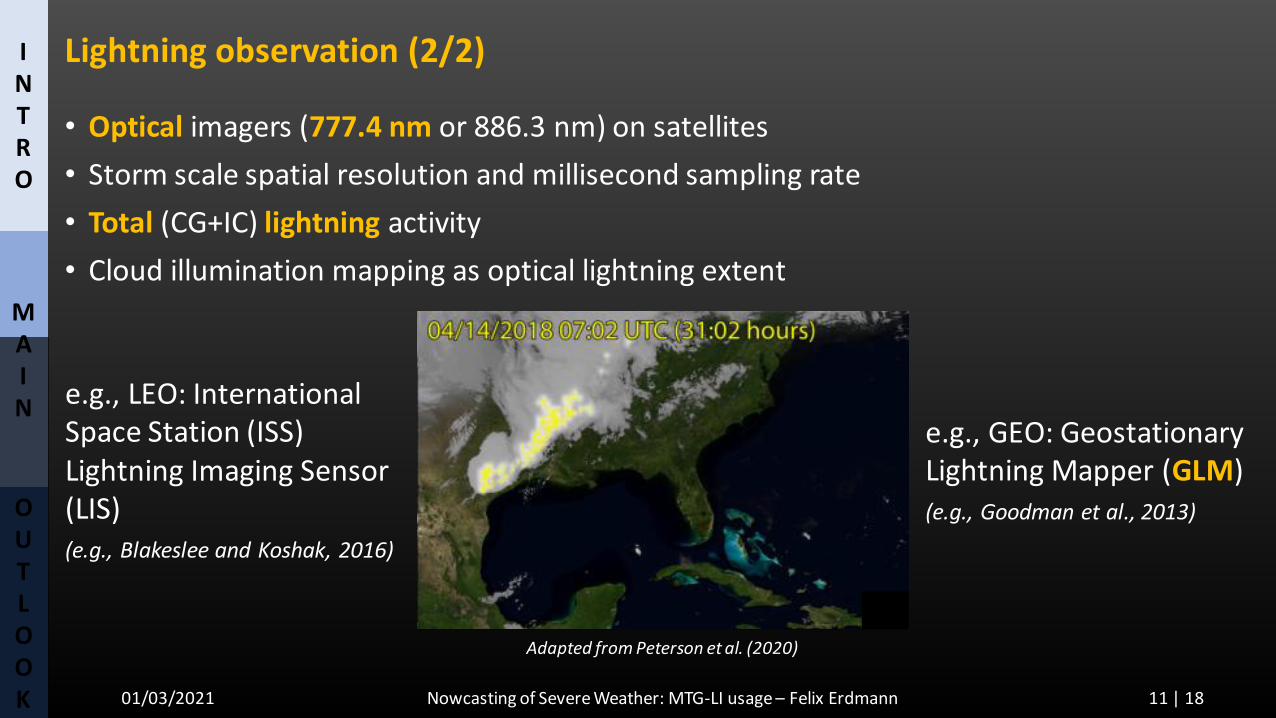
Lightning observation (2/2)
• Optical imagers (777.4 nm or 886.3 nm) on satellites
• Storm scale spatial resolution and millisecond sampling rate
• Total (CG+IC) lightning activity
• Cloud illumination mapping as optical lightning extent
Adapted from Peterson et al. (2020)
(a)
e.g., LEO: International Space Station (ISS) Lightning Imaging Sensor (LIS) (e.g., Blakeslee and Koshak, 2016)
e.g., GEO: Geostationary Lightning Mapper (GLM) (e.g., Goodman et al., 2013)
01/03/2021 Nowcasting of Severe Weather: MTG-LI usage – Felix Erdmann 11 | 18
I NT RO
MA I N
OUT LOOK
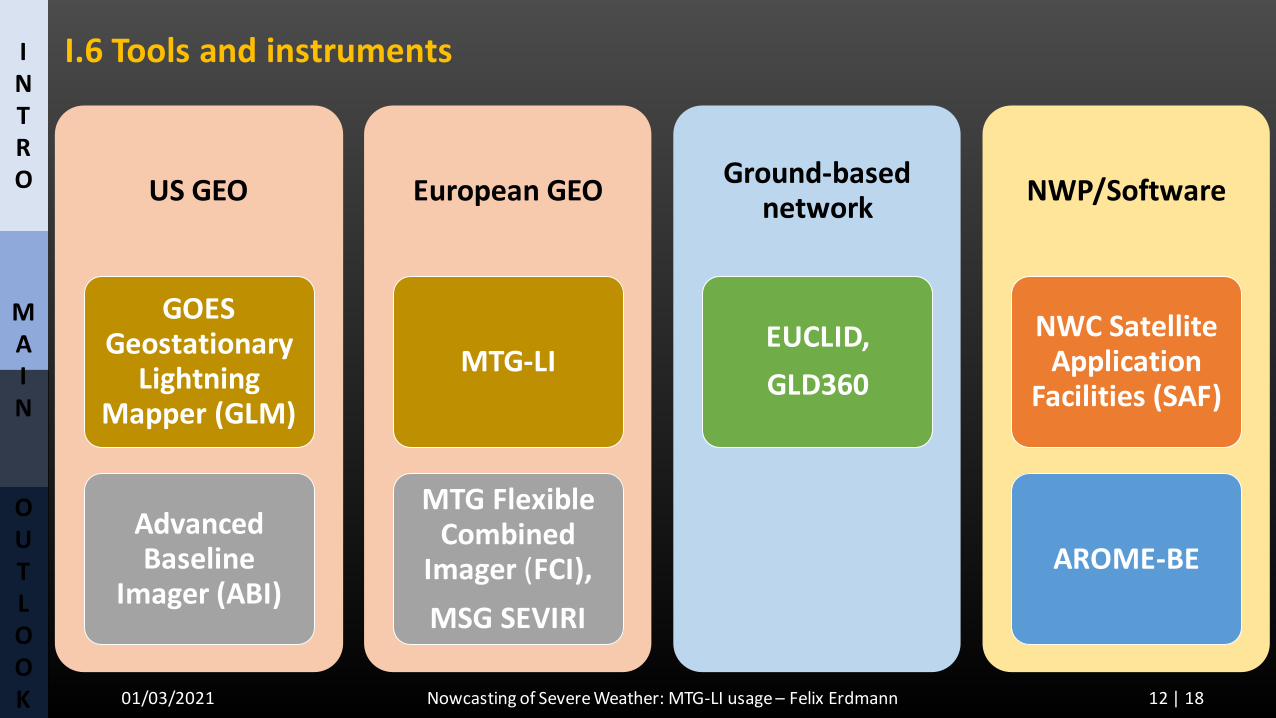
I.6 Tools and instruments
US GEO
GOES Geostationary
Lightning Mapper (GLM)
AdvancedBaseline
Imager (ABI)
European GEO
MTG-LI
MTG Flexible Combined
Imager (FCI),
MSG SEVIRI
Ground-basednetwork
EUCLID,
GLD360
NWP/Software
NWC Satellite Application
Facilities (SAF)
AROME-BE
01/03/2021 Nowcasting of Severe Weather: MTG-LI usage – Felix Erdmann 12 | 18
I NT RO
MA I N
OUT LOOK
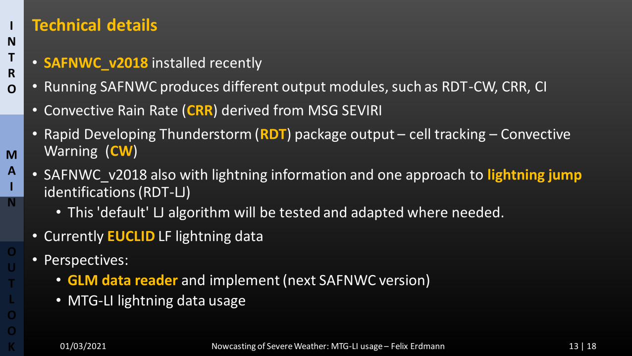
Technical details
• SAFNWC_v2018 installed recently
• Running SAFNWC produces different output modules, such as RDT-CW, CRR, CI
• Convective Rain Rate (CRR) derived from MSG SEVIRI
• Rapid Developing Thunderstorm (RDT) package output – cell tracking – Convective Warning (CW)
• SAFNWC_v2018 also with lightning information and one approach to lightning jump identifications (RDT-LJ)
• This 'default' LJ algorithm will be tested and adapted where needed.
• Currently EUCLID LF lightning data
• Perspectives:
• GLM data reader and implement (next SAFNWC version)
• MTG-LI lightning data usage
01/03/2021 Nowcasting of Severe Weather: MTG-LI usage – Felix Erdmann 13 | 18
I NT RO
MA I N
OUT LOOK
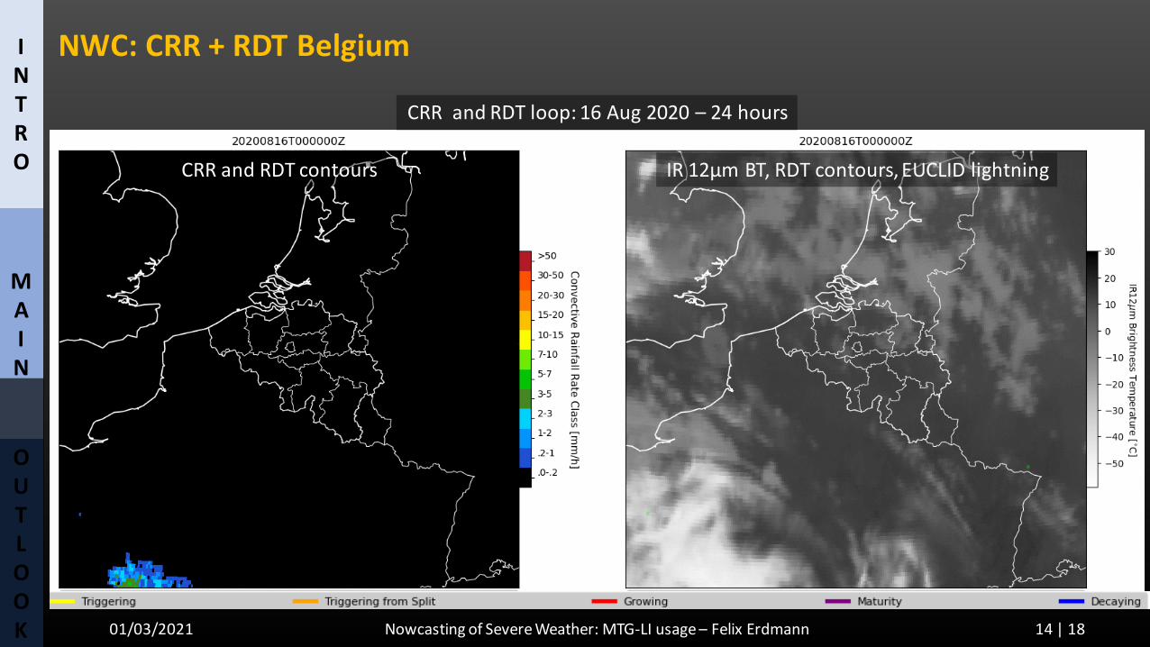
NWC: CRR + RDT Belgium
01/03/2021 Nowcasting of Severe Weather: MTG-LI usage – Felix Erdmann 14 | 18
CRR and RDT contours IR 12µm BT, RDT contours, EUCLID lightning
CRR and RDT loop: 16 Aug 2020 – 24 hours
I NT RO
MA I N
OUT LOOK
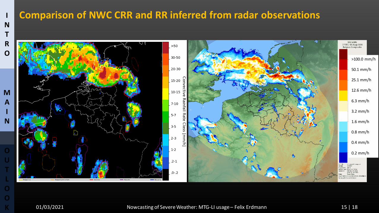
Comparison of NWC CRR and RR inferred from radar observations
01/03/2021 Nowcasting of Severe Weather: MTG-LI usage – Felix Erdmann
>100.0 mm/h
50.1 mm/h
25.1 mm/h
12.6 mm/h
6.3 mm/h
3.2 mm/h
1.6 mm/h
0.8 mm/h
0.4 mm/h
0.2 mm/h
15 | 18

I NT RO
MA I N
OUT LOOK
RDT cell identification and tracking – Input and Thresholds
• Detection of the cloud system
• Tracking of the cloud
• Discrimination of convection
• Convective forecast
Dynamic low altitude (BT) and high latitudetemperature (ST) for each cloudBT-ST > 𝚫Tower Cell detection
01/03/2021 Nowcasting of Severe Weather: MTG-LI usage – Felix Erdmann 16 | 18
I NT RO
MA I N
OUT LOOK
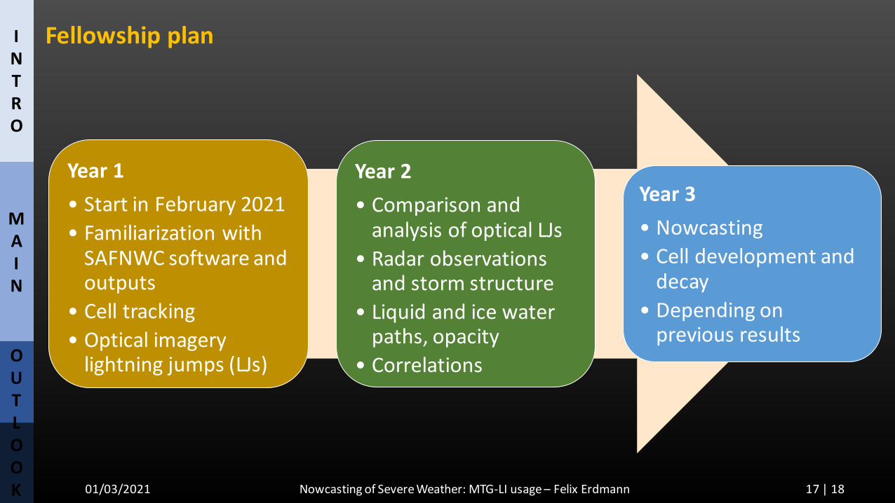
Fellowship plan
Year 1
• Start in February 2021
• Familiarization with SAFNWC software and outputs
• Cell tracking
• Optical imagery lightning jumps (LJs)
Year 2
• Comparison and analysis of optical LJs
• Radar observations and storm structure
• Liquid and ice water paths, opacity
• Correlations
Year 3
• Nowcasting
• Cell development and decay
• Depending on previous results
01/03/2021 Nowcasting of Severe Weather: MTG-LI usage – Felix Erdmann 17 | 18
I NT RO
MA I N
OUT LOOK
Summary
• Test runs and first outputs with the new SAFNWC_v2018.1
• EUCLID lightning impact on SAFNWC output
• Collaboration with Météo-France – exchange of results
• Preparation for the use of GLM data in SAFNWC (SAFNWC_v2018.2)
• First result:
• Stroke-type data input leads to high numbers of lightning jumps (LJs)
use flash data (e.g., Schultz et al. 2009)
01/03/2021 Nowcasting of Severe Weather: MTG-LI usage – Felix Erdmann 18 | 18
Thank you for the [email protected]
I NT RO
MA I N
OUT LOOK
Backup slides
01/03/2021 Nowcasting of Severe Weather: MTG-LI usage – Felix Erdmann 19 | 18
I NT RO
MA I N
OUT LOOK
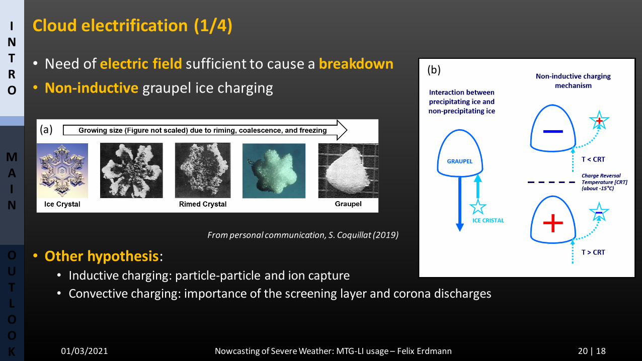
Cloud electrification (1/4)
• Need of electric field sufficient to cause a breakdown
• Non-inductive graupel ice charging
• Other hypothesis:• Inductive charging: particle-particle and ion capture
• Convective charging: importance of the screening layer and corona discharges
From personal communication, S. Coquillat (2019)
(a)
(b)
01/03/2021 Nowcasting of Severe Weather: MTG-LI usage – Felix Erdmann 20 | 18
I NT RO
MA I N
OUT LOOK
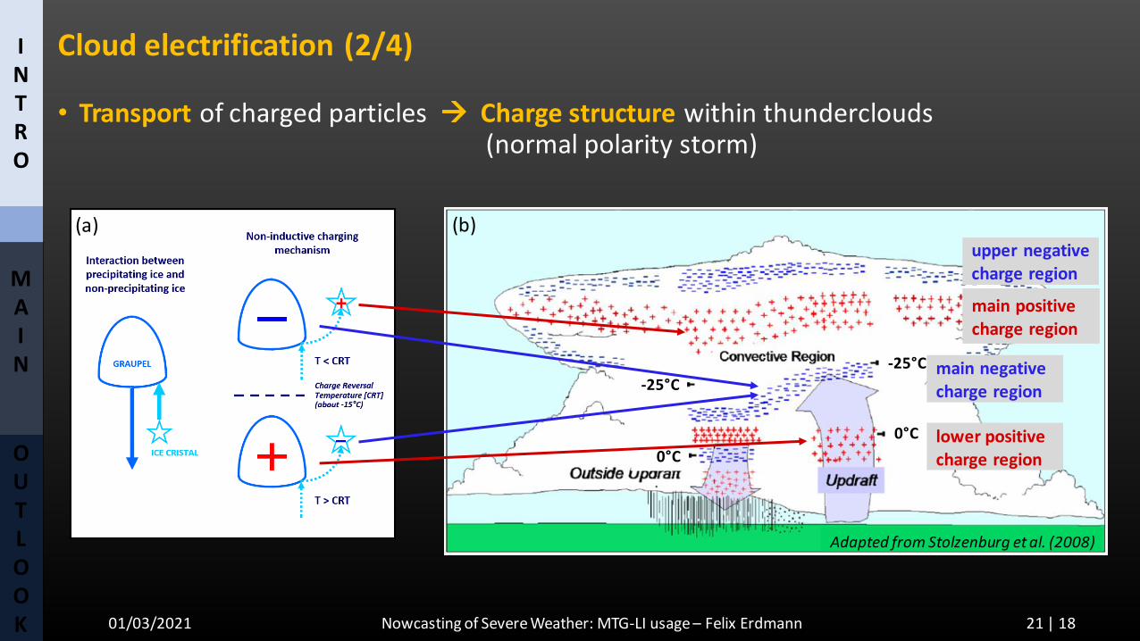
Adapted from Stolzenburg et al. (2008)
-25°C
0°C
0°C
-25°C
upper negative charge region
main negative charge region
main positive charge region
lower positive charge region
Cloud electrification (2/4)
• Transport of charged particles Charge structure within thunderclouds(normal polarity storm)
(a) (b)
01/03/2021 Nowcasting of Severe Weather: MTG-LI usage – Felix Erdmann 21 | 18
I NT RO
MA I N
OUT LOOK
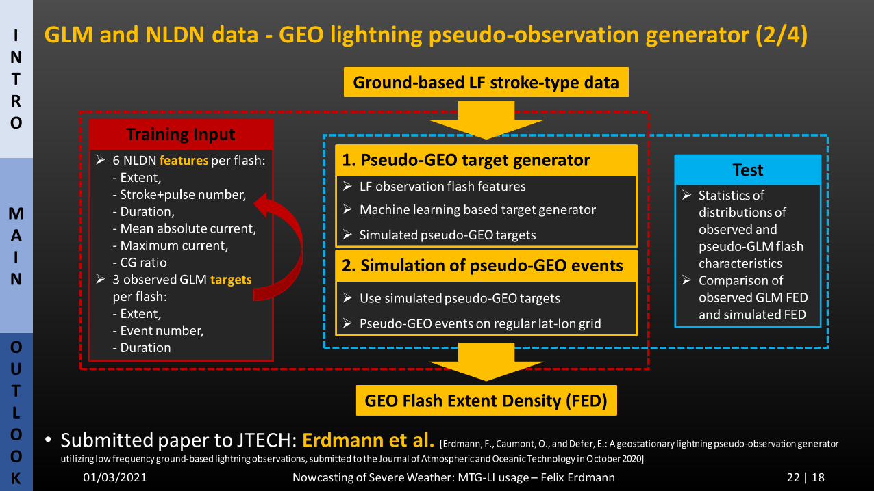
GLM and NLDN data - GEO lightning pseudo-observation generator (2/4)
• Submitted paper to JTECH: Erdmann et al. [Erdmann, F., Caumont, O., and Defer, E.: A geostationary lightning pseudo-observation generator
utilizing low frequency ground-based lightning observations, submitted to the Journal of Atmospheric and Oceanic Technology in October 2020]
01/03/2021 Nowcasting of Severe Weather: MTG-LI usage – Felix Erdmann 22 | 18
I NT RO
MA I N
OUT LOOK
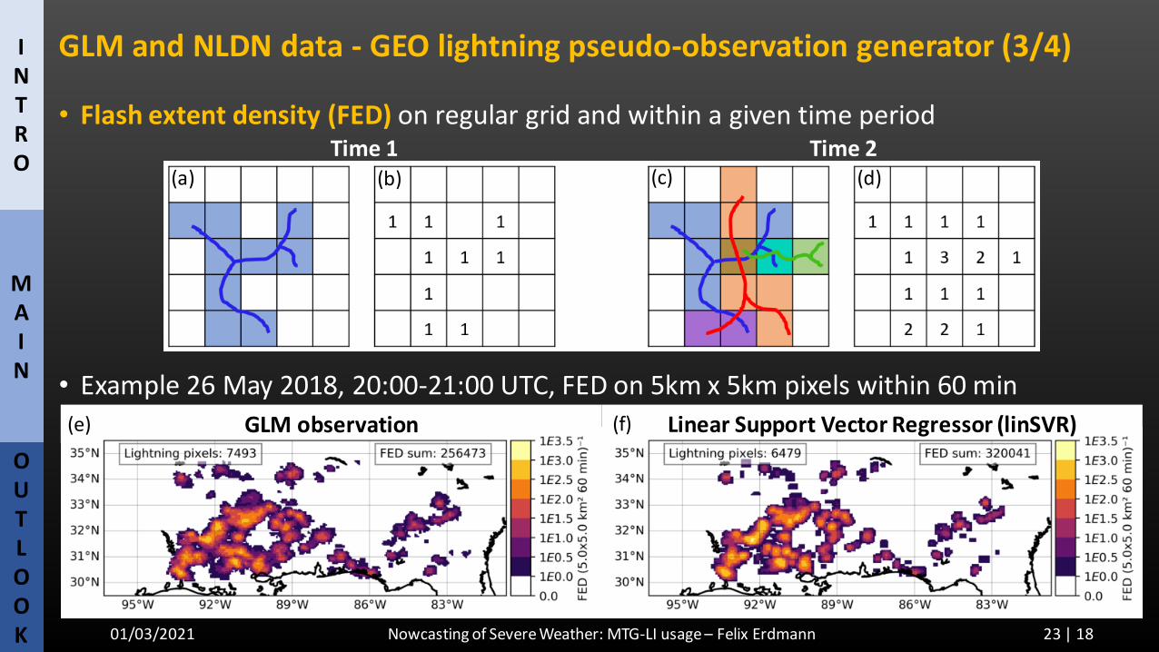
GLM and NLDN data - GEO lightning pseudo-observation generator (3/4)
• Flash extent density (FED) on regular grid and within a given time period
• Example 26 May 2018, 20:00-21:00 UTC, FED on 5km x 5km pixels within 60 min
Time 1 Time 2(a) (b) (c) (d)
Linear Support Vector Regressor (linSVR)GLM observation(e) (f)GLM observation Linear Support Vector Regressor (linSVR)
01/03/2021 Nowcasting of Severe Weather: MTG-LI usage – Felix Erdmann 23 | 18
I NT RO
MA I N
OUT LOOK
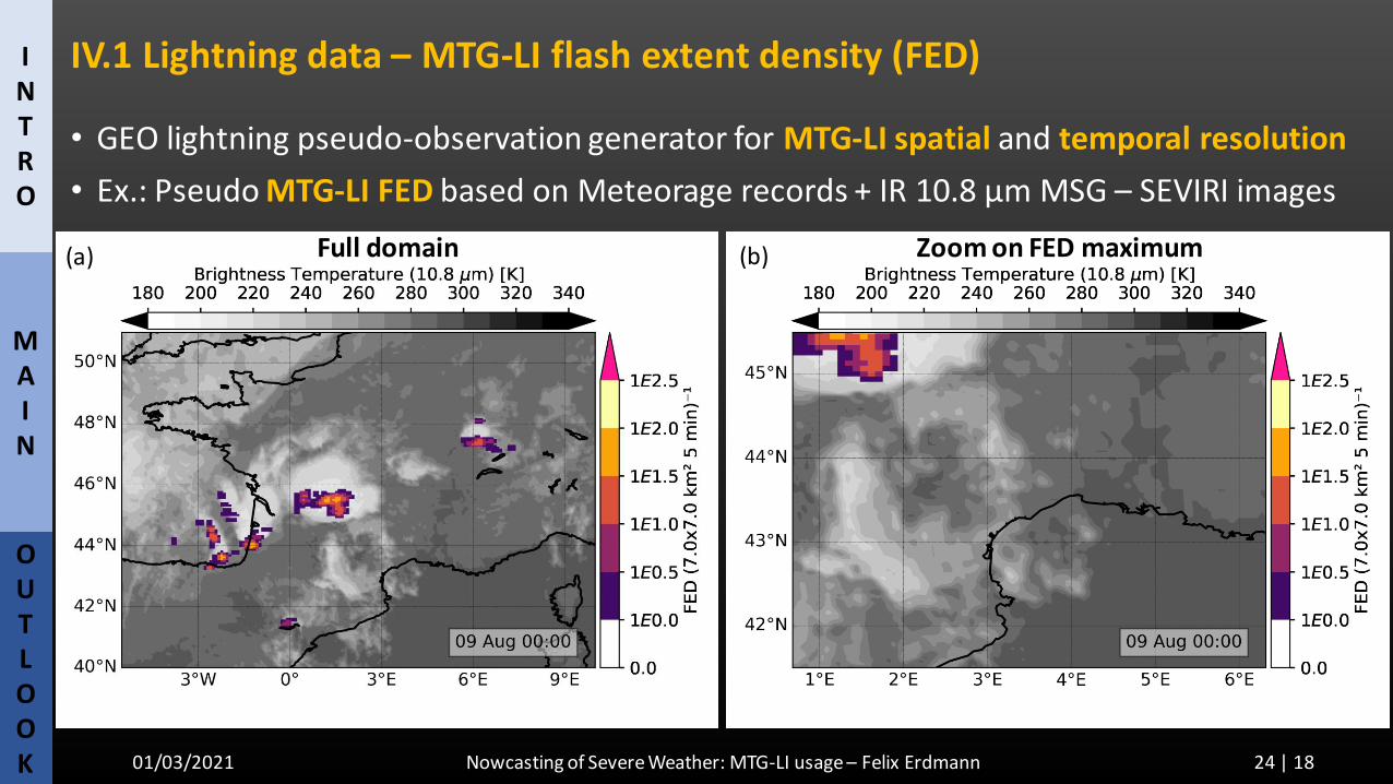
IV.1 Lightning data – MTG-LI flash extent density (FED)
• GEO lightning pseudo-observation generator for MTG-LI spatial and temporal resolution
• Ex.: Pseudo MTG-LI FED based on Meteorage records + IR 10.8 µm MSG – SEVIRI images
Full domain Zoom on FED maximum(a) (b)
01/03/2021 Nowcasting of Severe Weather: MTG-LI usage – Felix Erdmann 24 | 18
I NT RO
MA I N
OUT LOOK
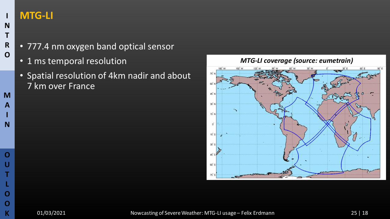
MTG-LI
MTG-LI coverage (source: eumetrain)
• 777.4 nm oxygen band optical sensor
• 1 ms temporal resolution
• Spatial resolution of 4km nadir and about 7 km over France
01/03/2021 Nowcasting of Severe Weather: MTG-LI usage – Felix Erdmann 25 | 18
I NT RO
MA I N
OUT LOOK
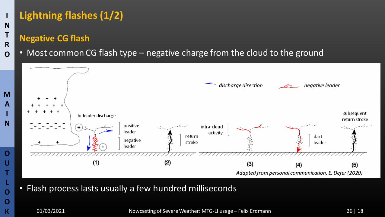
Lightning flashes (1/2)
Negative CG flash
• Most common CG flash type – negative charge from the cloud to the ground
• Flash process lasts usually a few hundred milliseconds
Leaders determine the path• Negative stepped leader• Positive continuous leader
negative leaderdischarge direction
Adapted from personal communication, E. Defer (2020)
01/03/2021 Nowcasting of Severe Weather: MTG-LI usage – Felix Erdmann 26 | 18
I NT RO
MA I N
OUT LOOK
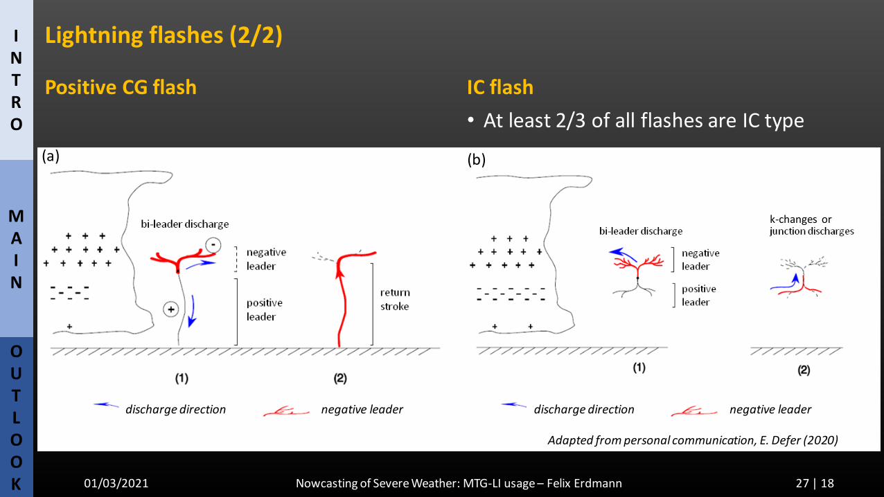
Lightning flashes (2/2)
IC flash
• At least 2/3 of all flashes are IC type
Positive CG flash
negative leaderdischarge direction negative leaderdischarge direction
Adapted from personal communication, E. Defer (2020)
(a) (b)
k-changes or
01/03/2021 Nowcasting of Severe Weather: MTG-LI usage – Felix Erdmann 27 | 18
I NT RO
MA I N
OUT LOOK
Objectives
• Lightning time series for individual storm cells
• Identification of (optical) lightning jumps (LJs)
• Dependency on RDT parameters and thresholds
• Lightning data in SAFNWC_v2018
• Impact of current EUCLID input possibility
• GLM data input
• Research on input of MTG-LI (proxy) data
• Understanding and characterization of optical LJs
• E.g, radar observations, weather reports
• Automated severe weather warning based on optical LJs
01/03/2021 Nowcasting of Severe Weather: MTG-LI usage – Felix Erdmann 28 | 18
Top Related