


Languages
Pages
Legal

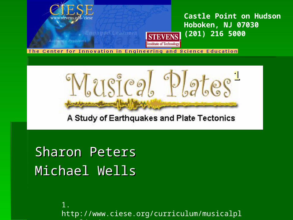
Sharon PetersSharon Peters
Michael WellsMichael Wells
1. http://www.ciese.org/curriculum/musicalplates3/en/
11
Castle Point on HudsonHoboken, NJ 07030(201) 216 5000

StandardsStandards22
As a result of the activities, all students As a result of the activities, all students should develop an understanding ofshould develop an understanding of the structure of the earth's system. the structure of the earth's system. earth's history. earth's history. evolution and equilibrium. evolution and equilibrium. change, constancy and measurement.change, constancy and measurement.
2.http://www.ciese.org/curriculum/musicalplates3/en/curriculumstandards.shtml

BenchmarksBenchmarks Real-Time Data Real-Time Data (6.5 Measurement)(6.5 Measurement)
Time Zones Time Zones (6.5 Measurement, 6.1 Number (6.5 Measurement, 6.1 Number Sense)Sense) ((Greenwich Mean TimeGreenwich Mean Time (GMT), (GMT), Coordinated Universal TimeCoordinated Universal Time (UTC) (UTC) History and Why we use themHistory and Why we use them
Cartesian Plane Cartesian Plane (6.3 Data)(6.3 Data) Cartesian Plane (data plotting and reading graphs)Cartesian Plane (data plotting and reading graphs)
Reading Maps Reading Maps (6.4 Geometry, 6.3 Data)(6.4 Geometry, 6.3 Data)
Velocity Velocity (6.2 Algebra, 6.6 Computation)(6.2 Algebra, 6.6 Computation)
Rounding Rounding (6.1 Number Sense)(6.1 Number Sense)

Topic RelevanceTopic Relevance
It is good to learn these skills because It is good to learn these skills because geologists and other scientists use them geologists and other scientists use them to obtain more information and to obtain more information and knowledge about the earth, what it does knowledge about the earth, what it does and will do. and will do.
Changes in the earth are not only Changes in the earth are not only relevant they are important because they relevant they are important because they affect all life on earth, including YOU!affect all life on earth, including YOU!

Prior KnowledgePrior Knowledge
Using a ruler to Using a ruler to measure lengthmeasure length in [cm] in [cm] RangesRanges i.e. 1-10,11-20,21-30… i.e. 1-10,11-20,21-30… Map LegendsMap Legends RoundingRounding Reading a mapReading a map and and approximationapproximation of of
distancedistance Some beginning knowledge of Some beginning knowledge of plotting data on plotting data on
a mapa map or other or other coordinate systemcoordinate system

VocabularyVocabulary Coordinated Universal Time (UTC)Coordinated Universal Time (UTC) Real Time DataReal Time Data SeismicSeismic Plate tectonicsPlate tectonics VelocityVelocity EpicenterEpicenter MagnitudeMagnitude DepthDepth Cartesian coordinate systemCartesian coordinate system LatitudeLatitude LongitudeLongitude
(this list will certainly grow)(this list will certainly grow)

Lesson Outline Lesson Outline 33
Preliminary Activity: The President Wants YOU!Preliminary Activity: The President Wants YOU! Students should Students should begin here begin here FIRSTFIRST before moving on to the Core Lessons. before moving on to the Core Lessons.
Lesson 1: Plot Current Earthquake DataLesson 1: Plot Current Earthquake Data In this lesson students In this lesson students will access USGS earthquake information and plot the locations will access USGS earthquake information and plot the locations on a world map. on a world map.
Lesson 2: Look for PatternsLesson 2: Look for Patterns Students will compare the map they Students will compare the map they created in Lesson One to a map showing tectonic plates and look created in Lesson One to a map showing tectonic plates and look for a relationship.for a relationship.
Lesson 3: Where will you be in a million years? Students will Lesson 3: Where will you be in a million years? Students will access information about the motion (speed and direction) of the access information about the motion (speed and direction) of the Earth's tectonic plates and make predictions. Earth's tectonic plates and make predictions.
Lesson 4: How do volcanoes fit in the picture? Students will plot Lesson 4: How do volcanoes fit in the picture? Students will plot recent volcanic activity on a world map and look for relationships recent volcanic activity on a world map and look for relationships between volcanoes and plate boundaries.between volcanoes and plate boundaries.
3.http://www.ciese.org/curriculum/musicalplates3/en/teacherlessons.shtml
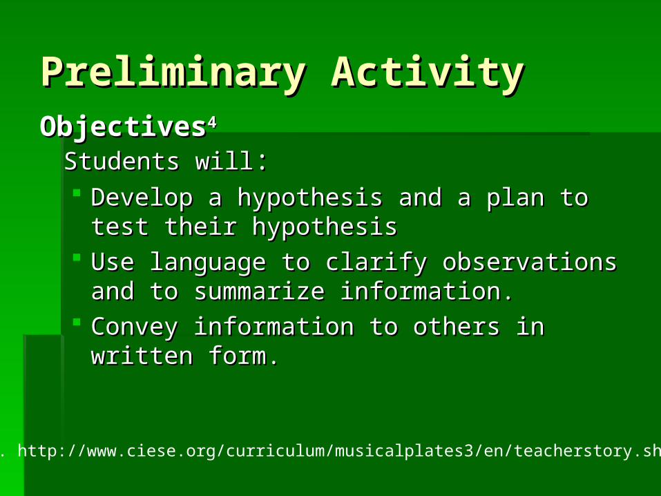
Preliminary ActivityPreliminary ActivityObjectivesObjectives44
Students willStudents will:: Develop a hypothesis and a plan to test their Develop a hypothesis and a plan to test their
hypothesis hypothesis Use language to clarify observations and to Use language to clarify observations and to
summarize information. summarize information. Convey information to others in written form. Convey information to others in written form.
4. http://www.ciese.org/curriculum/musicalplates3/en/teacherstory.shtml

Lesson 1Lesson 1ObjectivesObjectives55
Students will: Students will: Access and interpret online data information. (real-time data)Access and interpret online data information. (real-time data) Plot the longitude and latitude of an earthquake on a map.Plot the longitude and latitude of an earthquake on a map. Make generalizations about a particular region’s likelihood of Make generalizations about a particular region’s likelihood of
having an earthquake based upon its location.having an earthquake based upon its location.
5. http://www.ciese.org/curriculum/musicalplates3/en/teacherlesson1.shtml
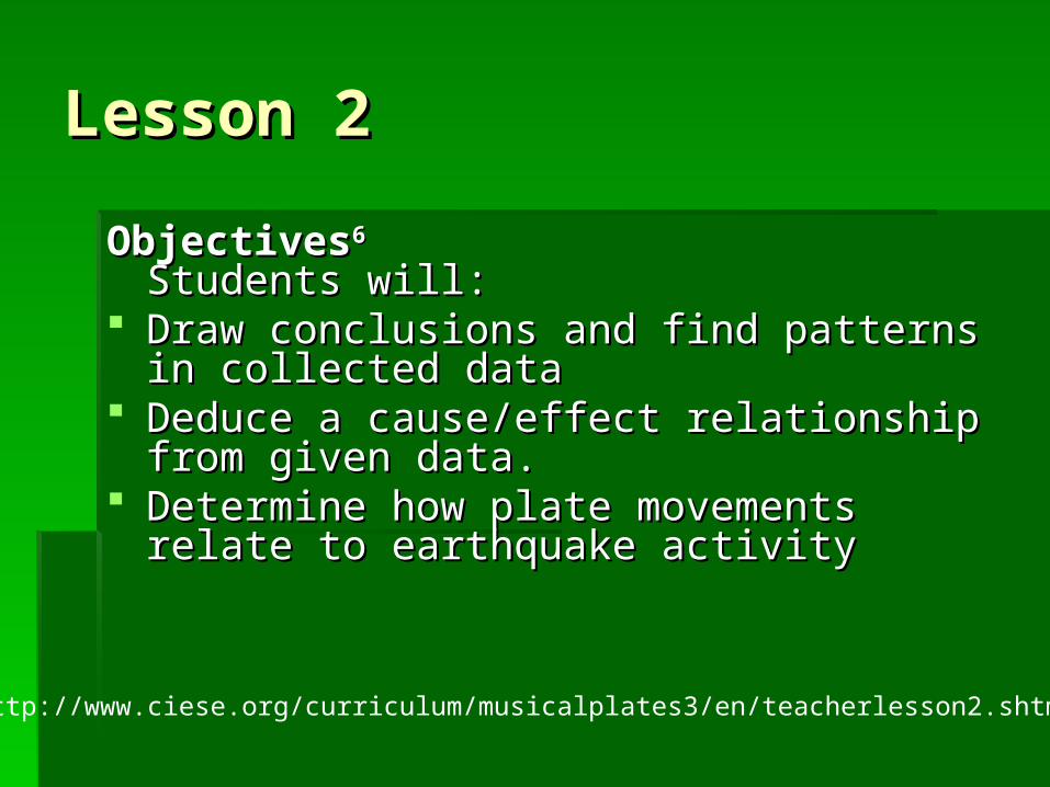
Lesson 2Lesson 2
ObjectivesObjectives66
Students will: Students will: Draw conclusions and find patterns in collected Draw conclusions and find patterns in collected
data data Deduce a cause/effect relationship from given Deduce a cause/effect relationship from given
data. data. Determine how plate movements relate to Determine how plate movements relate to
earthquake activity earthquake activity
http://www.ciese.org/curriculum/musicalplates3/en/teacherlesson2.shtml


Lesson 3Lesson 3
ObjectivesObjectives77
Students will: Students will: Locate stations on the Global Velocities map Locate stations on the Global Velocities map Interpret the information on Global Velocities Interpret the information on Global Velocities
map map Determine the speed at which the locations are Determine the speed at which the locations are
moving moving Draw conclusions and identify a trend from Draw conclusions and identify a trend from
collected data collected data
7. http://www.ciese.org/curriculum/musicalplates3/en/teacherlesson3.shtml

Velocity x Time = Distance
Lesson 4Lesson 4ObjectivesObjectives88
Students will: Students will: Analyze data for meaning Analyze data for meaning Draw conclusions based on observationsDraw conclusions based on observations
Volcanic activity is linked to plate-tectonic processes. Volcanic activity is linked to plate-tectonic processes. The majority of volcanic eruptions occur along plate The majority of volcanic eruptions occur along plate
boundaries such as the boundary between the Pacific boundaries such as the boundary between the Pacific Plate and the North American plate. Plate and the North American plate.
The majority of earthquakes coincide with regions where The majority of earthquakes coincide with regions where there are active volcanoes particularly near continental there are active volcanoes particularly near continental coasts and mountain systems. coasts and mountain systems.
8. http://www.ciese.org/curriculum/musicalplates3/en/teacherlesson4.shtml
Top Related