

Languages
Pages
Legal

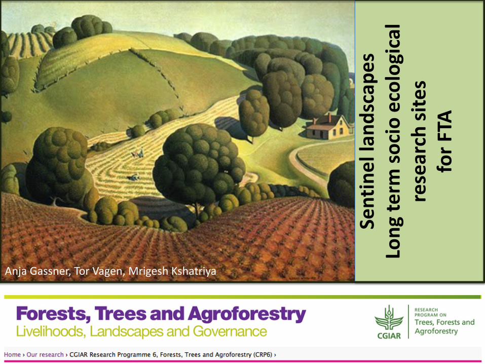
Sent
inel
land
scap
es
Long
term
soci
o ec
olog
ical
re
sear
ch si
tes
for F
TA
Anja Gassner, Tor Vagen, Mrigesh Kshatriya
CGIAR has the ability to undertake truly international and long-term research. Yet its research activities are not usually based on a common set of research instruments, making it difficult to collate comparative results and identify cross-national patterns (Stripe, 2009).
Why?
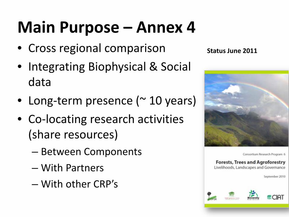
Main Purpose – Annex 4 • Cross regional comparison • Integrating Biophysical & Social
data • Long-term presence (~ 10 years) • Co-locating research activities
(share resources) – Between Components – With Partners – With other CRP’s
Status June 2011
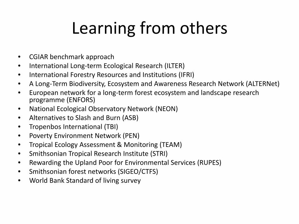
Learning from others • CGIAR benchmark approach • International Long-term Ecological Research (ILTER) • International Forestry Resources and Institutions (IFRI) • A Long-Term Biodiversity, Ecosystem and Awareness Research Network (ALTERNet) • European network for a long-term forest ecosystem and landscape research
programme (ENFORS) • National Ecological Observatory Network (NEON) • Alternatives to Slash and Burn (ASB) • Tropenbos International (TBI) • Poverty Environment Network (PEN) • Tropical Ecology Assessment & Monitoring (TEAM) • Smithsonian Tropical Research Institute (STRI) • Rewarding the Upland Poor for Environmental Services (RUPES) • Smithsonian forest networks (SIGEO/CTFS) • World Bank Standard of living survey
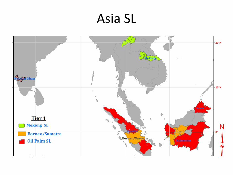
Asia SL
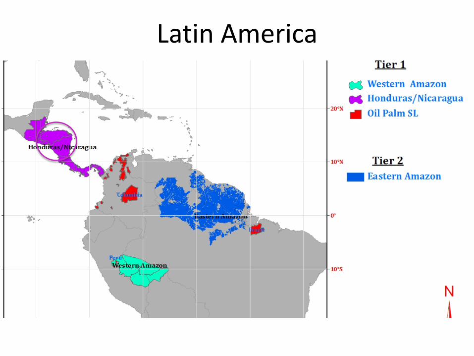
Latin America
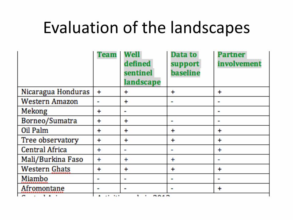
Evaluation of the landscapes
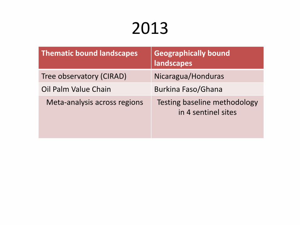
2013 Thematic bound landscapes Geographically bound
landscapes Tree observatory (CIRAD) Nicaragua/Honduras Oil Palm Value Chain Burkina Faso/Ghana
Meta-analysis across regions
Testing baseline methodology in 4 sentinel sites
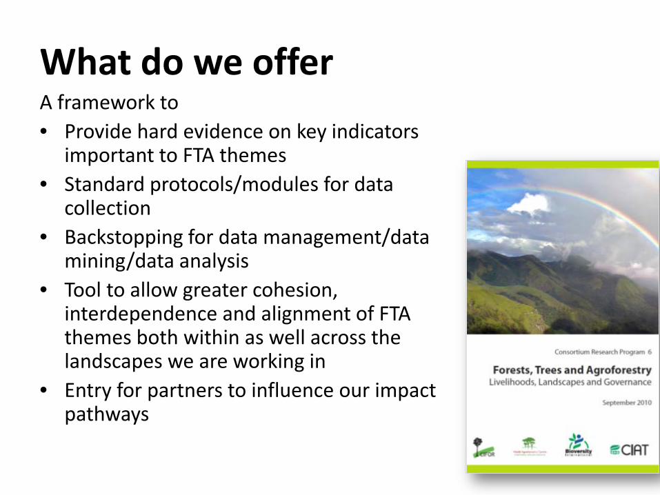
What do we offer A framework to • Provide hard evidence on key indicators
important to FTA themes • Standard protocols/modules for data
collection • Backstopping for data management/data
mining/data analysis • Tool to allow greater cohesion,
interdependence and alignment of FTA themes both within as well across the landscapes we are working in
• Entry for partners to influence our impact pathways
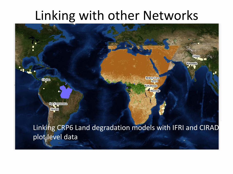
Linking with other Networks
Linking CRP6 Land degradation models with IFRI and CIRAD plot level data
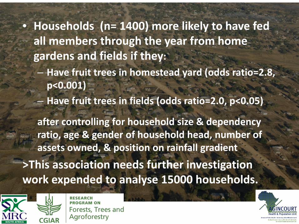
• Households (n= 1400) more likely to have fed all members through the year from home gardens and fields if they: – Have fruit trees in homestead yard (odds ratio=2.8,
p<0.001) – Have fruit trees in fields (odds ratio=2.0, p<0.05)
after controlling for household size & dependency ratio, age & gender of household head, number of assets owned, & position on rainfall gradient
>This association needs further investigation work expended to analyse 15000 households.
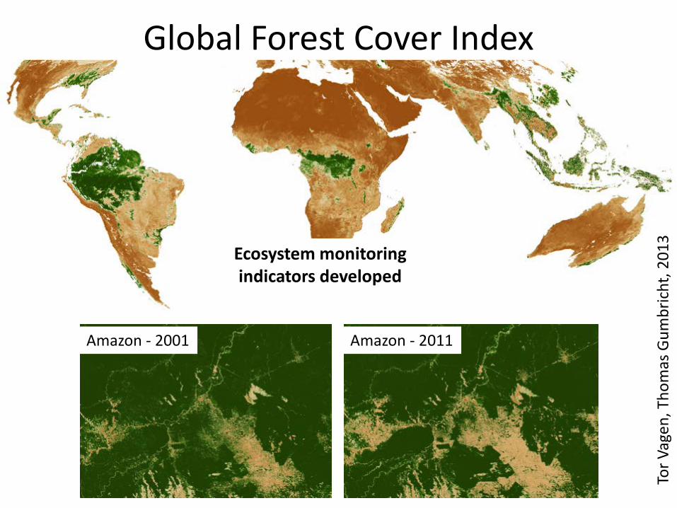
Global Forest Cover Index
Amazon - 2001 Amazon - 2011
Tor V
agen
, Tho
mas
Gum
bric
ht, 2
013
Ecosystem monitoring indicators developed
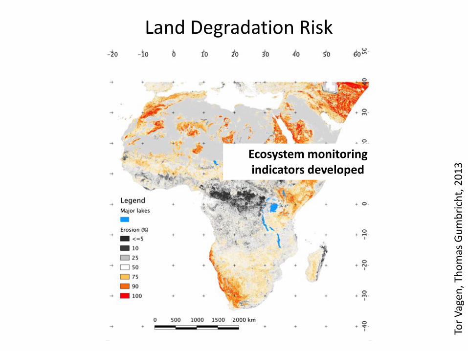
Land Degradation Risk
Tor V
agen
, Tho
mas
Gum
bric
ht, 2
013
Ecosystem monitoring indicators developed
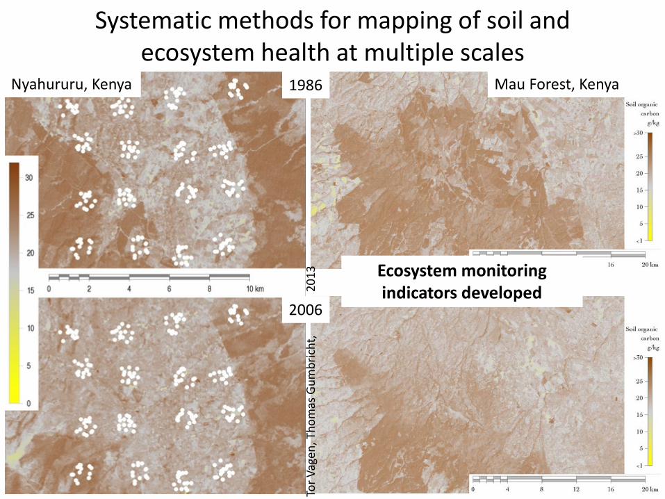
Systematic methods for mapping of soil and ecosystem health at multiple scales
Nyahururu, Kenya Mau Forest, Kenya
2006
1986
Tor V
agen
, Tho
mas
Gum
bric
ht,
201
3 Ecosystem monitoring indicators developed
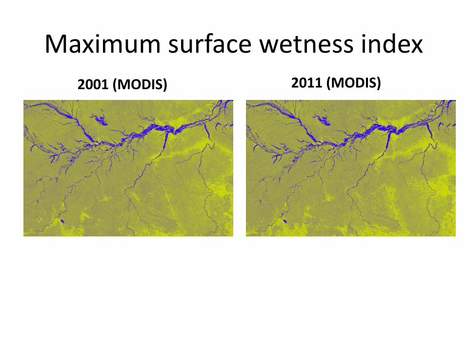
Maximum surface wetness index 2001 (MODIS) 2011 (MODIS)
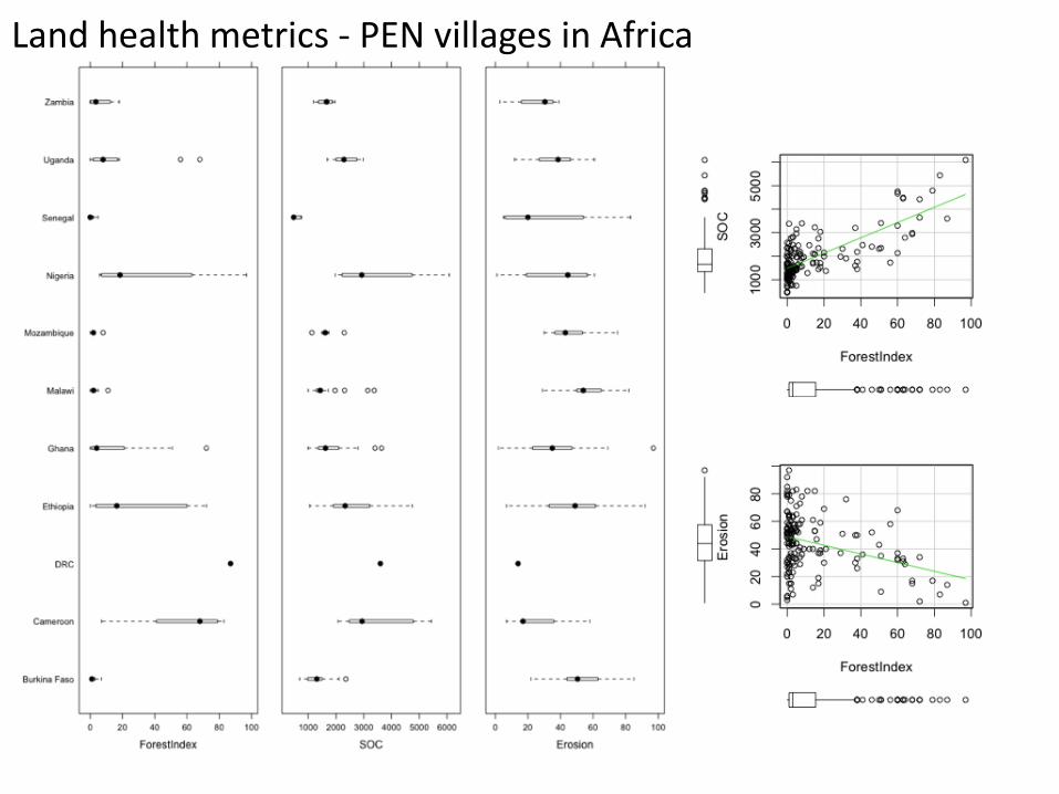
Land health metrics - PEN villages in Africa
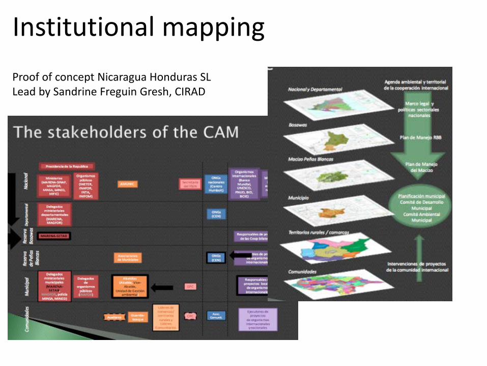
Institutional mapping Proof of concept Nicaragua Honduras SL Lead by Sandrine Freguin Gresh, CIRAD
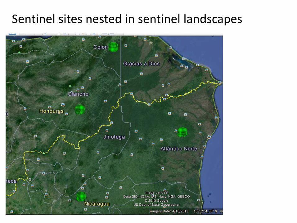
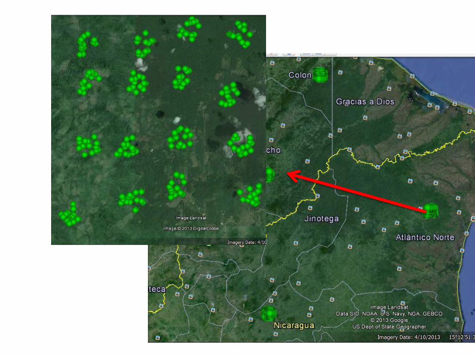
Sentinel sites nested in sentinel landscapes
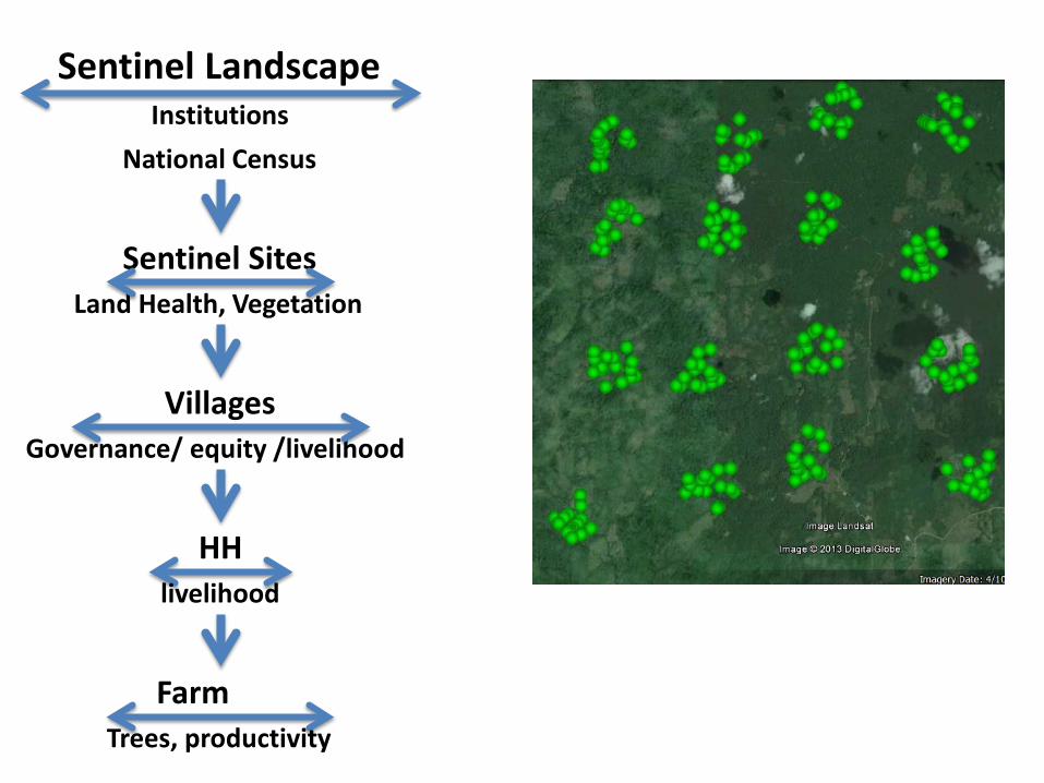
Sentinel Landscape Institutions
National Census
Sentinel Sites Land Health, Vegetation
Villages Governance/ equity /livelihood
HH livelihood
Farm Trees, productivity
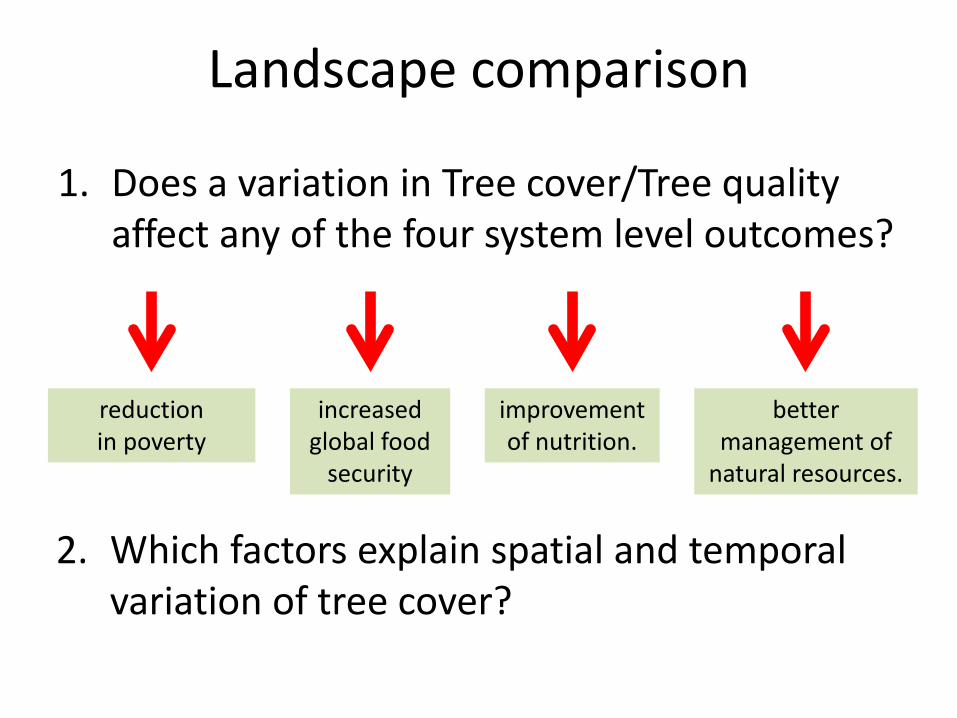
Landscape comparison
1. Does a variation in Tree cover/Tree quality affect any of the four system level outcomes?
reduction in poverty
increased global food
security
improvement of nutrition.
better management of
natural resources.
2. Which factors explain spatial and temporal variation of tree cover?
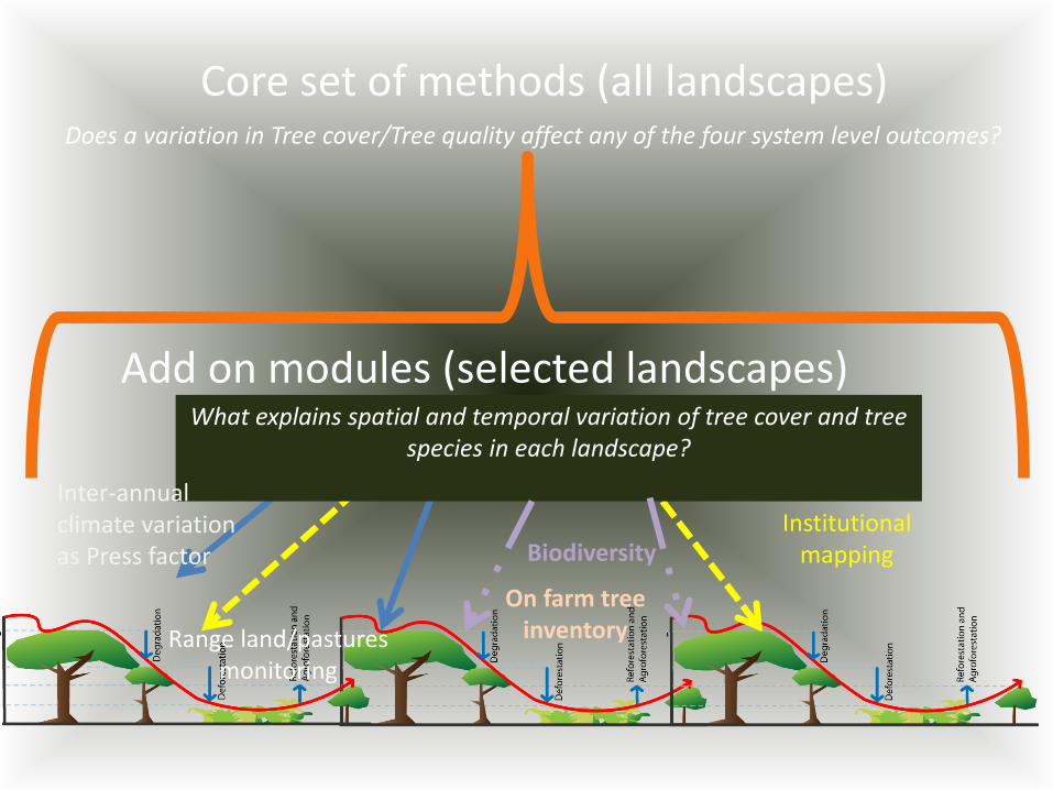
Core set of methods (all landscapes)
Add on modules (selected landscapes)
Does a variation in Tree cover/Tree quality affect any of the four system level outcomes?
What explains spatial and temporal variation of tree cover and tree species in each landscape?
Institutional mapping
Inter-annual climate variation as Press factor Biodiversity
On farm tree inventory Range land/pastures
monitoring
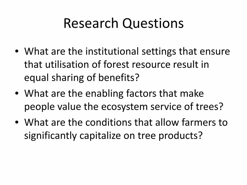
Research Questions
• What are the institutional settings that ensure that utilisation of forest resource result in equal sharing of benefits?
• What are the enabling factors that make people value the ecosystem service of trees?
• What are the conditions that allow farmers to significantly capitalize on tree products?
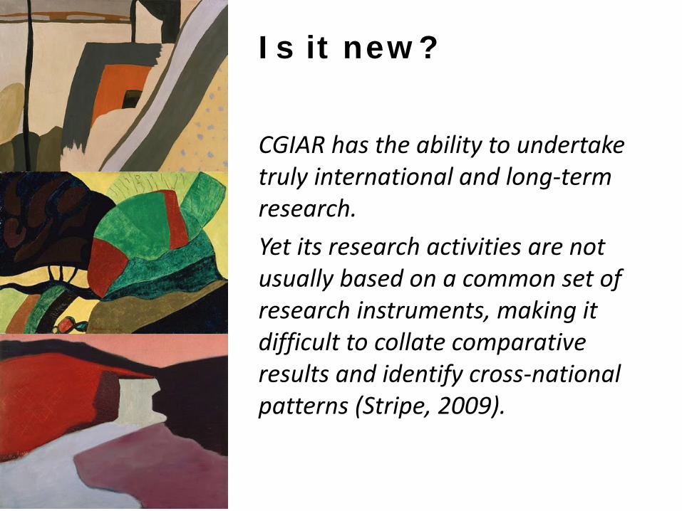
CGIAR has the ability to undertake truly international and long-term research. Yet its research activities are not usually based on a common set of research instruments, making it difficult to collate comparative results and identify cross-national patterns (Stripe, 2009).
Is it new?
Top Related