


Languages
Pages
Legal

02112012
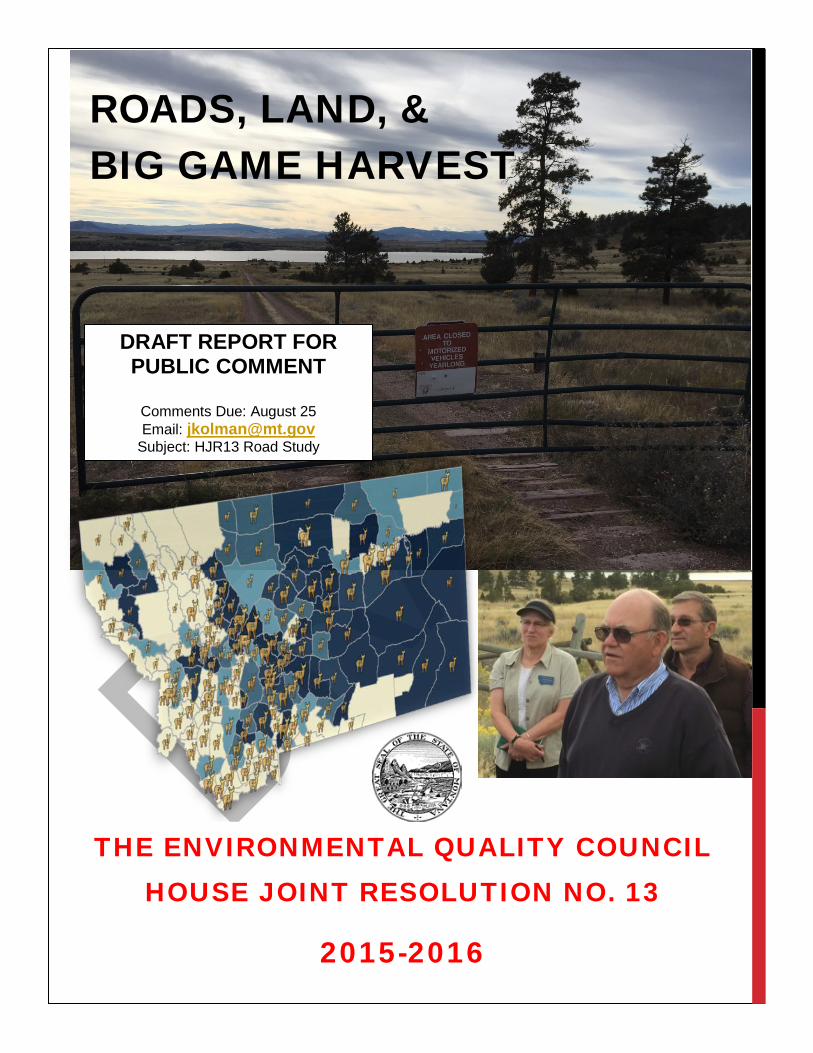
ROADS, LAND, &BIG GAME HARVEST
THE ENVIRONMENTAL QUALITY COUNCIL HOUSE JOINT RESOLUTION NO. 13
2015-2016
DRAFT REPORT FOR PUBLIC COMMENT
Comments Due: August 25 Email: [email protected]
Subject: HJR13 Road Study
1
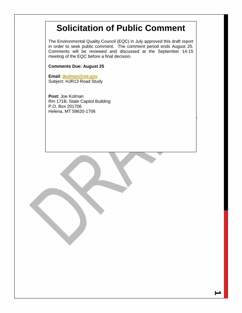
Solicitation of Public Comment The Environmental Quality Council (EQC) in July approved this draft report in order to seek public comment. The comment period ends August 25. Comments will be reviewed and discussed at the September 14-15 meeting of the EQC before a final decision. Comments Due: August 25 Email: [email protected] Subject: HJR13 Road Study
Post: Joe Kolman Rm 171B, State Capitol Building P.O. Box 201706 Helena, MT 59620-1706

2 Executive Summary The Environmental Quality Council assembled an immense amount of information previously unavailable in one place as a result of the House Joint Resolution 13 study. The council examined information on federal roads, parcels of public land with no public access, and harvest rates for elk and deer. The EQC heard from a variety of experts as well as numerous members of the public. The council also toured Forest Service and Bureau of Land Management (BLM) roads and lands around Helena to see road and access issues firsthand.
Roads There are approximately 32,000 miles of Forest Service system roads in Montana. Of those, 9,784 miles are only available for administrative use, meaning they are effectively closed to motorized use.
Other roads may be closed and returned to a natural state. There are 5,976 miles of decommissioned roads no longer in the system. Unauthorized roads, mostly created by users, are not within the Forest Service system and are closed to motorized use. The Forest Service estimates there are 6,191 miles of unauthorized roads in Montana.
Since the mid-1990s, about 21,951 miles of road on land managed by the Forest Service have been closed to motorized use.
There are almost 1,800 miles of documented roads under the jurisdiction of the Bureau of Land Management that are open year round for motorized use. Another 886 miles are open at least part of the year. About 1,700 miles of BLM roads are closed to motorized use. More than 1,500 miles of road are considered open until a travel planning decision is made.
Inaccessible Public Parcels About 10% of public lands in Montana are probably inaccessible by a public road or waterway. In many cases, the parcel may be surrounded by private land. Although the private landowner may grant permission to cross, access to the public land for the general public is not guaranteed.
Nearly all of the inaccessible land is owned by either the state of Montana or the BLM. State trust lands account for 2,429 square miles of inaccessible parcels. The BLM owns 2,179 square miles of inaccessible land.
HJR 13 Kerry White
Rep. White, who is
also a member of the
EQC, sponsored the
study resolution in
2015. It passed the
House 69-37 and the
Senate 32-18. The
study focused on road
management on federal
lands, parcels of
inaccessible public
land, and the effect of
diminished access on
recreational
opportunities,
specifically hunting.
The EQC built an
online map showing
roads, inaccessible
parcels, land
ownership, and big
game harvest rates for
any area in the state.

3 Big Game Harvest While the number of elk in Montana rose over the last few years, the highest elk harvest over the last 16 years was in 2003. Hunters killed more than 25,000 elk in 2014, the highest number since 2008. However, many areas in the state remain over the population goals set by the Department of Fish, Wildlife and Parks (DFWP).
Mule deer and whitetailed deer populations are rebounding after recent rough winters and disease outbreaks, but harvest numbers over the last decade were highest in 2006, when almost 134,000 deer were harvested. Hunters bagged just under 76,000 deer in 2014.
Findings and Recommendations 1) The EQC examined roads currently managed by the Forest Service and compiled available information on decommissioned Forest Service roads and unauthorized roads created on Forest Service lands. Not all unauthorized roads were documented prior to closure, and the agency has inadequate records to document roads decommissioned prior to 1990.
a) The EQC found that since 1995, almost 22,000 miles of roads on Forest Service lands were closed.
b) The EQC examined roads on land managed by the Bureau of Land Management. About 1,700 miles of roads are closed to motorized use. In addition, almost 900 miles of road are closed to motorized use at least part of the year.
2) While the EQC did not study rights-of-way across unreserved public lands granted by a provision in the 1866 Mining Act, some of these roads may exist in Montana and may provide public access to public lands. The 1866 law, Revised Statute 2744, was repealed in 1976. However RS2477 roads in existence at the time were grandfathered.
3) The EQC recommends that the DFWP and the State Parks and Recreation Board identify off-highway vehicle roads and trails that connect to state parks.
4) The EQC examined data in various formats for Forest Service roads dating back in some cases to the 1970s as well as the laws and policies that affected road policy. The council also analyzed elk and deer harvest data and academic studies that address the relationship between roads and wildlife.
5) Over a period of more than a century, road management on federal land has evolved from a laissez-faire approach, allowing roads to be built as needed, to active management of a complicated road system serving a wide array of objectives.
6) Contemporary management of state and federal roads incorporates intensive public involvement. Environmental analysis on federal travel management plans that comply with the National Environmental Policy Act requires meaningful engagement with individuals and agencies that have a site-specific and/or a general interest.
7) A 2013 analysis by the Department of Fish, Wildlife and Parks found that 3,116,800 acres (4,870 square miles) of public land cannot be accessed by a legal road or water access. Of the inaccessible land:
4 a) Forest Service parcels account for about 5%, or 232 square miles. Almost 95% of the inaccessible public land in the state, about 4,600 square miles, is managed by either the Bureau of Land Management or the state of Montana with the inaccessible lands divided about evenly between the two entities.
b) A total of 978,647.6 acres (1,529.13 square miles) lies in areas elk may inhabit. Without more information and analysis, the EQC is unable to determine if road closures across private lands created isolated public parcels.
8) Elk distribution on private land increased by 17% between 2004 and 2015.
9) As of 2015, 80 hunting districts had elk populations that exceeded target populations determined to be sustainable based on habitat. Two of those districts had elk populations that were more than ten
times the objective population.
10) The EQC compiled information on roads, public land, inaccessible public land, and hunter success rates for every hunting district in the state. Given the scope of the HJR13 study and the knowledge that a variety of factors may influence hunter success, the EQC is unable to determine if hunter success in a specific district was influenced by road closures or inaccessible public land.
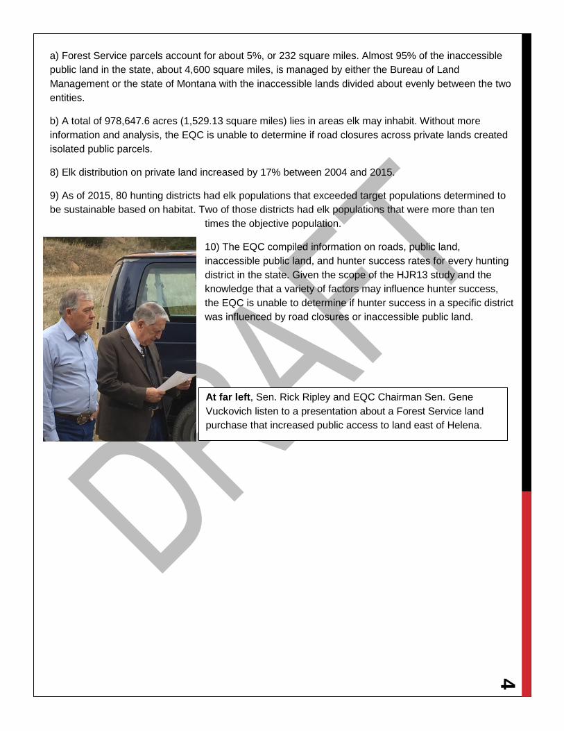
At far left, Sen. Rick Ripley and EQC Chairman Sen. Gene Vuckovich listen to a presentation about a Forest Service land purchase that increased public access to land east of Helena.
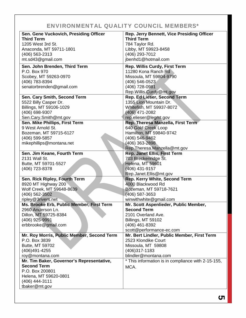
5 ENVIRONMENTAL QUALITY COUNCIL MEMBERS*
Sen. Gene Vuckovich, Presiding Officer Third Term 1205 West 3rd St. Anaconda, MT 59711-1801 (406) 563-2313 [email protected]
Rep. Jerry Bennett, Vice Presiding Officer Third Term 784 Taylor Rd. Libby, MT 59923-8458 (406) 293-7012 [email protected]
Sen. John Brenden, Third Term P.O. Box 970 Scobey, MT 59263-0970 (406) 783-8394 [email protected]
Rep. Willis Curdy, First Term 11280 Kona Ranch Rd Missoula, MT 59804-9790 (406) 546-0523 (406) 728-0981 [email protected]
Sen. Cary Smith, Second Term 5522 Billy Casper Dr. Billings, MT 59106-1029 (406) 698-9307 [email protected]
Rep. Ed Lieser, Second Term 1355 Lion Mountain Dr. Whitefish, MT 59937-8072 (406) 471-2082 [email protected]
Sen. Mike Phillips, First Term 9 West Arnold St. Bozeman, MT 59715-6127 (406) 599-5857 [email protected]
Rep. Theresa Manzella, First Term 640 Gold Creek Loop Hamilton, MT 59840-9742 (406) 546-9462 (406) 363-2898 [email protected]
Sen. Jim Keane, Fourth Term 2131 Wall St. Butte, MT 59701-5527 (406) 723-8378
Rep. Janet Ellis, First Term 703 Breckenridge St. Helena, MT 59601 (406) 431-9157 [email protected]
Sen. Rick Ripley, Fourth Term 8920 MT Highway 200 Wolf Creek, MT 59648-8639 (406) 562-3502 [email protected]
Rep. Kerry White, Second Term 4000 Blackwood Rd Bozeman, MT 59718-7621 (406) 587-3653 [email protected]
Ms. Brooke Erb, Public Member, First Term 2960 Anderson Ln. Dillon, MT 59725-8384 (406) 925-9991 [email protected]
Mr. Scott Aspenlieder, Public Member, Second Term 2101 Overland Ave. Billings, MT 59102 (406) 461-8392 [email protected]
Mr. Roy Morris, Public Member, Second Term P.O. Box 3839 Butte, MT 59702 (406)491-4255 [email protected]
Mr. Bert Lindler, Public Member, First Term 2523 Klondike Court Missoula, MT 59808 (406)317-1183 [email protected]
Mr. Tim Baker, Governor’s Representative, Second Term P.O. Box 200801 Helena, MT 59620-0801 (406) 444-3111 [email protected]
* This information is in compliance with 2-15-155, MCA.
6 LEGISLATIVE ENVIRONMENTAL POLICY OFFICE STAFF
Joe Kolman, Legislative Environmental Policy Analyst Dawn Field, Research and Publications Jason Mohr, Resource Policy Analyst Sonja Nowakowski, Resource Policy Analyst Hope Stockwell, Resource Policy Analyst Helen Thigpen, Attorney Nadine Spencer, Legislative Secretary

7
CONTENTS Executive Summary ............................................................................................................................... 2
Roads ................................................................................................................................................ 2
Inaccessible Public Parcels ................................................................................................................ 2
Big Game Harvest .............................................................................................................................. 3
Findings and Recommendations ........................................................................................................ 3
Environmental Quality Council Members* .............................................................................................. 4
Legislative Environmental Policy Office Staff ......................................................................................... 6
Policy Overviews ................................................................................................................................... 9
Roads ................................................................................................................................................ 9
Forest Service Roads in Montana ................................................................................................... 9
Montana Bureau of Land Management Roads .............................................................................. 12
Public Access and Public Lands ....................................................................................................... 12
Wildlife Management ........................................................................................................................ 15
Elk Population and Distribution ..................................................................................................... 15
Harvest ......................................................................................................................................... 18
Deer Population and Harvest ........................................................................................................ 20
Expert Testimony, Public Comment, and EQC Discussion .................................................................. 23
September 9, 2015, EQC Meeting .................................................................................................... 23
Federal Road Management .......................................................................................................... 23
Public Access to Federal Land ...................................................................................................... 23
January 13, 2016 EQC Meeting ....................................................................................................... 23
Tour ..................................................................................................................................................... 25
Ward Ranch ..................................................................................................................................... 25
York Gulch ....................................................................................................................................... 26
Map Overview ...................................................................................................................................... 27
Getting Started ................................................................................................................................. 27
Explore ............................................................................................................................................. 27
Tips .................................................................................................................................................. 28
Results of FWP Harvest Survey ........................................................................................................... 28
Public Comment .................................................................................................................................. 28

8
9 POLICY OVERVIEWS
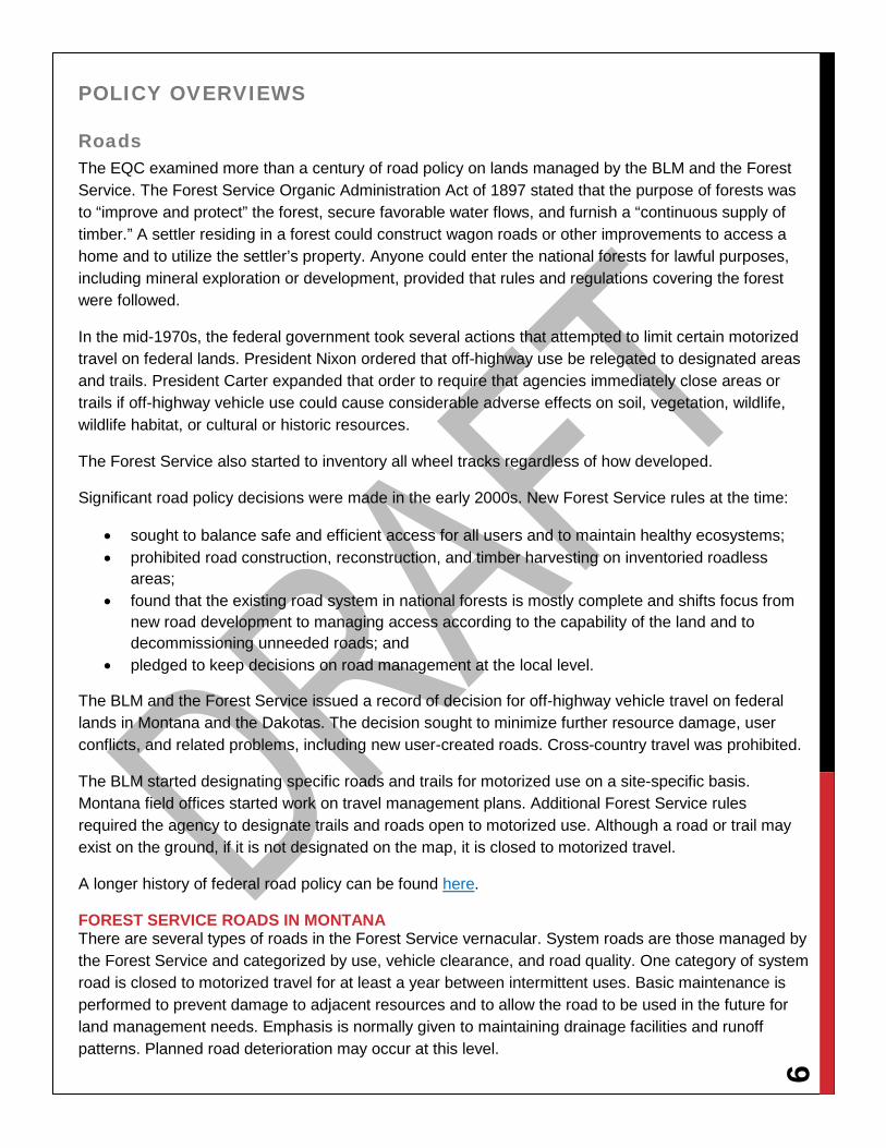
Roads The EQC examined more than a century of road policy on lands managed by the BLM and the Forest Service. The Forest Service Organic Administration Act of 1897 stated that the purpose of forests was to “improve and protect” the forest, secure favorable water flows, and furnish a “continuous supply of timber.” A settler residing in a forest could construct wagon roads or other improvements to access a home and to utilize the settler’s property. Anyone could enter the national forests for lawful purposes, including mineral exploration or development, provided that rules and regulations covering the forest were followed.
In the mid-1970s, the federal government took several actions that attempted to limit certain motorized travel on federal lands. President Nixon ordered that off-highway use be relegated to designated areas and trails. President Carter expanded that order to require that agencies immediately close areas or trails if off-highway vehicle use could cause considerable adverse effects on soil, vegetation, wildlife, wildlife habitat, or cultural or historic resources.
The Forest Service also started to inventory all wheel tracks regardless of how developed.
Significant road policy decisions were made in the early 2000s. New Forest Service rules at the time:
• sought to balance safe and efficient access for all users and to maintain healthy ecosystems; • prohibited road construction, reconstruction, and timber harvesting on inventoried roadless
areas; • found that the existing road system in national forests is mostly complete and shifts focus from
new road development to managing access according to the capability of the land and to decommissioning unneeded roads; and
• pledged to keep decisions on road management at the local level.
The BLM and the Forest Service issued a record of decision for off-highway vehicle travel on federal lands in Montana and the Dakotas. The decision sought to minimize further resource damage, user conflicts, and related problems, including new user-created roads. Cross-country travel was prohibited.
The BLM started designating specific roads and trails for motorized use on a site-specific basis. Montana field offices started work on travel management plans. Additional Forest Service rules required the agency to designate trails and roads open to motorized use. Although a road or trail may exist on the ground, if it is not designated on the map, it is closed to motorized travel.
A longer history of federal road policy can be found here.
FOREST SERVICE ROADS IN MONTANA There are several types of roads in the Forest Service vernacular. System roads are those managed by the Forest Service and categorized by use, vehicle clearance, and road quality. One category of system road is closed to motorized travel for at least a year between intermittent uses. Basic maintenance is performed to prevent damage to adjacent resources and to allow the road to be used in the future for land management needs. Emphasis is normally given to maintaining drainage facilities and runoff patterns. Planned road deterioration may occur at this level.
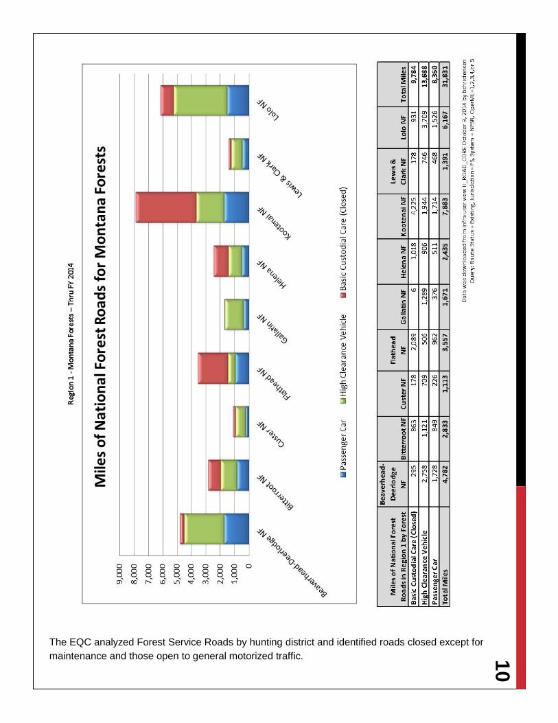
10
The EQC analyzed Forest Service Roads by hunting district and identified roads closed except for maintenance and those open to general motorized traffic.

11
The Forest Service also closes roads by a process called decommissioning. In general, roads are decommissioned because they are no longer of use or pose an environmental threat. Roads were being decommissioned in the early 1990s and before, but the Forest Service does not have adequate records to document the activity. Decommissioning a
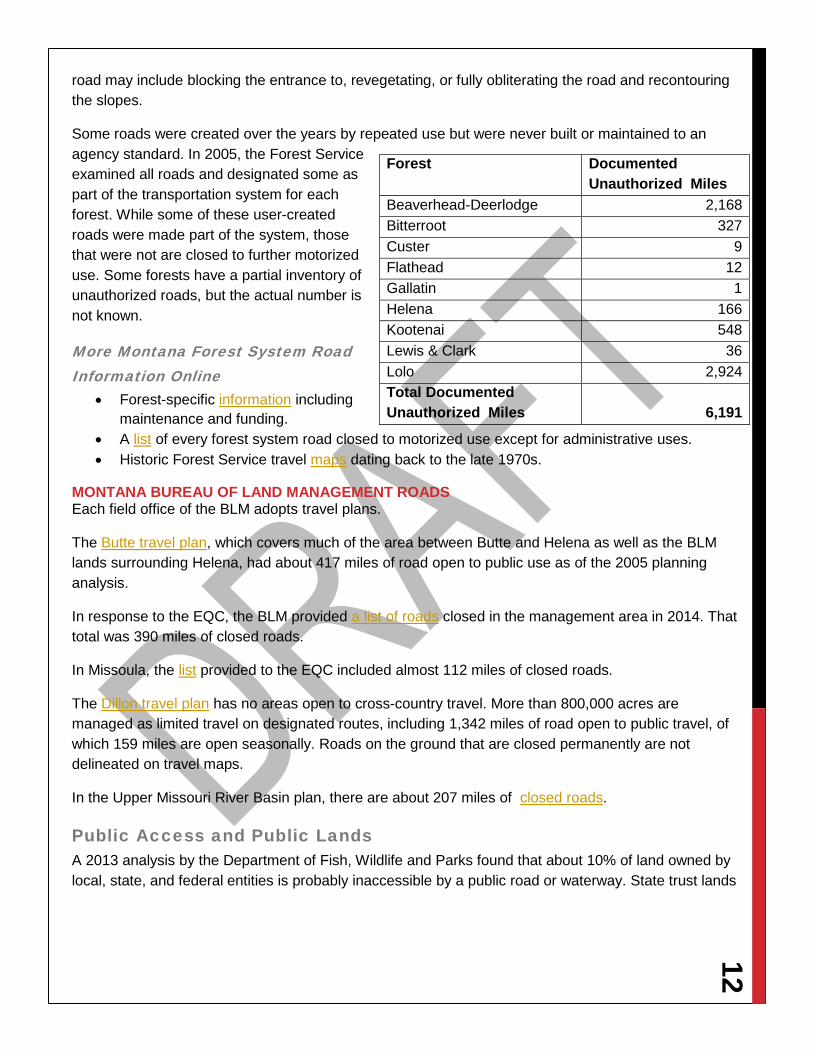
12 road may include blocking the entrance to, revegetating, or fully obliterating the road and recontouring the slopes.
Some roads were created over the years by repeated use but were never built or maintained to an agency standard. In 2005, the Forest Service examined all roads and designated some as part of the transportation system for each forest. While some of these user-created roads were made part of the system, those that were not are closed to further motorized use. Some forests have a partial inventory of unauthorized roads, but the actual number is not known.
More Montana Forest System Road Information Online
• Forest-specific information including maintenance and funding.
• A list of every forest system road closed to motorized use except for administrative uses. • Historic Forest Service travel maps dating back to the late 1970s.
MONTANA BUREAU OF LAND MANAGEMENT ROADS Each field office of the BLM adopts travel plans.
The Butte travel plan, which covers much of the area between Butte and Helena as well as the BLM lands surrounding Helena, had about 417 miles of road open to public use as of the 2005 planning analysis.
In response to the EQC, the BLM provided a list of roads closed in the management area in 2014. That total was 390 miles of closed roads.
In Missoula, the list provided to the EQC included almost 112 miles of closed roads.
The Dillon travel plan has no areas open to cross-country travel. More than 800,000 acres are managed as limited travel on designated routes, including 1,342 miles of road open to public travel, of which 159 miles are open seasonally. Roads on the ground that are closed permanently are not delineated on travel maps.
In the Upper Missouri River Basin plan, there are about 207 miles of closed roads.
Public Access and Public Lands A 2013 analysis by the Department of Fish, Wildlife and Parks found that about 10% of land owned by local, state, and federal entities is probably inaccessible by a public road or waterway. State trust lands
Forest Documented Unauthorized Miles
Beaverhead-Deerlodge 2,168 Bitterroot 327 Custer 9 Flathead 12 Gallatin 1 Helena 166 Kootenai 548 Lewis & Clark 36 Lolo 2,924 Total Documented Unauthorized Miles 6,191
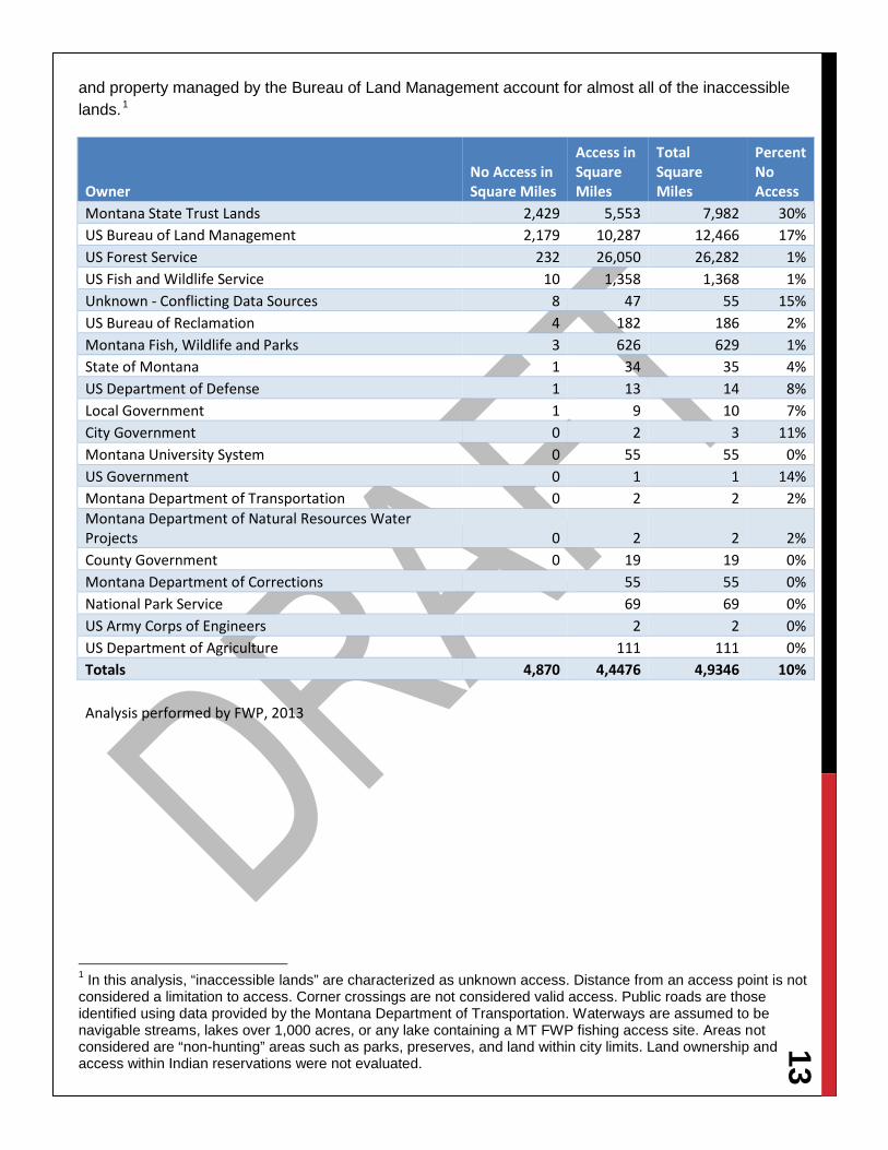
13 and property managed by the Bureau of Land Management account for almost all of the inaccessible lands.1
Owner No Access in Square Miles
Access in Square Miles
Total Square Miles
Percent No Access
Montana State Trust Lands 2,429 5,553 7,982 30% US Bureau of Land Management 2,179 10,287 12,466 17% US Forest Service 232 26,050 26,282 1% US Fish and Wildlife Service 10 1,358 1,368 1% Unknown - Conflicting Data Sources 8 47 55 15% US Bureau of Reclamation 4 182 186 2% Montana Fish, Wildlife and Parks 3 626 629 1% State of Montana 1 34 35 4% US Department of Defense 1 13 14 8% Local Government 1 9 10 7% City Government 0 2 3 11% Montana University System 0 55 55 0% US Government 0 1 1 14% Montana Department of Transportation 0 2 2 2% Montana Department of Natural Resources Water Projects 0 2 2 2% County Government 0 19 19 0% Montana Department of Corrections
55 55 0%
National Park Service
69 69 0% US Army Corps of Engineers
2 2 0%
US Department of Agriculture
111 111 0% Totals 4,870 4,4476 4,9346 10%
Analysis performed by FWP, 2013
1 In this analysis, “inaccessible lands” are characterized as unknown access. Distance from an access point is not considered a limitation to access. Corner crossings are not considered valid access. Public roads are those identified using data provided by the Montana Department of Transportation. Waterways are assumed to be navigable streams, lakes over 1,000 acres, or any lake containing a MT FWP fishing access site. Areas not considered are “non-hunting” areas such as parks, preserves, and land within city limits. Land ownership and access within Indian reservations were not evaluated.
14
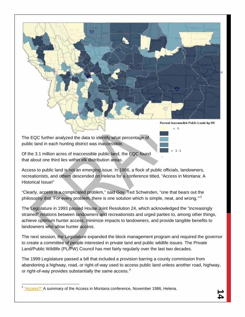
The EQC further analyzed the data to identify what percentage of public land in each hunting district was inaccessible.
Of the 3.1 million acres of inaccessible public land, the EQC found that about one third lies within elk distribution areas.
Access to public land is not an emerging issue. In 1986, a flock of public officials, landowners, recreationists, and others descended on Helena for a conference titled, “Access in Montana: A Historical Issue!”
“Clearly, access is a complicated problem,” said Gov. Ted Schwinden, “one that bears out the philosophy that ‘For every problem, there is one solution which is simple, neat, and wrong.’”2
The Legislature in 1993 passed House Joint Resolution 24, which acknowledged the “increasingly strained” relations between landowners and recreationists and urged parties to, among other things, achieve optimum hunter access, minimize impacts to landowners, and provide tangible benefits to landowners who allow hunter access.
The next session, the Legislature expanded the block management program and required the governor to create a committee of people interested in private land and public wildlife issues. The Private Land/Public Wildlife (PL/PW) Council has met fairly regularly over the last two decades.
The 1999 Legislature passed a bill that included a provision barring a county commission from abandoning a highway, road, or right-of-way used to access public land unless another road, highway, or right-of-way provides substantially the same access.3
2 “Access?” A summary of the Access in Montana conference, November 1986, Helena.
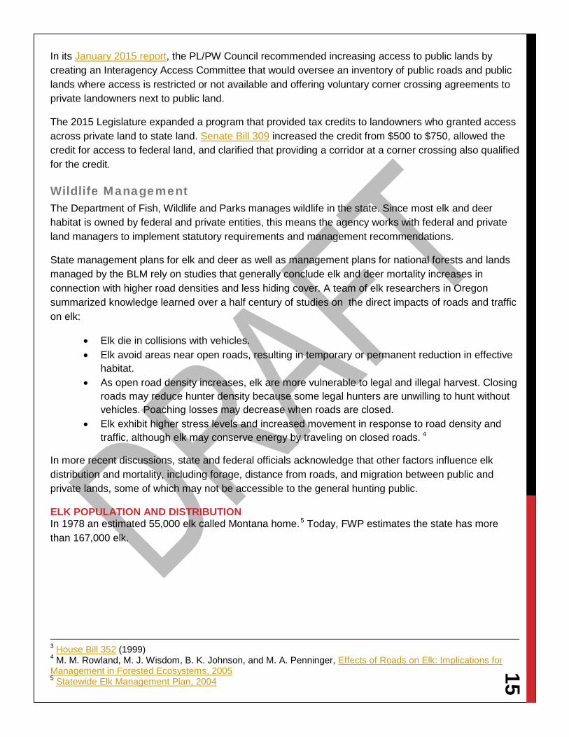
15 In its January 2015 report, the PL/PW Council recommended increasing access to public lands by creating an Interagency Access Committee that would oversee an inventory of public roads and public lands where access is restricted or not available and offering voluntary corner crossing agreements to private landowners next to public land.
The 2015 Legislature expanded a program that provided tax credits to landowners who granted access across private land to state land. Senate Bill 309 increased the credit from $500 to $750, allowed the credit for access to federal land, and clarified that providing a corridor at a corner crossing also qualified for the credit.
Wildlife Management The Department of Fish, Wildlife and Parks manages wildlife in the state. Since most elk and deer habitat is owned by federal and private entities, this means the agency works with federal and private land managers to implement statutory requirements and management recommendations.
State management plans for elk and deer as well as management plans for national forests and lands managed by the BLM rely on studies that generally conclude elk and deer mortality increases in connection with higher road densities and less hiding cover. A team of elk researchers in Oregon summarized knowledge learned over a half century of studies on the direct impacts of roads and traffic on elk:
• Elk die in collisions with vehicles. • Elk avoid areas near open roads, resulting in temporary or permanent reduction in effective
habitat. • As open road density increases, elk are more vulnerable to legal and illegal harvest. Closing
roads may reduce hunter density because some legal hunters are unwilling to hunt without vehicles. Poaching losses may decrease when roads are closed.
• Elk exhibit higher stress levels and increased movement in response to road density and traffic, although elk may conserve energy by traveling on closed roads. 4
In more recent discussions, state and federal officials acknowledge that other factors influence elk distribution and mortality, including forage, distance from roads, and migration between public and private lands, some of which may not be accessible to the general hunting public.
ELK POPULATION AND DISTRIBUTION In 1978 an estimated 55,000 elk called Montana home.5 Today, FWP estimates the state has more than 167,000 elk.
3 House Bill 352 (1999) 4 M. M. Rowland, M. J. Wisdom, B. K. Johnson, and M. A. Penninger, Effects of Roads on Elk: Implications for Management in Forested Ecosystems, 2005 5 Statewide Elk Management Plan, 2004

16
With that higher population has come not only a wider distribution but also an increased movement onto private land. Elk distribution in this context means the overall range of elk. Elk may move seasonally or even more frequently within a distribution area. Elk distribution on private land increased 17%, more than 2 million acres, between 2004 and 2015.6
State law directs the Fish and Wildlife Commission to determine the number of elk that can be viably sustained based on habitat acreage.7 The statewide Elk Management Plan directs the DFWP to “maintain elk population numbers at levels producing a healthy and productive condition of elk, vegetation, soil, and water and that also reduces elk conflicts on private and public lands.”8 The objective of the law and the plan is to keep populations at or below the sustainable population. In 2015, 80 hunting districts, more than half, were over objective. Another 29% were at objective, and 17% were below objective.9 The area containing Districts 411E and 530 in the Big Snowy and Bull Mountains is
6 FWP Distribution Maps and Population Charts. Distribution areas represent land that elk may inhabit. Given that elk may roam in response to a variety of factors, it cannot be inferred that elk inhabit all lands in the distribution map equally or at all times. 7 87-1-323, MCA. 8 Statewide Elk Management Plan, 2004 9 2015 Population Status Chart

17 nearly 10 times over objective with an estimated 5,082 elk in the area.
The next highest, at about five times over objective with 547 elk, is District 450, which lies between the Teton and Sun Rivers.

18
HARVEST Over the last 16 years, the number of elk killed in Montana ranged from a low of 18,209 in 1999 to a high of almost 29,000 in 2003.10
In terms of success rates, the low was again in 1999, when 16% of hunters filled a tag.11 For the rest of the period examined, in most years at least one out of every five hunters shot an elk. Nonresident hunters, at least some of whom likely hired guides and hunted on private land, fared better than residents.
ANNUAL ELK HARVEST
10 The statistics in this subsection are derived from Fish, Wildlife, and Parks harvest reports. For the years 1999-2002, numbers were not broken out between residents and nonresidents. 11 For this analysis, the success percentage is the number of elk divided by the number of hunters.
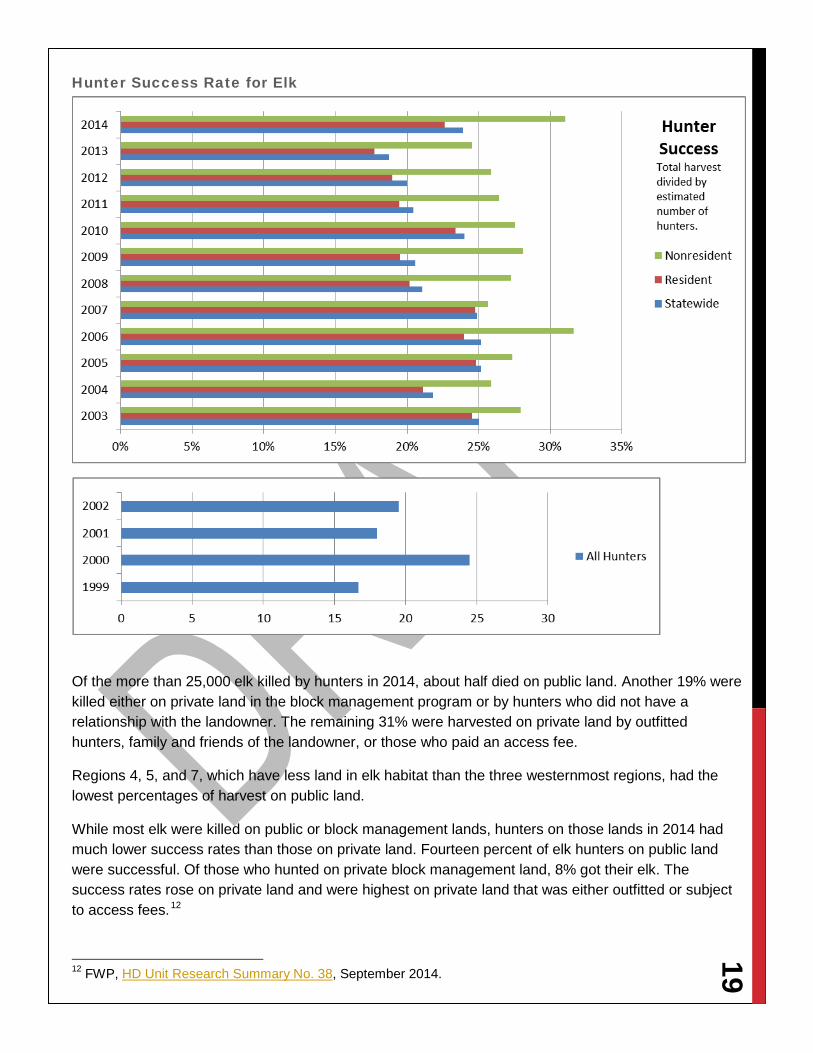
19 Hunter Success Rate for Elk
Of the more than 25,000 elk killed by hunters in 2014, about half died on public land. Another 19% were killed either on private land in the block management program or by hunters who did not have a relationship with the landowner. The remaining 31% were harvested on private land by outfitted hunters, family and friends of the landowner, or those who paid an access fee.
Regions 4, 5, and 7, which have less land in elk habitat than the three westernmost regions, had the lowest percentages of harvest on public land.
While most elk were killed on public or block management lands, hunters on those lands in 2014 had much lower success rates than those on private land. Fourteen percent of elk hunters on public land were successful. Of those who hunted on private block management land, 8% got their elk. The success rates rose on private land and were highest on private land that was either outfitted or subject to access fees.12
12 FWP, HD Unit Research Summary No. 38, September 2014.

20 Elk Harvest by Landowner and Access
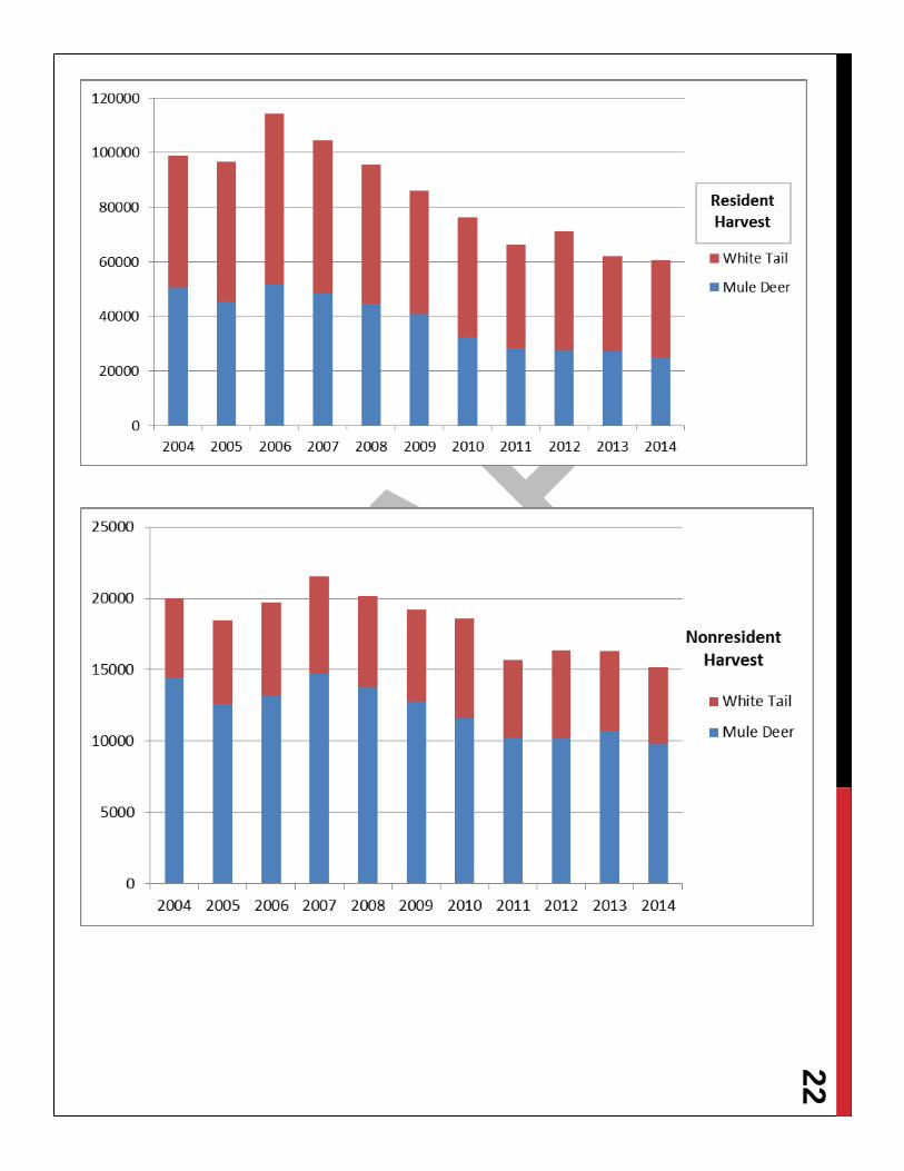
DEER POPULATION AND HARVEST Almost 300,000 mule deer and about 200,000 white tailed deer are estimated to live in Montana. After recent rough winters and disease outbreaks, the populations are starting to rebound. The total deer harvest and success rates also declined from a high in 2006.13
2015 WHITE TAILED DEER STATUS WHITE TAILED DEER
POPULATION ESTIMATES
YEARS USED FOR 10-YEAR AVERAGE
2015 TOTAL
REGION 1 75,920 2005-2014 84,655 REGION 2 33,791 2005-2014 35,872 REGION 3 23,974 2003-2008 & 2011-2013 23,451 REGION 4 30,225 2003-2008 & 2011-2013 26,193 REGION 5 18,297 2005-2014 12,520 REGION 6 13,216 2005-2014 11,110 REGION 7 12,154 2005-2014 14,350 STATEWIDE TOTAL 207,577 208,151
The estimates for white tailed deer populations are based upon population modeling with survey and harvest inputs. White tailed deer estimates are not comprehensively validated with site-specific research or enhanced monitoring efforts. White tailed deer estimates are not framed with confidence intervals and are subject to adjustment.
13 Statewide success for deer harvest is the total harvest estimate divided by the number of licenses and permits issued.

21 Hunter Success Rate for Deer
2015 MULE DEER STATUS Region 2005 2006 2007 2008 2009 2010 2011 2012 2013 2014 2015 AVG.
1 15,260 16,722 13,915 11,722 9,296 8,983 13,095 6,226 7,590 10,782 8,008 11,359 2 18,599 21,209 24,837 16,188 13,229 11,486 14,226 11,472 12,754 12,267 14,267 15,627 3 51,116 52,477 62,759 46,594 40,747 33,624 33,293 33,204 34,172 35,482 38,912 42,347 4 76,408 68,337 70,262 65,826 59,589 50,096 46,384 46,216 49,210 56,133 56,629 58,846 5 43,139 38,434 41,765 41,791 39,813 38,334 34,720 33,836 37,977 32,185 32,042 38,199 6 35,305 48,902 39,683 51,428 45,056 35,488 42,053 32,983 36,674 37,487 43,561 40,506 7 74,714 98,061 93,650 101,169 93,167 69,213 65,549 47,424 53,934 79,287 103,812 77,617 TOTAL 314,541 344,142 346,870 334,717 300,895 247,224 249,320 211,361 232,312 263,623 297,231 284,501
Mule deer estimates are not comprehensively validated with site-specific research or enhanced monitoring efforts.
Mule deer estimates are not framed with confidence intervals and are subject to adjustment. The method used to make mule deer population estimates was changed in 2015. The estimates above are based on the new methodology.
22
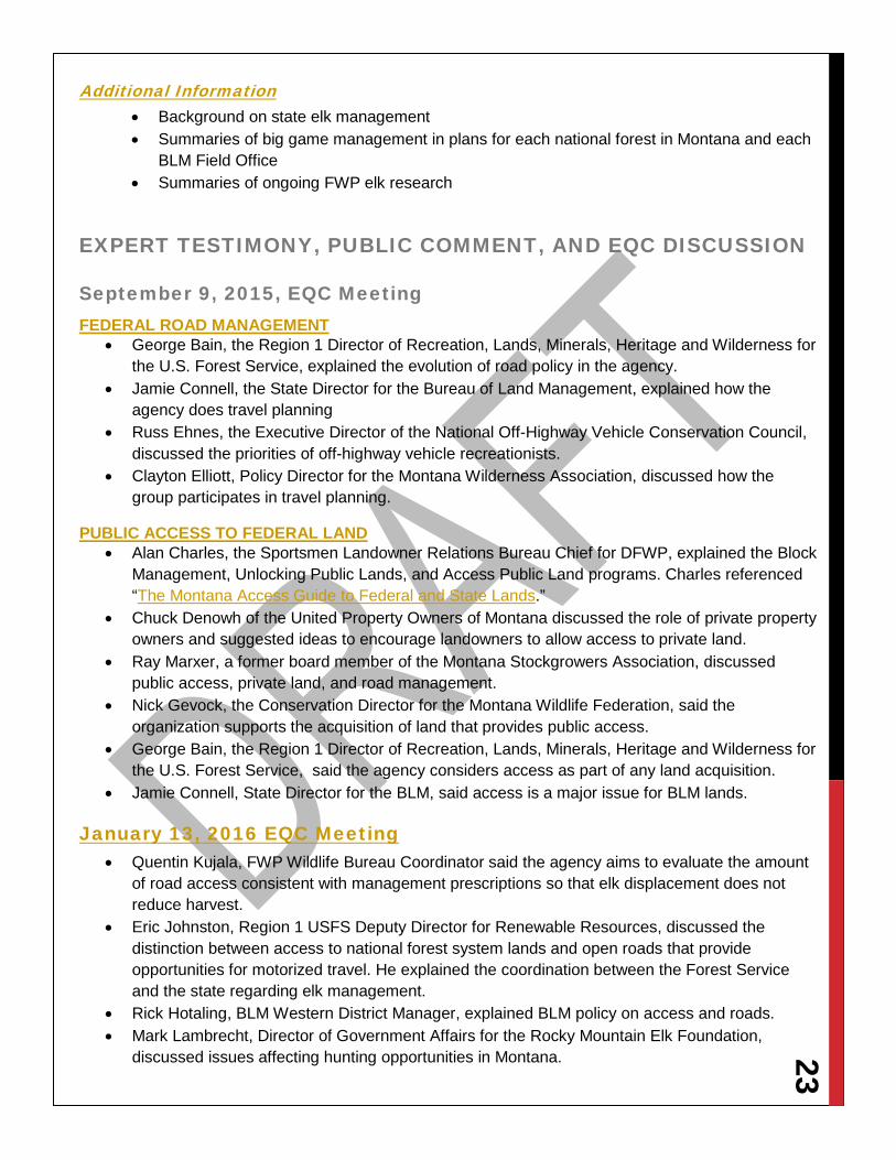
23 Additional Information
• Background on state elk management • Summaries of big game management in plans for each national forest in Montana and each
BLM Field Office • Summaries of ongoing FWP elk research
EXPERT TESTIMONY, PUBLIC COMMENT, AND EQC DISCUSSION
September 9, 2015, EQC Meeting FEDERAL ROAD MANAGEMENT
• George Bain, the Region 1 Director of Recreation, Lands, Minerals, Heritage and Wilderness for the U.S. Forest Service, explained the evolution of road policy in the agency.
• Jamie Connell, the State Director for the Bureau of Land Management, explained how the agency does travel planning
• Russ Ehnes, the Executive Director of the National Off-Highway Vehicle Conservation Council, discussed the priorities of off-highway vehicle recreationists.
• Clayton Elliott, Policy Director for the Montana Wilderness Association, discussed how the group participates in travel planning.
PUBLIC ACCESS TO FEDERAL LAND • Alan Charles, the Sportsmen Landowner Relations Bureau Chief for DFWP, explained the Block
Management, Unlocking Public Lands, and Access Public Land programs. Charles referenced “The Montana Access Guide to Federal and State Lands.”
• Chuck Denowh of the United Property Owners of Montana discussed the role of private property owners and suggested ideas to encourage landowners to allow access to private land.
• Ray Marxer, a former board member of the Montana Stockgrowers Association, discussed public access, private land, and road management.
• Nick Gevock, the Conservation Director for the Montana Wildlife Federation, said the organization supports the acquisition of land that provides public access.
• George Bain, the Region 1 Director of Recreation, Lands, Minerals, Heritage and Wilderness for the U.S. Forest Service, said the agency considers access as part of any land acquisition.
• Jamie Connell, State Director for the BLM, said access is a major issue for BLM lands.
January 13, 2016 EQC Meeting • Quentin Kujala, FWP Wildlife Bureau Coordinator said the agency aims to evaluate the amount
of road access consistent with management prescriptions so that elk displacement does not reduce harvest.
• Eric Johnston, Region 1 USFS Deputy Director for Renewable Resources, discussed the distinction between access to national forest system lands and open roads that provide opportunities for motorized travel. He explained the coordination between the Forest Service and the state regarding elk management.
• Rick Hotaling, BLM Western District Manager, explained BLM policy on access and roads. • Mark Lambrecht, Director of Government Affairs for the Rocky Mountain Elk Foundation,
discussed issues affecting hunting opportunities in Montana.

24 • Marshall Johnson, Eastern Montana Regional Director for the Mule Deer Foundation, explained
the organization’s views on public and private land and block management.

25 TOUR The EQC toured BLM and Forest Service lands near Helena with federal officials.
At the BLM Ward Ranch trailhead, officials discussed travel planning that closed the area between the trailhead and Canyon Ferry Reservoir to motorized use.
Ward Ranch
.
Pictured above from left to right: Rep. Jerry Bennett, Rep. Willis Curdy, Mr. Bert Lindler, Rep. Janet Ellis, Sen. Mike Phillips, Mr. Roy Morris, Sen. John Brenden, Sen. Rick Ripley, Sen. Jim Keane, Sen. Gene Vuckovich, Montana BLM Director Jamie Connell, Rep. Ed Lieser, and Jeanne Holmgren, Forest Service realty specialist.
At far left: Scott Haight, a BLM field manager from Butte, explains the BLM acquisition of the Ward Ranch property and the travel planning process the agency uses to determine the closure of certain roads. To his right are USFS state liaison John Hagengruber, Rep. Ed Lieser, and Mr. Bert Lindler.

26 York Gulch The EQC also toured a 200-acre Forest Service land acquisition in the York Gulch that provided permanent access to public land.
At right: Jeanne Holmgren, Forest Service realty specialist, explains the York Gulch land acquisition .
Below: The map shows the parcels acquired and the public access secured.

27 MAP OVERVIEW The EQC gathered a large amount of data during the HJR13 study that is best displayed with an online map.
Getting Started Click on the link: http://arcg.is/1OiyF1G
The map comes up showing Elk Hunter Success by hunting district (the antlered icon) and the percentage of inaccessible public land by hunting district (the darker the color the higher the percentage).
Explore Click on the Content tab.
The Content tab shows all of the layers available for viewing. By checking and unchecking the boxes in Content, layers turn on and off in the map. (Note: If too many layers are on at once, it will be hard to read the map.)
• Elk Success is the number of elk harvested by district from 2004-2012 and 2014 divided by the number of hunters. (An estimate for the number of hunters by district is not available for 2013.)
• Elk Distribution shows the general area elk inhabit in Montana. Keep in mind that elk may move in response to seasons or for other reasons, so elk are not distributed evenly across the distribution area at any one time.
• Elk Objective shows the population of each district in relation to the desired objective population.
• Elk Harvest per HD square mile is the density of the historic elk harvest in relation to the area of the district.
• White Tail Success 2013 is the number of deer harvested in 2013 divided by the estimated hunters in each district. (District estimates are not done annually.)
• Mule Deer Success 2013 is the number of deer harvested in 2013 divided by the estimated hunters in each district. (District estimates are not done annually.)
• Percent Inaccessible Public Lands by HD is the percent of public lands in the district that do not have legal access by road or water. (The lands may be accessed by permission of an adjoining landowner, but that information is not available.)
• Percent Public Land Ownership by Hunting District shows how much of the district is publicly owned.
• No Access Public Lands. These parcels with no legal road or water access show up as the map is zoomed into a specific area.
• Miles of open FS Roads by HD shows the total mileage in each district of roads open to motorized travel in the national forests.
• Miles of closed FS roads by HD shows the total mileage in each district of roads closed except for administrative use (Level 1).
• National Forest System Roads closed to motorized uses will appear as the map is zoomed into a specific area. Roads will appear in red.
• BLM Roads shows roads that are open, closed, temporarily closed, and without designation.
28 • FWP administrative regions shows the districts contained in each region. • National Forest System Roads will appear as the map is zoomed in. • Montana Cadastral Parcels will appear as the map is zoomed in. Clicking on the parcel will
show the ownership. • Vegetation Analysis shows how vegetation changed between 1990 and 2010.
Tips • The map can be zoomed in and out with the cursor. • Clicking on the words in a layer (not the box) will bring up the legend for that layer. • Only turn on one of the Success layers at a time and view it in conjunction with the information
sought, for example, Elk Success and Objective. Or turn off Objective and turn on Percent Inaccessible Lands to see how those relate.
• Clicking anywhere on the map will open a pop-up box that shows information about the layers that are checked. In the upper left, it will show how many layers are open. Click the right arrow to move through the boxes.
RESULTS OF FWP HARVEST SURVEY September 2016
PUBLIC COMMENT To Be Solicited
Top Related