


Languages
Pages
Legal


Exam 3: Introduction to Catastrophe Modeling Methodologies Learning Objectives
Assignment 1. Model Construction Overall goal: Demonstrate professional mastery of catastrophe modeling (beyond technical competence)
Module Title Learning Objectives
1. High Level Overview (LO1) Describe the main modules of a catastrophe model and their order
(LO2) Articulate the various sources of uncertainty introduced by the different modules of a catastrophe model
(LO3) Calculate a mean damage ratio given a hazard level and a vulnerability curve
(LO4) Explain why catastrophe models are used instead of standard actuarial models
(LO5) Articulate the history of catastrophe models from 1990-present
(LO6) List the catastrophic events most significant to the development and usage of catastrophe models
(LO7) Define Monte Carlo simulation
(LO8) Explain the benefits of simulation-based modeling as applied to catastrophes
(LO9) Explain the limitations of the historical record for constructing hazard and/or vulnerability modules
(LO10) List the primary exposure characteristics needed to perform an analysis and explain how the model treats missing values (LO11) Differentiate between event loss tables (ELT) and year loss tables (YLT) and explain the advantages and disadvantages of each (LO12) Define geocoding
(LO13) Explain the hierarchy of policies, accounts, and locations and how they’re represented in the model (L14) Identify the main uses of catastrophe modeling output and how those might influence the construction of the model (L15) List different approaches to constructing industry exposure databases for use in catastrophe models
READINGS
• Mitchell-Wallace: Metrics and Risk Measures; 1.4 Why Do We Need Catastrophe Models; 1.5 History of Catastrophe Models; 1.8 Anatomy of a Catastrophe Model; 1.9 Model Input; 1.9.1.1 – Location; 1.9.1.3 - Exposure Characteristics: Primary and Secondary Modifiers; 1.9.3 – Portfolio Hierarchy; 1.10 Model Output; 2 Applications of Catastrophe Modelling; 2.16.1 Treatment of Uncertainty in Catastrophe Models; 4.3.1 Deterministic Versus Probabilistic Hazard Models; 4.4 Exposure Models and Databases; 4.5 Vulnerability;
• “What Is Monte Carlo Simulation?” RiskAMP, www.riskamp.com/files/RiskAMP%20-%20Monte%20Carlo%20Simulation.pdf.
Module Title Learning Objectives
2. Statistics & Parameterized Models (LO16) Differentiate between aggregate and occurrence exceedance probability curves and explain why one would use one over the other given a set of criteria
(LO17) Differentiate between process and parameter risk
(LO18) Describe methods for parameterizing models (vulnerability, hazard) from limited historical data
(LO19) Differentiate between statistically and physically based models
(LO20) List the main inputs to physically based hurricane and earthquake models
(LO21) Explain the benefits of using stochastic event sets as compared to historical distributions (LO22) Calculate annual average loss given an abbreviated ELT or YLT
(LO23) Explain the differences between time dependent and time-independent event sets
(LO24) Evaluate the challenges in building

catastrophe models for single location modeling vs. portfolio modeling (LO25) Identify and describe the statistical distributions most commonly used in catastrophe modeling (Poisson, negative binomial, beta, Pareto, etc.
READINGS
• Mitchell-Wallace: 1.4 - Why Do We Need Catastrophe Models; 1.10 - Model Output: Metrics and Risk Measures; 1.11 Statistical Basis for Catastrophe Modelling; 2.16.1 – Treatment Uncertainty in Catastrophe Models; 4.3 Hazard; 4.4 – Exposure Models and Databases; 4.5 – Vulnerability
• What Is Monte Carlo Simulation? RiskAMP, www.riskamp.com/files/RiskAMP%20-%20Monte%20Carlo%20Simulation.pdf.
Module Title Learning Objectives
3. Unique Issues for Other Perils (LO26) Evaluate the relative maturity of models for primary vs. secondary perils (LO27) List the largest historical natural catastrophes including the resulting loss amounts (economic, insured) and perils (LO28) Describe (describe the volatility of loss amounts produced by the various natural perils and contrast the volatility of loss from the primary perils to that of the secondary perils (LO29) List one challenge endemic to each of the secondary perils (winter, flood, thunder, wildfire, terror, cyber) (LO30) Differentiate modeling challenges for natural perils versus human-driven perils (cyber, terror)
READINGS
• Mitchell-Wallace: 3 – The Perils in Brief • “List of Disasters by Cost.” Wikipedia, Wikimedia Foundation, 4 Nov. 2018,
en.wikipedia.org/wiki/List_of_disasters_by_cost.
Assignment 2. Hurricane Hazard
Module Title Learning Objectives

1. Global tropical cyclone formation
(LO31) Define tropical cyclone (LO32) List the six regional ocean basins that produce tropical cyclones (LO33) Identify which ocean basin typically has the highest average number of hurricane formations per year (LO34) Identify the regional names for tropical cyclones within each basin (LO35) Explain why the South Atlantic and Southeast Pacific only rarely produce tropical cyclones
READINGS
• http://www.aoml.noaa.gov/hrd/tcfaq/A1.html • http://www.aoml.noaa.gov/hrd/tcfaq/G6.html • https://www.wral.com/why-don-t-hurricanes-form-in-the-south-atlantic-/1672862/ • https://oceanservice.noaa.gov/facts/cyclone.html
Module Title Learning Objectives
2. Hurricane climatology in the North Atlantic Basin: Season, frequency, genesis locations
(LO36) Identify the climatological peak of the Atlantic hurricane season & most active months (LO37) Identify the average, max, and min number of named storms, hurricanes, and major hurricanes per year in the Atlantic Basin (LO38) Identify the average, max, and min number of U.S. hurricane and major hurricane landfalls per year (LO39) Identify the areas where hurricane tracks are most likely to start in the early hurricane season (June-July) and the direction they are most likely to move (LO40) Define African easterly waves and explain how they are associated with hurricane formation in the Atlantic Ocean, especially during peak hurricane months (August – September) (LO41) Identify the areas where hurricane tracks are most likely to start in the late hurricane season (October – November) and the direction they are most likely to move (LO42) Recognize how seasonal sea surface temperatures impact genesis locations and storm paths

READINGS
• http://www.aoml.noaa.gov/hrd/tcfaq/G1.html • https://www.nhc.noaa.gov/climo/ • http://www.aoml.noaa.gov/hrd/tcfaq/E10.html • https://www.nhc.noaa.gov/pastdec.shtml • http://www.hurricanescience.org/science/science/hurricanegenesis/ • https://www.livescience.com/3815-hurricanes-form.html
Module Title Learning Objectives
3. Key structural features of a mature tropical cyclone
(LO43) Define the following key structural features of a mature tropical cyclone and be able to identify on an image:
• Eye • Eyewall • Feeder bands / Rain bands • Outflow
(LO44) Using an internal combustion engine as an analogy, explain how a hurricane functions
(LO45) Identify the common features between an internal combustion engine and a hurricane, e.g., fuel in an internal combustion engine is equivalent to evaporated warm ocean water (water vapor) in a hurricane
READINGS
• http://www.hurricanescience.org/science/science/hurricanestructure/ • https://www.weather.gov/jetstream/tc_structure • http://ftp.comet.ucar.edu/ootw/tropical/textbook_2nd_edition/media/graphics/anatomy/index.htm • http://ftp.comet.ucar.edu/ootw/tropical/textbook_2nd_edition/navmenu.php_tab_9_page_2.1.0.ht
m
Module Title Learning Objectives
4. Key meteorological descriptors for tropical cyclone/hurricane events
(LO46) Define the following hurricane event descriptors:
• Central pressure • Radius to maximum winds • Maximum wind speed (peak gust vs.
sustained wind speeds) • Storm speed
(LO47) Describe the relationship between central pressure and hurricane intensity
READINGS
• Powell et al, 2005 - State of Florida hurricane loss projection model: Atmospheric science component

• NOAA Technical Report NWS 23 • Vickery and Twisdale, 1995 – Prediction of Hurricane Wind Speeds in the United States • Vickery and Twisdale, 1995 – Wind-Field and Filling Models for Hurricane Wind-Speed
Predictions • https://journals.ametsoc.org/doi/full/10.1175/2008JAMC1837.1 • https://www.nhc.noaa.gov/aboutgloss.shtml? • Harper, B. A., J. D. Kepert, and J. D. Ginger, 2010: Guidelines for converting between various
wind averaging periods in tropical cyclone conditions. World Meteorological Organization, TCP Sub-Project Report, WMO/TD-No. 1555.
Module Title Learning Objectives
5. Tropical Cyclone Intensity
(LO48) Define the Saffir-Simpson Hurricane Wind Scale and describe how it was developed
(LO49) Define sustained surface wind speed
(LO50) Describe how hurricane wind speeds are measured
(LO51) Define a ‘major’ hurricane
(LO52) Describe the damage caused by each hurricane category based on the Saffir-Simpson Hurricane Wind Scale
(LO53) Explain why storm surge is no longer considered a component of the Saffir-Simpson Hurricane Scale
(LO54) Identify the difference between a tropical depression, tropical storm, and hurricane
READINGS
• https://www.nhc.noaa.gov/aboutsshws.php?large • https://www.nhc.noaa.gov/pdf/sshws.pdf • https://www.accuweather.com/en/weather-news/whats-the-difference-between-a/34388 • https://sciencing.com/tools-used-measure-hurricanes-6862094.html
Module Title Learning Objectives
6. Meteorological and oceanographic factors that influence tropical cyclone formation
(LO55) Explain how the following factors can promote or inhibit tropical cyclone formation:
• Sea Surface Temperatures • Wind Shear • Atmospheric Moisture & Instability • Antecedent weather disturbances • Coriolis Force • Outflow
READINGS

• http://www.aoml.noaa.gov/hrd/tcfaq/A15.html • https://www.weather.gov/jetstream/tc • Dunion, J.P., and C.S. Velden, 2004: The impact of the Saharan Air Layer on Atlantic tropical
cyclone activity. Bull. Amer. Meteor. Soc., vol. 85 no. 3, 353-365. • http://www.aoml.noaa.gov/keynotes/keynotes_0715_windshear.html • http://www.physicscentral.com/explore/action/hurricane.cfm
Module Title Learning Objectives
7. Hurricane strengthening / weakening over lifecycle
(LO56) Explain how sea surface temperatures can l lead to strengthening / weakening of hurricanes
(LO57) Explain the reason why when a hurricane gets closer to the poles we generally see weakening
(LO58) Recognize the relationship between upper l level wind shear and the strengthening or weakening of a hurricane
(LO59) Explain how dry air intrusion into the circulation impacts hurricane strengthening/ weakening
(LO60) Define inland filling
(LO61) Describe why a hurricane weakens over land
(LO62) Identify factors that might increase the rate of hurricane weakening over land
READINGS
• http://www.hurricaneville.com/decaying_factors.html • http://www.hurricanescience.org/science/science/development/ • http://www.hurricanescience.org/science/science/hurricanedecay/ • https://blog.ucsusa.org/brenda-ekwurzel/hurricane-watch-checklist-four-factors-that-strengthen-
and-four-that-weaken-tropical-cyclones • http://www.aoml.noaa.gov/hrd/tcfaq/C2.html • Dunion, J.P., and C.S. Velden, 2004: The impact of the Saharan Air Layer on Atlantic tropical
cyclone activity. Bull. Amer. Meteor. Soc., vol. 85 no. 3, 353-365. • http://www.aoml.noaa.gov/keynotes/keynotes_0715_windshear.html • Kaplan, J., and M. DeMaria, 1995: A simple empirical model for predicting the decay of tropical
cyclone winds after landfall. J. Appl. Meteor., 34, 2499–2512. • http://www.hurricanescience.org/science/science/hurricaneandland/
Module Title Learning Objectives

8. Tropical Cyclone Movement (LO63) Describe what influences the movement of tropical cyclones and how
(LO64) Describe the typical path of a tropical cyclone in the Atlantic Basin
(LO65) Define the steering current
(LO66) Define the Coriolis effect and how it influences storm motion
READINGS
• http://www.aoml.noaa.gov/hrd/tcfaq/G5.html • https://pielkeclimatesci.files.wordpress.com/2012/10/b-11.pdf Chapter 4
Module Title Learning Objectives
9. “Secondary” hazards associated with hurricanes
(LO67) Explain how tornadoes are generated in a hurricane wind field
(LO68) Identify the quadrant of the hurricane that is particularly susceptible to tornadic activity and be able to explain why
(LO69) Define storm surge*
(LO70) Explain how precipitation induced hurricane flooding is different than storm surge
READINGS
• https://www.livescience.com/37235-how-hurricanes-spawn-tornadoes.html • https://www.nhc.noaa.gov/surge/ • http://www.wpc.ncep.noaa.gov/research/mcs_web_test_test_files/Page1637.htm • https://www.sciencedaily.com/releases/2014/07/140721123922.htm
*Note that this objective covers storm surge at a high level, there will be an additional objective focused on storm surge specifically
Module Title Learning Objectives
10. Storm Surge (LO71) Identify which aspects of a hurricane make storm surge more/less likely (LO72) Explain the difference between storm surge and storm tide (LO73) Define bathymetry and be able to explain how the slope of the near-shore seabed impacts storm surge for a particular event
(LO74) Identify where the highest storm surge typically occurs in relation to the storm track

(LO75) Describe how storm intensity (wind speed), forward speed, size and angle of approach either amplifies or dampens the possibility for a severe storm surge event (LO76) Recognize key storm surge events in history and describe why these hurricanes were associated with such significant coastal flooding
(LO77) Be able to describe the SLOSH model (LO78) Explain how local topographic features such as wetlands and barrier islands can impact storm surge footprints on the mainland (LO79) Explain the impact coastal erosion could have on the severity of storm surge events
(LO80) Explain how wave height is impacted in a hurricane as the event propagates into shallow water (approach the coast)
(LO81) Define wave runup
READINGS
• https://www.nhc.noaa.gov/surge/faq.php • https://www.wunderground.com/hurricane/surge_characteristics.asp • https://www.sciencedirect.com/topics/earth-and-planetary-sciences/storm-surge • https://www.nhc.noaa.gov/surge/slosh.php • http://www.hurricanescience.org/society/impacts/stormsurge/ • http://www.mdpi.com/2077-1312/4/4/85/pdf • “The Influence of Storm Size on Hurricane Surge” Irish, J., Resio, D., Ratcliff, J.J., American
Meteorological Society September 2008
Module Title Learning Objectives
11. Historical data sources available for hurricane model development
(LO82) Define HURDAT2
(LO83) Identify limitations of HURDAT2 data as it relates to the reliability of the data
(LO84) Explain why historical storms in HURDAT2 are being reanalyzed
(LO85) Identify key measurements available in the HURDAT2 data
READINGS

• http://www.aoml.noaa.gov/hrd/hurdat/Data_Storm.html • Jarvinen, B. R., C. J. Neumann, and M. A. S. Davis.1984.“A Tropical Cyclone Data Tape for the
North Atlantic Basin, 1886-1983: Contents, Limitations, and Uses.”NOAA Technical Memorandum NWS NHC 22, Coral Gables, Florida (point at specific passages??)
• https://www.nhc.noaa.gov/pdf/NWS-NHC-1988-22.pdf • Powell et al, 2005 - State of Florida hurricane loss projection model: Atmospheric science
component
Module Title Learning Objectives
12. Explain the general process to develop target landfall rates along the coast
(LO86) Describe how historical landfall data available through HURDAT2 is used to develop rates on the coast
(LO87) Explain why the coastline broken into segments
(LO88) Explain why smoothing is necessary across adjacent segments or gates
(LO89) Explain why target rates are typically established for different hurricane categories rather than all hurricanes
(LO90) Recognize regions that are more or less likely to see hurricane landfalls or major hurricane landfalls
(LO91) Identify how the same historical data can be used to produce multiple catalogs, e.g., warm or cold phases of the Multi-decadal climate cycles (check for ref)
(LO92) Given a list of historical events, landfall magnitudes, and landfall states, calculate the frequency of events by magnitude and region that should be replicated in a stochastic event catalog
READINGS
• Grossi: 3.2.1 and 3.2.2 • https://www.nhc.noaa.gov/climo/
Module Title Learning Objectives

13. Historical Track Simulation (LO93) Describe the basin simulation approach for creating event paths (LO94) How are rules used to evolve path and intensity during modeling (LO95) Describe how HURDAT2 historical track data is used to develop statistical distributions of heading and forward speed for events in basin- simulation-derived stochastic event sets (LO96) Explain how drastic changes in heading and forward speed are controlled
READINGS
• http://www.mathematik.uni-ulm.de/stochastik/aktuelles/sh06/sh_rumpf.pdf • https://serc.carleton.edu/introgeo/mathstatmodels/why.html • https://www.sbafla.com/method/Portals/Methodology/ModelSubmissions/2015/FCHLPM_CoreL
ogic2015_12April2017.pdf?ver=2017-05-19-134342-297 (Section M-2, question 1) • https://pubs.giss.nasa.gov/abs/ha00310j.html
Module Title Learning Objectives

14. Impact of climate modes on tropical cyclone activity in the North Atlantic Basin (frequency and severity)
(LO107) Define El Nino (LO108) Define La Nina (LO109) Define neutral conditions (LO110) Identify the recurrence interval of
extremes (LO111) Describe when the onset of El Nino
typically occurs and how long the duration is (LO112) Identify whether El Nino / La Nina years
correspond with an increase or decrease in hurricane activity in the Atlantic Ocean and Pacific Ocean
(LO113) Describe how El Nino / La Nina
occurrence impact hurricane activity (LO114) Define the Atlantic Multi-Decadal
Oscillation / Atlantic Meridional Overturning Circulation (AMO)
(LO115) Define how AMO impacts tropical cycle
activity (frequency and severity) in the North Atlantic Basin
(LO116) Identify the time span of the most recent
warm and cold AMO phases (LO117) Describe what determines whether we are
in a warm or cool phase of the AMO (LO118) Define the North Atlantic Oscillation (NAO) (LO119) Recognize how the NAO can impact
hurricane paths
READINGS
• http://www.sciencemag.org/news/2017/08/human-influence-may-prolong-ocean-cycle-gave-birth-harvey
• https://www.nature.com/articles/s41598-017-11046-x • https://www.ncdc.noaa.gov/teleconnections/enso/enso-tech.php • Christina M. Patricola and R. Saravanan (2014). "The Impact of the El Niño–Southern
Oscillation and Atlantic Meridional Mode on Seasonal Atlantic Tropical Cyclone Activity" AMS • https://www.climate.gov/news-features/understanding-climate/el-ni%C3%B1o-and-la-
ni%C3%B1a-frequently-asked-questions • http://www.aoml.noaa.gov/hrd/tcfaq/G2.html • https://www.climate.gov/news-features/blogs/enso/impacts-el-ni%C3%B1o-and-la-ni%C3%B1a-
hurricane-season • https://journals.ametsoc.org/doi/10.1175/JCLI4063.1 • https://climatedataguide.ucar.edu/climate-data/atlantic-multi-decadal-oscillation-amo • http://www.aoml.noaa.gov/phod/amo_faq.php

• http://www.sciencemag.org/news/2017/08/human-influence-may-prolong-ocean-cycle-gave-birth-harvey
• http://climatology.co.uk/north-atlantic-oscillation • https://www.ncdc.noaa.gov/teleconnections/nao/ • http://www.surfline.com/surf-science/atlantic-hurricanes-and-nao---forecaster-blog_19081
Module Title Learning Objectives
15. Wind speed variation with height above ground
(LO120) Describe the variation of wind speed with height above ground (below ~500m) in a hurricane wind field and what characteristics influence this relationship
(LO121) Identify key characteristics that impact the
wind speed profile (LO122) Identify the reference height of
measurements of wind speed used in building codes
READINGS
• https://www.nhc.noaa.gov/aboutwindprofile.shtml • ASCE7-10 Building Code (point to specific parts)
Module Title Learning Objectives
16. Extratropical Transition (ET) (LO123) Describe the process of extratropical transition (ET) and identify the key factors influencing ET
(LO124) Be able to describe the following cyclone
classifications used by the National Hurricane Center: Subtropical, Transitioning, and Post-tropical
READINGS
• http://www.aoml.noaa.gov/hrd/tcfaq/A6.html • http://www.aoml.noaa.gov/hrd/tcfaq/A7.html • http://www.msrc.sunysb.edu/~chang/atm205/Notes/TC_cyclone_differences.pdf • https://journals.ametsoc.org/doi/abs/10.1175/MWR-D-17-0027.1 (Intro & Section 4) • https://weather.com/storms/hurricane/news/hurricane-hermine-transition-impacts-forecast-post-
tropical
Assignment 3. Earthquake Hazard

Module Title Learning Objectives
1. Observations of Earthquakes
(LO125) Define where and why earthquakes occur (LO126) Identify the major earthquake risk regions
around the world (LO127) Describe the relation between plate
tectonics and earthquakes READINGS
• Mitchell-Wallace: 3.1 - The Perils in Brief, Overview; 3.7 - Earthquakes; 3.7.1 - What is the Peril • Bolt: 2 - Where Earthquakes Occur • Yanev: 1 - A Primer on Earthquakes • FEMA 454: 2.2.1 - Plate Tectonics and Seismicity • USGS: This Dynamic Earth: The Story of Plate Tectonics,
https://pubs.usgs.gov/gip/dynamic/dynamic.html • IRIS: Plate Tectonics—What Are the Forces that Drive Plate Tectonics?
https://www.iris.edu/hq/inclass/animation/what_are_the_forces_that_drive_plate_tectonics • HERP: Understanding Earthquakes,
https://www.jishin.go.jp/main/pamphlet/brochures2014en/understanding_earthquakes.pdf • GA: http://www.ga.gov.au/scientific-topics/hazards/earthquake • GNS: Tectonics
o https://www.gns.cri.nz/Home/Learning/Science-Topics/Earthquakes/Earthquakes-at-a-Plate-Boundary,
o https://www.gns.cri.nz/Home/Learning/Science-Topics/Earthquakes/Earthquakes-at-a-Plate-Boundary/Tectonic-Plates-and-Plate-Boundaries, https://www.gns.cri.nz/Home/Learning/Science-Topics/Earthquakes/Earthquakes-at-a-Plate-Boundary/Plate-Collision-in-NZ
Module Title Learning Objectives
2. Types of Earthquakes (LO128) Compare different types of seismic regions and the earthquakes they produce
(LO129) Define faults and list the different types of
fault mechanisms. READINGS
• Bolt: 3 - Faults in the Earth • FEMA 454: 2.2.2 - Earthquake Fault Types • USGS: https://www.usgs.gov/faqs/what-a-fault-and-what-are-different-types • IRIS:
o Normal Fault, https://www.iris.edu/hq/inclass/animation/fault_normal o Reverse Fault, https://www.iris.edu/hq/inclass/animation/fault_reverse_ o Strike-Slip Fault, https://www.iris.edu/hq/inclass/animation/fault_strikeslip o Oblique Fault, https://www.iris.edu/hq/inclass/animation/fault_oblique_ o https://www.iris.edu/hq/inclass/animation/pacific_northwest_three_types_of_tectonic_ea
rthquakes o https://www.iris.edu/hq/inclass/animation/plate_boundaries_three_types_described o https://www.iris.edu/hq/inclass/animation/plate_boundary_convergent_margin o https://www.iris.edu/hq/inclass/animation/plate_boundary_divergent_fastspreading_ridg

e o https://www.iris.edu/hq/inclass/animation/fault_transform
• HERP: Understanding Earthquakes, ,https://www.jishin.go.jp/main/pamphlet/brochures2014en/understanding_earthquakes.pdf
• GNS: Faults o https://www.gns.cri.nz/Home/Learning/Science-Topics/Earthquakes/Earthquakes-and-
Faults/Different-types-of-Faults o https://www.gns.cri.nz/Home/Learning/Science-Topics/Earthquakes/Major-Faults-in-
New-Zealand
Module Title Learning Objectives
3. Measuring Earthquakes
(LO130) Define the key parameters used to describe an earthquake.
(LO 131) Define earthquake magnitude and
compare it with earthquake intensity. (LO132) List some of the commonly used
magnitude scales. READINGS
• Bolt: 8 - Size of an Earthquake • FEMA 454: 2.4.1 - Earthquake Magnitude • USGS:
o https://earthquake.usgs.gov/learn/glossary/?term=magnitude o https://earthquake.usgs.gov/learn/glossary/?term=Richter%20scale o https://earthquake.usgs.gov/learn/topics/mag_vs_int.php
• IRIS: o https://www.iris.edu/hq/inclass/animation/earthquake_intensity o https://www.iris.edu/hq/inclass/animation/magnitudes_moment_magnitude_explained o https://www.iris.edu/hq/inclass/animation/magnitude_graphical_comparison_of_earthqua
ke_energy_release • HERP: Understanding Earthquakes,
https://www.jishin.go.jp/main/pamphlet/brochures2014en/understanding_earthquakes.pdf • GA: http://www.ga.gov.au/scientific-topics/hazards/earthquake
Module Title Learning Objectives
4. Seismograms and Seismic Waves (LO133) Describe how seismographs are used to measure ground motion
(LO134) Describe different types of seismic waves
and identify them on seismogram records
READINGS

• Bolt: 5 - Measuring Earthquakes • FEMA 454: 2.3.1 - Seismic Instrumental Recordings and Systems • FEMA 454: 2.3.2 - Types of Earthquake Waves • IRIS: Three Component Ground Motion,
https://www.iris.edu/hq/inclass/animation/3component_seismogram_records_seismicwave_motion
• HERP: Understanding Earthquakes • https://www.jishin.go.jp/main/pamphlet/brochures2014en/understanding_earthquakes.pdf • GNS: Seismograms, https://www.gns.cri.nz/Home/Learning/Science-
Topics/Earthquakes/Monitoring-Earthquakes/Seismic-Activity/What-are-Seismographs • GNS: Seismic Waves, https://www.gns.cri.nz/Home/Learning/Science-
Topics/Earthquakes/Monitoring-Earthquakes/Seismic-Activity/What-are-seismic-waves
Module Title Learning Objectives
5. Ground Shaking intensity (LO135) Describe different measures for quantifying ground shaking intensity
(LO136) Describe Modified Mercalli Intensity (MMI)
Scale and explain its shortcomings (LO137) Identify frequency and amplitude-based
intensity measures derived from time-history of ground motion such as PGA, PGV, PGD and SA
(LO138) Describe the advantages of using
frequency and amplitude-based intensity measure for estimating building damage
READINGS
• FEMA 454 - Chapter 2.2.3 Earthquake Effects-Ground Shaking Intensity, Chapter 2.5 Strong Ground Motion
• USGS: o What is Modified Mercalli Intensity Scale?
https://earthquake.usgs.gov/learn/topics/mercalli.php o What is Peak Ground Acceleration?
https://earthquake.usgs.gov/hazards/learn/technical.php#accel o What is spectral acceleration (SA)?
https://earthquake.usgs.gov/hazards/learn/technical.php#sa o How Seismic Waves Affect Different Size Buildings?
https://earthquake.usgs.gov/learn/topics/buildings-eqs.php • JMA: Other Seismic Intensity Scales (Japan)
o https://www.jma.go.jp/jma/en/Activities/inttable.html o https://www.jma.go.jp/jma/en/Activities/inttable.pdf
• HERP: o Other Seismic Intensity Scales (Japan), https://www.hp1039.jishin.go.jp/eqchreng/at2-
2.htm o Understanding Earthquakes,
https://www.jishin.go.jp/main/pamphlet/brochures2014en/understanding_earthquakes.pdf

Module Title Learning Objectives
6. Seismic Hazard (LO139) Describe Probabilistic Seismic Hazard Analysis (PSHA) and its use in building codes
(LO140) Explain the determination of the potential
seismic sources and faults (LO141) Describe the characterization of annual
rates of seismic events (LO142) Describe the difference between Time-
Dependent and Time-Independent rates of seismic events
(LO143) Define Ground Motion Prediction
Equations (GMPE) and their use in seismic hazard analysis
(LO144) Describe seismic hazard maps and their
use (LO145) Explain the use of scenario analysis in
earthquake risk assessment.
READINGS
• FEMA 454: 2.6 - Seismic Hazard; 2.6.2 - Probabilistic Seismic Hazard Analysis (PSHA) and Building Codes; 2.6.1 - Empirical Attenuation Curves
• USGS: Seismic hazard maps and their use. o https://earthquake.usgs.gov/hazards/learn/ o https://earthquake.usgs.gov/hazards/learn/basics.php o https://earthquake.usgs.gov/hazards/learn/technical.php
• USGS: Earthquake Scenarios, https://earthquake.usgs.gov/scenarios • IRIS: https://www.iris.edu/hq/inclass/fact-sheet/how_often_do_earthquakes_occur • GEM: https://storage.globalquakemodel.org/what/seismic-hazard/gmpes/ • Grossi: 3.2.1 - Locations of Potential Future Events; 3.2.2- Frequency of Occurrence; 3.2.3 -
Parameterizing Severity at Hazard’s Source • HERP : Understanding Earthquakes,
https://www.jishin.go.jp/main/pamphlet/brochures2014en/understanding_earthquakes.pdf
Module Title Learning Objectives
7. Site Impacts (LO 146) Explain the impact of soil conditions on ground motion
(LO 147) Define different soil types and their
impacts on ground motion amplification READINGS
• Yanev: 3 - Rocks, Soils, and Foundations • FEMA 454: 3.6.3 - Areas of Intensified Ground Motions

• USGS: Soil Type and Shaking Hazard in the San Francisco Bay Area., https://earthquake.usgs.gov/hazards/urban/sfbay/soiltype/
• IRIS: Ground Motion Amplification, https://www.iris.edu/hq/inclass/animation/buildings__bedrock_effects_of_amplification__liquefaction
• Grossi: 3.2.4 - Parameters for Local Intensity and Site Effects
Module Title Learning Objectives
8. Secondary Perils (LO148) Describe the importance of secondary perils in a comprehensive earthquake hazard analysis
(LO149) Describe secondary perils which cause
permanent ground displacements such as liquefaction and earthquake triggered landslides
(LO150) Explain how tsunamis are generated and
describe their impacts on built environment. (LO151) Define fire following earthquake
READINGS
• Mitchell-Wallace: 3.7.5 - Secondary Perils and Non-Modelled Items • Yanev: 3 - Rocks, Soils, and Foundations; Chapter 4: Other Hazards to Your Property • FEMA 454: 2.2.3 - Earthquake Effects
Liquefaction:
• FEMA 454: 3.6.2 - Ground Failure Due to Liquefaction • IRIS:
o https://www.iris.edu/hq/inclass/animation/liquefaction_during_the_1906_san_francisco_earthquake
o https://www.iris.edu/hq/inclass/animation/sand_boil_forms_example_from_1989_loma_prieta_earthquake
• EERI: http://eeri.org/wp-content/uploads/store/Free%20PDF%20Downloads/LIQ1.pdf • HERP: Understanding Earthquakes,
https://www.jishin.go.jp/main/pamphlet/brochures2014en/understanding_earthquakes.pdf Earthquake Triggered Landslide:
• Mitchell-Wallace: 3.8 - Mass Movement • FEMA 454: 3.6.4 - Ground Failure, Debris Flows, and Land Slides • USGS:
o https://www.usgs.gov/natural-hazards/landslide-hazards/science/landslides-101 o https://www.usgs.gov/natural-hazards/landslide-hazards/science/coseismic-landslides o https://pubs.usgs.gov/circ/1325/pdf/Sections/Section1.pdf (Section1: PartA and PartD)
Tsunami: • Mitchell-Wallace: 3.9 -Tsunami • USGS: https://walrus.wr.usgs.gov/tsunami/basics.html • IRIS:
https://www.iris.edu/hq/inclass/animation/subduction_zone_tsunamis_generated_by_megathrust

_earthquakes • HERP: Understanding Earthquakes,
https://www.jishin.go.jp/main/pamphlet/brochures2014en/understanding_earthquakes.pdf • GA: http://www.ga.gov.au/scientific-topics/hazards/tsunami • AIDR: 1 - Tsunami Basics, https://knowledge.aidr.org.au/resources/the-ultimate-guide-tsunami/#/
Module Title Learning Objectives
9. Other Earthquake Hazard Topics (LO 152) Describe earthquake event footprints and their use in post-earthquake response
(LO153) Describe induced (man-made)
earthquakes (LO154) Define earthquake early warning systems
and their role in hazard mitigation READINGS
• USGS: ShakeMap – Event Footprints, https://earthquake.usgs.gov/data/shakemap • USGS: Induced earthquakes, https://earthquake.usgs.gov/research/induced/myths.php • Rubinstein • USGS: Earthquake Early Warning
o https://earthquake.usgs.gov/research/earlywarning/overview.php o https://earthquake.usgs.gov/research/earlywarning/background.php
• HERP: Understanding Earthquakes, https://www.jishin.go.jp/main/pamphlet/brochures2014en/understanding_earthquakes.pdf
• GA: http://www.ga.gov.au/scientific-topics/hazards/tsunami/jatwc • BOM: http://www.bom.gov.au/tsunami/about/tsunami_warnings.shtml
Module Title Learning Objectives
10. Data Sources (LO 155) List some of the main sources of information relating to earthquake hazard
(LO156) List main sources of earthquake
catalogues: USGS, GEM, HERP, GA READINGS
• Mitchell-Wallace: 3.7.8 - Nonproprietary Data Sources • FEMA 454: 2.10 - Web Sources • GEM: https://storage.globalquakemodel.org/what/seismic-hazard/ • HERP: The Headquarters for Earthquake Research Promotion, Seismic Activity in Japan:
https://www.hp1039.jishin.go.jp/eqchreng/eqchrfrm.htm • GA: http://www.ga.gov.au/scientific-topics/hazards/earthquake
Additional Resources: Glossary, FAQ’s, Animations, Further Readings:

• USGS: o https://earthquake.usgs.gov/learn/topics/EQ101.pdf o https://earthquake.usgs.gov/learn/glossary/ o https://earthquake.usgs.gov/learn/faq.php o https://earthquake.usgs.gov/learn/animations/ o https://earthquake.usgs.gov/hazards/designmaps/
• FEMA: https://emilms.fema.gov/IS325/index.htm • GNS: https://www.gns.cri.nz/Home/Learning/Science-Topics/Earthquakes • SLC: https://www.sciencelearn.org.nz/resources/2624-exploring-natural-hazards
Assignment 4. Vulnerability Basics Overall goal: Demonstrate proficiency in the basics of developing vulnerability curves for catastrophe models
Module Title Learning Objectives
1. Vulnerability Definition (LO157) Define the role of vulnerability in a catastrophe model
READINGS
• Mitchell-Wallace: 1.8.2 - Vulnerability; 4.5 – Vulnerability
Module Title Learning Objectives
2. Components of a Vulnerability Curve
(LO158) Define a vulnerability curve (LO159) State how the damage ratio is used in the vulnerability curve (LO160) Define secondary uncertainty (LO161) Identify sources of secondary uncertainty. (LO162) Define conditional probability and chance of loss
READINGS
• Mitchell-Wallace: 1.8.2 – Vulnerability; 4.5 - Vulnerability; 4.5.1 – Vulnerability Function Development; 4.5.1.1 – Secondary Uncertainty in Vulnerability Functions; 4.5.1.2 – Case Study: Conditional Vulnerability and Change of Loss Estimation;

Module Title Learning Objectives
3. Hurricane Vulnerability Concepts (LO163) List the physical mechanisms that cause damage in a hurricane (LO164) List examples of hazard metrics used in hurricane vulnerability curves (LO165) Describe how storm size and storm speed can impact damage
READINGS
• Mitchell-Wallace: 3.2.2 – Damage Caused by the Peril; 3.2.4 – Representation in Industry Catastrophe Models
Module Title Learning Objectives
4. Earthquake Vulnerability Concepts
(LO166) List the physical mechanisms that cause damage in an earthquake (LO167) List examples of hazard metrics used in earthquake vulnerability curves
READINGS
• Mitchell-Wallace: 3.7.2 – Damage Caused by the Peril; 3.7.4 – Representation in Industry Catastrophe Models
Module Title Learning Objectives
5. Vulnerability by Coverage Type (LO168) Define building, contents and loss of use damage (LO169) Describe (or identify from a list) examples of building, contents and loss of use damage
READINGS
• Mitchell-Wallace: 4.5 – Vulnerability
Module Title Learning Objectives
6. Deriving Vulnerability Curves (LO170) Describe (or identify from a list) the approaches used to derive vulnerability curves (LO171) Describe (or identify from a list) examples of empirical approaches to creating vulnerability curves

(LO172) Describe (or identify from a list) the advantages and disadvantages of empirical approaches to creating vulnerability curves (LO173) Describe (or identify from a list) examples of analytical approaches to creating vulnerability curves (LO174) Describe (or identify from a list) the advantages and disadvantages of analytical approaches to creating vulnerability curves (LO175) Describe the difference between one-step and two-step construction processes for vulnerability curves. (LO176) Describe what is meant by a “hybrid” approach to constructing a vulnerability curve (LO177) Describe how regional variation is considered in the development of vulnerability curves
READINGS
• Mitchell-Wallace: 3.7. 4 – Representation in Industry Catastrophe Models; 4.5.1 – Vulnerability Function Development
Module Title Learning Objectives
7. Validating Vulnerability Curves (LO178) Describe the role and availability of the two primary sources of validation data: damage survey data and claims data (LO179) Explain why validation is needed
READINGS
• Mitchell-Wallace: 4.5.7 – Validating Vulnerability Models
Assignment 5. Primary Risk Characteristics Overall goal: Demonstrate knowledge of the primary risk characteristics supported by cat models and how each primary risk characteristic is used to differentiate hurricane and earthquake damage for different risk types
Module Title Learning Objectives
1. Primary risk characteristics
(LO180) List the primary risk characteristics used to develop vulnerability curves. (LO181) Discern the difference between primary risk characteristics that inform for most perils and secondary risk characteristics that are peril specific.
2. Occupancy Class (LO182) Describe how occupancy class can influence damage to different coverages
3. Construction Class (LO183) Describe (or identify from a list) typical construction types: wood, masonry, reinforced concrete, and steel and identify which would perform better in an earthquake or a hurricane (LO184) List ductile and non-ductile construction classes and describe why ductility is important to earthquake damage (LO185) Identify a shear wall, braced frame and moment resisting frame
4. Number of Stories (LO186) Articulate how the number of stories provides height information for use in wind and earthquake vulnerability (LO187) Explain why number of stories is an important indicator of earthquake damage (LO188) Explain why number of stories in an important indicator of hurricane damage
5. Year Built (LO189) Explain the role of building codes in vulnerability curve development (LO190) Describe the use of the year built to indicate the age of the building, and what code(s) may have been in place at the time of construction (LO191) Identify key hurricane and earthquake events that influenced changes in building codes.
READINGS
• Mitchell-Wallace: 1.9.1 – Exposure; 1.9.1.3 – Exposure Characteristics: Primary and Secondary Modifiers • Occupancy Class Study Note • FEMA 454: 4.5.2; 4.9; 5.2 • Hurricane Influence on Building Height Study Note • Building Codes Study Note

Assignment 6. Secondary Modifiers
Module Title Learning Objectives
1. Secondary Modifiers
(LO192) Describe the role and function of secondary modifiers for vulnerability curves
2. Hurricane Secondary Modifiers (LO193) Identify from a list appropriate secondary
modifiers for the hurricane peril (LO194) Articulate whether hurricane vulnerability increases or decreases for given scenarios of secondary modifiers (LO195) Define the building envelope and why it is
important to hurricane damage.
(LO196) List key components of the building e envelope that can be damaged during a hurricane (LO197) Explain how roof shape and roof slope influence hurricane damage
Module Title Learning Objectives
3. Earthquake Secondary Modifiers (LO198) Identify from a list appropriate secondary modifiers for the earthquake peril
(LO199) Articulate whether earthquake vulnerability increases or decreases for given scenarios of secondary modifiers (LO200) Define building irregularity and its role in earthquake damage (LO201) Identify from a list examples of structural irregularities that increase earthquake damage
READINGS • Mitchell-Wallace: 1.9.1 – Exposure; 1.9.1.3 – Exposure Characteristics: Primary and Secondary Modifiers;
3.7.4 – Representation in Industry Catastrophe Models; 4.5.2.1 – Empirical Vulnerability Functions: Property Vulnerability; 5.4.2.8 - Primary and Secondary Modifiers
• FEMA 454: 1.4.1 • Applied Research Associates: 5.2, 5.3
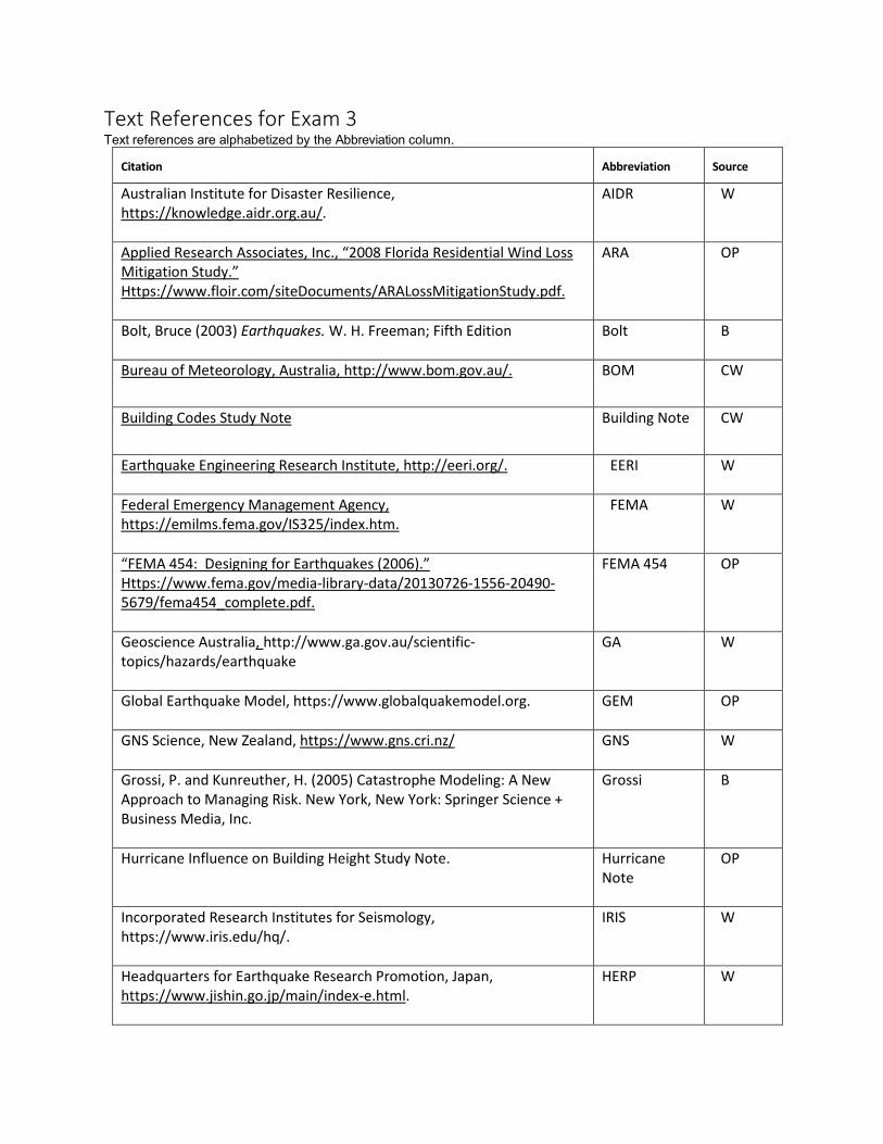
Text References for Exam 3 Text references are alphabetized by the Abbreviation column.
Citation Abbreviation Source
Australian Institute for Disaster Resilience, https://knowledge.aidr.org.au/.
AIDR W
Applied Research Associates, Inc., “2008 Florida Residential Wind Loss Mitigation Study.” Https://www.floir.com/siteDocuments/ARALossMitigationStudy.pdf.
ARA OP
Bolt, Bruce (2003) Earthquakes. W. H. Freeman; Fifth Edition
Bolt
B
Bureau of Meteorology, Australia, http://www.bom.gov.au/.
BOM
CW
Building Codes Study Note
Building Note
CW
Earthquake Engineering Research Institute, http://eeri.org/.
EERI W
Federal Emergency Management Agency, https://emilms.fema.gov/IS325/index.htm.
FEMA W
“FEMA 454: Designing for Earthquakes (2006).” Https://www.fema.gov/media-library-data/20130726-1556-20490-5679/fema454_complete.pdf.
FEMA 454
OP
Geoscience Australia, http://www.ga.gov.au/scientific-topics/hazards/earthquake
GA
W
Global Earthquake Model, https://www.globalquakemodel.org.
GEM
OP
GNS Science, New Zealand, https://www.gns.cri.nz/ GNS
W
Grossi, P. and Kunreuther, H. (2005) Catastrophe Modeling: A New Approach to Managing Risk. New York, New York: Springer Science + Business Media, Inc.
Grossi
B
Hurricane Influence on Building Height Study Note.
Hurricane Note
OP
Incorporated Research Institutes for Seismology, https://www.iris.edu/hq/.
IRIS
W
Headquarters for Earthquake Research Promotion, Japan, https://www.jishin.go.jp/main/index-e.html.
HERP
W

Citation Abbreviation Source
Japan Meteorological Agency, https://www.jma.go.jp/jma/indexe.html.
JMA W
Mitchell-Wallace, K., Jones, M., Hillier, J., and Foote, M. (2017) Natural Catastrophe Risk Management and Modeling, A Practitioner’s Guide. Hoboken, New Jersey: John Wiley & Sons Ltd.
Mitchell-Wallace
B
Occupancy Class Study Note
Occupancy Note
CW
Rubinstein, Justin L. and Babaie Mahani, Alireza, “Myths and Facts on Waste Water Injection, Hydraulic Fracturing, Enhanced Oil Recovery, and Induced Seismicity,” Seismological Research Letters, Volume 86, Number 4, July/August 2015. Hhttps://scits.stanford.edu/sites/default/files/isfc_2_rubenstein_pap_srl-2015067.pdf.”
Rubinstein OP
Science Learning Hub, New Zealand, https://www.sciencelearn.org.nz/
SLC
OP
U. S. Geological Survey, https://www.usgs.gov/
USGS OP
Yanev, Peter (2009) Peace of Mind in Earthquake Country: How to Save Your Home, Business, and Life. Chronicle Books, Third Edition
Yanev
B
Source Key
B Book OP On-line publication CW CatRiskCredentials.org Website W Website
Top Related