


Languages
Pages
Legal


Land(scape) classification (continued)
•approaches
•applications

Land(scape) classification
climatic
physiographic
vegetative
ecosystematic

Climatic classification:
-climate naturally dictates the major vegetation zones
-useful at broad scales,but land units too broadfor local level uses
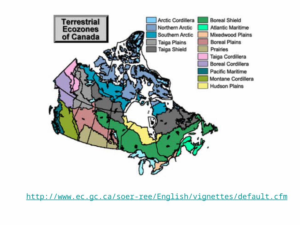
http://www.ec.gc.ca/soer-ree/English/vignettes/default.cfm

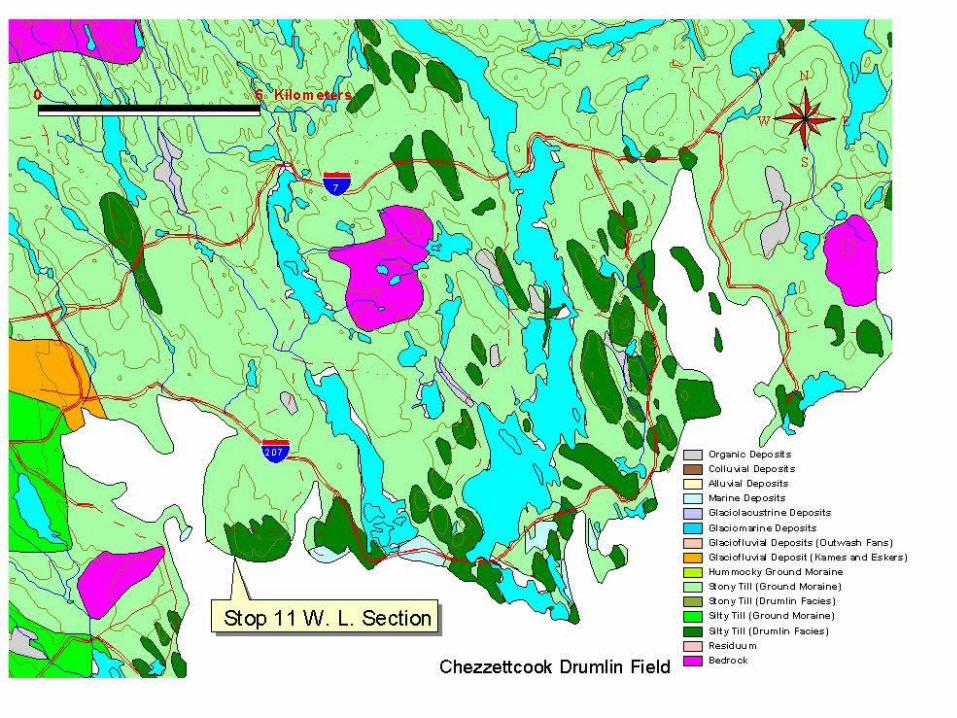
Physiographic classification:
-based on landform and soils
-based on relatively permanent features, so can be more long-lasting than e.g. vegetation classification alone
-lends itself to remote sensing
-of limited use for ecological purposes unless combined with vegetation
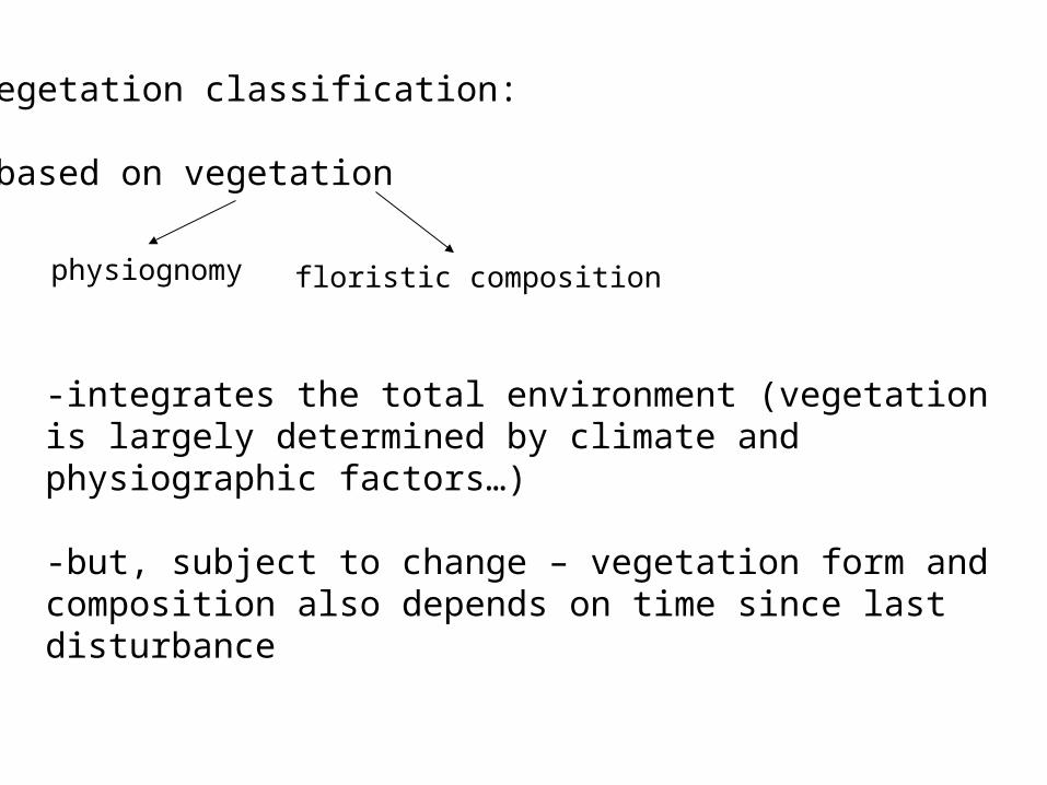
Vegetation classification:
-based on vegetation
physiognomy floristic composition
-integrates the total environment (vegetation is largely determined by climate and physiographic factors…)
-but, subject to change – vegetation form and composition also depends on time since last disturbance
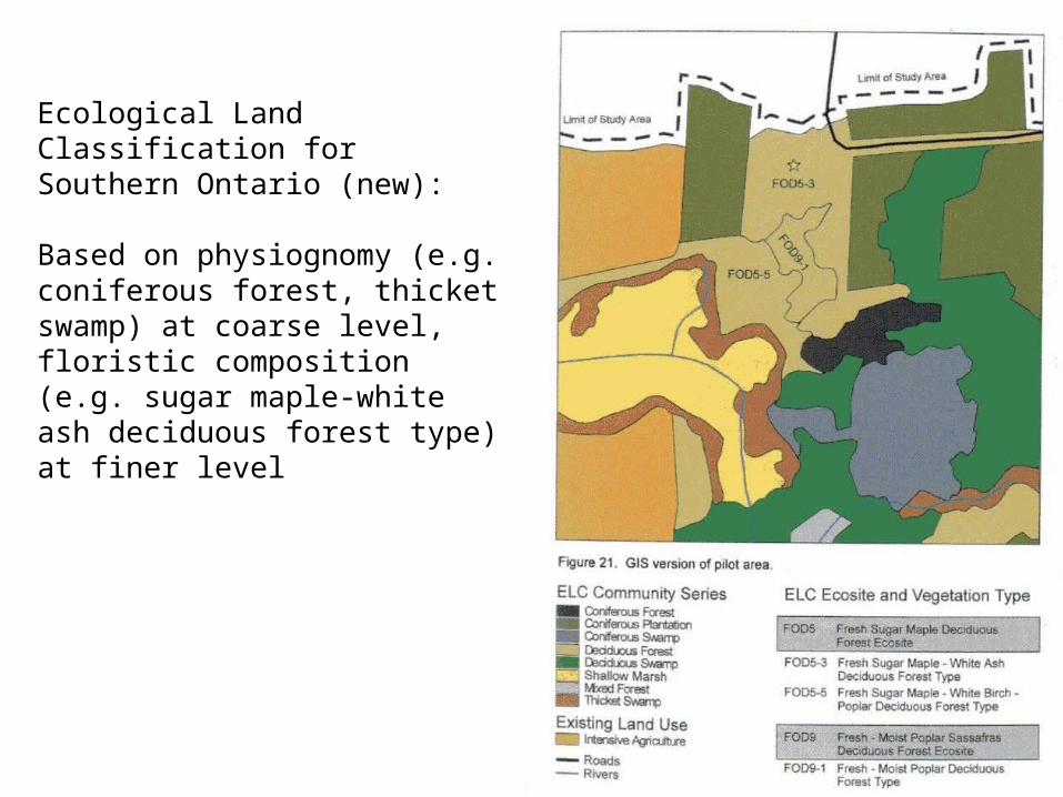
Ecological Land Classification for Southern Ontario (new):
Based on physiognomy (e.g. coniferous forest, thicket swamp) at coarse level, floristic composition (e.g. sugar maple-white ash deciduous forest type) at finer level
Ecosystem classification:
-incorporates climate, vegetation, soils, landform
-usually focuses on vegetation-soil units
-more useful in changing landscapes
-more useful for ecosyste-based management

Land classification systems can be parametric (”bottom-up”)…
-classifies land units based on the value of selected parameters(e.g. soil nutrient levels, elevation, height of dominant plants, mean annual temperature)
-precise, objective approach….but, difficult to select appropriate attributes and the ‘cut-off’ values between classes
…or based on morphological appearance (“top-down”)
-uses observations of topography, vegetation to distinguish different land units
-can be more subjective…but more intuitive as it is based on obvious distinguishing features

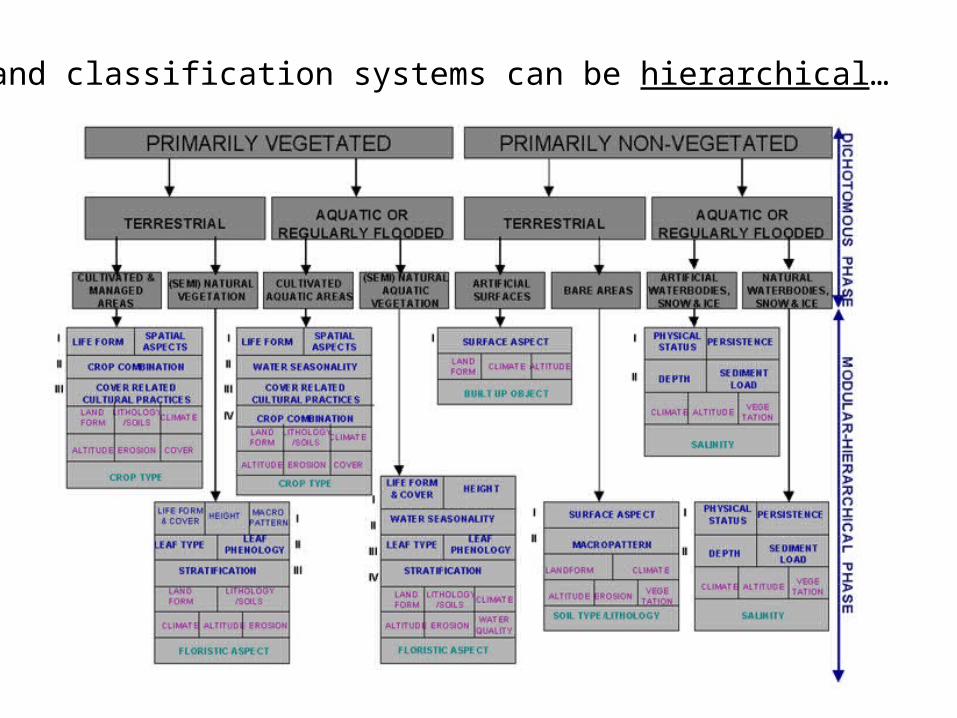
Land classification systems can be hierarchical…

…or not

-Moss has suggested classifying landscapes based on rates of different ecological functions (e.g. productivity, decay)
-Land classification is done for a purpose, not as an end in itself
-choice of characteristics on which a classification system is based depends on the end use of the system
-too many characteristics = small classes (few land units in each class) = less useful for making generalizations
-too few characteristics = large classes = not specific enough
Choice of criteria should be based on:
1. Accessibility (easy to measure/observe)
2. Significance (how well does the characteristic distinguish one land unit from another?)
Applications of land classification systems based on ecosystem characteristics:
-forest management
-conservation
-forest fire control
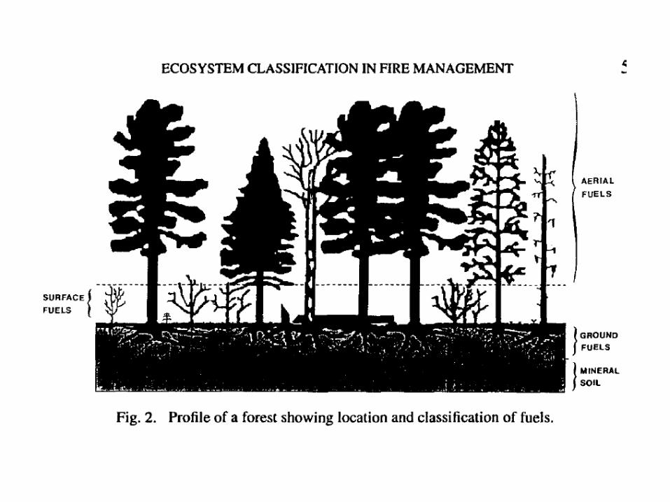

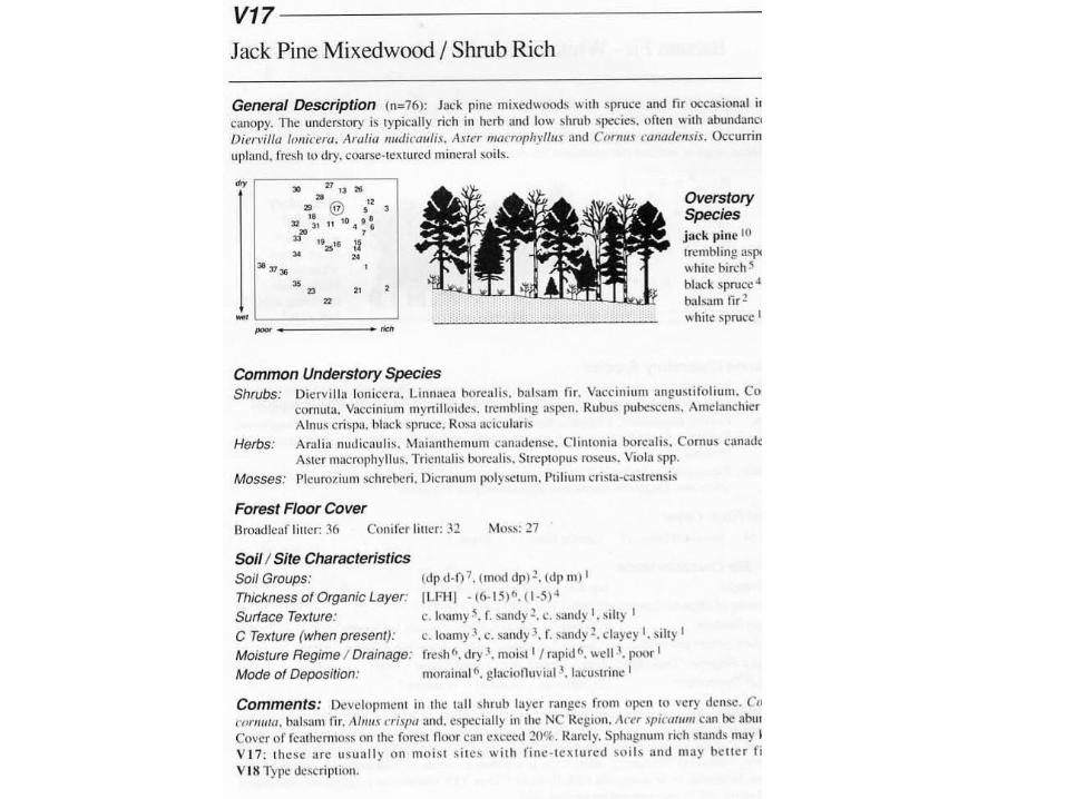
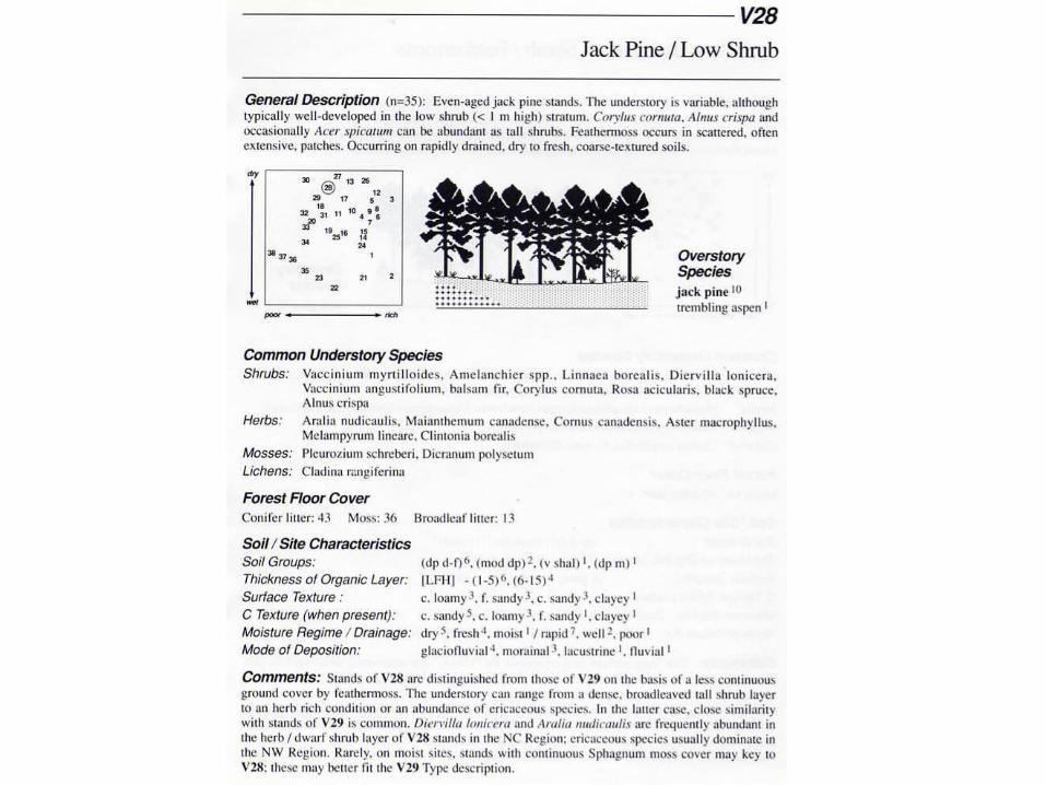
-different classes of jack pine forest may be more or less susceptible to fire
-the Northwestern Ontario Forest Ecosystem Classification distinguishes between jack pine-dominated forests based on understory vegetation
-the type of understory vegetation partly determines the burn potential of a forest patch
-fire control personnel can better predict the behaviour of fire (potential for intensity, spread, etc.), and prioritize control efforts, using the FEC to map out jack pine forest types

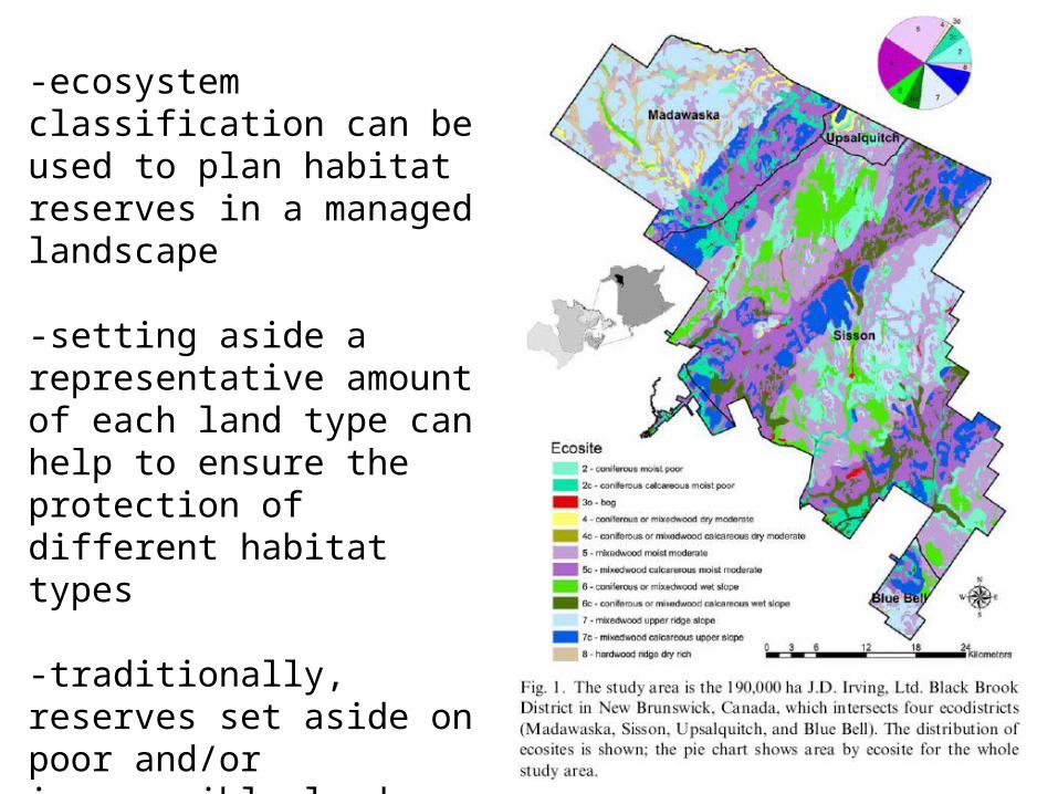
-ecosystem classification can be used to plan habitat reserves in a managed landscape
-setting aside a representative amount of each land type can help to ensure the protection of different habitat types
-traditionally, reserves set aside on poor and/or inaccessible land


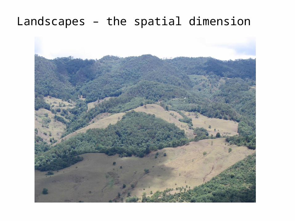
Landscapes – the spatial dimension
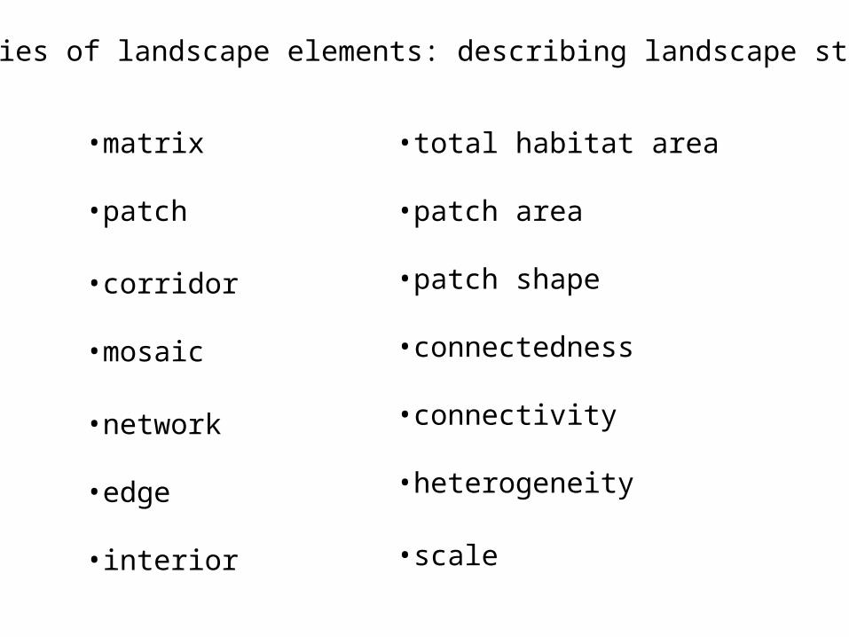
Categories of landscape elements: describing landscape structure
•matrix
•patch
•corridor
•mosaic
•network
•edge
•interior
•total habitat area
•patch area
•patch shape
•connectedness
•connectivity
•heterogeneity
•scale
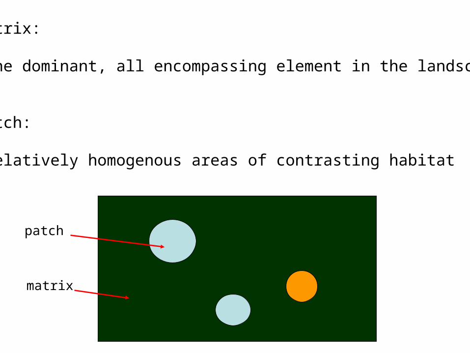
Matrix:
-the dominant, all encompassing element in the landscape
Patch:
-relatively homogenous areas of contrasting habitat
matrix
patch
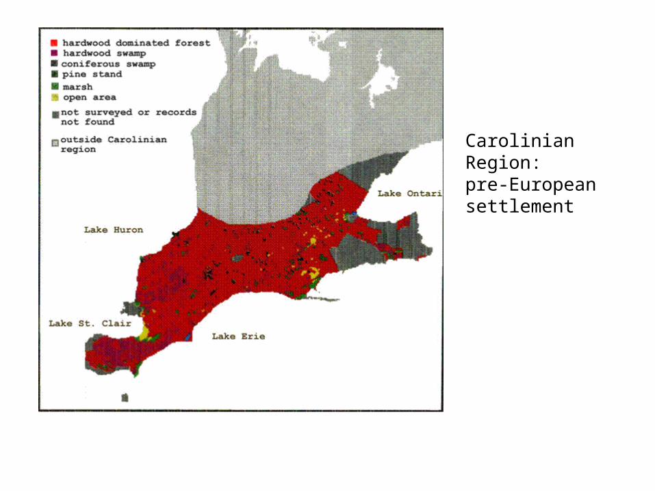
Carolinian Region: pre-European settlement
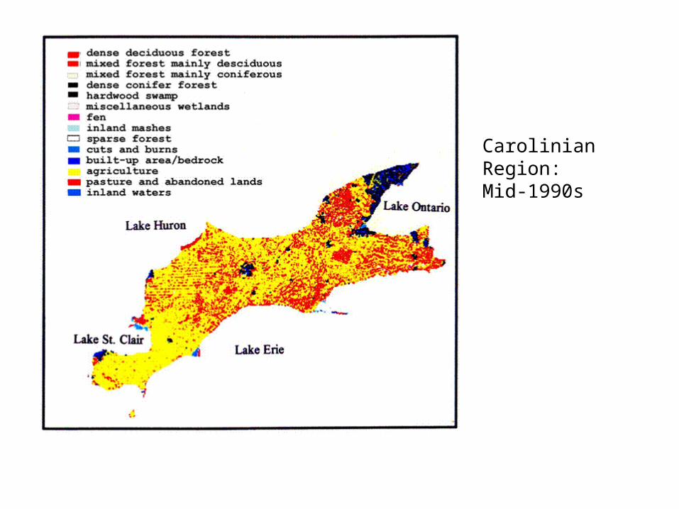
Carolinian Region: Mid-1990s
Both the quantity and quality of patches of a given type will affect the ecological functioning of the landscape (e.g. for wildlife habitat)
The habitat quality in a patch is related to its size and shape:
-large patches have a high ratio of interior to edge compared to small patches
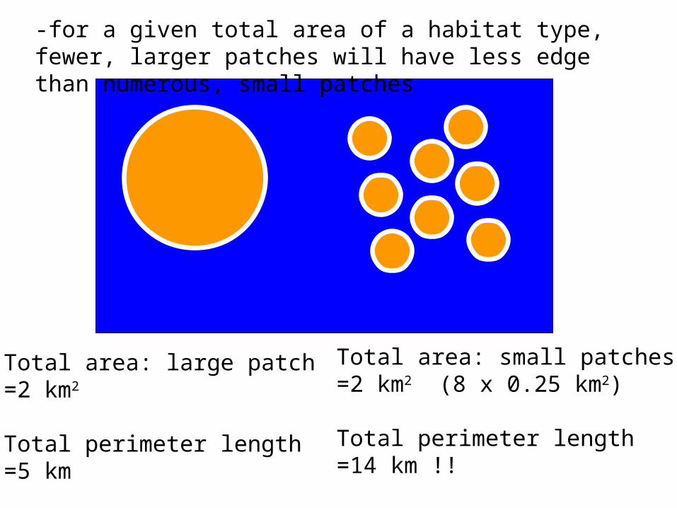
Total area: large patch=2 km2
Total perimeter length=5 km
Total area: small patches=2 km2 (8 x 0.25 km2)
Total perimeter length=14 km !!
-for a given total area of a habitat type, fewer, larger patches will have less edge than numerous, small patches
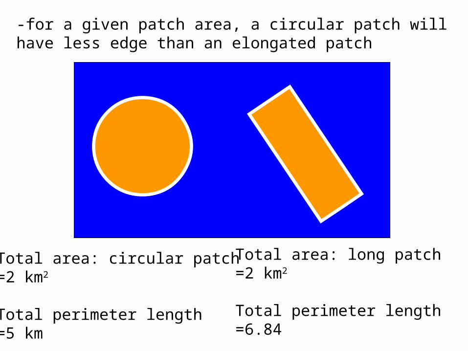
-for a given patch area, a circular patch will have less edge than an elongated patch
Total area: circular patch=2 km2
Total perimeter length=5 km
Total area: long patch=2 km2
Total perimeter length=6.84
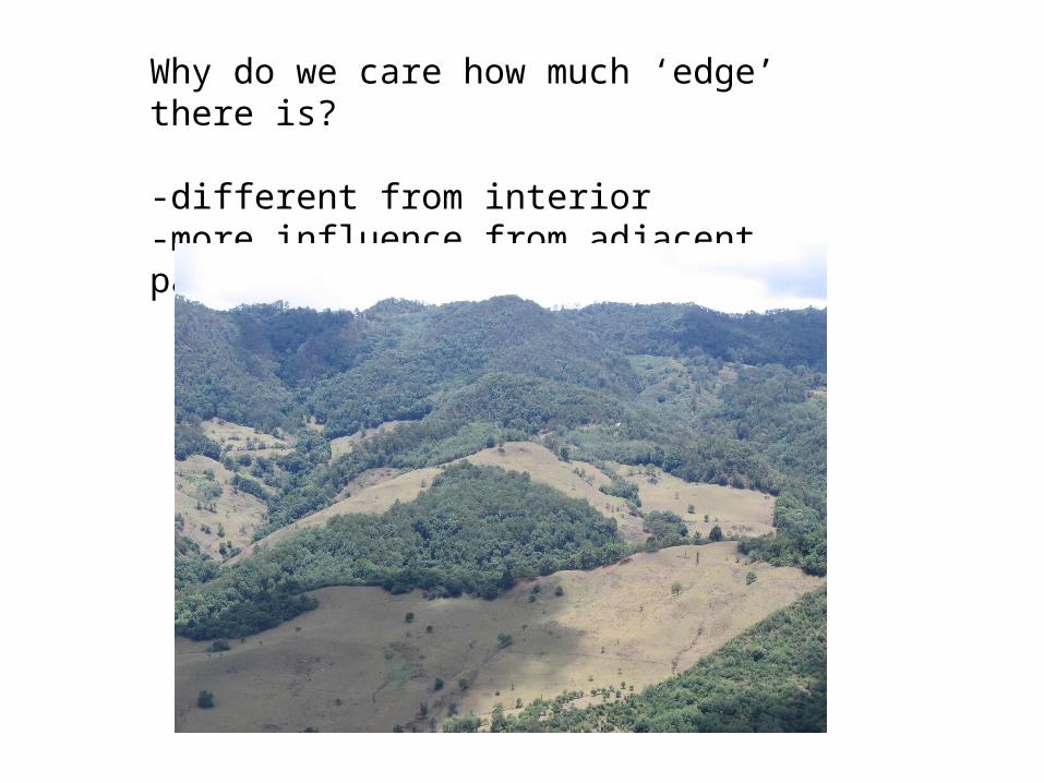
Why do we care how much ‘edge’ there is?
-different from interior-more influence from adjacent patches

In the case of forest patches in a fragmented landscape,edge habitat has:
-different microclimate, e.g. more light availability
-more ground vegetation
-different species…more ‘pioneers’, opportunistic species

The ‘edge effect’ – different microclimate near forest edge vs. interior

The ‘edge effect’ – different plant community composition near edge

The ‘edge effect’ – can result in more diversity at the forest edge vs. interior
forest old field

From a study of the effects of forest harvesting on landscape patterns in NB

Corridor:
-linear elements, may stand alone or link patches together
-not necessarily continuous…’stepping stones’ of habitat may also be considered corridors
Network: a set of corridors on the landscape
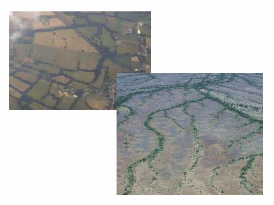

Function of corridors:
-provide connectivity between patches of habitat
-increase the permeability of the landscape
-(sometimes a distinction is made between connectivity and connectedness)

Function of corridors:
-why is more connectivity usually desirable in fragmented landscapes?
-is more connectivity always good?

From Tewksbury et al., 2002
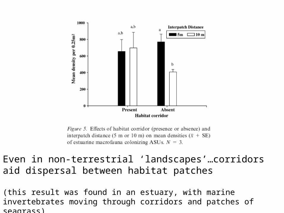
Even in non-terrestrial ‘landscapes’…corridors aid dispersal between habitat patches
(this result was found in an estuary, with marine invertebrates moving through corridors and patches of seagrass)
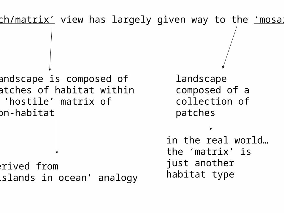
The ‘patch/matrix’ view has largely given way to the ‘mosaic’ view
landscape is composed of patches of habitat within a ‘hostile’ matrix of non-habitat
landscape composed of a collection of patches
derived from ‘islands in ocean’ analogy
in the real world…the ‘matrix’ is just another habitat type
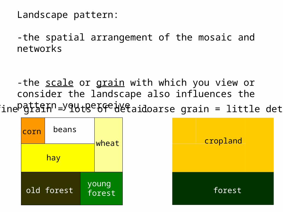
Landscape pattern:
-the spatial arrangement of the mosaic and networks
-the scale or grain with which you view or consider the landscape also influences the pattern you perceive
fine grain = lots of detail
cropland
forestold forestyoung forest
beans
wheat
corn
hay
coarse grain = little detail
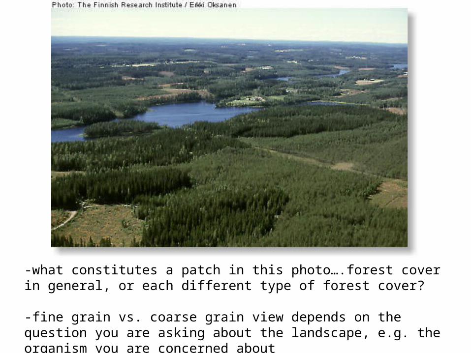
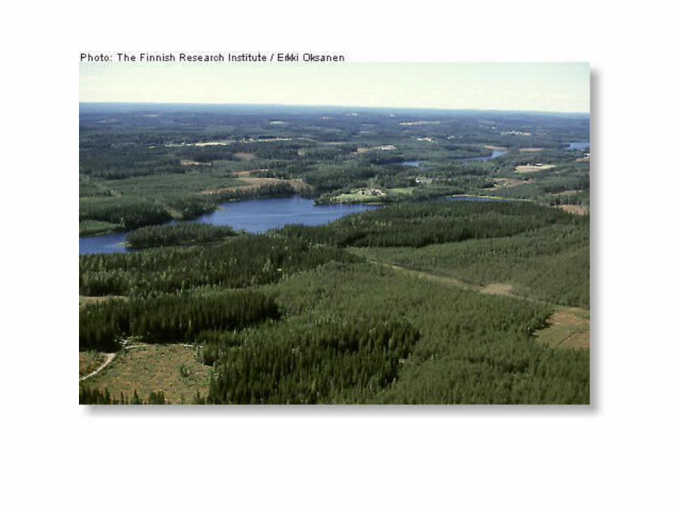
-what constitutes a patch in this photo….forest cover in general, or each different type of forest cover?
-fine grain vs. coarse grain view depends on the question you are asking about the landscape, e.g. the organism you are concerned about

-what is continuous is also in the eye of the beholder…
-a corridor that is continuous on a coarse scale may be discontinuous on a fine scale
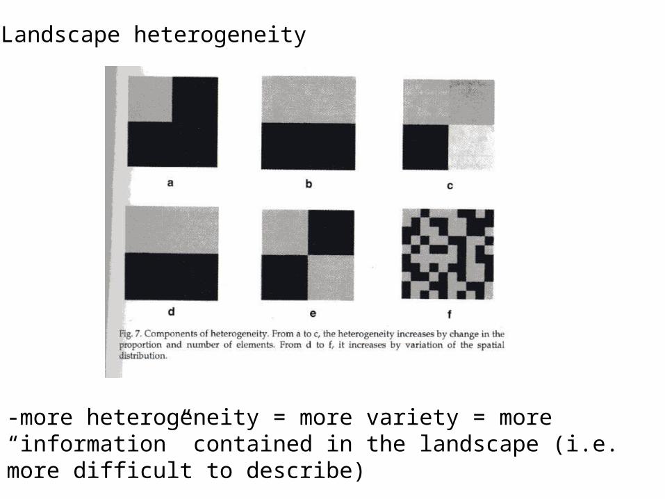
Landscape heterogeneity
-more heterogeneity = more variety = more “information” contained in the landscape (i.e. more difficult to describe)

What causes spatial heterogeneity in a landscape?
-environmental variability (e.g. soil texture, elevation)
-natural disturbances
-anthropogenic disturbances/land use
Landscape heterogeneity
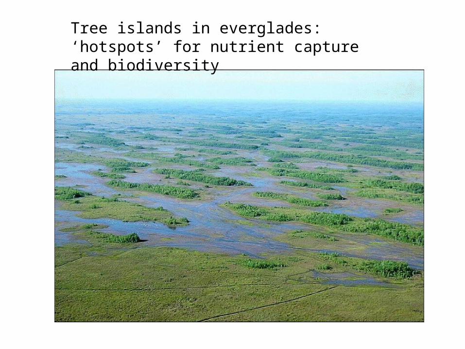
Tree islands in everglades: ‘hotspots’ for nutrient capture and biodiversity

Positive feedbacks lead to island growth


Anthropogenic changes in hydrology leading to island loss = homogenization of landscape, loss of a habitat type

Landscapes – the temporal dimension
-movie-landscape change in Glacier Bay Park: primary succession
Tewksbury et al. 2002. Corridors affect plants, animals, and their interactions in fragmented landscapes. Proceedings of the National Academy of Sciences, 99(20): 12923-12926
Pickett and Cadenasso, 1995. Landscape ecology: spatial heterogeneity in ecological systems. Science 269(5222): 331-334
Mladenoff et al. 1993. Comparing spatial pattern in unaltered old-growth and disturbed forest landscapes. Ecological Applications 3(2): 294-306
This week’s readings…
(all are available online)