


Languages
Pages
Legal


Initial Assessment Reporton
Sendong Flood in Iligan-Cagayan de Oro
Philippines
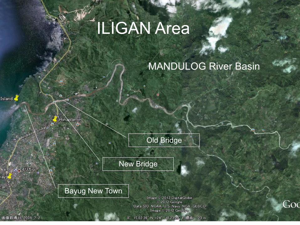
ILIGAN Area
MANDULOG River Basin
Bayug New Town
New Bridge
Old Bridge

Drift logs clogged old Mandulog Bridge then Flood was diverted into city proper. After that the bridge was
destroyed by excessive water pressure.
Flood Diverted to City Area

Flash Flood burst out from the old bridge run over the New Bridge
Destroyed Old Bridge
New Bridge

Flah Flood swept away Bayug Elmt.school then devastated Bayug New Town
LowHigh
Direction of Flash Flood
Old BridgeNew Bridge
Elmt. School
Bayug New Town

Bayug New Town was totally devastated by flash flood
Hard Hit
of
Flash Flood

Upstream of Mandulog River still potential source
of drift logs

Shallow Estuary of Mandulog is threatening upstream area with future flooding
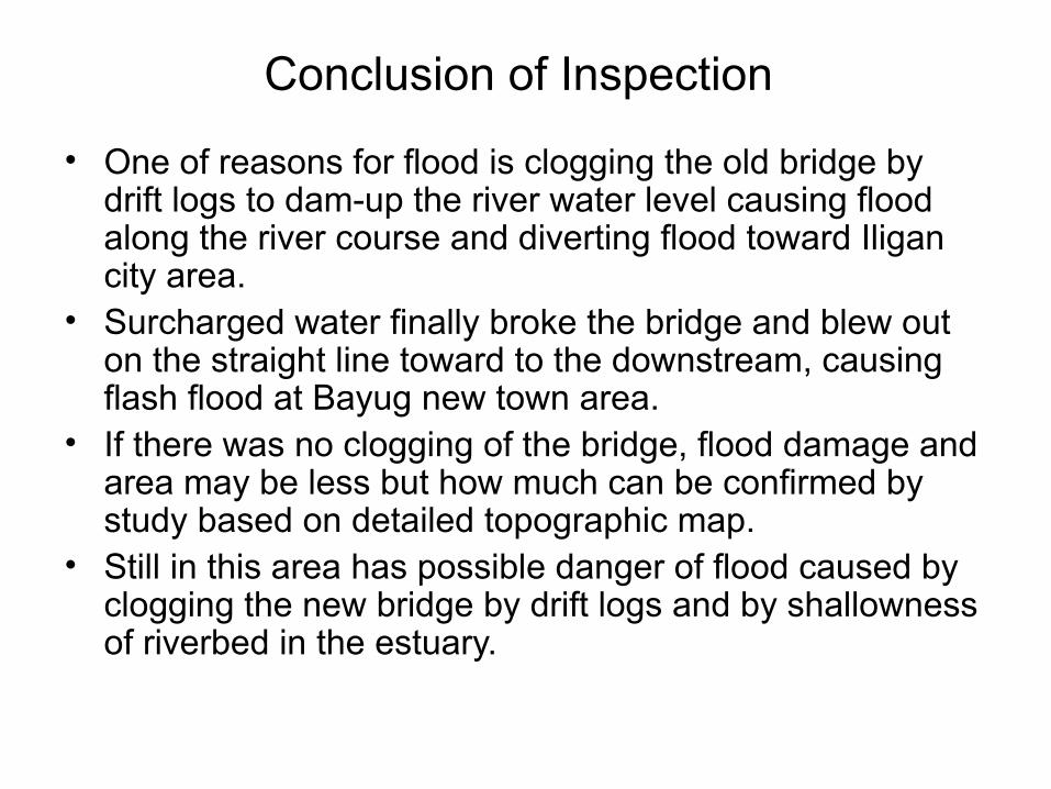
Conclusion of Inspection
• One of reasons for flood is clogging the old bridge by drift logs to dam-up the river water level causing flood along the river course and diverting flood toward Iligan city area.
• Surcharged water finally broke the bridge and blew out on the straight line toward to the downstream, causing flash flood at Bayug new town area.
• If there was no clogging of the bridge, flood damage and area may be less but how much can be confirmed by study based on detailed topographic map.
• Still in this area has possible danger of flood caused by clogging the new bridge by drift logs and by shallowness of riverbed in the estuary.

Recommendation
• Mark the flood traces and record their locations and elevations for future flood analysis.
• Dredge the estuary of Mandulog River.
• Construct facilities to trap drift logs
• Study on flood analysis and countermeasure, and on Sabo Works including drift-log trap.
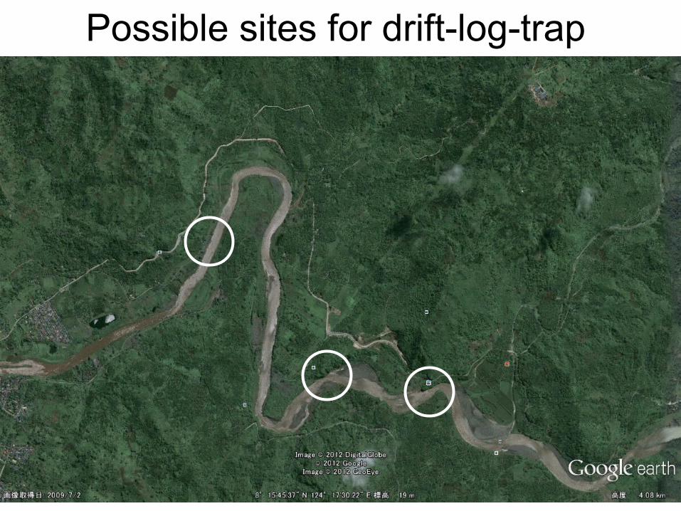
Possible sites for drift-log-trap
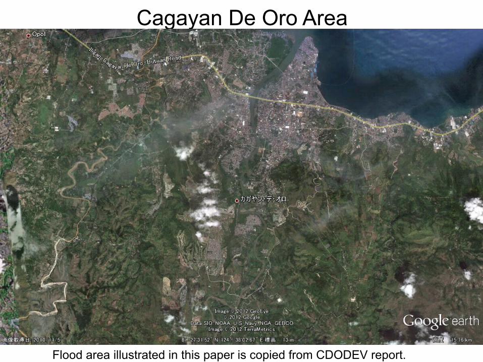
Cagayan De Oro Area
Flood area illustrated in this paper is copied from CDODEV report.
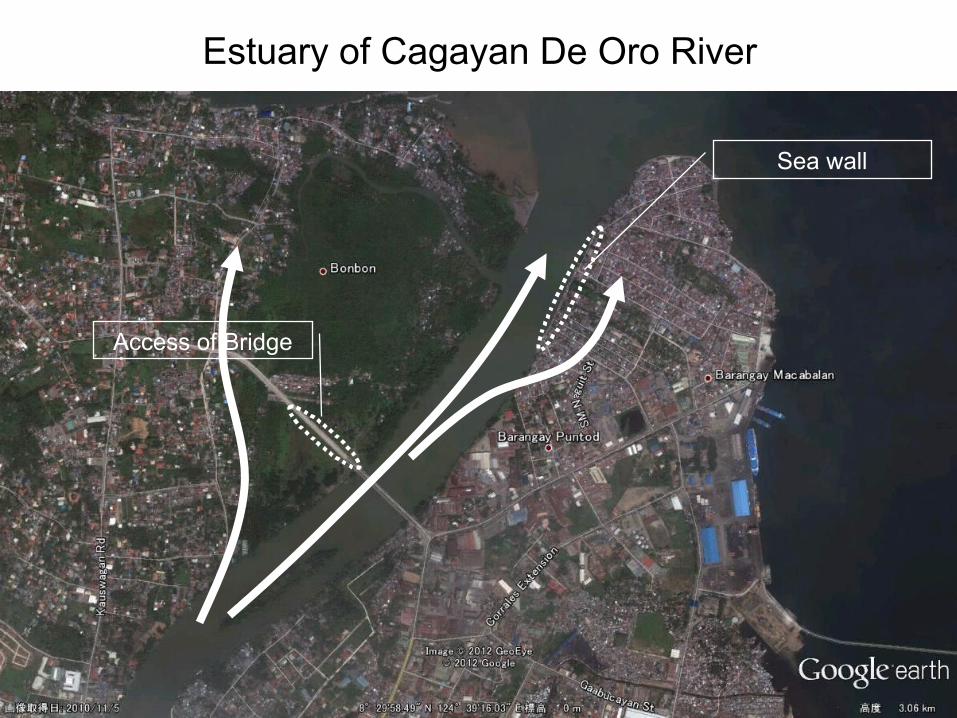
Estuary of Cagayan De Oro River
Access of Bridge
Sea wall

River flow is obstructed by the bridge approach ramp in the flood plain
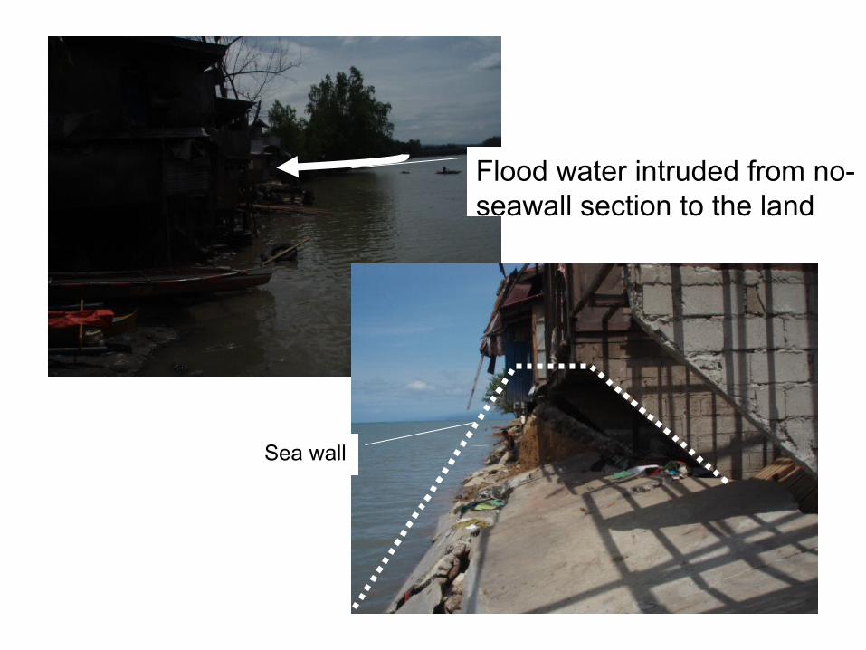
Flood water intruded from no-seawall section to the land
Sea wall

Isla De Oro : Low Land
Flood Area

Isla de Ore is one of sand bars and very low land area
Flood mark shows the level
Flood water level
Sand bars have reduced flow capacity of the river
4 or 5 m
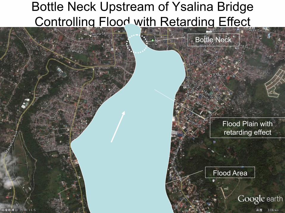
Bottle Neck Upstream of Ysalina BridgeControlling Flood with Retarding Effect
Bottle Neck
Flood Plain with retarding effect
Flood Area
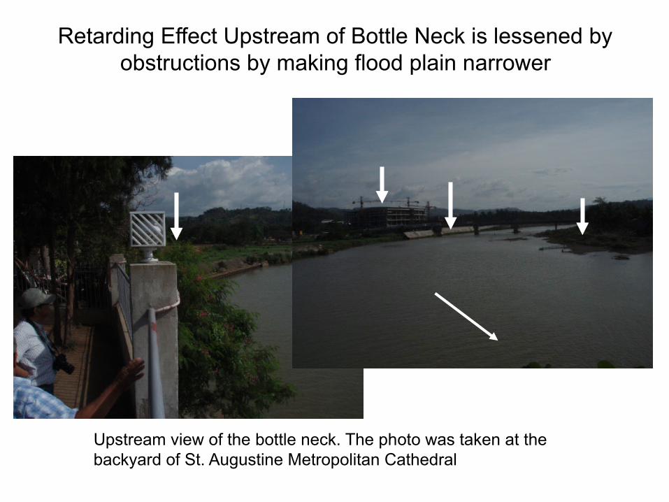
Retarding Effect Upstream of Bottle Neck is lessened by obstructions by making flood plain narrower
Upstream view of the bottle neck. The photo was taken at the backyard of St. Augustine Metropolitan Cathedral

Balulang-Macasandig Town in Flood Plain
Flood Area
Macasandig New Town
Balulang New Town
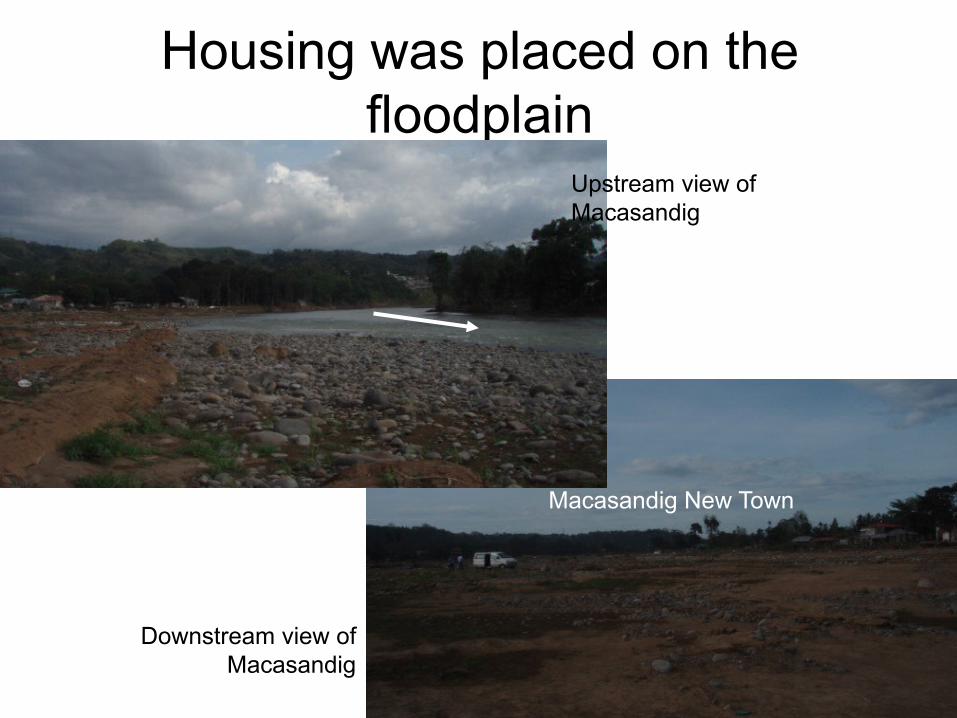
Housing was placed on the floodplain
Upstream view of Macasandig
Downstream view of Macasandig
Macasandig New Town

Upstream of Balulang-Macasandig
Pelaez Bridge
Flood Flow
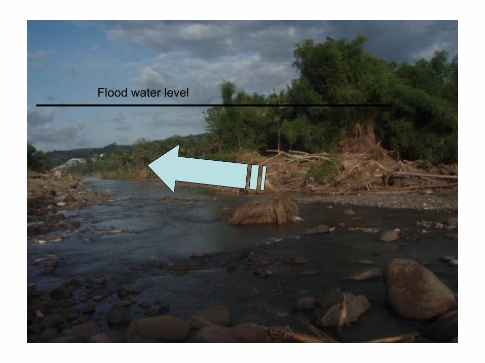
Flood water level

Upstream of Pelaez BridgeBoulders cumulate a large amount
Boulders LayersBroken Pipe Bridge
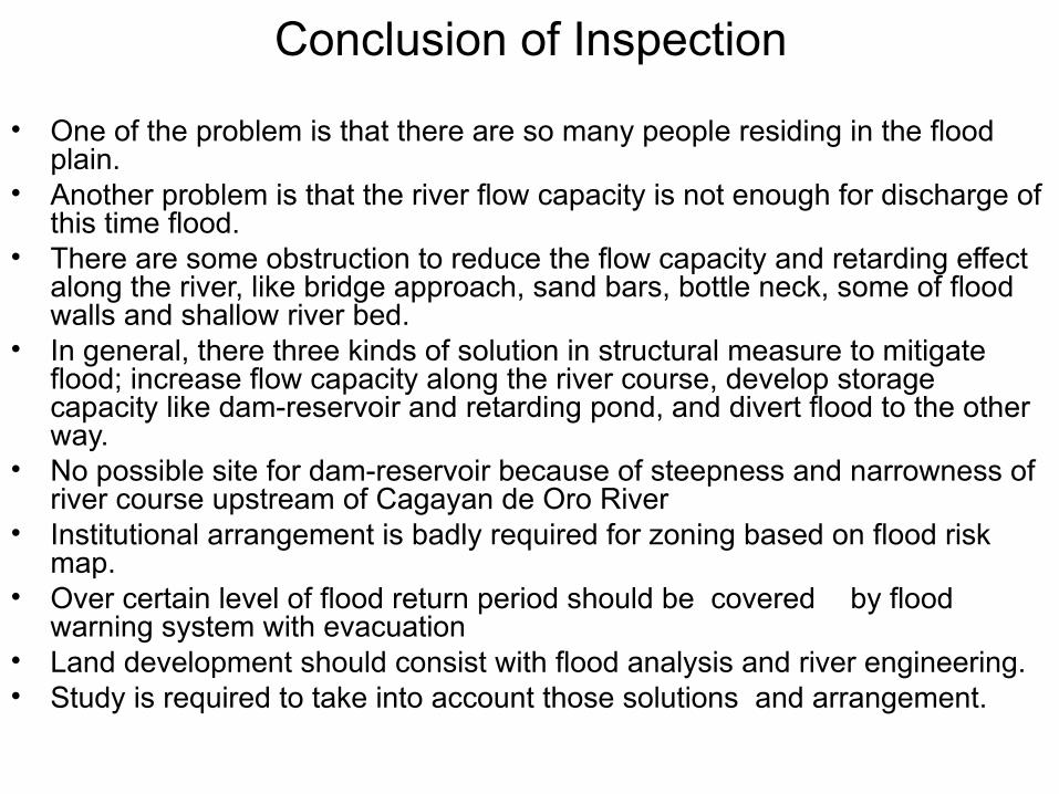
Conclusion of Inspection
• One of the problem is that there are so many people residing in the flood plain.
• Another problem is that the river flow capacity is not enough for discharge of this time flood.
• There are some obstruction to reduce the flow capacity and retarding effect along the river, like bridge approach, sand bars, bottle neck, some of flood walls and shallow river bed.
• In general, there three kinds of solution in structural measure to mitigate flood; increase flow capacity along the river course, develop storage capacity like dam-reservoir and retarding pond, and divert flood to the other way.
• No possible site for dam-reservoir because of steepness and narrowness of river course upstream of Cagayan de Oro River
• Institutional arrangement is badly required for zoning based on flood risk map.
• Over certain level of flood return period should be covered by flood warning system with evacuation
• Land development should consist with flood analysis and river engineering.• Study is required to take into account those solutions and arrangement.
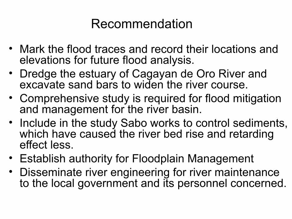
Recommendation
• Mark the flood traces and record their locations and elevations for future flood analysis.
• Dredge the estuary of Cagayan de Oro River and excavate sand bars to widen the river course.
• Comprehensive study is required for flood mitigation and management for the river basin.
• Include in the study Sabo works to control sediments, which have caused the river bed rise and retarding effect less.
• Establish authority for Floodplain Management• Disseminate river engineering for river maintenance
to the local government and its personnel concerned.
Top Related