


Languages
Pages
Legal

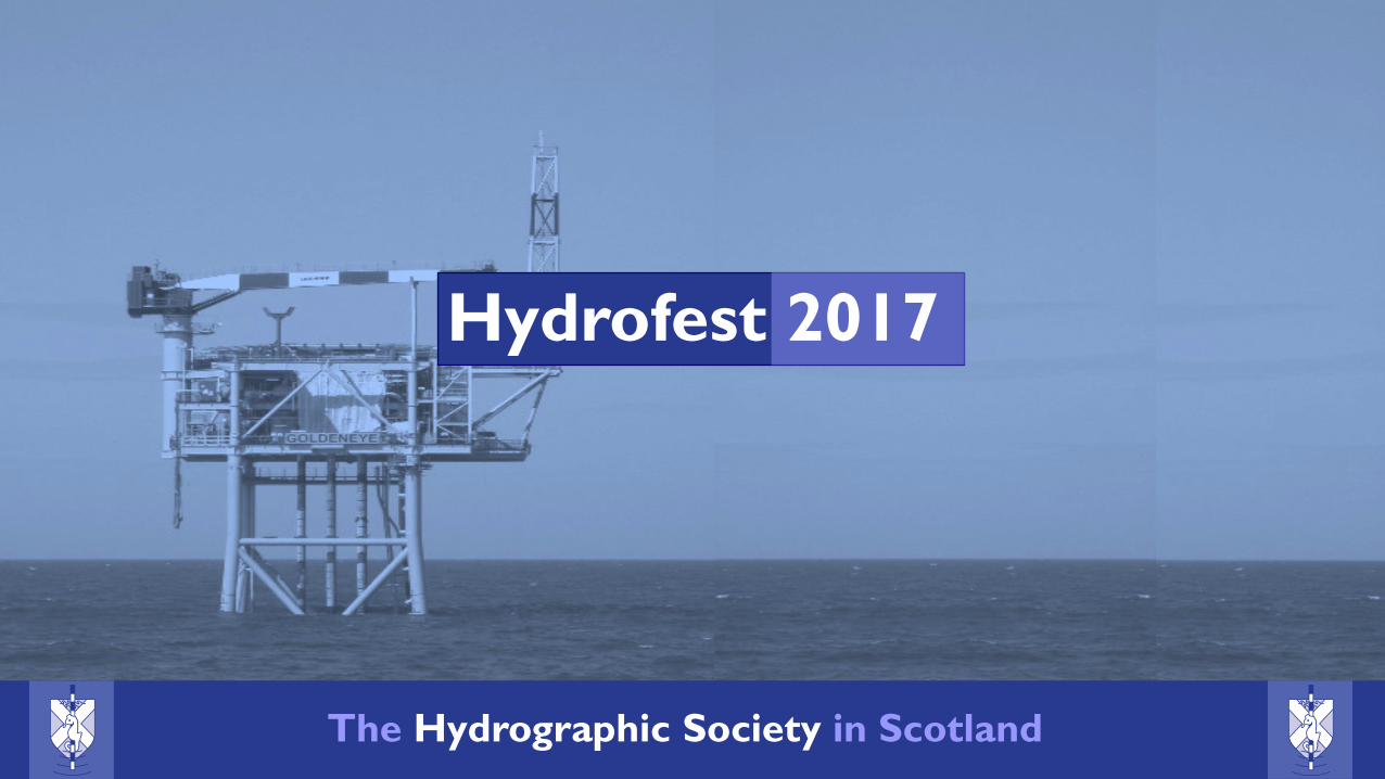
Hydrofest 2017
The Hydrographic Society in Scotland
The Hydrographic Society In Scotland
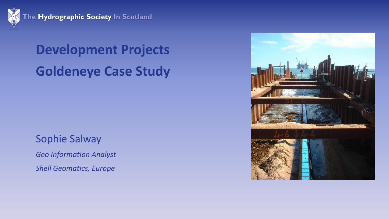
Sophie Salway
Geo Information Analyst
Shell Geomatics, Europe
Development Projects
Goldeneye Case Study

The Hydrographic Society In Scotland
GOLDENEYE
ST. FERGUS
• Gas Condensate Field
• Located in Outer Moray Firth, 100km NE of St Fergus Gas Terminals
• Low safety risks due to normally unmanned operations offshore
• Total lifetime production expected to be in excess of 500 Billion scf Gas and 17 Million barrels Condensate over a 10 Year period
• Greatest water depth (120 metres) in which a Jack-Up rig will be used for production well drilling
Goldeneye Case Study

The Hydrographic Society In Scotland
Project Timeline
Activity / Year 1 2 3 4 5 6 7 8 9 10 11
Exploration Seismic Acquisition
Interpretation
Exploration Drilling
Appraisal
Final Investment Decision
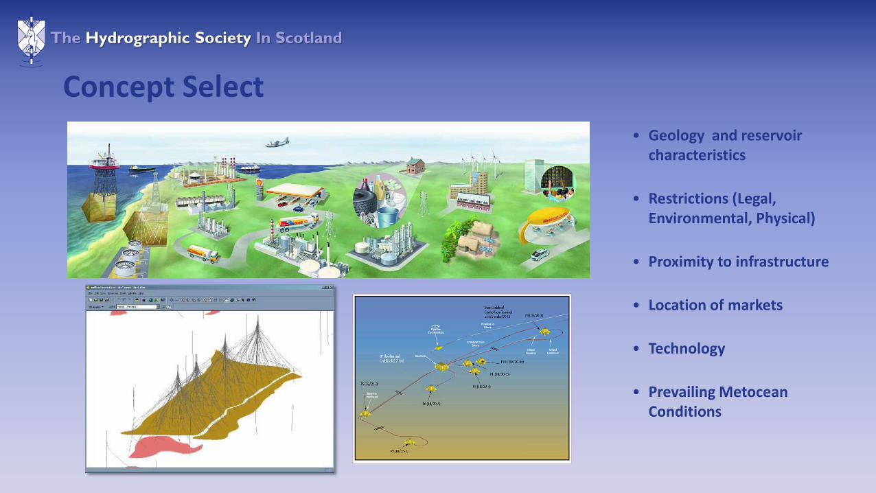
Concept Select
Route Survey + Site Investigation
Front End +Detailed Design
Offshore Construction
Development Drilling
Production Start Up
The Hydrographic Society In Scotland
• Geology and reservoir characteristics
• Restrictions (Legal, Environmental, Physical)
• Proximity to infrastructure
• Location of markets
• Technology
• Prevailing MetoceanConditions
Concept Select

The Hydrographic Society In Scotland
Construction Operations
• Pipe Lay – Shore Pull – Near shore / Offshore Operations
• Trenching
• Backfilling
• Platform Installation
• Tie-In and Pre-Commissioning Works
• Rock dumping – Crossings and Pipeline Protection
• Drilling Phase
The Hydrographic Society In Scotland
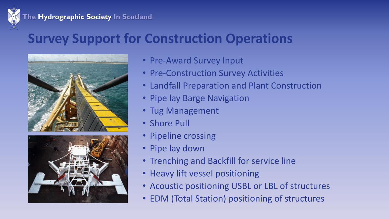
Survey Support for Construction Operations
• Pre-Award Survey Input
• Pre-Construction Survey Activities
• Landfall Preparation and Plant Construction
• Pipe lay Barge Navigation
• Tug Management
• Shore Pull
• Pipeline crossing
• Pipe lay down
• Trenching and Backfill for service line
• Heavy lift vessel positioning
• Acoustic positioning USBL or LBL of structures
• EDM (Total Station) positioning of structures

The Hydrographic Society In Scotland
Pre Installation Survey
• Ensures route / site is free of obstructions
• Side Scan Sonar and MBES
• ROV centre line / site visual survey
• Digital Terrain Model
• Route Topography Analysis
• Array visibility Analysis
The Hydrographic Society In Scotland
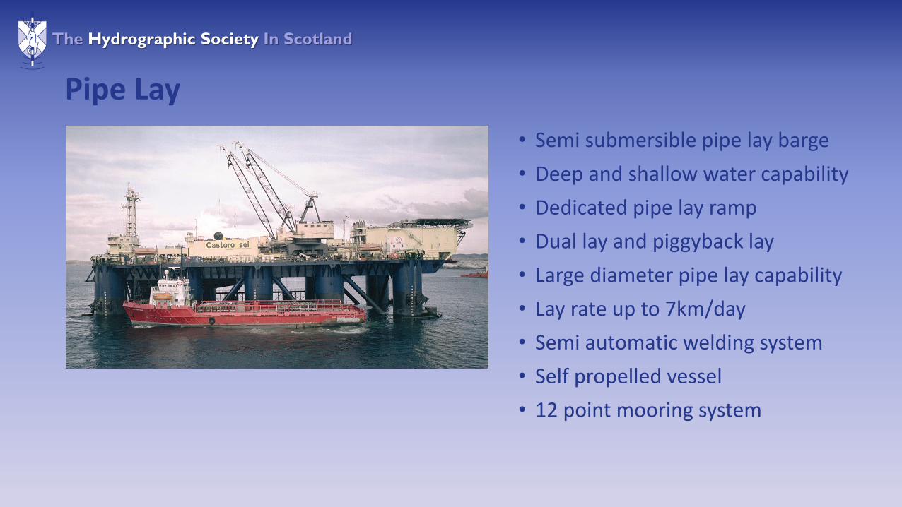
Pipe Lay
• Semi submersible pipe lay barge
• Deep and shallow water capability
• Dedicated pipe lay ramp
• Dual lay and piggyback lay
• Large diameter pipe lay capability
• Lay rate up to 7km/day
• Semi automatic welding system
• Self propelled vessel
• 12 point mooring system

The Hydrographic Society In Scotland
Shore Pipeline Pull
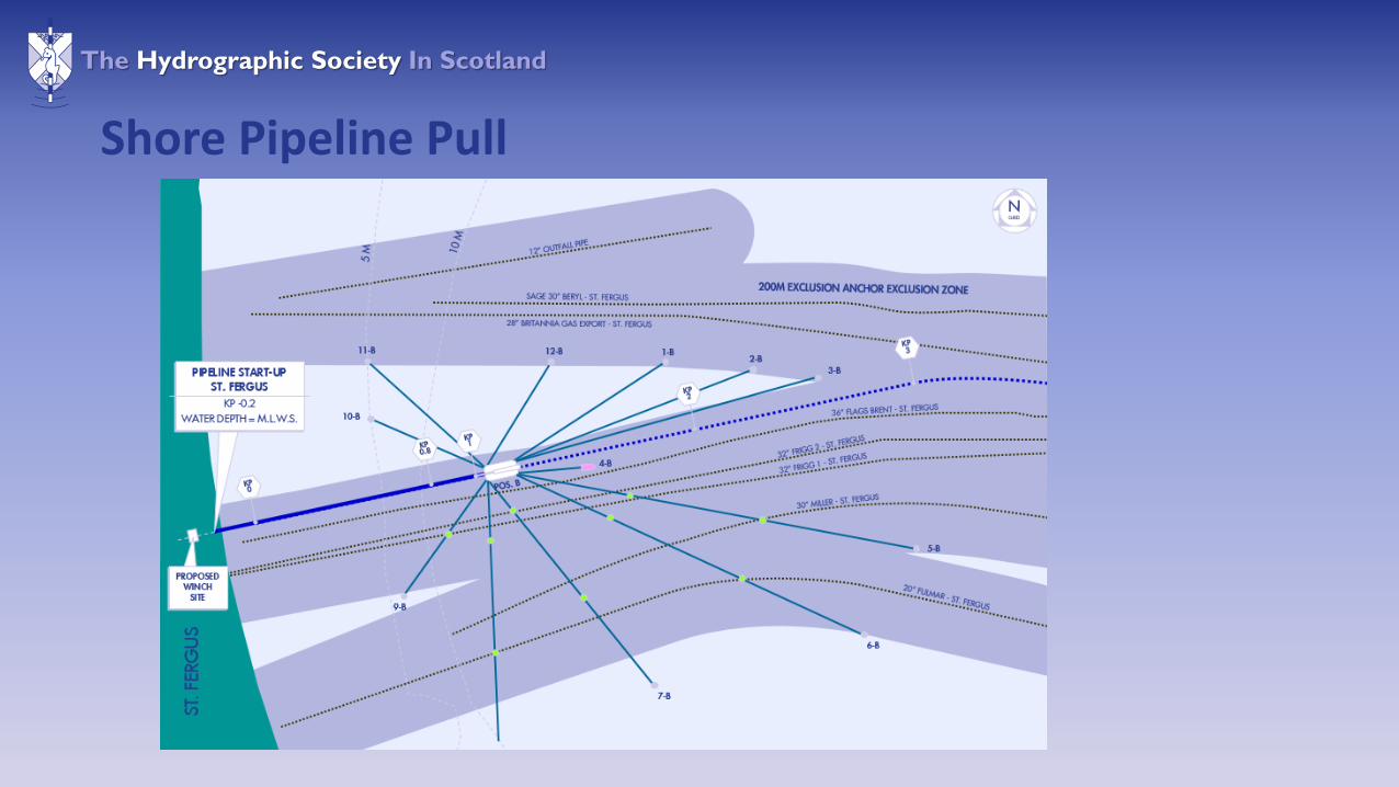
The Hydrographic Society In Scotland
Shore Pipeline Pull
The Hydrographic Society In Scotland
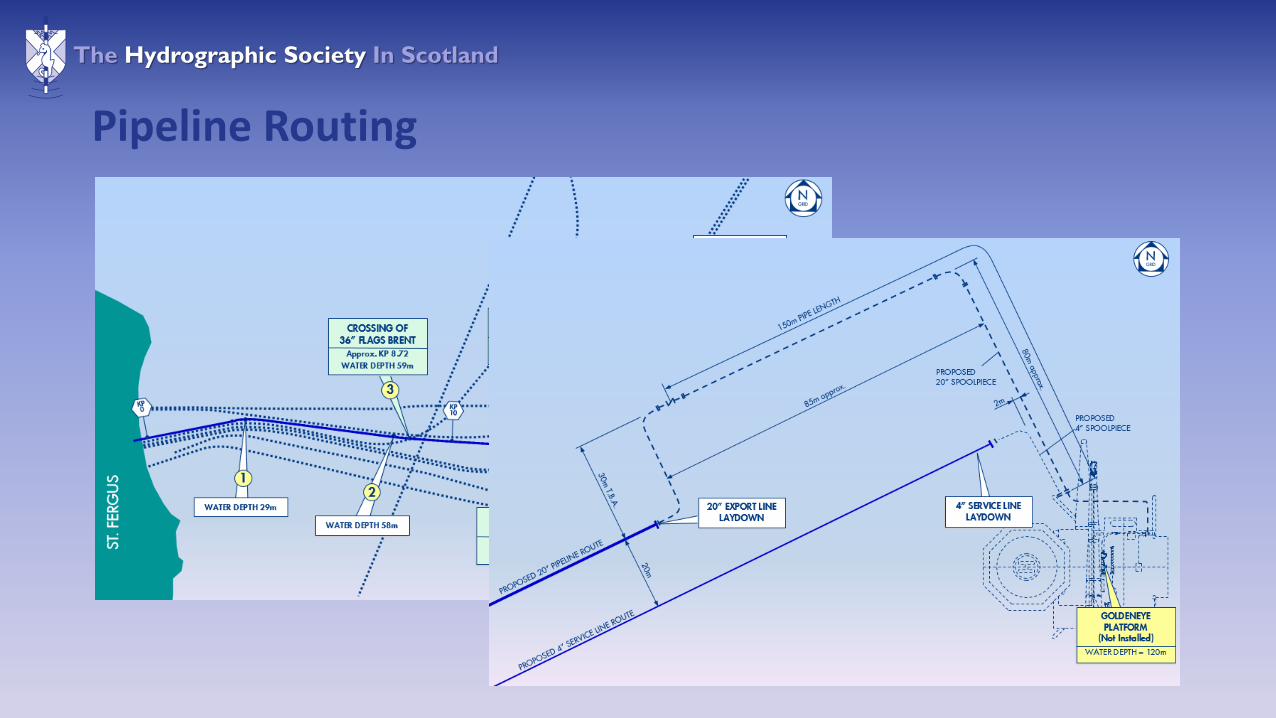
Pipeline Routing
The Hydrographic Society In Scotland
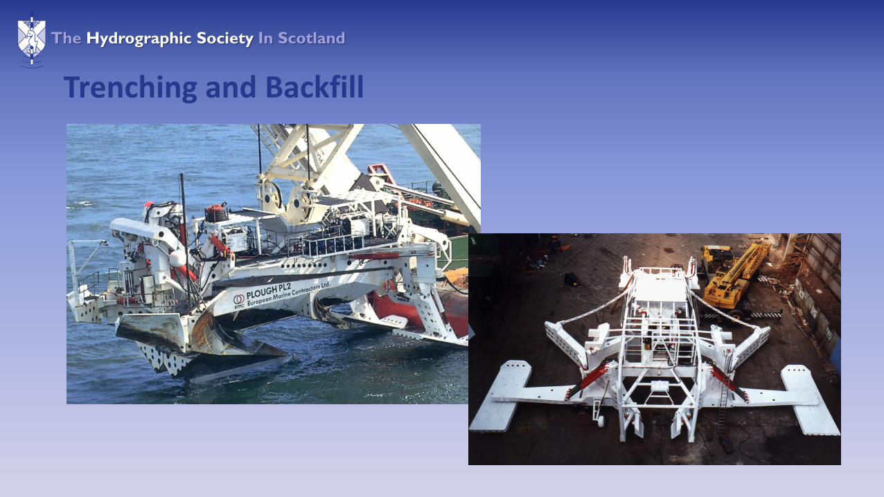
Trenching and Backfill

The Hydrographic Society In Scotland
Platform Installation
The Hydrographic Society In Scotland
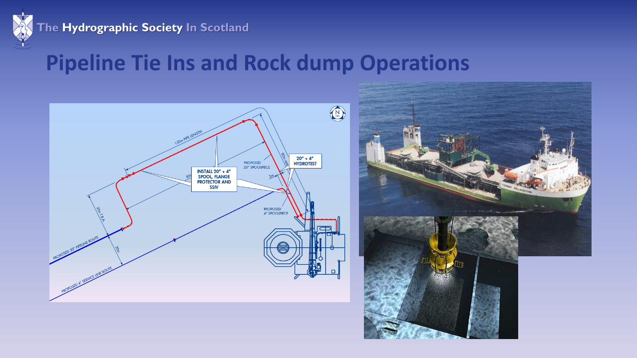
Pipeline Tie Ins and Rock dump Operations
The Hydrographic Society In Scotland
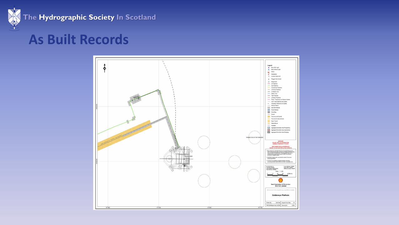
As Built Records
The Hydrographic Society In Scotland
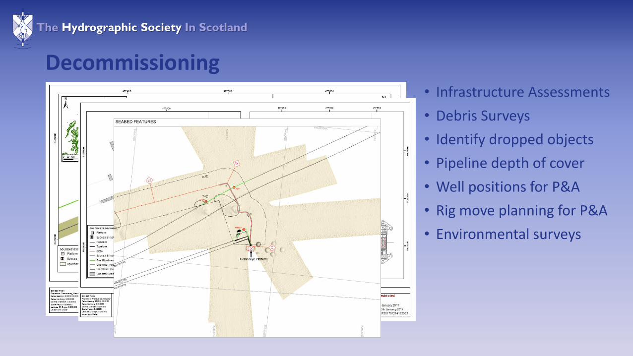
Decommissioning• Infrastructure Assessments
• Debris Surveys
• Identify dropped objects
• Pipeline depth of cover
• Well positions for P&A
• Rig move planning for P&A
• Environmental surveys
The Hydrographic Society In Scotland
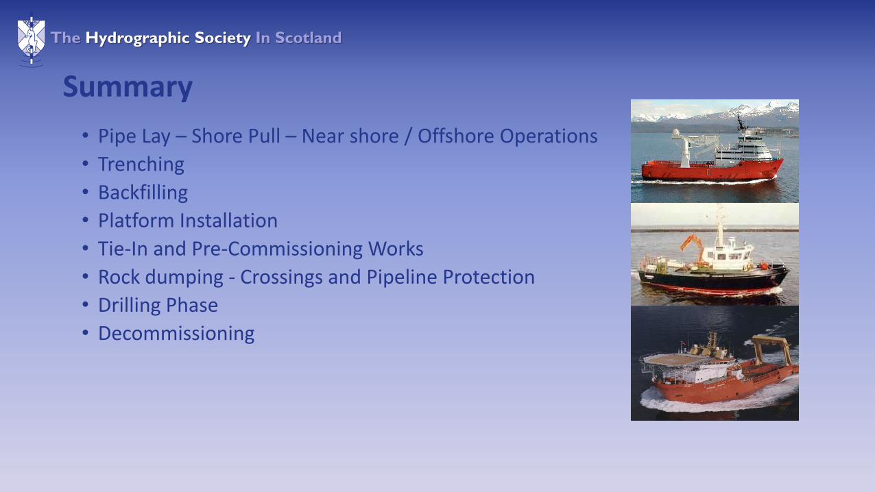
Summary
• Pipe Lay – Shore Pull – Near shore / Offshore Operations
• Trenching
• Backfilling
• Platform Installation
• Tie-In and Pre-Commissioning Works
• Rock dumping - Crossings and Pipeline Protection
• Drilling Phase
• Decommissioning

The Hydrographic Society In Scotland
Questions?
Top Related