


Languages
Pages
Legal


Map of Suzuka, Japan
http://maps.google.com/maps Suzuka, Japan
Executive BriefingTopic 2 –
Information Communications
Jan CookISYM 540 – SSII
Current Topics in ISMJuly 9th, 2009

GeospatialInformation Communications
in Disaster Response

Cable Net-Suzuka’sL-shaped tv screen
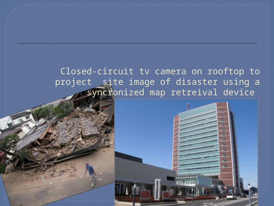
Closed-circuit tv camera on rooftop to project site image of disaster using a syncronized map retreival
device

Rooftop camera Projects the site image onto monitors
using a synchronized map retrieval device.
Has an antenna for amateur radio transmissions -for backup
Has radio-based reporting system allowing amateur radio groups to join the group radio station operated by municipal employees
b&w -works just as well at night

Extensive public education
…and public access to information
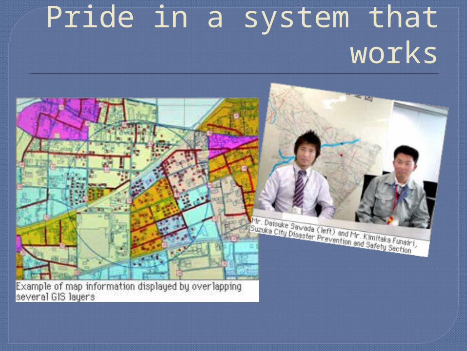
Pride in a system that works

Location –Based Service(LBS)Locates Optimal PathDetermine location of disaster
Find clear selected streets Input current location of repairmanCount # of intersected streets
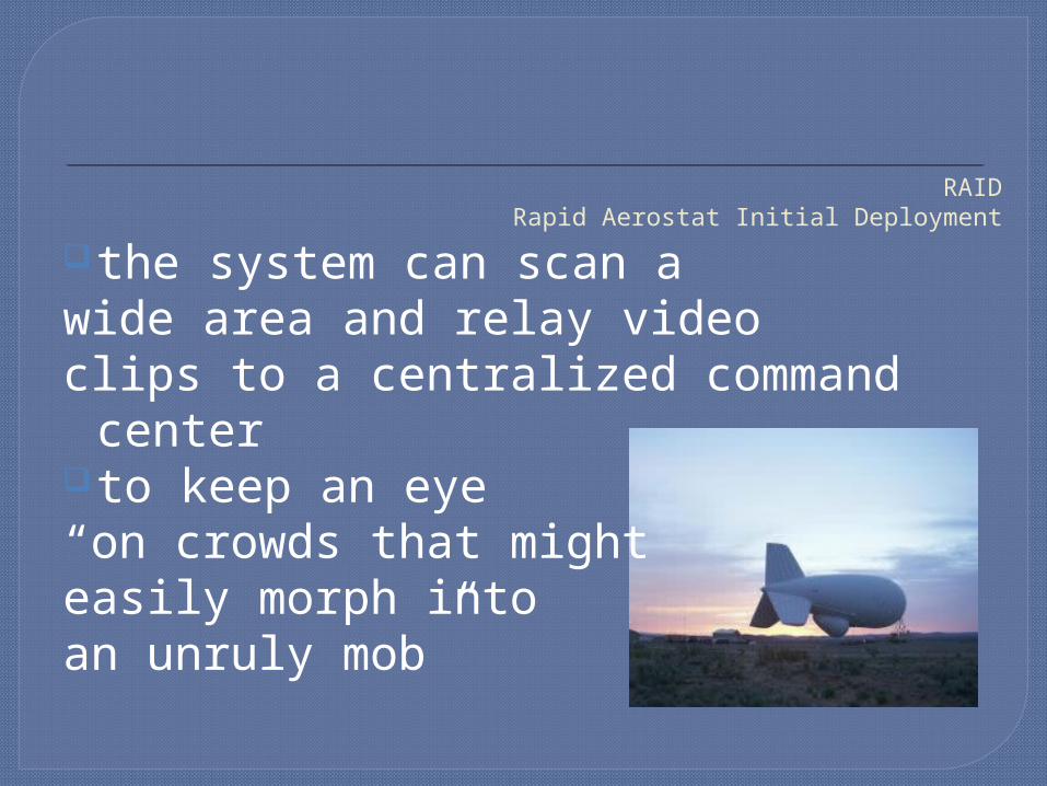
RAIDRapid Aerostat Initial Deployment
the system can scan a wide area and relay video clips to a centralized command centerto keep an eye “on crowds that might easily morph into an unruly mob”
Sources:“Googlemap” google.com, 2009, <http://maps.google.com/maps?
hl=en&q=suzuka+Japan&um=1&ie=UTF-8&split=0&gl=us&ei=0btQSoH1OoeftgfS8IGsBA&sa=X&oi=geocode_result&ct=title&resnum=1>
“Emergency Management Enlists Geospatial Technology” Geoplace.com, October
2006,<10/1/2006http://www.geoplace.com/ME2/dirmod.asp?sid=&nm=&type=Publishing&mod=Publications%3A%3AArticle&mid=8F3A7027421841978F18BE895F87F791&tier=4&id=A2B34A557F5741F1A5EE4632AE022FB5>
“Googlemap” 2009<http://www.gdacs.org/map/googlemap.asp> “LASDEC Local Authorities Systems Development Center”Nippon.net, 2007© <http://www.nippon-
net.ne.jp/its/bestpractice/english/original/b1.html> “Integration of GIS and GPS for Water Utility Disaster Management/ The GeoSpatial Resource Portal”
gisdevelopment.net 2000© <http://www.gisdevelopment.net/><www.gisdevelopment.net/application/Utility/others/mi08_192.htm> “Raytheon” pacificfreepress.com, Newsweek, June 11, 2009
<http://www.pacificfreepress.com/news/1/4313-look-up-look-down-raytheon-releases-raid.html>
Top Related