


Languages
Pages
Legal


Ignite Spatial Vermont GIS Smartphone Apps
April 17, 2012

Ignite Spatial Vermont: GIS Smartphone Apps
• Our focus:
– GIS Solutions
– Research & Development
– Strategic Consulting
• Our customers: local, state, tribal, federal government,
and private sector.
John Waterman, PMP, GISP
Vice President of Geospatial Solutions, GCS Research
East Burke, Vermont
802.473.4009 - [email protected]
GCS Research: Introduction
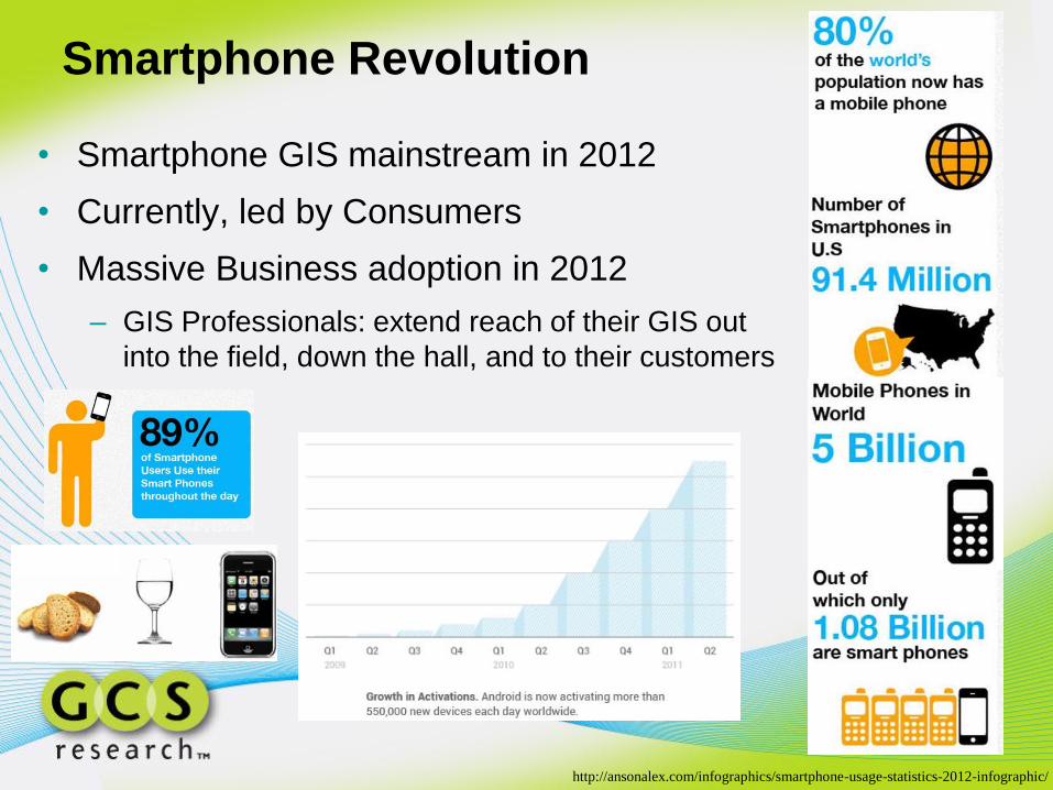
Smartphone Revolution
• Smartphone GIS mainstream in 2012
• Currently, led by Consumers
• Massive Business adoption in 2012
– GIS Professionals: extend reach of their GIS out
into the field, down the hall, and to their customers
http://ansonalex.com/infographics/smartphone-usage-statistics-2012-infographic/

Vermont Parcel App
• Google Android
• ESRI ArcGIS Server
• Parcels from VCGI
• Grand List data from towns
• Data to be updated shortly

GCS Research Parcel Apps
• First published Google Android
Apps to use Esri technology
• ~10,000 downloads
• Coming soon:
– Data updates
– iPhone/iPad & Windows 7
– New Apps for states/cities
Current Apps for:
• Montana
• Vermont
• Washington
• Denver
• San Diego

National Geographic World Map App
• Esri and National Geographic collaborated to produce a
distinctive basemap that reflects National Geographic's
cartographic design, typographic style, and map policies.
Released three days ago:
500+ downloads already

Town of Brookline, Massachusetts
• “Where Am I” App helps locate the closest public
transportation, parks and public schools, library, parking lots
and parking meters in town.
• Coming soon: iPhone
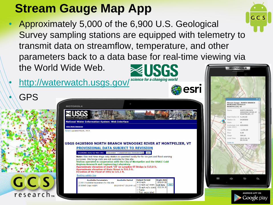
Stream Gauge Map App
• Approximately 5,000 of the 6,900 U.S. Geological
Survey sampling stations are equipped with telemetry to
transmit data on streamflow, temperature, and other
parameters back to a data base for real-time viewing via
the World Wide Web.
• http://waterwatch.usgs.gov/
• GPS

Fire Apps • Active Wildland Fires Map App
– In order to give fire managers near real-time information,
fire perimeter data is updated daily based upon input from
incident intelligence sources, GPS data, infrared (IR)
imagery from fixed wing and satellite platforms.
• US Fire History Map App
– Displays fire perimeter data from 2000 to 2009 on top of
Wildland Fire Potential.
• About the data
– Fire Perimeter data is a product of Geospatial Multi-
Agency Coordination (GeoMAC).
– Fire Potential data is a product of USFS Forest Service
Rocky Mountain Research Station (RMRS).

‘Transfer of Care’ App for the iPhone
• Secure information sharing App for
medical community, i.e. hospitals
• Doctors share video and other relevant
real-time information to medical staff
• Highly Secure App
• Sensitive medical information
• Map message locations
• Not available in the Apple App Store

FEMA 100 Year Flood Zone Map App
• The 100-year flood is referred to as the 1% annual
exceedance probability flood, since it is a flood that has
a 1% chance of being equaled or exceeded in any single
year.
• Flood zone data created by FEMA.
• GPS

Soil Survey Map App
• Features the Soil Survey Geographic (SSURGO) by the
United States Department of Agriculture's Natural
Resources Conservation Service.
• It also shows data that was developed by the National
Cooperative Soil Survey and supersedes the State Soil
Geographic (STATSGO) dataset.
• GPS
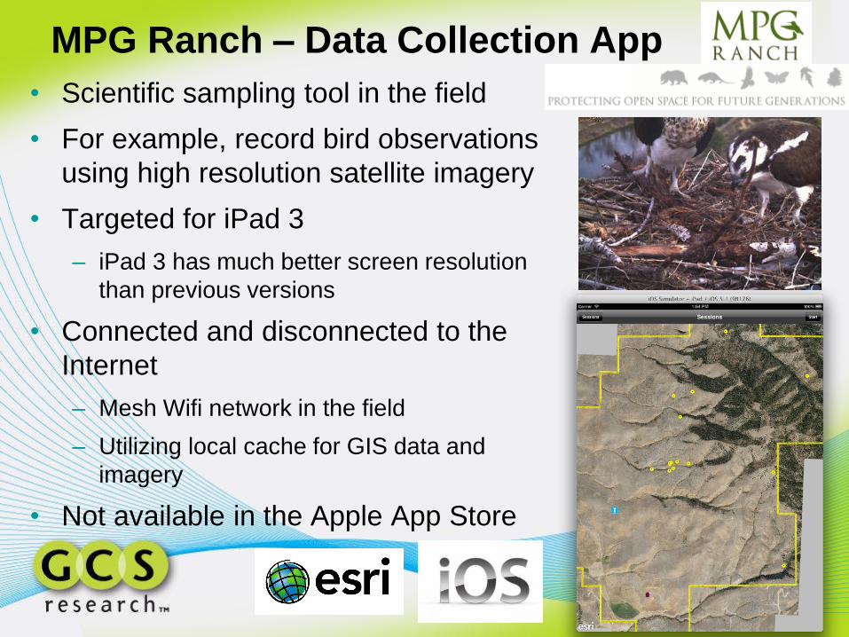
MPG Ranch – Data Collection App
• Scientific sampling tool in the field
• For example, record bird observations
using high resolution satellite imagery
• Targeted for iPad 3
– iPad 3 has much better screen resolution
than previous versions
• Connected and disconnected to the
Internet
– Mesh Wifi network in the field
– Utilizing local cache for GIS data and
imagery
• Not available in the Apple App Store

Nuclear Sites Map App • Map contains approximate buffered (50 and 100 km)
locations of world nuclear plants.
• The data has not been verified against the nuclear
regulatory commission for each country.
• Quaternary faults and fold data provided by the USGS.
• Contains services from Esri ArcGIS Online.
• GPS

EPA Watch List Map App
• To improve public health and the environment,
the United States Environmental Protection
Agency (USEPA) collects information about
facilities, sites, or places subject to
environmental regulation or of environmental
interest.
• GPS

Burke Vermont Bike Trails Map App
• Data published via ArcGIS Online

Demographic Apps • Median Household Income Map App
– Displays US median household income for the US in 2010
• Population Change Map App
– Displays annual compound rate of total population change in
the US from 2000 to 2010
• Total Crime Map App
– Displays index of total crime in state, county, ZIP Code and
block group
• Data and services provided by Esri ArcGIS Online

Modeling as a Service (MaaS)

Smartphone Platform Market Share (2011)
• Big gains expected in 2012 with Microsoft Window 7
Droid 1: Released October 17, 2009

Multi-Platform Mobile GIS Apps
• One solution: PhoneGap
– open source mobile framework
– Single code base deploys to multiple (7) platforms
• GCS Research integrating PhoneGap and ArcGIS Server to
solve the multi-platform problem for Esri Enterprise GIS
customers

Montana Site Selector
• Developed for businesses looking to open,
expand or relocate in Montana.
• Developed by GCS Research; funded by
the Montana Governor’s Office of Economic
Development and local governments
• Multiplatform mobile apps to be released
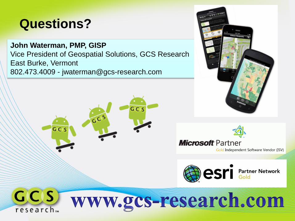
Questions?
John Waterman, PMP, GISP
Vice President of Geospatial Solutions, GCS Research
East Burke, Vermont
802.473.4009 - [email protected]
Top Related