


Languages
Pages
Legal

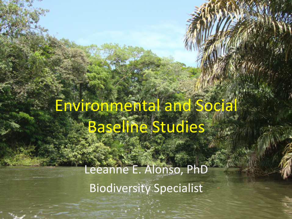
Environmental and Social Baseline Studies
Leeanne E. Alonso, PhD
Biodiversity Specialist

My Experiences
1998-2011 • 13 years as Director of Rapid Assessment
Program (RAP) at Conservation International (NGO) – Baseline biodiversity and socio-
economic surveys – To guide conservation planning – >40 field surveys worldwide
Currently: • Consultant to IFC to review biodiversity
aspects of projects (hydro, mining, oil, roads, infrastructure, chemicals etc.) – particularly baseline biodiversity
surveys • Global Wildlife Conservation NGO) -
Director of Global Biodiversity Exploration
NGO – Lender – Client perspectives

What are Baseline Studies?
• Studies to determine the current environmental and/or social condition of an area
• Studies to evaluate how these conditions will develop in the absence of a “project”
• Baseline Information needed for ESIA
• Forms the basis for planning, decisions, and mitigation
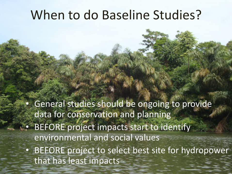
When to do Baseline Studies?
• General studies should be ongoing to provide data for conservation and planning
• BEFORE project impacts start to identify environmental and social values
• BEFORE project to select best site for hydropower that has least impacts
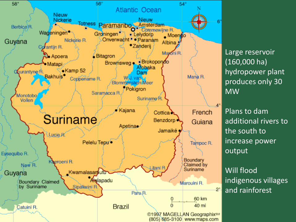
• Large
Large reservoir (160,000 ha) hydropower plant produces only 30 MW Plans to dam additional rivers to the south to increase power output Will flood indigenous villages and rainforest

ESIA Process

Steps for a Baseline Study
1. Compile existing data: – Review existing literature, reports and datasets – Consult experts and stakeholders – Identify gaps
2. Collect new data as needed – Field studies – Stakeholder consultations – Consult and involve experts
3. Analyze data – Compare to other sites – Feed into project planning and decision making – Data management and storage
4. Distribute of data – Publications – Project reports – Stakeholder presentations

Environmental and Social Aspects for which baseline studies are needed
• Water/ecological flow
• Water quality
• Sediments
• Biodiversity (habitats and species) – Aquatic
– Terrestrial
• Ecological services such as fisheries
• Socio-economic parameters
• Human and ecosystem health

Baseline studies need good*:
Objectives (why)
Geographic scope (where)
Background Research
Time (when and how long)
Selection of parameters/measurements (how)
Internationally accepted methodologies
Expertise (who)
Analysis
*Follow and meet international standards and good practice

Why do Baseline Studies?
• Provide quality information to make best planning decisions for an area
• Evaluate global importance of a site
• Comply with national and international laws and standards
• Comply with lenders requirements

International Finance Corporation (IFC) Performance Standards
Performance Standard 1: Assessment and Management of Environmental and Social Risks and Impacts Performance Standard 2: Labor and Working Conditions Performance Standard 3: Resource Efficiency and Pollution Prevention Performance Standard 4: Community Health, Safety, and Security Performance Standard 5: Land Acquisition and Involuntary Resettlement Performance Standard 6: Biodiversity Conservation and Sustainable Management of Living Natural Resources Performance Standard 7: Indigenous Peoples Performance Standard 8: Cultural Heritage

Why do Baseline Studies
• Assess potential impacts of planned projects on environmental and social parameters
• Develop mitigation plans to reduce impacts

Magnitude of Impact
Negligible
Small
Medium
Large
Value of Resource/ Sensitivity
Within normal range of natural variation
Perceptible difference from baseline conditions
Clearly evident change from baseline conditions
Change dominant in comparison to baseline conditions
Negligible No specific value or sensitivity
Not Significant
Not Significant
Not Significant
Not Significant
Low Locally valued, slight sensitivity
Not Significant
Not Significant
Minor Moderate
Medium regional/national value, moderate
Not Significant
Minor Moderate Major
High National/international value, high
Not Significant
Moderate Major Critical

Why do Baseline studies
Assess and mitigate impacts on the project
– Sedimentation
– Community relations
– Water flow and quality
– Invasive species
– Global biodiversity issues

Kihansi Gorge, Tanzania
Kihansi Spray Toad Extinct in the Wild (2004)
180 mega-watt Lower Kihansi Hydropower Project (LKHP) No baseline biodiversity studies before project started

Habitat re-created with mist sprinkler system Population rebounded but then hit by chytrid fungus
Captive breeding started with 499 individuals Reintroduced 1700 to the wild in 2012
Where - Geographic scope • Regional/national level ongoing data collection is best
• Potential project footprint at all stages (pre- project,
feasibility, construction, operations) • Area of influence - direct and indirect impacts • Terrestrial and Aquatic Areas • Each habitat type – multiple sampling in each
• Surrounding area on an ecological and/or socially
relevant scale • IFC’s PS6 requires biodiversity assessment at an
ecological scale that encompasses an entire habitat type area or watershed
• Other watersheds for potential offset sites
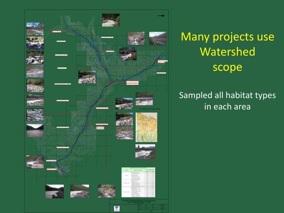
Many projects use Watershed
scope
Sampled all habitat types in each area
0
1:50.000
Plano 1.
069-2402
Febrero 2010
RP
MV
SC
La Higuera

Mekong River
At 4,350km it is the 12th
longest river in world,
and the 7th longest in Asia
Watershed:
795,000 sq km
Starting in Tibetan
Plateau, from China along
Myanmar, Thailand,
Lao PDR, through
Cambodia to Vietnam
One of the richest areas
of biodiversity in the
world
90 million people depend
on Mekong River
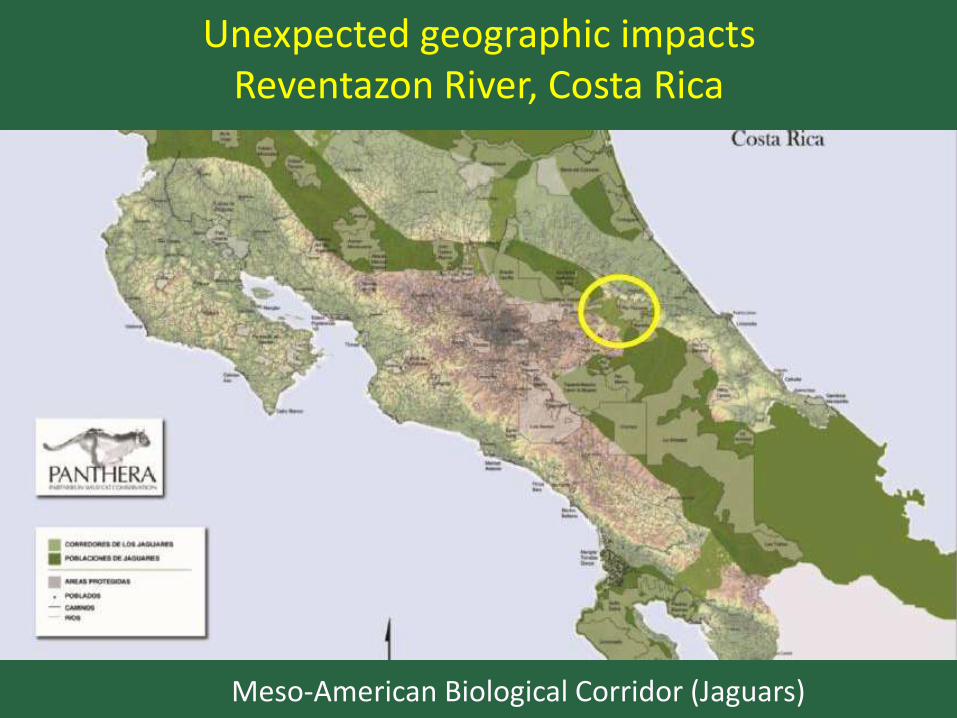
Unexpected geographic impacts Reventazon River, Costa Rica
Meso-American Biological Corridor (Jaguars)

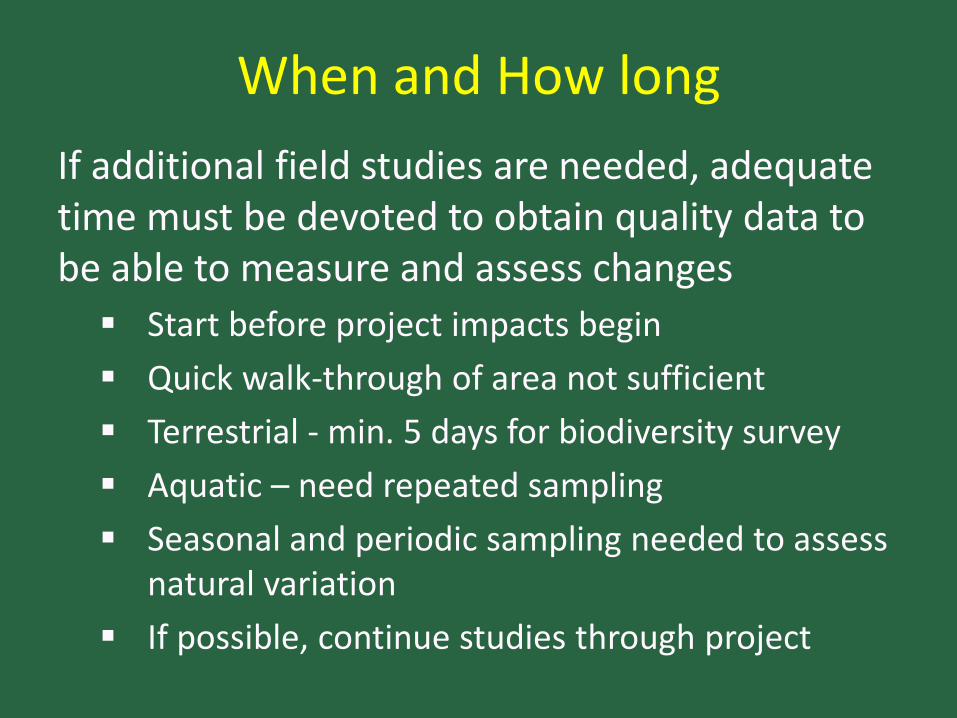
When and How long
If additional field studies are needed, adequate time must be devoted to obtain quality data to be able to measure and assess changes
Start before project impacts begin
Quick walk-through of area not sufficient
Terrestrial - min. 5 days for biodiversity survey
Aquatic – need repeated sampling
Seasonal and periodic sampling needed to assess natural variation
If possible, continue studies through project
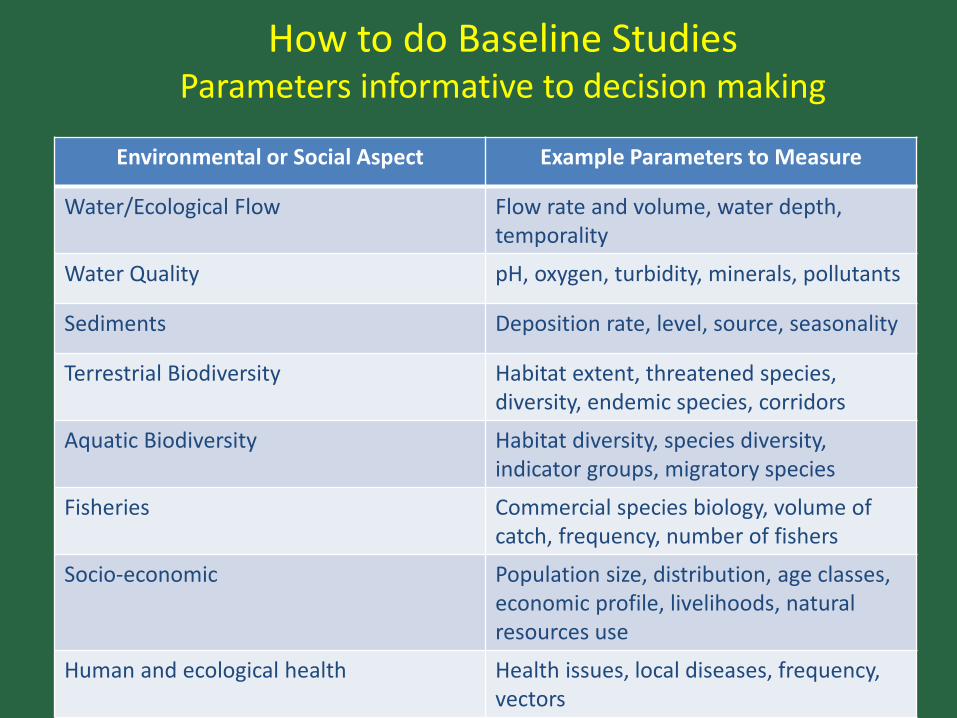
How to do Baseline Studies Parameters informative to decision making
Environmental or Social Aspect Example Parameters to Measure
Water/Ecological Flow Flow rate and volume, water depth, temporality
Water Quality pH, oxygen, turbidity, minerals, pollutants
Sediments Deposition rate, level, source, seasonality
Terrestrial Biodiversity Habitat extent, threatened species, diversity, endemic species, corridors
Aquatic Biodiversity Habitat diversity, species diversity, indicator groups, migratory species
Fisheries Commercial species biology, volume of catch, frequency, number of fishers
Socio-economic Population size, distribution, age classes, economic profile, livelihoods, natural resources use
Human and ecological health Health issues, local diseases, frequency, vectors
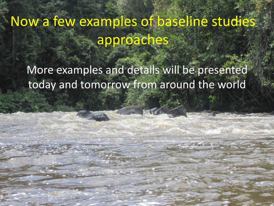
Now a few examples of baseline studies approaches
More examples and details will be presented today and tomorrow from around the world
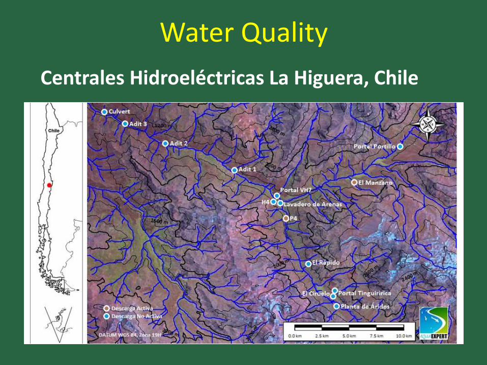
Water Quality
Centrales Hidroeléctricas La Higuera, Chile

At each sampling point (2 control and 2 impact) they measured:
• Habitat (water velocity,
substrate, width, depth)
• Water quality (conductivity, dissolved oxygen, pH, temperature, turbidity)
• Biological Community (6 Surber samples of 0.09 m2)
• Calculated index using SIGNAL 2

Biological Indicators
Invertebrate Families recorded:
Chironomidae. Family tolerant of adverse conditions (e.g. Low oxygen)
Plecoptera. Family indicator of good quality water
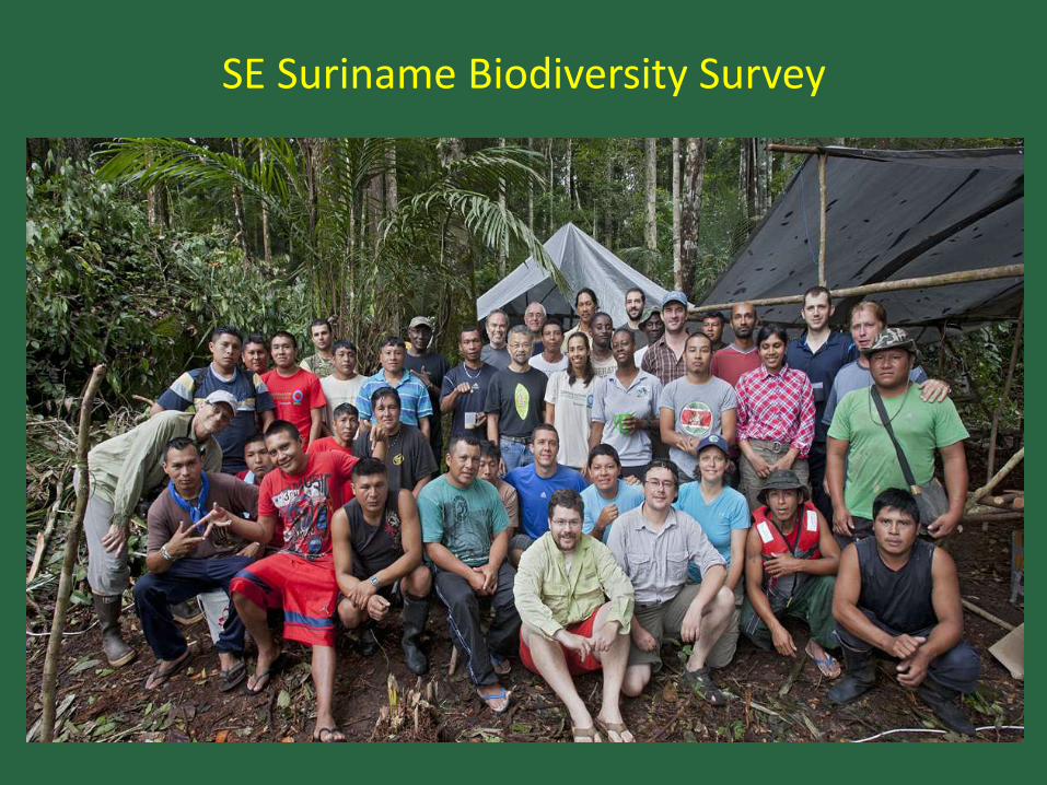
SE Suriname Biodiversity Survey

Make Vegetation Map to select sampling sites in different habitat types
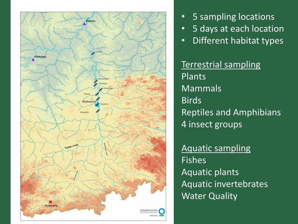
• 5 sampling locations • 5 days at each location • Different habitat types Terrestrial sampling Plants Mammals Birds Reptiles and Amphibians 4 insect groups Aquatic sampling Fishes Aquatic plants Aquatic invertebrates Water Quality
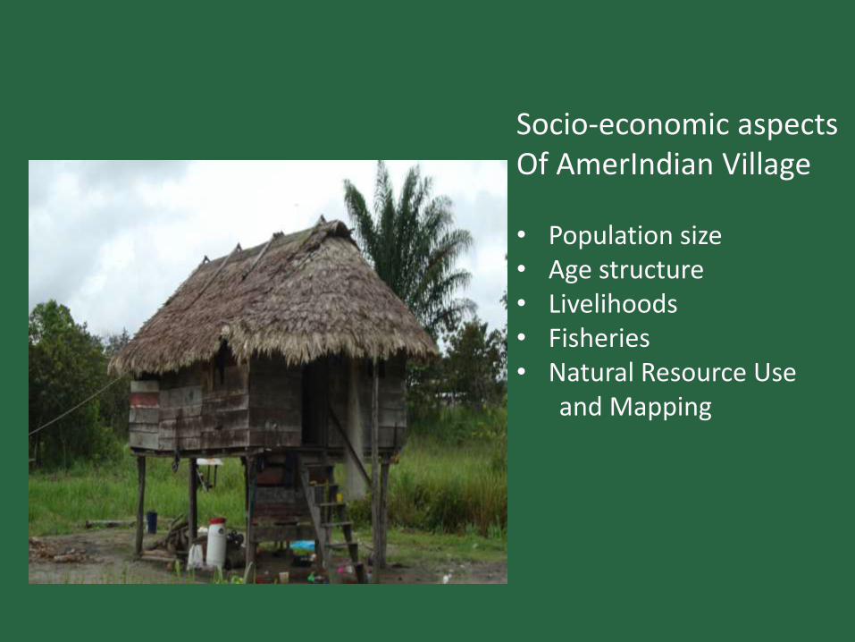
Socio-economic aspects Of AmerIndian Village • Population size • Age structure • Livelihoods • Fisheries • Natural Resource Use and Mapping

Sampling methods

Aquatic Biodiversity Mekong Delta

Over 1200 fish species (maybe 1700 species) High endemism in hill streams (upper reaches)

Cambodian inland capture fisheries ranks 4th in the world in terms of total catch
Most intense inland capture fishery in the world in terms of fish caught per capita
Over 400,000 tonnes of freshwater fish caught annually – more than that of USA and
Canada combined
Fish are a major natural asset for Cambodia, essential for food security, contributing
around 12% of Cambodia’s GDP in recent years
Fisheries - Cambodia
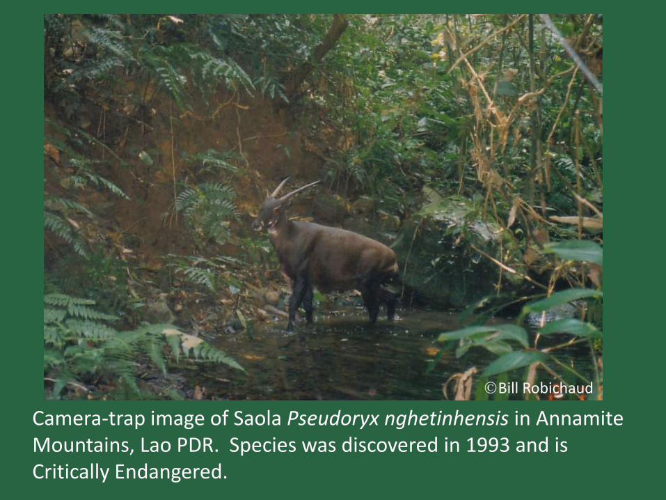
Camera-trap image of Saola Pseudoryx nghetinhensis in Annamite Mountains, Lao PDR. Species was discovered in 1993 and is Critically Endangered.
Bill Robichaud

Hydrological/Hydraulic Methods IFIM-PHABSIM: Río Carrión (Palencia)Transecto 1
Methodologies to Determine Ecological Flow (EF)
Habitat Simulation / Holistic (requires biological information)
1960’s
Present

Who - Expertise
Who does the studies is very important
Qualified individuals needed to ask the right questions and collect quality data and analyze results
Consulting firms may need to bring in outside expertise
Expert guidance is essential- either direct involvement or as advisors
Partnerships with NGOs and other groups encouraged
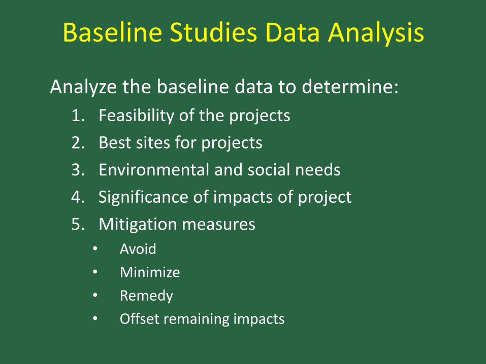
Baseline Studies Data Analysis
Analyze the baseline data to determine:
1. Feasibility of the projects
2. Best sites for projects
3. Environmental and social needs
4. Significance of impacts of project
5. Mitigation measures
• Avoid
• Minimize
• Remedy
• Offset remaining impacts

Baseline studies and Monitoring
• Are they the same?
• No, baseline studies need to establish a good dataset of the current condition so should be more comprehensive
• Monitoring involves repeated measurement of a selected set of indicators from the baseline dataset that can assess changes or measure progress of mitigation actions
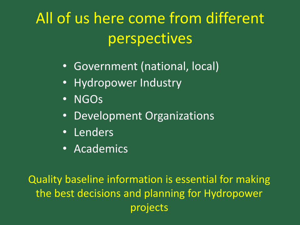
All of us here come from different perspectives
• Government (national, local)
• Hydropower Industry
• NGOs
• Development Organizations
• Lenders
• Academics
Quality baseline information is essential for making
the best decisions and planning for Hydropower projects
Good Baseline Studies need to include:
International standards and good practice Broad geographic scope Solid Background Research Adequate time and frequency before project starts Selection of parameters/measurements Internationally accepted methodologies Expertise Analysis of values
With the objective of documenting the current environmental and/or social conditions
I look forward to discussing baseline studies
with you during the workshop
Thank you!
Top Related