


Languages
Pages
Legal


City of Concord
Concord Community Reuse Project
EIR - Scoping Summary Report (Second Round)

City of Concord
Concord Community Reuse Project
EIR - Scoping Summary Report (Second Round) January 2008
This report takes into account the
particular instructions and requirements of our client. It is not intended for and should not be relied upon by any third party and no responsibility is undertaken to any third party
Arup North America Ltd 901 Market Street, Suite 260, San Francisco, CA 94103 Tel +1 415 957 9445 Fax +1 415 957 9096 www.arup.com Job number 131595

City of Concord Concord Community Reuse ProjectEIR - Scoping Summary Report (Second Round)
Q:\131595 CCRP CONTRACT 4 EIR\4 INTERNAL PROJECT DATA\4-05 REPORTS & MEMOS\SCOPING SUMMARY REPORT #2 (JAN 2008)\SCOPING SUMMARY REPORT SECOND ROUND V2 FINAL.DOC 4-05 Round 2
Arup North America LtdIssue January 9, 2008
Contents
Page 1 Introduction 1 2 Updated Initial Study and Notice of Preparation 1 3 Scoping Meeting Presentation 2 4 Scoping Meeting Participants and Comments 2 5 Other Scoping Inputs 2 6 Next Steps 2
Appendices Appendix A Environmental Checklist / Initial Study Appendix B Notice of Preparation Appendix C State Clearinghouse Distribution Letter Appendix D Sample Letter from City of Concord to Local Reviewing Agencies Appendix E Public Hearing Notice Appendix F Public Hearing Notice Published in Newspaper Appendix G PowerPoint Presentation Appendix H Scoping Meeting Participants Appendix I Scoping Meeting Transcripts Appendix J Documents Received as a Response to the Notice of Preparation and Other Related Documents
City of Concord Concord Community Reuse ProjectEIR - Scoping Summary Report (Second Round)
Q:\131595 CCRP CONTRACT 4 EIR\4 INTERNAL PROJECT DATA\4-05 REPORTS & MEMOS\SCOPING SUMMARY REPORT #2 (JAN 2008)\SCOPING SUMMARY REPORT SECOND ROUND V2 FINAL.DOC 4-05 Round 2
Page 1 Arup North America LtdIssue January 9, 2008
1 Introduction This report summarizes the second round of scoping that was undertaken to support the development of the Environmental Impact Report (EIR) for the Concord Community Reuse Project (CCRP). The purpose of the CCRP is to develop a Reuse Plan for the “Inland Area” of the Naval Weapons Station Seal Beach Detachment, Concord, CA also known as the Concord Naval Weapons Station (CNWS). The Inland Area consists of approximately 5,028 acres that is entirely located within the City of Concord.
In December 2005 the U.S. Secretary of Defense designated the City as the Local Reuse Authority (LRA) for the site and the U.S. Navy designated the site as surplus in March 2007. As a result of the Navy’s decision, the LRA is required to develop and adopt a Reuse Plan for the site. However, prior to adopting the Reuse Plan the LRA must comply with the requirements of the California Environmental Quality Act (CEQA). The City has made a determination that an EIR will be required to comply with CEQA and before it can take action to adopt a Reuse Plan.
After the EIR is certified and the Reuse Plan is adopted the plan will be submitted the U.S. Department of Housing and Urban Development to address federal requirements with respect to provisions for the homeless and to the Navy to initiate their conveyance and disposition process for the land. The Navy will need to comply with the National Environmental Policy Act (NEPA) before they can take action with respect to the transfer of property and it is expected they will prepare an Environmental Impact Statement (EIS) to address their proposed actions.
In May, 2007 the City submitted a Notice of Preparation (NOP) to the California Office of Planning and Research (OPR) that identified the decision to prepare the EIR. The NOP initiated the scoping process for the EIR. An Environmental Checklist / Initial Study (EC/IS) was also submitted with the NOP that identified the status of the planning effort at that point in time and the range of environmental issues to be addressed in the EIR. OPR circulated the EC/IS to state and federal agencies and other interested parties. The City also circulated the EC/IS to their distribution list. Notices were also posted and circulated announcing two public scoping meetings.
The two scoping meetings were held on June 14, 2007 in the Concord City Council Chambers to address the information presented in the May 2007 EC/IS. These sessions were chaired by Michael Wright, the City’s Reuse Project Director. He provided a PowerPoint Presentation about the CCRP and the EIR process. He acknowledged that because of the preliminary stage of the planning effort it was difficult to comment on the EC/IS and what should be addressed in the EIR. Therefore, Mr. Wright made a commitment to revise the EC/IS and to hold a second round of scoping after the planning process identified a range of alternative concepts for reuse of the CNWS.
After his presentation Mr. Wright opened the meeting to take testimony from individuals that had asked to speak about the EIR and the potential environmental consequences of implementing the Reuse Plan. The information presented during the initial scoping effort and the comments that were received by the City and OPR were summarized into an EIR Scoping Summary Report that was posted to the CCRP website, www.concordreuseproject.org in July 2007.
2 Updated Initial Study and Notice of Preparation During the spring and summer of 2007 an extensive community-based planning effort was undertaken to identify options for reuse of the CNWS. On October 9 the Concord City

City of Concord Concord Community Reuse ProjectEIR - Scoping Summary Report (Second Round)
Q:\131595 CCRP CONTRACT 4 EIR\4 INTERNAL PROJECT DATA\4-05 REPORTS & MEMOS\SCOPING SUMMARY REPORT #2 (JAN 2008)\SCOPING SUMMARY REPORT SECOND ROUND V2 FINAL.DOC 4-05 Round 2
Page 2 Arup North America LtdIssue January 9, 2008
Council acting as the LRA reviewed seven alternative reuse concepts and approved them for analysis in the EIR. As a result of the planning effort, a second round of scoping for the EIR was initiated and the EC/IS was revised to identify the seven alternative concepts that are to be addressed in the EIR. The revised EC/IS was completed on November 16, 2007 and is included as Appendix A. The updated EC/IS confirmed that the intent of the City was to produce the EIR at a program level.
In addition a new NOP, included as Appendix B, was submitted to OPR. The NOP was circulated and posted as required to comply with CEQA. The NOP addressed how the EC/IS could be accessed for review and included an invitation to two public scoping meetings. Appendix C provides a copy of the OPR circulation letter sent to federal and state agencies and Appendix D provides a sample copy of the City’s circulation letter and the list of local agencies to which the letter was sent. Appendix E contains a copy of the public hearing notice provided by the City and Appendix F provides a copy of the public hearing notice that was published in the Contra Costa Times.
3 Scoping Meeting Presentation
Two scoping meetings were held on November 29, 2007 in the Concord City Council Chambers. The first meeting started at 2:00 PM and the second at 6:00 PM. Mr. Wright gave a presentation, included as Appendix G, that addressed the status of the reuse planning effort, provided information on the seven alternative reuse concepts, and identified the EIR process and the issues to be included in the analysis to prepare the EIR. After his presentation Mr. Wright opened the meeting for public testimony.
4 Scoping Meeting Participants and Comments Appendix H is a listing of the individuals that attended the afternoon and evening scoping sessions. Twenty-three people attended the afternoon session and eleven provided verbal testimony. Seventeen people attended the evening session and five provided verbal testimony. Appendix I provides the transcripts from the two sessions.
5 Other Scoping Inputs During the scoping review period ten comment letters were submitted to the City. These documents are included as Appendix J.
6 Next Steps
The information presented in this Summary Report will be circulated to the team of professionals that will prepare the Draft EIR. This team has also been provided the previous Scoping Summary Report that was prepared in July, 2007. All of the information contained in these two reports will be used to help identify the potential impacts that will be addressed in the Draft EIR. The Draft EIR is scheduled to be published during the spring of 2008. The Draft EIR will be made available to public agencies and interested parties and a 45-day comment period will be provided. During the public comment period a public hearing will also be held to obtain comments on the information presented in the Draft EIR. When the public comment period is completed, responses will be developed for incorporation into the Final EIR.
After the comment period on the Draft EIR is completed, it is anticipated that additional planning will be undertaken to help refine the seven alternative concepts and to forge a consensus about what will be the preferred Reuse Plan that will be presented for action by the City Council sitting as the LRA. Before the City Council takes action to approve a Reuse Plan, the Final EIR will be circulated for review and comment.

City of Concord Concord Community Reuse ProjectEIR - Scoping Summary Report (Second Round)
Q:\131595 CCRP CONTRACT 4 EIR\4 INTERNAL PROJECT DATA\4-05 REPORTS & MEMOS\SCOPING SUMMARY REPORT #2 (JAN 2008)\SCOPING SUMMARY REPORT SECOND ROUND V2 FINAL.DOC 4-05 Round 2
Arup North America LtdIssue January 9, 2008
Appendix A Environmental Checklist / Initial Study

Environmental Checklist / Initial Study California Environmental Quality Act
SCH # 2007052094
Initial Study 2007 11 16 v5.doc 1
CITY OF CONCORD 1950 Parkside Drive, MS/1B Concord, CA 94519 PHONE: (925) 671-3019 FAX: (925) 798-0636
1. Project Title:
Concord Community Reuse Project
2. Lead Agency Name and Address:
City of Concord Local Reuse Authority 1950 Parkside Drive, MS/1B Concord, CA 94519
3. Contact Person and Phone Number:
Michael Wright, Reuse Project Director, (925) 671-3019 Reuse Project Website: www.concordreuseproject.org
4. Project Location:
Naval Weapons Station Seal Beach Detachment, Concord, CA; a.k.a. Concord Naval Weapons Station (CNWS)
5. Project Sponsor’s Name and Address:
City of Concord Local Reuse Authority 1950 Parkside Drive, MS/1B Concord, CA 94519
6. General Plan Designation:
Naval Weapons Station
7. Zoning:
(S) Study District
8. Description of Project: Project Summary
The Concord Community Reuse Project (CCRP) is a comprehensive, community-based planning and environmental review process. The objective of the CCRP is to produce two documents: a Reuse Plan, which will guide future uses on the Inland Area of the Naval Weapons Station Seal Beach Detachment, Concord, California (also known as the Concord Naval Weapons Station, or CNWS); and a Program-Level Environmental Impact Report (EIR), which will support preparation and adoption of the Reuse Plan by assessing seven reuse alternatives to understand their potential environmental impacts. Both documents will serve as platforms to support future activities that involve reuse of the CNWS. This document, the Environmental Checklist / Initial Study, is the first step towards preparing the EIR. The EIR will analyze all seven alternatives at an equal level of detail; this approach is designed to provide sufficient information so that the City could approve any one of these alternatives or combinations of alternatives. The seven alternatives are designed to reflect a reasonable range of alternatives that are potentially feasible, and that would feasibly attain most of the City’s basic objectives for the project. The final determination regarding the feasibility of alternatives, and the extent to which those alternatives meet most of the City’s basic objectives, will be made as part of the City’s final decision-making process to ultimately adopt a Reuse Plan. To help describe the CCRP, the text in this section includes the following subsections: Project Context and Background (page 2); CCRP Planning Process (page 5); Description of Alternative Concepts (including a “No Project” Alternative) (page 7); What’s Next – the Environmental Review Process (page 19); and Technical Analysis (page 19).

Initial Study 2007 11 16 v5.doc 2
The rest of the document includes the following sections: Section 9, a description of Setting and Surrounding Land Uses (page 22); Section 10, a list of other public agencies whose approval is required for the implementation of the Reuse Plan (page 23); and The Environmental Checklist, which is used to help identify whether the project may impact the environment in any of 17
categories of impacts (page 24). Project Context and Background The CCRP involves developing a plan that will guide the reuse of the approximately 5,028-acre site known as the Inland Area of the CNWS. The City of Concord (City) was designated in 2005 as the Local Reuse Authority (LRA) by the Office of the Secretary of Defense as part of the National Base Realignment and Closure (BRAC) process to develop the plan for reusing the site. The U.S. Navy designated the site as surplus on March 6, 2007. As a result of the Navy’s decision, the LRA is required to develop and adopt a Reuse Plan for the site. To adopt the Reuse Plan, the City must comply with the requirements of the California Environmental Quality Act (CEQA) (Pub. Resources Code, § 21000 et seq.). On the basis of the information presented in this Initial Study, the City has concluded that an EIR will be prepared to comply with CEQA. When the City’s efforts are complete, the Navy will also complete the federal environmental review process in accordance with the National Environmental Policy Act (NEPA). Separately, consistent with BRAC legislation, the U.S. Department of Housing and Urban Development will review the Reuse Plan to determine if it balances the needs of the homeless with the economic and land use needs of the community. The CCRP is a community-based planning process. The Concord City Council, acting as the LRA, established the Community Advisory Committee (CAC) in Fall 2006. The 21-member CAC acts in an advisory role to the LRA in matters related to the CCRP. It is comprised primarily of residents of Concord and some residents of neighboring communities. The City has also engaged local stakeholders, including non-profit groups and public agencies, in a series of Technical Advisory Groups (TAGs) established to provide input on specific topics, including Transportation, Education, Recreation, and Parks and Open Space / Conservation. The CNWS is located entirely within the incorporated City of Concord, as shown on Figure 1. Other nearby communities include Clyde, Bay Point, and Pittsburg to the north; Clayton to the east; and Walnut Creek and Pleasant Hill to the south and west. The Inland Area contains buildings, ammunition bunkers, and other infrastructure that supported the operations carried out by the Navy. Diablo Creek Golf Course is a public golf course, part of which is on land leased from the Navy in the northern part of the site. Mt. Diablo Creek is a linear feature which runs through the site from northwest to southeast. The area to the south of Mt. Diablo Creek is relatively flat with the lowest point being 14 feet above sea level. The Los Medanos Hills rise north of the creek to an elevation of more than 1,120 feet above sea level at the highest point of the ridge line. Three major highways serve the site directly or indirectly: Interstate Highway 680 (I-680), State Route 242 (SR 242), and SR 4. Two public roads traverse through the site, Willow Pass Road and Bailey Road. Some adjacent or nearby roads include Port Chicago Highway; East Olivera Road; Concord Boulevard; and Kirker Pass Road. The Bay Area Rapid Transit District (BART) metro rail system serves the area with nearby stations in Walnut Creek, Pleasant Hill, Pittsburg, and Concord, including the North Concord BART station which abuts the western edge of the site. The County Connection bus transit system serves Central Contra Costa County including routes that serve the areas around the CNWS. A more detailed site description is included in this document in Section 9, Setting and Surrounding Land Uses. In May 2007, an earlier version of this Environmental Checklist / Initial Study was submitted to the California Office of Planning and Research (OPR) to initiate the EIR process. It described the planning that had been undertaken up to that date. It was circulated for agency and public review and comment, and two public scoping meetings were held on June 14, 2007. The Scoping Summary Report that addresses how the initial scoping effort was conducted and records the comments received is available at the City of Concord Reuse Project website, www.concordreuseproject.org. The planning has since progressed through a series of public workshops and meetings, and a mix and range of possible future uses has been assembled into seven alternative concepts for reuse of the CNWS. Because more specific information about the possible reuse of the CNWS is now available, this revised Environmental Checklist / Initial Study is being circulated to solicit additional agency and public input about what should be addressed in the EIR. Broadly, all seven alternative concepts include a range of open space, recreation, residential, retail, office, education, and public benefit land uses. The alternative concepts also incorporate economic and financial considerations. The alternatives are conceptual and refinements are anticipated 1) to develop a recommended Reuse Plan and 2) after the property is conveyed from Navy ownership, when more specific land use development programs are proposed in the future by public and private partners to

Initial Study 2007 11 16 v5.doc 3
whom the land will be conveyed. More information about the seven alternative concepts is presented later in this section. The environmental analysis that will be undertaken to develop the EIR is closely integrated with the planning process. The next stage of the planning process will include consideration of the environmental impacts of the alternative concepts to help define a preferred alternative. The Reuse Plan and EIR will be the foundational documents of the CCRP. The City intends to subsequently amend the General Plan to specify the allowed future uses at the CNWS. The Reuse Plan and EIR may be used as a basis for establishing a redevelopment area, and could be used to establish assessment districts or other financing mechanisms. There may be the need for more detailed planning after the Reuse Plan is adopted to identify specific development actions, possibly including the preparation of specific plans or other special studies. More information about the integration of the planning process with the environmental analysis is presented below. The EIR that will be produced will be a program-level document that will analyze the environmental impacts of the seven alternative concepts. The analysis will be undertaken from a broad-based perspective, which will be appropriate for eventually approving the Reuse Plan and subsequent General Plan amendment, and for supporting creation of a redevelopment area and other assessment districts, if they are appropriate. As more detailed planning is undertaken in the future, subsequent environmental studies will be conducted to analyze potential environmental impacts at a finer level of detail. Subsequent project-level environmental reviews would “tier” off the EIR in accordance with the rules governing Program-level EIRs and tiering. (See Cal. Pub. Resources Code, §§ 21068.5, 21093, 21094).

OakleyAntioch
Livermore
San Ramon
Danville
DublinCastro ValleySan Leandro
San Francisco
Oakland
Alameda
Pittsburg
Walnut Creek
ConcordPleasant Hill
Martinez
Benicia
San Pablo
Richmond
Berkeley
Suisun CityFairfield
Vallejo
Napa
Clayton
Alamo
LafayetteOrinda
Hercules
Brentwood
S O L A N O
S A NM A T E O
S A NF R A N C I S C O
N A P A
CONTRA COSTACOUNTY
A L A M E D A
§̈¦580
§̈¦680
§̈¦580
§̈¦680
§̈¦80
§̈¦780
§̈¦280
§̈¦80
§̈¦880
£¤101
UV24
UV121
UV4
UV37 UV29
UV123
UV238
UV113
UV12
UV61
UV84
UV4
UV185
UV13
UV12
S a n P a b l o B a y
S a n F r a n c i s c oB a y
S u i s u n B a y
Sacram
ento R
iver
ConcordNaval Weapons
Station
Figure 1Concord Naval Weapons Station Regional Location Map
N
0 3 6 91.5 Miles
LEGEND
County Boundary
Concord City Limit
Study Area

Initial Study 2007 11 16 v5.doc 5
CCRP Planning Process
The CCRP features close integration between the community-based planning process and the environmental analysis. The following timeline outlines how the results of the planning process have been used to help define the seven alternative concepts. Goal-Setting and Information Gathering: Summer 2006 – March 2007 The project started with an extensive public process in Summer 2006 which resulted in the creation of a Planning Framework that defined overarching goals; specific goals; and guiding principles for the Reuse Plan. The four overarching goals are to: Develop a world-class project; Achieve a balanced approach; Provide for economically viable and sustainable development; and Ensure quality of life.
These overarching goals continue to be used today. The Planning Framework was adopted and published in August 2006, completing Stage 1 of the CCRP. The Stage 1 report is available online at the City of Concord Reuse Project website at www.concordreuseproject.org (for details, see the “For More Information” section on the next page). Stage 2 of the planning process began in November 2006 and the first phase of work culminated in a public information Open House on March 17, 2007, during which approximately 30 displays and illustrations were presented on a variety of topics related to the project site, as shown on Figure 2. Site Capacity and Constraints Analysis: April 2007 – June 2007 The next phase of work began following the March Open House. An analysis of the CNWS site capacities and constraints was shared with the public at a workshop held on April 21, 2007 entitled, “Applying Goals and Guiding Principles.” After a presentation, the attendees spent the bulk of the workshop time engaged in a community planning exercise involving the placement of pieces on diagrams spanning the site, illustrated on Figure 3. As a result, the public expressed strong preferences for the following themes: Higher intensity uses around the North Concord BART station; Lower intensity uses between Willow Pass Road and Bailey Road; Preservation of the Los Medanos Hills above a 30
percent grade and the ridgeline, with incorporation of hiking trails; and
Protection and enhancement of Mt. Diablo Creek with a trail along the creek for walking and biking.
The next workshop, which was held on June 16, 2007 and entitled, “Balancing the Land Use Mix,” was focused on examining the possible choices to be made in terms of scale, magnitude, and balance of land uses on the site as well as understanding connections and relationships between the site and the existing urbanized area. Figure 4 illustrates a few examples of the 15 site diagrams. Each table of participants completed a diagram that represented approximately a third of the site.
Figure 2. Photo of March 17 Open House
Figure 3. April 21 Workshop participants
Figure 4. Three sample site diagrams from the June 16 workshop
Initial Study 2007 11 16 v5.doc 6
It was also at this time in May 2007 that the first Environmental Checklist / Initial Study was issued for public and agency review and comment (see “Project Context and Background” section above for details). Key Issues and Development of Alternative Concepts: July 2007 – September 2007 While the planning exercise at the June workshop provided a broad foundation for understanding the community’s desires and expectations, the wide variety of schemes and the feedback from the CAC indicated that additional comment and discussion from policymakers was needed to help guide the development of a set of alternatives. Feedback from policymakers and the public was received at a series of meetings on four key issues: Level of intensity; Arrangement of land uses and transit; Distribution of open space; and Role of buffers and transitions.
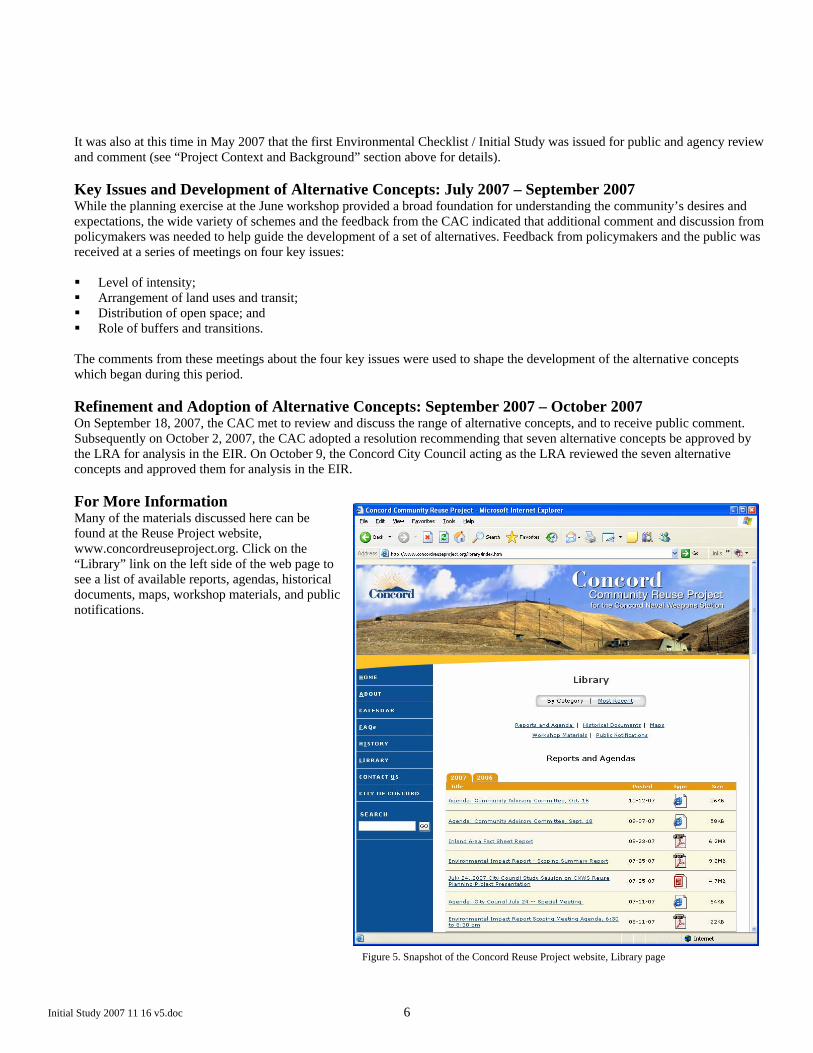
The comments from these meetings about the four key issues were used to shape the development of the alternative concepts which began during this period. Refinement and Adoption of Alternative Concepts: September 2007 – October 2007 On September 18, 2007, the CAC met to review and discuss the range of alternative concepts, and to receive public comment. Subsequently on October 2, 2007, the CAC adopted a resolution recommending that seven alternative concepts be approved by the LRA for analysis in the EIR. On October 9, the Concord City Council acting as the LRA reviewed the seven alternative concepts and approved them for analysis in the EIR. For More Information Many of the materials discussed here can be found at the Reuse Project website, www.concordreuseproject.org. Click on the “Library” link on the left side of the web page to see a list of available reports, agendas, historical documents, maps, workshop materials, and public notifications.
Figure 5. Snapshot of the Concord Reuse Project website, Library page

Initial Study 2007 11 16 v5.doc 7
Description of Alternative Concepts The seven alternative concepts to be addressed in the EIR have been developed based on careful consideration of the specific characteristics of the site, potential opportunities and constraints, historical context, regional context, remediation needs, market realities, access, and other planning considerations. They are intended to “bracket” a wide range of possible land uses, configurations, and intensities that may ultimately be possible with the implementation of the Reuse Plan. They are sufficiently defined for purposes of preparing a Program-Level EIR. However, they are flexible enough to accommodate some changes and further refinement resulting from new data generated from studies in process, from potential public benefit conveyance and homeless assistance proposals that will be considered by the LRA as part of the BRAC process, and from future planning activities. Organizing Themes The seven alternative concepts can be divided into three broad organizing themes, which reflected comments and guidance from the public and policymakers. The three themes are: Extended Neighborhoods; Clustered Villages; and Concentration and Conservation. After these three themes are introduced in relation to the seven alternative concepts, the components common to all seven of the alternatives are identified as are specific considerations common to the seven alternatives. Based on this foundation, the key issues and elements of each alternative are presented. Extended Neighborhoods – Alternative Concept 1 – Maintaining consistency with the recent history of development in
Concord, and maximizing compatibility with the existing neighborhoods that border the CNWS;
Clustered Villages – Alternative Concepts 2, 3, 6 – Concentrating uses in neighborhood “villages” which are linked together
by high-quality transit service and intensifying some uses to gain space for parks, recreation, and open space; and
Concentration and Conservation – Alternative Concepts 4, 5, 7 – Exploring opportunities to maximize parks, recreation, and open space, and focusing the remainder of uses around the North Concord BART station and north of Willow Pass Road.
1
2 3 6
4 5 7
Initial Study 2007 11 16 v5.doc 8
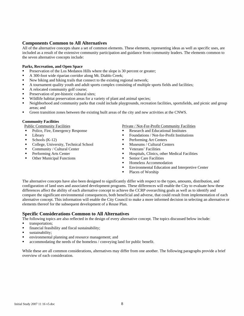
Components Common to All Alternatives All of the alternative concepts share a set of common elements. These elements, representing ideas as well as specific uses, are included as a result of the extensive community participation and guidance from community leaders. The elements common to the seven alternative concepts include: Parks, Recreation, and Open Space Preservation of the Los Medanos Hills where the slope is 30 percent or greater; A 300-foot wide riparian corridor along Mt. Diablo Creek; New biking and hiking trails that connect to the existing regional network; A tournament quality youth and adult sports complex consisting of multiple sports fields and facilities; A relocated community golf course; Preservation of pre-historic cultural sites; Wildlife habitat preservation areas for a variety of plant and animal species; Neighborhood and community parks that could include playgrounds, recreation facilities, sportsfields, and picnic and group
areas; and Green transition zones between the existing built areas of the city and new activities at the CNWS.
Community Facilities
Public Community Facilities Police, Fire, Emergency Response Library Schools (K-12) College, University, Technical School Community / Cultural Center Performing Arts Center Other Municipal Functions
Private / Not-For-Profit Community Facilities Research and Educational Institutes Foundations / Not-for-Profit Institutions Performing Art Centers Museums / Cultural Centers Veterans’ Facilities Hospitals, Clinics, other Medical Facilities Senior Care Facilities Homeless Accommodation Environmental Education and Interpretive Center Places of Worship
The alternative concepts have also been designed to significantly differ with respect to the types, amounts, distribution, and configuration of land uses and associated development programs. These differences will enable the City to evaluate how these differences affect the ability of each alternative concept to achieve the CCRP overarching goals as well as to identify and compare the significant environmental consequences, both beneficial and adverse, that could result from implementation of each alternative concept. This information will enable the City Council to make a more informed decision in selecting an alternative or elements thereof for the subsequent development of a Reuse Plan. Specific Considerations Common to All Alternatives The following topics are also reflected in the design of every alternative concept. The topics discussed below include: transportation; financial feasibility and fiscal sustainability; sustainability; environmental planning and resource management; and accommodating the needs of the homeless / conveying land for public benefit.
While these are all common considerations, alternatives may differ from one another. The following paragraphs provide a brief overview of each consideration.

Initial Study 2007 11 16 v5.doc 9
Transportation A common backbone road network was developed that makes provision for access through the site and connections into the surrounding road network. This network varies in scale by alternative but has the following common elements: Limited crossings of Mt. Diablo Creek; Limited access into the neighborhoods to the west of the site; and Extension of some existing streets.
The North Concord BART station is a key element in the transportation program, and transit oriented development is a feature of all alternative concepts. There is, however, a variance in intensity among the alternatives. In addition, where the intensity of uses and land use arrangement allow, there could be high capacity bus service providing service to BART and connections to other parts of Concord. Financial Feasibility and Fiscal Sustainability An initial assessment of the financial feasibility and fiscal sustainability of each alternative concept has been completed. Financial feasibility means that the revenues (e.g., new home prices or office rents) must be sufficient to cover all of the developers’ costs for land acquisition and preparation, construction of commercial, residential and designated community facilities/infrastructure, and still allow a reasonable profit to the private sector developer. Fiscal sustainability means that the fiscal revenues (e.g. taxes and fees) generated by the development must at least be sufficient to cover all the service and facilities/infrastructure costs expected to be incurred by the City as a result of the development and impose no net burden on the General Fund. This “point in time” analysis evaluated financial feasibility and fiscal sustainability assuming full build-out in 2007 dollars. The results are summarized in the description of each alternative concept. In general terms, the analysis suggests that all the alternative concepts are potentially feasible, and are therefore suitable to be taken forward for further study. The City will make final determinations of financial feasibility at the time they approve a plan, along with other factors affecting feasibility and/or the attainment of the City’s basic project objectives. This determination will be based on the EIR, and on all other information available to the City at the time it makes its decision. Sustainability The CCRP Planning Framework established the broad targets for sustainability, and community and professional planning efforts have been focused on a key building block of sustainability – the choice, location, intensity, and mix of land uses on the site. The strategies and techniques available to each alternative concept are very broad at this point but include, for example, a mix of uses affording easy access to all aspects of daily life (e.g. home, work, school, play, and shops), the use of renewable energy, such as solar and wind, adopting green building techniques, and providing the infrastructure and facilities to encourage walking, biking, and transit. Environmental Planning and Resource Management The site has areas of contamination, sensitive habitats, and endangered species. Using existing literature, conducting focused verification studies, and through informal discussions with regulators, the alternative concepts have been developed to initiate incorporation of steps to avoid, minimize, or mitigate potential impacts to or from these resources. These steps will be further refined and the alternative concepts altered as additional investigations are completed by the Navy and the City. Accommodating the Needs of the Homeless / Conveying Land for Public Benefit Based on federal statute, notices of interest were requested to be submitted by September 26, 2007 from public agencies, not-for-profit groups, and other organizations that have an interest or role in accommodating the needs of the homeless, or that have an interest in a conveyance of land for public benefit. The types and location of uses requested will be considered by the LRA and may alter some or all of the alternative concepts. Each alternative concept has a base assumption for affordable housing in accord with current policies set in the Housing Element of the City’s General Plan.

Initial Study 2007 11 16 v5.doc 10
Individual Alternative Concept Descriptions A brief description of each of the proposed alternative concepts is provided below. Additional details are provided in the Proposed Alternative Concepts document that was issued at the City Council meeting on October 9, 2007, and available on the Reuse Project website at www.concordreuseproject.org. For each alternative concept presented below, a brief introductory paragraph highlights the features of the alternative. The paragraph is followed by a summary diagram including types and intensities of land uses and a potential roadway network. Please note two abbreviations in the land use key: “TOD” is an acronym for “Transit Oriented Development” which refers to the concept of building residential, commercial, and other land uses around a transit station at intensities sufficiently high to support increased transit ridership. “DU/Ac” refers to residential intensity in terms of “Dwelling Units per Acre”. More detail about each of the land use categories is also included in the Proposed Alternative Concepts document referenced above. Following each summary diagram is a list of bullet points highlighting the key points about the alternative in terms of land use distribution and intensity, transportation networks, and open space. Finally, each alternative concept ends with a short table listing key characteristics. The seven alternative concepts are presented in the following order: Extended Neighborhoods Alternative Concept 1: Extending the Neighborhoods
Clustered Villages Alternative Concept 2: Connected Villages Alternative Concept 3: Creek Park Villages Alternative Concept 6: West Side Villages
Concentration and Conservation Alternative Concept 4: Concord Park Alternative Concept 5: Concentration and Conservation Alternative Concept 7: Conservation First
In addition, a “No Project” Alternative will be analyzed in the EIR for comparison purposes. A description of the circumstances which comprise the “No Project” Alternative is included following the descriptions of the seven alternative concepts.

Initial Study 2007 11 16 v5.doc 11
Alternative Concept 1: Extending the Neighborhoods
This alternative concept represents an extension of Concord’s present land use pattern of single-family, suburban development that is found in much of the city today. Areas are reserved for open space/habitat conservation in the Los Medanos Hills and adjacent to Mt. Diablo Creek, and city parks are integrated throughout the site. Some higher intensity of uses around the North Concord BART station would encourage transit use for those living and working close to the station. However, it is generally expected that residents and workers would need to depend on private vehicles for their mobility needs.
Key Elements: Land Use: This alternative is most similar to the existing adjacent residential neighborhoods, with 85 percent of housing
units being single-family and distributed fairly evenly throughout most areas of the site. The area adjacent to the existing North Concord BART station would accommodate some higher density housing and commercial use, but the intensity of use would be less than that found in the other alternatives.
Transportation: This alternative features a limited-access, higher-speed parkway east of Mt. Diablo Creek that would connect Kirker Pass Road to SR 4. An extensive network of arterial and collector roads would serve the lower density residential areas. Community shuttles or local bus transit might be supported at a level of service similar to that provided in Concord today.
Open Space: Active parks and recreation are reserved in areas adjacent to Mt. Diablo Creek and in the hills next to the North Concord BART station, though of the seven alternative concepts, this alternative has the least total acreage and percentage of parks, recreation, and open space.
Key Characteristics:
Population 21,500 people Housing Units 7,900 units Single-family / Multi-family Units 85 percent single-family; 15 percent multi-family Employment 17,700 jobs Commercial Space 5,050,000 square feet Parks, Recreation, and Open Space 2,250 acres (47 percent)
Alternative Concept 1
Extending the Neighborhoods
Initial Study 2007 11 16 v5.doc 12
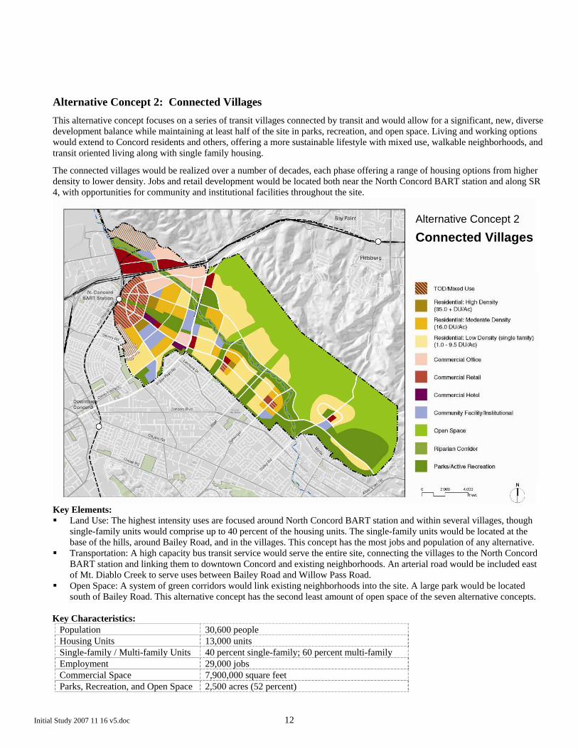
Alternative Concept 2: Connected Villages
This alternative concept focuses on a series of transit villages connected by transit and would allow for a significant, new, diverse development balance while maintaining at least half of the site in parks, recreation, and open space. Living and working options would extend to Concord residents and others, offering a more sustainable lifestyle with mixed use, walkable neighborhoods, and transit oriented living along with single family housing.
The connected villages would be realized over a number of decades, each phase offering a range of housing options from higher density to lower density. Jobs and retail development would be located both near the North Concord BART station and along SR 4, with opportunities for community and institutional facilities throughout the site.
Key Elements: Land Use: The highest intensity uses are focused around North Concord BART station and within several villages, though
single-family units would comprise up to 40 percent of the housing units. The single-family units would be located at the base of the hills, around Bailey Road, and in the villages. This concept has the most jobs and population of any alternative.
Transportation: A high capacity bus transit service would serve the entire site, connecting the villages to the North Concord BART station and linking them to downtown Concord and existing neighborhoods. An arterial road would be included east of Mt. Diablo Creek to serve uses between Bailey Road and Willow Pass Road.
Open Space: A system of green corridors would link existing neighborhoods into the site. A large park would be located south of Bailey Road. This alternative concept has the second least amount of open space of the seven alternative concepts.
Key Characteristics:
Population 30,600 people Housing Units 13,000 units Single-family / Multi-family Units 40 percent single-family; 60 percent multi-family Employment 29,000 jobs Commercial Space 7,900,000 square feet Parks, Recreation, and Open Space 2,500 acres (52 percent)
Alternative Concept 2
Connected Villages

Initial Study 2007 11 16 v5.doc 13
Alternative Concept 3: Creek Park Villages
In this alternative concept an expanded city-wide Creek Park would serve as the signature feature, with mixed use villages linking to and surrounding the park. An intensely developed mixed-use village would create a front door to the area at the North Concord BART station, with open space and creek corridor links to Creek Park. South of Willow Pass Road, three additional transit villages would work together to create a meandering new development edge where the City meets the park. This alternative would also accommodate a potential research or education campus along Bailey Road.
Key Elements: Land Use: This concept is similar in arrangement to Alternative Concept 2 but has fewer housing units and jobs. It keeps the
same proportion of single-family (40 percent) to multi-family (60 percent) units, but accommodates Creek Park and the campus along Bailey Road by reducing the number of housing units and jobs and by shifting some of the lower-density housing units south of Bailey Road.
Transportation: Similar to Alternative Concept 2, a high capacity bus transit service would serve the entire site. An arterial road would be included east of Mt. Diablo Creek to link the uses at Bailey Road to Willow Pass Road.
Open Space: Creek Park shares the benefits of open space throughout the site – placing a significant amenity next to urban densities and defining a clear development limit to the park edge. This alternative has a greater percentage of total parks, recreation, and open space (55 percent) than Alternative 2 (52 percent).
Key Characteristics:
Population 27,000 people Housing Units 11,300 units Single-family / Multi-family Units 40 percent single-family; 60 percent multi-family Employment 23,000 jobs Commercial Space 6,300,000 square feet Parks, Recreation, and Open Space 2,650 acres (55 percent)
Alternative Concept 3
Creek Park Villages

Initial Study 2007 11 16 v5.doc 14
Alternative Concept 6: West Side Villages
Alternative Concept 6 would focus development west of Mt. Diablo Creek and north of Willow Pass Road, creating a contiguous open space and conservation area east of the creek. Development would be concentrated near the North Concord BART station, north of SR 4 and Willow Pass Road, and in two transit-accessible mixed-use residential villages south of Willow Pass Road and west of the creek. This alternative concept would include a linear urban park on the southern edge of the site adjacent to existing Concord neighborhoods, provide recreational facilities for the broader community, and serve as a buffer to existing development. The alternative would accommodate a major institutional use or potential campus on Willow Pass Road near SR 4.
Key Elements: Land Use: The uses in this concept are concentrated further into villages in order to maximize the amount of open space.
There are also significantly fewer housing units than the other village concepts (Alternative Concepts 2 and 3) and about the same number of housing units as Alternative Concept 1. This alternative would generate more jobs than Alternative Concept 1 but fewer jobs than Alternative Concepts 2 and 3.
Transportation: This is the third and last concept that would likely support a high capacity bus transit service, which would connect the area north of Willow Pass Road and the residential villages south of Willow Pass Road to the North Concord BART station and with downtown Concord. Consistent with the location of development, the roadway network would not extend to the east side of Mt. Diablo Creek or to Kirker Pass Road.
Open Space: This concept has the highest proportion of parks, recreation, and open space (72 percent) compared to Alternative Concepts 2 and 3, with more than half the site in open space conservation, and recreational facilities located nearer existing neighborhoods.
Key Characteristics:Population 18,100 people Housing Units 8,000 units Single-family / Multi-family Units 30 percent single-family; 70 percent multi-family Employment 20,900 jobs Commercial Space 5,800,000 square feet Parks, Recreation, and Open Space 3,500 acres (72 percent)
Alternative Concept 6
West Side Villages

Initial Study 2007 11 16 v5.doc 15
Alternative Concept 4: Concord Park
Signature parks, east and west of Mt. Diablo Creek are a key feature of this alternative concept. As such, this alternative concept would bring the park to the City, extending all the way to the existing City edge and framing this park with newly developed areas. The City-wide park and open space would be expected to have an area-wide draw.
Key Elements: Land Use: More intense uses are focused near the North Concord BART station while lower density uses are located near
Bailey Road, creating space for Concord Park in the middle of the site. This concept is most similar to Alternative Concept 6 in numbers of housing units and jobs but has a higher proportion of single-family housing units and less land available for parks, recreation, and open space. Compared to Alternative Concept 1, this concept has more housing units and jobs but also has a higher amount of open space.
Transportation: This concept would likely support neighborhood shuttle services or local bus service at the northern end of the site, whereas the rest of the site would be more dependent on private vehicles. The roadway network would connect the lower intensity uses near Bailey Road to Willow Pass Road as well as to Kirker Pass Road.
Open Space: This alternative concept features a large city park adjacent to existing neighborhoods and recreation corridors which link to expanded open space areas. It has a greater amount of land for parks, recreation, and open space (58 percent) than Alternative Concepts 1, 2, and 3.
Key Characteristics:
Population 22,000 people Housing Units 8,900 units Single-family / Multi-family Units 55 percent single-family; 45 percent multi-family Employment 21,000 jobs Commercial Space 5,750,000 square feet Parks, Recreation, and Open Space 2,800 acres (58 percent)
Alternative Concept 4
Concord Park

Initial Study 2007 11 16 v5.doc 16
Alternative Concept 5: Concentration and Conservation
Alternative Concept 5 would concentrate a significant amount of housing, retail, and commercial uses to the north of Willow PassRoad. Both the residual open space area and intensified transit-oriented development area would potentially create signature components – a program that would minimize the development footprint, maximize densities, and offer a different way of living. The rest of the site would be left as open space with some limited active recreation. The developed area would be characterized by intensive mixed-use development. Uses would be layered, one above the other, and linked to structured parking. High densities combined with the pattern of development would establish walkable neighborhoods, work, and shopping areas.
Key Elements: Land Use: Uses are focused in the area north of Willow Pass Road. This concept has the highest number of housing units and
jobs of the three “concentration and conservation” concepts (Alternative Concepts 4, 5, and 7), and it is the most intense as it has the lowest proportion of single-family housing units (27 percent) of all the alternative concepts.
Transportation: The intensity of uses north of Willow Pass Road would likely support an extensive network of neighborhood shuttles or other local transit services which would provide circulation within the area and to downtown Concord. One roadway serving the park west of Mt. Diablo Creek would connect Willow Pass Road to Bailey Road.
Open Space: Almost all of the land south of Willow Pass Road is set aside for a large open space focused on conservation and habitat protection. This concept is one of three that has more than 70 percent open space, while it has more housing units than four other alternatives and more jobs than five other alternatives.
Key Characteristics:
Population 22,300 people Housing Units 10,000 units Single-family / Multi-family Units 27 percent single-family; 73 percent multi-family Employment 23,500 jobs Commercial Space 6,200,000 square feet Parks, Recreation, and Open Space 3,450 acres (71 percent)
Alternative Concept 5
Concentration and Conservation

Initial Study 2007 11 16 v5.doc 17
Alternative Concept 7: Conservation First
Alternative Concept 7 would maximize open space conservation by concentrating all development north of Willow Pass Road, and west of Mt. Diablo Creek, and in the area north of SR 4. Open space would extend from SR 4, east of the creek, to the southern end of the site. The alternative also would provide opportunities for active recreation in a large park south of Willow Pass Road and west of Mt. Diablo Creek.
Key Elements: Land Use: This concept features the smallest development footprint of all the alternatives, and contains development within
the area north of Willow Pass Road. The residential uses are similar in intensity to those in the first two clustered village concepts, Alternative Concepts 2 and 3, with 40 percent of housing units falling in the single-family category. However, because the footprint is smaller, this concept has the least number of housing units of all the alternative concepts and only has more jobs than Alternative Concept 1.
Transportation: A network of shuttle transit routes would connect the developed areas with the North Concord BART station and downtown Concord. The roadway network would not extend to the east of Mt. Diablo Creek, and roads would not connect between Willow Pass Road and Bailey Road except perhaps for local access roads to the park and active recreation uses.
Open Space: This concept has the highest amount of land for parks, recreation, and open space (81 percent) than any other alternative, with all of the land south of Willow Pass Road and additional areas north of Willow Pass Road dedicated to those uses.
Key Characteristics:
Population 14,700 people Housing Units 6,250 units Single-family / Multi-family Units 40 percent single-family; 60 percent multi-family Employment 18,100 jobs Commercial Space 5,200,000 square feet Parks, Recreation, and Open Space 3,900 acres (81 percent)
Alternative Concept 7
Conservation First

Initial Study 2007 11 16 v5.doc 18
Summary Tables of Key Characteristics of the Alternative Concepts The tables below summarize the key characteristics listed in each alternative concept description above. The tables are grouped by organizing theme and in the order the alternative concepts are presented above. Extended Neighborhoods
Alternative Concept 1: Extending the Neighborhoods
Population 21,500 people Housing Units 7,900 units Single-family / Multi-family Units
85 percent single-family; 15 percent multi-family
Employment 17,700 jobs Commercial Space 5,050,000 square feet Parks, Recreation, and Open Space
2,250 acres (47 percent)
Clustered Villages
Alternative Concept 2: Connected Villages 3: Creek Park Villages
6: West Side Villages
Population 30,600 people 27,000 people 18,100 people Housing Units 13,000 units 11,300 units 8,000 units Single-family / Multi-family Units
40 percent single-family; 60 percent multi-family
40 percent single-family; 60 percent multi-family
30 percent single-family; 70 percent multi-family
Employment 29,000 jobs 23,000 jobs 20,900 jobs Commercial Space 7,900,000 square feet 6,300,000 square feet 5,800,000 square feet Parks, Recreation, and Open Space
2,500 acres (52 percent) 2,650 acres (55 percent) 3,500 acres (72 percent)
Concentration and Conservation
Alternative Concept 4: Concord Park 5: Concentration and Conservation
7: Conservation First
Population 22,000 people 22,300 people 14,700 people Housing Units 8,900 units 10,000 units 6,250 units Single-family / Multi-family Units
55 percent single-family; 45 percent multi-family
27 percent single-family; 73 percent multi-family
40 percent single-family; 60 percent multi-family
Employment 21,000 jobs 23,500 jobs 18,100 jobs Commercial Space 5,750,000 square feet 6,200,000 square feet 5,200,000 square feet Parks, Recreation, and Open Space
2,800 acres (58 percent) 3,450 acres (71 percent) 3,900 acres (81 percent)

Initial Study 2007 11 16 v5.doc 19
“No Project” Alternative The “No Project” Alternative may be defined as the continuation of an existing plan, policy, or procedure or as failure to implement an action. The “No Project” Alternative provides a benchmark to compare the magnitude of the environmental effects of the various alternatives. Under the “No Project” Alternative, the Navy would retain ownership of the Inland Area of the CNWS. Except for buildings currently used for maintenance of the site, all buildings would remain vacant, and all other facilities would remain but would be unused. No new leases would be entered into under the “No Project” Alternative, and existing leases would continue until they expire or are terminated. The property would be held in an inactive or caretaker status. This is consistent with current zoning and General Plan designations which indicate military use, and there are no other adopted land use plans indicating different future uses. It is also recognized that the Inland Area would not be expected to be used actively by the military, given the Navy’s mandate to close the base. A set of assumptions consistent with a “No Project” Alternative might include: Maintain structures to limit deterioration. Maintain existing perimeter fencing; fire / security services would continue patrolling the site and controlling access. Provide limited maintenance of roads to ensure access. Provide limited grounds maintenance of open areas to eliminate fire, health, and safety hazards. Maintain and renew existing grazing leases. Continue operation of the portion of the Diablo Creek Golf Course on the land leased from the Navy. Continue site remediation of areas with identified contamination.
What’s Next – the Environmental Review Process Moving forward, the City will prepare a Program-Level EIR pursuant to CEQA. The EIR will enable the City to evaluate the environmental impacts of the series of actions related to the Reuse Project. The EIR will evaluate how well each of the seven alternative concepts convert the site to civilian uses, to identify the beneficial and adverse environmental effects that may result from the conversion, to identify ways to avoid or substantially lessen significant adverse environmental effects, and to provide a comparative analysis of the environmental effects. The EIR will inform decision makers and the public of the potential environmental impacts associated with each of the alternative concepts. This information will enable the City Council to make a more informed decision in development and adoption of a Reuse Plan. It will also create a foundation for future environmental review of specific development plans. Specifically between October 2007 and Spring 2008, the City will do the following: Issue a new “Notice of Preparation of an EIR” and circulate the revised “Environmental Checklist / Initial Study” (this
document) and accept written comments for a period of 30 days; Conduct public scoping meetings to take public testimony; and Prepare a Draft EIR and accept written comments for a period of 45 days.
Upon conclusion of the scoping meeting and review period for the Environmental Checklist / Initial Study, the City will prepare the Draft EIR. The Draft EIR is anticipated to be available for public review in the first quarter of 2008, at which time a Notice of Completion of the document will be filed with the California Office of Planning and Research and circulated to all interested parties. The Draft EIR will be made available for public comment and then will be revised to address the comments that are received, including any additional analysis that is required. The City intends to use the analysis from the environmental review process to aid in reducing the seven alternative concepts to a final recommended Reuse Plan. A Final EIR will be presented to the City Council for a decision on the adequacy of the EIR as a basis for ultimately adopting the Reuse Plan. Technical Analysis The development of this Environmental Checklist / Initial Study represents the next step to comply with the requirements of CEQA. This Environmental Checklist / Initial Study serves the following purposes: (1) it describes the project, including its location; (2) it describes the project’s environmental setting; (3) it provides information identifying the project’s environmental effects by use of a matrix; (4) it introduces ways to mitigate the significant effects identified; and (5) it examines whether the project would be consistent with existing zoning, plans, and other applicable land use controls. (CEQA Guidelines, § 15063, subd. (d).). This document identifies the potential environmental impacts associated with the implementation of any of the seven alternative concepts. It is based on review of a sizeable body of documentation that has been prepared about the site and its surroundings as well as field observations. There is sufficient information about the site and its surroundings to be able to make

Initial Study 2007 11 16 v5.doc 20
an initial evaluation about the possible environmental consequences of reuse. For example, previous reports have identified that certain areas on the site have sensitive biological species and their habitats, known cultural resources, and areas of known contamination that need to be reflected in the planning for reuse. Understanding these and other environmental conditions will aid the planning process to further recognize opportunities to avoid, minimize, or mitigate potential environmental impacts and to identify restoration or enhancement opportunities. This understanding will also help focus the environmental analysis so that the EIR addresses the potentially significant impacts that could result from implementation of any of the alternative concepts. Based on this evaluation, as introduced previously, the City has determined that the implementation of any of the seven alternative concepts may have a significant effect on the environment and the potential impacts will be evaluated in the EIR. This Environmental Checklist / Initial Study reflects more detailed information about the potential consequences of ultimately implementing the Reuse Plan for the CNWS. As such it reflects more information about the range of seven alternative concepts under consideration that have been identified since the initial Environmental Checklist / Initial Study was circulated for review and comment. This Environmental Checklist / Initial Study is also open to public comment and review by other public agencies to identify any other environmental factors that should be analyzed for the EIR. The review period will last 30 days from the date of issue. Public scoping meetings will also be held during that period to gather input about what analysis should be included in the EIR. In May 2007, an earlier version of this Environmental Checklist / Initial Study was submitted to the California Office of Planning and Research (OPR) to initiate the EIR process. It described the planning that had been undertaken up to that date. It was circulated for agency and public review and comment, and two public scoping meetings were held on June 14, 2007. The Scoping Summary Report that addresses how the initial scoping effort was conducted and records the comments received is available at the City of Concord Reuse Project website, www.concordreuseproject.org. The planning has since progressed through a series of public workshops and meetings, and a mix and range of possible future uses has been assembled into seven alternative concepts for reuse of the CNWS. Because more specific information about the possible reuse of the CNWS is now available, this revised Environmental Checklist / Initial Study is being circulated to solicit additional agency and public input about what should be addressed in the EIR. This Environmental Checklist / Initial Study follows the format established in Appendix G of the CEQA Guidelines. It includes reference to the documents that were consulted as a foundation to presenting information about potential impacts of implementing any of the seven alternative concepts. The following documents were reviewed to prepare the Environmental Checklist / Initial Study: Documents (cited as) Bay Area Air Quality Management District 2000 Clean Air Plan and 2001 Ozone Attainment Plan California Department of Conservation, Farmland Mapping and Monitoring Program, 2004 California Natural Diversity Data Base California Environmental Protection Agency, Department of Toxic Substances Control, Cortese List California Regional Water Quality Control Board, San Francisco Bay Region, Basin Plan, December 2006 Concord Community Reuse Project Phase I Final Report, September 2006 (CCRP Phase I Final Report) Concord 2030 Urban Area General Plan Hearing Draft, December 2006; and Concord 2030 Urban Area General Plan Draft
Environmental Impact Report, December 2006 (Concord General Plan and EIR) Contra Costa County Airport Land Use Compatibility Plan, December 2000 East Contra Costa County Habitat Conservation Plan/Natural Community Conservation Plan, October 2006 Environmental Condition of Property Report for the Naval Weapons Station Seal Beach Detachment Concord, April 2006
(Concord Naval Weapons Station Environmental Condition of Property Report) Federal Highway Administration 8-hour Ozone Nonattainment Area Maps, October 2004 Naval Weapons Station, Seal Beach, Detachment Concord, Integrated Cultural Resources Management Plan, March 2002 Navy correspondence related to mapping natural drainage features, undated U.S. Environmental Protection Agency National Priorities List

Clayton Rd
4
Cowell Rd
Bailey Rd
Oak
Grove
Rd
Concord Blvd
Clayton Rd
Arnold Indu
strial Wy
E OliveraR
d
Ay
ers
R d
Pine Hollow Rd
Kirker PassRd
Myrtle Dr
Will
owP
ass
Rd
Albe
rtaW
y
Tu rtl e Creek Rd
OliveDr
Bates Av
LandanaD
r
Cr ysty l
Ra nch
R
d
Detroit Av
West S
t
Den
kinge
r Rd
Salvio
St
Bab el Ln
Galindo
St
Grant
St
Port C
hicagoH
wy
East St
UV4
CONCORD
BAY POINT
P i ne C r eek
Mt. DiabloCreek
GalindoCreek
Figure 6Concord Naval Weapons Station Site Context Map
N
0 0.5 1 1.50.25 Miles
LEGEND
BART Station
BART Line
Railroads
Buildings on Site
Concord City Limit
Parks
Creeks
Study Area
PITTSBURG
CLAYTON
CLYDE
ConcordNaval Weapons Station
(Tidal Area)
ConcordNaval Weapons Station
(Inland Area)

Initial Study 2007 11 16 v5.doc 22
9. Setting and Surrounding Land Uses: The Inland Area of the CNWS, as shown on Figure 6, consists of buildings, ammunition bunkers, and other infrastructure that
supported the operations carried out by the Navy. This includes: 217 Explosive Ordnance Magazines totaling 879,000 square feet; 77 other maintenance, storage, administrative, and miscellaneous structures totaling 296,000 square feet; 55 miles of railroad track; an abandoned airfield runway and other paved areas (roads, parking lots, etc.) totaling 781,519 square yards; and utility facilities such as telephone, electric, water, sewer, gas, storm drainage, fire protection systems, etc. Networks of roads, railroads, and utilities link the buildings across the site. Some areas are more developed than others. Most of the administration and maintenance buildings are located in the portion of the Inland Area that is known as the “Administrative Area” to the north of SR 4. The remainder of the developed portion of the site is primarily populated with support buildings, storage bunkers, railroad tracks, and roads. The CNWS is fenced, off limits to the public, and patrolled to maintain security. The area of the CNWS to the south of Mt. Diablo Creek is relatively flat with the lowest point being 14 feet above sea level. The area to the north is hilly and rises up over 1,120 feet above sea level at the highest point of the ridge line. The site has been grazed and appears as open grassland with occasional stands of larger vegetation such as trees and shrubs, including in the riparian area adjacent to Mt. Diablo Creek. Potentially up to 1,200 acres out of the 5,028 acres on the site may be contaminated due to former military activities that may require environmental cleanup of some kind. The contamination falls roughly into three types: 1) munitions storage areas; 2) groundwater contamination; and 3) explosive ordnance disposal areas. Up to 1,000 acres in and around the munitions storage areas may be impacted with arsenic in surface soil, due to application of herbicides. Approximately 7 acres experience groundwater contamination, with chlorinated solvents in the groundwater at two different sites. Finally, approximately 174 acres of explosive ordnance disposal areas potentially contain spent (or exploded) munitions or munitions constituents. The Inland Area lies within the city limits of the City of Concord and is located in the northeast quadrant of the city. The western and southern edges of the site are bounded primarily by single-family neighborhoods and related uses such as parks and schools (namely, Willow Pass Park and Concord High School). The area known as North Concord, near SR 4 and west of the site, consists mainly of industrial uses. The unincorporated community of Clyde is adjacent directly to the north off Port Chicago Highway, and beyond Clyde the U.S. Army will retain the Tidal Area of the CNWS for military logistics purposes. Diablo Creek Golf Course is a public golf course operated by the City of Concord located adjacent to Port Chicago Highway. A portion of the land comprising the golf course is on the CNWS and is leased from the Navy. Also to the north, and east of Willow Pass Road, is the unincorporated community of Bay Point. East of Bay Point, and north of the site, is the City of Pittsburg. Most of the development in Pittsburg near the site consists of single-family residences. A strip of unincorporated land separates portions of the site from the Pittsburg city limits. The Keller Canyon Landfill is one facility off Bailey Road that is in an unincorporated area. Another unincorporated area along the southern perimeter of the site is adjacent to Myrtle Drive. Known as the “County Island”, and primarily developed with a mix of suburban-style housing and small ranches, this area situated near Bailey Road separates part of the CNWS from other residential neighborhoods in Concord. To the east beyond the boundary of the site, and beyond Kirker Pass Road, is the incorporated Town of Clayton, primarily a residential community. To the south of the City of Concord is the incorporated City of Walnut Creek. To the west of the City of Concord is the incorporated City of Pleasant Hill. Three major highways serve the site directly or indirectly – I-680, SR 242, and SR 4. The site has a direct connection to SR 4 at the Willow Pass Road interchange. Two public roads traverse through the site, Willow Pass Road between downtown Concord and SR 4, and Bailey Road from Clayton Road north to the City of Pittsburg. Nearby roads include Port Chicago Highway and East Olivera Road along the western boundary; near the southern boundary, Willow Pass Road, Lynwood Drive, Concord Boulevard, and Myrtle Drive; and to the east, Kirker Pass Road. Kirker Pass Road is an important regional arterial that originates in Pittsburg as Railroad Avenue, changes name to Kirker Pass Road between Pittsburg and Concord, and changes name again to Ygnacio Valley Road at the intersection of Clayton Road. Ygnacio Valley Road continues through Concord to Walnut Creek and connects to I-680 and the Walnut Creek BART station. Denkinger Road, which originates along the southern boundary of the site, changes name to Treat Boulevard at Clayton Road and quickly becomes a major arterial through Concord that connects to the Pleasant Hill BART station at I-680, and continues through Pleasant Hill. The BART metro rail system serves the area via one line with nearby stations in Walnut Creek, Pleasant Hill, Concord, and Pittsburg. The North Concord BART station abuts the site along Port Chicago Highway at the terminus of Panoramic Drive. The County Connection bus transit system serves Central Contra Costa County including routes that serve the areas around the CNWS.

Initial Study 2007 11 16 v5.doc 23
10. Participating Agencies There are a series of other public agencies whose acceptance or approval of the Reuse Plan and/or the ultimate disposition of the
CNWS is required. These agencies include: U.S. Navy; U.S. Environmental Protection Agency (EPA); U.S. Department of Housing and Urban Development; U.S. Army Corps of Engineers; U.S. Fish and Wildlife Service; California Department of Fish and Game; California Department of Transportation; California Department of Toxic Substances Control; California State Historic Preservation Office; Native American Heritage Commission; California Regional Water Quality Control Board, San Francisco Bay Region; Bay Area Air Quality Management District; and Contra Costa Transportation Authority.

Initial Study 2007 11 16 v5.doc 24
Environmental Factors Potentially Affected: The environmental factors checked below would be potentially affected by this project, involving at least one impact that is a “Potentially Significant Impact” as indicated by the checklist on the following pages.
Aesthetics Hazards and Hazardous Materials Public Services Agriculture Resources Hydrology and Water Quality Recreation Air Quality Land Use and Planning Transportation and Traffic Biological Resources Mineral Resources Utilities and Service Systems Cultural Resources Noise Mandatory Findings of Significance Geology and Soils Population/Housing
Determination: On the basis of this initial evaluation:
I find that the proposed project COULD NOT have a significant effect on the environment, and a NEGATIVE DECLARATION will be prepared.
I find that although the proposed project could have a significant effect on the environment, there will not be a significant effect in this case because revisions in the project have been made by or agreed to by the project proponent. A MITIGATED NEGATIVE DECLARATION will be prepared.
I find that the proposed project MAY have a significant effect on the environment, and an ENVIRONMENTAL IMPACT REPORT is required.
I find that the proposed project MAY have a “potentially significant impact” or “potentially significant unless mitigated” impact on the environment, but at least one effect 1) has been adequately analyzed in an earlier document pursuant to applicable legal standards, and 2) has been addressed by mitigation measures based on the earlier analysis as described on attached sheets. An ENVIRONMENTAL IMPACT REPORT is required, but it must analyze only the effects that remain to be addressed.
I find that although the proposed project could have a significant effect on the environment, because all potentially significant effects (a) have been analyzed adequately in an earlier EIR or NEGATIVE DECLARATION pursuant to applicable standards, and (b) have been avoided or mitigated pursuant to that earlier EIR or NEGATIVE DECLARATION, including revisions or mitigation measures that are imposed upon the proposed project, nothing further is required.
Signature Date
Printed Name For

Initial Study 2007 11 16 v5.doc 25
Issues: Summary of Impacts
Potentially Significant
Impact
Less Than Significant with Mitigation Incorporated
Less Than Significant
Impact No
Impact
I. AESTHETICS – Would the project: a) Have a substantial adverse effect on a scenic vista? Areas adjacent to the site have a largely uninterrupted view of the Los Medanos
Hills and to Mt. Diablo and beyond. The introduction of potential new residences, commercial or industrial structures, above-grade infrastructure, and other engineered structures could change scenic vistas of the site from the perimeter, including the SR 4 travel route, and certain views from within the site. Depending on the configuration of the land uses ultimately approved for future development, impacts to scenic vistas could occur. (Sources: CCRP Phase I Final Report, Concord General Plan and EIR, Environmental Condition of Property Report.)
b) Substantially damage scenic resources, including, but not limited to, trees, rock outcroppings, and historic buildings within a state scenic highway?
SR 4 and SR 242 adjacent to the site are not designated as state scenic highways. Trees, rock outcroppings, and buildings of potential historic significance are present at the CNWS. Where impacts to such resources could occur, mitigation measures to offset the impacts will be identified in the EIR. (Sources: CCRP Phase I Final Report, Concord General Plan and EIR, Environmental Condition of Property Report.)
c) Substantially degrade the existing visual character or quality of the site and its surroundings?
The potential for additional development at the CNWS as a result of implementing the ultimate Reuse Plan could change the existing visual character and quality of the site and its surroundings. (Sources: CCRP Phase I Final Report, Concord General Plan and EIR, Environmental Condition of Property Report.)
d) Create a new source of substantial light or glare which would adversely affect day or nighttime views in the area?
The addition of new buildings and other land uses at the CNWS could introduce new sources of light and could, depending on the location and types of the new structures and their construction materials, result in new sources of glare that could be visible during the day and nighttime. It is possible that these new sources of light and glare could result in significant changes to views in the area. (Sources: CCRP Phase I Final Report, Concord General Plan and EIR, Environmental Condition of Property Report.)

Initial Study 2007 11 16 v5.doc 26
Summary of Impacts
Potentially Significant
Impact
Less Than Significant with Mitigation Incorporated
Less Than Significant
Impact No
Impact
II. AGRICULTURE RESOURCES – In determining whether impacts to agricultural resources are significant environmental effects, lead agencies may refer to the California Agricultural Land Evaluation and Site Assessment Model (1997) prepared by the California Dept. of Conservation as an optional model to use in assessing impacts on agriculture and farmland. Would the project:
a) Convert Prime Farmland, Unique Farmland, or Farmland of Statewide Importance (Farmland), as shown on the maps prepared pursuant to the Farmland Mapping and Monitoring Program of the California Resources Agency, to non-agricultural use?
According to the California Department of Conservation’s maps, much of the land at the CNWS is identified as grazing land, and no areas are shown as Prime Farmland, Unique Farmland, or Farmland of Statewide Importance. Certain onsite locations, however, are noted as “Farmland of Local Importance”--one is the former CNWS airstrip currently used for cattle grazing and the other is a portion of the site north of SR 4. The potential exists for these designated “Farmlands of Local Importance” to be affected by implementing the ultimate Reuse Plan. (Source: California Department of Conservation, Farmland Mapping and Monitoring Program, 2004; Concord General Plan and EIR, Environmental Condition of Property Report.)
b) Conflict with existing zoning for agricultural use, or a Williamson Act contract?
Implementing the ultimate Reuse Plan could alter the existing grazing activities at the proposed site. Federal ownership of the site, however, excludes consideration of the site under the Williamson Act program, and conversion of the land to other uses would not require canceling an existing Williamson Act contract. (Source: California Department of Conservation, Farmland Mapping and Monitoring Program, 2004; Concord General Plan and EIR, Environmental Condition of Property Report.)
c) Involve other changes in the existing environment which, due to their location or nature, could result in conversion of Farmland to non-agricultural use?
Implementing the reuse alternatives would not result in the conversion of other Farmland to a non agricultural use. (Source: Concord General Plan and EIR, Environmental Condition of Property Report.)
III. AIR QUALITY – Where available, the significance criteria established by the applicable air quality management or air pollution control district may be relied upon to make the following determinations. Would the project:
a) Conflict with or obstruct implementation of the applicable air quality plan? Depending on the level and type of development (residential, commercial,
industrial, or recreational) that could result from implementing the ultimate Reuse Plan, conflicts could occur with the Bay Area Air Quality Management District’s Clean Air Plan and other air quality requirements. Increased vehicle use entering and exiting the site could also result in emissions that do not comply with the Clean Air Plan. (Source: Bay Area Air Quality Management District 2000 Clean Air Plan and 2001 Ozone Attainment Plan.)

Initial Study 2007 11 16 v5.doc 27
Summary of Impacts
Potentially Significant
Impact
Less Than Significant with Mitigation Incorporated
Less Than Significant
Impact No
Impact
b) Violate any air quality standard or contribute substantially to an existing or projected air quality violation?
Depending on the level and type of future development resulting from the ultimate Reuse Plan and new vehicular emissions that would occur, the additional contribution of gases and particulates could violate air quality standards. (Source: Bay Area Air Quality Management District 2000 Clean Air Plan and 2001 Ozone Attainment Plan.)
c) Result in a cumulatively considerable net increase of any criteria pollutant for which the project region is non-attainment under an applicable federal or state ambient air quality standard (including releasing emissions which exceed quantitative threshold for ozone precursors)?
The nine-county Bay Area is a designated 1-hour and 8-hour ozone nonattainment area. Combined with other planned development in the area and the region (and depending on the level and type of residential, commercial, industrial, or recreational development that could occur), cumulative impacts could occur. Cumulative impacts related to additional greenhouse gas emissions could also occur. (Source: Bay Area Air Quality Management District 2000 Clean Air Plan, 2001 Ozone Attainment Plan, and Federal Highway Administration 8-hour Ozone Nonattainment Area Maps, October 2004)
d) Expose sensitive receptors to substantial pollutant concentrations? Depending on the location of sensitive receptors and the location, level, and type of
future development that could occur, the potential exists that sensitive receptors could be affected by substantial pollutant concentrations during development-related construction activities. (Source: Bay Area Air Quality Management District 2000 Clean Air Plan; Concord General Plan and EIR; Environmental Condition of Property Report.)
e) Create objectionable odors affecting a substantial number of people? The potential exists for odors to be emitted as a result of actions to remediate
known sources of contamination at the site. In addition, odors could result from construction activities, and from vehicle emissions. It is anticipated that such odors could be controlled by the application of available odor control measures. (Source: Concord General Plan and EIR; Environmental Condition of Property Report.)
IV. BIOLOGICAL RESOURCES – Would the project:
a) Have a substantial adverse effect, either directly or through habitat modifications, on any species identified as a candidate, sensitive, or special status species in local or regional plans, policies, or regulations, or by the California Department of Fish and Game or U.S. Fish and Wildlife Service?
Portions of the site are known to support or could be identified as providing habitat for species, such as the California tiger salamander and the California red-legged frog, that are listed as threatened or endangered by the U.S. Fish and Wildlife Service and/or the California Department of Fish and Game. The ultimate Reuse Plan would identify potential development areas that could result in impacts to listed species or their habitats. The EIR will evaluate the extent to which the alternatives would result in impacts to these species. (Source: California Natural Diversity Data Base; Concord General Plan and EIR; Environmental Condition of Property Report.)

Initial Study 2007 11 16 v5.doc 28
Summary of Impacts
Potentially Significant
Impact
Less Than Significant with Mitigation Incorporated
Less Than Significant
Impact No
Impact
b) Have a substantial adverse effect on any riparian habitat or other sensitive natural community identified in local or regional plans, policies, regulations or by the California Department of Fish and Game or U.S. Fish and Wildlife Service?
Riparian habitat in Mt. Diablo Creek could be affected by the implementation of the alternatives. The alternatives also could result in beneficial impacts to the the existing riparian habitat. The EIR will evaluate the extent to which the alternatives would result in impacts to riparian species. (Source: California Natural Diversity Data Base; Concord General Plan and EIR; Environmental Condition of Property Report.)
c) Have a substantial adverse effect on federally protected wetlands as defined by Section 404 of the Clean Water Act (including, but not limited to, marsh, vernal pool, coastal, etc.) through direct removal, filling, hydrological interruption, or other means?
Depending on where development could occur, up to 41 acres of existing wetlands could be affected. The EIR will evaluate the extent to which the reuse alternatives would result in impacts to wetlands and related features such as vernal pools. (Source: California Natural Diversity Data Base; Concord General Plan and EIR; Environmental Condition of Property Report.)
d) Interfere substantially with the movement of any native resident or migratory fish or wildlife species or with established native resident or migratory wildlife corridors, or impede the use of native wildlife nursery sites?
Depending on where development would occur, wildlife migration corridors could be affected. The Programmatic EIR will evaluate the extent to which the proposed alternatives would result in impacts to these species. (Source: California Natural Diversity Data Base; Concord General Plan and EIR; Environmental Condition of Property Report.)
e) Conflict with any local policies or ordinances protecting biological resources, such as a tree preservation policy or ordinance?
Depending on where development would occur, heritage trees designated under the Concord Municipal Code could be affected. Consideration of heritage trees will be incorporated in the ultimate Reuse Plan and it is assumed that any potential impacts will be mitigated in accordance with the Concord Municipal Code. (Source: California Natural Diversity Data Base; Concord General Plan and EIR; Environmental Condition of Property Report.)
f) Conflict with the provisions of an adopted Habitat Conservation Plan, Natural Community Conservation Plan, or other approved local, regional, or state habitat conservation plan?
While there is an approved Habitat Conservation Plan (HCP) addressing the area to the east of the site, it does not address the site itself. The EIR will address if implementation of the ultimate Reuse Plan could conflict with the HCP. (Source: East Contra Costa County Habitat Conservation Plan/Natural Community Conservation Plan.)

Initial Study 2007 11 16 v5.doc 29
Summary of Impacts
Potentially Significant
Impact
Less Than Significant with Mitigation Incorporated
Less Than Significant
Impact No
Impact
V. CULTURAL RESOURCES – Would the project:
a) Cause a substantial adverse change in the significance of a historical resource as defined in §15064.5?
None of the recorded historic sites and structures identified in the incorporated area in the City of Concord are located within the boundary of the site. However, there are buildings known at the site that predate the development of the CNWS in 1942. Also there are World War II-era buildings and structures at the site that may have historic merit. There is the possibility that all of these potentially historic features could be impacted by the implementation of the Reuse Plan. (Source: Concord General Plan EIR: Environmental Condition of Property Report; Naval Weapons Station, Seal Beach, Detachment Concord, Integrated Cultural Resources Management Plan.)
b) Cause a substantial adverse change in the significance of an archaeological resource pursuant to §15064.5?
Surveys conducted at the site have identified areas with archaeological value. The potential exists for these resources to be affected as a result of implementing the ultimate Reuse Plan. However, avoidance and standard construction monitoring mitigation measures for cultural resources will be proposed to be implemented to mitigate potential impacts to archaeological resources to a less than significant level. (Source: Environmental Condition of Property Report; Naval Weapons Station, Seal Beach, Detachment Concord, Integrated Cultural Resources Management Plan.)
c) Directly or indirectly destroy a unique paleontological resource or site or unique geologic feature?
The surveys of the site have also identified that resources with paleontological value may be present at the site. The potential exists for these resources to be affected, but avoidance and standard construction monitoring mitigation measures for cultural resources will be proposed to mitigate potential impacts to paleontological resources to a less than significant level. (Source: Environmental Condition of Property Report: Naval Weapons Station, Seal Beach, Detachment Concord, Integrated Cultural Resources Management Plan.)
d) Disturb any human remains, including those interred outside of formal cemeteries?
Human bone has been recovered at one location at the site and was reportedly reburied using the appropriate protocol. The potential exists for additional human remains to be encountered as part of ground-disturbing activities related to implementing the reuse alternatives. It is assumed that avoidance and standard construction monitoring mitigation measures would be incorporated when implementing the ultimate Reuse Plan and appropriate protocols for addressing the remains would be observed. (Source: Environmental Condition of Property Report: Naval Weapons Station, Seal Beach, Detachment Concord, Integrated Cultural Resources Management Plan.)

Initial Study 2007 11 16 v5.doc 30
Summary of Impacts
Potentially Significant
Impact
Less Than Significant with Mitigation Incorporated
Less Than Significant
Impact No
Impact
VI. GEOLOGY AND SOILS – Would the project:
a) Expose people or structures to potential substantial adverse effects, including the risk of loss, injury, or death involving:
i) Rupture of a known earthquake fault, as delineated on the most recent Alquist-Priolo Earthquake Fault Zoning Map issued by the State Geologist for the area or based on other substantial evidence of a known fault? Refer to Division of Mines and Geology Special Publication 42.
ii) Strong seismic ground shaking?
iii) Seismic-related ground failure, including liquefaction?
iv) Landslides?
Two traces of the Clayton Fault enter the site from the southeast, join near the center of the site, and then the fault continues in a northwest direction through the rest of the site. The Concord Fault is located to the west of the site, and areas adjacent to it have been classified as Alquist-Priolo fault zones by the State of California. Depending where future development would be allowed and how it would implemented there is the possibility that people or structures could be exposed to potential adverse seismic conditions. (Source: Concord General Plan EIR, Environmental Condition of Property Report.)
b) Result in substantial soil erosion or the loss of topsoil? The upland portion of the site has areas where the slope of the land is between 15
and 40 percent slope. These areas have a higher potential for soil erosion. Development in areas with greater than 15 percent slope or in excess of 350 feet in elevation, however, are subject to the controls of the City of Concord Hillside Ordinance or policies in the updated General Plan. Future development would be required to incorporate the necessary erosion control measures to comply with the City of Concord and other requirements related to erosion control and protection of topsoil. (Source: Concord General Plan EIR, Environmental Condition of Property Report.)

Initial Study 2007 11 16 v5.doc 31
Summary of Impacts
Potentially Significant
Impact
Less Than Significant with Mitigation Incorporated
Less Than Significant
Impact No
Impact
c) Be located on a geologic unit or soil that is unstable, or that would become unstable as a result of the project, and potentially result in on- or off-site landslide, lateral spreading, subsidence, liquefaction or collapse?
In addition to the known earthquake fault zones, and the presence of areas where the slopes of the land are above 15 percent, there are also known areas at the site that have been identified as having potential for liquefaction. Much of the area within the Mt. Diablo Creek channel south of SR 4 is classified as having a very high potential for liquefaction. Additionally, two areas of the site are classified as having high potential for liquefaction, the Runway Area at the southwest corner of the site, and an area near the center of the site that lies adjacent to and south of Mt. Diablo Creek. It is assumed that any future development at the CNWS would incorporate measures that comply with the City of Concord and other building requirements that protect structures and other facilities from problems associated with lateral spreading, subsidence, liquefaction, and related sources. (Source: Concord General Plan EIR, Environmental Condition of Property Report.)
d) Be located on expansive soil, as defined in Table 18-1-B of the Uniform Building Code (1994), creating substantial risks to life or property?
Future development at the site must comply with the Uniform Building Code, including incorporation of requirements addressing development in areas of expansive soils. (Source: Concord General Plan EIR, Environmental Condition of Property Report.)
e) Have soils incapable of adequately supporting the use of septic tanks or alternative waste water disposal systems where sewers are not available for the disposal of waste water?
All the reuse alternatives will comply with relevant public health and safety codes for treatment of sanitary waste. (Source: Concord General Plan EIR, Environmental Condition of Property Report.)
VII. HAZARDS AND HAZARDOUS MATERIALS – Would the project:
a) Create a significant hazard to the public or the environment through the routine transport, use, or disposal of hazardous materials?
Contamination from past uses of the site are known and, depending on the schedule for remediation, the potential exists for contaminated wastes to be transported from the site. Such transport and ultimate treatment and/or disposal would be conducted in compliance with local, state, and federal regulations. (Source: Environmental Condition of Property Report.)
b) Create a significant hazard to the public or the environment through reasonably foreseeable upset and accident conditions involving the release of hazardous materials into the environment?
Small quantities of hazardous materials could be used during construction, and future land uses allowed could involve operations that include the use of hazardous materials. All hazardous materials will be managed in accordance with applicable regulations. (Source: Environmental Condition of Property Report.)

Initial Study 2007 11 16 v5.doc 32
Summary of Impacts
Potentially Significant
Impact
Less Than Significant with Mitigation Incorporated
Less Than Significant
Impact No
Impact
c) Emit hazardous emissions or handle hazardous or acutely hazardous materials, substances, or waste within one-quarter mile of an existing or proposed school?
Concord High School, which is adjacent to the southern boundary of the site, is the only existing school known to be within one-quarter mile of site contamination. The school is next to the magazine area that was historically treated with herbicides containing arsenic. Future development of the site could result in remediation activities that handle the contaminated topsoil, which could occur within one-quarter mile of Concord High School. It is also unknown at this time whether future land uses or activities would be located such that they would emit hazardous emissions or materials near a future or existing school. (Source: Environmental Condition of Property Report.)
d) Be located on a site which is included on a list of hazardous materials sites compiled pursuant to Government Code §65962.5 and, as a result, would it create a significant hazard to the public or the environment?
The site is not listed by the State of California Department of Toxic Substances Control on its “Hazardous Waste and Substances Site List”, also known as the Cortese List, compiled pursuant to Government Code Section 65962.5. However, the site is listed on the National Priorities List maintained by the U.S. EPA, and it is possible that some portions of the site could create a significant hazard to the public or the environment. However, it is assumed that development resulting from the implementation of the ultimate Reuse Plan would require mitigation or remediation of hazardous materials appropriate to allow the safe use of such development. (Source: California Environmental Protection Agency, Department of Toxic. Substances Control, Cortese List, and U.S. Environmental Protection Agency National Priorities List.)
e) For a project located within an airport land use plan or, where such a plan has not been adopted, within two miles of a public airport or public use airport, would the project result in a safety hazard for people residing or working in the project area?
The western edge of the site is located within two miles of Buchanan Field. It is assumed that the development of the Reuse Plan will only propose uses that do not conflict with the plans for Buchanan Field set forth in the Contra Costa County Airport Land Use Compatibility Plan. (Source: Concord General Plan EIR, Contra Costa County Airport Land Use Compatibility Plan.)
f) For a project within the vicinity of a private airstrip, would the project result in a safety hazard for people residing or working in the project area?
There are no private airstrips known to be located within two miles of the site. (Source: Analysis of aerial photographs in the vicinity of the site.)
g) Impair implementation of or physically interfere with an adopted emergency response plan or emergency evacuation plan?
There is the potential that the new land uses that would result from implementation of the ultimate Reuse Plan and the resultant traffic changes could affect existing emergency response capabilities. However, emergency response considerations are to be incorporated and any potential impacts mitigated. (Source: Concord General Plan and EIR.)

Initial Study 2007 11 16 v5.doc 33
Summary of Impacts
Potentially Significant
Impact
Less Than Significant with Mitigation Incorporated
Less Than Significant
Impact No
Impact
h) Expose people or structures to a significant risk of loss, injury or death involving wildland fires, including where wildlands are adjacent to urbanized areas or where residences are intermixed with wildlands?
As with most portions of California and the Bay Area, the site could be subject to wildfire. However, it is assumed that the development that is allowed as a result of the ultimate Reuse Plan will incorporate measures to control wildfire and all structures would have to meet the applicable fire control requirements of the City of Concord and the Contra Costa County Fire Protection District. (Source: Concord General Plan and EIR.)
VIII. HYDROLOGY AND WATER QUALITY – Would the project:
a) Violate any water quality standards or waste discharge requirements? Runoff that exceeds established water quality standards could occur unless
adequate best management practices are implemented. Erosion could result from grading and other activities required for construction to implement the ultimate Reuse Plan. In addition, if runoff from construction areas exceeds water quality standards, the implementation of additional mitigation measures to comply with waste discharge requirements could be required. The land uses that result from the ultimate Reuse Plan could also lead to runoff, such as from parking lots or other areas with impervious surfaces, that also exceeds water quality standards. (Source: California Regional Water Quality Control Board, San Francisco Bay Region, Basin Plan.)
b) Substantially deplete groundwater supplies or interfere substantially with groundwater recharge such that there would be a net deficit in aquifer volume or a lowering of the local groundwater table level (e.g., the production rate of pre-existing nearby wells would drop to a level which would not support existing land uses or planned uses for which permits have been granted)?
The site is underlain by portions of both the Clayton Valley and Ygnacio Valley groundwater basins. It is assumed that the municipal water supply demands that will be generated as a result of implementing the ultimate Reuse Plan will be met by the Contra Costa Water District and would not rely on the use of groundwater. It is possible that new impervious surfaces could alter the amount and quality of water that percolates to the two groundwater basins, but that best management practices will be applied to protect these resources. (Source: California Regional Water Quality Control Board, San Francisco Bay Region, Basin Plan.)
c) Substantially alter the existing drainage pattern of the site or area, including through the alteration of the course of a stream or river, in a manner which would result in substantial erosion or siltation on- or off-site?
Approximately 41.6 miles of natural drainage features are known to exist at the site. Implementation of the ultimate Reuse Plan could result in changes to Mt. Diablo Creek and the small water courses and channels that drain to the creek. For example, grading associated with allowed development could alter the existing drainage patterns at different parts of the site. (Source: Concord General Plan and EIR; Environmental Condition of Property Report; Navy correspondence related to mapping natural drainage features.)

Initial Study 2007 11 16 v5.doc 34
Summary of Impacts
Potentially Significant
Impact
Less Than Significant with Mitigation Incorporated
Less Than Significant
Impact No
Impact
d) Substantially alter the existing drainage pattern of the site or area, including through the alteration of the course of a stream or river, or substantially increase the rate or amount of surface runoff in a manner which would result in flooding on- or off-site?
The development that could result from the implementation of the ultimate Reuse Plan could also introduce additional surface water as a result of runoff from areas with impervious surfaces that could increase flows in existing drainages including Mt. Diablo Creek. (Source: Concord General Plan and EIR; Environmental Condition of Property Report.)
e) Create or contribute runoff water which would exceed the capacity of existing or planned stormwater drainage systems or provide substantial additional sources of polluted runoff?
Runoff from the portions of the site that do not naturally drain to Mt. Diablo Creek and instead flow to the west and into the Walnut Creek drainage could exceed the capacity of components of that storm drainage system. (Source: Concord General Plan and EIR.)
f) Otherwise substantially degrade water quality? Development construction could result in emissions that degrade water quality.
However, it is assumed that any development allowed by the ultimate Reuse Plan will incorporate designs and the use of best management practices to protect water quality. (Source: California Regional Water Quality Control Board, San Francisco Bay Region, Basin Plan; Concord General Plan and EIR.)
g) Place housing within a 100-year flood hazard area as mapped on a federal Flood Hazard Boundary or Flood Insurance Rate Map or other flood hazard delineation map?
Limited information is available on flood plain conditions at the site because the majority of the site has not been mapped by the Federal Emergency Management Agency (FEMA). However, it is assumed that the ultimate Reuse Plan will locate potential housing in areas that would not be inundated during a 100-year flood event or will provide for adequate protection to ensure that future housing at the site would not be subject to flooding, including changes to flood levels that could occur as a result of increased greenhouse gas emissions and resultant global warming. (Source: Concord General Plan and EIR.)
h) Place within a 100-year flood hazard area structures which would impede or redirect flood flows?
It is also assumed that future structures allowed in the ultimate Reuse Plan would not be placed within a 100-year flood zone. (Source: Concord General Plan and EIR.)

Initial Study 2007 11 16 v5.doc 35
Summary of Impacts
Potentially Significant
Impact
Less Than Significant with Mitigation Incorporated
Less Than Significant
Impact No
Impact
i) Expose people or structure to a significant risk of loss, injury, or death involving flooding, including flooding as a result of the failure of a levee or dam?
Stock ponds are present onsite, and stock ponds and other impoundments exist upstream in the Mt. Diablo Creek drainage. Mt. Diablo Creek is incised as it flows across the site. It is assumed that the redevelopment of the CNWS will recognize the existing hydrology conditions in the watershed and will plan uses and their locations so as not to expose people or structures to possible flood hazards. (Source: Concord General Plan and EIR.)
j) Inundation by seiche, tsunami, or mudflow? The site is not subject to inundation from a seiche or a tsunami. Depending on
where development occurs, structures would be subject to mudflows as a result of mass wasting from erosion-prone hillsides. It is assumed that adequate land use controls will be incorporated into the ultimate Reuse Plan to protect any allowed structures from potential mudflows. (Source: Concord General Plan and EIR.)
IX. LAND USE AND PLANNING – Would the project:
a) Physically divide an established community? The new development that could result from implementation of the ultimate Reuse
Plan could interrupt current established uses in the community. (Source: Concord General Plan and EIR.)
b) Conflict with any applicable land use plan, policy, or regulation of an agency with jurisdiction over the project (including, but not limited to the general plan, specific plan, local coastal program, or zoning ordinance) adopted for the purpose of avoiding or mitigating an environmental effect?
It is understood that adoption of any future plan for reuse of the CNWS would result in amendment of the Concord General Plan to allow for the planned uses at the site. The current zoning designation will also need to be changed to reflect the planned uses. It is possible that more detailed planning may also be required, such as embodied in a Specific Plan or community plan, to address reuse of the site. All development allowed at the site will have to comply with the General Plan (as amended) and all other planning regulations of the City of Concord. (Source: Concord General Plan and EIR.)
c) Conflict with any applicable habitat conservation plan or natural community conservation plan?
The East Contra Costa County Habitat Conservation Plan/Natural Community Conservation Plan applies to the area immediately to the east of the site. However, there is no applicable habitat conservation plan or natural community conservation plan applicable to the site. (Source: East Contra Costa County Habitat Conservation Plan/Natural Community Conservation Plan.)

Initial Study 2007 11 16 v5.doc 36
Summary of Impacts
Potentially Significant
Impact
Less Than Significant with Mitigation Incorporated
Less Than Significant
Impact No
Impact
X. MINERAL RESOURCES – Would the project:
a) Result in the loss of availability of a known mineral resource that would be of value to the region and the residents of the state?
The California Department of Conservation, Geological Survey has not evaluated the site for potential mineral resources. Concerns regarding security, sensitive biological resources, and subsidence have historically limited the potential development of mineral resources at the site. Depending on where future development could be allowed, there is the possibility that areas with mineral resources could be affected. (Source: Concord General Plan and EIR.)
b) Result in the loss of availability of a locally important mineral resource recovery site delineated on a local general plan, specific plan, or other land use plan?
No mineral deposits at the site are identified in the Concord General Plan. It is understood that the reuse of the CNWS will make provisions for mitigating impacts to mineral resources if any are identified at the site. (Source: Concord General Plan and EIR.)
XI. NOISE – Would the project:
a) Exposure of persons to or generation of noise levels in excess of standards established in the local general plan or noise ordinance, or applicable standards of other agencies?
It is understood that the uses that are allowed as a result of the ultimate Reuse Plan will include incorporation of mitigation measures so that people residing or working at the site are not exposed to noise levels in excess of established standards. This includes application of policies included in the General Plan to buffer noise levels and to locate sensitive receptors away from noise sources. (Source: Concord General Plan and EIR.)
b) Exposure of persons to or generation of excessive groundborne vibration or groundborne noise levels?
Mitigation measures will be incorporated in the ultimate Reuse Plan that would ensure that construction activities, such as pile driving, would not expose people on- or off-site to the generation of excessive groundborne vibration or groundborne noise levels. (Source: Concord General Plan and EIR.)
c) A substantial permanent increase in ambient noise levels in the project vicinity above levels existing without the project?
Noise from development could increase ambient conditions above existing levels. In addition, the additional traffic could result in noise impacts. (Source: Concord General Plan and EIR.)
d) A substantial temporary or periodic increase in ambient noise levels in the project vicinity above levels existing without the project?
The construction that could result from implementation of the ultimate Reuse Plan could temporarily increase noise levels above existing conditions. (Source: Concord General Plan and EIR.)

Initial Study 2007 11 16 v5.doc 37
Summary of Impacts
Potentially Significant
Impact
Less Than Significant with Mitigation Incorporated
Less Than Significant
Impact No
Impact
e) For a project located within an airport land use plan or, where such a plan has not been adopted, within two miles of a public airport or public use airport, would the project expose people residing or working in the project area to excessive noise levels?
While portions of the site are located within two miles of Buchanan Field, it is assumed that the ultimate Reuse Plan will require the implementation of noise mitigation measures that would not expose people residing or working in the project area to excessive noise levels from general purpose aircraft. (Source: Concord General Plan and EIR.)
f) For a project within the vicinity of a private airstrip, would the project expose people residing or working in the project area to excessive noise levels?
The CNWS is not known to be within the vicinity of a private airstrip. (Source: Analysis of aerial photographs.)
XII. POPULATION AND HOUSING – Would the project:
a) Induce substantial population growth in an area, either directly (for example, by proposing new homes and businesses) or indirectly (for example, through extension of roads or other infrastructure)?
The implementation of the ultimate Reuse Plan could allow for new residential development at the site that would result in an increase in population. (Source: Concord General Plan and EIR.)
b) Displace substantial numbers of existing housing, necessitating the construction of replacement housing elsewhere?
It is understood that all buildings used to house military personnel at the site have been closed. As a result, implementation of the ultimate Reuse Plan is not expected to displace a substantial number of existing housing units that will need to be replaced. (Source: Concord General Plan and EIR.)
c) Displace substantial numbers of people, necessitating the construction of replacement housing elsewhere?
It is understood that there are no substantial numbers of people residing on the CNWS. As a result, implementation of the ultimate Reuse Plan is not expected to displace a substantial number of people that will need replacement housing elsewhere. (Source: Concord General Plan and EIR.)

Initial Study 2007 11 16 v5.doc 38
Summary of Impacts
Potentially Significant
Impact
Less Than Significant with Mitigation Incorporated
Less Than Significant
Impact No
Impact
XIII. PUBLIC SERVICES – Would the project:
a) Would the project result in substantial adverse physical impacts associated with the provision of new or physically altered governmental facilitities, need for new or physically altered governmental facilities, the construction of which could cause significant environmental impacts, in order to maintain acceptable service ratios, response times or other performance objectives for any of the public services:
Fire protection?
Police protection?
Schools?
Parks?
Other public facilities?
The development that could result from the implementation of the ultimate Reuse Plan could require the development of new public facilities to provide fire protection, police, schools, parks, and other public services. (Source: Concord General Plan and EIR.)
XIV. RECREATION – Would the project:
a) Would the project increase the use of existing neighborhood and regional parks or other recreational facilities such that substantial physical deterioration of the facility would occur or be accelerated?
The additional population that could occur as a result of implementing the ultimate Reuse Plan could result in an increased use of existing neighborhood and regional parks or other recreational facilities. (Source: Concord General Plan and EIR.)
b) Does the project include recreational facilities or require the construction or expansion of recreational facilities which might have an adverse physical effect on the environment?
It is understood that the implementation of the ultimate Reuse Plan will include provision of recreation facilities to ensure that the new development complies with the recreation standards in the Concord General Plan. (Source: Concord General Plan and EIR.)

Initial Study 2007 11 16 v5.doc 39
Summary of Impacts
Potentially Significant
Impact
Less Than Significant with Mitigation Incorporated
Less Than Significant
Impact No
Impact
XV. TRANSPORTATION/TRAFFIC – Would the project:
a) Cause an increase in traffic which is substantial in relation to the existing traffic load and capacity of the street system (i.e., result in a substantial increase in either the number of vehicle trips, the volume to capacity ratio on roads, or congestion at intersections)?
The addition of new residential, commercial, industrial, and recreational development as well as other uses that could be allowed as a result of the ultimate Reuse Plan could result in traffic that, in turn, could result in a substantial increase in relation to existing traffic loads and capacity of the street system. (Source: Concord General Plan and EIR.)
b) Exceed, either individually or cumulatively, a level of service standard established by the county congestion management agency for designated roads or highways?
The level of service standards for both road segments and for intersections could be exceeded as a result of the development that could be allowed by the ultimate Reuse Plan. (Source: Concord General Plan and EIR.)
c) Result in a change in air traffic patterns, including either an increase in traffic levels or a change in location that results in substantial safety risks?
The development that could be allowed as a result of the ultimate Reuse Plan may require mitigation measures to address potential conflicts related to existing and proposed operations at Buchanan Field. (Source: Concord General Plan and EIR.)
d) Substantially increase hazards due to a design feature (e.g., sharp curves or dangerous intersections) or incompatible uses (e.g., farm equipment)?
New roads and other transportation features that are incorporated into the ultimate Reuse Plan will need to incorporate standards that ensure the improvements comply with all appropriate transportation system requirements. (Source: Concord General Plan and EIR.)
e) Result in inadequate emergency access? The ultimate Reuse Plan will need to incorporate necessary emergency access
provisions to ensure the new development and the resulting transportation pattern complies with all appropriate emergency requirements. (Source: Concord General Plan and EIR.)
f) Result in inadequate parking capacity? New residential, commercial, industrial, and recreational development as well as
other uses allowed by the ultimate Reuse Plan will need to incorporate adequate parking to comply with applicable requirements. There is the possibility that some uses could be allowed with a parking capacity requirement lower than that currently allowed by the Concord General Plan. However, it is assumed that any different parking requirements would be accommodated into the anticipated General Plan amendment required to implement the ultimate Reuse Plan. (Source: Concord General Plan and EIR.)

Initial Study 2007 11 16 v5.doc 40
Summary of Impacts
Potentially Significant
Impact
Less Than Significant with Mitigation Incorporated
Less Than Significant
Impact No
Impact
g) Conflict with adopted policies, plans, or programs supporting alternative transportation (e.g., bus turnouts, bicycle racks)?
The new development allowed as a result of the ultimate Reuse Plan is intended to incorporate alternative transportation measures to increase the use of non-motorized vehicles and transit, and reduce vehicle trips and dependence on motor vehicles. (Source: Concord General Plan and EIR.)
XVI. UTILITIES AND SERVICES SYSTEMS – Would the project:
a) Exceed wastewater treatment requirements of the applicable Regional Water Quality Control Board?
There is the possibility that the new development allowed as a result of the ultimate Reuse Plan could result in an increase in the flow or quality of wastewater that could exceed the capability of the Central Contra Costa Sanitary District to comply with the waste discharge requirements of the California Regional Water Quality Control Board, San Francisco Bay Region, (Source: California Regional Water Quality Control Board, San Francisco Bay Region, Basin Plan.)
b) Require or result in the construction of new water or wastewater treatment facilities or expansion of existing facilities, the construction of which could cause significant environmental effects?
Depending on when certain types of land use changes could occur as a result of implementing the ultimate Reuse Plan, there is the potential that expansion of the wastewater treatment facility operated by the Central Contra Costa County Sanitary District could be required. (Source: Concord General Plan and EIR.)
c) Require or result in the construction of a new storm water drainage facilities or expansion of existing facilities, the construction of which could cause significant environmental effects?
The development allowed as a result of the ultimate Reuse Plan will require new stormwater management facilities. (Source: Concord General Plan and EIR.)
d) Have sufficient water supplies available to serve the project from existing entitlements and resources, or are new or expanded entitlements needed?
New water supply and distribution systems may be needed to support development allowed by the ultimate Reuse Plan. (Source: Concord General Plan and EIR.)
e) Result in a determination by the wastewater treatment provider which serves or may serve the project that it has adequate capacity to serve the project’s projected demand in addition to the provider’s existing commitments?
Depending on when certain types of land use changes occur as a result of implementing the ultimate Reuse Plan, there is the potential that expansion of the wastewater treatment facility operated by the Central Contra Costa Sanitary District could be required. (Source: Concord General Plan and EIR.)
f) Be served by a landfill with sufficient permitted capacity to accommodate the project’s solid waste disposal needs?
The development allowed as a result of implementing the ultimate Reuse Plan will require incorporation of adequate solid waste diversion measures to comply with the Contra Costa County Solid Waste Management Plan and the requirements of the City of Concord. (Source: Concord General Plan and EIR.)
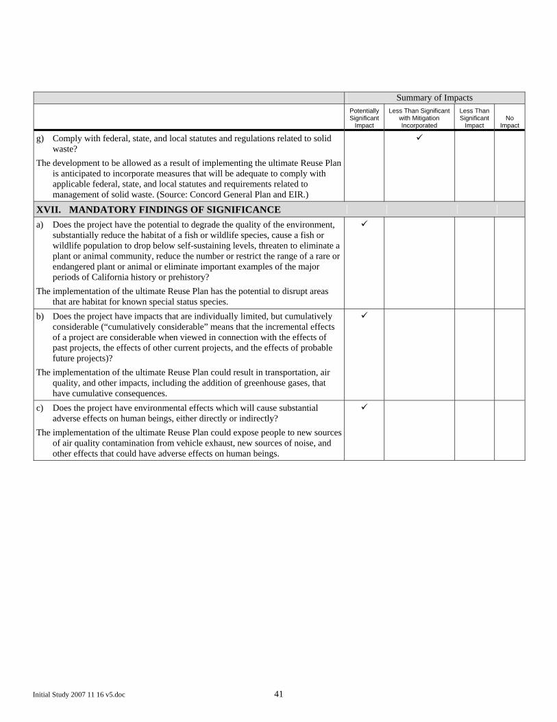
Initial Study 2007 11 16 v5.doc 41
Summary of Impacts
Potentially Significant
Impact
Less Than Significant with Mitigation Incorporated
Less Than Significant
Impact No
Impact
g) Comply with federal, state, and local statutes and regulations related to solid waste?
The development to be allowed as a result of implementing the ultimate Reuse Plan is anticipated to incorporate measures that will be adequate to comply with applicable federal, state, and local statutes and requirements related to management of solid waste. (Source: Concord General Plan and EIR.)
XVII. MANDATORY FINDINGS OF SIGNIFICANCE
a) Does the project have the potential to degrade the quality of the environment, substantially reduce the habitat of a fish or wildlife species, cause a fish or wildlife population to drop below self-sustaining levels, threaten to eliminate a plant or animal community, reduce the number or restrict the range of a rare or endangered plant or animal or eliminate important examples of the major periods of California history or prehistory?
The implementation of the ultimate Reuse Plan has the potential to disrupt areas that are habitat for known special status species.
b) Does the project have impacts that are individually limited, but cumulatively considerable (“cumulatively considerable” means that the incremental effects of a project are considerable when viewed in connection with the effects of past projects, the effects of other current projects, and the effects of probable future projects)?
The implementation of the ultimate Reuse Plan could result in transportation, air quality, and other impacts, including the addition of greenhouse gases, that have cumulative consequences.
c) Does the project have environmental effects which will cause substantial adverse effects on human beings, either directly or indirectly?
The implementation of the ultimate Reuse Plan could expose people to new sources of air quality contamination from vehicle exhaust, new sources of noise, and other effects that could have adverse effects on human beings.

City of Concord Concord Community Reuse ProjectEIR - Scoping Summary Report (Second Round)
Q:\131595 CCRP CONTRACT 4 EIR\4 INTERNAL PROJECT DATA\4-05 REPORTS & MEMOS\SCOPING SUMMARY REPORT #2 (JAN 2008)\SCOPING SUMMARY REPORT SECOND ROUND V2 FINAL.DOC 4-05 Round 2
Arup North America LtdIssue January 9, 2008
Appendix B Notice of Preparation


City of Concord Concord Community Reuse ProjectEIR - Scoping Summary Report (Second Round)
Q:\131595 CCRP CONTRACT 4 EIR\4 INTERNAL PROJECT DATA\4-05 REPORTS & MEMOS\SCOPING SUMMARY REPORT #2 (JAN 2008)\SCOPING SUMMARY REPORT SECOND ROUND V2 FINAL.DOC 4-05 Round 2
Arup North America LtdIssue January 9, 2008
Appendix C State Clearinghouse Distribution Letter


City of Concord Concord Community Reuse ProjectEIR - Scoping Summary Report (Second Round)
Q:\131595 CCRP CONTRACT 4 EIR\4 INTERNAL PROJECT DATA\4-05 REPORTS & MEMOS\SCOPING SUMMARY REPORT #2 (JAN 2008)\SCOPING SUMMARY REPORT SECOND ROUND V2 FINAL.DOC 4-05 Round 2
Arup North America LtdIssue January 9, 2008
Appendix D Sample Letter from City of Concord to Local Reviewing Agencies


Contra Costa Commute Alternative Network 1407 Oakland Blvd, Suite 100
Walnut Creek, CA 94523
C.C.CO. Airport Land Use Commission C/O Community Development Dept
County Admin Building 651 Pine St., 4th Floor, North Wing
Martinez, CA 94553
Contra Costa County Clerk
822 Main Street Martinez, CA 94553
C.C.CO. Environmental Health Dept. Attn: Planning/Development
2120 Diamond Blvd Concord CA 94520
C.C.CO. Public Health Services Attn: Public Health Admin. 597 Center Ave, Suite 200
Martinez, CA 94553
C.C.CO. Fire Protection District
2010 Geary Road Pleasant Hill, CA 94523
County Water Agency Attn: Roberta Goulart
651 Pine Street, North Wing Martinez, CA 94553-4711
C.C.CO. Mosquito & Vector Control Dist. Craig Downs, General Manager
155 Mason Circle Concord, CA 94520
C.C.CO. Public Works Department
255 Glacier Drive Martinez, CA 94553
C.C.CO. Resource Conservation District 5552 Clayton Road
Concord, CA 94521
Contra Costa Water District P. O. Box H2O
Concord, CA 94520
Astound Broadband 215 Mason Circle
Concord, CA 94520
Central Contra Costa Sanitary District Jim Kelly, General Manager
5019 Imhoff Place Martinez, CA 94553
Comcast Attn: Phillip Arndt
2500 Bates Avenue, Suite A Concord, CA 94520
Concord Disposal Attn: Nick Adler
4080 Mallard Drive Concord, CA 94520
PG&E Attn: Planning/Development Review
1030 Detroit Avenue Concord, CA 94518-2487
Contra Costa County Airports
510 Sally Ride Drive Concord, CA 94520
City of Clayton
6000 Heritage Trail Clayton, CA 94517
City of Martinez Deputy Director of Com. & Econ. Dev.
525 Henrietta Street Martinez, CA 94553
City of Pittsburg, Planning Department
65 Civic Drive Pittsburg, CA 94565
City of Pleasant Hill 100 Gregory Lane
Pleasant Hill, CA 94523
City of Walnut Creek Planning Department 1666 N. Main Street
P.O. Box 8039 Walnut Creek, CA 94596
California State East Bay, Concord Campus
Coordinator of Admin. Services 4700 Ygnacio Valley Rd
Concord, CA 94521
Mt. Diablo Healthcare
2580 Park Avenue, Suite 1 Concord, CA 94520
Caltrans Department of Transportation
111 Grand Avenue Oakland, CA 94612
Bay Area Rapid Transit District Roberta Collier, Asst. Treasurer 300 Lakeside Drive, 22nd Floor
Oakland, CA 94612
County Superintendent of Schools K-12 Schools ERAF
Karen Hall 77 Santa Barbara Road Pleasant Hill, CA 94523
Contra Costa Fire Keith Richter, Chief
2010 Geary Road Pleasant Hill, CA 94523
Contra Costa Community College Dist. Community College ERAF
Larry Hanson 500 Court Street
Martinez, CA 94553-4711
Los Medanos Hospital District
PO Box 8698 Pittsburg, CA 94565-8698

Contra Costa Transit Authority 220 Ygnacio Valley Road Walnut Creek, CA 94596
Contra Costa Transportation Authority Attn: Martin Englemann
3478 Buskirk Avenue, Suite 100 Pleasant Hill, CA 94523-7311
Metro Transportation Commission
101 8th Street Oakland, CA 94607
TRANSPAC Attn: TRANSPAC Manager
296 Jayne Avenue Oakland, CA 94610
TRANSPLAN Community Development Dept.
651 Pine Street, 4th Floor Martinez, CA 94553
Assoc. of Bay Area Governments Attn: Planning/Development Review
101 8th Street Oakland, CA 94607
Bay Area Air Quality Mgmt. District Attn: Planning/Development
939 Ellis Street San Francisco, CA 94109
Contra Costa Flood Control/Z-3B Judy Lytle
255 Glacier Drive Martinez, CA 94533-4711
East Bay Regional Park District Patrick O’Brien, General Manager
2950 Peralta Oaks Court Oakland, CA 94605-0381
Native American Heritage Commission 915 Capitol Mall, Room 364
Sacramento, CA 95814
County Library Susan Caldwell, Librarian
1750 Oak Park Blvd. Pleasant Hill, CA 94523
Mt. Diablo Unified School District Attn: Dir. of Research & Evaluation
1936 Carlotta Drive Concord, CA 94519
Sonoma State University Anthropological Studies Center
1801 E. Cotati Avenue Rohnert Park, CA 94928
Regional Water Quality Control Board Environmental Document Coordinator
San Francisco Bay Region 1515 Clay Street, Suite 1400
Oakland, CA 94612
U.S. Department HUD Attn: Steve Sachs
600 Harrison Street, 3rd Floor San Francisco, CA 94107-1300
Federal Transit Administration 1400 29th Street
Sacramento, CA 95812
Department of Conservation 801 K Street, MS 12-30 Sacramento, CA 95814
Department of Fish and Game
1416 Ninth Street Sacramento, CA 95814
Dept. of Forestry & Fire Protection 1416 Ninth Street, Room 1516-24
Sacramento, CA 95814
Dept. of Health and Drinking Water 1616 Capitol Ave., MS 7400
PO Box 997377 Sacramento, CA 95899-7377
Dept. of Housing & Comm. Development
Attn: Deputy Director 1800 Third Street, Room 430
Sacramento, CA 95814
Department of Parks & Recreation Resource Management Division
1416 9th Street Sacramento, CA 95814
Department of Water Resources
P. O. Box 942836 Sacramento, CA 94236
Governor’s Office of Planning & Research
1400 Tenth Street Sacramento, CA 95815
Office of Emergency Services Coastal Region
1300 Clay Street San Francisco, CA 94612
Office of Historic Preservation 1416 9th Street, Room 1442-7
Sacramento, CA 95814
Seismic Safety Commission 1755 Creekside Oaks Drive, Suite 100
Sacramento, CA 95833
State Clearinghouse State of California
1400 10th Street Sacramento, CA 95814
State Lands Commission
100 Howe Ave, Suite 100 South Sacramento, CA 95825-8202
U.S. Army Corps of Engineers Deputy District Engineer
333 Market Street San Francisco, CA 94105

U.S. EPA, Wetlands Regulatory Office
75 Hawthorne Street San Francisco, CA 94105
U.S. Fish and Wildlife Service
2800 Cottage Way, Room W2928 Sacramento, CA 95825
East Bay Municipal Utility District
375 11th Street Oakland, CA 94607
Contra Costa County Airports 550 Sally Ride Drive Concord, CA 94520
Dept. of Forestry & Fire Protection
1416 9th Street Sacramento, CA 94244-2460
Bureau of Reclamation Mid-Pacific Region 2800 Cottage Way
Sacramento, CA 95825-1898
Bay Area Air Quality Mgmt. District Attn: Planning/Development
939 Ellis Street San Francisco, CA 94109
LAFCO Attn: Planning/Development
Review 651 Pine Street
Martinez, CA 94553
Tarry Smith Ambrose Recreation andPark
District 3105 Willow Pass Road Bay Point, CA 94565
Vicki Zumqait Bay Point MAC
3105 Willow Pass Road Bay Point, CA 94565
Donn Diebert Dept. of Toxic Substances Control
8800 Cal Center Drive Sacramento, CA 95826
Gary Kuwabara Project Manager
Office of Economic Adjustment 1325 J Street, Suite 1500
Sacramento, California 95814
John M. Hill Base Closure Manager
Department of Navy, BRAC Program 1455 Frazee Road, Suite 900
San Diego, California 92108-4310
Jonathan B. Jarvis National Park Service, Pacific West
Region 1111 Jackson Street, Suite 700
Oakland, CA 94607-4807
The County Connection Central Attn: Eric Harris
2477 Arnold Industrial Way Concord, CA 94520
Federal Housing Administration Sacramento Regional Office
925 L Street Sacramento, CA 95814
Lt. Julie Page Environmental Review-Special Projects
California Highway Patrol 2555 1st Avenue
Sacramento, CA 95818
Robert Sleppy Chief, Environmental Services Section
Dept. of General Services 707 Third Street
P. O. Box 989052, 3-400 West Sacramento, CA 95798-9052
Judy Corbett, Executive Director Local Government Commission
1414 K Street, Suite 600 Sacramento, CA 95814
Mike Falkenstein, Program Manager State Water Resources Control Board
Division of Water Rights 1001 I Street
P. O. Box 2000 Sacramento, CA 95814
San Francisco Bay Conservation & Development Commission
50 California Street, 26th Floor San Francisco, CA 94111
Sue O’Leary, Supervisor CA Integrated Waste Management Board
Environmental Review Section 1001 I Street
P. O. Box 4025 MS-15 Sacramento, CA 95812-4025
Contra Costa Resource Cons, District
5552 Clayton Road Concord, CA 94521
Bob McEwan, Executive Director Housing Authority
3133 Estudillo Street P.O. Box 2759
Martinez, CA 94553
Federal Housing Administration Sacramento Regional Office
925 L Street Sacramento, CA 95814

City of Concord Concord Community Reuse ProjectEIR - Scoping Summary Report (Second Round)
Q:\131595 CCRP CONTRACT 4 EIR\4 INTERNAL PROJECT DATA\4-05 REPORTS & MEMOS\SCOPING SUMMARY REPORT #2 (JAN 2008)\SCOPING SUMMARY REPORT SECOND ROUND V2 FINAL.DOC 4-05 Round 2
Arup North America LtdIssue January 9, 2008
Appendix E Public Hearing Notice


City of Concord Concord Community Reuse ProjectEIR - Scoping Summary Report (Second Round)
Q:\131595 CCRP CONTRACT 4 EIR\4 INTERNAL PROJECT DATA\4-05 REPORTS & MEMOS\SCOPING SUMMARY REPORT #2 (JAN 2008)\SCOPING SUMMARY REPORT SECOND ROUND V2 FINAL.DOC 4-05 Round 2
Arup North America LtdIssue January 9, 2008
Appendix F Public Hearing Notice Published in Newspaper


City of Concord Concord Community Reuse ProjectEIR - Scoping Summary Report (Second Round)
Q:\131595 CCRP CONTRACT 4 EIR\4 INTERNAL PROJECT DATA\4-05 REPORTS & MEMOS\SCOPING SUMMARY REPORT #2 (JAN 2008)\SCOPING SUMMARY REPORT SECOND ROUND V2 FINAL.DOC 4-05 Round 2
Arup North America LtdIssue January 9, 2008
Appendix G PowerPoint Presentation

Pre
se
nta
tio
n o
f P
rop
ose
d
Altern
ative C
oncepts
Co
nco
rdC
om
mu
nity R
eu
se
Pla
n
CCiittyy oo
ff CC
oonn
ccoo
rrdd

ConcordCommunity Reuse Plan
Proposed Alternative Concepts
Site C
ontext
No
rth
Co
nco
rd
B
AR
T S
tati
on
Pit
tsb
urg
US
4
US
24
2
Do
wn
tow
n
Co
nco
rd
BA
RT
Lin
e
Bo
un
dary o
f C
NW
S
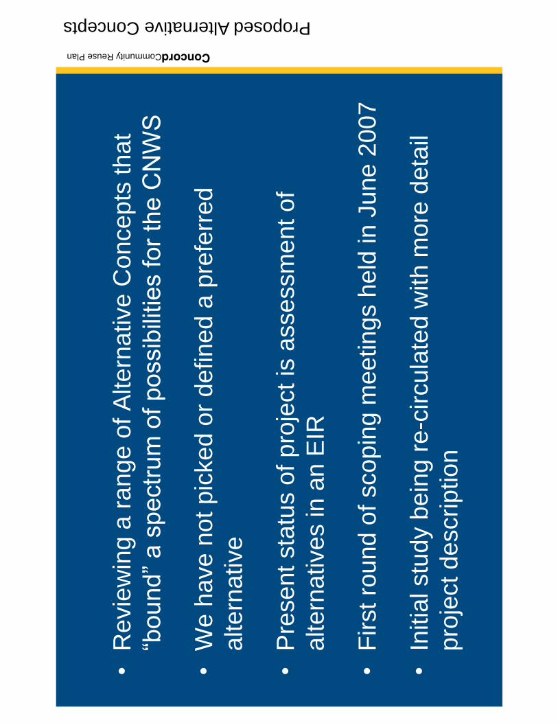
ConcordCommunity Reuse Plan
Proposed Alternative Concepts
Re
vie
win
g a
ra
ng
e o
f A
lte
rna
tive
Co
nce
pts
th
at
We
ha
ve
no
t p
icke
d o
r d
efin
ed
a p
refe
rre
d
alte
rna
tive
Pre
sent sta
tus o
f pro
ject is
assessm
ent of
alte
rna
tive
s in
an
EIR
First ro
un
d o
f sco
pin
g m
ee
tin
gs h
eld
in
Ju
ne
20
07
Initia
l stu
dy b
ein
g r
e-c
ircu
late
d w
ith
mo
re d
eta
il
pro
ject d
escrip
tio
n

ConcordCommunity Reuse Plan
Proposed Alternative Concepts
Develo
pin
gth
eR
euse P
lan
Alt
ern
ativ
e C
on
cep
t 1
Reu
se P
lan
EIR
An
alys
is
Oct
ob
er 2
007
9 m
on
ths
Jun
e 20
08
Alt
ern
ativ
e C
on
cep
t 7
Alt
ern
ativ
e C
on
cep
t 6
Alt
ern
ativ
e C
on
cep
t 2
Alt
ern
ativ
e C
on
cep
t 3
Alt
ern
ativ
e C
on
cep
t 4
Alt
ern
ativ
e C
on
cep
t 5
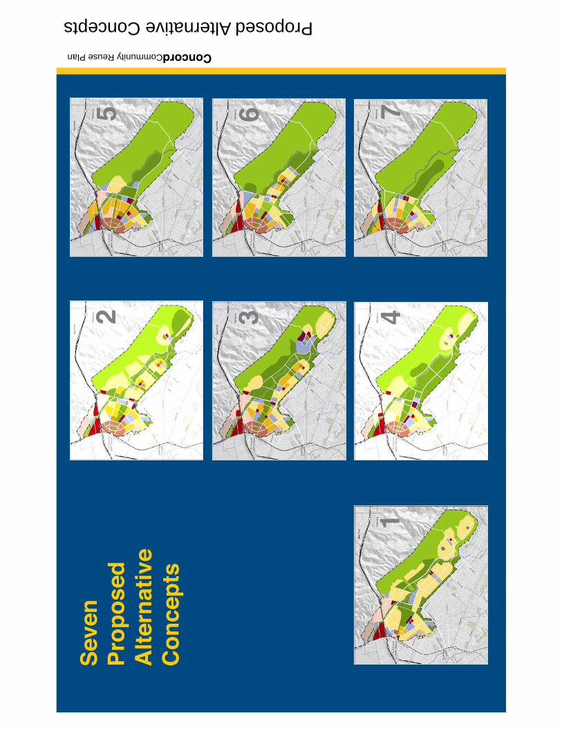
ConcordCommunity Reuse Plan
Proposed Alternative Concepts
1
2 3 4
Sev
en
Pro
po
sed
A
lter
nat
ive
Co
nce
pts
65 7

ConcordCommunity Reuse Plan
Proposed Alternative Concepts
Altern
ative C
oncept 1
Ext
end
ing
the
Nei
gh
bo
rho
od
s

ConcordCommunity Reuse Plan
Proposed Alternative Concepts
Co
nn
ecte
d V
illag
esA
lte
rna
tive
Co
nce
pt 2
Cre
ek P
ark
Vill
ages
Alte
rna
tive
Co
nce
pt 3
Wes
t S
ide
Vill
ages
Alte
rna
tive
Co
nce
pt 6

ConcordCommunity Reuse Plan
Proposed Alternative Concepts
Co
nco
rd P
ark
Alte
rna
tive
Co
nce
pt 4
Co
nce
ntr
atio
n +
C
on
serv
atio
n
Alte
rna
tive
Co
nce
pt 5
Co
nse
rvat
ion
Fir
stA
lte
rna
tive
Co
nce
pt 7

ConcordCommunity Reuse Plan
Proposed Alternative Concepts
Su
mm
ary
of
the
Alt
ern
ativ
e C
on
cep
ts

ConcordCommunity Reuse Plan
Proposed Alternative Concepts
The
City
of
Con
cord
(an
d/or
its
cons
ulta
nts)
ow
n al
l cop
yrig
hts,
oth
er in
telle
ctua
l pro
pert
y ri
ghts
, and
oth
er in
tere
sts
in th
isw
ork
prod
uct b
y U
nite
d St
ates
cop
yrig
ht la
ws
and
inte
rnat
iona
l tre
aty
prov
isio
ns. T
his
wor
k pr
oduc
t may
not
be
copi
ed, r
euse
d, o
r tr
ansf
erre
dto
any
thir
d pa
rty
with
out C
ity o
f C
onco
rd w
ritte
n co
nsen
t.
©C
ity o
f C
onco
rd, 2
007

City of Concord Concord Community Reuse ProjectEIR - Scoping Summary Report (Second Round)
Q:\131595 CCRP CONTRACT 4 EIR\4 INTERNAL PROJECT DATA\4-05 REPORTS & MEMOS\SCOPING SUMMARY REPORT #2 (JAN 2008)\SCOPING SUMMARY REPORT SECOND ROUND V2 FINAL.DOC 4-05 Round 2
Arup North America LtdIssue January 9, 2008
Appendix H Scoping Meeting Participants


City of Concord Concord Community Reuse ProjectEIR - Scoping Summary Report (Second Round)
Q:\131595 CCRP CONTRACT 4 EIR\4 INTERNAL PROJECT DATA\4-05 REPORTS & MEMOS\SCOPING SUMMARY REPORT #2 (JAN 2008)\SCOPING SUMMARY REPORT SECOND ROUND V2 FINAL.DOC 4-05 Round 2
Arup North America LtdIssue January 9, 2008
Appendix I Scoping Meeting Transcripts

1
2
3
4
5
6
7
8
9
10
11
12
13
14
15
16
17
18
19
20
21
22
23
24
EIR Scoping Meeting, November 29, 2007 2:00 p.m. - 1 - DigitalScribe.net
EIR SCOPING MEETING
NOVEMBER 29, 2007
2:00 – 4:00 p.m.
Mr. Wright: Okay. Well, good afternoon. This is a Public Scoping Meeting
for the Programmatic EIR for the Community Reuse Project, and my name is Mike Wright.
I’m the project director for the city, and today we’re going to spend just a few minutes sort of
recapping where we’ve been talking about the seven alternatives that we have, that are going
to be in consideration in the EIR, and then we will turn it over to you to provide your
comments, to give us your advice and input on issues that need to be addressed in the EIR.
So just to quickly recap in case after roughly an 18-month period of time, there’s any of you
here that are not familiar with what we’re doing, the weapon station, the part of it that we’re
involved in planning, the total weapon station encompasses about 12,000 acres, 7,000 of
those acres, 7,000 of the 12,000 were transferred directly to the United States Army by the
Navy, so that is the portion that is down by Port Chicago, and it is not part of our planning
consideration. The area that we’re working on is called the Inland portion. It is a little bit
north of Highway 4, and then the bulk of the site runs south of Highway 4 all the way down
basically Kirker Pass. We have Willow Pass Road cutting right through here up to Highway
4, and Bailey Road coming down through the site and on into Pittsburg down here. Our
North Concord BART Station is contiguous to the property, and just in relationship to the
downtown area of Concord we have, in this area here with our other Concord BART Station.
The eastern boundary of the weapons station is shown here. This is also, it’s not actually the
boundary of the City of Pittsburg, but it is there an urban limit line for the city of Pittsburg
and there are a lot of plans for development that are going on in the Pittsburg side of the Los
1
2
3
4
5
6
7
8
9
10
11
12
13
14
15
16
17
18
19
20
21
22
23
24
EIR Scoping Meeting, November 29, 2007 2:00 p.m. - 2 - DigitalScribe.net
Mendonas Hills. For those of you that have been with us here, you’ll know that there have
been requests to produce a map that shows all of the proposed land uses, approved projects,
areas of open space, new roads, and so on, that are proposed in this area of the City of
Pittsburg, and we have been working closely with the city to get those defined. We have a
map that’s gone through a couple of sets of review, kind of have their last final changes on
those put together which will be presented to the City of Pittsburg staff on Friday, and we
hope to have that map that several of you have requested ready for public display and
distribution early next week, end of next week. So we are working on that. We haven’t
forgotten about it, but it has taken a lot of back and forth with the City of Pittsburg to make
sure that (inaudible). The planning area, again, it was surplused by the Navy at 5,028 acres.
That does not include 115 acres up here on the north end of the property, right at the entrance
to the weapons station that was transferred to the Army. It does not include 58 acres of old
military housing that’s right down here along Olivera Road. It was transferred directly to the
United States Coast Guard. It does include a little five acre plot on the west side of Olivera
Road, which is where the city’s Little League Field’s are today, so those will also be part of
the transfer consideration, and even though the announcement was for 5,028 acres on the site,
when you actually take out easements and right of ways that are owned and operated by
others, other than the United States Navy, we actually end up with about 4,875 acres that
we’re actually doing the planning for, and that’s what we’re doing a lot of our calculations
against when we talk about percentage open space and things like that (inaudible). So where
are we today? What are we doing? Well, first and foremost, I do want to emphasize that what
we are preparing is a programmatic level environmental impact report. That is bound by the
same California Environmental Quality Act as any other kind of EIR, but is a little bit
different than the types of environmental impact reports that some of you may be familiar

1
2
3
4
5
6
7
8
9
10
11
12
13
14
15
16
17
18
19
20
21
22
23
24
EIR Scoping Meeting, November 29, 2007 2:00 p.m. - 3 - DigitalScribe.net
with where you have a very specific development. You have very specific engineering
associated with that development, and a lot of detail. In our case we’re dealing with very
broad general land uses, and therefore, the programmatic level EIR will be fairly broad in
general, in its assessment of impact issues. I also want to emphasize that when we complete
our work the Federal Government will prepare an environmental impact statement under
Federal law that will be separate from our document, but it will build on a lot of the work that
we’ve done, and then at the point where the community has a reuse plan, and it’s been
accepted by HUD, and the Navy has transferred the property from it’s ownership to someone
else’s ownership there will then be another round of environmental impact review that will
occur for any specific development that is proposed to take place on the property. And that
includes any use of the property for open space for parks and recreation. It isn’t just
residential use or commercial retail or putting in infrastructure and things like that. So any
kind of use out on the property is going to go through additional rounds of environmental
review beyond what we’re going to be doing. We are looking at a range of alternative
concepts. We’ve tried to create a broad spectrum that sort of brackets a range of impacts.
That range of alternatives has been approved by the Community Advisory Committee, as
well as our city counsel acting as a the local reuse authority, and we have specifically not
picked, nor are we going to pick any time in the immediate future a preferred alternative
from the seven that we’re working with. We are intending to use the environmental impact
report process as another screening device to put another overlay on the site to help us in that
selection of a preferred alternative, but we do not have one right now. At this point, all of the
alternatives that we’re going to talk about today are all here at an equal level, and they’re all
going to be analyzed in the environmental document at an equal level. I also want to remind
folks that we had a set of scoping meetings back in June, June 14th, I believe. I do notice, I

1
2
3
4
5
6
7
8
9
10
11
12
13
14
15
16
17
18
19
20
21
22
23
24
EIR Scoping Meeting, November 29, 2007 2:00 p.m. - 4 - DigitalScribe.net
was talking to somebody earlier that, the afternoon crowd that we had that day was actually
very large. Because on that particular day it was about 107 outside, and people were looking
for air conditioning, so we had quite an attendance that afternoon, but we did have a set of
scoping meetings, again, in the afternoon and in the evening, just like we’re doing today, and
all of the input that was given during those scoping meetings is all part of the record. It is all
still with us. It is the basis upon which we’re going to do the environmental impact report. It
is not like folks came and talked about that, and that’s kind of off the boards and now we’re
going to do it again. The reason we’re doing this today is that, when we had the scoping
meeting back in June, we did not have our range of alternatives defined, and so there were a
lot of the commenters that felt it was important that once we got the range of alternatives
defined that we would re-circulate our initial study, which we have done with that more
detailed information and so that we could make sure that we got the most and broadest range
of comments for what we need to address in the EIR. So again, I do want to emphasize, if
you spoke to us in June, anything you said is in the record. It is in our transcript, and it is
part of what we’re going to use to help set the scope for the EIR. So today, just to remind
everybody, we have seven alternatives and I’m going to talk about them in a second here.
We are analyzing all of these at the same level of detail in our EIR. The EIR itself, we
actually have started the preparation of it a couple of months ago working on the
environmental setting, baseline conditions, what you can do because it’s just talking about
sort of what exists today. We’re now getting in, now that we’ve got the alternatives, we’re
starting the process of doing the analysis of each one of those, a lot of the traffic modeling,
air quality modeling, things that you’ve asked us to look at in the last set of scoping thing.
We will have draft documents coming out in the first quarter of 2008, and, again, our
ultimate goal is to have gotten through of EIR process to have put that environmental overlay

1
2
3
4
5
6
7
8
9
10
11
12
13
14
15
16
17
18
19
20
21
22
23
24
EIR Scoping Meeting, November 29, 2007 2:00 p.m. - 5 - DigitalScribe.net
on our alternatives, and to call that then to a singular reuse plan in June of 2008 in accord
with BRAC statutes, so that’s the timeline that we’re operating on right now. So we have
seven alternatives. These have come out of a variety of workshops and conversations with
the community. It also involved conversations regulators, regional stakeholders, the business
community, our city council, several of our boards and commissions in the city, all of that
provided input to the seven alternatives, and there are a number of folks that go, wow, how
are you going to get seven of these of done? It sounds like a lot, but from our perspective we
think that you can actually break them into three big groups. They’re not all that separate
when you really start to look at them. So I’m going to run through these very quickly and
just give you a little highlight and then we’ll allow you folks to come up and provide
commentary to us. First and foremost with alternative one, it does sort of stand alone by
itself. It is different than the other seven. The primary features of this we call it Extending
the Neighborhoods. It is a very low density, low intensity alternative. About 47% of the site
is left in open space or the darker green areas would be more active park activities, but about
47% of the site is open. This has about, a little under 8,000 housing units, most of them
typical of what you see in Concord today, lower density single-family housing. It is a
relatively automobile reliant alternative. It has a little bit of intensity near the BART Station,
but not really probably to the degree that you would see in some of the other alternatives that
have some fairly intense transit oriented development. It also has about a little under 6
million square feet of commercial and retail space, office space, that are associated with it,
and this creates a new population in Concord of about 21,000 people and about 17,000 jobs.
We then have alternatives two, three, and six, which are really variations on a theme. The
theme being higher intensity development in and around the North Concord BART Station,
with mixed-use residential/commercial. A lot of that in densities that are probably in the 40-

1
2
3
4
5
6
7
8
9
10
11
12
13
14
15
16
17
18
19
20
21
22
23
24
EIR Scoping Meeting, November 29, 2007 2:00 p.m. - 6 - DigitalScribe.net
unit acre, maybe some of them even a little higher than that, not very much in the way of
surface parking, a lot of structured parking either contiguous to or underneath facilities. Each
one of these also have then a series of village clusters that come down along the west side of
the property that also have a certain amount of intensity that’s associated with them, and the
idea would be to connect these with some sort of dedicated transit that can connect up the
BART Station and maybe create a bigger transit loop throughout the entire city as we move
through. These are different, there’s no question about that. They’re different by design, no
pun intended, to task some other features that were brought up in some of our community
workshops. In this one we have development east of the creek. It also has a road that
connects out to Kirker Pass. In concept three, we have a lot less development east of the
creek, but still some roadways, but then more development down around Bailey Road and
south of Bailey Road, and then in alternative six we have no development east of the creek,
no development south of Bailey Road so that each one of these can give us a different
perspective on the constraints and opportunities and restrictions or opportunities of the site.
They range in, they had a range of open space from about 52% of the site here in concept
two, and about 72% of the site in concept six. They also range in intensity. Alternative two
is the most intense of all the seven alternatives. It has about 13,000 housing units, almost 8
million square feet of commercial space that’s embedded in it. Alternative six has about
8,000 housing units, and just about 6 million square feet of commercial office space. So,
again, you can see that this is designed to have a developmental range of intensity in the site
that we have done also by design so that we can sort of test the bounds of what is an impact,
and what you can do to mitigate those. We also have in alternative six about 14,000 new
residents, up to almost 30,000 new residents in alternative two, and about 17,000 new jobs in
concept six and up to about 27,000 new jobs in alternative two. We then have our concepts

1
2
3
4
5
6
7
8
9
10
11
12
13
14
15
16
17
18
19
20
21
22
23
24
EIR Scoping Meeting, November 29, 2007 2:00 p.m. - 7 - DigitalScribe.net
four, five, and seven, and these are, have a little different focus. It’s really trying to really
concentrate development in and around the North Concord BART Station, and not have a lot
of development in other parts of the site, and so they’re all variations on a theme of
concentration and conservation, and those are the two aspects that these three really represent
in different forms. Like the previous three alternatives that we showed you, they are
designed to test different features, and so alternative four, as an example, does have some
development down around Bailey Road, whereas alternative five and seven do not. In
alternative seven, we really do not have any proposed runway connections between Willow
Pass Road and Bailey Road, which is very different than some of the other alternatives. In
alternative five the roads are kept, the one road anyway, that comes down into the south part
of the site is kept west of the creek. These also range in intensity from about 6,000 housing
units in concept seven to about 10,000 in concept five. In terms of open space, the range
runs from about 58% of the site in alternative four to almost 81% of the site in alternative
seven so, again, a big range for us to take a look at. These also have differing degrees of
active recreation in them. The darker green areas versus the lighter green of more passive
activity and open space, and they also have, and particularly in concept five, it’s a very
intense area in and around the BART Station with again stacked uses where you’ve got
probably underground parking, some sort of commercial retail on the ground floor, and then
probably residential activity stacked on top of that, so differing types of mixed use, different
ranges of intensity in all of these alternatives. And then we will, although most of these
materials have been posted up on the website before. This particular presentation will also be
up on the website. There’s a summary table of all of the sort of statistics that I just ran
through that you can get if you pick this up on the website. So with that, that is my
presentation. Again, we’ll now take your input, and testimony. We do need you to fill out a

1
2
3
4
5
6
7
8
9
10
11
12
13
14
15
16
17
18
19
20
21
22
23
24
EIR Scoping Meeting, November 29, 2007 2:00 p.m. - 8 - DigitalScribe.net
blue speaker’s card if you are proposing to talk to us today. You don’t have to if you don’t
want to, but we would like you to fill these out, so does anyone need one? (Male asks
question in background – inaudible) You can as soon as I get up to the dais. Anybody else?
Okay. As you’re filling those out, if you can give them to Pam, and she’ll bring them up. So
our first speaker is Bob Barnes.
Mr. Barnes: I think you partially answered my one question it was starting off with
is, this sort of a all or nothing, EIR Report? To give you an example, will it address say an
expansion of Willow Pass Road from its current state to another state, or is, where I think
you were answering this is much more of a general perspective type of specific question like
that may not be addressed, that that specific type of question would be addressed in the later
EIR when development is done?
Mr. Wright: It could be, and it also could be that the recommendation would be for
any of the alternatives that we’re looking at, that one of the ways to mitigate traffic impacts
would be to change the alignment or widen the alignment or do something with Willow Pass
or Bailey or something else, and that suggestion would be made as part of the EIR, perhaps
as a mitigating factor, but the actual impact of it would probably require you to wait for the
detail that would come later when you actually had design information.
Mr. Barnes: Yes, so these are basically staying on the broad scope. Then I also
notice, too, that alternative zero, you have no impact, no—doing nothing, leaving it the hands
of the Navy. That no EIR has to be done with that alternative?
Mr. Barnes: It’s always there, but it’s never really talked about.
Mr. Wright: Well you’ll notice that in the initial study there actually is a description
of a No Action or No Project alternative, and the environmental impact report will address
what that means.

1
2
3
4
5
6
7
8
9
10
11
12
13
14
15
16
17
18
19
20
21
22
23
24
EIR Scoping Meeting, November 29, 2007 2:00 p.m. - 9 - DigitalScribe.net
Mr. Barnes: Okay.
Mr. Wright: So it will be part of the analysis, both in our document as well as in the
Navy’s document.
Mr. Barnes: Okay. Thank you.
Mr. Wright: Troy Bristol.
Mr. Bristol: Good Afternoon. My name is Troy Bristol. I’m a land conservation
associate from Save Mt. Diablo. I would just like to reiterate a few of the points that Save
Mt. Diablo has been making along with the community collation throughout the process and
how they interact with the different alternatives that were presented. One, we’ve been calling
for 80% open space and there is one alternative that includes 81%, which is alternative seven.
Also, alternative six shows a good amount of open space also. This amount of open space
would help to minimize the negative impacts of traffic especially if the development centered
around North Concord BART, it would also help minimize the negative visual impacts for
people throughout the neighborhood surrounding, and negative noise impacts for people in
the neighborhoods surrounding. We’ve been advocating for a world class regional park to be
dedicated as part of the 80% of open space that we’re calling for, which would also help
minimize negative impacts on special status species in the area. We were hoping that no new
roads would be built east of Mt. Diablo Creek, which would fragment the open space
between the creek and the hills and there are a few alternatives that include that, so we
emphasize those alternatives. And in addition, have the linear parking between existing
neighborhoods to the west and new neighborhoods, which would also help mitigate negative
noise impacts, or minimize negative noise impacts and visual impacts for those existing
neighborhoods. I have a letter here that goes into more detail about the different things that
we’re looking for, but just want to emphasize those points. Thank you very much.
1
2
3
4
5
6
7
8
9
10
11
12
13
14
15
16
17
18
19
20
21
22
23
24
EIR Scoping Meeting, November 29, 2007 2:00 p.m. - 10 - DigitalScribe.net
Mr. Wright: Christina Wong.
Ms. Wong: Hi, I’m Christina Wong, and I’m the East Bay Field Representative for
Greenbelt Alliance. I wanted to take this time to just kind of go over what’s in my letter in
more detail, but basically we want to make sure that the EIR covers the growth inducing
impacts that this weapons station, that developing the weapons station might have both on
the site and off the site. So on the site we want to make sure that what’s designated as open
space on one of the alternative plans remains open space so that it’s not creating a footprint
for now and then eventually it gets totally developed, but that once we have this plan that it
stays. Secondly, is the growth inducing impact throughout the region that we want to make
sure that the weapons station is not just analyzing its own bubble, but it’s taken in account
the development in Pittsburg and particularly Pittsburg is planning to have the James
Donalyn Road, which is essentially to become a road bypass go through the southwest hills
and we want to know the impacts on the weapons station and that road in addition to those
areas outside of Pittsburg that zoned low density residential making sure that all of that’s
taken to account in this EIR. Regarding transportation and traffic, we want to make sure that
it’s analyzed at a road east of the creek, the impacts to wildlife and being cutoff from the
open space part, and the creek is fully analyzed. The big thing I want to highlight is that we
really want to stress that the city of Concord uses the urbanist model for a traffic study and
this is different than a traditional traffic study in that they actually take in account the land
use in effecting how the transportation is and the air resources board currently uses this
model, and it’s good because it takes in account mixed use affordable housing, public
transportation and really giving an accurate and effective model for the way the traffic’s
going to be. We also want to make sure that particularly the area south of Bailey Road is
analyzed for traffic impacts if there is development especially if the road does cut through

1
2
3
4
5
6
7
8
9
10
11
12
13
14
15
16
17
18
19
20
21
22
23
24
EIR Scoping Meeting, November 29, 2007 2:00 p.m. - 11 - DigitalScribe.net
that area of the weapons station to go hook up to Kirker Pass Road. I have a whole list of the
different biological resources that we want analyzed, but the big thing that we’re asking for is
that a comprehensive plant survey is conducted throughout the entire site, and also that
current data on the species of special concern and common species in the area are analyzed
because the most current wildlife surveys except for the 2007 California Tiger Salamander
and the California Red-Legged Frog surveys are close to ten years old, so we want to make
sure we have updated surveys on all the species, and that there’s a bunch of different things
that we asked for, but also that, there’s a hydrograph of Mt. Diablo Creek because this is an
area that might be prone to flooding, and that the fiscal analysis is conducted. So that’s just
the highlights that I have in my letter, but there’s more detail.
Mr. Wright: If I could just give you one response to your thing about the traffic.
We’re taking a look at the model, but mostly to use it from the perspective of the carbon
footprint and the air quality issues that are associated with the site. The actual traffic
modeling, we really have to use the county’s county-wide traffic model to model traffic so
that it incorporates all the things that are going on broadly in the county, and this is actually
defined under Measure J of how we have to go about doing that. So there’s going to be two
aspects of this when we go through this.
Ms. Wong: Okay, but you’re thinking about it at least for the carbon footprint. Okay.
Do you want me to give you the letter or?
Mr. Wright: I have it electronically.
Ms. Wong: Oh, okay.
Mr. Wright: Just give those extra ones to Pam if you want.
Ms. Wong: Okay, great. Thanks.
Mr. Wright: Thank you. Brian Holt.

1
2
3
4
5
6
7
8
9
10
11
12
13
14
15
16
17
18
19
20
21
22
23
24
EIR Scoping Meeting, November 29, 2007 2:00 p.m. - 12 - DigitalScribe.net
Mr. Holt: Thank you. I’m Brian Holt, East Bay Regional Park District, just a couple
of questions. What’s the date that written comments are being accepted until?
Mr. Wright: Would be 30 days from last Friday.
Mr. Holt: Okay. I’ll figure out what that date was. And then I’m wondering if you
can just talk generally about how the cumulative projects will be defined sort of I guess in
time or that sort of thing.
Mr. Wright: Well, the purpose of this is actually not for us to go into a description of
what we’re going to do.
Mr. Holt: Right.
Mr. Wright: We’ve received your input that you believe that there’s a broad
cumulative assessment that needs to take place. We certainly intend to do that. As an
example using the county’s traffic model that’s how one of the ways you get accumulative
impacts. As far as the roadways are concerned we’re going to be looking at development
levels, at general plan input from our surrounding neighbors and what they’re proposing to
do in their own communities and to the degree that we can, we will add those pieces of
information into our analysis as we go forward.
Mr. Holt: Okay. Generally, that’s what I was looking for. So I guess other general
comments, we’ll be submitting written comments with sort of detailed points, but I guess we
want to stress that the reuse plan and the EIR shouldn’t necessarily be focused on the
development opportunities, but also really look at some of the restoration and conservation
opportunities, and sort of in the vein of avoid, minimize, mitigate, really taking a focus of
being proactive on the avoidance of impacts, and where possible try and to identify and
pursue beneficial impacts. So in terms of the riparian corridor along Mt. Diablo Creek there
may be a great opportunity to achieve a beneficial impact with the creation of a more

1
2
3
4
5
6
7
8
9
10
11
12
13
14
15
16
17
18
19
20
21
22
23
24
EIR Scoping Meeting, November 29, 2007 2:00 p.m. - 13 - DigitalScribe.net
enhanced habitat, and same could be said with wetland creation and that type of thing. So in
the vein of encouraging mitigation on site and striving to achieve some level of beneficial
impacts, I think the EIR should take that level of focus. And then, like I said, we’ll be
submitting more detailed comments on some of the individual topic areas, so thank you.
Mr. Wright: Anna Rikkelman.
Ms. Rikkelman: Hi. I am a member of the Community Advisory Committee, but
today I’m here representing my family, myself, my husband, and a seven and eight year old
who live off of Bailey Road. You know, I participated even before my involvement in the
Community Advisory Committee and many of the workshops, and following this project.
Alternative one creates nothing different than what we have today. It is not transit oriented.
The population, it creates, yes, maybe a lower numbers than the other alternatives, but it is
truly not a transit oriented development and I think when we talk about carbon footprints, and
becoming a sustainable community and all of the other good things that we’re trying to do
here, alternative one has my least preference. With respect to traffic, I think we have to be
very careful about the impact that traffic is going to have on existing Ignacio Valley, Kirker
Pass, Treat Boulevard, and even Bailey Road. Right now those roads are a lot of bypasses,
informal bypasses for those coming from east county speeding down, making it very difficult
to cross the road with your dog in the morning, very dangerous to even cross over. So I’m
very concerned about any roads that go through the property of the Naval Weapons Station
and how that impacts on roads that are already terribly impacted anyway, that we’re paying
for out of our tax dollars here in Concord, and they’re being used as bypasses for those in
other parts of the county. I think that some of the other alternatives even though they are
larger populations of folks, I think we need to really look at the densities that are being
proposed and the locations near BART, and the fact that they are transit oriented, and some

1
2
3
4
5
6
7
8
9
10
11
12
13
14
15
16
17
18
19
20
21
22
23
24
EIR Scoping Meeting, November 29, 2007 2:00 p.m. - 14 - DigitalScribe.net
of the economic impacts that those can bring into the city with respect to additional
commercial business, and for those folks who know me, it looks like they could bring in
some good shopping to Concord. And open space, finally my comment about open space,
and I’ve said this many times over. Are we looking at open space to look at, or open space to
participate in, and I know that one of the proposals that has been made to the city with
respect to open space. Open space to participate in, and I’m sorry, for me it’s got to be more
than picnic tables and trees. You know, I think of my first—I’m from Louisiana so moving
here, my first touches with the great neighborhood open spaces of the Bay area that at
Golden Gate Park, that at Tilden Park, just some wonderful places. Even before kids, you
know, my first touches with that made me continue to go back and back, and go back and
back more once I had kids were the carousel, the horse rides, the pony rides, of course not
pony rides for me, but my kids. The DeYoung Museum, and some other great things that are
there at those parks that it’s more than a picnic table. It’s something to keep folks here in the
community satisfied so we don’t have to drive far away and it’s something that would be
world class, world class more than, you know, picnic tables and trees. And that’s about it,
thank you.
Mr. Wright: Thank you. Amie Fishman.
Ms. Fishman: Good Afternoon, and thank you. I’m Amie Fishman with East Bay
Housing Organization. I’m also here as part of the Community Coalition for a Sustainable
Concord, and once again, I want to thank the staff and the tremendous work that’s gone
through a very thorough process, and I’m glad to be here today to contribute again to the
Scoping Hearing. My comments today, well as you know, the community coalition is part of
what our vision and our platform is, is to create vibrant walkable communities, open space,
affordable housing, and supportive housing, and to look at this in a very comprehensive way,

1
2
3
4
5
6
7
8
9
10
11
12
13
14
15
16
17
18
19
20
21
22
23
24
EIR Scoping Meeting, November 29, 2007 2:00 p.m. - 15 - DigitalScribe.net
and so as we’ve seen in the alternatives those concepts are there. What I would like to speak
on specifically is to incorporate as part of the environmental factors in this, and the issues to
be studied, a broader view about some of them to incorporate issues of socio-economic and
health impacts. As we know people in our communities are not separated from the
environment, but very much integrated as part of it. So there are ways that we need to go
further in order to be comprehensive and to be visionary about what it is that we’re doing at
the Naval Weapons Station. So specifically under population and housing we need a broader
discussion about socio-economic and health impacts. We need to look at issues of racial and
economic segregation or integration. How is the plan, that is being put forward is going to
support people to integrate into community rather than be segregated. We want to look
specifically at the impact on homeless and more vulnerable populations, low income
families, immigrant families, etc., who do we need to think about to make sure that we have a
strong fabric of bringing everyone together. We also need to look under public services at
health services as well, and looking more deeply at what are the health needs, and under land
use and planning, also looking at the broader issues around health impacts and equity. So
whether it’s access to open space, access to transportation, again, issues of concentration
versus integration, we need to look at how people have services and opportunities available
to them, and in particular we need to look at having density and zoning that supports the
needs for affordable housing and housing for the homeless. So that’s, again, just an idea of
looking comprehensively at these issues and incorporating those concepts into the checklist
that you have. Thank you very much.
Mr. Wright: Thank you. Ellen Williams.
Ms. Williams: Hi, I’m Ellen Williams. I’m a member of the Community Advisory

1
2
3
4
5
6
7
8
9
10
11
12
13
14
15
16
17
18
19
20
21
22
23
24
EIR Scoping Meeting, November 29, 2007 2:00 p.m. - 16 - DigitalScribe.net
Committee, and I just have a couple of comments here. I think for benefit of the public, if
you could just comment here or somewhere else, on why we decided to include alternative
one in there where it was pretty obvious to all of us that it was not a very desirable
alternative, and any concerns about the economic impact of studying something that seemed
to be not really attractive to the major portions of the city. Maybe you want to comment on
it, and then I have two comments following here.
Mr. Wright: Well, I think it’s there because while I recognize that some people may
not think that it’s the right alternative there. When you look at the breadth of the comments
that we got and input that we got in the workshops, there were, there are a body of people
who actually feel that that’s the right way for us to go. So whether it is or not, we felt that it
was appropriate for it to be included in the analysis, and to go through just with all the others
that we have.
Ms. Williams: And there is a way to filter it out pretty quickly, determine that it’s not
feasible pretty early on without investing a lot of additional time on it, is that not true?
Mr. Wright: Well, I think at this point, and I do want to emphasize this broadly for
all the alternatives. We are really committed to analyzing them all to an equal level of detail.
Ms. Williams: Okay.
Mr. Wright: And then at that point, when we’re through with the analysis then the
community as a whole, the council, can go through and start that process of culling it down
or creating a hybrid out of the seven that we have.
Ms. Williams: Okay. Thank you. Two other points here, in my professional career
associated with traffic modeling, not as a traffic modeling expert, but taking a look at
different modeling, often times what is not included in the traffic modeling is the impact of
mobile technologies and information technologies on how and when people use the current

1
2
3
4
5
6
7
8
9
10
11
12
13
14
15
16
17
18
19
20
21
22
23
24
EIR Scoping Meeting, November 29, 2007 2:00 p.m. - 17 - DigitalScribe.net
transportation system, and that is changing rapidly. And more than ten years ago the
Southern California Association of Governments took an initial look at the whole arena there,
and I just would ask that when you take a look at the model that’s going to be used, ask the
question, how is that factored into that at the current levels and in future levels? Because
clearly when and how we use the transportation system is clearly changing and how and
where we work, and we need to factor that in. One other thing, it may be minor in the
impacts is though, but since it’s very likely that scheduled air service will return to Buchanan
Airport is that, that has some implications not only to Concord, but to the region of where
people would start using Buchanan rather than extending it out over Ygnacio or Kirker Pass
onto Oakland Airport, whatever. It may be miniscule, but I just suggest that it might be
considered. Okay?
Mr. Wright: Okay.
Ms. Williams: That’s it. Thank you.
Mr. Wright: Ursula Luna.
Ms. Luna: Hello. I’m also a CAC member or maybe a quasi CAC member at this
point, and on my previous comments I’m glad to say that you mention that they will be still
part of this, so I won’t repeat those, so they still all apply, and I wanted to talk a little bit
about traffic and specifically about Bailey Road, and the Bailey Road/Concord Boulevard
intersection, and so I’m assuming that new traffic counts will be taken as part of this project,
but I think that it’s also important to look at traffic counts that have been taken in pervious
EIR’s like the general plan and in EIR’s for other nearby projects such as projects in
Pittsburg. It’s actually kind of interesting to me living right behind Bailey Road and seeing
the, especially in a.m. peak traffic period, I’m sure that the level of service of Bailey Road
has definitely gone down during the past couple of years and I’m guessing that that’s in large

1
2
3
4
5
6
7
8
9
10
11
12
13
14
15
16
17
18
19
20
21
22
23
24
EIR Scoping Meeting, November 29, 2007 2:00 p.m. - 18 - DigitalScribe.net
part to some of the new development that’s occurred in Pittsburg, which isn’t even close to
be fully developed compared to what’s been approved plus pending projects, and then when
you add new development on Concord Naval Weapons Station, if under any of the proposed
alternatives there’s access through Bailey Road, I’m sure that the level of service there is
going to be—definitely needs to be looked at and mitigated. And let’s see, so basically levels
of service, and then safety, like if any traffic calming needs to take place on that road as a
result of the proposed project, and I’m sure that other people are interested in Willow Pass
Road and other roads sort of kind of the same thing, of course, Bailey Road is in my
backyard, so I’m bringing up that particular one, but I think overall, for all of the major
thoroughfares that this type of thing needs to looked at. And then in general just, Highway 4,
under the general plan EIR that was circulated and I’m probably certified by now, that the
level of service on Highway 4 is an F at all of the freeway segments that were looked at, and
I just think that it seems somewhat irresponsible to add to that problem, and adding more
development is a, you know out, a way to mitigate Highway 4 is a problem, and it’s not just a
problem for Concord residents, it’s a problem for the entire region, and I think from a policy
perspective that the city council really needs to look at that, and this document is one way to
do that. Under noise, I would like a noise study to be done for the residents that will be
butting up to new development or up to roads that will have significant additional traffic due
to proposed development under the different alternative, and I would like to also in that noise
study to have the existing trees, how they help mitigate noise, and I’m actually speaking out
of experience when the county went and there’s the bridge that they had to repair on Bailey
Road near the Concord Naval Weapons Station, they took out a couple of fifty-year-old
walnut trees, which were behind my house and when they did that the noise level that we
were able to hear in our house, in our backyard went up. And so I think, and want a study

1
2
3
4
5
6
7
8
9
10
11
12
13
14
15
16
17
18
19
20
21
22
23
24
EIR Scoping Meeting, November 29, 2007 2:00 p.m. - 19 - DigitalScribe.net
looking at that as part of a noise study of how the existing trees, if they’re saved, how they
could be a mitigation measure in terms of noise if that’s needed. And the only other
comments/question I have, I’m looking at section 15.228 of the CEQUA Guidelines. It’s
talking about where a Federal Agency will not cooperate, and to summarize it saying that if a
Federal Agency won’t do a combined EIS/EIR process that the local entity should look at
this state as helping or playing a role in preparing that document because a state document
will meet the NEPA requirement, and so I was curious if any conversations like that
happened, and then to go on to section 15.229 of the CEQUA Guidelines, it talks about the
process of a baseline analysis for military base reuse plan EIR’s, and talking about prior to
circulating the draft EIR that a number of things need to happen in a certain order and one of
those is to hold a Public Hearing at which is discussed the Federal EIS prepared for, or being
prepared for the closure of the base, and I know we’re not at that point yet. I know you’re
not circulating a draft EIR, but it begs the question of where is the Federal Government with
their EIS document. Because it sounds like, it’s part of this EIR process that there should be a
Public Hearing that will be held where the public will get a chance to look at some of their
baseline conclusions and analysis and what they think the mitigation, or the impacts might
be.
Mr. Wright: Well specific to the Navy’s process because the way this round of
BRAC is setup that we really are putting our reuse plan in place prior to them making
disposition decisions about the property. We’re going to, the sequence in these reverse, so
we’re doing ours first and then theirs will follow on, and they will do their EIS based on our,
on the reuse plan that we provide to them, which will be the same one that we push forward
to HUD for HUD’s review on the accommodation of the homeless. So it is not that they’re
not going to do one, but they’re going to be sequential.

1
2
3
4
5
6
7
8
9
10
11
12
13
14
15
16
17
18
19
20
21
22
23
24
EIR Scoping Meeting, November 29, 2007 2:00 p.m. - 20 - DigitalScribe.net
Ms. Luna: And so they haven’t started theirs yet?
Mr. Wright: I can’t speak completely for the Navy. I believe they’re doing some of
their baseline studies, and we have gotten input from some of their baseline studies that we
will use, and then conversely a lot of the transportation, traffic modeling and air quality work
that we do, the Navy will probably use in their EIS. So we’re definitely coordinating the
documents, but they’re not going to be a combined EIR/EIS.
Ms. Luna: Well, will it be possible to hold a Public Hearing prior to the circulation of
the draft EIR where the EIS is discussed?
Mr. Wright: We can certainly talk to the Navy about doing that. They will have their
own set of scoping meetings as well before they start their EIS.
Ms. Luna: Okay. Thank you.
Mr. Wright: Jimm Edgar.
Mr. Edgar: Jimm Edgar, President of Mt. Diablo Audubon and a member of the
Community of Coalition of a Sustainable Concord, and we certainly agree with all of their
positions, but I had just a couple of questions. Do you know how much land is really
unbuildable because of being too steep or, not quite sure what the right phrase is, on the
property that we are considering?
Mr. Wright: Well, the answer to that is kind of difficult because it could reflect
policy so there’s sort of one answer. There probably are any number of developers that
would tell you that the whole thing is buildable.
Mr. Edgar: Yeah.
Mr. Wright: So it just depends on what one’s perspective is. I think that in all of the
alternatives after we looked at the city’s policy about hillside development and looked at the
typography of the site, and sort of reviewed this with the community. That’s how we set a,

1
2
3
4
5
6
7
8
9
10
11
12
13
14
15
16
17
18
19
20
21
22
23
24
EIR Scoping Meeting, November 29, 2007 2:00 p.m. - 21 - DigitalScribe.net
really a preservation contour that is anything that’s above 30% grade would automatically be
an open space. Now that doesn’t mean there isn’t going to be other areas below that, that
would also be an open space, but that was sort of the cutoff that we made.
Mr. Edgar: The other question is a little bit more personal. I a, in, there are a
number of questions surrounding it, but it has to do with the golf course.
Mr. Wright: To you or to me?
Mr. Edgar: Pardon?
Mr. Wright: To you or to me?
Mr. Edgar: (laughter) To me. It has to do with the golf course. I happen to be a
member there, and part of that land is owed by the city, but part is Naval Weapons Station
land?
Mr. Wright: That’s correct.
Mr. Edgar: And that probably will go away, be located somewhere else? Our golf
course is in the offing?
Mr. Wright: Well, it’s under consideration, and to be specific, if you’re familiar with
the golf course, the front nine is on Navy property, and the back nine is on city property.
Mr. Edgar: Okay.
Mr. Wright: Roughly.
Mr. Edgar: Yeah.
Mr. Wright: And as was pointed out to me by someone yesterday, the actual property
dividing line goes right through the middle of the Legend and Hero’s Sports Bar and Grill, as
well.
Mr. Edgar: Owned by George Marshall.
Mr. Wright: When the community looked at the entire site in the workshops, there

1
2
3
4
5
6
7
8
9
10
11
12
13
14
15
16
17
18
19
20
21
22
23
24
EIR Scoping Meeting, November 29, 2007 2:00 p.m. - 22 - DigitalScribe.net
was a fair amount of consensus that maybe there was a better place for the golf course within
the inland portion of the Weapons Station than in that area just north of Highway 4, and so in
the alternatives, I believe that all of them show that the golf course would essentially be
relocated to another place to be determined within the area really south of Highway 4.
Mr. Edgar: Yeah. Okay. Thank you.
Mr. Wright: Dan Hardy.
Mr. Hardy: I have a question basically regarding sequence of events. I’ve been
affiliated and associated with a task force whose concern is the homeless and supportive of
housing, and I’m pleased to see the a number of times this issue is raised as a reality that will
be taken care of. I know that the CAC has had a number of presentations by proposed, what
I’ll call “Housing Developers”, how does all that work? What is the sequence of events from
their proposal, which obviously are somewhere generic in nature, you know, X number of
units of housing, not specified where, perhaps specifying how many acres it takes to do it.
Now at what point do those things become physically on a plot? How many and…
Mr. Wright: There will be area that will be set aside by the time we get to June, and
in the aggregate, all of those applications that are proposing to provide accommodation and
services to the homeless, the total request for land is about 45 acres. So obviously, we have
quite a bit of area there where we can accommodate, and we will specify areas on the
property. Then the total number of units and the total number of housing units, as well as
how that fits with the accommodation of the needs of the homeless will be reflective of
exactly how or which alternative the council and the community feel is the right one to go
with, and then the specifics of how that gets structured and with whom then are put in legally
binding agreements that go with a Homeless Accommodation Plan. So there are two plans
that get prepared when we get done in June. A Reuse Plan, a Homeless Accommodation

1
2
3
4
5
6
7
8
9
10
11
12
13
14
15
16
17
18
19
20
21
22
23
24
EIR Scoping Meeting, November 29, 2007 2:00 p.m. - 23 - DigitalScribe.net
Plan, and those two pieces along with legally binding agreements that dictate how the
property owners, how the homeless service providers are going to operate with each other
going forward, all of that is sent to HUD, then in June, for HUD’s review and determination
as to whether or not we’ve in fact balanced the needs of the homeless with the other land use
and economic needs that the community is interested in. So that’s the sequencing and it is
going to be a fairly new process for HUD. It’s a little bit of a new process for the military
because this is not really the way this has been done in the past, and it’s a little unusual in
that we’re going to submit a plan, and we’re going to submit binding agreements about how
everyone’s going to play and behave, but we’re not actually going to have a new property
owner, and so this is going to be a very difficult and negotiated solution to how we’re going
to accommodate it, but it will be codified, if you will, when it gets sent off to HUD, so that
everyone knows what the outcome is going to be.
Mr. Hardy: And that’s looking at June?
Mr. Wright: June of 2008.
Mr. Hardy: Yes.
Mr. Wright: Sorry.
Mr. Hardy: Thank you.
Mr. Wright: Katherine…
Ms. Dano-Luttjohann: Katherine Dano-Luttjohann.
Mr. Wright: Wow.
Ms. Dano-Luttjohann: Katherine Dano-Luttjohann, Concord resident. Thank you for
giving the public an opportunity to speak. I’m going to expand upon my comments of the
last study, scoping meeting regarding biological resources. In order to be accurate the EIR
needs to be completed during a normal rainfall year and not during a drought year, such as

1
2
3
4
5
6
7
8
9
10
11
12
13
14
15
16
17
18
19
20
21
22
23
24
EIR Scoping Meeting, November 29, 2007 2:00 p.m. - 24 - DigitalScribe.net
the one we’ve been in. It needs to cover at least an entire year as things change seasonally in
order to accurately reflect all of the migratory birds, fish and native plants. The migratory
birds, such as the Oriel and the Hummingbird, to name a few, migrate and nest in the trees on
the Concord Naval Weapons Station. That property is right behind my house so I’m aware
of this. The trees need to remain for the migratory birds, and that’s all the comments I have
today. Thank you.
Mr. Wright: Thank you. Okay, that completes all the cards that I have. Does anyone
else wish to speak? Yes, Bob.
Mr. Barnes: I’ve got a couple questions resulting from the comments.
Mr. Wright: Okay.
Mr. Barnes: I am Bob Barnes. One is on the homeless. Let’s say Option Zero is the
result that’s implemented. Does the city still have to resolve the homeless question?
Mr. Wright: Let me make sure I understand what your question is. So if…
Mr. Barnes: Zero says do nothing.
Mr. Wright: … the no project alternative is selected, does the city have to do
anything, and the answer would be no.
Mr. Barnes: Okay.
Mr. Wright: Not in relationship to the Concord Navel Weapons Station. Now that
does not…
Mr. Barnes: Yeah, that’s a different question.
Mr. Wright: Yeah.
Mr. Barnes: Okay. I just question whether it was something that the city would have
to consider even though nothing is done with the Weapons Station.
Mr. Wright: The guidelines that are directing how the city, and not just how the city,

1
2
3
4
5
6
7
8
9
10
11
12
13
14
15
16
17
18
19
20
21
22
23
24
EIR Scoping Meeting, November 29, 2007 2:00 p.m. - 25 - DigitalScribe.net
but actually how the region performs in relationship to this are statute inside of the BRAC
Realignment, the Base Realignment and Closure Act. So if there is no base realignment or
closure than the statutes inside that act then would not apply.
Mr. Barnes: Okay. Then the second set of questions and like traffic studies. (Dead
air for several minutes) … process of, well if you do this or if Pittsburg does this, then how
do we apply the Weapons Station alternatives on top of that, but will be (inaudible) if the
Pittsburg solutions are not put in place or if the Pittsburg solutions are done ten years from
now and the Weapons Station’s are implemented so that there’s multiple studies on impacts
and different scenarios, and would those results be available to view?
Mr. Wright: Well, certainly anything that we do is going to be available to view, and
the programmatic nature of what we’re doing will require us to take a point and time, and say
this is what we know today, and this is what we base the analysis on, and if those conditions
change either internally to the city of Concord or things that go on in Pittsburg or elsewhere
in the region they would have to be picked up then at the subsequent levels of environmental
review as specific activities would come forward, but all we can do is to try and understand
what others have proposed. We can look at their general plans. We can make judgments
about it, and if they choose to change their general plans projects fall out, timing changes.
It’s pretty hard for us to go back and sort of do everything all over again.
Mr. Barnes: Okay. So from my perspective then, let me just arbitrarily pick January
1, 2008 as the deadline, as the timeline. You would then pick whatever Pittsburg has laid out
in its general plans and development cycles, and the impact that those studies have done to
the use of the county’s traffic analysis programs, and then apply the Weapons Station’s
alternatives on top of that impacts.
Mr. Wright: That’s correct, and I would hasten to add just Pittsburg.
1
2
3
4
5
6
7
8
9
10
11
12
13
14
15
16
17
18
19
20
21
22
23
24
EIR Scoping Meeting, November 29, 2007 2:00 p.m. - 26 - DigitalScribe.net
Mr. Barnes: Oh, no. I’m just arbitrarily picking on Pittsburg because it’s what we
all like, easy to pick on type deal.
Mr. Wright: Okay.
Mr. Barnes: But it’s the same thing as the impact on development down on
Lone Creek, and the reverse flows are the worst flows coming in across the Sacramento
River and across the bridges and feeding to us. Speaking of that is, does the county have
impacts from Sonoma County on the traffic flows, and are they then fed into these studies
too?
Mr. Wright: Off the top of my head, Bob, I don’t know. I could get you the answer
to that. I do know that the reason that we will be using the County’s model is that it includes
activity that’s going on in Brentwood, or Antioch and Pittsburg and other places in our
county so that there is consistency then with our analysis, and what is going on in other
communities.
Mr. Barnes: Right, but we then have the external impacts coming across the bridges
(inaudible).
Mr. Wright: I’ll check and find that out.
Mr. Barnes: Okay. Thank you.
Mr. Wright: Okay, any other questions, comments? Going once, going twice. Okay,
our scheduled time is from 2:00 to 4:00. So what we’re going to do is go into adjournment
here until about 3:30, just to see if anyone else comes by. You don’t have to stay if you’ve
made your comments. We probably will re-open and then close this particular session and
there will be another session tonight from 6:00 to 8:00 p.m. Thank you for coming.

1
2
3
4
5
6
7
8
9
10
11
12
13
14
15
16
17
18
19
20
21
22
23
24
EIR Scoping Meeting, November 29, 2007 6:00 p.m. - 1 - DigitalScribe.net
EIR SCOPING MEETING
NOVEMBER 29, 2007
6:00 – 8:00 p.m.
Mr. Wright: Okay. Well good evening. My name is Mike Wright. I am the Project
Director for the City for the Weapons Station Project. I recognize most of you, so we’ll keep
this pretty informal. I’m going to spend a few minutes just kind of recapping the project and
setting the stage for what we’re doing here tonight. The broad purpose is, this is to solicit
additional input in terms of what the scope of the environmental impact report needs to be for
the Weapons Station for the alternatives that we have that we’re going to analyze, and we did
have a session this afternoon. We had about 25 folks participate. We also will have a period
that will extend out really until almost the end of December where you can also submit
written comments. So if you hear something tonight and you want to think about it, go home
and write us a letter, or you don’t feel comfortable standing up and talking to us in person
you can send it to us in writing. It’s all the same process and we’ll get it considered at that
point. So I think almost all of you are pretty familiar with the site, but I’ll go through it
quickly just to make sure. The portion of the sight that we’re dealing with is the inland
portion of the Weapons Station. It was transferred or surplused I should say, by the Navy
back in March, and they surplused about 5,028 acres of the property. It does not include 115
acres up here north of Highway 4. That was transferred directly to the Army, and it does not
include 58 acres of military housing down along Olivera Road that was transferred directly to
the United States Coast Guard. For those of you that are really familiar with the
neighborhood it does, in fact, however, include the five acres that are Little League fields are
sitting on, are presently along Olivera Road. So those will be part of the transfer of acreage

1
2
3
4
5
6
7
8
9
10
11
12
13
14
15
16
17
18
19
20
21
22
23
24
EIR Scoping Meeting, November 29, 2007 6:00 p.m. - 2 - DigitalScribe.net
when we get through this process. Just for orientation, we have Highway 4 coming right
through here, so there’s a small portion of the site including about half of the city’s golf
course. It is all part of the Weapons Station, so those of you that use the golf course, it’s the
front line (inaudible). The bounds to the site south of Highway 4, we have Willow Pass Road
passing right through here. Bailey Road connecting here all the way over to Pittsburgh and
Kirker Pass (inaudible) train pavilion is right there on the bottom end of the site. We do have
the North Concord BART Station, which is contiguous to the property, and then the
downtown area and our downtown BART Station, down in this location right here. Even
though the Navy surplused 5,028 acres, by the time we actually take out rights-of-way in
areas that are within the inland portion of the base, but the Navy doesn’t actually own the
land we end up with about 4,878 acres that we actually have to work with, and so some of the
acreage that comes out are rights-of-way that tow, that actually is Highway 4 that belong to
Cal Trans, and the Contra Costa Canal and Clayton Canal, which are actually owned by the
Bureau of Reclamation and we know they’re operated by the Water District. So the acreages
that are associated with that are not part of the Navy property. We are in the process of doing
planning for them and we’ll figure out how we want to use those (inaudible) into our plans
formally. So what are we doing here? The first thing I want to point out is that we are
preparing a programmatic level EIR, and I realize for a lot of you that are not in the business,
you should be thankful that you’re probably not, of having to actually prepare environmental
impact reports. A programmatic level document is a little different than what normally gets
prepared for standard development packages. It is very general. It has, you know, our
project description has less detail in it because we’re at a very Conceptual level about land
uses. We haven’t put down roads. We haven’t designed anything. So the level of detail that
you have with a programmatic EIR is very different than you would have in a project level

1
2
3
4
5
6
7
8
9
10
11
12
13
14
15
16
17
18
19
20
21
22
23
24
EIR Scoping Meeting, November 29, 2007 6:00 p.m. - 3 - DigitalScribe.net
EIR where you have a lot of definition. You have a lot of design information that can be
analyzed. So there is a little different level of detail and there’s a little different level of
analysis that goes on in the programmatic document. One of the things that we are looking at
is we’re reviewing a range of alternative Concepts, and we have a big range, and we tried to
make it big intentionally to try and create as big of a bracket to look at impacts on the site as
we possibly can. And that range of alternatives was reviewed. It came out of our community
planning process. It was reviewed by our Community Advisory Committee. It was passed
out to the City Council on an 18 to 2 vote by our Community Advisory Committee, and the
Council reviewed it, and the Council pushed it forward to staff to include all of our seven
alternatives in our environmental (inaudible). I will repeat we have not picked a preferred
alternative. We are not picking a preferred alternative right now. That will come out of this
environmental review process, so what we’ve done is we’ve gone to a lot of community
planning. We have a lot of different concepts in these seven alternatives. Now we’re going
to do a lot of environmental resource investigation. We’ll put an environmental resource
overlay on those plans to see what the impacts are and to help us in making a decision about
which one of them might be the best course of action for the community to pursue. We did
have some scoping meetings back in June, and as I pointed out to some folks this afternoon,
we had a bigger crowd this afternoon than I anticipated. It started out pretty slow. That last
time we did this it was 107 outside, and we had a lot of people coming down, I think, to the
scoping meeting is because the room was air conditioned, and we don’t quite have that
tonight. Maybe they’re coming in to get warm, but we did have a scoping meeting back in
June, and all of he comments that came out of that scoping meeting, all of the letters that we
got, all of the things that our folks said to us in the scoping meeting are all part of the record.
It’s all part of what we continue to look at, but we are having this second set of meetings

1
2
3
4
5
6
7
8
9
10
11
12
13
14
15
16
17
18
19
20
21
22
23
24
EIR Scoping Meeting, November 29, 2007 6:00 p.m. - 4 - DigitalScribe.net
because we now have our alternatives, and so there’s more detail in essentially what the
description of the project is going to be, and so we’re allowing folks to come back, okay now
that we see the more detailed description of the project, we see the alternatives or maybe
some additional things that folks want to comment on, and help us with in terms of the scope
(inaudible). So we re-circulated our initial study, and that goes out for a 30-day circulation.
It started a week ago last Friday, and will run until really just right after Christmas, and
during that period of time, again, you can submit other letters. And, again, all of the
comments we got before are all part of the record. So we have our seven alternatives. We’re
going to go through a process of having them all go through the EIR process. They’re all
going to be analyzed with the same level of detail, and the idea would be that it will help the
community and the Council in their decision making to move towards an actual single reuse
project. Our schedule again is, we’ve actually started a lot of the work on the EIR
particularly defining what’s called the environmental setting or the baseline conditions.
We’ve been doing a lot of survey work, validating work that was previously done by the
Navy. All of that is being added in to sort of set the base conditions. Now that we have the
alternatives we’re starting to actually do the analysis on those, and all the modeling, the noise
and air quality and all the other traffic that folks have raised as issues, and we’ll have a draft
of the EIR out in the early part of the first quarter of next year, and that will go through a
series of public reviews. We’re also going to have another public workshop where we take
all that information and we’ll go back to (inaudible) boards that we had in some of the
workshops that we had back in the summer, we’ll put those environmental overlays on top of
each one of the alternatives and sort of see how they do, again, towards environmental
factors, and we’ll then try and come to a decision as a community out into June timeframe
where we’ll actually have a reuse plan. So that’s, again, it’s not a schedule that we’re

1
2
3
4
5
6
7
8
9
10
11
12
13
14
15
16
17
18
19
20
21
22
23
24
EIR Scoping Meeting, November 29, 2007 6:00 p.m. - 5 - DigitalScribe.net
necessarily making up and imposing, this is a schedule that is imposed on us by the Federal
Government. It is in Statue and the Base Realignment Enclosure Act. So that’s what we’re
trying to adhere to as we go through this (inaudible). So just very quickly, we do have seven
alternatives. As I’ve gone around and talked to folks and made a presentation about the
alternatives to a lot of members of our community and the regional community a lot of folks
have kind of raised their eyebrow to (inaudible). But from our perspective we actually kind
of look at it a little differently, and so as I run through these I’m going to break them into
some different groups that we think actually makes a little more sense and maybe it will
make a little more sense to you of why we’re doing it the way we’re doing it. The first
alternative, which we’re calling extending the neighborhoods is probably the most different
of the seven. It really is a moving forward with the way Concord is today. It’s very low
density, low intensity, so a lot of single-family housing. It certainly has a certain amount of
commercial and retail activity, but because it’s single-family housing, low density, it takes up
a lot of the site. This particular alternative has about 47% of the site is in open space and
park area, but the balance of it is in housing, retail/commercial activities, a little bit of higher
density, higher intensity use up around the BART Station, but as you’ll see, or you have seen
in the other alternatives that we talked about, it’s not nearly as intense as some of the other
alternatives. And a lot of roads in this particular alternative because this is an alternative that
is really very based on continued use of the automobile as the primary mode of
transportation, and so we have roads that move through the site and then actually come all
the way out to the bottom of the site, all the way out to Kirker Pass. And just as some
highlights for this, I’ll sort of track through these as we go through all of them, but this
particular alternative, it has about 8,000 housing units, about 5 million square feet of
commercial and retail space. I mentioned that about 47% of the site is in open space. It

1
2
3
4
5
6
7
8
9
10
11
12
13
14
15
16
17
18
19
20
21
22
23
24
EIR Scoping Meeting, November 29, 2007 6:00 p.m. - 6 - DigitalScribe.net
creates about 21,000 new residents in Concord, and about 17,000 jobs. Then we have three
other alternatives, Concept 2, 3 and Concept 6, and these are all different and they all have
differing levels of intensity and density and use on them, but there are some very common
themes that we feel make them very similar, and so they all have pretty intense development
in and around The BART Station, a transit oriented development with a lot of mixed use in
and around The BART Station. They have higher density generally in the housing patterns in
them, and so there is not as much traditional low density single-family housing in them. You
will see that in all of these they’re structured a little differently. Alternative 2 is probably the
most dense and intense of all of the alternatives. It has development east of the creek. It has
roads east of the creek. Alternative 3 has a little less activity, less development east of the
creek, but it’s mostly park and recreation activities, but it does have some roads. Alternative
3 also has a lot of development down around Bailey Road and south of Bailey Road. And
then in Alternative 6 there are no roads east of the creek, no real development east of the
creek, and nothing down around Bailey Road and south of Bailey Road, and the reason for
this is to allow us to, again, test a range of land uses, test a range of mixed uses in the
environmental document, and see what will really work and what won’t work, and that’s why
these have all been sort of structured this way. But they do have the sort of common theme
of a series of dense villages along the west side of the property, west of Mt. Diablo Creek,
and a connection of those villages probably with some higher speed transit, bus transit,
limited access bus transit that can connect these villages all the way up to The BART Station,
and we also think that by creating this kind of linkage in many of these that it may actually
create a bigger, even rapid or higher speed transit relationship between the site and other
parts of Concord, which may like the model does, but it may actually help solve some other
traffic issues that we have elsewhere in the city. Well those are our three village Concepts.

1
2
3
4
5
6
7
8
9
10
11
12
13
14
15
16
17
18
19
20
21
22
23
24
EIR Scoping Meeting, November 29, 2007 6:00 p.m. - 7 - DigitalScribe.net
Again, sort of a low to high in terms of open space. Alternative 3, about 52% of the site
running to a high of almost 72% of the site is in open space, and alternative 6, again, this has
about 13,000 housing units, a little less than 8 million square feet of commercial and retail
space, and then in Concept 6, you’re down to about 8,000 housing units, and right at about 6
million square feet of commercial space, and you have a range, a high of 30,000 jobs created
in Concept 2 with about 20,000 jobs in Concept 6, and this goes from about 30,000 new
residents here down to about 14,000 residents in Alternative 6. So again, broad range, but
from our perspective they’re very similar, and some of the basic precepts that are in it, in
terms of the clustering and the transit oriented development. Then in Alternatives 4, 5 and 7,
the theme here is to try and concentrate to a large degree the development right at The BART
Station, and then maximize conservation elsewhere on the site, and again, in a similar fashion
these are different, each one of them is different in relationship to each other, but they do
have a common theme of trying to maximize conservation and then having the concentration
and development right up around The BART Station. These also vary significantly in their
makeup. Alternative 4 is about 58% open space, about 72% in Alternative 5, and 81% in
Alternative 7. Also from high to low it doesn’t actually run like this. This is the highest
density of these three alternatives. On Alternative 5 you have about 10,000 housing units
that are associated here, and down to about 6,000 housing units as a low of these three, and
Concept #7, and all land between, I would say from Concept 7, again, to the high of Concept
5 they have about 5 million square feet of commercial space here and here, and about 7
million that is in Alternative 5, and there’s a range between a low of 15,000 new residents
here in Concept 7 up to almost 22,000 in Concept 5, and about 18,000 jobs with Concept 7,
and about 26,000 here in Concept 5, so again, a big range. We also, again, have some things
we’re testing, like in Concept #4, we do have some roadways that are east of the creek

1
2
3
4
5
6
7
8
9
10
11
12
13
14
15
16
17
18
19
20
21
22
23
24
EIR Scoping Meeting, November 29, 2007 6:00 p.m. - 8 - DigitalScribe.net
servicing the recreation area. We do have some development that’s down near and south of
Bailey Road, but at the same time then in Alternative 5, and Alternative 7, Alternative 5 has a
little bit of roadway activity west of the creek to service some recreation areas that we have
west of the creek, and then on Alternative 7 we actually have no roadway access between
Willow Pass Road and Bailey Road and certainly nothing between Bailey Road and Kirker
Pass. So this presentation, like everything else, will be up on the website. A lot of you have
seen this before and have picked up the packets that we have distributed, but this summary
table that sort of provides you with all the fun facts that I just went through there. You can
get that on the website. It’ll be posted up, and like I said, it is the same table that has been in
a lot of materials physically handed out to the CAC. So with that, I’m going to stop talking.
Again, our purpose here tonight is to allow you to provide input to us on the scope of the
document, and so, again, if you would like to speak, we have the little cards. We’d like you
to fill them out, and give them to Pam, and right now, I only have one, so that would be you
Kathy.
Ms. Gleason: Thank you, Michael. Kathy Gleason representing the Concord Naval
Weapons Station Neighborhood Alliance, and I didn’t speak at the last scoping meeting, so I
just wanted to go over a few points that we’re very much interested in. First, is the size of
the greenbelt adjacent to the homes, we’ve been asking for about 300 yards from the
beginning, and we’re hoping that we will get an ample greenbelt. We’re asking for thorough
study and protection of all existing wildlife on the property, retaining existing trees on the
property, thorough study of traffic impacts within the neighborhood and beyond, Concord
Boulevard, Treat Boulevard, Ignacio Valley, and into Highway 680 and 4. And regarding
cleanup, we really want to be ensured that the residents, especially those nearby the bunkers
are protected when there’s many environmental cleanup is done. That’s a big concern. We

1
2
3
4
5
6
7
8
9
10
11
12
13
14
15
16
17
18
19
20
21
22
23
24
EIR Scoping Meeting, November 29, 2007 6:00 p.m. - 9 - DigitalScribe.net
want you to look at the cultural impacts carefully and do a thorough investigation and
preservation of structures that can be preserved, artifacts, Indian grounds, stained glass
windows a church, anything of historical value on the site. And then I have a couple of
questions for you, but first of all, I want to thank you. We’ve been asking that the developer
that owns the Pittsburgh hillsides be put on the maps and thank you, you told me tonight that
that’s coming. We think that’s really important that when people see these they know there
is development already planned on those hills. And then we have another question regarding
the EIS, when is that due?
Mr. Wright: That’s a good question. The Navy’s EIS will start at the point where we
have a single reuse plan.
Ms. Gleason: Okay.
Mr. Wright: And so on the schedule we’re on right now, in June we have to have our
reuse plan, we have to have our homeless accommodation plan, and we have to have the
legally binding agreements that direct the homeless accommodation activity, and all of that
goes to the Navy, and also it goes to HUD, and so that is the point at which then the Navy
will commence preparation of their EIS. So roughly, in June or July of ’08 they’ll commence
their EIS process, and they are anticipating that it will take them about a year.
Ms. Gleason: Okay. And how does that compare to the EIR?
Mr. Wright: Well it’s a little bit different in that, it’s different in the way they use it
is a decision making document. We’re using it to try and help us, help our council, help the
community do the planning for what we’re trying to do, and to make a good sound
environmental decision. The Navy has a slightly different focus of their EIS because it is,
they’re using our plan as a basis, but what they’re really talking about is the actual impact of
their action of disposal, and so their focus is going to be a little bit more on the mechanisms

1
2
3
4
5
6
7
8
9
10
11
12
13
14
15
16
17
18
19
20
21
22
23
24
EIR Scoping Meeting, November 29, 2007 6:00 p.m. - 10 - DigitalScribe.net
by which they convey the property as opposed to the land uses. The land uses they’re going
to accept what the community has put forth, and so their document is going to focus on how
the property is going to transfer.
Ms. Gleason: Okay. Thank you.
Mr. Wright: Okay. So anyone else that would like to speak? Don’t be shy. I think
we have a winner in the back of the room, so I’m going to let him fill out his blue card.
Thank you.
Mr. Fafarman: Oh hello, my name is E. D. Fafarman, and I understand this to be a
meeting that’s supposed to look at the environmental impacts of developing the Concord
Naval Weapons Station predominately for housing. One of the things that occurred to me is
part of increasing the housing there, is that it would likely increase the number of trips on
Ygnacio Valley and Kirker Pass Road for folks heading to State Route 24 or Interstate 680.
And but there’s currently a metering light at Ygnacio Valley and Oak Grove, and another one
at Kirker Pass near the Concord Pavilion, and that it would be a good idea if they have a Park
& Ride lot near that metering light for Ygnacio Valley Road near Oak Grove at Mitchell
Canyon Park & Ride which would be a good idea to have a Park & Ride lot near the other
metering light that’s at Kirker Pass Road near the Concord Pavilion, and as a piece of the site
Concord Naval Weapons Station that’s near that spot. It might be a good time to consider
putting that in. I noticed in the short range transit plan for the county connection that they’ve
been looking for a site near Clayton Road and Ignacio Valley, which is only about a half
dozen blocks from there.
Mr. Wright: Anyone else? Okay, going once, going twice. John.
Mr. Hemm: Good evening, and thank you for giving me this chance to speak. My

1
2
3
4
5
6
7
8
9
10
11
12
13
14
15
16
17
18
19
20
21
22
23
24
EIR Scoping Meeting, November 29, 2007 6:00 p.m. - 11 - DigitalScribe.net
name is John Hemm. I am a member of the Citizens Advisory Committee. I just would like
to ask that when speakers do come up and address the committee and the board that they
identify if they are from a group, if they are a self-appointed group and the name of that
group. Because I’ve noticed that some groups have very big slick titles that almost sound
like they are appointed by the city, or they are part of the Concord Naval Weapons Station
when they are not, and it almost gives that group, almost a sense of approval just by the name
itself. So just so we have that separation of the group and the committees. Thank you.
Mr. Bradshaw: Can I take a blue card?
Mr. Wright: Well, you can fill it out afterwards.
Mr. Bradshaw: Okay. I’m Jerry Bradshaw. I live in Bishop Estates on Fillmore
Way. I’m somewhat familiar with the CEQUA process and I know that it’s just in its
structure it is going to compel you to be pretty thorough with the process. It looks like you
are hoping to have an EIR certified by next summer in time for the Navy to do their EIS
based on that, or at least a draft so they can prepare theirs. Okay. Well that’s pretty ambitious
timeline, but I think it’s probably doable. I know you’ve put a lot of work into this so far,
and I understand you’re preparing that. So I just want to confirm the timeline. As you look
at transit options, I just wanted to add one thing that often gets overlooked. I know you’ll be
looking at Park & Ride’s and bus service into BART and so forth, and with the TOD
development around The BART Station I’m glad you’re considering that. Casual carpooling
is something I think that we would like to see put into the mix somehow to see if there’s a
way to actually sanction some sort of structure that could work around The BART Station.
It’s sort of the forgotten child and can actually help take a few cars off the road, too.
Mr. Wright: Okay.
Mr. Bradshaw: Okay. Thanks.

1
2
3
4
5
6
7
8
9
10
11
12
13
14
15
16
17
18
19
20
21
22
23
24
EIR Scoping Meeting, November 29, 2007 6:00 p.m. - 12 - DigitalScribe.net
Mr. Wright: And yes, it’s an ambitious schedule, but this is the season of miracles.
Okay. Well if there are no further speakers we’re going to adjourn for the moment and see if
anybody else shows up here in the next twenty minutes or so. You don’t need to stay. We’ll
stay and take testimony. The transcript of what went on this afternoon and what has gone on
tonight, as well as letters that we receive through the mail will all be incorporated into a
Scoping Summary Report. The report from our work back in June is available and it is in the
library on the project website for the city, and as soon as we can get the transcripts done on
this and get all the letters accumulated we’ll have sort of an addendum to that where you can
see what went on this afternoon as well as your own testimony. So at that we’ll stand
adjourned until about 7:00 o’clock.
(Background speaking)
Mr. Wright: Okay. We have one more speaker who has come in and would like to
make a presentation, so Colleen Coll.
Ms. Coll: Not necessarily a presentation but…okay my question was, I am curious as
to find out what is the projected date that the EIS is supposed to be finalized?
Mr. Wright: The Navy’s EIS?
Ms. Coll: Yes.
Mr. Wright: In the summer 2009.
Ms. Coll: 2009?
Mr. Wright: Yes.
Ms. Coll: Okay. And it’s my understanding that when the EIS is, in fact, finalized
and you’re now saying it’s the summer of 2009, the Navy can sell it to a potential buyer such
as Shaw.
Mr. Wright: Well, when the Navy has a certified EIS and they have made their

1
2
3
4
5
6
7
8
9
10
11
12
13
14
15
16
17
18
19
20
21
22
23
24
EIR Scoping Meeting, November 29, 2007 6:00 p.m. - 13 - DigitalScribe.net
findings associated with that, they would then start the process of disposition of the property,
which could involve public sale, but it would also involve determinations as to whether or
not property will convey under public benefit conveyance or any of the other conveyance
methods that they have.
Ms. Coll: Well trying to get some clarity there, okay, as a layperson. If, in fact the
Navy did sell the property to Shaw, what then happens to the public conveyance issue
process in and of itself, if it’s then privately held?
Mr. Wright: The way the process works is that the city will have received a series of
inquiries or requests for public benefit conveyance, and we have those in hand now.
Ms. Coll: Right, that I understand, sir. But it’s…
Mr. Wright: And we…
Ms. Coll: Okay, go ahead on.
Mr. Wright: …will evaluate whether or not those uses will be part of our reuse plan,
and so when we have our reuse plan we hand it to the Navy, we will hand them not only the
land uses, but we will indicate to them that there are certain areas or portions of the site, if we
choose to do this, that we would want conveyed through public benefit conveyance. So at
the time that they would get ready to transfer the property they would arrange to make the
public benefit conveyances and then only the remainder of the property would be put out
through some sort of public auction.
Ms. Coll: Okay so…mm-hmm.
Mr. Wright: And I would like to be fairly clear that it will be a competitive
environment, so I certainly don’t want you or anyone else to feel that there’s some sort of
slam dunk that the Navy will sell it to any company singularly.
Ms. Coll: No. But my point sir, is that in my understanding of what you’ve just told

1
2
3
4
5
6
7
8
9
10
11
12
13
14
15
16
17
18
19
20
21
22
23
24
EIR Scoping Meeting, November 29, 2007 6:00 p.m. - 14 - DigitalScribe.net
me is that the land that is then, like lack of a better term here, leftover, okay, from that which
has been set aside recognized as “public conveyance” is that land that then the Navy can in
fact sell to a competitive bidder?
Mr. Wright: Yes.
Ms. Coll: Okay. And it is the city who takes the lead in determining exactly how
much acreage is in fact set aside for public conveyance whatever use it may be?
Mr. Wright: The city will make a recommendation to the Navy as to the areas and the
size of the areas that they believe it would benefit the community to be conveyed through a
public benefit conveyance.
Ms. Coll: Right. Okay, recommend.
Mr. Wright: Recommend.
Ms. Coll: Okay. So then the Navy has the option to say yes, I accept this
“recommendation” or I don’t?
Mr. Wright: They do, and in all of these there is a negotiation process that goes on
between the community and the Navy, or the military in general.
Ms. Coll: And that negotiation process is conducted by whom?
Mr. Wright: In this particular case it would be conducted in concert with the city
management and the city attorney, and recommendations from the City Council.
Ms. Coll: And is all this public?
Mr. Wright: Sure. There’s not some big back room thing that goes on. I mean, the
City will state what its position is, and the Navy will state what it is if there’s a conflict
between those two.
Ms. Coll: And if there is in fact a conflict, okay, between the two entities, what other

1
2
3
4
5
6
7
8
9
10
11
12
13
14
15
16
17
18
19
20
21
22
23
24
EIR Scoping Meeting, November 29, 2007 6:00 p.m. - 15 - DigitalScribe.net
alternative does the community have other than going to the ballot box, which is always an
option.
Mr. Wright: I guess I would say that probably to go to the ballot boxes is what the
option is.
Ms. Coll: The most viable, is that what you said?
Mr. Wright: Mm-hmm.
Ms. Coll: Okay. And so that could conceivably be just projecting out, if in fact this
EIS is completed and certified in the year 2009 of the summer, then we could possibly be
looking at something within that close proximity of going to the ballot if all, you know, if
possibly the community doesn’t feel satisfied or certain entities do not feel satisfied with all
that has been recommended or arbitrated or agreed to by the leaders?
Mr. Wright: I would say that that would probably be premature that you would want
to make that decision in the summer of 2009. In the summer of 2009 is when the dialog will
really begin between the community and the Navy as to the disposition strategies and
methods, and the actual disposition of the property, or the transfer of the property would
probably not occur, we don’t think, until probably sometime in 2010. It’s going to take
awhile for all of that back and forth to occur.
Ms. Coll: Okay. And the bidding process, as you say, it is competitive. Would the
City be privy to all that information as well?
Mr. Wright: The one example where they have done this of something of this size
and magnitude is what was done at the City of Irvine, and the City was a participate and was
privy to the information, yes.
Ms. Coll: Okay. And this a little bit, let’s see, very much related, but I’m thinking

1
2
3
4
5
6
7
8
9
10
11
12
13
14
15
16
17
18
19
20
21
22
23
24
EIR Scoping Meeting, November 29, 2007 6:00 p.m. - 16 - DigitalScribe.net
because there are so many public entities that are obviously very vested in terms of time, so
far, in wanting to see a portion of this land to be set aside for their dream, their vision, is
there any thought or discussion to date about someone acting as a facilitator, or is that
yourself, to sit in with all these various groups and say once it’s decided that X amount of
portion of land is conceivably going to be set aside for public or community based use, is
there someone who would step forward and say, okay, it’s going to cost such and such. Now
we’re actually talking about cost in addition to all the information that is given to us through
the EIR? Are you envisioning anyone like that or no?
Mr. Wright: Well I’m not quite sure where you’re going with this line of questioning.
Ms. Coll: Well I’m going everywhere.
Mr. Wright: We have whole group of people that are experienced in moving military
bases like this through this process. So we have a lot of experts and legal advice to help us
do this in a manner that it gets done in a way that is beneficial for this community, with this
community’s interest at heart, not necessarily the Navy’s, and certainly the City Council and
the city manager are going to have a lot of influence in that. Whether or not I would be
sitting here facilitating that or whether they would feel it was necessary to have a facilitator,
we’ll have to see where we are when we get to that point. I can tell you that the existing
activity with other military bases around the world is that they’re not getting into these kind
of loggerhead situations where you have to have a facilitative or an arbitrated negotiation
take place. Doesn’t mean it won’t happen here but…
Ms. Coll: Right-right. Well from your, let’s see, your experiences so far in terms of
this community, how many different entities do we have that are interested in a portion of
this public land be conveyed to them?
Mr. Wright: Seven.

1
2
3
4
5
6
7
8
9
10
11
12
13
14
15
16
17
18
19
20
21
22
23
24
EIR Scoping Meeting, November 29, 2007 6:00 p.m. - 17 - DigitalScribe.net
Ms. Coll: Seven. And they are?
Mr. Wright: They are the East Bay Regional Park District, the Concord Veterans’
Group, a collaborative of the County Fire, and Sheriff for an emergency response facility.
There are two self-help housing organizations, Habitat for Humanity, and Mercy Housing,
and Cal State University. Thank you.
Ms. Coll: That’s five. Six? I missed one, okay.
Mr. Wright: I’m forgetting one. There’s two housing, there’s the University, there’s
the Sheriff’s, there’s the Veterans and there’s East Bay Regional Park District, that’s the
seven.
Ms. Coll: Okay. So when in fact, the reuse plan is decided upon, all those seven
entities will then know definitely which have been chosen or not, is that correct, or incorrect?
Will it be definitive, in other words?
Mr. Wright: Well there are two issues here. They have made a request for use of the
land for various uses.
Ms. Coll: All seven?
Mr. Wright: All seven.
Ms. Coll: No, I understand.
Mr. Wright: And, well it’s pretty key that what we’re going to decide is whether or
not we agree as a community with those uses. There’s a whole separate discussion than of
whether or not we agree on whether those specific entities should actually be an owner of the
property of those uses. It’s entirely possible that the City may feel that that’s not the right
ownership, that’s not the right way to convey the property even though we think that’s the
right use for the property.
Ms. Coll: So there could be a partnership?

1
2
3
4
5
6
7
8
9
10
11
12
13
14
15
16
17
18
19
20
21
22
23
24
EIR Scoping Meeting, November 29, 2007 6:00 p.m. - 18 - DigitalScribe.net
Mr. Wright: There could be a partnership.
Ms. Coll: Conceivably.
Mr. Wright: There could be an operation in maintenance relationship for the
particular use. There may be other ways to convey the property for that particular use.
Ms. Coll: And then at what time do you get into the detailed discussion about cost?
Mr. Wright: Well we’re in the process of soliciting information from every one of
those applicants right now to talk about the cost.
Ms. Coll: Not just a general, but a specific?
Mr. Wright: No, we’re very interested in what they’re going to do with the land, how
they would pay for it, how they’re going to operate it, where they’re going to find capital
funds to build on it, because from the community’s perspective we wouldn’t want to see land
conveyed that is just going to sit there, and find out that the applicants or the entity doesn’t
have the wherewithal to actually follow through with whatever they propose to do with the
land.
Ms. Coll: And is there any timeline associated with that if one of the entities said if
in fact you convey the land to us, and yet it’s going to take us, you know, five years, six years
to raise the necessary capital, is that going to be allowed, or you just have to wait?
Mr. Wright: I wouldn’t propose to tell you what’s going to be allowed. That’s a
decision that will be made by the City Council.
Ms. Coll: Okay. I guess that answers all my questions so far. Thank you very much,
sir.
Mr. Wright: Sure. Okay, is there anyone else that would like to speak?
Mr. Bradshaw: I do.
Mr. Wright: Sure.

1
2
3
4
5
6
7
8
9
10
11
12
13
14
15
16
17
18
19
20
21
22
23
24
EIR Scoping Meeting, November 29, 2007 6:00 p.m. - 19 - DigitalScribe.net
Mr. Bradshaw: Jerry Bradshaw again. It’s more of a question really than a comment.
I was reading in the checklist about potential redevelopment areas. Is this land generally
viewed as eligible for redevelopment agency status of project area status, or has that been
discussed? Being new to the process I’m not sure.
Mr. Wright: It is eligible for that designation. It has not been designated that, but it
is eligible for that.
Mr. Bradshaw: Okay. But that will be part of the EIR processes to determine what…
Mr. Wright: Yes, whether or not we would want to have some portion of the site be a
redevelopment area for the city.
Mr. Bradshaw: Okay. Is the Mt. Diablo School District any part of the public
conveyance? You didn’t list them off.
Mr. Wright: They are not.
Mr. Bradshaw: Okay. Okay, thanks.
Mr. Wright: And there’s a reason for that if you’re interested.
Mr. Bradshaw: Well okay. I was going to guess that future developers would
dedicate land depending on what the educational needs are at the time.
Mr. Wright: Well they would, but as a broader issue the conveyance of land through
a public benefit conveyance comes with a significant amount of restrictions on it. The
applicant has to have a partnership with a Federal agency. The Federal agency influences the
uses that they can use that property for in the future, and it has a great deal of impact on other
uses that rub up against it, and so there may be better ways, and this is what I was driving at,
there may be better ways. If we believe that we have the right use there may be better ways
to have that property to convey into the public domain than to have it transfer from the Navy
through a public benefit conveyance.

1
2
3
4
5
6
7
8
9
10
11
12
13
14
15
16
17
18
19
20
21
22
23
24
EIR Scoping Meeting, November 29, 2007 6:00 p.m. - 20 - DigitalScribe.net
Mr. Bradshaw: So sort of sanitizes it and makes it more… okay, I think I understand.
Mr. Wright: The best example I can give you is, that Willow Pass Park, right down
here on the corner of Willow Pass Road and Olivera, was a piece of property that was
transferred through public benefit conveyance to the City of Concord from the Navy and it
required us to have a partnership or a sponsorship with The National Parks Service, and now
every time that we want to do something in Willow Pass Park, including something as simple
as just putting up a cell phone tower, we have to go back to The National Parks Service and
ask for their permission to be able to do that, and that particular use is actually not a use that
The National Park Service allows in parks where it is a sponsor for public benefit
conveyance. So it requires us to go through a lot of argument and a lot of discussion and a
lot of legal fees to do some very simple thing like that. So all of these conveyance structures,
you know, there’s a lot of folks that get very interested in them because they can get land for
free, but I would argue that the land does not come free, it comes with a whole lot of things
attached to it and we as a community have to decide, is that the right way to convey the
property if we believe in the use. Is there another way to convey the property so that there
are not so many restrictions on it?
Mr. Bradshaw: Thank you very much, that helps.
Mr. Wright: Okay. I have no more blue cards. So with that we will adjourn for the
night and thank you very much for your time.

City of Concord Concord Community Reuse ProjectEIR - Scoping Summary Report (Second Round)
Q:\131595 CCRP CONTRACT 4 EIR\4 INTERNAL PROJECT DATA\4-05 REPORTS & MEMOS\SCOPING SUMMARY REPORT #2 (JAN 2008)\SCOPING SUMMARY REPORT SECOND ROUND V2 FINAL.DOC 4-05 Round 2
Arup North America LtdIssue January 9, 2008
Appendix J Documents Received as a Response to the Notice of Preparation and Other Related Documents

City of Concord Concord Community Reuse ProjectEIR - Scoping Summary Report (Second Round)
Q:\131595 CCRP CONTRACT 4 EIR\4 INTERNAL PROJECT DATA\4-05 REPORTS & MEMOS\SCOPING SUMMARY REPORT #2 (JAN 2008)\SCOPING SUMMARY REPORT SECOND ROUND V2 FINAL.DOC 4-05 Round 2
Page J1 Arup North America LtdIssue January 9, 2008
Date Commenting Entity Number of Pages
November 26, 2007 Greenbelt Alliance 8
November 29, 2007 City of Walnut Creek 1
December 3, 2007 California Department of Transportation
4
December 6, 2007 East Bay Municipal Utility District 4
December 13, 2007 TRANSPLAN Committee – East County Transportation Planning
2
December 17, 2007 Carpenters and Joiners of America Local Union No. 152
3
December 18, 2007 East Bay Housing Organizations 2
December 27, 2007 Contra Costa County Public Works Department
1
December 27, 2007 California Native Plant Society, East Bay Chapter
9
December 28, 2007 East Bay Regional Park District 12
January 2, 2008 Contra Costa County Flood Control and Water Conservation District
3
January 3, 2008 California Department of Toxic Substances Control
3

MAIN OFFICE • 631 Howard Street, Suite 510, San Francisco, CA 94105 • (415) 543-6771 • Fax (415) 543-6781 SOLANO/NAPA OFFICE • 1652 West Texas Street, Suite 163 Fairfield, CA 94533 • (707) 427-2308 • Fax (707) 427-2315
SOUTH BAY OFFICE • 1922 The Alameda, Suite 213, San Jose, CA 95126 • (408) 983-0856 • Fax (408) 983-1001 EAST BAY OFFICE •1601 North Main Street, Suite 105, Walnut Creek, CA 94596 • (925) 932-7776 • Fax (925) 932-1970 SONOMA/MARIN OFFICE • 555 5th Street, Suite 300B, Santa Rosa, CA 95401 • (707) 575-3661 • Fax (707) 575-4275
[email protected] • www.greenbelt.org
November 26, 2007 City of Concord Local Reuse Authority Attn: Michael Wright 1950 Parkside Dr. MS/1B Concord, CA 94519 Re: Concord Community Reuse Project-Concord Naval Weapons Station Initial Study comments Dear Mr. Wright, Greenbelt Alliance appreciates the opportunity to take part in the review process for the Concord Naval Weapons Station Reuse Plan (CNWS) and looks forward to commenting on the draft Environmental Impact Report (dEIR). Due to the nature of the proposed site, the analysis must be exceptionally rigorous in its attention to the following:
• Cumulative and growth inducing impacts; • Land use and planning consistency; • Population and housing increase; • Traffic and congestion; • Geology and Soils; • Biological resources; • Aesthetics; • Noise impacts on existing community and wildlife; • Air and water quality impact; • Cultural resources.
Cumulative and Growth Inducing Impacts CEQA recommends analysis of cumulative and/or growth inducing environmental effects Under CEQA, the responsible agency must consider the cumulative environmental effects of its action before a project gains irreversible momentum. (Bozung v. Local Agency Formation Com. (1975) 13 Cal.3d 263, 282 [118 Cal.Rptr. 249, 529 P.2d 1017];

MAIN OFFICE • 631 Howard Street, Suite 510, San Francisco, CA 94105 • (415) 543-6771 • Fax (415) 543-6781 SOLANO/NAPA OFFICE • 1652 West Texas Street, Suite 163 Fairfield, CA 94533 • (707) 427-2308 • Fax (707) 427-2315
SOUTH BAY OFFICE • 1922 The Alameda, Suite 213, San Jose, CA 95126 • (408) 983-0856 • Fax (408) 983-1001 EAST BAY OFFICE •1601 North Main Street, Suite 105, Walnut Creek, CA 94596 • (925) 932-7776 • Fax (925) 932-1970 SONOMA/MARIN OFFICE • 555 5th Street, Suite 300B, Santa Rosa, CA 95401 • (707) 575-3661 • Fax (707) 575-4275
[email protected] • www.greenbelt.org
City of Carmel-by-the-Sea v. Board of Supervisors (1986) 183 Cal.App.3d 229, 242 [227 Cal.Rptr. 899].) Growth inducing on the project site It appears that developing the CNWS will create prejudicial momentum in favor of future growth on the site. Greenbelt Alliance wants to make sure that whatever Alternative is chosen will assure that any open space on the site remains open space and does not eventually become developed. Therefore, the dEIR needs to analyze how the development will pressure other parts of the site to be developed. Growth inducing throughout the region The dEIR needs to evaluate how development on the CNWS will cause more pressure to develop the region, particularly in the cities of Pittsburg and Antioch. The City of Pittsburg is currently conducting an EIR for the James Donlon Road, which will have significant growth inducing impacts. The cumulative growth impacts on the CNWS and the James Donlon Road needs to be analyzed, particularly how the CNWS will pressure more development in existing open space. Also, the Los Medanos hills and the southeast hills located in the City of Pittsburg’s borders are currently pre-zoned for low-density residential development. The cumulative impact of the City of Pittsburg’s development on the CNWS needs to be analyzed. Transportation and Traffic Environmental degradation with a road east of Mount Diablo creek The dEIR needs to analyze the growth inducing impacts of having a road east of Mount Diablo creek, particularly with Alternative 3 and 4. Having a road east of Mount Diablo creek will divide the open space and wildlife from Mount Diablo creek in Alternatives 5 and 6. The impacts to wildlife and traffic need to be evaluated. Use Urbemis model for traffic study A traditional traffic study is not adequate for such a large and complex project such as the CNWS. Greenbelt Alliance requests that the dEIR evaluates traffic using the Ubemis model that takes into account how mixed use, current land use patterns, density, affordable housing and public transportation affects traffic patterns. Currently the Air Resources Board uses the Urbemis model frequently so the City of Concord should use the same model since it is proven to be accurate and effective.

MAIN OFFICE • 631 Howard Street, Suite 510, San Francisco, CA 94105 • (415) 543-6771 • Fax (415) 543-6781 SOLANO/NAPA OFFICE • 1652 West Texas Street, Suite 163 Fairfield, CA 94533 • (707) 427-2308 • Fax (707) 427-2315
SOUTH BAY OFFICE • 1922 The Alameda, Suite 213, San Jose, CA 95126 • (408) 983-0856 • Fax (408) 983-1001 EAST BAY OFFICE •1601 North Main Street, Suite 105, Walnut Creek, CA 94596 • (925) 932-7776 • Fax (925) 932-1970 SONOMA/MARIN OFFICE • 555 5th Street, Suite 300B, Santa Rosa, CA 95401 • (707) 575-3661 • Fax (707) 575-4275
[email protected] • www.greenbelt.org
The traffic study needs to analyze how land use patterns that encourage non-motorized transportation such as having pedestrian friendly sidewalks, bicycle lanes, and trails throughout the site affects traffic congestion. The traffic study should analyze how traffic is affected on a local and regional scale when higher densities are located near public transportation. Because the site is so big and land use will determine the feasibility of public transportation, the dEIR needs to include future public transportation investments on the site, particularly when the density is high enough to support public transportation. Also, the dEIR needs to analyze how mixed use development, focusing residential, office and retail clustered near public transportation will increase the usage of public transportation as well as serve as a job center for local residents. On the opposite end of the spectrum, the traffic study should analyze how campus-style parking lots and low-density development increases the use of an automobile while making public transportation infeasible. The traffic study needs to analyze how local roads, Highway Four and surrounding cities will be affected. The traffic study needs to take into account that the City of Pittsburg currently zones adjacent hillsides as low-density residential. Environmental degradation of the area south of Bailey Road with road dividing the area The dEIR needs to analyze the growth inducing impacts of having a road that connects from Bailey Road to Kirker Pass Road. Particularly the dEIR needs to evaluate Alternative 1, 2, 3 and 4 where the road would divide the open space and wildlife in the pristine area south of Bailey Road. Also, the how the region will be affected by this road. Traffic impacting Air Quality The Bay Area air quality basin is considered out of compliance for two pollutants. Given that, it is very likely that the development of the CNWS will have a significant impact on air quality. Likewise, the development of the CNWS will significantly increase traffic in the project area. Greenbelt Alliance urges the city to consider a number of aggressive policies to reduce traffic congestion and its impacts on air quality. The dEIR must analyze the full range of potential mitigation measures that could reduce these impacts. Biological Resources The site is rich with special status species and their associated habitats

MAIN OFFICE • 631 Howard Street, Suite 510, San Francisco, CA 94105 • (415) 543-6771 • Fax (415) 543-6781 SOLANO/NAPA OFFICE • 1652 West Texas Street, Suite 163 Fairfield, CA 94533 • (707) 427-2308 • Fax (707) 427-2315
SOUTH BAY OFFICE • 1922 The Alameda, Suite 213, San Jose, CA 95126 • (408) 983-0856 • Fax (408) 983-1001 EAST BAY OFFICE •1601 North Main Street, Suite 105, Walnut Creek, CA 94596 • (925) 932-7776 • Fax (925) 932-1970 SONOMA/MARIN OFFICE • 555 5th Street, Suite 300B, Santa Rosa, CA 95401 • (707) 575-3661 • Fax (707) 575-4275
[email protected] • www.greenbelt.org
The ECP contains documentation from reconnaissance surveys conducted by biologists from the University of Arizona between July 1998 and September 1999. These studies documented the presence of the following special status species:
California tiger salamander (CTS) (Federally Listed Threatened) California red-legged frog (CRLF) (Federally Listed Threatened) Golden Eagle (Federally Listed Bird of Conservation Concern) Cooper’s hawk (Federally Listed Bird of Conservation Concern) Western burrowing owl (Federal and State Listed Species of Special Concern) Northwestern pond turtle (Federal and State Listed Species of Special Concern) Suisun song sparrow (Federal and State Listed Species of Special Concern) Loggerhead shrike (Federal and State Listed Species of Special Concern) Northern harrier (State Listed Species of Special Concern) California horned lark (State Listed Species of Special Concern) Yellow warbler (State Listed Species of Special Concern) Ferruginous hawk (State Listed Species of Special Concern) Sharp-shinned hawk (State Listed Species of Special Concern) Merlin (State Listed Species of Special Concern) Prairie falcon (State Listed Species of Special Concern) Osprey (State Listed Species of Special Concern)
The 2007 Smallwood and Morrison monitoring effort surveyed over 50 ponds on the CNWS inland area and noted an abundance of CTS larvae in many ponds, and the presence of CRLF in other ponds. CTS larvae were even noted in two ponds where this species had not been previously recorded. Some of these ponds are located in areas, which regardless of the project alternative, will be developed. Address possibility of future expansion of California Tiger Salamander critical habitat by US Fish and Wildlife service Additionally, the United States Fish and Wildlife Service (USFWS) designated approximately 200,000 acres of critical habitat for the Central Population of California tiger salamander (CTS), published in the Federal Register in August 2005. No property within the Seal Beach Detachment Concord was included in the Final Rule as the Seal Beach Det Concord was exempted from critical habitat designation due to the approved Integrated Natural Resources Management Plan (INRMP) implemented by the US Navy and for reasons of national security. However, now that the area has been decommissioned, the US Navy will no longer implement the INRMP and there are no longer national security concerns so portions of

MAIN OFFICE • 631 Howard Street, Suite 510, San Francisco, CA 94105 • (415) 543-6771 • Fax (415) 543-6781 SOLANO/NAPA OFFICE • 1652 West Texas Street, Suite 163 Fairfield, CA 94533 • (707) 427-2308 • Fax (707) 427-2315
SOUTH BAY OFFICE • 1922 The Alameda, Suite 213, San Jose, CA 95126 • (408) 983-0856 • Fax (408) 983-1001 EAST BAY OFFICE •1601 North Main Street, Suite 105, Walnut Creek, CA 94596 • (925) 932-7776 • Fax (925) 932-1970 SONOMA/MARIN OFFICE • 555 5th Street, Suite 300B, Santa Rosa, CA 95401 • (707) 575-3661 • Fax (707) 575-4275
[email protected] • www.greenbelt.org
the project area could now be reevaluated for designation as critical habitat for CTS by USFWS. The dEIR needs to address this possibility in relation to the project alternatives. Wildlife, plant and water quality impacts from development east of Mount Diablo creek Alternative 1, 2, 3, and 4 all have development east of Mount Diablo creek. The dEIR needs to analyze how this development will affect the wildlife and plant species. It is particularly important to analyze how wildlife will be impacted from being cut off from Mount Diablo creek and how their wildlife corridors will be impacted. Also, the amount of run-off, including sediment and other pollution from the development near Mount Diablo creek needs to be analyzed for impacts to wildlife, plants and humans. The Mount Diablo Creek Watershed Inventory Final Report published in June 2006 stressed that Mount Diablo Creek should be managed as a key linkage in regional wildlife migration. In this report, the State Water Resources Control Board commented that water quality and aquatic habitat in Mount Diablo Watershed is excellent in the upper watershed as the majority of the upper watershed is protected from development. However, development has impacted the middle and lower watershed. The dEIR must address that development east of the creek would significantly impact the functioning of the Mount Diablo Watershed in this area i.e. down cutting has disconnected the creek from its flood plain in urbanized areas. Further any development of the Concord Naval Weapons Station Inland Area will likely adversely impact the creek and thus the watershed. CALFED, a collaboration of state and federal agencies dedicated to improving habitat and ecological functioning of the Delta helped fund the Final Report referred to above and this entity is interested in watershed planning, primarily for watersheds connected directly to the Delta. The dEIR needs to analyze the effects any development would have on the Delta and CALFED’s goals. Conduct comprehensive plant survey of entire site Though the Mt. Diablo Creek Watershed Inventory Final Report (2006) contains some vegetation mapping of the watershed, a comprehensive plant survey of the entire CNWS Inland site should be conducted in the proper season and these results should be provided in the dEIR. Analyze possibility of restoring steelhead trout in Mt. Diablo Creek Leidy et al. (2005) noted that historically there was a run of steelhead, likely part of the Central Coast steelhead ESU (Environmentally Sensitive Unit), in Mount Diablo Creek.

MAIN OFFICE • 631 Howard Street, Suite 510, San Francisco, CA 94105 • (415) 543-6771 • Fax (415) 543-6781 SOLANO/NAPA OFFICE • 1652 West Texas Street, Suite 163 Fairfield, CA 94533 • (707) 427-2308 • Fax (707) 427-2315
SOUTH BAY OFFICE • 1922 The Alameda, Suite 213, San Jose, CA 95126 • (408) 983-0856 • Fax (408) 983-1001 EAST BAY OFFICE •1601 North Main Street, Suite 105, Walnut Creek, CA 94596 • (925) 932-7776 • Fax (925) 932-1970 SONOMA/MARIN OFFICE • 555 5th Street, Suite 300B, Santa Rosa, CA 95401 • (707) 575-3661 • Fax (707) 575-4275
[email protected] • www.greenbelt.org
This report also currently designates Mount Diablo Creek as a stream with a “possible” run of steelhead, though there are multiple barriers to fish migration present in the creek. The Navy’s INRMP report notes that Central Valley steelhead occur at Seal Beach Det Concord. The National Heritage Institute’s Technical Memorandum of 2005 states that Mount Diablo Creek has excellent potential for restoring a steelhead run. Given the above information, the dEIR needs to address affects from project alternatives to the future of Mt. Diablo Creek’s steelhead restoration goals, treating the present creek habitat as a stream that may currently support a remnant run of steelhead in its lower reaches. Provide current data on species of special concern and common species in area Since most wildlife surveys (except for the 2007 CTS and CRLF surveys) are close to 10 years old, the dEIR needs to provide current data on habitat and species of special concern previously identified, as well as any other special status species, which might be newly identified. The dEIR needs to analyze impacts to these species and their associated habitats from each project alternative. Consider the CNWS as one of the last relatively undisturbed wildlife corridors in the area The Naval Weapons Station Inland Area has been restricted from most anthropogenic effects and the flora and fauna of the Inland Area have benefited from this “benign neglect” which makes animal populations in this area extremely sensitive to any human activity. The lack of even recreational activities such as hiking and biking have contributed to a unique, diverse, and relatively isolated haven for wildlife. The dEIR needs to consider the entire Inland Area of the CNWS as one of the last remaining refuges for plant and wildlife in an area of increasing urban encroachment. The area east of Mt. Diablo Creek should not be developed given the information presented. Hydrology and Water Quality Analyze the risk of flooding and develop hydrograph of Mt. Diablo Creek According to the Final Environmental Condition of Property Report for the Naval Weapons Station Seal Beach Detachment Concord, Concord, California (ECP) approximately 130 acres of the site would be inundated during a 100-year flood event and there are no base flood elevations (BFEs) established (ECP 2006). This report notes that approximately 111 acres within the Administration Area, 8 acres within the Runway Area and 11 acres within the remainder of the inland area would be inundated during a 100-year flood event.

MAIN OFFICE • 631 Howard Street, Suite 510, San Francisco, CA 94105 • (415) 543-6771 • Fax (415) 543-6781 SOLANO/NAPA OFFICE • 1652 West Texas Street, Suite 163 Fairfield, CA 94533 • (707) 427-2308 • Fax (707) 427-2315
SOUTH BAY OFFICE • 1922 The Alameda, Suite 213, San Jose, CA 95126 • (408) 983-0856 • Fax (408) 983-1001 EAST BAY OFFICE •1601 North Main Street, Suite 105, Walnut Creek, CA 94596 • (925) 932-7776 • Fax (925) 932-1970 SONOMA/MARIN OFFICE • 555 5th Street, Suite 300B, Santa Rosa, CA 95401 • (707) 575-3661 • Fax (707) 575-4275
[email protected] • www.greenbelt.org
The report further notes that historical records indicate that flooding occurs in the Mount Diablo/Seal Creek watershed annually. Supposedly the floodplain extends from the Concord Municipal Golf Course northward to Kinee Boulevard (Tetra Tech 2002). The dEIR must analyze the risk of flooding and the impact flooding would have on any development within or near these areas. A hydrograph of Mt. Diablo Creek should be developed to adequately address flooding and setback concerns. Provide wetland delineation analysis and effects of development There have never been formal USACE wetlands delineations at this site, which are necessary to determine whether the additional bodies of water located in the Inland Area are considered to be “water of the U.S.” The dEIR needs to provide delineation and analysis of the affects of any development to delineated waters of the U.S. Indirect Environmental Effects Evaluate social and economic impacts through a fiscal analysis The EIR should evaluate the indirect environmental effects of social and economic impacts caused by the project. CEQA Guidelines section 15064 states:
“In evaluating the significance of the environmental effect of a project, the lead agency shall consider… reasonably foreseeable indirect physical changes in the environment which may be cause by the project.”
Furthermore, CEQA Guidelines section 15131 states:
“(a) An EIR may trace a cause and effect from a proposed decision on a project through anticipated economic or social changes resulting from the project the physical changes caused in turn by economic or social changes. (b) Economic or social effects of a project may be used to determine the significance of physical changes caused by the project. For example, if the construction of a new freeway or rail line divides an existing community, the construction would be the physical change, but the social effect on the community would be the basis for determining that the effect would be significant. As an additional example, if the construction of a road and the resulting increase in noise in an area disturbed existing religious

MAIN OFFICE • 631 Howard Street, Suite 510, San Francisco, CA 94105 • (415) 543-6771 • Fax (415) 543-6781 SOLANO/NAPA OFFICE • 1652 West Texas Street, Suite 163 Fairfield, CA 94533 • (707) 427-2308 • Fax (707) 427-2315
SOUTH BAY OFFICE • 1922 The Alameda, Suite 213, San Jose, CA 95126 • (408) 983-0856 • Fax (408) 983-1001 EAST BAY OFFICE •1601 North Main Street, Suite 105, Walnut Creek, CA 94596 • (925) 932-7776 • Fax (925) 932-1970 SONOMA/MARIN OFFICE • 555 5th Street, Suite 300B, Santa Rosa, CA 95401 • (707) 575-3661 • Fax (707) 575-4275
[email protected] • www.greenbelt.org
practices in the area, the disturbance of the religious practices could be used to determine that the construction and use of the road and the resulting noise would be significant effects on the environment.” (emphasis added)
The significant and large development footprint of the CNWS could result in increased taxes and municipal fees for existing residents as well as deterioration of the present atmosphere and character of the region that existed when residents initially purchased their homes. All of these financial considerations should be included in a fiscal analysis that is conducted in the dEIR. Conclusion The level of review required for this project requires dedication of significant resources and expertise. Greenbelt Alliance requests that the City of Concord take into consideration our aforementioned concerns while preparing the dEIR. Thank you very much for your time and for the opportunity to provide comment. Sincerely,
Christina Wong East Bay Field Representative


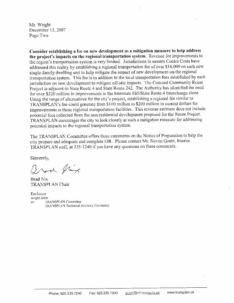


538 – 9th STREET, SUITE 200, OAKLAND, CALIFORNIA 94607 (510) 663-3830, FAX (510) 663-3833
EBHO EAST BAY HOUSING ORGANIZATIONS
December 18, 2007 City of Concord Local Reuse Authority Attention: Michael Wright 1950 Parkside Dr. MS/1B Concord, CA 94519
Re: East Bay Housing Organizations comments on Notice of Preparation for the Concord Community Reuse Project
Dear Mr. Wright, The description of the process for planning reuse of the Naval Weapons Station in the Notice of Preparation clarifies that selection of a Preferred Alternative will be made based in part on the EIR. Factors that will be considered are transportation; financial feasibility and fiscal sustainability; sustainability; environmental planning and resource management; and accommodating the needs of the homeless / conveying land for public benefit. Although mandatory CEQA analysis focuses on potentially significant impacts to the physical environment, aspects of the analysis will necessarily overlap with these planning considerations. For example, these planning issues will play a key role in shaping project objectives [§15124(b)], determining the feasibility of proposed mitigations [§15126.6(f)(1), and potential findings of overriding considerations [§15124(b)] . In similar fashion, CEQA does not require analysis of economic and social impacts, but recognizes that they can play a critical role in determining the significance of physical impacts [§15131(b)]. For these reasons, EBHO requests that the City ensure that those studies that will play a role in the evaluation of environmental impacts be made available to the public for review and comment as part of their preparation, and that they be referenced in the EIR where they affect judgments about the level of acceptable environmental impact. In particular, the public should be provided a timely opportunity to review and comment on the proposed fiscal and financial analysis and other analyses, including:
1. The assumptions and methodology that will be used to determine residential pro-formas, costs and allocation among project land uses of infrastructure and cleanup, project financing, timeframe, and phasing, possible establishment of a redevelopment project area, application of Concord’s inclusionary zoning requirements, and fiscal analysis.
2. Residential, including affordable housing and density, scenarios reflected in each of the alternatives and the cost/benefit assumptions of these scenarios.
3. Terms of conveyance of the property from the Navy
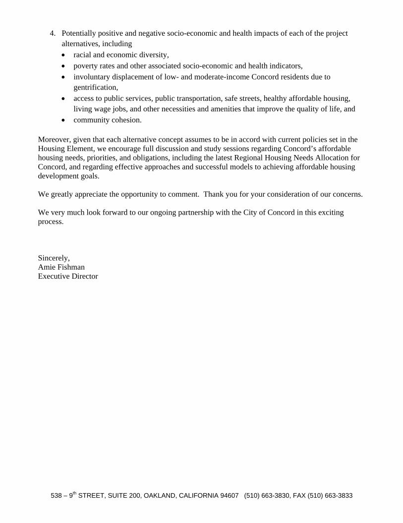
538 – 9th STREET, SUITE 200, OAKLAND, CALIFORNIA 94607 (510) 663-3830, FAX (510) 663-3833
4. Potentially positive and negative socio-economic and health impacts of each of the project alternatives, including • racial and economic diversity, • poverty rates and other associated socio-economic and health indicators, • involuntary displacement of low- and moderate-income Concord residents due to
gentrification, • access to public services, public transportation, safe streets, healthy affordable housing,
living wage jobs, and other necessities and amenities that improve the quality of life, and • community cohesion.
Moreover, given that each alternative concept assumes to be in accord with current policies set in the Housing Element, we encourage full discussion and study sessions regarding Concord’s affordable housing needs, priorities, and obligations, including the latest Regional Housing Needs Allocation for Concord, and regarding effective approaches and successful models to achieving affordable housing development goals. We greatly appreciate the opportunity to comment. Thank you for your consideration of our concerns. We very much look forward to our ongoing partnership with the City of Concord in this exciting process. Sincerely, Amie Fishman Executive Director


· · East Bay Chapter – California Native Plant Society – P.O. Box 5597, Elmwood Station, Berkeley, California 94705
California Native Plant Society East Bay Chapter
Conservation Committee
December 27, 2007
Michael Wright, Reuse Project Director
City of Concord Local Reuse Authority
1950 Parkside Drive, MS/1B
Concord, CA 94519
RE: Concord Community Reuse Project (CCRP) Notice of Preparation of Draft
Environmental Impact Report (DEIR)
Dear Mr. Wright:
The East Bay Chapter of the California Native Plant Society (EBCNPS) greatly
appreciates the opportunity to comment on the Concord Community Reuse Project (CCRP). The
California Native Plant Society (CNPS) is a non-profit organization of more than 10,000
laypersons, and professional and academic botanists organized into 33 chapters throughout
California. The mission of the CNPS is to increase the understanding and appreciation of
California's native plants and to preserve them in their natural habitat through scientific activities,
horticulture, education, and conservation.
Our chapter has a long history, dating back to 2004, of formal and informal conversations
with the City of Concord regarding the potential reuse of the Naval Weapons Station. We
appreciate the coordination and look forward to continuing to support the City in this process.
Additionally, EBCNPS has been meeting with a technical group of local environmental
organizations to help recognize potential environmental issues and opportunities relating to the
reuse of the Naval Weapons Station. Please see the environmental platform, attached to the end
of this document, which is intended to help the community and City understand some of our key
concerns in the reuse process.
The notice of preparation for this DEIR is programmatic in nature. One of the goals of a
programmatic EIR is to analyze cumulative impacts of a group of related projects. Since the
reuse process will probably require decades of smaller projects, a well written programmatic
document can greatly abbreviate subsequent project level EIRs if the document is comprehensive
and adaptive. We hope a range of impacts will be presented and an appropriate mitigation and
monitoring plan be produced to mitigate these impacts. A proper analysis at this scale can
greatly improve mitigation success and increase support from the environmental community.
Native flora will be impacted by each of the seven alternatives presented in the initial
study document. Adequate analysis of impacts to an area that is large and regionally significant
requires that floristic and vegetation surveys and analysis be conducted at fine scales and at the
appropriate times of year in order to get an accurate picture of species diversity and distribution.
These surveys require field-based mapping and full disclosure in the EIR to aid in identification

EBCNPS Conservation Committee
East Bay Chapter – Comments Concord Community Reuse Project NOP 2
of areas that require protection under CEQA. Surveys require adequate advance planning and
should follow the guidelines set forth in the following publications: California Native Plant
Society’s Botanical Survey Guidelines1, California Department of Fish and Game’s Guidelines
for Assessing the Effects of Proposed Projects on Rare, Threatened, and Endangered Plants and
Natural Communities2, and U.S. Fish and Wildlife’s Guidelines for Conducting and Reporting
Botanical Inventories for Federally Listed, Proposed and Candidate Plants3.
If suitable habitat is present, focused protocol-level special-status species surveys must be
conducted at the site prior to issuing permits. These surveys must be conducted during the
appropriate blooming periods of identified target species in order to adequately identify and map
potentially occurring populations and to meet CEQA compliance. We have attached a list of
current and historical special status plant taxa known from the Concord area.
EBCNPS strongly urges the City to initiate multi-year botanical surveys so that when
project specific concerns arise, there is an accurate, recent collection of appropriate surveys that
specifically serve the purpose of this reuse process. Although EBCNPS highly recommends the
use of old surveys for comparison studies, with recent changes in land use and management, new
surveys must be conducted in order to determine the quality of the habitat in the landscape.
Additionally, these surveys can help assess the need for interim management activities that will
allow for preserve of valuable resources in historically managed landscapes.
Finally, EBCNPS hopes that this process and reuse plan will continue to provide
opportunities for community participation and funding for community projects that can help
make the CCRP a success for all interested parties. The City of Concord has been receptive and
open to community concerns and we hope that this model will continue throughout the reuse
process. Thank you for your consideration of the above comments. Please do not hesitate to
contact me with questions at (510) 734 0335.
Sincerely,
Lech Naumovich
Conservation Analyst
California Native Plant Society
East Bay Chapter
1 California Native Plant Society (CNPS). 2001a. Inventory of Rare and Endangered Plants of California. 6th
Edition. Rare Plant Scientific Advisory Committee, David P. Tibor, Convening Editor. Sacramento, California. 388
pp.
2 CDFG. 2000. Guidelines for Assessing the Effects of Proposed Projects on Rare, Threatened, and Endangered
Plants and Natural Communities. Sacramento, CA. 3 USFWS. 2000. Guidelines for Conducting and Reporting Botanical Inventories for Federally Listed, Proposed and
Candidate Plants.

EBCNPS Conservation Committee
East Bay Chapter – Comments Concord Community Reuse Project NOP 3
Environmental Platform Concord Naval Weapons Station Reuse Plan
1) Develop 20 Percent—a Huge Area—of the Concord Naval Weapons Station and Preserve
80 Percent as Open Space.
We endorse the community of Concord’s demand that 80 percent of the Weapons Station be
preserved as public parks and open space. Approximately 65 percent of the Weapons Station
should be included in a regional park and 15 percent in a community park. This would protect
the Los Medanos Hills, the ridgeline between central and eastern Contra Costa County, and
Mount Diablo Creek while buffering existing neighborhoods and protecting sensitive
resources. Much of the Weapons Station is not developable, thus 80 percent is a reasonably-
sized park area. Concord’s hillside standards, which protect slopes, will require protection of a
significant part of the site, and the federal and state Endangered Species Acts will require
protection of large areas, as well.
Twenty percent (20%) of the Weapons Station, or approximately one thousand acres will be
available for development. This is a very large development area. For comparison, the
entirety of downtown Concord is well under 1000 acres.
2) Create a Sustainable, Economically Viable Community.
The Reuse Plan should strive to make the Weapons Station an economically viable model of
sustainable development for the entire Bay Area, the state, and the nation. The Reuse Plan
should include a high level of affordable and workforce housing. Concord’s General Plan
Housing Element states that 57 percent of new housing should be available for low-, very low-,
and moderate-income households, and the Reuse Plan should support this goal while focusing
on non-profit housing providers who maintain affordable housing in perpetuity. Construction
firms should be required to pay prevailing wages guaranteed through Project Labor
Agreements. The Reuse Plan should concentrate on green design, open space preservation, and
natural resource restoration. It should also focus on renewable energy sources and remediate
contaminated areas. The Navy’s responsibility for remediation of contaminated areas must not
be transferred to private owners without guarantees that remediation will be carried out and that
it will meet the standards applicable to the land use specified in the Reuse Plan.
3) Designate a World Class Regional Park: The Entire Area East Of Mount Diablo Creek
Should Be Protected
Concord, the largest city in Contra Costa County, is the only city in the East Bay without a
regional park. Most of Weapons Station’s open space should become a regional park for
“passive recreation” (walking, biking, picnicking, etc.) and for the public benefit of the entire
East Bay region. The natural landscape and wildlife corridor of the Los Medanos Hills as well
as all land east of Mount Diablo Creek and south of Highway 4 should be permanently
preserved as open space.

EBCNPS Conservation Committee
East Bay Chapter – Comments Concord Community Reuse Project NOP 4
Open space and trails have been shown to greatly increase property values and improve
residents’ quality of life. Development of the Weapons Station must include a funding
mechanism to support operation and maintenance of this new, much-needed regional park.
4) Design a Diverse, Vibrant, Walkable, Bikeable Community.
To make Concord a better place to live and to use our valuable resource of Weapons Station
land wisely, all new development should be in the form of walkable neighborhoods that include
a mix of jobs, shops, and homes people can afford. The developed area should include
different types of homes to meet the needs of singles, seniors, and families, as well as people
with a range of incomes. Development that includes retail and office space should be clustered
around the North Concord BART station to create a vibrant new neighborhood and make it
easy for people to commute and do errands near their homes. In areas farther from BART,
development should remain compact and include plenty of homes to make it possible for bus
service to be frequent and efficient. Throughout the area, trails and bike lanes should be
included to permit residents to get around easily without having to drive for every trip. The
developed area should include amenities and services to meet family and community needs
including parks, schools, health clinics, libraries, cultural and community centers, historic sites,
and small businesses. Additionally, a comprehensive parking management policy should be
developed so valuable land is not wasted on empty, unused parking lots and more land can be
saved for schools, open space, and community facilities.
5) Build No New Roads East of Mount Diablo Creek.
A road east of Mount Diablo creek would separate wildlife and recreational users of the creek
corridor from the protected Los Medanos Hills. Any major vehicle roads or transit should be
west of the creek except for regional park access. Non-motorized commuting and recreation
can alleviate traffic. Multi-use trails throughout the Weapons Station, including the linear park
buffer, should provide access to open space, recreation trails, and bike paths and extend beyond
the Weapons Station boundaries to regional trail networks.
6) Create Concord’s Own “Golden Gate Park”: A Linear Public Park Buffering Existing
Neighborhoods.
Central Park is 800 acres and Golden Gate Park is 1000 acres in size. A major linear park on
15 percent of the Weapons Station at its western boundary will buffer existing neighbors, who
will face the worst impacts, and help integrate the project with the city. It will serve residents
of the entire city and region, while enhancing economic values and connecting the North
Concord BART station with the regional park. The park can be developed over decades and
include cultural and other facilities such as museums and sports fields for the community.
7) Protect and Restore Mount Diablo Creek and Other Wildlife Corridors.
We endorse the ecological restoration of the entire length of Mount Diablo Creek and
recommend at least a 300-foot buffer on both sides of the creek, including north of Highway 4.
Mount Diablo Creek, an important wildlife corridor, should be preserved and restored without
any major realignment. Any upgrades to roads and other infrastructure that cross the creek
should be designed to ensure that they preserve and enhance wildlife corridors and that they do

EBCNPS Conservation Committee
East Bay Chapter – Comments Concord Community Reuse Project NOP 5
not create barriers to the movement of fish and wildlife. Wildlife passage and recreational trail
crossings should be part of planning for the Reuse Area’s transportation and road network.
8) Integrate Reuse of the Weapons Station to Make Concord a World-Class City.
The Weapons Station Reuse Plan should be integrated with existing plans for the City of
Concord. Coordinating downtown redevelopment and urban infill with the reuse of the
Weapons Station can work to make Concord a world class city. Onsite amenities and financial
benefits should be utilized to integrate the Weapons Station with the rest of the city to avoid
creating an island or a “New” Concord. The city should also consider implications of this
reuse process on the greater East Bay region.
9) Preserve Sensitive Resources and Encourage Environmental Education.
Preserve the natural and cultural resources of the area—unique vegetation, heritage trees,
endangered species, and sensitive habitats—that make it undeniably the “East Bay.” Use
appropriate native plants and drought-resistant landscaping for development. Encourage
education and interpretation of unique natural and cultural resources. It is especially important
to survey, disclose, and research the historical, natural, and cultural resources north of Kirker
Pass and south of Highway 4 and plan appropriately.
10) Incorporate Community-Based Planning for Major Projects.
In order to assure that all of the above goals are implemented and the Naval Weapons Station is
planned according to the community’s needs, it is important that future land use decisions
about the Weapons Station are made through a community-based planning process. An
extensive community-based planning process, sometimes called a charette, should be
conducted for the following specific areas: the half-mile radius around the North Concord
BART station, the area north of Highway 4, any planned transit villages, and the area between
Willow Pass Road and Bailey Road. During the reuse planning process, the city has been
conducting a series of public workshops to solicit community input. This public community
planning process should continue even after the land is transferred and development
agreements are in place to ensure that the community has a say in the final design of the
projects. Through this process, decision-making will be more transparent and will generate
more opportunities for collective visions and aspirations for social and economic justice.
The 5,000-acre Inland Area of the Concord Naval Weapons Station is one of the largest remaining developable areas in the entire San Francisco Bay region. Much of it is relatively pristine habitat for native plants and wildlife that has been preserved due to its status as a military base. This natural treasure deserves our concerted efforts to protect its unique vegetation, endangered species, sensitive habitat, and open space value and to plan its development in an environmentally and socially responsible manner. The following recommendations have been developed by members from the California Native Plant Society, Friends of Mount Diablo Creek, Greenbelt Alliance, Mount Diablo Audubon Society, Save Mount Diablo, and Sierra Club San Francisco Bay Chapter. As a coalition of environmentally-minded organizations and citizens, we support reuse of the Concord Naval Weapons Station to create a sustainable, economically-viable mixed-use development that preserves 80 percent of the land as open space and public parks and protects wildlife corridors, important plant habitat, and historical and cultural resources through a process that ensures environmental, social, and economic justice.

EBCNPS Conservation Committee
East Bay Chapter – Comments Concord Community Reuse Project NOP 6
CEQA-Protected Rare and Unusual Plants of the Concord Area (Statewide Rare Plants in Upper Case)
February 20, 2003
Rank in East
Bay Species Common Name Habitat
A1 Allium crispum crinkled onion Dry Open Slopes;
Serpentine; Misc. habitats
A1 Amsinckia tessellata var. gloriosa tessellate fiddleneck Sand or Sandstone; Misc.
habitats
*A2 ANDROSACE ELONGATA SSP. ACUTA California androsace Dry Open Slopes;
Grassland
*A2 ARCTOSTAPHYLOS AURICULATA Mt. Diablo manzanita Chaparral; Sand or
Sandstone
*A2 ASTER LENTUS Suisun marsh aster Misc. Wetlands
A1 Astragalus didymocarpus var. didymocarpus
(A. gambelianus is more common)
two-seeded milkvetch Grassland
A2 Bidens laevis bur-marigold Freshwater Marsh; Misc.
Wetlands
*A2 BLEPHARIZONIA PLUMOSA big tarplant Grassland; Scrub
*A2 CALOCHORTUS PULCHELLUS Mt. Diablo fairy-lantern Chaparral; Serpentine;
Woodland
*A2 CALOCHORTUS UMBELLATUS Oakland star-tulip Chaparral; Scrub;
Woodland
A2 Calystegia sepium ssp. limnophila hedge bindweed Misc. Wetlands
A2 Camissonia intermedia small primrose Burns; Scrub
A1 Carex globosa round-fruited sedge Misc. habitats
A1 Carex multicostata many-ribbed sedge Misc. habitats
A1x Castilleja ambigua ssp. ambigua (historical-
1937)
Johnny-nip Coastal Bluff; Grassland
*A1 CASTILLEJA RUBICUNDULA SSP.
RUBICUNDULA(?)
pink cream sacs Grassland
A2 Centromadia pungens ssp. maritima
(Hemizonia pungens ssp. maritima in
Jepson Manual)
(ssp. pungens is more common)
common spikeweed Salt Marsh
A2 Cicendia quadrangularis timwort Grassland
A1 Cicuta maculata var. bolanderi water hemlock Brackish Marsh; Salt
Marsh
A1 Collinsia bartsiifolia var. bartsiifolia white Chinese houses Sand or Sandstone
*A2 CORDYLANTHUS MOLLIS SSP.
MOLLIS
soft bird's-beak Brackish Marsh; Salt
Marsh
A2 Cornus glabrata brown dogwood Riparian
A1 Cucurbita foetidissima calabazilla Gravel; Rock, Tallus or
Scree; Sand or Sandstone
A2 Deinandra lobbii
(Hemizonia lobbii in Jepson Manual)
three-rayed tarweed Misc. habitats
A2 Deschampsia cespitosa ssp. holciformis tufted hairgrass Misc. Wetlands
A1x Downingia ornatissima var. eximia Solano downingia Vernal Pools; Misc.
Wetlands

EBCNPS Conservation Committee
East Bay Chapter – Comments Concord Community Reuse Project NOP 7
Rank in East
Bay Species Common Name Habitat
A1 Elatine brachysperma waterwort Freshwater Marsh; Misc.
Wetlands
*A1 ERODIUM MACROPHYLLUM round-leaved filaree Grassland; Scrub
A1 Eryngium articulatum coyote-thistle Freshwater Marsh;
Riparian; Misc. Wetlands
A1 Glaux maritima sea-milkwort Alkali areas; Salt Marsh;
Misc. Wetlands
A1 Glyceria leptostachya Davy's mannagrass Freshwater Marsh; Riparian
A1 Guillenia flavescens yellow-flowered thelypodium Serpentine
A2 Helenium bigelovii
(H. puberulum is more common)
Bigelow's sneezeweed Brackish Marsh;
Freshwater Marsh
*A2 HELIANTHELLA CASTANEA Diablo helianthella Chaparral; Grassland;
Woodland
A1 Helianthus gracilentus slender sunflower Burns; Dry open Slopes
A2 Hemizonia lobbii (See Deinandra)
A2 Hemizonia pungens ssp. maritima (See
Centromadia)
A2 Hoita macrostachya California hemp Freshwater Marsh; Riparian
*A1 LASTHENIA CONJUGENS Contra Costa goldfields Alkali areas; Vernal Pools;
Misc. Wetlands
A2 Lasthenia glaberrima smooth goldfields Vernal Pools; Misc.
Wetlands
*A2 LATHYRUS JEPSONII VAR. JEPSONII Delta tule pea Brackish Marsh;
Freshwater Marsh
A1x Layia glandulosa white layia Sand or Sandstone
A2 Lepidium dictyotum var. acutidens sharp-toothed pepper-grass Alkali areas
A2 Leptochloa fascicularis bearded sprangletop Misc. Wetlands
A2 Lessingia glandulifera var. glandulifera valley lessingia Forest; Sand or Sandstone
*A2 LILAEOPSIS MASONII Mason's lilaeopsis Brackish Marsh;
Freshwater Marsh
A1x Limnanthes douglasii ssp. douglasii
(historical-1940)
meadowfoam Vernal Pools; Misc.
Wetlands
A1 Limnanthes douglasii ssp. nivea meadowfoam Vernal Pools; Misc.
Wetlands
A2 Linanthus dichotomus evening snow Gravel; Rock, Tallus or
Scree; Sand or Sandstone;
Serpentine
A1 Linanthus pygmaeus ssp. continentalis pigmy linanthus Misc. habitats
A1x Linum lewisii var. lewisii (historical-1936) western blue flax Dry Open Slopes
A2 Lithophragma bolanderi Bolander starflower Misc. habitats
A1 Lupinus affinis lupine Misc. habitats
A1x Lupinus luteolus butter lupine Misc. habitats
*A1 MALACOTHAMNUS HALLII
(M. fasciculatus in Jepson Manual)
Hall's bush mallow Chaparral
A1 Malacothrix coulteri snake's-head Grassland; Scrub; Sand or
Sandstone
*A1 MICROPUS AMPHIBOLUS Mt. Diablo cottonweed Dry Open Slopes;
Grassland; Rock, Tallus or
Scree
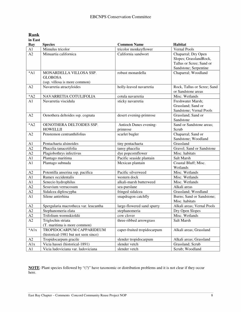
EBCNPS Conservation Committee
East Bay Chapter – Comments Concord Community Reuse Project NOP 8
Rank in East
Bay Species Common Name Habitat
A1 Mimulus tricolor tricolor monkeyflower Vernal Pools
A2 Minuartia californica California sandwort Chaparral; Dry Open
Slopes; GrasslandRock,
Tallus or Scree; Sand or
Sandstone; Serpentine
*A1 MONARDELLA VILLOSA SSP.
GLOBOSA
(ssp. villosa is more common)
robust monardella Chaparral; Woodland
A2 Navarretia atractyloides holly-leaved navarretia Rock, Tallus or Scree; Sand
or Sandstone areas
*A2 NAVARRETIA COTULIFOLIA cotula navarretia Misc. Wetlands
A1 Navarretia viscidula sticky navarretia Freshwater Marsh;
Grassland; Sand or
Sandstone; Vernal Pools
A2 Oenothera deltoides ssp. cognata desert evening-primrose Grassland; Sand or
Sandstone
*A2 OENOTHERA DELTOIDES SSP.
HOWELLII
Antioch Dunes evening-
primrose
Sand or Sandstone areas;
Scrub
A2 Penstemon centranthifolius scarlet bugler Chaparral; Sand or
Sandstone; Woodland
A1 Pentachaeta alsinoides tiny pentachaeta Grassland
A2 Phacelia tanacetifolia tansy phacelia Gravel; Sand or Sandstone
A2 Plagiobothrys infectivus dye popcornflower Misc. habitats
A1 Plantago maritima Pacific seaside plantain Salt Marsh
A1 Plantago subnuda Mexican plantain Coastal Bluff; Misc.
Wetlands
A2 Potentilla anserina ssp. pacifica Pacific silverweed Misc. Wetlands
A1 Rumex occidentalis western dock Misc. Wetlands
A1 Senecio hydrophilus alkali-marsh butterweed Misc. Wetlands
A2 Sesuvium verrucosum sea-purslane Alkali areas
A2 Sidalcea diploscypha fringed sidalcea Grassland; Woodland
A1 Silene antirrhina snapdragon catchfly Burns; Sand or Sandstone;
Misc. habitats
A2 Spergularia macrotheca var. leucantha large-flowered sand spurry Alkali areas; Vernal Pools
A2 Stephanomeria elata stephanomeria Dry Open Slopes
A2 Trifolium wormskioldii cow clover Misc. Wetlands
A2 Triglochin striata
(T. maritima is more common)
three-ribbed arrowgrass Salt Marsh
*A1x TROPIDOCARPUM CAPPARIDEUM
(historical-1981 but not seen since)
caper-fruited tropidocarpum Alkali areas; Grassland
A2 Tropidocarpum gracile slender tropidocarpum Alkali areas; Grassland
A1x Vicia hassei (historical-1891) slender vetch Grassland; Scrub
A1 Vicia ludoviciana var. ludoviciana slender vetch Scrub; Woodland
NOTE: Plant species followed by “(?)” have taxonomic or distribution problems and it is not clear if they occur
here.

EBCNPS Conservation Committee
East Bay Chapter – Comments Concord Community Reuse Project NOP 9
Dates indicated for historical species refer to last known record in the Alameda-Contra Costa Counties area.
Explanation of Ranks
*A1 or *A2: Species in Alameda and Contra Costa counties listed as rare, threatened or endangered statewide by
federal or state agencies or by the state level of CNPS.
A1x: Species previously known from Alameda or Contra Costa Counties, but now believed to have been extirpated,
and no longer occurring here.
A1: Species currently known from 2 or less regions in Alameda and Contra Costa Counties.
A2: Species currently known from 3 to 5 regions in the two counties, or, if more, meeting other important criteria
such as small populations, stressed or declining populations, small geographical range, limited or threatened habitat,
etc.

December 28, 2007 City of Concord Concord Community Reuse Project ATTN: Michael Wright 1950 Parkside Dr. MS/53 Building D, Permit Center Concord Ca, 94519 Subject: Concord Community Reuse Project – Concord Naval Weapons Station Dear Mr. Wright: The East Bay Regional Park District (District) has received the Notice of Preparation (NOP) for the Concord Community Reuse Project Draft Environmental Impact Report (DEIR) and appreciates the opportunity to provide the following comments. The District has previously provided written comments on the initial NOP for the project in a letter dated June 12, 2007. The East Bay Regional Park District (the ‘District’) has been actively advocating for and coordinating with the National Park Service and others on a public benefit conveyance for approximately 2,900 acres (59%) of the closed federal property at the Concord Naval Weapons Station (CNWS) to establish a great urban regional park. The District has had a long-term interest in the CNWS site, and has participated in the past on the CNWS Joint Use Committee with the City of Concord following the station’s placement in a Reduced Operational Status in 1999. The committee explored opportunities for civilian access and use of the CNWS site. A great urban regional park on CNWS can generate substantial economic benefits and other quality of life benefits for the community. The District looks forward to continuing to work together with the City of Concord to create a great urban regional park within the world-class project at the CNWS. The District believes that by working together on creative funding options with the City of Concord and all stakeholders, we can expedite the promises to provide a world-class regional park to the community much sooner than if the City waits decades for the development to generate the funding by itself.

Detailed scoping comments on the Reuse Plan and NOP are attached. The District appreciates the opportunity to comment on the NOP and Initial Study for the Concord Community Reuse Plan and looks forward to continuing to work with the City of Concord to develop a world class project incorporating regional park and trail facilities that meets the needs of the community. Please feel free to contact me at (510) 544-2623 or by email at [email protected] should you have any questions. Respectfully,
Brian W. Holt Senior Planner Cc: Concord City Council/LRA
Community Advisory Committee EBRPD Board of Directors

EAST BAY REGIONAL PARK DISTRICT SCOPING COMMENTS CONCORD COMMUNITY REUSE PROJECT – NOTICE OF PREPARATION DECEMBER 28th 2007 COMPREHENSIBILITY The intent of the California Environmental Quality Act (CEQA) and the requirement to prepare an Environmental Impact Report (EIR) for projects such as the Concord Community Reuse Project is to provide for a public decision making process that is informed and comprehensive in its disclosure of the available information and analysis concerning a project and its potential effects. The Concord Community Reuse Project is a substantial project comprising an area of eight square miles and a quarter of the City of Concord. The EIR will be evaluating seven alternatives at an equal level of analysis. It can be reasonably anticipated that the amount of information and analysis prepared for the project will be unwieldy and overwhelming for the vast majority of the general public and decision makers. In order to comply with the intent of CEQA and provide for an informed public decision making process, the EIR should be organized in a manner that is highly comprehensible by the general public. The EIR should incorporate the use of maps and visual exhibits as appropriate and general summaries should be provided in a manner that will be comprehensive yet easily understood by all. The City should make a concerted effort to ensure that the information and analysis prepared and presented in the EIR is presented and disseminated in a manner that is readily understood by all stakeholders, residents, and decision makers. NATIONAL ENVIRONMENTAL POLICY ACT The CNWS is a federal facility and the closure and any future use of the site will be subject to the National Environmental Policy Act (NEPA) as well as CEQA. While similar, the two processes do have different requirements to meet both the state and federal mandates. The NOP describes what is next for the City’s process under CEQA, but fails to describe how the NEPA process will be addressed. The NOP should make an effort to describe how the NEPA requirements will be addressed and how that process will correlate with the CEQA review process.
1

ALTERNATIVES Extended Neighborhoods
The only Alternative included in the “Extended Neighborhoods” category is Alternative 1. Alternative 1 proposes the second fewest housing units and the lowest amount of employment generation yet would also result in the smallest percentage of area remaining for parks, recreation, and open space.
- The amount and cost of infrastructure and services necessary to serve such a large development footprint would be expected to be much greater than an alternative promoting a more concentrated development. How does the economic sustainability and feasibility of Alternative 1 compare to the other more clustered alternatives?
- Alternative 1 includes a minimum of seven creek crossings and extensive development
on the east side of the creek. What biologic, aesthetic, and cultural resource impacts would result through development within the visual and habitat corridor between the Cities of Concord and Pittsburg?
- Alternative 1 includes the development of a thru-road connecting Kirker Pass Road and
Highway 4 on the east side of Mt. Diablo Creek. The inclusion of this road east of Mt. Diablo Creek and connecting to Kirker Pass Road will require thorough analysis in the draft EIR.
How will this affect traffic patterns between eastern Contra Costa County and
Concord? What wildlife impacts would result from development of a thru-road in an
important wildlife corridor between the Los Medanos Hills and Mt. Diablo Creek? How will wildlife corridors be preserved between the Los Medanos Hills and Mt. Diablo Creek?
2

What impacts and changes to the regional circulation network will result from the introduction of off-site traffic across the CNWS (i.e. from East Contra Costa County and/or from Walnut Creek)?
- According to data provided in the U.S. Navy’s Environmental Condition of Property
Report, the lands south of Bailey Road and east of Mt. Diablo Creek provide substantial habitat for special status wildlife species and a number of occurrences of potential wetlands. The majority of special status species are concentrated in these areas. What resource impacts would result from development in the most sensitive areas of the CNWS property and would mitigation for such expansive disturbance occur onsite?
Clustered Villages
The “Clustered Villages” category includes Alternatives 2, 3, and 6. Alternatives 2 and 3 both propose development east of Mt. Diablo Creek, a thru-road connecting Highway 4 to Kirker Pass Road, and development south of Bailey Road. Alternative 6 does not include development east of the creek and includes a thru-road between Bailey Road and Willow Pass Road.
- As with Alternative 1, the EIR will need to evaluate the unique traffic/circulation, biologic, and aesthetic resource impacts, among others, associated with the development of a thru-roadway as proposed in Alternatives 2 and 3 between Kirker Pass Road and Highway 4.
- Alternatives 2 and 3 would require the development of substantial infrastructure
necessary to serve the components of the project developed east of Mt. Diablo Creek and south of Bailey Road. What are the extra costs associated with extending infrastructure and providing services to areas separated from the existing development
3

in Concord and the transit village proposed adjacent to the North Concord BART station?
- Alternative 3 is the only alternative that includes a substantial amount of employment
generating uses on the south end of the site along Bailey Road., with large areas designated for Community Facility/Institutional, Commercial Hotel, and Commercial Retail as well as Single Family Residential. What would be the transportation and circulation impacts of developing an employment center at the south end of the property in a manner that is highly auto dependent and far removed from public transit?
- As with Alternative 1, Alternatives 2 and 3 include substantial development east of Mt.
Diablo Creek and south of Bailey Road within areas identified by the U.S. Navy’s Environmental Condition of Property report as being the most resource sensitive areas on the property.
Concentration and Conservation
The “Concentration and Conservation” category includes Alternatives 4, 5, & 7. The intent of the category is to maximize parks, recreation, and open space.
- Alternatives 4 & 5 both include development east of Mt. Diablo Creek in an area identified in Navy studies as providing substantial habitat for special status species.
- As with Alternatives 1, 2, and 3, Alternative 4 includes a thru-road connecting Kirker
Pass Road to Highway 4 located on the east side of Mt. Diablo Creek. The EIR will need to evaluate the unique traffic/circulation, biologic, and aesthetic resource impacts, among others, associated with the development of a thru-roadway as proposed in Alternative 4 between Kirker Pass Road and Highway 4.
4

- Alternatives 4 and 5 would both require the development of substantial infrastructure
and provision of services to serve the portions of the development proposed separated from the existing city and proposed transit village area adjacent to the North Concord BART station.
How would the costs associated with the development of extra infrastructure
and provision of extra services beyond the primary area of development affect the economic feasibility and sustainability of the Alternative? Would the extra infrastructure and service costs outweigh the benefit of development of those particular aspects of the project?
What protections would be instituted to ensure the lands between the southern
development area and the northern development areas in Alternative 4 would not be available for development in the future?
SCOPING COMMENTS Aesthetics The inland area of the CNWS is currently maintained as protected open space. Development of the site would have the potential to result in adverse effects to scenic vistas (Los Medanos Hills, Mt. Diablo, general open space), substantially change scenic resources (trees, grasslands, views of Mt. Diablo, rock outcroppings, riparian corridors, Mt. Diablo creek, potentially historic buildings, wetlands, etc.), substantially degrade the existing visual character and quality of the site (loss of open space/natural lands), and create new sources of light and glare. The Reuse Plan should be proactive in avoiding potential aesthetic effects to the maximum extent feasible. Alternatives 6 and 7 seem to preserve the most aesthetically significant features on the property (scenic vistas, Los Medanos Hills, rock out croppings, trees, grasslands, natural resources). Where adverse effects cannot be avoided, they should be minimized to the degree possible and mitigation must be incorporated to reduce the potential significant effects to less than significant levels. The EIR should be proactive in identifying the following aesthetic effects, and the Reuse Plan should be designed in a manner that avoids aesthetic impacts:
- Offsite views of the Diablo Valley, Las Trampas and Briones Regional Parks, and Mt. Diablo State Park should be preserved, and development that obstructs such views would result in significant adverse aesthetic effects that should be avoided, and minimized/mitigated where avoidance is not feasible.
- If the Reuse Plan proposes the establishment of park lands and trails that provide access
to scenic vistas, a beneficial aesthetic impact should be identified and non-motorized
5

public access should be encouraged as appropriate to the scenic vistas on the property that provide panoramic views of the Central Contra Costa County region.
- Roadways outside of proposed development areas, such as the north/south connector
road between Bailey Road or Kirker Pass Road and Highway 4, would introduce a substantial amount of light and glare in an area that otherwise would not experience such conditions. Such development and infrastructure that would have the potential to be introduced outside of concentrated development areas should be avoided, and light/glare generating development and infrastructure should be concentrated to reduce the area of impact.
Air Quality Any development will undoubtedly have substantial air quality effects in an area already in nonattainment for 1-hour and 8-hour ozone levels. The Reuse Plan should be proactive in designing a project that avoids further contributions to air quality impacts by minimizing the amount of development, planning for high density compact development adjacent (within ¼ to ½ mile maximum) to existing transit centers and transportation corridors, providing for Transit Oriented Development and pedestrian friendly designs that avoid and minimizing automobile dependency, plan for non-polluting land uses, and incorporate open space protection and native landscaping throughout the project. The Draft EIR will have to analyze the potential greenhouse gas (GHG) emissions of any potential development projects on the CNWS site and what the potential contribution to climate change may be and demonstrate compliance with AB32.
- Air quality impacts associated with high amounts of auto emissions can be avoided by developing a Reuse Plan that favors a more compact and less auto-dependent development pattern.
- Alternatives 1, 2, 3, and 4 appear to spread development across the project site and
would, therefore, result in a greater amount of vehicle miles traveled and higher air quality impacts. These alternatives each propose development on the very south end of the property, adjacent to and south of Bailey Road, in an area that would not be served by public transit and would necessitate the use of the automobile as the sole mode of transportation.
- Emissions generated by offsite traffic traveling through the CNWS site on the proposed
thru-road connecting Highway 4 to Kirker Pass Road will need to be included in the estimation of air quality impacts and greenhouse gas emissions on those alternatives where such a road is included (Alternatives 1,2,3, and 4).
- The Reuse Plan should plan for and include non-motorized transportation facilities such
as trails and bike lanes, and provide for pedestrian friendly design to minimize the use of automobiles across the site.
6

- The Reuse Plan should propose and incorporate Green Building design standards and the project should strive for certification under the Leadership in Energy and Environment (LEED) Green Building Rating System. LEED is the nationally accepted benchmark for the design, construction and operation of high performance green buildings. The LEED program is designed to minimize the amount of energy use in a building, and thus, decreases the air quality effects of new development. Phase 1 of the Community Reuse Project also developed a Guiding Principle calling for the incorporation of ‘green’ design and construction practices.
- The Reuse Plan should minimize the amount of paved surfaces proposed throughout the
project area and should propose the incorporation of landscaping throughout developed areas to promote the capture of evaporative emissions associated with large paved surfaces.
Biological Resources The inland portion of the CNWS property is known to be a biologically rich site that is currently maintained as protected open space. Any development of the site would have a high likelihood of resulting in significant adverse impacts to biological resources. The Reuse Plan should be designed in a manner that is proactive in its avoidance of impacts to biological resources. Biological resource mitigation measures must be designed in a manner that does not preclude the use of public lands by the public for compatible recreation activities. Additionally, the Reuse Plan should be proactive in looking for opportunities to conduct habitat restoration, protection of wildlife and open space corridors, and maintaining complete intact landscapes. The EIR should consider the development of a Habitat Conservation Plan/Natural Communities Conservation Plan (HCP/NCCP) for the CNWS site in order to ensure the protection of biologic resources is balanced with the potential development proposed for the site.
- The U.S. Navy’s Environmental Condition of Property report includes data concerning the presence of sensitive biological resources. All of the alternatives propose some level of development in areas of sensitive habitats and special status species. The majority of the resources appear to be concentrated on the lands east of Mt. Diablo Creek, along the Mt. Diablo Creek riparian corridor, and in the area south of Bailey Road. Alternatives 1, 2, 3, and 4 all show development in the areas mapped by the U.S. Navy as having the highest level of biological sensitivity.
- Development of a thru-roadway on the east side of Mt. Diablo Creek as proposed in
Alternatives 1,2,3, and 4 would serve as a significant barrier to the movement of wildlife between the Los Medanos Hills and the riparian area. Impacts associated with habitat fragmentation, barriers to wildlife movement, and the potential ‘roadkill’ impacts of any new road development east of Mt. Diablo Creek will need to be evaluated in the EIR.
7

- The CNWS site provides a number of substantial restoration opportunities including, but not limited, restoration of Mt. Diablo Creek and its associated riparian corridor, wetland restoration, and restoration of oak savannahs. The Reuse Plan should be proactive in planning for the restoration of the site resulting in beneficial biologic resource impacts.
Cultural Resources The Reuse Plan should be proactive in fully disclosing the presence of culturally and historically significant resources and features on the CNWS property. Impacts to historic and cultural resources should be avoided.
- The East Bay Regional Park District in partnership with a number of groups including the National Park Service, the Friends of Port Chicago, and the Concord Historical Society has proposed the development of a multi-agency historical and cultural interpretation center. Historical resources that can not be preserved in their current location, i.e. the stained glass windows in the Chapel, should be preserved in this interpretation center for the public benefit.
Hazards & Hazardous Materials The Draft EIR will need to disclose and address the extensive history and over 20 years of documentation of contamination and remedial investigations on the inland area of CNWS by the Environmental Protection Agency, the Navy, and state environmental agencies. Hazardous materials found at various locations of the inland area of the CNWS include arsenic, chlordane, and volatile organic compounds. Additionally, the potential for unexploded ordinance to be uncovered on the CNWS property should be addressed. Furthermore, for the benefit of informed decision making, the Draft EIR and Reuse Plan should clearly describe the timeline and extent of clean up responsibility of the U.S. Navy. The draft EIR and Reuse Plan will need to incorporate measures to control blowing dust and movement of potentially contaminated soils during construction activities. Hydrology & Water Quality The potential for hydrologic and water quality impacts should be fully analyzed and disclosed early in the process to allow for such information to be considered and incorporated into the formulation of a range of alternatives. The Reuse Plan should be proactive in protecting water quality, providing substantial riparian and sensitive habitat buffers, and avoiding hydrologic impacts. Additionally, opportunities for restoration and improvement of water quality, particularly with regards to Mt. Diablo Creek, should be embraced.
8

- Each of the Alternatives indicate that the existing Diablo View Golf Course will be designated for development. It is anticipated that the Reuse Plan will identify a golf course elsewhere on the CNWS site. The EIR will need to address the use of pesticides and herbicides related to golf course maintenance, and the potential for such chemicals to affect the water quality of Mt Diablo Creek.
- Alternatives 1, 2, 3, 4, 5, and 6 each propose new crossings of Mt. Diablo Creek.
Crossings of Mt. Diablo Creek should be limited and measures will need to be incorporated to preserve water quality and limit runoff from roadways into the creek.
- Mt. Diablo Creek has substantial restoration opportunities. The Reuse Plan should be
proactive in planning for the restoration of this critical resource and strive to achieve a beneficial water quality impact.
Land Use & Planning The 1994 Concord General Plan set forth goals and policies that recognize the value of the CNWS as visual open space and as valuable wildlife habitat. When the 2030 Concord General Plan was adopted, the goals and policies regarding the CNWS were not changed or amended. The EIR will need to fully analyze the impacts of changing the goals and policies pertaining to the CNWS in the 1994 Concord General Plan. Phase I of the Concord Community Reuse Project included the formulation of Goals and Guiding Principles. These Goals and Guiding Principles and the considerable community input received during Phase I of the project should be consistent with, and incorporated throughout, the Reuse Plan. The Draft EIR should include a discussion on the Reuse Plans consistency with the community planning effort undertaken to develop the Goals and Guiding Principles during Phase I of the Community Reuse Project. The Goals and Guiding Principles included, but were not limited to, the following:
- Environmentally Sustainable Development - Maximize Open Space - Resource Conservation - Transit-Oriented Development - Multi-Modal Transportation System - Regional Connectivity of Parks and Open Space Areas - ‘Green Building’ Practices
The individual alternatives will have to be evaluated in the EIR to determine their consistency with the Goals and Guiding Principles, and the proposed project in the Reuse Plan will need to demonstrate that the Goals and Guiding Principles are being applied.
9

Noise The EIR will need to evaluate the potential for noise to impact existing residents, increase ambient noise levels, and disturb wildlife throughout the CNWS property.
- Alternatives 1, 2, 3, 4, and 5 include development on the east side of Mt. Diablo Creek. The Los Medanos Hills, Mt. Diablo Creek, and the open landscape between serves as a critical wildlife corridor between Suisun Bay and Mt Diablo. The Navy’s Environmental Condition of Property report indicates a high concentration of sensitive habitats and special status species on the lands east of Mt. Diablo Creek. The EIR will need to evaluate the impacts of increased noise levels due to development proposed east of Mt. Diablo Creek, including noise generated on roadways adjacent to sensitive habitats.
Transportation and Circulation Traffic and circulation impacts will require thorough analysis in the Draft EIR. The Reuse Plan should be proactive in providing a compact urban development centered around existing transit facilities that minimize automobile dependence while providing a pedestrian friendly atmosphere and access to regional non-motorized facilities.
- Traffic modeling will need to take into account planned and approved projects throughout the region including the Eastern Contra Costa County cities of Antioch, Brentwood, and Oakley as well as those cities directly adjacent to Concord including Pittsburg, Clayton, and Walnut Creek.
- The EIR should take into account planned circulation improvements such as the
Highway 4 Bypass project, James Donlon Road extension to Kirker Pass Road, San Marcos Boulevard extension to Bailey Road, and others as appropriate.
Financial Feasibility and Fiscal Sustainability Without adequate funding for ongoing maintenance and operation of open space, parks, and restoration, the CNWS alternatives would result in significant adverse impacts, especially in the elements of aesthetics, biological resources, cultural resources, hydrology and water quality, and land use and planning. The EIR should fully acknowledge the need for such adequate funding and identify potential funding sources for the ongoing maintenance and operation of open space, parks, and restoration. As identified in the EBRPD letter dated December 7, 2007, responding to the request for additional information regarding the Districts Public Benefit Conveyance request, the District believes that by working together on creative funding options with the City of Concord and the full range of stakeholders we can expedite the promises to provide a world-class park to the community much sooner than if the City waits decades for the development to generate the funding by itself.
10


Top Related