


Languages
Pages
Legal


Connected Vehicles and Weather – The Vehicle Data Translator (VDT) Version 3.0
Michael Chapman National Center for Atmospheric Research (NCAR)
Research Applications Lab (RAL) Boulder, CO
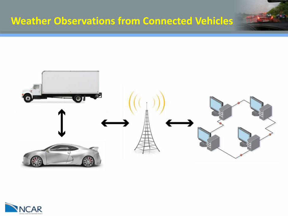
Weather Observations from Connected Vehicles

Weather Observations from Connected Vehicles

Vehicle Data Translator (VDT) – Version 3.0
Objectives
Develop and improve the Connected Vehicles’ role in “Anytime, Anywhere Road Weather Information”
Better Characterization of current weather and road-weather conditions
Accurate Quality Checking and/or Quality Control of vehicle data
Development of inferred road segment specific weather and
road-weather information for end-user applications
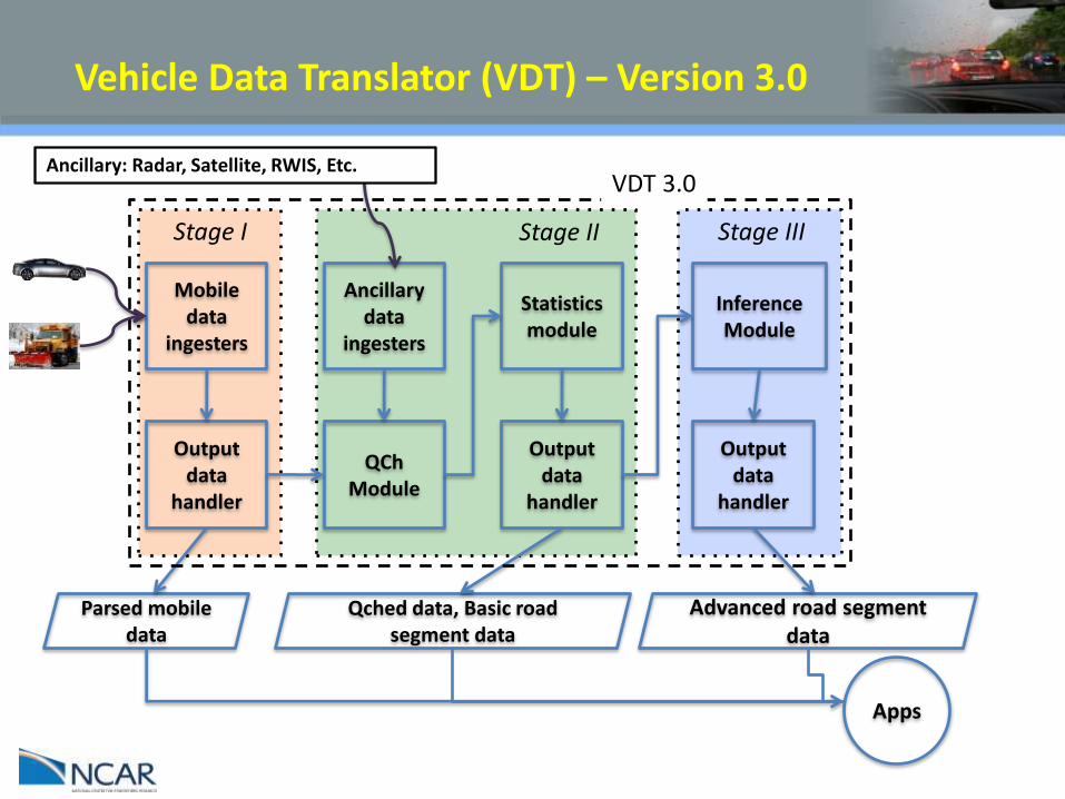
Vehicle Data Translator (VDT) – Version 3.0
Mobile data
ingesters
Parsed mobile data
Output data
handler
QCh Module
Statistics module
Ancillary data
ingesters
Qched data, Basic road segment data
Output data
handler
Inference Module
Advanced road segment
data
Output data
handler
Apps
Stage I Stage II Stage III
VDT 3.0 Ancillary: Radar, Satellite, RWIS, Etc.

Vehicle Data Translator (VDT) – Version 3.0
Mobile data
ingesters
Parsed mobile data
Output data
handler
Apps
Stage I • Ingest vehicle data from CANBus & aftermarket sensors
• Data parsed, sorted/binned
• Light Quality Control
• Sorted by time, road segment and grid cell
– Segments & grids user defined
• All processed data available for other applications

Vehicle Data Translator (VDT) – Version 3.0
Mobile data
ingesters
Parsed mobile data
Output data
handler
QCh Module
Statistics module
Ancillary data
ingesters
Qched data, Basic road segment data
Output data
handler
Inference Module
Advanced road segment
data
Output data
handler
Apps
Stage I Stage II Stage III
VDT 3.0 Ancillary: Radar, Satellite, RWIS, Etc.
Vehicle Data Translator (VDT) – Version 3.0
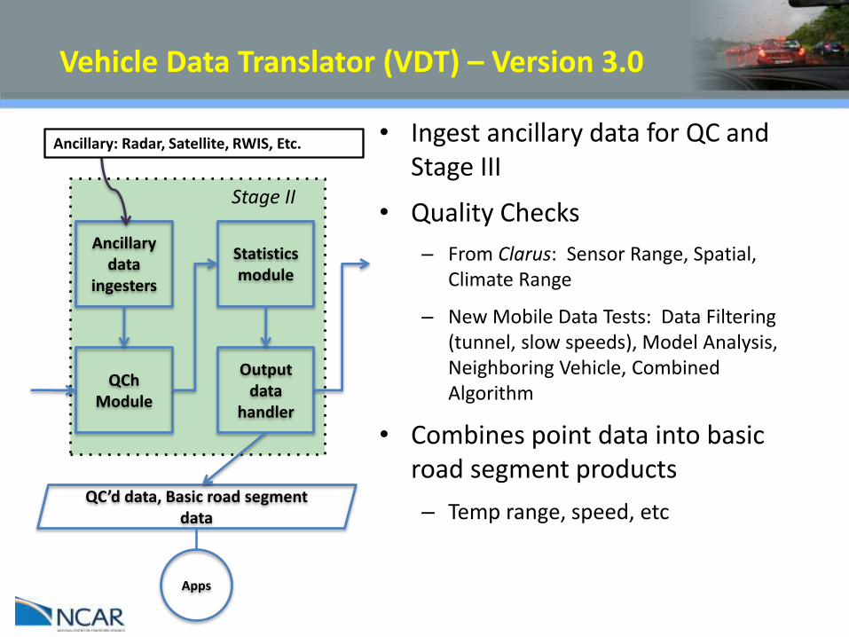
QCh Module
Statistics module
Ancillary data
ingesters
QC’d data, Basic road segment data
Output data
handler
Apps
Stage II
Ancillary: Radar, Satellite, RWIS, Etc. • Ingest ancillary data for QC and Stage III
• Quality Checks
– From Clarus: Sensor Range, Spatial, Climate Range
– New Mobile Data Tests: Data Filtering (tunnel, slow speeds), Model Analysis, Neighboring Vehicle, Combined Algorithm
• Combines point data into basic road segment products
– Temp range, speed, etc

Vehicle Data Translator (VDT) – Version 3.0
Mobile data
ingesters
Parsed mobile data
Output data
handler
QCh Module
Statistics module
Ancillary data
ingesters
Qched data, Basic road segment data
Output data
handler
Inference Module
Advanced road segment
data
Output data
handler
Apps
Stage I Stage II Stage III
VDT 3.0 Ancillary: Radar, Satellite, RWIS, Etc.

Vehicle Data Translator (VDT) – Version 3.0
Inference Module
Advanced road segment
data
Output data
handler
Stage III
• More sophisticated road impact information
• Precipitation Type and Intensity: combines basic vehicle (e.g. wiper, temp), weather radar and satellite data
• Visibility: combines basic vehicle (e.g. headlight, wiper, temp), satellite and fixed weather station data
• Pavement Condition: combines more vehicle (e.g. ABS, traction, etc) , weather radar and satellite
Apps

APPLICATIONS – IMO Project
Where do the roads need treatment?

APPLICATIONS
VDT-based weather alerts Impending weather hazards Alerts from other vehicles Re-routing Decision support
Not just for the everyday driver!

APPLICATIONS
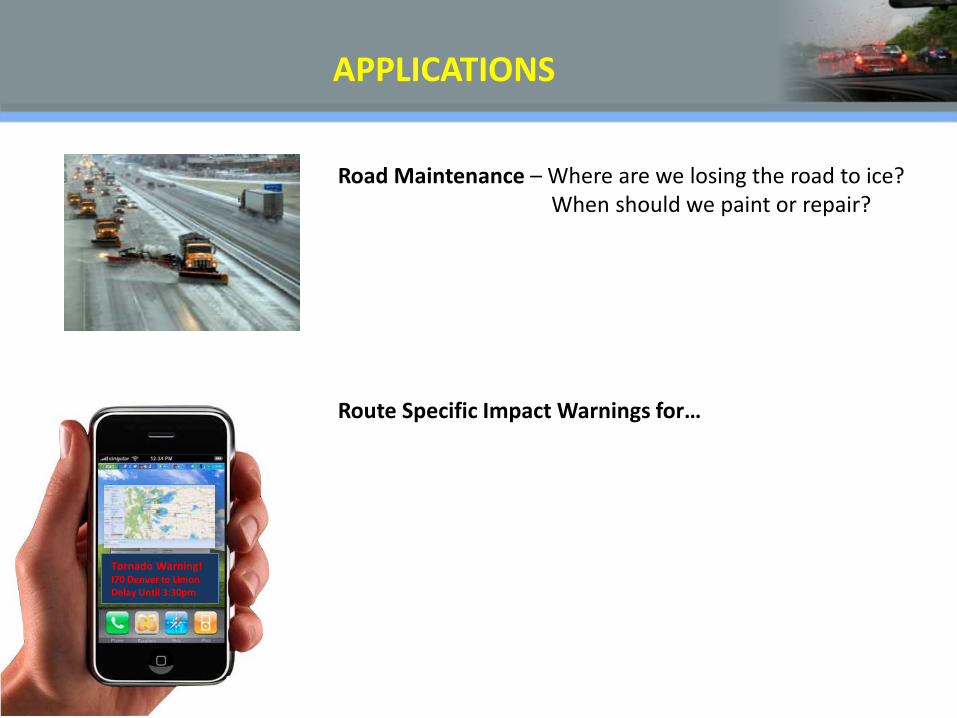
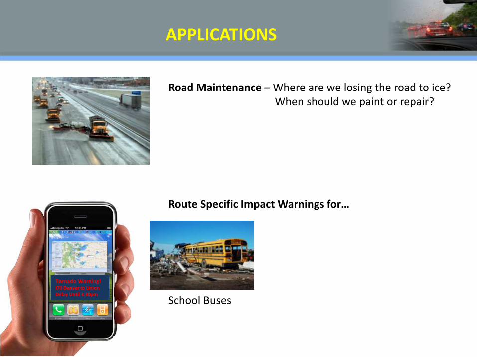
Road Maintenance – Where are we losing the road to ice? When should we paint or repair?
APPLICATIONS
Tornado Warning! I70 Denver to Limon Delay Until 3:30pm
Route Specific Impact Warnings for…
Road Maintenance – Where are we losing the road to ice? When should we paint or repair?
APPLICATIONS
Tornado Warning! I70 Denver to Limon Delay Until 3:30pm
Route Specific Impact Warnings for…
School Buses
Road Maintenance – Where are we losing the road to ice? When should we paint or repair?

APPLICATIONS
Tornado Warning! I70 Denver to Limon Delay Until 3:30pm
Route Specific Impact Warnings for…
School Buses
Truckers
Road Maintenance – Where are we losing the road to ice? When should we paint or repair?

Road Maintenance – Where are we losing the road to ice? When should we paint or repair?
APPLICATIONS
Tornado Warning! I70 Denver to Limon Delay Until 3:30pm
Route Specific Impact Warnings for…
School Buses
Truckers
EMS
More APPLICATIONS
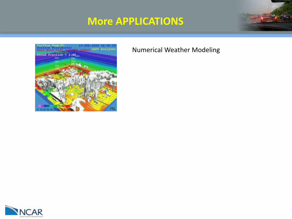
Numerical Weather Modeling

More APPLICATIONS
Numerical Weather Modeling
Traffic Modeling and Alerting
More APPLICATIONS
Numerical Weather Modeling
Traffic Modeling and Alerting
Weather Modeling – complex terrain

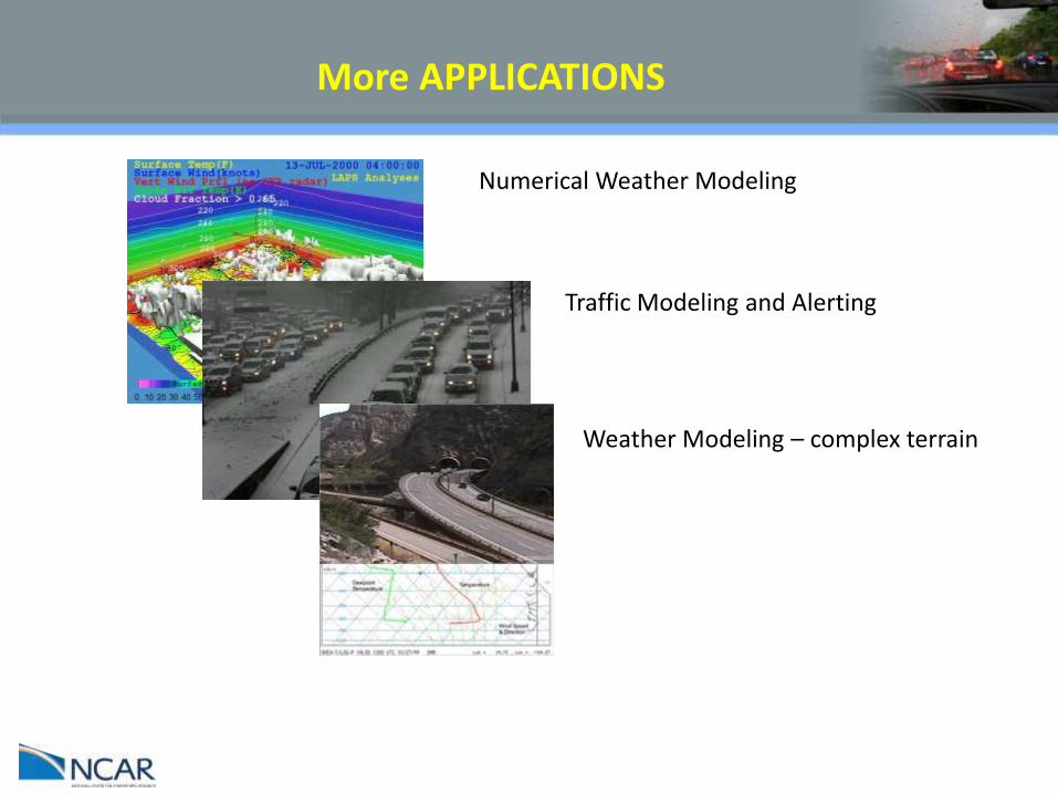
More APPLICATIONS
Numerical Weather Modeling
Traffic Modeling and Alerting
Weather Modeling – complex terrain
Other surface transportation users
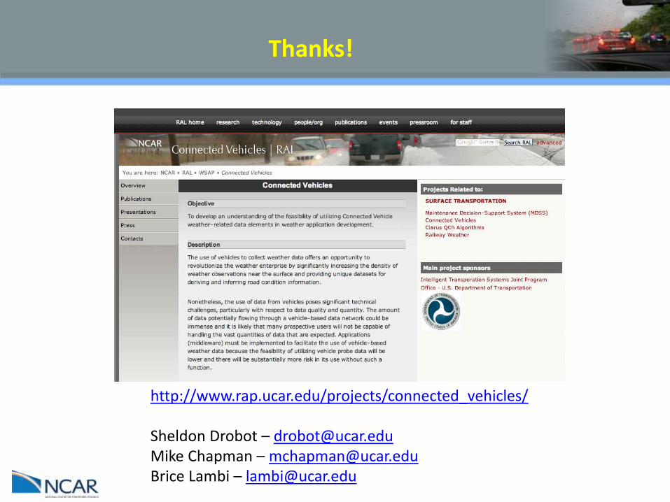
Thanks!
http://www.rap.ucar.edu/projects/connected_vehicles/ Sheldon Drobot – [email protected] Mike Chapman – [email protected] Brice Lambi – [email protected]
Top Related