


Languages
Pages
Legal

Characterization of the Atmosphere above a Site for Millimeter
Wavelength Astronomy
Francesco Nasir

frac
CIAO L O O P
Contents
Introduction to the Sardinia radio telescope project
Site testing and monitoring
Instruments
Modelling atmospheric emission/absorption with ARTS
Results
Conclusions
Introduction
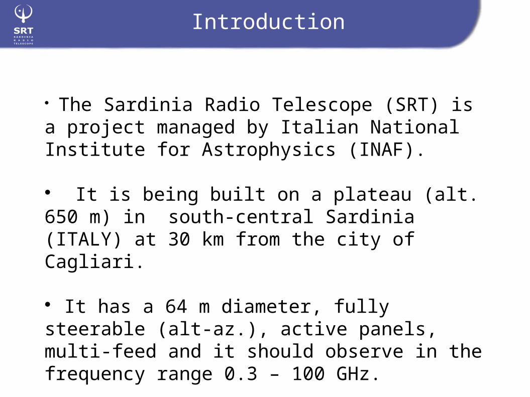
Contents: The Sardinia Radio Telescope (SRT) is a project managed by Italian National Institute for Astrophysics (INAF).
It is being built on a plateau (alt. 650 m) in south-central Sardinia (ITALY) at 30 km from the city of Cagliari.
It has a 64 m diameter, fully steerable (alt-az.), active panels, multi-feed and it should observe in the frequency range 0.3 – 100 GHz.
Introduction
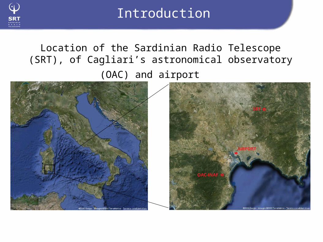
Location of the Sardinian Radio Telescope (SRT), of
Cagliari’s astronomical observatory (OAC) and airport

North Tower
Offices, South Tower,Meteo Sensors Visitor center
Introduction

http://www.srt.inaf.it
Introduction

Introduction

Site Characterization
Board of Directors L. Feretti (Chairman), N. D’Amico, F. Palla, G. Grueff,
G. Tofani, I. Porceddu,F. Mantovani, F. Fusi Pecci
SRT Project Director
N. D’Amico
G.A.I. 1: Active surface
Radio telescope
P.I. (G. Tofani)Co-PI. (R. Ambrosini)
& Antenna contracts surveillance Commission
Site and Infrastructure development
P.I. (I. Porceddu)&
P.I. Working Group
SRT Project Scientist
(I. Prandoni)
& P.S. Working group
G.A.I. 2: Metrology
G.A.I. 3: Optics
G.A.I. 4: Receivers
G.A.I. 5: Servo systems
G.A.I. 6: Software
G.A.I. 7: Antenna plants
G.A.I. 8: Rx Cntrl
G.A.I. 9: Web page
WP1: Local LAN
WP2: Supercomputing
WP3: VLBI Terminal
WP4: Meteo, GPS, and Site monitoring
WP5: RFI monitoring
WP6: Time & Frequency
Antenna engineering services
Site Safety
Site engineering services
Photographic documentation
IRA Administration
Logistics
Outsourcing
OAC Administration
Activity coordinated or administrated by an IRA Staff
Activity coordinated or administrated by an OAC Staff or Associate
Activity coordinated or administrated by an IRA Guest at OAC
Activity coordinated or administrated by an OAA Staff or Associate
SRT Project – Organization Chart:

Radio Pulsars at 0.3-1.4 GHz, supernova
remnants, HII regions
Water molecule maser studies at 22.23 GHzfor detecting star forming regions and
black hole mass
Carbon monoxide main transitions at 110 GHz but
redshifted may be observed at less than 100 GHz , a useful
tracer for the hydrogen molecule, the most abundant
molecule in the universe.
Thermal and maser emission of silicon
monoxide at 40 GHz for detecting high density
gas in nebulas.
Atmospheric opacity [Np]
- SRT astronomical observations, atmospheric signal absorption
Site Characterization

Site Characterization
GPS
Local meteorological station
Microwave radiometer
Radiosondes and Atmospheric Radiative Transfer Models (e.g., ARTS)
methods &
instruments
Accurate atmospheric opacity measurements at different frequencies , integrated water vapour (IWV) and integrated cloud liquid water (ILW) are necessary to:
a) Characterize the site accurately, especially at high frequencies (3mm band): a statistical study of which astronomical observations should be performed preferably during each month of the year.
b) Allow for “Dynamic scheduling” of the radiotelescope: real time opacity, IWV and ILW estimates in order to decide which frequency to observe. Maybe also nowcasting.

GPS as atmospheric probe:
A geodetic GPS permanent station is operating at SRT site since winter 2006.
If antenna coordinates and satellite ephemerides are known with sufficient precision, the path excess or zenithal total delay (ZTD) is accurately measured.
IWV is obtained from the ZTD with 1 mm accuracy by means of ground meteorological parameters.
OUTPUT:- ZWD, ZTD- IWV
Site Characterization

Local weather:
GPS needs a good weather station. The SRT weather station was realized at home using a low cost Linux micro-computer as data-logger.
Surface pressure gauge
micro-computer
TCP/IP
USB pen drive
Surface Temperature, humidity and wind
RS232
OUTPUT:- P, T, RH, Wind
Site Characterization

New microwave radiometer (Radiometrics , MP-3000A) with 35 channels:
- K band (20-30 GHz) useful for retriving water vapour IWV and cloud liquid water ILW
- L band (50-60 GHz) useful for retriving temperature profiles.
- Infrared thermometer for cloud base detection
- Typical Tb resolution is 0.25 K.
Radiometro:
OUTPUT:- IWV e LWC- Tb and Opacity at different frequencies
Site Monitoring

Site Characterization
We used a 50 year radiosonde dataset (1960 -2010) and a 3 year finer dataset with higher vertical and time resolution (1998 – 2001).
The launch site is the cagliari airport at 30 km from the SRT site. Launches are routinely performed by Italian air-force.
Pressure, temperature and relative humidity were measured layer by layer up to 30 km height.
Integrate profiles for IWV, use empirical model and profiles for ILW, use profiles and ARTS to simulat emission and absorption properties of the atmosphere.
OUTPUT:- T, P, RH profiles- Post processed IWV- Post processed ILW (empirical model) - Post processed opacity (using ARTS)
Radiosondes:

Using radiosonde profiles, Arts (1.0.214) and an empirical cloud liquid model for site characterization:
Site Characterization
General scheme:

Site Characterization
- The radiosonde launch site is at Cagliari airport at sea level. - The radiotelescope is at 30 km from the airport and at 650 m of altitude.- Are the radiosonde soundings representative for the radiotelescope site atmosphere?
- Evapotraspiration and boundary layer turbulance make it so that it is not possible to simply clip off the first 650 m from the radiosonde soundings in order to represent the atmosphere of the radiotelescope site.
- By clipping off the first 200 of the radiosonde soundings we found a good comparison with GPS receiver IWV at the radiotelescope site (2007 – 2009).
- This is the sensor height used also in our arts simulations.

Statistics for Water Vapour (IWV):
Results

Statistics for cloud Liquid (ILW):
Results

Statistics for 22 GHz opacity:
Results

Statistics for 100 GHz opacity:
Results

Clear sky versus cloudy sky opacity:100 GHZ22.23 GHz
At 0.2 Np 50 % mean relative error
At 0.2 Np 10 % mean relative error
Results

Statistics for all quantities and frequencies:Probability of geophysical values below tresh hold values:- IWV < 10 mm- ILW = 0 mm (clear sky)- Opacity (tau) < 0.15 Np
Results

“Conclusions”
The statistical-climatic study is nearly complete for the Sardinia Radio Telescope, this could help schedule astronomical observations at different frequencies in the most appropriate time slots during the year and thus optimize machine time. A real-time monitoring system comprising of a surface meteorological station, a radiometer and a GPS receiver is being implemented and tested.
Techniques are being studied in order to forecast water vapour and other geophysical quantities and so plan ahead astronomical observations.
Thank you so
much for Your kind attention