


Languages
Pages
Legal


5: An Island Introduction Based on the Hawaii quarter reverse
OBJECTIVES Students will research and identify key geographical, cultural, and political concepts as they apply to Hawaii. Students will identify different types of maps.
MATERIALS • 1 overhead projector • 1 overhead transparency (or photocopy) of each of the following:
– “Hawaii Quarter Reverse” page – “Map of Hawaii” page – “The King’s K-W-L Chart” worksheet – “Map This!” worksheet – “Island Introduction” worksheet – “Island Introduction” rubric
• Copies of the following: – “Hawaii Quarter Reverse” page – “Map of Hawaii” page – “The King’s K-W-L Chart” worksheet – “Map This!” worksheet – “Island Introduction” worksheet – “Island Introduction” rubric
• 1 class map of the United States • Chart paper • Markers • Student World Maps with Longitude and Latitude shown • Various texts that give information about maps and map types. For example:
– Maps: Getting from Here to There by Harvey Weiss – Discovering Maps: A Children’s World Atlas Published by Hammond World
Atlas Corporation – Student Atlas of Hawaii by James O. Jurik – All About Maps (Hello Out There) by Catherine Chambers
PORTIONS © 2008 U.S. MINT. ALL RIGHTS RESERVED. Grades Four through Six41

An Island Introduction
• Various types of maps, such as: – Political – Economic/Resource – Topographical – Climate – Road
• 1 copy of a text that gives information about Hawaii. For example: – Hawaii’s Royal History by Helen Wong and Ann Rayson – Hawai’i by Shelley Gill – Hawai’i (Celebrate the States) by Jake Goldberg and Joyce Hart
• Computers with Internet access • Old magazines and newspapers • Colored pencils • Glue • Scissors • Cardboard • Construction paper
PREPARATIONS • Make an overhead transparency of each of the following:
– “Hawaii Quarter Reverse” page – “Map of Hawaii” page – “The King’s K-W-L Chart” worksheet – “The King’s K-W-L Chart” worksheet completed – “Map This!” worksheet – “Map This!” worksheet completed – “Island Introduction” worksheet – “Island Introduction” worksheet completed – “Island Introduction” rubric
• Make copies of each of the following: – “Hawaii Quarter Reverse” (1 per student) – Enlarged outline map of Hawaii (1 per student) – “The King’s K-W-L Chart” (1 per student)
PORTIONS © 2008 U.S. MINT. ALL RIGHTS RESERVED. Grades Four through Six42
An Island Introduction
– “Map This!” worksheet (1 per student) – “Island Introduction” worksheet (1 per student) – “Island Introduction” rubric (1 per student)
• Gather various types of maps (see examples under “Materials”). • Gather texts that give information about maps and map types (see examples under
“Materials”). • Locate a text that gives information about Hawaii (see examples under “Materials”)
and mark passages to read. • Arrange to use the school computer lab for one session. • Bookmark Internet sites that contain information about Hawaii.
GROUPINGS • Whole group • Pairs • Individual work
CLASS TIME Five 45- to 60-minute sessions
CONNECTIONS • Social Studies • Language Arts
TERMS AND CONCEPTS • Quarter • Obverse (front) • Reverse (back) • Archipelago • Hawaiian Islands • Political map • Economic/Resource map • Physical map • Road map • Topographic map • Climate map
BACKGROUND KNOWLEDGE Students should have a basic knowledge of: • Maps • Cardinal directions • Longitude and latitude
PORTIONS © 2008 U.S. MINT. ALL RIGHTS RESERVED. Grades Four through Six43
An Island Introduction
STEPS Session 1 1. Describe the 50 State Quarters® Program for background information, if necessary,
using the example of your own state, if available. Then display the transparency or photocopy of the “Hawaii Quarter Reverse” page. Locate Hawaii on a classroom map. Note its position in relation to your school’s location.
2. Examine the Hawaii quarter with the students. Have the students identify the different elements in this image, including King Kamehameha I and the state’s motto “Ua Mau Ke Ea O Ka ’Aina I Ka Pono” (which means “The life of the land is perpetuated in righteousness”).
3. Distribute a “Map of Hawaii” page to each of the students. Display the labeled transparency of the “Map of Hawaii” page. Identify that there are eight major islands that make up the state of Hawaii, one of which is uninhabited. Ask the students to label the eight major islands on their maps referring to the completed transparency. The eight major islands of Hawaii are: Ni’ihau, O’ahu, Maui, Lana’i, Kaua’i, Moloka’i, (the Big Island of) Hawai’i, and Kaho’olawe. Ask students to mark Kaho’olawe as the uninhabited island. Have the students save their maps to use throughout the lesson.
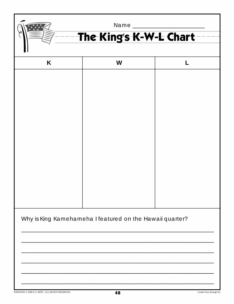
4. Distribute the “The King’s K-W-L Chart” worksheet to the students. Ask the students to think of what they know about Hawaii and to record their answers on their worksheets in the “K” column.
5. Display the transparency of the “The King’s K-W-L Chart” worksheet. Ask what the students have recorded in the “K” column of their worksheets. Record their answers on the transparency in the “K” column. Ask the students to think of what they would like to learn about Hawaii and record their responses on their worksheets in the “W” column. Discuss and record student answers in the transparency’s “W” column.
6. Introduce the students to the selected text about Hawaii. Ask the students to record any new information they learn during the reading in the “L” column on their “The King’s K-W-L Chart” worksheet. Ask the students to think about how Hawaii compares to other states in the United States. Ask the students to also think about why King Kamehameha I is important in Hawaiian history.
7. Read the selected text passages aloud to students and attend to unfamiliar vocabulary and concepts.
8. After the reading, ask students to share what they have recorded in the “L” column of their worksheets. Discuss and record student answers in the “L” column of the transparency.
9. Ask the students to answer the question at the bottom of their “The King’s K-W-L
PORTIONS © 2008 U.S. MINT. ALL RIGHTS RESERVED. Grades Four through Six44

An Island Introduction
Chart” worksheet, “Why is King Kamehameha I featured on the Hawaii quarter?” Discuss and record the student responses on the transparency. Students should know that King Kamehameha I was responsible for uniting the peoples of the Hawaiian islands.
10.Ask the students to review the “The King’s K-W-L Chart” worksheet and answer any remaining questions. Collect the worksheet.
Session 2 1. Redistribute the “The King’s K-W-L Chart” worksheets from the previous session.
Review what students learned and what images are included in the Hawaii quarter. Display the transparency of the “Map of Hawaii” page. Ask the students to look at the coin and the “Map of Hawaii” transparency. Ask the students to discuss the map image in the design.
2. Introduce the term “archipelago” by writing it on chart paper. Ask students what they think this term means and record student responses. Define archipelago as “a large group or chain of islands.”
3. Distribute a “Map This!” worksheet and “Map of Hawaii” page to each student. Display the transparency of the “Map This!” worksheet and review the directions with the students. Answer any student questions.
4. Give the students time to answer the questions in the “Map Basics” section of the “Map This!” worksheet. Record the students’ answers on the transparency. Review and discuss student answers and add student responses to the transparency for the “Why do we use maps?” section.
5. Introduce the students to the various texts about maps. Ask the students to complete the “Map Match” section of the “Map This!” worksheet in class. Allow the students time to research different map types by using the various texts about maps.
6. Review the “Map This!” worksheet with the students. Display the transparency of the completed “Map This!” worksheet. Review and discuss student answers. Show the students the examples of different types of maps and pass them around the classroom. Discuss with the students some of the characteristics of these maps and the functions that each of the map types serve. Collect the worksheets from the students.
Sessions 3 and 4 1. Redistribute the “The King’s K-W-L Chart” worksheet and the “Map This!”
worksheet and have the students review both worksheets. Answer any student questions.
2. Distribute an “Island Introduction” worksheet and an “Island Introduction” presen-
PORTIONS © 2008 U.S. MINT. ALL RIGHTS RESERVED. Grades Four through Six45
An Island Introduction
tation rubric to each student. Review both sheets with the students. Explain to the students that they will be researching one of the seven inhabited islands (excluding uninhabited Kaho’olawe) that make up the state of Hawaii. Each student will need to complete the “Island Introduction” worksheet and create a map of the chosen island.
3. Explain to the students that the map of the island can be a political map, a resource and economic map, or a physical map. Students will need to create this map using a variety of materials (such as magazines or newspapers, cardboard, construction paper, and markers).
4. Review the “Island Introduction” presentation rubric with the students. Explain that they will need to present their island and the map they have created to the class. The map should highlight the unique features of the island and the facts should be displayed on the map in some way. Explain that all the worksheets (“The King’s K-W-L Chart,” “Map This!” and “Island Introduction”) will be collected after their presentation.
5. Arrange for class time in the school’s computer lab and to have texts in class for students to use as resources.
Session 5 1. Have the students present their maps and research from the “Island Introduction”
worksheet. Use the rubric to assess student performance. 2. Collect the “The King’s K-W-L Chart” worksheet, the “Map This!” worksheet, and
the “Island Introduction” worksheet. Complete a presentation rubric for each student.
3. Display the worksheets and maps around the classroom. Allow the students time to view their classmates’ work.
ASSESSMENT Use the students’ class participation, worksheets, island maps, and presentation rubrics to evaluate whether they have met the lesson objectives.
ENRICHMENTS/EXTENSIONS • Have students locate other islands of North America or the United States on a map.
Have students note the longitude and latitude of these islands. • Have students research the climate of their home state. Ask students to examine
how the longitude and latitude of their home state may affect its climate.
PORTIONS © 2008 U.S. MINT. ALL RIGHTS RESERVED. Grades Four through Six46

An Island Introduction
DIFFERENTIATED LEARNING OPTIONS • Allow students to work in pairs. • Have students use texts at various reading levels for their research materials. • Allow students to write their reports by hand or use a scribe rather than use the
computer.
CONNECTION TO WWW.USMINT.GOV/KIDS Have students learn more about various cultures and islands by visiting the Coins of the World cartoon at www.usmint.gov/kids/cartoons/coinsOfTheWorld/.
PORTIONS © 2008 U.S. MINT. ALL RIGHTS RESERVED. Grades Four through Six47
The King’s K-W-L Chart Name _________________________
K W L
Why is King Kamehameha I featured on the Hawaii quarter?
___________________________________________________________________
___________________________________________________________________
___________________________________________________________________
___________________________________________________________________
___________________________________________________________________
___________________________________________________________________
PORTIONS © 2008 U.S. MINT. ALL RIGHTS RESERVED. Grades Four through Six48

Name _________________________
Map This!
MAP BASICS Directions: Using what you have learned about maps, complete the following questions. 1. What are the longitude and latitude of Honolulu, Hawaii?
2. What is an archipelago?
3. Why do we use maps?
MAP MATCH Directions: Using what you have learned about maps, connect the name of each type of map to the correct description or picture.
These maps give information about a region’s weather. Colors show different zones of climate or precipitation (rain and snow).
Economic/Resource Road Topographic Climate Physical Political
These maps use symbols toKauai
indicate an area’s natural Honolulu
resources or economic Maui activities. For example,
pineapple icons might show where tropical fruit is
Hawaii
grown.
PORTIONS © 2008 U.S. MINT. ALL RIGHTS RESERVED. Grades Four through Six49
___________________________________________________________________
___________________________________________________________________
Name _________________________
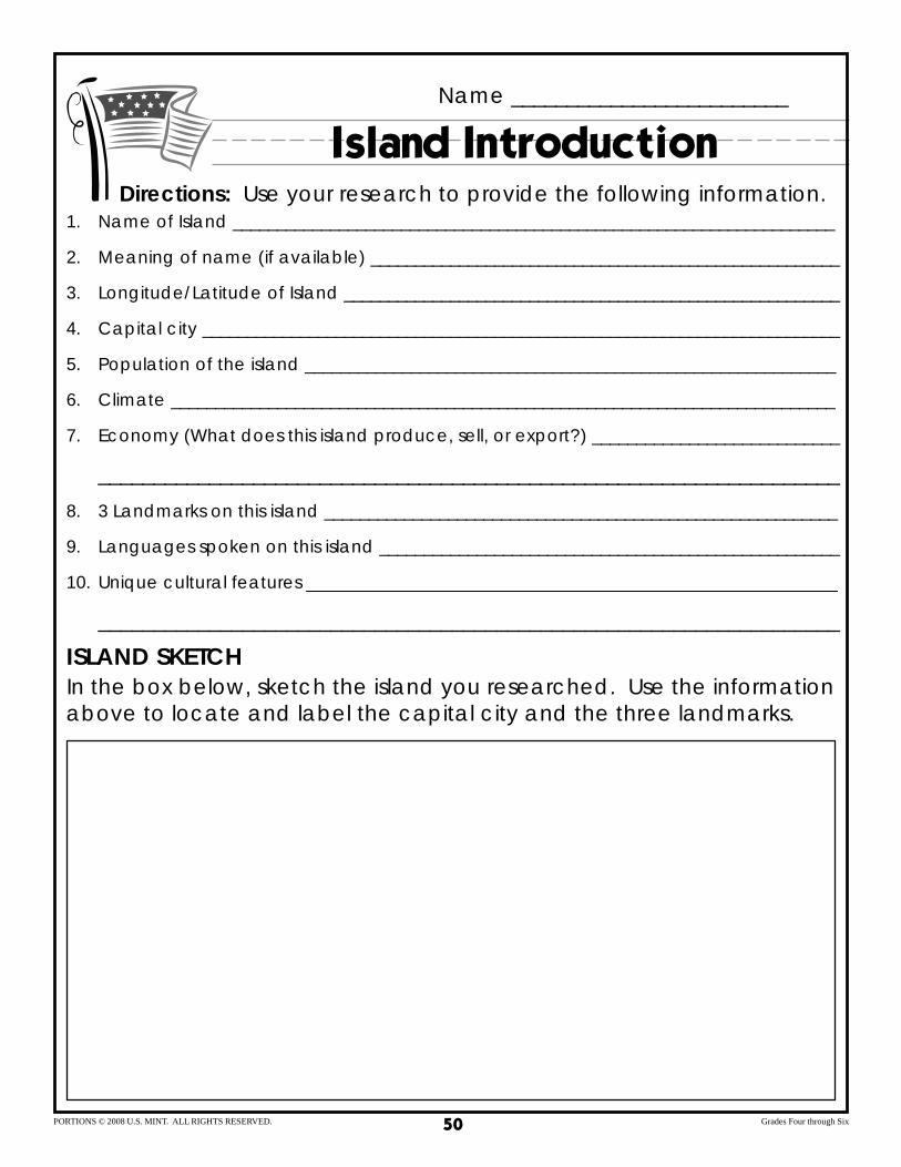
Island Introduction Directions: Use your research to provide the following information.
1. Name of Island ____________________________________________________________________
2. Meaning of name (if available) _____________________________________________________
3. Longitude/Latitude of Island ________________________________________________________
4. Capital city ________________________________________________________________________
5. Population of the island ____________________________________________________________
6. Climate ___________________________________________________________________________
7. Economy (What does this island produce, sell, or export?) ____________________________
8. 3 Landmarks on this island __________________________________________________________
9. Languages spoken on this island ____________________________________________________
10. Unique cultural features ____________________________________________________________
ISLAND SKETCH In the box below, sketch the island you researched. Use the information above to locate and label the capital city and the three landmarks.
PORTIONS © 2008 U.S. MINT. ALL RIGHTS RESERVED. Grades Four through Six50

_________ _________
_________
____________
______________
_________
_________
_________
________________
Name _________________________
Map of Hawaii Eight Main Islands
PACIFIC OCEAN
PACIFIC OCEAN
PORTIONS © 2008 U.S. MINT. ALL RIGHTS RESERVED. Grades Four through Six51

_________
_________
________________
Name _________________________
Map of Hawaii Key
PACIFIC
_________NI’IHAU KAUA’I OCEAN
_________
O’AHU_________
____________MOLOKA’I
MAUI_________ ______________HONOLULU
LANA’I
KAHO’OLAWEPACIFIC (UNINHABITED)OCEAN
HAWAI’I
PORTIONS © 2008 U.S. MINT. ALL RIGHTS RESERVED. Grades Four through Six52

Island Introduction Rubric
CATEGORY 4 3 2 1 SELF TEACHER Content and Student answered all Student answered all Student answered most Student answered some Information questions on “Island questions on the “Island questions on the “Island questions on the “Island
Introduction” worksheet Introduction” worksheet Introduction” worksheet Introduction” worksheet, and created one of the and created one of the and created one of the but did not correctly three map types for their three map types for their three map types for their create one of the three chosen island, with all chosen island, with chosen island, with most map types for their assigned criteria correctly nearly all the assigned of the assigned criteria chosen island or correctly identified and labeled. criteria correctly correctly identified and identify and label all of the
identified and labeled. labeled. assigned criteria.
Quality of Student paid close Student paid attention to Student paid some Student paid little Construction attention to detail and detail and carefully attention to detail and attention to detail and
carefully selected each selected most of the carefully selected some did not include major item that was included on items on the map, which of the items on the map, items on the map, which the map, which was was turned in neatly and which was turned in with was turned in with turned in neatly and with with no stray marks. some stray marks. considerable stray no stray marks. marks.
Time and Effort Student used research and execution time wisely and put considerable effort into planning and completing the assignment.
Student mostly used research and execution time wisely and put some effort into planning and completing the assignment.
Student did not always use research and execution time wisely or put the best effort into planning and completing the assignment.
Student did not use research and execution time wisely or put much effort into planning and completing the assignment.
Oral Student was completely Student was prepared, Student was Student was not well-Presentation prepared, stayed on
topic, spoke clearly, and showed a full understanding of the assignment.
stayed on topic, usually spoke clearly, and showed a good understanding of the assignment.
somewhat prepared or spoke clearly some of the time or showed only some understanding of the assignment.
prepared, strayed from the topic, spoke indistinctly, and/or showed little understanding of the assignment.
Audience Student listened actively Student listened actively Student listened and Student hardly listened Participation and always respected
classmates during their presentations.
and mostly respected classmates during their presentations.
respected classmates some of the time during their presentations.
actively or respected classmates during their presentations.
TOTALS 20 15 10 5 TEACHER COMMENTS
PORTIONS © 2008 U.S. MINT. ALL RIGHTS RESERVED. Grades Four through Six53

Hawaii Quarter Reverse
PORTIONS © 2008 U.S. MINT. ALL RIGHTS RESERVED. Grades Four through Six54
Top Related