Zahid Chaudhry ITO-TAGIS West Virginia Department of Environmental Protection
8
Zahid Chaudhry ITO-TAGIS West Virginia Department of Environmental Protection http:// zachsgeospatial.blogspot.c om/
-
Upload
melanie-campbell -
Category
Documents
-
view
217 -
download
1
Transcript of Zahid Chaudhry ITO-TAGIS West Virginia Department of Environmental Protection

Zahid ChaudhryITO-TAGIS
West Virginia Department of Environmental Protection
http://zachsgeospatial.blogspot.com/
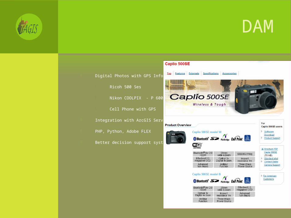
DAM
Digital Photos with GPS Info
Ricoh 500 Ses
Nikon COOLPIX - P 6000
Cell Phone with GPS
Integration with ArcGIS Server Workflow
PHP, Python, Adobe FLEX
Better decision support system

EXIF WITH PHP
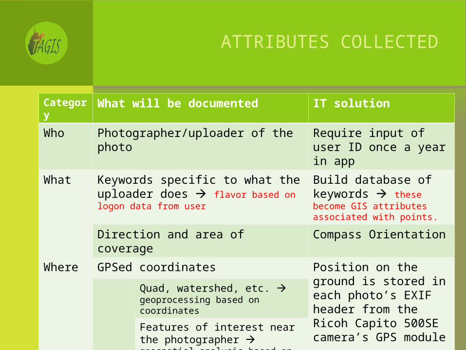
ATTRIBUTES COLLECTED
Category What will be documented IT solution
Who Photographer/uploader of the photo Require input of user ID once a year in app
What Keywords specific to what the uploader does flavor based on logon data from user
Build database of keywords these become GIS attributes associated with points.
Direction and area of coverage Compass Orientation
Where GPSed coordinates Position on the ground is stored in each photo’s EXIF header from the Ricoh Capito 500SE camera’s GPS module
Quad, watershed, etc. geoprocessing based on coordinates
Features of interest near the photographer geospatial analysis based on coordinates and logon data
When Date and time photo was taken Stored in EXIF
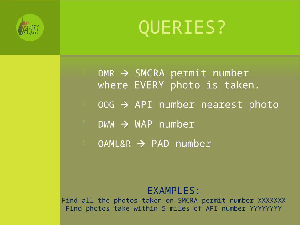
QUERIES?
DMR SMCRA permit number where EVERY photo is taken.
OOG API number nearest photo
DWW WAP number
OAML&R PAD number
EXAMPLES:Find all the photos taken on SMCRA permit number XXXXXXX
Find photos take within 5 miles of API number YYYYYYYY
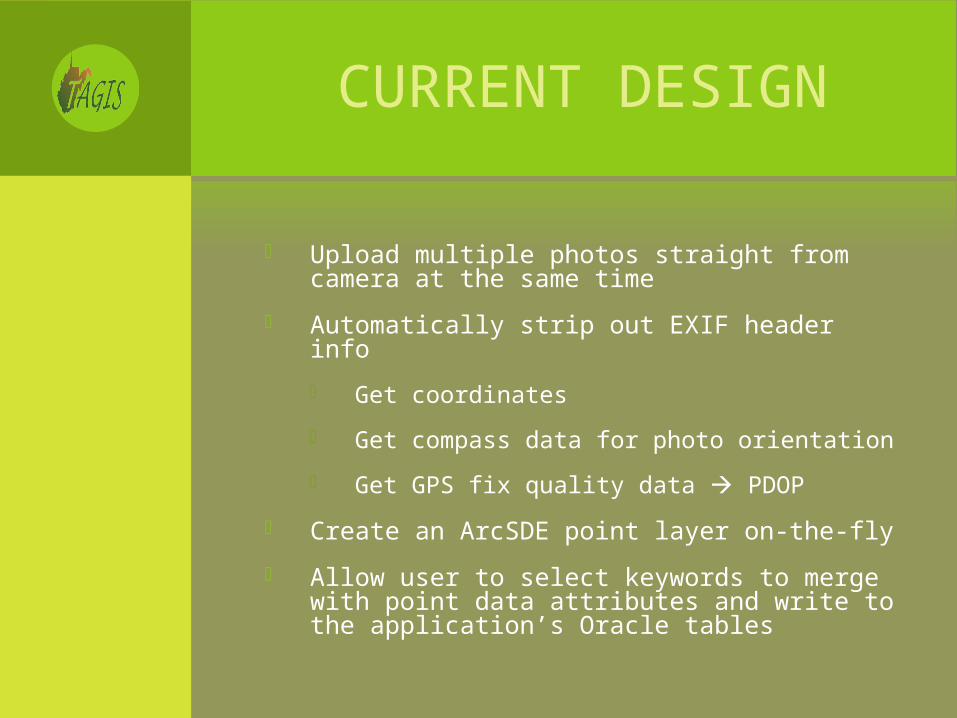
CURRENT DESIGN
Upload multiple photos straight from camera at the same time
Automatically strip out EXIF header info
Get coordinates
Get compass data for photo orientation
Get GPS fix quality data PDOP
Create an ArcSDE point layer on-the-fly
Allow user to select keywords to merge with point data attributes and write to the application’s Oracle tables

DEMO

http://zachsgeospatial.blogspot.com/