Xxx - Rother District Council elections - 6... · Web view10 SEP 2003 REAR OF, STATION ROAD...
133
RR/2003/2601/P CROWHURST BADGERS HOLT AND THE OAKS – LAND TO 10 SEP 2003 REAR OF, STATION ROAD CONSTRUCTION OF CONTIGUOUS BORED PILE WALL TO STABILISE REAR GARDEN AREAS AGAINST LANDSLIP Mr and Mrs Sargent This application was deferred at your last meeting to await the applicant’s reply to my request for his comments upon the “Ground Stability Assessment Walkover survey Report” produced by the Council’s consultant. An extract from the “Report” is included in my summary. Any reply received will be reported to Members at the meeting. SITE This application relates to the woodland areas (currently cleared) at the rear of two new houses erected at the northern end of Station Road and lying to the west of the station car park. The rear gardens of those houses are retained by a 45m long gabion wall that has a visible height above ground level of 5m. The woodland at the bottom of the gabion wall is in the ownership of the two houses. HISTORY RR/1999/9/R O/A Erection of two dwellings with garage/parking spaces – Approved RR/2000/1988/P One 5 bed house with detached double garage – Approved RR/2000/2071/P One 5 bed house with integral garage – Approved. RR/2001/1810/P Construction of gabion wall to reinstate stability of rear embankment – Delegated to Approve subject to Section 106 for retention and future management of the woodland and submission of details of supplementary planting. This has not been entered into because it will contain a clause requiring the planting to be undertaken within a specified time period. However, this cannot be undertaken until the pile wall has been constructed. PROPOSAL It is proposed to drive a 45m long contiguous pile wall into the ground approx 15m from the foot of the gabion wall. The piles would be 6m in length, 300mm in diameter with 400mm spacings. These would be capped by a 300mm x 300mm concrete beam which is not intended to project above finished 1
Transcript of Xxx - Rother District Council elections - 6... · Web view10 SEP 2003 REAR OF, STATION ROAD...
RR/2003/2601/P CROWHURST BADGERS HOLT AND THE OAKS – LAND TO 10 SEP 2003 REAR OF, STATION ROAD
CONSTRUCTION OF CONTIGUOUS BORED PILE WALL TO STABILISE REAR GARDEN AREAS AGAINST LANDSLIPMr and Mrs Sargent
This application was deferred at your last meeting to await the applicant’s reply to my request for his comments upon the “Ground Stability Assessment Walkover survey Report” produced by the Council’s consultant. An extract from the “Report” is included in my summary. Any reply received will be reported to Members at the meeting.
SITE This application relates to the woodland areas (currently cleared) at the rear of two new houses erected at the northern end of Station Road and lying to the west of the station car park. The rear gardens of those houses are retained by a 45m long gabion wall that has a visible height above ground level of 5m. The woodland at the bottom of the gabion wall is in the ownership of the two houses.
HISTORYRR/1999/9/R O/A Erection of two dwellings with garage/parking spaces –
ApprovedRR/2000/1988/P One 5 bed house with detached double garage – ApprovedRR/2000/2071/P One 5 bed house with integral garage – Approved.RR/2001/1810/P Construction of gabion wall to reinstate stability of rear
embankment – Delegated to Approve subject to Section 106 for retention and future management of the woodland and submission of details of supplementary planting. This has not been entered into because it will contain a clause requiring the planting to be undertaken within a specified time period. However, this cannot be undertaken until the pile wall has been constructed.
PROPOSAL It is proposed to drive a 45m long contiguous pile wall into the ground approx 15m from the foot of the gabion wall. The piles would be 6m in length, 300mm in diameter with 400mm spacings. These would be capped by a 300mm x 300mm concrete beam which is not intended to project above finished ground level. In a letter accompanying the application, the Applicant’s Engineer advises:“It is of course essential that, to avoid any further slippage of the sloping rear garden and possible destabilisation of the upslope wall, the piling works are undertaken as a matter of urgency. Indeed, if at all possible, the piling should be undertaken before the current very dry weather breaks – that is this would benefit construction and also minimise the risk of further slippage which is directly linked to rainfall/groundwater levels within the slope”.
CONSULTATIONSParish Council – Support an approval with the following comments:“1. There should be no further development considered between the curtilage and
the property banking, as it is outside of the development boundary, which has already been moved once.
2. The wall should be deep enough to prevent slippage of the land owned by the neighbours at ‘The Haven’.
3. Construction times should be limited to minimise noise and nuisance to neighbours”.
1

Environment Agency – Has no objection on the assumption that the adjacent watercourse will be unaffected by the proposed works and advise that the Council’s own Technical Services Department should be satisfied with regard to the structural integrity of the wall design.Director of Services – Amenities - Has advised me that it would be the Applicant and his Engineer who would be responsible for the structural integrity of the wall and not the Local Planning Authority. Works should not obstruct railway culvert which discharges onto the site.Chief Building Control Officer – Has no adverse comments.Planning Notice – 1 letter from ‘The Haven’ – has no objection in principle but wished several points, believed to be relevant and important, to be noted. These relate to 1: inaccurate plan of Section 106 and Tree Preservation Order lines, 2: outside village development boundary, 3: request a condition restricting construction working hours, 4: am concerned that project will not be successful and want assurance from Rother that proposed wall would not slip upon my land which is only 2m distant.
SUMMARY Members will recall visiting the site prior to the November meeting when you commissioned advice from a Geotechnical Engineer. They have carried out a walkover survey and provided a report containing the following comments:-“The survey has enabled a visual assessment of the overall stability of the Site to be made, and the most appropriate practicable form of ground investigation to be determined. The intrusive investigation will aim to provide data on the soil profile and ground conditions. The findings will help verify the form and depth of the instability, and the potential risks that it may pose. It will also incorporate an assessment of the soils at the specific site of the proposed retaining structure, to provide key parameters needed for its design. … It would be helpful to be able to view details of the wall construction, specification of the backfill (including details of the preparatory earthworks and inclusion of any reinforcement), and also determine the nature of the underlying strata. Calculations could then easily be undertaken to assess its overall stability.Given its apparent good condition it is most probable that the wall is extended to found onto relatively competent strata that may either be the Ashdown ‘Beds’ Member or the Wadhurst Clay (and possibly the sand in Wadhurst Clay Member). An appropriately constructed wall will be adequately stable against sliding/overturning even if the soils (and passive resistance) in front of the toe are lost by landslip, erosion or excavation for example.Despite this there remains some danger that unstable ground may prograde back towards the wall. In such an instance, the wall could potentially be undermined where the land falls away to a significant depth immediately in front of the toe. Currently this does not seem to be an immediate risk. However, it is recommended that a good understanding of the soil profile beneath and immediately in front of the toe of the wall will be needed to help verify this.The stability of the lower area of the garden is at immediate risk, and evidence of ongoing downslope movement has been observed. Key to improving stability will be the reduction in groundwater pressure/level by the provision of improved drainage. This would be further improved where the lower garden is planted, once the trees have had the opportunity to establish.It is recognised that some improvements in drainage have been completed. Although full details of depth and layout of the new drainage has not been made available for our inspection it is understood from the house owner that it comprises a single trench drain across the Site.
2
It is judged that the single drain across the Site only is unlikely to be entirely effective. The provision of additional drains perpendicularly down the slope, which will enable the water level in the ground to be drawn down to the level of the brook, will significantly improve the stability of the ground. The drains should enable the groundwater to be positively channelled into the stream (partly across the narrow strip of land beyond the western boundary). Perpendicular drains are recommended for ease of construction rather than diagonal ‘herringbone’ drains. Diagonal drains do not offer any significant advantage in drainage improvement. There is the probability that where drainage is provided and vegetation is able to become established, there may be no need for a large scale retaining structure to be built at the toe of the slope. This will partly depend on the susceptibility of the lower garden land to continue to fail, potentially beneath the toe of the gabion wall. This risk can be assessed by the proposed investigation. In any case, whether or not the new wall is built, the improvements in drainage would be needed.”I have therefore written to the Applicant requesting his comments upon the report particularly because “There is the probability that where drainage is provided and vegetation is able to become established, there may be no need for a large scale retaining structure to be built at the toe of the slope.”
RECOMMENDATION: DEFER (APPLICANTS’ REPLY)
RR/2003/3547/P BURWASH DUDWELL ST MARY CARE HOME,22 DEC 2003 ETCHINGHAM ROAD
DEMOLITION OF EXISTING BUILDINGS AND CONSTRUCTION OF 32 BED EXTENSION AND ASSOCIATED WORKSBarchester Healthcare Ltd
SITE Dudwell St Mary, the former convent, is situated on the south side of the A265 to the west of Borders Lane and is in use as a nursing home.
HISTORY RR/93/0155/P Change of use of convent to nursing home and alteration to access
– Approved Conditional.RR/94/0403/P Access to Borders Lane to orchard and septic tank – Approved
Conditional.RR/2000/1918/P Outline Application – 32 bed extension to nursing home,
associated service areas, office and conversion of existing service areas into bedrooms – Approved Conditional.
PROPOSAL This application relates to the submission of Reserved Matters for a 32 bed addition to the care home following the grant of outline planning permission under reference RR/2000/1918/P (dated 7th November 2002), A two storey detached addition is proposed, to the east of the main building, constructed of brick with tile hanging and a plain tile roof. The accommodation comprises 32 en-suite bedrooms, kitchen, 2 dining rooms, 3 lounges, stores, offices and staff facilities.The siting of the building is contained within the area of the existing coach house and the walled garden. In terms of floor area the building exceeds the existing care home.
CONSULTATIONSParish Council :- Support Refusal – “We appreciate the need for extra residential care. We consider this proposal to be over development.”
3

Highway Authority:- Recommends any consent shall include the following condition – “Adequate turning facilities for vehicles shall be provided outside the limits of the highway and thereafter permanently retained.”Environment Agency :- No comment.Southern Water:- Environment Agency should be consulted. The Council should satisfy itself on the adequacy of soakaways for surface water disposal.South East Water:- Mains water supply may need upgrading at developers expense to maintain service levels.Planning Notice:- No representations received.
SUMMARY The reserved matters submitted for consideration are siting, design, means of access and external appearance. The siting is within 3m of the existing building and broadly as indicated by the outline proposal, albeit larger. The means of access is existing and satisfactory, additional car parking is shown to meet your parking standards. No objection is raised by the Highway Authority.The design is of traditional materials with the use of projecting gables and bays to break up the mass of what is a substantial building. At this stage, no details of the actual external materials have been provided beyond the specification of bricks and plain tiles. The outline application was referred to GOSE as a departure and was considered acceptable in the countryside, the outline specified 32 bedrooms and thus a substantial building was anticipated. For these reasons I could not substantiate the Parish Council’s recommendation of refusal. Similarly, whilst I have advised the applicant’s agent of the comments of South East Water, it is not now possible to secure off site works to the supply pipe. If this was to be achieved this should have been received at the outline stage. South East Water did not respond to the outline application consultation.
RECOMMENDATION: APPROVE (RESERVED MATTERS – SITING, DESIGN AND MEANS OF ACCESS)
1. CN10A (Highway Conditions)2. CN13A (Landscaping scheme)3. CN13B (Supplementation of landscaping scheme)4. CN7B (External Materials)5. The premises shall be used in conjunction with the existing nursing home,
Dudwell St. Mary and for no other purpose including any other purpose in Class C3 of the Schedule to the Town and Country Planning (Use Classes) Order 1987 or in any provision equivalent to that Class in any statutory instrument revoking or re-enacting that order.Reason: To ensure an appropriate use of the property/site and to accord with Policy S1 of the East Sussex and Brighton & Hove Structure Plan 1991-2011.
6. Details of foul and surface water drainage for the site shall be submitted to and approved by the Local Planning Authority before any work on the site commences. The drainage works shall be constructed in accordance with the approved plans before the development hereby permitted is brought into use or occupied.Reason: To prevent water pollution, ensure satisfactory drainage of the site and accord with Policy EN11 of the East Sussex and Brighton & Hove Structure Plan 1991-2011.
7. No floodlighting or external lighting of the site shall take place without the prior written approval of the Local Planning Authority and such details for approval shall include methods of shielding the light source from outside of the site and the lighting shall be installed in accordance with the approved details.
4
Reason: To safeguard the amenities of the locality and to accord with Policy S1 of the East Sussex and Brighton & Hove Structure Plan 1991-2011.
RR/2004/230/P BURWASH ADMIRAL HOUSE - SITE OPPOSITE, HIGH 10 FEB 2004 STREET
ERECTION OF A TERRACE OF FOUR STARTER COTTAGES WITH ALTERATION TO EXISTING ACCESSMr M Wyatt
SITE This site lies on the north side of the A265 opposite Admiral House (formerly The Admiral Vernon PH) adjacent to the small public car park. The telephone exchange lies to the north of the site and it is just outside of the Conservation Area.
HISTORY (Relevant)RR/90/0559/P C/U of vacant land to a private car park - Approved Conditional.
PROPOSAL Full planning permission is sought for the erection of a terrace of four three bedroomed two storey houses. The submitted plans indicate facing brick at ground floor, white weatherboarding above and a tiled roof. No car parking is proposed.
CONSULTATIONSParish Council:- Support refusal.Highway Authority:- Recommends that consent be refused.Environment Agency:- No objection.Director of Services - Environmental Health:- Little space available for soakaways. The small Council owned car park is already heavily used. If approved a contaminated land conditions is recommended.Director of Transport & Environment - County Archaeologist:- No archaeological recommendation to make.Southern Water:- Comments awaited.Planning Notice:- I have received a copy of a petition sent to the Parish Council, with 64 signatories and at the time of writing this report 21 individual letters of objection had been received. The main objections being i) over-development; ii) lack of car parking; iii) proposed dwellings are not starter homes; iv) public car park is already over-subscribed; v) public transport is poor.
SUMMARY The site is within the Development Boundary of the village and therefore should be considered appropriate for development. However, I concur with the Parish Council and the weight of public opinion. In my view it is essential that any development makes appropriate provision for car parking; the public car park is well used during the day and already full at night, public transport is poor. Four dwellings on the site is an over-development (equivalent to 83 dwellings per hectare) to the extent that it is probably not possible to use soakaways for surface water as these must be at least 5m from any building. The site adjoins the Conservation Area boundary and I have to say that I do not believe the proposed design is adequate for such a location at the entrance to the village. Moreover, the submitted plans show a retaining wall around the north, west and eastern sides of the site with the whole development elevated to near to road level. The rear of the site would be raised 1.7m making the development very dominant and further limiting the use of soakaways. The elevations are bland and
5

the single span roof is too deep. I believe that all existing foliage on the site would be removed.
RECOMMENDATION: REFUSE (FULL PLANNING)1. The site is too restricted to satisfactorily accommodate the proposal which, if
permitted, would be out of character with and detrimental to the appearance of the area contrary to policies GD1(i), (iii), (v), (vi) and (viii) of the Rother District Local Plan: Revised Deposit (November 2003).
2. The design and external appearance of the building would if permitted be out of character and detrimental to the appearance of the locality adjacent to the Burwash Conservation Area. The proposal is therefore considered to be contrary to policies GD1(iv) and (viii) of the Rother District Local Plan: Revised Deposit (November 2003) and Policy S1(m) of the East Sussex and Brighton & Hove Structure Plan 1991-2011.
3. The proposal does not provide for car parking facilities within the site; this would result in additional congestion on the public highway causing interference with the free flow and safety of traffic on the A265 (Major Distributor Route).
RR/2004/279/P BURWASH GRAND TURZEL CARAVAN SITE, FONTRIDGE 11 FEB 2004 LANE
ERECTION OF 3 DETACHED DWELLINGS AND GARAGES, INCLUDING ALTERATIONS TO AN EXISTING ACCESS, CONSTRUCTION OF NEW ROAD AND ASSOCIATED WORKSSilver Homes
SITE This application relates to approx 1.4 ha of land to the north of Fontridge Lane. It is set back from the road and is accessed off the private access track to Grand Turzel Farm. It is currently occupied by a number of caravans and other structures. The application relates to a major part but not all of the land on which caravans are stationed.
HISTORYRR/1999/2914/P Erection of four houses, garage, associated works and alteration to
access - Refused.RR/2000/801/O Lawful use of land as caravan site with ancillary structures -
Approved - Use for 8 caravans.RR/2001/1077/O Lawful use as a caravan site for both permanent and touring
caravans - Appeal against non-determination allowed for 8 caravans.
RR/2001/2045/P Erection of 3 houses, garages and associated works with alteration to access - Recommended for Refusal - Withdrawn.
RR/2002/2895/O Lawful use of land as a caravan site for 9 caravans - Refused -Appeal Allowed.
RR/2003/1640/O Lawful use of land as caravan site for 9 caravans - Not Determined - Appeal Allowed.
A copy of the Inspector’s decision is attached as an APPENDIX DOCUMENT relating to this Committee 18 March 2004.
PROPOSAL This is a full application for the erection of 3 detached 5 bed houses of traditional design. The existing wooded frontage to the site will be retained and the
6
layout is informal with the dwellings set in large curtilages. Reference is made to the uncertainty on the numbers that may be lawfully stationed on site, and that there is every prospect the number will substantially exceed the figure of 9 established by the latest appeal. The agent says this is a special case and that the benefits are clear, providing a low-key use and the removal of the caravan use. Traffic flow will be reduced.A full supporting statement is attached as an APPENDIX DOCUMENT relating to this Committee 18 March 2004.
CONSULTATIONSHighway Authority:- No objection subject to the observations below:“Although highway safety concern is expressed over the suitability of Fontridge Lane (UC6198) to serve further residential development, it is considered that there are insufficient highway grounds to justify a recommendation for refusal for this proposal.Although this proposal indicates alteration to an existing access, it is from a private road which is not adopted highway and therefore highway conditions have not been issued in this instance.”They also draw attention to a public bridleway which follows the line of Grand Turzel Lane.Director of Services - Environmental Health:- No objection.Environment Agency:- No objection but would require provision of a treatment plant.Planning Notice:- No representations received.
SUMMARY Members inspected the site in July 2001 in relation to the application for 4 houses on the site. The position regarding the lawful use of the site has now been further clarified by the Inspector’s decision on appeal that granted a certificate for nine caravans on the site. It is however open for further consideration as to what point an increase in caravans on the site would represent a material change of use. That number would exceed the nine allowed on appeal. The land to the south owned by Mr Harvey, which also has a caravan use, is excluded from the site. If permission were to be given on the current application this would be a precedent for future development on the adjoining land. The site is within the High Weald Area of Outstanding Natural Beauty where residential development is not supported by national or local policies. Policy HG5 of the Rother District Local Plan: Revised Deposit (November 2003) does not support the replacement of existing mobile homes by permanent dwellings.I take the view that it would be wrong in principle to allow replacement of the caravans with three large dwellings. If however housing were to be supported a Section 106 would be required to extinguish all existing uses and the application would need to be referred to GOSE as a departure application and under the Density Direction.
RECOMMENDATION: REFUSE (FULL PLANNING)1. The site is within the countryside, outside any town or village as defined in the
Rother District Local Plan: Revised Deposit (November 2003). Policy S10 of the East Sussex and Brighton & Hove Structure Plan 1991-2011 and policies HG10 and HG5 of the Rother District Local Plan: Revised Deposit (November 2003) contain a strong presumption against residential development unless it meets one of the exceptions described in the plans. None of these apply and the development is contrary to these policies.
2. Notwithstanding the policy objections to residential development on this site, it is considered that the form of residential development proposed would prejudice the most efficient use being made of the site and the proposal would be contrary to the advice given in Planning Policy Guidance Note No.3 (PPG3).
7

3. The proposed development if permitted would be likely to set a precedent for residential development on other similar rural sites elsewhere in the district.
4. The site lies within the High Weald Area of Outstanding Natural Beauty, where policies S1(j), EN2 and EN3 of the East Sussex and Brighton & Hove Structure Plan 1991-2011 indicate that development will be carefully controlled to protect the character of the area. It is considered that the proposal does not meet this objective, and it would cause harm to the rural character of the area.
RR/2004/521/P MOUNTFIELD BATTLE ROAD SERVICE STATION, JOHNS 25 FEB 2004 CROSS
USE OF LAND FOR THE SITING OF STORAGE CONTAINERS AS PART OF ROAD HAULAGE/PALLET YARDMr M Horley
SITE Battle Road Service Station lies on the west side of the A21 and is now used as a roadside restaurant and haulage yard/pallet yard.
HISTORY (Relevant)RR/96/1030/P Erection of workshop and the formation of pallet and haulage yard
and retention of roadside restaurant - Approved Conditional.RR/2000/1718/P O/A Demolition of café, workshop and pallet yard and construction
of new motel with alteration to access - Approved Conditional.RR/2003/2974/P O/A re-development for 39 social housing units, alteration to
access and construction of new road - Refused.
PROPOSAL Planning permission is sought retrospectively for the use of part of the haulage yard for the stationing of storage containers used for the storage of goods and chattels brought on site by the operators of the yard. The containers are sited behind the fence fronting the A21 and are blue in colour.
CONSULTATIONSParish Council:- Comments awaited.Highways Agency:- Comments awaited.Highway Authority:- Comments awaited.Environment Agency:- Comments awaited.Director of Services - Environmental Health:- Comments awaited.Planning Notice:- No representations received to-date.
SUMMARY At your January 2004 meeting I recommended enforcement action expressing the view that had a planning application been submitted it may have been recommended for approval subject to conditions. It was resolved to take enforcement action and a Planning Contravention Notice was served; this was probably the catalyst for the submission of this planning application. I do not believe that the storage of containers in a haulage yard is unreasonable. The containers occupy an area previously used for parking lorries/trailers; the containers are no larger or prominent but of course they do not ‘come and go’ as the vehicles did. Nevertheless it would, in my view, be appropriate to grant planning permission with conditions to safeguard amenity. I believe that the use should be controlled and hours of use linked to that permitted for the yard, additionally a condition preventing the
8

stacking of containers is essential. Members may also consider that the containers should be painted a less strident colour.At the time of preparing this report all consultation responses are awaited but I expected to make the
RECOMMENDATION: GRANT (FULL PLANNING)1. CN12G (Hours of Use - 7.30am to 7.00pm weekdays, 7.30am to 1.00pm
Saturdays - not Sundays or Bank Holidays).2. The containers shall be used for storage purposes only and for no other
purpose. (Reason: RC35).3. The containers shall be positioned at ground level and no container shall be
stacked upon another. (Reason: RC35).4. CN12L (Floodlighting control).5. Within 3 months of the date of this permission the containers shall be painted a
colour to be agreed in writing by the Local Planning Authority and thereafter retained in the approved colour unless otherwise agreed in writing by the Local Planning Authority. Any new or replacement container placed on the site shall be painted using the agreed colour. (Reason: RC21).
RR/2003/3149/P BATTLE BEAUPORT PARK RIDING SCHOOL, HASTINGS 11 NOV 2003 ROAD
ERECTION OF INDOOR RIDING SCHOOL AND FORMATION OF NEW CAR PARKING AREAMr and Mrs N Simes
This application was deferred at your last meeting for further information and amended plans.
SITE Beauport Park riding school is located to the north of Beauport Park Hotel; vehicular accesses to the A2100 Battle Road and The Ridge West are shared with the hotel and the golf course.
HISTORY (Relevant)A/66/812 Covered riding school - Approved ConditionalRR/84/1173 Reconstruction of stable block - Approved ConditionalRR/84/2249 Covered riding school - Approved ConditionalRR/2001/893/P Erection of replacement stables - Approved ConditionalRR/2002/1810/P Revised plans for stables approved under reference
RR/2001/893/P - Approved Conditional
PROPOSAL Full planning permission is sought for the construction of a new building for an indoor riding school. The proposed building, located to the north of the existing covered school (A/66/812) would measure about 80m by 32.4m wide and 10m high overall. A grey fibre cement roof sheeting is specified with walls clad using a green profiled steel cladding. The submitted plan also indicates the clearance of an area 40m by about 25m for car parking which I estimate might provide 40-50 spaces for cars/horse boxes depending upon layout.
CONSULTATIONS
9
Town Council:- “The Council noted the substantial scale of this development which it feels is inappropriately large in what is in effect a countryside location.”Highway Authority:- Does not wish to restrict the grant of consent.Environment Agency:- Site is within a designated ‘Site of Nature Conservation Interest’. Use of soakaways should be based upon permeability tests. Manure storage should be at least 10m from any watercourse.Hastings Borough Council:- Raises concerns about the use of the proposed materials in the AONB.Director of Services - Environmental Health:- No objection subject to conditions.Planning Notice:- No representations received.
SUMMARY Members inspected this site prior to the February meeting of the Committee when it was resolved to defer a decision and request amended plans. I have advised the applicants’ agent that the amended plans should show comprehensively the whole site and including levels and landscaping with the parking area re-located to avoid further tree felling. The building also needs to be re-sited slightly further from the boundary so as to permit screen planting.If satisfactory revised proposals are received before your meeting I anticipate making the
RECOMMENDATION: GRANT (FULL PLANNING) DELEGATED (AMENDED PLANS)1. CN13C (Tree retention).2. CN13F (Tree/shrub planting).3. CN7B (External materials - amended - Roof and wall cladding).4. CN8B (Surface water details).5. CN12L (Floodlighting control).
RR/2004/384/P BATTLE ASHWOOD HOUSE - LAND TO WEST OF, 12 FEB 2004 CALDBEC HILL
OUTLINE: DEMOLITION OF EXISTING GARAGE BLOCK AND ERECTION OF DETACHED HOUSE AND GARAGEMr and Mrs V G Gray
SITE Ashwood House is a relatively new detached house on the west side of Caldbec Hill; to the northwest of the house there are four garages in a block adjoined by a timber carport. The application site measures about 22m wide and 30m deep and comprises part of the garden to Ashwood House including the garage block.
HISTORYRR/2003/447/P Demolition of existing garages and construction of new garages
with granny annexe above - Refused.
PROPOSAL Outline planning permission is requested for the demolition of garage block and erection of a detached house and garage.
CONSULTATIONSTown Council:- Comments awaited.Highway Authority:- Comments awaited.Planning Notice:- No representations received.
10

SUMMARY Members will recall inspecting this site in August 2003 in connection with RR/2003/447/P, an application for a flat above new garages refused for the reason:“The sub-division of the property in the manner proposed to create a separate dwelling unit would be out of character with and detrimental to the amenities of the locality…”The site falls within the Development Boundary of the town and the proposed site is not greatly different from those in the vicinity. I believe the Committee’s previous refusal (RR/2003/447/P) was founded upon the concept of size of site and a flat above garages being out of character in this location which is dominated by single detached two storey houses.PPG3 requires the efficient use of previously developed and urban land at a density of between 30-50 dwellings per hectare. This plot falls within this category and should therefore be considered appropriate for development. The proposal would not satisfy the density requirement of PPG3 in that it equates to 15 units to the hectare. However, I believe that in this instance the lower density is appropriate given the character of the adjacent development.I am awaiting the formal response of consultees but I am of the opinion that the proposal should be accepted. The new house would not adversely affect the amenities of adjacent properties and the character of the area would be maintained.
RECOMMENDATION: GRANT (OUTLINE PLANNING)1. Prior to the occupation of the dwelling hereby approved the garage block
coloured green upon the approved 1:500 scale block plan shall be demolished and the resultant materials removed from the site. (Reason: RC14).
RR/2004/398/P BATTLE THE OLD COURT HOUSE, MOUNT STREET13 FEB 2004 REVISED PROPOSALS FOR PROVISION OF FLAT FOR
CARER ABOVE EXISTING GARAGEMr and Mrs G Rainbird
RR/2004/402/L BATTLE THE OLD COURT HOUSE, MOUNT STREET13 FEB 2004 REVISED PROPOSALS FOR PROVISION OF FLAT FOR
CARER ABOVE EXISTING GARAGEMr and Mrs G Rainbird
SITE The Old Court House is a Grade II listed property on the west side of Caldbec Hill/Mount Street about 50m north of the Mount Joy junction. The property has a pair of garages in a forward location abutting the garage of the neighbouring property.
HISTORYRR/83/1757 Alterations to existing parking area and formation of two garages
and access alteration - Approved Conditional.RR/2003/2538/L Rebuild garage roof as Hansard to form staff flat for carer -
Refused.RR/2003/2546/P Rebuild garage roof as Hansard to form staff flat for carer -
Refused.
PROPOSAL Planning permission and Listed Building Consent are sought for a carers flat above the existing garages comprising a bed-sitting room with kitchen and shower/WC. The accommodation would be centred over the garage with the existing pair of garage doors changed for a single timber door.
11
The building is designed as a gazebo with a zinc roof and extensive glazing towards the highway.
CONSULTATIONSTown Council:- Comments awaited.Planning Notice:- No representations received.
SUMMARY These applications are the result of discussions after the refusal of the previous scheme for a carers flat (RR/2003/2538/L and RR/2003/2546/P). The proposal is distinctive and results in a beneficial improvement to the appearance of the garage.The parapet of the garage would be raised to form the eastern end of the new flat with a zinc sheet pyramidal roof.I am awaiting the views of the Town Council but I believe this revised scheme is acceptable. The proposed flat will need to be tied to the Old Court House by means of a Section 106 Obligation so as to ensure that the accommodation is not used as a separate dwelling.
RECOMMENDATIONS:RR/2004/298/P: GRANT (FULL PLANNING) DELEGATED (SECTION 106 OBLIGATION)1. The accommodation hereby permitted shall only be used for residential
accommodation in association with The Old Court House, and shall not be used as a separate dwelling unit. (Reason: RC35).
2. No development shall take place until there has been submitted to and approved by the Local Planning Authority a detailed schedule of external materials and finishes and the development shall be carried out using the approved materials. (Reason: RC2).
3. All window frames and external doors shall be of timber construction only painted white unless otherwise agreed in writing by the Local Planning Authority. (Reason: RC2).
RR/2004/402/L: GRANT (LISTED BUILDING CONSENT)1. No development shall take place until there has been submitted to and approved
by the Local Planning Authority a detailed schedule of external materials and finishes and the development shall be carried out using the approved materials. (Reason: RC2).
2. All window frames and external doors shall be of timber construction only painted white unless otherwise agreed in writing by the Local Planning Authority. (Reason: RC2).
RR/2004/450/P BATTLE RED BARN MEWS, HIGH STREET20 FEB 2004 OUTLINE: ERECTION OF OFFICE BLOCK
Mr K W Pearce
SITE This application relates to the rear portion of the Red Barn Mews which lies off the north east side of the High Street with its access close to the zebra crossing. The site is currently vacant and lies at a lower level than the remainder of Red Barn Mews; it measures about 30m by 27m and is within the Conservation Area.
HISTORY (Relevant)12

RR/87/2540 Formation of additional car parking spaces - Refused - Appeal Dismissed.
RR/90/1732/P Conversion and rebuilding of garages into 6 workshops, extension of workshop and additional car parking - Refused.
RR/91/0386/P Extend workshop, convert double garage to workshop, rebuild garage block and parking layout - Refused
RR/97/1396/P Formation of 6 parking spaces - Refused - Appeal Dismissed.
PROPOSAL Outline planning permission is sought for the construction of an office building, served via the existing access. An illustrative plan accompanying the application indicates a timber boarded building (15m by 15m) under a slate roof.
CONSULTATIONSTown Council:- Comments awaited.Highway Authority:- Comments awaited.Director of Transport & Environment - County Archaeologist:- Comments awaited.Director of Resources - Regeneration:- Comments awaited.Director of Services - Environmental Health:- Comments awaited.Southern Water:- No objection.Environment Agency:- Comments awaited.Sussex Police:- Comments awaited.Planning Notice:- No representations received.
SUMMARY The site is within the Development Boundary and may be considered to be brownfield. In principle therefore some development should be achievable.In my assessment the two principal issues are access and design bearing in mind the narrow entrance from the High Street and its location within the Conservation Area.With regard to access the applicant’s agent suggests that no additional car parking is to be provided or necessary given the location of the site within a short walk of the Mount Street car park. I have spoken to the Highway Authority and I do not anticipate a Highway objection. As to design the application is in outline and thus can be considered at the detailed stage. I believe the works already undertaken by the applicant to upgrade Red Barn Mews illustrates a design commitment. I would nevertheless propose a design informative to the applicant.I am awaiting the majority of consultation responses and subject to consideration of these I hope to be able to support this application.
RECOMMENDATION: GRANT (OUTLINE PLANNING)1. CN6A (Use limitation - offices B1).Note:The proposed development shall be of traditional design and constructed with vernacular materials in character with the Battle Conservation Area.
13
RR/2004/485/P BATTLE ST MICHAEL’S PRESBYTERY, CALDBEC HILL24 FEB 2004 REMOVAL OF CONDITION 10 (THAT THE EXISTING
COMMEMORATIVE STONE PLAQUE WITHIN THE FRONT ELEVATION OF THE BUILDING SHALL BE INCORPORATED WITHIN THE NEW DEVELOPMENT) IMPOSED ON PERMISSION RR/2003/1067/PTrustees of the Diocese of Arundel and Brighton
SITE St Michael’s Presbytery lies on the west side of Caldbec Hill, it occupies a substantial plot with many trees and shrubs. The land is in general some 4 to 5 metres above the road level.
HISTORYA/61/949/P Conversion into 2 flats – ApprovedRR/2003/1067/P O/A Demolition of existing. Erection of new two storey purpose
built development of 10 flats, 15 parking spaces and 1 garage – Approved Conditional
PROPOSAL Outline planning permission (RR/2003/1067/P) was granted following a site inspection in May 2003. The following condition was imposed:-“The existing commemorative stone plaque within the front elevation of the existing building shall be incorporated within the new development hereby permitted.”This application seeks the removal of this condition.
CONSULTATIONSTown Council:- Comments awaited.Planning Notice:- No representations received.
SUMMARY The plaque in question was presented by the Earl of Ashburnham who built the Presbytery in 1902. The Latin inscription reads “Remember me at the alter of God.” The Trustees of the Diocese wish to relocate the plaque at the entrance to the Church (Mount Street) where it will have continuing relevance. I can see no reason why the plaque need remain upon the site that will be a development of private flats, when it does not specifically contain any reference to the Presbytery.
RECOMMENDATION: GRANT (FULL PLANNING) DELEGATED (EXPIRY OF CONSULTATION PERIOD)Note: N23A (Amendment to conditions – remaining conditions imposed upon RR/2003/1067 remain in full force).
14

RR/2003/3241/P BEXHILL 8-12 WICKHAM AVENUE29 JAN 2004 CHANGE OF USE FROM RETAIL TO TRADITIONAL JD
WETHERSPOON WINE, ALE AND FOOD BARJ D Wetherspoon PLC
RR/2003/3251/P BEXHILL 8-12 WICKHAM AVENUE29 JAN 2004 CHANGE OF USE FROM RETAIL TO TRADITIONAL JD
WETHERSPOON WINE, ALE AND FOOD BARJ D Wetherspoon PLC
These applications have been added to the site inspection list for Tuesday, 16 March 2004.
SITE This site is the former ‘Hastings and Folkstone Glassworks (Sussex) Ltd’. It is located on the north side of Wickham Avenue approximately 35m west of the junction with Sackville Road. The site is on the inside edge of the main shopping area of the Town Centre and within, and on the northern edge of, the Conservation Area, as identified on the inset map of the Rother District Local Plan: Revised Deposit (November 2003). The areas to the west and south of the site are predominantly residential properties. Above the site on the first floor is a snooker hall with a licensed bar.
HISTORY (relevant)B/49/199 Application for permission to alter and extend business premises -
RefusedB/63/353 Change of use from dwelling house to decorators and builders
merchants store - Approved ConditionalRR/84/1930 Alterations/change of use of 1st floor to form private members club,
licensed for snooker and ancillary entertainment - Approved Conditional
RR/2003/2316/P Replacement of first floor left wood windows with PVCU windows - Approved
PROPOSAL This is a full application for the development as described viz Wetherspoon wine, ale and food bar. The agent has submitted a floor plan indicating the layout of the proposed premises, a before and after colour photo of the frontage showing indicatively the proposed treatment for the frontage, and fume extraction information has been submitted to the Director of Services – Environmental Health. The applicant has submitted a 4-page letter, which sets out in detail:
1. Style of operation2. Fume extraction information3. Management4. Customer profile
This supporting information sets out clearly the type of establishment being considered by the members; it is attached to this report as an APPENDIX DOCUMENT relating to this Committee 18 March 2004.
CONSULTATIONS Director of Services – Environmental Health:- “A site visit has been made and certain aspects (ventilation etc) have been discussed. exact details were not known at the
15

time. I have no objection to the proposed but recommend that the following conditions are attached to any permission:1. Please advise all applicants that from June 2004 a licence is required to sell hot
food after 2300 until 0500 (Licensing Act 2003). For further information please contact Mr Hoyland on 01424 787553 or email [email protected].
2. As an informative or note:Please advise that as the development comprises 500m2 or more then advice on energy efficiency is available from 'Actionenergy' on 0800 58 57 94 (www.actionenergy.org.uk).
3. A scheme for the fitting of odour control equipment to the building shall be submitted to the Local Planning Authority and no development shall commence until a scheme is approved by the Local Planning Authority. The use of the premises shall not commence until all odour control equipment works have been carried out to the satisfaction of the Local Planning Authority. The odour control equipment shall be maintained thereafter to the satisfaction of the Local Planning Authority.
4. A scheme for the sound insulation of odour control equipment referred to in the condition set out above shall be submitted to the Local Planning Authority and no development shall commence until all sound insulation works have been carried out to the satisfaction of the Local Planning Authority. The sound insulation works shall be maintained thereafter to the satisfaction of the Local Planning Authority.
5 A scheme for the suitable treatment of all plant and machinery against the transmission of sound and/or vibration shall be submitted to and approved by the Local Planning Authority. The use of the premises shall not commence until all specified works have been carried out to the satisfaction of the Local Planning Authority.
6. A scheme for the soundproofing of the building shall be submitted to the Local Planning Authority and no development shall commence until a scheme is approved by the Local Planning Authority. The use of the premises shall not commence until all soundproofing works have been carried out to the satisfaction of the Local Planning Authority. The soundproofing works shall be maintained thereafter to the satisfaction of the Local Planning Authority.
7 Noise emitted from the site shall not exceed X dB(A) expressed as a 15 minute Leq at anytime. This is measured [insert exact measurement location if possible].X = Level to be forwarded in due course
8. The use hereby permitted shall not be open to customers or any persons and no employee including a proprietor shall carry out any food preparation, cooking, and/or sales or serving to customers or any persons on the premises outside the hours of 08.00 to 23.00 Mondays to Saturdays and 09.00 to 22.30 am Sundays and all clearing, cleaning, and any other work associated with the approved use shall not continue and no employee including a proprietor or other persons shall be in the premises to carry out such work outside the hours of 08.00 to 23.30 Mondays to Saturdays and 09.00 to 23.00 on Sundays.
9. No amplified music shall be played on the premises.These conditions have been provisionally agreed with the agent.”Highway Authority:- No objection.Southern Water:- No comments to make on these applications. Environment Agency:- No objection.Sussex Police:- “It is appreciated that the introduction of a public house to a residential area will arouse local concern. The particular style of venue proposed does not raise undue concern from a policing perspective. The absence of music and operating times
16
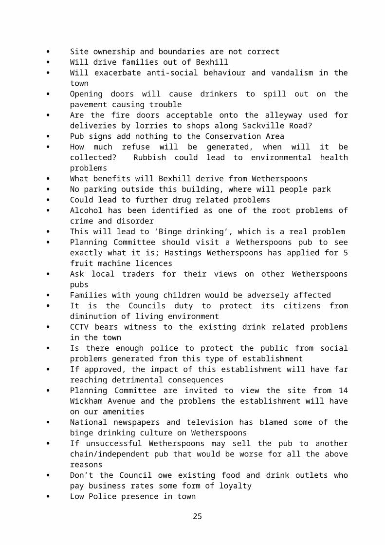
within the current licensing hours, together with other management procedures, will not create the excessive disturbance associated with many town centre establishments aimed at the 18-25 age group.I suggest that consideration is given to imposing a time condition with any consent to help preserve the amenities of local residents.If consent is granted, I would be pleased to work with the applicant's agent to ensure that unnecessary crime risks are not introduced. In particular, I am able to supply recommendations for the CCTV system.”Planning Notice:RR/2004/3241/P - 49 letters of objection: RR/2004/3251/P - 51 letters of objection: Insufficient parking provision Not an appropriate use for this quiet, residential neighbourhood, will be
detrimental to residential amenities Will generate extra noise and disturbance Will create noise and smells from cooking No details of ventilation system Enough food and drink businesses in Bexhill Will cause some food and drink outlets to close, Bexhill doesn’t need vacant
shops A Wetherspoons pub will not enhance, preserve or improve the desirability of
this Conservation Area Material inaccuracies in the application form Will lead to alcohol related social disturbance and problems Planning Officers and Committee members should check for themselves the
type of clientele frequenting these pubs. The BBC has recently presented a picture of Wetherspoons radically different
from the chains carefully constructed image, the BBC gives the true image. Wetherspoons are moving away from their no music policy 4 out of 5 newly opened Wetherspoons pubs are in the category of music pubs;
it is the town centre pubs where they now seek music licences. How long before they seek to change the character of the Bexhill pub
This pub would be right next door to a residential property, detrimental to amenities, and to character of the area
Would exacerbate existing parking problems Do any of the Planning Committee members live in the town centre and
experience parking problems first hand Will exacerbate existing vandalism problems in Egerton Park Will de-value houses Detrimental to existing residential amenities Disturbance by delivery lorries servicing a 7 day per week trade If supervisory staff are needed does this not hint at preventing potential trouble Not enough trade for this type of business Will adversely affect the trade of existing food and drink establishments in the
town centre. Noise and disturbance from contractors Will exacerbate existing traffic hazards and dangers Façade will be more distinctive No hours of operation mentioned Site ownership and boundaries are not correct Will drive families out of Bexhill Will exacerbate anti-social behaviour and vandalism in the town
17

Opening doors will cause drinkers to spill out on the pavement causing trouble Are the fire doors acceptable onto the alleyway used for deliveries by lorries to
shops along Sackville Road? Pub signs add nothing to the Conservation Area How much refuse will be generated, when will it be collected? Rubbish could
lead to environmental health problems What benefits will Bexhill derive from Wetherspoons No parking outside this building, where will people park Could lead to further drug related problems Alcohol has been identified as one of the root problems of crime and disorder This will lead to ‘Binge drinking’, which is a real problem Planning Committee should visit a Wetherspoons pub to see exactly what it is;
Hastings Wetherspoons has applied for 5 fruit machine licences Ask local traders for their views on other Wetherspoons pubs Families with young children would be adversely affected It is the Councils duty to protect its citizens from diminution of living environment CCTV bears witness to the existing drink related problems in the town Is there enough police to protect the public from social problems generated from
this type of establishment If approved, the impact of this establishment will have far reaching detrimental
consequences Planning Committee are invited to view the site from 14 Wickham Avenue and
the problems the establishment will have on our amenities National newspapers and television has blamed some of the binge drinking
culture on Wetherspoons If unsuccessful Wetherspoons may sell the pub to another chain/independent
pub that would be worse for all the above reasons Don’t the Council owe existing food and drink outlets who pay business rates
some form of loyalty Low Police presence in town Do not need another pub in Bexhill2 of the above letters have been attached to this report as an APPENDIX DOCUMENT relating to this Committee 18 March 2004. A total of 4 letters have been submitted in Support of the above applications.
SUMMARY First, I have written to the agent concerning the submitted drawings and photos and have asked for a detailed drawn plan of the proposed changes to the front elevation. From a design point of view I would prefer it if the building had a fixed four-pane frontage as shown on the submitted amended photo. However, in principle I consider the proposed amended treatment of the front elevation to be in character with the 1960s age of this building, including the first floor. I consider it important to raise the points fire safety and whether the plans submitted are correct in terms of their fire escape provision; I have written to the agent concerning this matter. Turning to the proposed use, I have noted the objections raised above, and have considered the comments of the consultees. In the ‘Town Centre section of the Rother District Local Plan: Revised Deposit (November 2003) there are no policies that restrict A3 uses; the accompanying and introductory note to the ‘Town Centre’ section of the plan states that: “The Council wants to see the town centre strengthen its position as the commercial and cultural heart of Bexhill. This includes building on its considerable strengths in the mix of land uses and strong architectural character, to support commercial regeneration and to create a more vibrant shopping environment.”
18

It has to be recognised that this is a proposed commercial use within, albeit on the edge of, the main shopping area of Bexhill Town Centre; Policy EM13 of the Rother District Local Plan: Revised Deposit (November 2003) states that: “Shopping and related commercial development shall be focused within the main shopping areas of Bexhill.” Whilst much has been raised about the operation of this A3 use, the Director of Services – Environmental Health considers that with appropriate controlling conditions he would have no objection to the proposed use. In consideration of the noise and activity generated from the deliveries and traffic associated with the use, it has to be recognised that its former use as a glassworks outlet included regular deliveries in an out of the large loading bay area on the west side of the building close to the neighbouring residential property. Within the Town Centre it has long been accepted that there is a very limited capacity for off street car parking for new development. In order not to adversely affect the vitality of the Town Centre, planning permissions’ have been granted without imposing off street car parking requirements, which has often been sustained by the Highway Authority; in relation to this it should be noted that the site is on a bus route and close to other public transport routes including other bus routes and trains.The Local Planning Authority would not want to make a decision that would adversely affect the vitality of the existing mixed commercial uses in the town centre, as it would be contrary to planning policies and government guidance. However, the Local Planning Authority are mindful of the need to protect and safeguard the amenities of neighbouring residential properties, so far as it has the power to do so. However, if the proposed A3 use has a marketing strategy and financial ability to sell alcohol and food at low prices, this is a free market factor that allows free and open commercial competition. The vitality of the Bexhill Town Centre is made up of mainly a mix of A1, A2 and considerable number A3 uses, which are currently in open and free market competition. In “The Government Response to the Office of the Deputy Prime Minister Housing, Planning, Local Government and the Regions Committee’s report on the Evening Economy and the Urban Renaissance” the following recommendations are made: “In producing the new Planning Policy Statement 6 on town centres, the Government will stress the need to plan positively for the future growth of town centres. In extending them it will encourage the development of mixed-use areas.The Government reconsider its desire to deal with issues of cumulative effect exclusively through the planning system. We continue to be convinced that cumulative effect is best dealt with through the more flexible licensing system.The cumulative effect of additional or existing licensed premises on the promotion of the licensing objectives is a proper matter for a licensing authority and its licensing committee to consider. Nothing in the Licensing Act 2003 prevents such an approach.”The town centre vitality benefits of this A3 use have to be weighed up against what impact the use may have on neighbouring residential amenities. With strict controlling conditions, the proposed A3 use could be controlled in terms of hours of opening, and a condition could include: no amplified, recorded, live or other form of music shall be played on the premises and no video, TV, or games/gambling screens and/or machines shall be installed and/or operated on the premises. Also, full details of satisfactory fume extraction equipment serving the restaurant will be required.Any anti social behaviour outside of the premises cannot be controlled under planning legislation. Unless there is justifiable evidence to clearly demonstrate that the proposed use would cause such problems to the detriment of neighbouring residential amenities, then there is no reason that I can see to withhold the granting of permission for the proposed use. Although the premises is close to residential amenities, indeed in the case of no. 14 next door, I am not convinced by the above objections that with the
19
imposition of the conditions set out below that this proposed A3 use would be the sole cause of any anti social behaviour or vandalism in the town that may occur. Members will be able to fully consider these matters upon their inspection of the site, however I anticipate making the following:
RECOMMENDATIONS:RR/2003/3241/P:- GRANT (FULL PLANNING) DELEGATED (AMENDED PLANS, CLARIFICATION RE SITE OWNERSHIP, VENTILATION AND FIRE ESCAPES, AND X dB(A) LEVELS FROM DCS)AndRR/2003/3251/P:- GRANT (FULL PLANNING) DELEGATED (AMENDED PLANS, CLARIFICATION RE SITE OWNERSHIP, VENTILATION AND FIRE ESCAPES, AND X dB(A) LEVELS FROM DCS)1. The premises shall only be used for the sale of food and drink for consumption
on the premises and for no other use/purpose including any other use/purpose in Class A3 of the Schedule to the Town and Country Planning (Use Classes) Order 1987 or in any provision equivalent to that Class in any statutory instrument revoking, amending, or re-enacting that order and this permission shall be carried on only by J D Wetherspoon plc.Reason: To ensure an appropriate use of the property/site in the interest of safeguarding neighbouring residential amenities and to accord with Policy S1 of the East Sussex and Brighton & Hove Structure Plan 1991-2011 and to accord with policy GD1 of the Rother District Local Plan: Revised Deposit (November 2003).
2. The use hereby permitted shall not be open to customers or any persons and no employee including a proprietor shall carry out any food preparation, cooking, and/or sales or serving to customers or any persons on the premises outside the hours of 10.00 to 23.00 Mondays to Saturdays and 12.00 noon to 22.30 Sundays and all clearing, cleaning, and any other work associated with the approved use shall not continue and no employee including a proprietor or other persons shall be in the premises to carry out such work outside the hours of 09:30 to 23.30 Mondays to Saturdays and 11:30 to 23.00 on Sundays.Reason: In the interest of safeguarding neighbouring residential amenities and to accord with Policy S1 of the East Sussex and Brighton & Hove Structure Plan 1991-2011 and to accord with policy GD1 of the Rother District Local Plan: Revised Deposit (November 2003).
3. No development shall commence until a scheme for the fitting of odour control equipment to the building has been submitted to and approved by the Local Planning Authority and the use of the premises shall not commence until all odour control equipment works have been carried out and fully installed and operational in accordance with the approved details. The odour control equipment shall be retained in a fully operational state and maintained thereafter in accordance with the manufacturers recommendations and to the satisfaction of the Local Planning Authority.Reason: In the interest of safeguarding neighbouring residential amenities and to accord with Policy S1 of the East Sussex and Brighton & Hove Structure Plan 1991-2011 and to accord with policy GD1 of the Rother District Local Plan: Revised Deposit (November 2003).
4. No development shall commence until a scheme for sound insulation of odour control equipment referred to in the condition set out above has been submitted to and approved by the Local Planning Authority and the use of the premises shall not commence until all sound insulation works have been carried out and
20

fully installed in accordance with the approved details. The sound insulation equipment shall be retained and maintained thereafter to the satisfaction of the Local Planning Authority.Reason: In the interest of safeguarding neighbouring residential amenities and to accord with Policy S1 of the East Sussex and Brighton & Hove Structure Plan 1991-2011 and to accord with policy GD1 of the Rother District Local Plan: Revised Deposit (November 2003).
5. Noise emitted from the site shall not exceed X dB(A) expressed as a 15 minute Leq at anytime. This is measured [insert exact measurement location if possible].Reason: In the interest of safeguarding neighbouring residential amenities and to accord with Policy S1 of the East Sussex and Brighton & Hove Structure Plan 1991-2011 and to accord with policy GD1 of the Rother District Local Plan: Revised Deposit (November 2003).
6. No amplified, recorded, live or other form of music shall be played on the premises and no video, TV, or the display of moving images (other than closed circuit security TV) shall be visible to customers on the premises.Reason: In the interest of safeguarding neighbouring residential amenities and to accord with Policy S1 of the East Sussex and Brighton & Hove Structure Plan 1991-2011 and to accord with policy GD1 of the Rother District Local Plan: Revised Deposit (November 2003).
7. No gaming of any kind whether by electronic devices, machines or otherwise shall take place on the premises.Reason: In the interest of safeguarding neighbouring residential amenities and to accord with Policy S1 of the East Sussex and Brighton & Hove Structure Plan 1991-2011 and to accord with policy GD1 of the Rother District Local Plan: Revised Deposit (November 2003).
8. No development shall commence until a scheme for the suitable treatment of all plant and machinery against the transmission of sound and/or vibration and a scheme for the soundproofing of the building has been submitted to and approved by the Local Planning Authority and the use of the premises shall not commence until all soundproofing treatment and insulation works have been carried out and fully installed in accordance with the approved details. The sound insulation equipment, treatment and insulation works shall be retained and maintained thereafter to the satisfaction of the Local Planning Authority.Reason: In the interest of safeguarding neighbouring residential amenities and to accord with Policy S1 of the East Sussex and Brighton & Hove Structure Plan 1991-2011 and to accord with policy GD1 of the Rother District Local Plan: Revised Deposit (November 2003).
9. Shop front/material details (awaiting amended plans/details).10. No dancing entertainment or sporting event shall take place on the premises.
Reason: In the interest of safeguarding neighbouring residential amenities and to accord with Policy S1 of the East Sussex and Brighton & Hove Structure Plan 1991-2011 and to accord with policy GD1 of the Rother District Local Plan: Revised Deposit (November 2003).
Note: The applicant’s attention is drawn to the following advice notes from the Council’s Director of Services – Environmental Health:1. Please advise all applicants that from June 2004 a licence is required to sell hot
food after 2300 until 0500 (Licensing Act 2003). For further information please contact Mr Hoyland on 01424 787553 or email [email protected].
2. Please advise that as the development comprises 500m2 or more then advice on energy efficiency is available from 'Actionenergy' on 0800 58 57 94 (www.actionenergy.org.uk).
21

3. The applicant’s attention is drawn to the advice of the Police in their letter (copy enclosed).
RR/2003/3416/P BEXHILL SITE D, SIDLEY GOODS YARD, NINFIELD ROAD,06 FEB 2004 STORAGE OF THREE LORRIES FOR OVERNIGHT PARKING
PLUS STORAGE OF RAILWAY SLEEPERS, MOTORWAY CRASH BARRIER AND 40 SKIPSHav-A-Skip
SITE This enclosed compound is located at the end of the service road just prior to the East Sussex County Council Highways Depot. Temporary planning permission RR/90/0538/P was granted for the use subject to conditions limiting hours of occupation and preventing any sorting or unloading of skips on site. The permission expired on 31 May 2002 and was not renewed.
HISTORYRR/80/1772 Use of vacant land for parking of public service vehicles and
erection of security fence – Approved.RR/80/2170 Siting of caravan for use as office and rest room for drivers –
Approved.RR/83/0471 Change of use of land to maintenance and repair of plant and
permission in principle to erect workshop – Approved.RR/86/0075 Change of use from restricted vehicle repairs to storage of
scaffolding – Approved.RR/86/1311 Erection of office/store and covered area for housing lorries and for
maintenance purposes. Erection of cement silo – Approved.RR/90/0538/P Use of land and buildings for heavy side builders merchants to
trade with ancillary office and storage – Approved.RR/2001/660/P Change of use of land to storage of two lorries with overnight
parking and for storage of a maximum of 28 skips – Approved (Temporary – expired on 31 May 2002).
PROPOSAL The previous temporary permission was for the storage of two lorries for overnight parking and a maximum of 28 skips. This application by the existing tenant seeks to continue the use but for the storage of three lorries for overnight parking, 40 skips and in addition, the storage of railway sleepers and motorway crash barriers.
CONSULTATIONSHighway Authority – Does not wish to restrict grant of consent subject to the observations below:“The site is affected by the approved scheme for the Bexhill Northern Approach Road.This scheme was developed as a link road to the now rescinded A259 Bexhill and Hastings Western By-pass and to provide access to development land in north Bexhill.Since there is still a requirement for access to the development land and for relief to be provided to the local road network, the scheme is being re-examined in that context. Any works associated with any resultant scheme would be unlikely to commence before 2007.It is considered therefore that planning consent should be for a temporary period only and lapse at the end of March 2007.”Environment Agency:- comments awaited.
22

Director of Services - Environment:- Comments awaited.Planning Notice:- 1 letter of objection - access on blind bend; firm has stored rubbish in skips on occasions; skips stored in high piles more dangerous than gravestone problem; site is in full view of our garden; previous screening trees have diminished; site is noisy; site is close to badger sett; site is over used; would devalue our property.
SUMMARY The Applicant also operates a similar use from his adjoining Site E which also has temporary planning permission (RR/2002/635/P) expiring on 31 December 2005. That site lies between this site and the properties in London Road and from where the letter of objection has been received. It is my belief that the objections relate more to that site than this. Notwithstanding, it would be necessary to ensure that the amenities of the residents in London Road would not be unreasonably affected by the proposed continued use. Given the historical use of this former railway goods yard and the Applicant’s continued compliance with appropriate conditions, I would not expect the local residents to be adversely affected to a degree that would justify a refusal of planning. With particular reference to the fact that loaded skips are occasionally stored on site, I am led to understand that this practice results from the fact that it is not always possible to dispose of the waste at the end of the working day. Furthermore, skips are never stored more than six high because it would then be impossible to lift them with the lorry’s hoist. Subject therefore to receiving satisfactory comments from the Director of Services - Environment I would expect to support the proposal subject to conditions similar to the following:-
RECOMMENDATION: GRANT (FULL PLANNING)1. CN14B insert “31 March 2007”.
Reasons: A and C (Time limited permission use).2. CN12G (Hours of use).3. No loaded skips shall be sorted or unloaded on the site.
Reason: To preserve the residential amenities of the locality and to accord with Policy S1 of the East Sussex and Brighton & Hove Structure Plan 1991-2011.
4. Prior to being discharged into any watercourse, surface water sewer or soakaway system, all surface water drainage from parking areas and hardstandings shall be passed through trapped gullies to BS5911:1982 with an overall capacity compatible with the site being drained.Reason: To prevent pollution of the water environment and to accord with Policy EN11 of the East Sussex and Brighton & Hove Structure Plan 1991-2011.
5. Unless otherwise agreed in writing with the Local Planning Authority, no railway sleepers and motorway crash barriers shall be stored at a height exceeding the height of any existing adjacent fences, walls or buildings on the boundaries of the site.Reason: In order to preserve the visual amenities of the area and to enable the Local Planning Authority to regulate and control the development of the land in accordance with Policies S1 of the East Sussex and Brighton & Hove Structure Plan 1991-2011 and GD1 of the Rother District Local Plan: Revised Deposit (November 2003).
RR/2004/27/P BEXHILL 1-4 VILLAGE MEWS, LITTLE COMMON08 JAN 2004 RETENTION OF REPLACEMENT EXTRACTION SYSTEM
Mr N Narinsakchai
SITE This site is an existing restaurant located on the northeast corner of Village Mews. There is residential accommodation above the restaurant.
23

HISTORY (relevant)RR/77/0259 External alterations, extension to form coffee shop, erection of
single storey building – WithdrawnRR/79/1040 Rebuild antiques showroom, construct coffee shop with 2 self-
contained flats over – Approved conditionalRR/84/1737 Alterations to existing first floor flat to form a restaurant – Approved
conditionalRR/82/2066 Change of use from coffee bar to wine bar – Approved conditionalRR/86/1541 Change of use from retail shop and restaurant with kitchen area
and wine store – Approved conditionalRR/90/1766/P Use of unit for sale of take-away fish and chips and supply of same
to existing restaurant (Village Inn) – Permitted developmentRR/94/1722/P Proposed change of use to restaurant as extension to existing
premises – RefusedRR/2003/2349/P Proposed change of use of 4 Village Mews to extend existing
restaurant and two air conditioning units to roof of 1 Village Mews - Delegated to Approve
PROPOSAL This is a retrospective application for the above. The new flue is located on the roof of the restaurant immediately outside the first floor flat. It is galvanised metal and discharges above the eaves of the flat. The agent and applicant have submitted supporting information in relation to this development, which is included as an APPENDIX DOCUMENT to this report.
CONSULTATIONSDirector of Community Services – Environment: “I have re-visited the occupier of the flat above this premises at 9pm on Thursday 19 th February 2004. The ‘hum’ from the restaurant was again all pervasive in the flat. I visited the restaurant and the system was switched off. On re-entering the flat there was no hum. Therefore the structure borne ‘hum’ is definitely from the new extract system.I have previously met the installer and he is to provide antivibration treatment to the system. There is no odour control equipment in the system and the occupant of the flat categorically states that the cooking odour was not present before the Thai Restaurant came into use. If the system was new (as this one appears to be) then an odour control scheme would be required. The retention of the replacement extract system cannot be approved in its current form.”Planning Notice: No representations received.
SUMMARY I have written to the Director of Community Services – Environment to ask what is required under Environmental Health. However, notwithstanding the supporting information provided by the agent, the comments of the Director of Community Services - Environment, clearly concludes that the extraction system as installed is unacceptable. For the reasons given above the fume extraction system should be refused.
RECOMMENDATION: REFUSE (FULL PLANNING)1. It has been demonstrated that when switched on the fume extraction system
installed at these premises causes noise and odours that are detrimental to the amenities and enjoyment of the residential flat above these premises and therefore is unacceptable. The development is therefore in conflict with Policy S1
24
of the East Sussex and Brighton & Hove Structure Plan 1991-2011 and policy GD1 of the Rother District Local Plan: Revised Deposit (November 2003).
RR/2004/50/P BEXHILL 8-10 LONDON ROAD - LAND AT24 JAN 2004 OUTLINE: DEMOLITION OF EXISTING BUILDINGS AND
ERECTION OF 16 APARTMENTS AND FLATS WITH CAR PARKING AND ACCESS ROAD INCLUDING FORMATION OF NEW VEHICULAR ACCESSThe Lawrence and Bungay Partnership
This application was deferred at your last meeting to allow discussion for a mixed use scheme which would retain some employment uses on the site. At the time of writing this report, I have only received verbal confirmation that the applicant is positively considering such a scheme. My following report therefore relates to the scheme as currently submitted.
SITE This irregular shaped site fronts the east side of London Road and adjoins the northern boundary of the British Legion Club. The site is currently occupied by two Edwardian period buildings currently used as offices. A central drive between the buildings provides access to a car parking area at the rear. The site includes a small area of land at the rear currently belonging to the Council.
HISTORYRR/77/0780 (No. 10) Change of use from part residential and part office use to
wholly office use – Deemed grantedRR/82/1912 (No. 8 & Application in principle for change of use from residential Part 10) to office use and use of rear garden for car parking –
Deemed grantedRR/1999/953/P (No. 10) Change of use to A2 use – Approved
PROPOSAL The application is accompanied by a layout plan showing a single frontage building with central archway to a parking area at the rear. Also submitted for guidance are steet scene sketches. These show the outline of the proposed buildings sharing a similar height to those opposite and adjoining the north side of the site. Parking provision would be at a ratio of 1 car space per unit. The density of the proposed development would be 133 dwellings per hectare. This is well above the minimum 30-50 dwellings per hectare recommended by the Government in PPG3. A supporting statement from the Agent CCM dated 3 February 2004 is contained in the separate APPENDIX DOCUMENT relating to this meeting 18 March 2004. Moat Housing Group have confirmed their interest in supplying (possibly 25%) affordable housing units for “key workers” on a shared ownership tenure basis.
CONSULTATIONSHighway Authority – No objection subject to agreement on access and turning at detail stage.Environment Agency – Has no objection subject to conditions to control the discharge of surface water from parking areas and hardstandings and land contamination.Southern Water Services – There are no objections to disposal of foul water to the main sewer. The Council’s Building Control officers or engineers should be satisfied with the proposal to discharge surface water to soakaways.Director of Services – Estates – Has no objection.
25

Director of Services – Environmental Health – Has no comments to make on this application.Director of Services – Housing – The Strategic Housing service would require a minimum of 40% affordable homes (6 flats).Director of Services – Regeneration – A fully copy of his comments dated 18 February 2004 is contained in the separate APPENDIX DOCUMENT relating to this Committee 18 March 2004. In brief, he is reluctant to support the loss of commercial accommodation to residential and refers to Local Plan Policy BX6 which places a responsibility upon the applicant to demonstrate that there is no prospect of continued office use. Based upon the information presented, the case has yet to be proven.Planning Notice – Comments awaited.
SUMMARY With regard to the proposed development itself, I consider it feasible to erect a block of flats in the form indicated on the submitted indicative plans. Furthermore, the Applicants have agreed to enter into a Section 106 Obligation to secure the provision of an element of affordable housing. An issue in this case would be the loss of office accommodation.The site falls within the Office Area shown on the Bexhill Town Centre map contained in the Rother District Local Plan: Revised Deposit (November 2003) where the following applies:“Policy BX6 Within Bexhill Town Centre, in the Office Area as shown on the Proposals Map, favourable consideration will be given to Class A2(a) and (b) and Class B1 (a) uses on all floors and to appropriate redevelopment proposals for such uses, subject to the other policies of this Plan.The loss of office uses, through conversion or redevelopment, will only be permitted where it is demonstrated that there is no prospect of a continued use”.The following extract from the supporting statement summarises the applicant’s case:“Clearly, there is balance between the use of 8 and 10 London Road as commercial offices and the redevelopment of the site for residential use including the provision of social housing. I believe it is the case that there is no realistic possibility of this site providing long term commercial offices, bearing in mind the physical condition and internal arrangements of the buildings; the fact that only one building has ever been in commercial use; the expected reduction in the number of users; the rise in electronic home working and the unrealistic expectation of a new commercial office building on this site. On the other hand the residential redevelopment of this site will provide small housing units for first time buyers and an element of much needed affordable housing for Bexhill”.Notwithstanding the Applicant’s assertion that there is no realistic possibility of this site providing long term commercial offices, I concur with the Director of Services - Regeneration comment that no evidence has currently been submitted to demonstrate that there is no prospect of a continued use for the site. In the absence of any such evidence the proposed wholly residential redevelopment is premature. However, as the applicant has verbally indicated that he is positively considering amending the application to a mixed use scheme I make the following
RECOMMENDATION: DEFER (RECEIPT OF AMENDED APPLICATION FOR MIXED USE SCHEME
RR/2004/105/P BEXHILL 45 CRANSTON AVENUE - LAND TO REAR16 JAN 2004 ERECTION OF DWELLING AND GARAGE
Mr and Mrs Herbert26
SITE The existing detached dwelling occupies a large plot on the southeastern side of Cranston Avenue. Cranleigh Close is located on the south of the site, with the car park and amenity land of Conquest House adjoining the west side of the site
HISTORYRR/86/1107 O/A demolition of garage and erection of new dwelling with garage
– Refused.RR/2002/2168/P Outline: erection of dwelling and garage – Refused - Appeal Allowed.
PROPOSAL This is a full application for the erection of a bungalow at the rear of 45 Cranston Avenue, the proposed plot is approximately 851m2. Access to the proposed bungalow will be via a proposed 4m wide driveway located at the eastern side of 45 Cranston Avenue. A garage to be utilised by the applicants of 45 Cranston Avenue is proposed at the rear of their proposed plot.
CONSULTATIONSHighway Authority:- Does not wish to restrict grant of consent.Planning Notice:- 4 letters of objection -3 Cranleigh Close: The proposed detached garage will adversely affect the light and aspect of the
west elevation bedroom windows of 3 Cranleigh Close; Inspectors views regarding 3 Cranleigh Close should not be ignored
Applicants own garden of 43 Cranston Avenue, this is not shown on application forms
The dwelling includes a bedroom at first floor level; the inspector for RR/2002/2168/P imposed a condition against first floor accommodation.
Loft window is not an escape window, but a full window Proposed floor levels would be much higher than surrounding properties Further development could occur if applicant does own 43 Cranston Avenue39a Cranston Avenue: Development of plot will exacerbate untidiness of site Will existing drainage system cope with additional development, could
exacerbate flooding into my property Do not agree with appeal inspectors report May be badgers and foxes on the site58 Cranston Avenue: Undesirable back land development No provision for service vehicles The development is no comparison to Trinity Trees or Cranleigh Close Understand there to be a badger set in the garden of the site
SUMMARY I have noted the above objections. However, in order to consider this application in the context of the allowed appeal on this site under RR/2002/2618/P, I would draw Members’ attention to the conclusion of the Inspector: “The appeal proposal lies in an area where development away from the surrounding road frontages is already a feature. I do not consider that harm would be caused to the character of the area. Nor would a harmful precedent be set by approval of the proposal. The amenities of neighbouring residents would not be prejudiced provided that a bungalow of suitable size and siting is approved at a later stage. Having taken account of all the matters raised in the representations, I have found nothing that
27

outweighs these conclusions.” The full text of the Inspector’s report is attached as an APPENDIX DOCUMENT relating to this Committee 18 March 2004.Bearing this conclusion in mind it is clear that the principle of residential development on this site has been established. In allowing the aforementioned appeal, the inspector imposed a condition for a single storey development with no dormer windows or roof lights in the roof space, to prevent overlooking. The agent in his supporting letter has addressed this issue as follows: “The above Outline planning consent was granted on appeal, subject to Conditions. In particular Condition 6 states: ‘The dwelling hereby permitted shall be single storey only and no dormer windows or rooflights shall be inserted into the roofspace.’This condition was imposed to preserve the privacy of the adjoining property at 3 Cranleigh Close. My client however wishes to make use of the roofspace in the new dwelling, essentially as a cinema room, and therefore does not wish to comply with Condition 6.This facility is important to my clients as Mr Herbert, who is registered disabled, is suffering from a degenerative illness and whilst his mobility is currently good this will inevitably deteriorate and home based recreation will become increasingly important.You will see though that I have limited the loft room to one window, positioned in the west elevation overlooking the Hastings Direct site, to avoid any loss of privacy to 3 Cranleigh Close.”In light of the allowed appeal, I consider the principle of a bungalow on this site has been established, and is acceptable in this application. I have noted the agent’s comments regarding the first floor window, and notwithstanding the condition imposed by the inspector, I take the view that as the proposed first floor window would overlook only the car park and open amenity field of ‘Hastings Direct’ to the west, there would be no detriment on neighbouring amenities; I therefore agree with the conclusion of the agent on this matter. My only concern with this development is the siting of the detached double garage in the southeast corner of the site. It would be sited approximately 4.5m from the west elevation bedroom window of no. 3 Cranleigh Close, which is approximately 0.5m lower than the ground level for the garage. I am therefore of the opinion that the garage, as sited, would have an overdominant impact, and may affect the daylight into this bedroom, the combination of which is likely to adversely affect these residential amenities. I have written to the agent to state that unless it is sited further north, at least to be in line/behind the north flank bedroom wall of 3 Cranleigh Close, I would make the following recommendation
RECOMMENDATION: REFUSE (FULL PLANNING) 1. The proposal double garage would be overdominant and would have an adverse
impact on the daylight, outlook and aspect of the amenities of neighbouring residents which would be in conflict with Policy GD1 OF THE Rother District Local Plan: Revised Deposit (November 2003) and Policy S1 of the East Sussex and Brighton & Hove Structure Plan 1991-2011.
RR/2004/158/P BEXHILL 10 ARTHUR ROAD21 JAN 2004 PROPOSED FIRST FLOOR EXTENSION
Mr S Colinson
SITE The semi-detached dwelling is the second plot on the north west side of Arthur Road from the junction with Eastwood Road. The rear garden of the site backs onto the rear gardens of dwellings in Eastwood Road.
28

HISTORYNo history.
PROPOSAL The application proposes to remove the cat slide roof on the out shot building on the rear of the dwelling and extend the height of the existing out shot building up to roof eve height and replace with a flat roof. This additional space at first floor level will be used to create a bathroom. CONSULTATIONSPlanning Notice:- 1 letter of objection from 8 Arthur Road concerned with the following: The somewhat incongruous 2 storey flat roofed projection, being south of our dwelling will most certainly interfere with the amenity value of our property. Hope this extension will be treated in the same vein that was applied to both our rear extension and that at No 6.
SUMMARY The proposed extension is small in comparison to the existing dwelling, and proposes to raise the height of the out shot building up to roof eve height and replace the cat slide roof with a flat roof. I do not consider that this small alteration to the rear of the dwelling will have any significant detrimental affect of the residential amenities of No 8, the increase in loss of light to their property will be minimal. I have considered the neighbours comments, but feel due to the size of this proposal it will not have the same impact on the locality as the previous applications at No 6 and No 8, RR/93/2232/P, RR/94/1794/P, RR/2002/1684/P and RR/2002/2309/P. The proposed window on first floor level is to be for a bathroom, and thus obscured glazing can be used to prevent overlooking. I take the view that the design could be improved by the reconsideration of the flat roof element. Subject to satisfactory amended plans I expect to make the RECOMMENDATION: GRANT (FULL PLANNING) DELEGATED (AMENDED PLANS)1. CN7C (Matching external materials)2. CN5E a) (Restriction of alterations/additions)3. The window at first floor level; on the rear elevation shall be glazed with obscure
glass and shall thereafter be retained in that condition.
29

RR/2004/223/P BEXHILL 203 COODEN DRIVE28 JAN 2004 OUTLINE: DEMOLITION OF EXISTING BUILDING AND
GARAGES AND ERECTION OF 14 FLATS WITH GARAGES AND PARKINGS Bestley
This application was considered by the Planning Committee at its meeting on 19 February 2004. It was resolved that authority be delegated to the Planning Officer to grant planning permission subject to conditions and to no adverse comments from outstanding consultees and expiry of the consultation period.
The public consultation period does not expire until 15 March 2004. However, as further public comment has been made, I am reporting this application back to the Planning Committee at their meeting on 18 March 2004.
This site was inspected by the Planning Committee on 17 February 2004.
SITE This site is an existing nursing home located on the on the southern side of Cooden Drive.
HISTORY (Relevant)RR/88/2708 Outline application for the erection of 2 storey block of 16 warden
care flats with 31 parking spaces - Refused - Appeal Dismissed.RR/90/0701/P Outline: erection of 2 storey block of 12 warden care flats linked to
existing nursing home - Withdrawn.RR/91/1951/P Outline: 2 storey extension providing 16 additional bed spaces,
new day rooms and lift - Approved Conditional.RR/92/1865/P 2 storey extension providing new bedrooms, day room, lift &
bathrooms pursuant to outline permission RR/91/1951 - Approved Conditional.
RR/97/519/P Renewal of outline planning permission RR/91/1951/P for 2 storey extension providing 16 bed spaces and new dayrooms - approved Conditional.
RR/2000/203/P Renewal of outline planning permission RR/91/1951/P for two storey extension providing 16 bed spaces and new dayrooms - Approved Conditional.
RR/2003/966/P Outline: erection of two-storey block of eight flats with car parking spaces and new vehicular access - Approved
RR/2003/971/P Renewal of outline planning permission RR/91/1951/P for two storey extension providing sixteen bed spaces and new dayrooms - Approved.
PROPOSAL This is an outline proposal for the demolition of ‘Three Chimneys’ and the erection of a pair of linked buildings for 14 flats. Also, the existing front car parking area would be replaced with new garage blocks on the east and west sides. The development of the flats would be on approximately the same footprint as the existing building.
CONSULTATIONSHealth and Safety Executive:- Does not advise, on safety grounds, against the granting of planning permission in this instance.
30

Highway Authority:- “The Highway Authority does not wish to restrict grant of Consent subject to the observations below:-In respect of this Outline Application, subject to agreement on access and the provision of satisfactory on-site parking in accordance with the County Council’s adopted standards and turning space at any Detail stage.Note: This Authority continues to be concerned over the width of the existing vehicular access and would recommend that this be widened to a minimum width of 5 metres prior this development at any detail stage.” Southern Water:- Recommend investigations regarding foul and surface water drainage.Environment Agency:- No objections in principle, but if planning permission is granted recommends a condition re surface water drainage.South East Water:- Any comments will be reported.Planning Notice:`- 2 letters of objection: Cannot see the need for more flats in this location The building of more flats does not alleviate the problem of loss of rest/nursing
homes Would have a detrimental affect on the character of the local street scene Increased noise levels due to increased traffic from residents of new flats With the recently approved flats at 207 Cooden Drive, the resulting appearance
will be of one solid block of 22 flats Local houses would be overlooked with a loss of privacy as a result The development, together with other approved schemes in the locality, does not
enhance the character of the area. The financial gain of the development is against the spirit of PPG 3
Likely view of an Inspector is that any such building does not improve the area Destruction of view Devaluation of local properties Increase in traffic and parking Increase in road accidents/hazards due to proposed exit/entrance on the severe
bend in the road Traffic flow increase compounded by existing flats under construction in Cooden
Drive
SUMMARY I have taken account of the above objections. However, the principle of some form of substantial development on this site has been previously established with the approval of previous applications for a two-storey extension to the ‘Three Chimneys’ nursing home, providing sixteen bed spaces and new day rooms on the west side of the Nursing home. Also, approval was granted on the adjacent garden land for a two-storey block of 8 flats under RR/2003/966/P. Although an appeal in 1988 was dismissed RR/88/2708/P, for a two-storey block of flats, an alternative form of development for a two-storey building may be appropriate, as with RR/2003/966/P. However, any such development should ensure an appropriate relationship with neighbouring properties, and the character of the area. The illustrative plans would not in my view achieve this. Subject to consideration of all the detailed matters under a reserved matters application, I anticipate making the following:
RECOMMENDATION: GRANT (OUTLINE PLANNING) 1. The siting, height, design, parking layout and means of access of the new
development, is not approved.
31

Reason: RC3, RC11, RC12, RC13 and to accord with Policy S1 of the East Sussex and Brighton & Hove Structure Plan 1991-2011 and Policy GD1 of the Rother District Local Plan: Revised Deposit (November 2003).
2. No development shall commence until full details of the finished floor level for the new building to a fixed datum level have been submitted to and approved by the Local Planning Authority and the development shall be carried out in accordance with the approved details. Reason: RC3.
3. Prior to the commencement of development details of foul and surface water drainage for the site shall be submitted to and approved by the Local Planning Authority. The drainage works shall be constructed in accordance with the approved plans before the development hereby permitted is brought into use or occupied.Reason: To prevent water pollution and ensure satisfactory drainage of the site and to accord with Policy EN11 of the East Sussex and Brighton & Hove Structure Plan 1991-2011.
4. At the time of development and before it is occupied, garage or parking spaces shall be provided and laid out within the site to the approval of the Local Planning Authority and maintained in that use thereafter.Reason: In the interests of road safety and to ensure adequate car parking provision.Prior to being discharged into any watercourse, surface water sewer or soakaway system, all surface water drainage from parking areas and hardstandings shall be passed through trapped gullies to BS 5911:1982 with an overall capacity compatible with the site being drained. Reason: To prevent pollution of controlled waters.
5. Only clean, uncontaminated rock, subsoil, brick rubble, crushed concrete and ceramic shall be permitted as infill material. Reason: To prevent pollution of controlled waters.
RR/2004/225/P BEXHILL 29-31 WESTERN ROAD10 FEB 2004 CHANGE OF USE AND CONVERSION OF UPPER FLOORS
INTO TWO 2 BED MAISONETTES, TWO 1 BED FLATS, FORMATION OF 2 SHOP UNITS WITH NEW SHOP FRONTS, CHANGE OF USE OF NO.31 FROM A1 TO ESTATE AGENCYMrs S Payne
SITE This is a vacant shop, formally ‘Friday Ad’, located on the south side of Western Road, and within the Bexhill Town Centre Conservation Area.
HISTORY (relevant)B/71/301 Proposed shop front and internal alteration to ground and first
floors - Approved PROPOSAL The proposed development would consist of the division of the existing single shop unit and fascia of the former ‘Friday Ad’ shop, with two individual shop units each with a new timber shop front; the new shop fronts would be designed to a traditional Victorian/Edwardian design. Also it is proposed to change the use of one of no. 31 into an Estate Agency under class A2. The upper floors of the units would be converted into two 2-bedroom maisonettes and two 1-bed flats; access to the proposed
32

residential accommodation would be via new entrance doors at either end of the new shop fronts.
CONSULTATIONSHighway Authority - No objection.Director of Services – Environment – No comments other than that sound insulation will be covered by the Building Regulations.Environment Agency – No objection.Building Control - Sound insulation will be covered by the Building Regulations.Southern Water – No objections.Planning Notice – Any comments will be reported.
SUMMARY In principle I have no objection to the proposed development. I would wish to see some design alterations to the shop fronts. The proposed A2 use of one of the shop units would be acceptable in the town centre, where there is a mixture of A1, A2 and A3 uses. Subject to an exploration for any concealed fascia under existing, further information from the agent with regard to any overlooking from new residential first floor windows, and the receipt of satisfactory amended plans for the shop fronts, I would not wish to restrict grant of consent. I can be satisfied with regard to the above, I would make the following:
RECOMMENDATION: GRANT (FULL PLANNING) DELEGATED (AMENDED SHOP FRONT PLANS, EXPLORATION OF ANY CONCEALED FASCIA UNDER THE EXISTING, AND FURTHER INFORMATION CONCERNING ANY OVERLOOKING FROM NEW FLAT WINDOWS)1. The new shop front shall be constructed of timber and precisely in accordance
with the design as given on the approved plans.Reason: To ensure that the external appearance of the building(s) is satisfactory and to accord with Policy S1 of the East Sussex and Brighton & Hove Structure Plan 1991-2011 and Policy GD1 of the Rother District Local Plan: Revised Deposit (November 2003)
2. Before the shop front hereby approved is installed joinery workshop details and details of the materials, finish, colour and profile of the capitals’, pilasters’ coloured glazing and glazing bar details, ceramic tiles, cornice, fascia frame, recess floor tiles, shall have been submitted to and approved by the Local Planning Authority and the shop front shall be constructed and finished in accordance with the approved details within two weeks following its installation.Reason: To ensure that the external appearance of the building(s) is satisfactory and to accord with Policy S1 of the East Sussex and Brighton & Hove Structure Plan 1991-2011 and Policy GD1 of the Rother District Local Plan: Revised Deposit (November 2003).
3. Before the shop front hereby approved is installed details of paint colour/s for the shop front shall have been submitted to and approved by the Local Planning Authority and the shop front shall be painted in accordance with the approved colour within two weeks following its installation.Reason: To ensure that the external appearance of the building(s) is satisfactory and to accord with Policy S1 of the East Sussex and Brighton & Hove Structure Plan 1991-2011 and Policy GD1 of the Rother District Local Plan: Revised Deposit (November 2003).
33

RR/2004/232/P BEXHILL 75 BARNHORN ROAD, BARNHORNE MANOR28 JAN 04 RENEWAL OF TEMPORARY PERMISSION RR/94/2166/P FOR
A CARAVAN SITE WITH TOILET BLOCKPIP Properties Ltd
SITE This existing caravan site lies to the south of Barnhorn Road and is accessed via the drive between nos. 73 and 77 Barnhorn Road serving Barnhorn Farm.
HISTORYB/49/164 Use of land as site for moveable dwellings - ApprovedB/51/339 Use of two sites for storage of six caravans during winter months -
Approved.B/54/474 Use of farm building and land for winter storage of 26 caravans -
Approved.B/56/456 Caravan site for 24 caravans - Approved.B/58/714 Site for winter storage of 44 caravans - Approved.B/60/828 Caravan site for 50 caravans - Approved.B/62/696 Winter storage for caravans - Approved.B/64/35 Extensions, alterations and improvements and increase in number
to a maximum of 100 caravans - ApprovedB/65/333 Toilet block and connection to main drainage - Approved.RR/75/1068 Renewal of permission for a caravan site with toilet block -
Approved.RR/85/0256 Renewal of permission for a caravan site with retention of toilet
block - Approved.RR/94/2166/P Renewal of permission for a caravan site with toilet block -
Approved.
PROPOSAL To renew the time limited planning permission granted in 1994 under RR/94/2166/P for a further period. Planning permission currently exists for 100.
CONSULTATIONSHighways Agency:- Any comments will be reported.East Sussex County Council - Rights of Way Officer:- No objection, applicant should be aware of footpath that crosses the site.Highway Authority:- Consider that Highways Agency need to be consulted.Southern Water Services:- No comments.Environment Agency:- No objection.Director of Community Services - Environment:- Condition re maximum number of caravans 100 as previous approval.Planning Notice:- No representations received.
SUMMARY The site has a long history of use and is well maintained. No breaches of previous conditions imposed have been recorded. The granting of a conditional planning permission for a further period of 10 years would appear appropriate.
RECOMMENDATION: GRANT (FULL PLANNING)1. CN4B 10 years.
Reason: C (Time limited permission use).2. The caravans shall be used for human habitation only during the period 1 March
to 31 October each year, both dates inclusive.
34

Reason: RC35.3. The maximum number of caravans placed on the site at any one time shall not
exceed 100 and they shall be only within the areas coloured pink on the plan submitted with this application.Reason: RC35.
4. CN13C (Tree retention).Note: The applicant’s attention is drawn to the letter from East Sussex County Council Rights of Way Officer (copy attached).
RR/2004/236/P BEXHILL WATERMILL LANE – LAND AT5 FEB 2004 OUTLINE: CONSTRUCTION OF 45 ENERGY EFFICIENT
SUSTAINABLE HOMES, INCLUDING ALTERATIONS TO AN EXISTING ACCESS AND CONSTRUCTION OF NEW ROADMr D Jeapes
SITE This application relates to a 1.5ha field on the west side of Watermill Lane. The field lies approximately 0.5km north of the development boundary of Bexhill as defined in the Rother District Local Plan: Revised Deposit (November 2003). It is not within the High Weald AONB.
HISTORYB/59/89 Outline: Residential development – RefusedB/60/512 Outline: Residential development – RefusedB/61/689 Outline: Residential development – RefusedRR/76/1486 Outline: Dwellinghouse and garage – RefusedRR/77/0455 Improvement of vehicular access – Approved
PROPOSAL The submitted plans show a proposed layout of 45 dwellinghouses adjacent to the perimeter boundaries of the field and with a communal green and pocket park, including a reed pond, in the middle. A communal allotment area is also proposed. Existing boundary trees would be retained and supplemented. The density would be 30 dwellings per hectare. Parking would be provided at a ratio of 1 per dwelling with on street parking for visitors. The application is supported by several documents, copies of which are contained in the separate APPENDIX DOCUMENT relating to this Committee meeting 18 March 2004.
CONSULTATIONSHighway Authority – Recommend refusal for following reasons:“The approach road, the C345 (Watermill Lane) is unsuitable to serve the proposed development by reason of its narrow width poor alignment and lack of footways. Furthermore, it would exacerbate levels of congestion within Bexhill in the absence of Bexhill-Hastings road improvements.This development is proposed on a Greenfield site and is poorly placed in terms of sustainable transport modes due to lack of non-car travel choices for residents.As submitted the proposal would lead to increased traffic hazards on the C345 (Watermill Lane) by reason of the inadequate visibility at the proposed access.NoteThe Highway Authority expresses concern at this outline proposal that would create additional traffic on Watermill Lane (C345) a narrow, poorly aligned country lane with no
35
footways. At the proposed access Watermill Lane measures just 4.5 metres and varies in width on the approaches to the site. In order to safely accommodate two way traffic flow the road should measure at least 5 metres wide.Housing development should be at places with good public transport accessibility such as city, town, district and local centres or around major nodes along good quality public transport corridors. It shouldn’t generate a significant number of journeys by car. This proposal clearly does not achieve these objectives and is therefore contrary to Structure Plan policies TR1 and TR3.This stretch of the C345 is subject to the national speed limit (60mph) although vehicle speeds are likely to be lower than 60mph”.Environment Agency – Has no objection subject to conditions to control the disposal of foul and surface water drainage in order to prevent the increased risk of flooding and to prevent pollution of the water environment.Southern Water – “Foul Sewerage - You should consult the Environment Agency direct to ascertain the acceptability of a private treatment plant to serve the proposed development. I have been unable to locate the proposed position of the private treatment plant on the Proposed Site Plan, drawing umber 03.112/01A.I would draw to your attention Policy GD2 and paragraph 5.32 of the Rother District Local Plan Revised Deposit, which seek to ensure that only in exceptional circumstances will provision of other drainage proposal be acceptable.The site is only approximately 500 metres north of a potential connection point on to the public sewer, which has adequate capacity to serve the development.”South East Water – Comments awaited.Director of Services – Environment – Comments awaited.Director of Services – Housing – Would require a minimum of 40% affordable homes for clients registered with the Council for re-housing, this being 18 houses/flats on this development.East Sussex County Council – Strategic Planning – Comments awaited.Sussex Police – Comments awaited.Planning Notice – 2 letters of objection – traffic flow already more than Lane can reasonably accept; any increase will seriously impair road safety; if granted would open the flood gates for every land owner to submit an application for housing; bad road surface in Lane struggles with heavy traffic using it to bypass traffic problems in Bexhill; proposed entrance would be near to sharp bend; no shops in immediate area and walking along Lane is highly dangerous. The Council for the Protection of Rural England ask that the application be refused commenting that:1. unsuitable in AONB2. outside development boundary in Rother District Local Plan3. insufficient infrastructure such as roads and services to support such a
development
SUMMARY The application is speculative and is not the result of any pre-application discussions with this Authority. A main argument by the Applicant for the development is that the site lies close to the proposed route of the ‘Country Avenue’ shown in the ‘Towards a Masterplan for Hastings and Bexhill’ prepared by MBM Architects and AZ Urban Studio and published in 2002. The idea would be to establish a pattern of tree lined streets designed to contain the urban areas, provide development opportunities and protect the countryside. The plans show a ‘Country Avenue’ passing approximately 200m south of the proposed site and adjacent to Preston Lodge. However, the document is only a vision for the future (eg. next 30 years) and currently has no status and specifically states that it does not replace existing plans and that projects within the framework will be tested and brought forward through the normal
36
statutory planning process. No such test for the idea of Country Avenues has yet been undertaken. Justification for the proposed development based upon that idea would therefore be premature. In any event the proposed site would be in the countryside beyond the ‘Country Avenue’ and would not be contained within it. The application therefore falls to be judged against the ‘existing plans’ referred to in the Masterplan. These are the Structure Plan and Rother District Local Plan, both of which contain Policies to protect the countryside outside defined development boundaries. The proposal falls within the countryside outside the development boundary of Bexhill and is therefore contrary to Policies S1 and S10 of the East Sussex and Brighton & Hove Structure Plan 1991-2011 and Policies DS3, DS4 and HG10 of the Rother District Local Plan: Revised Deposit (November 2003). However, Policies S10 and H5 of the East Sussex and Brighton & Hove Structure Plan 1991-2011 and HG2 of the Rother District Local Plan: Revised Deposit (November 2003) provides for an exception to those policies in order to meet a local housing need. For instance, Policy HG2 states:“In exceptional circumstances, planning permission may be granted for residential development outside development boundaries in order to meet a local housing need among those people unable to compete in the normal housing market”.The Policy goes on to say that proposals for development will be considered in the context of several criteria. It is my opinion that the proposal does not meet those criteria. Furthermore, the Highway Authority reinforce these criteria, and recommend refusal based upon the unsuitability of Watermill Lane to serve the development; exacerbation of existing congestion in Bexhill; location and lack of non-car travel choices for residents and inadequate visibility at the proposed access. In response to the Highway Authority’s comments, further representations have been received from the Applicant and a copy letter received from his agent MPA dated 29 January 2004 is contained, with the other documents received, in the separate APPENDIX DOCUMENT relating to this Committee meeting 18 March 2004. In this letter, he is offering to enter into an agreement to improve Watermill Lane (carriageways, widths and footways) to the south of the site as far as the junction with Mayo Lane. An amended plan has also been submitted showing the visibility splays at the proposed access increased. The letter also challenges the Highway Authority’s description of the site as ‘Greenfield’, alleging that in fact, it is a brownfield site, its last official use having been as a market garden, housing a number of greenhouses. I have no record of such a use and on the basis it is agricultural (which includes horticulture), this is specifically excluded from the definition of ‘previously developed land’ in Annex C to Government Advice contained in PPG3 Housing. The above letter and plan have been forwarded to the Highway Authority for further comment. However, I would not expect them to change their recommendation and therefore anticipate making the following:
RECOMMENDATION: REFUSE (OUTLINE PLANNING) DELEGATED (HIGHWAY AUTHORITY’S FURTHER COMMENTS)1. The site is within the countryside outside any town or village as defined in the
Rother District Local Plan: Revised Deposit (November 2003). Policies S1 and S10 of the East Sussex and Brighton & Hove Structure Plan 1991-2011 and DS3, DS4 and HG10 of the Rother District Local Plan: Revised Deposit (November 2003) contain a strong presumption against residential development in the countryside unless it meets one of the exceptions described in the plans. None of these apply and the development is contrary to these policies.
2. In exceptional circumstances, planning permission may be granted for residential development outside development boundaries in order to meet a local housing need among those people unable to compete in the normal housing market.
37
Proposals for development will be considered in the context of several criteria. The proposal does not meet those criteria, and therefore the development conflicts with Policy HG2 of the Rother District Local Plan: Revised Deposit (November 2003) and Policies S10(c) and H5 of the East Sussex and Brighton & Hove Structure Plan 1991-2011.
3. The approach road, the C345 (Watermill Lane) is unsuitable to serve the proposed development by reason of its narrow width poor alignment and lack of footways. Furthermore, it would exacerbate levels of congestion within Bexhill in the absence of Bexhill-Hastings road improvements.The proposed site is poorly placed in terms of sustainable transport modes due to lack of non-car travel choices for residents. As submitted the proposal would lead to increased traffic hazards on the C345 (Watermill Lane) by reason of the inadequate visibility at the proposed access. The proposed development would therefore be contrary to Policies S1, TR1 and TR3 of the East Sussex and Brighton & Hove Structure Plan 1991-2011; GD1 and HG2 of the Rother District Local Plan: Revised Deposit (November 2003) and Government Advice contained in PPG13: Transport.
N1A (Amended plan date stamped 3 March 2004)
RR/2004/340/P BEXHILL 47 DE LA WARR ROAD09 FEB 2004 FORMATION OF NEW PARKING AREA AND VEHICULAR
ACCESS FOR A DISABLED PERSONMr R Bray
SITE This detached property is occupied as three flats and is located on the north side of De La Warr Road approximately 130m east of the junction with Dorset Road. There is currently no off road parking.
HISTORY (relevant)RR/2001/1783/P Formation of new vehicular access and parking area - Refused -
Appeal Dismissed.RR/2002/1760/P Formation of new vehicular access and parking area - Refused.RR/2003/622/P Amended application for formation of new car parking area in front
with vehicular access RR/2001/1783/P - Refused.
PROPOSAL Planning permission RR/2001/1783/P for a vehicular access and parking area was refused on highway safety grounds; a subsequent appeal was also dismissed. Following this, further applications for similar parking schemes were refused under RR/2002/1760/P and RR/2003/0622/P. This latest scheme is again for the formation of a vehicular access. Essentially the scheme is similar to the previously refused applications. The new on site parking facility is required for a disabled person and includes a turning area; part of the frontage wall would be retained, and existing steps up to the side of the dwelling would be replaced by a new access ramp.
CONSULTEES Highway Authority: - Highways Agency should be consulted.Highways Agency: - Any comments will be reported.Planning Notice: - No representations received.
SUMMARY In view of the previous history and concern regarding the introduction of an access in this position, it is necessary to await the views of the Highways Agency.
38

RECOMMENDATION: DEFER (VIEWS OF HIGHWAYS AGENCY)
RR/2004/341/P BEXHILL 15 MARINA, LA PAVILION HOTEL23 FEB 2004 CHANGE OF USE OF GUEST HOUSE/HOTEL TO 15 BED-
SITTING ROOMS AND A TWO BEDROOM FLATMr P Hanlon
SITE This is a vacant guest house/hotel on the Marina sea front in between Linden Road and Albany Road.
HISTORY (relevant)RR/88/1456/P Established Use Certificate in respect of Hotel Use/Guest House –
Approved.
PROPOSAL The proposed development consists of a change of use of the premises to provide 15 bed sitting rooms and one, two bedroom flat. The agent has provided a supporting statement in respect of this application, which is included as an APPENDIX DOCUMENT relating to this Committee 18 March 2004. The proposal would not include any external alterations.
CONSULTATIONS Chief Building Control Officer :- “Building Regulations will not require a provision of sound insulation to bed-sitting rooms, however, sound insulation will be required to the new flat.With regard to fire precautions, I would advise the Building Regulations will require the provision of adequate means of escape in case of fire which will include the requirement of a lobby approach to the staircase. The development will be considered to be a house in multiple occupation and should be referred to the Environmental Health Department for comment.”Director of Services – Environment:- Any comments will be reported.Southern Water:- No comments to make.Director of Services – Housing:- Any comments will be reported.Highway Authority:- Any comments will be reported.Planning Notice:- No representations received.
SUMMARY I have noted the agent’s submitted demonstration that the proposed development would not be contrary to Policy EM9 of the Rother District Local Plan: Revised Deposit (November 2003), in that it would not result in the loss of “good quality visitor accommodation”, due to the inability to market the property as a hotel over the last 5 years. However, it should be borne in mind that this is a sea front location, and is therefore a prime location for its use as a hotel.I am aware of the requirements of PPG3 to utilise and bring into housing vacant premises in town centre locations, however I take the view that the proposed number of individual units of accommodation would be an over intensification of use that is likely to generate noise and disturbance to other nearby residents. I am not convinced that the loss of this hotel accommodation is acceptable. Also, I am concerned about the intensification of use as described above. Members will need to consider these issues, but for the reasons given I would not wish to support this application.
39
RECOMMENDATION: REFUSE (FULL PLANNING) DELEGATED (FOR COMMENTS FROM ESCC FIRE OFFICER RE MEANS OF ESCAPE)1. The proposed development would be contrary to policy EM9 of the Rother
District Local Plan: Revised Deposit (November 2003) and policy LT9 of the East Sussex and Brighton & Hove Structure Plan 1991-2011 in that it would not result in the loss of “good quality visitor accommodation” and therefore is unacceptable development.
2. The proposed number of individual units of accommodation would be an over intensification of use that is likely to generate noise and disturbance to other nearby residents. Such development would be in conflict with Policy GD1 of the Rother District Local Plan: Revised Deposit (November 2003) and Policy S1 of the East Sussex and Brighton & Hove Structure Plan 1991-2011.
RR/2004/484/P BEXHILL 31 STATION ROAD24 FEB 2004 CHANGE OF USE TO OFFICE ON GROUND AND FIRST
FLOORSRother District Council
SITE The application relates to a vacant two storey business premises fronting Station Road. It is within a terrace of small properties incorporating a mix of commercial uses. The J Sainsbury car park is to the rear of the terrace.
HISTORY (Relevant)B/74/0077 Change of use of part of ground floor from office to shop and
provision of new enlarged window to ground floor - Approved.RR/77/0106 Change of use of premises from office to shop - Withdrawn.RR/87/2242 Change of use from wool shop to office accommodation on ground
floor - Approved.RR/91/2532/PD Change of use from retail Class A1 to Class A2 financial services -
Withdrawn.
PROPOSAL The application has been submitted by Rother District Council seeking a change of use to office on the ground and first floors in order that the premises can be utilised in connection with the forthcoming public inquiry into the Rother District Local Plan. It would principally form office accommodation for the Planning Inspector and the Programme Officer. In terms of the Town and Country Planning (Use Classes) Order 1987, the proposed use would principally fall into office Class B1(a), although there may be an element of office Class A2, (incorporating use by visiting members of the public).
CONSULTATIONSPlanning Notice:- Any comments received will be reported.
SUMMARY The premises, which are vacant at present, lie within the Bexhill Town Centre area as identified on proposals map no. 1e of the Rother District Local Plan: Revised Deposit (November 2003). It is within policy area BX5, which states as follows:-
40

“The main shopping area of Bexhill town centre, as defined on the Proposals Map, will be the primary focus for retail development.Within the town centre, land including the Sainsburys store and adjacent properties, together with some properties on the north side of Western Road, as defined on the Proposals Map, are allocated for retail, residential, office development and car parking purposes.Comprehensive proposals will be permitted which incorporate the following elements:
(i) a large store, primarily selling convenience goods;(ii) an intensification of retail, residential and office space;(iii) a decked car park available for public use;(iv) new or significantly improved pedestrian access across the
railway to Western Road;(v) enhancements to the public realm, including Devonshire
Square, Town Hall Square and Western Road.”
The premises lie outside, but very close to, the identified ‘Office Area’ on the proposals map, which indicates that favourable consideration will be given to Class A2(a) and (b) and Class B1(a) office uses on all floors. The Plan recognises that the majority of Bexhill’s offices are located in the town centre and acknowledges that they make a significant contribution to the economic activity of the town and are vital to the mixed use character of the town centre. The office premises are required in connection with the Local Authority carrying out its statutory duties in connection with production of the District’s Local Plan, and in the circumstances there is a significant element of the proposed use being within the general public interest, which is capable of being a material planning consideration. Being mindful of the above, I am satisfied that the proposed use would be acceptable and I am able to support the application.
RECOMMENDATION: GRANT (FULL PLANNING) DELEGATED (EXPIRY OF CONSULTATION PERIOD)1. The premises shall be used only for the purposes described in the application
and this shall include office uses falling within Class A2 and Class B1(a) of the Town and Country Planning (Use Classes) Order 1987.
RR/2004/498/P BECKLEY MAIN ROAD – LAND AT25 FEB 2004 OUTLINE: SOCIAL AND AFFORDABLE HOUSING (47
DWELLINGS) INCLUDING FORMATION OF NEW VEHICULAR ACCESS AND CONSTRUCTION OF NEW ROADWhitgift Homes Ltd
SITE The proposal relates to some 0.9ha of land on the south side of Main Street just to the west of the Buddens Green estate which was built as a local affordable housing scheme. The site is outside the Four Oaks development boundary and within the High Weald Area of Outstanding Natural Beauty.
HISTORY (Relevant)RR/2002/232/P O/A Erection of pair of semi-detached houses (affordable
housing) – Refused – Appeal DismissedRR/2001/1048/P O/A Erection of two dwellings with alteration to existing access –
Refused
41
RR/91/1081/P Local affordable housing comprising 8 dwellings with 19 parking spaces and new estate road – Approved
PROPOSAL Outline consent is sought for the development of the site with 47 social affordable housing units served by a new access road joining Main Street just to the west of Buddens Green. Whilst the application is in outline it does however seek approval of siting, design, external appearance and access at this stage, leaving only landscaping as a reserved matter application. The housing mix proposed is 16 2-storey units (76m2), 27 2½-storey units (91m2) and 4 2-storey units (101m2). The layout shows terraced and staggered semi-detached development with external finishes in brick with tile and timber cladding and tiled roofs. In a supporting letter the agent states:“The site currently comprises an area of overgrown land, which has no use. It is not suitable for agriculture and adjoins a development of modern housing known as Buddens Green. Given its village location, my clients have commissioned Architects who have undertaken an assessment of the site and have produced detailed drawings of the proposal, including access onto Main Road.Prior to the submission of the application I have been in contact with your housing department and have a copy of the Rother District Housing Needs Survey of 2001 which at paragraph 4.15 suggests that at least 1,000 units of affordable housing will be required within the District over the next 5 years. This as the Report acknowledged is an average of 200 units per annum. In arriving at the housing mix my clients have taken account of the survey and of the type of housing required to meet the needs set out therein.My clients are acknowledged providers of social and affordable housing in many parts of the South East. Their developments have won a number of design awards and it is proposed that the development would be of a high standard of design and materials in keeping with the adjacent development and the form of development within Beckley.Beckley provides a limited number of services, including a primary school, village hall and centre, together with retail facilities. There are also local bus services. The proposal would therefore accord with Government guidance in PPG3, which seeks to address the need for affordable housing in rural areas as demonstrated by the Councils own survey. The provisionof affordable housing would also assist in securing a mixed and balanced community as referred to in Paragraph 70 of PPG3.I would be only too happy to discuss the proposal and to prepare, if necessary, a unilateral obligation or for my clients to enter into an undertaking under Section 106 of the Act in order to ensure that the scheme would assist in the provision of affordable housing to meet the needs of existing residents”.
CONSULTATIONSParish Council – Comments awaited.Highway Authority – Comments awaited.Environment Agency – Comments awaited.Southern Water Services – Comments awaited.Director of Services – Head of Housing – “These applications relate to the development of a site Main Road - Land at, Beckley.The application looks to provide 47 houses. The site is situated outside of the development boundary and therefore can only be considered as an exception site for the development of social and affordable housing, providing there is a proven need for affordable housing in the area. If this development were approved the Strategic Housing Service would require 100% affordable homes for clients registered with the Council for re-housing. The developer would be advised to work with a selected Registered Social Landlord (RSL) approved as a development partner of the Council to
42
ensure good management of the properties long-term with an RSL that has an interest in the local community.The design of the affordable housing would have to comply with Housing Corporation Scheme Development Standards and Lifetime Home Standards. The developer must be guided to work closely with the Council’s Strategic Housing Service to produce an acceptable design for affordable housing. The affordable housing units must also be developed in accordance with the design and specification brief to be provided by the strategic housing service.Decisions about the amount and types of affordable housing to be provided in individual proposals should reflect local housing need, as set out by the Strategic Housing Service. The objective should be to ensure that the affordable housing secured would contribute to satisfying local housing needs of the area, informed by statistics from the Housing Register, Homelessness and the Housing Needs Survey findings.Where a local planning and housing authority has decided, having regard to the criteria set out in paragraph 10 of circular 6/98, that an element of affordable housing should be provided in the development of a site, there is a presumption that such housing should be provided as part of the proposed development of the site. Failure to apply this policy could justify the refusal of planning permission.Therefore, in addition to the requirements set out in Article 25 of the Town and Country Planning (General Development Procedure) Order 1995, local planning authorities must ensure that full information about planning obligations involving affordable housing contributions is provided.Estimate of Need & Household Growth:Estimates of household growth in England show that 80% of the projected population increase is expected to be in the Southern part of the country. 45% of this is the level of estimated growth in London - however, it must be realised that the capacity constraints in London will result in the pressure falling on the Southern part of the country. Rother has experienced a consistent increase in its population in recent years as a result of net in-migration. The District has, in addition, experienced a continued increase in the cost of housing, and some areas are now inaccessible to families and single people living on local wages. With the continued pressure of in-migration, affordable housing demand remains high and unmet.Housing Needs:Homelessness and Housing Register applications have increased in Rother over the past year. There are currently in excess of 2500 applicants registered on the Housing Register in need of an affordable home, and the Council has recently undertaken a District-wide Housing Needs Survey, which suggests that the true level of housing need is much higher.There is an abundance of information available from the Council’s 1995 Housing Needs Survey, which was updated by a validation survey year on year up to 2000. Also the findings of the latest published Survey in 2001 is now available and shows that 200 new homes are required each year within Rother to address the local housing needs.Housing Need in Beckley:The District wide Housing Needs survey 2001, was undertaken on a parish by parish basis. A survey questionnaire was sent to 100% of the population in Beckley with a 34% response rate.16 households (10%) felt that their existing home did not meet their needs, mainly due to being too small, (14%), too large (7%), in need of repair (14%), or too expensive to run (11%). Some households had occupants with medical problems (4%), mortgage arrears (4%), or were too isolated (14%). Others felt the property needed modernising, (7%), had an insecure tenure (7%), or was not suitable for the disabled (14%). 1 respondent cited finding stairs difficult.
43
As a result, over the next five years, there could be 54 people needing separate accommodation or 31 potential new households.The main findings of the survey give clear evidence for the need for some additional housing within the parish, especially for younger single people and childless couples. However, many of these people will be unable to buy property on the open market, indicating a need for a variety of accommodation at affordable rents.The Council’s Housing Register states, as at 29 February 2004, 27 households in housing need for the Parish of Beckley. Of this number, 12 require one bed (this figure includes single elderly and elderly couples), 8 require 2 bed, 7 require 3 bed, and none require 4 bed.Evidence from the above sources suggests that, while there is some housing need in the area, 47 units would be excessive, therefore the Strategic Housing Service have provided a mix based on 27 units, this being the maximum proven housing need for Beckley.Of these 27 units, the Strategic Housing Service would require 25% to be shared equity housing (provided by an approved Registered Social Landlord), the remainder would be for rent (managed by an approved Registered Social Landlord) and should be affordable to local people on incomes equivalent to the lowest quartile for the area.”
“Main Road - Land at, Beckley -Scheme of 27 houses (This figure is proven housing need for Beckley) - affordable housing required is 100%
Housing Needs Survey 20011 bed 2 bed 3 bed 4+ bed
Numbers 8 11 5 2Ratio 31% 42% 19% 8%Units 9 11 5 2
Housing Register (live & deferred)As at 29 February 2004
1 bed 2 bed 3 bed 4+ bedNumbers 12 8 7 0Ratio 44% 30% 26% 0%Units 12 8 7 0
Average for unit ratios
1 bed 2 bed 3 bed 4+ bedUnits (out of 27) 10 10 6 1 “
Sussex Police – Comments awaited.Planning Notice – No representations received.
SUMMARY The proposal shows the intention to develop a 0.9 acre site immediately west of the Buddens Green estate of local affordable housing with 47 social/affordable dwellings served by a new access road. The site is outside the Four Oaks development boundary and within the High Weald AONB. Outline planning permission for the erection of two dwellings on part of this land comprising the western end of the frontage to Main Street was refused in June 2001 (RR/2001/1048/P) and a subsequent
44

proposal seeking outline consent for a pair of semidetached houses (affordable housing) on this part of the site was also refused (RR/2002/232/P). An appeal against the latter decision was dismissed. The Inspector gave his reasons“Suitability of the site for residential developmentThe site is located at the corner of a field fronting the main road. The draft Local Plan shows a development boundary around the settlement of Four Oaks, with the smaller, western part of the settlement around the currently vacant ‘Royal Oak’ public house site and the larger part of the settlement further to the east. The appellant argues that the appeal site is in the centre of the village. However, although the draft local plan is at an early stage in its preparation, I consider that the settlement boundary in this locality shown in the draft Local Plan reflects the current pattern of development. I find that the site lies adjacent to, but outside the settlement boundary in this locality shown in the draft Local Plan reflects the current pattern of development. I find that the site lies adjacent to, but outside, the settlement boundary for the western part of the settlement, and forms part of a clear and important break between the two parts of the settlement. I therefore consider that the appeal site is part of the countryside.Both the countryside in this locality and the land within the settlement boundaries lie within the High Weald AONB. The structure plan policies referred to above restrict additional housing development within the countryside and this restriction has greater force within the AONB, where the emphasis is on conserving and enhancing the landscape quality.The appellant argues that young people such as himself find it impossible to compete in the housing market in Beckley. Whilst I note his comments, although the application is described as being for affordable housing, no evidence has been supplied to me by the appellant or by the Council of the local need for affordable housing in the locality, carried out on a rigorous survey basis as required by Circular 6/98 and Annex B of PPG3.The appellant has argued that the Buddens Green development further to the east has set a precedent for allowing housing development on theappeal site. I do not consider this to be the case. Although I note that the Buddens Green development also lies outside the settlement boundaries of the two parts of Four Oaks as shown on the draft Local Plan the Council’s evidence shows that the development was for a local affordable housing scheme and is controlled by means of a legal agreement between a Housing Association and the Council under Section 106 of the Town and Country Planning Act. The appellant has not demonstrated how the proposed housing at the appeal site would be secured as affordable housing to meet local needs, either initially or in perpetuity. No legal agreement under Section 106 has been offered by the appellant nor has he indicated that he has the support if a Registered Social Landlord such as a Housing Association. The proposed development at the appeal site is not supported by the Council in its role as strategic housing authority.Having regard to all these circumstances, I do not consider that a sufficient case has been made as to why the appeal site should be released for housing development, contrary to the clear policies of restraint set out in the Structure Plan and the emerging Local Plan referred to above. I conclude on this issue that the appeal site is not a suitable site for housing development, having regard to current planning policies and national planning guidance.Effect on the countryside:As mentioned above, the appeal site lies within the countryside and within the High Weald AONB. The emphasis of the planning policies referred to above is to restrict development within the countryside, and that applies with particular force in AONB’s where the primary objective is the conservation and enhancement of the landscape quality and character. The site is part of a larger field which is itself part of the
45

countyside which extends around two parts of the settlement of Four Oaks. The landscape has an attractive quality with views from the site to groups of trees to the south.The appeal proposal would extend the built area of the settlement further to the east and erode in a small but significant way the important gap between the two parts of the settlement. Development at the appeal site would be harmful to the countryside and to the landscape quality of the AONB, and would lead to pressure for domestic outbuildings such as garages, sheds and greenhouses and other domestic paraphernalia such as washing lines, which would increase that harm.The appeal site frontage to Main Road and the larger field of which it forms part, are marked by a tall dense traditional hedge which is, in my view, an important feature emphasising the break between the two parts of the settlement. Although the application is in outline with all matters reserved, access to the proposed dwellings is likely to require the removal of a significant section of the hedge in order to obtain the visibility splays necessary to provide a safe means of access and egress. I have noted the comments of East Sussex County Council, as Highway Authority, that it would prefer access to be from the Buddens Green Estate Road, but that is at some distance from the appeal site and is not offered as part of this application. In any case such an access would require a long road which would create pressure for further development and would itself further adversely affect the countryside.I conclude on this issue that the proposed development would have an adverse impact on the character and appearance of the countryside and would be contrary to the Structure Plan policies referred to above…”The proposed scheme relate to a large 0.9ha area of land which includes this site and an accompanying layout plan shows how it could be developed by 47 two and two and a half storey dwellings served by a new vehicular access from Main Street. The views of the Highway Authority are awaited. However, the site is outside the Four Oaks and Beckley development boundaries and it has not been demonstrated that there is clear evidence of an unsatisfied need in the village that cannot be met through normal market mechanisms.
This is a greenfield site within the High Weald AONB. I do not consider development of this scale is appropriate on this site and would be clearly contrary to National and Local policies. Whilst there may be some affordable housing requirement this must be clearly demonstrated in relation to local need in Beckley and I do not consider the proposal to have justified the exceptional circumstances required by Policy HG2 of the Rother District Local Plan: Revised Deposit (November 2003), which states:
“In exceptional circumstances, planning permission may be granted for residential development outside development boundaries in order to meet a local housing need among those people unable to compete in the normal housing market. Proposals for development will be considered in the context of the following:
(i) There should be clear evidence of an unsatisfied housing need in the town/village or parish that cannot be met through normal market mechanisms;
(ii) The proposed development should be of a size, cost and type appropriate to those people in local housing need established in (i) above;
(iii) Any proposal should ensure that occupation can be controlled through appropriate legal agreements to meet the local housing needs of those people unable to compete in the normal housing market in the town/village or parish both now and in the future;
46

(iv) The proposed development should be well located within or adjacent to an existing settlement and be of an appropriate scale and character in keeping with existing development in the locality and normally provide good access to local facilities, e.g. shops and schools;
(v) The proposed development should not be intrusive in the landscape and should be in keeping with the character of the surrounding development and locality;
(vi) The proposed development should meet normal local planning and highway authority criteria for access, parking, retention of trees, landscaping and impact on neighbouring properties;
(vii) A legal agreement will be required to secure the above objectives.”
Further the form of development is very suburban in character with 2 and 2 ½ storey dwellings in terraced and semi-detached configuration served off the main cul-de-sac access road. Against this background I am minded to support a refusal
RECOMMENDATION REFUSE (OUTLINE PLANNING) DELEGATED (FOR EXPIRATION OF STATUTORY TIME LIMIT)1. The site is within the countryside outside any town or village as defined in the
Rother District Local Plan: Revised Deposit (November 2003) and Policy S10 of the East Sussex and Brighton & Hove Structure Plan 1991-2011 and HG10 of the Rother District Local Plan: Revised Deposit (November 2003) contain a strong presumption against residential development unless it meets one of the exceptions described in the plans. It is considered that the proposal is contrary to these policies and in particular it does not satisfy the requirements specified in Policy HG2 of the Rother District Local Plan: Revised Deposit (November 2003) for affordable housing as an exceptions site. It has not been demonstrated that there is a clear local unsatisfied need for 47 dwellings within the village of Beckley.
2. The development of the site in the manner proposed conflicts with Policy S1 of the East Sussex and Brighton & Hove Structure Plan 1991-2011 and Policy GD1 of the Rother District Local Plan: Revised Deposit (November 2003) in that the development is of a scale and form that is not compatible with the character of the locality and would be detrimental to the character and appearance of the area.
3. The site lies within the High Weald Area of Outstanding Natural Beauty, where policies S1(j), EN2 & EN3 of the East Sussex and Brighton & Hove Structure Plan 1991-2011 indicate that development will be carefully controlled to protect the character of the area. It is considered that the proposal by virtue of the layout, form and design of the proposed development would be suburban in appearance and does not meet this objective and it would cause harm to the rural character of the area.
4. Any objections as may be raised by the Highway Authority.
RR/2004/144/P NORTHIAM BLUE CROSS NORTHIAM EQUINE AND SMALL 21 JAN 2004 ANIMALS CENTRE, ST FRANCIS FIELDS, MAIN STREET
47

ERECTION OF EXTENSION TO FORM AN EQUINE VETERINARY CENTRE WITH PART CHANGE OF USE OF PADDOCK TO CAR PARKSCinque Ports Veterinary Associates
This application was considered at your February meeting when authority was delegated to the Head of Planning to grant planning permission subject to conditions, consideration of the amended plans and to await the comments of the Services Environmental Health Officer.
SITE The proposal relates to the existing Blue Cross Animal Welfare premises which are located off the east side of Main Street in the centre of Northiam. Vehicular access is gained via a private drive which joins Main Street (A28) immediately north of the Crown and Thistle public house. The site is just outside the development boundary and the boundary of the Conservation Area.
HISTORYA/69/528 O/A dwelling house – ApprovedA/70/120 Bungalow – ApprovedA/71/506 Cattery etc – ApprovedRR/76/1808 Horse loose box – ApprovedRR/84/0783 Stable block extension to create 3 loose boxes and one garage –
ApprovedRR/86/1770 Field shelter for Blue Cross horses – ApprovedRR/86/2099 Pitched roof to staff bungalow – ApprovedRR/89/2040 Block of 6 loose boxes and one store – ApprovedRR/93/0806 Manege – ApprovedRR/94/1285 Conversion of staff bungalow to two staff units – ApprovedRR/94/2119/P 4 bay carport and attached tack room – ApprovedRR/96/0894/P Erection of two field shelters and corral provision of winter exercise
area – Approved
PROPOSAL The plans show the demolition of a garage at the northern end of the range of buildings and the erection of a purpose built single storey extension (10.84m x 10.84m) to provide equine veterinary facilities. Part of the adjacent paddock to the west would be utilised for vehicular parking and turning space. In a supporting letter the agent states:“On behalf of my clients, Cinque Ports Veterinary Associates, I apply for planning permission for the above.My clients currently operate five veterinary centres in East Sussex and Kent. The Practice wishes to offer an improved equine service by providing diagnostic and treatment facilities in a specialist equine veterinary centre, to form the full time base for one veterinary surgeon and one Surgery/Office Assistant.While much of the Veterinary Surgeon’s work would remain outside the Centre in field visits. It is anticipated that one or two cases per day may need to attend at the Centre.The proposal involves demolishing the Workshop at the existing Blue Cross building, converting three loose boxes and constructing an extension to accommodate the treatment area. Although this needs a high ceiling to accommodate hoisting equipment to move anaesthetised horses, the roof of the building remains subordinate visually to the existing oast house roundel. The materials proposed are plain tiles and painted blockwork to match the existing building on site.
48
Blue Cross visitor and staff parking is currently located next to the proposed extension. Two new parking areas are proposed within the present front horse paddock, one for Blue Cross visitors, the other for the Veterinary Centre. Mixed hedgerow screen planting is proposed within a double post and rail fence around the new parking areas. Demolition of a field shelter will be needed to allow access from the drive. Part of the new parking area is allocated as a trot-up track and lunge circle for diagnosis of lameness.The remainder if the front paddock will be retained as horse grazing.With regard to traffic movements it is anticipated that the staff arrivals and departures, the Veterinary Surgeon’s field visits and the anticipated one or two client’s visits per day will amount to one or two movements per hour, of which only one or two per day will be horse boxes”.
CONSULTATIONSParish Council – Support an approval and comments that they ‘consider this amenity will benefit the village and provide much needed employment. In addition to enhancing facilities of the Blue Cross Centre, we do not feel there will be a problem with the small increase in traffic movements.The site is sufficiently isolated and, with the proposed fencing and screening, will not be detrimental to surrounding properties”.Highway Authority – Does not wish to restrict grant of consent.Environment Agency – “…has no objection to the proposal provided that the condition/s within this letter are imposed on any planning permission granted:Condition: No development approved by this permission shall be commenced until a scheme for the disposal of run off from hardstandings, manure heaps, stable washings and hay soaking areas has been approved by and implemented to the satisfaction of the Local Planning Authority.Reason: To prevent pollution of the water environment.Condition: Foul water from stables and water from hay washing must not enter any watercourse or waterbody.Reason: To prevent pollution of the water environment.Condition: Manure must be stored at least 10 metres away from any watercourse or waterbody in accordance with the ‘Code of Good Agricultural Practice for the Protection of Waters’ in order that there is no risk of polluting run-off entering either ground or surface waters.Reason: To prevent pollution of the water environment.The applicant has been sent a copy of the following Environment Agency Pollution Prevention Guidelines for information PPG24 - Stables, kennels and catteries.Decision Notice: Please forward a copy of the full decision notice to this office, quoting our reference number, to enable us to report on high Level Target 12.A copy of this letter has been sent to the applicant/agent.”Southern Water Services – “Foul Sewerage - There are no objections to the proposed method of foul sewage disposal.Surface Water Disposal - Your Council’s Building Control officers or your own engineers should be asked to comment on the adequacy of soakaways to dispose of surface water from the proposed development.”Director of Services – Environmental Health – Have no comments.Planning Notice – Written representations have been received from the owner/occupiers of 3 neighbouring properties in Main Street (Clench Green Cottage, Clinch Green Cottage and Lawn Cottage) generally to the effect that - whilst understanding some expansion of the central parking area would be needed to cater for
49
horse trailers it was not made clear they were proposing to extend the visitors and staff car parking areas encroaching to a large extent on the field adjacent to Clench Green Cottage - devalue neighbours’ properties many of which have no rear gardens or off road parking because the land was given in trust to the Blue Cross - field is very prone to flooding near the houses in times of bad weather and any surfacing could compound the problems - Blue Cross is an excellent charity and would like to see it developing but request the car parking aspect be reviewed and resited adjacent to the central buildings - noise from horse lorries pulling into car park - drainage problems - Clinch Green Cottage flooded 6 years ago from blocked drains in the main road and water pouring off field - Cinque Ports Veterinary Group already have an Equine Centre at Hawkhurst - understand the Blue Cross was donated in a trust on the understanding it would not be developed - have already put up with dog shows and cars parking in field throughout the year - if car park becomes a permanent fixture with horse lorries and trailers with diesel engines it will seriously devalue neighbours’ homes - hope there will be some remaining green areas in village - local vet at Badgers Oak already has approval for equine surgery and facilities - note that mature trees are to be removed - feel development would be an asset to the local rural community but have to rely on the Blue Cross being neighbour friendly - field in winter is always boggy and drainage works were carried out 20 years ago into a main drain in Beales Lane - would be a much easier access to site from Beales Lane - note that hedges and trees are shown to screen the development and if approved it is hoped there can be mature planting from the start.
SUMMARY These are the long established Blue Cross Animal Welfare premises in the centre of the village. The proposed extension would provide purpose built equine veterinary facilities for the Cinque Ports Veterinary Associates who wish to provide diagnostic and treatment facilities in a specialist centre. They currently operate five veterinary centres in East Sussex and Kent and whilst much of their work would remain outside in field visits they anticipate that one or two cases per day may need to attend this facility. Part of the adjacent paddock will be used for parking and turning areas with part of the new parking area allocated as a trot-up track and lunge circle. The design of the new building is in keeping with the rest of the animal welfare complex and new indigenous planting (field maple, hawthorn, holly, birch) is shown to screen the car parking area. No objections are raised by the Highway Authority, the Environmental Health Officer or the Environment Agency but concern has been expressed by some of the neighbours regarding the proximity of the car parking area, drainage and the effect on the value of their properties. An amended plan has been received showing the retention of most of the trees in the Veterinary Centre car park and the omission of the circular enclosure in the paddock and with the further screening indicated and appropriate controlling conditions I am minded to support an approval.
RECOMMENDATION GRANT (FULL PLANNING)1. CN13F (Tree/shrub planting)2. CN13B (Implementation of landscaping scheme)3. CN12L (Floodlighting)4. Details of the proposed surfacing and drainage for the car parking areas shall be
submitted to and be subject to the approval of the Local Planning Authority. The development shall be carried out in accordance with the approved details.
5. No development approved by this permission shall be commenced until a scheme for the disposal of run off from hardstanding, manure heaps, stable washings and hay soaking areas has been approved by and implemented to the satisfaction of the Local Planning Authority.
50
Reason: To prevent pollution of the water environment.6. Foul water from stables and water from hay washing must not enter any
watercourse or waterbody.Reason: To prevent pollution of the water environment.
7. Manure must be stored at least 10 metres away from any watercourse or waterbody in accordance with the ‘Code of Good Agricultural Practice for the Protection of Waters’ in order that there is no risk of polluting run-off entering either ground or surface waters.Reason: To prevent pollution of the water environment.
N1B (Amended plan date stamped 17 February 2004).
RR/2004/226/P NORTHIAM THE SURGERY, MAIN STREET28 JAN 04 REDEVELOPMENT OF EXISTING SURGERY BUILDING AND
EXTENSION INTO PART OF ADJACENT CAR PARKGPIC Ltd
I have added this site to your list for inspection.
SITE The existing barn style surgery building is located on the east side of Main Street and currently has its own dedicated car park within which there is a waste recycling area.
HISTORYRR/81/0118 Outline: Erection of a doctors surgery – ApprovedRR/81/0884 Approval of Reserved matters to erect doctors surgery pursuant to
RR/81/0118/P – ApprovedRR/91/0075/P Conversion of part of roof void into staff common room – ApprovedRR/91/2475/P Single storey extension for additional administrative space –
ApprovedRR/96/264/P Erection of two single storey extensions, elevation of and internal
alterations and the erection of timber store – Approved
PROPOSAL The existing building could be described as single storey with a first floor within the barn style roof. These are currently two consulting rooms, practice nurses room, waiting area etc on the ground floor and three first floor offices plus a common room within the roof space. It is proposed to enlarge the existing building by extending it into the car park and adding a full first floor under a new clay tiled barn style roof. The number of consulting rooms would increase to five and there would be a room for treatment/minor surgery together with rooms for treatment/diagnosis, nurses station/health care assistant and health visitor/midwife. An accompanying letters states: “It is vital that this project proceeds to create a doctors surgery, which can provide a first class Primary Care Centre for the community. An enormous amount of work has been considered to design the building to the detailed level that has been achieved. All of the doctors and the appropriate medical staff have been consulted and therefore any change to the plan would involve a serious amount of regeneration. The present building is simply too small to cope with the patient demand and comply with NHS guidelines”.
CONSULTATIONSParish Council – Support an approval
51
Highway Authority – Does not wish to restrict grant of consentEnvironment agency – has no objectionSouthern Water – Have no objection subject to no surface water being discharged to the public foul sewer and to the Council being satisfied with the discharge of surface water to either soakaways or a local land drainage watercourse.Sussex Police: Do not identify any unnecessary crime risks with the proposals commenting that the new design incorporates a number of sensible improvements over the present building.Chief Executive – Estates: Any comments will be reported.Planning Notice: No comments received.SUMMARY Compared to the building that currently occupies the site, the proposal represents a significant increase in height and mass. However, care has been taken to ensure that the amenities of the adjoining properties would not be adversely affected. For instance, the southern end incorporates a catslide roof in order to minimise the impact upon the adjoining property. In addition, an existing tall conifer tree screen will ensure that the property adjoining the east (rear side) is not overlooked from proposed first floor level windows. The number of parking spaces lost would be 8. However, the remaining 39 spaces are considered adequate to serve the development and the Highway Authority has no objection. The scheme as submitted results from pre-application negotiation and does in my opinion, represent an acceptable compromise between the Applicant’s operational requirements and the need to achieve a building which, in terms of size and design has an acceptable impact upon local amenity. On balance therefore, and subject to some minor detail changes, the proposal is supported.
RECOMMENDATION GRANT (FULL PLANNING)1. CN7G (Amended ‘bricks, tiles, weatherboard and render to be used for the
building).2. CN14K ‘The details of fenestration and design of the bay windows proposed on
the west (right side) elevation and fascia boards’ (Details for approval).3. CN4B (Doors and windows)
RR/2004/196/P PEASMARSH 15 BRICKFIELDS26 JAN 2004 ERECTION OF FIRST FLOOR EXTENSION OVER EXISTING
ANNEXEMr P Saunders
SITE The site is the end property of a terrace of 5 dwellings, located to the south west of Main Street Peasmarsh. There is a public right of way which runs along the north west boundary of the site.
HISTORYNo relevant history.
PROPOSAL This application seeks permission to erect an extension at first floor level over an existing single storey extension on the side on the dwelling. CONSULTATIONSParish Council:- No representation received.Planning Notice:- No representation received.
52
SUMMARY The proposed side extension is relatively small in comparison to the existing dwelling and is to be constructed on an existing single storey extension. Due to the position of the extension within the site and the location of neighbouring dwellings, means that the proposed extension will not have any adverse affect on any of the neighbours residential amenities. The design and scale of the extension is in keeping with the appearance of the dwelling and will not be detrimental to the appearance of the terrace, and I therefore support this application. RECOMMENDATION: GRANT (FULL PLANNING) 1. CN7C (Matching external materials).2. CN5E a) (Restriction of alterations/additions).
RR/2003/3269/P HURST GREEN HORSESHOE FILLING STATION & LITTLE 24 NOV 2003 CHEF, LONDON ROAD
CHANGE OF USE OF FORMER FILLING STATION AND A3 USE TO HAULAGE VEHICLE YARD AND ERECTION OF WORKSHOPS AND OFFICESC J Burgess
This application was considered by the Planning Committee at its meeting on 19 February 2004. It was resolved that authority be delegated to the Planning Officer to grant planning permission subject to conditions, to receipt of further comment from the Head of Environmental Health and references to GOSE under departure procedures.A further letter of representation has been received from the occupier of the neighbouring property ‘Orchard Bungalow’. This states that the general awareness among local residents of the application has until recently been relatively low and it is believed that this is due to the pink site notice being affixed directly outside our property not the application site. A letter signed by 6 local residents urging the Council to refuse permission has been sent with this representation. Two other residents have sent independent letters urging refusal. The application is being reported back to Committee in order that Members may be made aware of these objections.
SITE The application relates to a 0.45 hectares site fronting the western side of the A21 trunk road, about midway between Hurst Green and Flimwell. It formerly comprised the Horseshoe Filling Station, a Little Chef restaurant, and a used car sales area/office. The site is now vacant and in a derelict state. The site is within the countryside (AONB), outside any ‘Development Boundary' identified in the Rother District Local Plan: Revised Deposit (November 2003). There is a scattering of residential dwellings in the vicinity of the site including, Corner Cottage and Foxhole Farm to the south, Orchard Cottage and Boarzell Cottage to the north, and 'Elphicks' opposite.
HISTORY (Relevant)RR/2000/191/P Outline: Erection of a travel lodge – Withdrawn.RR/2001/520/P Demolition of existing petrol station, erection of extension to
existing restaurant facility and erection of 24 bedroom travellers rest hotel with alteration to existing access – Refused – Appeal Dismissed.
53

RR/2002/2631/P Demolition of existing petrol station and restaurant facility, erection of 7 residential units with alteration to existing access and construction of new road – Refused
PROPOSAL The application proposal is the demolition of the existing buildings and structures on the site and the redevelopment of the site by the formation of a haulage yard and the erection of workshops and offices. The applicant presently operates a haulage yard from a site at Ashes Wood, Bodiam. It is intended to transfer all operations to the Hurst Green site. I understand that an application for a mixed residential/commercial use is likely to be submitted in the near future. With respect to the Ashes Wood site. The development of the (Hurst Green) application site is shown on the submitted plans as follows:- The formation of parking bays for 30 no. articulated vehicles- A new workshop building located in the rear part of the site (maximum footprint
dimensions 21.65m x 27.85m (600 sq.m.) with a ridge height of 8.5m). The greater part of the building would comprise a workshop with an open roof void above. A range of offices and ancillary rooms/services are indicated along one side of the building on two floors. General storage rooms are also shown to be provided adjacent to the workshop area.External materials are described as, profiled colour coated steel sheet cladding with some areas of facing brickwork for the walls and profiled metal roofing sheets.
- Parking bays for 12 cars- Washdown bay- Underground diesel tanks- The closure of one vehicular access and the other access modified to form a
single point of entry/egress with the A21A supporting letter has been submitted by an agent acting for the applicant. Members’ attention was drawn to page 2 ‘The Development Proposal’ where it stated:“The application does not propose any time restrictions because the applicant would not be able to operate his business in a viable manner if times of arrival and departure were controlled. Therefore the application is submitted on the basis of no time controls.”In the planning report, Members will see that the Director of Services has requested that the standard hours of use condition be imposed on any consent (8.00 a.m. - 6.00p.m., no Saturday afternoons, Sundays or Bank Holidays). Clearly this would be at odds with the unrestricted operating times requested by the applicant. I have sent a copy of the agent’s supporting statement to the Director of Services - Environment and asked for further comments on the proposed operating times. A response is presently awaited.
CONSULTATIONSParish Council – Support an approval – “3-1 plus 1 Abstention, lively debate, concern over unsocial hours, restricted night access and non-obtrusive lighting required. Road access a concern but positive over employment issues”.Highways Agency – “Having considered the Applicant’s method of operation, I am content that the proposal will not generate any more traffic movements than the previous maximum permitted use did. However, the type of traffic will be different and principally associated with heavy, slow moving vehicles. The architect’s plan referred to in Kember Loudon Williams Ltd’s letter dated 12 January, showing HGVs’ ability to turn into/out of the site is awaited, since the effect on the free flow of traffic on the A21 Trunk Road is of great importance to us.
54
The Applicant will no doubt be aware of the public consultation that has taken place in respect of a new route (referred to as “Consultation Route”) for this section of the A21 and will be aware that whilst access it not precluded from the site, the alignment of the resulting service road is unlikely to be suitable for the significant numbers of heavy vehicles that this proposal will generate onto it. Other schemes are currently under consideration which also may affect access to the site. I am however, unable at this stage to say which scheme, if any, will be selected or when it will be implemented.”Environment Agency – No objection subject to conditions dealing with (i) land contamination, (ii) surface water disposal.Southern Water Services – No objections.Sussex Police – Do not identify any unnecessary crime risks with the proposal.Director of Services – Regeneration – Comments awaited.Director of Services – Environmental Health – No objection subject to conditions on the following:(i) land contamination(ii) standard hours of use condition(iii) boundary noise levels (to be provided)(iv) scheme for soundproofing the building(v) scheme for the suitable treatment of all plant and machinery against the
transmission of sound and/or vibrationFurther comments are awaited from the Director of Services - Environmental Health on the applicant’s request that the business should be allowed to operate without a condition imposing time restrictions.Planning Notice – 3 letters of support (Corner Cottage, Four Hedges and Foxhole Farm):- We approve of this commercial use of the site; would provide employment which
is one of the Council’s Corporate Aims- Suited to this location- Site has a long history of commercial usage- One reservation regarding high lorries parked against my boundary fence but
understand that the applicant will be addressing this by submitted an amended plan showing flat bed lorry parking only in this location (Corner Cottage)
- Fits in with similar activities around this part of the A21- One concern regarding second floor office windows overlooking Foxhole Farm.
Applicant has agreed to amend his plan to deal with this problem2 further letters of support have been received from the occupiers of Corner Cottage and Foxhole Farm indicating:- Previous concerns regarding light restriction have been dealt with in a
satisfactory way. Also pleased to see applicant has taken measures to reduce noise (hedge/shrub planting). Notes that other neighbours concerns (overlooking and the site of the diesel tank and wash bay) have also been dealt with satisfactorily.
- Changes made to the plans have addressed the serious problems and concerns raised in respect of the original plans, full support now given.
Letters of objection (including additional letters of objection received since your last meeting) are reproduced in the separate APPENDIX DOCUMENT to this Committee 18 March 2004. A letter of objection from the neighbouring occupier at Orchard Cottage contains a petition letter also signed by the occupiers of 6 other local properties urging the Council to refuse permission. In addition to this 3 independant objections have been received from the occupiers of Orchard Bungalow, Elphics Stables and Swiftsden Lodge. Objections from the occupiers of 9 no. properties in total on the grounds:- Proposed lorry park would be unsightly, noisy and hazardous
55
- We have had planning applications turned down. Area is described as an AONB. Planning permission for a lorry park would quash reasons for refusing development at Elphicks Stables. I will be wanting some answers from the Council if this current application is passed.
- My stables, horses and livelihood are already in jeopardy due to new road plans being threatened.
- The area falls within an AONB to which the East Sussex Structure Plan and Rother District Local Plan are committed to preserve and enhance. A large heavy goods vehicle haulage yard would contravene this commitment on the grounds of: visual intrusion, highway safety, noise and general disturbance, smell
- The development is surrounded by residential properties, to infill with heavy commercial use would be detrimental to residential amenity. Given the need for additional housing throughout the southeast to infill with a small housing scheme would be more in keeping with the adjoining surroundings
- Insufficient parking would be provided- Significant level of extra traffic would be generated- Hours of operation would have an impact on residential amenity- No indication of what security measures would be required – floodlighting and
boundary fences- Provision of underground diesel tanks would harm roots of adjacent mature trees- There is no mains drainage- A considerable amount of surface water drainage would be generated – unlikely
that soakaways would be effective- Existing foul water system has not been used for 5 years. In the past this proved
inadequate. Required emptying every two weeks. The existing system is located in the position of the proposed diesel tanks
- The proposed washdown area is just 2m from our boundary. No specific details or means of disposal of wastewater. Concerned about contaminated water/chemical detergents would cause groundwater pollution, resulting in harm to soil and plant life
- Safety concerns re storage of hazardous materials- Removal of waste products by contractors (waste oil, tyres etc) would add to
noise and vehicles movements- No details have been given of the existing yard/premises (at Ashes Wood)
despite the application form requesting this information. We believe that the future of the two sites is linked with proposals for housing likely to emerge for the existing site, depleting further employment opportunities in that area. This would appear to be allowing some individuals to profit while others will have their quality of life and values of their homes adversely affected.
- Still extremely concerned about the hours of use being requested. This could lead to 24 hour working and any conditions would be difficult to enforce as indicated by the case of the vehicle breakdown yard operated by Mick Gould at Flimwell. Supporting letter indicates vehicles leaving early (between 0500 and 0600) and arriving back late (1630 – 1900). This is unacceptable at these anti-social times and operations will adversely affect traffic flow and road safety especially when for many months of the year, it will be dark.
- Would produce high levels of engine noise at unsocial hours together with pollution from diesel fumes, chemicals from vehicle repairs and washing.
- A21 road proposals – we understand that these are still under discussion with a final decision having been delayed until late spring 2004. Some Councillors we
56

have spoken to regard a decision to approve the current proposal prior to this decision which would affect the access to the site to be premature.
- The proposed building remains at 8.5m high. This is higher than the surrounding building and not consistent with AONB status. As are not the proposed construction materials.
- Proposal involves the relocation of jobs rather than the creation of new jobs.- Proposal involves moving a business from a 1.0 ha site on the edge of Bodiam
village to one of just 0.45 ha, obviously not for expansion.
SUMMARY Although located in the countryside the application site is considered to be a ‘brownfield’ site and redevelopment should not be opposed in principle. The principal issues for consideration are:(i) The requirement to retain sites in employment generating use and maintain the
rural economy(ii) The highway implications(iii) The need to conserve the AONB(iv) The need to protect existing residential amenity. With respect to (i) Policy EM2 of the Rother District Local Plan: Revised Deposit (November 2003) and Policy E5 of the East Sussex and Brighton & Hove Structure Plan 1991-2011 recognises the need to retain sites currently, or last in, employment generating use. Members have previously refused residential development on this site on the basis that it should be retained for commercial purposes. In this respect the application is consistent with the principles of the aforementioned policies.Whilst the development proposal involves the transfer of a business use from one site within the District to another – rather than the setting up of a new business – the application indicates that some new/additional employment is likely to occur as a consequence of the development and this is put in the region of 13 no. new posts.With respect to (ii) a positive benefit of the proposal is that it would allow the applicant’s haulage vehicles to gain immediate access to the trunk road as opposed to negotiating narrow country lanes – as is the case with operations from the existing Ashes Wood site. It is noted that the Highways Agency has confirmed that a full traffic assessment would not now be required and there is no objection in principle to the application on highway grounds.With respect to points (iii) and (iv) I previously reported than an amended plan has been received together with additional information in a letter from the Agent. The letter was circulated around the table at your last meeting. The principal changes are as follows:- The proposed new maintenance building has been moved closer (8m) to the
side boundary with Orchard bungalow. this has allowed the proposed wash down area to be re-sited away from that property. Some additional planting is also proposed to supplement the existing vegetation along that boundary. A fence, screened by new hedge planting is also proposed along the site frontage.
- The agent has indicated that he considers the external appearance of the building, as submitted, to be most appropriate for this site, indicating that ‘Any attempt to alter its appearance into a vernacular style rural building would increase its height and mass’. Instead the agent believes the building to be of a simple form which reflects its industrial use and a light green/grey matt finish sheeting will blend the building into its background, whereas the use of traditional materials would make the building more prominent.Whilst the recent and additional letters of objection have been noted, the grounds of objection do not materially affect the decision to support the application in principle that Members made at your last meeting.
57
RECOMMENDATION GRANT (FULL PLANNING) DELEGATED (REFERENCE TO GOSE – DS ENVIRONMENT)1. CN13A (Landscaping scheme)2. CN13B (Implementation of landscaping scheme)3. CN12G (Amended hours of use. The building shall not be used for maintenance
of vehicles or any other repairs outside except as may be agreed in writing with the Local Planning Authority.
4. Details of the colour and texture of the external cladding of the proposed new building shall be submitted for the consideration and approval of the Local Planning Authority prior to being put in place on the building. The development shall only be carried out in accordance with the approved details.
5. The access to the site shall be laid out in accordance with that shown on the approved plan and the existing access shall be closed off prior to the site being brought into use. Precise details of the construction of the new access shall be submitted for the consideration and approval of the Local Planning Authority and the access shall be constructed wholly in accordance with the approved specification before being brought into use.
6. Conditions as may be required by Director of Services – Environmental Health.7. CN12L (Floodlighting)8. Detailed proposals of the type, position and height of new boundary fences shall
be submitted for the consideration and approval of the Local Planning Authority. This shall include the provision of fences behind the proposed new frontage hedge and alongside the side boundary with Orchard Cottage unless otherwise agreed in writing with the Local Planning Authority. The fences shall have been put in place in accordance with the approved details before the site is brought into use or at such a time as shall have been agreed in writing with the Local Planning Authority.
9. Contaminated land condition – desk top study.10. CN8C Foul and surface water disposal ‘amend to delete ‘before any work on site
commences’11. No soakaway shall be constructed in contaminated ground
Reason: To prevent pollution of the water environment.12. Prior to being discharged into any watercourse, surface water sewer or
soakaway all surface water drainage shall be passed through an oil bypass interceptor designed and constructed to have a capacity compatible with the site being drained. Roof water not pass through the interceptor.Reason: To prevent pollution of the water environment.
13. Prior to being discharged into any watercourse, surface water sewer or soakaway system, all surface water drainage from parking areas and hardstandings shall be passed through trapped gullies to BS: 5911: 1982 with an overall capacity compatible with the site being drained.Reason: To prevent pollution of the water environment.
14. The heavy goods vehicle parking bays identified on the approved plan as A16, A17 and A18 shall only be used for parking those HGV’s that are flat bed vehicles only.Reason: To minimise the visual impact on the occupier of the neighbouring property)
N1B Originally submitted site plan and amended plan - drawing no. 0323/02A date stamped 12 February 2004.
58
RR/2004/164/P HURST GREEN POOKS FIELD FARM, LONDON ROAD29 JAN 2004 OUTLINE: ERECTION OF DETACHED CHALET BUNGALOW
FOR USE AS FARM HOUSEMr and Mrs G Browne
This application was considered by the Planning Committee at its meeting on Thursday 19 February 2004 when it was resolved that a decision be deferred to await the agricultural appraisal from the Rural Estates Surveyor. This has now been received and a copy is contained in the separate APPENDIX DOCUMENT to this Committee 18 March 2004.
SITE The application relates to agricultural land to the eastern side of the A21 trunk road and to the north of Ashdene Garage Service Station. The site was inspected by the Planning Committee on 9 September 2003 in connection with application RR/2003/244/P.
HISTORYRR/80/1231 Agricultural dwelling on land to north of application side, adj
‘Wincot’ (for same applicant) – RefusedRR/84/1256 Vehicular access to Pooks Field – ApprovedRR/87/2387 Agricultural dwelling Pooks Field – RefusedRR/88/2148 Erection of agricultural dwelling with garage – RefusedRR/89/3205/P O/A: Erection of detached two storey agricultural dwelling with
garage – RefusedRR/2003/1244/P O/A Detached chalet bungalow as farmhouse for Pooks Field
holding - Withdrawn
PROPOSAL The application is a resubmission of RR/2003/1244/P above. As before the application is in outline only. A site plan submitted with the application indicates a footprint for the proposed chalet bungalow measuring approximately 9m x 9m. Illustrative drawings of the proposed development show a three/four bedroom chalet bungalow. Planning permission for the proposed dwelling is being sought on agricultural grounds.The application indicates that the area of the holding amounts to just over 18 hectares owned and a further 101 hectares or so, rented. The agricultural activity comprises mainly sheep (264 sheep put to ram) and cattle. I previously reported the supporting comments with application RR/2003/1244/P as follows:“I have lived in Hurst Green all my life, starting work with my father farming the area in 1971.Since 1984 after purchasing Pooks Fields of 15 acres I have since increased ownership to some 45 acres and farming locally between 200-300 acres sheep, arable, potatoes and cattle, the main enterprises. Living in rented accommodation 1 mile from the holding especially at lambing time proves very difficult. To continue farming effectively living on the holding is essential. Travelling to and from the holding during the night make life very difficult and not least expensive in fuel cost and security”…”The rented house we live in does not afford security. As the holding has grown and living the distance away, several break-ins and thefts have not helped.We need to live on the holding to give better welfare to the stock, make management easier and give us a permanent home in our village”.Other information provided with this application comprises:- Details of the search to find a property to rent. This indicates that the search
began on 20 October 2003 and 7 agents have been used without success.59
- Copy of letter to Mr Browne from Astero Establishment, regarding the vacation of 2 Stonehouse Cottage;“While I do sympathise with your situation I do however need vacant possession of the said property so I can advertise for a farm worker with a cottage available. I shall have to take legal proceedings to regain possession if you have not vacated in the near future”.
CONSULTATIONSParish Council:- Support an approval:“Three members (available) unaffected by Dec. of InterestOne no objections, one strongly supported and one strongly supported with comments below:1 A local business needing local housing2 No suitable rented accommodation available locally3 No objections from neighbours
Provides employment and is employed by the local community4 Provides employment and is employed by the local community5 Entrance onto A21 already in existence no extra traffic6 Modest family home for Established member of the community born in the
village”Highways Agency – No objection.Environment Agency – No objection.Rural Estates Surveyor – The full agricultural assessment report is contain in full in the separate APPENDIX DOCUMENT to this Committee 18 March 2004. The report concludes as follows: “i The applicants are genuine in their intentions to farm and to continue to farm the
land owned and rented by them. A further 12 hectares has been rented under the terms of a five year agreement. the sheep numbers are increased. The increase in the SMD requirement satisfies the full time employment criteria contained in Paragraph 15.
ii I am of the opinion that by reference to Annexe 1 of PPG7 that there is sufficient agricultural justification for the proposed dwelling.”
Planning Notice – 23 letters of support comments include the following:- Need to vacate rented accommodation in Merriments Lane- If the family cannot build a home they will have to leave the village causing a
loss to the farming community and the village.- Mr Browne is one of the few full-time working farmers left in Hurst Green.- Real countryment like Mr Browne should be helped; in order to maintain the rural
lifestyle in the community.- Mr Browne needs to keep a close eye on his livestock, being on hand can often
mean the difference between saving or losing an animal; it is hard enough to make a living out of farming these days.
- Proposed bungalow will not be seen from the road.- The A21 already has a commercial farm shop and 2 BP Service Stations.- Mr Browne’s land is hilly and not easy to farm; people prepared to farm this land
are rare- Mr Browne provides part time employment.
SUMMARY The proposed residential plot is within the countryside (AONB) where new dwellings are not permitted under planning policies unless it is demonstrated to the satisfaction of the Local Planning Authority that a dwelling is essential to the running of
60

an enterprise which must be in a countryside location. The applicant’s justification for the proposed dwelling is made on agricultural grounds. Comments now received from the Rural Estates Surveyor indicate that a justification for residential development has been demonstrated on agricultural grounds.Advice to local planning authorities on proposals for new agricultural dwellings is contained within PPG 7. This indicates that with respect to the ‘financial test’ it is necessary to establish that a farming enterprise is economically viable before new permanent accommodation can be justified. Paragraph I 5 (c) indicates that, a permanent new dwelling should only be allowed providing: the unit and the agricultural activity concerned have been established for at least three years, have been profitable for at least one of them, are currently financially sound, and have a clear prospect of remaining so. In this respect, in paragraph viii (c) of the Rural Estates Surveyor’s letter states that, whilst trading accounts have been seen, at the time of his site visit the most recent accounts were with the accountants and not therefore available. I have requested clarification from the Rural Estates Surveyor that the application fully satisfied the requirements of paragraph I 5 (c) of PPG 7 and therefore justifies a permanent dwelling. If this is not the case, in accordance with PPG7 it may be appropriate to agree to a mobile home or some other form of temporary accommodation that can easily be removed from the site until such a time as up to date trading accounts become available that would establish the justification for a permanent dwelling under PPG7 Annexe I 5 (c).
RECOMMENDATION: GRANT (FULL PLANNING) DELEGATED (SUBJECT TO CONFIRMATION FROM THE RURAL ESTATES SURVEYOR THAT THE REQUIREMENTS FOR A PERMANENT DWELLING HAVE BEEN SATISFIED AND COMPLETION OF A SECTION 106 RE AGRICULTURAL OCCUPATION/TIE TO LAND HOLDING. ALTERNATIVELY, SUBJECT TO THE RURAL ESTATES SURVEYOR’S COMMENTS, THAT THE APPLICANT BE INVITED TO AMEND THE APPLICATION TO THE TEMPORARY STATIONING OF A MOBILE HOME)
RR/2004/9/P SALEHURST/ROBERTSBRIDGE 2 STATION ROAD, SNUG 21 JAN 2004 COTTAGE, ROBERTSBRIDGE
ERECTION OF CONSERVATORY TO REAR (RETROSPECTIVE PPLICATION)Mrs S Bridges
This application was considered by the Planning Committee at its meeting on Thursday, 19 February 2004 when it was resolved that a decision be deferred to request further plans which show precisely the extension that has been built and the missing side elevation. Further plans have now been received. The site was inspected by members of the Planning Committee on 17 February 2004.
SITE The development relates to an end of terrace cottage (listed within grade II) fronting onto Station Road.
HISTORY (Relevant)RR/97/1048/L Repair of fire damaged cottages - ApprovedRR/1999/2483/L To demolish flat roofed porch and replace it with lean-to
conservatory to rear of premises - Approved.61
RR/2002/1597/L Erection of conservatory and revised position of vent pipe (retrospective application) - Refused - Appeal Allowed.
PROPOSAL The application is retrospective. The background to this matter is that on 8 December 1999 listed building consent was granted for the demolition of an existing flat roofed porch and replacement with a lean-to conservatory to the rear of this cottage. Some time after this a complaint was received from the occupier of the neighbouring property (Postage Stamp Cottage) indicating that the conservatory had not been built in accordance with the approved plans and the matter has been investigated by the Planning Enforcement Section. A retrospective listed building consent application for the conservatory, as built, was refused by this Local Planning Authority on 7 November 2002. A subsequent appeal against the refusal was allowed. The conservatory (and the repositioned vent pipe) now have listed building consent. The site was inspected by Members of the Planning Committee in October 2002.Prior to considering whether planning permission was necessary, investigations were undertaken as to whether the path to the south of the property was a public highway. This was an important consideration as it is one of the requirements that for development to be permitted by Class A of Part 2 of Schedule 2 to the Town and Country Planning (General Permitted Development) Order 1995, the extension should not be within 20 metres from the highway or closer to the highway than that part of the original dwelling nearest to the highway.Information was sought from East Sussex County Council (the Highway Authority) who indicated at that time that the path was not a public highway. This matter has now been checked again and it appears that the County Council gave this Authority incorrect information and the path is in fact a public highway. Under the circumstances, the conservatory is not permitted development and planning permission should have been obtained for its erection.The application before you is the retrospective planning application.
CONSULTATIONSParish Council:- “As a retrospective application, the council has concerns that the plans now submitted do not accurately reflect the size, nature and purpose of the actual structure. The council also feels that the work does not reflect the quality expected in a Conservation Area.”Planning Notice:- 2 letters of objection have been received from the occupier of the neighbouring property (Postage Stamp Cottage). This seeks to counter a number of the points made in the Agent’s supporting letter, particularly in respect of the size of the conservatory, the boundary position, and the position of the soil stack pipe. The letter from the neighbour also questions the accuracy of the dimensions of the conservatory as shown on the submitted plan. It also describes other alterations which are said to have taken place without listed building consent (viz Plan shows original back door and surrounding elevation preserved. They are demolished. Also, the plans show an unaltered bedroom. Here the eastern half of the ceiling has been demolished and steps fixed centrally to an access. The development has resulted in loss of outlook from the rear of Postage Stamp Cottage.)
SUMMARY Further plans have now been received showing the extension that has been built, incorporating the ground floor layout and all elevations of the building. The plan is to scale, annotated with respect to principal dimensions and appears accurate. In the circumstances, it is considered that the application can now be approved in accordance with the delegated decision made at your last meeting.For information, the principal points of my previous report summary were as follows:-
62

This is a retrospective application for a conservatory/extension, which has been added to the rear of a small terraced cottage (listed within Grade II). A retrospective application for listed building consent was allowed on appeal on 9 July 2003 following this Authority’s refusal of consent. The Inspector comments:-“…I conclude that the amended scheme has caused no harm to the special historic or architectural interest of the listed building and has thus complied with the policies summarised above.”The appeal decision has therefore addressed matters of design, external appearance and effect on the listed building. The application now before Members is a planning application and the principal issue for consideration is the impact of the development on neighbouring residential amenity. The neighbour’s objection letter specifically refers to loss of open outlook from the rear of the property.The neighbour’s rear garden/patio is small and enclosed by 2 metre high fences. It is also south facing. The window referred to in the objection letter is a window on the stairway and not to a principal room. Being mindful of the above I do not consider that the expanse, or area, of the solid side wall of the conservatory that is visible above the boundary fence is so significant, so as to result in any material loss of outlook, or result in, an oppressive outlook, from the neighbour’s property.It is not considered that a refusal of planning permission on the grounds that the development has resulted in loss of residential amenity of the occupier of the neighbouring cottage would be justified.Finally, the neighbour has also raised the matter of the applicant’s vent pipe and maintains that this has been attached to her property. The applicant disagrees with this claim (as set out in the grounds of appeal in respect of application RR/2002/1597/L). This matter was put before the Appeal Inspector who stated “I further note that the Applicant disputes that the vent pipe is attached to the neighbouring cottage, however this matter of property ownership is not for me to determined.” It is also the case that an issue of property ownership is not a matter for the Local Planning Authority.
RECOMMENDATION: GRANT (FULL PLANNING) N1B (Originally submitted site plan and amended plan drawing no. KTA/045/004 date stamped 3 March 2004).N8B (Rights of access/entry).
RR/2004/58/P SALEHURST/ROBERTSBRIDGE 13-21 HIGH STREET – 12 JAN 2004 REAR OF, ROBERTSBRIDGE
ERECTION OF FIVE TOWN HOUSESMr G Watkins
This application was considered by the Planning Committee at its meeting on 19 February 2004 when it was resolved to defer a decision on the matter pending an inspection of the site being made. The application has been included on your list of Committee site inspections for 16 March 2004.
SITE A vacant site with an established Lawful Use for use as a car park to the rear of properties in the High Street and bounded to the north and west by Darwell Stream flood bank. The site area is approximately 0.2 hectares/0.5 acres. It lies within the Robertsbridge Conservation Area and within the Development Boundary as identified on the Rother District Local Plan: Revised Deposit (November 2003) proposals map.
63
HISTORY (Relevant)RR/87/2656 O/A Proposed development of sheltered housing unit –
withdrawn.RR/91/0108/P Residential development 11 two bedroomed houses and 12 one
bedroom flats – Withdrawn.RR/92/0107/P O/A 23 shletered accommodation units plus wardens cottage, car
parking and access road – Refused – Appeal Dismissed.RR/95/308/P O/A 17 sheltered retirement dwellings, car parking provision,
construct new access off High Street – Refused – Appeal dismissed.
RR/96/2283/O Lawful use of land for car parking – Approved.RR/1999/1215/P Development of three detached two storey dwellings with double
garages including provision of 18 car parking spaces for existing High Street properties and extension of existing access road – Refused – appeal allowed in respect of condition 9 – Archaeological watching brief.
RR/1999/1514/P Development of three detached two storey dwellings with double garages including provision of 18 car parking spaces for existing High Street properties and extension of existing access road – Approved.
RR/2002/721/P Flood defence works in and around Robertsbridge comprising of earth embankments, brick faced or timber walls and flood gates or demountable flood dams – Approved.
RR/2002/1672/P Variation of condition 2, 4 and 6 of RR/2002/721/P to allow construction of parts of the development prior to the submission of details for other parts – Approved
PROPOSAL The construction of 5 no. houses (one block of three and one block of two). The application is in full and the plans show a 3 storey development with garages/storage areas on the ground floor and residential accommodation above. The dwellings incorporate balconies and external stairways to the living accommodation from ground floor level. The existing parking area serving a number of properties in High Street is retained and the access to the development would be via the existing car park access between nos. 11 and 13 High Street.
CONSULTEESParish Council:- Object to proposal: The scale and design is not in keeping with this part of the village Concerned about potential large number of occupants and size of units. 5 units
might be acceptable if they were smaller Previously assured that a minimum of 40% affordable homes would be provided Concerned about surface water flooding and inadequate drainage Concerned about potential loss of parking space in the High Street (refers to
Highway Authority comments). The village already has a problem meeting parking needs
In the event that planning permission is granted, would wish to see a condition requiring a drainage pump as recommended by the Environment Agency.
Highway Authority:- Does not wish to restrict grant of consent subject to further details and amendments in respect of the visibility splays with High Street and satisfactory surface water drainage details. The Authority is concerned that the existing surface
64

water sewer has insufficient capacity to accept any additional discharge. The Authority would wish to be reconsulted on the scheme following the applicant’s response to these points.Environment Agency:- No objection to the proposal but would like to offer the following advice:“The site is located in an area known to be at risk from flooding, however, the site is currently defended to the 1 in 100 year standard. The site is still vulnerable to surface water flooding and the Agency would still recommend that a pumped surface water disposal system is considered. The Agency would wish to confirm that these development proposals are seen as a significant improvement in terms of design to the existing permission for the development of 3 houses on the site”. Southern Water Services:- No objection subject to a planning condition on any consent dealing with means of foul and surface water disposal. A plan has been provided showing the approximate position of a public sewer that crosses the site.Director of Transport & Environment – County Archaeologist:- I do not believe that any Archaeological remains are likely to be affected by these proposals. I have no recommendations to make in this instance. Director of Services – Head of Housing – Requires the provision of a minimum of 40% affordable housing.Planning Notice – 5 letters/emails of objection (7/9, 11, 20 and 23 High Street and 1 Hoadley Terrace)- The development is on the flood plain- The access is a narrow twitten. This is too narrow for accommodate the
development. Would create problems for emergency vehicles reaching the site- The place for an entrance to this site is on a blind bend and this would be even
closer to the flood bund- Question whether the existing sewer system is adequate to cope with additional
development- Would generate further traffic. Adequate car parking provision is presently a
problem in Robertsbridge- We were previously given assurance by a spokesman from DEFRA that they
would firmly oppose anymore planning applications for building on the flood plain- The Parish Council have stated that no more than 3 properties should be built on
a particular site (according to the local plan).- Concerned about surface water run off. No. 11 High Street has been flooded
twice since the main flood and both times from water run-off from the High Street- The style and character of the proposed properties is totally out of character with
the surrounding buildings- Would result in both loss of privacy and outlook in respect of our property (no. 11
High Street)- Would devalue our property- Strongly believe that a more thoughtful and sympathetic development is possible
Understood that no new building would take place on the flood plain Whilst there is a need for low-cost starter homes, it is doubtful whether these
town houses will be affordable for the average young couple Concerned about a group of mature willow trees along the boundary. These are
an attractive feature in the landscape and hold the soil together. It is hoped that these would remain
Similarly, the evergreen hedge along the side boundary provides a natural windbreak. This could be reduced in height without destroying it
A letter from the Hastings Area Archaeological Group (HAARG) requests an archaeological presence on site if planning permission is granted.
65
An email from Councillor Mrs Prochak expresses concern about possible surface water flooding on the site and indicates that, if Members are minded to approve the application, the site level should not be raised in any way and a pump should be installed as recommended by the Environment Agency. It also gives support to the Parish Council in that the percentage of affordable homes must not be negotiated down.
SUMMARY I previously reported that an amended plan has been received showing some minor design changes to the proposed units. Also the applicant has provided a sample of the artificial cladding he proposes to use on a number of the units at first floor level.There is an extant planning permission for the erection of 3 no. detached two storey dwellings on this site.Following the granting of planning permission a restriction was put on the site by the Environment Agency under its own legislation that effectively prevents the development going ahead. The Environment Agency as agents for the Rother Drainage Board refused consent for works on the site pending the full consultants report on the Robertsbridge floods and the implementation of a scheme if viable.The developers have since been in consultation with the Environment Agency and with a view towards addressing the concerns raised are seeking planning permission for this alternative three storey scheme which sets all the living accommodation at second and third floor level above ground floor garaging and storage areas. I have no objection, in principle, to this form of development on the site, being mindful of the need to protect neighbouring residential amenity as well as the character and appearance of the Conservation Area. The form of development is predominantly 2 ½ storey in respect of the elevation facing the rear of properties flanking High Street. The roof eaves level is lowered on this elevation with the upper most accommodation principally contained within the roof area. Despite the amended plan I still have some concerns about the detailed design on the properties. Members will, however, be able to give full consideration to this matter at the site inspection.
RECOMMENDATION: GRANT (FULL PLANNING) DELEGATED (FURTHER DETAILS AND AMENDED PLANS)1. CN7B (External materials (a) roofing tiles, (b) hanging tiles and (c) facing bricks).2. CN9K (Floor levels)3. CN8C (Foul and surface water drainage)4. Prior to the commencement of development or at such a time as shall be agreed
in writing with the Local Planning Authority, a scheme for the laying out of the whole site, including details of any walls, fences or other means of enclosure, driveways, parking areas and any other areas of hard landscaping (including the surface thereof). The scheme, as approved shall be implemented before the development is occupied for residential purposes, unless otherwise agreed in writing.
5. CN14J (Alternative permission to RR/1999/1215/P and RR/1999/1514/P).6. Conditions as may be required by Highway Authority.7. The ground floor of the properties shall be retained as garages and storage
areas as shown on the approved plan and at no time in the future shall be occupied as living accommodation.
8. CN8G (Bunded tanks)Notes:N1B Amended plans
66
(i) A public foul sewer crosses the application site the approximate position of which is shown on the attached plan. The exact position of the public sewer must be determined on site by the applicant before the layout and landscaping of the proposed development are finalised. No new building or new tree planting should be located over or within 3 metres of the public sewer. Access to the public sewer must be retained both during and after the construction period.
(ii) The Environment Agency has indicated that due to the low lying nature of the area, the site may experience drainage problems, including flooding during prolonged periods of heavy rainfall
RR/2004/338/P UDIMORE 1 & 2 THREE CHIMNEYS COTTAGES, 06 FEB 2004 DUMBWOMANS LANE
EXTENSIONS AND ALTERATIONS TO TWO EXISTING COTTAGES TO FORM THREE COTTAGES. ERECTION OF DOUBLE GARAGE AND FORMATION OF NEW ACCESS. CHANGE OF USE OF LAND TO EXTEND RESIDENTIAL CURTILAGE TO PROVIDE OFF ROAD PARKING AREAV A Morin
SITE The proposal relates to a semi-detached pair of two storey brick and slate Victorian cottages standing on the east side of Dumbwomans Lane at its junction with the Udimore Road (B2089). A single storey brick and tile outbuilding stands just to the rear with a flat roof brick structure (a water tank) just beyond that. The property lies in open countryside on the western outskirts of Rye within the High Weald Area of Outstanding Natural Beauty.
HISTORYRR/2002/1456/P Demolition of single storey outbuildings and construction of new
two storey rear extension - Approved.
PROPOSAL Approval is sought to extend the properties rearward at ground and first floor level (on the site of the existing outbuildings) by about 3.5m and to subdivide the enlarged range into 3 dwellings (2 two bedroom and 1 three bedroom units). A brick and slate double garage would be erected in the curtilage about 23m to the south and 4 parking spaces and associated turning space would be provided within an indicated extension of the curtilage at the southern end of the garden. A new vehicular access at the end of the present garden would serve both the garages and the parking spaces. In a supporting letter the agent states “…Past records and ordnance survey plans show that the building was in fact four cottages until the late nineteenth century. At this time part of the building was demolished, thereby reducing the number of dwellings to three. It then remained as three cottages until the late 1920s when it was altered to its current configuration of two. These two dwellings sit within basically the same footprint as the three.Whilst extending the pair of cottages, it is our intention to bring the accommodation up to modern standards in respect of insulation, fire protection and heating facilities and to rationalise the layouts to remove the flying freeholds. The third unit will also conform to current requirements with regard to disabled access. The substantial outbuilding and water storage building to the rear of the cottages, which is shown on the plans will also be removed as part of the proposal.
67
We intend to provide off road parking and turning facilities to current highways standards as part of the scheme. This will give considerable benefits in highway safety as currently parking takes place at the northern end of Dumbwomans Lane adjacent to the junction with the B2089.An extension has previously been approved on the rear of unit one. Application reference RR/2002/1456/P. This extension has not been implemented. The depth of this approved extension has been followed in respect of the rear extensions proposed to Units 2 and 3.The southern wall of the existing cottages is currently sub-standard. It has previously been buttressed to prevent further movement and it has been sand and cement rendered in an attempt to prevent rain penetrating through the masonry. It is our intention to demolish this wall and rebuild it in cavity brick/block work. This rebuild wall will be located some 950mm from its current position, to avoid any existing foundations, thereby extending the building slightly southwards….”
CONSULTATIONSParish Council:- Comment that “We have some disagreement on this. One school of thought finds the development over-large and out-of-keeping on a quite prominent corner. The other welcomes an extra dwelling and thinks the increased size is not excessive. There is agreed concern, however, at the amount of extra development down the lane - the double garage and the number of parking spaces using at-present unspoiled land. There would be also some extra traffic turning onto the B2089 at this quite dangerous junction. We note that the area of agricultural land actually fenced off seems significantly larger than that shown on the plan. Will this require ‘change of use’? On balance, we think the proposal should be looked at again.”Highway Authority:- Recommends appropriate highway conditions to be attached to any consent.Environment Agency:- “…has no objection to the proposal, but would like to offer the following advice.Foul Drainage:The DETR Circular 03/99 in respect of the Use of Non-Mains Sewerage states that, where possible, sewerage should always be discharged to the public sewer.If it is demonstrated to the Local Planning Authority that connection to the sewer is not feasible then a package treatment plant should be installed. If taking into account cost and/or practicability neither of the above methods of sewerage disposal are considered feasible then a septic tank system should be considered in preference to a cesspool.We ask that the advice within Circular 3/99 is followed with regard to the foul drainage from the proposal.A copy of the Agency’s PPG4 ‘Disposal of Sewage Where No Mains Drainage is Available’, has been sent to the applicant/agent.Surface Water Disposal:The Agency would expect infiltration rates for soakaways to be based on permeability tests undertaken over the winter period and not those done during the drier months. The design needs to be based upon BS6297:1983 and BRE 365. The local geological and hydrogeological characteristics of the site will dictate whether soakaways will be applicable and an investigation would be required.Your Council’s own engineers should be satisfied with the proposed method of surface water disposal.A copy of this letter has been sent to the applicant/agent.”Planning Notice:- Written representations have been received from the owner/occupiers of 2 neighbouring properties (Watlands and Stocks Farmhouse) generally to the effect that:- feel the 2 cottages will be over-developed - although
68
development appears to be under the existing roof the area to facilitate the third cottage is being built on the back - the vote at the Parish meeting although divided was three against such a large extension and turning the cottages into 3 units - 2 members did not object but it was a unanimous decision to oppose the garages, parking area and turn round in Dumbwomans Lane - although used as garden doubts it ever had approval - the lane is rural, very narrow and has a dangerous exit onto B2089 - development would intensify the problem and destroy the aesthetic appearance and setting of the cottages - object to change of use of large field adjacent to cottages recently purchased from agricultural - land has been used for pastoral/grazing and application uses part of this for parking and curtilage use - parking for cottages 1 and 2 is extremely detached and looks rather sprawling - feel this is excessive and over development considering recent approvals at Watlands Farm - centre cottage has very little rear garden and concerned that the recently purchased field will be so used - land is in clear view of Watlands and they ask whether a condition could be imposed restricting its use.
SUMMARY These are existing two storey Victorian cottages in a countryside location on the western outskirts of Rye. Planning consent was granted in July 2002 for a two storey rear addition some 4.85m in width extending 3.5m from the northern most dwelling (RR/2002/1456/P) but this has not yet been implemented. The proposal now seeks to extend the whole range rearwards by 3.5m and to subdivide the enlarged property (now 2 dwellings) into 3 dwellings. Garage and car parking accommodation is proposed to the south of the dwelling with a new shared vehicular access onto Dumbwomans Lane. No objection is raised by the Highway Authority to the new access. On balance I can see no objection in principle to the proposed extensions and alterations to the cottages or the reversion to 3 dwellings. Equally the new garages would have little impact on the local environment and the additional parking area would infill the gap in the road frontage between this property and Carpenters Cottage to the south. I would however have strong reservations regarding the change of use of the larger area of field to the east of the site (which has been acquired by the applicant) to residential curtilage and this point has been taken up by the agent. Provided this aspect is satisfactorily resolved I am minded to support an approval.
RECOMMENDATION: GRANT (FULL PLANNING) DELEGATED (FURTHER INFORMATION)1. CN7C (Matching external materials).2. CN10A (Highway conditions).3. CN9I a) dwellings (Fencing - Non-estate development).4. CN13I (Hedge retention - access).
RR/2003/2925/P WESTFIELD 16 MOAT LANE, EIGHT OAKS14 OCT 2003 DEMOLITION OF EXISTING HOUSE AND ERECTIONOF NEW
HOUSEMr & Mrs R Williams
69

This application was considered at the February 2004 meeting of the Planning Committee when it was resolved to delegate authority to refuse planning permission subject to the submission of amended plans. Amended plans have now been received.
SITE The level site lies to the east of Moat Lane, bounded to the north and east by open fields and to the south lies a field which has extant planning permission for the erection of a single storey detached bungalow. The site is outside any town or village development boundary and within the High Weald Area of Outstanding Natural Beauty and outside any town or village development boundary. The existing detached chalet bungalow is in a poor state of repair and does not lend itself well to extensions.
HISTORYRR/2003/367/P Erection of detached dwelling and double garage - Refused
PROPOSAL This application seeks permission to demolish the existing property and replace it with a two storey dwelling. The dwelling will be set back from the highway some 55m and stand approximately in the centre of the substantial plot. The siting is also to be ‘in-line’ with the dwellings on the eastern side of Moat Lane. No garage facility is proposed for the dwelling. The footprint measures some 13.6m by 10.6m (including the veranda) with a ridge height measuring some 8.6m.
CONSULTATIONSParish Council – Support proposal Highway Authority – Does not wish to restrict grant of consentPlanning Notice – No comments received
SUMMARY The dwelling is markedly different to that of the existing dwelling in respect of its style, form and appearance. The site was subject to a refused scheme (RR/2003/367/P) The proposed dwelling is very similar in terms of mass and scale, though no garage building has been proposed within this application. The initial design was considered unacceptable within the High Weald AONB. By introducing design elements reflecting the vernacular found within the High Weald countryside, the revised scheme is now considered acceptable.
RECOMMENDATION GRANT (FULL PLANNING)1. CN5E(a) (Restrictions and alterations)2. CN7B (External materials)3. CN13A (Landscaping scheme)4. CN13B (Implementation of landscaping scheme)5. CN13D (Tree retention)6. N1A Amended Plan date stamped 3.3.04.
70

RR/2004/15/P WESTFIELD 7 MOAT LANE07 JAN 2004 EXTENSIONS AND ALTERATIONS TO EXISTING CHALET
BUNGALOWA Noronha Esq
This application has been added to the Committee Site inspection List.
SITE The property lies to the east of Moat Lane, bounded to the east by open fields and to the north and south by residential properties and the highway to the west. The dwelling is set back from the highway some 14m. The site is within the countryside and the High Weald Area of Outstanding Natural Beauty and outside any town or village development boundary. The dwelling style is a chalet bungalow.
HISTORYRR/84/2157 Erection of single storey extension to provide dining room,
enlarged kitchen, entrance hall, porch and toilet – Approved.
PROPOSAL This application seeks permission to extend and alter the existing property.
CONSULTATIONSParish Council – Support approval, subject to overlooking neighbours and matching materials.Planning Notice – Two letters have been received. One letter (6 Moat Lane) states, “The current plans indicate a substantial structure with tall chimney adjacent to the property which I fear would reduce the light to the kitchen. There are windows proposed that overlook the garden and may restrict our privacy.” The second letter (8 Moat Lane) which refers to the increased mass and height and potential for overlooking, is attached to this Committee report as an APPENDIX DOCUMENT relating to this Committee 18 March 2004.
SUMMARY The existing dwelling does not positively contribute to the aesthetics of the streetscene or open countryside to the rear. It is considered the proposed design, though large, will not be detrimental to the visual amenity of the streetscene and the scheme will introduce a dwelling with more character than the existing dwelling. This is due primarily to the proposed finish of the external elevations and the roof design. Though the dwelling will be substantially increased in terms of its mass and volume, it is considered acceptable in terms of design in so far it reflects the chalet style of the existing dwelling. Two letters of objection have been received which raise primary concern over the potential impact of overlooking and overshadowing. Potential impact of the proposed chimney is not considered unduly detrimental to the amenities of the neighbouring residential occupier, due to the distance it would be set from the side elevation of number 6 and the mass/ bulk of the proposed chimneystack. The dwelling is to be set some 3m away from the boundary with number 8. The potential of overlooking both neighbours’ rear gardens will be inherent with any scheme, however, the sites benefit from existing tress, bushes and shrub screening the gardens. Additional planting can be carried out to further safeguard the amenities of the neighbours. Finally, with regard to the ‘track’, this is a private access point serving the rear of the site which will not be obstructed as a result of the proposed development.Members will be able to assess on site the potential impact of the proposal.
RECOMMENDATION: GRANT (FULL PLANNING)71

7. CN5E(a) (Restrictions and alterations)8. CN6B (Domestic garage use)9. CN7B (External materials)10. CN7F (Rendering)11. CN13A (Landscaping scheme)12. CN13B (Implementation of landscaping scheme)13. CN13D (Tree retention)
RR/2004/244/P ICKLESHAM HOGTROUGH LANE - FORMER GASOMETER 29 JAN 2004 AT, WINCHELSEA
REMOVAL OF REDUNDANT GASOMETER AND ERECTION OF ONE BARN-STYLE DWELLING INCLUDING FORMATION OF NEW VEHICULAR ACCESSMr W Coney
I have added this site to your list for inspection.
SITE This Victorian gasometer is located on the north side of the unmade Hogtrough Lane on the western outskirts of Winchelsea and at the foot of the wooded slope that screens it from the town. The site is outside the development boundary of Winchelsea as defined in the Rother District Local Plan. It also falls just outside the Conservation Area boundary. HISTORYA/62/713 Outline: Removal of gasometer and erection of dwelling - Refused
- Appeal DismissedA/72/1577 Outline: Dwelling - RefusedRR/89/1955/P Conversion of former gasometer to private dwelling house -
RefusedRR/89/3152/P Conversion of former gasometer into two bedroomed cottage -
Refused (Appeal Dismissed)RR/2003/605/P Removal of gasometer and erection of new dwelling - Refused
PROPOSAL It is proposed to remove the 18’ high approx. steel cylindrical gasometer and erect a detached barn-style 2 bedroom dwelling. This would be located immediately behind the gasometer. The submitted plan shows existing mature boundary trees retained together with some additional tree and hedge planting. A full supporting statement has been submitted with the application and a copy is contained in the separate APPENDIX DOCUMENT relating to this meeting on 18 March 2004.
CONSULTATIONSParish Council:- “Support Approval with following conditions - 1) External finish to be in keeping with surroundings, i.e. (black stained boarding), 2) No further development or extension of the property or grounds, 3) Archaeologist be present due to the SSI grounds, 4) Landscaping to be clarified to ensure in keeping with surrounding embankment.”Highway Authority:- Advise that Highways Agency needs to be consulted.Highways Agency:- Comments awaited.Environment Agency:- Has no objection subject to conditions regarding possible land contamination and surface water drainage.
72

Director of Services - Environment:- Comments awaited.English Heritage:- Confirms that the site is not currently included within the nearby scheduled ancient monument (Medieval Town of Winchelsea) and believes that there will not be competitive, confusing or incongruous impacts on the setting of the scheduled monument. However, they concur with the County Archaeologist about the need to adopt a precautionary approach and suggests that the developer should be required to undertake an archaeological evaluation to supply the Council with details of the archaeological potential of the site.County Archaeologist:- Considers that the gasometer is now of sufficient age and interest to count as an archaeological remain and recommends that an archaeological field evaluation be carried out before the application is determined. His full comments are contained in a letter dated 27/2/04 a copy of which is contained in the separate APPENDIX DOCUMENT relating to this meeting 18 March 2004.Planning Notice:- Hogtrough Lane should be maintained as footpath; any planning permission should include necessary restrictions to prevent part of land that runs up the hill being used by vehicles.
SUMMARY Members refused planning permission RR/2003/605/P for a dwelling on this site in July last year for Policy reasons that included i) non-essential dwelling in the countryside; ii) harmful to the rural character of the area and AONB; and iii) unsuitability of Hogtrough Lane to accommodate extra traffic. It is my opinion that those reasons equally apply to this re-application for a smaller dwelling on the site. Unlike that proposal however, this re-application is supported by a very full statement containing the following main assertions:-
the proposal is for a considerably smaller dwelling on a brownfield site it will replace a notable and unsightly derelict structure and therefore enhance
the appearance of the landscape and AONB that this would justify an exception to the general presumption against new
development in the countryside that Hogtrough Lane has adequate width which, together with an improved
surfaced poses no threat to highway safety.It is also claimed that the previous decision was heavily reliant upon the Inspector’s comments on the 1990 Appeal and does not appear to have taken account of significant changes in national policy guidance on housing which presumes strongly in favour of the reuse of brownfield land for housing and does not preclude the development of brownfield sites in the countryside.A significant part of the Applicant’s argument in support of the proposal hinges on whether or not the land is a brownfield site and whether the existing structure is an “eyesore”. Guidance upon these issues can be obtained from PPG3: Housing. This contains the following definition in Annex C:-“Previously developed land is that which is or was occupied by a permanent structure … Previously developed land may occur in both built-up and rural settings … The definition excludes land and buildings that are currently in use for agricultural or forestry purposes … Also excluded is land that was previously developed but where the remains of any structure or activity have blended into the landscape in the process of time to the extent that it can reasonably be considered as part of the natural surroundings), and where there is a clear reason that could outweigh the re-use of the site - such as its contribution to nature conservation - or it has subsequently been put to an amenity use and cannot be regarded as requiring redevelopment.”Notwithstanding the Applicant’s description of the gasometer as an eyesore, the cylinder and framework has rusted and has an irregular pattern of green algae on its sides. These natural colours have over time, enabled the structure to blend into the
73

landscape. Furthermore, the County Archaeologist considers that it is now of sufficient age and interest to count as an industrial remain that should be preserved. I do not therefore consider that the site falls within the definition of “Previously-developed” land or that its existence is as unsightly as suggested and that the appearance of the landscape and AONB would necessarily be enhanced by its replacement by the proposed dwelling. Finally, whilst the comments received from English Heritage and the County Archaeologist upon the previous application drew attention to possible archaeological significance at the site, the County Archaeologist withdrew his initial recommendation for refusal, believing that a suitable mitigation strategy could be developed. However, his comments upon this proposal draw attention to the importance of following Government Advice contained in PPG16 Archaeology and Planning and recommends that an archaeological field evaluation be carried out to ascertain whether or not the site is of archaeological significance before the application is determined. However, the proposal is not considered acceptable for policy reasons as outlined above.
RECOMMENDATION: REFUSE (FULL PLANNING)1. The site is within the medieval planned town of Winchelsea and has been
identified as having the potential to contain Nationally Important Remains capable of protection by inclusion on the Schedule of Ancient Monuments. The Local Planning Authority has therefore considered Government Advice contained in PPG16 Archaeology and Planning and takes the view that an archaeological field evaluation should be carried out in order to establish whether or not the site has any archaeological significance. No such evaluation has been carried out and the Applicant has therefore not demonstrated that the site can be developed satisfactorily to allow any archaeological remains found to be preserved either in situ or by record. For these reasons, the development would be contrary to the Government Advice contained in PPG16, Policy S1(j) of the East Sussex and Brighton & Hove Structure Plan 1991-2011 and Policy GD1(viii) of the Rother District Local Plan: Revised Deposit (November 2003).
2. The Local Planning Authority has considered Government Advice contained in PPG3: Housing and takes the view that the site is excluded from the definition of “previously developed land” because the remains of the former gasometer “have blended into the landscape in the process of time (to the extent that it can reasonably be considered as part of the natural surroundings)”. Furthermore, the gasometer is now of sufficient age and interest to count as an industrial remain, the preservation of which, in the opinion of the Local Planning Authority, constitutes “a clear reason that could outweigh the re-use of the site”. For these reasons, the development would be contrary to the Government Advice contained in PPG3, Policy S1(m) of the East Sussex and Brighton & Hove Structure Plan 1991-2011 and Policy GD1(viii) of the Rother District Local Plan: Revised Deposit (November 2003).
3. The site is within the countryside outside any town or village as defined in the Rother District Local Plan: Revised Deposit (November 2003). Policies S1, S10 and S11 of the East Sussex and Brighton & Hove Structure Plan 1991-2011 and DS3, DS4 and HG10 of the Rother District Local Plan: Revised Deposit (November 2003) contain a strong presumption against residential development unless it meets one of the exceptions described in the plans. The proposed dwelling is not essential to the needs of agriculture or forestry and is therefore considered to be contrary to these policies.
4. The site lies within the High Weald Area of Outstanding Natural Beauty, where policies S1(j), EN2 and EN3 of the East Sussex and Brighton & Hove Structure
74

Plan 1991-2011, Policy GD1(v) of the Rother District Local Plan: Revised Deposit (November 2003) and Government Advice contained in PPG7 indicate that development will be carefully controlled to protect the character of the area. It is considered that the proposal does not meet this objective, and it would cause harm to the rural character of the area.
5. Possible Highways Agency reason.
RR/2003/1849/P PLAYDEN PLAYDEN WOMENS INSTITUTE HALL - LAND 25 JUL 2003 OPPOSITE, SCHOOL LANE
CHANGE OF USE OF AGRICULTURAL LAND TO CAR PARK FOR W.I. HALL AND FORMATION OF NEW VEHICULAR ACCESSPlayden’s Womens Institute
Consideration of this application was deferred at your meeting on 9 October 2003 to await revised plans relocating the access across adjoining land to the west. Members had previously inspected the site.
SITE The proposal relates to agricultural land on the south side of School Lane opposite and about 20m to the east of the Playdens Women’s Institute Hall. The site is rectangular in form and comprises the north-west corner of a field in agricultural use.
HISTORYA/53/130 O/A permission to develop land for residential purposes – Refused.RR/98/1982/P Extensions and refurbishment of hall, committee room, kitchen
(Women’s Institute Hall) – Approved.
PROPOSAL Approval is sought for the provision of a car park for the Playden Women’s Institute Hall and in a supporting schedule accompanying the original proposal it sets out that “The car park is to be formed on agricultural land owned by Mr Matthews of Playden. The area will be leased on a long term basis. The top soil shall be excavated and deposited as directed by the owner of the land.1. Cut through the existing hedge, excavating as necessary, to form access to
proposed car park, trim back any protruding branches etc. either side to give a sight line of 2metres back from the curb line and provide a concrete paved entrance ramp as detailed on the drawing.
2. Excavate to remove the topsoil to spoil heaps in a position as directed by the farmer, excavate, cutting and filling as necessary to achieve a suitably level formation to receive the consolidated hardcore fill (200av. deep) and Mountfield roadstone chippings (or other approve) (50av. deep); lay and compact the finished surface with a suitable road roller to the area shown.
3. Provide and fix a 1500mm. High close boarded fence to the West side and the front areas of car park as detailed in green on the drawing, include a one metre return on the end on the end of each length of fence for stability as shown; fit a 250mm high treated board at the base of the fence to uphold the edge of the surfacing. The fence is to be stained with dark green Cuprinol finish to the manufacturers instructions”.The original plan showed a rectangular plot having a frontage of 18m and a depth of 60m served by a new centrally positioned vehicular access. The revised scheme now submitted shows a smaller reorientated car park about 16m by 39m with a 3m wide access at its western end. In a supporting letter they state:
75
“The W.I. have now instructed me to forward the revised proposals for the car park and I enclose the drawing which we hope will satisfy everyone concerned. We have had meetings and discussions with the residents and attempted to address as many of their objections as it is practical to do so. Unfortunately it was not possible to gain access over Mr Turner’s land, they were not happy about it and in any case it was difficult to find a suitable accessible entrance.The car park has been reduced to accommodate 24 vehicles and turned the other way to hide behind the existing hedge. A narrower entrance has been provided and placed in a less obtrusive position.The excavated material will be formed into an embankment around the site and a hawthorn hedge will be placed on top.It is considered that as many of the objections as possible have been considered and the revised scheme is now submitted to be considered for approval.”
CONSULTATIONS In respect of the original proposal:Parish Council:- Unable to discuss – inquorate.Highway Authority – Recommends appropriate highway conditions and comments – “It should be noted that the plan of the proposed car park as submitted does not show the actual intended parking layout/arrangements. However by having an overall width of 18 metres and assuming that the cars will be parked along each side, this would still leave a width of some 8 metres through the centre sufficient for vehicles to turn around within the site”.Planning Notice:- Written representations from the owner/occupiers of 13 neighbouring properties (Abingworth, The Nut Orchard, Treetops, Co ckle Cottage at New England Lane; Beacon House, 2 The Oakfield; Peace Cottage, Oakfield, Bramble Cottage, New House and The Old Police House at Houghton Green Lane; The Peace & Plenty Inn, The Corner House, Saunders, Saltcote Lane) generally to the affect that – Council and the WI supplied substantial funds recently to refurbish the hall and a car park is essential if lane is not to be obstructed by parked vehicles; beneficial to users of all and neighbours; only one hall in the village and it has been there for more than 80 years; would make Hall more attractive to a wider range users; contentious application with 3 of the 5 Parish Councillors declaring an interest leaving the Parish Council inquorate; car park essential but has a difficult access; car park should be kept locked; car park too large with dangerous access on a bend in a narrow part of the lane; loss of substantial part of hedge; nuisance from noise and car headlights; still some distance for users to walk; suggested alternative access across neighbours land to the west; should be for a change of use; doesn’t say how long lease is or how cost of construction and upkeep will be met; relatively small hall with better management and car sharing etc. doesn’t warrant large car park; loss of rural tranquillity; likely to attract car crime, skateboarders, fly tipping etc.; no speed limited or footways; rarely more than a dozen cars parked in lane; lighting?; why is land only to be leased; an important local amenity should be as safely accessible as possible; at present Houghton Green Lane can be reduced to a single lane by parked cars; danger to pedestrians and vehicles especially after dark; people otherwise have to park on busy Peasmarsh Road (A268); new access on a bend in narrow part of lane 30 yards from Hall opposite housing would increase traffic hazards; site on agricultural land; increased noise and disturbance; loss of privacy; car park too large for usage of hall; danger of car crime and vandalism; controversial proposal with opposition mostly from residents nearby; support mainly from people in other parts of village or in Rye.In a further letter from The Corner House, Playden it sets out that:
76

There is correspondence from 6 neighbouring properties all objecting; 2 letters from residents approx half a mile down Houghton Green Lane both objecting and giving two alternative access; remaining 5 letters are from residents approx half a mile in the other direction, towards Rye, who support the application; she attended a Parish meeting and it seemed even those in support thought the car park too large; if approved urge an additional recommendation regarding size; an area 18m x 30m (using recommended guidelines) would take 24 cars which is unlikely to be exceeded and would have less impact on people nearby.Rye Conservation Society objects to the scheme commenting that hard surfacing does not seem the best solution considering the limited hours involved. Grasscrete or an alternative soft finish would be preferred.
In respect of the revised scheme:Parish Council:- No comments received.Highway Authority:- “It is noted that the amended arrangements for the new vehicular access to serve the car parking area has been reduced in width by 2 metres from the original application and is considered to be unacceptable to this Authority.It is important that a vehicular access serving this type of development, which could create a number of traffic movements where vehicles are arriving or leaving at similar times should have a width of no less than 4.5 metres for at least the first 10 metres into the site. This would allow for a two way flow at the point where it joins the public highway and reduce the risk of balking traffic on this road.Furthermore, it is also noted that the new arrangement shows the gate opening out towards the public highway. The gate needs to be positioned some 5 metres into the site and open away from the main road. This would then allow for a car to stand clear of the road whilst the gate is being opened or closed.The Highway Authority would wish to be re-consulted in respect of the Applicant/Agent’s response to the above comments to enable the necessary highway conditions to be issued in due course.”Planning Notice:- Written representations have been received from the owner/occupier of New House, Houghton Green Lane objecting on the grounds of:- The car park will result in a change of use of Agricultural Land and would make
future development a possibility. The proposed access is still on a narrow and dangerous part of the land and the
bank and hedgerow will require considerable cutting back to provide an adequate sight line for drivers. Furthermore, hall users will have to walk down the entrance ramp and cross the road before entering the WI Hall.
The proposed site is not opposite the WI Hall but opposite residential housing. Privacy is an issue since our elevated house would directly overlook the car park and the hedgerow provides very little screening.
The proposed car park is still large based on current usage of the hall. Given that people will continue to park in the lane as near to the hall as possible (human nature!) the car park will effectively be an overflow car park.
SUMMARY Playden Woman’s Institute Hall occupies a restricted site on the north side of School Lane (Houghton Green Lane) just to the east of the Peace and Plenty Public House. The lane is relatively narrow without speed limits or footways and no off street parking is available for the recently refurbished hall. The proposal originally sought to provide car parking spaces for up to 40 vehicles on the western edge of an agricultural holding about 20m away from the hall. No objection was raised by the Highway Authority subject to appropriate conditions and from the planning viewpoint it must be beneficial for vehicles using the hall to be parked clear of the highway. Members were
77
not however, prepared to agree the access in the position shown and requested the applicants consider accessing the site across land to the west. This appears possible without affecting existing trees and would enable the existing frontage hedge/vegetation to be retained and screen the site. This being the case and with appropriate landscaping including hedge and tree planting and post and rail fencing such a scheme would be one I would feel able to support.The revised proposal does not satisfy this requirement and additionally the proposed access arrangements are unacceptable to the Highway Authority.These points have been taken up with the applicants and it is hoped to have their response available at the meeting.
RECOMMENDATION: DEFER (FOR FURTHER CONSULTATIONS REGARDING THE PROPOSED MEANS OF ACCESS)
R/2004/207/P ETCHINGHAM BROOKSIDE, OXENBRIDGE LANE27 JAN 2004 OUTLINE: ERECTION OF NEW DWELLING WITH GARAGE ND
FORMATION OF NEW VEHICULAR ACCESSMrs R Thackeray
SITE No. 5 Brookside Cottages is a detached two storey house (brick and tile) fronting Oxenbridge Lane at its corner with Willow Close (private road) to the south. The Oxenbridge Lane bridge over the channel of the River Dudwell is immediately beyond this. The site is within the Development Boundary for Etchingham identified on the Rother District Local Plan: Revised Deposit (November 2003) proposals map. The proposed plot falls within the Fluvial Floodplain 2002 of the River Dudwell, which is also shown on the plan. The whole area is within the High Weald Area of Outstanding Natural Beauty.
HISTORYNone.
PROPOSAL The construction of a separate dwelling and garage onto the side flank wall of the existing property – thereby forming a pair of semi-detached cottages. The development would be within the side garden adjacent to Willow Close. The proposed building plot is an irregular shape, having a maximum width of just over eight metres and tapering to the front and rear. A new vehicular access onto Oxenbridge Lane is also proposed to serve the proposed dwelling. A supporting statement has been provided with the application together with a flood risk assessment. “The report concludes that the application site should be categorized as Flood Zone 2 – low to medium risk in accordance with PPG25 Table 1 for which the appropriate planning response is that the land is suitable for most development but that a flood risk assessment should be submitted with planning applications. The guidance suggest that flood resistant construction may be required depending on the flood risk assessment but as the attached assessment has indicated that the chances of a flood event adversely affecting the site are extremely small, this has not been incorporated into the proposals.”
CONSULTEESParish Council:- Support an approval.
78
“After discussion, approved by a majority of one but serious concerns expressed about the access onto Oxenbridge Lane and the possibility of additional parking in Willow Close.”Highway Authority:- “The Highway Authority recommends that consent be refused for the following reasons:- The proposal would lead to increased hazards on Oxenbridge Lane (C213) by reason of the inadequate visibility at the proposed access. The proposal does not provide for adequate turning facilities within the site and reversing vehicles to or from the site onto the public highway would cause hazards to be introduced by the interference with the free flow and safety of traffic on the C213.”Environment Agency:- Comments awaited.Planning Notice:- 4 letters of objection (2 and 4 Willow Close, 4 Brookside Cottages, Brookside Cottages): Concerned about the proposed access onto Oxenbridge Lane; close to the
access with Willow Close; Oxenbridge Lane is busy, particularly during morning and evening. It is also quite narrow. A new dwelling situated on the corner of Willow Close and Oxenbridge Lane and more importantly the inevitable increase of parked cars near the proposed property would severely restrict access to Willow Close, impede the traffic along Oxenbridge Lane and increase the dangers of turning into and out from Willow Close.
We understand that the applicant’s may also be proposing a second access, onto Willow Close. This is a private road, and would require the agreement of the residents that live along Willow Close.
Any additional entrances so close to Willow Close would be a dangerous hazard especially as the entrance is just outside of the speed restrictions within the village;
We also consider the additional proposed building would intrude on the privacy of residents of Willow Close as it would overlook all 4 properties.
We would also like to point out a recent application to erect a temporary play group building on land opposite Brookside Cottages was rejected because of a high flood risk factor. This proposed development is actually even closer to the River Dudwell.
Small plot. Detrimental to visual amenities of the area. New dwelling on the corner of Oxenbridge Lane and Willow Close would appear
cramped and unsightly. Spoil people’s views/also affect their light. Car parking problems.
SUMMARY The site is within the Development Boundary and there is no policy objection to the principle of residential development. The application has been submitted in outline only and an indicative block plan of the site has been received showing the footprint of a semi-detached dwelling and side garage. No illustrative plans have been provided indicating the details of the size and design of the proposed development.The width of the proposed plot is significantly less than that of existing dwellings in the vicinity of the site. The restricted plot width, compounded by its irregular shape, is a constraint on the development proposal. I am not satisfied that it has been demonstrated that a new dwelling and attached side garage can be satisfactorily accommodated on the site without appearing a cramped and visually awkward form of development that was prominent on this corner site and detrimental to the street scene. I am particularly mindful of the fact that this is an attractive rural area on the edge of the village.
79
On a second issue, it is noted that the Highway Authority recommends that the application be refused for highway safety reasons. I share these concerns, particularly in view of the fact that the proposed new access would be extremely close to the junction with Willow Close/Oxenbridge Lane and moreover, would be just outside of the 30 mph speed restriction within the village.On a third issue, the matter of the fluvial floodplain, the comments of the Environment Agency are still awaited and I hope to have received these in time for your meeting.
RECOMMENDATION: REFUSE (OUTLINE PLANNING)1. The application site is considerably narrower than neighbouring plots. It has not
been demonstrated that a new dwelling and attached side garage can be satisfactorily accommodated on the site without appearing a cramped and visually awkward form of development that would be prominent on this corner site and detrimental to the street scene. The development is contrary to Policy S1(b), S8(c) and EN2(a) of the East Sussex and Brighton & Hove Structure Plan 1991-2011 and Policy GD(iv) and (v), and Policy HG4 of the Rother District Local Plan: Revised Deposit (November 2003).
2. The proposal would lead to increased traffic hazards on Oxenbridge Lane (C213) by reason of the inadequate visibility at the proposed access. The proposal does not provide for adequate turning facilities within the site and reversing vehicles to or from the site onto the public highway would cause hazards to be introduced by the interference with the free flow and safety of traffic on the C213. The application proposal is contrary to Policy S1(d) of the East Sussex and Brighton & Hove Structure Plan 1991-2011 and Policy GD1(iii) of the Rother District Local Plan: Revised Deposit (November 2003).
3. Possibly objection from Environment Agency.
RR/2004/542/P TICEHURST REVISED PROPOSALS FOR THE FEB 2004 CONSTRUCTION OF DUPLICATE BEWL DARWELL
TRANSFER SCHEME INCORPORATING A DUPLICATE WATER TRANSFER RESERVOIR TO DARWELL RESERVOIR; NEW PUMPING STATION AT BEWL WATER RESERVOIR; BREAK PRESSURE TANK AT TICEHURST; KIOSK HOUSING FLOW CONTROL EQUIPMENT OFF MOUNTFIELD LANE; STRAINER BUILDING FOR SOUTHERN WATER AT DARWELL PUMPING STATION; DRAW-OFF PIPELINE, VALVE CHAMBER, CONTROL BUILDING AND PUMP STATION FOR SOUTH EAST WATER AT DARWELL RESERVOIR, NEW TRANSFER PIPELINE FROM DARWELL RESERVOIR TO LAND SOUTH OF A271, NORTH OF HAZARDS GREEN; BREAK PRESSURE TANK AT LAND EAST OF LITTLE SPRAY’S FARM; CONTROL KIOSK, PUMPING STATION AND BASE FOR TEMPORARY PLANT AT BREDE WATER SUPPLY WORKS; PASSING PLACES ON MOUNTFIELD LANE, CHURCH ROAD AND PENHURST LANE AND LORRY HOLDING AREAS OFF A21.BEWL WATER RESERVOIR TO LAND SOUTH OF A271, NORTH OF HAZARDS GREEN INCORPORATING LAND TO NORTH OF TICEHURST, LAND NORTH OF MOUNTFIELD LANE, CHURCH ROAD/MOUNTFIELD LANE AND PENHURST LANE; LAY-BY ON A21 NORTH OF ROBERTSBRIDGE AND
80
LAND OFF A21 NORTH OF THE A2100 JUNCTION, DARWELL RESERVOIR, LAND TO EAST OF LITTLE SPRAY’S FARM AND BREDE WATER SUPPLY WORKS.PARISHES OF TICEHURST, ETCHINGHAM, SALEHURST/ ROBERTSBRIDGE, BRIGHTLING, MOUNTFIELD, BATTLE, ASHBURNHAM, PENHURST & BREDE
Rother District Council conditionally granted planning permission for the Bewl to Darwell Transfer Scheme on 6 November 2003 (RR/2003/1603/P). A number of revisions to the scheme are now required which necessitate the submission of a fresh planning application. The scheme revisions are proposed in response to the following: The Environment Agency has asked water companies in the South East to
improve reservoir storage levels following an exceptional shortage of rainfall in 2003. Accelerating the construction of the Bewl-Darwell transfer is one way that could avoid potential water supply deficits. Changes are therefore proposed to the pipeline route, in particular at Bewl Water, and to the construction methodology to decrease the period it will take for the transfer scheme to become operational;
Some landowners, parish councils and technical bodies, such as the Environment Agency and East Sussex County Council Highways, have asked that changes to the scheme be made; and,
The detailed design process is now underway and further consideration of technical and environmental issues has identified a number of improvements that will further minimise the impact of the scheme. These include the relocation of access points to the easement during construction, additional material storage areas and changes to the traffic management proposals.
SITE The application site forms a linear route - from Bewl Water Reservoir, taking a southerly direction to skirt the eastern side of Ticehurst and continuing down to pass between the villages of Hurst Green and Etchingham before going on to cross Robertsbridge in the vicinity of the recreation ground and then to Darwell Reservoir. From Darwell Reservoir the second stage of the route continues down to Hazards Green, passing Darwell Hole, Penhurst and Ashburnham Place. Hazards Green Water Supply Works (WSW) is just over the border in Wealden District.
HISTORYRR/2003/1603/P Construction of Bewl-Darwell Transfer Scheme - Approved.
PROPOSAL The main components of the scheme remain unaltered. In summary the proposals involve: Upgrading the raw water transfer system between Bewl Water Reservoir and
Darwell Reservoir to accommodate transfers up to 35 MI/d. This will involve laying a duplicate pipeline from Bewl Water to Darwell Reservoir along the majority of the existing pipeline corridors;
Construction of a new pipeline from Darwell Reservoir for the onward transfer of up to 12MI/d to SEW’s Hazards Green Water Supply Works (WSW);
Associated upgrading of existing infrastructure and new works at both Bewl Water and Darwell Reservoir and at pumping stations and break pressure tanks within the water transfer system; and,
Upgrading and extension of the existing works at Brede, Beauport and Hazards Green WSWs.
81

The proposed changes to the previously approved scheme are described in the application as follows:Bewl to Darwell section of scheme: Re-alignment of the pipeline across Bewl Water; Four minor pipeline re-alignments (one at Ticehurst, one at the Rother Valley
Railway crossing, and two near Glottenham Farm); Nine new/revised access locations and five new temporary compounds; Additional section of pipe to link the existing Bewl-Darwell Transfer pipeline to
the proposed pipeline just to the east of Browns Bridge, south of Robertsbridge; Re-location of the strainer building at Darwell; Re-location of the control kiosk from adjacent to Mountfield Lane, to the north
eastern corner of Darwell Reservoir; and As a result of the revisions some areas will not now be affected (i.e. cable route
between the pipeline and SW’s Darwell Pumping Station and the access across the recreation ground in Robertsbridge).
Darwell to Hazards Green section of scheme: Revision to the proposals at the Darwell Pumping Station and Intake Works
comprising construction of one building, instead of two. The single proposed building will be adjacent to the reservoir;
Three re-alignments of the pipeline (one minor at Little Sprays Farm and two major (around Darwell Wood and south of the A271));
Revised location and size of four temporary compounds; Eight new/revised access locations; The eight previously proposed passing bays on Mountfield Lane, Kent Lane and
Penhurst Lane are no longer planned; A minor widening of the entrance to Penhurst Lane at Darwell Hole crossroads;
and The two Large Goods Vehicle (LGV5) holding areas previously proposed are no
longer planned.An inventory of the proposed changes from the permitted scheme (RR/2003/1603/P) together with details of specific geographic locations and the reasons for the changes is contained within the separate APPENDIX DOCUMENT relating to this Committee 18 March 2004.
CONSULTATIONS - presently outstanding -Parish Councils:Ashburnham and Penhurst:-Battle Town Council:-Brede:-Brightling:-Etchingham:-Mountfield:-Salehurst and Robertsbridge:-Ticehurst:-Highway Authority:-Highways Agency:-InterRoute:-Environment Agency;-English Heritage:-Director of Transport & Environment: Strategic Planning:- Draft comments have been received which include the following:
82
“Following consideration of the report on RR/2003/1603/P, the officer recommendation was endorsed by the County Council’s sub committee. The application was supported in principle subject to the satisfactory resolution of the County Council’s strategic concerns, namely:1. securing appropriate landscape and archaeological mitigation strategies;2. ensuring that the impact of the operational phase on the county’s highway
network is mitigated to acceptable levels;3. ensuring that all affected rights of way are reinstated by the applicant to an
acceptable standard; and4. the need for the applicant to supply detailed information on how the land filling of
waste soils is to be minimised.The view of officers of the County Council remains unchanged in that the principle of the proposal is to be supported subject to the issues set out above.”The comments explain in some detail that, whilst negotiations are continuing in respect of the above with the developers and their agent, all the above matters have not yet been fully resolved.Director of Transport & Environment: County Archaeologist:-Network Rail:-British Gas Transco:-Tunbridge Wells Borough Council:-Other Representations:-The Garden History Society:The Countryside Agency:Planning Notice:-
SUMMARY Members of the Planning Committee granted planning permission for a Bewl-Darwell Transfer Scheme and associated works on 6 November 2003. (RR/2003/1603/P). The principle of the development has therefore been established and the previous permission (RR/2003/1603/P) remains extant. The application now before you retains the main components of the approved scheme. The below ground route of the pipeline remains principally as before except with a number of localised re-alignments. A number of these have arisen as a result of requests by landowners and consultees on the previous application. Other amendments include changes relating to construction methods, plant, and development required during construction process (works compounds, access points and passing bays etc). Rather than submit an application for revisions to the previously approved scheme the applicants, Southern Water Services Ltd and South East Water Plc have chosen to submit this fresh planning application for the whole scheme but incorporating the proposed amendments. The revised planning application is accompanied by an updated Environmental Statement, which re-assesses the impacts and effects in the context of the whole scheme. The proposed revisions are quite numerous but taken individually, they are not major amendments in the light of the whole scheme. Whilst I do not anticipate receiving any fundamental objections to the scheme there are likely to be localised issues which will need to be addressed as well as specialist or technical areas of expertise that will be required from consultees. In this respect Members will be aware that comments from consultees are presently outstanding. Subject to this, I hope to make the
RECOMMENDATION: GRANT (FULL PLANNING) DELEGATED (EXPIRY OF CONSULTATION PERIOD)1. The development must begin not later than the expiration of five years beginning
with the date of this permission.83
Reason: In accordance with Section 91 of the Town and Country Planning Act 1990.
2. Within six months from the date of the completion of the development or at such a time as shall be agreed in writing with the Local Planning Authority, the proposals of landscaping and planting those areas affected by the development shall be carried out in accordance with the details put forward in the application.Reason: To accord with the requirements of Policy S1 of the East Sussex and Brighton & Hove Structure Plan 1991-2011.
3. Detailed aspects of the mitigation strategies for archaeology shall be submitted for the consideration and approval of the Local Planning Authority prior to development commencing. The development shall only be carried out in accordance with the approved details.Reason: To accord with the requirements of Policy S1 of the East Sussex and Brighton & Hove Structure Plan 1991-2011.
4. Detailed aspects of the mitigation strategies for landscape shall be submitted for the consideration and approval of the Local Planning Authority prior to development commencing. The development shall only be carried out in accordance with the approved details.Reason: To accord with the requirements of Policy S1 of the East Sussex and Brighton & Hove Structure Plan 1991-2011.
5. Details of the volume of waste generated by the proposal and how land filling of waste soils is to be minimised and re-used shall be submitted for the consideration and approval of the Local Planning Authority prior to the commencement of works on the excavation of the pipeline. The development shall only be carried out in accordance with the approved details.Reason: To accord with the requirements of Policy W10 of the East Sussex and Brighton & Hove Structure Plan 1991-2011 and Draft Waste Local Plan Policy WLP11.
6. No development approved by this permission shall be commenced until Construction and Environmental Management Plans have been submitted to and approved in writing by the Local Planning Authority. Thereafter the approved scheme shall be carried out in accordance with the approved plans.Reason: To protect the environment and reduce the risk of pollution and to accord with Policy S1 of the East Sussex and Brighton & Hove Structure Plan 1991-2011.
7. No development approved by this permission shall be commenced until a detailed monitoring strategy has been submitted to and approved in writing by the Local Planning Authority. Thereafter the approved scheme shall be carried out in accordance with the approved strategy. The strategy shall include details on the following:a) River habitat surveys, macrophyte and aquatic macroinvertebrate
monitoring for watercourse crossings where open trench crossing techniques are employed (excluding dry ditches);
b) Aquatic macroinvertebrate monitoring at 3 locations on the River Medway catchment and 3 locations on the River Rother catchment for a period of 3 years after a transfer event;
c) Monitoring of both Bewl and Darwell Reservoirs for a suite of species, to be agreed with the Environment Agency. This information will be made available to a technical steering group whose task it will be to evaluate the risk to the environment of non-native species if identified. The technical steering group will then advise and oversee an appropriate course of action;
84

d) In the absence of prior demonstration to the Environment Agency that water to be discharged during a washout event is uncontaminated in terms of water quality and non-native species, aquatic macroinvertebrate monitoring will be completed after a washout event on affected watercourses.
Reason: To protect the environment and monitor impacts of the transfer scheme and to accord with Policy S1 of the East Sussex and Brighton & Hove Structure Plan 1991-2011.
8. There must be no discharge of foul or contaminated drainage from construction activities into the groundwater.Reason: To accord with Policy S1 of the East Sussex and Brighton & Hove Structure Plan 1991-2011.
9. Nothing other than uncontaminated excavated natural materials shall be used during construction.Reason: To accord with Policy S1 of the East Sussex and Brighton & Hove Structure Plan 1991-2011.
10. The method of construction and operation for the project in order to prevent pollution of underlying groundwater shall be carried out in accordance with the scheme to be approved in writing by the Local Planning Authority prior to any development commencing.Reason: To accord with Policy S1 of the East Sussex and Brighton & Hove Structure Plan 1991-2011.
11. Any facilities for the storage of oils, fuels or chemicals shall be sited on impervious bases and surrounded by impervious bund walls. The volume of the bunded compound should be at least equivalent to the capacity of the tank plus 10%. If there is multiple tankage, the compound should be at least equivalent to the capacity of the largest tank or the combined capacity of interconnected tanks plus 10%. All filling points, vents, gauges and sight glasses must be located within the bund. The drainage system of the bund shall be sealed with no discharge to any watercourse, land or underground strata. Associated pipework should be located above ground and protected from accidental damage. All filling points and tank overflow pipe outlets should be detailed to discharge downwards into the bund.Reason: To prevent pollution of the groundwater environment and to accord with Policy S1 of the East Sussex and Brighton & Hove Structure Plan 1991-2011.REASONS FOR THE GRANT OF PLANNING PERMISSIONPlanning permission has been granted because the proposal accords with Policy S1 of the East Sussex and Brighton & Hove Structure Plan 1991-2011 and Policy GD1 of the Rother District Local Plan: Revised Deposit (November 2003).
12. CN14J (Alternative permission to RR/2003/1603/P.Notes:
(i) Further details required under conditions 3, 4 and 5 above have been requested by East Sussex County Council. It will be necessary to re-consult with the County Council in respect of any details received under those conditions.
(ii) East Sussex County Council will require that the impact of construction traffic on the County’s highway network is minimised to levels acceptable to the Highway Authority and that the costs of all necessary mitigation works are met by the applicants.
85
(iii) East Sussex County Council will require that the reinstatement of all affected rights of way are undertaken by the applicant to a standard acceptable to the County Council.
RR/2002/2666/P SEDLESCOMBE 3 COACH HOUSE, HURST LANE05 NOV 2002 ERECTION OF SINGLE STOREY EXTENSION TO FORM
DINING ROOM AND UTILITY ROOM AREAMr and Mrs Garner
AMENDED PLAN An amended plan was considered at your last meeting in respect of retrospective amendments:
1. Velux roof light to side elevation2. Brickwork below new bay window3. New window to utility room marginally deeper
It was agreed that the amended plan be approved. I have received further representation by telephone from the occupier of the neighbouring property regarding the proposal. It appears that he was not notified specifically of the amended plan as indicated in my previous report. In view of this I have not issued the letter of approval and a copy of the amended plan has been sent to the neighbour.
As I previously reported:In Members’ assessment of this amended plan proposal it is necessary to be mindful of the nature of ‘permitted development rights’. Unlike in the case of flats (such as Great Sanders House), provision is contained within the General Permitted Development Order 1995 to allow the occupiers of dwelling houses to carry out certain developments without the need to apply for planning permission. This would include the insertion of a window in a dwellinghouse, or in this case, a rooflight. Therefore, whilst in granting a planning permission there is a requirement upon an applicant to carry out a development in accordance with the approved plans, upon completion of the approved development there is nothing to stop a property owner inserting a new window/rooflight under permitted development rights. The difference is that in this case the property owner has inserted the rooflight in the course of implementing the works for the extension. Therefore, whilst members could insist that the rooflight be removed and the development carried out in accordance with the approved plan, the applicant could put it back again afterwards. To insist upon this would have clear financial implications for the applicant whilst, in the long-run, not necessarily achieving the removal of the roof light – if indeed, that was considered to be a desirable objective. In considering planning appeals, Inspectors are mindful of ‘permitted development rights’ and to pursue such a planning authority open to a claim of unreasonable behaviour. Letters received from the applicant, and objection, are also contained within the separate APPENDIX DOCUMENT. Any further representations will be reported at your meeting.
RECOMMENDATION: APPROVE (AMENDED PLAN)
86

RR/2004/479/P SEDLESCOMBE PUMP HOUSE YARD – LAND AT, THE 23 FEB 2004 GREEN
OUTLINE: ERECTION OF 4 TERRACE COTTAGES WITH ASSOCIATES PARKING SPACES AND VEHICULAR ACCESSMr D Thomas
SITE The application site forms the rear part of a linear shaped strip of land presently in use as a builders yard. The application site is 22 metres wide and has an average length of 45 metres. The land is within the village Development Boundary. There is an existing frontage to the turning head at the end of the Gammons Way cul-de-sac. The side boundaries of the site border the RDC car park and properties in Gammons Way to the northwest, and the rear garden of Harriet House - a private residential property - to the southeast. There are a number of mature oak trees around the perimeter of the site.
HISTORYRR/2003/3314/P Erection of 4 terrace cottages with associates parking spaces
and vehicular access – Refused
PROPOSAL The application is a revised resubmission of RR/2003/3314/P above. A supporting letter contains the following:“The application has been revised to take into consideration the reasons for refusal stated on the previous decision notice dated 22 January 2004.The use of the site is a builders yard. The development area has become overgrown over the past few years, as builders no longer need to store materials and equipment. Builder’s Merchants now deliver materials direct to sites on a daily basis and equipment is normally hired by builders as required.The proposed development causes no loss of employment and sufficient parking for the commercial use is maintained. The development would also enhance the visual aspect of the area viewed from the public car park and school.The existing trees have been indicated on the plan, which shows the development can be achieved without the loss if any existing trees.The orientation of the properties has been amended so as only one property adjoins the tall hedge lined boundary of ‘Harriet House’. No clear glass windows would be proposed on the Southeast elevation of the property adjoining this boundary, to ensure no overlooking. Harriet House will remain approx 80.0m away from the proposed properties in the position indicated”.
CONSULTATIONSParish Council – Any comments will be reported.Highway Authority – Any comments will be reported.Environment Agency – Any comments will be reported.Southern Water Services – Any comments will be reported.Director of Transport & Environment – County Archaeologist – Any comments will be reported.Director of Services – Environmental Health – Any comments will be reported.Planning Notice – 2 emails received objecting to the application from Brookfield and Sedlescombe School Caretaker:- unsafe access to site- recipe for disaster due to location of primary school nearby- loss of business and industrial site.- application does not consider needs of village community
87
- need to protect the historic character and building of the village
SUMMARY The previous planning application was refused on principally three grounds (briefly) (i) loss of employment land, (ii) impact on neighbouring residential amenity (Harriet House) and (iii) potential impact on trees. These are the principal issues for consideration with respect to the new application now before you. Whilst the revised layout of the proposed development is rather more acceptable in terms of (ii) its impact on neighbouring residential amenity and in particular, the potential overlooking issue, the application has still not satisfactorily addressed i) the employment land issue. Policy EM2 of the Rother District Local Plan: Revised Deposit (November 2003) sets out your position on this as follows:“Proposals to change the use of existing buildings or redevelop sites currently or last in employment creating use will generally be resisted unless it is demonstrated that there is not prospect of its continued use for business purposes or that it would perpetuate serious harm to residential amenities”.The requirement to protect the level of the existing stock of industrial and commercial premises is reiterated in Policy E5 of the East Sussex and Brighton & Hove Structure Plan 1991-2011. With respect to Policy EM2 it is generally accepted that a demonstration of demand, or lack of demand, for the continued use of the site for business purposes would require the site owner to carry out a full and satisfactory marketing exercise. No such marketing exercise appears to have been carried out and consequently it has not been established that all means of retaining the site in business/commercial use have been fully explored. Regarding the second criteria within Policy EM2, it is not considered that the continued use of this site for business/commercial purposes would be unacceptable in this location by perpetuating serious harm to residential amenities. The principle of residential development has not therefore been established.The Tree Officer has been consulted with respect to the revised indicative development layout and a view has been requested with respect to any likely impact on the trees. I hope to have further information in time for your meeting. Subject to any outstanding comments from Consultees I anticipate making the
RECOMMENDATION REFUSE (OUTLINE PLANNING) DELEGATED (EXPIRY OF CONSULTATION PERIOD)1. The proposed use of this site for residential development conflicts with Policy
EM2 of the Rother District Local Plan: Revised Deposit (November 2003) in that proposals to change the use of existing buildings or develop site currently or last in employment creating use will generally be resisted. It has not been satisfactorily demonstrated that all means of retaining the site in business/commercial use have been full explored or that the continued use of the site for business/commercial purposes would perpetuate serious harm to residential amenities. The proposal also conflicts with Policies E5 and E7 pf the East Sussex and Brighton & Hove Structure Plan 1991-2011 which sets out a requirement to safeguard the level of the existing stock of industrial and commercial premises.
2. Possible objection from Tree Officer in respect of potential impact to trees.
88

RR/2004/130/P FAIRLIGHT BIRCHEN KNOLL FARM, PETER JAMES LANE5 FEB 2004 ERECTION OF NEW 3 BED BUNGALOW TO REPLACE
CARAVANP Elliott
SITE The site lies outside any village development boundary and within the High Weald Area of Outstanding Natural Beauty. This is a plot of land set within a group of farm buildings which are themselves set generally within the centre of the 260ha farm. The plot is approximately 0.7Km from the highway and some 0.2Km from Fairlight Hall.
HISTORYRR/90/1718/P Alterations and extension to provide a farm managers office,
second bathroom and two additional bedrooms – Approved. RR/2003/1865/P Erection of lean-to extension to storage barn for livestock housing -
Approved
PROPOSAL This application seeks permission to erect a new 3 bedroom bungalow to replace a caravan. Justification for the additional dwelling is given as “need for worker to live on farm to look after livestock and waiting list for local affordable housing” …”need for accommodation for farm worker due to farm operation expanding and being based here”. A further letter from the agent states:“Birchen Knoll Farm is 600 acres in total and they are in the process of buying a further 350 acres, they are 3 years into a 10 year period of the countryside Stewardship Scheme, with plans to extend stock of pedigree cattle to 60 head. The dwelling that Mr Elliot lives in accommodates 3 generation of his family.Totally unacceptable according to the Council Regulations, they have had to give up the farm office to accommodate them. The owner has invested a great deal of money conforming to the Stewardship Scheme, you have passed an application to extend the barn to house the cattle, but without the extra accommodation which is needed so that someone is on the site 24 hours a day. It cannot be emphasized enough that without somewhere for the farm labour to live the whole scheme will fail.”
CONSULTATIONSParish Council – Any comments will be reported.Rural Estates Surveyor – Concludes: “i) This is a well managed farm with the proposed introduction of the beef this will compliment and fit in with the existing arable operation. ii) I am of the opinion that the criteria contained in Annexe I is satisfied and that there is agricultural justification for the proposed dwelling.” The full report is included as APPENDIX DOCUMENT relating to this Committee 18 March 2004.Planning Notice – No comments received.
SUMMARY The proposed development would be located within the group of farm buildings which are set in an elevated position and visible from the Grade II Listed Fairlight Hall some 200m to the south west. The site is not visible from any highway. The proposed three bedroom bungalow is for a manager (to relocate from the existing farm house) and one farm worker (to relocate from dwelling off site). While proposed expansion is understood to be imminent, the need for an additional dwelling has to be tested against existing functional need, as required within the criteria contained within PPG7. In light of this required test, the proposal is considered premature. I can trace no planning record of the caravan that is currently on site and unoccupied. In view of the current situation I consider it would be more appropriate to support a temporary mobile home on site to allow the proposed expansion to take place.
89
I have sent the additional information to the Rural Estates Surveyor asking him to confirm the position regarding the need for a second dwelling on the holding.
RECOMMENDATION: DEFER (FURTHER VIEWS OF RURAL ESTATES SURVEYOR/CONSIDERATION OF A TEMPORARY MOBILE HOME)
RR/2004/408/P PETT ELMS LANE – LAND AT16 FEB 2004 OUTLINE: DEMOLITION OF EXISTING OUTBUILDING AND
CONSTRUCTION OF NEW DWELLINGMr E Lovejoy & Miss G Austen
SITE This overgrown site of roughly 0.2 acre of land stands on the south side of the private road Elms Lane just to the east of the development at The Oakfield.The site has a shed on the front east boundary and a dilapidated stable in the centre of the site and a steel lock container. To the rear of the site is an open field and the land opposite to the north side of Elms Lane is currently undeveloped where applications for the erection of dwellings have been refused.
HISTORYRR/97/864/P Retention of garage with new roof, two sheds, greenhouse &
summerhouse (Retrospective application) – Approved conditional.
PROPOSAL Outline approval is sought to demolish the existing outbuilding and construction of a new dwelling. CONSULTATIONSParish Council – Comments awaited.Environment Agency – Comments awaited.Highways Agency – Comments awaited.Rural Estates Surveyor – Comments awaited.Planning Notice – 3 letters of objection concerned with the following;
The site is outside the defined development boundary of Pett village, Could set a precedent for further development in the lane, Proposal would extend built up area of Pett and have a detrimental impact on the
landscape and would neither conserve nor enhance the character of the AONB, The land opposite has been refused planning permission, far to much building is
going on in the village, if it continues there will be not be any farmland left and the villages of Icklesham, Pett, Fairlight and Guestling will become one village,
All people supporting application live no where near Elms Lane Pett, having watched many buildings being squashed into the smallest of spaces, maybe now is the time for the village to object, before it loses all of its character,
Mr Lovejoy has started he needs to live in the area because of his farm contracting work, but as he has no livestock this work could be run from any property in the area and by the nature of constructing, his work will take him to other parishes and towns in the area where plant could be left
No sewage outlet to proposed construction Detrimental implications from the proposed development e.g. cars, noise
4 letters of support from local farmers and 1 letter from Kent Farmline raising the following points;
90
The farmers all employ Mr Lovejoy as an agricultural contractor throughout the year
The hours and type of work undertaken by Mr Lovejoy means that living long distances from his work is not practical
Most of the full time labour within farming has gone and many of those employed were in tied houses, these have disappeared along with the workforce, they have either been Let or sold off to people or second homes in the country. The value of these has been too high for any young person working locally in agriculture to have rented or bought
Finding qualified staff has become an ever increasing problem, as I am unable to offer any accommodation with the job. Indeed this situation has been getting considerably worse over recent years as there is no affordable housing available for farm staff in this area
Many young agricultural workers are being forced to move away from the area due to the lack of housing
Mr Lovejoy and Miss Austen are demonstrating their wish to become part of this community by starting a sustainable rural business, as well as by living in the village and supporting local services which otherwise might close. Mr Lovejoy has made a request to our information service (Kent Farmline) for details of business support services in his area, which we have supplied.
SUMMARY The site lies within the High Weald Area of Outstanding Natural Beauty and outside the development boundary of Pett village as defined in the Rother District Local Plan: Revised Deposit. Within such areas the plan contains a strong presumption against residential development unless it meets one of the exceptions described, in Policy S10(c) of the East Sussex and Brighton & Hove Structure Plan 1991-2011. The concerns raised about the price of local housing stock may be justified, however, this is not the case for other areas within suitable commuting distance from the farms where Mr Lovejoy has employment. Although Mr Lovejoy is an agricultural worker he is not tied to a specific farm and therefore it will be just as convenient for such a worker to live in a nearby town or village, as it would be for them to live in the immediate area of their work. Although the site is adjacent to the development boundary, to extend this boundary is a matter for the Local Plan. This proposal would be intrusive and detrimental to the character of the AONB, by way of it visual impact on this rural location. To approve this application would set a precedent for further applications of a similar nature in this vicinity. For the reasons above I cannot support this application. RECOMMENDATION REFUSE (FULL PLANNING)1. The site does not lie within a village/town framework as defined in Policy DS3 of
the Rother District Local Plan: Revised Deposit. Outside such areas where countryside protection policies apply, Policies DS4 and HG10 of the Rother District Local Plan: Revised Deposit indicate that dwellings will only be permitted where it has been demonstrated that new housing is essential for the running of an enterprise which must be in a countryside location. The development proposal is not essential to the need of agriculture or forestry and is considered to be contrary to the provisions of the Plan.
2. The proposed development, if permitted, would be likely to encourage similar proposals in the vicinity.
3. The site lies within the High Weald Area of Outstanding Natural Beauty, where polices S1(j), EN2 and EN3 of the East Sussex and Brighton & Hove Structure Plan 1991-2011 indicate that development will be carefully controlled to protect
91

the character of the area. It is considered that the proposal does not meet this objective, and it would cause harm to the rural character of the area.
-o0o-
92