Workshop on International Standards, Contemporary Technologies and Regional Cooperation, Noumea, New...
32
Workshop on International Standards, Contemporary Technologies and Regional Cooperation, Noumea, New Caledonia, 04–08 February 2008 Results Generated from the questionnaire disseminated prior to the workshop
-
Upload
nora-mckinney -
Category
Documents
-
view
219 -
download
0
Transcript of Workshop on International Standards, Contemporary Technologies and Regional Cooperation, Noumea, New...

Workshop on International Standards, Contemporary Technologies and Regional Cooperation, Noumea, New Caledonia, 04–08 February 2008
Results Generated from the questionnaire disseminated prior to the workshop
Workshop on International Standards, Contemporary Technologies and Regional Cooperation, Noumea, New Caledonia, 04–08 February 2008
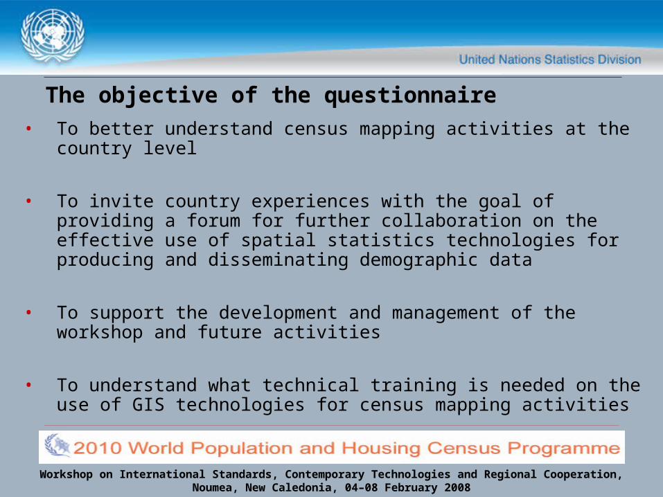
The objective of the questionnaire• To better understand census mapping activities at the country
level
• To invite country experiences with the goal of providing a forum for further collaboration on the effective use of spatial statistics technologies for producing and disseminating demographic data
• To support the development and management of the workshop and future activities
• To understand what technical training is needed on the use of GIS technologies for census mapping activities
Workshop on International Standards, Contemporary Technologies and Regional Cooperation, Noumea, New Caledonia, 04–08 February 2008
Key Questions by Section of the Questionnaire
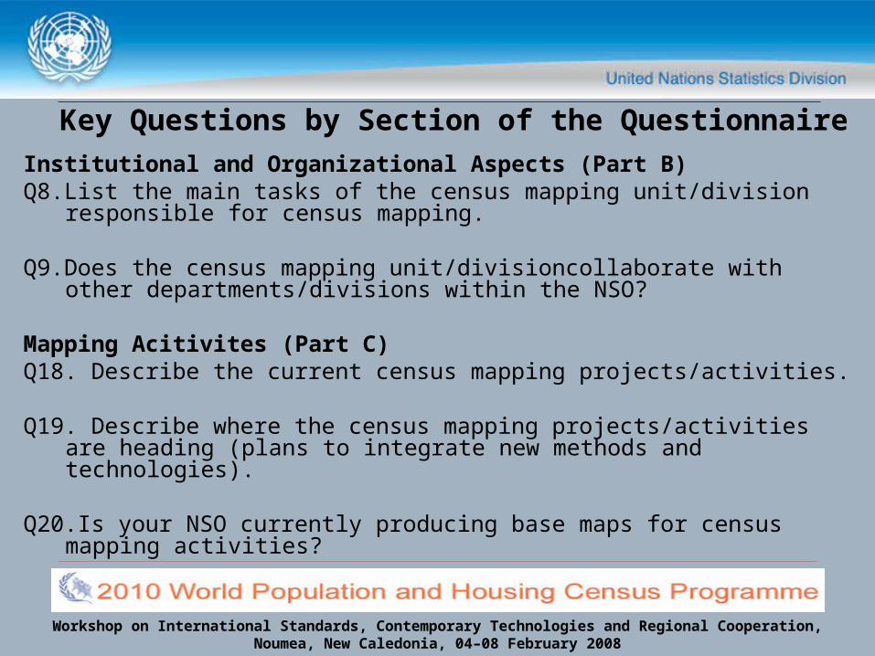
Institutional and Organizational Aspects (Part B)Q8.List the main tasks of the census mapping unit/division
responsible for census mapping.
Q9.Does the census mapping unit/divisioncollaborate with other departments/divisions within the NSO?
Mapping Acitivites (Part C)Q18. Describe the current census mapping projects/activities.
Q19. Describe where the census mapping projects/activities are heading (plans to integrate new methods and technologies).
Q20.Is your NSO currently producing base maps for census mapping activities?
Workshop on International Standards, Contemporary Technologies and Regional Cooperation, Noumea, New Caledonia, 04–08 February 2008
Key Questions by Section of the Questionnaire
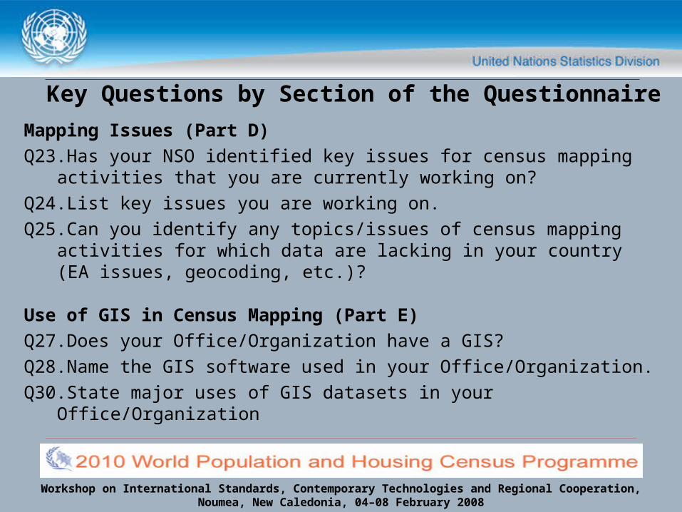
Mapping Issues (Part D)Q23.Has your NSO identified key issues for census mapping
activities that you are currently working on?Q24.List key issues you are working on.Q25.Can you identify any topics/issues of census mapping
activities for which data are lacking in your country (EA issues, geocoding, etc.)?
Use of GIS in Census Mapping (Part E)Q27.Does your Office/Organization have a GIS?Q28.Name the GIS software used in your Office/Organization.Q30.State major uses of GIS datasets in your Office/Organization
Workshop on International Standards, Contemporary Technologies and Regional Cooperation, Noumea, New Caledonia, 04–08 February 2008
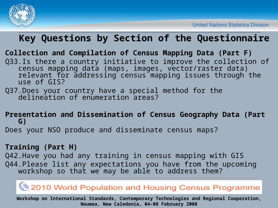
Key Questions by Section of the Questionnaire
Collection and Compilation of Census Mapping Data (Part F)Q33.Is there a country initiative to improve the collection of census
mapping data (maps, images, vector/raster data) relevant for addressing census mapping issues through the use of GIS?
Q37.Does your country have a special method for the delineation of enumeration areas?
Presentation and Dissemination of Census Geography Data (Part G)
Does your NSO produce and disseminate census maps?
Training (Part H)Q42.Have you had any training in census mapping with GISQ44.Please list any expectations you have from the upcoming
workshop so that we may be able to address them?

Workshop on International Standards, Contemporary Technologies and Regional Cooperation, Noumea, New Caledonia, 04–08 February 2008
# of
res
pond
ents
by
coun
try
question number corresponding to questionnaire
UNSD Questionnaire on Census Geography Management: Global Scope of country
responses by question & section

Workshop on International Standards, Contemporary Technologies and Regional Cooperation, Noumea, New Caledonia, 04–08 February 2008
Key Responses to Section on Institutional and Organizational Aspects (Part B)
• Almost all NSO’s have a special unit responsible for census mapping with staffing ranging from 10’s to 100’s.
• The main tasks of the census mapping unit/division) are the following:• Collecting data from various census and surveys to generate tables
at different administrative levels.• Develop a database of information (not limited to census and
surveys) that can be geographically referenced.• Prepare base maps and EA maps for censuses and surveys• Updating base maps and GIS information• Provide geographic information on enumeration areas for censuses
and surveys• Prepare and publish updated maps which include thematic and
statistical maps
Workshop on International Standards, Contemporary Technologies and Regional Cooperation, Noumea, New Caledonia, 04–08 February 2008
Key Responses to Section on Institutional and Organizational Aspects (Part B)
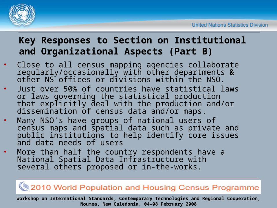
• Close to all census mapping agencies collaborate regularly/occasionally with other departments & other NS offices or divisions within the NSO.
• Just over 50% of countries have statistical laws or laws governing the statistical production that explicitly deal with the production and/or dissemination of census data and/or maps.
• Many NSO’s have groups of national users of census maps and spatial data such as private and public institutions to help identify core issues and data needs of users
• More than half the country respondents have a National Spatial Data Infrastructure with several others proposed or in-the-works.

Workshop on International Standards, Contemporary Technologies and Regional Cooperation, Noumea, New Caledonia, 04–08 February 2008
Key Responses to Section on Mapping Acitivites (Part C)
• Currently, most NSO’s are heavily engaged census mapping projects/activities
• Most are integrating (or plan to)new methods and technologies into census mapping activities
• More than half are currently producing base maps for census mapping activities
• Scales range largely from 1:1000 to 1:1,000,000 depending on the application (Country level, district level etc.)
Workshop on International Standards, Contemporary Technologies and Regional Cooperation, Noumea, New Caledonia, 04–08 February 2008
Key Responses to Section on Mapping Issues (Part D)
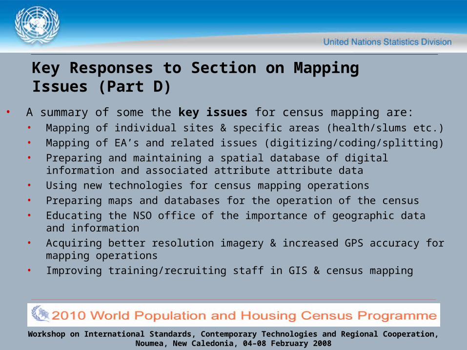
• A summary of some the key issues for census mapping are:• Mapping of individual sites & specific areas (health/slums etc.) • Mapping of EA’s and related issues (digitizing/coding/splitting)• Preparing and maintaining a spatial database of digital information
and associated attribute attribute data• Using new technologies for census mapping operations• Preparing maps and databases for the operation of the census• Educating the NSO office of the importance of geographic data and
information• Acquiring better resolution imagery & increased GPS accuracy for
mapping operations• Improving training/recruiting staff in GIS & census mapping

Workshop on International Standards, Contemporary Technologies and Regional Cooperation, Noumea, New Caledonia, 04–08 February 2008
Key Responses to Section on Mapping Issues (Part D)
• In identifying topics of census mapping for which data are lacking it was found that:
0
1
2
3
4
5
6
7
8
9
Data Available - InadequateResolution
Data Available- But Costly
Data Not Avail.- No Conc. Or
Meth. Dev.
Data Not Avail.No Funding to
Collect
Other (specify)
# of
res
pond
ents
Workshop on International Standards, Contemporary Technologies and Regional Cooperation, Noumea, New Caledonia, 04–08 February 2008
Key Responses to Section on the Use of GIS in Census Mapping (Part E)
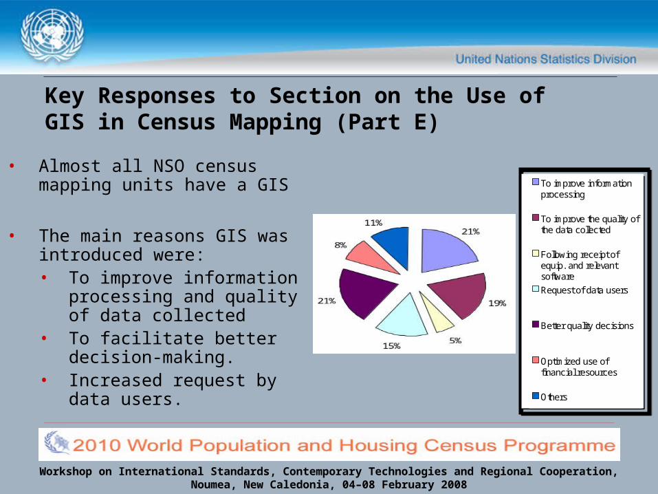
• Almost all NSO census mapping units have a GIS
• The main reasons GIS was introduced were:• To improve information
processing and quality of data collected
• To facilitate better decision-making.
• Increased request by data users.
To improve informationprocessing
To improve the quality ofthe data collected
Following receipt ofequip. and relevantsoftware
Request of data users
Better quality decisions
Optimized use offinancial resources
Others
To improve informationprocessing
To improve the quality ofthe data collected
Following receipt ofequip. and relevantsoftware
Request of data users
Better quality decisions
Optimized use offinancial resources
Others

Workshop on International Standards, Contemporary Technologies and Regional Cooperation, Noumea, New Caledonia, 04–08 February 2008
Populatio
n Cen
sus
Household
Sur
veys
Health
Educatio
n
Others
Trade
Transp
ortatio
n
Tourism
Indus
try
Min
ing a
nd Ener
gy
Agricultu
re
Others
Land U
se
Wate
r qual
ity a
nd use
Fauna
and F
lora
Others
0
2
4
6
8
10
12
14
16 Demographic & Social Statistics
Economic Statistics
EnvironmentStatistics
# of
res
pons
es
Major uses by category and number of responses(Part E):

Workshop on International Standards, Contemporary Technologies and Regional Cooperation, Noumea, New Caledonia, 04–08 February 2008
Key Responses to Section on the Use of GIS in Census Mapping (Part E)
• Major problems encountered in using GIS
0 2 4 6 8 10 12 14 16
Shortage of skilled staff
Cost of data collection or capture
Data source availability inadequate
Inadequate financial allocations
Software Compadibility
Hardware Reliability
Level of geographic detail at which data are collected
Incomplete data
Level of geographic detail from available sources
System user-friendliness
Lack of sources
# of respondents
Workshop on International Standards, Contemporary Technologies and Regional Cooperation, Noumea, New Caledonia, 04–08 February 2008
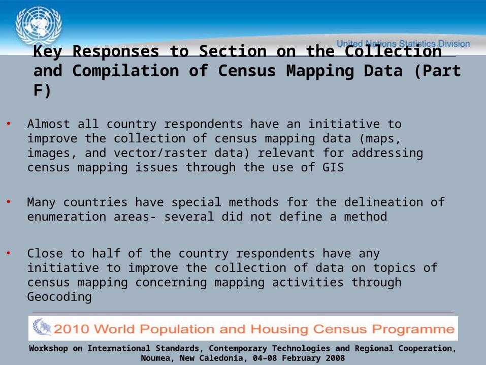
Key Responses to Section on the Collection and Compilation of Census Mapping Data (Part F)
• Almost all country respondents have an initiative to improve the collection of census mapping data (maps, images, and vector/raster data) relevant for addressing census mapping issues through the use of GIS
• Many countries have special methods for the delineation of enumeration areas- several did not define a method
• Close to half of the country respondents have any initiative to improve the collection of data on topics of census mapping concerning mapping activities through Geocoding

Workshop on International Standards, Contemporary Technologies and Regional Cooperation, Noumea, New Caledonia, 04–08 February 2008
Key Responses to Section on the Presentation and Dissemination of Census Geography Data (Part G)
• The majority of NSO’s regularly produce and disseminate census maps (thematic, statistical, topographic, etc.)
• The remaining plan to produce and disseminate census maps
• Several countries refer to documents published online for widespread use

Workshop on International Standards, Contemporary Technologies and Regional Cooperation, Noumea, New Caledonia, 04–08 February 2008
Key Responses to Section on Training (Part H)
• Just over half the respondent NSO’s have had no training in census mapping with GIS either through workshops, formal/academic training, short and/or long term
• Several individually delegated respondents by country have had individual training
• Training of individual countries varies based on the level of GIS infrastructure use in census mapping activities

Workshop on International Standards, Contemporary Technologies and Regional Cooperation, Noumea, New Caledonia, 04–08 February 2008
The expectations according to you…
• All participants are interested in gaining knowledge -be it increased or initial- on mapping and analysis of population dynamics using GIS.
• This includes:• Managing and Using data in a GIS • Using this data to produce useful tools such as maps and
analysis outputs• Better understand the usefulness of new technologies
which include free and open source software applications as well as commercial software and hardware.• Several expressed the need for increased understanding of the
role of GPS in census-taking• Several touched on the need to better understand geocoding,
EA delineation methods.
Workshop on International Standards, Contemporary Technologies and Regional Cooperation, Noumea, New Caledonia, 04–08 February 2008
Results Generated from the questionnaire disseminated prior to the workshop:
Regional Workshop Synopsis
Workshop on International Standards, Contemporary Technologies and Regional Cooperation, Noumea, New Caledonia, 04–08 February 2008
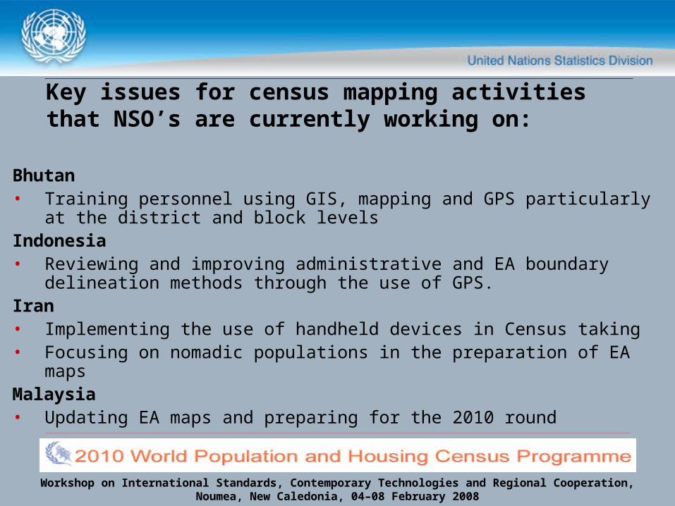
Key issues for census mapping activities that NSO’s are currently working on:
Bhutan• Training personnel using GIS, mapping and GPS particularly at
the district and block levelsIndonesia• Reviewing and improving administrative and EA boundary
delineation methods through the use of GPS.Iran• Implementing the use of handheld devices in Census taking • Focusing on nomadic populations in the preparation of EA mapsMalaysia • Updating EA maps and preparing for the 2010 round

Workshop on International Standards, Contemporary Technologies and Regional Cooperation, Noumea, New Caledonia, 04–08 February 2008
Key issues for census mapping activities that NSO’s are currently working on:
Mongolia• Incorporating GIS into 2010 P&H census activities• Developing a GIS for use in census data dissemination activitiesPakistan• Updating census maps, acquiring fresh area lists to finalize the
delimitation of census areas.Sri Lanka
Conducting field work to prepare maps at the census block level for the 2011 census
Thailand • Updating the base map to better guide future mapping activities

Workshop on International Standards, Contemporary Technologies and Regional Cooperation, Noumea, New Caledonia, 04–08 February 2008
Key issues for census mapping activities that NSO’s are currently working on:
Brunei Darussalam• Organizing existing map stock to improve and benefit upcoming
census activities mapping Nepal• Preparing EA maps for municipalities throughout the country for
the 2011 P&H census. • Harnessing the use of digital orthophotos to aid development of
EA maps for census purposes.Phillipines• Utilizing existing data sources to improve GIS maps of specific
regions

Workshop on International Standards, Contemporary Technologies and Regional Cooperation, Noumea, New Caledonia, 04–08 February 2008
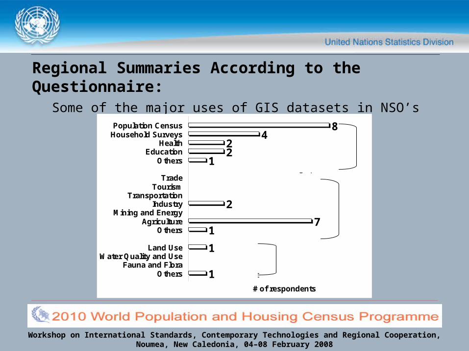
Regional Summaries According to the Questionnaire
• According to the questionnaire responses, 78% of the countries use ESRI products (ArcInfo/ArcGIS or both)
• 44% use both ESRI Products and MapInfo (now called Pitney Bowes MapInfo)
• 11% use MapInfo only
33% of countries do not have a GIS but plan to
Workshop on International Standards, Contemporary Technologies and Regional Cooperation, Noumea, New Caledonia, 04–08 February 2008
Regional Summaries According to the Questionnaire:
Some of the major uses of GIS datasets in NSO’s8
422
1
2
71
1
1
Population CensusHousehold Surveys
HealthEducation
Others
TradeTourism
TransportationIndustry
Mining and EnergyAgriculture
Others
Land UseWater Quality and Use
Fauna and FloraOthers
# of respondents
Social and Demographic
Economic
Environment
Workshop on International Standards, Contemporary Technologies and Regional Cooperation, Noumea, New Caledonia, 04–08 February 2008
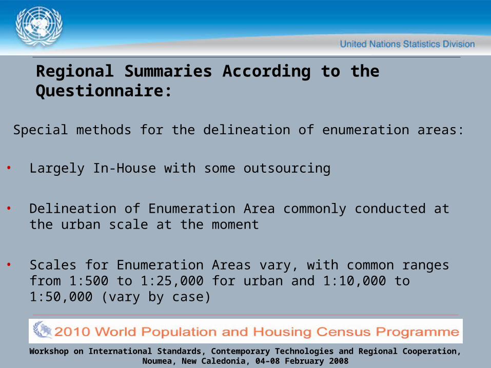
Special methods for the delineation of enumeration areas:
• Largely In-House with some outsourcing
• Delineation of Enumeration Area commonly conducted at the urban scale at the moment
• Scales for Enumeration Areas vary, with common ranges from 1:500 to 1:25,000 for urban and 1:10,000 to 1:50,000 (vary by case)
Regional Summaries According to the Questionnaire:

Workshop on International Standards, Contemporary Technologies and Regional Cooperation, Noumea, New Caledonia, 04–08 February 2008
Regional Summaries According to the Questionnaire:
Special methods for the delineation of enumeration areas:
Bhutan• Rule framed in the mapping manual for the surveyors- each EA consists of
max. 40 households/structures urban and 25 rural
• GPS coordinates taken for 25 households- surveyor delineates EA following the topographical features (rivers, footpath, etc.)
• If no physical features for delineation exist, imaginary line used.
• The EA maps have a title; Block Name; EA #; structure #; numbering is serially for particular blocks only

Workshop on International Standards, Contemporary Technologies and Regional Cooperation, Noumea, New Caledonia, 04–08 February 2008
Special methods for the delineation of enumeration areas:
Malaysia• EA’s are restricted to the preferred range of 80-120 living quarters
or 500-600 people and do not to cross any administrative/local authority areas
Pakistan• Delimitation of EAs are carried out with the collaboration of
Provincial Revenue, Local Government & Education Departments • Each enumerator is assigned an identifiable area comprising 150
to 200 houses
Regional Summaries According to the Questionnaire:
Workshop on International Standards, Contemporary Technologies and Regional Cooperation, Noumea, New Caledonia, 04–08 February 2008
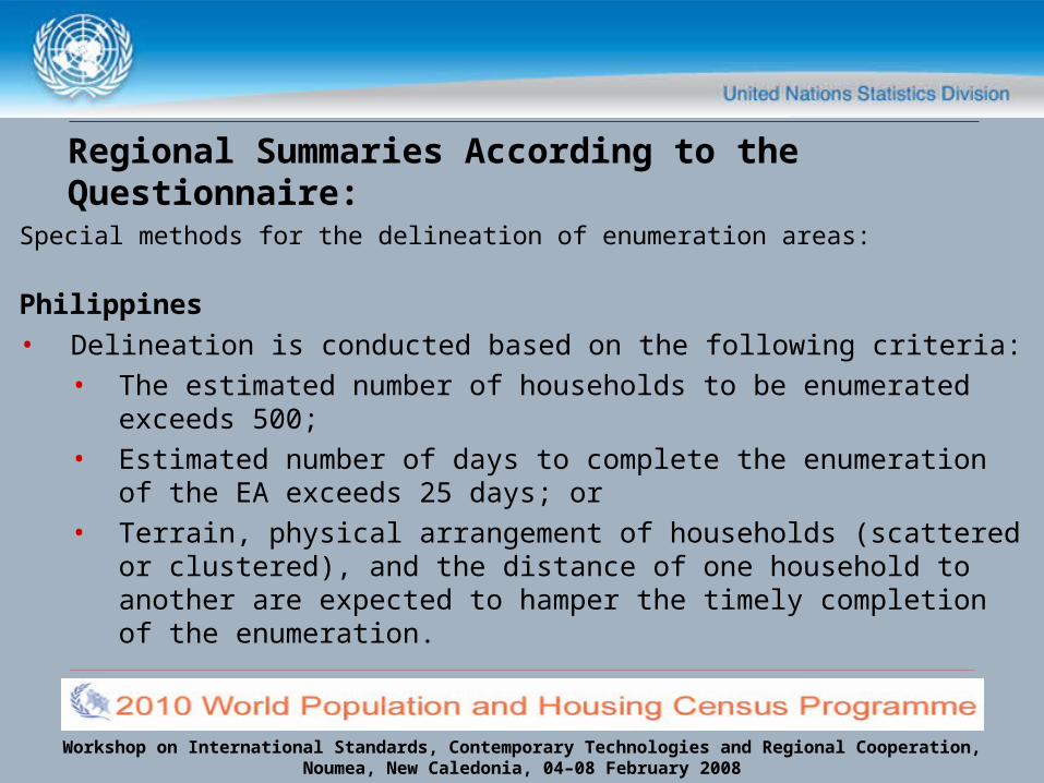
Special methods for the delineation of enumeration areas:
Philippines• Delineation is conducted based on the following criteria:
• The estimated number of households to be enumerated exceeds 500;
• Estimated number of days to complete the enumeration of the EA exceeds 25 days; or
• Terrain, physical arrangement of households (scattered or clustered), and the distance of one household to another are expected to hamper the timely completion of the enumeration.
Regional Summaries According to the Questionnaire:

Workshop on International Standards, Contemporary Technologies and Regional Cooperation, Noumea, New Caledonia, 04–08 February 2008
Types of Thematic, Statistical, Topographic Maps produced and/or disseminated by NSO’s:
• Health • Education • Social • Econmic• Agricultural• Communication• Census indicators
• Geographical Classifications• Relative Development Index
report• Census Atlases• Topographic• Population density• Population Distribution • Migration Analysis Reports
Regional Summaries According to the Questionnaire:
Workshop on International Standards, Contemporary Technologies and Regional Cooperation, Noumea, New Caledonia, 04–08 February 2008
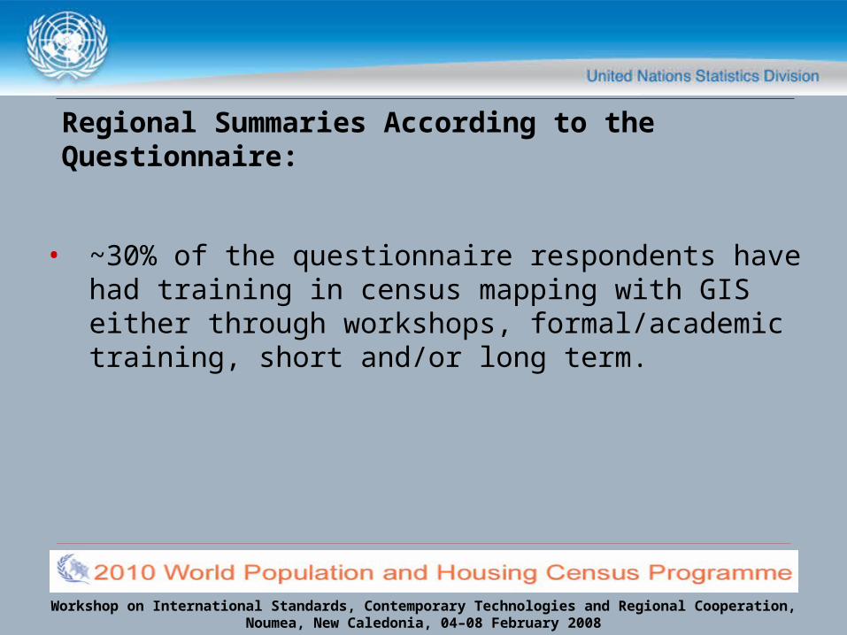
• ~30% of the questionnaire respondents have had training in census mapping with GIS either through workshops, formal/academic training, short and/or long term.
Regional Summaries According to the Questionnaire:
Workshop on International Standards, Contemporary Technologies and Regional Cooperation, Noumea, New Caledonia, 04–08 February 2008
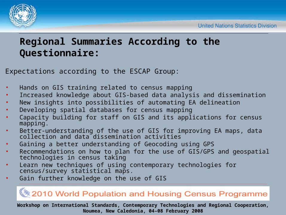
Expectations according to the ESCAP Group:
• Hands on GIS training related to census mapping• Increased knowledge about GIS-based data analysis and dissemination• New insights into possibilities of automating EA delineation • Developing spatial databases for census mapping • Capacity building for staff on GIS and its applications for census mapping. • Better-understanding of the use of GIS for improving EA maps, data collection
and data dissemination activities• Gaining a better understanding of Geocoding using GPS • Recommendations on how to plan for the use of GIS/GPS and geospatial
technologies in census taking• Learn new techniques of using contemporary technologies for census/survey
statistical maps.• Gain further knowledge on the use of GIS
Regional Summaries According to the Questionnaire:

Workshop on International Standards, Contemporary Technologies and Regional Cooperation, Noumea, New Caledonia, 04–08 February 2008
Expanded Country Discussion Welcomed
END