WOCAT-LADA modules: Watershed Management & Climate Change Adaptation
65
1 WOCAT-LADA Methods and Tools Modules Biodiversity Poverty Light Watershed management CARBON sequestr. Climate Change Basic
-
Upload
wocat-world-overview-of-conservation-approaches-and-technologies -
Category
Environment
-
view
91 -
download
0
Transcript of WOCAT-LADA modules: Watershed Management & Climate Change Adaptation
1
WOCAT-LADA Methods and Tools
Modules
BiodiversityPoverty
Light
Watershed management
CARBONsequestr.
Climate Change
Basic
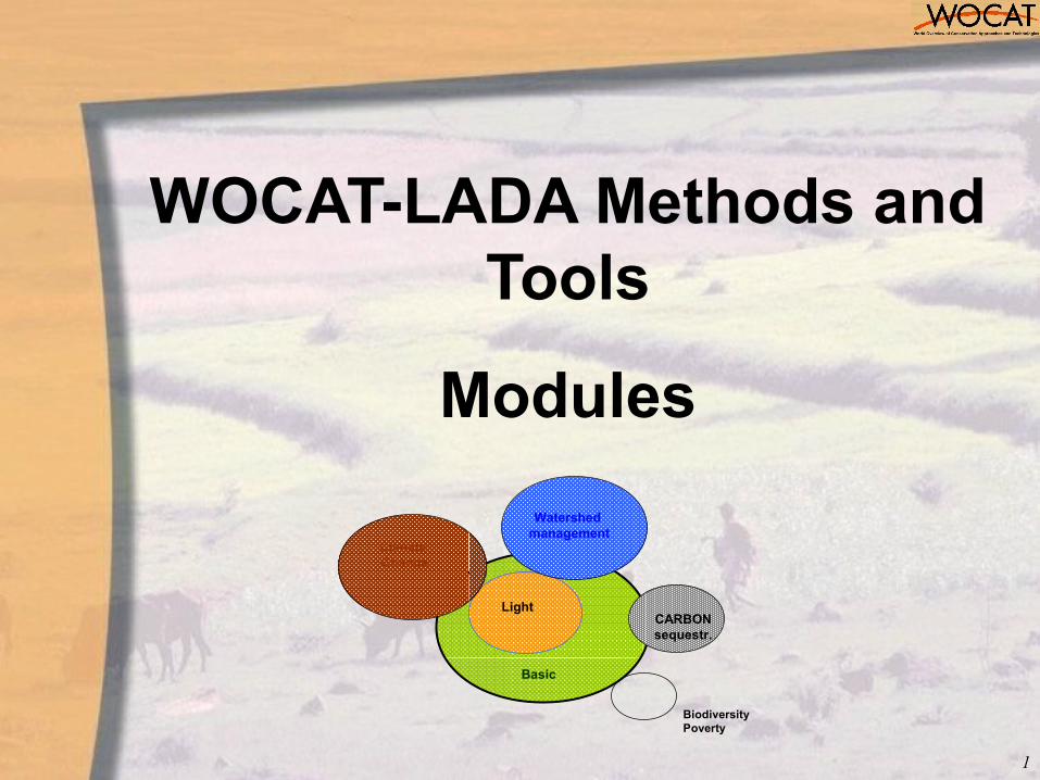
WOCAT modular
Modular structure meets the needs of different user groups and keeps the framework flexible and open for supplementary topics/ themes and global issues
Core element of WOCAT-LADA framework are questionnaires for evaluating SLM based on expert knowledge (QT, QA and QM).
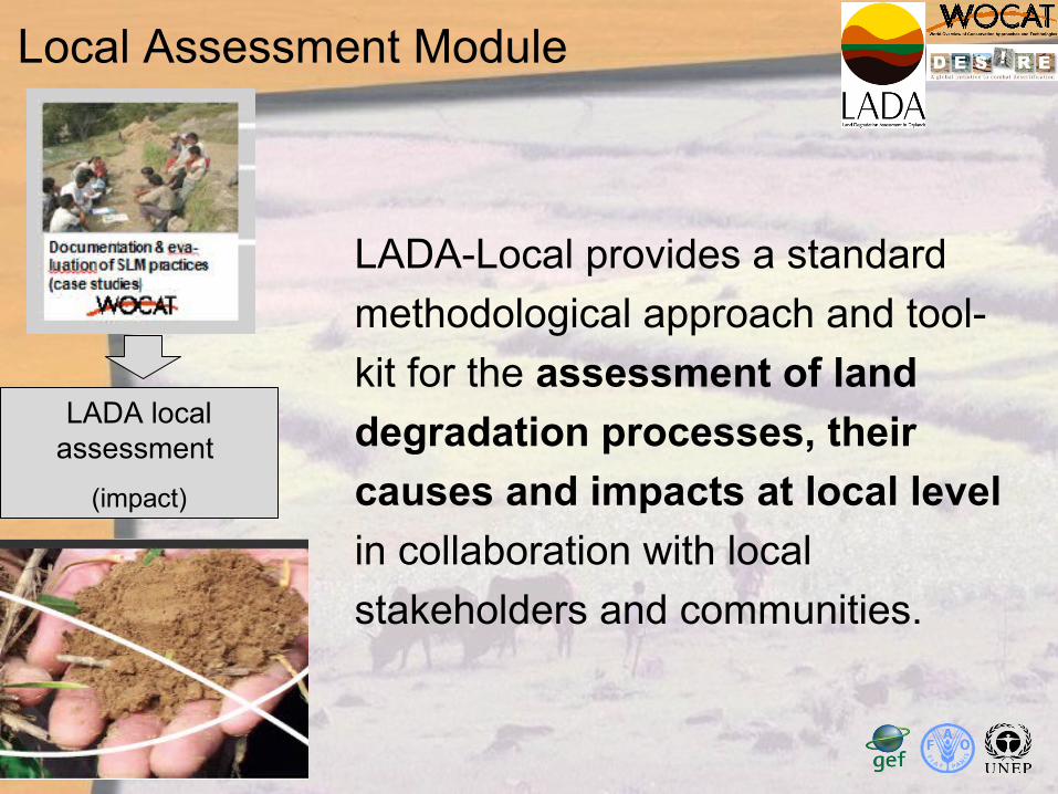
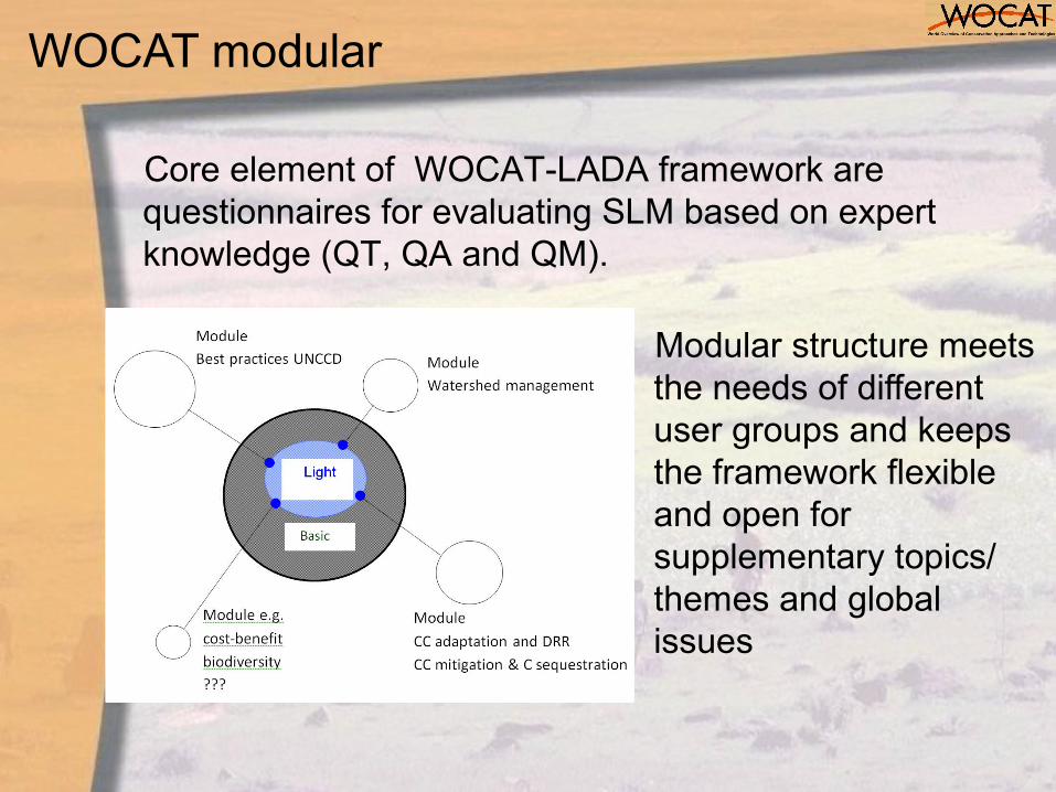
LADA local assessment
(impact)
LADA-Local provides a standard
methodological approach and tool-
kit for the assessment of land
degradation processes, their
causes and impacts at local level
in collaboration with local
stakeholders and communities.
Local Assessment Module
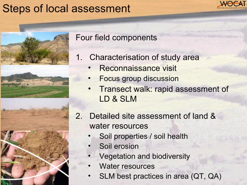
Steps of local assessment
Four field components
1. Characterisation of study area• Reconnaissance visit• Focus group discussion• Transect walk: rapid assessment of
LD & SLM
2. Detailed site assessment of land & water resources• Soil properties / soil health• Soil erosion• Vegetation and biodiversity• Water resources• SLM best practices in area (QT, QA)
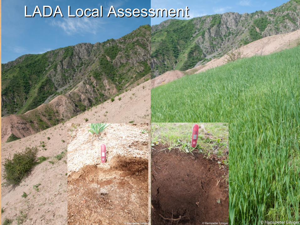
LADA Local AssessmentLADA Local Assessment
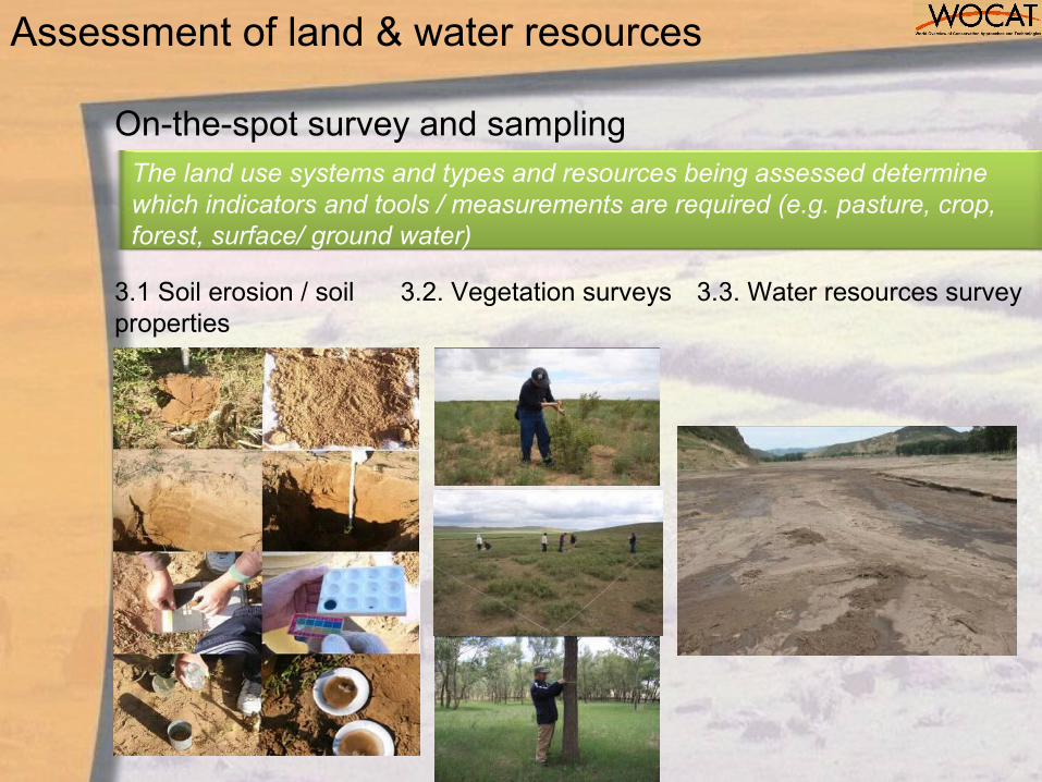
On-the-spot survey and sampling
3.2. Vegetation surveys 3.3. Water resources survey
Assessment of land & water resources
The land use systems and types and resources being assessed determine which indicators and tools / measurements are required (e.g. pasture, crop, forest, surface/ ground water)
3.1 Soil erosion / soil properties

Steps of local assessment contd
3. Livelihood assessment• HH livelihood interview, drivers, causes
and impacts• Discussion with land users / key
informants
4. Analysis of impacts on Ecosystem Services (DPSIR)
Watershed Management Module
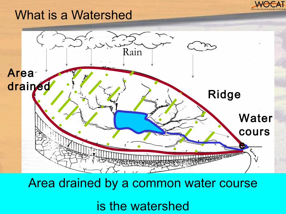
What is a Watershed
Rain
Ridge
Area drained
Water course
Area drained by a common water course
is the watershed
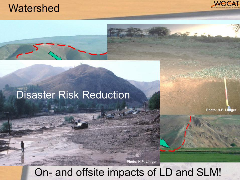
Watershed
Photo: H.P. Liniger
Photo: H.P. Liniger
Disaster Risk Reduction
On- and offsite impacts of LD and SLM!
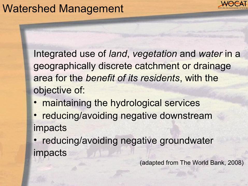
Integrated use of land, vegetation and water in a geographically discrete catchment or drainage area for the benefit of its residents, with the objective of:• maintaining the hydrological services• reducing/avoiding negative downstream impacts• reducing/avoiding negative groundwater impacts
(adapted from The World Bank, 2008)
Watershed Management
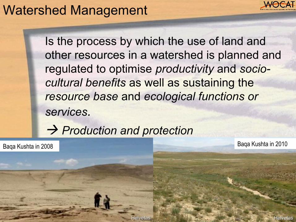
Is the process by which the use of land and other resources in a watershed is planned and regulated to optimise productivity and socio-cultural benefits as well as sustaining the resource base and ecological functions or services.
Production and protection
Watershed Management
Baqa Kushta in 2008 Baqa Kushta in 2010
HelvetasHelvetasHelvetasHelvetas
16
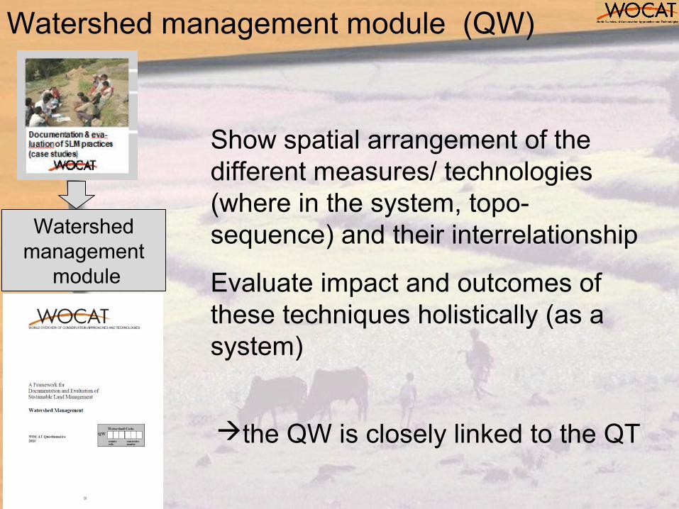
Show spatial arrangement of the different measures/ technologies (where in the system, topo-sequence) and their interrelationship
Evaluate impact and outcomes of these techniques holistically (as a system)
Watershed management
module
the QW is closely linked to the QT
Watershed management module (QW)
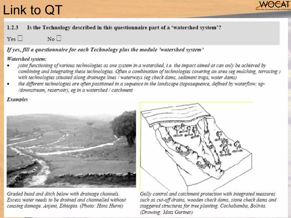
Link to QT
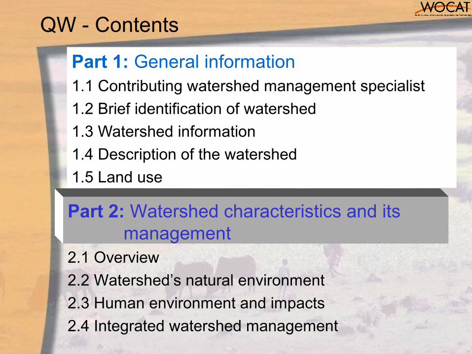
QW - Contents
Part 1: General information1.1 Contributing watershed management specialist
1.2 Brief identification of watershed
1.3 Watershed information
1.4 Description of the watershed
1.5 Land use
Part 2: Watershed characteristics and its management
2.1 Overview
2.2 Watershed’s natural environment
2.3 Human environment and impacts
2.4 Integrated watershed management
QW- Contents cont’d
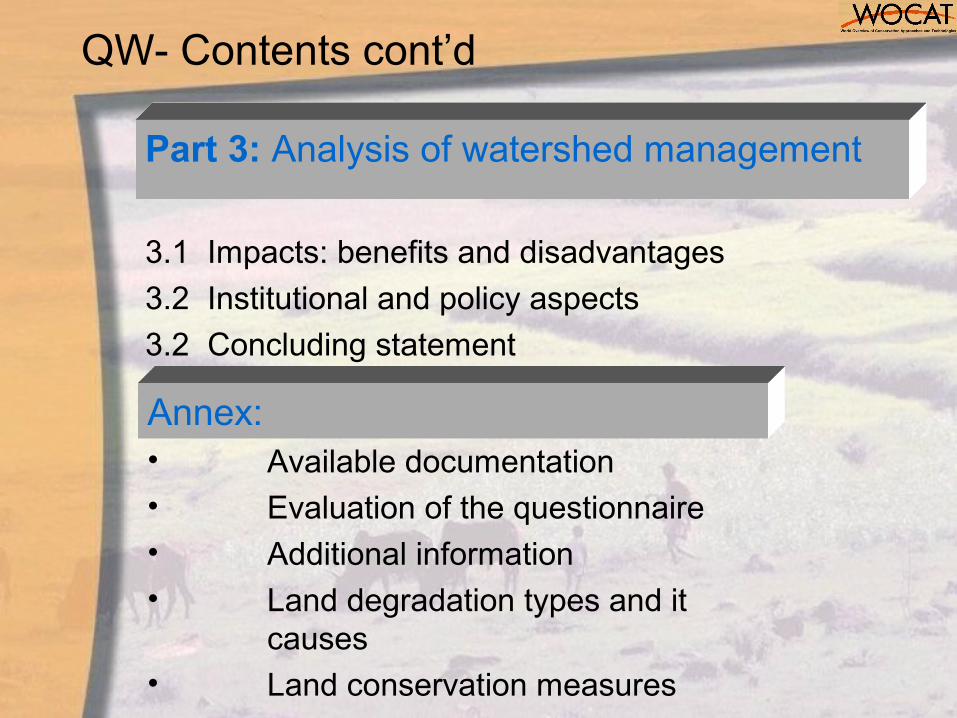
Part 3: Analysis of watershed management
3.1 Impacts: benefits and disadvantages
3.2 Institutional and policy aspects
3.2 Concluding statement
Annex: • Available documentation• Evaluation of the questionnaire
• Additional information
• Land degradation types and it causes
• Land conservation measures
20
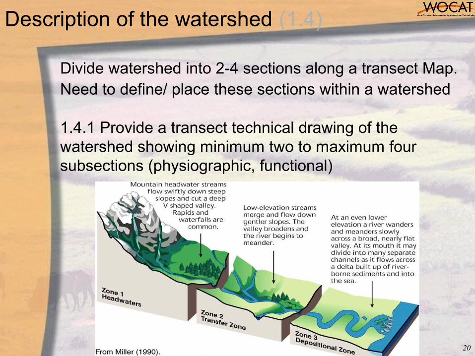
1.4.1 Provide a transect technical drawing of the watershed showing minimum two to maximum four subsections (physiographic, functional)
Divide watershed into 2-4 sections along a transect Map. Need to define/ place these sections within a watershed
Description of the watershed (1.4)
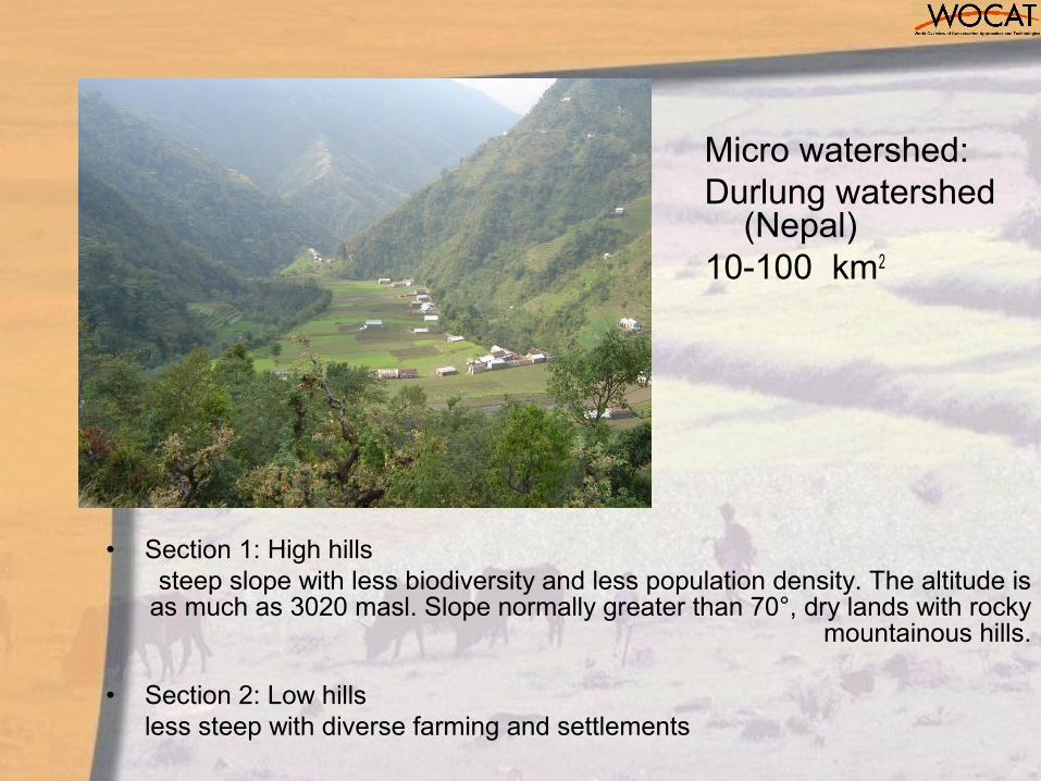
Micro watershed:Durlung watershed
(Nepal)10-100 km2
• Section 1: High hills steep slope with less biodiversity and less population density. The altitude is
as much as 3020 masl. Slope normally greater than 70°, dry lands with rocky mountainous hills.
• Section 2: Low hills less steep with diverse farming and settlements
22
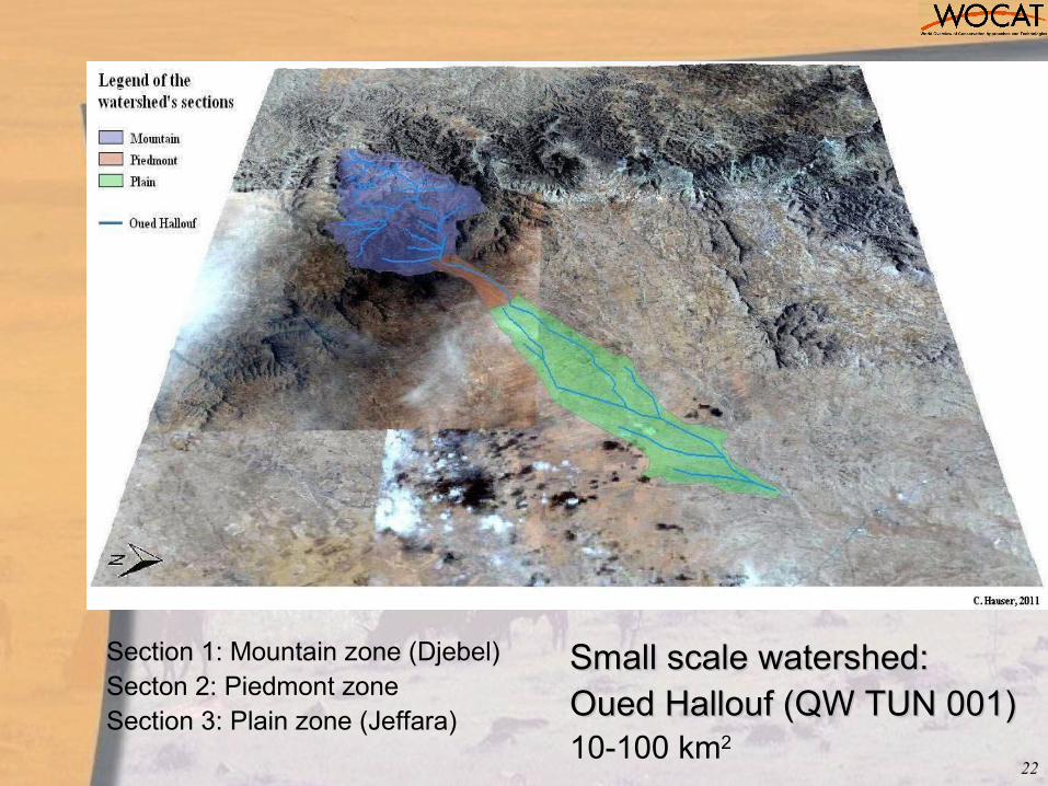
Small scale watershed: Small scale watershed: Oued Hallouf (QW TUN 001)Oued Hallouf (QW TUN 001)10-100 km2
Section 1: Mountain zone (Djebel)Secton 2: Piedmont zoneSection 3: Plain zone (Jeffara)
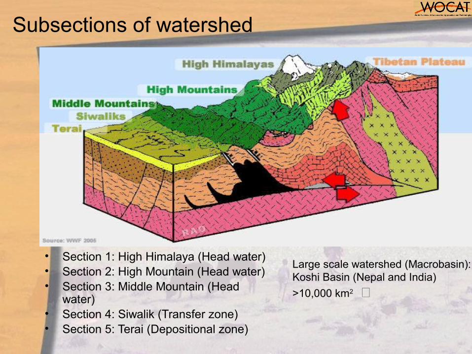
Subsections of watershed
• Section 1: High Himalaya (Head water) • Section 2: High Mountain (Head water) • Section 3: Middle Mountain (Head
water)• Section 4: Siwalik (Transfer zone)• Section 5: Terai (Depositional zone)
Large scale watershed (Macrobasin):Koshi Basin (Nepal and India)
>10,000 km2
Part 2: Characteristics and management
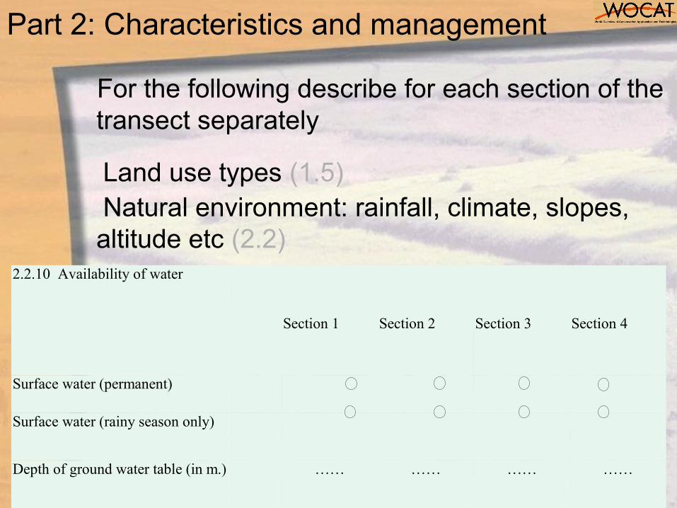
For the following describe for each section of the transect separately
Land use types (1.5)Natural environment: rainfall, climate, slopes, altitude etc (2.2)
2.2.10 Availability of water
Section 1 Section 2 Section 3 Section 4
Surface water (permanent)
Surface water (rainy season only)
Depth of ground water table (in m.)
…… …… …… ……
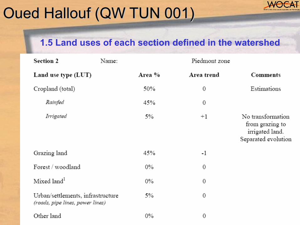
Oued Hallouf (QW TUN 001)Oued Hallouf (QW TUN 001)
1.5 Land uses of each section defined in the watershed
26
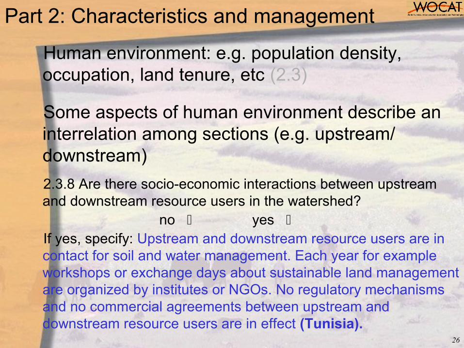
Human environment: e.g. population density, occupation, land tenure, etc (2.3)
Some aspects of human environment describe an interrelation among sections (e.g. upstream/ downstream)
2.3.8 Are there socio-economic interactions between upstream and downstream resource users in the watershed?
no yes If yes, specify: Upstream and downstream resource users are in contact for soil and water management. Each year for example workshops or exchange days about sustainable land management are organized by institutes or NGOs. No regulatory mechanisms and no commercial agreements between upstream and downstream resource users are in effect (Tunisia).
Part 2: Characteristics and management
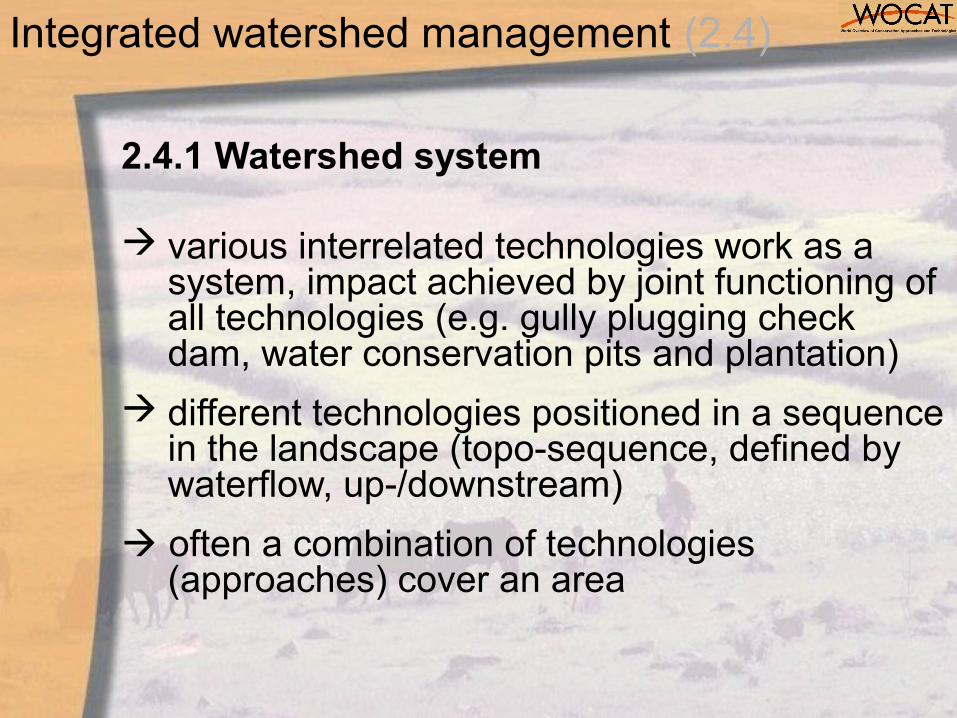
2.4.1 Watershed system
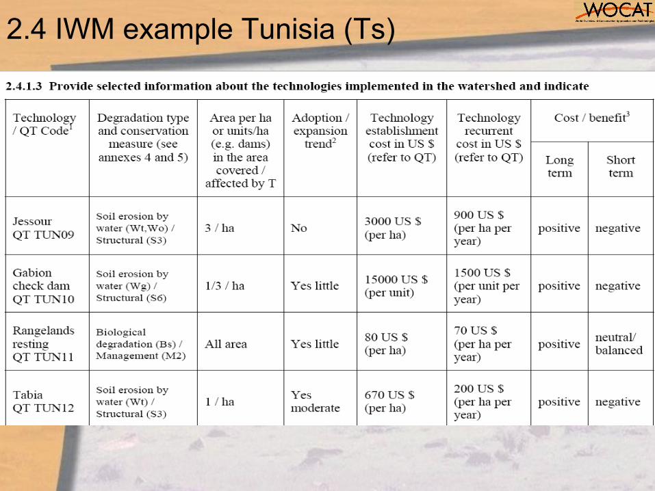
various interrelated technologies work as a system, impact achieved by joint functioning of all technologies (e.g. gully plugging check dam, water conservation pits and plantation)
different technologies positioned in a sequence in the landscape (topo-sequence, defined by waterflow, up-/downstream)
often a combination of technologies (approaches) cover an area
Integrated watershed management (2.4)
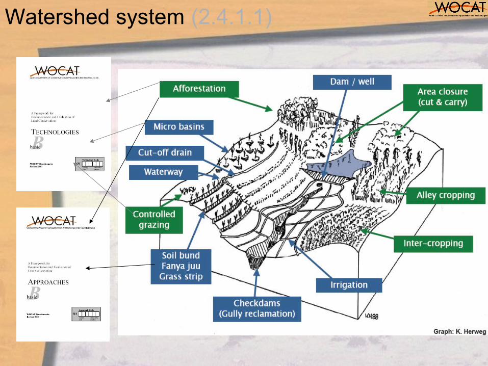
Watershed system (2.4.1.1)
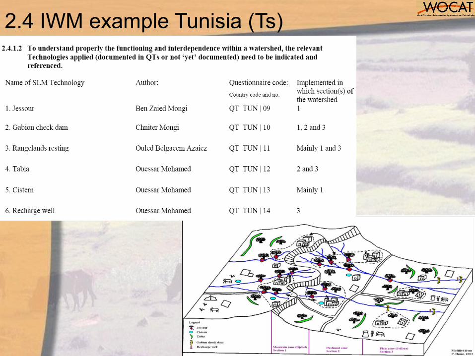
2.4 IWM example Tunisia (Ts)
2.4 IWM example Tunisia (Ts)
Challenges (Part 2)
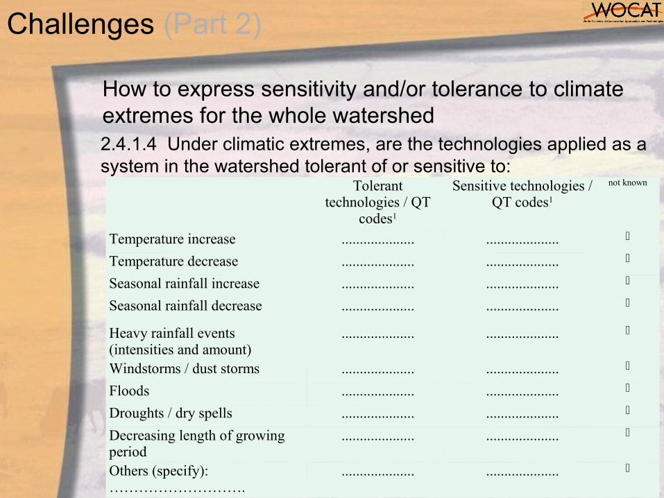
How to express sensitivity and/or tolerance to climate extremes for the whole watershed
Tolerant technologies / QT
codes1
Sensitive technologies / QT codes1
not known
Temperature increase .................... ....................
Temperature decrease .................... ....................
Seasonal rainfall increase .................... ....................
Seasonal rainfall decrease .................... ....................
Heavy rainfall events (intensities and amount)
.................... ....................
Windstorms / dust storms .................... ....................
Floods .................... ....................
Droughts / dry spells .................... ....................
Decreasing length of growing period
.................... ....................
Others (specify):……………………….
.................... ....................
2.4.1.4 Under climatic extremes, are the technologies applied as a system in the watershed tolerant of or sensitive to:
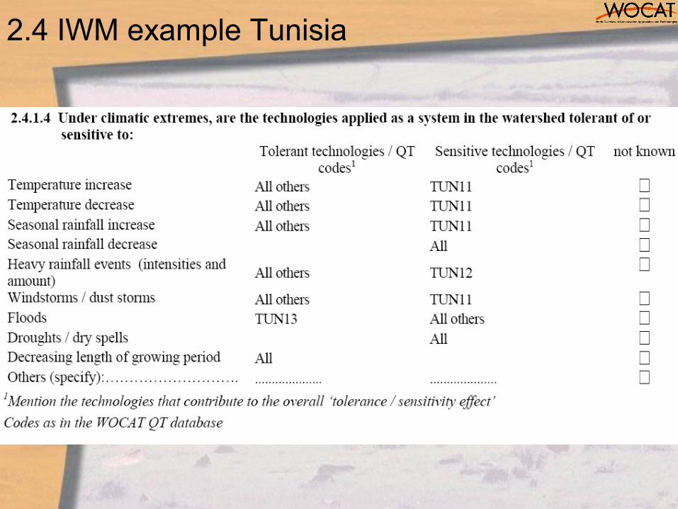
2.4 IWM example Tunisia
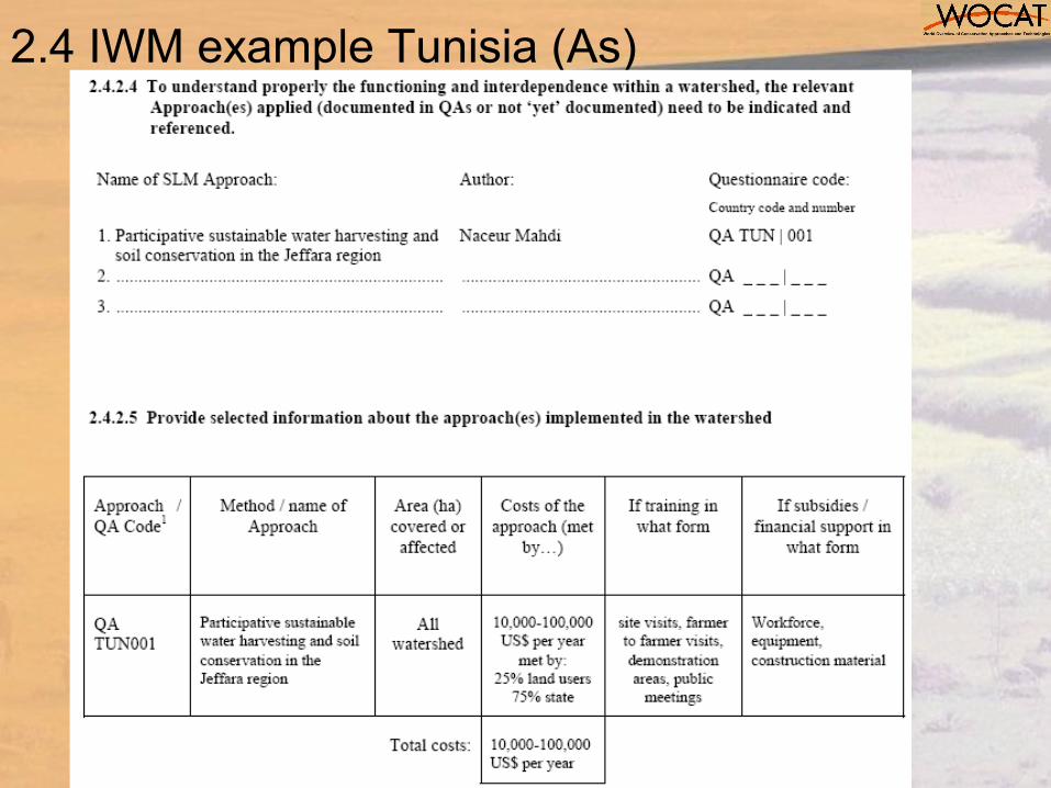
2.4 IWM example Tunisia (As)
34
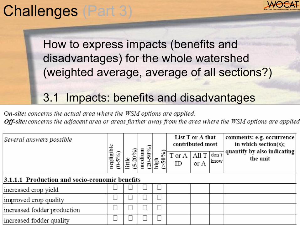
How to express impacts (benefits and disadvantages) for the whole watershed (weighted average, average of all sections?)
3.1 Impacts: benefits and disadvantages
Challenges (Part 3)
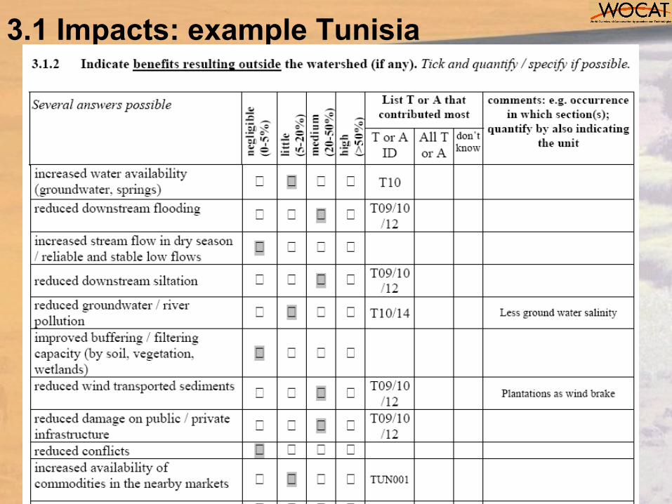
3.1 Impacts: example Tunisia

36
Section on Institutional and policy aspects (3.2)
3.2.4 Is payment for environmental services (PES) applied for implementing the management plan? Payments include financial mechanisms and other rewards such as training, provision of inputs, conflict resolution measures, etc.
no yes
Analysis (Part 3)
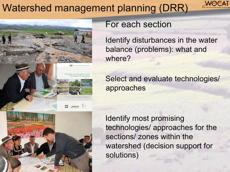
For each section
Identify disturbances in the water balance (problems): what and where?
Select and evaluate technologies/ approaches
Identify most promising technologies/ approaches for the sections/ zones within the watershed (decision support for solutions)
Watershed management planning (DRR)
38
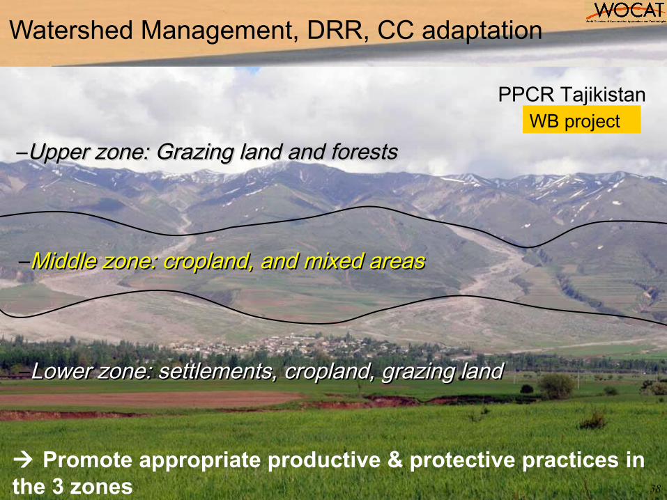
–Upper zone: Grazing land and forestsUpper zone: Grazing land and forests
–Middle zone: cropland, and mixed areasMiddle zone: cropland, and mixed areas
–Lower zone: settlements, cropland, grazing land Lower zone: settlements, cropland, grazing land
Watershed Management, DRR, CC adaptation
Promote appropriate productive & protective practices in the 3 zones
PPCR TajikistanWB project
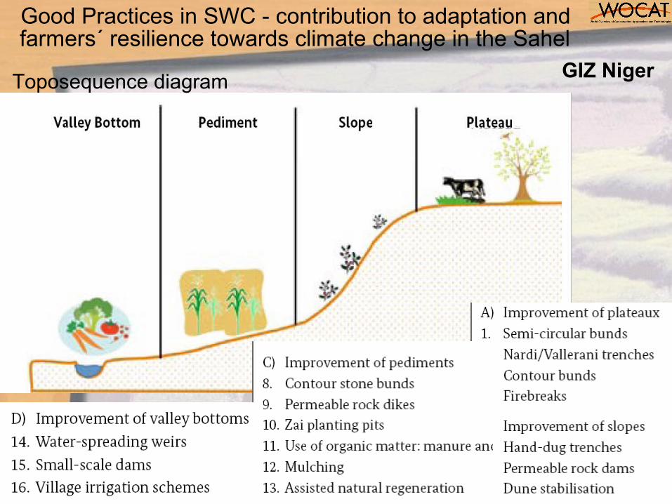
Good Practices in SWC - contribution to adaptation and farmers´ resilience towards climate change in the Sahel
Toposequence diagram GIZ Niger
40
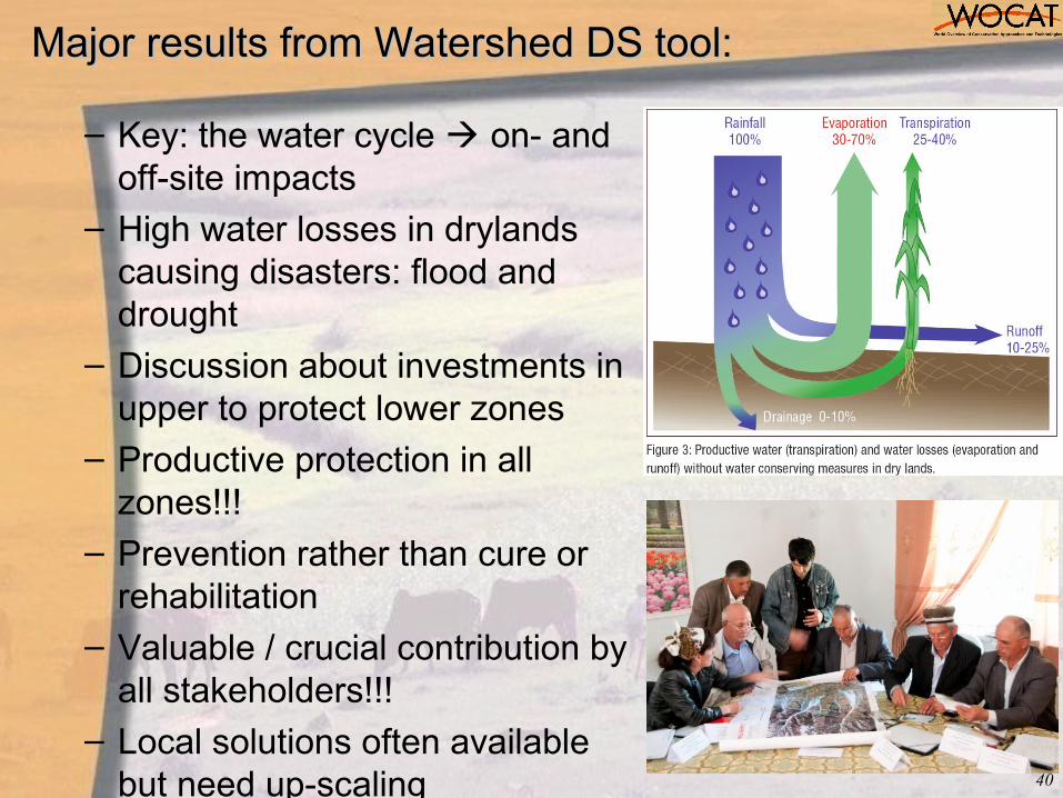
Major results from Watershed DS tool:Major results from Watershed DS tool:
– Key: the water cycle on- and off-site impacts
– High water losses in drylands causing disasters: flood and drought
– Discussion about investments in upper to protect lower zones
– Productive protection in all zones!!!
– Prevention rather than cure or rehabilitation
– Valuable / crucial contribution by all stakeholders!!!
– Local solutions often available but need up-scaling
Climate Change Adaptation Module
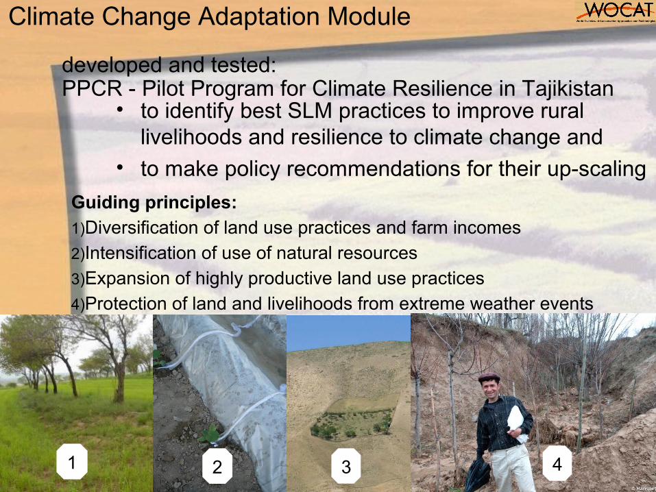
Guiding principles:1)Diversification of land use practices and farm incomes2)Intensification of use of natural resources3)Expansion of highly productive land use practices4)Protection of land and livelihoods from extreme weather events
1 2 3 4
developed and tested: PPCR - Pilot Program for Climate Resilience in Tajikistan
• to identify best SLM practices to improve rural livelihoods and resilience to climate change and
• to make policy recommendations for their up-scaling
Climate Change Adaptation Module

Adaptation to Climate Change
Climate Change: A change of climate which is attributed directly or indirectly to human activity that changes the composition of the global atmosphere and which is in addition to natural climate variability observed over comparable time periods.
(IPCC 2007)
Adaptation: An adjustment in natural or human systems in response to actual or expected climatic stimuli or their effects. It involves planned, enhanced, developed and implemented measures and behaviors to prevent, moderate, cope with and take advantage of the consequences of climate events.
(adapted from UNDP 2005, UKCIP 2003 and IPCC 2001)
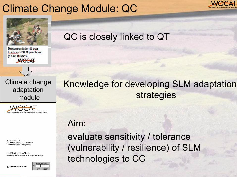
Climate change adaptation
module
Knowledge for developing SLM adaptation strategies
Climate Change Module: QC
Aim:
evaluate sensitivity / tolerance (vulnerability / resilience) of SLM technologies to CC
QC is closely linked to QT
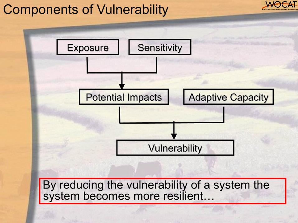
Components of Vulnerability
By reducing the vulnerability of a system the system becomes more resilient…
ExposureExposure SensitivitySensitivity
Potential ImpactsPotential Impacts Adaptive CapacityAdaptive Capacity
VulnerabilityVulnerability
47
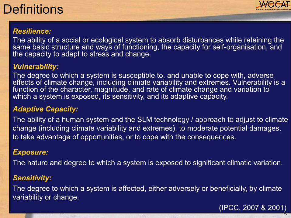
Definitions
Resilience: The ability of a social or ecological system to absorb disturbances while retaining the same basic structure and ways of functioning, the capacity for self-organisation, and the capacity to adapt to stress and change.
Vulnerability: The degree to which a system is susceptible to, and unable to cope with, adverse effects of climate change, including climate variability and extremes. Vulnerability is a function of the character, magnitude, and rate of climate change and variation to which a system is exposed, its sensitivity, and its adaptive capacity.
Adaptive Capacity:
The ability of a human system and the SLM technology / approach to adjust to climate change (including climate variability and extremes), to moderate potential damages, to take advantage of opportunities, or to cope with the consequences.
Exposure:
The nature and degree to which a system is exposed to significant climatic variation.
Sensitivity:
The degree to which a system is affected, either adversely or beneficially, by climate variability or change.
(IPCC, 2007 & 2001)

QC content
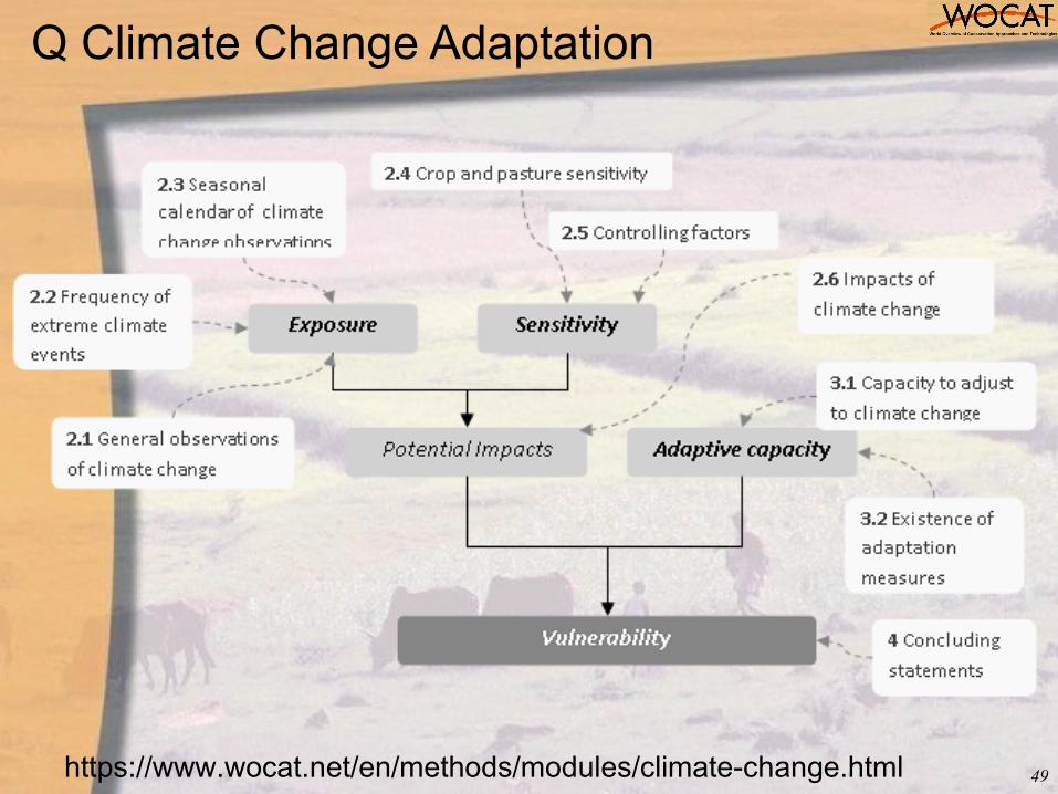
Q Climate Change Adaptation
49https://www.wocat.net/en/methods/modules/climate-change.html
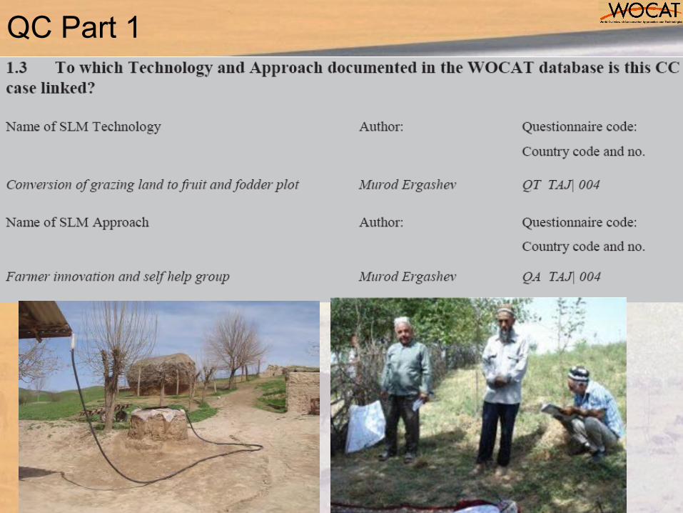
QC Part 1
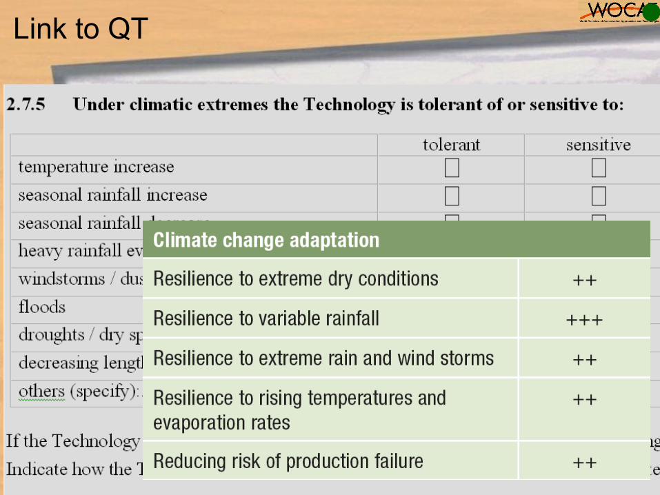
Link to QT
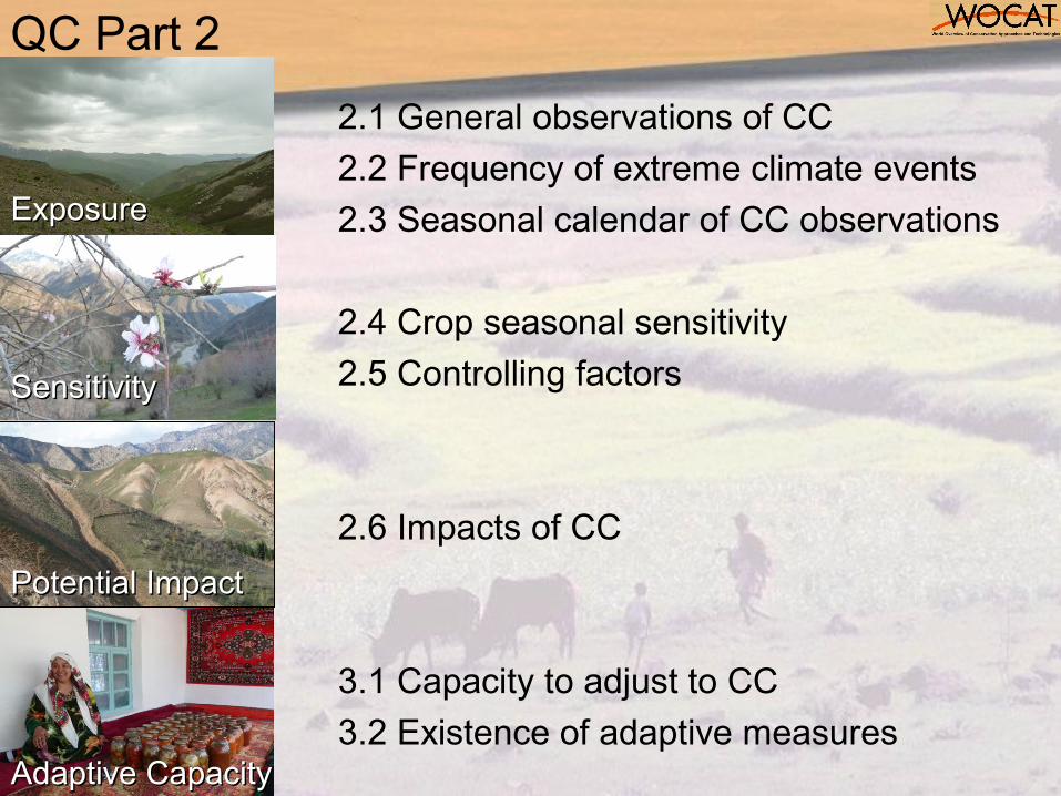
QC Part 2
2.1 General observations of CC
2.2 Frequency of extreme climate events
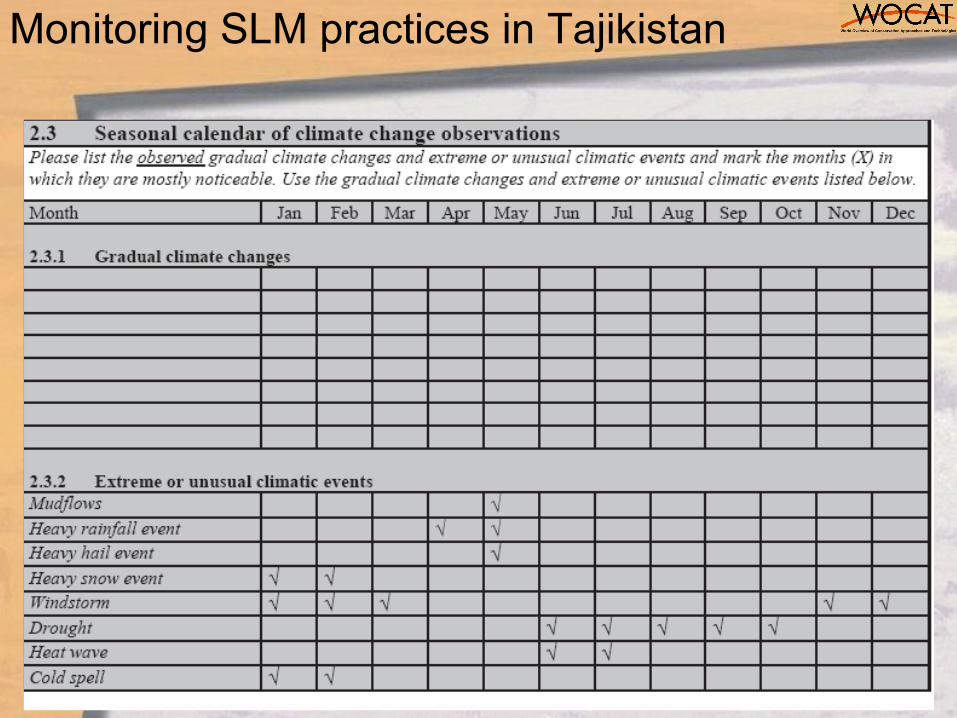
2.3 Seasonal calendar of CC observations
2.4 Crop seasonal sensitivity
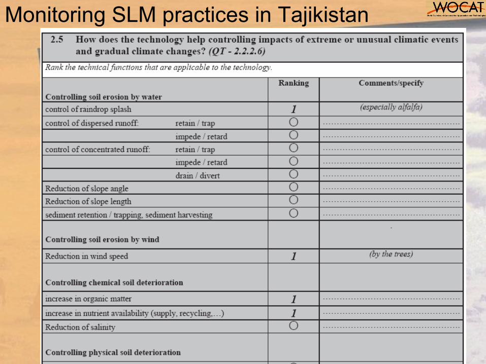
2.5 Controlling factors
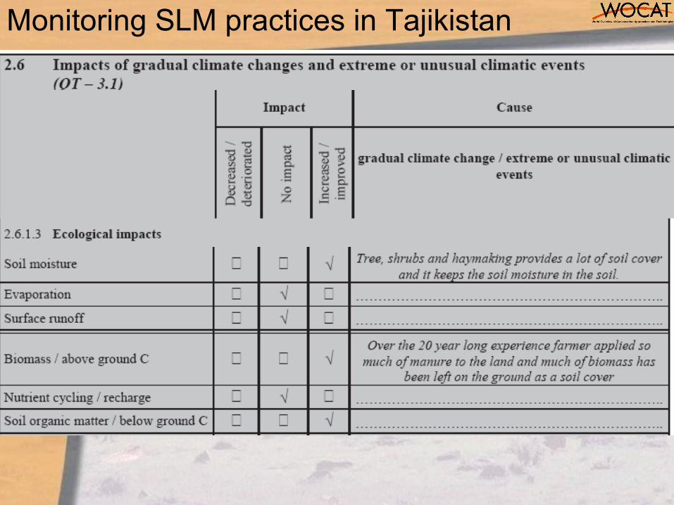
2.6 Impacts of CC
3.1 Capacity to adjust to CC
3.2 Existence of adaptive measures
ExposureExposure
SensitivitySensitivity
Potential ImpactPotential Impact
Adaptive CapacityAdaptive Capacity
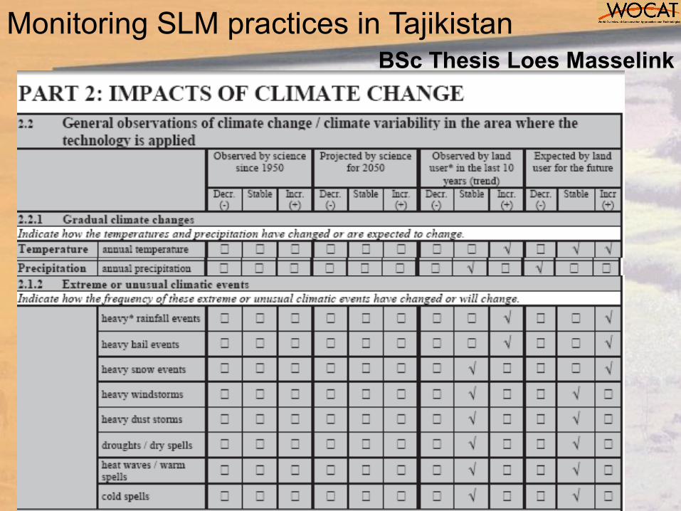
Monitoring SLM practices in TajikistanBSc Thesis Loes Masselink

Monitoring SLM practices in Tajikistan
Monitoring SLM practices in Tajikistan
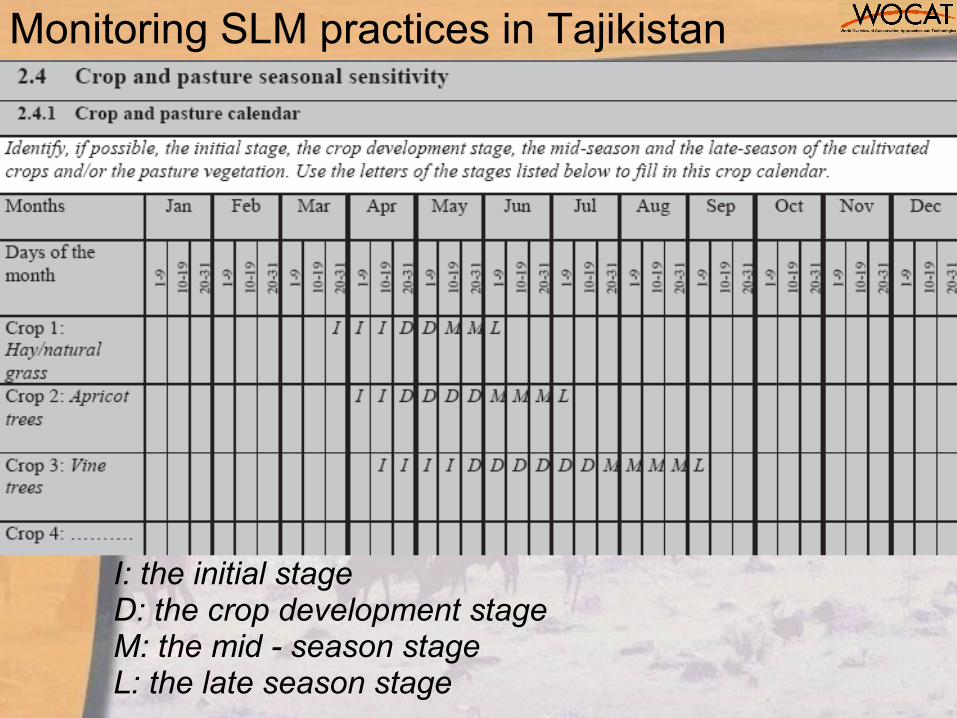
I: the initial stageD: the crop development stageM: the mid - season stageL: the late season stage
Monitoring SLM practices in Tajikistan
Monitoring SLM practices in Tajikistan
Monitoring SLM practices in Tajikistan
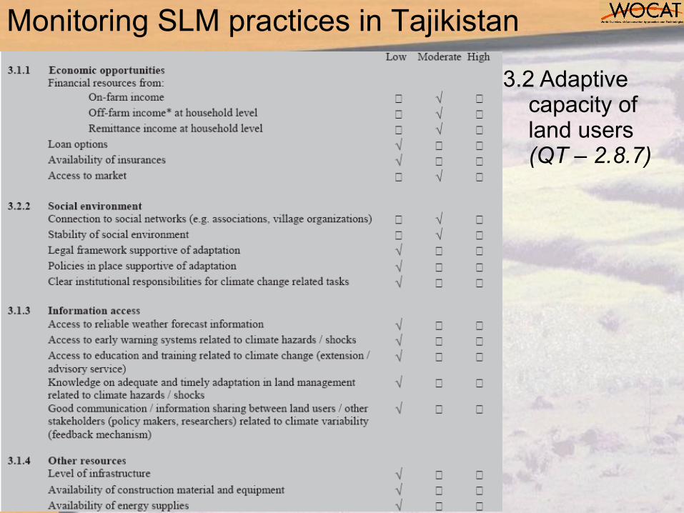
3.2 Adaptive capacity of land users (QT – 2.8.7)
Monitoring SLM practices in Tajikistan
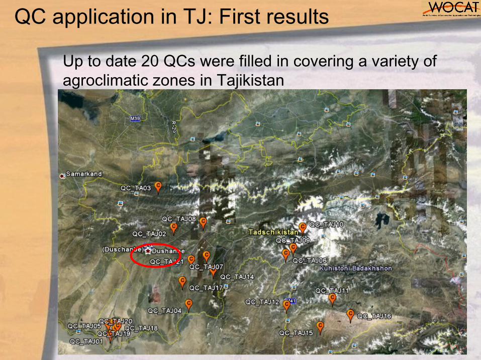
QC application in TJ: First results
Up to date 20 QCs were filled in covering a variety of agroclimatic zones in Tajikistan

Taj national overview
61
10 Technology Groups No CC impact being addressedImproved grazing land 4 Vegetation degradation
Irrigation infrastructure management 7 Water shortageWater harvesting 3 Less frequent rainfalls
Soil productivity enhancement 7 Soil fertility declineCross-slope measures:
onsite protection5 Heavy rainfall
Cross-slope measures: offsite protection
4 Land slides due to extreme rainfalls
Agroforestry 10 Crop failure in monoculture systemsPlanted and natural forest 3 Riverbank erosion
Tree belts 4 Wind erosion, change in microclimateIndirect SLM measures 2 Desertification
Total number of WOCAT case studies
46
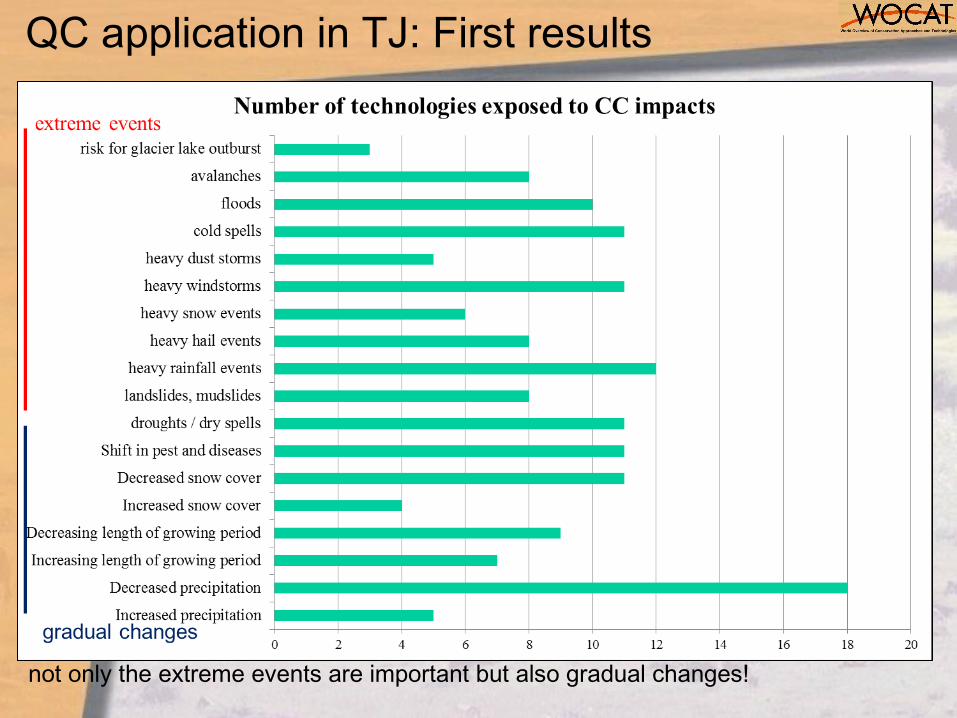
not only the extreme events are important but also gradual changes!
QC application in TJ: First results

Sensitivity of SLM technologies
QC application in TJ: First results

therefore…
Need for SLM technologies that:
• increase resistance to pests and diseases
• improve adaptation to warmer temperatures using suitable crop varieties
• increase water harvesting and preserve soil humidity
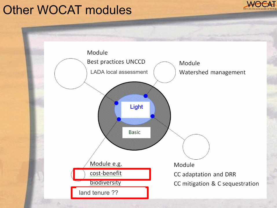
Other WOCAT modules
land tenure ??
LADA local assessment
• The various WOCAT-LADA-DESIRE tools complement each other at the different levels (local to global)
• Stimulates self-evaluation and encourages learning by comparing experiences within SLM initiatives
• Serves for informed choices & decision making
• Practices have to be modified and adapted to the specific local context
• Assist monitoring and adaptation of implemented SLM practices
Use of tools for KM and DS
Thank you شكرا