Wildlife Management Zones - New Brunswick · 2 Zone Maps Wildlife Management Zones have been...
22
Wildlife Management Zones
Transcript of Wildlife Management Zones - New Brunswick · 2 Zone Maps Wildlife Management Zones have been...

Wildlife Management Zones

1 2
34 5
8
9
67
11
10
16
12 13
14
19
2518
22 24
2321
17
15
2627
20
Province of New Brunswick PO 6000, Fredericton NB CANADA E3B 5H1
www.gnb.caISBN 978-1-4605-1788-8 | 11048 (revised 2017.08)

1
New Brunswick has 27 Wildlife Management Zones…These zones have been developed by the Department of Energy and Resource Development (ERD) to help manage:• Wildlife populations.• The harvest of deer, moose, bear and furbearers.
Zones are mapped according to different landscapes. Each includes unique features that do not change; such as climate and soils. Other features— such as the forest, land use, and wildlife itself— may change over time. When change occurs, management tactics can be altered accordingly. The result is effective wildlife management.
Zones give greater flexibility in how wildlife is managed.

2
Zone Maps
Wildlife Management Zones have been designed to be easily recognized by the public. Most boundaries follow roads, rivers, lakes, streams or railroads.
Some locations on individual zone maps are marked with bold letters A through N. These letters indicate areas that are shown in detail in the Appendix at the end of this booklet.
Note: All roads and railways that form zone boundaries are considered part of both adjacent zones. All zone boundaries marked by rivers, lakes or streams will follow the centre of those waterways.
Islands located on major waterways have been placed in individual zones. Details of these locations are outlined in New Brunswick’s fish and wildlife regulations. If you have any questions regarding boundaries, contact your local ERD office.
Remember: It is the responsibility of each hunter / trapper to be within legal Wildlife Management Zone boundaries.
For further information, contact your nearest ERD office
Bathurst 506-547-2080 Edmundston 506-735-2040 Richibucto 506-523-7600
Campbellton 506-789-2336 Florenceville-Bristol 506-392-5105 St. George 506-755-4040
Canterbury 506-279-6005 Fredericton 506-453-2345 Saint Quentin 506-235-6040
Chipman 506-339-7019 Hampton 506-832-6055 Sussex 506-432-2008
Dieppe 506-856-2344 Miramichi 506-627-4050 Tracadie-Sheila 506-394-3636
Doaktown 506-365-2001 Plaster Rock 506-356-6030 Welsford 506-486-6000
or the Public Services Desk, Fredericton: 506-453-3826

3
Important
Areas closed to hunting, trapping and snaring:• Zone 7 — Mount Carleton Provincial Park• Zone 10 — Demerchant Brook PNA• Zone 14 — Kouchibouguac National Park• Zone 15 — Hovey Hill PNA• Zone 17 — Burpee Wildlife Management Area• Zone 17 — Bull Pasture Bog PNA• Zone 20 — Utopia Wildlife Refuge; St. Croix River Islands PNA• Zone 21 — University of New Brunswick Wildlife Refuge• Zone 23 — Fundy National Park • Zone 24 — Wilson Brook PNA• Zone 26 — Whitehorse Island PNA
Wildlife Management Areas open to hunting, trapping and snaring:• Zone 3 — Kedgwick Wildlife Management Area• Zones 7, 11 and 12 — Plaster Rock-Renous Wildlife Management Area• Zone 8 — Big Tracadie River Wildlife Management Area• Zone 16 — Becaguimec Wildlife Management Area• Zone 17 — Bantalor Wildlife Management Area• Zone 18 — Canaan River Wildlife Management Area• Zone 20 — Lepreau River Wildlife Management Area
Important: Scout, Guide and Youth camps, all federal and provincial parks, historic sites and all refuges are closed to hunting, trapping and snaring, but are not shown on zone maps. If in doubt, check with your local ERD office before you go.
The status of military areas is variable, eg, the 5th Canadian Division Support Base Gagetown in Zone 21. For information on these areas, contact the Department of National Defence.
The following islands in the Saint John River are part of Zone 16:• KeswickIsland • Mitchell’sIsland• LowerShoresIsland • SugarIsland• Merrithew’sIsland • UpperShoresIsland (All are located below the Mactaquac Dam)
For information on hunting, trapping and snaring regulations, contact your local ERD office.

4
Legend
zone boundary
closed areas
city, town
000 route
bridge
X see Appendix

5
Zone 1
Zone 2
Lac-Baker
Clair
Edmundston
Saint John RiverFleuve Saint-Jean
Rivière Madawaska
River
Rivière Saint-François
River
QUÉBEC
MAINE
Saint-Quentin
Saint John RiverFleuve Saint-Jean
Saint-Léonard
Edmundston
Rivière Madawaska
River
Green River Rivière Verte
Crown Land | Terres de la couronneQUÉBEC
1 2
MAINE
Little Main Restigouche River | Petite rivière Restig
ouche p
rincip
ale
17

6
Zone 3
Zone 4
3 4
Saint-Quentin
Rivière Kedgwick River
QUÉBEC
Rivière Restigouche
River
Rivière Patapédia
River
Kedgwick
Saint-Quentin
Campbellton
Dalhousie
Pont Montgomery
Bridge
Rivière Upsalquitch
River
Northwest Upsalquitch RiverRivière Upsalquitch Nord-Ouest
Rivière Restigouche
River
Rivière Charlo River
New NBIP RoadNouveau chemin
de la NBIP
Old NBIP RoadAncien chemin
de la NBIP
A
QUÉBEC
Pont Montgomery
Bridge
Crown Land | Terres de la Couronne
A
Kedgwick Wildlife Management Area
Unité d’aménagement de la faune de Kedgwick
180
17
265
1
265

7
Zone 5
Zone 6
56
Bathurst
Pointe-Verte
Rivière Nepisiguit River
Ruisseau Forty Mile
Brook
Ruisseau Caribou Brook
Rivière Tetagouche River
Rivière Jacquet
River
Chaleur BayBaie des Chaleurs
Rivière Charlo River
Plaster RockGrand Falls / Grand-Sault
Saint-Léonard
Saint-Quentin
Pont Turcotte Bridge
Old Route 385 Ancienne route
Rue Main St.
Chemin Mamozekel Road
Little Tobique RoadChemin de la
Petite rivière TobiqueLittle Tobique RiverPetite rivière Tobique
Old NBIP RoadAncien chemin
de la NBIP
New NBIP RoadNouveau chemin
de la NBIP
B
Mount Carleton Provincial Park Parc provincial du mont Carleton
180
180
385
108
109
395
17
2

8
Zone 7
Zone 8
78
Mount Carleton Provincial Park Parc provincial du mont Carleton
Pont Morrissey
Bridge
Plaster Rock-Renous Wildlife Management Area
Unité d’aménagement de la faune de Plaster Rock-Renous
Ruisseau Forty Mile
Brook
Miramichi
Renous
Ruisseau Caribou Brook
Rivière Nepisiguit River
Northwest Miramichi RiverRivière Miramichi Nord-Ouest
Little Southwest Miramichi RiverPetite rivière Miramichi Sud-Ouest
COMTÉ DE VICTORIA COUNTY
COMTÉ DE NORTHUMBERLAND
COUNTY
Rivière Renous
RiverNorth Branch Renous RiverBras nord de la rivière Renous
Southwest Miramichi River | Rivière
Miramichi Sud-Ouest
Chemin Mamozekel
Road
Little Tobique
Road Chemin de la Petite rivière
Tobique
Miramichi
Bathurst
Rivière Pokeshaw River
Big Tracadie RiverGrande rivière Tracadie
Rivière Tabusintac River
Rivière Bartibog River
Rivière Miramichi
River
Rivière Nepisiguit
River
Pont Morrissey Bridge
Chemin Mines Road
Baie de Nepisiguit BayBig Tracadie River
Wildlife Management AreaUnité d’aménagement
dela faune de la Grande rivière Tracadie
Tracadie Military RangeChamp de tir militaire
de Tracadie
Baie de Miramichi
Bay
C
C
365160
135
180
430
430
108
8
8

9
Zone 9
Zone 10
9
10
Saint-Isidore
Rivière Pokeshaw
River
Chaleur BayBaie des Chaleurs Île Miscou Island
Île Lamèque Island
Big Tracadie RiverGrande rivière Tracadie
HazeldeanPlaster Rock
Juniper Station
Florenceville-Bristol
Woodstock
Rivière Meduxnekeag River
Saint John River Fleuve Saint-Jean
Saint John River Fleuve Saint-Jean
Rivière Tobique River
Ruisseau Demerchant
Brook (PNA/ZNP)
Chemin de fer du CN Railway
Pont Turcotte Bridge
Tracadie Military Range
Champ de tir militaire de Tracadie
Grand Falls /Grand-Sault
MAI
NE
D
F
E
B
108
395
109
107
95
365
135

10
Zone 11
Nictau
Plaster Rock
Juniper Station Deersdale
Chemin Irving Road
Chemin de fer du CN Railway
COMTÉ DE NORTHUMBERLAND
COUNTY
COMTÉ DE VICTORIA COUNTY
Chemin Mamozekel Road
Rivière Tobique River
Plaster Rock-Renous Wildlife Management AreaUnité d’aménagement de la
faune de Plaster Rock-Renous
Zone 12
1112 McGivney
Napadogan
BoiestownDoaktown
Blackville
Renous
Rivière Dungarvon
River
Rivière Renous
River
Southwest Miramichi River Rivière Miramichi Sud-Ouest
North Branch Renous River Bras nord de la rivière Renous
Chemin Irving Road
Chemin de fer du CN Railway
Plaster Rock-Renous Wildlife Management Area
Unité d’aménagement de la faune de Plaster Rock-Renous
G
B
108
8
108
385
109

11
Zone 13
Zone 14
Harcourt
1314
Harcourt
Rogersville
Miramichi
Blackville
Doaktown
Rivière Gaspereau
River
Rivière Cains River
Southwest Miramichi RiverRivière Miramichi Sud-Ouest
Pont Morrissey
Bridge
Richibucto
Rogersville
Miramichi
Rivière Richibucto River
Rivière Kouchibouguac
River
Rivière Bay du Vin
River
Rivière Miramichi River
Baie de Miramichi
Bay
Parc national Kouchibouguac National Park
C
H
C
126
123
116
126

12
Zone 16
Zone 15
1516
Woodstock
Longs Creek
Harvey
McAdam
Saint John RiverFleuve Saint-Jean
Grand LakeGrand Lac Lac Magaguadavic Lake
MAINE
MAINE
Juniper Station
McGivney
Fredericton
Woodstock
BristolRivière
Nashwaak River
Chemin de fer du CN Railway
Saint John River Fleuve Saint-Jean
Becaguimec Wildlife Management Area
Unité d’aménagement de la faune de Becaguimec
Ruisseau Nackawic
Stream
Saint John River Fleuve Saint-Jean
Rivière Keswick
River
Hovey Hill(PNA/ZNP)
E
D
J
I
F95
3
4
107
148

13
Zone 18
17 18
Gaspereau Forks
Chipman
Saint John RiverFleuve Saint-Jean
Southwest Miramichi RiverRivière Miramichi Sud-Ouest
Burpee Wildlife Management Area
Unité d’aménagement de la faune de Burpee
Tourbière Bull Pasture Bog (PNA/ZNP)
BoiestownDoaktown
Rivière Cains River
Grand LakeGrand Lac
Fredericton
Oromocto
Gagetown
Gaspereau Forks
ChipmanRivière Salmon
River
Canaan River Wildlife Management AreaUnité d’aménagement de la faune
de la rivière Canaan River
Rivière Canaan River
Grand LakeGrand Lac
Salisbury
Harcourt
Zone 17
Ruisseau Youngs Creek
Rivière Salmon
River
Bantalor Wildlife Management Area
Unité d’aménagement de la faune de Bantalor
H
G
J
K
Chemin Homestead
Road
148
10
112
116126
123
123

14
Richibucto
Moncton
Shediac
Rivière Petitcodiac River
Buctouche RiverRivière Bouctouche
Rivièr Richibucto
River
Ruisseau Halls Creek
Harcourt
Rivière Cocagne
River
20
19
Zone 19
Zone 20
Rivière Scoudouc River
Chemin Homestead
Road L
M
126
128
112
15
Saint John
McAdam
Rivière St. Croix
River
Îles de rivière St. Croix River
Islands (PNA/ZNP)
Harvey
Baie de FundyBay of FundyÎles The Wolves
St. StephenMAINE
Saint John RiverFleuve Saint-Jean
Rivière Nerepis
River
Lac Oromocto Lake
South Oromocto LakeLac Oromocto Sud
Rivière Magaguadavic
River
Utopia Wildlife RefugeRéserve de la faune Utopia
Lepreau River Wildlife Management Area
Unité d’aménagement de la faune de
la rivière Lepreau River
645
6403
4101
7
102

15
Zone 22
Zone 21Fredericton
Tracy
Rivière Petitcodiac
River
Rivière Nerepis River
Grand LakeGrand Lac
Saint John
Rothesay
Sussex
Cork Station CFB/BFC Gagetown
Saint John RiverFleuve Saint-Jean
Baie Belleisle
Bay
Rivière Oromocto
River
Lac Washademoak
Lake
Rivière Kennebecasis River
Ruisseau Youngs Creek
Petitcodiac
Norton
Saint John RiverFleuve Saint-Jean
Oromocto
21 22
Saint John RiverFleuve Saint-Jean
I
K
N
University of New Brunswick Wildlife Refuge
Réserve de la faune de l’Université du Nouveau-Brunswick
640645
3
101
10
112
114
1
7
102

16
Zone 23
NortonSussex
Hillsborough
Rivière Petitcodiac
River
Loch LomondLac Lamond
Petitcodiac
Parc national Fundy
National Park
Ruisseau Wilson Brook (PNA/ZNP)
Moncton
Baie de Chignecto
Bay
Rothesay
Saint John HarbourPort de Saint-Jean
Parc national Fundy
National Park
2324
Saint John
Zone 24
Baie de FundyBay of Fundy
Rivière Kennebecasis
River
Baie de FundyBay of Fundy
114
1
114
N
N
1727
25
26
Moncton
Shediac
SackvilleNOVA SCOTIA
NOUVELLE-ÉCOSSE
Baie Verte
Baie de Shepody
Bay
Ruisseau Halls Creek
Rivière Scoudouc River
Rivière Memramcook
River
Île Campobello Island
West Isles
Île Deer Island
Île Whitehorse Island (PNA/ZNP)
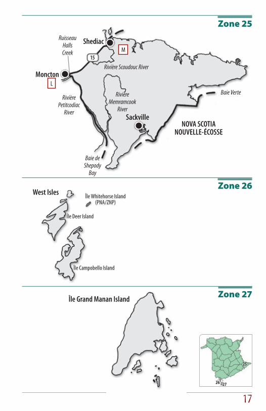
Zone 25
Zone 26
Zone 27
Rivière Petitcodiac
River
Île Grand Manan Island
M
L
15

18
Appendix
ARivière
Kedgwick River
Rivière Restigouche
River
Little Main Restigouche River
Petite rivière Restigouche principale
265
ZONE 4
ZONE 3ZONE 3
E
Saint John River / Fleuve
Saint-Jean
Ruissiau Shikatehawk
Stream
107
105
105
ZONE 10
ZONE 10
ZONE 10
ZONE 16
Bristol
G
Rivière Taxis River
Southwest Miramichi RiverRivière Miramichi Sud-Ouest
Ruissiau Burntland
Stream
8
8
ZONE 12
ZONE 17
ZONE 17
Boiestown
FRivière
Meduxnekeag River
Saint John River / Fleuve
Saint-Jean
103
103
2
555
2
ZONE 10
ZONE 15
ZONE 16
Woodstock
B
Plaster Rock
Hazeldean
Rue Main St.
Old Route 385Ancienne route 385
Chemin de fer du CN Railway
385108
395
109
ZONE 11
ZONE 10
ZONE 6
C
Rivière Miramichi
River
430 8
1268
ZONE 14ZONE 7
ZONE 8
ZONE 13
Miramichi
D
107
ZONE 10 ZONE 11
ZONE 16
Juniper
Juniper Station
Chemin Southwest
Road
Chemin de fer du CN Railway
Chemin Juniper
Road
HSouthwest Miramichi River
Rivière Miramichi Sud-Ouest
8
8
ZONE 12
ZONE 13Doaktown
Chemin de Doaktown
South Road
Grand Lake RoadChemin du Grand Lac
ZONE 17

19
I
Ruisseau Longs Creek
102
32
2
ZONE 21
ZONE 15
Longs Creek
Saint John River / Fleuve
Saint-Jean
ZONE 16 J
Rivière Nashwaak
River
8
rue Canada St.rue Gibson St.
rue Union St. 8Fredericton
105
Saint John RiverFleuve Saint-Jean
ZONE 16
ZONE 21ZONE 17
KAnse
Youngs Cove
Ruisseau Youngs Creek
10510
10
Youngs Cove
ZONE 18
ZONE 22
L
Rivière Petitcodiac
River
Ruisseau HallsCreek
15
Moncton
ZONE 19
ZONE 19
ZONE 25
ZONE 24
M Havre de ShediacShediac Harbour
Rivière Scoudouc
River
15
11
Shediac
ZONE 19
ZONE 25
ZONE 25
N
1
114
114
PenobsquisSpringdale
ZONE 22
ZONE 23
ZONE 24
Chemin Portage Vale
Road

The Department of Energy and Resource Development supports Crime Stoppers in an effort to stop poaching, netting and
jigging fish, illegal possession of deer, salmon, or moose meat and other violations of the Fish and Wildlife Act.