West Virginia GIS Technical Center West Virginia...
12
West Virginia GIS Technical Center West Virginia University Department of Geology and Geography Eberly College of Arts and Sciences WV Spatial Data Infrastructure January 2004 Status Report WV Spatial Data Infrastructure Report: The West Virginia GIS Technical Center (WVGISTC) periodically publishes a report on the availability and development of geospatial data specific to West Virginia. This report focuses on the best available, core geographic data sets that form the backbone or “Framework” for local, State, and National Spatial Data Infrastructures. The report identifies base geographic data layers needed by organizations to implement successful computer mapping applications. Within the Spatial Data Infrastructure, organizations cooperatively produce and share the “best” available geographic data throughout all levels of government, private and non-profit sectors, and the academic community. Spatial Data Infrastructure components include “Framework” or core geographic base layers, standards, metadata, Clearinghouses, and partnerships. WV Framework Base Layers: West Virginia’s Framework geographic layers consists of nine core themes (hydrography, transportation, orthoimagery, elevation, land ownership (cadastral), geodetic control, boundaries (governmental units), structures, geographic names) used by most GIS mapping applications at the state and local level, and targeted as National Map layers for future topographic map production. This report also includes six application-specific data themes (soils, geology, land cover, critical structures, flood hazards, economic development) built on top of the core Framework layers and USGS digital topographic maps, a commonly used base image reference layer. The following is provided for each data theme: brief description, mapping status, ultimate mapping goal, and data producer information, including originator(s) of data, resolution, currency, and data availability. In the future this report will be an integral part of the State’s GIS Development Plan. WV Spatial Data Infrastructure Other Applications Data: Soils Geology Critical Structures Economic Development Health Care Demographics Natural Resources Environment Historical Land Cover / Land Use WV Core Data: Hydrography Transportation Orthoimagery Elevation Cadastral Geodetic Control Governmental Units Structures Geographic Names http://wvgis.wvu.edu/stateactivities/framework.html 1
Transcript of West Virginia GIS Technical Center West Virginia...

West Virginia GIS Technical Center West Virginia University Department of Geology and Geography Eberly College of Arts and Sciences
WV Spatial Data Infrastructure
January 2004 Status Report WV Spatial Data Infrastructure Report: The West Virginia GIS Technical Center (WVGISTC) periodically publishes a report on the availability and development of geospatial data specific to West Virginia. This report focuses on the best available, core geographic data sets that form the backbone or “Framework” for local, State, and National Spatial Data Infrastructures. The report identifies base geographic data layers needed by organizations to implement successful computer mapping applications. Within the Spatial Data Infrastructure, organizations cooperatively produce and share the “best” available geographic data throughout all levels of government, private and non-profit sectors, and the academic community. Spatial Data Infrastructure components include “Framework” or core geographic base layers, standards, metadata, Clearinghouses, and partnerships. WV Framework Base Layers: West Virginia’s Framework geographic layers consists of nine core themes (hydrography, transportation, orthoimagery, elevation, land ownership (cadastral), geodetic control, boundaries (governmental units), structures, geographic names) used by most GIS mapping applications at the state and local level, and targeted as National Map layers for future topographic map production. This report also includes six application-specific data themes (soils, geology, land cover, critical structures, flood hazards, economic development) built on top of the core Framework layers and USGS digital topographic maps, a commonly used base image reference layer. The following is provided for each data theme: brief description, mapping status, ultimate mapping goal, and data producer information, including originator(s) of data, resolution, currency, and data availability. In the future this report will be an integral part of the State’s GIS Development Plan. WV Spatial Data Infrastructure
Other Applications Data: Soils Geology Critical Structures Economic Development Health Care Demographics Natural Resources Environment Historical Land Cover / Land Use
WV Core Data: Hydrography Transportation Orthoimagery Elevation Cadastral Geodetic Control Governmental Units Structures Geographic Names
http://wvgis.wvu.edu/stateactivities/framework.html 1
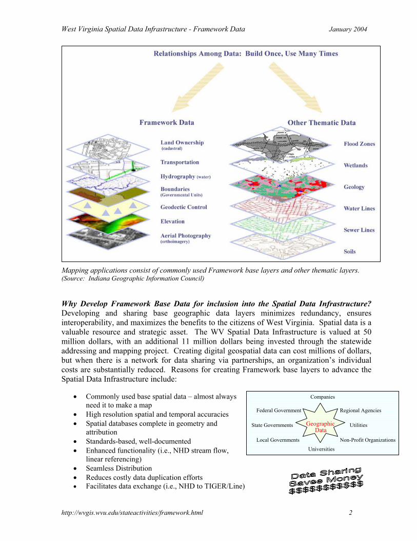
West Virginia Spatial Data Infrastructure - Framework Data January 2004
Mapping applications consist of commonly used Framework base layers and other thematic layers. (Source: Indiana Geographic Information Council) Why Develop Framework Base Data for inclusion into the Spatial Data Infrastructure? Developing and sharing base geographic data layers minimizes redundancy, ensures interoperability, and maximizes the benefits to the citizens of West Virginia. Spatial data is a valuable resource and strategic asset. The WV Spatial Data Infrastructure is valued at 50 million dollars, with an additional 11 million dollars being invested through the statewide addressing and mapping project. Creating digital geospatial data can cost millions of dollars, but when there is a network for data sharing via partnerships, an organization’s individual costs are substantially reduced. Reasons for creating Framework base layers to advance the Spatial Data Infrastructure include:
Geographic Data
Companies
Federal Government Regional Agencies
Universities
Non-Profit Organizations Local Governments
UtilitiesState Governments
• Commonly used base spatial data – almost always need it to make a map
• High resolution spatial and temporal accuracies • Spatial databases complete in geometry and
attribution • Standards-based, well-documented • Enhanced functionality (i.e., NHD stream flow,
linear referencing) • Seamless Distribution • Reduces costly data duplication efforts • Facilitates data exchange (i.e., NHD to TIGER/Line)
http://wvgis.wvu.edu/stateactivities/framework.html 2

West Virginia Spatial Data Infrastructure - Framework Data January 2004 Framework Principles: Approved mapping standards, along with cooperative efforts of local, state, federal, and private organizations, are necessary to create a reliable, seamless, continually maintained, consistent set of core geographic data. West Virginia Framework data is built on the best available data and adheres to the following principles: • Data Access: Framework data must be widely accessible through data clearinghouses and Web portals that standardize
the systematic collection and management of information. Restrictions may apply for sensitive or private information.
• Data Charges: Charges for access to Framework data are limited to the costs of providing access and dissemination.
• Data Certification: Framework data are complete, quality checked, and geometrically and topologically clean.
• Standards: Framework data must conform to approved technical and administrative standards.
• Metadata: FGDC metadata is preferred for all Framework data, but abbreviated metadata is acceptable if it includes the following summary information: description, scale, location, attribute documentation, source lineage, coordinate system, and file format. Metadata also can be collected at the feature level.
• Coordinate Referencing System: The Geographic Coordinate System (longitude and latitude) is encouraged for Framework data, although the following common coordinate systems are also acceptable: (1) Universal Transverse Mercator (UTM), Zone 17 North, map units in meters, for statewide GIS data sets, and (2) WV State Plane Coordinate System (SPCS), North and South Zones, map units in U.S. feet, for countywide data sets. Horizontal coordinate information is referenced to the North American Datum of 1983 (NAD 83) and vertical coordinate information is referenced to the North American Vertical Datum of 1988 (NAVD 88).
• GIS File Format: Framework data are in a digital format that can be easily imported into a Geographic Information System.
• Seamless: Framework data are seamless (no arbitrary edges) across political or other collection area boundaries.
• Integrated within and between Themes of Data: Framework data are positional and logically consistent among themes, such as the coincidental alignment of a stream and political boundary.
• Multiple Resolutions and Generalization: Framework data consists of variable resolutions to satisfy different users’ needs. To avoid independent data collection, more detailed and complete data sets are generalized for those agencies requiring less detailed data that cover a large area.
• Continually Maintained and Complete: Framework data is built on the best available data. Data stewards continually maintain consistently classified data.
• Geographic: Framework data contains no cartographic generalizations. Future Directions: Leadership, cooperation, and coordination are required among numerous agencies to advance the WV Spatial Data Infrastructure in West Virginia. Presently, the WV Spatial Data Infrastructure for the State is progressing on four fronts: (1) development of new digital mapping standards; (2) creation of communicative networks and business partnerships to coordinate data sharing; (3) collection of more current, higher resolution data; and (4) promotion of GIS to the statewide community. For most Framework base layers, the ultimate goal is to achieve statewide coverage and integration of more current, higher-resolution thematic data. In the future, most core geographic data will be collected at mapping scales of 1:4800 or larger. If you have any questions or remarks about this report or want to participate in advancing the WV Spatial Data Infrastructure, please contact Kurt Donaldson of the WV GIS Technical Center or the State GIS Coordinator, Craig Neidig. Technical Center Staff WV GIS Technical Center West Virginia University e-mail: [email protected] web: wvgis.wvu.eduhttp://wvgis.wvu.edu/stateactivities/framework.html 3

West Virginia Spatial Data Infrastructure - Framework Data January 2004
TRANSPORTATION DESCRIPTION: Transportation networks and facilities to include roads, trails, railroads, waterways, airports, bridges and tunnels. Road centerlines should incorporate street address ranges for geocoding applications and a linear referenced system for routing applications.
COORDINATION: Coordination among transportation data producers in the State is necessary to establish core content standards and business relationships. Through such coordination will foster formal/informal agreements for sharing, creating, and maintaining statewide transportation data.
MAPPING STATUS:
(1) WV Statewide Addressing and Mapping Board (WVSAMB): By 2007, the WVSAMB Addressing Vendor will attribute transportation files based on NENA-2-010 format for road centerlines, major driveways, railroad centerlines, navigable waterways, overpasses, bridges and tunnels, building points, major structure polygons, and dams and spillways. http://www.addressingwv.org
(2) WV Department of Transportation (WV DOT): The WVDOT plans, designs, builds and maintains more than 34,000 miles of state roads. The WVDOT does not have a GIS Section, although they are contracting the private sector to generate a digital cartographic copy of their existing general highway county map series. In 2002 the Rahall Appalachian Transportation Institute and the West Virginia Department of Transportation funded Marshall University and West Virginia to develop a strategic plan for the implementation of a geographic information system (GIS). This plan supports the efforts of WVDOT to develop an integrated GIS resource management system to meet its evolving operational and managerial business needs. http://wvgis.wvu.edu/stateactivities/transportation.html.
(3) U.S. Census Bureau (Census): Harris Corporation has been awarded an eight-year contract, valued in excess of $200 million, by the U.S. Census Bureau for the Master Address File/Topologically Integrated Geographic Encoding and Referencing Accuracy Improvement Project (MAF/TIGER AIP). The objectives of this program are to align existing 1:100,000-scale roads, hydrography, railroads, structures, landmarks, pipelines, power lines and other TIGER database features to a horizontal accuracy standard of 7.6 meters for all of the nation’s 3,232 counties by FY 2008. http://www.census.gov/geo/mod/maftiger.html
(4) U.S. Geological Survey (USGS) and U.S. Forest Service (USFS): In 2003 WVGISTC completed statewide, 1:24,000-scale topographic-based transportation vector files. These files are digital vector representations of roads, trails, bridges, exit ramps, tunnel portals and other detailed transportation features derived from USFS and USGS 1:24,000-scale topographic maps. USGS Digital Line Graph (DLG) road attribute data is limited to road classification and federal/state highway route numbers. http://wvgis.wvu.edu/data/data.php (search on roads). The Monongahela National Forest maintains a trail and road geographic database for 3,300 miles of roads (http://wvgis.wvu.edu/data/data.php, search on roads). The spatial databases originated from 1:24,000-scale USFS Cartographic Feature Files and are linked to Oracle INFRA attribute tables which include linear referencing measures for event themes. http://www.fs.fed.us/eng/road_mgt/documents.shtml
(5) U.S. Department of Transportation (US DOT): The Federal Highway Administration (FHWA) is in the process of enhancing the National Highway Planning Network (NHPN), a comprehensive network database of the nation's major highway system. The current 1:100,000-scale geographic database consists of over 400,000 miles of the nation's highways comprised of Rural Arterials, Urban Principal Arterials and all National Highway System routes (http://wwwcf.fhwa.dot.gov/hep10/gis/gis.html). The National Transportation Atlas Data (NTAD) is a set of transportation-related geospatial data for the United States compiled by the Bureau of Transportation Statistics (BTS). The data consist of transportation networks such as the NHPN, transportation facilities, and other spatial data used as geographic reference. http://www.bts.gov/gis/ntatlas/index.html
(6) National Park Service (NPS): In 2003 the Rivers & Trails Program of the National Park Service completed state trails at a nominal scale of 1:100,000. http://wvgis.wvu.edu/data/data.php (search on trails)
(7) Local Government: Local data producers maintain countywide road centerlines with street ranges, supplemented with double-line (edge of pavement) roads for urban areas.
DATA PRODUCERS: DATASET NAME ORIGINATOR(S) SCALE MAP UNIT % WV CURRENCY
TIGER U.S. Census 1:100,000 County 100 2000 National Transportation Atlas U.S. DOT 1:100,000 State 100 2001 County Highway Maps (Not Vector) WV DOT 1:63,500 County 100 Variable Digital Line Graphs (DLG) USGS 1:24,000 7.5 Min. Quad 85 1950-1997 Cartographic Feature Files (CFF) USFS 1:24,000 7.5 Min. Quad 15 1995 E-911 Road Centerlines & Addresses WVSAMB 1:4800 SAMB Index ? Local Road Databases County/City Govts. 1:600 to 1:4800 Jurisdiction ? Variable New Roads WV DOT / Contractors Survey-scale Planned Route N/A Variable Major Trails NPS, WV DNR, USFS GPS to 1:100,000 Jurisdiction 100 2003 ULTIMATE GOAL: Statewide 1:4800 or larger scale addressing and mapping database of core transportation features.
http://wvgis.wvu.edu/stateactivities/framework.html 4

West Virginia Spatial Data Infrastructure - Framework Data January 2004
HYDROGRAPHY (Water) DESCRIPTION: The National Hydrography Dataset (NHD) is a comprehensive set of digital spatial data that contains information about surface water features such as lakes, ponds, streams, rivers, springs and wells. Within the NHD, surface water features are combined to form "reaches," which provide the framework for linking water-related data to the NHD surface water drainage network. These linkages enable users to access information about the connectivity and flow direction of stream networks as well as to provide a system for a linear referencing. The Watershed Boundary Dataset is a national geospatial database containing the hydrologic unit boundaries for the 1st through 6th level units.
MAPPING STATUS: • In 2002 WVGISTC completed statewide coverage of 1:24,000-scale USGS Hydrography
DLGs. http://wvgis.wvu.edu/data/data.php (search on streams and rivers) • In 2003 WVU NRAC completed high-resolution (1:24,000-scale or larger) NHD
mapping by conflating 1:24,000-scale hydrography USGS DLGs/USFS CFFs for all sub-basins (8-digit HUC) of the State. Status graphic at http://nhd.usgs.gov/data.html.
• WVSAMB hydrography will have limited attribution and connectivity. Funding sources are needed to integrate WVSAMB 1:4800-scale streams into NHD. A State Hydrography Board should be established to oversee maintenance of NHD.
• In 2004 the newly certified 1:24,000-scale subwatershed boundaries (6th level, 12-digit HUCs) should be available. The embedded watershed boundaries (5th level, 10-digit HUCs) will change but the subbasin boundaries (4th level, 8-digit HUCs) will remain the same. (http://www.ftw.nrcs.usda.gov/huc_data.html)
DATA PRODUCERS: DATASET NAME ORIGINATOR(S) SCALE /
RESOLUTION MAPPING
SYSTEM UNIT %
WV CURRENT-NESS
National Hydrography Dataset USGS / EPA 1:100,000 1:24,000
Watershed Watershed
100 100
2000 2000-2003
Digital Line Graphs (DLG) USGS 1:24,000 7.5 Min. Quad 100 1950-1997 Cartographic Feature Files (CFF) USFS 1:24,000 7.5 Min. Quad 17 1995 WVSAMB WVSAMB 1:4800 50,000’x50,000’ ? 2003 WV DNR Watershed Files WV DNR GPS Watershed 7 2000 Local Government Databases County/Municipal
Governments 1:1200 to
1:4800 Jurisdiction ? Variable
ULTIMATE GOAL: Statewide high resolution (1:24,000 or larger scale) National Hydrography Dataset (NHD) and Watershed Boundary Dataset (WBD).
Land Ownership (Cadastral) DESCRIPTION: Cadastral information refers to land ownership. Other geographic information such as orthoimagery, transportation, hydrography, and coordinate geometry are required to create a seamless digital tax parcel district file from hundreds of hardcopy maps or deed surveys. Vector-based cadastral data should be geometrically and topologically clean and linked to a single, comprehensive parcel database.
MAPPING STATUS: • Approximately 76% of WV Counties have implemented or are transitioning to a GIS file
format for their digital tax mapping. • WVGISTC is spearheading an effort to create digital tax mapping guidelines for the
State. The Center is working with the Property Valuation Training and Procedures Commission and other public/private stakeholders to revise the procedural regulations, The Statewide Procedures for the Manual Maintenance of Surface Tax Maps, Title-Series 189-04 (http://www.wvsos.com/csrdocs/worddocs/189-04.doc). These updated procedures will provide necessary guidance and clarification procedures for the “digital” collection, maintenance, and electronic display of surface tax parcels. Training workshops and online resources for mapping professionals are also part of this effort.
• In 2003 WVGISTC created a digital version of the official tax district boundary lines adopted by the WV Legislature in 1973.
DATA PRODUCERS: DATASET NAME ORIGINATOR(S) SCALE /
RESOLUTION MAPPING
SYSTEM UNIT %
WV CURRENT-NESS
Mineral Lands Mapping Program
WV DTR, GIS Development Unit
1:12,000 to 1:24,000
Tax District, Corporation
50 Variable
Local Government Databases (CAD or GIS)
County Assessors Survey scale to 1:24,000
Tax District, Corporation
72 Variable
ULTIMATE GOAL: Statewide, seamless, georeferenced, vector-based surface tax parcel mapping system integrated with external assessment databases.
http://wvgis.wvu.edu/stateactivities/framework.html 5

West Virginia Spatial Data Infrastructure - Framework Data January 2004
ELEVATION DESCRIPTION: Terrain represented by contour lines or by a Digital Elevation Model (DEM), an array of elevations for ground positions at regularly spaced intervals.
MAPPING STATUS: • DOI high-priority program revising USGS 1:24,000-scale topographic maps with contour
updates in mountaintop mining areas of central and southern WV. A by-product is 10-meter, Level 2 DEMs. See status graphic: http://mcmcweb.er.usgs.gov/status/mac/wv/wv_dem10.html
• Mineral Lands Mapping Program (MLMP) creating 10-meter, Level 2 DEMs using the ArcInfo TOPOGRID command. Coordination is necessary between the State and USGS to derive similar 10-meter products. See status graphic at http://wvgis.wvu.edu/stateactivities/dem10m_status.html
• USGS 1:24,000-scale hypsography DLGs will continue to be created at WVU until superceded by newer products. State 77% complete.
• Wyoming County LIDAR data created by Enerquest Systems for FEMA was processed incorrectly and thus needs to be rectified.
• WV DEP hopes to acquire radar for the coalfield areas. License restrictions may apply. • WVDOT has committed funds to enhance the WVSAMB elevation data. NRCS and
USGS are interested in this dataset. The vertical accuracy and availability of future WVSAMB elevation data is unknown.
DATA PRODUCERS: DATASET NAME OWNER(S) Horiz.
Accuracy Vertical RMSE and
Contour Interval MAPPING SYSTEM
UNIT
% WV
DATE
National Elevation Dataset (Level 1 & 2 DEMs)
USGS 30 meter
10 to 50 ft. RMSE 20 or 40 ft. C.I.
Seamless Nationwide
100 2000
Digital Line Graph (DLG) Contours and Spot Elevations
USGS 1:24,000-scale
10 to 20 ft. RMSE 20 or 40 ft. C.I.
7.5 Min. Quad
77 1950-1997
10-meter DEMs (USGS) USGS 10 m 10 to 20 ft. RMSE 7.5 Min. Quad 36 Varies WVSAMB WVSAMB ? 10 ft. C.I. (?) ? ? 2003 IFSAR Radar ~ 5 m 3 ft. (1st Surface) Study Area LIDAR FEMA 0.5 m 0.5 ft. RMSE
< 2 ft. C.I. Study Area 2 Varies
Local Government Databases
County/Municipal Governments
1:1200 to 1:4800
Jurisdiction ? Varies
ULTIMATE GOAL: Statewide higher resolution (10 meters or better) surface elevation data.
BOUNDARIES (Governmental Units ) DESCRIPTION: Governmental unit boundaries for counties, incorporated places, minor civil divisions, and public lands. Each of these features includes the attributes of name and the applicable Federal Information Processing Standard (FIPS) code.
MAPPING STATUS: • The Census Geography Division, WV Redistricting Office, and WVGISTC are reviewing
business partnerships regarding digital boundary and annexation submissions. • A request has been made to the BAE Systems mapping contractor of the WVSAMB
project to code ridgeline breaklines with a unique label to facilitate immediate use in the subsequent refinement of political boundaries.
• Organizations should review procedures for ensuring coincidental features share the same boundary.
DATA PRODUCERS:
DATASET NAME ORIGINATOR(S) SCALE / RESOLUTION
MAPPING SYSTEM UNIT
% WV
CURRENT-NESS
County Boundaries USGS / USFS 1:24,000 State 100 1950-1997 Public Lands State / Federal 1:24,000 State 100 Varies Municipal Boundaries Municipality Varies Jurisdiction ? Varies ULTIMATE GOAL: Governmental unit boundaries of high spatial and temporal resolution.
http://wvgis.wvu.edu/stateactivities/framework.html 6
West Virginia Spatial Data Infrastructure - Framework Data January 2004
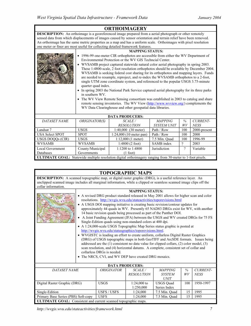
ORTHOIMAGERY DESCRIPTION: An orthoimage is a georeferenced image prepared from a aerial photograph or other remotely sensed data from which displacements of images caused by sensor orientation and terrain relief have been removed. An orthoimage has the same metric properties as a map and has a uniform scale. Orthoimages with pixel resolution one meter or finer are most useful for collecting detailed framework features.
MAPPING STATUS: • 1996-99 one-meter CIR orthophotos are accessible from either the WV Department of
Environmental Protection or the WV GIS Techncial Center. • WVSAMB project captured statewide natural color aerial photography in spring 2003.
These 1:4800-scale, 2 foot resolution orthophotos should be available by December 2004. WVSAMB is seeking federal cost sharing for its orthophotos and mapping layers. Funds are needed to resample, reproject, and re-index the WVSAMB orthophotos to a 2-foot, single UTM zone coordinate system, and referenced to the popular USGS 3.75-minute quarter quad index.
• In spring 2003 the National Park Service captured aerial photography for its three parks in southern WV.
• The WV View Remote Sensing consortium was established in 2003 to catalog and share remote sensing inventories. The WV View (http://www.wvview.org/) complements the WV Data Clearinghouse and other geospatial data libraries.
DATA PRODUCERS:
DATASET NAME ORIGINATOR(S) SCALE / RESOLUTION
MAPPING SYSTEM UNIT
% WV
CURRENT-NESS
Landsat 7 USGS 1:40,000 (30 meter) Path / Row 100 2000-present USA Select SPOT SPOT 1:24,000 (10 meter pan) Path / Row 100 2000 USGS DOQQs (CIR) USGS 1:12,000 (1 meter) 7.5 Min. Quad 100 1996-99 WVSAMB WVSAMB 1:4800 (2 foot) SAMB index ? 2003 Local Government Databases
County/Municipal Governments
1:1200 to 1:4800 (1 foot)
Jurisdiction ? Variable
ULTIMATE GOAL: Statewide multiple resolution digital orthoimagery ranging from 30-meter to 1-foot pixels.
TOPOGRAPHIC MAPS DESCRIPTION: A scanned topographic map, or digital raster graphic (DRG), is a useful reference layer. An unclipped scanned image includes all marginal information, while a clipped or seamless scanned image clips off the collar information.
MAPPING STATUS: • A revised DRG product standard released in May 2001 allows for higher scan and color
resolutions. http://wvgis.wvu.edu/stateactivities/toporevisions.html • A USGS DOI mapping initiative is creating basic revision/contour updates for
approximately 44 quads in WV. Presently 65 NAD83 DRGs exist for WV, with another 14 basic revision quads being processed as part of the Panther DOI.
• A Joint Funding Agreement (JFA) between the USGS and WV created DRGs for 75 FS Single-Edition quads using non-standard colors at 400 dpi.
• A 1:24,000-scale USGS Topographic Map Series status graphic is posted at http://wvgis.wvu.edu/statusgraphics/toporevisions.html.
• WVGISTC is leading an effort to create uniform, collarless Digital Raster Graphics (DRG) of USGS topographic maps in both GeoTIFF and ArcSDE formats. Issues being addressed are the (1) consistent no data value for clipped collars, (2) color model, (3) scan resolution, and (4) horizontal datums. A complete, consistent set of collar and collarless DRGs is needed.
• The NRCS, CVI, and WV DEP have created DRG mosaics.
DATA PRODUCERS: DATASET NAME ORIGINATOR SCALE /
RESOLUTION MAPPING SYSTEM
UNIT
% WV
CURRENT-NESS
Digital Raster Graphic (DRG) USGS 1:24,000 to 1:250,000
USGS Quad Series Index
100 1950-1997
Single-Edition USFS / USFS 1:24,000 7.5 Min. Quad 15 1995 Primary Base Series (PBS) Soft-copy USFS 1:24,000 7.5 Min. Quad 15 1995 ULTIMATE GOAL: Consistent and current scanned topographic maps.
http://wvgis.wvu.edu/stateactivities/framework.html 7
West Virginia Spatial Data Infrastructure - Framework Data January 2004
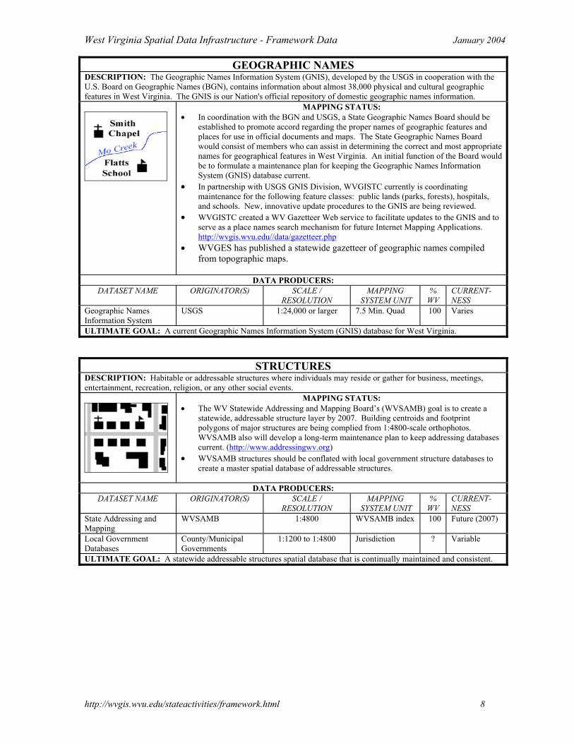
GEOGRAPHIC NAMES DESCRIPTION: The Geographic Names Information System (GNIS), developed by the USGS in cooperation with the U.S. Board on Geographic Names (BGN), contains information about almost 38,000 physical and cultural geographic features in West Virginia. The GNIS is our Nation's official repository of domestic geographic names information.
MAPPING STATUS: • In coordination with the BGN and USGS, a State Geographic Names Board should be
established to promote accord regarding the proper names of geographic features and places for use in official documents and maps. The State Geographic Names Board would consist of members who can assist in determining the correct and most appropriate names for geographical features in West Virginia. An initial function of the Board would be to formulate a maintenance plan for keeping the Geographic Names Information System (GNIS) database current.
• In partnership with USGS GNIS Division, WVGISTC currently is coordinating maintenance for the following feature classes: public lands (parks, forests), hospitals, and schools. New, innovative update procedures to the GNIS are being reviewed.
• WVGISTC created a WV Gazetteer Web service to facilitate updates to the GNIS and to serve as a place names search mechanism for future Internet Mapping Applications. http://wvgis.wvu.edu//data/gazetteer.php
• WVGES has published a statewide gazetteer of geographic names compiled from topographic maps.
DATA PRODUCERS:
DATASET NAME ORIGINATOR(S) SCALE / RESOLUTION
MAPPING SYSTEM UNIT
% WV
CURRENT-NESS
Geographic Names Information System
USGS 1:24,000 or larger 7.5 Min. Quad 100 Varies
ULTIMATE GOAL: A current Geographic Names Information System (GNIS) database for West Virginia.
STRUCTURES DESCRIPTION: Habitable or addressable structures where individuals may reside or gather for business, meetings, entertainment, recreation, religion, or any other social events.
MAPPING STATUS: • The WV Statewide Addressing and Mapping Board’s (WVSAMB) goal is to create a
statewide, addressable structure layer by 2007. Building centroids and footprint polygons of major structures are being complied from 1:4800-scale orthophotos. WVSAMB also will develop a long-term maintenance plan to keep addressing databases current. (http://www.addressingwv.org)
• WVSAMB structures should be conflated with local government structure databases to create a master spatial database of addressable structures.
DATA PRODUCERS: DATASET NAME ORIGINATOR(S) SCALE /
RESOLUTION MAPPING
SYSTEM UNIT %
WV CURRENT-NESS
State Addressing and Mapping
WVSAMB 1:4800 WVSAMB index 100 Future (2007)
Local Government Databases
County/Municipal Governments
1:1200 to 1:4800
Jurisdiction ? Variable
ULTIMATE GOAL: A statewide addressable structures spatial database that is continually maintained and consistent.
http://wvgis.wvu.edu/stateactivities/framework.html 8

West Virginia Spatial Data Infrastructure - Framework Data January 2004
GEODETIC CONTROL DESCRIPTION: The horizontal and vertical geodetic control layer. It is the “transparent layer” of a Geographic Information System that provides a common reference system for establishing the coordinate positions of all geographic data.
MAPPING STATUS: • WV High Accuracy Reference Network (HARN) for Federal Base Network (FBN) and
Cooperative Base Network (CBN) Stations completed in Year 2000. • In August 2002 the GIS Steering Committee approved Standards for WV Coordinate
Systems. • A survey grade GPS base station has been installed at the Glenville State College,
Survey Program. This is the second (public) survey grade GPS base station in West Virginia, the first being in Beckley. Another is scheduled for central Pocahontas County.
DATA PRODUCERS:
DATASET NAME ORIGINATOR(S) SCALE / RESOLUTION
MAPPING SYSTEM UNIT
% WV
CURRENT-NESS
Geodetic Control Stations NGS, WVALS Survey Scale Point Location N/A N/A ULTIMATE GOAL: Very high-accuracy network of permanently monumented geodetic control points.
SOILS DESCRIPTION: The Soil Survey Geographic Database (SSURGO) is a detailed field verified inventory of the kinds and distribution of soils on the landscape, whereas the State Soil Geographic Database (STATSGO) is a generalized soils database.
MAPPING STATUS: • In 2007 SSURGO mapping will be completed in West Virginia. Status graphic:
http://wvgis.wvu.edu/graphics/statusgraphics/soilsurvey1.jpg
DATA PRODUCERS: DATASET NAME ORIGINATOR(S) SCALE /
RESOLUTION MAPPING
SYSTEM UNIT %
WV CURRENT-NESS
STATSGO NRCS 1:250,000 State 100 1994 SSURGO NRCS 1:24,000 or larger scale 7.5 Min. Quad 60 1997-present ULTIMATE GOAL: Statewide SSURGO maps.
GEOLOGY DESCRIPTION: Bedrock and surficial geology, coal-bed mapping, oil and gas exploration.
MAPPING STATUS: • The North American Geologic Map Data Model Steering Committee is developing
mapping standards for digital geological mapping data for inclusion into the National Geologic Map Database as required by the National Geologic Mapping Act.
• STATEMAP 1:24k mapping progress (1993-present) http://www.wvgs.wvnet.edu/www/statemap/statemap.htm
• In 2003 WVGISTC completed a digital conversion of seven 1:24,000-scale geological maps for the WV Geological and Economic Survey (WVGES). WVGISTC published a technical report on the digital conversion procedures for geologic maps.
• In 2003 WVGES created scanned files of the early 1900 county geological maps.
DATA PRODUCERS: DATASET NAME ORIGINATOR(S) SCALE /
RESOLUTION MAPPING
SYSTEM UNIT %
WV CURRENT-NESS
Coal Bed Mapping Program
WVGES 1:24,000 7.5 Min. Quad 16 1999-present
Bedrock Geology WVGES 1:24,000 7.5 Min. Quad 5 1999-present Oil and Gas WVGES / WVDEP /
PTTC Variable Point Location N/A N/A
ULTIMATE GOAL: Statewide geologic maps at 1:24,000 scale.
http://wvgis.wvu.edu/stateactivities/framework.html 9

West Virginia Spatial Data Infrastructure - Framework Data January 2004
FLOOD MAPPING DESCRIPTION: Flood mapping involves aspects as delineating accurate floodplains and mitigating flood hazards.
MAPPING STATUS: • In 2002 the West Virginia Soil Conservation Agency was the lead agency in developing a
Statewide Flood Protection Plan that recommends GIS technologies be employed for floodplain mapping and flood damage assessment.
• As a Cooperative Technical Partner, WVGISTC is assisting FEMA in its efforts to create statewide digital flood-mapping themes.
• An interagency team needs to compile repetitive flood loss information into a single spatial database.
• WVOES has contracted Baker Engineering and CVI to assist in developing the State’s All-Hazards Mitigation Plan, mandated by the Disaster Act of 2000, for such hazards as flooding, winter storms, wildfires, dam failure, and landslides.
• Digital flood data exists for 38 counties (69%). • In 2003 WV DEP created a statewide Q3 composite floodplain coverage. • In 2003 U.S Army Corps of Engineers created a GIS file of at-risk structures in floodplains
for 37 counties. DATA PRODUCERS:
Data producers include federal, state, local government and private companies. PRODUCT STATUS COUNTY
Q3 Q3 Completed Barbour Braxton Brooke Cabell Calhoun Clay Gilmer Grant Greenbrier Hardy Harrison Jackson Kanawha Lewis Lincoln Logan Marshall Mason McDowell Mingo Ohio Putnam Raleigh Randolph Roane Summers Tucker Tyler Upshur Wayne Wetzel Wirt Wood Wyoming
PRE-DFIRM Jefferson, Berkeley DFIRM Proposed Gilmer DFIRM Mapping Cabell Fayette Jackson Logan McDowell Ohio Putnam Raleigh
Wyoming DFIRM Final Modifications Mercer DFIRM QC Jackson
DFIRM
DFIRM Completed Hampshire Monroe ULTIMATE GOAL: Develop a statewide, GIS-based Floodplain Mapping Information System that adheres to state and federal mapping guidelines.
LAND COVER DESCRIPTION: Land cover relates to the type of feature present on the surface of the earth. Both land cover datasets, WV-USGS Gap Analysis Program (GAP) and National Land Cover Dataset (NLCD), were created from classified 1992-94 Landsat TM imagery purchased as part of the Multi-Resolution Land Characteristics Consortium (MRLC) program.
MAPPING STATUS: • The U.S. Forest Service and Westvaco Corporation maintain their own land cover data
sets for timber management. • WV Division of Forestry, WV Division of Natural Resources, and WVU’s Appalachian
Hardwood Center are conducting GIS mapping for all eight State Forests. GIS data layers include management compartments, forest cover, timber stands, and recreational data.
• The Natural Resource Analysis Center (NRAC) at WVU will release a more current WV-GAP Land Cover dataset in FY 2003.
• Rahall Transportation Institute (RTI) is creating master land cover plans for 8 southern counties.
• Penn State University's Land Analysis Laboratory has been funded by a grant from the EPA to generate land use data within the Chesapeake Bay Watershed.
• More coordination is needed to standardize the collection efforts of high-resolution (1:24,000-scale or better) land cover data sets.
DATA PRODUCERS: DATASET NAME ORIGINATOR(S) SCALE /
RESOLUTION MAPPING
SYSTEM UNIT %
WV CURRENT-NESS
WV-GAP WVU-USGS 1:40,000 (30 meter) State 100 1992-94 NLCD USGS 1:40,000 (30 meter) State 100 1992-93 ULTIMATE GOAL: Current and higher resolution statewide land cover data sets.
http://wvgis.wvu.edu/stateactivities/framework.html 10

West Virginia Spatial Data Infrastructure - Framework Data January 2004
CRITICAL STRUCTURES DESCRIPTION: Critical structures are human-built systems that are essential to the safety, security, health and economic well-being of our modern society. Transportation networks such as rail lines, navigable waterways, along with utility and telecommunication systems, are an integral part of the State’s critical infrastructure. Critical facilities and infrastructure are vulnerable to disruption by natural or technological disasters.
MAPPING STATUS: • Coordination needed to collect utility and telecommunication networks. • Certain datasets need to be collected at higher spatial accuracies and validated by the
appropriate agency or by emergency management officials at the local level. The WV OES is coordinating the collection of better quality spatial data along with appropriate disclosure statements for sensitive data.
• The WVSAMB Addressing Vendor will create spatial Emergency Service Zone (ESN) polygons and other address-based files useful for emergency response.
DATASETS REQUESTED BY WV OFFICE OF EMERGENCY SERVICES:
SA = spatial accuracy (1:24,000-scale or better) CO = Completeness (geometry and attributes) CU = Currency Y = Yes N = No U = Unknown ? = No Data Available
DATASET NAME ORIGINATOR(S) / DATA SOURCE SA CO CU Airports (Public) U.S. Department of Transportation N Y Y Communications Transmitter Sites Emergency Medical Services, State Police, WV Public
Broadcasting, WV Division of Highways N Y Y
Courthouses Federal and county registers Y Y Y Dams (federal, state and local) U.S. Corps of Engineers, WV Department of Environmental
Protection Y N Y
Electric Power Systems / Facilities (trans. lines, plants, substations)
U.S. Environmental Protection Agency, Public Service Commission, American Electric Power, Allegheny Power
N U Y
Fire Stations WV State Fire Marshal's Office, WV Division of Forestry Y Y Y Gasoline Bulk Plants Petroleum Industry Association Y Y Y Hospitals WV Health Care Authority Y Y Y Intermodal Terminal Facilities U.S. Department of Transportation N Y Y Landfills WV Department of Environmental Protection Y U Y Major Chemical Facilities National Institute for Chemical Studies Y Y Y Major Natural Gas Compressors WV Public Service Commission Y Y Y Major Natural Gas Pipelines U.S. DOT, Utility Companies Y N N Municipal Water Reservoirs WV Bureau of Public Health Y U Y National Guard Armories WV Army National Guard Y Y Y Nursing Homes WV Health Care Authority N Y Y Ports / Navigable Waterways U.S. Department of Transportation N Y Y Prisons (state) WV Division of Corrections Y Y Y Regional Jails WV Regional Jail Authority N Y Y Schools (PK-12 and college) WV Department of Education, WV Army National Guard
WV Higher Education Policy Commission N N Y
Sewer Treatment Plants WV Division of Water Resources N Y N Significant Critical Structures (communications, military, energy)
WV Office of Emergency Services Y Y Y
Significant Critical Bridges (Rail and Highway)
WV Division of Highways, WV Public Service Commission
U Y Y
Sports Arenas Y U Y State Police Detachments WV State Police N Y Y Telephone Central Offices Verizon, Citizen Y Y Y Water Treatment Plants WV Bureau of Public Health Y U Y ULTIMATE GOAL: Statewide critical facilities and infrastructure mapping files that are spatially accurate, complete, and current.
http://wvgis.wvu.edu/stateactivities/framework.html 11

West Virginia Spatial Data Infrastructure - Framework Data January 2004
ECONOMIC DEVELOPMENT DESCRIPTION: Economic development facilitates business opportunities and growth throughout the state. It focuses on enhancing the factors of productive capacity - land, labor, capital, and technology.
MAPPING STATUS: • The WV Development Office (WV DO) has contracted RTI to develop an online, GIS-
based Economic Development Information System similar to Kentucky’s http://www.thinkkentucky.com/edis/.
• WVGIST has created GIS datasets for industrial sites, empowerment zones, enterprise communities, foreign trade zones, air-pollution non-attainment area, proposed highways, regional economic development and workforce boundaries, and other economic development data http://wvgis.wvu.edu//data/data.php?action=search&subject=Economic%20Development&location=ALL+LOCATIONS
• The WV DO can link spatial data to DEP’s Environmental Resource Information System (ERIS) to obtain surface mine status
DATASETS REQUESTED BY WV DEVELOPMENT OFFICE: Italics = sensitive dataset GIS coverage available (Y = Yes, N = No, P = Partial, U = Unknown) # DATASET NAME ORIGINATOR(S) / DATA SOURCE GIS 1 State, county and municipal boundaries U.S. Geological Survey (USGS), U.S. Census Y 2 Public lands U.S. Forest Service, USGS-WV GAP, WV
Division of Natural Resources (DNR) Y
3 Metropolitan Statistical Areas and Urbanized Areas U.S. Census, Office of Management and Budget Y 4 Regional Economic Development and Workforce
Development boundaries Governor's Workforce Investment Office Y
5 Federal Empowerment Zones, Enterprise Communities, Foreign Trade Zones
U.S. Department of Agriculture, U.S. Department of Housing and Urban Development (HUD), WV Development Office (DO)
Y
6 Street, road and highway network, including proposed major highways
U.S Department of Transportation (DOT), WV DOT Y
7 Rail network, including rail spurs by type/frequency of service
US DOT, USGS Y
8 Existing and proposed airports and ports US DOT Y 9 Streams, lakes, wetlands, navigable waterways and
100 year floodplains (67% coverage) USGS, U.S. Fish & Wildlife Service. US DOT, FEMA, USACE, WV Soil Conservation Service P
10 Known industrial sites (166), parks (82) and buildings (83)
WV Development Office (WV DO) P
11 Water, sewer, gas, electric and fiber optic communications lines (by size, condition, capacity)
U.S. DOT, WV Public Service Commission, Utility Companies, Miss Utility P
12 Existing, proposed and reclaimed surface mines (updated annually)
WV Geological Survey (27% coverage), WV Department of Environmental Protection (88% open permits, 40% closed permits)
P
13 Air pollution non-attainment areas and endangered streams
WV DEP, WV DNR Y
14 Brownfield sites WV DEP U 15 Major highway and rail underpasses and clearance
height WV DOT N
16 Vo-tech schools, colleges and universities WV Department of Education, WV Higher Education Policy Commission P
17 Large employers WV DO, WV Bureau of Employment Programs P 18
Major recreation and resort facilities (public and private)
Public land databases, national business directories P
19 Generalized Land Use USGS, RTI, satellite imagery Y 20 Parcel Boundaries WV Department of Tax and Revenue, Assessors P ULTIMATE GOAL: Develop a GIS-based Economic Development Information System for the state.
http://wvgis.wvu.edu/stateactivities/framework.html 12