Weathering & Erosion - Weeblymrsburkey-science.weebly.com/uploads/1/2/6/9/12690679/erosion... ·...
85
Weathering & Erosion
Transcript of Weathering & Erosion - Weeblymrsburkey-science.weebly.com/uploads/1/2/6/9/12690679/erosion... ·...
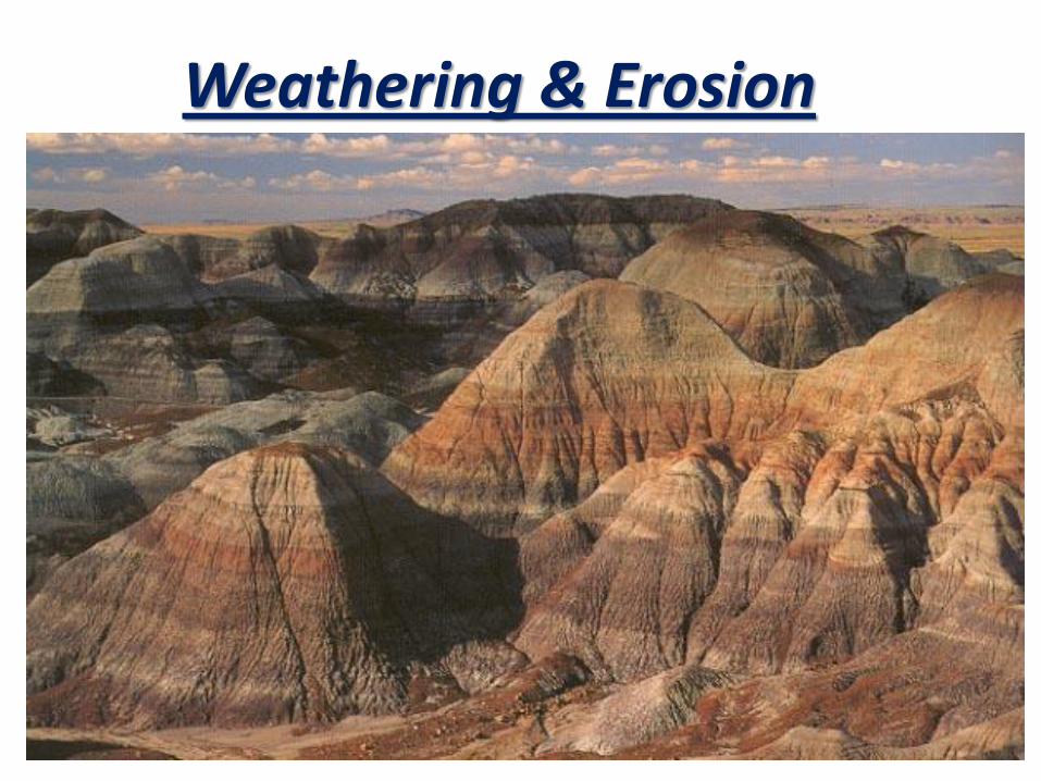
Weathering & Erosion

Weathering and Erosion
Weathering - processes at or near Earth’s surface that cause rocks and minerals to break down
Erosion - process of removing Earth materials from their original sites through weathering and transport to another place.
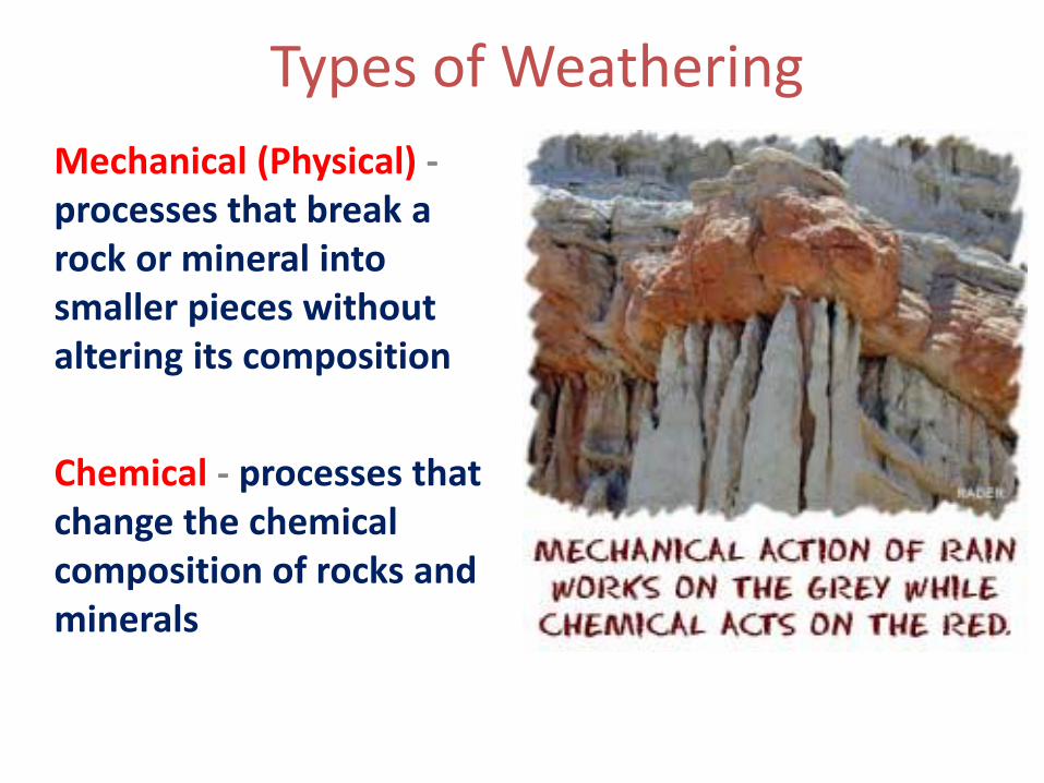
Types of Weathering
Mechanical (Physical) -processes that break a rock or mineral into smaller pieces without altering its composition
Chemical - processes that change the chemical composition of rocks and minerals
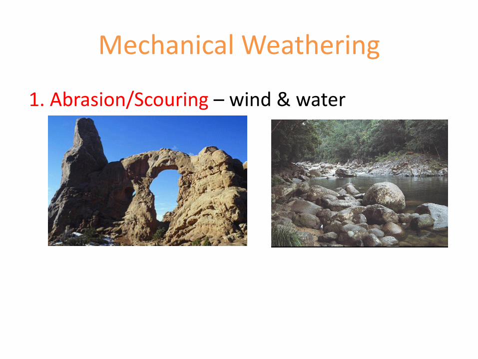
Mechanical Weathering
1. Abrasion/Scouring – wind & water
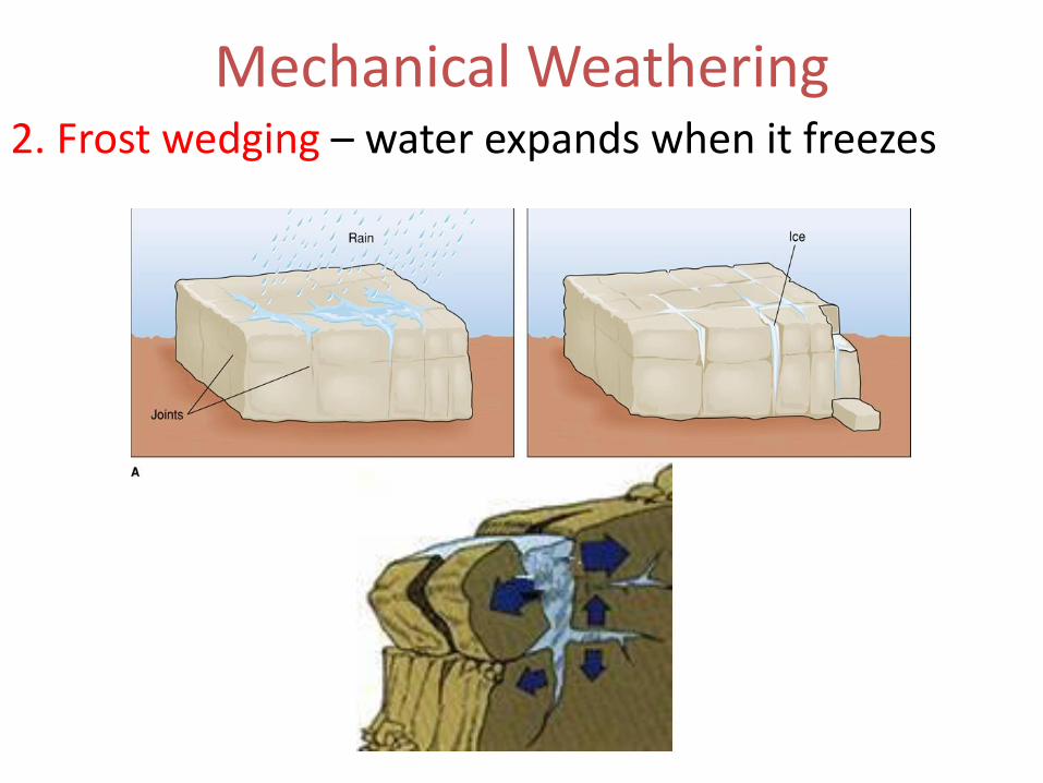
Mechanical Weathering2. Frost wedging – water expands when it freezes
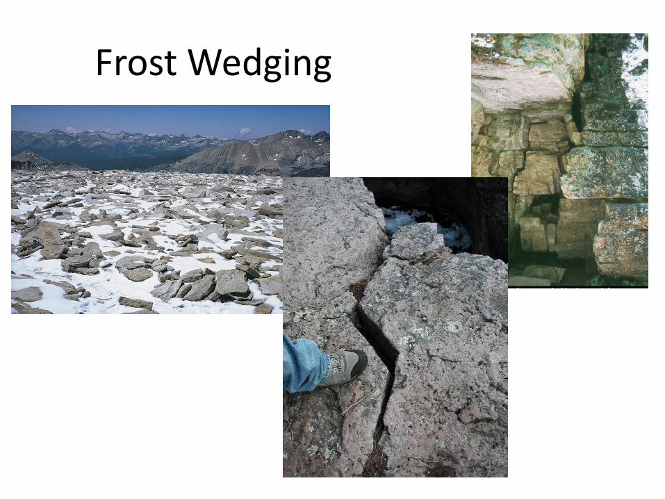
Frost Wedging
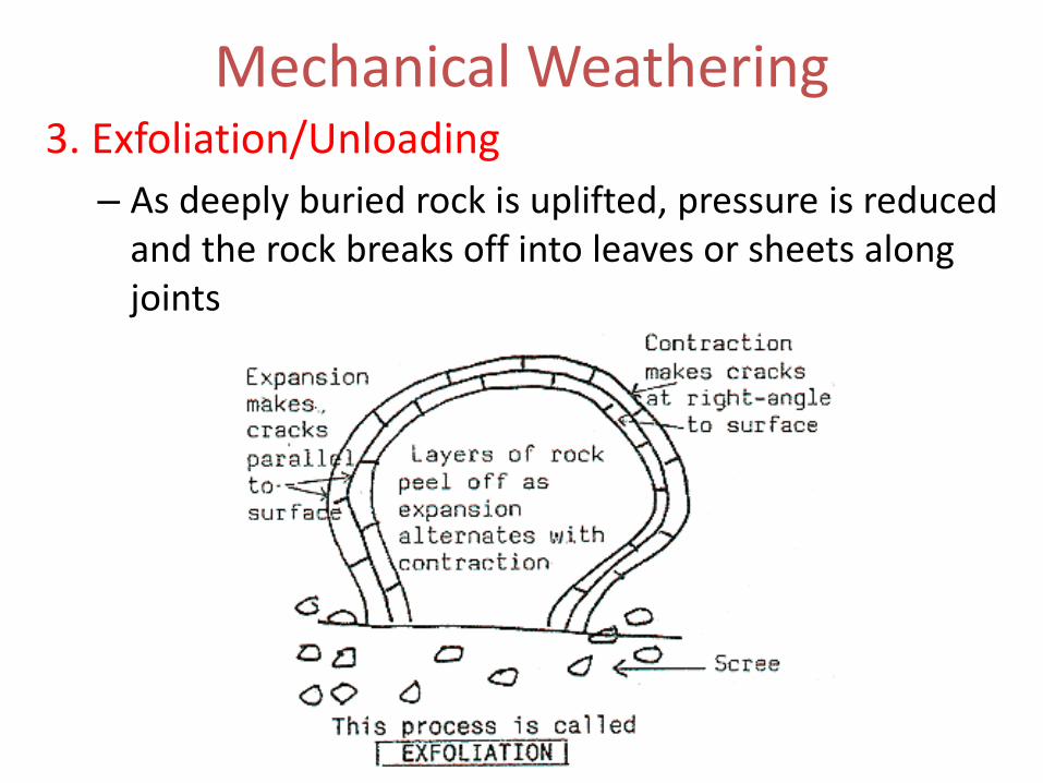
Mechanical Weathering3. Exfoliation/Unloading
– As deeply buried rock is uplifted, pressure is reduced and the rock breaks off into leaves or sheets along joints
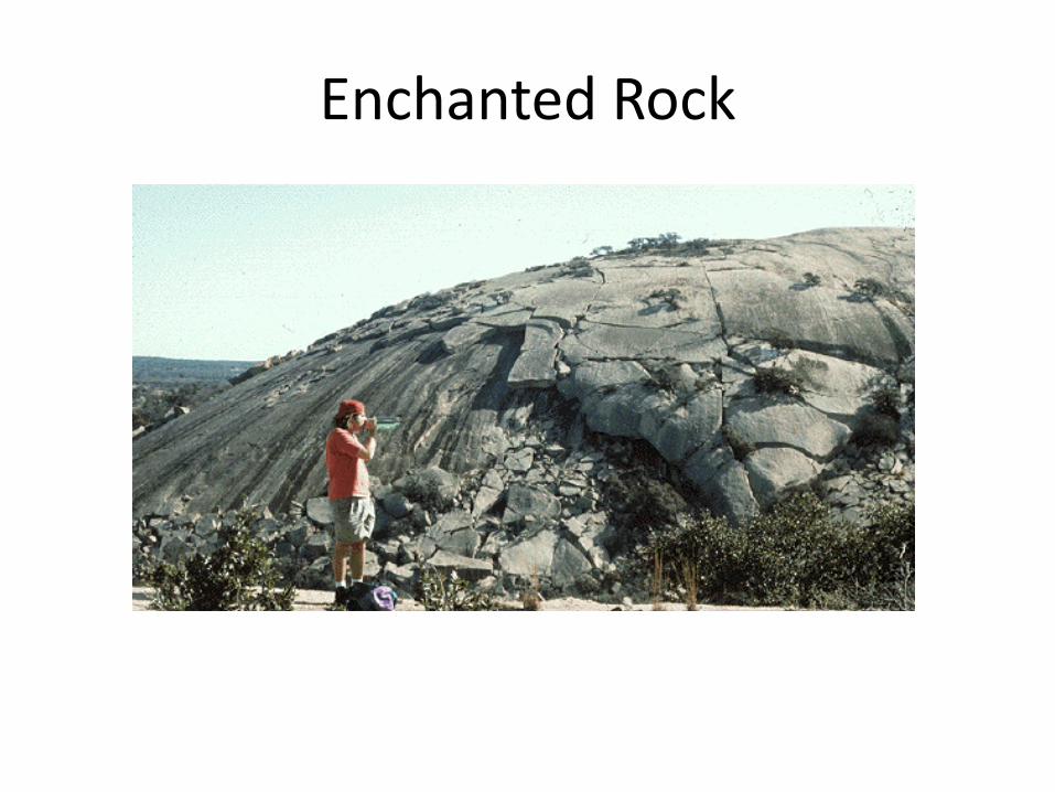
Enchanted Rock

Mechanical Weathering
4. Thermal Expansion/Contraction – repeated, daily heating (expansion) and cooling (contraction) of rock causes stress along natural boundaries in the rock
Mechanical Weathering
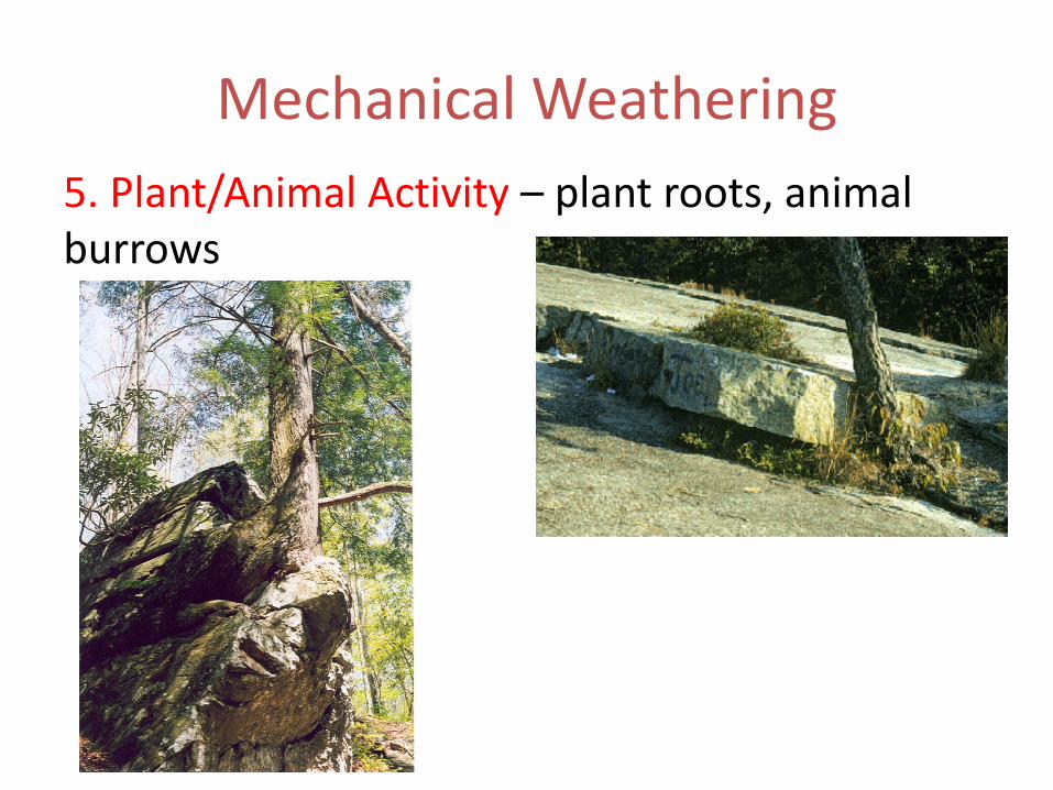
5. Plant/Animal Activity – plant roots, animal burrows
Mechanical Weathering
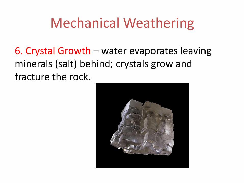
6. Crystal Growth – water evaporates leaving minerals (salt) behind; crystals grow and fracture the rock.
Chemical Weathering
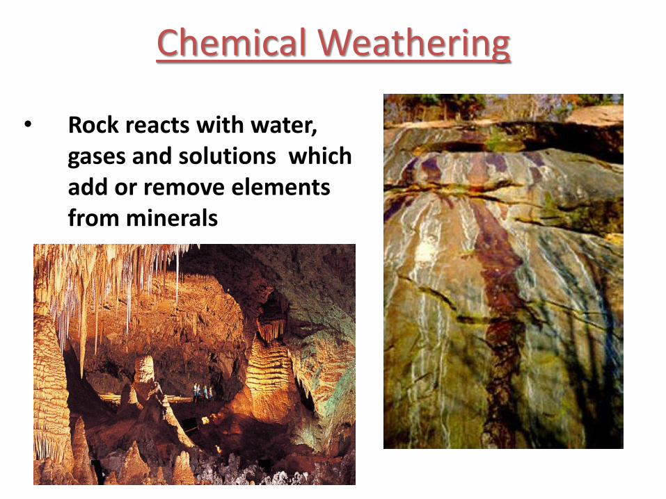
• Rock reacts with water, gases and solutions which add or remove elements from minerals
Chemical Weathering
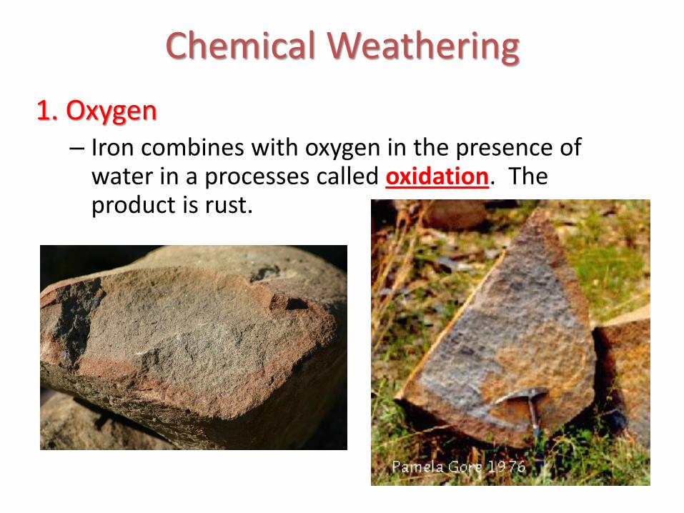
1. Oxygen– Iron combines with oxygen in the presence of
water in a processes called oxidation. The product is rust.
Chemical Weathering
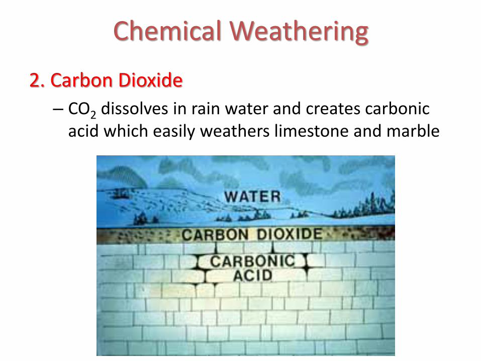
2. Carbon Dioxide
– CO2 dissolves in rain water and creates carbonic acid which easily weathers limestone and marble
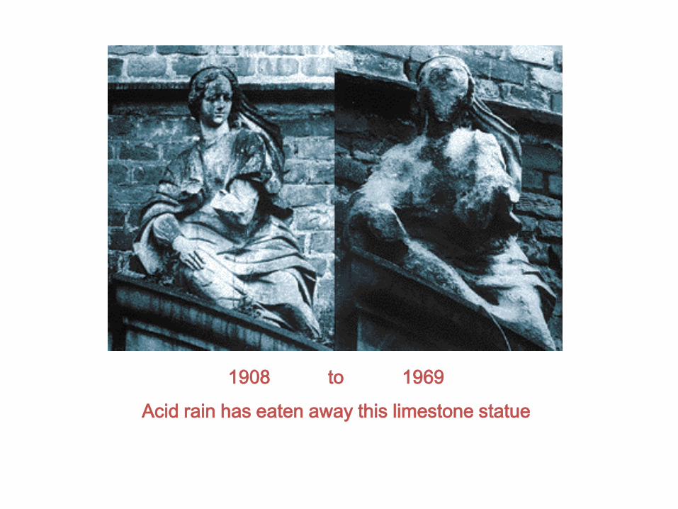
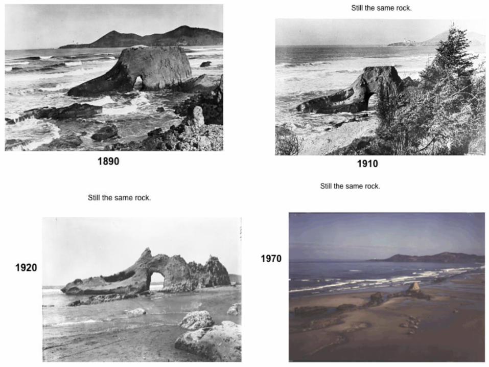
1908 to 1969
Acid rain has eaten away this limestone statue

Chemical Weathering3. Biological Activity
– Lichen that grow on rocks produce weak acids that chemically weather rock
Weathering and Erosion
Weathering - processes at or near Earth’s surface that cause rocks and minerals to break down
Erosion - process of removing Earth materials from their original sites through weathering and transport to another place.
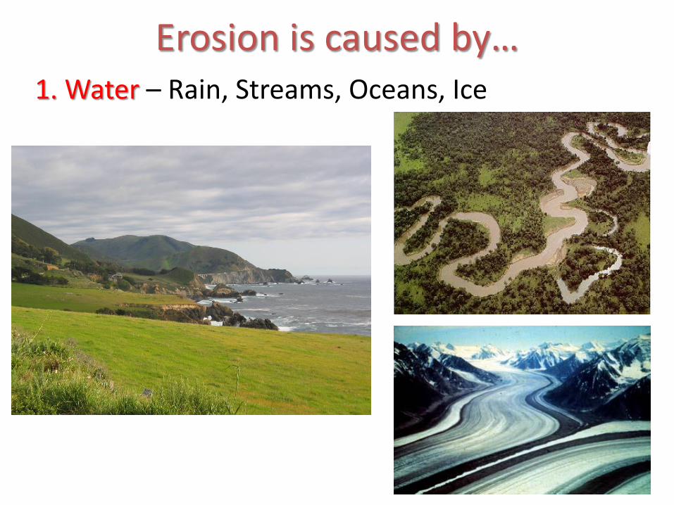
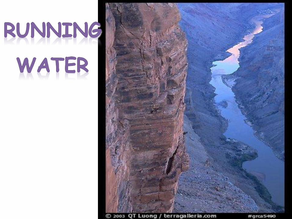
Erosion is caused by…1. Water – Rain, Streams, Oceans, Ice
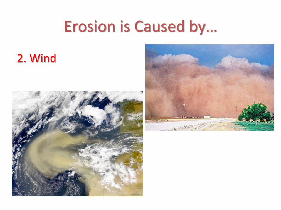
Erosion is Caused by…
2. Wind
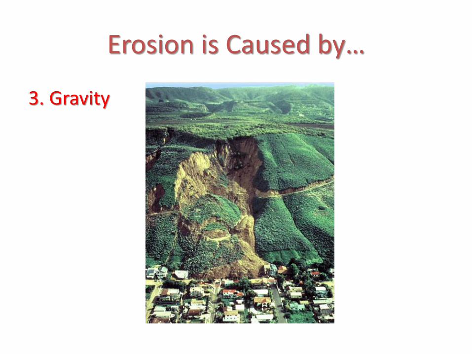
Erosion is Caused by…
3. Gravity
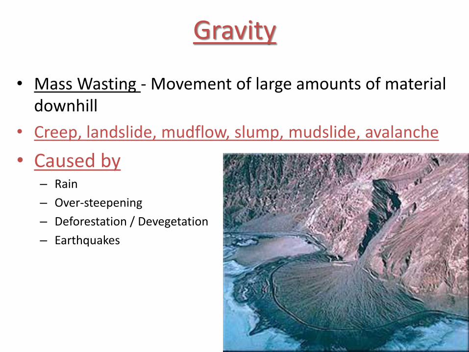
Gravity
• Mass Wasting - Movement of large amounts of material downhill
• Creep, landslide, mudflow, slump, mudslide, avalanche
• Caused by– Rain
– Over-steepening
– Deforestation / Devegetation
– Earthquakes
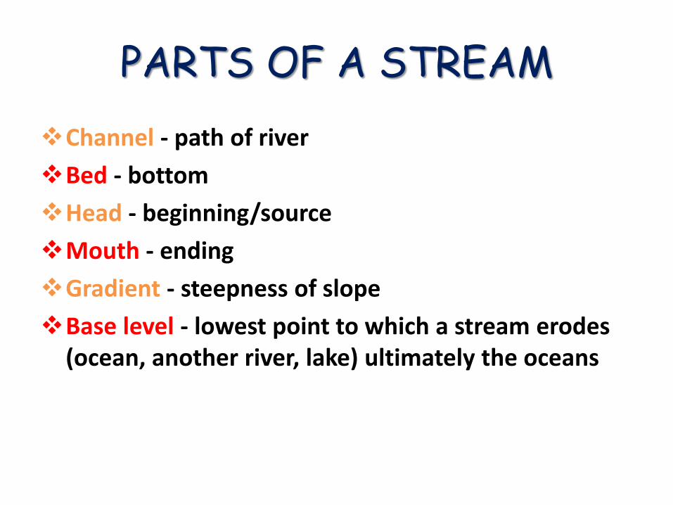
PARTS OF A STREAM
Channel - path of river
Bed - bottom
Head - beginning/source
Mouth - ending
Gradient - steepness of slope
Base level - lowest point to which a stream erodes (ocean, another river, lake) ultimately the oceans
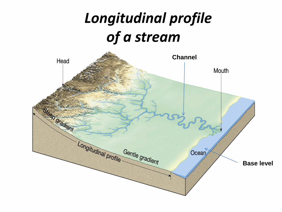
Longitudinal profile of a stream
Channel
Base level
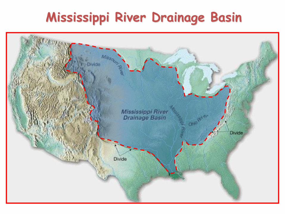
Mississippi River Drainage Basin
A drainage basin is the land area that contributes water to a stream.
A divide is an imaginary line that separates the drainage basins of one stream from another.
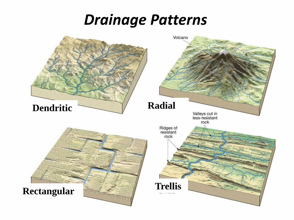
Drainage Patterns
Dendritic Radial
TrellisRectangular

What streams do…
• Erode
• Transport Material
• Dissolved load
• Suspended load
• Bed load
• Deposit
Fig. 10.37a
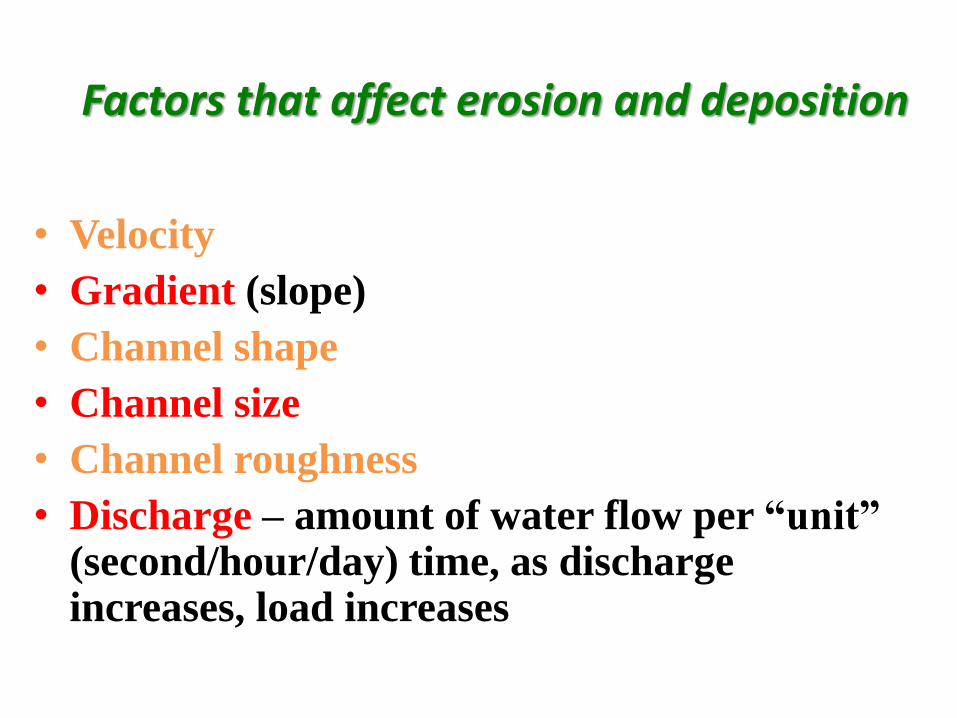
Factors that affect erosion and deposition
• Velocity
• Gradient (slope)
• Channel shape
• Channel size
• Channel roughness
• Discharge – amount of water flow per “unit” (second/hour/day) time, as discharge increases, load increases
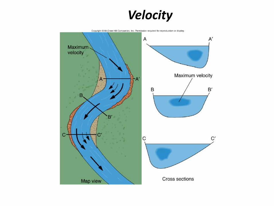
Velocity
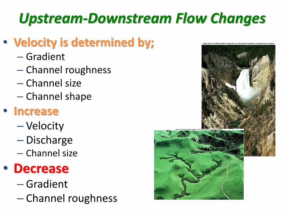
Upstream-Downstream Flow Changes
• Velocity is determined by;– Gradient– Channel roughness– Channel size– Channel shape
• Increase– Velocity– Discharge– Channel size
• Decrease– Gradient– Channel roughness
Fig. 10.37d
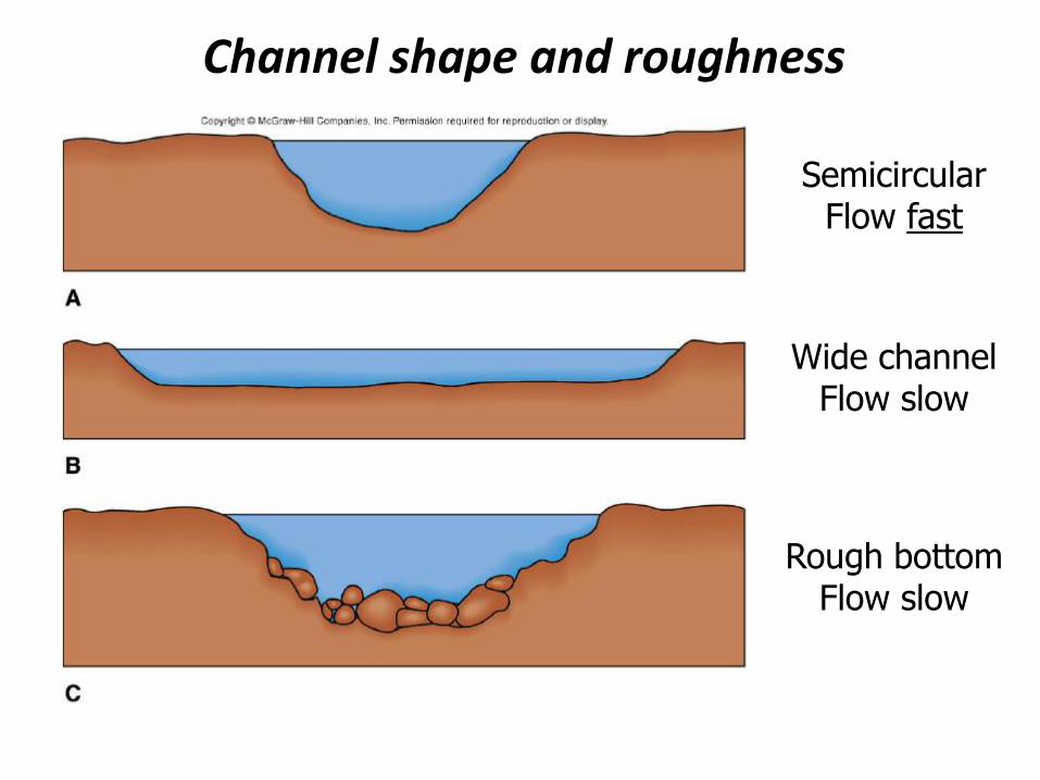
Channel shape and roughness
SemicircularFlow fast
Wide channelFlow slow
Rough bottomFlow slow
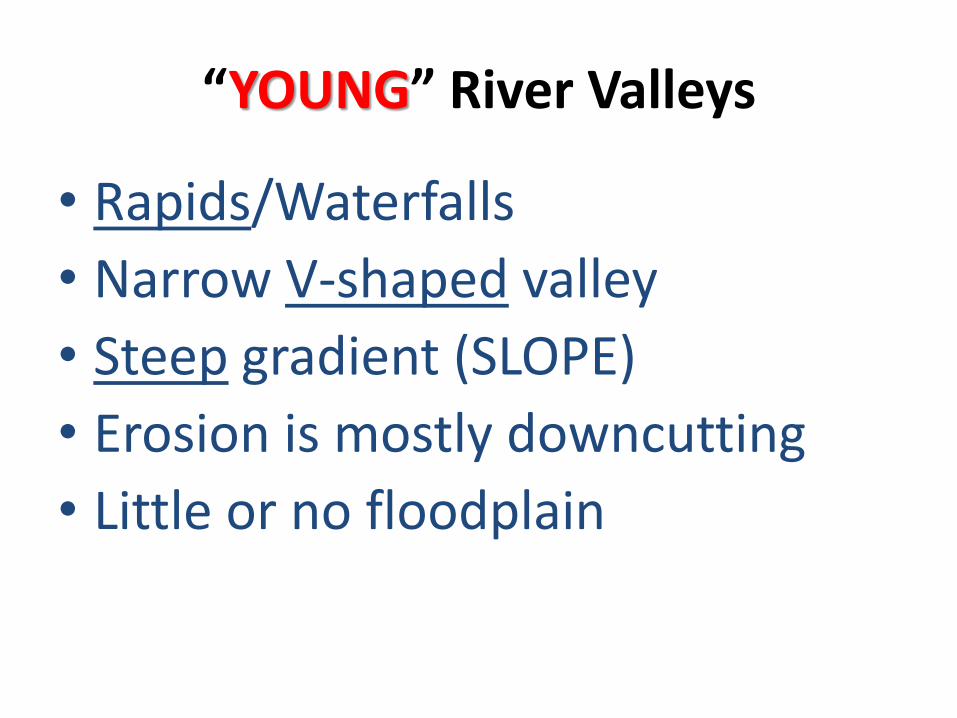
“YOUNG” River Valleys
• Rapids/Waterfalls
• Narrow V-shaped valley
• Steep gradient (SLOPE)
• Erosion is mostly downcutting
• Little or no floodplain

A narrow V-shaped valley

The Yellowstone River in Wyoming
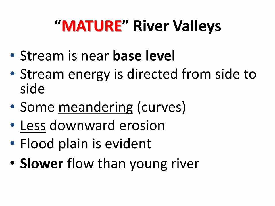
“MATURE” River Valleys
• Stream is near base level • Stream energy is directed from side to
side • Some meandering (curves)• Less downward erosion• Flood plain is evident
• Slower flow than young river
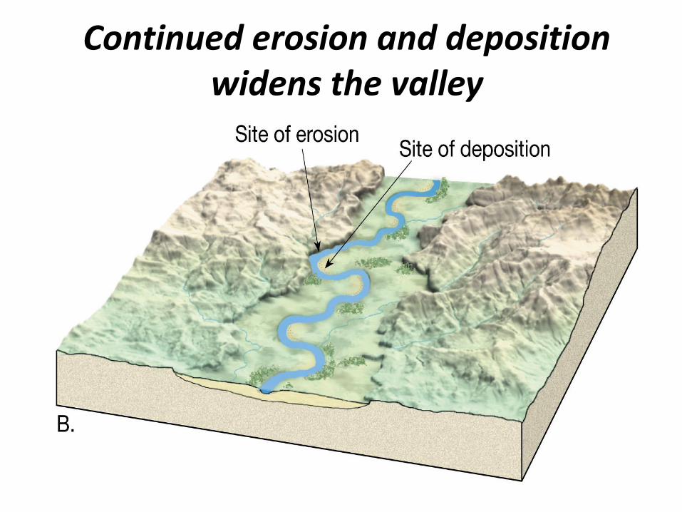
Continued erosion and deposition widens the valley
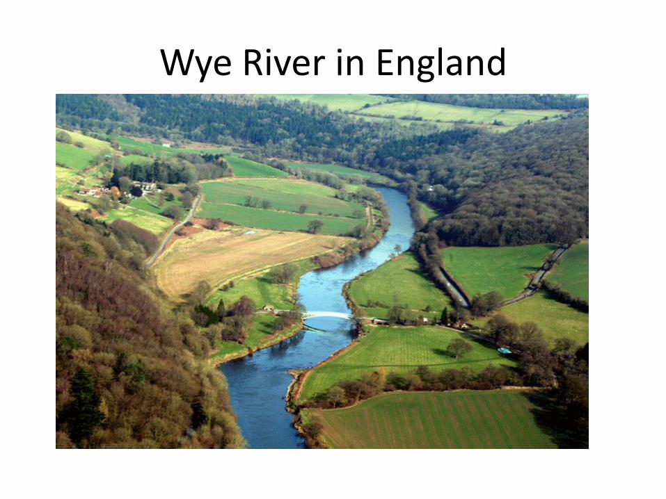
Wye River in England

“OLD” River Valleys
• Close to base level
• Slowest velocity & widest channel
• Low gradient (slope)
• Meanders well-developed
• Wide flood plain
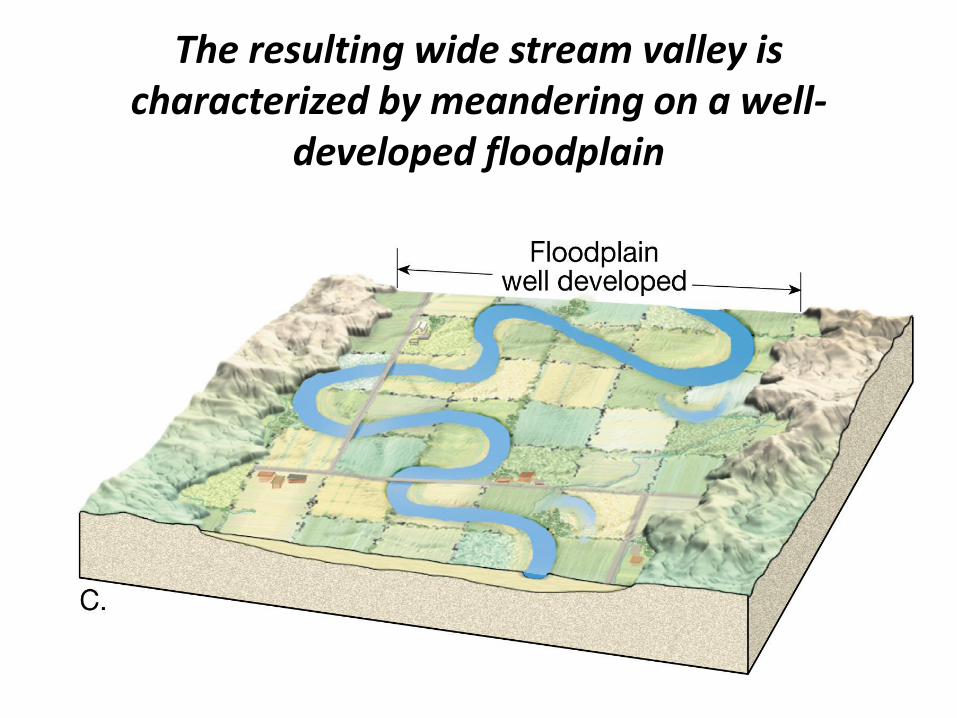
The resulting wide stream valley is characterized by meandering on a well-
developed floodplain
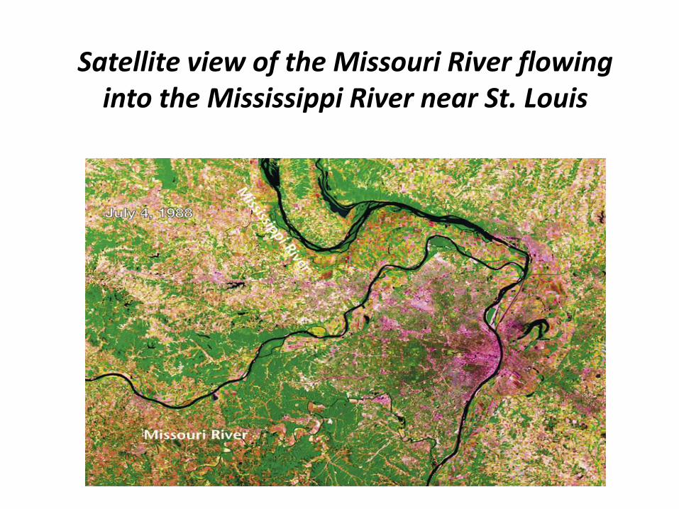
Satellite view of the Missouri River flowing into the Mississippi River near St. Louis
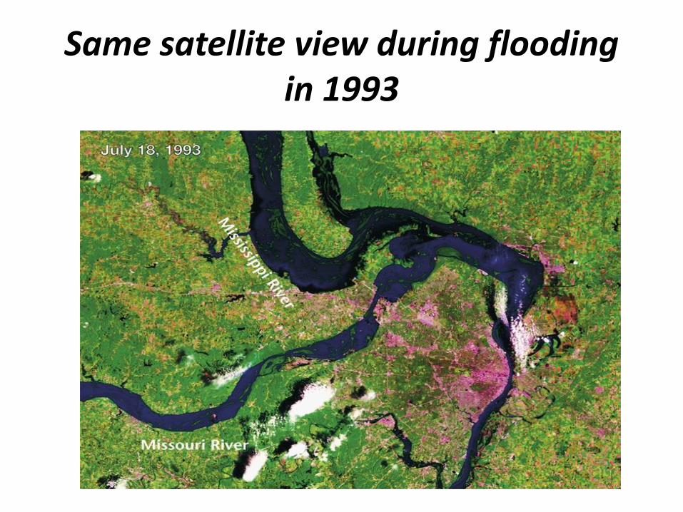
Same satellite view during flooding in 1993
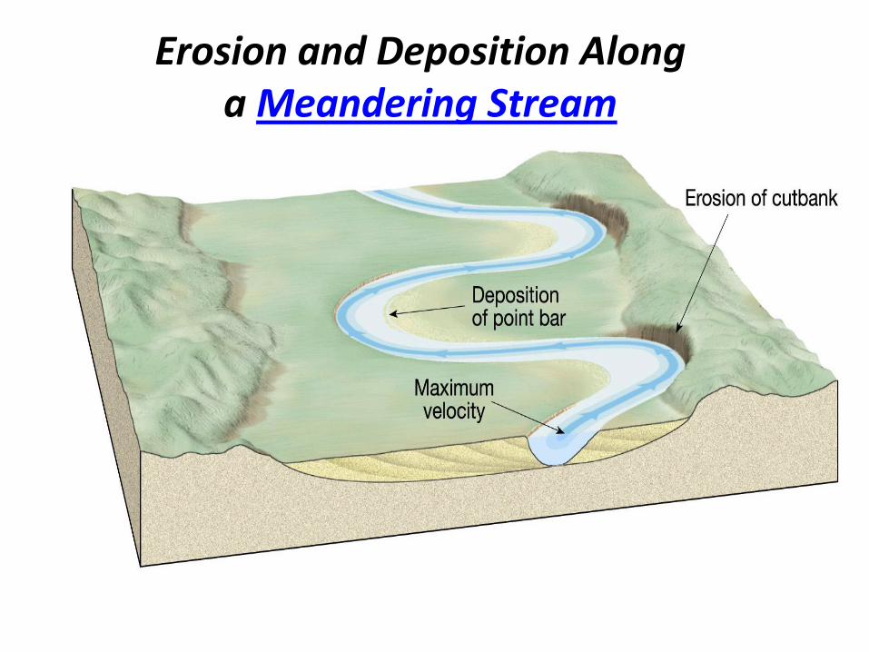
Erosion and Deposition Along a Meandering Stream
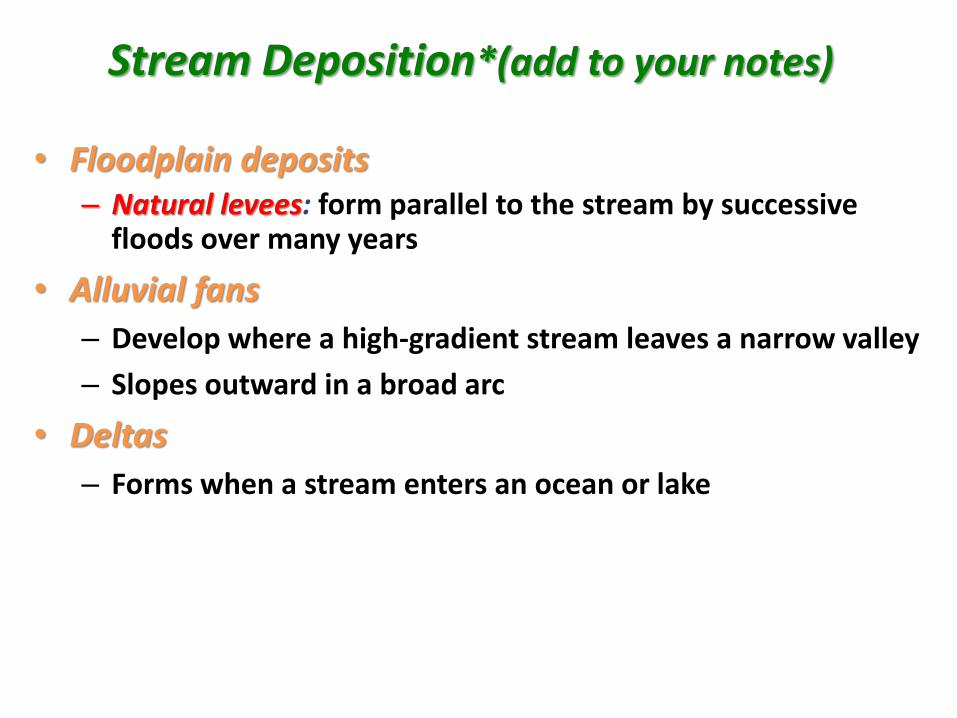
Stream Deposition*(add to your notes)
• Floodplain deposits– Natural levees: form parallel to the stream by successive
floods over many years
• Alluvial fans
– Develop where a high-gradient stream leaves a narrow valley
– Slopes outward in a broad arc
• Deltas
– Forms when a stream enters an ocean or lake
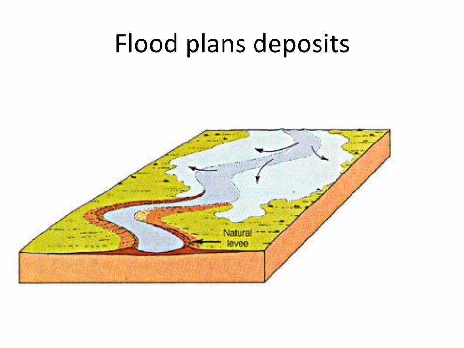
Flood plans deposits
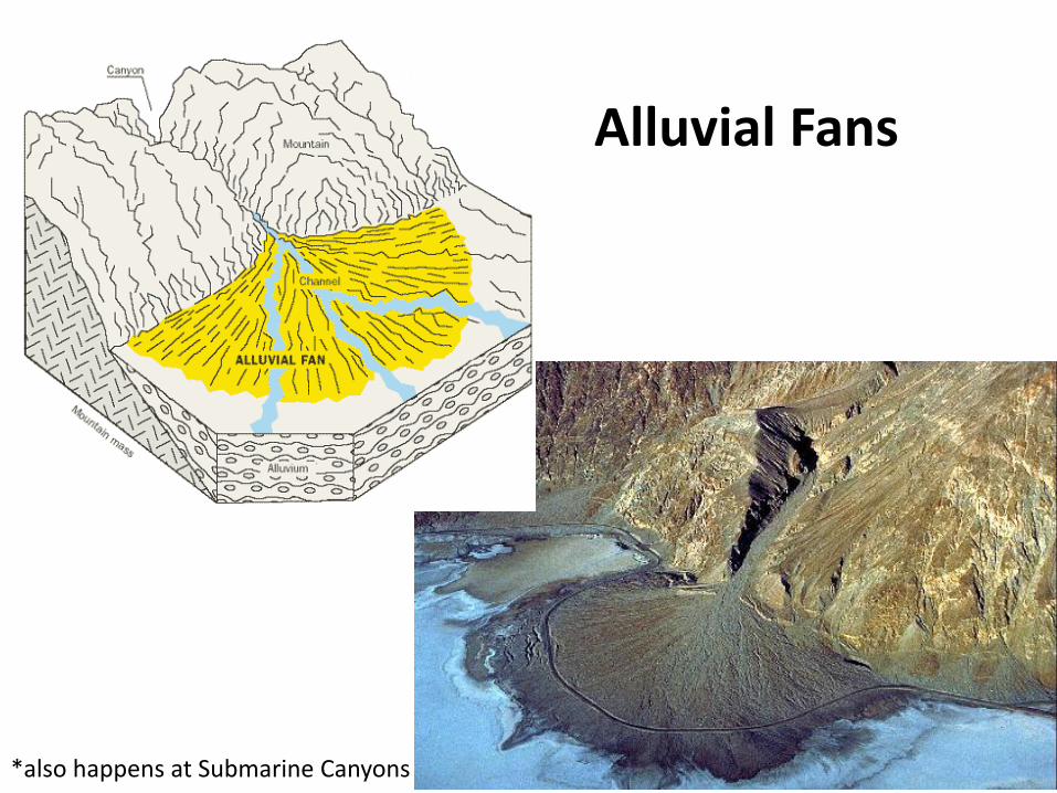
Alluvial Fans
*also happens at Submarine Canyons

River delta--- “bird’s foot” delta
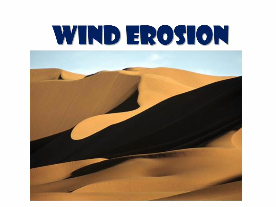
Wind Erosion
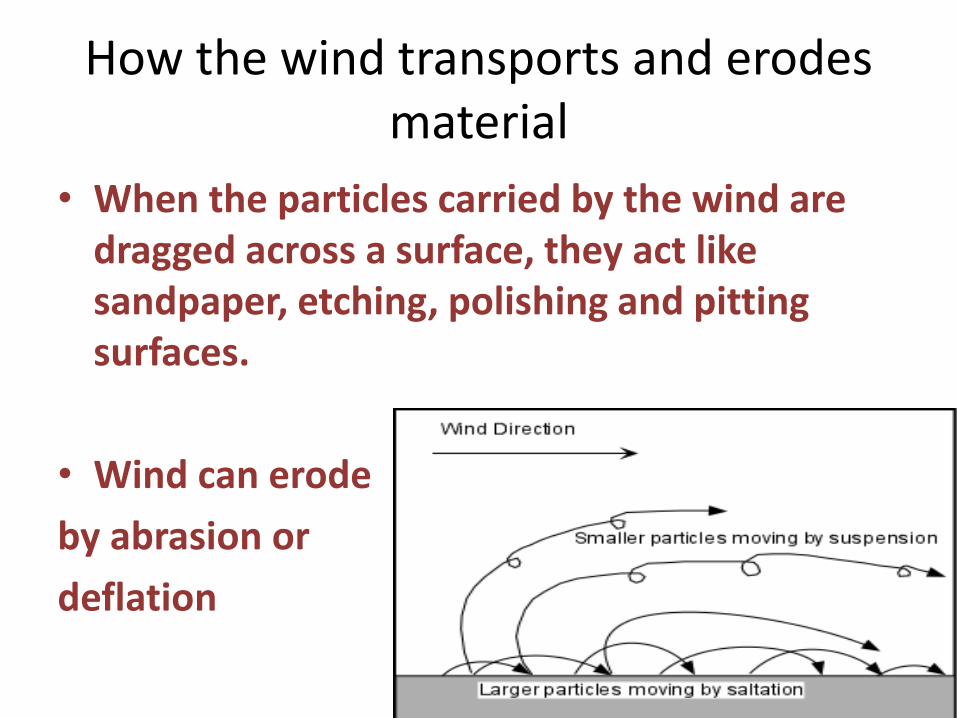
How the wind transports and erodes material
• When the particles carried by the wind are dragged across a surface, they act like sandpaper, etching, polishing and pitting surfaces.
• Wind can erode
by abrasion or
deflation
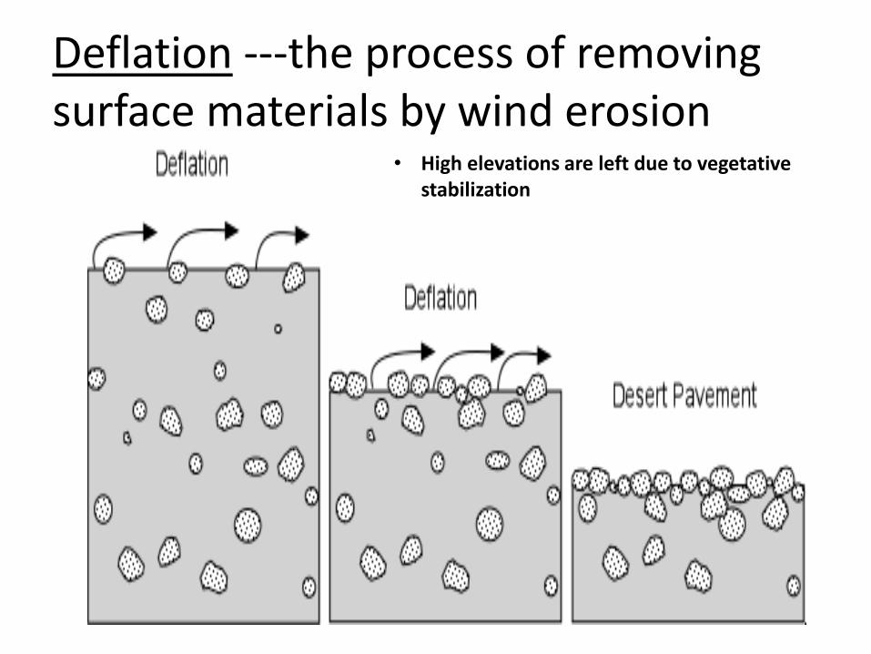
Deflation ---the process of removing surface materials by wind erosion
• High elevations are left due to vegetative stabilization
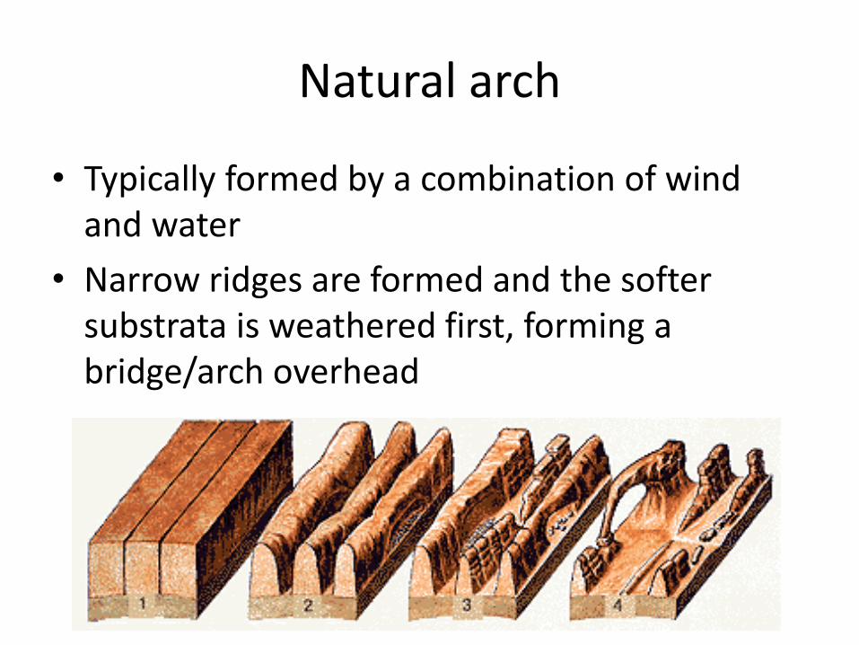
Natural arch
• Typically formed by a combination of wind and water
• Narrow ridges are formed and the softer substrata is weathered first, forming a bridge/arch overhead

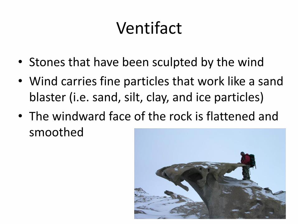
Ventifact
• Stones that have been sculpted by the wind
• Wind carries fine particles that work like a sand blaster (i.e. sand, silt, clay, and ice particles)
• The windward face of the rock is flattened and smoothed
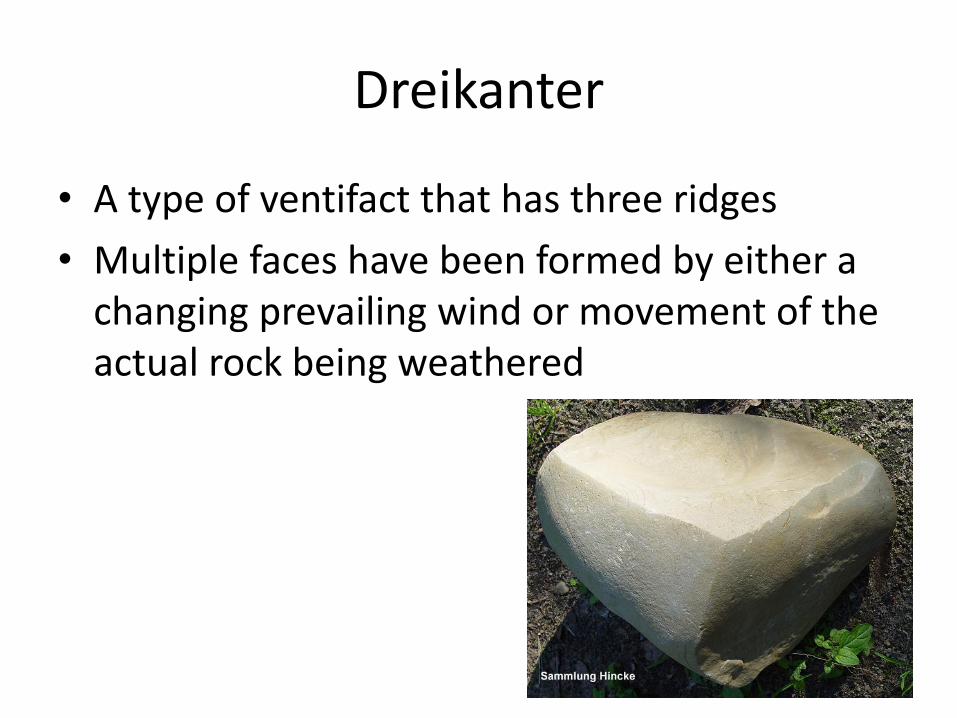
• A type of ventifact that has three ridges
• Multiple faces have been formed by either a changing prevailing wind or movement of the actual rock being weathered
Dreikanter
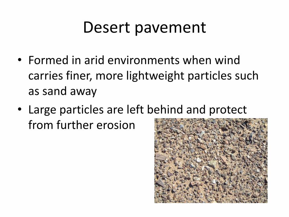
Desert pavement
• Formed in arid environments when wind carries finer, more lightweight particles such as sand away
• Large particles are left behind and protect from further erosion
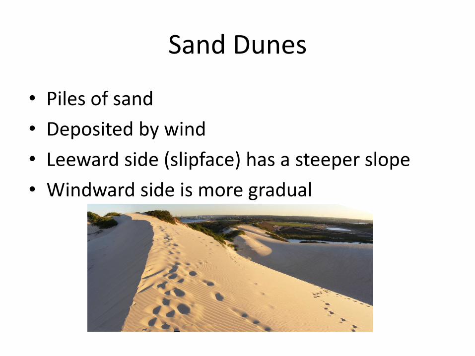
Sand Dunes
• Piles of sand
• Deposited by wind
• Leeward side (slipface) has a steeper slope
• Windward side is more gradual
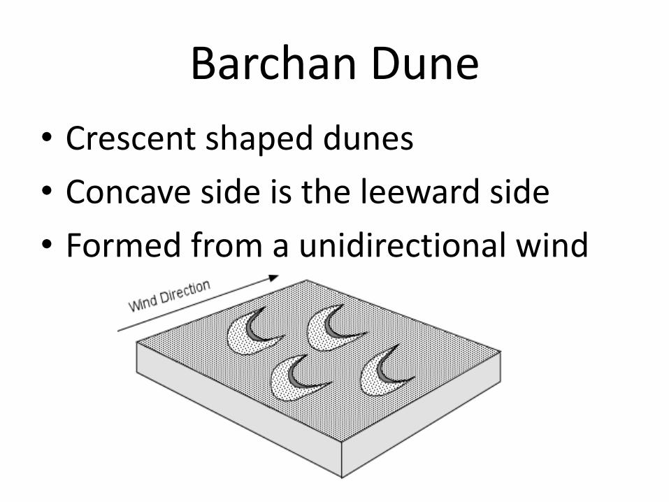
Barchan Dune
• Crescent shaped dunes
• Concave side is the leeward side
• Formed from a unidirectional wind

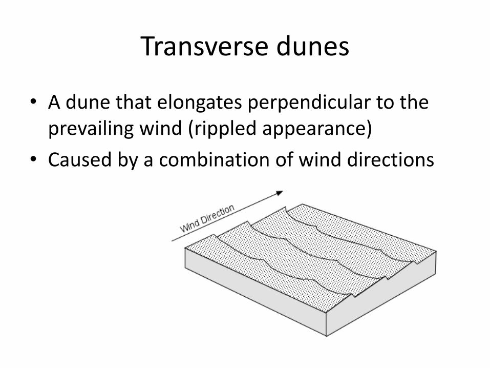
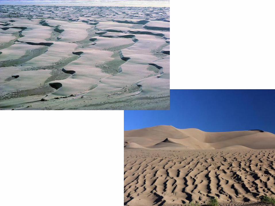
Transverse dunes
• A dune that elongates perpendicular to the prevailing wind (rippled appearance)
• Caused by a combination of wind directions
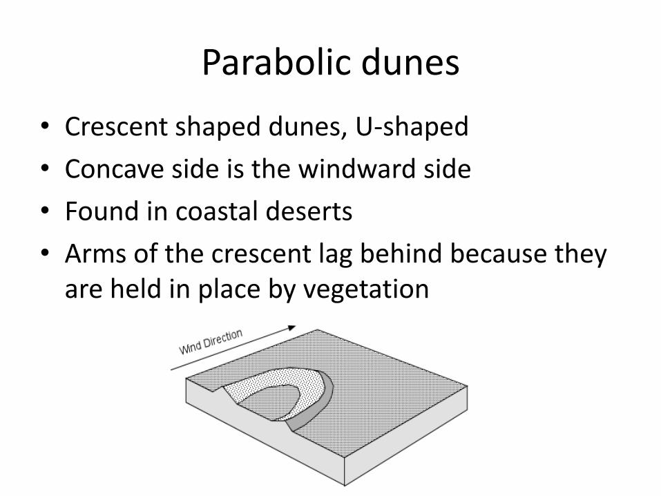
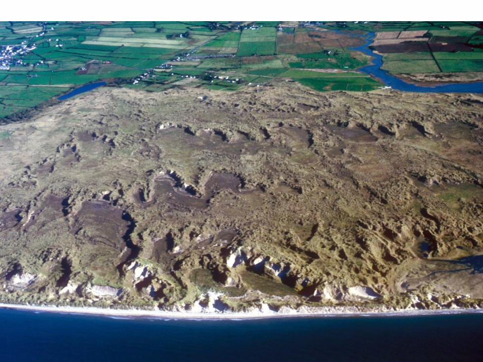
Parabolic dunes
• Crescent shaped dunes, U-shaped
• Concave side is the windward side
• Found in coastal deserts
• Arms of the crescent lag behind because they are held in place by vegetation
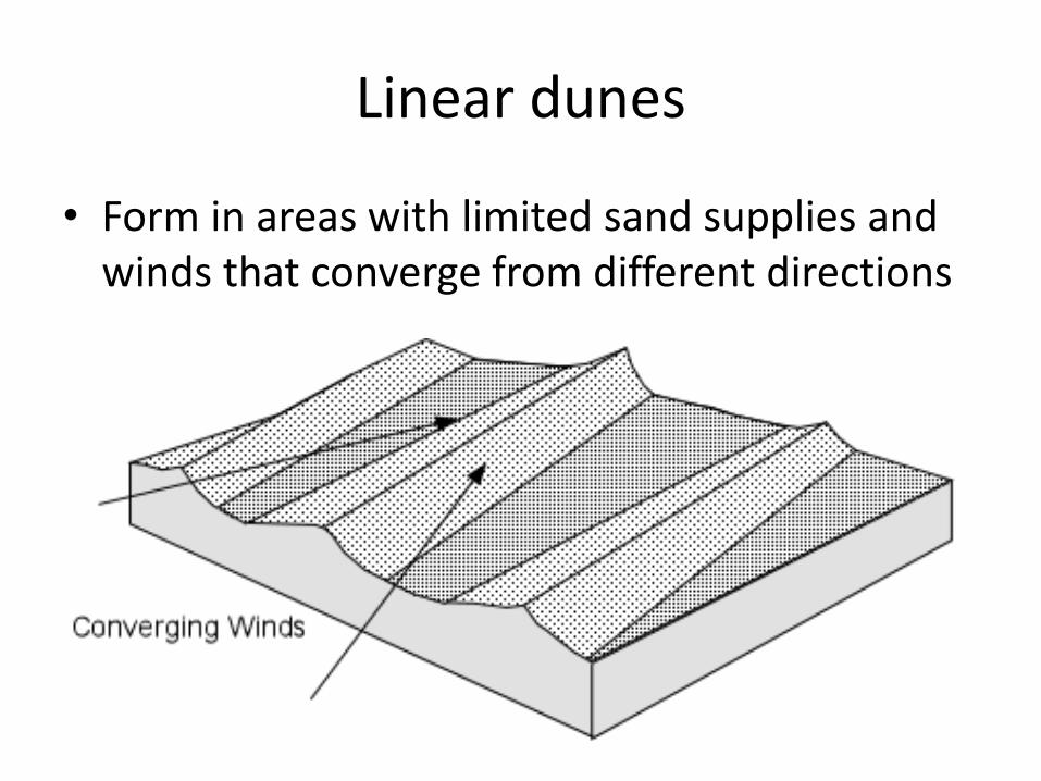
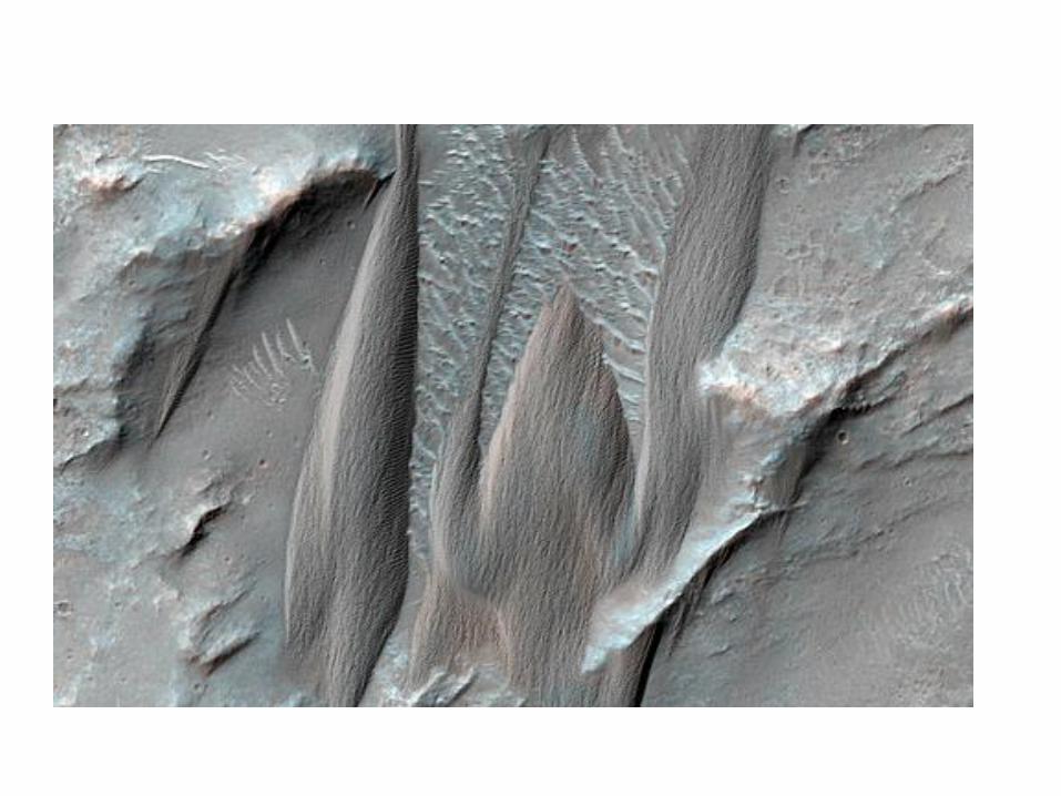
Linear dunes
• Form in areas with limited sand supplies and winds that converge from different directions
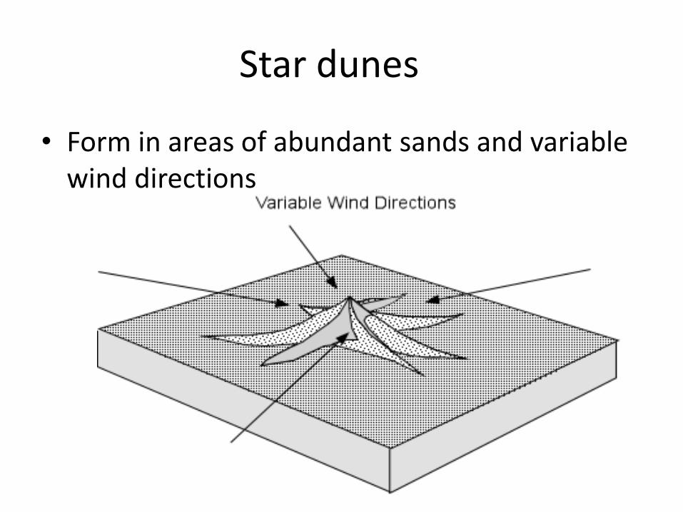
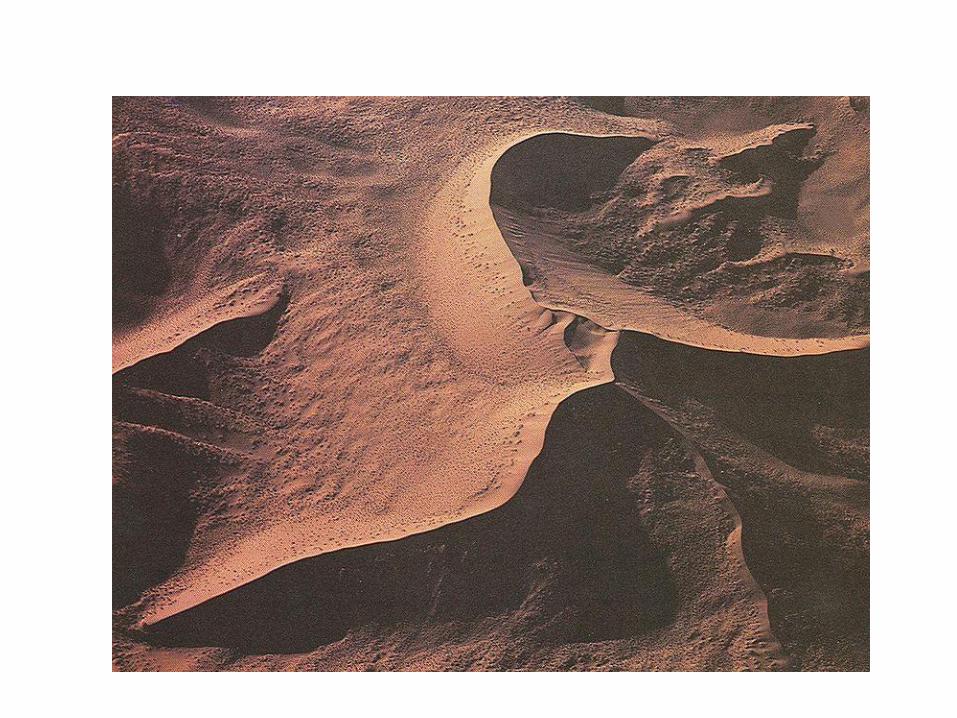
Star dunes
• Form in areas of abundant sands and variable wind directions
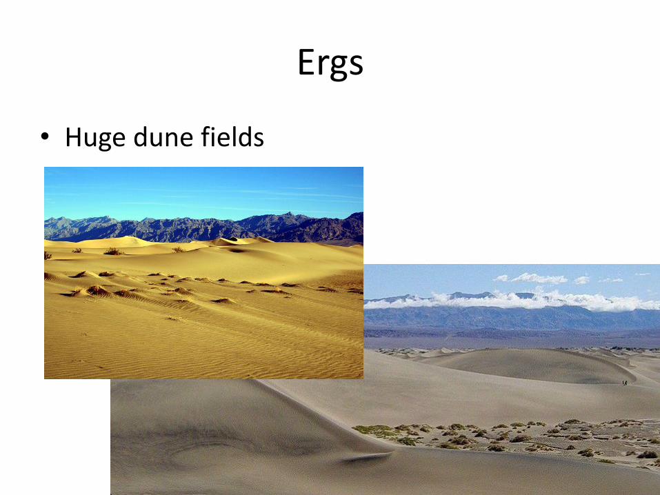
Ergs
• Huge dune fields
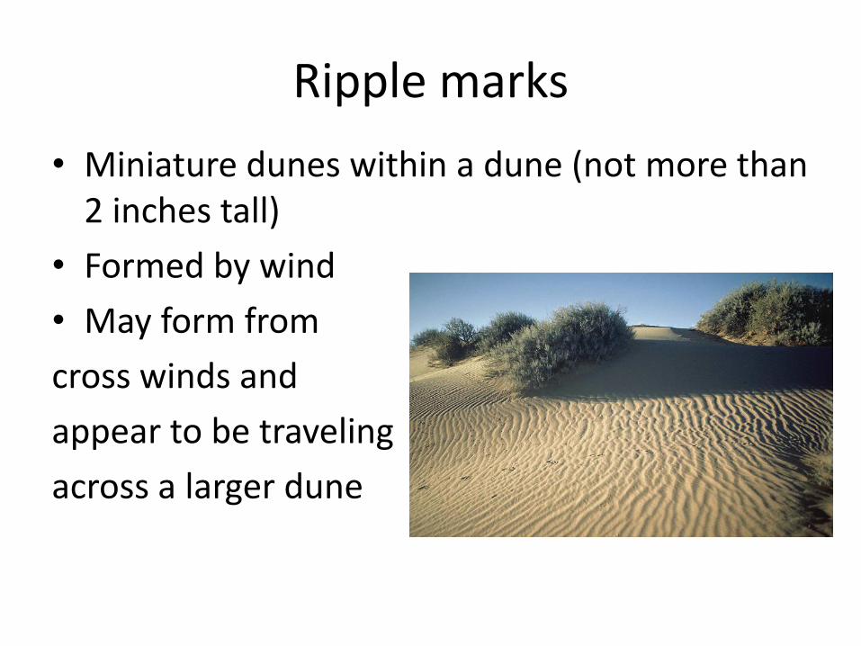
Ripple marks
• Miniature dunes within a dune (not more than 2 inches tall)
• Formed by wind
• May form from
cross winds and
appear to be traveling
across a larger dune
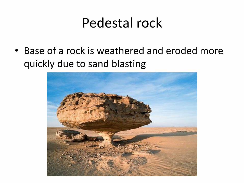
Pedestal rock
• Base of a rock is weathered and eroded more quickly due to sand blasting
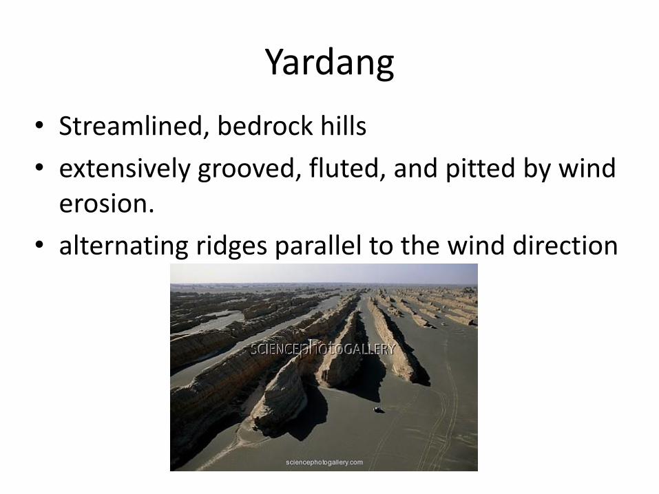
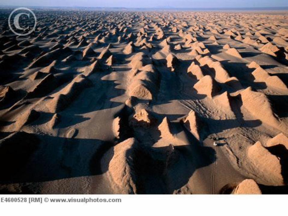
Yardang
• Streamlined, bedrock hills
• extensively grooved, fluted, and pitted by wind erosion.
• alternating ridges parallel to the wind direction
GlacierNotes
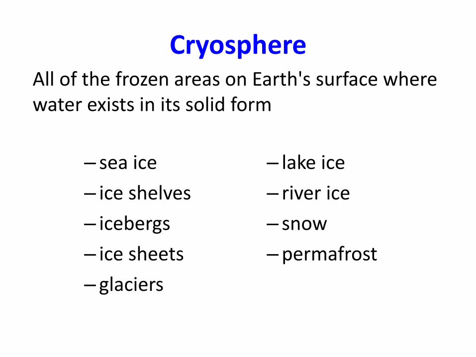
Cryosphere
– sea ice
– ice shelves
– icebergs
– ice sheets
– glaciers
– lake ice
– river ice
– snow
–permafrost
All of the frozen areas on Earth's surface where water exists in its solid form
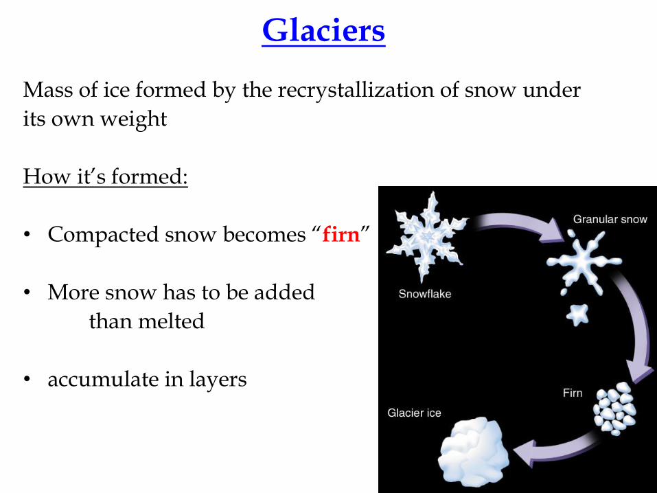
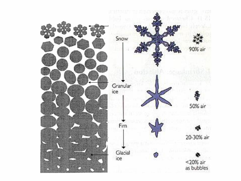
Glaciers
Mass of ice formed by the recrystallization of snow under
its own weight
How it’s formed:
• Compacted snow becomes “firn”
• More snow has to be added
than melted
• accumulate in layers
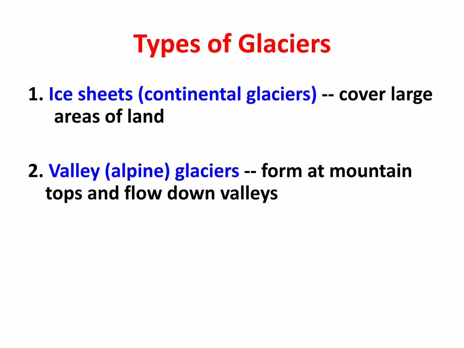
Types of Glaciers
1. Ice sheets (continental glaciers) -- cover large areas of land
2. Valley (alpine) glaciers -- form at mountain tops and flow down valleys
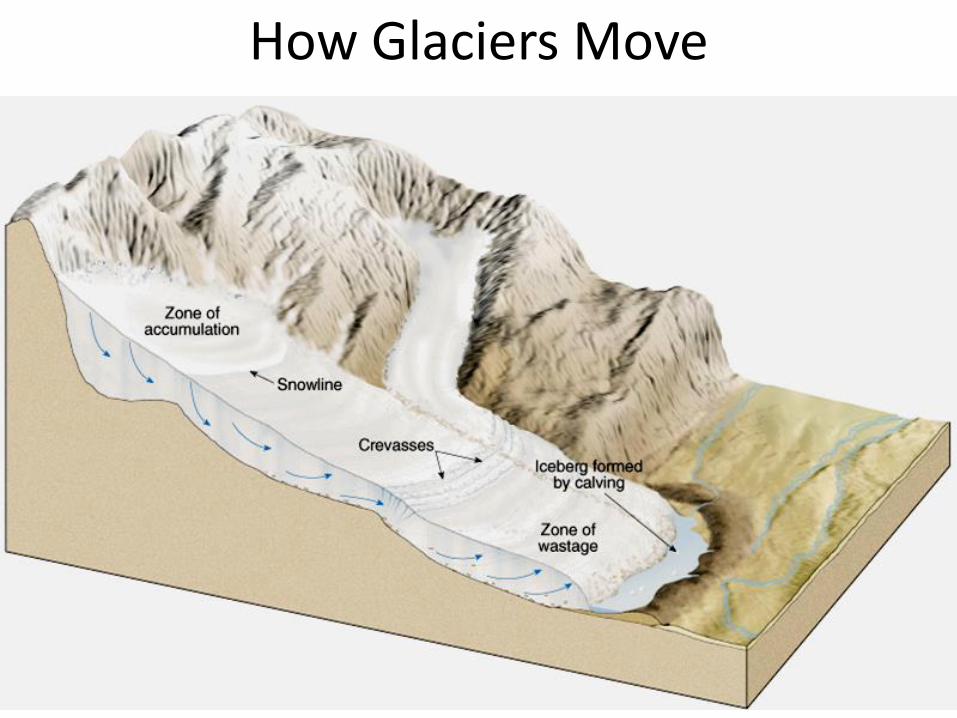
How Glaciers Move
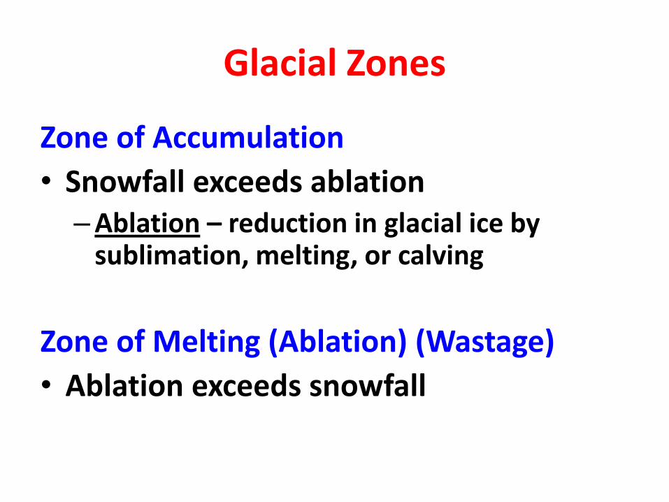
Glacial Zones
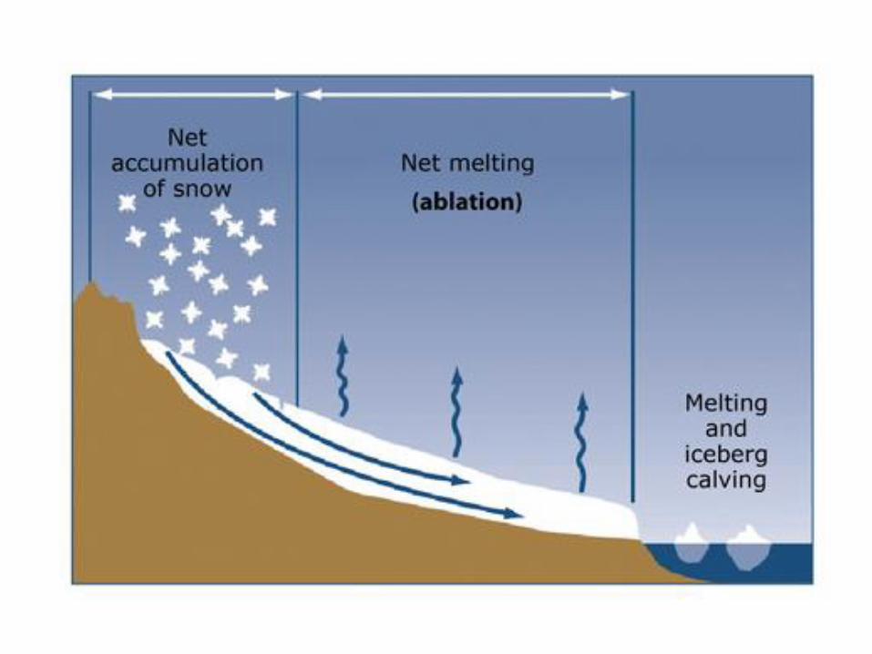
Zone of Accumulation
• Snowfall exceeds ablation–Ablation – reduction in glacial ice by
sublimation, melting, or calving
Zone of Melting (Ablation) (Wastage)
• Ablation exceeds snowfall
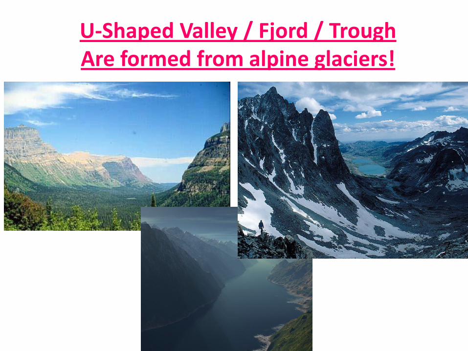
U-Shaped Valley / Fjord / TroughAre formed from alpine glaciers!
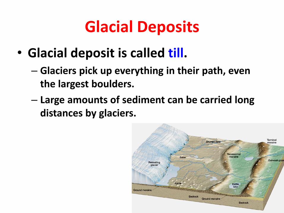
Glacial Deposits
• Glacial deposit is called till.– Glaciers pick up everything in their path, even
the largest boulders.
– Large amounts of sediment can be carried long distances by glaciers.
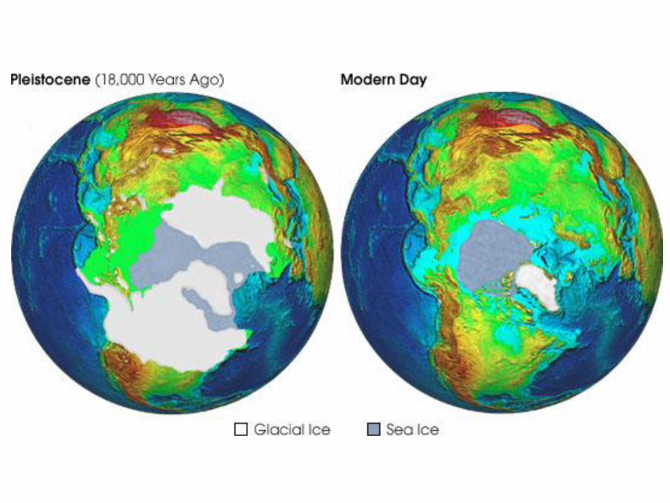
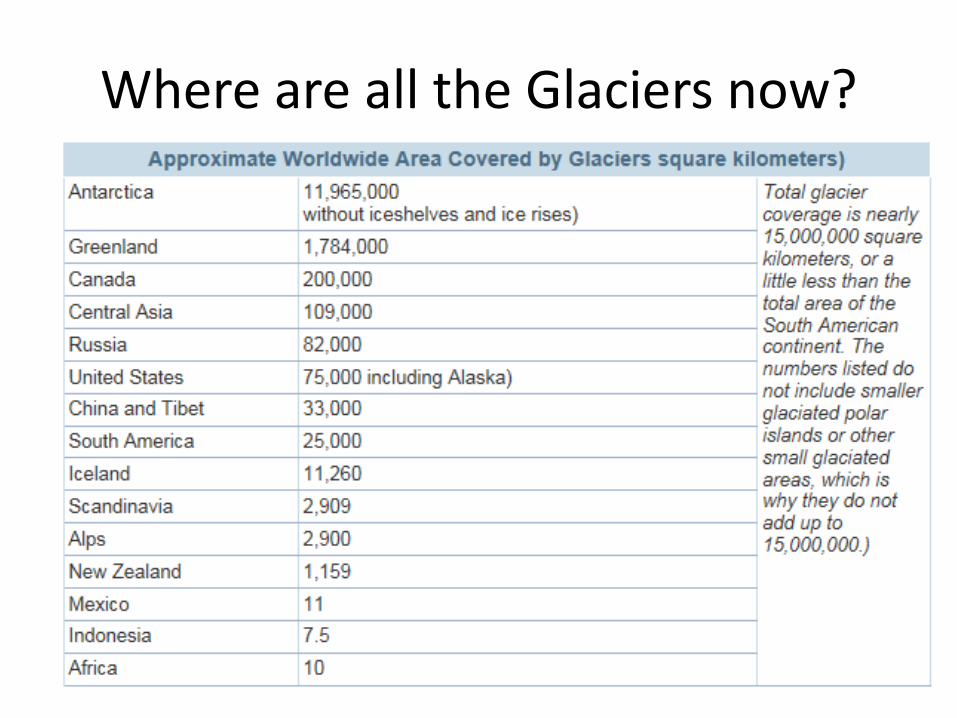
Where are all the Glaciers now?