
Watch/Warning Philosophy and Coordination and TC Messaging
23
Watch/Warning Philosophy and Coordination and TC Messaging Michael Brennan and Dan Brown NHC 29 April 2021
Transcript of Watch/Warning Philosophy and Coordination and TC Messaging
Watch/Warning Philosophy and Coordination and TC Messaging
Michael Brennan and Dan Brown
NHC
29 April 2021
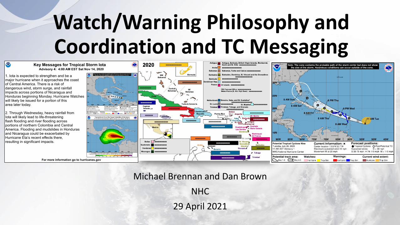
Where Would You Issue the Warning?
• Hurricane forecast to reach the coast of Nicaragua in 48-60 h
• 34-kt winds arrive on the coast in about 36 h
• Where would you issue a Hurricane Warning?
34-kt wind radii64-kt wind radii
4836
60
24

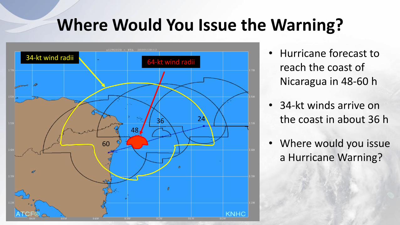
Where Would You Issue the Warning?
• Hurricane forecast to reach the coast of Nicaragua in 48-60 h
• 34-kt winds arrive on the coast in about 36 h
• Where would you issue a hurricane warning?
64-kt wind radii
4836
60
24
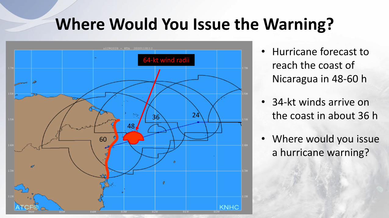
Where Would You Issue the Warning?
• Hurricane forecast to reach the coast of Nicaragua in 48-60 h
• 34-kt winds arrive on the coast in about 36 h
• Where would you issue a hurricane warning?
64-kt wind radii
4836
60
24
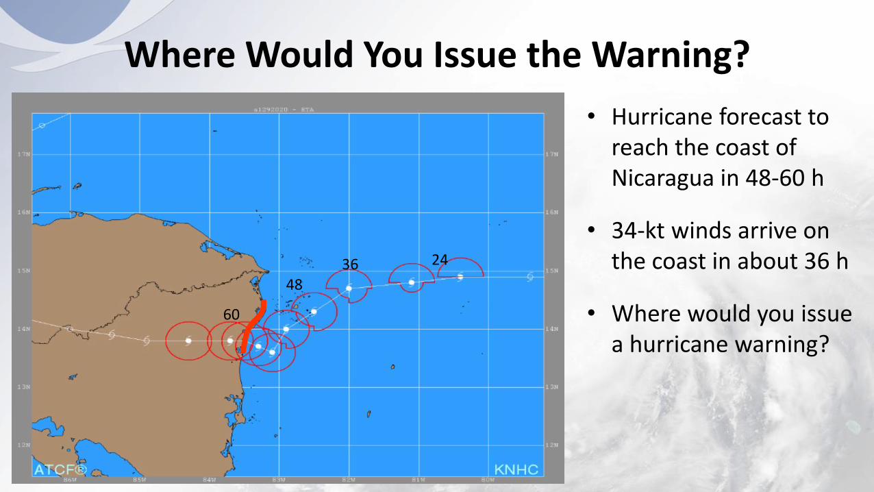
Where Would You Issue the Warning?
• Hurricane forecast to reach the coast of Nicaragua in 48-60 h
• 34-kt winds arrive on the coast in about 36 h
• Where would you issue a hurricane warning?
4836
60
24

Where Would You Issue the Warning?
• Hurricane forecast to reach the coast of Nicaragua in 48-60 h
• 34-kt winds arrive on the coast in about 36 h
• Where would you issue a hurricane warning?
4836
60
24
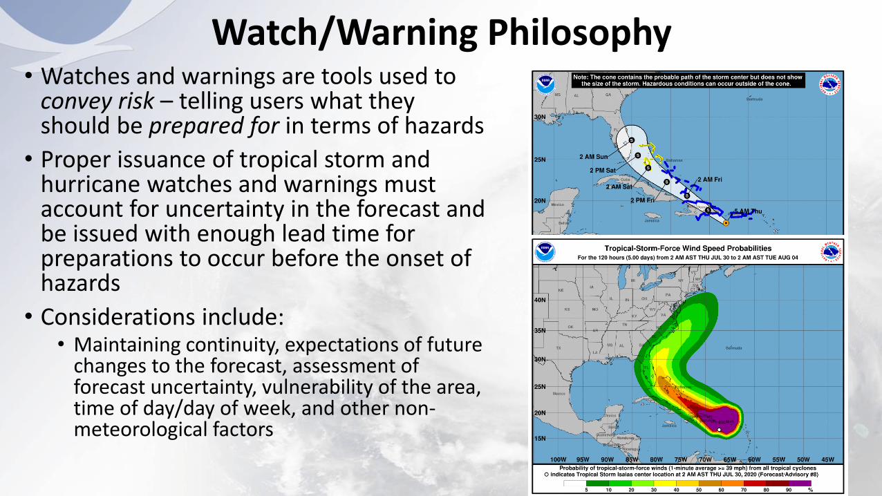
Watch/Warning Philosophy• Watches and warnings are tools used to
convey risk – telling users what they should be prepared for in terms of hazards
• Proper issuance of tropical storm and hurricane watches and warnings must account for uncertainty in the forecast and be issued with enough lead time for preparations to occur before the onset of hazards
• Considerations include:• Maintaining continuity, expectations of future
changes to the forecast, assessment of forecast uncertainty, vulnerability of the area, time of day/day of week, and other non-meteorological factors
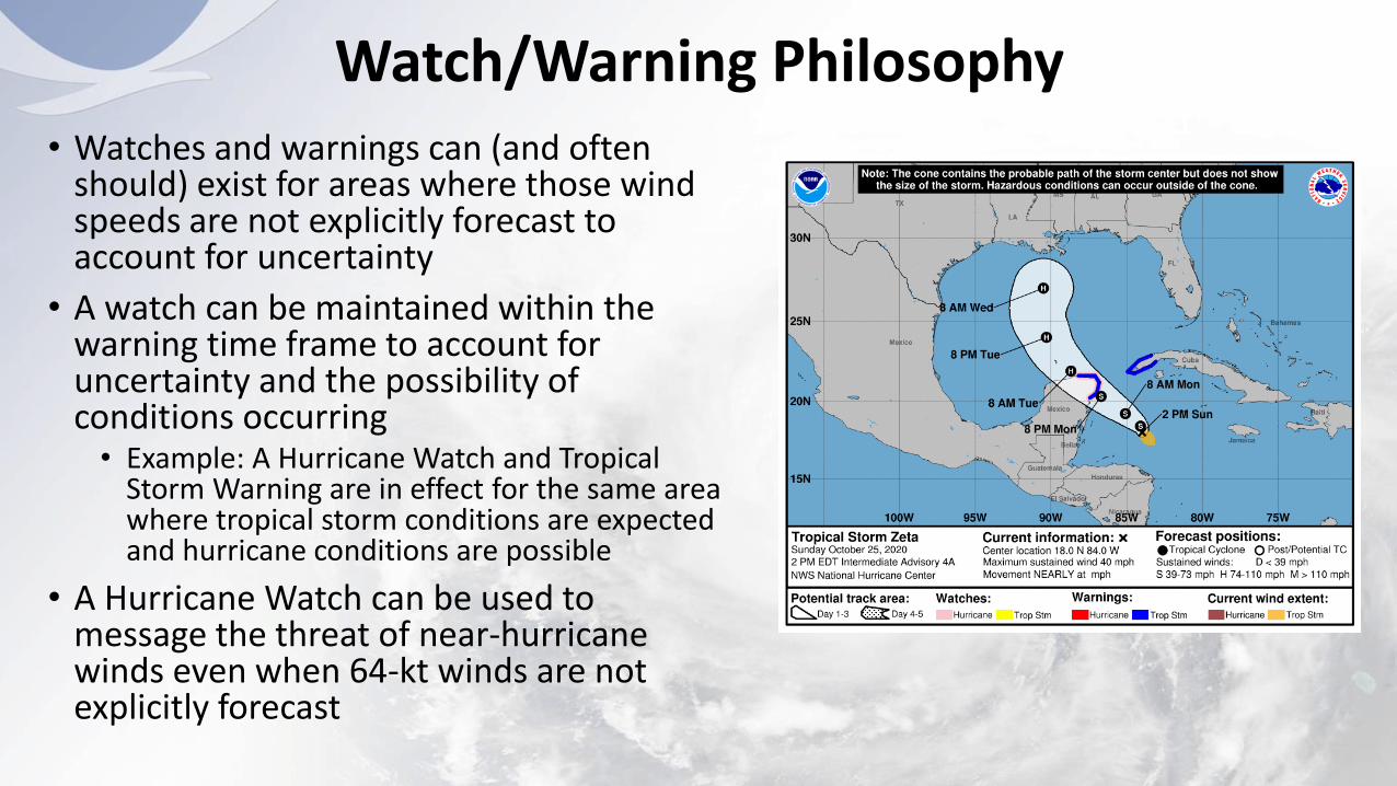
Watch/Warning Philosophy• Watches and warnings can (and often
should) exist for areas where those wind speeds are not explicitly forecast to account for uncertainty
• A watch can be maintained within the warning time frame to account for uncertainty and the possibility of conditions occurring• Example: A Hurricane Watch and Tropical
Storm Warning are in effect for the same area where tropical storm conditions are expected and hurricane conditions are possible
• A Hurricane Watch can be used to message the threat of near-hurricane winds even when 64-kt winds are not explicitly forecast
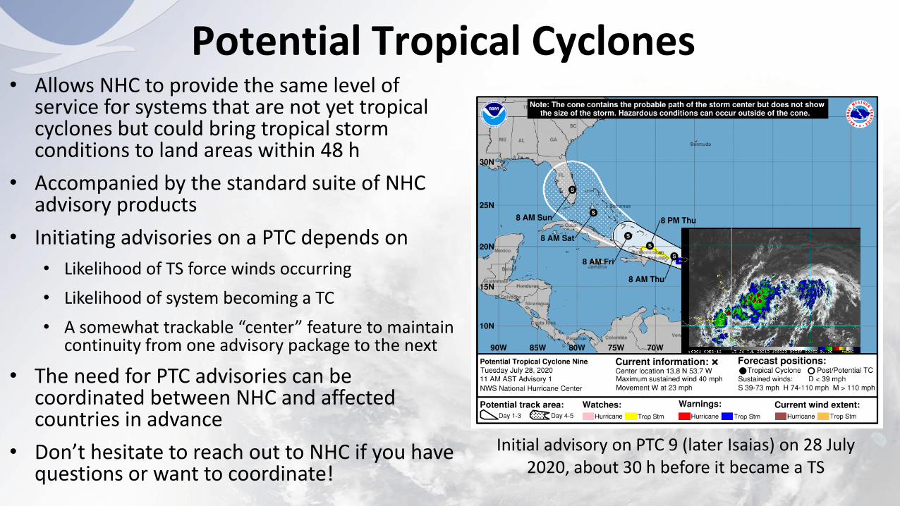
Potential Tropical Cyclones• Allows NHC to provide the same level of
service for systems that are not yet tropical cyclones but could bring tropical storm conditions to land areas within 48 h
• Accompanied by the standard suite of NHC advisory products
• Initiating advisories on a PTC depends on
• Likelihood of TS force winds occurring
• Likelihood of system becoming a TC
• A somewhat trackable “center” feature to maintain continuity from one advisory package to the next
• The need for PTC advisories can be coordinated between NHC and affected countries in advance
• Don’t hesitate to reach out to NHC if you have questions or want to coordinate!
Initial advisory on PTC 9 (later Isaias) on 28 July 2020, about 30 h before it became a TS
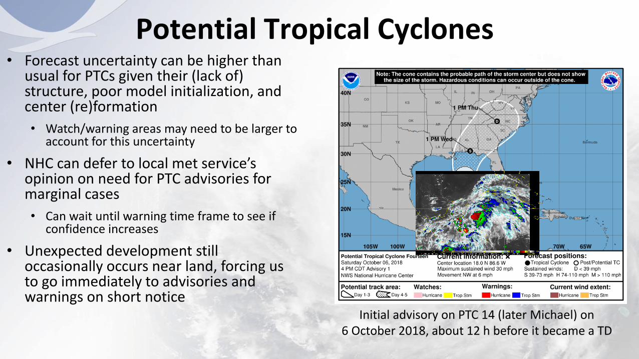
Potential Tropical Cyclones• Forecast uncertainty can be higher than
usual for PTCs given their (lack of) structure, poor model initialization, and center (re)formation
• Watch/warning areas may need to be larger to account for this uncertainty
• NHC can defer to local met service’s opinion on need for PTC advisories for marginal cases
• Can wait until warning time frame to see if confidence increases
• Unexpected development still occasionally occurs near land, forcing us to go immediately to advisories and warnings on short notice
Initial advisory on PTC 14 (later Michael) on 6 October 2018, about 12 h before it became a TD
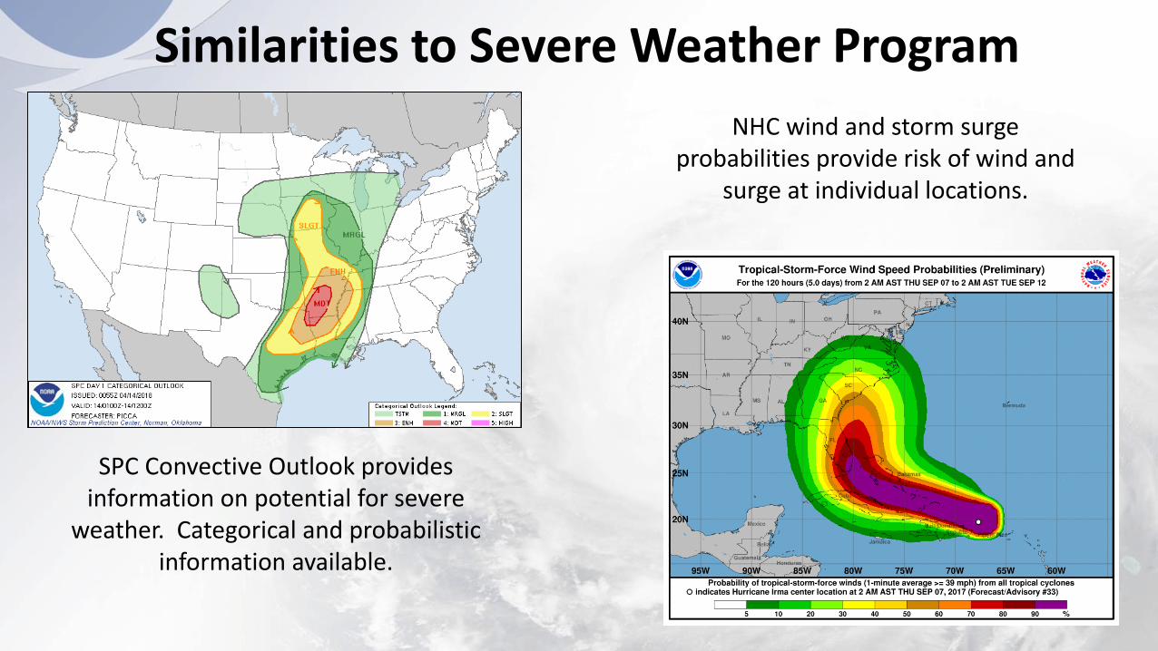
SPC Convective Outlook provides information on potential for severe
weather. Categorical and probabilistic information available.
NHC wind and storm surge probabilities provide risk of wind and
surge at individual locations.
Similarities to Severe Weather Program
Similarities to Severe Weather Program
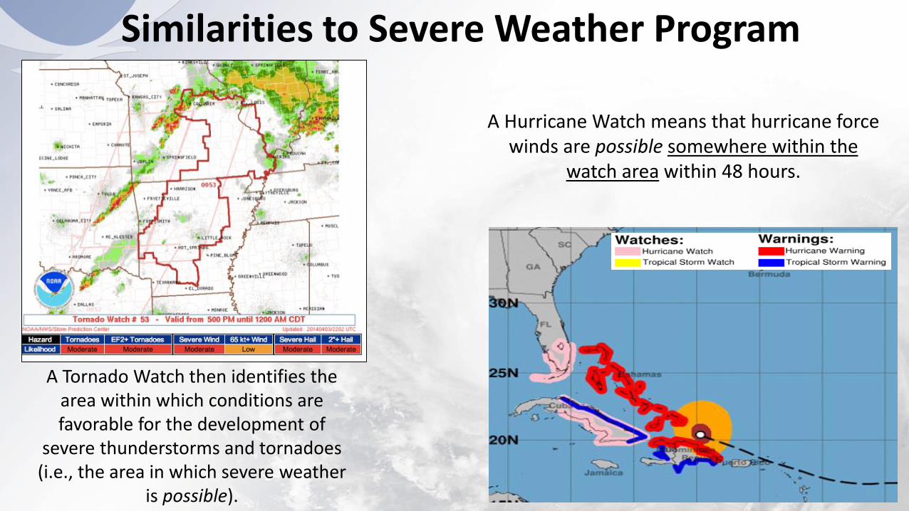
A Tornado Watch then identifies the area within which conditions are favorable for the development of
severe thunderstorms and tornadoes (i.e., the area in which severe weather
is possible).
A Hurricane Watch means that hurricane force winds are possible somewhere within the
watch area within 48 hours.
Similarities to Severe Weather Program
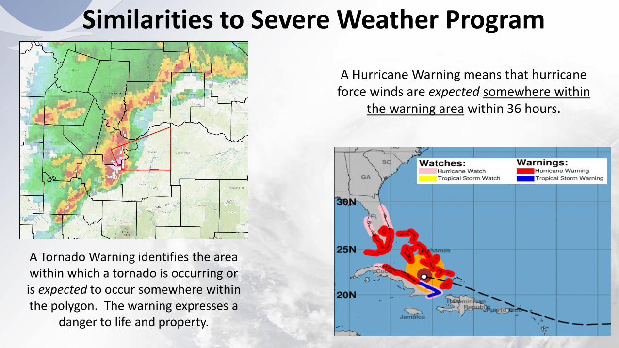
A Tornado Warning identifies the area within which a tornado is occurring or is expected to occur somewhere within the polygon. The warning expresses a
danger to life and property.
A Hurricane Warning means that hurricane force winds are expected somewhere within
the warning area within 36 hours.
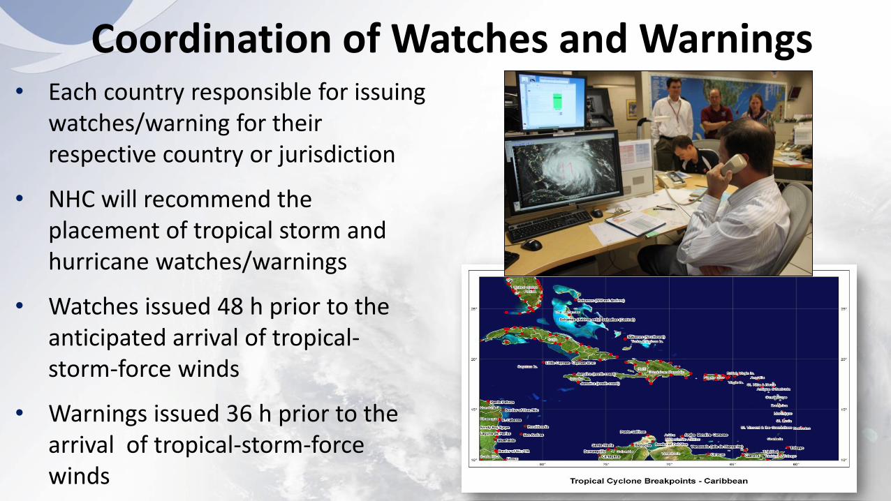
• Each country responsible for issuing watches/warning for their respective country or jurisdiction
• NHC will recommend the placement of tropical storm and hurricane watches/warnings
• Watches issued 48 h prior to the anticipated arrival of tropical-storm-force winds
• Warnings issued 36 h prior to the arrival of tropical-storm-force winds
Coordination of Watches and Warnings
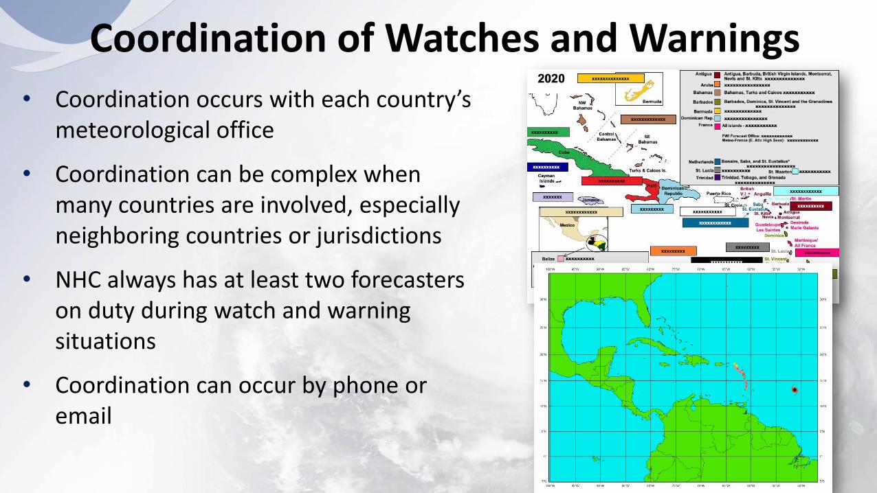
Coordination of Watches and Warnings
• Coordination occurs with each country’s meteorological office
• Coordination can be complex when many countries are involved, especially neighboring countries or jurisdictions
• NHC always has at least two forecasters on duty during watch and warning situations
• Coordination can occur by phone or email
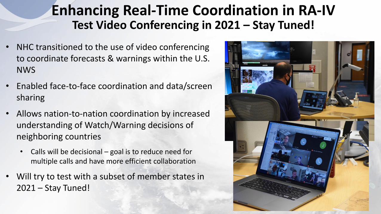
• NHC transitioned to the use of video conferencing to coordinate forecasts & warnings within the U.S. NWS
• Enabled face-to-face coordination and data/screen sharing
• Allows nation-to-nation coordination by increased understanding of Watch/Warning decisions of neighboring countries
• Calls will be decisional – goal is to reduce need for multiple calls and have more efficient collaboration
• Will try to test with a subset of member states in 2021 – Stay Tuned!
Enhancing Real-Time Coordination in RA-IVTest Video Conferencing in 2021 – Stay Tuned!

• “Key” takeaways from each NHC forecast package focused on evolving risk of hazards, not on storm “details”
• Included in the Tropical Cyclone Discussion and on graphic for dissemination via social media
• Spanish language graphic available on hurricanes.gov
• Geared toward public, emergency managers, and media for consistent messaging of threat/impacts
Key Messages

Pre-Genesis Messaging
● Strongly worded TWOs issued before Harvey’s genesis mentioned: ○ Storm Surge○ Tropical storm or hurricane-force
winds○ Very heavy rainfall across portion of
central and eastern Texas
● 1 AM CDT Wednesday, August 23 TWO
mentioned that tropical storm or
hurricane watches could be required for
a portion of TX and LA coasts later that day
Tropical Weather Outlook
NWS National Hurricane Center Miami FL
200 PM EDT Tue Aug 22 2017
Interests in northeastern Mexico and along the Texas coast
should monitor the progress of this system, as it could
produce storm surge and tropical storm or hurricane force
winds along portions of the Texas coast, and very heavy
rainfall across portions of central and eastern Texas from
Friday through the weekend. Please refer to products from
your local National Weather Service office for more
information on this system.
18
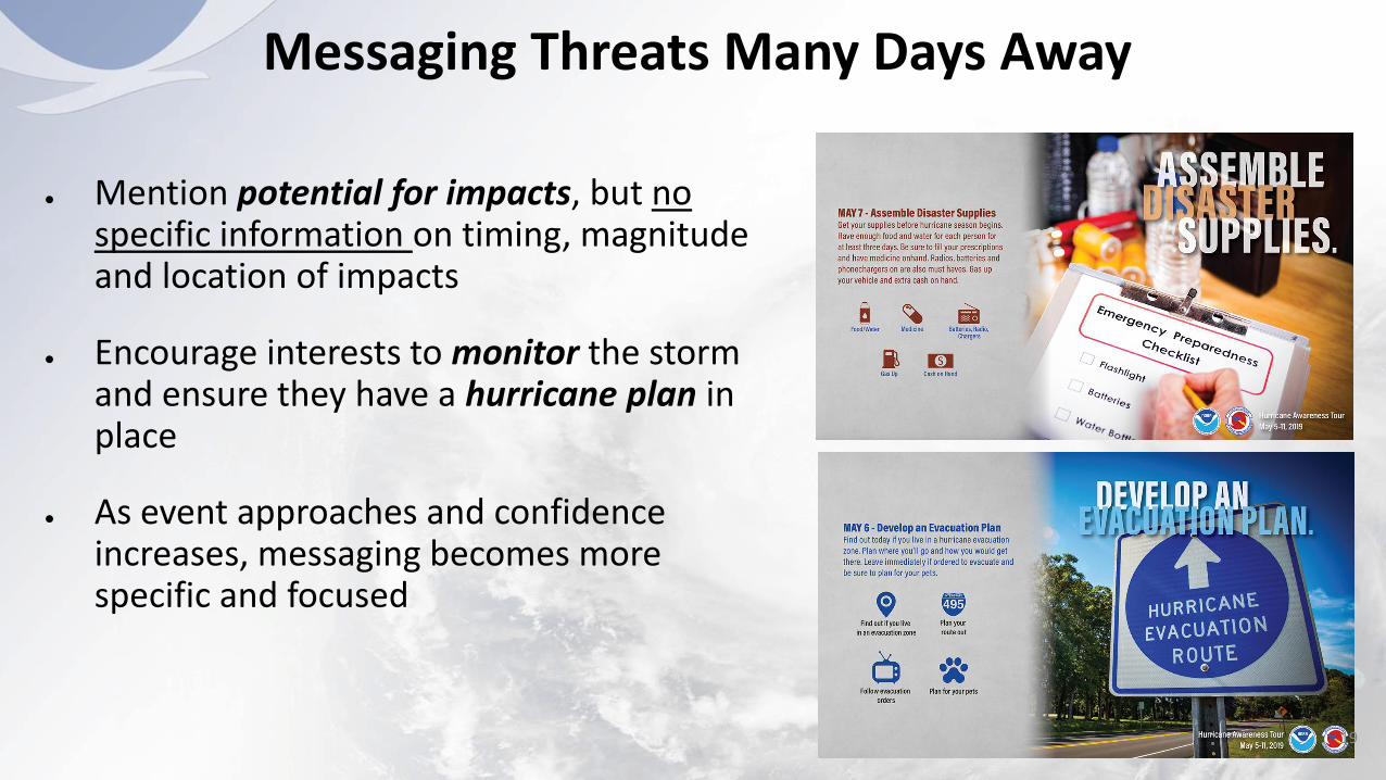
● Mention potential for impacts, but no specific information on timing, magnitude and location of impacts
● Encourage interests to monitor the storm and ensure they have a hurricane plan in place
● As event approaches and confidence increases, messaging becomes more specific and focused
Messaging Threats Many Days Away
19
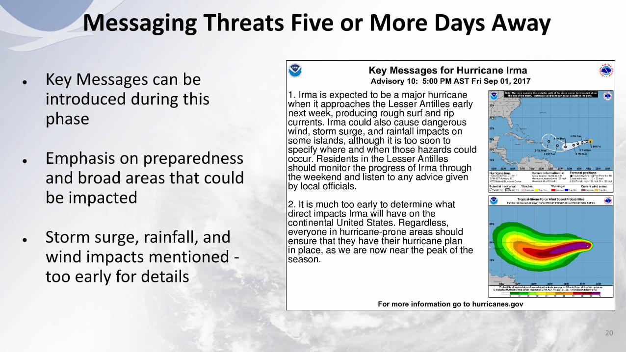
● Key Messages can be introduced during this phase
● Emphasis on preparedness and broad areas that could be impacted
● Storm surge, rainfall, and wind impacts mentioned -too early for details
Messaging Threats Five or More Days Away
20
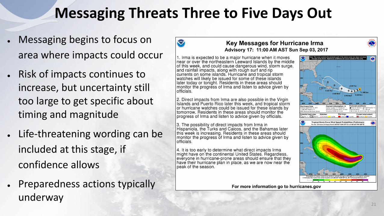
Messaging Threats Three to Five Days Out
● Messaging begins to focus on
area where impacts could occur
● Risk of impacts continues to increase, but uncertainty still too large to get specific about timing and magnitude
● Life-threatening wording can be
included at this stage, if
confidence allows
● Preparedness actions typically underway
21
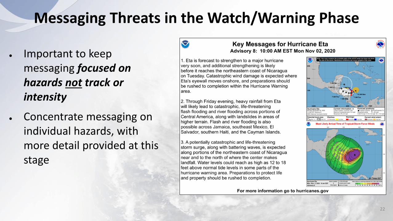
Messaging Threats in the Watch/Warning Phase
● Important to keep messaging focused on hazards not track or intensity
● Concentrate messaging on individual hazards, with more detail provided at this stage
22
Questions/Discussion?