WA’s Exploration Incentive Scheme (EIS) - CSIRO … - Tyler.pdf · WA’s Exploration Incentive...
9
Government of Western Australia Department of Mines and Petroleum Geological Survey of Western Australia WA’s Exploration Incentive Scheme (EIS) ‘UNCOVER’ Looking beneath the Nullarbor
-
Upload
nguyenhanh -
Category
Documents
-
view
220 -
download
0
Transcript of WA’s Exploration Incentive Scheme (EIS) - CSIRO … - Tyler.pdf · WA’s Exploration Incentive...
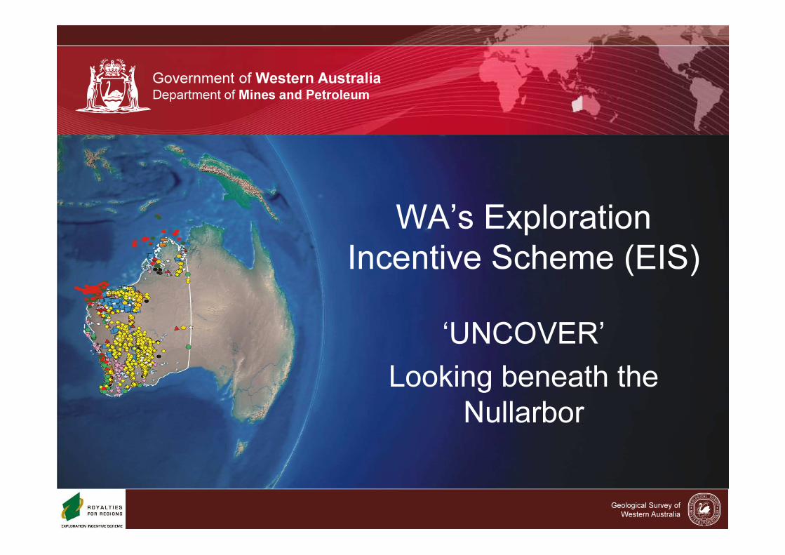
Government of Western Australia
Department of Mines and Petroleum
Geological Survey of
Western Australia
WA’s Exploration
Incentive Scheme (EIS)
‘UNCOVER’
Looking beneath the
Nullarbor
Government of Western Australia Department of Mines and PetroleumGovernment of Western Australia Department of Mines and PetroleumGovernment of Western Australia Department of Mines and Petroleum
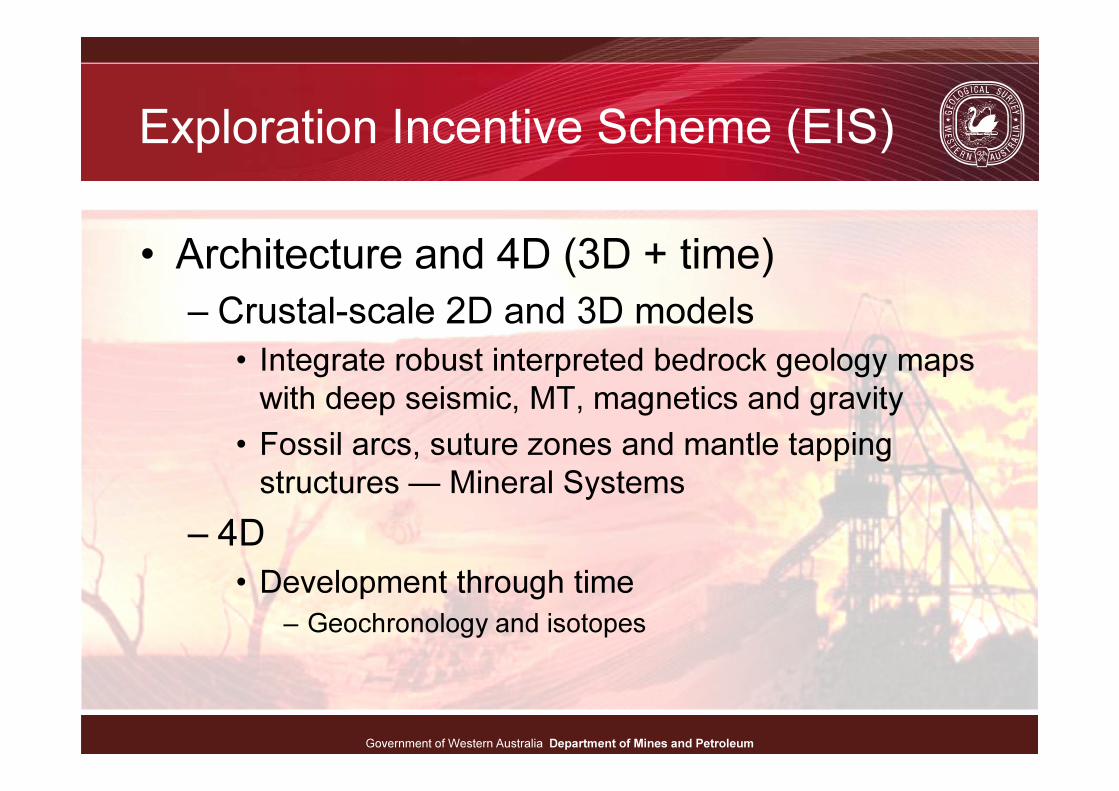
Exploration Incentive Scheme (EIS)
• Architecture and 4D (3D + time)
– Crustal-scale 2D and 3D models
• Integrate robust interpreted bedrock geology maps
with deep seismic, MT, magnetics and gravity
• Fossil arcs, suture zones and mantle tapping
structures — Mineral Systems
– 4D
• Development through time
– Geochronology and isotopes
Government of Western Australia Department of Mines and PetroleumGovernment of Western Australia Department of Mines and PetroleumGovernment of Western Australia Department of Mines and Petroleum
The Nullarbor: Eucla Basin basement
• Miocene seafloor –– 400 m of
limestone cover
• EIS datasets:
– Airborne magnetics and
radiometrics
• 200 and 400 metre line spacing
– Ground gravity
• 2.5 km stations
– Deep crustal seismic and
magnetotelluric surveys
• Albany–Fraser and Eucla–Gawler
– Industry Co-funded and GSWA
stratigraphic drilling
• Geochemistry, geochronology and
isotopes
Government of Western Australia Department of Mines and PetroleumGovernment of Western Australia Department of Mines and PetroleumGovernment of Western Australia Department of Mines and Petroleum
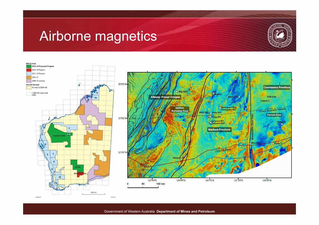
Airborne magnetics
Government of Western Australia Department of Mines and PetroleumGovernment of Western Australia Department of Mines and PetroleumGovernment of Western Australia Department of Mines and Petroleum
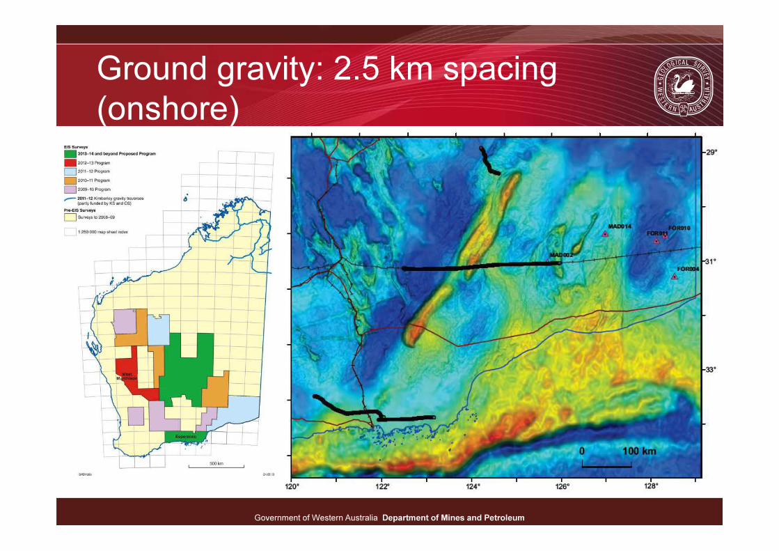
Ground gravity: 2.5 km spacing
(onshore)
Government of Western Australia Department of Mines and PetroleumGovernment of Western Australia Department of Mines and PetroleumGovernment of Western Australia Department of Mines and Petroleum
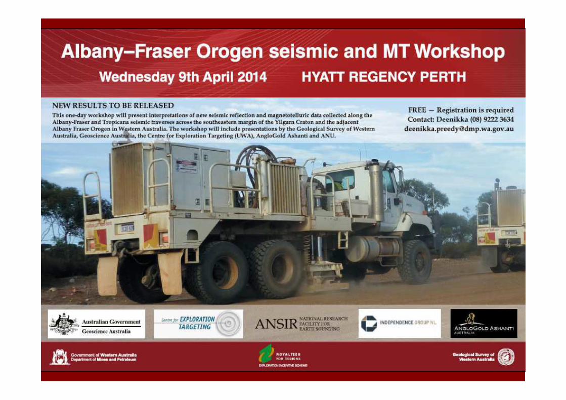
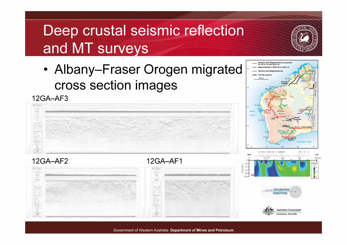
Deep crustal seismic reflection
and MT surveys
• Albany–Fraser Orogen migrated
cross section images
12GA–AF2 12GA–AF1
12GA–AF3
Government of Western Australia Department of Mines and PetroleumGovernment of Western Australia Department of Mines and PetroleumGovernment of Western Australia Department of Mines and Petroleum
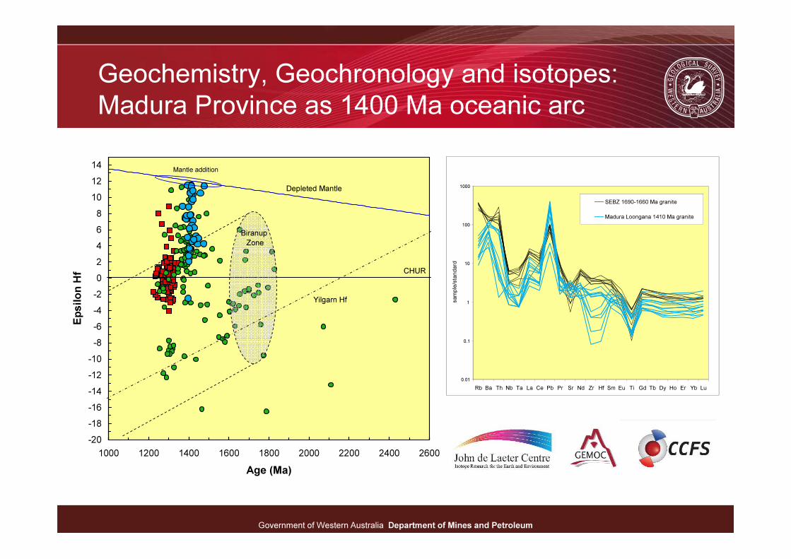
Geochemistry, Geochronology and isotopes:
Madura Province as 1400 Ma oceanic arc
-20
-18
-16
-14
-12
-10
-8
-6
-4
-2
0
2
4
6
8
10
12
14
1000 1200 1400 1600 1800 2000 2200 2400 2600
Age (Ma)
Ep
silo
n H
f
Depleted Mantle
CHUR
Biranup
Zone
Mantle addition
Yilgarn Hf
0.01
0.1
1
10
100
1000
Rb Ba Th Nb Ta La Ce Pb Pr Sr Nd Zr Hf Sm Eu Ti Gd Tb Dy Ho Er Yb Lu
sample/standard
SEBZ 1690-1660 Ma granite
Madura Loongana 1410 Ma granite

Government of Western Australia Department of Mines and PetroleumGovernment of Western Australia Department of Mines and PetroleumGovernment of Western Australia Department of Mines and Petroleum
Sutures east of the Albany–Fraser
Orogen: Rodona Shear Zone?