Warner Ranch Infrastructure Study Chapter 5 Wastewater€¦ · Warner Ranch Infrastructure Study...
13
Transcript of Warner Ranch Infrastructure Study Chapter 5 Wastewater€¦ · Warner Ranch Infrastructure Study...

Warner Ranch Infrastructure Study Chapter 5 WastewaterShapouri & Associates
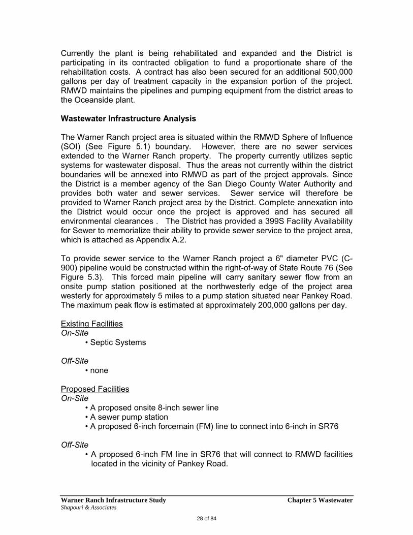
Currently the plant is being rehabilitated and expanded and the District is participating in its contracted obligation to fund a proportionate share of the rehabilitation costs. A contract has also been secured for an additional 500,000 gallons per day of treatment capacity in the expansion portion of the project. RMWD maintains the pipelines and pumping equipment from the district areas to the Oceanside plant.
Wastewater Infrastructure Analysis
The Warner Ranch project area is situated within the RMWD Sphere of Influence (SOI) (See Figure 5.1) boundary. However, there are no sewer services extended to the Warner Ranch property. The property currently utilizes septic systems for wastewater disposal. Thus the areas not currently within the district boundaries will be annexed into RMWD as part of the project approvals. Since the District is a member agency of the San Diego County Water Authority and provides both water and sewer services. Sewer service will therefore be provided to Warner Ranch project area by the District. Complete annexation into the District would occur once the project is approved and has secured all environmental clearances . The District has provided a 399S Facility Availability for Sewer to memorialize their ability to provide sewer service to the project area, which is attached as Appendix A.2.
To provide sewer service to the Warner Ranch project a 6" diameter PVC (C-900) pipeline would be constructed within the right-of-way of State Route 76 (See Figure 5.3). This forced main pipeline will carry sanitary sewer flow from an onsite pump station positioned at the northwesterly edge of the project area westerly for approximately 5 miles to a pump station situated near Pankey Road. The maximum peak flow is estimated at approximately 200,000 gallons per day.
Existing Facilities On-Site
• Septic Systems
Off-Site • none
Proposed Facilities On-Site
• A proposed onsite 8-inch sewer line• A sewer pump station• A proposed 6-inch forcemain (FM) line to connect into 6-inch in SR76
Off-Site • A proposed 6-inch FM line in SR76 that will connect to RMWD facilities
located in the vicinity of Pankey Road.
28 of 84


Warner Ranch Infrastructure Study Chapter 5 WastewaterShapouri & Associates
District Annexation Process
Established by State Law in 1963, the San Diego Local Agency Formation Commission (LAFCO) is a regulatory agency with quasi-legislative authority. While having county-wide jurisdiction, LAFCO is independent of county government. LAFCOs were designed to provide assistance to local agencies in overseeing jurisdictional boundary changes. LAFCOs are governed by the Cortese-Knox-Hertzberg Act.
LAFCO is responsible for coordinating, directing, and overseeing logical and timely changes to local governmental boundaries, including annexation and detachment of territory, incorporation of cities, formation of special districts, and consolidation, merger, and dissolution of districts. A primary objective of LAFCO is to initiate studies and furnish information that contributes to the logical and reasonable development of public agencies
The Commission also is obligated to develop and adopt spheres of influence for each city and special district within the county. A sphere of influence is defined as a "plan for the probable physical boundaries and service area of a local government agency as determined by the Commission". Spheres are characterized as planning tools used to provide guidance for individual proposals involving jurisdictional changes, and are intended to encourage efficient provision of organized community services and prevent duplication of service delivery. Territory must be within a city or district's sphere in order to be annexed.
As mentioned above, the Warner Ranch project area is situated within the RMWD district boundaries or Sphere of Influence. (See Figure 5.1) As such, complete annexation into the district boundaries will be necessary once the project is approved and all environmental clearances are secured.
Annexation is the means by which an existing agency extends its corporate boundaries. In its most basic form, annexation can be considered a four part process. The steps are generally outlined below.
Prefiling. An application may be filed with the LAFCO by petition of affected landowners or registered voters, or by resolution from the involved agency. Prior to filing, the proponent should meet with the LAFCO's executive officer to establish the minimum requirements for processing, then meet with any affected special districts and agencies to agree upon a taxation scheme and needed property tax transfers. Commission action is subject to CEQA and an initial study will be required. In most cases, the agency (or the private proponent) will be responsible for preparing the initial study and the environmental document under LAFCO direction.
30 of 84

Warner Ranch Infrastructure Study Chapter 5 WastewaterShapouri & Associates
Filing and LAFCO Consideration. LAFCO has 30 days in which to review an annexation application and determine that it is complete for processing. Once the application has been accepted as complete, the LAFCO will analyze the proposed annexation in light of the commission's state mandated evaluation criteria and responsibilities and its own adopted policies. Before the executive officer issues a certificate of filing, the involved agency, and affected special districts are required to negotiate the allocation of property tax revenues during a 30-day mandatory negotiation period, but are not required to reach agreement (Rev & Tax Code Section 99 and 71 Ops. Cal. Atty. Gen. 344 (1988)). Nonetheless, the executive officer is prohibited from issuing a certificate of filing if an agreement has not been reached, which is a precondition to LAFCO's hearing on an application for annexation (Greenwood Addition Homeowners Associationv. City of San Marino (1993) 14 Cal.App.4th 1360).
LAFCO may approve, conditionally approve or deny the proposed annexation. The lead agency, whether it is the LAFCO or the involved city, must comply with CEQA requirements prior to the LAFCO's action. The conditions set by the commission's resolution will be the ground rules for the conducting authority's subsequent action (Section 56851). Within 30 days of the LAFCO's resolution, any person or affected agency may file a written request with the executive officer for reconsideration of the annexation proposal (Section 56857).
Proceedings of the Conducting Authority. The involved agency, acting as the "conducting authority" in accordance with the requirements of the Cortese-Knox Act and LAFCO, will hold a public protest hearing to determine whether the proposed annexation must be approved without an election, terminated, or whether an election must be called to determine the proposal's outcome. The number of protests received before and during the hearing will determine which of these options the city must follow. If the annexation is approved, the agency will forward a resolution containing the results of its activities to the LAFCO for final review and ratification. If the proposal is terminated, a resolution to this effect will be forwarded to the LAFCO and no new annexation may be proposed on the site for at least one year, unless the LAFCO waives the limitation upon finding that the limitation is detrimental to the public interest (Sections 56855 and 56851). When an election is held, only residents of the proposed city or territory have a right to vote on the issue of annexation (Sec. 57103 and Board ofSupervisors v. LAFCO (1992) 3 Cal.4th 903).
Final Certification. When the LAFCO executive officer is satisfied that all elements of the Act have been properly addressed, that the annexation approved by the agency conforms to the annexation proposal approved by the Commission, and that all conditions have been met, he or she will certify that the annexation is complete. If the executive officer finds the application submittal to be incomplete, then it will be returned to the agency for completion. The annexation is not complete until it has been certified by the executive officer. The commission may establish an "effective date" for the annexation. Alternatively,
31 of 84
Warner Ranch Infrastructure Study Chapter 5 WastewaterShapouri & Associates
the effective date will be the date the certificate of completion is recorded by the County Recorder.
Wastewater Opportunities and Constraints
Opportunities:
The Warner Ranch project area is located on the eastern reaches of theRMWD where no sewer facilities currently exist. The project will connect toRMWD facilities located near Pankey Road and provide for an adequateconnection point for the project needs.
The project sewer facilities will replace existing septic systems and will ensureongoing sewer service and management.
Annexation - The Project is situated within the RMWD Sphere of Influence(SOI) boundary and would require annexation proceedings once the project isapproved and all environmental clearances are secured.
Constraints
The Warner Ranch project area is located on the eastern reaches of theRMWD where no sewer facilities currently exist. The project will need toconnect to RMWD facilities located near Pankey Road and provide for anadequate connection point for the project needs.
The project will need to bear all costs associated with providing sewerfacilities to the site.
Annexation - The Project is situated within the RMWD Sphere of Influence(SOI) boundary and would require annexation proceedings once the project isapproved and all environmental clearances are secured.
/////
32 of 84

Warner Ranch Infrastructure Study Chapter 6 Stormwater/DrainageShapouri & Associates
Infrastructure Stormwater/Drainage
A Drainage Study has been prepared pursuant to the San Diego County Grading Ordinance, Grading Plan Manual, Drainage Design Manual and all other applicable County, State and Federal Regulations. The study analyzed existing, pre-development hydrologic conditions as well as examined the post-development hydrology as proposed on the Warner Ranch Preliminary Grading Plan Site Grading (Tract No. 5508 rpl4). The adequacy of the proposed drainage system will be determined in regards to the 100 year storm event. (See Appendix A.4)
Methodology
The study is consistent with all current County of San Diego’s ordinances and procedures. All components of the study are designed to convey storm water based on a 100 year flood event. The anticipated storm runoff has been calculated based on the County of San Diego Rational Method for Computing Water Runoff of Small Watersheds.
The following references have been used in preparation of this report:
County of San Diego Hydrology Manual, June 2003.
San Diego County Grading, Clearing and Watercourses Ordinance, datedApril 23, 2004
San Diego County Drainage Design Manual, dated July 2005.
San Diego County Hydrology Manual for NRCS (National ResourcesConservation Service) Hydrologic Method calculations.
Water Control Plan for the San Diego Basin (9) from the CaliforniaRegional Water Quality Control Board San Diego Region, September1994, (with amendments effective on April 25, 2007).
San Diego County Rational Hydrology Program – CIVILCADD/CIVILDESIGN Engineering Software, Version 7.5
The San Diego Unit Hydrograph (SDUH) Peak Discharge Program.
6
33 of 84

Warner Ranch Infrastructure Study Chapter 6 Stormwater/DrainageShapouri & Associates
US Army Corps of Engineers, HEC-RAS Program, Version 4.0.0
San Diego County Topographic Survey maps, photographs taken 1960and 1985
County of San Diego Hydrology Manual, Soils Hydrologic Group Map,2007.
Pre-Development Conditions
The Warner Ranch project site is situated between two small bodies of intermittently flowing water on both sides. Gomez Creek runs through the western portion of the Project, and Pala Creek traverses through the eastern side.
The Site is generally characterized by diverse topography with elevation ranging 350 feet to 1,000 feet above mean sea level; the entire Gomez Creek (Design Point 1) basin study reaches a high elevation of 1,950’. The northern portion of the site within Gomez Creek drainage basin is generally depicted as moderate to steep slopes. The area contains a variety of vegetation types, including Chaparral and Coastal Sage Scrub. The Southern portion of the site is relatively flat and presently contains orchards, as well as a network of unimproved roads for the Gomez Creek basin area.
The total drainage study area for the Gomez creek basin is approximately ± 6.4 square miles, flowing southerly along the western side of the proposed project and eventually converges with the San Luis Rey River further south after crossing the existing Gomez Creek Bridge, serving the State Route 76, Pala Road. The drainage basin is mostly within soil group “C” and “D”, there is a small percentage of soil groups “A” and “B” on the Southern part of the property on the proposed development site.
Post-Development Conditions
Post development conditions propose storm drain systems that route through open swales and infiltration/detention basins to clean and contain hydrological flow during storm events. The post-hydrological area consists of one watershed; Gomez Creek Basin designated as: Design Point 1. The Gomez Creek basin was further broken down into appropriate sub-basins for evaluation.
The project area within the Gomez Creek sub-basins, will be graded for 780 residential units (534 single family detached, and 246 multi-family and attached town homes), including private community parks, landscaped areas, preserved
34 of 84
Warner Ranch Infrastructure Study Chapter 6 Stormwater/DrainageShapouri & Associates
open space, on-site fire station and a public recreational park, as Illustrated on the Post-development hydrology map. Various BMP areas are proposed within this Watershed, after which, all drainage flows are conveyed to the same design point (1). Bioretention/detention facilities areas will clean and contain hydrological flows during storm events.
As designed, the development will not alter the natural drainage path or divert any drainage from the existing natural conditions or drainage boundaries. All drainage facilities are designed using the peak discharge of a 100-year storm event.
This Drainage Study contains 1 Design Point, located at the Existing Gomez Creek Bridge crossing at State Route 76, Pala Road, and labeled as: “Design Point 1”. The following discussion is a summary of the Drainage patterns for Design Point 1, as shown on the “Post Hydrology Maps” for Preliminary Grading Plan (Tract No. 5508rpl4) (dated 11/30/2012):
Design Point 1 consists of two drainage basins; Gomez Creek and the Project Development Basin, which have an overall drainage flow of 5,402 cubic feet per second (cfs). (Please refer to Post development study report and Post Hydrology Map attached) Gomez Creek basin, consists of Nodes 113.1 to 113.2, this basin contributes a majority of the drainage flow of approximately 5,066 cfs at the peak of the 100-year storm event. The second basin is the project development area, which contributes approximately, 375 cfs of the total flow, however, when combined with the Gomez Creek basin the flow is approximately 5,402 cfs. The second basin covers the majority of the project development area as well as the undeveloped lands situated to the north and northeast of the project at an elevation of 1,621 feet (Node 103.1). The drainage of this undisturbed area continue it’s route through the project’s storm drain system and converge into Dry-Detention Ponds 1 and 4, Bio-Retention Ponds 6 and ends at “Swale No.1” located at the south-west of the project boundary, Node 110. Drainage flows from Dry-Detention Pond No. 2 next to Public Park located at the southeast corner of the project boundary, Bio-Retention Ponds 3 and 8 all converge into Swale No. 2, which is located at southeast of the project boundary along SR76 and flows directly to Swale No. 1. Drainage flows from Bio-Retention No. 7 coincide with Swale No.1 as well. Drainage flows from Dry-Detention Pond No. 5 located at the west corner converges into Swale No.3 and confluence with water from Swale No.1. Swale No.3 it’s located near to the Gomez Creek Bridge.
As shown on the Preliminary Grading Plans and Post-Development hydrology map, the private drainage system is proposed to consist of:
Five (5) Bio-Retention Ponds Four (4) Dry-Detention Ponds
35 of 84

Warner Ranch Infrastructure Study Chapter 6 Stormwater/DrainageShapouri & Associates
Four (4) Swales Drainage System that consist of majority of 24”RCP along with 30”, 36”,
42” 48” 54”, and 66” RCP’S (Please refer to Post Hydrology Map for PipeSizing)
One (1) 20’ wide Box culvert, 2’ height with 4 spans, each 5’ wide, per SanDiego Regional Standard Drawing D-77D.
The proposed drainage facilities have been designed to adequately convey the 100-year flood conditions, and are sufficient to protect the proposed site development as shown on the attached “Post Hydrology Map” (See Figure)
Overall, the project will result in a minor decrease of drainage flow (See attached Comparison Pre & Post Table A) from pre-development conditions and thus will not contribute to the existing water stream under Gomez Creek Bridge crossing (Design Point 1).
Stormwater Drainage Opportunities and Constraints
Opportunities:
The project will provide area wide bio retention/detention facilities
Existing drainage lines and structures will upgraded and upsized toaccommodate project needs
The creation and enhancement of drainage channels, swales,detention/retention basins will serve as wetland preserves and openspace.
Constraints:
Onsite bio retention/detention will need to be constructed to containproject flows
. Existing drainage facilities will need to be upsized to accommodate project
needs.
/////
36 of 84

Warner Ranch Infrastructure Study Chapter 7 Traffic and TransportationShapouri & Associates
Infrastructure Traffic/Transportation
INTRODUCTION
A traffic study has been prepared for the Warner Ranch Specific Plan area. This section of the infrastructure study summarizes relevant local and regional policies as well as existing conditions and the proposed project impacts. This study is attached as Appendix A.6.
REGULATORY OVERVIEW
State
The California Department of Transportation (Caltrans) is responsible for the planning, design, construction and maintenance of all state highways. Caltrans jurisdiction also extends to improvements to these roadways as well as interchange ramps serving area freeways. All federally funded transportation improvements are subject to review by Caltrans staff and ultimately the California Transportation Commission. The Caltrans Highway Design Manual, prepared by the Office of Geometric Design Standards (Caltrans 2008), establishes uniform policies and procedures to carry out the highway design functions of Caltrans. Caltrans has also prepared a Guide for the Preparation of Traffic Impact Studies (Caltrans 2002). Objectives for the preparation of this guide include providing consistency and uniformity in the identification of traffic impacts generated by local land use proposals.
Regional
Regional Transportation Plans and Programs SANDAG serves as the forum for decision-making on regional issues such as growth, transportation, land use, the economy, the environment, and criminal justice. SANDAG builds consensus, makes strategic plans, obtains and allocates resources, and provides information on a broad range of topics pertinent to the region’s quality of life. SANDAG is governed by a Board of Directors composed of mayors, council members, and supervisors from each of the San Diego region’s 19 local governments. As the San Diego County MPO and Regional Transportation Planning Agency, SANDAG has produced the documents listed below that identify transportation plans and policies in the San Diego area.
7
37 of 84

Warner Ranch Infrastructure Study Chapter 7 Traffic and TransportationShapouri & Associates
2030 Regional Transportation Plan (RTP) Changes in anticipated cost and revenue have resulted in an update of the 2030 RTP that was approved by the SANDAG Board of Directors in 2006. The 2030 RTP, also known as 2030 RTP: Pathways for the Future, was adopted in November 2007 and serves as a blueprint to address the mobility challenges created by the San Diego region’s growing population and employment. It incorporated a new regional growth forecast and contains an integrated set of public policies, strategies, and investments to maintain, manage, and improve the transportation system in the region.
2006 Regional Transportation Improvement Program (RTIP) The RTIP is a multi-year program of proposed major highway, arterial, transit, and bikeway projects. The 2006 RTIP is a prioritized program designed to implement the region’s overall strategy for providing mobility and improving the efficiency and safety of efforts to attain federal and State air quality standards for the region. The 2006 RTIP also incrementally implements the latest update to the RTP. The 2006 RTIP covers fiscal years 2007 to 2011. The 2006 RTIP, including an air quality emissions analysis for all regionally significant projects, was adopted on August 4, 2006.
Congestion Management Program (CMP) State Proposition 111, passed by voters in 1990, established a requirement that urbanized areas prepare and regularly update a CMP, which is a part of SANDAG’s RTP. The purpose of the CMP is to monitor the performance of the region’s transportation system, develop programs to address near-term and long-term congestion, and better integrate transportation and land use planning. The San Diego region has elected to be exempt from the State CMP and, as a result, the County Board of Supervisors adopted a resolution electing to be exempt from the State CMP. Existing CMP monitoring, threshold levels, guidelines and mitigation strategies will be incorporated into other SANDAG plans and/or programs as a result.
County of San Diego Regulatory Ordinances, Sections 77.201 – 77.220, Transportation Impact Fee (TIF) The San Diego County TIF Ordinance requires the assessment and collection of fees for roadway impacts as a condition of approval of a subdivision map or prior to issuance of a development permit, including a building permit. The County TIF Ordinance defrays the actual or estimated costs of constructing planned transportation facilities necessary to accommodate increased traffic generated by future development consistent with Mitigation Fee Act (Section 66000 et seq. of the California Government Code). Application of this fee includes, but is generally not limited to, development for residential, commercial, and industrial land uses. The fees are collected to fund identified transportation facilities, or portions thereof, that provide increased road capacity necessitated by the cumulative impacts of future development.
38 of 84
Warner Ranch Infrastructure Study Chapter 7 Traffic and TransportationShapouri & Associates
EXISTING CONDITIONS
Traffic Volumes The intersection turning movement counts were conducted during the weekday morning peak period from 7:00 AM to 9:00 AM and during the weekday evening peak period from 4:00 PM to 6:00 PM in June of 2009, October of 2009 and November of 2010. Average daily traffic volumes were obtained through machine data collection. Freeway mainline volumes were collected from Caltrans online volume databank and are representative of 2008 freeway volumes.
Roadway Network The principal roadways in the project study area are described briefly below. The description includes the physical characteristics, adjacent land uses, and traffic control devices along these roadways. The existing roadway geometry and control conditions are shown in the following tables and further detailed in the TIS. Additional details regarding specific intersection operating conditions can also be found on the capacity analysis worksheets in the TIS.
State Route 76 runs east/west connecting several of the northern communities in San Diego County. State Route 76 varies in its classification from a 2 lane highway, to a 4 lane collector, to a 4 lane major. Specifics regarding the classifications can be seen in the segment analysis sections of each chapter. The roadway does provide project access to adjacent land uses. It has a painted median. The posted speed limit is 55 MPH. State Route 76 provides project access. The adjacent land uses on the project access road includes: fronting residential, and open space.
Old Highway 395 runs north/south running parallel to Interstate 15. It has a functional classification of a 2 lane collector with 1 lane in each direction. The roadway does provide access to adjacent uses. It has a painted median. The posted speed limit is 50 MPH.
Pala Mission Road runs east/ west connecting SR-76 to Pala Temecula Road. It has a functional classification of a 2 lane local road with 1 lane in each direction. The roadway does provide access to adjacent uses. It has a painted median. The posted speed limit is 25 MPH.
Pala Temecula Road runs north/ south connecting the Pala community to the City of Temecula. It has a functional classification of a 2 lane rural collector with 1 lane in each direction. The roadway does provide access to adjacent uses. The posted speed limit is 30 MPH.
39 of 84