Volume 2 Transit Master Plan
46
VOLUME 2 Transit Master Plan Implementation Strategy Washtenaw County Transit Master Plan A Proposal to the Citizens of Washtenaw County
Transcript of Volume 2 Transit Master Plan

Volume 2
Transit Master Plan Implementation Strategy
Washtenaw County Transit Master Plan A Proposal to the Citizens of Washtenaw County

Monitoring and Updating the plan
iiii
ACHIeVING ouR GoAlS
VOLUME 1 | A TRANSIT VISION FOR WASHTENAW COUNTY
HIGHlIGHTING THe ImPACT
VOLUME 1 | A TRANSIT VISION FOR WASHTENAW COUNTYSOURCE: ian fREiMUth

Monitoring and Updating the plan
Washtenaw County in Context i
CHAPTER 1introduction 1
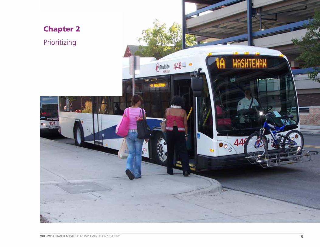
CHAPTER 2
Prioritizing 5
CHAPTER 3
next Steps 9
CHAPTER 4
Working together 15
CHAPTER 5
Monitoring and Updating the Plan 19
appendix a 25
appendix B 37
Table of Contents

������������
�������������
������
Lake Erie
Lake St.Clair
WASHTENAW
LIVINGSTON OAKLAND
WAYNE
MONROELENAWEEHILLSDALE
MACOMBINGHAMEATON
JACKSONCALHOUN
Ann Arbor
MichiganOhio
Indiana
Jackson
Lansing
Detroit
Toledo
Livonia
CantonDearbom
Milan
Saline
Manchester
ChelseaDexter
Ontario
miles
0 10 20
Washtenaw County in Context
introduction
VoLuME 2 TRANSIT MASTER PLAN IMPLEMENTATION STRATEGY
chAPTER 1
1
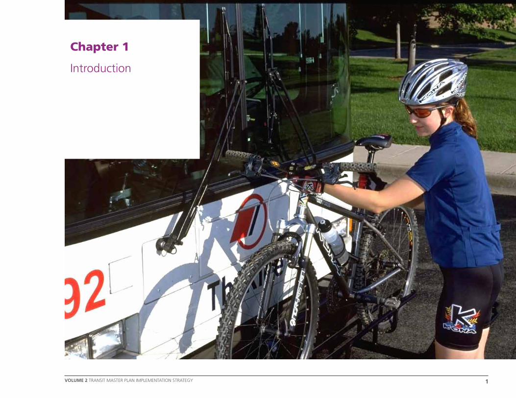
Chapter 1
Introduction
chapter 1 introduction
VoLuME 2 traNSIt MaSter pLaN IMpLeMeNtatION StrateGY2
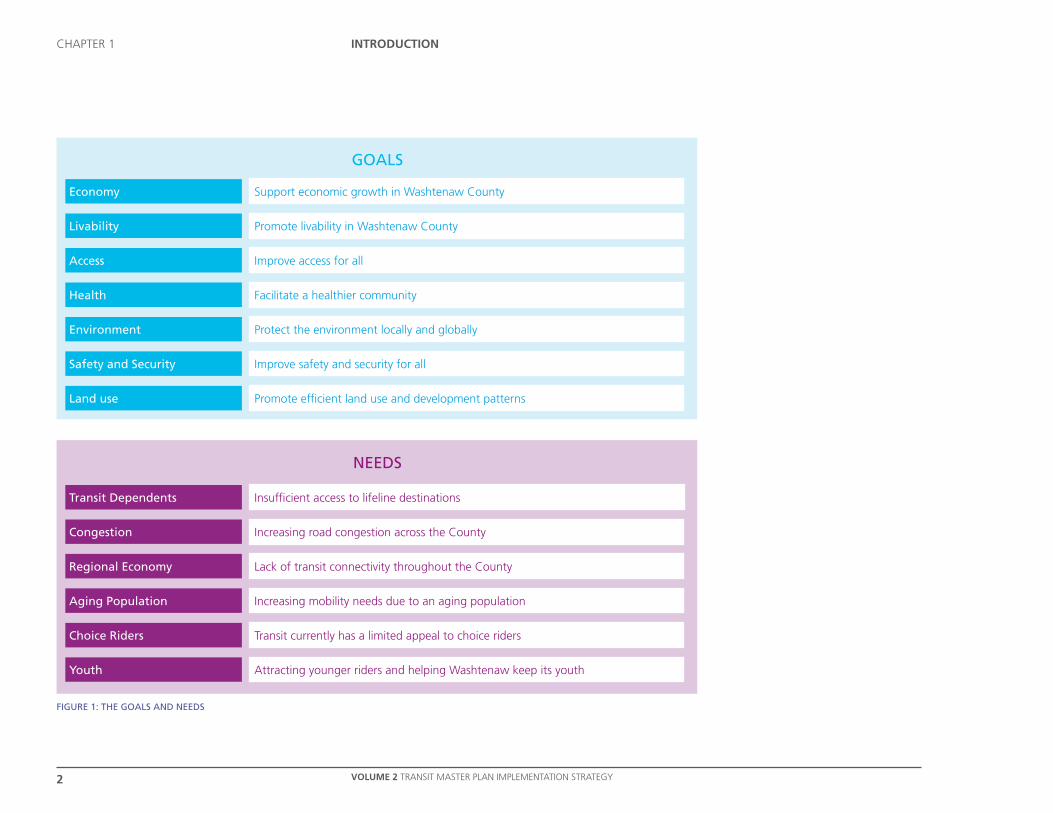
figURE 1: thE gOaLS and nEEdS
gOaLS
nEEdS
Economy
Livability
access
health
Environment
Safety and Security
Land use
Support economic growth in Washtenaw County
Promote livability in Washtenaw County
Improve access for all
Facilitate a healthier community
Protect the environment locally and globally
Improve safety and security for all
Promote efficient land use and development patterns
transit dependents
Congestion
Regional Economy
aging Population
Choice Riders
Youth
Insufficient access to lifeline destinations
Increasing road congestion across the County
Lack of transit connectivity throughout the County
Increasing mobility needs due to an aging population
Transit currently has a limited appeal to choice riders
Attracting younger riders and helping Washtenaw keep its youth

introduction
VoLuME 2 TRANSIT MASTER PLAN IMPLEMENTATION STRATEGY
chAPTER 1
3
What is the Transit Master Plan?
The Moving You Forward Transit Master Plan for Washtenaw County is a new long range plan which sets out a transit vision for the whole County for the next 30 years.
The Plan is the culmination of nine months of work and three extensive rounds of public outreach that helped identify the challenges and needs and develop options and scenarios to address them.
The Plan provides a robust, feasible and integrated package of transit investments and services, designed to make transit a real transportation choice for everyone in Washtenaw County.
The Purpose of the Implementation Plan
In particular, this document provides an outline for starting the Transit Master Plan and beginning the implementation of projects that underpin the Plan.
The Transit Master Plan has been developed to help achieve the Goals and address the Key Needs in the County.
It is imperative that we maintain this focus throughout the implementation of the Plan to ensure that we are delivering transit that will make a real difference to our community.
The Goals and Needs are shown in Figure 1.
* This document is in preparation and will be published at a later date.
The Plan consists of three documents:
» A Transit Vision for Washtenaw County;
» Transit Master Plan Funding Options*; and
» This document: Transit Master Plan Implementation Strategy.
While the Transit Master Plan sets out what the future will look like and the Funding Options Report will set out how this could be paid for, the Implementation Plan complements these with information on how the Strategies included within the Transit Master Plan will be implemented and shows the priorities and timelines for implementation.
chapter 1 introduction
VoLuME 2 traNSIt MaSter pLaN IMpLeMeNtatION StrateGY4
Wha
t do
I do
toda
y to
ach
ieve
this
visio
n?
Vision of what
I want
PRESENTPRESENT
FUTUREFUTURE
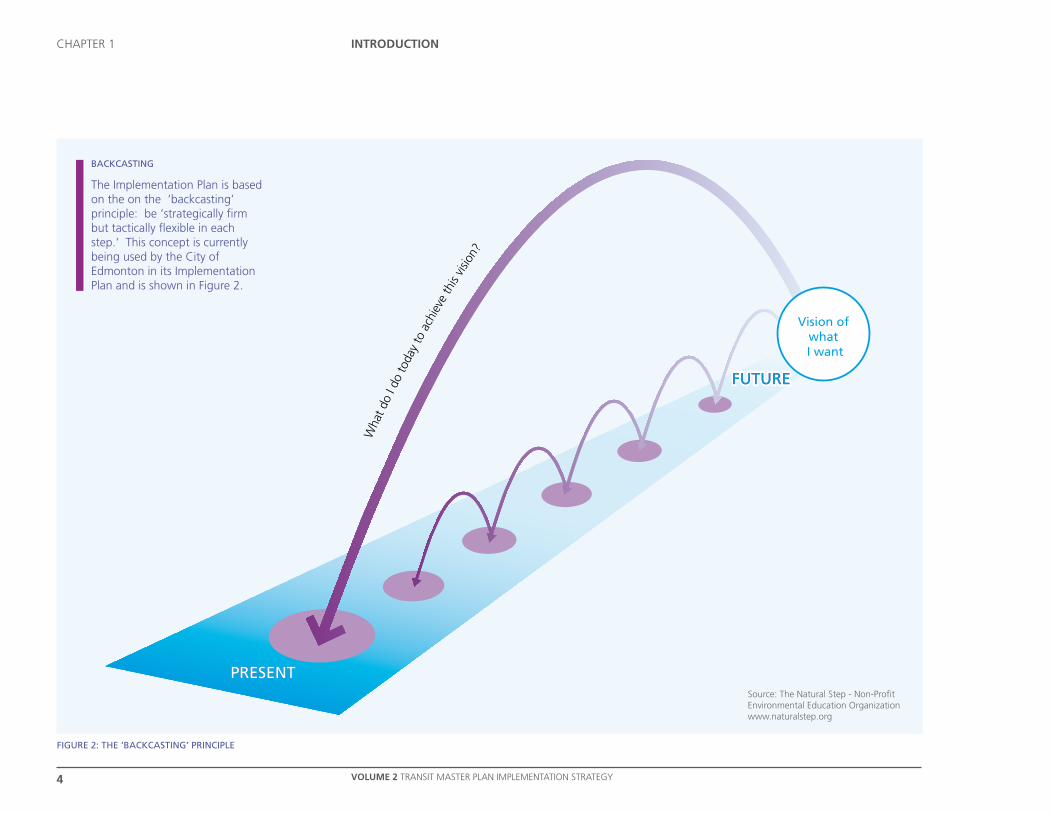
figURE 2: thE ‘BaCkCaSting’ PRinCiPLE
Source: The Natural Step - Non-Profit Environmental Education Organizationwww.naturalstep.org
BaCkCaSting
The Implementation Plan is based on the on the ‘backcasting’ principle: be ‘strategically firm but tactically flexible in each step.’ This concept is currently being used by the City of Edmonton in its Implementation Plan and is shown in Figure 2.
5
Prioritizing
5
chapter 2
VOLUME 2 traNSIt MaSter pLaN IMpLeMeNtatION StrateGY
TRANSIT TodAy
Chapter 2
Prioritizing

6
Prioritizing
6 VOLUME 2 TRANSIT MASTER PLAN IMPLEMENTATION STRATEGY
chAPTER 2
Figure 3: Strategic Priorities
Strategies Implementation Phase Total Washtenaw County Share
years 1-5
years 6-15
years 16-30
Value $m
Value $m
% Total
Existing Urban Bus (ongoing vehicle replacement) 27% 33% 40% 109.8 109.8 100%
Urban Bus Network Improvements (plus part of Making Connections)1 36% 32% 32% 34.2 34.2 100%
Countywide Connections (plus part of Making Connections)2 41% 43% 16% 19.3 17.4 90%
Regional Connections 10% 79% 11% 133.0 39.9 30%
High Capacity Transit 3% 72% 25% 282.5 282.5 100%
Integrating Transit into the Community 25% 75% 20.0 20.0 100%
598.8 503.7 84%
No capital cost
Low level capital cost (1% - 30% of total)
Medium level capital cost (31% - 60% of total)
High level capital cost (61% - 100% of total)
Notes
1.Including Transit Center Upgrades/New Multi Modal Interchange, Stop Quality & Facility Enhancements and Additional Bus Storage Facilities
2.Including Local Transit Hubs and Park & Ride Intercept Lots
kEY

7
Prioritizing
7
chapter 2
VOLUME 2 traNSIt MaSter pLaN IMpLeMeNtatION StrateGY
* This document is in preparation and will be published at a later date.
Overview The implementation priorities and funding options have been developed in parallel and in line with the backcasting principle:
» Strategically Firm The Transit Master Plan Funding Options report* provides a strategic profile of capital cost, which supports all of the Transit Master Plan strategies and elements, and
» Flexible Steps To maintain flexibility in the short term, an implementation plan has been developed for years 1-5 acknowledging that short term flexibility is required.
The following strategies and elements are detailed within Volume 1: A Transit Vision for Washtenaw County.
Strategy 1 Essential Services Countywide » Door-to-Door Countywide » Flex-Ride Services
Strategy 2 Countywide Connections » Enhanced WAVE Service » Countywide Express Services » Local Community Circulators
Strategy 3 Urban Bus Network Improvements » Urban Bus Network Enhancements » Downtown Circulator » Bus Priority Measures
Strategy 4 High Capacity Transit » North-South Ann Arbor » Ann Arbor to Ypsilanti
Strategy 5 Regional Connections » Airport Shuttle and Taxi » Car/Vanpooling » Regional Commuter Rail
Strategy 6 Making Connections » Transit Center Upgrades/New
Multimodal Interchange » Local Transit Hubs » Park & Ride Intercept Lots » Stop Quality and Facility Enhancements
Strategy 7 Integrating Transit into Community » Walkability » Biking
Strategy 8 Integrated Systems - Ticketing
Strategy 9 Integrated Systems - Information » Mobility Management or Travel Planning » Travel Training » Information » Marketing
Strategy 10 Vehicle Enhancements.
Strategically Firm
The prioritization of each strategy, as shown in Figure 3, has been developed considering the future levels of demand, the relationships between different elements and the potential profile of future funding. This table reflects the detailed capital costs as included in the Transit Master Plan Funding Options.
Flexible Steps
Flexibility in the short term, while still working towards the strategic direction of the Transit Master Plan, provides the opportunity to adapt to changing local circumstances.
For example, if a new large employer or retail unit opens, detailed priorities, such as the extension of weekend operating hours on one service or another, may be altered to accommodate the new land use.

PUBLiC aRt, BORdEaUx tRaM, fRanCE

9
Next StepS
9VOLUME 2 TRANSIT MASTER PLAN IMPLEMENTATION STRATEGY
chAPTER 3
Chapter 3
Next Steps
10
Next StepS
10 VOLUME 2 TRANSIT MASTER PLAN IMPLEMENTATION STRATEGY
chAPTER 3
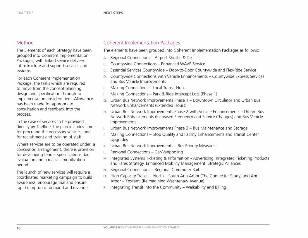
Method
The Elements of each Strategy have been grouped into Coherent Implementation Packages, with linked service delivery, infrastructure and support services and systems.
For each Coherent Implementation Package, the tasks which are required to move from the concept planning, design and specification through to implementation are identified. Allowance has been made for appropriate consultation and feedback into the process.
In the case of services to be provided directly by TheRide, the plan includes time for procuring the necessary vehicles, and for recruitment and training of staff.
Where services are to be operated under a concession arrangement, there is provision for developing tender specifications, bid evaluation and a realistic mobilization period.
The launch of new services will require a coordinated marketing campaign to build awareness, encourage trial and ensure rapid ramp-up of demand and revenue.
Coherent Implementation Packages
The elements have been grouped into Coherent Implementation Packages as follows:
A. Regional Connections – Airport Shuttle & Taxi
B. Countywide Connections – Enhanced WAVE Service
C. Essential Services Countywide – Door-to-Door Countywide and Flex-Ride Service
D. Countywide Connections with Vehicle Enhancements – Countywide Express Services and Bus Vehicle Improvements
E. Making Connections – Local Transit Hubs
F. Making Connections – Park & Ride Intercept Lots (Phase 1)
G. Urban Bus Network Improvements Phase 1 – Downtown Circulator and Urban Bus Network Enhancements (Extended Hours)
H. Urban Bus Network Improvements Phase 2 with Vehicle Enhancements – Urban Bus Network Enhancements (Increased Frequency and Service Changes) and Bus Vehicle Improvements
I. Urban Bus Network Improvements Phase 3 – Bus Maintenance and Storage
J. Making Connections – Stop Quality and Facility Enhancements and Transit Center Upgrades
K. Urban Bus Network Improvements – Bus Priority Measures
L. Regional Connections – Car/Vanpooling
M. Integrated Systems Ticketing & Information - Advertising, Integrated Ticketing Products and Fares Strategy, Enhanced Mobility Management, Strategic Alliances
N. Regional Connections – Regional Commuter Rail
O. High Capacity Transit – North – South Ann Arbor (The Connector Study) and Ann Arbor – Ypsilanti (ReImagining Washtenaw Avenue)
P. Integrating Transit into the Community – Walkability and Biking

11
Next StepS
11VOLUME 2 TRANSIT MASTER PLAN IMPLEMENTATION STRATEGY
chAPTER 3
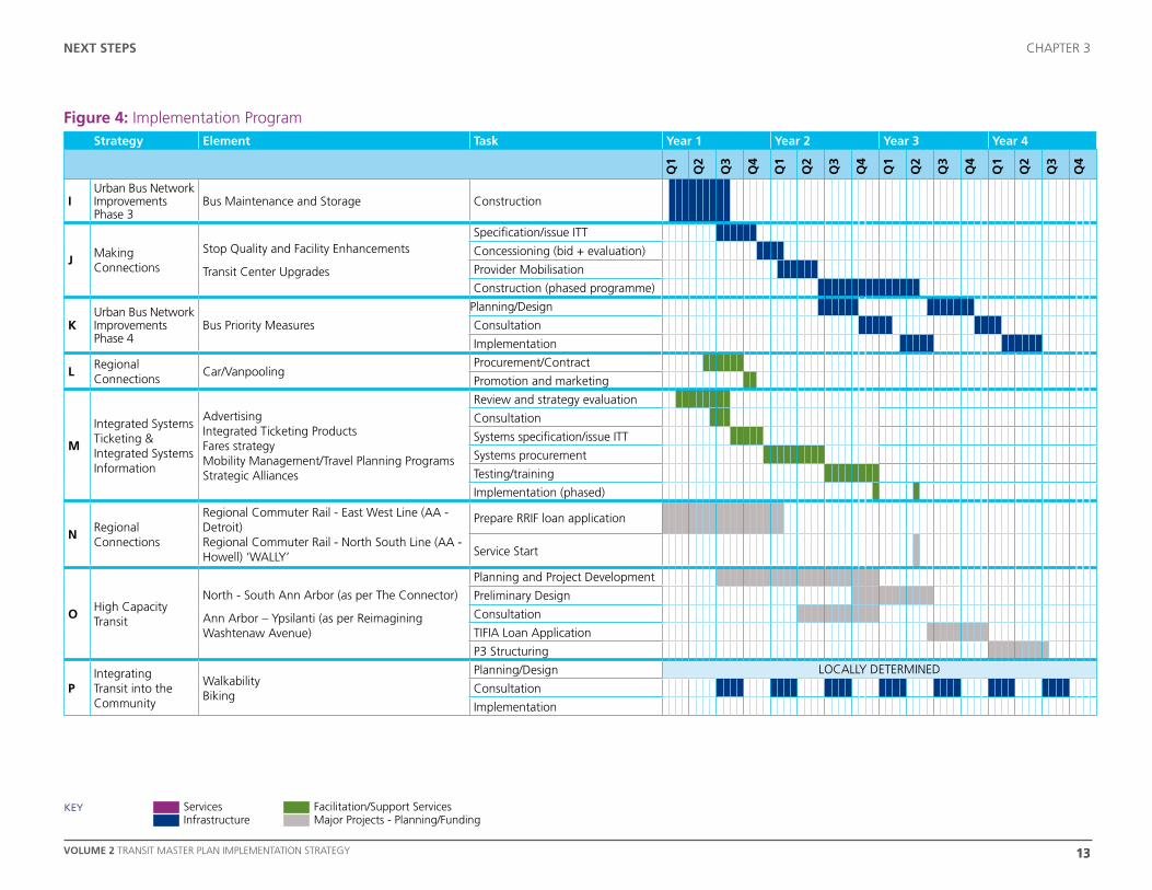
Figure 4 shows the Implementation Program and the following paragraphs provide an overview of the content.
Package A: Regional Connections – Airport Shuttle & Taxi
The Airport Shuttle element is already being advanced by TheRide and should be implemented very quickly.
Packages B and C: Countywide Connections – Enhanced WAVE Service & Essential Services Countywide – Door-to-Door Countywide and Flex-Ride ServiceThese elements should be delivered in the short term largely using existing infrastructure and vehicles (associated with transit or private operators) and will deliver benefits across the County.
Package D: Countywide Connections with Vehicle Enhancements – Countywide Express Services and Bus Vehicle Improvements Expansion of Countywide Express Services should follow the implementation of Countywide Door-to-Door and should launch at a similar time to the first phase of Park & Ride Intercept Lots.
Packages E and F: Making Connections – Local Transit Hubs and Park & Ride Intercept Lots (Phase 1)These elements should be advanced quickly and advanced over a period of
time. These measures will support the Countywide Connections and Essential Services Countywide.
Package G: Urban Bus Network Improvements Phase 1 – Downtown Circulator and Urban Bus Network Enhancements (Extended Hours) These elements should be introduced with limited additional resources and are a“quick win.”
Package H: Urban Bus Network Improvements Phase 2 with Vehicle Enhancements – Urban Bus Network Enhancements (Increased Frequency and Service Changes) and Bus Vehicle Improvements These elements will require more planning and consultation, and additional resources. This package should also include improvements to vehicles.
Packages I, J and K: Urban Bus Network Improvements Phase 3 – Bus Maintenance and Storage ; Making Connections – Stop Quality and Facility Enhancements and Transit Center Upgrades; & Urban Bus Network Improvements – Bus Priority Measures These elements should be advanced alongside service developments.
Package L: Regional Connections – Car/VanpoolingThis element is also already being advanced by TheRide and should follow shortly after the Airport Shuttle.
Package M: Integrated Systems Ticketing & Information - Advertising, Integrated Ticketing Products and Fares Strategy, Enhanced Mobility ManagementThese elements will have a significant lead time for systems specification, procurement, testing and training, to ensure the systems are ready to support the introduction of new services.
Package N: Regional Connections – Regional Commuter RailAdvancement of this element is also already underway. Preparation of a funding application in Year 1 could allow services to commence in Year 2.
Package O: High Capacity Transit – North – South Ann Arbor (The Connector Study) and Ann Arbor – Ypsilanti (ReImagining Washtenaw Avenue) Planning for development of High Capacity Transit is already underway. Completing a preliminary design in Year 3 should lay the ground for a TIFIA loan application and structuring of a P3 package.
Package P: Integrating Transit into the Community – Walkability and Biking Advancement of these elements is already underway and the timeframes would be led by other partner organizations.
The eventual future Washtenaw County Transit Network is shown in Figure 5.

12
Next StepS
12 VOLUME 2 TRANSIT MASTER PLAN IMPLEMENTATION STRATEGY
chAPTER 3
Figure 4: Implementation ProgramStrategy element Task year 1 year 2 year 3 year 4
Q1
Q2
Q3
Q4
Q1
Q2
Q3
Q4
Q1
Q2
Q3
Q4
Q1
Q2
Q3
Q4
ARegional Connections
Airport Shuttle & Taxi
Service Planning
Contracting
Recruit/Training
Marketing/Launch
BCountywide Connections
Enhanced WAVE Service
Service Planning
Procure Vehicles
Recruit/Training
Marketing/Launch
CEssential Services Countywide
Door-to-Door CountywideService Specification/issue ITT
Concessioning (bid + evaluation)
Flex-Ride ServiceProvider Mobilisation
Marketing/Launch
d
Countywide Connections
Countywide Express Services - Chelsea/DexterCountywide Express Services - Saline/Milan /ManchesterCountywide Express Services - Canton/Livonia Bus vehicle improvements
Service Planning
Procure Vehicles
With Bus Vehicle Enhancements
Recruit/Training
Marketing/Launch
eMaking Connections
Local Transit Hubs
Planning/Design
Consultation
Tendering
Construction
FMaking Connections
Park & Ride Intercept Lots (Phase 1)
Planning/Design
Consultation
Tendering
Construction
G
Urban Bus Network Improvements Phase 1
Downtown Circulator
Urban Bus Network Enhancements (Extended Hours)
Service Planning
Recruit/Training
Marketing/Launch
H
Urban Bus Network Improvements Phase 2With Bus Vehicle Improvements
Urban Bus Network Enhancements (Service Changes) Urban Bus Network Enhancements (Increased Frequency)Bus vehicle improvements
Service Planning
Consultation
Procure Vehicles
Recruit/Training
Marketing/Launch
Services Infrastructure
Facilitation/Support Services Major Projects - Planning/Funding
kEY
1313
chapter 3
Figure 4: Implementation Program
Volume 2 TRANSIT MASTER PLAN IMPLEMENTATION STRATEGY
NexT STePS
Strategy element Task year 1 year 2 year 3 year 4
Q1
Q2
Q3
Q4
Q1
Q2
Q3
Q4
Q1
Q2
Q3
Q4
Q1
Q2
Q3
Q4
IUrban Bus Network Improvements Phase 3
Bus Maintenance and Storage Construction
JMaking Connections
Stop Quality and Facility Enhancements
Transit Center Upgrades
Specification/issue ITT
Concessioning (bid + evaluation)
Provider Mobilisation
Construction (phased programme)
KUrban Bus Network Improvements Phase 4
Bus Priority Measures
Planning/Design
Consultation
Implementation
lRegional Connections
Car/Vanpooling Procurement/Contract
Promotion and marketing
m
Integrated Systems Ticketing & Integrated Systems Information
Advertising Integrated Ticketing ProductsFares strategyMobility Management/Travel Planning Programs Strategic Alliances
Review and strategy evaluation
Consultation
Systems specification/issue ITT
Systems procurement
Testing/training
Implementation (phased)
NRegional Connections
Regional Commuter Rail - East West Line (AA - Detroit) Regional Commuter Rail - North South Line (AA - Howell) ‘WALLY’
Prepare RRIF loan application
Service Start
oHigh Capacity Transit
North - South Ann Arbor (as per The Connector)
Ann Arbor – Ypsilanti (as per Reimagining Washtenaw Avenue)
Planning and Project Development
Preliminary Design
Consultation
TIFIA Loan Application
P3 Structuring
PIntegrating Transit into the Community
Walkability Biking
Planning/Design LOCALLY DETERMINED
Consultation
Implementation
Services Infrastructure
Facilitation/Support Services Major Projects - Planning/Funding
kEY

M
To Canton
To Livonia
To Dearborn& Detroit
To DetroitMetro Airport
to Howell
To Jackson
To Toledo
Saline
Chelsea
Dexter
Ann Arbor
Manchester
Milan
Ypsilanti
Whitmore Lake
Door to door countywide*
Flex-ride service*
Vanpool/carpool*
Countywide express
Countywide express to Whitmore Lake integrated with Wally rail service
Enhanced WAVE
Potential WAVE extension
Local circulators
Urban bus service enhancements & route extensions
High capacity transit
New intercept lots
Downtown circulator
New regional rail service & station
Existing rail lines
New multi-modal interchange (Fuller Rd)
Transit center upgrade
Local transit hubs with parking
Extended hours of operation
Bus vehicle improvements
Stop quality & facilities
Airport shuttle plus taxi
Expansion of bicycling network
Bus priority measures
Integrated ticketing
Improved walkability
M
* Countywide service
Base map data © OpenStreetMap contributors, CC-BY-SA Cartography by Steer Davies Gleave 2011
Figure 5: Possible Future Washtenaw County Transit Network
1515VOLUME 2 TRANSIT MASTER PLAN IMPLEMENTATION STRATEGY
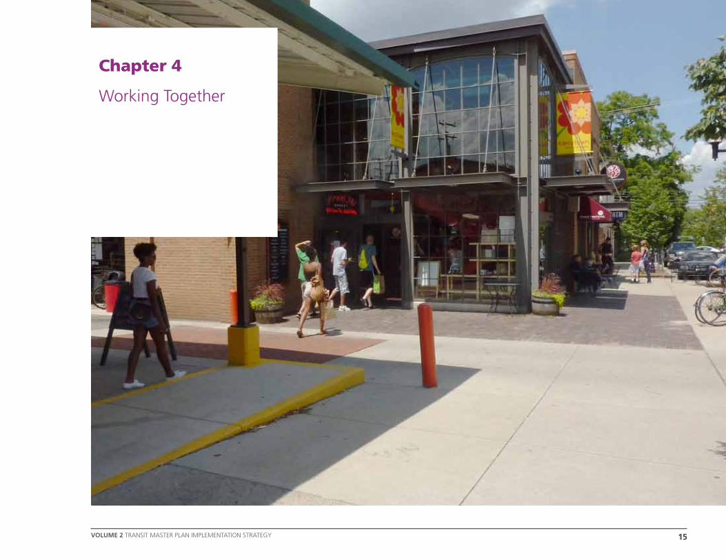
chAPTER 4WOrking TOgEThEr
Chapter 4
Working Together
1616
Working TogeTher
VoLUMe 2 TRANSIT MASTER PLAN IMPLEMENTATION STRATEGY
chAPTER 4
Recommendations for Advancing the Plan
TheRide should work together with stakeholders from across the County to take the Transit Master Plan forward and ensure that it is integrated with other community initiatives and projects.
To maintain strong relationships in the community TheRide should:
» continue to reach out to the public regularly to provide updates on the Plan’s progress and solicit input;
» continue to work with Partners for Transit to support their role in involving the community in transit;
» maintain and develop the Leadership Group and continue to seek direction and contributions from community leaders;
» continue to brief and lobby the local, state and national elected officials to ensure that transit remains a high priority on the political agenda; and
» maintain an ‘open door’ culture and welcome regular liaison groups on specific topics such as labor, development, culture, social services, healthcare, recreation, and education.
Recommendations for Implementing the Plan
TheRide should maintain and develop relationships with the many existing transit and transportation providers, local authorities, institutions and stakeholders across the County and look to foster new relationships and opportunities.
Where TheRide is not the most appropriate party to take plans forward it should provide support to and work with the appropriate parties. This is particularly important in the development of walking and biking initiatives, the development of local transit hubs and local facilities.
Where TheRide is supporting a local operator or implementing services in a new area, TheRide should encourage the local community to take the lead to benefit from the expertise and local knowledge of others.
Overall, in terms of the technical planning and implementation processes, TheRide should:
» maintain and develop the Technical Advisory Team and continue to seek expertise and input from technical experts from across the County;
» work transparently with all stakeholders including public and private operators and local authorities; and
» maintain an ‘open door’ culture and welcome new ideas and methods of implementation from interested parties.
1717VOLUME 2 TRANSIT MASTER PLAN IMPLEMENTATION STRATEGY
chAPTER 4WOrking TOgEThEr
Recommendations for Integrating Land use and Transportation Planning
Land use Planner Dave Betts has been working with TheRide to investigate ways to integrate land use and transportation planning in Washtenaw County.
This work culminated in a document outlining the structure of Land use Planning in Washtenaw County at both the local and regional level, identification of the responsibilities held and tools used in the planning process, and five recommendations for TheRide to progress land use and transportation planning integration.
The background and supporting information is presented in Appendix A and the six recommendations are:
1. TheRide should build strategic alliances with local planning authorities. Initially the focus should concentrate on areas projected to have population and employment increases. The strategic alliances should be designed to support working relationships with planning staff and consultants serving these local units to coordinate and advance changes in development ordinances and local Master Plan policy. These relationships should involve regular discussions on
pending re-zonings, site plans and transportation plans.
2. TheRide should aim to comment during each local community’s 5 year Master Plan update and present transit-oriented land use policy suggestions. In accordance with the new State notification requirements, TheRide may formally notify each jurisdiction in the County of its interest in coordinating local Master Plan updates with TheRide system plans. Accordingly TheRide should determine each jurisdiction’s review timeline and arrange to attend Planning Commission and Board meetings during the local Master Plan public notification process.
3. TheRide should build on current inter-jurisdictional collaborations centered on the communities of Chelsea, Dexter, Saline, Manchester and Milan to communicate regional transit objectives and propose special transit projects. These are initiatives that can best be supported by multi-jurisdictional agreements in which transit-oriented land use tools can be employed. Wherever possible, TheRide should advocate regional cooperation and communication.
4. TheRide should be aware of local governments’ proposals for special grant programs, tax benefit districts, overlay zoning districts and other publicly supported incentives which require the preparation of urban design plans. These plans will contain land use standards in which transit objectives may be advocated.
5. TheRide should link transit service expansion decisions with land use policy changes along new or expanded transit routes, modeling the development objectives envisioned for the Re-Imagining Washtenaw Avenue project and code changes advocated by Smart Growth and Sustainable Community organizations.
6. TheRide should further strengthen its relationships with land developers in order to ensure that it is understood to be an approachable organization and to encourage developers to work with TheRide to serve future developments or redevelopments.

COMMUnitY OUtREaCh – at SUMMER EVEntS

1919
Monitoring and Updating the plan
VolUMe 2 TRANSIT MASTER PLAN IMPLEMENTATION STRATEGY
chAPTER 5
Chapter 5
Monitoring & Updating The Plan

20
Monitoring and Updating the plan
20 VOLUME 2 TRANSIT MASTER PLAN IMPLEMENTATION STRATEGY
chAPTER 5
TheRide’s Continuous Planning Cycle
Since 2009, TheRide has developed and implemented its continuous improvement planning cycle across the organization as shown in Figure 6.
The cycle shows how all projects must be planned, implemented, monitored and adjusted over time to ensure that they are delivering real value to the community.
Robust public engagement is central to the planning process and informs each step.
Like all projects undertaken by TheRide, the final Transit Master Plan will be implemented, monitored and adjusted. This is necessary to ensure that the Plan continues to reflect the priorities of the County and its communities.
ENGAGE
Plan
Implement
Monitor
Adjust
figURE 6: thERidE’S COntinUOUS PLanning CYCLE

2121
Monitoring and Updating the plan
VolUMe 2 TRANSIT MASTER PLAN IMPLEMENTATION STRATEGY
chAPTER 5
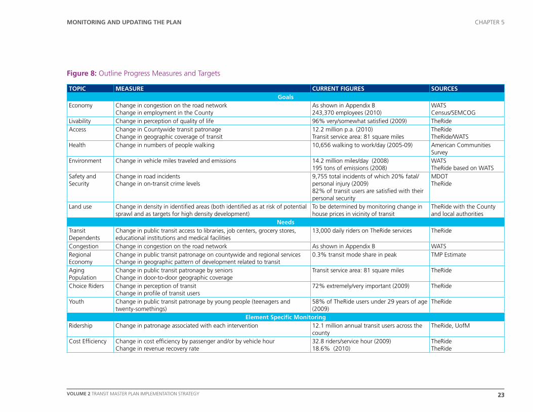
figURE 7: MOnitORing & UPdating thE PLan
Recommendations for Monitoring the Plan
As shown in Figure 7, the implementation and success of the Plan should be monitored biennially.
The full scope of the monitoring program should be set out in the next six months with details of:
» what will be measured,
» how it will be measured, and
» who will be responsible for undertaking the work.
The monitoring program should identify both:
» measures that are specific to particular elements, for example: ridership or cost efficiency, and
» measures to establish the impact of the Plan overall in the context of other related influences in the County, for example: change in congestion levels on key highways.
To provide context, an outline of possible progress measures and targets have been identified in Figure 7.
Recommendations for Adjusting the Plan
Figure 6 also shows that the Plan should be adjusted and updated every five years. This update should take into account:
» Developments to the transit network;
» Changing local conditions;
» Changing external factors; and
» Results of monitoring studies.
Publish the plan Update the plan
PLa
nn
ing Phase 1
Phase 2
Phase 3
COMPLEtiOn Of tRanSit MaStER PLan
iMPL
EMEn
tin
g Stage 1 (0-5 years) Biennial Monitoring
Stage 2 (5-15 years) Biennial Monitoring
Stage 3 (15-30 years) Biennial Monitoring
22
Monitoring and Updating the plan
22 VOLUME 2 TRANSIT MASTER PLAN IMPLEMENTATION STRATEGY
chAPTER 5
Recommendations for Involving the Community
Public Outreach should be undertaken as part of the program of monitoring and updating the Plan. It is important that the Plan continues to accurately reflect the needs and aspirations of the community and that members of the public who have contributed to the development of the Plan so far keep in touch with the process and see the progress made.
Recommendations for Taking Responsibility
Delivering the Plan will require a vast coordinated effort and TheRide should consider who will be responsible for championing, managing and implementing the Plan as a whole, as well as how particular elements will be developed.
Outline Progress Measures and Targets
TheRide will work with other stakeholders to assess how the County’s goals are being met and the County’s needs are being addressed, as well as monitoring transit ridership and financial performance. The following table provides an outline of some of the indicators that may be considered. Many indicators will require geographic information systems and mapping to deliver useful data.
2323
Monitoring and Updating the plan
VolUMe 2 TRANSIT MASTER PLAN IMPLEMENTATION STRATEGY
chAPTER 5
ToPIC meASuRe CuRReNT FIGuReS SouRCeSGoals
Economy Change in congestion on the road networkChange in employment in the County
As shown in Appendix B243,370 employees (2010)
WATSCensus/SEMCOG
Livability Change in perception of quality of life 96% very/somewhat satisfied (2009) TheRideAccess Change in Countywide transit patronage
Change in geographic coverage of transit 12.2 million p.a. (2010)Transit service area: 81 square miles
TheRideTheRide/WATS
Health Change in numbers of people walking 10,656 walking to work/day (2005-09) American Communities Survey
Environment Change in vehicle miles traveled and emissions 14.2 million miles/day (2008)195 tons of emissions (2008)
WATSTheRide based on WATS
Safety and Security
Change in road incidents Change in on-transit crime levels
9,755 total incidents of which 20% fatal/personal injury (2009)82% of transit users are satisfied with their personal security
MDOTTheRide
Land use Change in density in identified areas (both identified as at risk of potential sprawl and as targets for high density development)
To be determined by monitoring change in house prices in vicinity of transit
TheRide with the County and local authorities
Needs Transit Dependents
Change in public transit access to libraries, job centers, grocery stores, educational institutions and medical facilities
13,000 daily riders on TheRide services TheRide
Congestion Change in congestion on the road network As shown in Appendix B WATSRegional Economy
Change in public transit patronage on countywide and regional services Change in geographic pattern of development related to transit
0.3% transit mode share in peak TMP Estimate
Aging Population
Change in public transit patronage by seniors Change in door-to-door geographic coverage
Transit service area: 81 square miles TheRide
Choice Riders Change in perception of transit Change in profile of transit users
72% extremely/very important (2009) TheRide
Youth Change in public transit patronage by young people (teenagers and twenty-somethings)
58% of TheRide users under 29 years of age (2009)
TheRide
element Specific monitoringRidership Change in patronage associated with each intervention 12.1 million annual transit users across the
countyTheRide, UofM
Cost Efficiency Change in cost efficiency by passenger and/or by vehicle hour Change in revenue recovery rate
32.8 riders/service hour (2009)18.6% (2010)
TheRideTheRide
Figure 8: Outline Progress Measures and Targets

VOLUME 2 TRANSIT MASTER PLAN IMPLEMENTATION STRATEGY 25
appendix a
Appendix A
Land use Planning


VOLUME 2 TRANSIT MASTER PLAN IMPLEMENTATION STRATEGY 27
appendix a
This appendix provides a summary of Land use Planning in Washtenaw County to support the recommendations on the integration of Land use and Transportation Planning included in Section 4.
The text for this Appendix has been included from the Land use Planning Memorandum (January 5th 2011) by David Betts MA.
Background
The Washtenaw County Transit Master Plan intends to create a “robust, feasible and integrated plan with which to establish county-wide public transportation.” The long term implementation of this vision will be dependent on two land use planning objectives: encouraging increased housing and employment density in appropriate locations along transit corridors; and, promoting a development character that incorporates new transit facilities and mixed use development in urbanized areas. TheRide wishes to identify opportunities to implement these transit objectives within the context of local land use planning considerations and influence local land use policy wherever possible.
Local Planning Decisions
In Michigan, the responsibility for local planning and development is shared by elected legislative bodies and appointed planning commissions. The former are the decision makers; the latter are the advisors.
Planning Commissions typically:
» review development proposals and changes to zoning & subdivision ordinances;
» conduct reviews of site plans and other development proposals;
» prepare and recommend a community Master Plan to the legislative body;
» make recommendations about public works proposals that effect the local Capital Improvements Program (if any);
» educate the public about planning issues; and
» cooperate with other units of government on planning matters including the review of local Master Plans.
Appendix A: Land use Planning
The legislative Boards or Councils generally:
» approve local Master Plans and other planning policy documents;
» adopt zoning and subdivision regulations, approve some site plans and other development proposals recommended by the Planning Commission;
» receive and approve the Planning Commission’s annual work program report and budget; and
» generally support and direct the Planning Commission’s advisory responsibilities.
VOLUME 2 TRANSIT MASTER PLAN IMPLEMENTATION STRATEGY28
appendix a
Regional Planning Perspective
Local units of government are primarily concerned with planning and development decisions within their own jurisdictions. While residents and businesses are closely involved in development reviews, ordinance changes and policy formation, their decisions may lack a regional perspective except where inter-jurisdictional groups exist or communication between adjacent units of government is required by State law. There is not a single regional planning authority in the County advocating or mandating a broader perspective to local land use planning decisions. But there are notable multi-jurisdictional organizations that provide oversight, assistance and planning studies relative to TheRide’s Transit Master Plan intentions. These include the Southeast Michigan Council of Governments (SEMCOG), representing
multiple levels of government and education over the seven-county southeast Michigan region; and, the Washtenaw Area Transportation Study (WATS) representing multiple agencies and local units within the County. Both organizations play a role in the allocation of federal and state funding for local transportation projects and have advocated land use changes in support of public transportation objectives.
The Washtenaw County Planning Advisory Commission supported by the County Planning Department once provided oversight and technical assistance during the preparation of local Master Plans and revisions to local ordinances. The County also maintained a repository of local government plans and ordinances, and helped with special inter-jurisdictional projects and research. These functions were recently relinquished due to budget and other considerations.
All of Washtenaw County’s townships, villages and cities have 7-member Planning Commissions except for Freedom and Sharon townships which have 5-member commissions. Planning Commissions are supported either by professional planning staff (in the case of the larger jurisdictions) or by planning consultants. These planners have substantial influence and knowledge regarding local land use policy and politics across the County and can be a valuable contacts for TheRide to support the integration of land use and transportation planning.
VOLUME 2 TRANSIT MASTER PLAN IMPLEMENTATION STRATEGY 29
appendix a
Inter-Jurisdictional Planning Projects
Important cooperative efforts by adjoining jurisdictions in area-wide land use planning are evident throughout the County and were for a time supported by the County planning staff. These ‘regional’ planning projects indicate the ability and willingness of adjacent governments to cooperate on land use policy and operational issues of mutual interest. Such established relationships may indicate an interest in transit-oriented development and facility planning collaborations that would support the Washtenaw County Transit Master Plan. They also indicate a receptive forum of community leaders with different geographic perspectives. These inter-jurisdictional planning projects include the following:
» The Manchester Community Joint Planning Commission (MCJPC) was formed in 2007 to develop a regional plan for the Village of Manchester, Manchester Township, Freedom Township and Bridgewater Township (although Bridgewater Township has since withdrawn). It was formed by the Southwest Washtenaw Council of Governments (SWWCOG) which itself promotes communication and sharing of resources among its participating members: Freedom, Bridgewater,
Manchester and Sharon Townships, the Village of Manchester, and Manchester Community Schools.
» The Chelsea Area Planning Team/Dexter Area Regional Team alliance (CAPT/DART) was formed in 2005 to cooperate on regional planning issues such as transportation, the environment and growth. The participating jurisdictions include the City of Chelsea, the Village of Dexter and the Townships of Lyndon, Dexter, Scio, Sylvan, Lima and Webster.
» The Milan Organization for Regional Excellence (MORE) was formed in 2001 to address growth issues of mutual concern. The participants are the City of Milan, the Townships of York and Augusta in Washtenaw County, Milan and London Townships in Monroe County , the Milan Area Chamber of Commerce and Milan Area Schools.
» The Saline Area Sustainability Circle (SSC) was formed in 2001 to develop regional planning guidelines and better communication between the participants on a vision for the area. Participants are the City of Saline, the Townships of Lodi, Pittsfield, Saline and York, the Saline Area Chamber of Commerce and Saline Area Schools.
» The Re-Imagining Washtenaw Avenue project intends to “improve the investment environment and retrofit Washtenaw Avenue to a compact, walkable mixed-use transit corridor.” This cooperative effort involves the Cities of Ann Arbor and Ypsilanti, and the Townships of Ypsilanti and Pittsfield. Each of the jurisdictions has approved resolutions to form a joint Corridor Improvement Authority (CIA) which will implement the Re-Imagining Washtenaw Avenue strategy.

VOLUME 2 TRANSIT MASTER PLAN IMPLEMENTATION STRATEGY30
appendix a
Local Master Plans
This State mandated planning policy tool is perhaps the most comprehensive expression of local land use policy. Michigan legislation requires every jurisdiction with a planning commission to adopt a Master Plan as a guide for local development. This document is the policy anchor for all subsequent actions regarding zoning, infrastructure, transportation, plat subdivision, recreation and potentially many other public actions. The Master Plan covers the physical development of land and infrastructure. It generally contains goals & objectives, demographic and economic data, a future land use map, a zoning plan, a transportation plan and special subarea plans. Among the purposes of a Master Plan stated in the State enabling legislation of relevance to transit objectives are: “(i) a system of transportation to lessen congestion on streets” and “ (iv) healthful and convenient distribution of population.” Two new laws (HB5211 & HB5212) require local units to (1) include public transportation provisions in new or “substantially amended” Master Plans, and (2) to involve public transportation agencies in the notification and comment process. Local Master Plans are to be reviewed every 5 years to determine if changes are needed. Coordination and cooperation with other local units in this review is required. Public
notices are posted 15 days before public hearings if the Master Plan is amended. In this period of limited budgets and low development activity, few Master Plans are being substantially updated. Nevertheless, the mandatory review period may be an opportunity to provide public input on land use policy, possibly focusing on defining a transit-oriented development element for the Master Plan’s Future Land use Map and Street/Transportation section.
Local Land use Decisions
TheRide’s ability to express transit system objectives in regard to specific local land use decisions is generally absent. TheRide does not have the legislative authority to review or influence these actions. It can, however, lobby for the inclusion of transit elements in the standards adopted by each jurisdiction for considering development proposals. These standards may be expressed as ordinances or guidelines based on the policies expressed in the jurisdiction’s Master Plan as noted above. In the event TheRide wishes to become more involved in local development review, the following is an explanation of the public notification process for most land use changes.
» For rezoning changes, the Planning Commission must hold a public hearing and publish a notice in a newspaper of general local circulation not less than 15 days before the hearing. In addition, notice of the rezoning must be sent by mail to property owners and occupants within 300 feet of the rezoning 15 days before the hearing. In townships only, after the public hearing the petition is to be referred to the County planning “review body” for advisory comment within 30 days. (This review may be waved by the county board of commissioners.) Thereafter, the rezoning petition, any Planning Commission recommendations, a report of the public hearing and the County’s review comments if any are referred to the township board. In villages and cities, following the public hearing the Planning Commission sends the petition and its recommendations to the legislative body.

VOLUME 2 TRANSIT MASTER PLAN IMPLEMENTATION STRATEGY 31
appendix a
» Site plan review is required as part of a special use permit, or Planned Unit Development, or variance request process. Any other use of this tool would be determined by each jurisdiction’s zoning ordinance. Site plan approval may be granted administratively, by the appointed commission or by the legislative body as determined by local ordinance. In any event, a public notice or public hearing is usually not required.
» Planned use development (Pud) is another zoning tool that allows flexible development standards to address special site conditions, permit a mix of uses, clustering of units, retention of open space and placement of streets. A public hearing is required with public notice procedures similar to the rezoning process.
» Subdivision Regulations are prepared by the local planning commission for approval by the legislative body. Subdivision regulations must take into account arrangement of streets,
adequate spaces for traffic, utilities, firefighting access, recreation, light and air, avoidance of congestion, and installation of utility facilities. Prior to recommending such regulations, the planning commission must hold a public hearing preceded by a newspaper notice at least 15 days before the hearing. After regulations are in place and when a Master Plan has been adopted, the planning commission may review and recommend on subdivision plats after a public hearing and 15 days public notice in a local newspaper and mailed to adjoining land owners.
» master Plans are prepared by the local unit’s Planning Commission. The planning commission first sends a notice of intent to prepare or update the Master Plan to the recipients listed below. After the Master Plan is drafted, it is submitted to the legislative body to approve the distribution of the document to the public. Required
* The county’s review comments if any must include a statement whether the proposed Master Plan is consistent with that of any other municipality or regional authority, or the county’s own master plan.
recipients of the proposed Master Plan and notice of intent include:
» municipalities located within or contiguous to the local unit;
» the county planning commission if one exists;
» the regional planning commission if there is no county planning commission;
» the county board of commissioners if there is no county planning commission*;
» each public utility company, railroad company and public transportation agency owning or operating within the local unit’s jurisdiction;
» the County Road Commission and the State Transportation Department if the proposed Master Plan includes a Street Plan.
VOLUME 2 TRANSIT MASTER PLAN IMPLEMENTATION STRATEGY32
appendix a
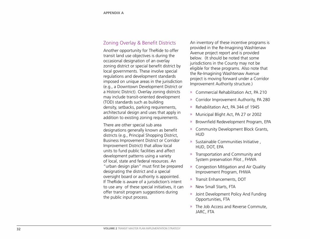
Zoning Overlay & Benefit Districts
Another opportunity for TheRide to offer transit land use objectives is during the occasional designation of an overlay zoning district or special benefit district by local governments. These involve special regulations and development standards imposed on unique areas in the jurisdiction (e.g., a Downtown Development District or a Historic District). Overlay zoning districts may include transit-oriented development (TOD) standards such as building density, setbacks, parking requirements, architectural design and uses that apply in addition to existing zoning requirements.
There are other special sub area designations generally known as benefit districts (e.g., Principal Shopping District, Business Improvement District or Corridor Improvement District) that allow local units to fund public facilities and affect development patterns using a variety of local, state and federal resources. An “urban design plan” must first be prepared designating the district and a special oversight board or authority is appointed. If TheRide is aware of a jurisdiction’s intent to use any of these special initiatives, it can offer transit program suggestions during the public input process.
An inventory of these incentive programs is provided in the Re-Imagining Washtenaw Avenue project report and is provided below. (It should be noted that some jurisdictions in the County may not be eligible for these programs. Also note that the Re-Imagining Washtenaw Avenue project is moving forward under a Corridor Improvement Authority structure.)
» Commercial Rehabilitation Act, PA 210
» Corridor Improvement Authority, PA 280
» Rehabilitation Act, PA 344 of 1945
» Municipal Blight Act, PA 27 or 2002
» Brownfield Redevelopment Program, EPA
» Community Development Block Grants, HUD
» Sustainable Communities Initiative , HUD, DOT, EPA
» Transportation and Community and System preservation Pilot , FHWA
» Congestion Mitigation and Air Quality Improvement Program, FHWA
» Transit Enhancements, DOT
» New Small Starts, FTA
» Joint Development Policy And Funding Opportunities, FTA
» The Job Access and Reverse Commute, JARC, FTA
VOLUME 2 TRANSIT MASTER PLAN IMPLEMENTATION STRATEGY 33
appendix a
Land use Models
The following are very general assumptions and observations about local land use concerns gathered from a review of local planning documents, which are intended as background for consideration of the Washtenaw County Transit Master Plan land use objectives:
» Development in the rural areas of the County should be sensitive to the preservation of the agricultural life style and the conservation of environmental resources.
» Continued very low density development in the townships should be supported by appropriate building densities and services in nearby small urban centers.
» New businesses should be recruited into small commercial clusters and town centers rather than along major roadways as strip development.
» Redevelopment of underutilized sites with public services should be favored over greenfield sites that would impact rural resources.
» The resident population will tend to “age in place” where services and infrastructure are supportive.
» “Place-making” to retain educated and talented younger workers/residents is desirable.
These concerns are an opportunity for discussing how transit-oriented development models may be applied to appropriate locations in the County, especially town centers with water/sewer, public safety and other services that can support increased population densities. Where there are inter-jurisdictional planning agreements, development may be directed to villages and small towns, reserving the lower density land uses for the rural areas. Outside of the highly developed corridors between Ann Arbor and Ypsilanti, the outlying communities of Chelsea, Dexter, Manchester, Milan, and Saline should be a focus for TheRide service expansions supported by these new land use models.
VOLUME 2 TRANSIT MASTER PLAN IMPLEMENTATION STRATEGY34
appendix a
There are a number of relevant ordinances and development standards available that local planning commissions may use. Some of the more noteworthy can be found at:
» The EPA Smart Growth site (http://www.epa.gov/smarthgrowth/) including information about the HUD-DOT-EPA Partnership for Sustainable Communities resources.
» The Smart Growth Network “Smart Growth Online” site (http://www.smartgrowth.org) with an extensive resource library.
» The Center for Transit-oriented Development guidebook and other transit/land use tools available at (http://tinyurl.com/TODTransitPerformanceTool) .
» The American Planning Association publication “Smart Codes: Model Land Development Regulations” (PAS Report 556) available at http://www.planning.org/.
» The Home Depot Foundation’s Sustainable Cities Institute (http://sustainablecitiesinstitute.org) with a Land use sections listing model TOD ordinances.
» The American Public Transportation Association (http://apta.com/resources ) publications including “Building Better Communities – Coordinating Land use and Transit Planning Sourcebook” 1990, and “Agencies Role in Regional Planning Process” 2009.
» Smart Growth Leadership Institute 2007 Tool Kit includes the means to audit local ordinances as well as links to model codes http://www.sgli.org/tool-kit/.
» The Southeast Michigan Council of Government (SEMCOG) Sustainability Framework’s “Land use Tools & Techniques – A Handbook for Local Communities” 2003 (http://www.semcog.org/Sustainability.aspx )
Special Initiatives
Another approach to implementing TheRide’s Transit Master Plan objectives, in parallel with advocating land use change, is initiating special transformational projects that capture the public’s imagination and the market’s attention. Quite often in other communities it is the advent of ground breaking transit programs and facilities that inspire the market driven land use changes needed to sustain an expanded transit system. The Re-Imagining Washtenaw Avenue project offers this kind of opportunity. The planning tools necessary to sustain and guide the desired development density and character are well known and well presented in that project’s documentation.

VOLUME 2 TRANSIT MASTER PLAN IMPLEMENTATION STRATEGY 35
appendix a
level Authority Role Influence
State Elected Legislature and Appointed Department of Transportation
Enabling laws and funding authority Direct and autonomous
Multi-County Region Membership supported Council of Governments Advise and assist; planning authority for federal and state funding
Indirect and cooperative
County Elected Commissioners (and in some Counties an appointed Planning Commission)
Policy oversight for state and federal funding
Indirect and autonomous
Multi-Jurisdictional Area Membership agreements and joint planning ability Joint operation and communication Direct and collaborative
Local Government Unit Elected Boards and appointed planning commissions
Municipal Corporation – taxing, services and regulations
Direct and autonomous
Special District Designation by local planning unit(s) with appointed Board of Directors
Implementing subarea redevelopment plans
Indirect and semi-autonomous
This table provides a summary of the key organizations involved in local and regional planning in Michigan. The geographical relationships between these organizations are depicted in the accompanying diagram.
STATE REGION
COUNTY
Local Unit Township
Multi-Jurisdictional Area
District
Local Unit City or Village
WITHIN THE STATE WITHIN THE COUNTY
thiS diagRaM iLLUStRatES thE SPatiaL RELatiOnShiP BEtWEEn thE ORganizatiOnS dESCRiBEd.


VOLUME 2 TRANSIT MASTER PLAN IMPLEMENTATION STRATEGY 37
appendix a
Appendix B
Road Congestion


VOLUME 2 TRANSIT MASTER PLAN IMPLEMENTATION STRATEGY 39
appendix a
Appendix B: Road Congestion
2010 Washtenaw County Congestion

VOLUME 1 | A TRANSIT VISION FOR WASHTENAW COUNTY40
If you have any comments or questions about this document or if you would like more copies, please visit our website: www.MovingYouForward.org
Alternatively you can call, email or write to us:
For general inquires: Michael Benham Project Manager - TheRide Email: [email protected] Tel: 734.794.1851
For media inquires: Mary Stasiak Community Relations Manager – TheRide Email: [email protected] Tel: 734.794.1870
Postal address: Michael Benham/Mary Stasiak TheRide 2700 South Industrial Highway Ann Arbor, MI 48104
Published: June 2011