Vol 9 Wilsden October 2008 - Bradford
76
City of Bradford MDC Local Development Framework for Bradford Landscape Character Supplementary Planning Document Volume 9: Wilsden October 2008
Transcript of Vol 9 Wilsden October 2008 - Bradford

City of Bradford MDC
Local Development Framework for Bradford
Landscape Character Supplementary Planning Document
Volume 9: Wilsden
October 2008


FOREWORD
This is Volume 9 of the Landscape Character Supplementary Planning Document (SPD) and
outlines the Landscape Character Assessment of Wilsden.
This document provides a detailed description and analysis of the landscape of Wilsden along
with a succinct set of policy guidelines for each landscape type. A map of the character area can
be found on Page 15.
Bradford Council will expect developers who wish to submit a planning application for a
development within a landscape character area, to take account of this SPD.
To achieve maximum benefit for all its users, this SPD contains two additional components, which
comprise of a non-technical User Guide and Landscape Character Design Guidance. Each of
these components are intended to help the user within the planning process and ultimately
achieve good, sympathetic design proposals which both protect and enhance the character and
appearance of the District’s natural landscapes.
The User Guide can be found overleaf; and the Design Guidance can be found in Appendix 1 of
this document.

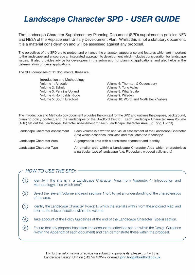
Landscape Character SPD - USER GUIDE
The Landscape Character Supplementary Planning Document (SPD) supplements policies NE3and NE3A of the Replacement Unitary Development Plan. Whilst this is not a statutory document,it is a material consideration and will be assessed against any proposal.
The objectives of the SPD are to protect and enhance the character, appearance and features which are importantto the landscape and encourage an integrated approach to development which includes consideration for landscapeissues. It also provides advice for developers in the submission of planning applications, and also helps in thedetermination of these applications.
The SPD comprises of 11 documents, these are:
The Introduction and Methodology document provides the context for the SPD and outlines the purpose, background,planning policy context, and the landscapes of the Bradford District. Each Landscape Character Area Volume(1-10) set out the Landscape Character Assessment for each Landscape Character Area (Eg Tong, Esholt).
Landscape Character Assessment Each Volume is a written and visual assessment of the Landscape CharacterArea which describes, analyses and evaluates the landscape.
Landscape Character Area A geographic area with a consistent character and identity.
Landscape Character Type An smaller area within a Landscape Character Area which characterisesa particular type of landscape (e.g: Floodplain, wooded valleys etc)
For further information or advice on submitting proposals, please contact theLandscape Design Unit on (01274) 433542 or email [email protected]
HOW TO USE THE SPD:
1 Identify if the site is in a Landscape Character Area (from Appendix 4: Introduction andMethodology), if so which one?
2 Select the relevant Volume and read sections 1 to 5 to get an understanding of the characteristicsof the area.
3 Identify the Landscape Character Type(s) to which the site falls within (from the enclosed Map) andrefer to the relevant section within the volume.
4 Take account of the Policy Guidelines at the end of the Landscape Character Type(s) section.
5 Ensure that any proposal has taken into account the criterions set out within the Design Guidance(within the Appendix of each document) and can demonstrate these within the proposal.
Introduction and MethodologyVolume 1: AiredaleVolume 2: EsholtVolume 3: Pennine UplandVolume 4: Rombalds RidgeVolume 5: South Bradford
Volume 6: Thornton & QueensburyVolume 7: Tong ValleyVolume 8: WharfedaleVolume 9: WilsdenVolume 10: Worth and North Beck Valleys


Bradford Metropolitan District Council Local Development Framework
Landscape Character Supplementary Planning Document - October 2008 Volume 9:Wilsden
WILSDEN
CONTENTS PAGE
1.0 GENERAL DESCRIPTION 1
2.0 NATURAL LANDSCAPE 3
3.0 CULTURAL LANDSCAPE 7
4.0 ANALYSIS 11
5.0 GENERAL CONCLUSIONS 14
6.0 WILSDEN: GRITSTONE MOORLAND 16
7.0 WILSDEN: UPLAND PASTURE 20
8.0 WILSDEN: MIXED UPLAND PASTURE 24
9.0 WILSDEN: WOODED INCLINE 28
10.0 WILSDEN: ENCLOSED PASTURE 31
11.0 WILSDEN: PARKLAND 36
12.0 WILSDEN: WOODED VALLEYS 41
APPENDICES
APPENDIX 1: LANDSCAPE CHARACTER DESIGN GUIDANCE 45


Bradford Metropolitan District Council Local Development Framework
Landscape Character Supplementary Planning Document - October 2008 Volume 9:Wilsden Page 1
WILSDEN
1.0 GENERAL DESCRIPTION
1.1 The Wilsden character area is a sheltered, settled landscape dominated by the three
principle settlements of Harden, Wilsden and Cullingworth which nestle in the concave
landform of sheltered hollows and dips. Farmsteads are scattered throughout the
landscape but are often large, and extended with modern farm buildings. It is a well
wooded area with significant, sometimes dominant, mixed plantations interspersed with
actively farmed pastures, surrounded predominately by stone walls. Parkland also
contributes significantly to the landscape and there are small outcrops of gritstone
moorland around Harden Moor.
1.2 It is a relatively low-lying plateau of land set above the Aire Valley, which drops away to
the north east, and it forms an important rural fringe area between Bradford and Keighley.
Wilsden character area includes two small fingers of countryside which extend eastwards
into the urban area between Shipley and Heaton, and Heaton and Allerton.
1.3 The Aire Valley forms the character area boundary to the north and east, and the Worth
Valley forms the boundary to the west. The boundary with the Pennine Upland character
area to the south west is narrow, running along Halifax Road between Flappit Spring and
Manywells Height where the land slopes gently down towards Cullingworth in contrast to
the upland moorland plateau of Black Moor to the west. The boundary with the
Thornton/Queensbury character area to the south is less distinct, where the landform
changes gradually from a gently hollowed topography to a gently rounded plateau at the
top end of Wilsden.
1.4 The Wilsden character area is made up from a mixture of seven landscape types, with
mixed upland pasture forming the dominant element within the landscape, dissected by
large and significant tracts of wooded incline and wooded valley landscape types.
Parkland also covers a large proportion of the character area; with gritstone moorland,
upland pasture and enclosed pasture also occurring in isolated pockets. In addition there
are three settlements within this character area.

Bradford Metropolitan District Council Local Development Framework
Landscape Character Supplementary Planning Document - October 2008 Volume 9:Wilsden Page 2
1.5 KEY LANDSCAPE ELEMENTS
• Rolling, concave plateau landform.
• Improved grasslands, extensively farmed and managed.
• Strong field pattern with stone wall boundaries.
• Parkland golf courses.
• Significant woodland cover including mixed plantations.
• Three principle settlements of Harden, Cullingworth and Wilsden.

Bradford Metropolitan District Council Local Development Framework
Landscape Character Supplementary Planning Document - October 2008 Volume 9:Wilsden Page 3
2.0 NATURAL LANDSCAPE
2.1 LANDFORM
• The Wilsden area is characterised by a gently rolling, open elongated bowl-shaped
valley sloping in a north easterly direction towards the Aire Valley.
• This main valley has been deeply incised by Harden Beck; some of it’s tributaries
also form narrow wooded valleys.
• Other smaller valleys, such as Chellow Dean and Noon Nick/Nailor Rough have
been formed by glacial action.
• Higher ground wraps around the main valley rising generally towards Harden Moor
in the north west and towards Thornton in the south.
• Wilsden lies along a north-south valley between two higher spurs of land; Northcliffe
and Heaton Woods lie in higher land to the east, separated from Wilsden by the
Cottingley Beck valley.
2.2 GEOLOGY
• The area is heavily influenced by glacial erosion, with overflow channels occurring
at Harden Beck, Cottingley Beck and Noon Nick/Nailor Rough where the
Cullingworth-Cottingley Lake drained into the Bradford Lake during the last Ice
Age. These Channels are unique to the Bradford area in West Yorkshire.
• The Millstone Grit Yeadonian sandstone outcrops at Harden Moor and Cottingley;
bands of siltstone/mudstone occur in the Harden Beck valley, with Kinderscoutian-
Marsdenian sandstone on higher ground around Cullingworth.
• The superficial deposits predominantly consist of glacial till with pebbles, cobbles
and boulders.
2.3 SOILS
• The area generally consists of sandy clay soils, shallow over large areas.
• Occasional alluvial deposits occur along Harden Beck.

Bradford Metropolitan District Council Local Development Framework
Landscape Character Supplementary Planning Document - October 2008 Volume 9:Wilsden Page 4
2.4 BIODIVERSITY
The Wilsden Character Area has a variety of habitats, such as substantial areas of
woodland, quality moorland and wetlands, as well as a few interesting grasslands, but
does not have any sites of national or international ecological value.
The sites of most significance for nature conservation include: -
• Coppice Bog/Pond SEGI and St. Ives – council owned country park near Bingley.
Coppice Pond/Bog contains a good range of aquatic species, including the
regionally rare shoreweed (Littorella Uniflora) and important and diverse mire
communities with an excellent example of bog asphodel valley mire. The St Ives
Estate is also a large recreational resource with heathland and large areas of
deciduous and plantation woodland supporting many species of wildlife.
• Goitstock Wood SEGI – an extensive woodland site, centered on Harden Beck.
Well structured woodland and well developed bryophyte flora; contains the
county’s largest population of climbing corydalis (Ceratocapnos Claviculata), a
species of scattered occurrence. The grassland communities are good examples
of diverse hay meadows.
• Harden Moor – large area of heather moorland near Bingley and St Ives Estate.
Common Land and well used by the public.

Bradford Metropolitan District Council Local Development Framework
Landscape Character Supplementary Planning Document - October 2008 Volume 9:Wilsden Page 5
BIODIVERSITY
HABITAT GENERAL SUMMARY
Woodlands Large mixed plantations in St Ives and Cottingley Woods, dominated by
conifers. In contrast, small wooded valleys of deciduous species in Goitstock
Woods and semi natural Deepcliffe Wood. Occasional small woods/shelter
belts on higher ground. Chellow Dean and Northcliffe/Heaton Woods contain
more mixed ornamental planting including beech.
* (AW) denotes that a site is also classed as an Ancient Woodland.
* (pt AW) denotes that part of the site is Ancient Woodland.
Hedgerows There are some hedgerows within the area, but they do not contribute
significantly to the landscape character.
Grasslands Large golf courses at St Ives, Chellow and Heaton form large grassland
areas. Most grasslands in Wilsden are improved for agricultural purposes
and of limited ecological value. Damp meadows at Hazel Beck and two
fields included in Goitstock Woods SEGI are grasslands of note1*
Moorland Harden Moor has good quality heather cover with varied invertebrate
interest; large areas of heathland occur within the St Ives Estate. Both sites
are council owned and have good public access.
Wetlands Harden Beck is known for freshwater crayfish and is therefore relatively
clean; Coppice Bog/Pond SEGI in St Ives Estate is a natural mire and
artificial pond with a good range of aquatic species, some of which are
regionally rare.
SPA SSSI AREA SEGI AREA
None
None
Chellow Dean Reservoir
Coppice Bog/Pond
Goitstock Wood (AW)
Goitstock Waterfall (RIGS)
400 lin.m
7.2ha
46.4ha
1 Bradford Grassland Survey

Bradford Metropolitan District Council Local Development Framework
Landscape Character Supplementary Planning Document - October 2008 Volume 9:Wilsden Page 6
THIRD TIER SITES
Moorland
Harden Moor
Black Moor (pt)
Wetlands
Hazel Beck
Miles Rough
Milking Hole Beck/ Hewenden Res.
Woodlands
Chellow Dean Woods (AW)
Cottingley Woods/Black Hills
(pt AW)
Deepcliffe Wood (AW)
Heaton Woods/ Northcliffe & Old
Woods (AW)
Hewenden Wood
Hollin plantation (AW)
Renolds Woods
Stoney Ridge Plantation
Amenity
St Ives Estate (pt AW)
Wildlife Corridors
Thornton-Cullingworth
Disused Railway
Others
Caperley Beck
WILDLIFE
Freshwater crayfish, which are becoming a threatened species, are known in Harden Beck and
Coppice Bog/Pond which also has a good amphibian interest, including palmate newts. The pond
supports a good range of fish, including three and five spined stickleback and is regularly fished by a
local club. The wetlands also attract a variety of wildfowl including winter visitors teal (Anas Crecca),
goldeneye (Bucephalus Clangula) and pochard (Aythya Ferina), as well as great crested and little
grebes.
Roe and fallow deer are associated with St Ives Estate, especially the large moorland areas where a
wide range of other wildlife is well represented. Barn owls have been recorded but there are no
recent records.
A wide variety of bee, butterfly and other insect species are associated with heathland of Harden
Moor, but this area is limited for birdlife, possibly due to the disturbance from informal recreation.
Heron are common throughout the area, with a known heronry near Harden, only one of two in West
Yorkshire.
Chellow Dean is also important for populations of all three native woodpeckers, as well as a variety of
fish including roach, perch, bream, carp, eels and pike.

Bradford Metropolitan District Council Local Development Framework
Landscape Character Supplementary Planning Document - October 2008 Volume 9:Wilsden Page 7
3.0 CULTURAL LANDSCAPE
3.1 HISTORY, ARCHAEOLOGY AND CULTURAL ASSOCIATIONS
• Harden Moor has three stone cairns that are scheduled monuments; one is a small
ring cairn – a prehistoric ritual monument of 13m diameter and two smaller round
cairns, which were burial mounds from the Bronze Age.
• St Ives Estate – formerly known as Harden Grange, was substantially built and
landscaped during the mid 1800’s, with much of the design work in the gardens carried
out by the first and second wives of Squire Ferrand. His mother-in-law, Lady Blantyre
used to visit St Ives often and there is a plaque on a rock to commemorate where she
used to sit and admire the views. Another member of the family, William Busfield
Ferrand, was a politician and friend of Disraeli (who came to stay at the mansion and
made a speech at Druid’s Alter).
• Civil War – there is no documentary evidence about a battle on Harden Moor, but
General Fairfax made a camp above St Ives in 1642 and used the hall as his
headquarters. The Fairfax Entrenchment was probably erected to protect his camp
from troops from Skipton.
• Woodland along Cottingley Beck, adjacent to Cottingley Moor Road is associated with
the true story about two young girls, earlier this century, who convinced the world they
photographed fairies at the bottom of the garden. The hoax was not discovered until
many years later. The “Cottingley Fairies” were recently the subject of a motion picture
called “Fairytale”.
• Conservation areas have been designated at Wilsden, Cullingworth, Hainworth and
Ryecroft:-
o Wilsden grew up around the woollen manufacturing industry prior to 1845, giving
rise to several mills and associated mill workers cottages.
o Cullingworth, until the early 1800s, consisted of a village street made up of eight
farms and a few cottages; the increased importance of the textile industry
changed the agricultural emphasis of the village. However the early settlement is
relatively intact, although interspersed with more modern development.

Bradford Metropolitan District Council Local Development Framework
Landscape Character Supplementary Planning Document - October 2008 Volume 9:Wilsden Page 8
o Ryecroft is focused around a late 17th century farm, which has developed over
two centuries to become a hamlet just outside Harden. The Conservation Area
includes related field boundaries to ensure the retention of the rural setting.
o Hainworth is a small settlement centred around a former large manor. The
earliest buildings date from 1624 although the majority are 18th Century farms
and cottages. It is significant in that apart from minimal alterations and
modernisation, it remains very much as it was in the mid 19th Century.
LISTED BUILDINGS, CONSERVATION AREAS AND ARCHAEOLOGY
World Heritage
Site
Saltaire World Heritage Site Buffer Zone covers part of this Character
Type, in particular part of the ‘Enclosed Pasture’ Character Type
Listed Buildings
There are approximately 86 Listed Buildings within the Wilsden Character Area.
The following list are Grade I or Grade II* listed buildings and/or
structures which are of exceptional historical importance within the
landscape:
- Barn to east of New Close farm, Glenview Road, Shipley (Grade II*)
- 1, 2, 3 Royds Hall Farm, Shay Lane, Bradford (Grade II*)
- Harden Hall, Wilsden Road, Harden (Grade II*)
Conservation
Areas
Cullingworth
Hainworth
Ryecroft
Wilsden The Design and Conservation Team have prepared up-to-date
Conservation Area Assessments/Appraisals for each of the areas
listed above. These documents should be taken into consideration
as part of any proposal.
Ancient/Scheduled
Monuments
1 No.
3 Stone Cairns Harden Moor
Historic Parks &
Gardens
None
Battlefield None
Historical
Other Associations None

Bradford Metropolitan District Council Local Development Framework
Landscape Character Supplementary Planning Document - October 2008 Volume 9:Wilsden Page 9
3.2 SETTLEMENT PATTERNS
• The three traditional settlements of Harden, Wilsden and Cullingworth nestle in the
tributary valleys of Harden Beck and are all surrounded by higher land. They have
similar cores and have all grown up around crossroads, although Wilsden and
Cullingworth have developed into linear settlements.
• St Ives Estate, in particular, and Harden Grange are former manorial residences set
within their own grounds.
• Occasional small groups of house/hamlets have developed along roads at Ryecroft
and Harecroft which are linked to Harden and Wilsden respectively.
• Scattered farmsteads occur throughout the rest of the area, many dating from the 17th
century and are mostly traditional gritstone buildings.
3.3 TRANSPORT INFRASTRUCTURE
• The character area contains a very busy network of roads, consisting mainly of b-
roads and minor roads, which do not necessarily relate to the landform and cut across
the contours.
• The area is exceptionally well covered by public footpaths, bridleways and tracks,
giving good access throughout.
• Part of Thornton-Cullingworth disused railway line extends into the area, pointing to
the industrial links of the past.
3.4 RECREATION/TOURISM
• St Ives Estate is the main recreational “honey-pot” in the area, offering a variety of
woodland and moorland walks, fishing, golf and archery.
• There are about four golf courses – Shipley, Northcliffe, Chellow and St Ives – and a
driving range within this area.

Bradford Metropolitan District Council Local Development Framework
Landscape Character Supplementary Planning Document - October 2008 Volume 9:Wilsden Page 10
• There is a well-used and extensive footpath and bridleway network across moorland
and farmland.
• Riding schools throughout the area on the urban fringe farmland provide an additional
source of income to marginal farms.
• Fishing is a popular activity at Coppice Pond in St Ives Estate and also at Chellow
Dean and Hewenden Reservoirs; good quality trout fishing is available in Harden
Beck.
• Model air planes are flown on old land adjacent to Harden Moor, orienteering, motor
cycle trial events in old quarry area, horse riders and walking/rambling are all popular
pursuits.

Bradford Metropolitan District Council Local Development Framework
Landscape Character Supplementary Planning Document - October 2008 Volume 9:Wilsden Page 11
4.0 ANALYSIS
4.1 Sensitivity
• Strength of character Moderate
Parts of the character area such as the upland pastures to the north and west of Harden
around Hewenden Reservoir have a relatively strong character. However, across the whole
character area, pylons and other urban influences have significantly weakened the
character.
• Historic continuity Medium
Traditional farms are now diversifying to accommodate a wider range of land uses.
Suburban estate developments on the edge of the settlements, volume of traffic, and
extensive networks of electricity pylons have brought significant changes to this
landscape.
• Remoteness Settled
There is a very busy character to the area, with various urban elements in the landscape
signalling the proximity of the large settlements of Keighley and Bradford.
• Significance of new development Medium
Twentieth century estates development features significantly within particular views of the
area but overall it can not yet be said to be a dominant element in the landscape.
Incidences of newer, suburban style detached dwellings such as Lee Lane, Cottingley and
new developments such as Cuckoo Nest, near Harden are beginning to weaken the
overall rural character of the area.
• Pressures on the integrity of the unit Immediate
There is a real danger of the three villages joining up through development, particularly
Harden and Wilsden. Further development along routes through the countryside would
cause fragmentation of this unit of landscape by creating urbanised traffic corridors of
developed land bearing little relation to the particular character of the individual villages.

Bradford Metropolitan District Council Local Development Framework
Landscape Character Supplementary Planning Document - October 2008 Volume 9:Wilsden Page 12
4.2 Important Features
Landmarks
• The viaduct near the bottom of Hewendon Reservoir forms a dramatic focal point in
views of this area. It is prominent in views from the Bradford to Haworth Road which
drops steeply into the Harden Beck Valley while the adjacent viaduct runs overhead.
Skylines
• Cottingley Woods form an important skyline in views from Airedale. They are a
dominant element in the landscape and being positioned on the brow of the hillside,
and as substantial wood inclines, they make an important contribution to the character
of Airedale as well as that of Wilsden.
Key Views and Vistas
• The panoramic view from Harden Moor looking east and south encapsulates the
character of the Wilsden area, showing the wooded valleys running up to the three
villages.
• The view south east and south west from the parkland around the Bingley to Harden
Road shows the wooded incline leading into the wooded valley which runs across the
mixed upland pasture.
• The view from Ryecroft Road near Catstones Hill south-west towards the mixed
upland pasture of Lees Moor portrays the dominance of the field pattern in the
landscape where the patchwork of stone walls stands out on the gently sloping terrain.
• The Saltaire Environmental Capacity Study and the Saltaire Conservation Area
Assessment both identify key views and vistas into and out of the World Heritage Site.
Any development proposal shall take these into account and ensure that they are
preserved.
Memorable Places
• The St Ives Estate has its own distinctive parkland character with many interesting local
features including woodland walks around Coppice Pond and Lady Blantyre’s Rock.

Bradford Metropolitan District Council Local Development Framework
Landscape Character Supplementary Planning Document - October 2008 Volume 9:Wilsden Page 13
• Deepcliffe Wood is a remnant of ancient woodland. The track from Moor Edge winds along
the stream side and up through the woodland passing many interesting old oak specimens,
and then opening out to reveal the treeless vistas of Harden Moor.
• Harden village centre is memorable because of the pastures that come right into the heart
of the village retaining the traditional balanced relationship between the farmland and the
settlement.
• Grassy banks and woodland walks along Milking Hole Beck north of Denholme lead down
to the Hewenden Reservoir and give the landscape a natural countryside character despite
being close to a settlement and a busy road.
4.3 Detractors
• Pylons are detractors in all landscape character areas, but Wilsden has been
particularly strongly affected by them. They are dominant vertical elements in a
landscape where vertical elements are not a significant part of the unique character of
the area.
• The current working quarry on Harden Moor is an eyesore from the immediate vicinity
along Ryecroft Road, as in the quarry at Manywells, Cullingworth.
• Row of modern detached houses along Lee Lane near Cottingley Moor not in keeping
with the traditional stone character of the area.
• Suburban style housing in non-traditional materials on edges of Cullingworth and
Wilsden in particular.


Bradford Metropolitan District Council Local Development Framework
Landscape Character Supplementary Planning Document - October 2008 Volume 9:Wilsden Page 14
5.0 GENERAL CONCLUSIONS
• With moderate strength of character, medium historic continuity, a settled character, medium
significance of new development, and immediate pressures on the integrity of the unit; the
Wilsden area has moderate sensitivity, with a particular pressure of settlements merging.
• It is a very mixed character area with the higher ground being more sensitive than the lower
valleys due to its prominence in views from routes through the area, and due to the open
character of the landscape types there.
• By summarising the landscape character strategy for the seven landscape types in Wilsden,
it can be seen that in general the character strategy in Wilsden is to conserve the character
with potential to enhance it in some areas.
• The Wilsden area is already perceived as a busy and quite crowded landscape with most
lanes having a heavy traffic flow. It does not have the capacity to accommodate vast amounts
of new development, mainly due to the associated infrastructure, e.g. roads, lightning, kerbs
and signs that further development would bring to the landscape – causing significant
damage to the Wilsden character.
• There is also the issue of the settlement joining up, particularly Wilsden and Harden. Further
development, in particular along the roads between them, will have a far more significantly
detrimental effect on the character of the Wilsden area than development hidden from views
off these roads. It is very important that the distinctiveness, and separate natures of these
villages be retained and enhanced because the imminent alternative of three historic village
centres within a suburban sprawl of large detached houses and road infrastructure would
destroy the meaning, integrity and character of the three villages (Wilsden, Harden and
Cullingworth), and in turn reduce the open countryside to a small pocket that fringes Bradford
and Keighley. It is strongly recommended that Village Design Statements be produced for all
three of these settlements in the short term to assess and conserve the special character of
the villages in any new development that does take place.
• Should further development be required in this character area there are places where it could
be relatively well accommodated and hidden. These are detailed in the landscape change
sections of the landscape types.


0 0.4 0.8 1.2 1.6 2Kilometers
WILSDENGritstone moorland
Upland pasture
Mixed upland pasture
Wooded valley
Enclosed pasture
Parkland
Wooded incline
Settlement


Bradford Metropolitan District Council Local Development Framework
Landscape Character Supplementary Planning Document - October 2008 Volume 9:Wilsden Page 16
6.0 WILSDEN: GRITSTONE MOORLAND
6.1 Description
• Wilsden gritstone moorland consists mainly of Harden Moor which is a relatively small
area of low-lying moorland occurring on the plateau of high ground between Keighley
and Harden. It is split in two by a small length of wooded valley at Deepcliffe Wood.
Smaller areas of gritstone moorland adjoin Harden Moor, at Catstones Moor to the
west, and in part of the St Ives Estate to the north-east.
• Most of the area consists of good quality low-lying moorland heath (some of the best
quality in the district) which has been managed recently by burning and scrub control
to improve its regeneration. Part of the area also consists of acid grassland and birch
scrub giving a good quality mosaic of upland habitats.
• However, the area is blighted by the ongoing quarry activities alongside the Ryecroft
Road, where the piles of newly quarried stone stand out physically against the

Bradford Metropolitan District Council Local Development Framework
Landscape Character Supplementary Planning Document - October 2008 Volume 9:Wilsden Page 17
relatively flat landform and visibly against the muted colours of the moorland beyond.
Older accumulations of excavated materials further along the road have successfully
revegetated and include scrub and tree/shrub cover.
6.2 LANDSCAPE STRATEGY
6.2.1 Analysis
• Strength of character Strong
This is a distinct landscape of high quality moorland which stands out against the pastures
surrounding it. The historic remains and associations also give it a timeless character.
• Condition Declining
The condition of the moorland itself is generally good, although it sometimes appears
disturbed and slightly fragmented in the short term when the current quarrying activities
are fresh and from the perceived poor restoration of former spoil heaps giving the
landscape a degraded feel. Harden Moor also suffers from erosion from horses and
walkers along the extensive network of footpaths which cross it. Some areas of Harden
Moor and the moorland within St Ives are in danger of reverting to woodland through
Scrub invasion.
Goo
d
STRENGTHEN
Strengthen and
Conserve
CONSERVE
Dec
linin
g
Strengthen and
Enhance
Conserve and
Enhance
Conserve and
Restore
Poor
CREATION
Restore and
Enhance
RESTORE
Weak Moderate Strong
Con
ditio
n
Character

Bradford Metropolitan District Council Local Development Framework
Landscape Character Supplementary Planning Document - October 2008 Volume 9:Wilsden Page 18
1.1.1 Policy Guidelines
Conserve and Restore
• Conserve the habitat of the heather moorland; improve the vegetation by regimes of
heather burning and scrub control. A management strategy has been produced for
Harden Moor to address issues such as vegetation management and access control.
• Enhance the recreational use of the area by improving the footpath and bridle
networks for public access. However, consideration must be made to minimise
disturbance to the wildlife such as nesting birds, by providing information access
points.
• Enhance the current areas of active quarrying by tree planting to screen and mitigate
the views from Ryecroft Road and planting to integrate the previously quarried areas
into the moorland landscape.
1.2 POTENTIAL FOR DEVELOPMENT
6.3.1 Sensitivity Analysis
• Strength of character Strong
(See Above)
• Historic Continuity High
The presence of prehistoric stone cairns on the moorland would suggest that this area
had a very high historic continuity. Catstones Ring on Catstones Moor is possibly the
site of a prehistoric settlement. Even the quarrying has been carried out on an irregular
basis since the last century and the current workings are still relatively small scale.
• Visual Prominence and Enclosure Prominent, exposed
It is highly prominent as a skyline from views around the Wilsden area, and its distinct
colours, textures and lack of field boundaries stand out against the surrounding pasture
dominated landscape. As a raised treeless plateau, with no field boundaries it does
have an exposed character, although the revegetated spoil heaps give a degree of
enclosure in some areas.

Bradford Metropolitan District Council Local Development Framework
Landscape Character Supplementary Planning Document - October 2008 Volume 9:Wilsden Page 19
1.2.1 Traditional Settlement Patterns
• There is no housing within this landscape type. There are some temporary structures
associated with the quarrying of the land.
1.2.2 Policy Guidelines
• This landscape has a strong character, high historic continuity, is prominent and
exposed, it can therefore be seen to be a very sensitive landscape. The moorland is of
relatively high quality and the fact that there is no existing settlement or historic pattern
of development here would indicate that any development here would be detrimental
to the landscape character.
• The infrastructure associated with quarrying (access roads, spoil mounds, heavy
traffic, mud and dust) is contributing to the declining condition of the area and any
future large-scale continuation of these activities should be strongly resisted.
• Recreational development, in accordance with the written Management Plan, would be
appropriate.

Bradford Metropolitan District Council Local Development Framework
Landscape Character Supplementary Planning Document - October 2008 Volume 9:Wilsden Page 20
7.0 WILSDEN: UPLAND PASTURE
7.1 DESCRIPTION
• There are two areas of upland pasture in the Wilsden character area, both on the high
ridge of land which separates Keighley from the Wilsden settlements. Closely linked to
settlements at Moor Edge, Harden and Long Lee near Keighley, they also give
extensive views of built-up areas. They appear as remnants of upland pasture and are
therefore more isolated than the extensive moorland fringe upland pastures of
Rombalds Ridges and the Pennine Upland character areas. In addition, several lines of
pylons, which run across the area, add to their “urbanisation”.
• However, there is relatively little tree cover and a strong pattern of drystone wall field
boundaries which justifies their landscape type. A low density of traditional farmsteads
are also scattered throughout the landscape.

Bradford Metropolitan District Council Local Development Framework
Landscape Character Supplementary Planning Document - October 2008 Volume 9:Wilsden Page 21
7.2 LANDSCAPE STRATEGY
7.2.1 Analysis
• Strength of character Moderate
This is a landscape with a simple, smooth character of open, gently sloping pastures with
grid-like patterns of dry stone walls which is weakened by the presence of vertical elements
such as pylons and telegraph poles stretching out across the fields.
• Condition Declining
Some stone walls are in disrepair and there are large gaps in field boundaries. Some of the
pastures are becoming marginal through under grazing and moorland rushes are starting to
encroach, giving a degraded appearance to the landscape. Conditions varies from farm to
farm.
Goo
d
STRENGTHEN
Strengthen and
Conserve
CONSERVE
Dec
linin
g
Strengthen and
Enhance
Conserve and
Enhance
Conserve and
Restore
Poor
CREATION
Restore and
Enhance
RESTORE
Weak Moderate Strong
Con
ditio
n
Character

Bradford Metropolitan District Council Local Development Framework
Landscape Character Supplementary Planning Document - October 2008 Volume 9:Wilsden Page 22
7.2.2 Policy Guidelines
Conserve and Enhance
• Conserve the overall rural character of the landscape; resist urbanising influences such
as street lighting, pylons, telegraph poles and signage.
• Conserve the strong field pattern and pasture dominated landscape throughout by
discouraging extensions to farm buildings in non-traditional materials or new access
roads which would be highly visible.
• Conserve the open, treeless character of the landscape. However, the landscape
setting of some of the farmsteads could be strengthened by planting small shelterbelts
of sycamore and ash, especially where modern farm buildings have weakened the
traditional character.
• Enhance the characteristic field pattern by maintaining and repair of drystone walls;
restore stone walls where gaps occur and replace boundaries with stone where
appropriate.
• Enhance the ecological value of the pastures by improving species diversity,
encouraging appropriate grazing regimes and ecologically sensitive management.
7.3 POTENTIAL FOR DEVELOPMENT
7.3.1 Sensitivity Analysis
• Strength of Character Moderate
(See above)
• Historic Continuity High
Traditional, relatively unspoilt upland pasture. Pylons will have been one of the few
changes to take place here over the past centuries.
• Visual Prominence and Enclosure Prominent, Open
These areas are on the upper slopes of a ridge that forms the skyline visible from many
views around the Wilsden character area and they are, therefore, very prominent. Their

Bradford Metropolitan District Council Local Development Framework
Landscape Character Supplementary Planning Document - October 2008 Volume 9:Wilsden Page 23
position in the landform, and the general lack of tree cover means the landscape has
an open character.
7.3.2 Traditional Settlement Pattern
• Low density traditional Pennine gritstone farmsteads in the upland pastures adjacent
to Long Lee. No settlement within the upland pastures at Moor Edge, Harden although
there is a traditional stone terraced housing within the adjacent settlement.
7.3.3 Policy Guidelines
• With a moderately strong character, high historic continuity, and being a prominent
and open landscape these areas are sensitive to development. There is also an
unbroken historic precedent for development to be restricted to the number of
farmsteads able to be supported by the land. Therefore it can be concluded that
further development in the landscape is not appropriate.
• There may be opportunities for allowing new, sensitively designed farm buildings to
consolidate existing farmsteads in accordance with their traditional layout, especially to
replace current farm buildings that are out of keeping with the local character. There is
a trend for the expansion of farmsteads leading to large modern farm buildings/slurry
stores which dominate the farmsteads, and through built in traditional materials, have
a scale and design that are out of character with the rest of the farm buildings. Large
‘specimen’ size sycamores are often associated with isolated farm buildings and are
an important landscape component. Thinning of smaller self-set groups with the
replanting of oaks would be appropriate.
• The settlement of Thwaites, (part of the Keighley area) occurs to the west of the
upland pastures on the slopes of the Aire Valley. The twentieth century suburban style
developments are very prominent in a large number of long distance views around the
Bradford District, and are detrimental to the character of the area. Expansion of this
settlement in the upland pastures of Wilsden would have a significant negative impact
on the character of the area. Expansion of this settlement in the upland pastures of
Wilsden would have a significant negative impact on the character of the area because
of the prominence and openness of the land.

Bradford Metropolitan District Council Local Development Framework
Landscape Character Supplementary Planning Document - October 2008 Volume 9:Wilsden Page 24
8.0 WILSDEN: MIXED UPLAND PASTURE
8.1 DESCRIPTION
• Although the Wilsden character area contains seven of the nine landscape types found
in the Bradford District; the landscape type occupying the largest area is the mixed
upland pasture. It is continuous with the larger areas of mixed upland pasture to the
south, adjoining the Thornton/Queensbury area and in the Pennine Uplands, fringing in
either side of the wooded valleys, and encircling the settlements.
• The mixed upland pasture either side of Wilsden is dominated by lines of pylons with
street lighting along the roads, and kerbs along many of the road edges. By contrast,
the mixed upland pasture to the north and south of Cullingworth has far fewer pylons,
street lights and kerbs, and hence the landscape has a smoother, more open and
remote character.

Bradford Metropolitan District Council Local Development Framework
Landscape Character Supplementary Planning Document - October 2008 Volume 9:Wilsden Page 25
8.2 LANDSCAPE STRATEGY
8.2.1 Analysis
• Strength of Character Moderate
The strength of the drystone wall field pattern is weakened by the presence of pylons and
electricity sub-stations, especially to the east and west of Wilsden; as well as street lighting,
roads and associated traffic which all fragment the character of the mixed upland pasture.
• Condition Declining
The drystone walls are often in poor repair with frequent gaps. Many of the pastures also
appear marginal, under grazed with rushes beginning to encroach, although these are often
more ecologically diverse than improved pastures. The pastures near Cullingworth,
however, are in a better condition, although this varies from farm to farm.
Goo
d
STRENGTHEN
Strengthen and
Conserve
CONSERVE
Dec
linin
g
Strengthen and
Enhance
Conserve and
Enhance
Conserve and
Restore
Poor
CREATION
Restore and
Enhance
RESTORE
Weak Moderate Strong
Con
ditio
n
Character

Bradford Metropolitan District Council Local Development Framework
Landscape Character Supplementary Planning Document - October 2008 Volume 9:Wilsden Page 26
8.2.2 Policy Guidelines
Conserve and Enhance
• Conserve the pasture dominated landscape throughout; discourage further
development such as housing or the erection of modern farm buildings in non-
traditional materials, especially away from the traditional farm layout.
• Conserve the rural character of the landscape; resist urbanising influences such as
street lighting, pylons and telegraph poles.
• Enhance the strong field pattern through the repair of drystone walls; restore stone
walls where gaps occur and replace boundaries with stone walls where appropriate.
• Enhance the ecological value of the pastures by encouraging appropriate grazing,
species diversity and ecological sensitive management.
• Enhance the setting of farmsteads within the landscape by encouraging the planting of
traditional “South Pennine” shelterbelts of sycamore and ash trees around the edges.
8.3 POTENTIAL FOR DEVELOPMENT
8.3.1 Sensitivity
• Strength of Character Moderate
(See above)
• Historic Continuity Medium
The pasture landscape still dominates the character of the area but twentieth century
changes such as pylons, new development, and traffic has significantly changed it.
• Visual Prominence and Enclosure Prominent, Open
Around Wilsden the mixed upland pasture occurs on a plateau which means it is
prominent in views across the landscape. Around Cullingworth it is on lower lying
slopes meaning it is prominent in views from the surrounding roads on higher ground.

Bradford Metropolitan District Council Local Development Framework
Landscape Character Supplementary Planning Document - October 2008 Volume 9:Wilsden Page 27
The mixed upland pasture does not have any sense of enclosure, it is an open
landscape with few trees.
8.3.2 Traditional Settlement Pattern
• Settlement within the Wilsden character area generally consists of scattered
farmsteads, along with the occasional hamlet such as Ryecroft, which has developed
from a C17th farmstead, or rows of stone terraced properties, such as New Brighton
near Cottingley, which are often isolated from but close to the edge of urban areas.
8.3.3 Policy Guidelines
• Although the Wilsden mixed upland pasture has moderate strength of character, this
pasture dominated landscape is sensitive because of it’s prominence and openness.
In summary, development here could have a greater impact on the character of the
area than development in other less prominent and more enclosed landscape types
within the Wilsden area.
• There is an existing pattern of occasional rows and groups of houses isolated from the
settlements, but if more such developments were built it would visually fragment the
landscape and damage the character by introducing more urban elements into it.
• If further development is required in the mixed upland pasture, it would be most
appropriately accommodated through expansion of the existing settlements. Some
small-scale development around the edges of Cullingworth and the south side of
Wilsden could improve the relationship of these settlements to the surrounding
landscape. New sensitively designed appropriate housing following detailed planning
briefs for particular sites, and incorporating significant landscaping could be planned to
create enhanced village edges.

Bradford Metropolitan District Council Local Development Framework
Landscape Character Supplementary Planning Document - October 2008 Volume 9:Wilsden Page 28
9.0 WILSDEN: WOODED INCLINE
9.1 DESCRIPTION
• There is only one area of wooded incline in this character area. It is located to the west
of Cottingley and is close to other areas of wooded incline on the site of the Aire
Valley. It is prominent in views from the St Ives Estate, forming a bold green skyline
round the parkland landscapes.
• It is primarily a band of conifer planting running along the steep upper parts of the
incline, and continuing over the break of slope at Park Rocks.
• The landscape just contains woodland, tracks, and forest rides.

Bradford Metropolitan District Council Local Development Framework
Landscape Character Supplementary Planning Document - October 2008 Volume 9:Wilsden Page 29
9.2 LANDSCAPE STRATEGY
9.2.1 Analysis
• Strength of Character Strong
The woodland is a very bold, large scale, unifying feature in the landscape with no sub-
division. It is an enclosing feature which limits and defines views.
• Condition Good
The woodland is managed and not degraded or fragmented.
9.2.2 Policy Guidelines
Conserve
• Conserve the woodlands and ensure management programmes are in place.
Management plans should be drawn up which recognise the visual importance of the
woodland within the landscape.
• Consider opportunities for extending the woodlands with deciduous tree planting to
soften edges of conifer plantations. See Section 10.0 - Wilsden Enclosed Pasture.
• Conserve field boundaries of the pasture fields present.
Goo
d
STRENGTHEN
Strengthen and
Conserve
CONSERVE
Dec
linin
g
Strengthen and
Enhance
Conserve and
Enhance
Conserve and
Restore
Poor
CREATION
Restore and
Enhance
RESTORE
Weak Moderate Strong
Con
ditio
n
Character

Bradford Metropolitan District Council Local Development Framework
Landscape Character Supplementary Planning Document - October 2008 Volume 9:Wilsden Page 30
• Strengthen and enhance the recreational opportunities available within the woodlands.
9.3 POTENTIAL FOR DEVELOPMENT
9.3.1 Sensitivity Analysis
• Strength of Character Strong
(See above)
• Historic Continuity High
Although the plantation woodlands are changing all the time in the course of
management, felling and replanting; the area of land itself has had a long history of
woodland, and changes are occurring at a steady intermittent pace.
• Visual Prominence and enclosure Prominent, Very enclosed
This landscape is on one slope of a fairly open valley and occupying a large length of
skyline in views of the area. Continuous woodland canopy occupies more than 75% of
the area which gives the landscape a very enclosed character.
9.3.2 Traditional Settlement Pattern
• No development, just wooded slopes.
9.3.3 Policy Guidelines
• With its strong character, high historic continuity and being prominent and very
enclosed, the wooded incline can be seen to be sensitive to change. However, due to
the very enclosed nature of these landscapes it may be possible to accommodate
some development. However there is no historic precedent of settlement within the
wooded incline due to the steep slopes, and so this landscape is not the most
appropriate one for housing.
• Should further development be required, Cottingley could expand into this incline on a
small scale in the form of terraces of development which are hidden within the
woodland structure, and therefore not visible in views of the wooded valley side.
• However, these comments should be considered along with the recommendations
contained within the Wilsden Enclosed Pasture in Section 10.0 of this assessment.


Bradford Metropolitan District Council Local Development Framework
Landscape Character Supplementary Planning Document - October 2008 Volume 9:Wilsden Page 31
10.0 WILSDEN: ENCLOSED PASTURE
10.1 DESCRIPTION
• There are three small areas of enclosed pasture within the Wilsden character area.
Two of them are associated with wooded valleys, and the other area, above Cottingley
reflects some of the character of the neighbouring character area of Airedale.
• The enclosed pasture to the west of Cullingworth has a broken network of tree groups
associated with the shallow, open slopes of a stream valley, and the line of a disused
railway.
• The enclosed pasture at Heaton Royds flanks the upper, flatter, slopes of an incised
wooded valley just outside the Bradford urban area. A similar landscape, but on a
smaller scale, exists at the nearby Chellow Dean.

Bradford Metropolitan District Council Local Development Framework
Landscape Character Supplementary Planning Document - October 2008 Volume 9:Wilsden Page 32
10.2 LANDSCAPE STRATEGY
10.2.1 Analysis
• Strength of Character Moderate
Small woods and groups of trees provide a structure to the landscape, but the areas
are not particularly distinct from the surrounding countryside.
• Condition Declining
All the areas have a lush, slightly overgrown feel to them. They are attractive in
character but some fields are not regularly used for grazing, and some walls are in
need of repair.
Goo
d
STRENGTHEN
Strengthen and
Conserve
CONSERVE
Dec
linin
g
Strengthen and
Enhance
Conserve and
Enhance
Conserve and
Restore
Poor
CREATION
Restore and
Enhance
RESTORE
Weak Moderate Strong
Con
ditio
n
Character

Bradford Metropolitan District Council Local Development Framework
Landscape Character Supplementary Planning Document - October 2008 Volume 9:Wilsden Page 33
10.2.2 Policy Guidelines
Conserve and Enhance
• Conserve the network of small woods, tree groups, hedges and individual trees that
give the enclosure to these areas.
• Conserve the structure of pockets of open land enclosed by networks of woodlands
and trees.
• Enhance pasture land through return of regular sheep grazing or considering
alternative land uses for marginal pasture land in poor condition – potentially new
woodlands, other wildlife habitats. As these three small areas of enclosed pasture do
not form a major part of the Wilsden character, and are associated with either wooded
valleys or wooded inclines, it may be desirable to plant up parts of these areas with
native broad-leaved woodlands.
• Enhance the recreational opportunities available by creation of green routeways
through woodlands or along disused railway lines.
• Protect the universal value of Saltaire World Heritage Site and minimise the negative
impact of development within the Buffer Zone on the World Heritage Site.
10.3 POTENTIAL FOR DEVELOPMENT
10.3.1 Sensitivity Analysis
• Strength of character Moderate
(See Above)
• Historical Continuity Medium
Some changes in the landscape have often resulted in tree growth, for example the
cessation of hedgerow management, and the disuse of the railway corridor.
• Visual Prominence and Enclosure Visible, enclosed
The area to the west of Cullingworth is visible in some views but not prominent due
to its relatively low-lying position. The area south of Cottingley is more prominent,

Bradford Metropolitan District Council Local Development Framework
Landscape Character Supplementary Planning Document - October 2008 Volume 9:Wilsden Page 34
featuring views from Lee Lane, and from the other side of Airedale. Heaton Royds
enclosed pasture is not prominent, but is visible from the adjacent urban areas.
All the areas are relatively enclosed due to their significant tree cover.
9.2.1 Traditional Settlement Pattern
• Scattered farmsteads
10.3.3 Policy Guidelines
• It can be seen that with moderate strength of character, medium historic continuity, and
a visible and enclosed nature; these areas are only moderately sensitive to
development relative to other parts of the Wilsden character area. With significant tree
cover, and not a prominent position in the landscape the visual impacts of
development here would be less than in most other parts of the character area, and
they could potentially accommodate some future development if it were required.
• The historic precedent for the form of development here is scattered farmsteads, and
other forms of development would look out of character with this landscape unless
they were a logical, and carefully designed, expansion of adjacent settlements, the
area to the west of Cottingley and the area to the west of Cullingworth.
• Because of the particular character of this enclosed pasture there is the potential to
both enhance the character of the landscape, and satisfactorily accommodate further
development, through the provision of new woodlands.
• As stated above in the landscape character strategy, new woodlands could be created
on some of the marginal pasture in poor condition to link up with existing woodlands in
the adjacent wooded valleys and wooded inclines to enhance the character of the
area. This would then strengthen the existing network of woodlands and tree groups to
provide a suitable framework for possible settlement expansion to the west of
Cottingley and to the west of Cullingworth.
• Village Design Statements would be one way to secure appropriate, small scale
traditional village housing, which does not repeat the bland, suburban “standard”
estate development that has damaged the character of the Wilsden area in the past.

Bradford Metropolitan District Council Local Development Framework
Landscape Character Supplementary Planning Document - October 2008 Volume 9:Wilsden Page 35
The extended woodland network would provide an effective screen, structure, and
visual and recreational amenity or the new development.
• The third area of enclosed pasture – around Heaton Royds, is adjacent to the Bradford
urban area. Together with the wooded valley and the parkland landscape types it
fingers into the suburban development forming a valuable “green wedge” or small
“island” of landscape which has almost been enveloped by the Bradford urban area.
This area is of significant amenity value to local people, and the whole area is heavily
used for recreation.
• While the land south of the wooded valley may be an obvious place to extend the
Bradford urban area into, this pocket of landscape is sensitive because of the
important role it plays in providing visual and recreational amenity very close to high
numbers of people. Therefore further development here is not considered to be
desirable in landscape terms.


Bradford Metropolitan District Council Local Development Framework
Landscape Character Supplementary Planning Document - October 2008 Volume 9:Wilsden Page 36
11.0 WILSDEN: PARKLAND
11.1 DESCRIPTION
• The parkland in Wilsden occurs in two areas; St Ives Estate and the adjoining land to
the south of Harden Road which constitutes the Shipley Golf Course; and Northcliffe
Golf Course to the south west of Shipley, along with the area of glacial overflow
channels within Stoney Ridge Plantation. There are three golf courses within the
landscape type, all of which consist if large blocks of woodland enclosing large open
grassland areas, containing individual and small groups of mature parkland trees.
Some of the woodland contains coniferous tree species and more ornamental planting.
Boundaries consist mainly of stone walls but post and wire fencing and occasional
hedges are a feature within Shipley Golf Course.

Bradford Metropolitan District Council Local Development Framework
Landscape Character Supplementary Planning Document - October 2008 Volume 9:Wilsden Page 37
11.2 LANDSCAPE STRATEGY
11.2.1 Analysis
• Strength of Character Strong
The scale of the open areas and enclosures given by the substantial blocks of
woodland and mature parkland trees give this landscape a definite character.
• Condition Good
Estate management regimes for the golf courses and local authority management of
the recreational areas of St Ives Estate has a secured a good quality landscape.
11.2.2 Policy Guideline
Conserve and Enhance
• Conserve the well-wooded, enclosure character of the landscape; encourage tree
planting and management to ensure the longevity and replacement of the mature
parkland trees and the woodland blocks. This is a well balanced landscape which
already contains large areas of woodland enclosing equally large areas of
Goo
d
STRENGTHEN
Strengthen and
Conserve
CONSERVE
Dec
linin
g
Strengthen and
Enhance
Conserve and
Enhance
Conserve and
Restore
Poor
CREATION
Restore and
Enhance
RESTORE
Weak Moderate Strong
Con
ditio
n
Character

Bradford Metropolitan District Council Local Development Framework
Landscape Character Supplementary Planning Document - October 2008 Volume 9:Wilsden Page 38
grassland/parkland trees; there is little scope or necessity for additional tree planting to
enhance the landscape character.
• Conserve the wetland habitats within the St Ives Estate primarily for their wildlife value,
but also for their landscape and recreational attributes. Harden Beck should also be
conserved as an ecological valuable and relatively unpolluted watercourse.
• Enhance and strengthen the existing hedgerows where these occur as field
boundaries.
• Enhance grassland areas adjacent to the golf fairways and which do not form active
parts of the golf courses for their species diversity and contribution to wildlife.
• Restore stone walls where necessary, especially where these encompass the original
areas of parkland.
11.3 POTENTIAL FOR DEVELOPMENT
11.3.1 Sensitivity Analysis
• Strength of Character Strong
(See above)
• Historic Continuity Medium
St Ives Estate and Harden Grange have been in existence since being built and
landscaped during the 1800’s and have remained relatively unchanged since. The
other areas were probably landscaped at a similar time and also remain undeveloped,
though sometimes modified for their current recreational uses.
• Visual Prominence and Enclosure Visible, enclosed
A lot of the parkland is on low-lying ground which is visible in views from the
surrounding countryside, but not prominent.
The large blocks of woodland are dominant features in the landscape and along with
the parkland trees contribute to the enclosed, intimate character of the landscape.
However, there are also extensive views of the district afforded from within parts of St
Ives Estate and Northcliffe Golf Course.

Bradford Metropolitan District Council Local Development Framework
Landscape Character Supplementary Planning Document - October 2008 Volume 9:Wilsden Page 39
11.3.2 Traditional Settlement Patterns
• The Character of parkland generally excludes settlement apart from large, individual
country houses within their landscaped parkland setting, although estate buildings
such as lodges, agricultural cottages, farms or barns are associated with the country
houses within St Ives Estate and Harden Grange. The settlement within the Northcliffe
Golf Course parkland consists of occasional traditional farmsteads, archive maps of
the 1850’s show several larger residences such as Park House, North Hall, and
Plantation Hall in the vicinity, one of which may have been the manorial residence
associated with this parkland in the past. However, none of these houses exist today
and there is no other information available to substantiate this connection.
11.3.3 Policy Guidelines
• With its strong character, medium historic continuity, visible and enclosed character,
this landscape can be seen to be only moderately sensitive to development relative to
other parts of the District. In one sense the low-lying, tree covered, landscape is
relatively able to absorb some development without a high impact in views of the
landscape from the surrounding countryside. However the landscape clearly has a
specific historical basis as a “country house estate” landscape giving it a sensitivity on
a historical, cultural, and recreational basis which is likely to restrict its consideration
for future development.
• Wilsden parkland is identified by its country houses absorbed within a parkland setting,
enclosed by dense woodland. This is a well balanced landscape where the landscape
setting of its buildings is integral to the character of the area. The fragmented nature
and associated infrastructure of housing development could not be appropriately
absorbed within this landscape, as can be seen at Cuckoo Nest near Harden where
the small modern, non-traditional housing estate is at odds with the parkland which
surrounds it.
• There may be some potential for a high quality, robust, single structure of appropriate
proportions to be absorbed within a suitably wooded setting within the parkland to the
south of Shipley Golf Course where it could be framed by Cottingley Woods on the
wooded incline beyond, so long as the infrastructure (access roads, signage, lighting
etc.) is minimal and sympathetic to the landscape setting.

Bradford Metropolitan District Council Local Development Framework
Landscape Character Supplementary Planning Document - October 2008 Volume 9:Wilsden Page 40
• Other parts of the Wilsden Parkland have an elevated landform and are too prominent
to be able to easily absorb additional development.


Bradford Metropolitan District Council Local Development Framework
Landscape Character Supplementary Planning Document - October 2008 Volume 9:Wilsden Page 41
12.0 WILSDEN: WOODED VALLEYS
12.1 DESCRIPTION
• The Wilsden character area contains three areas of wooded valleys. The main one is
the Harden Beck valley which sub-divides into the valleys of its tributaries and extends
into the settlements. The other two: Chellow Dean and Heaton Royds, are smaller
lengths of wooded valley which finger in between estate developments of the Bradford
urban core.
• While the Harden Beck wooded valley rests in the bottom of a gently sloping bowl
feature in the landform, the other two have flat to shallow sloping upper sides, and a
narrow, V-shaped, incised valley below which is heavily wooded.
• In general the wooded valleys are viewed in the landscape as bold, dark green blocks
of trees which run along the stream valleys. The land cover is predominantly

Bradford Metropolitan District Council Local Development Framework
Landscape Character Supplementary Planning Document - October 2008 Volume 9:Wilsden Page 42
broadleaved trees, but Chellow Dean includes some adjacent fields, and Harden Beck
includes Hewenden Reservoir within the wooded valley landscape type.
12.2 LANDSCAPE STRATEGY
12.2.1 Analysis
• Strength of Character Strong
The bold pattern of woodland picking out the changes in the landform gives a strong
structure to the landscape.
• Condition Good
In general the land has a good condition though some walls are in need of repair, and
some fields are of marginal agricultural quality.
Goo
d
STRENGTHEN
Strengthen and
Conserve
CONSERVE
Dec
linin
g
Strengthen and
Enhance
Conserve and
Enhance
Conserve and
Restore
Poor
CREATION
Restore and
Enhance
RESTORE
Weak Moderate Strong
Con
ditio
n
Character

Bradford Metropolitan District Council Local Development Framework
Landscape Character Supplementary Planning Document - October 2008 Volume 9:Wilsden Page 43
12.2.2 Policy Guidelines
Conserve
• Conserve the tree cover of the wooded valleys, and encourage woodland
management. There is the potential to expand the woodlands into the adjacent
enclosed pastures to increase the woodland cover of Bradford and provide further
wildlife habitats.
• Conserve the non-developed, natural, character of the valleys.
• There are possibilities for enhancing the recreational potential of the valleys through
securing access to the woodlands and sign posting footpaths.
12.3.1 Sensitivity Analysis
• Strength of Character Strong
(See above)
• Historic Continuity High
As the land is difficult to develop, the woods have remained very similar for many
centuries. There are few threats to the wooded valleys, and the main changes have
been the development of reservoirs and sewage works.
• Visual Prominence and Enclosure Visible, very enclosed
The wooded valleys are visible in particular views, but because of their low-lying
position in the landform they are generally quite hidden.
Due to the landform and the heavy tree cover, these landscapes have a very enclosed
character.
12.3.2 Traditional Settlement Pattern
• No housing, just utility infrastructure such as sewage works and reservoirs.

Bradford Metropolitan District Council Local Development Framework
Landscape Character Supplementary Planning Document - October 2008 Volume 9:Wilsden Page 44
12.3.3 Policy Guidelines
• Though the strong character, high historic continuity, and visibility point towards the
landscape being sensitive to development, the wooded valleys are very enclosed and
so reduce the impacts that development within it has on the wider landscape.
• However the historic pattern of development has precluded housing in these
landscapes because of the difficulties of developing steeply sloping wooded land. So
although the landscape could effectively “hide” some development, development is not
appropriate to the character of the wooded valleys.
• Extensions to existing industry or utility infrastructure would be appropriate, as well as
small scale recreational developments. Another issue worth considering is that due to
the vertical elements, and enclosure that woodland provides it is the ideal location for
runs of pylons. If opportunities for relocating pylons arise, then running them along
side the wooded valleys may be a way greatly reducing their impact on the landscapes
of Bradford.
• Development in the wooded valley between Harden and Wilsden should be strongly
resisted, because development here would contribute to the amalgamation of the
settlements which would substantially damage the character of the whole Wilsden
character area.

Bradford Metropolitan District Council Local Development Framework
APPENDIX 1 Landscape Character Supplementary Planning Document - October 2008 Volume 9:Wilsden Page 45
APPENDIX 1:
LANDSCAPE CHARACTER SUPPLEMENTARY PLANNING DOCUMENT
LANDSCAPE CHARACTER DESIGN GUIDANCE
OCTOBER 2008

Bradford Metropolitan District Council Local Development Framework
APPENDIX 1 Landscape Character Supplementary Planning Document - October 2008 Volume 9:Wilsden Page 46
CONTENTS PAGE
1.0 INTRODUCTION 47
The Aim of the Design Guidance
The Landscape Context
The Role of Developers in the Landscape Process
2.0 PRELIMINARY WORK 49
Site Survey and Appraisal
Outline Landscape Plan
3.0 LANDSCAPE DESIGN 51
Landscape Design Principles
Landscape Design Details
4.0 LANDSCAPE MANAGEMENT & MAINTENANCE 54
Maintenance Considerations
Maintenance Responsibilities
Management Plans
5.0 FURTHER ADVICE 56
Council Contacts
Other Useful Council Contacts
Other Useful Contacts

Bradford Metropolitan District Council Local Development Framework
APPENDIX 1 Landscape Character Supplementary Planning Document - October 2008 Volume 9:Wilsden Page 47
1.0 INTRODUCTION
1.1 The Aim of the Design Guidance
Whilst the Landscape Character Supplementary Planning Document aims to preserve
and enhance the character of defined areas in Volumes 1 to 10 that accompany this
document, it is important to note that appropriate development may occur within these
areas. The adoption of a systematic approach to development as outlined in this
guidance will help encourage good design and integration of development into the
landscape, thereby maintaining and enhancing its character and value for the benefit of
future generations.
These guidance notes set out the approach that will be taken by Bradford Council with
regard to the implementation of Policies NE3 and NE3A of the adopted Replacement
Unitary Development Plan for the Bradford District. These notes are intended as
guidance for developers; they do not replace any other planning obligations that may
relate to a site. Where an Environmental Assessment is required, for example, the
contents of this guidance will form part of the scoping exercise.
1.2 The Landscape Context
Landscape results from the way that different components of our environment - both
natural (the influences of geology, soils, climate, flora and fauna) and cultural (the
historical and current impact of land use, settlement, enclosure and other human
interventions) – interact together and are perceived by us.
All landscapes, whether in urban or rural locations, have interest, meaning and value to
those who live and work within them or visit them. They have locally distinctive character
that sets them apart from the rest. Landscapes also have, to varying degrees, value for
wildlife and the diversity of vegetation which is a significant factor in determining that
value. This draft SPD provides a comprehensive overview of all aspects of the
landscape that characterises each of the 10 Landscape Character Areas and should be
referred to as part of this process.
The Council recognises that the inherent characteristics of a landscape are vital factors in
giving it local distinctiveness, and that in order to maintain this distinctiveness these
characteristics must be retained and enhanced wherever possible.

Bradford Metropolitan District Council Local Development Framework
APPENDIX 1 Landscape Character Supplementary Planning Document - October 2008 Volume 9:Wilsden Page 48
1.3 The Role of Developers in the Landscape Process
In order to achieve successful integration of development into the landscape and
restoration, retention and enhancement of local landscape character the Council expects
developers to follow a systematic approach as outlined on the following pages. The
objective is to ensure that the aims of development are consistent with the principles of
sustainability, landscape enhancement and nature conservation. Proper consideration of
landscape issues should not be seen as a financial burden but as a positive benefit in
terms of its value to a development.
The size of a proposed development and/or the relative sensitivity of the site will dictate
the extent of details expected to be provided. The Council will seek to advise developers
of its expectations within the early stages, through pre-application advice and
discussions. Notwithstanding this, the principles contained within these guidance notes
should still be relevant to anyone involved in the development process whether on a large
or small scale, and will be applicable to all development.
There are three main sections to this guidance note which must be taken into
consideration as part of any proposal. These are:
Preliminary Work
Design Principals
Landscape Management and Maintenance

Bradford Metropolitan District Council Local Development Framework
APPENDIX 1 Landscape Character Supplementary Planning Document - October 2008 Volume 9:Wilsden Page 49
1.0 PRELIMINARY WORK
2.1 Site Survey and Appraisal
At the stage of pre-application discussion, applying for outline or full planning permission,
or when undertaking a feasibility study on which the Council’s views are sought, the
applicant or developer will be expected to carry out and submit an accurate site survey
and comprehensive site appraisal to include:
Context A description and analysis of the surrounding areas, including hard and
soft landscapes, buildings etc. and an indication of important links and
inter-relationships, described in the character assessments.
Levels/contours A diagram illustrating the levels and contours of the site.
Landform A statement of the slopes, orientation of the site etc. Existing features A statement of existing trees, hedgerows, other significant areas of
vegetation, water, ditches, boundary treatments, significant structures,
areas of hard surfaces etc.
Visual Qualities - A statement and/or photographs to illustrate the views in/out of the site,
quality of view/s, general character, local distinctiveness, any dominant
features etc.
- A zone of visual influence may be required for prominent development
proposals in the landscape
Designations An identification and assessment of any local designations which are
applicable to the site, to include:
Special Protection Area (SPA)
Special Areas of Conservation (SAC)
Sites of Special Scientific Interest (SSSI)
Site of Ecological and Geological Importance (SEGI)
Regionally Important Geological Sites (RIGS)
Local Nature Reserves (LNR)
Bradford Wildlife Area (BWA)
Sites of Nature Conservation Importance
Tree Preservation Orders (TPO’s)
Saltaire World Heritage Site (and buffer zone)
Listed Buildings
Conservation Areas
Scheduled Ancient Monuments
Historic Parks and Gardens

Bradford Metropolitan District Council Local Development Framework
APPENDIX 1 Landscape Character Supplementary Planning Document - October 2008 Volume 9:Wilsden Page 50
Archaeological sites
Battlefield Sites
Registered Cemeteries
Rights of Way
Setting - A statement of the impact on the setting of any designations as listed
above.
2.2 Outline Landscape Plan
2.2.1 The site survey and appraisal leads to the next element of the feasibility or application
stage when the developer will be expected to draw up and submit an outline landscape
plan for the development site, to form the basis of a detailed scheme to be submitted at a
later stage. This is to ensure that landscape matters are being considered at the outset
as an integral part of the development.
2.2.2 The outline plan should contain general information on the landscape approach to the
site, including:-
1) How the proposal will not adversely affect local character and
distinctiveness of the Landscape Character Area.
2) The treatment of site boundaries
3) The retention of existing landscape features
4) Intended access points and circulation routes
5) The main ‘structural’ planting and significant areas of hard landscaping to
be incorporated within the development
General
Information &
Landscape
Approach
6) Details of any existing trees or other landscape features which it is
proposed to remove or retain including protection measures.
2.2.3 Conditions which are imposed on the subsequent granting of planning permission will be
related to the outline landscape plan which is submitted. However, it is expected that this
plan should not over-constrain the submission of subsequent details, but rather establish
the broad principles of the landscape design approach.

Bradford Metropolitan District Council Local Development Framework
APPENDIX 1 Landscape Character Supplementary Planning Document - October 2008 Volume 9:Wilsden Page 51
2.0 LANDSCAPE DESIGN
3.1 Landscape Design Principles
3.1 Before development commences on site, the developer will be required to submit, and
have approved by the Council, a detailed landscape design for the site. This should be
based on the survey and appraisal and be consistent with the overall context described in
the Outline Landscape Plan, unless convincing arguments can be put to the contrary.
3.2 The detailed layout should address the following issues:
1) The layout and design should be appropriate to the area and establish a
built environment of quality and variety, which integrates retaining local
distinctiveness of the built form within the landscape.
2) Consideration should be given to the use and form of space when
planning the site
3) The layout should maintain and enhance the diversity and character of
the established vegetation on the site and utilises it where appropriate for
shelter and passive enjoyment and habitat creation. Reference should be
made to the Postcode Plant Database:
http://www.nhm.ac.uk/nature-online/life/plants-fungi/postcode-plants/
4) Where appropriate the layout should provide an integrated, attractive and
safe environment for pedestrians, cyclists and those with disabilities
5) Consideration should be given to ‘designing out crime’ – e.g. by not
creating screening which could conceal anti-social or criminal activity, or by
using thorny ‘deterrent’ shrubs to prevent access onto the site.
6) Where appropriate (i.e. mainly for housing developments) there may be a
requirement to provide recreational open space within the layout and
consideration should be given to integrating any such provision into the
development
7) Consideration should be given to the maintenance of hard and soft
landscaping in the future
Landscape Design
Principals
8) The surface water drainage system should minimise run-off and utilise
natural and sustainable drainage systems where appropriate. The use of
innovative green technology such as green roofs needs to be considered.

Bradford Metropolitan District Council Local Development Framework
APPENDIX 1 Landscape Character Supplementary Planning Document - October 2008 Volume 9:Wilsden Page 52
3.2 Landscape Design Details
1.1.1 The detailed landscape design should include:
1) Botanical names, including genus, species and varieties of all proposed trees,
shrubs and herbaceous plants
2) Planting sizes of all proposed plants
3) The proposed positions and spacing of plants
4) The species mix percentages for grass seeds
5) Accurately plotted positions of trees, shrubs, other vegetation and features to be
retained and precise details of their means of protection during the construction
period
6) The position of existing trees and other significant landscape features which is
proposed to remove
7) All maps and plans should have on them a north point and appropriate scaling
8) Weed control measures including maintaining areas prior to planting, herbicide
treatment, mulch specification and depth.
9) Topsoil specification, depths for all the above, grade of topsoil in accordance
with the current B.S 3882 and proposed additives / ameliorants.
10) Slope stabilisation methods
Landscape
Planting Plan
11) Management plans including objectives and aftercare maintenance proposals
12) Tree retention and felling plan; all to be cross referenced to a tree condition
survey in accordance with the current B.S. 5837
13) Protective fencing during construction (type and positioning)
Treatment
of Existing
Trees 14) Tree surgery proposals, cross referenced to trees on a plan and any tree
survey details
15) Paint or wood stain colours should be included for all appropriate materials
16) Surfacing materials and kerbs / edge restraints, with existing and proposed
levels
17) Boundary treatment, including walls and fences, retailing walls, internal plot
fences
18) Utility routes, including draining, depth, special measures and any easements
19) Special constructions, e.g. tree pit surrounds, planters, steps, ramps, retaining
structures, public art
20) Lighting and Street furniture, including protection against vehicle impact, e.g.
bollards, tree guards, temporary / permanent fencing, low walls etc.
Hard Landscape
Plan
21) Location and design of refuse and sub-station storage screens and enclosures.

Bradford Metropolitan District Council Local Development Framework
APPENDIX 1 Landscape Character Supplementary Planning Document - October 2008 Volume 9:Wilsden Page 53
3.2.2 The detailed landscape design should take account of:
1) The use of species, materials and street furniture which reflect local
character
2) The use of recycled materials and materials from sustainable sources
3) The incorporation of existing plants and other features
4) The use of plants to create screening and microclimatic conditions
through shade, shelter etc
5) The use of plants and public art to create local focal points
6) A selection of plant species to provide year-round interest
7) A selection of plants to encourage wildlife where appropriate
8) The suitability of plants for the location (e.g. their ultimate size and habit,
tolerance of soil conditions and shade, root spread, long-term ease of
management etc
9) A specification and depth of topsoil for different types of planting
10) The use of larger tree stock to resist vandalism
11) Future maintenance needs of, and access to, hard and soft landscaped
areas for e.g. litter clearance
12) Landform, and the treatment and use of sloping ground, taking account
of the needs of people with impaired mobility
13) Drainage and the need to conserve drain water
14) Means of defining boundaries
15) The creation of an overall character and unifying landscape structure for
the development
Landscape
Design
Details
16) The integration of the development into the surrounding landscape (e.g.
the transition from residential to agricultural use).

Bradford Metropolitan District Council Local Development Framework
APPENDIX 1 Landscape Character Supplementary Planning Document - October 2008 Volume 9:Wilsden Page 54
3.0 LANDSCAPE MANAGEMENT AND MAINTENACE
4.1 Maintenance Considerations
The success of any landscape scheme will, to a significant extent, be determined by the
standard of maintenance undertaken following implementation of the scheme.
Consideration must therefore be given to how the works are to be maintained in the
future to ensure that the original design is effectively turned into an attractive landscape.
For hard landscaped areas, the maintenance programme should incorporate actions to
keep all materials and street furniture in a good, safe and attractive condition.
Consideration should be given to keeping areas free of litter and other debris. Methods
of keeping paving free from chewing gum and walls free from graffiti should also be
considered.
For soft landscaped areas, consideration should be given to watering in the early stages
where necessary. Excessive weed growth can inhibit the development of young plants
and measures must be considered whereby weeds are suppressed by the use of
mulching techniques. These can include the use of mulch mats around individual plants,
textile membranes over planting beds or shredded bark or other suitable loose material to
a depth of at least 50mm. The use of chemical herbicides should be kept to a minimum
to ensure that accidental damage to plants does not occur through inappropriate
application.
1.1 Maintenance Responsibilities
All landscape schemes will require an on-going commitment to management. Planning
conditions may impose a limited period of maintenance or replacement of failed plants to
ensure initial establishment is in place from the start.
Responsibility for future maintenance should be clarified at the earliest opportunity, with
parties aware of their maintenance obligations. Where public areas are created,
consideration should be given to how these will be maintained in the future. If the
Council is to be asked to take ownership of such areas for future management, this
should be made clear within the early stage in the development process and transfer of
land will only be agreed in accordance with current Council policies. This may involve
agreements under the Town and Country Planning Act and the payment of a commuted
sum by the developer.

Bradford Metropolitan District Council Local Development Framework
APPENDIX 1 Landscape Character Supplementary Planning Document - October 2008 Volume 9:Wilsden Page 55
The recycling of green waste is encouraged on site (and off site) to encourage the use of
composting or composting of green waste off site, rather than it being mixed with general
waste.
1.2 Management Plans
For larger schemes it may be appropriate, or may be required as part of a condition of
planning approval, that a management plan be prepared. Such a plan will contain details
of how maintenance is to be carried out, who will be responsible for carrying it out and
how frequently it will need to be carried out. A management plan is particularly relevant
where the responsibility for maintenance will rest with a different party after works have
been completed, and it is essential that the management plan is understood by the
recipient prior to responsibility being handed over.

Bradford Metropolitan District Council Local Development Framework
APPENDIX 1 Landscape Character Supplementary Planning Document - October 2008 Volume 9:Wilsden Page 56
4.0 FURTHER ADVICE & CONTACTS
5.1 If you require further advice, information or clarity regarding any aspect of this document or the
requirements as part of a planning application relating to the landscape, please direct your
contact to the Landscape Design Unit who will be able to assist you.
5.2 COUNCIL CONTACTS:
Landscape Design Unit
The Landscape Design Unit have a wide range of specialist skills and experience of the
following areas of professional practice: landscape and environmental design; environmental
master planning; landscape planning; project management; communications.
Landscape Officer
Landscape Design Unit
8th Floor Jacobs Well Telephone: (01274) 433542
Manchester Road Fax: (01274) 734516
Bradford BD1 5RW Email: [email protected]
5.3 OTHER USEFUL COUNCIL CONTACTS:
Local Development Framework
The Local Development Framework (LDF) Group produced the Replacement Unitary
Development Plan (2005) and is currently in the process of producing the family of documents
which will form the Bradford District Local Development Framework (LDF).
Telephone: (01274) 432499
Fax: (01274) 433767
Email: [email protected]
Development Services Development Services processes planning applications and provides advice on planning
matters. The Bradford District is divided into a number of area teams for development service
purposes.
All of the different planning teams can be contacted by telephoning the following switchboard
number: (01274) 434605, or by emailing any enquires to the addresses given below.

Bradford Metropolitan District Council Local Development Framework
APPENDIX 1 Landscape Character Supplementary Planning Document - October 2008 Volume 9:Wilsden Page 57
Bradford West:
includes Heaton, Manningham, Thornton, Clayton, Queensbury, Great Horton and Buttershaw.
e-mail: [email protected]
Bradford City Centre
e-mail: [email protected]
Bradford East: includes Thackley, Idle, Greengates, Eccleshill, Fagley, Bowling, Odsal, Low Moor and Wyke.
e-mail: [email protected]
Shipley: includes Shipley, Bingley, Baildon, Idle, Thackley, Wrose, Harden, Denholme, Cullingworth and
Wilsden.
e-mail: [email protected]
Keighley:
includes the Worth Valley, Keighley, Riddlesden, Silsden and Steeton.
e-mail: [email protected]
Ilkley: includes Ilkley, Addingham, Burley-in-Wharfedale and Menston.
e-mail: [email protected]
Design and Conservation
The Design and Conservation Team advises on matters relating to urban design, listed
buildings and conservation areas. To view a Conservation Area Assessment or find out if a
building is listed, visit: www.bradford.gov.uk/Conservation for more information.
Telephone: (01274) 433952
e-mail: [email protected]
Building Control
Building Control can provide you with all you want to know about buildings, building work, safe
environments and how to organise public events safely. The Building Control Service has two
offices in the District:
Bradford Tel: (01274) 433807
Keighley Tel: (01535) 618010
Countryside and Rights of Way
Tel: (01274) 432666
e-mail: [email protected]
Bradford Metropolitan District Council Local Development Framework
APPENDIX 1 Landscape Character Supplementary Planning Document - October 2008 Volume 9:Wilsden Page 58
Waste and Minerals Planning and Trees Minerals - Tel: (01274) 433770 email: [email protected]
Trees - Tel: (01274) 434297 e-mail: [email protected]
1.1 OTHER USEFUL CONTACTS
Arboricultural Association (Directory of Consultants & Contractors)
The Arboricultural Association seeks to advance the science of arboriculture for the public
benefit.
Ampfield House Tel: 01794 368717
Romsey Fax: 01794 368978
Hampshire Web: www.trees.org.uk
S051 9PA Email: [email protected]
British Association of Landscape Industries (BALI) The British Association of Landscape Industries is the UK’s representative trade association for
firms undertaking landscaping, both interior and exterior, a wide range of associated suppliers
to the industry. With a landscape contracting membership of over 700, BALI is continually
raising standards throughout an industry that is all too often tarred with a ‘cowboy’ reputation.
Landscape House Tel: 0870 770 4971
Stoneleigh Park Fax: 0870 770 4972
Warwickshire Web: www.bali.co.uk
CV8 2LG Email: [email protected]
Landscape Institute – (Directory of Landscape Architects)
The Landscape Institute is the Royal Chartered body for landscape architects in the UK. There
are over 5,000 members who work across a range of organisations such as local authorities,
government agencies and private practice. They are involved in a broad range of tasks
including masterplanning, environmental assessment, public consultation and design.
33 Great Portland Street Tel: 020 7299 4500
London Fax: 020 7299 4501
W1W 8QG Web: http://www.landscapeinstitute.org/
Email: [email protected]

Bradford Metropolitan District Council Local Development Framework
APPENDIX 1 Landscape Character Supplementary Planning Document - October 2008 Volume 9:Wilsden Page 59
Natural History Museum
The Natural History Museum promotes the discovery, understanding, enjoyment and
responsible use of the natural world. The website provides a useful link to a Plant Postcode
Database which generates lists of native plants and wildlife for any specified postal district in
the UK. Visit this tool by using the following web link:
http://www.nhm.ac.uk/nature-online/life/plants-fungi/postcode-plants/
West Yorkshire Archaeology Advisory Service (WYAAS)
At the heart of the Advisory Service's work is the West Yorkshire Historic Environment Record.
This Record is the basis for a wide range of Information on West Yorkshire's Heritage,
developed by the Service's specialist staff for a variety of audiences, as well as being the basis
for its Education Services. It is also the foundation for the Planning and Development Advice
provided by the Service, the framework for which is set out in the Service's Policies and
Strategies. The Advisory Service actively encourages voluntary-sector engagement, and
provides Useful Contacts for those wishing to begin exploring West Yorkshire's past.
West Yorkshire Historic Environment Record Tel: 01924 306797
Registry of Deeds Fax: 01924 306810
Newstead Road Web: www.arch.wyjs.org.uk
Wakefield WF1 2DE Email: [email protected]


City of Bradford MDC
City of Bradford MDC
Produced by the City of Bradford Metropolitan
District Council
Local Development Framework Group
October 2008