· Web viewTimber framed on dressed and coursed sandstone plinth with mid-C19 purplish-brown brick...
45
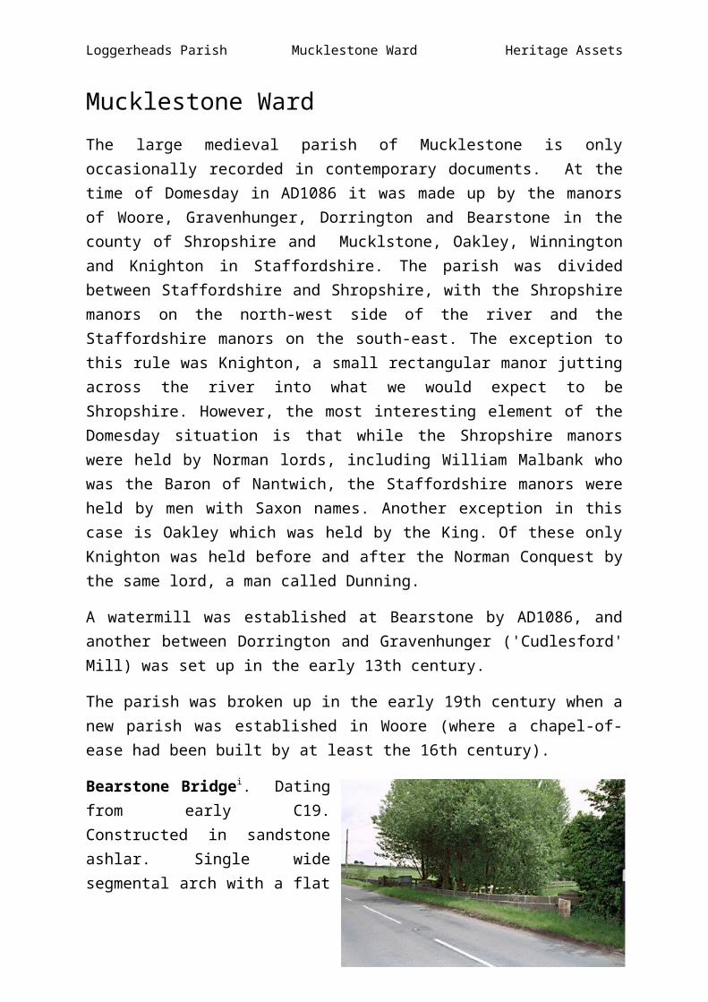
Loggerheads Parish Mucklestone Ward Heritage Assets Mucklestone Ward The large medieval parish of Mucklestone is only occasionally recorded in contemporary documents. At the time of Domesday in AD1086 it was made up by the manors of Woore, Gravenhunger, Dorrington and Bearstone in the county of Shropshire and Mucklstone, Oakley, Winnington and Knighton in Staffordshire. The parish was divided between Staffordshire and Shropshire, with the Shropshire manors on the north-west side of the river and the Staffordshire manors on the south-east. The exception to this rule was Knighton, a small rectangular manor jutting across the river into what we would expect to be Shropshire. However, the most interesting element of the Domesday situation is that while the Shropshire manors were held by Norman lords, including William Malbank who was the Baron of Nantwich, the Staffordshire manors were held by men with Saxon names. Another exception in this case is Oakley which was held by the King. Of these only Knighton was held before and after the Norman Conquest by the same lord, a man called Dunning. A watermill was established at Bearstone by AD1086, and another between Dorrington and Gravenhunger ('Cudlesford' Mill) was set up in the early 13th century. The parish was broken up in the early 19th century when a new parish was established in Woore (where a chapel-of- ease had been built by at least the 16th century). Bearstone Bridge i . Dating from early C19. Constructed in sandstone ashlar. Single wide segmental arch with a flat
Transcript of · Web viewTimber framed on dressed and coursed sandstone plinth with mid-C19 purplish-brown brick...
Loggerheads Parish Mucklestone Ward Heritage Assets
Mucklestone WardThe large medieval parish of Mucklestone is only occasionally recorded in contemporary documents. At the time of Domesday in AD1086 it was made up by the manors of Woore, Gravenhunger, Dorrington and Bearstone in the county of Shropshire and Mucklstone, Oakley, Winnington and Knighton in Staffordshire. The parish was divided between Staffordshire and Shropshire, with the Shropshire manors on the north-west side of the river and the Staffordshire manors on the south-east. The exception to this rule was Knighton, a small rectangular manor jutting across the river into what we would expect to be Shropshire. However, the most interesting element of the Domesday situation is that while the Shropshire manors were held by Norman lords, including William Malbank who was the Baron of Nantwich, the Staffordshire manors were held by men with Saxon names. Another exception in this case is Oakley which was held by the King. Of these only Knighton was held before and after the Norman Conquest by the same lord, a man called Dunning.
A watermill was established at Bearstone by AD1086, and another between Dorrington and Gravenhunger ('Cudlesford' Mill) was set up in the early 13th century.
The parish was broken up in the early 19th century when a new parish was established in Woore (where a chapel-of-ease had been built by at least the 16th century).
Bearstone Bridgei. Dating from early C19. Constructed in sandstone ashlar. Single wide segmental arch with a flat string course and capping, curving slightly to ends and terminating in octagonal piers. The bridge straddles the River Tern which here forms the boundary between Staffordshire and Shropshire.
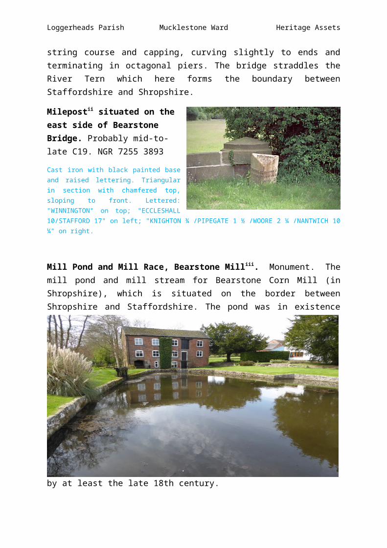
Milepostii situated on the east side of Bearstone Bridge. Probably mid-to-late C19. NGR 7255 3893
Cast iron with black painted base and raised lettering. Triangular in section with chamfered top, sloping to front. Lettered: "WINNINGTON" on top; "ECCLESHALL 10/STAFFORD 17" on left; "KNIGHTON ¾ /PIPEGATE 1 ½ /WOORE 2 ¼ /NANTWICH 10 ¼" on right.
Loggerheads Parish Mucklestone Ward Heritage Assets
Mill Pond and Mill Race, Bearstone Milliii. Monument. The mill pond and mill stream for Bearstone Corn Mill (in Shropshire), which is situated on the border between Shropshire and Staffordshire. The pond was in existence by at least the late 18th century.
Knighton
Knighton / Chenistetone. Settlement.
A settlement recorded in the Domesday survey of 1086 as having land for one plough and two slaves.

Loggerheads Parish Mucklestone Ward Heritage Assets
Knighton Farmiv, Bearstone Road, Knighton. Monument. NGR 7320 3994.
An isolated farmstead laid out around a regular, E-plan courtyard with farmhouse set long side on to the yard. The farmstead was probably established in the mid-19th century and survives largely unaltered, although with some new sheds added to the north.
Knighton Grange Farmv, Smithy Lane, Knighton. Monument. NGR 7296 4032.
A farmstead laid out around a regular, L-plan yard at the centre of the village of Knighton. The farmstead existed by at least the late 19th century (and potentially by the late 18th century) and is still extant.
Knighton Methodist Chapelvi. Closed as a chapel in the 1970s and now a private residence including the adjacent manse. Built in 1834 with a datestone over the door. Constructed in red brick with dentilled eaves cornice under a plain tiled roof. NGR 7301 4018.
Windows to the left and right of a central gabled brick porch; 16-paned glazing bar sashes with plastered lintels and stone cills, also to south-east gable end. Two-storied manse attached to the north-west, much altered and not included in the listing.

Loggerheads Parish Mucklestone Ward Heritage Assets
No. 102 London Roadvii. A house, latterly 3 cottages. Probably C17, re-faced and eaves raised early C19, with mid-C19 additions and alterations. NGR 7296 4019
Brown brick, probably concealing timber frame, with extension to right in purple brick, plain tiled roof, prominent brown brick ridge stack to left with smaller one to right, slightly projecting integral stack to right-hand gable end. 2 stories, dentilled eaves cornice to C19 addition; old part probably of 3 framed bays with 3-window front, all 3-light mid-C19 casements with raised plastered lintels and projecting keystones; C19 doors with bracketed heads, that on the left boarded and one between the second and third bays from left 6-panelled. Mid-C19 addition has a multi-paned ground floor bay window to the left and a boarded door to the right. Exposed purlins to the left-hand gable end and further 2-storied mid-C19 additions at right angles to the rear. Interior chamfered spine beam with straight-cut stops and inglenook fireplace to the left-hand ground floor room. Late C19 cast iron pump and stone basin in yard to the rear.
The Brookhouseviii in Smithy Lane. A former Elizabethan merchant house. Probably late C16 or early C17, partially re- modelled c.1700 with later additions and alterations; dismantled and removed from its original site in the North Stoke area during the 1970's, the house was re-erected in its present location (in a disused railway cutting). NGR 7283 4037. Timber framed on dressed and coursed sandstone plinth with mid-C19 purplish-brown brick cladding to rear, porch also of sandstone; plain tiled roof. Originally a 4-bay partly open hall of longhouse type with an unheated storage bay or granary at the lower (formerly east) end, approached by external lateral steps to rear; the eastern middle bay was floored over in late C17 and a double stack inserted at its west end, replacing an existing dual firehood which had heated both the eastern and western middle bays; c.1700 an external stone stack was built against the gable end of the western bay (also formerly unheated). One storey and attic; cellar. Framing: double-pegged close studding with single cross rail and short tension braces; jettied to right-hand gable end with herringbone decoration. At time of re-survey (1984) 3 windows to ground floor and 3 gabled eaves dormers (that to right-hand middle bay larger than other 2), as left-hand- former storage bay has yet to be re-erected, all 2-light late C20 latticed casements. entrance to left through gabled stone porch with datestone 1636 over door; brown brick ridge VA stack with capping immediately to right. 2 partly exposed Wall posts to brick-clad rear. Interior: under reconstruction at time of re-survey (1984), but timber frame (including close studding of original firehood) exposed, several C17 plank and muntin doors; the cellar, under right-hand bay and lit by a 4-light mullioned window at ground level, incorporates stonework from the C13 Cistercian Abbey of Hulton, close to the house's original site at Bucknall, Stoke-on-Trent (note the mason's marks). Roof of Queen- strut type, but with 2 collars and 2 tiers of windbraces. It should be noted that in the course of re-erection, the building's axis

Loggerheads Parish Mucklestone Ward Heritage Assets
has been changed so that east has become west et cetera. Ian Bailey, builder, (personal communication); Eric Mercer, English Vernacular Houses, R.C.H.M. (1975), p.201.
No. 123 Smithy Laneix. Cottage, latterly divided. Mid-to-late C17 with later additions and alterations. Timber framed with painted brick infill on sandstone plinth, plain tiled roof. One storey and attic, lit by 2 gabled eaves dormers; 2 framed bays. Framing: 3 rectangular panels from cill to wall plate. Mid-C19 casements and fixed light windows with latticed glazing, filling panels of framing (inserted in 1960's), 2 pairs to left, one pair to centre and one pair to right; latticed lights also to dormers. Mid-C20 boarded door with barley-sugar twisted colonettes to surround to right; roughly central ridge stack re-built in mid-C19 purplish-brown brick. Mid-C19 brick addition at right-angles to rear. There was formerly an entrance to the left (leading to former No.122, which is now part of No.123) but this has been blocked and windows inserted in its place. The windows in fact came from the C19 additions to Maer Hall, demolished in the
1960's.Milepostx. On the B5026. Probably mid-to-late C19. NGR 7303 4047.
Cast iron with black painted base and raised lettering. Triangular in section, with chamfered top, sloping to front. Lettered: KNIGHTON" on top; "ECCLESHALL 11/STAFFORD 18" on left; "WOORE I¼ /NANTWICH 9¼" on right.
Mucklestone Conservation Area
Mucklestone (Moclestone).
A settlement recorded in the Domesday Survey of 1086 as having a priest, three villagers and one plough. “Leofing holds Mucklestone. Alric and Edric held it before 1066. One hide. There is land for three ploughs. There is a priest and three villagers who have one plough. Meadow, 1 acre; woodland two furlongs long and as wide. Value 5 shillings.”

Loggerheads Parish Mucklestone Ward Heritage Assets
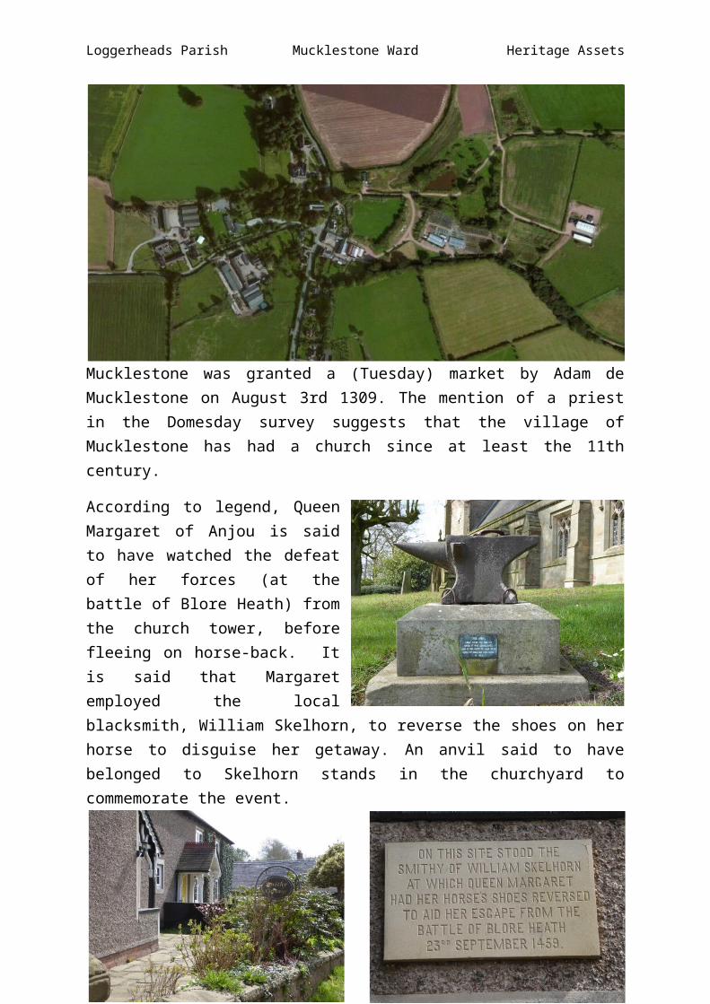
Mucklestone was granted a (Tuesday) market by Adam de Mucklestone on August 3rd 1309. The mention of a priest in the Domesday survey suggests that the village of Mucklestone has had a church since at least the 11th century.
According to legend, Queen Margaret of Anjou is said to have watched the defeat of her forces (at the battle of Blore Heath) from the church tower, before fleeing on horse-back. It is said that Margaret employed the local blacksmith, William Skelhorn, to reverse the shoes on her horse to disguise her getaway. An anvil said to have belonged to Skelhorn stands in the churchyard to commemorate the event.
Present day Smithy Cottage

Loggerheads Parish Mucklestone Ward Heritage Assets
Margaret of Anjou was the wife of King Henry VI of England. As such, she was Queen of England from 1445 to 1461 and again from 1470 to 1471. Born in the duchy of Lorraine into the House of Valois-Anjou, Margaret was the second eldest daughter of René of Anjou and Isabella, Duchess of Lorraine. She was one of the principal figures in the series of dynastic civil wars known as the Wars of the Roses and at times personally led the Lancastrian faction. Owing to her husband's frequent bouts of insanity, Margaret ruled the kingdom in his place. It was she who called for a Great Council in May 1455 that excluded the Yorkist faction headed by Richard of York, 3rd Duke of York, and thus provided the spark that ignited a civil conflict that lasted for over thirty years, decimated the old nobility of England, and caused the deaths of thousands of men, including her only son Edward of Westminster, Prince of Wales, at the Battle of Tewkesbury in 1471.
Margaret was taken prisoner by the victorious Yorkists after the Lancastrian defeat at Tewkesbury. In 1475, she was ransomed by her cousin, King Louis XI of France. She went to live in France as a poor relation of the French king, and she died there at the age of 52.
Church of St Maryxi. Parish church. NGR 7255 3735.
A listed parish church originally built in the 13th century. The church retains a crenellated tower of mid-14th century date. Rebuilt, except for the mid-C14 West tower, in 1790 and again in 1883 by Lynam and Rickman of Stoke-on-Trent.
An archaeological watching brief was undertaken at the church in June and July 2008 and the excavation of a trench against the inner face of the church’s western wall exposed the sandstone foundations, although no cut for the church was revealed. No evidence for an earlier floor was revealed. Blocks of sandstone were also encountered within a trench excavated to the west of the church

Loggerheads Parish Mucklestone Ward Heritage Assets
and it is considered possible that these may represent construction material deposited as rubble during one of the church's past rebuilding phases.
Sandstone ashlar with machine tiled and graded slate roofs. Nave and chancel in one, west tower; north aisle extending full length of church, south porch. Tower: tall, in 3 stages with angle buttresses; reticulated tracery to the west window and in the belfry openings; cusped single lights to the first and second stages (except on the west) and, on the south, rectangular slits lighting the internal stair turret; the embattled parapet with its corner pinnacles and gargoyle on the east side may well be later (probably C15); a narrow blocked doorway on the south has the inscription NW/179(?)0 above. Continuous nave and chancel in 5 bays; flat-headed windows of 3 cusped lights, those inchancel (2 eastern bays) with quatrefoils above; gabled stone porch in first bay from west with immediately to its west a single cusped window; East window of 5 lights has a curious form of reticulated tracery. The north aisle also of 5 bays is very similar in style but has a roof of large graded slates in the slope of which are 3 slate-hung gabled dormers; a pointed doorway between the first and second bays from the east and in the east wall an indecipherable inscription tablet. Interior: good triple chamfered pointed tower arch (c.1340); the rest of the church and fittings are almost entirely of 1883, arch-braced roofs throughout (painted in chancel) with V-struts to the collars; the 2 eastern bays of the north aisle are screened off to form a north chancel chapel; octagonal font of 1850. All the stained glass (except in the single- light cusped window to the west of the porch) is by C.E. Kempe, of high quality, and ranges in date from 1891 to 1905. The only monuments of note are the C18 tablets to members of the Chetwode family on the east wall of the north chancel chapel. A priest is recorded here in the Domesday Book.
Churchyard, Church of St Mary, Mucklestonexii. Monument.
The churchyard to St Marys Church, Mucklestone. Tombs within the churchyard demonstrate that it has been used for burial from at least the 18th century, although it is conjectured that it could be of mediaeval origin. An archaeological watching brief within the churchyard in 1999 encountered occasional fragments of human bone, particularly to the west and south of the church. One possible disturbed burial was also identified. All skeletal material was reburied within the churchyard.
An archaeological watching brief during the excavation of several trenches within the churchyard in June and July 2008 revealed concentrations of disarticulated human bone. A north-south aligned sandstone wall was also encountered to the west of the church, which may have been the return of a boundary wall visible along Church Lane. This wall may represent the remains of an old boundary line for the churchyard enclosure. And historical mapping does indicate that there has been some reorganization of the boundary in this area between 1892 and 1903. Disarticulated remains were also recovered from an area immediately to the west of the churchyard, within an area that now lies within Rectory Park, possibly indicating that the churchyard once extended further to the west. No in-situ burials were identified during the watching brief.
Loggerheads Parish Mucklestone Ward Heritage Assets
Benbow Memorialxiii. Chest tomb. Mid-C19.
Sandstone ashlar. Rectangular plan. Moulded plinth and capping with chamfered top ledger; fluted corner pilasters. Moulded inscription panels on north and south commemorate John Benbow (died 1851) and William Benbow (died 1855) respectively; further inscriptions on top ledger to their wives, Mary (died 1869) and Sarah (died 1865).
Birchall Memorialxiv. Chest tomb. C.1830.
Sandstone ashlar. Rectangular plan. Moulded plinth and capping; fluted corner pilasters. Moulded inscription panel on south commemorates John Birchall (died 1829); another to his parents William and Elizabeth (died 1832) on north and inscription on top ledger to their daughter, Elizabeth (died 1858).
Goodall Memorialxv. Chest tomb. John Goodall, died 1826.
Sandstone ashlar. Rectangular plan with battered sides, tapering slightly on top. Moulded plinth and capping with steep-chamfered top ledger. Moulded inscription panel on south with only left-hand side inscribed.
Latham Memorialxvi. Chest tomb. Thomas Latham, died 1799.
Sandstone ashlar. Rectangular plan. Moulded capping. Inscription to Thomas Latham under incised round-headed canopy on top ledger with another to right left blank.
Unidentified chest tombxvii. Chest tomb. C.1790.
Sandstone ashlar. Rectangular plan. Moulded capping with reeded corner pilasters and capping blocks. Oval inscription panels, 2 to long sides and one to short, all illegible.

Loggerheads Parish Mucklestone Ward Heritage Assets
Old Rectoryxviii. Former rectory, now house. Probably partly C17, extended and re-modelled c.1730 and c.1820-30.
Red brick (partly painted) in parts probably over timber frame; plain tiled roofs, gabled to east, hipped to west. 2 storeys and attics; cellars. East front: in 2 distinct sections with steeper roof pitch to left. C18 brick cladding over timber frame; right-hand portion of 3 bays; glazing bar sashes and one gabled dormer in roof slope, tall brick end stacks; lower section with 2 sashes to first floor and 2 multi-paned casements to ground; sashed staircase window to left and gabled dormer in roof slope, also to left. South front: re-faced c,1730 (see straight joint between brick angle pilaster and wall behind). 5 bays with brick pilasters to 2 left-hand bays and right-hand corner; flush-framed glazing bar sashes, those on ground floor with segmental heads (also one narrow blocked window to left- hand bay on first floor); late C19 inserted pointed doorway with Gothic tracery to left-hand bay; floor band and moulded eaves cornice, 2 brick ridge stacks. West (garden) front: in 3 bays with wide projecting full-height 3-window bow with conical roof to left; glazing bar sashes including one blind and one tripartite French window to right; wide spreading eaves, ridge stack. Long single-storied painted brick range (housing workshops) extends at right-angles from south-east corner of east side (hidden from south by red brick wall with stone coping [not included]). Interior: drawing room in bow with plaster ceiling and marble fireplace (c.1830), original shutters to this range; cellars with thick, coursed sandstone walls probably C17. Double-purlin roof. with straight windbraces.
Outbuildings and pigstiesxix at the Old Rectory. Range of outbuildings, comprising former brewhouse, bakery, wash-house and laundry; pigsties attached to brewhouse at north end. Probably mid- C18, pigsties early C19.
Red brick, plain tiled roof with end stack to left and ridge stack to right. Aligned along east side of courtyard to Old Rectory. One storey with loft to bakery; 3 casements, 2 with latticed panes, and one fixed light window; 3 doorways (to brewhouse, bakery and wash-house), all openings with cambered heads; nesting boxes over 2 left-hand doors. Interior: bakery retains remains of bread oven; King post roof in 4 bays. 2 pigsties, attached to north. Red brick walls with stone coping ramped down from road at north end.
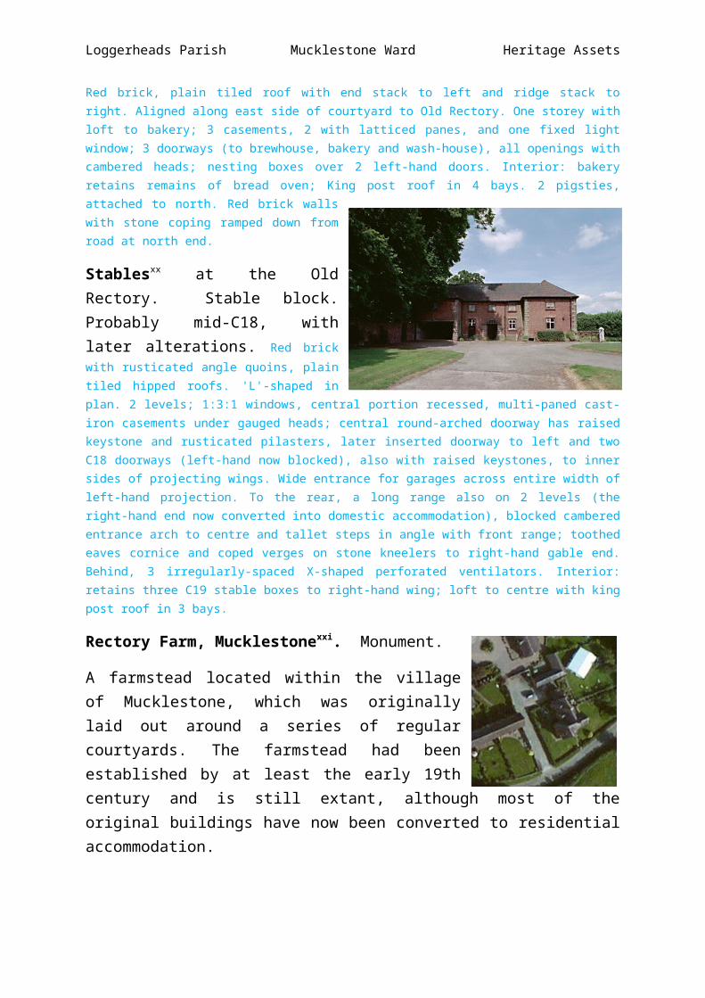
Stablesxx at the Old Rectory. Stable block. Probably mid-C18, with later alterations. Red brick with rusticated angle quoins, plain tiled hipped roofs. 'L'-shaped in plan. 2 levels; 1:3:1 windows, central portion recessed, multi-paned cast-iron casements under gauged heads; central round-arched doorway has raised keystone and rusticated pilasters, later inserted doorway to left and two C18 doorways (left-hand

Loggerheads Parish Mucklestone Ward Heritage Assets
now blocked), also with raised keystones, to inner sides of projecting wings. Wide entrance for garages across entire width of left-hand projection. To the rear, a long range also on 2 levels (the right-hand end now converted into domestic accommodation), blocked cambered entrance arch to centre and tallet steps in angle with front range; toothed eaves cornice and coped verges on stone kneelers to right-hand gable end. Behind, 3 irregularly-spaced X-shaped perforated ventilators. Interior: retains three C19 stable boxes to right-hand wing; loft to centre with king post roof in 3 bays.
Rectory Farm, Mucklestonexxi. Monument.
A farmstead located within the village of Mucklestone, which was originally laid out around a series of regular courtyards. The farmstead had been established by at least the early 19th century and is still extant, although most of the original buildings have now been converted to residential accommodation.
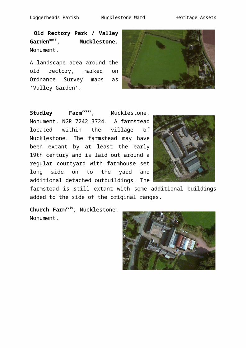
Old Rectory Park / Valley Gardenxxii, Mucklestone. Monument.
A landscape area around the old rectory, marked on Ordnance Survey maps as 'Valley Garden'.
Studley Farmxxiii, Mucklestone. Monument. NGR 7242 3724. A farmstead located within the village of Mucklestone. The farmstead may have been extant by at least the early 19th century and is laid out around a regular courtyard with farmhouse set long side on to the yard and additional detached outbuildings. The farmstead is still extant with some additional buildings added to the side of the original ranges.
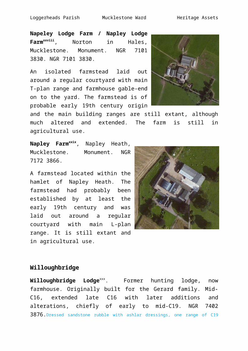
Church Farmxxiv, Mucklestone. Monument.
A large farmstead located within the village of Mucklestone. The farmstead was extant by at least the early 19th century and is laid out around a regular U-plan courtyard with farmhouse set long side on and additional detached elements. It appears to survive relatively

Loggerheads Parish Mucklestone Ward Heritage Assets
unaltered although with some new sheds erected to the east of the original ranges. NGR 7258 3727.
Milepost at NGR 7258 3738xxv. Milepost. Probably mid-to-late C19.
Cast iron with black painted base and raised lettering. Triangular in section with chamfered top, sloping to front. Lettered: "MUCKLESTONE" on top; "ECCLESHALL 9/STAFFORD 16" on left; "KNIGHTON 1 1/3 /PIPEGATE 2½ /WOORE 3 1/3 /NANTWICH ll½" on right
Napley/Napley Heath
Possible Site of Romano British Settlementxxvi, The Arbour, Napley, Mucklestone. Monument.
The reputed site of a Romano-British settlement to the north of Arbour Farm at Napley. Aerial photography apparently shows an enclosure, although it is suggested that this feature may have been the result of quarrying. No evidence of this feature was identified during a site visit in the 1960s. North of Arbour Farm (at NGR SJ 711 378) is a rectangular site measuring 900' by 700' with a road on one side and a footpath on the two longer sides. A large low mound enclosed by a wall of huge, unhewn stone (an air photograph of which shows up the larger blocks) under turf forming a rectangle, near Little Manchester, Mucklestone. In 1953 the site had been newly ploughed. The cause of the aerial photographic markings was not apparent at this time. The well-defined medial ridge is natural. No evidence of masonry, building or occupational debris seen to substantiate the suggestions of a Roman settlement here, although it should be noted that the probable course of the Wroxeter to Chesterton Roman Road passes some 40 metres to the south-east on an almost parallel course. Suggested as the theoretical site of 'Mediomanus' (although possibly confused with Mediolanum (Whitchurch). Pape, however, suggests that the site may actually be the remains of an old marl pit or quarry and that it is 'not rectangular'.

Loggerheads Parish Mucklestone Ward Heritage Assets
Ditched Enclosure and Earthwork Moundxxvii, NorthWest of Napley Lodge, Mucklestone. Monument. NGR 70815 38449.
A ditched enclosure and earthwork mound of unknown date or function, identified on aerial photographs from 1963. Still visible on aerial photography from circa 2000. The mound and enclosure are reminiscent of motte and bailey type earthworks.
Napeley Lodge Farm / Napley Lodge Farmxxviii, Norton in Hales, Mucklestone. Monument. NGR 7101 3830. NGR 7101 3830.
An isolated farmstead laid out around a regular courtyard with main T-plan range and farmhouse gable-end on to the yard. The farmstead is of probable early 19th century origin and the main building ranges are still extant, although much altered and extended. The farm is still in agricultural use.
Napley Farmxxix, Napley Heath, Mucklestone. Monument. NGR 7172 3866.
A farmstead located within the hamlet of Napley Heath. The farmstead had probably been established by at least the early 19th century and was laid out around a regular courtyard with main L-plan range. It is still extant and in agricultural use.
Willoughbridge
Willoughbridge Lodgexxx. Former hunting lodge, now farmhouse. Originally built for the Gerard family. Mid-C16, extended late C16 with later additions and alterations, chiefly of early to mid-C19. NGR 7402 3876.Dressed sandstone rubble with ashlar dressings, one range of C19 additions red brick, plain tiled roofs. Earliest part a square tower with flanking gabled wings - probably slightly later are the 2 front gabled wings at right angles to these; long parallel C19 additions to rear. Tower: in 3 stages over cellar with moulded string courses to second and third stages; 2 stepped buttresses at corners to front, embattled parapet (partly renewed);

Loggerheads Parish Mucklestone Ward Heritage Assets
projecting rectangular stair turret to right with scale-patterned ogee cap and globe finial; two 3-light mullioned windows to second and third stages and 2 single-light openings (both with dripstones) to ground floor on either side of flat-headed doorway, also with dripstone and C19 iron-studded door. Flanking 2-storeyed wings: of one bay in each direction (note the better dressed masonry of the slightly later ones to the front); 3-light mullioned windows with dripstones and coped stone verges to gables (the globe finials now lie on the ground nearby); sandstone ridge stack to left-hand front wing with on the wall below an engraved stone commemorating the Great Cattle Plague of 1866. 2-storeyed ranges at right angles to rear, the right-hand one of stone and probably slightly earlier than the left-hand one of red brick, both with mid-C20 casements. Interior not inspected. A buttressed sandstone revetment wall immediately to the north protects the terraced hill on which the lodge stands. Magnificent views across the Cheshire Plain.
Willoughbridge Lodge Farmxxxi. Monument.
Willoughbridge Lodge Farm is of possible mid-16th century origins. It has a regular 'L' shaped courtyard with additional detached elements. The farm has suffered significant loss, and the modern structures suggest its continuing agricultural use. The date for the farm is based on the date of the surviving farmhouse, although it should be noted that this was originally built as a hunting lodge.
Enclosure at Park Housexxxii
Monument. An incomplete enclosure, identified as an earthwork feature on aerial photography from 1963. Centred at NGR SJ 7575 3858 (100m by 68m).

Loggerheads Parish Mucklestone Ward Heritage Assets
White House Farmhousexxxiii lies in an imposing position on a hillside overlooking the Tadgedale quarry site. It was probably constructed c.1800 with later C19 additions. NGR 7382 3661. Built of brick and rendered except to the rear with a plain tile hipped roof with ridge stacks to the left and right. It has two stories with a late C20 wood modillion eaves cornice; 3 windows, glazing bar sashes with stone cills; a central late C19 door with c.1800 fanlight and late C20 brick and timber porch. A two-storied lean-to addition to the rear, formerly with a date stone (said to be c.1860) and 3 casements under cambered heads. To the rear also is a mid-C19 cast iron pump. The listing is partly as an imposing and prominent feature in the landscape.
Winnington
Winnington (Wennitone).
A settlement recorded in the Domesday survey as having two villagers and one smallholder.
Winnington Mill / Winnington Forgexxxiv. Monument. NGR 7342 3910.
Documentary evidence for the site of a mill from at least the 13th century. The mill was operating as a forge from at least the 16th century and forge slag was apparently being collected from the area in the 1990s. The site later appears to have operated as a cheese factory.
In 1273, at the inquisition of Sir Geoffrey de Bromley, it is recorded that 'they said he held the vill of Wonington (Winnington)…and he had one mill in the same vill which is worth yearly one mark [13s. 4d.]'. The mill site may later have been converted for use as a forge. The Gerards are recorded to have operated a well-known forge and smithy at Winnington from at least the 16th century onwards and the parish registers of Muckleston mention the forge on a number of occasions; in May 1599 a 'widowe Bilboo from Sir Thomas Garrard works at Wynyngton…was buried' and in February 1613 'George Grote, hamner (hammer) man to my Lord Garrard' was also buried. Later, in 1699 the register records that 'John, son of Benjamin Bluit and Katherine his wife of Winnington forge' was baptised. The forge was in the area now occupied by Winnington Forge Farm and is suggested to have still been operating as a forge in 1914 (although the absence of the associated mill pond and race by this time appears

Loggerheads Parish Mucklestone Ward Heritage Assets
to contradict this unless it had been converted to steam power). William Yates' map of 1775 shows a large pool to the east of the site with a head race running to a wheel near the road. By 1902 the site appears to have been in use as a cheese factory.
Mill Pondxxxv, Winnington Mill / Winnington Forge. Monument.
Mill Pond: A mill pond and pond bay associated with Winnington Mill and Forge shown to the east of the mill on William Yates' map of Staffordshire, with a head race running to a wheel near the road.
The mill pond is not shown on the 1830s 1" Ordnance Survey mapping or the later 1880s 6" mapping suggesting it may have been in-filled by the 19th century.
Grange Farmhousexxxvi. Farmhouse. Late C.18 with additions of. c.1870. NGR 7267 3839.
Rendered brick, plain tiled roofs. 2 storeys; dentilled eaves cornice. 2:2:2 windows with slightly projecting open pedimented break to centre; windows all mid- C20 casements but in original openings, round-headed to centre, remainder segmental, blind lunette above to centre; doorway with plain pediment and reeded pilastered doorcase to right side of central portion; 2 brown brick ridge stacks. 2-storeyed red brick addition to rear with former dairies attached at right angles.
Grange Farm, Winningtonxxxvii. Monument.
A farmstead laid out around a regular F-plan courtyard with detached farmhouse and additional detached elements
The listed Grange Farmhouse dates to the late 18th century while the outbuildings (including a barn, hay barn, cowshed and granary) are of probable mid-19th century date.
The farmstead appears to survive largely unaltered, with only minor losses. It remains in agricultural use.
Loggerheads Parish Mucklestone Ward Heritage Assets
Barn, Winnington Grangexxxviii. Monument.
A mid-19th century brick built barn with a tiled roof of queen post construction. In good condition situated in a farm group which also includes a granary and a cow shed. The barn measures 80 ft by 20 ft, with the interior split into a series of eight bays each measuring 10 ft, with two entrances and loft space above. The barn has regular ventilation holes on either side. Although the barn is in generally good condition the removal of an internal support wall has resulted in some subsidence to the walls.
Cowshed and Granary, Winnington Grangexxxix. Monument.
A cowshed and granary forming part of the range of farm buildings at Winnington Grange Farm. The three storey granary has three bays with the timber roof structure comprising of a collar and two struts. The cowshed has a datestone reading '1858'.
Hay Barnxl, Grange Farm, Winnington.
The hay barn at Grange Farm dates to the last two decades of the 19th century.
Winnington Farm / Winnington House Farmxli. Monument. NGR 7287 3853.
A farmstead originally laid out around an E-plan courtyard with detached farmhouse set gable end on. The farmstead may have been established by at least the later 18th century and although still extant has undergone significant alteration and conversion. The layout of the farmstead has been significantly altered in early 21st century, with the loss of some original ranges and the remainder appear to have been converted for residential use.
Oakley
Oakley (Aclei). Deserted settlement
Land recorded in the Domesday survey of 1086 as having land for three ploughs. No reference to any occupants is made at this time suggesting that any settlement was a later development, although it has been recorded as a possible deserted settlement. Recorded by Bate and Palliser as a possible lost village site, although no date for desertion is given.
Loggerheads Parish Mucklestone Ward Heritage Assets
Oakley Hallxlii. Oakley Hall is a privately owned early 18th century mansion house at Mucklestone. It is a Grade II* listed building. The Chetwode family who from about the 13th century owned the Chetwode Manor estate in Buckinghamshire also held the manor of Oakley. There was a substantial manor house at Oakley in the 16th century. In about 1710 Sir John Chetwode Bt, replaced the old house with a two-storey mansion. The 1881 census discloses the 6th Baronet and his family in residence with a staff of fifteen servants. The 7th Baronet was Field Marshall Philip Chetwode who completed a distinguished career in the British army. He first saw action in the Chin Hills expedition in Burma from 1892-3. This was followed by service in the second Boer War, the Western Front and the Palestine Campaign in the First World War. In 1930 he became Commander-in-Chief, India and was promoted to Field Marshall in 1933. This was followed by service as Constable of the Tower from 1943 to 1948 and President of the Royal Geographical Society. He died in 1950. The Chetwodes sold the estate in 1919. It was already by then in the family of Cyril Charles Dennis, High Sheriff of Staffordshire until 1948 when he retired to Park House in the grounds where he died in 1964.
Country house. 1710 (datestone on north wall) with later additions and alterations. NGR 7013 3694.
Two sphinx-like statues with female heads flank the main entrance. Red brick on sandstone plinth with ashlar and rusticated dressings; slate roofs, orange-brown brick ridge stacks re-built in late C20. Two storeys over cellars; flat stone string course, moulded eaves cornice and parapet. East front: is entrance front; symmetrical of

Loggerheads Parish Mucklestone Ward Heritage Assets
11 bays arranged a-b-c-b-a; the 2 end bays projecting slightly; rusticated quoin strips to corners and ashlar-faced centre flanked by 2 giant pilasters with Corinthian capitals; windows all glazing bar sashes in moulded stone surrounds with projecting keystones, mid-window also with grotesque lion's head above and swags of garlands and bottom volutes to sides; central doorway with segmental pediment on console brackets, 6-panel double door with delicately wreathed metal fanlight; balustrade above parapet with plain early C20 pediment, decorated with festooned garlands, to centre (the original pediment was curvaceous with shaped finials). North front: in 7 bays with 3-window bow (early C19) to centre of ground floor. West front: 3:3:3 bays; central section slightly projecting and with a full-height 3-window bow under conical roof (note the turned balusters below the first floor windows and the console brackets to the central one). Plain south front in 4 bays with a 4-bay colonnaded verandah (reconstructed as a conservatory in late C20) attached to south-west corner. Interior: considerably altered in early 1970's, the chief items of interest are now the early C18 staircase with its turned balusters and a plastered ceiling and frieze (c.1800) to the ground floor of the 2-storeyed bow on west side; this room also has a good fireplace (again of c.1800) and shutters to the windows, as have those to the single-storeyed bow on north. 2 sphinx-like figures with female heads and cast iron lamps behind flank the main entrance. A ha-ha with drystone wall approximately 1.2m high lies about 60m to the east and lies within the curtilage.
Stable block and coach housexliii. Probably late C18.
Red brick with ashlar dressings; plain tiled hipped roofs. Roughly 'U'-shaped in plan with stable block ranged round 3 sides of courtyard and detached coach house at top end. Stable block: 2 storeys to main range with dentilled eaves cornice and stone floor band; single-storeyed ranges at right angles to east and west; 5:3:5 bays to front, those to centre forming a slight pedimented break; glazing bar sashes with horns to first floor, central 3 with narrow round-headed arches; C20 fixed light windows to ground floor but in original openings. Central. carriage entrance with wide elliptical arch; wooden round-arched cupola above with lead roof and brass weathervane; 4 ridge stacks, 2 to each side of entrance. To rear 2 hexagonal stair turrets flank the entrance. Single-storeyed ranges both have late C19 and C20 openings; to west, 5 late C19 alternating doors and windows and to east the same arrangement, but with wide C20 cart entrances taking the place of the doors. Coach house: 2 levels; 4-bay elliptical-arched arcade to ground level with original iron-strapped double doors; 4 lunette windows to upper level, dentilled eaves cornice. Tallet steps to rear on right, built of engineering brick. Interior: C19 cast iron stables in west range of stable block.
Ice Housexliv. Probably mid-C18.
Red brick and coursed sandstone rubble. Round-arched entrance with rubblestone voussoirs under coped stone gable, approached down lateral flight of steps at right angles to right. The short tunnel is brick-lined and leads to an egg-shaped cavity, stone-lined and covered by a brick dome. Approximately 3.5m in diameter externally. A well preserved example of its type, made more interesting by its architectonic entrance

Loggerheads Parish Mucklestone Ward Heritage Assets
Grottoxlv. Probably early to mid-C18. Cut out of natural sandstone with ashlar facings. Approached down flight of steps from terrace (not included in listing) at north end of garden to Oakley Hall.
Wide segmental arch with flanking pilasters and moulded cornice, framing deep semi-circular recess with bench cut from natural rock at back. A round-headed niche, also cut from natural rock, to right of steps up to terrace.
Ball-capped gate piersxlvi. Probably c.1710.
Red brick piers with sandstone ashlar capping. Square in section with moulded capping and ball finials.
Former brewhousexlvii now disused. Probably early C19.
Red brick with ashlar plinth and dressings, plain tiled hipped roof. 2 storeys; moulded cornice to blocking course and stone floor band; windows to left and right of central entrance, late C19 fixed lights including tripartite window to left on ground floor (on right an inserted wide C20 garage entrance); 6-panel door in round-arched doorway with plain fanlight. Lateral brick stack to rear behind ridge. Mid-to-late C20 brick garages attached to either side, not included in listing.
Oakley Hall Parkxlviii, Mucklestone. Monument.
A landscape park in the area around Oakley Hall, the extent of which is mapped on the 1st Edition Ordnance survey map of 1889. It is associated with Oakley Hall which dates to the early 18th century. The Park straddles the boundary between Mucklestone Ward and Tyrley Ward.
Loggerheads Parish Mucklestone Ward Heritage Assets
Walled Gardenxlix, Oakley Hall. Monument.
The walled garden is marked on the first edition 6" OS map, its origins are unknown but it may be contemporary with the adjacent model farm and stable block which are both of late 18th century date. The walls and the buildings to the west (also shown on the first edition map) are extant, but the interior is no longer in use as gardens.
Farm buildings at Oakley Park Farml.
Farm buildings ranged round 4 sides of a courtyard with a gatehouse. A late eighteenth century model farm complex that formed part of the Chetwode estate. This model farm has been described as a large example, with a regular courtyard, with additional detached elements. The farm has been altered from its original state, with a building to the immediate west and probably two to the south have been demolished.
Barn: late C18 with later alterations. Red brick on sandstone ashlar plinth with plain tiled hipped roof, dentilled eaves cornice. Tall central section with flanking lower wings. Large round-arched recess to right of central section, with X-shaped ventilator perforations, further X-shaped ventilator perforations 2 to left and one to right on upper level, 2 diamond-shaped ventilator perforations below eaves. One stable door on ground floor to left and 2 windows with segmental heads; C20 flat-headed wide entrance with double doors below cambered arch; loft door above with winch for hoist. Flanking wings also with hipped roofs, left-hand of 3 bays, right-hand of 2, linking with north range of shelter sheds (not included in listing). South range of stables: late C18. Red brick with plain tiled roof, hipped to right, dentilled eaves cornice. 2 levels. 6 openings to upper level, the 2 right-hand ones being windows. From left, 2 stable doors and windows alternating; 1:3:1 bay arcade (partially damaged) and further doors, outer window to right-hand in arched recess. Included for group value. Farmyard gatehouse, dairy and cowhouse: late C18. Red brick with sand- stone ashlar plinth and hinge blocks to doors; hipped tiled roof and dentilled eaves cornice. One and 2 levels; 2:1:1 bays, carriage arch to right of centre; 2 ranges of segmental-headed mid-C19 casements and a stable door to left-hand range, C20 doorway and window to right-hand range. Above the carriage arch is a stone-framed oculus; cupola removed; lower 3-bay cowhouse to right with 5 segmental-headed doorways. East farmyard range: mid-C19. Orange brick with stone hinge blocks, plain tiled roofs, dentilled eaves cornice. 2 levels; 4 pitching eyes and 3 triangular-shaped ventilator perforations alternate on upper level with, in centre, a gabled hoist door. On ground floor 2 stable doorways with segmental heads and flanking windows; central segmental-headed cart entrance with double doors.

Loggerheads Parish Mucklestone Ward Heritage Assets
Former Estate Office and Adjacent Buildingli, Oakley Park. Monument. NGR 7050 3714. The site of two buildings, one of which is suggested to have been the former estate office to Oakley Park. Neither building now survives.
Betton Mill / Oakley Milllii. Monument. The site of a water mill since the medieval period. This is most probably the mill referred to in the Domesday Book ('Girard holds Betton - there is a mill'). The mill is also mentioned in documentary sources from 1291 ('income from a mill at Betton £1 10s') and again in records from the reign of Henry VIII ('the monks had a mill at Betton valued at £1 10s per annum). The Mucklestone tithe map shows the mill in Oakley under the ownership of Sir John Chetwode, Bart. The miller was an Edward Riley, who was probably a farmer. In the 1851 census Edward Riley is shown as living at Betton Mill House. The mill was most likely sited by the present New Mill Cottage and the old mill tail race runs under the road to the River Tern from near this point. The wheel was probably undershot and connected to a substantial and well preserved head race going northwards towards Oakley Pool. NGR 6987 3661.
Head Race and Tail Raceliii, Betton Mill / Oakley Mill. Monument. The old mill tail race runs under the road to the River Tern from near New Mill Cottage. There was a substantial and well preserved head race going northwards to Oakley Pool. The channel is built up on the river side and has a natural rocky bank on the other. This wide head race running from an ample water supply at the large Oakley Pool would hold a considerable quantity of water. There are signs of two sluice positions along the length of the head race and these would have been used to release excessive water back to the river.
Barrowliv, Oakley. Monument. A disc barrow on a hill slope overlooking the stream at Oakley. Documentary evidence for the site of a round barrow, near the Devils Ring and finger. There is evidence to suggest that the barrow once had a central monolith, although the stone is missing. The exact location of the barrow is now unknown. Several flints have been recovered from the ground surface. NGR 705 375.

Loggerheads Parish Mucklestone Ward Heritage Assets
The Devil’s Ring and Fingerlv (Whirl Stones). NGR 7072 37782 standing stones, grooved and perforated.
Despite being removed from their original positions, the two stones standing 200m east of Norton Forge Farm known as The Devil’s Ring and Finger represent an evocative reminder of Neolithic society and ritual. In particular, the holed stone represents a very rare survival with only a handful of similar stones currently known in England. Both stones were likely to have been upstanding as part of an arrangement of stones such as a stone alignment, circle, or chambered tomb within the nearby vicinity. Monuments containing holed stones are known from the Neolithic period but a Bronze Age date is also possible.
The monument includes two stones to the south-east of Norton in Hales situated on a gentle slope running down to the River Tern. The stones stand adjacent to each other at the edge of a field boundary. The northern stone is grooved and measures 1.8m high and 1m by 0.6m wide. The southern stone is holed and measures 1.5m high and 1.9m by 0.5m wide. The aperture in the holed stone is 0.45m in diameter and large enough for a person to pass through. There is no evidence to confirm they are in their original position and their leaning nature against a field boundary wall indicates they have been moved. They are likely to be from a chambered tomb or stone setting. There are currently no known associated monuments of the Neolithic and Bronze Age periods within the vicinity, however, the site of a possible Bronze Age disc barrow lies 350m to the south-west.

Loggerheads Parish Mucklestone Ward Heritage Assets
Mill Pondlvi, Norton Forge Farm, South of Norton in the Hales. Monument.
A mill pond associated with the mill/forge at Norton Forge Farm, south of Norton in the Hales. The site of the mill/forge probably lies over the border in Shropshire, while the mill pond straddles the county boundary. The pond was extant by the late 18th century, but now appears to be infilled. NGR 7048 3799.
Lordsley End Farmlvii, Lordsley. Monument. NGR 7454 3758.
An isolated farmstead originally laid out around a loose, single-sided yard. The farmstead was probably established in the early 19th century and survives largely unaltered although with new sheds added around the original outbuildings.
Eccleshall Road Farmlviii. Monument. NGR 7295 3678.
An isolated farmstead laid out around a loose courtyard with additional detached elements. The farmstead was probably established in the mid-19th century and is still extant, although with modern agricultural buildings added to the east of the original ranges.
Farmstead South of Eccleshall Road Farm / Tadgedale Farmlix, Tadgedale. Monument.
An isolated farmstead laid out around a loose, single-sided yard with farmhouse long side on to the yard. The farmstead appears to have been established in the mid-19th century and survives relatively unaltered.
Farm South-East of Eccleshall Road Farmlx, Tadgedale. Monument.
(53249 on plan). An isolated farmstead with loose, single-sided courtyard plan consisting of a farmhouse long side on to the yard and additional detached agricultural buildings. The farmstead was probably extant by the mid-19th century and survives in agricultural use, with new sheds located to the north. NGR 7305 3647.

Loggerheads Parish Mucklestone Ward Heritage Assets
Mucklestone Wood End / Ranworth Lodgelxi, Rock Lane. Monument. NGR 7331 3680.
An isolated linear-plan farmstead which appears to have been established in the late 18th or early 19th century as 'Mucklestone Wood End'. The farmstead is still extant and survives relatively unaltered. It is now known as 'Ranworth Lodge'.
Ridge and Furrowlxii. Monument.
The earthwork remains of ridge and furrow, evidence of medieval and later ploughing, visible on aerial photography. Centred at NGR SJ 7033 3683
Milepostlxiii north of Tadgedale quarry site on the Eccleshall Road towards Mucklestone. Probably mid-to-late C19. NGR 7322 3644.
Cast iron with black painted base and raised lettering. Triangular in section with chamfered top, sloping to front. Lettered: "MUCKLESTONE" on top; "ECCLESHALL 8/STAFFORD 15" on left; "KNIGHTON 2¾ /PIPEGATE 3½ /WOORE 4¼ /NANTWICH 12¼" on right.

Loggerheads Parish Mucklestone Ward Heritage Assets
Map of Mucklestone Ward showing location of assets.
3 76 5 4
2
18
115 20 16 17
13 14 19
2827 12
26 11 299 8 10
24 23 21 33 30 32
25 22 31 34 17a
See overleaf for the assets located at each of the above sites

Loggerheads Parish Mucklestone Ward Heritage Assets
Map Site Asset No. Asset
1xlvi Bearstone Bridgexlvii Milestone at Bearstone Bridgexlviii Mill Pond and Mill Race at Bearstone Mill
2 xlix Knighton Farm3 l Knighton Grange Farm4 li Mucklestone Methodist Chapel5 lii 102 London Road
6 liii The Brookhouseliv 123 Smithy Lane
7 lv Milepost
8
lvi Church of St Marylvii Churchyardlviii Benbow Memoriallix Birchall Memoriallx Goodall Memoriallxi Latham Memoriallxii Unidentified chest tomblxiii Old Rectorylxiv Outbuildings and pigstieslxv Stableslxvi Rectory Farmlxvii Old Rectory Park
9 lxviii Studley Farm10 lxix Church Farm11 lxx Milepost12 lxxi Romano British Settlement13 lxxii Ditched enclosure and earthwork mound14 lxxiii Napeley Lodge Farm15 lxxiv Napley Farm
16 lxxv Willoughbridge Lodgelxxvi Willoughbridge Lodge Farm
17 lxxvii Enclosure at Park House17a lxxviii White House Farm
18 lxxix Winnington Milllxxx Mill pond
19 lxxxi Grange Farmhouselxxxii Grange Farmlxxxiii Barnlxxxiv Cowshed and granarylxxxv Hay barn
20 lxxxvi Winnington Farm21 lxxxvii Oakley Hall
lxxxviii Stable block and coach houselxxxix Ice house
xc Grottoxci Ball-capped gate piersxcii Former Brewhousexciii Oakley Hall Park
22 xciv Walled garden23 xcv Farm buildings at Oakley Park Farm24 xcvi Former estate office
25 xcvii Betton Millxcviii Head race and tail race
26 xcix Barrow27 c The Devil’s Ring and Finger28 ci Millpond

Loggerheads Parish Mucklestone Ward Heritage Assets
29 cii Lordsley End Farm
Map Site Asset No. Asset
30 ciii Eccleshall Road Farmciv Farmstead South of Eccleshall Road Farm
31 cv Farm South-East of Eccleshall Road Farm32 cvi Mucklestone Wood End33 cvii Ridge and furrow34 cviii Milepost

i ii iii iv v vi vii viii ix x xi xii xiii xiv xv xvi xvii xviii xix xx xxi xxii xxiii xxiv xxv xxvi xxvii xxviii xxix xxx xxxi xxxii xxxiii xxxiv xxxv xxxvi xxxvii xxxviii xxxix xl xli xlii xliii xliv xlv xlvi xlvii xlviii xlix l li lii liii liv lv lvi lvii lviii lix

lx lxi lxii lxiii