Vancouver, Coast & Mountains 2014 Travel Experience Guide, British Columbia
Vancouver Island
Mountains by Laura Janssen & Henri Simpson
Geography 476 Spring 2013
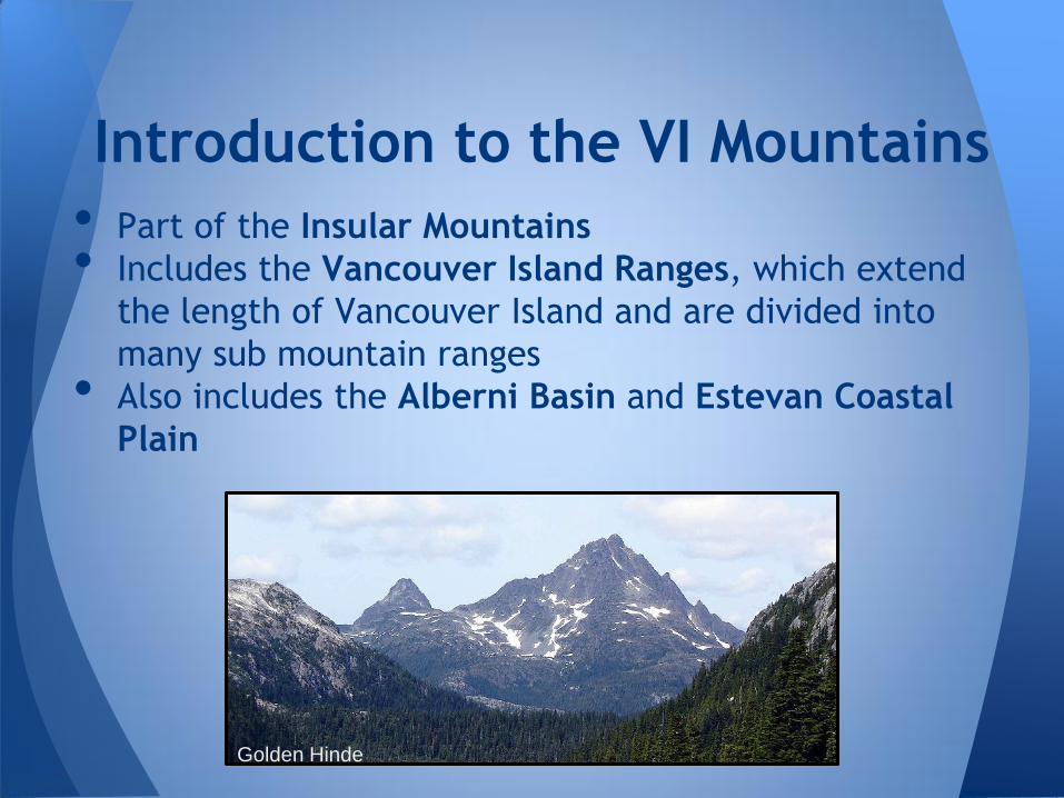
• Part of the Insular Mountains
• Includes the Vancouver Island Ranges, which extend
the length of Vancouver Island and are divided into
many sub mountain ranges
• Also includes the Alberni Basin and Estevan Coastal
Plain
Introduction to the VI Mountains
Golden Hinde
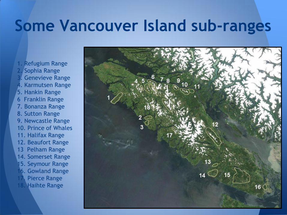
1. Refugium Range
2. Sophia Range
3. Genevieve Range
4. Karmutsen Range
5. Hankin Range
6 Franklin Range
7. Bonanza Range
8. Sutton Range
9. Newcastle Range
10. Prince of Whales
11. Halifax Range
12. Beaufort Range
13 Pelham Range
14. Somerset Range
15. Seymour Range
16. Gowland Range
17. Pierce Range
18. Haihte Range
Some Vancouver Island sub-ranges
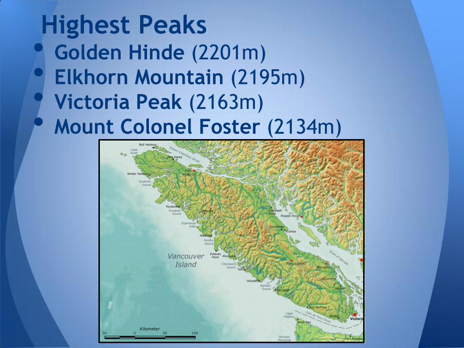
Highest Peaks • Golden Hinde (2201m)
• Elkhorn Mountain (2195m)
• Victoria Peak (2163m)
• Mount Colonel Foster (2134m)
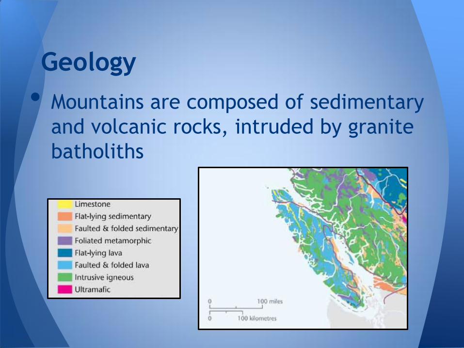
• Mountains are composed of sedimentary
and volcanic rocks, intruded by granite
batholiths
Geology
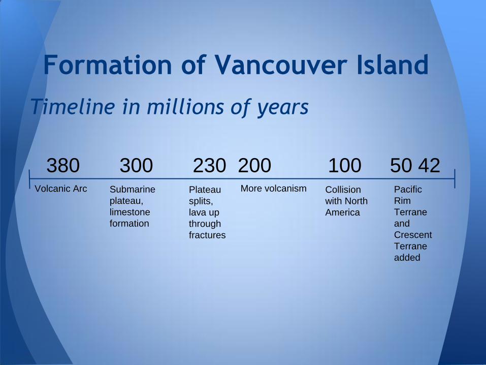
Timeline in millions of years
Formation of Vancouver Island
380 300 230 200 100 50 42
Volcanic Arc Submarine
plateau,
limestone
formation
Plateau
splits,
lava up
through
fractures
More volcanism Collision
with North
America
Pacific
Rim
Terrane
and
Crescent
Terrane
added
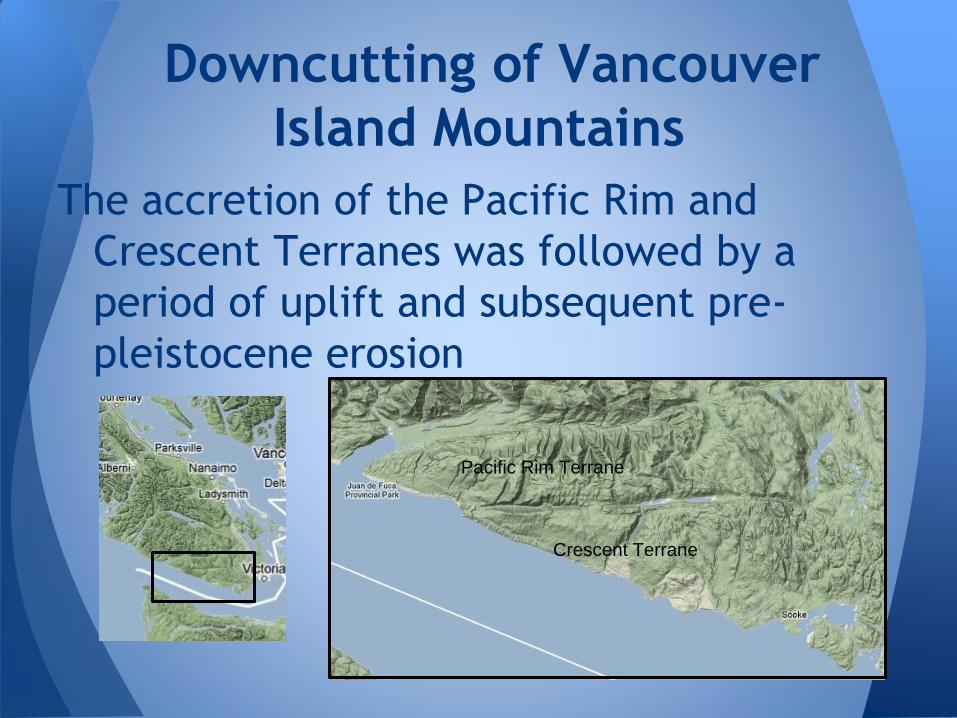
The accretion of the Pacific Rim and
Crescent Terranes was followed by a
period of uplift and subsequent pre-
pleistocene erosion
Downcutting of Vancouver
Island Mountains
Pacific Rim Terrane
Crescent Terrane
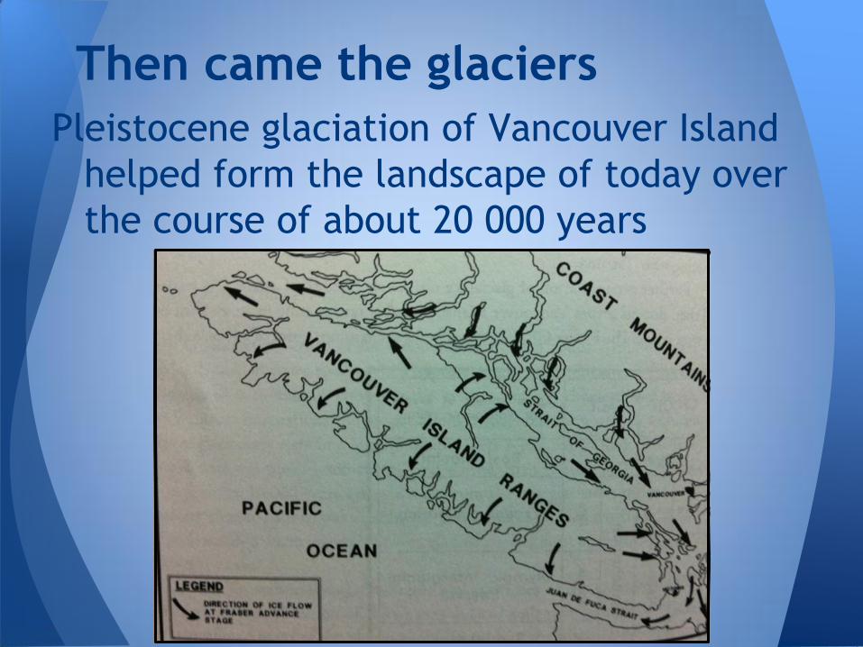
Pleistocene glaciation of Vancouver Island
helped form the landscape of today over
the course of about 20 000 years
Then came the glaciers
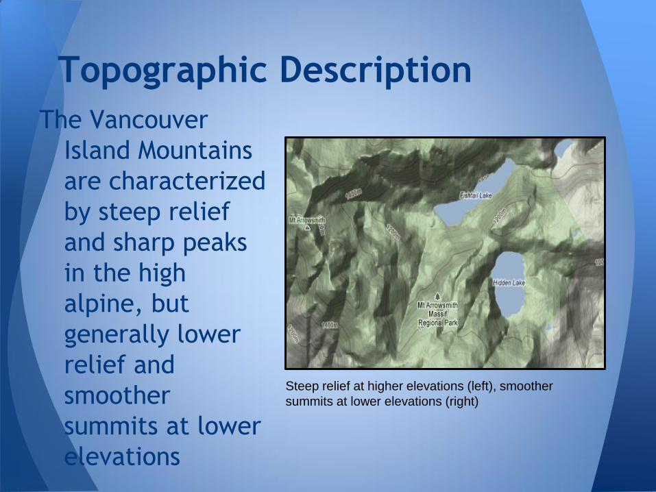
The Vancouver
Island Mountains
are characterized
by steep relief
and sharp peaks
in the high
alpine, but
generally lower
relief and
smoother
summits at lower
elevations
Topographic Description
Steep relief at higher elevations (left), smoother
summits at lower elevations (right)
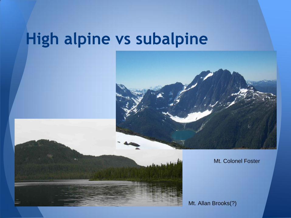
High alpine vs subalpine
Mt. Colonel Foster
Mt. Allan Brooks(?)
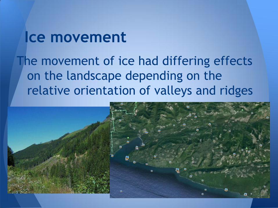
The movement of ice had differing effects
on the landscape depending on the
relative orientation of valleys and ridges
Ice movement
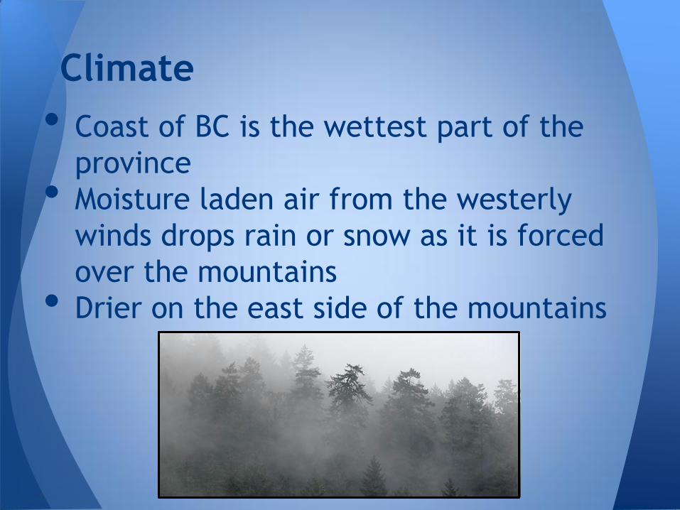
• Coast of BC is the wettest part of the
province
• Moisture laden air from the westerly
winds drops rain or snow as it is forced
over the mountains
• Drier on the east side of the mountains
Climate
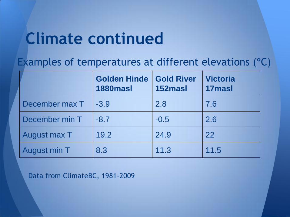
Examples of temperatures at different elevations (°C)
Data from ClimateBC, 1981-2009
Climate continued
Golden Hinde
1880masl
Gold River
152masl
Victoria
17masl
December max T -3.9 2.8 7.6
December min T -8.7 -0.5 2.6
August max T 19.2 24.9 22
August min T 8.3 11.3 11.5
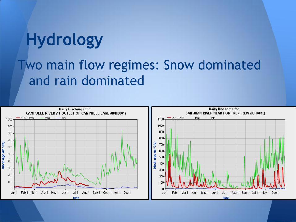
Two main flow regimes: Snow dominated
and rain dominated
Hydrology
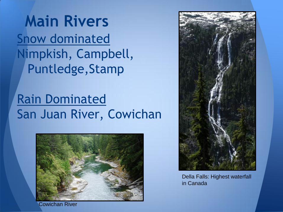
Snow dominated
Nimpkish, Campbell,
Puntledge,Stamp
Rain Dominated
San Juan River, Cowichan
Main Rivers
Cowichan River
Della Falls: Highest waterfall
in Canada
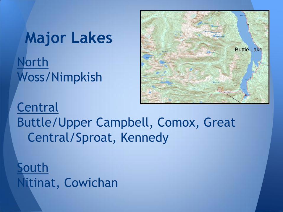
North
Woss/Nimpkish
Central
Buttle/Upper Campbell, Comox, Great
Central/Sproat, Kennedy
South
Nitinat, Cowichan
Major Lakes Buttle Lake
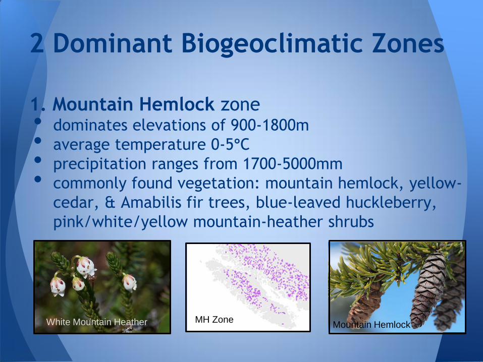
1. Mountain Hemlock zone • dominates elevations of 900-1800m
• average temperature 0-5°C
• precipitation ranges from 1700-5000mm
• commonly found vegetation: mountain hemlock, yellow-
cedar, & Amabilis fir trees, blue-leaved huckleberry,
pink/white/yellow mountain-heather shrubs
2 Dominant Biogeoclimatic Zones
MH Zone White Mountain Heather Mountain Hemlock
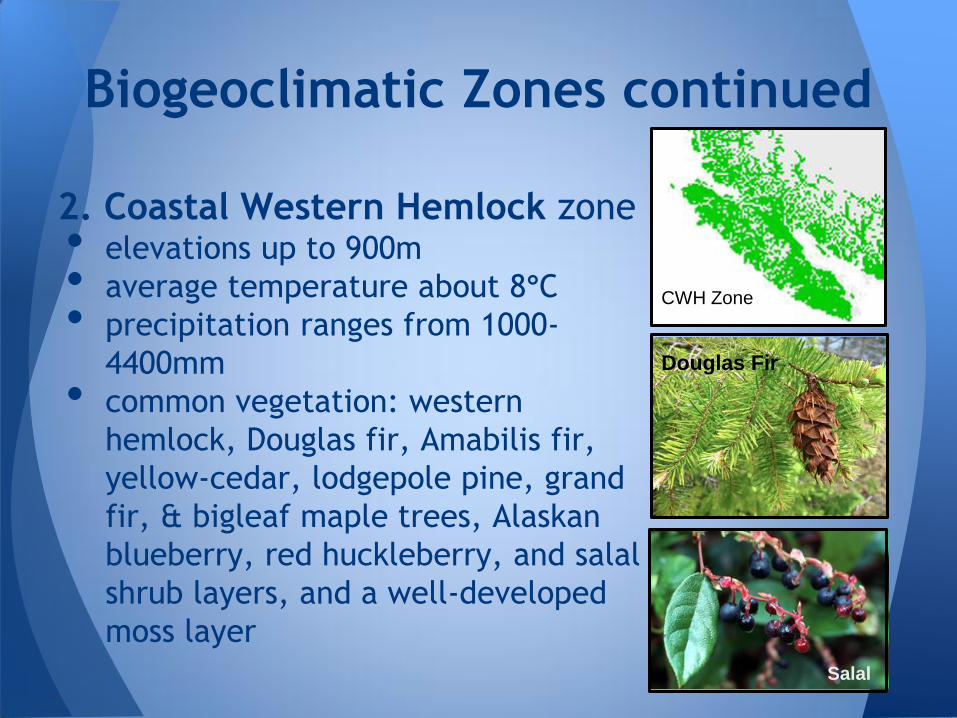
2. Coastal Western Hemlock zone • elevations up to 900m
• average temperature about 8°C
• precipitation ranges from 1000-
4400mm
• common vegetation: western
hemlock, Douglas fir, Amabilis fir,
yellow-cedar, lodgepole pine, grand
fir, & bigleaf maple trees, Alaskan
blueberry, red huckleberry, and salal
shrub layers, and a well-developed
moss layer
Biogeoclimatic Zones continued
CWH Zone
Douglas Fir
Salal
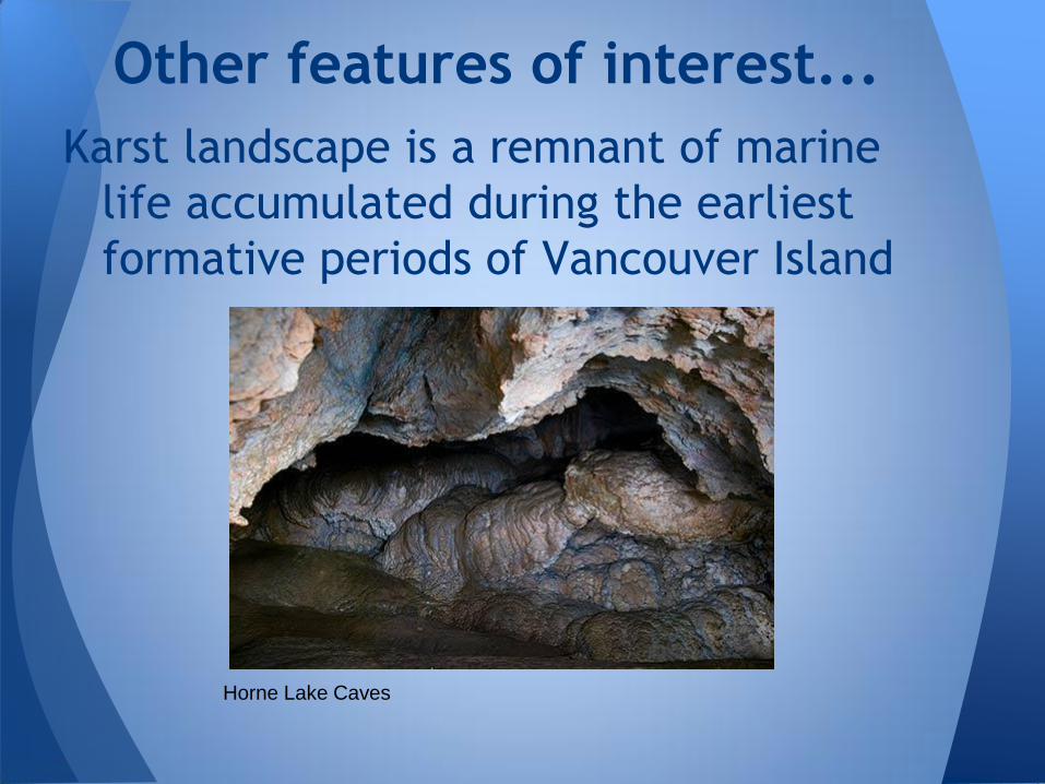
Karst landscape is a remnant of marine
life accumulated during the earliest
formative periods of Vancouver Island
Other features of interest...
Horne Lake Caves
Subranges of the Vancouver Island Mountain Ranges: Wikipedia
Highest peaks:Holland, S.S. 1976. Landforms of British Columbia: A Physiographic Outline.
Geology/History: Holland.
Yorath, C. 2005. The Geology of Southern Vancouver Island.
Climate data: Moore, R.D., Spittlehouse, D.L., Whitfield, P.H., Stahl, K. Weather & Climate
ClimateBC
Biogeoclimatic zones: BC Ministry of Forests
Coastal Western Hemlock zone: http://www.for.gov.bc.ca/hfd/pubs/docs/srs/Srs06/chap6.pdf
Mountain Hemlock zone: http://www.for.gov.bc.ca/hfd/pubs/docs/srs/Srs06/chap7.pdf
Victoria CRD site: Various documents
BC Parks
Geological Survey of Canada
River discharge data: Environment Canada
References