Using the iPAQ Pocket PC to Record Measurement Metadata For Field Instruments June 28, 2004 by...
10
Using the iPAQ Pocket PC to Record Measurement Metadata For Field Instruments June 28, 2004 by Kenneth Smith
-
Upload
cleopatra-parrish -
Category
Documents
-
view
221 -
download
0
Transcript of Using the iPAQ Pocket PC to Record Measurement Metadata For Field Instruments June 28, 2004 by...

Using the iPAQ Pocket PC to Record Measurement Metadata
For Field Instruments
June 28, 2004
by
Kenneth Smith

Introduction•The model of pocket PC being used is the Compaq iPAQ H3670.
•Has a touch screen and a stylus to write with.
•Expansion pack includes a 256 MB compact flash card and an external battery.
•Software includes pocketWord, pocketExcel, and ArcPad 6.03.

Introduction
• ArcPad is the GIS software for the handheld device.
• It operates like a stripped down version of ArcView.
• Allows you to use a base map or aerial photo of your location, and take waypoints by either selecting a location on the map, or by using a GPS unit.
• The ArcPad software has been customized to allow the user to easily enter metadata information for each ASD and the D&P.

Basic Theory
• Information that will be recorded will pertain to both the subject being measured as well as the actual measurement itself (including instrument specifications).
• The information in ArcPad is stored in a shapefile. This is a vector file that includes geographic feature information and metadata for the measurements1.
•The shapefile has associated .SHP, .SHX, and .DBF files.
1Clarke, Shane, Craig Greenwald, and Valerie Spalding. 2000.
Using ArcPad: ArcPad 6. ESRI. Redlands, CA
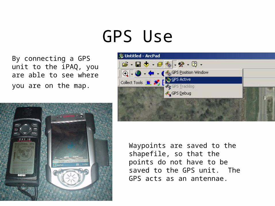
GPS UseBy connecting a GPS unit to the iPAQ, you are able to see where
you are on the map.
Waypoints are saved to the shapefile, so that the points do not have to be saved to the GPS unit. The GPS acts as an antennae.
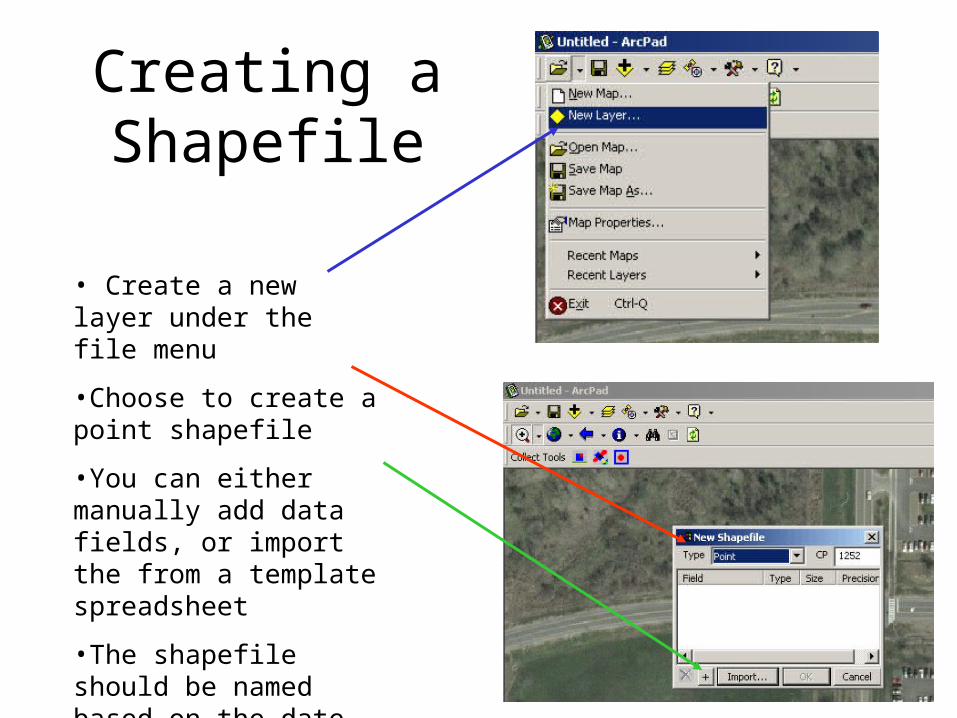
Creating a Shapefile
• Create a new layer under the file menu
•Choose to create a point shapefile
•You can either manually add data fields, or import the from a template spreadsheet
•The shapefile should be named based on the date such as 20040614.shp

Using ArcPad
Open Instrument Form
Takes a GPS Waypoint
Takes a Map Point
Metadata Form
Adds Layer to Map
Subject Location Points

Using ArcPad
•After filling out the information for the measurement subject, you are given the choice of which instrument you are using.
•The rest of the metadata is specific to the instrument being used.

Removing Data from the Storage Card
•The shapefile and DBF files of subject and mesurement information are transferred to a PC via a card reader
•The information on the DBF files can than be uploaded to the Measurements Website after it is reviewed

Metadata Arrangement
Subject Metadata
ID Subject
1
2
3
4
5
grass
pavement
rocks
maple leaf
car door
ASD Metadata
ID Filename
1
2
grass1
pavement3
D & P Metadata
ID
2
4
5
Filename
200406241132
200406241145
200406241205