USING PICTOMETRY & GIS TO SOLVE COMPLEX …...USING PICTOMETRY & GIS TO SOLVE COMPLEX ASSESSMENT...
15
USING PICTOMETRY & GIS TO SOLVE COMPLEX ASSESSMENT ISSUES Identifying “Split Parcels” in the Town of Rye Denise S. Knauer, IAO Assessor Town of Rye (914) 939-3566 [email protected]
Transcript of USING PICTOMETRY & GIS TO SOLVE COMPLEX …...USING PICTOMETRY & GIS TO SOLVE COMPLEX ASSESSMENT...
USING PICTOMETRY & GIS TO SOLVE COMPLEX ASSESSMENT ISSUES
Identifying “Split Parcels” in the Town of Rye
Denise S. Knauer, IAO Assessor Town of Rye
(914) 939-3566 [email protected]
WHAT IS A SPLIT PARCEL?
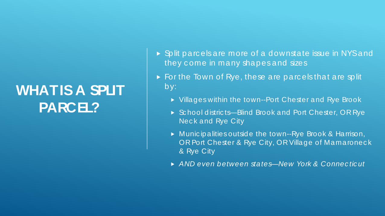
Split parcels are more of a downstate issue in NYS and they come in many shapes and sizes
For the Town of Rye, these are parcels that are split by: Villages within the town--Port Chester and Rye Brook
School districts—Blind Brook and Port Chester, OR Rye Neck and Rye City
Municipalities outside the town--Rye Brook & Harrison, OR Port Chester & Rye City, OR Village of Mamaroneck & Rye City
AND even between states—New York & Connecticut
WHAT IS A SPLIT PARCEL?
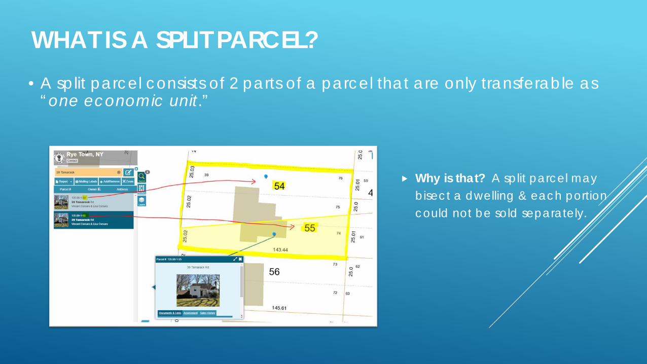
Why is that? A split parcel may bisect a dwelling & each portion could not be sold separately.
• A split parcel consists of 2 parts of a parcel that are only transferable as “one economic unit.”
.
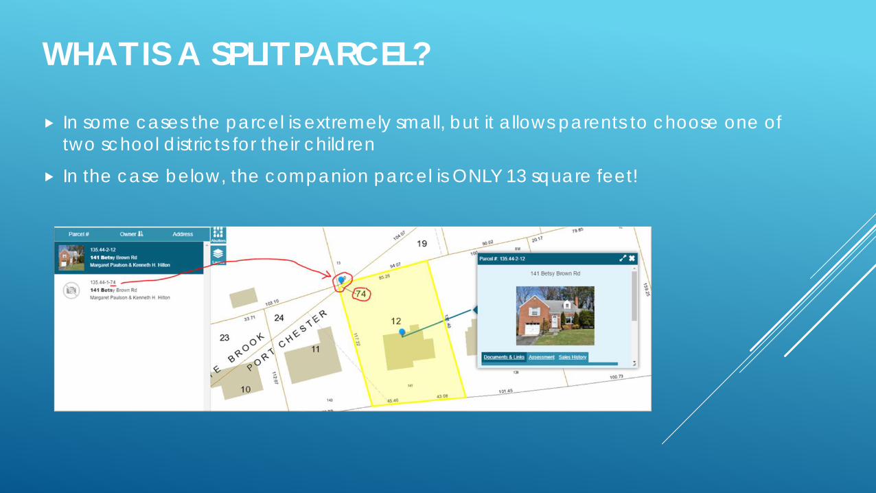
In some cases the parcel is extremely small, but it allows parents to choose one of two school districts for their children
In the case below, the companion parcel is ONLY 13 square feet!
WHAT IS A SPLIT PARCEL?
IDENTIFYING SPLIT PARCELS – DRAWING POLYLINES
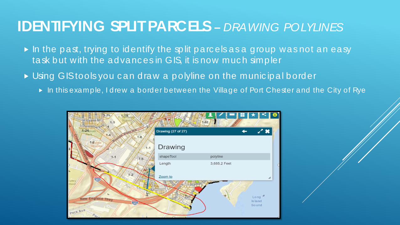
In the past, trying to identify the split parcels as a group was not an easy task but with the advances in GIS, it is now much simpler
Using GIS tools you can draw a polyline on the municipal border In this example, I drew a border between the Village of Port Chester and the City of Rye

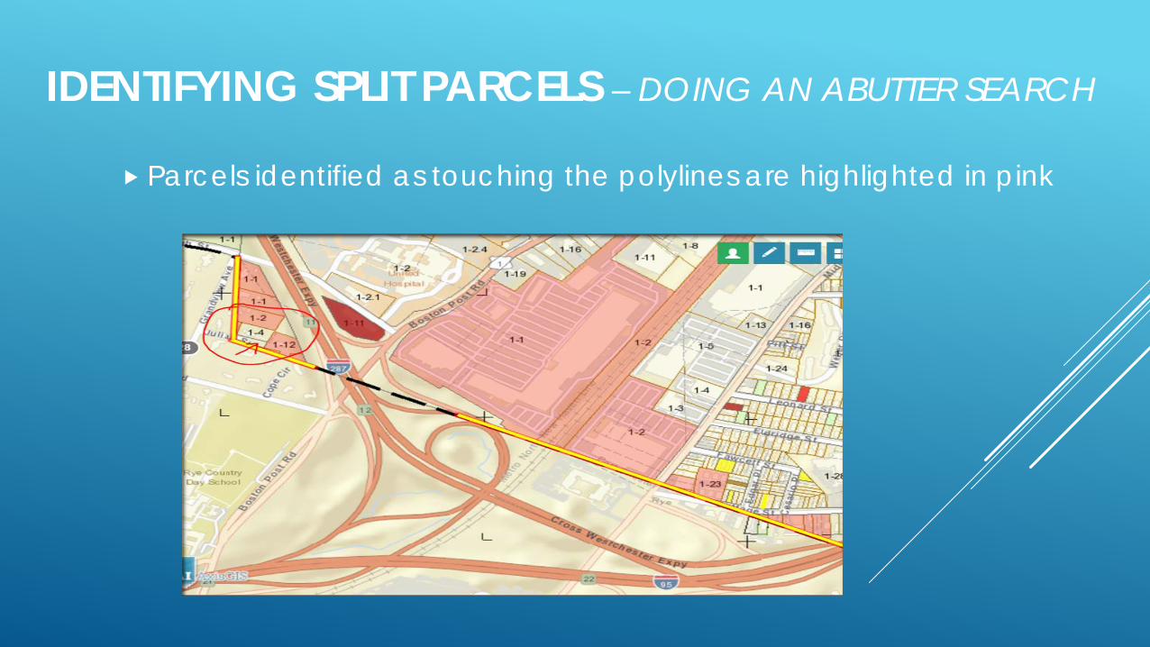
After adding 3 polylines, I did a 10 foot abutter search to identify the parcels touching the polylines
IDENTIFYING SPLIT PARCELS – DOING AN ABUTTER SEARCH
IDENTIFYING SPLIT PARCELS – DOING AN ABUTTER SEARCH
Parcels identified as touching the polylines are highlighted in pink
IDENTIFYING SPLIT PARCELS – DO AN ABUTTER SEARCH
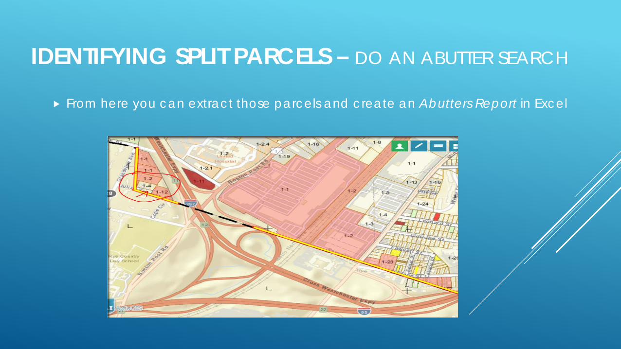
From here you can extract those parcels and create an Abutters Report in Excel
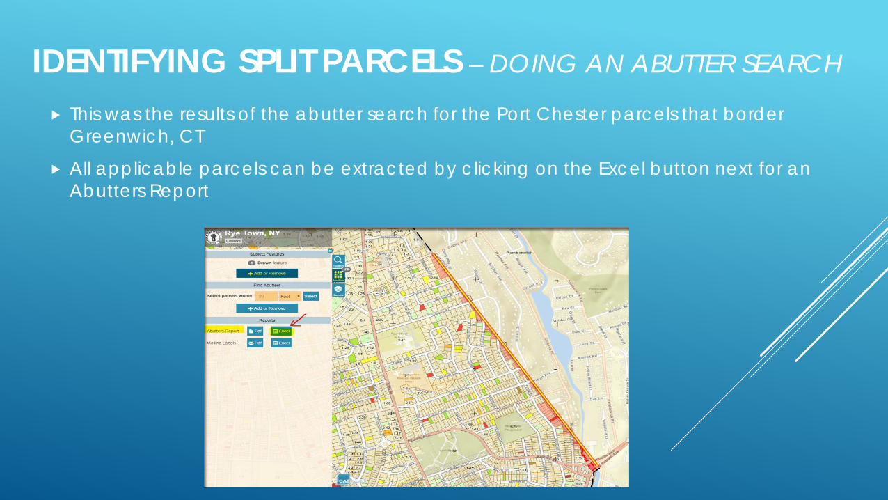
This was the results of the abutter search for the Port Chester parcels that border Greenwich, CT
All applicable parcels can be extracted by clicking on the Excel button next for an Abutters Report
IDENTIFYING SPLIT PARCELS – DOING AN ABUTTER SEARCH
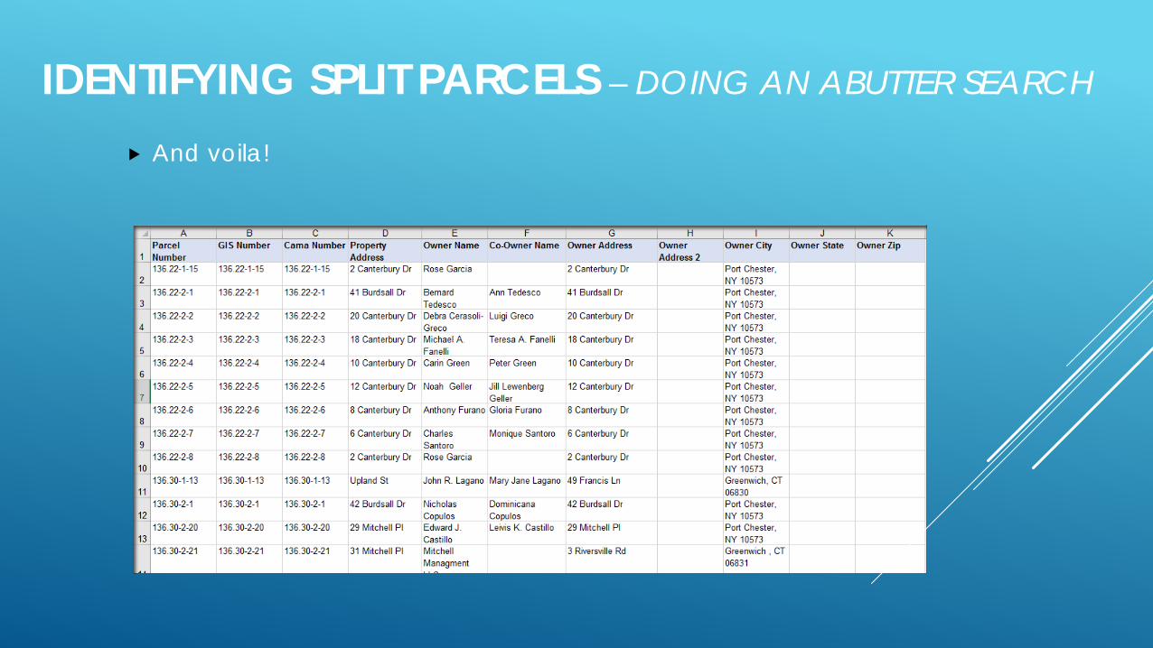
And voila!
IDENTIFYING SPLIT PARCELS – DOING AN ABUTTER SEARCH

We then used the spreadsheet to cross reference the parcels in our NYS RPS assessment database and made notations which we can then include in a custom report extract in RPS
IDENTIFYING SPLIT PARCELS – ASSESSMENT DATABASE UPDATE
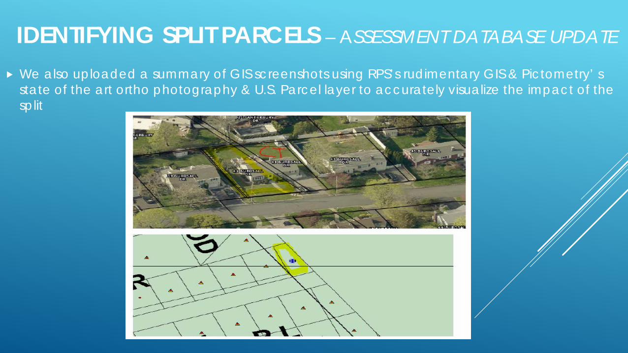
We also uploaded a summary of GIS screenshots using RPS’s rudimentary GIS & Pictometry’ s state of the art ortho photography & U.S. Parcel layer to accurately visualize the impact of the split
IDENTIFYING SPLIT PARCELS – ASSESSMENT DATABASE UPDATE
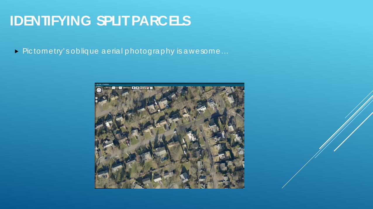
Pictometry’s oblique aerial photography is awesome…
IDENTIFYING SPLIT PARCELS
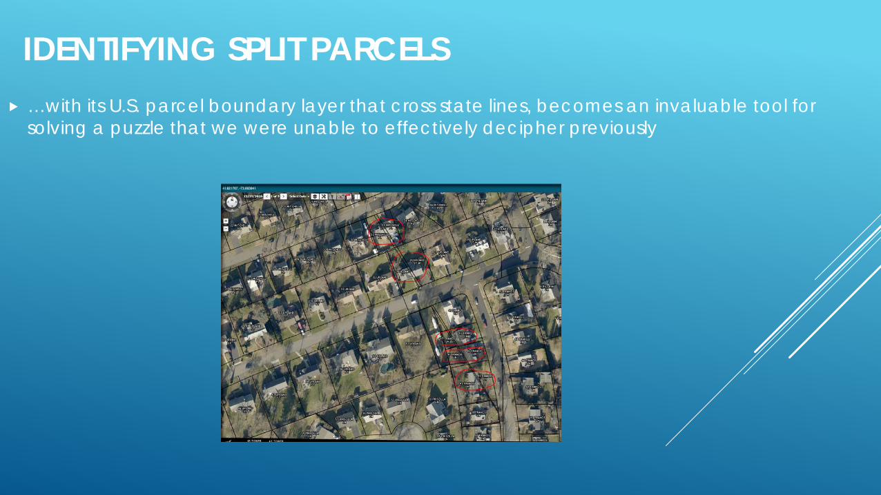
…with its U.S. parcel boundary layer that cross state lines, becomes an invaluable tool for solving a puzzle that we were unable to effectively decipher previously
IDENTIFYING SPLIT PARCELS