User Manual Version 1.1 March 2013
32
User Manual Version 1.1 March 2013 Project Team Matt Diebel Adam Freihoefer Kevin Kirsch Theresa Nelson Trip Hook Xiaochun Zhang
Transcript of User Manual Version 1.1 March 2013

User Manual Version 1.1 March 2013
Project Team
Matt Diebel Adam Freihoefer
Kevin Kirsch Theresa Nelson
Trip Hook Xiaochun Zhang
i
DISCLAIMER
PRESTO, the included documentation, and sample data files are made available free on an "as is" basis with no implied or express warranties. The user must assume the entire risk of using the tool. Although PRESTO has been tested with statewide data, good engineering practice requires that all work completed using this program should be checked with alternative methods.
This manual assumes that the user has an intermediate knowledge of ArcGIS software, GIS processing, and GIS datasets.

ii
PRESTO Users Guide Outline
1.0 OVERVIEW ................................................................................................................. 1 2.0 HOW DOES PRESTO WORK? ................................................................................... 1 3.0 UPDATES TO PRESTO 1.1 ........................................................................................ 2 4.0 PRESTO INPUTS ......................................................................................................... 3 5.0 SYSTEM REQUIREMENTS ....................................................................................... 6 6.0 INSTALLATION ......................................................................................................... 6 7.0 SETTING UP PRESTO .............................................................................................. 10 8.0 OUTPUTS................................................................................................................... 22 9.0 TROUBLESHOOTING .............................................................................................. 25 10.0 TECHNICAL SUPPORT ......................................................................................... 28

iii

1
1.0 OVERVIEW The Wisconsin Department of Natural Resources (WDNR) Bureau of Water Quality has developed a set of spatial processes called the Pollutant Load Ratio Estimation Tool (PRESTO) to compare a watershed’s average annual point and nonpoint phosphorus loads. The tool delineates the watershed upstream of a respective point source outfall, calculates the contributing nonpoint source load using either a simple unit area load export coefficient or a multiple regression based equation, and compares the measured point source effluent phosphorus load to the upstream nonpoint source phosphorus load. The comparison provides a screening tool for industrial and municipal dischargers to determine whether they are eligible for adaptive management as part of Wisconsin administrative code NR 217. Adaptive management allows a point source to control phosphorus discharges from other point and/or nonpoint sources to achieve compliance with applicable phosphorus water quality criteria in s. NR 102.06 in the most economically efficient manner possible. PRESTO also helps industry and municipalities determine if water quality trading is a feasible option within their watershed. The PRESTO User Manual provides step by step instructions needed to implement the tool. A complimentary narrative titled Pollutant Load Ratio Estimation Tool Documentation, Validation, and Analysis provides a technical description of how the tool was developed, compares PRESTO’s pollutant load output to measured pollutant loads, and provides the results of a statewide outfall point source to nonpoint source loading ratio assessment. The PRESTO model and supplemental information can be located at the WDNR’s homepage by searching “PRESTO” in the keyword box or referencing this link: http://dnr.wi.gov/topic/surfacewater/presto.html 2.0 HOW DOES PRESTO WORK? PRESTO was designed to be easily modified, transparent to the end user, and provide an efficient result based on readily available datasets. PRESTO performs three basic functions: watershed delineation, nonpoint source loading estimation, and point source loading aggregation. The PRESTO outputs include a delineated watershed, watershed landcover composition, the estimated nonpoint source and measured point source phosphorus loads (pounds per year), and the percent ratio of point to nonpoint phosphorus in a watershed. PRESTO was developed within the ArcGIS 10 framework and requires the Spatial Analyst extension. PRESTO is written in the Python scripting language, which has been adopted as the native scripting language for ArcGIS 10, replacing Visual Basic in the command line and map algebra environments. Python was chosen as the scripting language for PRESTO not only because of the ease of integration with ArcGIS 10, but because of its transparency, availability, and power. ESRI aptly describes Python as “free, cross platform, open source, stable, mature, simple, and powerful” – with this in mind, PRESTO is designed to be easily customizable and transparent to users with only a basic knowledge of scripting. ArcGIS 10 includes the ArcPy module for Python, which replaces the geoprocessor object utilized in previous versions of ArcGIS and includes functions for all geoprocessing tools.

2
PRESTO performs three routines: (1) delineation of a drainage basin upstream of a point, (2) application of spatially-explicit nonpoint source models to a drainage basin polygon, and (3) aggregation of all point sources within the delineated watershed. When running PRESTO, it is possible to perform all of these functions in sequence, or any of them individually. 3.0 UPDATES TO PRESTO 1.1 PRESTO 1.1 includes updates to the tools interface, inputs, and scripts. The improvements were directed towards the function and sustainability of the PRESTO tool.
• The municipal and industrial point source dataset was updated with the following: o Some outfall locations were modified through their location or named receiving
water due to previously identified delineation errors. For example, the Madison Metropolitan Sewer District outfall was moved from HUC 070900020703 to HUC 070900020801 to confirm to the appropriate drainage.
o Added 45 outfalls that had not previously been geolocated o Extended the phosphorus loading dataset through 2011
• Updated the PRESTO toolbox interface to automatically adjust the selectable inputs
based on what process is required (point-based delineation & phosphorus load estimation, pre-delineated basins & phosphorus load estimation, and watershed delineation only)
• Corrected routing within PRESTO’s default statewide HUC12 layer. Previously, several HUC12 basins had the wrong downstream code, leading to incorrect delineations if the watershed delineation encompassed two or more HUC12 subwatersheds.
• Created option to confine watershed delineation to the boundary of the basin containing the point, and bypass the process of appending upstream basins. This effectively divides basins containing points into upstream and downstream pieces.
• Improved PRESTO Python code for more efficient watershed delineation process and
compatibility with ArcGIS 10.0 and 10.1.

3
4.0 PRESTO INPUTS Prior to setting up the PRESTO tool, the user should be aware that PRESTO is packaged with a default set of input datasets with which the tool was designed to work. To allow for greater flexibility, PRESTO’s spatial framework allows the user to load other datasets into the tool, provided they follow a similar attribute structure.
PRESTO requires up to five spatial datasets in order to accomplish its core functions: watershed delineation, nonpoint source estimation, and point source loading aggregation. All spatial datasets should have the same spatial coordinate system. There are five statewide inputs included with PRESTO: Digital Elevation Model (DEM):
Default Input (burned_dem): A statewide 30-meter DEM that was hydrologically conditioned with modified 1:24,000 hydrology flow lines. Optional Input: The user can load any spatially referenced, raster based DEM into PRESTO. DEMs should be conditioned with the hydrologic network to be used in the analysis, and topographic sinks should be filled.
Hydrologic Network:
Default Input (WI_24K_Hydrolines): A modified version of the Wisconsin 1:24,000 scale stream flow lines was used to define the hydrologic network. The modified version eliminated the orphan, or land locked, flow lines as well as any lines that were not considered to be a stream center line. The default stream flow lines also contained a stream name attribute that was linked to the delineation point (outfall or user defined point) receiving water attribute. Optional Input: The end user can load any spatially referenced stream polyline. The coverage should not contain orphan lines and should use centerlines through lakes, reservoirs, or impoundments.
Subbasin Boundaries:
Default Input (WI_Revised_HUC12): The statewide subbasin coverage in PRESTO uses the 12-digit hydrologic unit code (HUC) as the smallest level of unique identification for drainage areas. The HUC12 subbasins are numbered sequentially from upstream to downstream. To assist with the PRESTO delineation process, a HUC12 hierarchy file was created to identify the upstream basin IDs for each basin in the basins layer.
Optional Input: Any subbasin polygon coverage can be used in PRESTO. If using PRESTO to delineate watersheds, the coverage should contain a numbering scheme that indicates the downstream watershed. If using PRESTO to calculate
4
loads for individual subbasins rather than an entire upstream drainage area, the numbering scheme is not needed. Outfalls:
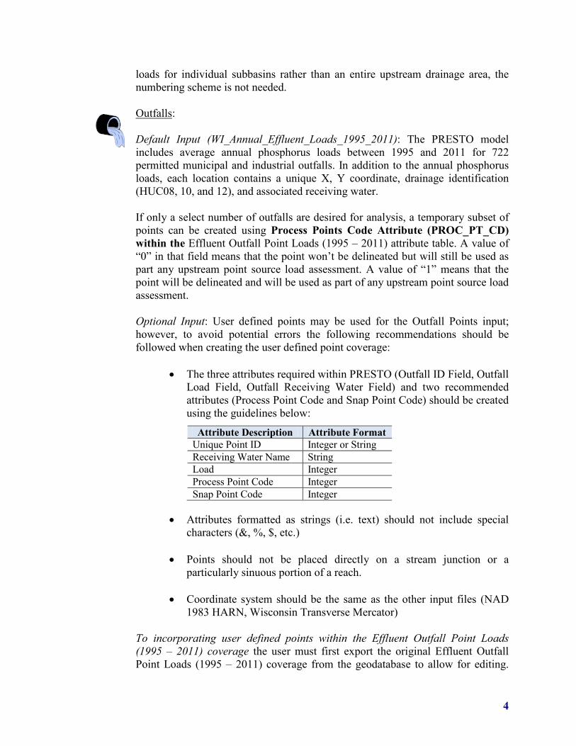
Default Input (WI_Annual_Effluent_Loads_1995_2011): The PRESTO model includes average annual phosphorus loads between 1995 and 2011 for 722 permitted municipal and industrial outfalls. In addition to the annual phosphorus loads, each location contains a unique X, Y coordinate, drainage identification (HUC08, 10, and 12), and associated receiving water. If only a select number of outfalls are desired for analysis, a temporary subset of points can be created using Process Points Code Attribute (PROC_PT_CD) within the Effluent Outfall Point Loads (1995 – 2011) attribute table. A value of “0” in that field means that the point won’t be delineated but will still be used as part any upstream point source load assessment. A value of “1” means that the point will be delineated and will be used as part of any upstream point source load assessment. Optional Input: User defined points may be used for the Outfall Points input; however, to avoid potential errors the following recommendations should be followed when creating the user defined point coverage:
• The three attributes required within PRESTO (Outfall ID Field, Outfall Load Field, Outfall Receiving Water Field) and two recommended attributes (Process Point Code and Snap Point Code) should be created using the guidelines below:
• Attributes formatted as strings (i.e. text) should not include special characters (&, %, $, etc.)
• Points should not be placed directly on a stream junction or a
particularly sinuous portion of a reach.
• Coordinate system should be the same as the other input files (NAD 1983 HARN, Wisconsin Transverse Mercator)
To incorporating user defined points within the Effluent Outfall Point Loads (1995 – 2011) coverage the user must first export the original Effluent Outfall Point Loads (1995 – 2011) coverage from the geodatabase to allow for editing.
Attribute Description Attribute Format Unique Point ID Integer or String Receiving Water Name String Load Integer Process Point Code Integer Snap Point Code Integer

5
Once complete, the user can add additional points (e.g. monitoring sites, etc.) while still recognizing the surrounding point source phosphorus loads. The user must also be sure to populate the process points, snap points, and receiving water fields. The user defined points can contain a load of “0” if the site represents a monitoring station, etc. Landcover: Default Input (NLCD_Wisc_2006): The 2006 National Landcover Data (NLCD) developed by the multi-resolution land characteristics consortium (MRLC) was used to define each watershed’s land cover composition and assist in the calculation of nonpoint source phosphorus loads. The 2006 NLCD uses a 16-class land cover classification scheme and has a spatial resolution of 30-meters. Each land cover class is defined with a unique grid code value.
Optional Input: An alternate raster-based land cover dataset may be used in place of the default 2006 NLCD. It is recommended that each land cover type have a unique ID and reclassification table that reflects the unique IDs. The reclassification table can be used to assign load values or other classifications to land use codes in the land use raster. The table may be modified to provide tabular information for other models used in conjunction with PRESTO.

6
5.0 SYSTEM REQUIREMENTS To successfully install and operate PRESTO, the following requirements are needed:
• 1.50 GB of RAM • ESRI ArcGIS 10 or 10.1 Desktop – ArcView • ESRI ArcGIS 10 or 10.1 Spatial Analyst Extension
6.0 INSTALLATION 6.1 Downloading PRESTO
PRESTO can be obtained from the WDNR TMDL modeling staff or from the agency’s website (http://dnr.wi.gov/topic/surfacewater/presto.html). The model files are distributed as two WinZip files (PRESTO 1.1.zip, 1.5 MB, wisconsin_statewide.zip, 260 MB). Once the WinZip files has been downloaded, the user must first unzip the PRESTO 1.1.zip and the save it to their computer (preferably C:\). After the user has unzipped the PRESTO 1.1 folder to the C:\, then the user must unzip the wisconsin_statewide.zip into the C:\PRESTO 1.1\ToolData folder in order for the PRESTO 1.1.mxd to work in Step 6.3
6.2 Model File Setup PRESTO was designed to be used with ArcGIS Desktop (ArcGIS 10 and 10.1). PRESTO is packaged with an ESRI ArcMap document (PRESTO 1.1.mxd), toolbox (PRESTO 1.1.tbx), and folders containing scripts and default datasets.
User Manual
Output geodatabase and tables
Temporary model run files
Python scripts to execute PRESTO and default parameters table (default_parameters.csv) to redefine toolbox inputs / outputs
Default statewide datasets, HUC12 hierarchy file
PRESTO interface, Contains PRESTO.tbx
Set of tools that make up PRESTO
Defines current version of PRESTO
7
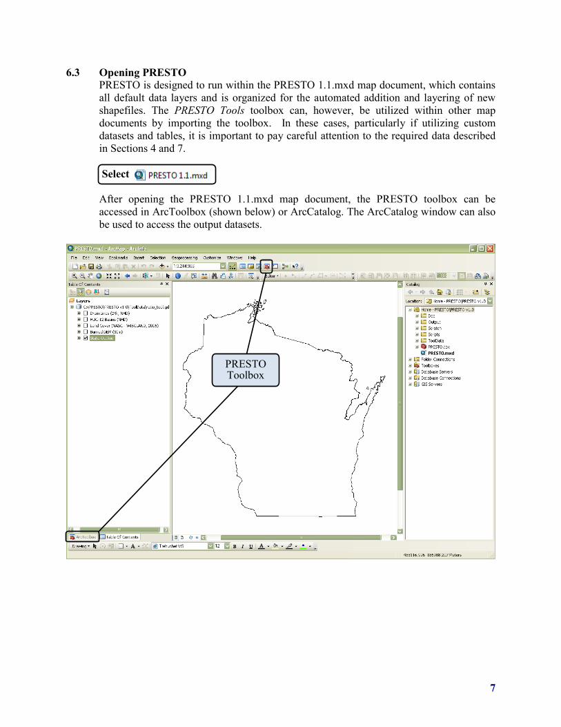
6.3 Opening PRESTO PRESTO is designed to run within the PRESTO 1.1.mxd map document, which contains all default data layers and is organized for the automated addition and layering of new shapefiles. The PRESTO Tools toolbox can, however, be utilized within other map documents by importing the toolbox. In these cases, particularly if utilizing custom datasets and tables, it is important to pay careful attention to the required data described in Sections 4 and 7.
Select
After opening the PRESTO 1.1.mxd map document, the PRESTO toolbox can be accessed in ArcToolbox (shown below) or ArcCatalog. The ArcCatalog window can also be used to access the output datasets.
PRESTO Toolbox

8
6.4 Verify Availability of Spatial Analyst Extension ArcMap ToolbarCustomize Extensions
6.5 Locating the PRESTO toolbox
Once ArcToolbox is opened within the ArcMap PRESTO 1.1.mxd, the PRESTO toolbox will be visible.
9
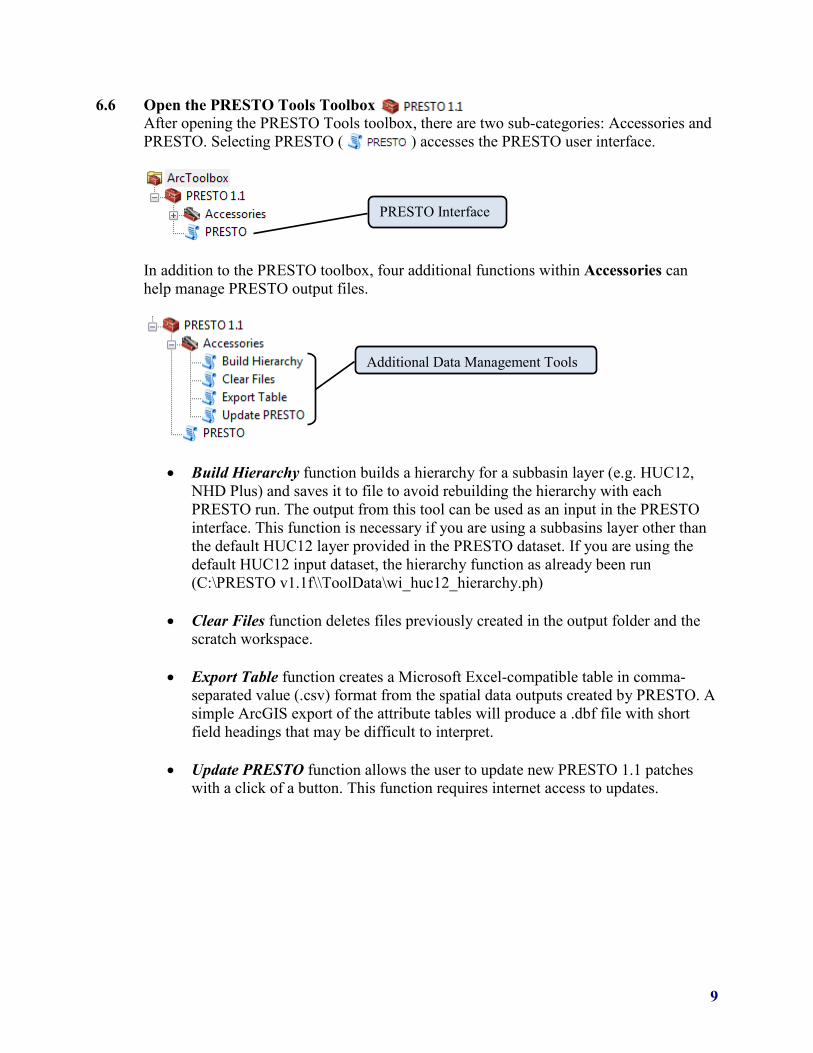
6.6 Open the PRESTO Tools Toolbox After opening the PRESTO Tools toolbox, there are two sub-categories: Accessories and PRESTO. Selecting PRESTO ( ) accesses the PRESTO user interface.
In addition to the PRESTO toolbox, four additional functions within Accessories can help manage PRESTO output files.
• Build Hierarchy function builds a hierarchy for a subbasin layer (e.g. HUC12, NHD Plus) and saves it to file to avoid rebuilding the hierarchy with each PRESTO run. The output from this tool can be used as an input in the PRESTO interface. This function is necessary if you are using a subbasins layer other than the default HUC12 layer provided in the PRESTO dataset. If you are using the default HUC12 input dataset, the hierarchy function as already been run (C:\PRESTO v1.1f\\ToolData\wi_huc12_hierarchy.ph)
• Clear Files function deletes files previously created in the output folder and the scratch workspace.
• Export Table function creates a Microsoft Excel-compatible table in comma-
separated value (.csv) format from the spatial data outputs created by PRESTO. A simple ArcGIS export of the attribute tables will produce a .dbf file with short field headings that may be difficult to interpret.
• Update PRESTO function allows the user to update new PRESTO 1.1 patches
with a click of a button. This function requires internet access to updates.
PRESTO Interface
Additional Data Management Tools

10
7.0 SETTING UP PRESTO The PRESTO tool interface is divided into 6 sections that can be subdivided into three utilities: watershed delineation, point source load aggregation, and nonpoint source (NPS) phosphorus load estimation. Parameters marked “Optional” are not necessarily optional in all configurations – for example, if Drainage Area Definition is set to Points, neither Outfall Points nor any associated attribute fields (Outfall ID Field/Load Field/Receiving Water Field) are optional, and the tool will fail if they are not provided. However, if Drainage Area Definition is set to Basins, outfalls are not required, but may be provided to calculate point source loading.
• (1) Watershed Processing Mode • (2) Input Datasets • (3) Basin Parameters • (4) Outfall Parameters • (5) Nonpoint Modeling Setup • (6) Output Parameters
Because there are more than 20 input fields, many of which are not expected to change between model runs, default values are specified for the majority of the parameters. These default values can be changed by right-clicking the PRESTO toolbox, selecting Properties, opening the Parameters tab, and entering new default values. They can also be changed by accessing the default_parameters.csv table within the scripts folder. The following sections describe the sections of PRESTO. In addition, the user can reference the help screen within the interface for an explanation of inputs.

11
7.1 Watershed Processing Mode
Method by which drainage areas, the spatial units for pollutant load analysis, are defined. There are three options: Points, Basins, Delineate Only. Depending on what the user need, one option may be selected over another.
• Points: Custom drainage areas are delineated for either the points in the outfall points or the user-defined points layer. This option should be selected when attempting to model pollutant loads at a point on the stream network.
• Basins: Drainage area geometry is provided by polygons in the Drainage Basins
layer. This mode is useful if watershed delineation has already been performed but additional modeled information (e.g. pollutant loads, landcover definition) is desired. Unlike the Points definition which uses nearly all of the fields, this option requires fewer inputs resulting in the deactivation of many input fields within the PRESTO interface.
• Delineate Only: Custom drainage areas are delineated for the either points in the
outfall points or user-defined points layer. This option should be selected when attempting to delineate a watershed and determine watershed characteristics such as land cover composition. This option will not provide pollutant load assessment.

12

13
7.2 Input Datasets
A. Drainage Basins Input consists of a polygon shapefile containing drainage basins. Depending on the value provided for the Drainage Area Definition input (Points or Basins), this layer has one of two applications.
• Drainage Area Definition = Points: This layer will be used in the delineation of
drainage areas. If this method is used, both a Basin ID field and a Basin Downstream ID field must be provided. A default HUC12 subwatershed input has been provided in PRESTO that contains both a Basin ID field and a Basin Downstream ID field.
• Drainage Area Definition = Basins: The polygons in this layer will serve as the
spatial unit for analysis, serving the same purpose as the delineated watersheds generated in Points mode. All analysis (point source and nonpoint load assessment) will be done for each subwatershed with the provided basins layer. If the basins in the Drainage Basin layer correspond to a set of Outfall Points, the values of the Basin ID field should match the values in the Outfall ID field in order to determine a basin's "Own Load".
B. Outfalls or Delineation Points
The set of points from which drainage areas will be delineated, ratios calculated, and from which point source loads will be calculated. This layer is required if the drainage area definition is set to points. If it is set to basins, this layer is optional and can be used to calculate point source pollution loads. Refer to Section 4 for additional information on the outfall point input.

14
C. Drain Lines The drain lines are defined by a polyline shapefile representing channelized flow paths. This input field is used to find basin pour points and for snapping outfall points. This layer is also used by two nonpoint estimation models; Multiple Regression Model #1 and Multiple Regression Model #2. Refer to Section 4 for additional information on the stream polyline input.
D. Reclassification Table The reclassification table input is a look-up table that relates pollutant load values to landcover codes in the land cover raster. The table may be modified to support tabular information for models. The default currently represents export coefficient-based phosphorus loads associated with specific land cover.
E. Digital Elevation Model The digital elevation model (DEM) is a raster elevation dataset used to delineate the inner subwatershed of an outfall point’s watershed. Refer to Section 4 for additional information on the DEM input
F. Land Cover The landcover is a raster-based GIS input that defines the landcover of the watershed. It should also have the same cell size as the DEM being used. Refer to Section 4 for additional information on the land cover input.
G. Delineation Boundary
The state outline is a polygon representing the outer boundary of the state of Wisconsin. Its function is to indicate whether delineated basins extend beyond the state and potentially into data-deficient areas since all other inputs have been clipped to the state boundary.

15
7.3 Basin Parameters
H. Basin ID Field This attribute field within the Drainage Basins coverage represents a unique basin identifier. This identifier may be numeric or text but must be unique for each entry and not contain spaces or special characters. This attribute can be selected from the drop down menu.
I. Basin Downstream ID Field
This is the field in the Drainage Basins layer that contains the basin identifier of the immediate downstream basin.
• Drainage Area Definition = Points: This field is required if the drainage definition
area is based on points. The value in the attribute field will be used to determine the upstream/downstream relationships needed for delineation. For example, if the value of the Basin Downstream ID Field for basin A is "B", the basin is assumed to drain into the polygon with the Basin ID "B".
• Drainage Area Definition = Basins: This field is not used
J. Basin Hierarchy File
The PRESTO hierarchy file (.ph) contains upstream basin IDs for each basin in the basins layer. A .ph file can be created for a set of basins using the "Create Hierarchy" tool in the PRESTO\Accessories toolbox. A hierarchy file (.ph) has already been created for the default PRESTO drainge basins input (HUC-12 basins) and is located in \PRESTO v1.1\ToolData. If not using the default drainage basins input, the user must generate a PRESTO hierarchy file (.ph) for the basins layer provided. Modifying the basins layer after the hierarchy files has been created may cause PRESTO to fail.

16
7.4 Outfall Parameters
K. Outfall ID Field
Outfall ID field is the attribute that identifies the point (outfall, monitoring site, etc.) to name the output watershed files and table entries. Any attribute from the outfall points layer can be used as long each point has a unique value that does not contain any special characters ($, &, #).
L. Outfall Load Field
The outfall load field, an attribute of the Outfall Points, contains a numeric value representing a pollutant load. If the attribute field is left blank, the pollutant load will be assumed to be zero for the point and only nonpoint source pollution will be estimated.
M. Outfall Receiving Water Field
The outfall receiving water field, an attribute of the outfall points, contains a text string identifying the receiving water of the outfall. The receiving water string must match a string in the drain name field.
• Drainage Area Definition = Points: This field is used to ensure that the outfall
point is snapped to the correct stream reach. If this field is left blank, the outfalls will be snapped to the nearest stream segment.
• Drainage Area Definition = Basins: This field is not used
N. Drain Name Field
The drain name field contains an identifier used to snap outfalls to stream segments. The values in the drain name field should match those in the Outfall Receiving Water Field.
O. Process Points Field
A numeric field indicating which points will be delineated in the Points Mode. Records with a value of “1” are delineated, while records with a value of “0” are used

17
for aggregation of point source loads. If the user requires all points to be delineated, all points should be assigned a value of “1” in this field.
P. Snap Points Field
A numeric field indicating which points will be snapped in the Points Mode. Records with a value of “1” are snapped, while records with a value of “0” are processed in place. This feature may be useful if examining sites draining to lakes or wetlands (i.e. not directly on the stream / river network.
7.5 Nonpoint Estimation Setup
Q. Nonpoint Estimation Models
There are three models used to estimate nonpoint source phosphorus export. By default, all three methods are selected to run with PRESTO. To only perform the watershed delineation, all three Nonpoint Estimation Models should be deselected.
Based on a statewide validation of the three nonpoint estimation models, it was
determined that Multiple Regression Model #1 estimated phosphorus loads most accurately. See Section 7 in the PRESTO Documentation, Validation, & Analysis Report for more information.

18
R. Reclassification Code Field The reclassification code field contains a unique value for each entry in the Reclassification Table. Typically entries are numerical but may also be strings. While the PRESTO design allows for some flexibility in the use of this table, currently the reclassification code field values correspond to those used in the default landcover ( 2006 NLCD) input (11, 21, 22, etc.).
S. Reclassification Name Field The reclassification name field is the unique identifier describing the reclassification code field. For example, for the reclassification code “11”, the reclassification name is “open water”.
T. Confine Delineation
If selected, this option confines watershed delineation to the boundary of the basin containing the point, and bypasses the process of appending upstream basins. This effectively divides basins containing points into upstream and downstream pieces.
U. Raster Snap Distance If the calculated watershed area is less than one square mile, the raster pour point is snapped to the Flow Accumulation layer by a maximum distance of 1-5 cells, increasing incrementally each time the watershed area fails to reach the 1 square mile threshold. After 5 attempted delineations, the watershed is assumed to actually be small, or that the data is faulty.
V. Fragment Tolerance Fragment tolerance is the size threshold below which a delineated watershed will be flagged as a "fragment", thus triggering further recursive snapping of the raster pour point. If this is set too low, some misplaced pour points won't be detected and the user will get a lot of failed delineations in the form of tiny watersheds. Too high, and pour points might get moved unnecessarily for smaller, upland watersheds.

19
7.6 Output
W. Output Folder The output folder defines the location where the PRESTO output files will be stored. The default location is typically within the PRESTO folder set-up C:\PRESTO v1.1\Output).
X. Output GDB
The output geodatabase (GBD) is used to name the geodatabase that will be created in the specified output folder. If this field is left blank, a geodatabase name will be automatically generated in numerical sequence within the output folder. If the GDB specified as the output GDB already exists (i.e. Output_1.gdb), the output records will be appended to the existing geodatabase (i.e.Output_1.gdb).
Note that if the Overwrite Records is selected, existing entries will be deleted and re-run. If it is not selected, the points or basins for which outputs already exist will be skipped.
Y. Overwrite Records The overwrite records field allows the user to overwrite previously created output records within the same output GDB. For example, if the output for outfall “1234” was already created within output_1.gdb and the overwrite records field was not selected, then PRESTO will skip outfall “1234” when processing additional outputs to the same output GDB.
20
By default, PRESTO creates a new GDB with each execution of the tool. The default output GDB is named Output_#.gdb, where # is a unique number which increases by 1 with each successive model run. If an existing GDB is specified in the Output GDB field, output files will be generated in that GDB. If the field Overwrite Records is selected, all points or basins will be run and added to output files, and existing model outputs will be overwritten. If Overwrite Records is deselected, points or basins which have already been processed in the Output GDB will not be re-run. This is useful if a previous PRESTO session was interrupted before an entire set of points or basins was analyzed, or if a subset of analyses is deleted and re-run.
Z. Output Shapefiles
In addition to tabular data created by PRESTO, the user may select different types of spatial outputs including:
• Snapped outfalls – a point shapefile identifying the final locations of the outfall
points after snapping to the correct receiving water or nearest hydro polyline. • Combined watersheds – a single polygon shapefile with multiple polygons
records representing drainages areas created and/or used for the analysis.
• Individual watersheds – Multiple shapefiles representing an individual polygon for each outfall that was created and/or analyzed through PRESTO.
7.7 Run PRESTO
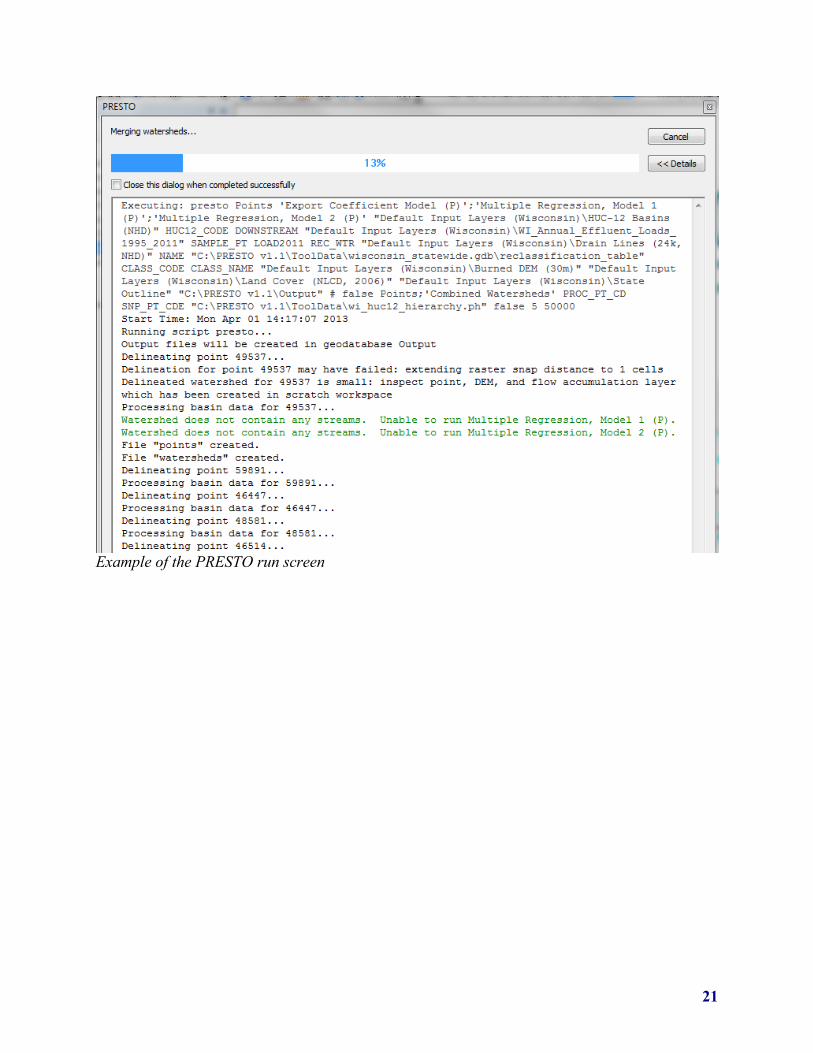
Select to Run PRESTO Upon clicking on “OK”, the PRESTO run screen will appear. PRESTO will process each outfall or subbasin. The length of time per outfall or subbasin is dependent on the watershed size and how many nonpoint estimation models are selected. In the event that an error occurs and PRESTO stops running, refer to Section 10.0, Troubleshooting.
21
Example of the PRESTO run screen
22
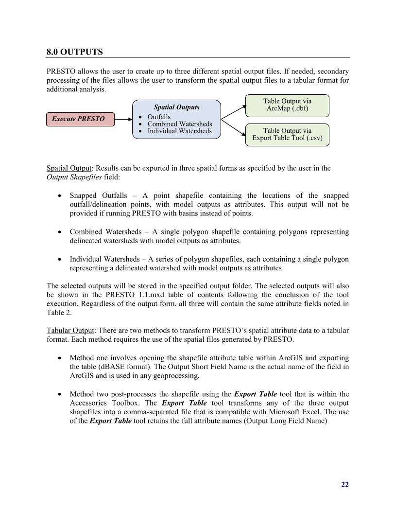
8.0 OUTPUTS PRESTO allows the user to create up to three different spatial output files. If needed, secondary processing of the files allows the user to transform the spatial output files to a tabular format for additional analysis. Spatial Output: Results can be exported in three spatial forms as specified by the user in the Output Shapefiles field:
• Snapped Outfalls – A point shapefile containing the locations of the snapped outfall/delineation points, with model outputs as attributes. This output will not be provided if running PRESTO with basins instead of points.
• Combined Watersheds – A single polygon shapefile containing polygons representing
delineated watersheds with model outputs as attributes.
• Individual Watersheds – A series of polygon shapefiles, each containing a single polygon representing a delineated watershed with model outputs as attributes
The selected outputs will be stored in the specified output folder. The selected outputs will also be shown in the PRESTO 1.1.mxd table of contents following the conclusion of the tool execution. Regardless of the output form, all three will contain the same attribute fields noted in Table 2. Tabular Output: There are two methods to transform PRESTO’s spatial attribute data to a tabular format. Each method requires the use of the spatial files generated by PRESTO.
• Method one involves opening the shapefile attribute table within ArcGIS and exporting the table (dBASE format). The Output Short Field Name is the actual name of the field in ArcGIS and is used in any geoprocessing.
• Method two post-processes the shapefile using the Export Table tool that is within the
Accessories Toolbox. The Export Table tool transforms any of the three output shapefiles into a comma-separated file that is compatible with Microsoft Excel. The use of the Export Table tool retains the full attribute names (Output Long Field Name)
Execute PRESTO Spatial Outputs
• Outfalls • Combined Watersheds • Individual Watersheds
Table Output via ArcMap (.dbf)
Table Output via Export Table Tool (.csv)

23
Table 2: PRESTO Output Attribute Fields Output Long Field Name
Output Short Field Name Description
Basin ID SAMPLE_PT Unique outfall identifier Basin Area (sq. mi) BASIN_AREA Area of basin in square miles
Stream Density Str_Dens Stream density: the total length of 24k streams in watershed divided by the watershed area
30m Grass Buffer (%) GRS_BUF_30 % grassland in 30 meter buffer around 24k streams
Upstream Point Source (lbs) UPST_PS annual phosphorus load in lbs of all upstream point sources
Point Load (lbs) OWN_LOAD annual phosphorus load in lbs of point source (this attribute will be zero if using a user defined point that contains a load of “0”).
Basin extends beyond state boundary OUT_STATE flag indicating if the basin extends beyond the
Wisconsin state boundary (1 = yes, 0 = no) Export Coefficient Model (P), Low Estimate EC_LOW Export coefficient model annual phosphorus
load in lbs - low estimate Export Coefficient Model (P), High Estimate EC_HIGH Export coefficient model annual phosphorus
load in lbs - high estimate Export Coefficient Model (P), Nonpoint Load EC_NP Export coefficient model annual phosphorus
load in lbs - most likely estimate
Export Coefficient Model (P), Total Load (lbs) EC_sum
Export coefficient model annual phosphorus loads - most likely estimate plus upstream and point source loads in lbs
Export Coefficient Model (P), Point to Nonpoint Ratio EC_PNP Point % : Nonpoint % (i.e. 75:25)
Export Coefficient Model (P), Load By Area (lbs/sq. mi) EC_ld_a Total load in lbs divided by the basin area in
square miles Multiple Regression, Model 1 (P), Lower Interval MRP1_LOW MR #1 model annual phosphorus load in lbs -
low estimate Multiple Regression, Model 1 (P), Upper Interval MRP1_HIGH MR #1 model annual phosphorus load in lbs -
high estimate Multiple Regression, Model 1 (P), Nonpoint Load MRP1_NP MR #1 model annual phosphorus load in lbs -
most likely estimate
Multiple Regression, Model 1 (P), Total Load (lbs) MRP1_sum
MR #1 model annual phosphorus loads - most likely estimate plus upstream and point source loads in lbs
Multiple Regression, Model 1 (P), Point to Nonpoint Ratio MRP1_PNP Point % : Nonpoint % (i.e. 75:25)

24
Table 2: PRESTO Output Attribute Fields Output Long Field Name
Output Short Field Name Description
Multiple Regression, Model 1 (P), Load By Area (lbs/sq. mi) MRP1_ld_a Total load in lbs divided by the basin area in
square miles Multiple Regression, Model 2 (P), Lower Interval MRP2_LOW MR #2 model annual phosphorus load in lbs -
low estimate Multiple Regression, Model 2 (P), Upper Interval MRP2_HIGH MR #2 model annual phosphorus load in lbs -
high estimate Multiple Regression, Model 2 (P), Nonpoint Load MRP2_NP MR #2 model annual phosphorus load in lbs -
most likely estimate Multiple Regression, Model 2 (P), Total Load (lbs) MRP2_sum
MR #2 model annual phosphorus loads - most likely estimate plus upstream and point source loads in lbs
Multiple Regression, Model 2 (P), Point to Nonpoint Ratio MRP2_PNP Point % : Nonpoint % (i.e. 75:25)
Multiple Regression, Model 2 (P), Load By Area (lbs/sq. mi) MRP2_ld_a Total load in lbs divided by the basin area in
square miles Percent Open Water* c11_r Percent of watershed area as open water
Percent High Intensity Urban* c24_r Percent of watershed area as high intensity urban land
Percent Pasture/Hay* c81_r Percent of watershed area as pasture/hay Percent Open Space* c21_r Percent of watershed area as open space
Percent Low Intensity Urban* c22_r Percent of watershed area as low intensity urban land
Percent Medium Intensity Urban* c23_r Percent of watershed area as medium intensity
urban land Percent Barren Land* c31_r Percent of watershed area as barren land Percent Evergreen Forest* c42_r Percent of watershed area as evergreen forest Percent Mixed Forest* c43_r Percent of watershed area as mixed forest Percent Deciduous Forest* c41_r Percent of watershed area as deciduous forest Percent Grassland/Herbaceous* c71_r Percent of watershed area as
grassland/herbaceous Percent Cultivated Crops* c82_r Percent of watershed area as cultivated crops Percent Woody Wetlands* c90_r Percent of watershed area as woody wetlands Percent Shrub/Scrub* c52_r Percent of watershed area as shrub/scrub Percent Emergent Herbaceous Wetlands* c95_r Percent of watershed area as emergent
herbaceous wetlands * = Naming scheme (long and short field names) originated from reclassification table

25
9.0 TROUBLESHOOTING Executing PRESTO may result in one of several types of errors, particularly when incorporating user defined inputs into the model, rather than the default datasets. If an error does occur, the tool was designed to provide as many descriptive qualifiers as possible to allow for identification of the problem. Sources of PRESTO error include:
• The input datasets do not share the same projection • The outfall point is located on a section of stream that is highly sinuous • The outfall point is located on the edge of the state
(Mississippi River, Lake Michigan, Lake Superior, or WI / IL Border) • The necessary outfall point attribute fields were not correctly formatted • Instability of ArcGIS processing platform
Some of the common PRESTO notifications and potential solutions are listed below: Example 1 – Invalid Attribute Field Characters Message "class 'arcgisscripting.ExecuteError'>: ERROR 000354: The name contains invalid
characters Problem The user-defined outfall point attributes (ID, Load, Receiving Waters) were not
formatted properly Possible Solution
Refrain from using special characters (&, %, $) in the attributes
Example 2: Unable to Process Specific Basin or Outfall Point Message Delineating point 50068...
<type 'exceptions.RuntimeError'>: Object: Error in executing tool Failed to execute (presto2).
Problem The ArcGIS software has encountered an unresolved problem or the point with ID 50068 may be unable to be processed with PRESTO or is cannot be run through PRESTO
Possible Solution
The first possible solution may be to restart PRESTO by closing the PRESTO 1.1.mxd and re-opening it. A second solution is that the outfall location may need to be adjusted or eliminated from the simulation. Another possible solution
Example 3: Outfall Point is not within a HUC-12 Basin Message <type 'exceptions.SystemExit'>: Point 49936 does not appear to fall within a basin.
Move point to a basin, discard, or check projection Failed to execute (presto2).
Problem The outfall point was located on or outside the Wisconsin border, in this case, on an island off the shoreline of Lake Superior. The outfall layer may also have an inconsistent projection from that of the other input data layers.
Possible Solution
If the outfall was on the border of the drainage area, one solution would be to move the point within the extent of the drainage area. In this example, the only solution would be to omit the point from analysis.

26
Example 4: Unable to Run Nonpoint Estimation Methods Message Processing basin data for 50183...
Watershed does not contain any streams. Unable to run Multiple Regression, Model 1 (P). Watershed does not contain any streams. Unable to run Multiple Regression, Model 2 (P).
Problem This error is not fatal and will appear in the PRESTO dialogue box if the analyzed watershed does not contain any stream reaches. A stream reach is necessary to calculate two of the nonpoint estimation models (multiple regression model #1 and multiple regression model #2).
Possible Solution
Modify the input datasets (edit stream hydroline and re-burn the DEM using a tool such as ArcHydro) to reflect existing stream reach if one exists.
Example 5: Location of Outfall Point requires significant raster snapping distance Message Delineation for point 47726 may have failed: extending raster snap distance to 1
cells Delineation for point 47726 may have failed: extending raster snap distance to 2 cells Delineation for point 47726 may have failed: extending raster snap distance to 3 cells Delineation for point 47726 may have failed: extending raster snap distance to 4 cells Delineation of point 47726 required an extended snap distance of 4 cells: inspect watershed to verify proper delineation
Problem This error is not fatal and will appear in the PRESTO dialogue box if the streams
don’t match the burned DEM or if there are projection issues Possible Solution
To help correct this problem, make sure the DEM has the streams burned into the coverage and that the “snap point to streams” option in PRESTO has been selected.
27
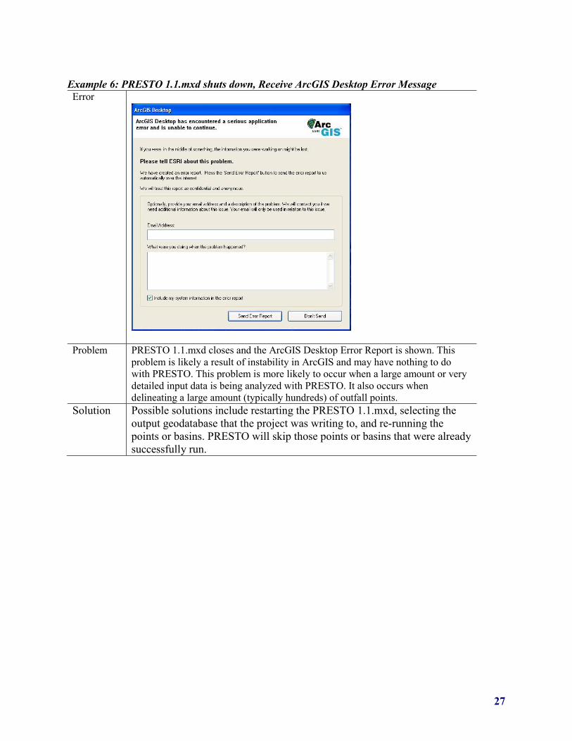
Example 6: PRESTO 1.1.mxd shuts down, Receive ArcGIS Desktop Error Message Error
Problem PRESTO 1.1.mxd closes and the ArcGIS Desktop Error Report is shown. This problem is likely a result of instability in ArcGIS and may have nothing to do with PRESTO. This problem is more likely to occur when a large amount or very detailed input data is being analyzed with PRESTO. It also occurs when delineating a large amount (typically hundreds) of outfall points.
Solution Possible solutions include restarting the PRESTO 1.1.mxd, selecting the output geodatabase that the project was writing to, and re-running the points or basins. PRESTO will skip those points or basins that were already successfully run.

28
10.0 TECHNICAL SUPPORT Technical issues can be sent to [email protected] and will be responded to by one of the Wisconsin Department of Natural Resources Modeling Technical Team staff. Updated versions of the PRESTO toolbox, user’s manual, and documentation provided on the WDNR website http://dnr.wi.gov/topic/surfacewater/presto.html. Updates to the PRESTO script can always be checked using the “Update PRESTO” tool within the PRESTO toolbox.