USA Select Briefing to The Federal Geographic Data Committee November 6, 2001 Glenn Geoghegan SPOT...
11
USA Select Briefing to The Federal Geographic Data Committee November 6, 2001 Glenn Geoghegan SPOT Image Corporation Reston, VA http://www.spot.com
-
Upload
erica-lester -
Category
Documents
-
view
213 -
download
0
Transcript of USA Select Briefing to The Federal Geographic Data Committee November 6, 2001 Glenn Geoghegan SPOT...

USA Select Briefing to
The Federal Geographic Data Committee
November 6, 2001
Glenn Geoghegan
SPOT Image Corporation
Reston, VA
http://www.spot.com

The premier base layer for GIS, Desktop Mapping, and Image Processing Software
• Current, cloud-free imagery; Pan or Natural Color
• 10m resolution on-the-shelf; 2.5m and 5m updates in ‘02
• Co-registered with existing USGS information products
• “Load & Go” Format for Simplified GIS Desktop Mapping Use
• Instantly available base maps for presentations, geospatial analysis, map updating, and change detection
Entities in the following states have already purchased USA Select data products: California, Connecticut, Florida, Idaho, Kentucky, Louisiana, Maine, Maryland, Mississippi, New Jersey, North Carolina, Ohio, Oregon, Pennsylvania, Rhode Island, South Carolina, Texas and West Virginia
USA Select
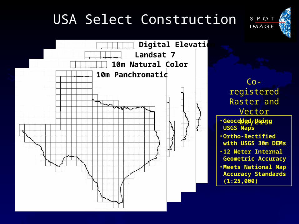
USA Select Construction
Co-registered Raster and
Vector Layers
Landsat 7
10m Panchromatic 10m Natural Color
Digital Elevation
•Geocoded Using USGS Maps
•Ortho-Rectified with USGS 30m DEMs
•12 Meter Internal Geometric Accuracy
•Meets National Map Accuracy Standards (1:25,000)
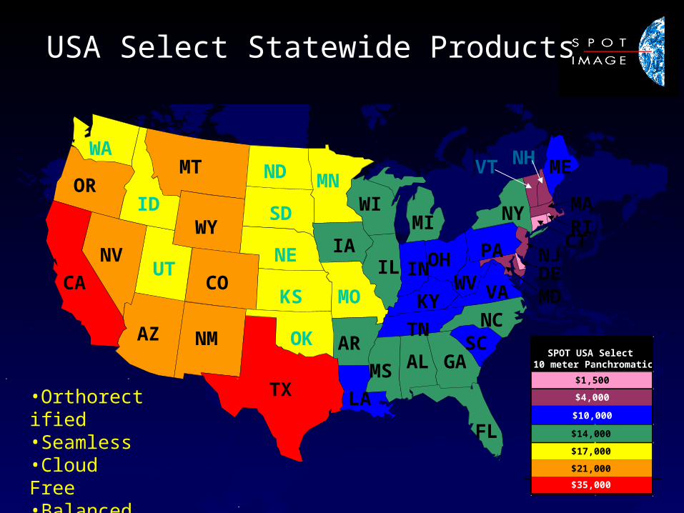
USA Select Statewide Products
•Orthorectified•Seamless•Cloud Free•Balanced•Current
MA
CTRI
CA
NV
OR
WA
ID
UT
AZ NM
CO
WY
MT
TX
OK
KS
NE
SD
ND MN
IA
MO
AR
LA
MS AL GA
FL
IL
WIMI
IN
TN
KY
SCNC
VA
OHWV
PA
NY
MEVT NH
NJ
MDDE
SPOT USA Select 10 meter Panchromatic
$1,500
$4,000
$10,000
$14,000
$17,000
$21,000
$35,000
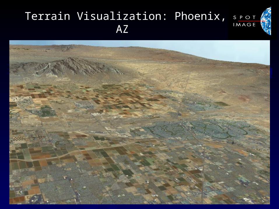
Terrain Visualization: Phoenix, AZ
Extended Licensing Ensures Widely Used, Dynamic and Valuable Base Map
• Any OHS Data Sharing requirements met by SPOT’s flexible, extended, licensing options
• Supports Common Operating Picture for all Federal, DoD, State and Local Agencies
• Unrestricted public access / web-based distribution options available
Resolution Upgrade Option: SPOT will extend a 25% discount on a 5m upgrade if (1) the initial 10 meter order is placed before 12/15/01, and (2) the SPOT 5 upgrade is ordered by 9/30/02. Full price for 5m upgrade will be charged after Oct 1, 2002.

SPOT Background Information
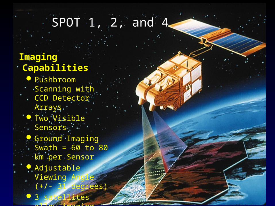
Imaging CapabilitiesPushbroom Scanning
with CCD Detector Arrays
Two Visible SensorsGround Imaging
Swath = 60 to 80 km per Sensor
Adjustable Viewing Angle (+/- 31 degrees)
3 satellites allow imaging every day
SPOT 1, 2, and 4
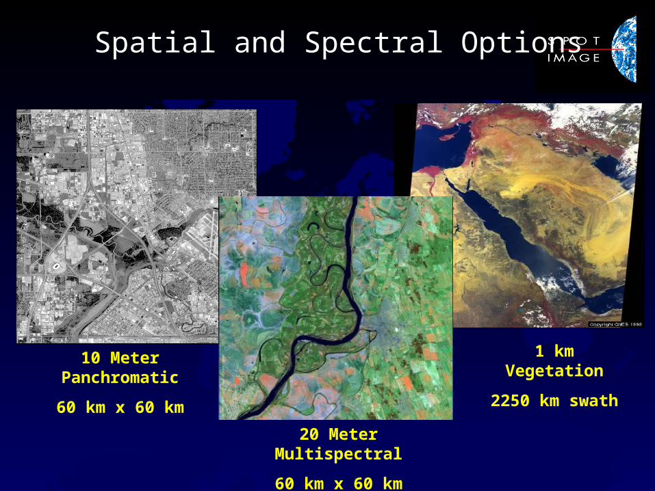
Spatial and Spectral Options
1 km Vegetation
2250 km swath
20 Meter Multispectral
60 km x 60 km
10 Meter Panchromatic
60 km x 60 km
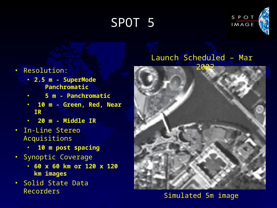
SPOT 5
• Resolution:• 2.5 m - SuperMode
Panchromatic
• 5 m - Panchromatic
• 10 m - Green, Red, Near IR
• 20 m - Middle IR
• In-Line Stereo Acquisitions• 10 m post spacing
• Synoptic Coverage• 60 x 60 km or 120 x 120 km
images
• Solid State Data Recorders
Launch Scheduled – Mar 2002
Simulated 5m image
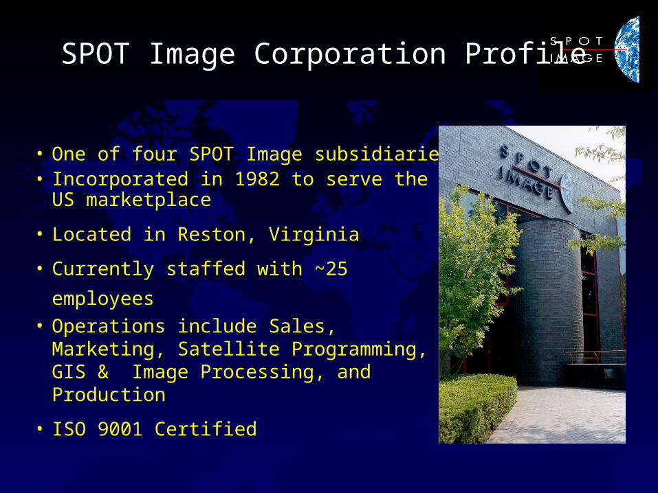
SPOT Image Corporation Profile
• One of four SPOT Image subsidiaries• Incorporated in 1982 to serve the US
marketplace
• Located in Reston, Virginia
• Currently staffed with ~25 employees• Operations include Sales, Marketing,
Satellite Programming, GIS & Image Processing, and Production
• ISO 9001 Certified