U.S. Surface Coal Mine Methane Recovery Project Opportunities · · 2016-03-02This methane is...
43
OUTREACH PROGRAM Coalbed Methane U.S. EPA U.S. Environmental Protection Agency July 10, 2008 EPA430-R-08-001 U.S. Surface Coal Mine Methane Recovery Project Opportunities
Transcript of U.S. Surface Coal Mine Methane Recovery Project Opportunities · · 2016-03-02This methane is...

OUTREACH PROGRAM
Coalbed MethaneU.S. EPA
U.S. Environmental Protection AgencyJuly 10, 2008EPA430-R-08-001
U.S. Surface Coal Mine Methane Recovery Project Opportunities

ACKNOWLEDGEMENT
This draft was prepared under U.S. Environmental Protection Agency Contract EP-W-05-063 by Raven Ridge Resources, Incorporated.
2
Frequently Used Terms .................................................................................................. 4 Frequently Used Abbreviations ..................................................................................... 5 Executive Summary ........................................................................................................ 6 1. Introduction ................................................................................................................. 7 2. Surface Mine Methane Projects and Opportunities ............................................... 10
Jacobs Ranch .......................................................................................................................... 12 Black Thunder ......................................................................................................................... 15 North Antelope Rochelle ........................................................................................................ 18 Caballo ..................................................................................................................................... 21 Cordero Rojo Complex ........................................................................................................... 24 Antelope ................................................................................................................................... 27 Eagle Butte............................................................................................................................... 30 Belle Ayr ................................................................................................................................... 33 Buckskin .................................................................................................................................. 36 Rosebud ................................................................................................................................... 39
References..................................................................................................................... 42
3

Frequently Used Terms
Coalbed methane: Methane that resides within coal seams.
Coal mine methane: As coal mining proceeds, methane contained in the coal and surrounding strata may be released. This methane is referred to as coal mine methane since its liberation resulted from mining activity.
Degasification system: A system that facilitates the removal of methane gas from a mine by ventilation and/or by drainage. However, the term is most commonly used to refer to removal of methane by drainage technology.
Drainage system: A system that drains methane from coal seams and/or surrounding rock strata. These systems include vertical pre-mine wells, gob wells and in-mine boreholes.
Methane emissions: This is the total amount of methane that is not used and therefore emitted to the atmosphere. Methane emissions are calculated by subtracting the amount of methane used from the amount of methane liberated (emissions = liberated – recovered/used).
4
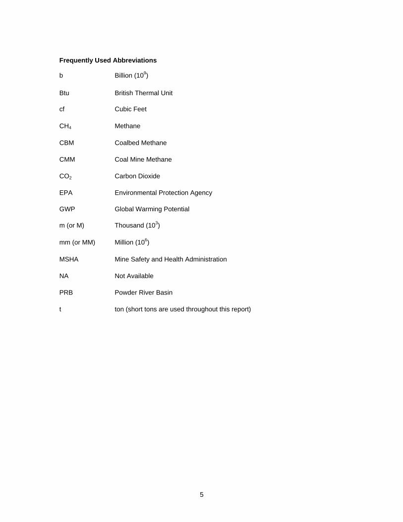
Frequently Used Abbreviations
b Billion (109)
Btu British Thermal Unit
cf Cubic Feet
CH4 Methane
CBM Coalbed Methane
CMM Coal Mine Methane
CO2 Carbon Dioxide
EPA Environmental Protection Agency
GWP Global Warming Potential
m (or M) Thousand (103)
mm (or MM) Million (106)
MSHA Mine Safety and Health Administration
NA Not Available
PRB Powder River Basin
t ton (short tons are used throughout this report)
5
Executive Summary
EPA has recently begun exploring the significance of methane emissions from active surface mines in the US, including the potential for recovering methane from these mines. In 2005, EPA funded an assessment of emissions from US surface mines that reviewed available technologies for estimating surface mine emissions, made specific recommendations for improving the parameters used to calculate surface mine emissions, and identified the Powder River Basin as the most promising coal basin for potential mine-specific methane recovery project opportunities. This report expands upon that work by developing profiles of ten potentially promising sites for project opportunities as well as identifying an existing surface mine methane project. A number of constraints were encountered in collecting data for this report. Due to today’s climate related to homeland security in the United States, pipeline maps and information were not available for a public report of this nature. This prohibits specific pipeline data from being published at this time.
6
1. Introduction There are three potential sources of fugitive methane emissions associated with surface coal mining. These are:
• Methane emitted by the coal excavated and processed during mining activities • Methane emitted by the coal and other gas bearing strata in the overburden and/or
underburden exposed by mining activities • Methane emitted by the overburden coal excavated and stored on site in waste piles
For methane emissions covered by the first point above, the available methane emitted by the excavated and processed coal is the estimated total gas content of the material excavated. For the second and third points above, the available methane is more uncertain as it depends on a variety of factors such as gas content and thickness of the adjacent coal seams, permeability of the coals and other strata found in the overburden and underburden, overburden thickness, and the amount of disturbance to the mine floor and highwall as a result of mining. The gas in coal and associated strata may be released during different stages in mining. Excavated coal will release methane as it is broken and removed from the highwall face, transported on site, and crushed and sized for transportation off-site. Overburden, inter-burden and uneconomic coal is normally dumped together with non-coal material in waste piles. The methane contained in these coals will be released as the material is excavated, broken, dumped, and later used as backfill. In addition, methane emissions will also migrate out of the floor and highwall of the surface mine. The magnitude of the floor emissions will depend on several factors such as:
• gas content of the unmined coal beneath the mine floor • proximity of the coal seams to the mine floor • extent of disturbance of the coal and the effect this has on its permeability • amount of coal left in the floor • presence of water
The magnitude of emissions from the highwall will similarly depend on
• gas content of the unmined coal remaining in the highwall • extent of disturbance of the coal near the highwall and the impact this has on the
permeability • presence of water
Currently, surface coal mines account for 67% of U.S. coal production, but constitute only 16% of the coal mine methane emissions. This primary reason for this is due to the relatively low gas content of the coals that are mined from surface mines. The low gas content of these coal seams is likely related to the shallow depth of burial, and the fact that some are lower rank with commensurately lower gas adsorption capacity. Gas contents used in estimating emissions from surface mines are based on a variety of studies. Average in-situ gas content values are assigned on a basin-specific basis and range from 5.6 cf/ton to 74.5 cf/ton. Unlike underground mines, for which degasification and ventilation emissions data is readily available, mine-specific emissions measurements are generally not measured for surface mines because no measurements are required for safety reasons due to the low risk of accidents resulting from excessive methane concentrations. The current approach used for estimating surface mine methane emissions is to apply a country or basin-specific emission factor to the amount of coal produced. As a result, emissions from surface mines (and post-mining activities) are calculated by multiplying basin-specific coal production by a basin-specific gas content and
7

then by the country-specific emission factor to determine methane emissions. The emission factor currently used by the U.S. is based on 200% of the in-situ gas content of the coal.1 Mines in the Powder River Basin (PRB) are the most productive surface mines in the U.S. and thus estimated to be the highest emitters of surface mine methane. Since the 1990s, the PRB has been the focus of massive coalbed methane development efforts. Methane recovery at these mine sites would make a significant contribution towards mitigating methane emissions from surface mines. The PRB has estimated methane reserves of 25 trillion cubic feet. The coalbed methane industry in the basin is flourishing as the number of producing wells has climbed to over 21,000 by the end of 2004, while in the mid-1990s, the basin had only 4,000 wells. With the methane industry thriving, coalbed methane development in the form of surface mine pre-drainage could make a sizeable contribution to methane recovery. Realistically, the only feasible type of methane recovery to be deployed at surface mines is pre-mine drainage. Because of their proximity to existing CBM production wells, any pre-drainage wells placed in advance of the coal mining operations could be connected to an existing gas pipeline infrastructure. Many of the surface mines in the PRB require dewatering wells in advance of mining. It is also possible that some of the dewatering wells could be converted to methane production wells once the water table has been drawn down ahead of the highwall. Due to the high permeability of the PRB coals, only vertical CBM-type wells are feasible to use to degas coals ahead of mining, since nearly all of the gas within 2000 feet of the highwall has already been released. Issues in the Powder River Basin Co-developing mineral resources in the PRB must be considered in the context of this report. The PRB has experienced a particularly dramatic increase in coalbed methane exploration and development. It contains the largest coal reserves of any basin in the United States. Over 90% of the Basin's coal estate is in Federal ownership and accounts for one-third of all U.S. coal production. About 45% of the oil and gas estate (including coalbed methane) in the PRB is under Federal ownership. Conflict has surrounded the development of CBM resources in the PRB in recent years. A major clash has occurred between coal licensees and oil and gas developers. Commonly in the PRB, resource ownership is a “split estate” issue where the surface owner may not own the mineral rights below. Much of the mineral rights in the basin are owned by BLM and leased to private companies. Most federal oil and gas leases in the PRB are senior to coal licenses; however, at the time of overlapping licensure, extensive CBM development was not anticipated. In the past, traditional oil and gas and coal conflicts generally involved oil and gas resources contained in reservoirs much deeper than the coal, thereby allowing for development of coal without loss of the oil and gas development. Since CBM is trapped within the coal seams and was considered a valueless gas which escaped from coal, rather than part of the valuable coal fuel itself, coal companies routinely vented the gas to the atmosphere. Rising interest in CBM exploration and development as a result of new technology, a better understanding of the resource and increasing energy demand has created a mineral conflict situation concerning federal leases. In order to optimize production of coal and CBM on federal lands, the Federal Bureau of Land Management (BLM) has established Conflict Administration Zones (CAZ); which will encourage pre-mine gas drainage prior to mining, resulting in reduced methane liberation during surface mining. The CAZ typically includes areas located immediately west of the existing surface coal
1 Based on methodology currently employed for inventory purposes by USEPA. See page 3-40 of Inventory of U.S. Greenhouse Gas Emissions and Sinks: 1990-2004 (April 2006), USEPA # 430-R-06-002. Available from http://www.epa.gov/climatechange/emissions/usinventoryreport.html
8

mines in the Powder River Basin (PRB) that BLM has been identified as having the most potential for conflict between CBM development and surface coal mine development. The CAZ includes areas where surface mines will be mining coal within the next 10 years and where CBM development is underway or anticipated. Each CAZ is reviewed annually to adjust its boundary. BLM created the CAZ to:
• Prevent future conflicts on coal tracts that may be leased; • Provide a timely notice to the coal and CBM lessees or operators prior to their planned
development of coal or CBM development to allow for enough time to resolve future conflicts on coal tracts that may be leased; and
• Optimize federal coal and gas development. Once the CAZ is identified, the CBM lessees or operators are notified that their oil and gas lease is within the CAZ and informed of future mining activities. BLM requires the proper and timely development of leased resources, the prevention of waste and proper abandonment of wells, and the potential availability of incentives such as royalty rate reductions to encourage development. Once a CAZ has been identified, BLM proceeds to:
• Review the status of all oil and gas leases within the CAZ for CBM development; • Provide direction related to the development of the resources; • Mitigate conflicts between surface coal mining and CBM operations; and • Oversee public health, safety environmental impacts.
BLM may offer a royalty rate reduction to oil and gas lessees and allow these wells to be drilled on 40 acre centers. Well spacing for CBM wells drilled in the PRB are typically 80 acre centers. This provides additional gas drainage over a shorter period of time. BLM offers this incentive to encourage CBM operators to drill wells and drain as much CBM as possible in the time available to allow uninterrupted coal mining operations. This CAZ policy does not apply to oil and gas wells which produce from deeper zones. To qualify for a royalty rate reduction the oil and gas lessee must agree to the following:
• Expedite CBM production in a manner that will maximize the recovery of the resource before required abandonment;
• Cease production operations and abandon wells and facilities at BLM’s request prior to the commencement of mining operations in the area of the CBM wells; and
• BLM will notify the oil and gas operator at least 180 days prior to the date when the well should be abandoned.
Lessees with leases located on federal oil and gas property within a CAZ who agree to these conditions are eligible for a 50 percent royalty rate reduction on CBM production for the remaining life of the well. BLM has determined that without the royalty reductions recovery of valuable CBM resources within the CAZ would not be maximized. The details of this program can be found in BLM’s Instruction Memorandum No. 2003-253, written August 21, 2003.
9
2. Surface Mine Methane Projects and Opportunities
10
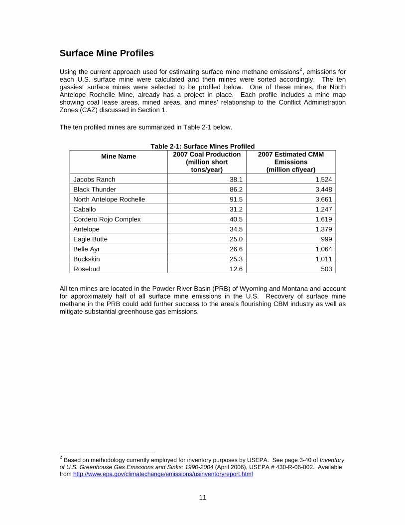
Surface Mine Profiles Using the current approach used for estimating surface mine methane emissions2, emissions for each U.S. surface mine were calculated and then mines were sorted accordingly. The ten gassiest surface mines were selected to be profiled below. One of these mines, the North Antelope Rochelle Mine, already has a project in place. Each profile includes a mine map showing coal lease areas, mined areas, and mines’ relationship to the Conflict Administration Zones (CAZ) discussed in Section 1. The ten profiled mines are summarized in Table 2-1 below.
Table 2-1: Surface Mines Profiled Mine Name 2007 Coal Production
(million short tons/year)
2007 Estimated CMM Emissions
(million cf/year) Jacobs Ranch 38.1 1,524Black Thunder 86.2 3,448North Antelope Rochelle 91.5 3,661Caballo 31.2 1,247Cordero Rojo Complex 40.5 1,619Antelope 34.5 1,379Eagle Butte 25.0 999Belle Ayr 26.6 1,064Buckskin 25.3 1,011Rosebud 12.6 503
All ten mines are located in the Powder River Basin (PRB) of Wyoming and Montana and account for approximately half of all surface mine emissions in the U.S. Recovery of surface mine methane in the PRB could add further success to the area’s flourishing CBM industry as well as mitigate substantial greenhouse gas emissions.
2 Based on methodology currently employed for inventory purposes by USEPA. See page 3-40 of Inventory of U.S. Greenhouse Gas Emissions and Sinks: 1990-2004 (April 2006), USEPA # 430-R-06-002. Available from http://www.epa.gov/climatechange/emissions/usinventoryreport.html
11

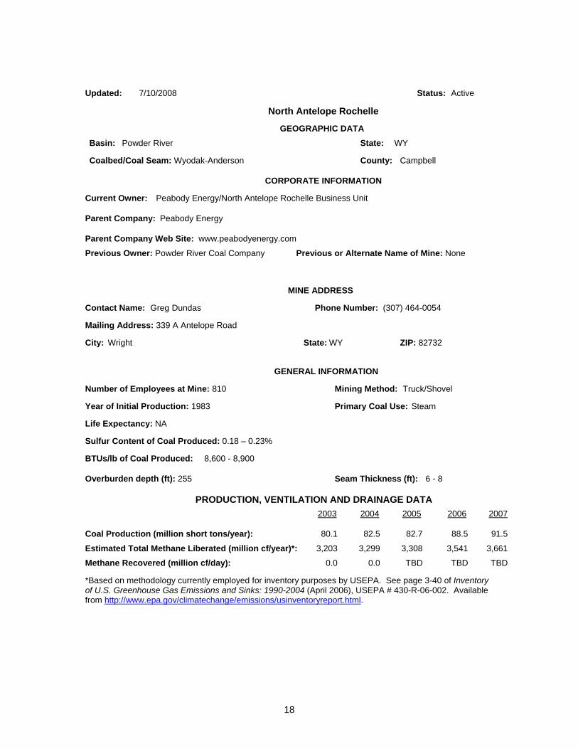
Updated: 7/10/2008 Status: Active
Jacobs Ranch GEOGRAPHIC DATA Basin: Powder River State: WY
Coalbed/Coal Seam: County: Campbell
CORPORATE INFORMATION Current Owner: Jacobs Ranch Coal Company
Parent Company: Rio Tinto Energy America
Parent Company Web Site: www.kennecottenergy.com Previous Owner: Kennecott Energy (name change) Previous or Alternate Name of Mine: None
MINE ADDRESS Contact Name: Lyle Randen, GM Phone Number: (307) 939-1216
Mailing Address: PO Box 3009
City: Gillette State: WY ZIP: 82717
GENERAL INFORMATION Number of Employees at Mine: 557 Mining Method: Truck/Shovel
Year of Initial Production: 1978 Primary Coal Use: Steam
Life Expectancy:
Sulfur Content of Coal Produced: 0.21 – 0.65%
BTUs/lb of Coal Produced: 8,725 (average)
Overburden depth: Seam Thickness (ft):
PRODUCTION, VENTILATION AND DRAINAGE DATA 2003 2004 2005 2006 2007
Coal Production (million short tons/year): 35.5 38.6 37.3 40.0 38.1 Estimated Total Methane Liberated (million cf/year)*: 1,420 1,542 1,491 1,600 1,524
Methane Recovered (million cf/day): 0.0 0.0 0.0 0.0 0.0
*Based on methodology currently employed for inventory purposes by USEPA. See page 3-40 of Inventory of U.S. Greenhouse Gas Emissions and Sinks: 1990-2004 (April 2006), USEPA # 430-R-06-002. Available from http://www.epa.gov/climatechange/emissions/usinventoryreport.html.
12

13
Jacobs Ranch (continued) Pipeline Sales Potential Description of Surrounding Terrain: Rolling hills Transmission Pipeline in County? Yes
Owner of Nearest Pipeline: NA
Distance to Pipeline (miles): NA Pipeline Diameter: NA Owner of Next Nearest Pipeline: NA
Distance to Next Nearest Pipeline (miles): NA Pipeline Diameter: NA
Other Utilization Possibilities Name of Nearby Coal Fired Power Plant: None Distance to Plant (miles): NA
Comments:
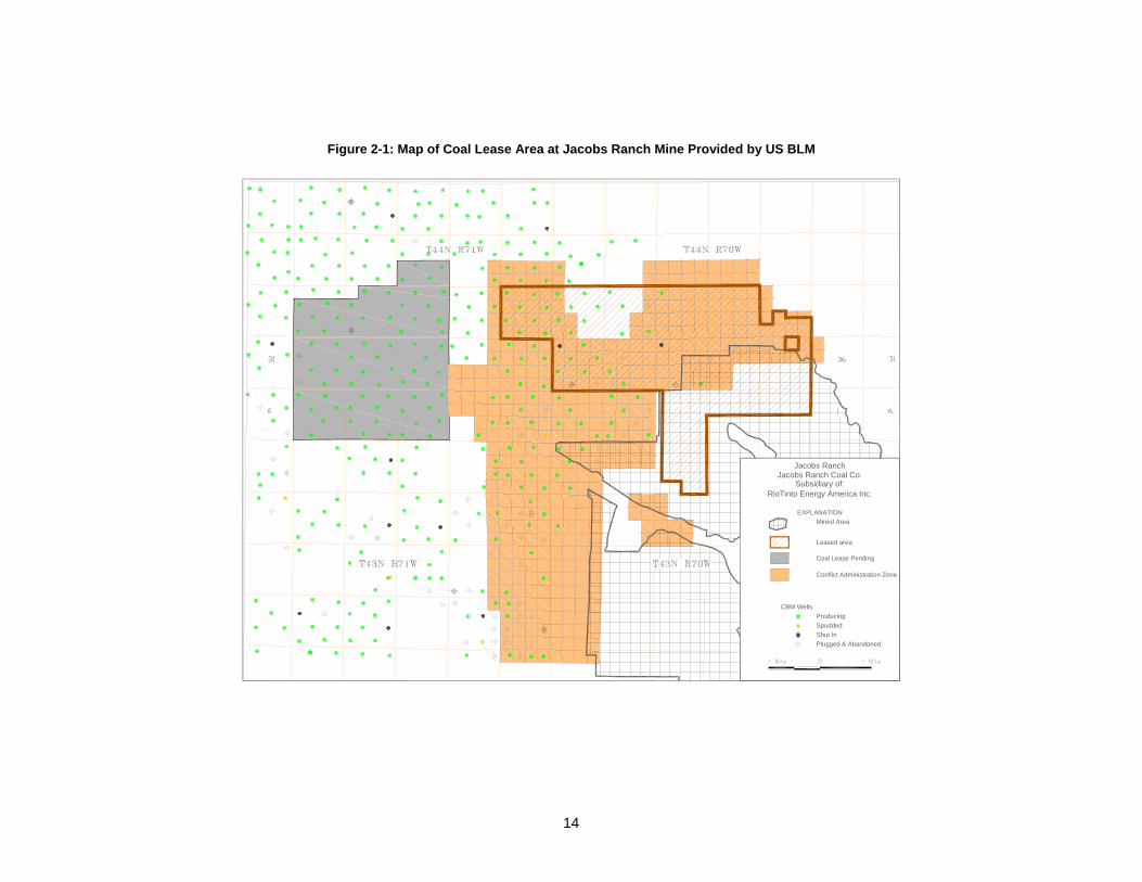
Figure 2-1: Map of Coal Lease Area at Jacobs Ranch Mine Provided by US BLM
EXPLANATIONMined Area
Leased area
Coal Lease Pending
Conflict Administration Zone
CBM WellsProducingSpuddedShut In
Jacobs RanchJacobs Ranch Coal Co.
Subsidiary of:RioTinto Energy America Inc.
Plugged & Abandoned
14

Updated: 7/10/2008 Status: Active
Black Thunder GEOGRAPHIC DATA Basin: Powder River State: WY
Coalbed/Coal Seam: Wyodak-Anderson County: Campbell
CORPORATE INFORMATION Current Owner: Thunder Basin Coal Company LLC
Parent Company: Arch Coal Inc.
Parent Company Web Site: www.archcoal.com Previous Owner: None Previous or Alternate Name of Mine: None
MINE ADDRESS Contact Name: Phone Number: (307) 939-1300
Mailing Address: P.O. Box 406
City: Wright State: WY ZIP: 82732
GENERAL INFORMATION Number of Employees at Mine: 470 Mining Method: Dragline/truck
Year of Initial Production: 1976 Primary Coal Use: Steam
Life Expectancy: NA
Sulfur Content of Coal Produced: 0.21 – 0.42%
BTUs/lb of Coal Produced: 8,830 (average)
Overburden depth: NA Seam Thickness (ft): 70
PRODUCTION, VENTILATION AND DRAINAGE DATA 2003 2004 2005 2006 2007
Coal Production (million short tons/year): 62.6 72.2 87.6 92.6 86.2 Estimated Total Methane Liberated (million cf/year)*: 2,505 2,889 3,503 3,706 3,448
Methane Recovered (million cf/day): 0.0 0.0 0.0 0.0 0.0
*Based on methodology currently employed for inventory purposes by USEPA. See page 3-40 of Inventory of U.S. Greenhouse Gas Emissions and Sinks: 1990-2004 (April 2006), USEPA # 430-R-06-002. Available from http://www.epa.gov/climatechange/emissions/usinventoryreport.html.
15

16
Black Thunder (continued) Pipeline Sales Potential
Description of Surrounding Terrain: Rolling hills Transmission Pipeline in County? Yes
Owner of Nearest Pipeline: NA
Distance to Pipeline (miles): NA Pipeline Diameter: NA Owner of Next Nearest Pipeline: NA
Distance to Next Nearest Pipeline (miles): Pipeline Diameter: NA
Other Utilization Possibilities Name of Nearby Coal Fired Power Plant: None Distance to Plant (miles): NA
Comments:
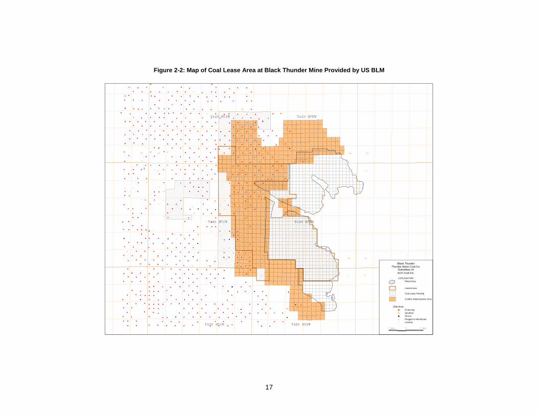
Figure 2-2: Map of Coal Lease Area at Black Thunder Mine Provided by US BLM
EXPLANATIONMined Area
Leased area
Coal Lease Pending
Conflict Administration Zone
CBM WellsProducingSpuddedShut In
Black Thunder
Plugged & AbandonedLocation
Thunder Basin Coal Co.Subsidiary of:Arch Coal Inc.
17
Updated: 7/10/2008 Status: Active
North Antelope Rochelle GEOGRAPHIC DATA Basin: Powder River State: WY
Coalbed/Coal Seam: Wyodak-Anderson County: Campbell
CORPORATE INFORMATION Current Owner: Peabody Energy/North Antelope Rochelle Business Unit
Parent Company: Peabody Energy
Parent Company Web Site: www.peabodyenergy.com Previous Owner: Powder River Coal Company Previous or Alternate Name of Mine: None
MINE ADDRESS Contact Name: Greg Dundas Phone Number: (307) 464-0054
Mailing Address: 339 A Antelope Road
City: Wright State: WY ZIP: 82732
GENERAL INFORMATION Number of Employees at Mine: 810 Mining Method: Truck/Shovel
Year of Initial Production: 1983 Primary Coal Use: Steam
Life Expectancy: NA
Sulfur Content of Coal Produced: 0.18 – 0.23%
BTUs/lb of Coal Produced: 8,600 - 8,900
Overburden depth (ft): 255 Seam Thickness (ft): 6 - 8
PRODUCTION, VENTILATION AND DRAINAGE DATA 2003 2004 2005 2006 2007
Coal Production (million short tons/year): 80.1 82.5 82.7 88.5 91.5 Estimated Total Methane Liberated (million cf/year)*: 3,203 3,299 3,308 3,541 3,661
Methane Recovered (million cf/day): 0.0 0.0 TBD TBD TBD
*Based on methodology currently employed for inventory purposes by USEPA. See page 3-40 of Inventory of U.S. Greenhouse Gas Emissions and Sinks: 1990-2004 (April 2006), USEPA # 430-R-06-002. Available from http://www.epa.gov/climatechange/emissions/usinventoryreport.html.
18
19
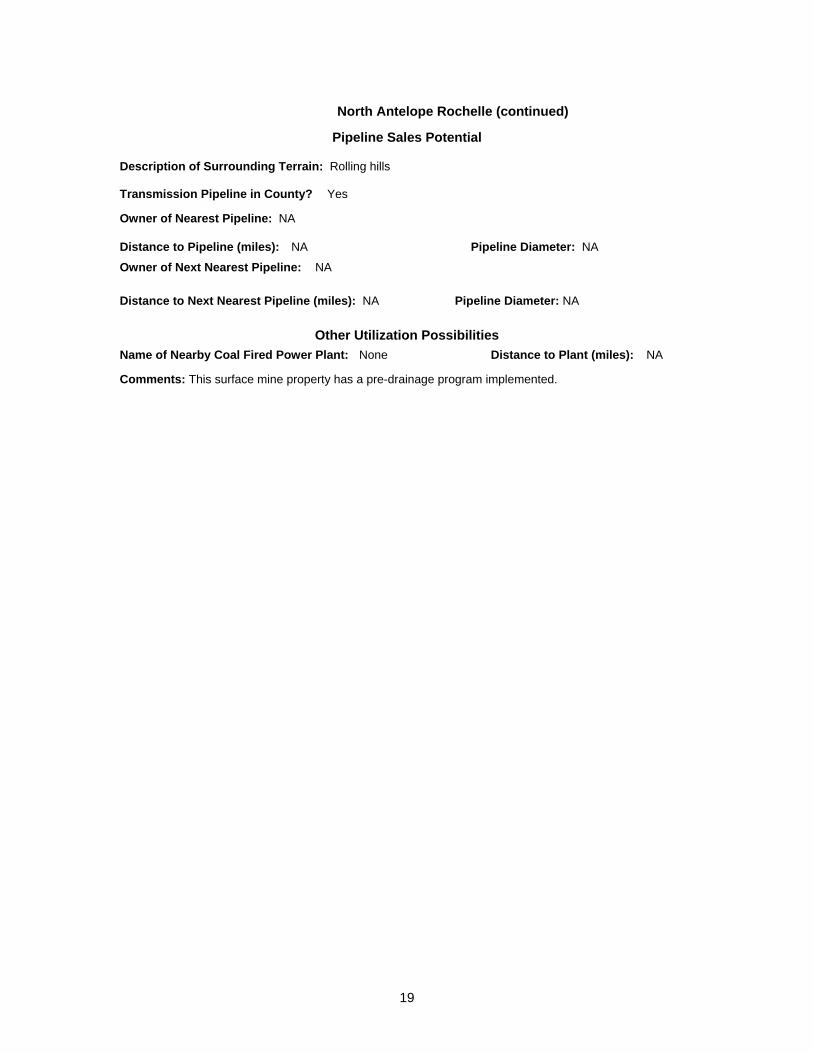
North Antelope Rochelle (continued) Pipeline Sales Potential
Description of Surrounding Terrain: Rolling hills Transmission Pipeline in County? Yes
Owner of Nearest Pipeline: NA
Distance to Pipeline (miles): NA Pipeline Diameter: NA Owner of Next Nearest Pipeline: NA
Distance to Next Nearest Pipeline (miles): NA Pipeline Diameter: NA
Other Utilization Possibilities Name of Nearby Coal Fired Power Plant: None Distance to Plant (miles): NA
Comments: This surface mine property has a pre-drainage program implemented.
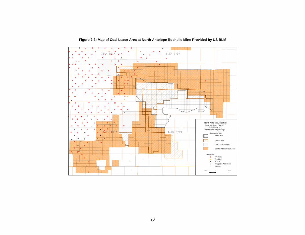
Figure 2-3: Map of Coal Lease Area at North Antelope Rochelle Mine Provided by US BLM
EXPLANATIONMined Area
Leased area
Coal Lease Pending
Conflict Administration Zone
CBM WellsProducingSpuddedShut In
North Antelope / RochellePowder River Coal LLC.
Plugged & AbandonedLocation
Subsidiary of:Peabody Energy Corp.
20

Updated: 7/10/2008 Status: Active
Caballo GEOGRAPHIC DATA Basin: Powder River State: WY
Coalbed/Coal Seam: Smith/Wyodak-Anderson County: Campbell
CORPORATE INFORMATION Current Owner: Caballo Coal Company
Parent Company: Peabody Energy
Parent Company Web Site: www.peabodyenergy.com Previous Owner: Carter Mining Company Previous or Alternate Name of Mine: None
MINE ADDRESS Contact Name: David Ott Phone Number: (307) 686-1991
Mailing Address: 2298 Bishop Road
City: Gillette State: WY ZIP: 82718
GENERAL INFORMATION Number of Employees at Mine: 275 Mining Method: Truck/Shovel
Year of Initial Production: 1978 Primary Coal Use: Steam
Life Expectancy: NA
Sulfur Content of Coal Produced: 0.29 – 0.42%
BTUs/lb of Coal Produced: 8,500 (Average)
Overburden depth (ft): 250 Seam Thickness (ft): 68
PRODUCTION, VENTILATION AND DRAINAGE DATA 2003 2004 2005 2006 2007
Coal Production (million short tons/year): 22.7 26.5 30.5 32.8 31.2
Estimated Total Methane Liberated (million cf/year)*: 910 1,059 1,221 1,311 1,247
Methane Recovered (million cf/day): 0.0 0.0 0.0 0.0 0.0
*Based on methodology currently employed for inventory purposes by USEPA. See page 3-40 of Inventory of U.S. Greenhouse Gas Emissions and Sinks: 1990-2004 (April 2006), USEPA # 430-R-06-002. Available from http://www.epa.gov/climatechange/emissions/usinventoryreport.html.
21
22
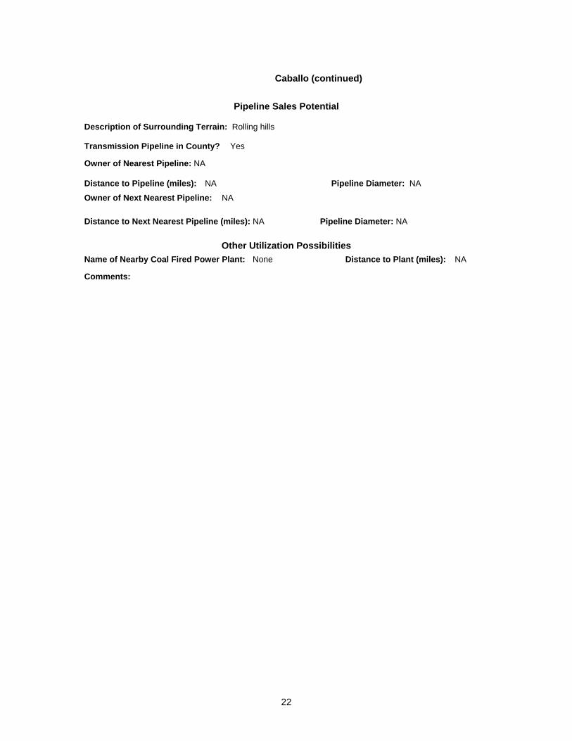
Caballo (continued)
Pipeline Sales Potential Description of Surrounding Terrain: Rolling hills Transmission Pipeline in County? Yes
Owner of Nearest Pipeline: NA
Distance to Pipeline (miles): NA Pipeline Diameter: NA Owner of Next Nearest Pipeline: NA
Distance to Next Nearest Pipeline (miles): NA Pipeline Diameter: NA
Other Utilization Possibilities Name of Nearby Coal Fired Power Plant: None Distance to Plant (miles): NA
Comments:

Figure 2-4: Map of Coal Lease Area at Caballo Mine Provided by US BLM
EXPLANATIONMined Area
Leased area
Coal Lease Pending
Conflict Administration Zone
CBM WellsProducingSpuddedShut In
CaballoCaballo Coal Co.
Plugged & AbandonedLocation
Subsidiary of:Peabody Energy Corp.
23

Updated: 7/10/2008 Status: Active
Cordero Rojo Complex GEOGRAPHIC DATA Basin: Powder River State: WY
Coalbed/Coal Seam: Wyodak-Anderson County: Campbell
CORPORATE INFORMATION Current Owner: Kennecott Energy
Parent Company: Rio Tinto Energy America
Parent Company Web Site: www.kennecottenergy.com Previous Owner: Kennecott Energy (name change) Previous or Alternate Name of Mine: None
MINE ADDRESS Contact Name: Colin Marshall Phone Number: (307) 682-8005
Mailing Address: PO Box 1449
City: Gillette State: WY ZIP: 82717
GENERAL INFORMATION Number of Employees at Mine: 383 Mining Method: Dragline
Year of Initial Production: 1976 Primary Coal Use: Steam
Life Expectancy: NA
Sulfur Content of Coal Produced: 0.25 – 0.37%
BTUs/lb of Coal Produced: 8,400 (Average)
Overburden depth (ft): 140 Seam Thickness (ft): 58.3
PRODUCTION, VENTILATION AND DRAINAGE DATA 2003 2004 2005 2006 2007
Coal Production (million short tons/year): 36.1 38.7 37.8 39.7 40.5 Estimated Total Methane Liberated (million cf/year)*: 1,443 1,550 1,513 1,590 1,619
Methane Recovered (million cf/day): 0.0 0.0 0.0 0.0 0.0
*Based on methodology currently employed for inventory purposes by USEPA. See page 3-40 of Inventory of U.S. Greenhouse Gas Emissions and Sinks: 1990-2004 (April 2006), USEPA # 430-R-06-002. Available from http://www.epa.gov/climatechange/emissions/usinventoryreport.html.
24
25
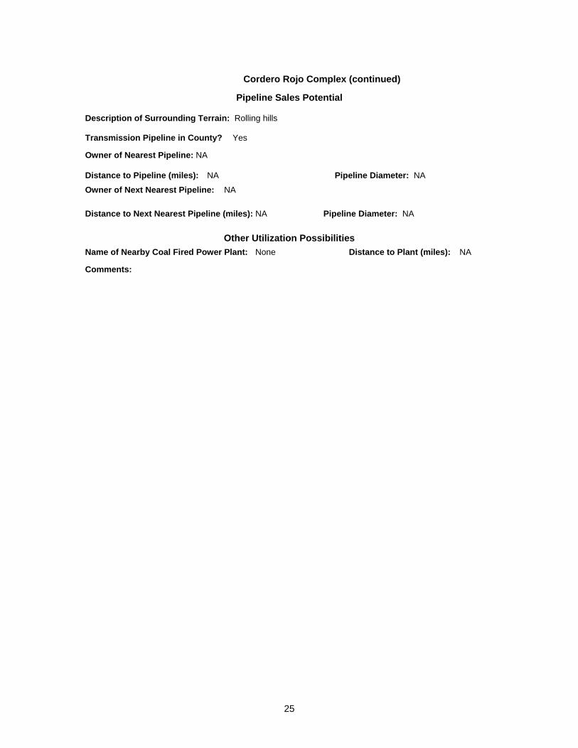
Cordero Rojo Complex (continued) Pipeline Sales Potential
Description of Surrounding Terrain: Rolling hills Transmission Pipeline in County? Yes
Owner of Nearest Pipeline: NA
Distance to Pipeline (miles): NA Pipeline Diameter: NA Owner of Next Nearest Pipeline: NA
Distance to Next Nearest Pipeline (miles): NA Pipeline Diameter: NA
Other Utilization Possibilities Name of Nearby Coal Fired Power Plant: None Distance to Plant (miles): NA
Comments:

Figure 2-5: Map of Coal Lease Area at Cordero Rojo Complex Mine Provided by US BLM
EXPLANATIONMined Area
Leased area
Coal Lease Pending
Conflict Administration Zone
CBM WellsProducingSpuddedShut In
Cordero-RojoCaballo Rojo Inc.
Plugged & AbandonedLocation
Subsidiary of:RioTinto Energy America Inc.
26
Updated: 7/10/2008 Status: Active
Antelope GEOGRAPHIC DATA Basin: Powder River State: WY
Coalbed/Coal Seam: Anderson and Canyon County: Campbell
CORPORATE INFORMATION Current Owner: Kennecott Energy
Parent Company: Rio Tinto Energy America
Parent Company Web Site: www.kennecottenergy.com Previous Owner: Kennecott Energy (name change) Previous or Alternate Name of Mine: None
MINE ADDRESS Contact Name: Jeane Hull Phone Number: (307) 464-1133
Mailing Address: Caller Box 3008
City: Gillette State: WY ZIP: 82717
GENERAL INFORMATION Number of Employees at Mine: 221 Mining Method: Dragline/Truck
Year of Initial Production: 1985 Primary Coal Use: Steam
Life Expectancy: NA
Sulfur Content of Coal Produced: 0.12 – 0.36%
BTUs/lb of Coal Produced: 8,800 (Average)
Overburden depth (ft): 140 Seam Thickness (ft): 62.5
PRODUCTION, VENTILATION AND DRAINAGE DATA 2003 2004 2005 2006 2007
Coal Production (million short tons/year): 29.5 29.7 30.0 33.9 34.5 Estimated Total Methane Liberated (million cf/year)*: 1,181 1,187 1,198 1,355 1,379
Methane Recovered (million cf/day): 0.0 0.0 0.0 0.0 0.0
*Based on methodology currently employed for inventory purposes by USEPA. See page 3-40 of Inventory of U.S. Greenhouse Gas Emissions and Sinks: 1990-2004 (April 2006), USEPA # 430-R-06-002. Available from http://www.epa.gov/climatechange/emissions/usinventoryreport.html.
27
28
Antelope (continued) Pipeline Sales Potential
Description of Surrounding Terrain: Rolling hills Transmission Pipeline in County? Yes
Owner of Nearest Pipeline:
Distance to Pipeline (miles): Pipeline Diameter: Owner of Next Nearest Pipeline:
Distance to Next Nearest Pipeline (miles): Pipeline Diameter: Other Utilization Possibilities Name of Nearby Coal Fired Power Plant: None Distance to Plant (miles): NA
Comments:
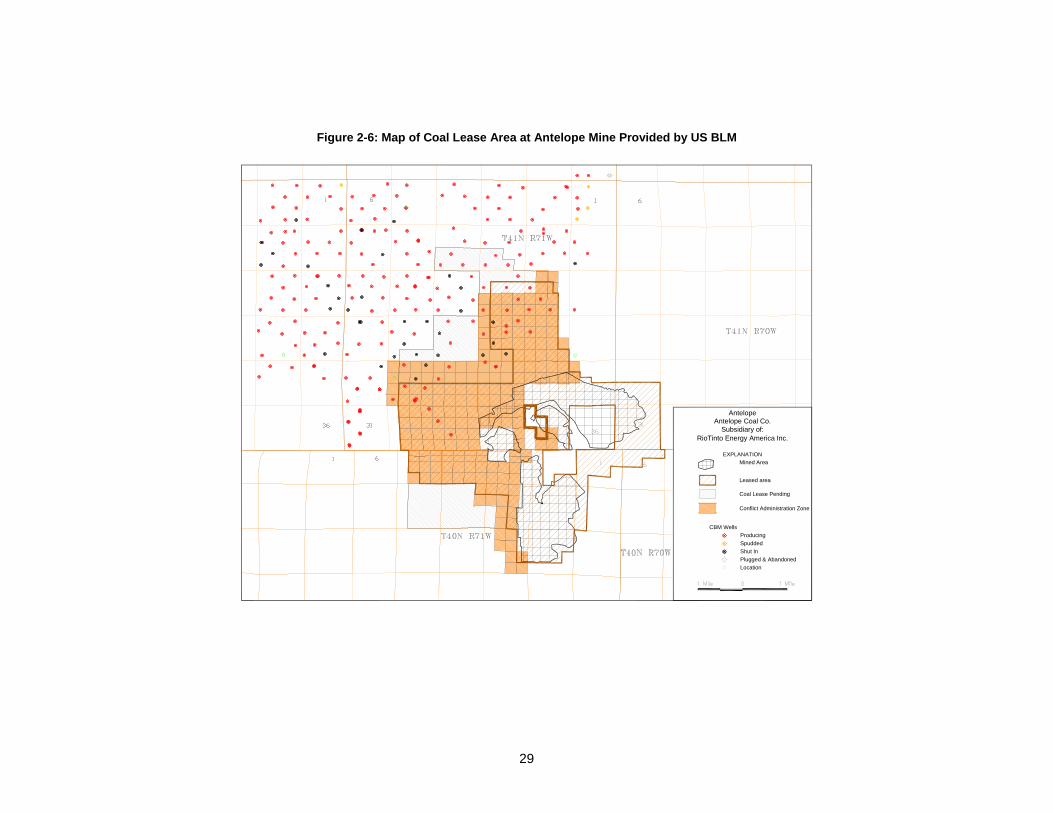
Figure 2-6: Map of Coal Lease Area at Antelope Mine Provided by US BLM
EXPLANATIONMined Area
Leased area
Coal Lease Pending
Conflict Administration Zone
CBM WellsProducingSpuddedShut In
AntelopeAntelope Coal Co.
Subsidiary of:RioTinto Energy America Inc.
Plugged & AbandonedLocation
29

Updated: 7/10/2008 Status: Active
Eagle Butte GEOGRAPHIC DATA Basin: Powder River State: WY
Coalbed/Coal Seam: Roland and Smith County: Campbell
CORPORATE INFORMATION Current Owner: Foundation Coal West Incorporated
Parent Company: Foundation Coal Company
Parent Company Web Site: www.foundationcoal.com Previous Owner: Amax Coal West Previous or Alternate Name of Mine: None
MINE ADDRESS Contact Name: Kurt Kost Phone Number: (307) 687-3300
Mailing Address: 10023 Hwy 14-16
City: Gillette State: WY ZIP: 82717
GENERAL INFORMATION Number of Employees at Mine: 234 Mining Method: Truck/Shovel
Year of Initial Production: 1978 Primary Coal Use: Steam
Life Expectancy: NA
Sulfur Content of Coal Produced: 0.34%
BTUs/lb of Coal Produced: 8,400 (Average)
Overburden depth (ft): 110 Seam Thickness (ft): NA
PRODUCTION, VENTILATION AND DRAINAGE DATA 2003 2004 2005 2006 2007
Coal Production (million short tons/year): 24.7 23.0 24.1 25.4 25.0 Estimated Total Methane Liberated (million cf/year)*: 989 920 965 1,014 999
Methane Recovered (million cf/day): 0.0 0.0 0.0 0.0 0.0
*Based on methodology currently employed for inventory purposes by USEPA. See page 3-40 of Inventory of U.S. Greenhouse Gas Emissions and Sinks: 1990-2004 (April 2006), USEPA # 430-R-06-002. Available from http://www.epa.gov/climatechange/emissions/usinventoryreport.html.
30

31
Eagle Butte (continued) Pipeline Sales Potential
Description of Surrounding Terrain: Rolling hills Transmission Pipeline in County? Yes
Owner of Nearest Pipeline: NA
Distance to Pipeline (miles): NA Pipeline Diameter: NA Owner of Next Nearest Pipeline: NA
Distance to Next Nearest Pipeline (miles): NA Pipeline Diameter: NA
Other Utilization Possibilities Name of Nearby Coal Fired Power Plant: None Distance to Plant (miles): NA
Comments:

Figure 2-7: Map of Coal Lease Area at Eagle Butte Mine Provided by US BLM
EXPLANATIONMined Area
Leased area
Coal Lease Pending
Conflict Administration Zone
CBM WellsProducingSpuddedShut In
Eagle ButteFoundation Coal West
Plugged & AbandonedLocation
32

Updated: 7/10/2008 Status: Active
Belle Ayr GEOGRAPHIC DATA Basin: Powder River State: WY
Coalbed/Coal Seam: Wyodak County: Campbell
CORPORATE INFORMATION Current Owner: Foundation Coal West Incorporated
Parent Company: Foundation Coal Company
Parent Company Web Site: www.foundationcoal.com Previous Owner: Amax Coal West Previous or Alternate Name of Mine: None
MINE ADDRESS Contact Name: Kurt Kost Phone Number: (307) 687-3300
Mailing Address: PO Box 3039
City: Gillette State: WY ZIP: 82717
GENERAL INFORMATION Number of Employees at Mine: 230 Mining Method: Truck/Shovel
Year of Initial Production: 1972 Primary Coal Use: Steam
Life Expectancy: NA
Sulfur Content of Coal Produced: 0.31%
BTUs/lb of Coal Produced: 8,550 (Average)
Overburden depth (ft): NA Seam Thickness (ft): NA
PRODUCTION, VENTILATION AND DRAINAGE DATA 2003 2004 2005 2006 2007
Coal Production (million short tons/year): 17.8 18.7 19.3 24.6 26.6
Estimated Total Methane Liberated (million cf/year)*: 714 748 773 984 1,064
Methane Recovered (million cf/day): 0.0 0.0 0.0 0.0 0.0
*Based on methodology currently employed for inventory purposes by USEPA. See page 3-40 of Inventory of U.S. Greenhouse Gas Emissions and Sinks: 1990-2004 (April 2006), USEPA # 430-R-06-002. Available from http://www.epa.gov/climatechange/emissions/usinventoryreport.html.
33

34
Belle Ayr (continued) Pipeline Sales Potential
Description of Surrounding Terrain: Rolling hills Transmission Pipeline in County? Yes
Owner of Nearest Pipeline: NA
Distance to Pipeline (miles): NA Pipeline Diameter: NA Owner of Next Nearest Pipeline: NA
Distance to Next Nearest Pipeline (miles): NA Pipeline Diameter: NA
Other Utilization Possibilities Name of Nearby Coal Fired Power Plant: None Distance to Plant (miles): NA
Comments:

Figure 2-8: Map of Coal Lease Area at Belle Ayr Mine Provided by US BLM
EXPLANATIONMined Area
Leased area
Coal Lease Pending
Conflict Administration Zone
CBM WellsProducingSpuddedShut In
Belle AyrFoundation Coal West
Plugged & AbandonedLocation
35

Updated: 7/10/2008 Status: Active
Buckskin GEOGRAPHIC DATA Basin: Powder River State: WY
Coalbed/Coal Seam: County: Campbell
CORPORATE INFORMATION Current Owner: Kiewit Mining Group
Parent Company: Kiewit Peter Sons’ Incorporated
Parent Company Web Site: www.kiewit.com Previous Owner: Triton Coal Company Previous or Alternate Name of Mine: None
MINE ADDRESS Contact Name: Phone Number: (307) 687-2062
Mailing Address: PO Box 3039
City: Gillette State: WY ZIP: 82716
GENERAL INFORMATION Number of Employees at Mine: 154 Mining Method: Truck/Shovel
Year of Initial Production: 1981 Primary Coal Use: Steam
Life Expectancy: NA
Sulfur Content of Coal Produced: 0.44%
BTUs/lb of Coal Produced: 8,454 (Average)
Overburden depth (ft): 200 Seam Thickness (ft): NA
PRODUCTION, VENTILATION AND DRAINAGE DATA 2003 2004 2005 2006 2007
Coal Production (million short tons/year): 17.5 20.3 19.6 22.8 25.3
Estimated Total Methane Liberated (million cf/year)*: 702 811 783 911 1,011
Methane Recovered (million cf/day): 0.0 0.0 0.0 0.0 0.0
*Based on methodology currently employed for inventory purposes by USEPA. See page 3-40 of Inventory of U.S. Greenhouse Gas Emissions and Sinks: 1990-2004 (April 2006), USEPA # 430-R-06-002. Available from http://www.epa.gov/climatechange/emissions/usinventoryreport.html.
36
37
Buckskin (continued) Pipeline Sales Potential
Description of Surrounding Terrain: Rolling hills Transmission Pipeline in County? Yes
Owner of Nearest Pipeline: NA
Distance to Pipeline (miles): NA Pipeline Diameter: NA Owner of Next Nearest Pipeline: NA
Distance to Next Nearest Pipeline (miles): NA Pipeline Diameter: NA
Other Utilization Possibilities Name of Nearby Coal Fired Power Plant: None Distance to Plant (miles): NA
Comments:

Figure 2-9: Map of Coal Lease Area at Buckskin Mine Provided by US BLM
EXPLANATIONMined Area
Leased area
Coal Lease Pending
Conflict Administration Zone
CBM WellsProducingSpuddedShut In
Buckskin
Plugged & AbandonedLocation
Kiewit Mining Properties Inc.
38

Updated: 7/10/2008 Status: Active
Rosebud GEOGRAPHIC DATA
Basin: Powder River State: MT
Coalbed/Coal Seam: Rosebud County: Rosebud
CORPORATE INFORMATION Current Owner: Western Energy Company
Parent Company: Westmoreland Coal Company
Parent Company Web Site: www.westmoreland.com Previous Owner: None Previous or Alternate Name of Mine: None
MINE ADDRESS Contact Name: John Olaughlin Phone Number: (406) 748-5100
Mailing Address: PO Box 99
City: Colstrip State: MT ZIP: 59323
GENERAL INFORMATION Number of Employees at Mine: 308 Mining Method: Dragline/Truck
Year of Initial Production: 1924 Primary Coal Use: Steam
Life Expectancy: 2033
Sulfur Content of Coal Produced: 0.64%
BTUs/lb of Coal Produced: 8,456 (Average)
Overburden depth (ft): 100 Seam Thickness (ft): NA
PRODUCTION, VENTILATION AND DRAINAGE DATA 2003 2004 2005 2006 2007
Coal Production (million short tons/year): 11.0 12.7 13.4 12.7 12.6
Estimated Total Methane Liberated (million cf/year)*: 441 507 535 509 503
Methane Recovered (million cf/day): 0.0 0.0 0.0 0.0 0.0
*Based on methodology currently employed for inventory purposes by USEPA. See page 3-40 of Inventory of U.S. Greenhouse Gas Emissions and Sinks: 1990-2004 (April 2006), USEPA # 430-R-06-002. Available from http://www.epa.gov/climatechange/emissions/usinventoryreport.html.
39
40
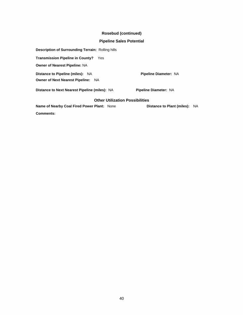
Rosebud (continued) Pipeline Sales Potential
Description of Surrounding Terrain: Rolling hills Transmission Pipeline in County? Yes
Owner of Nearest Pipeline: NA
Distance to Pipeline (miles): NA Pipeline Diameter: NA Owner of Next Nearest Pipeline: NA
Distance to Next Nearest Pipeline (miles): NA Pipeline Diameter: NA
Other Utilization Possibilities Name of Nearby Coal Fired Power Plant: None Distance to Plant (miles): NA
Comments:
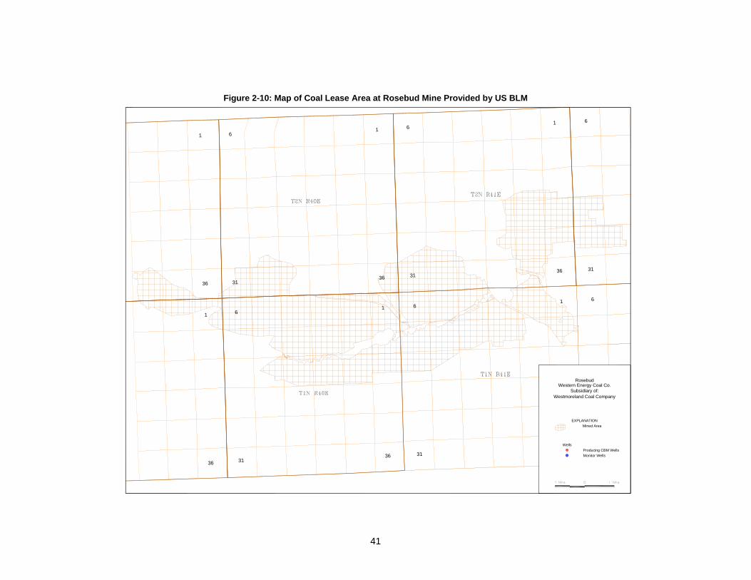
Figure 2-10: Map of Coal Lease Area at Rosebud Mine Provided by US BLM
6
6
31
1
36
6
31
16
31
1
36
6
31
1
36
6
31
1
36
1
36
EXPLANATIONMined Area
WellsProducing CBM WellsMonitor Wells
RosebudWestern Energy Coal Co.
Subsidiary of:Westmoreland Coal Company
41
References
Keystone. 1997-2001. Keystone Coal Industry Manual. Years 1997, 1998, 1999, 2000, 2001,
2002, 2003, 2004, and 2005. Chicago, Illinois: Maclean Hunter Publishing Co. MSHA (Mine Safety and Health Administration). Online. http://www.msha.gov USBLM (U.S. Bureau of Land Management). Instruction Memorandum 2003-253. Available
online: http://www.blm.gov/wy/st/en/programs/energy/CAZ/im2003-253.html USEPA (U.S. Environmental Protection Agency). 2006. Inventory of U.S. Greenhouse Gas
Emissions and Sinks 1990-2004, Office of Atmospheric Programs, USEPA # 430-R-06-002. April 2006.
42

43
References and Calculations Used in the Mine Profiles
Data Item Sources Calculations
Geographic Data (State, County, Basin, Coalbed)
Keystone Manual
Corporate Information:
Current Owner Past versions of Keystone Coal Manual and recent coal industry publications
Previous Owner Past versions of Keystone Coal Manual
Parent Company Past versions of Keystone Coal Manual
Phone/Address/Contact Information
Past versions of Keystone Coal Manual
General Information:
Number of Employees Past versions of Keystone Coal Manual
Year of Initial Production MSHA; Past versions of Keystone Coal Manual and articles in coal industry publications
Mining Method Past versions of Keystone Coal Manual
Primary Use Past versions of Keystone Coal Manual
Production, Ventilation, and Drainage Data
Coal Production MSHA
Estimated Total Methane Liberated
Based on methodology currently employed for inventory purposes by USEPA. See page 3-40 of Inventory of U.S. Greenhouse Gas Emissions and Sinks: 1990-2004 (April 2006), USEPA # 430-R-06-002. Available from http://www.epa.gov/climatechange/emissions/usinventoryreport.html.