U.S. Geological Survey National Mapping Division EROS Data Center A Proposal for Caribbean-Wide Land...
28
U.S. Geological Survey National Mapping Division EROS Data Center A Proposal for Caribbean-Wide Land Cover/Use Mapping
-
Upload
magnus-hall -
Category
Documents
-
view
229 -
download
0
Transcript of U.S. Geological Survey National Mapping Division EROS Data Center A Proposal for Caribbean-Wide Land...
U.S. Geological SurveyNational Mapping DivisionEROS Data Center
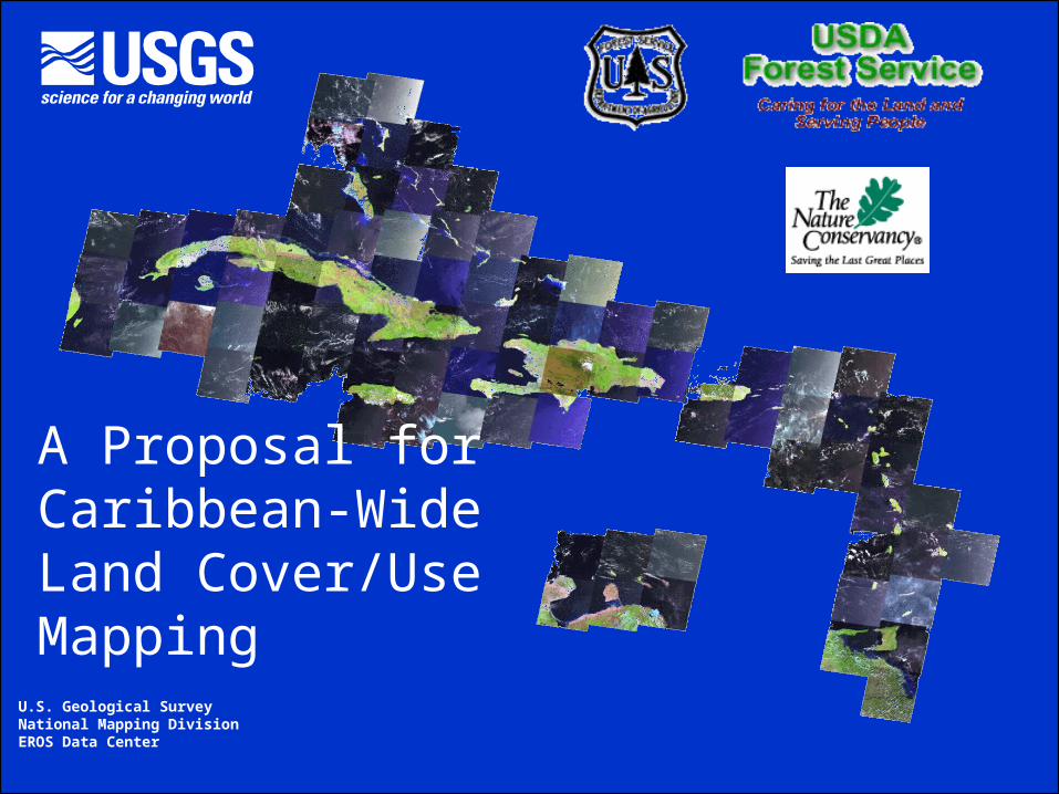
A Proposal for Caribbean-Wide Land Cover/Use Mapping

Developing a Regional Planning Framework for Biodiversity Conservation, Disaster Preparedness, and Economic and Agricultural Development
In the Insular Caribbean
The Nature Conservancy U.S. Forest Service U.S. Geological Survey International Conservation Program International Institute of EROS Data Center Conservation Science Department Tropical Forestry
A Proposal funded by the USAID Caribbean Regional Office
& supported by FAO, NASA

WHY make Consistent Land Cover/Use Products for the Caribbean? To respond to Strategic Objective 2 of the Caribbean
Regional Program Strategy (USAID, 2000): “Environmental Management – Improved environmental management by public and private entities”
To enable integrated environmental and economic
planning by: providing improved access to information for regional and in-
region planners and other stakeholders, bringing the spatial dimension to the development of best
practices, and developing national capacity and management resources in an
integrated and cooperative regional framework.

Imagery DEM Soil + Other
Other Climate
Soil + Soil + Other
Decision Tree Training of Complete Data Set
Field Refinement
GrassShrubSmallGrain Montane
ForestBarren
SedgeWetland
Indus-trial
Documented and Adaptable Land Classification
Internet Map Server Applications for Diverse Clients
Source Data and Rules for Specific Client Applications
Integrated Land Cover/Use System for the Caribbean Islands
DEM +
IMSImplementation
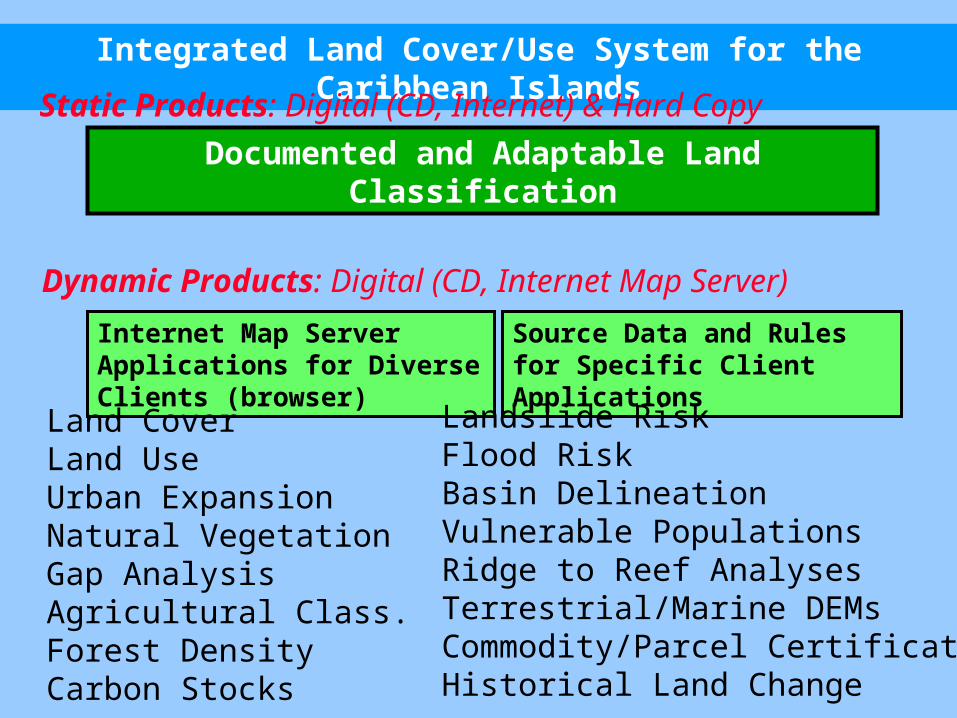
Integrated Land Cover/Use System for the Caribbean Islands
Internet Map Server Applications for Diverse Clients (browser)
Source Data and Rules for Specific Client Applications
Documented and Adaptable Land Classification
Static Products: Digital (CD, Internet) & Hard Copy
Dynamic Products: Digital (CD, Internet Map Server)
Land CoverLand UseUrban ExpansionNatural VegetationGap AnalysisAgricultural Class.Forest DensityCarbon Stocks
Landslide Risk Flood RiskBasin DelineationVulnerable PopulationsRidge to Reef AnalysesTerrestrial/Marine DEMsCommodity/Parcel CertificationHistorical Land Change

Final Products will Consist of: High resolution land cover/use database & maps with
best georectification for each island (MRLC-like) Ancillary databases including where possible
prior land cover maps, GIS data layers, digital elevation models, forest inventory data, soils maps, and others
Consistently labeled and interpreted products for the Caribbean
A flexible mapping framework for specific client refinement and modification
Vector-based land cover units designed for conservation planning
A network of knowledgeable users among the Caribbean Islands
(An ArcIMS Data Querying & Distribution System for each country and cooperating regional organizations)
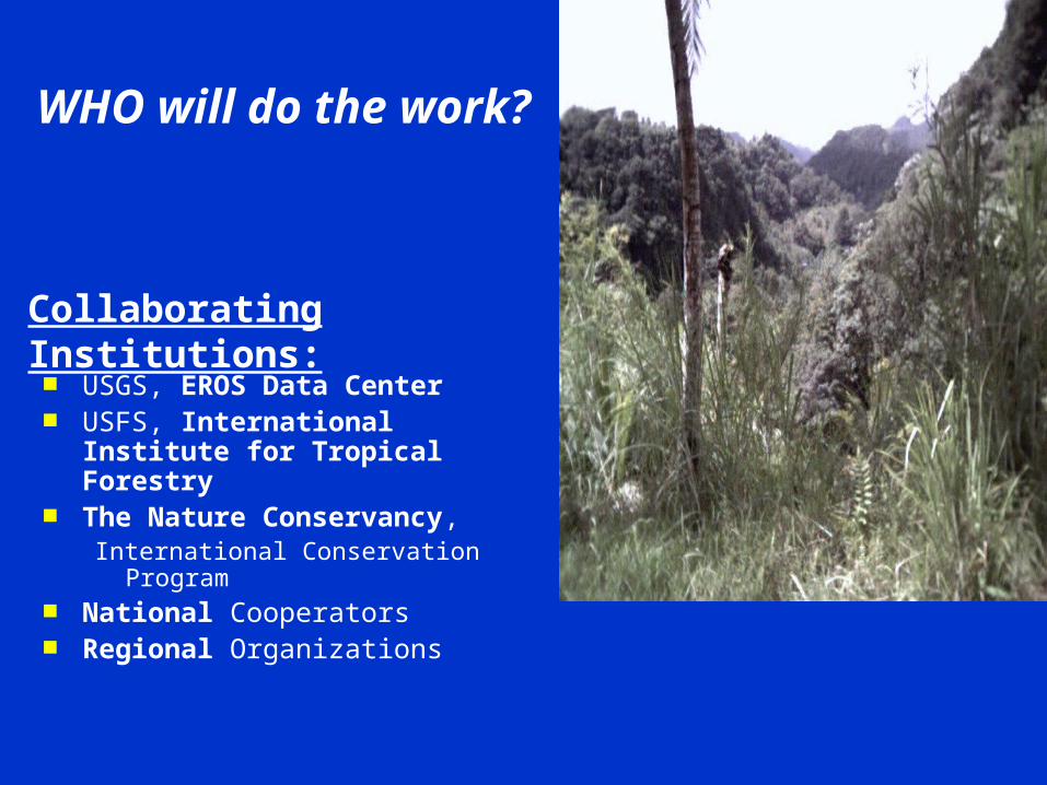
WHO will do the work?
USGS, EROS Data Center USFS, International Institute
for Tropical Forestry The Nature Conservancy,
International Conservation Program
National Cooperators Regional Organizations
Collaborating Institutions:

Anticipated Work Flow – An Iterative Process
The Lead Institution Primary Analyst is responsible for coordinating all efforts for an island.
EDC will have specific roles in
1. training, 2. image acquisition, 3. processing all
data inputs, and 4. implementing a
distributed data dissemination system
Secure, Process
TM Images
CalibrateSubsetMask
SpectralData Stack
CreateField Map
Field MapPlan/Perform
Fieldwork
Field DataReviewEdit
Extract
TrainingData
DigitizeRasterize
GeoregisterResample
AncillaryData Ancillary
Data Stack
CombineCreate Metadata
All DataStack
Metadata
Submit toEDC
Review
Accept
RejectReturn
ExplainRejection
GenerateAdditional
DataRun Preliminary
Decision Tree
PreliminaryClassification
Image
Submit ToPrimaryAnalyst
Review/Edit/Identify CorrectionsCreate Improved Training Data
New Training Data
Submit toEDC
Review
Accept Run FinalDecision Tree
FinalClassification
Image
Submit ToPrimaryAnalyst
Review/Edit
“Final”Land Cover
Maps & Databases
EROS/USGS SCIENTIST “Final”Land Cover
Maps & Databases
“Final”Land Cover
Maps & DatabasesArcIMS-based Distribution by Country

Acquire Landsat 7 ETM+ Imagery
Multiple date acquisitions are anticipated to negate clouds and seasonal impacts.

Finished Land Cover/Use Maps and Databases
After edits and reviews are incorporated by all interested local agencies, the final Land Cover/Use Maps and ancillary databases are released for use and distribution.

Distribution of Products
Complete data set to collaborators and each island. Digital versions on CDs with convenient interface. A Caribbean web site for information and down load. Data for a Caribbean Digital Atlas. Source data available from web sites, collaborators
and others.

MultipleProduct Benefits
-National Planning/Management-Natural Resource Monitoring-Regional Assessments and
Planning-Smallholder Development-Public Relations, Advertising,
and Tourism-Personal Networking
Premium Value for BananaCertification

What do we gain with new and Consistent Land Cover/Use Mapping?
A standardized classification schema, high resolution land cover/use maps, and associated databases will:
Permit inter-island comparisons of the status and ecological variability of similar landscape units,
Enable regional conservation strategies, Provide a baseline for regional biodiversity
monitoring programs. Protect coastal environments, Enable regional land use planning Facilitate environmental management Support agricultural certification, and Enable change comparisons

Don’t Land Cover/Use Maps Already Exist?
Although maps of “vegetation” exist for many of the individual Caribbean islands, these are often: out of date, erroneous, lacking information, frequently too coarse, both spatially and in classification, for
many practical applications, unsuitable for diverse client needs, i.e. too categoric non-standardized in both classification and methodology, not integrated with ancillary databases, not incorporated in integrated applications, not in a framework that promotes upgrading and refinement not available to a general group of users via browsers, and not integrated into an Internet Mapping System

Aren’t the Global & Regional Maps Adequate?
Global and regional land cover maps that already exist are not suitable for the Insular Caribbean because of:
1. Spatial Scales
2. Classification Details
3. Lack of Ancillary Databases
4. Lack of Internet Map Serving
Therefore, most existing maps are unsuitable for local terrestrial land use and coastal planning, monitoring, management or for comparisons of vegetation across multiple islands.

HOW do we propose to do this?
Draw on existing methods developed by USGS for the National Land Cover project (MRLC)
Landsat 7 ETM+ Source 30 Meter Pixel Standardized Projection Consistent Classification Large-area Applications Associated Databases

Landsat 7 ETM+ Instrument Characteristics
Band Spectral GroundNumber Range (micrometers) Resolution (m) 1 .450 to .515 30 2 .525 to .605 30 3 .630 to .690 30 4 .750 to .900 30 5 1.55 to 1.75 30 6 10.40 to 12.5 60 7 2.09 to 2.35 30 Pan .520 to .900 15
Swath Width: 185 kmRepeat Coverage Interval: 16 days (233 orbits)Altitude: 705 kmQuantization: Best 8 of 9 bitsOn-board data storage: ~375Gb (solid state)Inclination: Sun-synchronous, 98.2o
Equatorial Crossing: Descending, 10:00am +/- 15 min.Launch vehicle: Delta IILaunch Date: April 15, 1998

Use On-Island Expertise
Those islands able to contribute to the process are encouraged to do so.
Field validationImage interpretationImage processingData distribution
Identify and contact island specific agencies and experts to enlist their interest, expertise, and input.
Appropriate Land Use at Forest Margins
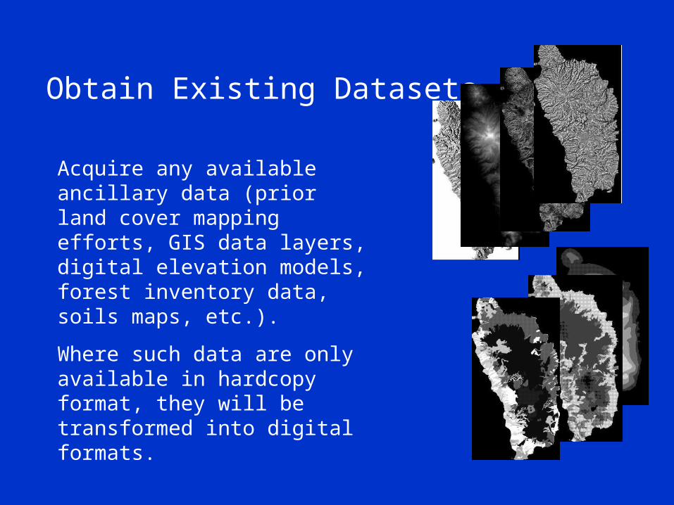
Obtain Existing Datasets
Acquire any available ancillary data (prior land cover mapping efforts, GIS data layers, digital elevation models, forest inventory data, soils maps, etc.).
Where such data are only available in hardcopy format, they will be transformed into digital formats.

Responsibilities of The Primary Analyst
All ancillary datasets will be digitized, rasterized, and georegistered to the Landsat 7 ETM+ imagery.
Metadata describing each dataset will be generated.
Metadata and Data will be Placed in Distributed Clearinghouses.
Support Parcel and CommodityIdentity or Certification

Responsibilities of The Primary Analyst (cont)
An unsupervised classification will be used to create cloud, cloud shadow, and water masks.
Protect “reef to ridge” Systems andEnvironmental Protection

Responsibilities of The Primary Analyst (cont)
Secure Local Knowledge of the island to help identify spectral groups which correspond to the proposed land cover schema.
This will provide a realistic check on spectral separability of land cover classes.
This will guide productive field data collection.
Identify, Conserve and ProtectRare Communities and Species

Responsibilities of The Primary Analyst (cont)
Islands with existing land cover maps will be “crosswalked” into the proposed regional land cover classification schema.
Unchanged portions of the island may be used to provide training data for an intermediate classification on this new schema.
Prior Classification Proposed Classification
Agriculture Mixed Commercial and Subsistence Plantations
Elfin and Alpine Meadow
Montane Cloud Forest and Montane Grasslands
Littoral Woodland Lowland Semi-deciduous Forest
Montane Rain Forest Montane Rain Forest
Montane Thicket Evergreen Montane Shrubland
Secondary Rain Forest Disturbed Submontane Rain Forest
Mature Rain Forest Submontane Rainforest
Semi-Evergreen Forest Lowland/Submontane Seasonal Evergreen Forest
Scrub Woodland Lowland Drought Deciduous Shrubland
Grasslands Short/Medium/Tall Grasslands
Swamp and Wetlands Seasonally Flooded Rainforest/Woodland/Grassland

Responsibilities of The Primary Analyst (cont)
Field data, collected via GPS, recent aerial photography, or other means, will be used to verify and correct both of these preliminary efforts at generating training data.
A final training dataset will be assembled.
Assist Management of Natural Resources

Responsibilities of The Primary Analyst (cont)
Provide all imagery, ancillary data, metadata, and training data for initial EDC processing.
EDC prepares a preliminary classification using a “decision tree” linear regression technique.
Identify local experts who can take advantage of sub-regional training as processing is done.

EROS Data Center will Process all Data
Input Database
Elevation
Aspect
Position Index
SlopeMultiple Dates and Spectral Bands of LANDSAT TM ETM+Imagery
Training Data
Soil
If tm2b1 > 30 and tm1b5 < 45and tm1b3 > 30 and tm2b4 < 25and tm1b1 < 127 and slope < 5and elevation > 4500 and position< 3 and aspect eq north and soil eq 2Then SHRUB
Land Cover Map
Decision Tree
Spatial Expression
Textual Expression

Responsibilities of the Primary Analyst (cont)
The land cover map resulting from this preliminary classification will be returned to primary analyst and each island for review, edits, and corrections.
Corrections will be used to provide improved training data to EDC.
EDC will use the new training data to run a final classification with the same “decision tree” technique. This land cover map will be the last submission EDC plans to make in the process.
Any further classification efforts will be done by more traditional, supervised classification methods, by the Primary Analyst and Island entities.

Contributors to Caribbean Mapping
IITF, USDA $225k NASA Data Buy 75+ IITF, USDA 180 UN FAO Caribbean Training 15 USAID/W, TNC (Dominica and Bahamas) 150 USAID/Jamaica 70 USAID/Dominican Republic 200 EDC and TNC 27 EDC/MRLC (Puerto Rico and U.S.V.I.) 100
TOTAL = $1,022k